
Continental Divide Trail (CDT) Thru Hike Guide & Journals
Continental Divide Trail Thru Hike Guide
Miles: 2998 Days: 165 Elevation Gain: 470,284ft Dates: NOBO, April 21st – October 2nd
Famous’ 2018 Continental Divide Trail Journal Entries By State
New Mexico
Crazy Cook to Lordsburg
Lordsburg to Silver City
Silver City to Doc Campbell’s Post
Doc Campbell’s Post to Pie Town
Pie Town to Grants
Grants to Cuba
Cuba to Ghost Ranch
Ghost Ranch to Chama
Colorado
Chama to Pagosa Springs
Pagosa Springs to Lake City
Lake City to Salida
Salida to Twin Lakes
Twin Lakes to Breckenridge
Breckenridge to I70 (Frisco)
I70 (Frisco) to Grand Lake
Grand Lake to Steamboat Springs
Steamboat Springs to Encampment
Wyoming
Encampment to Rawlins
Rawlins to Lander
Lander to Dubois
Dubois to Jackson
Jackson to Flagg Ranch
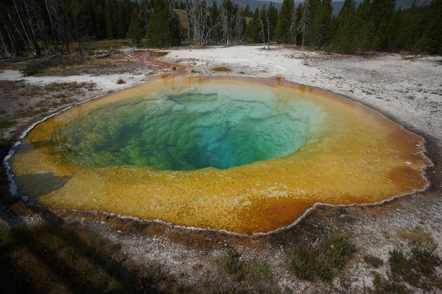
Flagg Ranch to Old Faithful
Old Faithful to Macks Inn
Idaho\Montana
Macks Inn to Lima
Lima to Leadore
Leadore to Darby
Darby to Anaconda
Anaconda to Lincoln
Lincoln to East Glacier
East Glacier to Canada
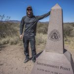
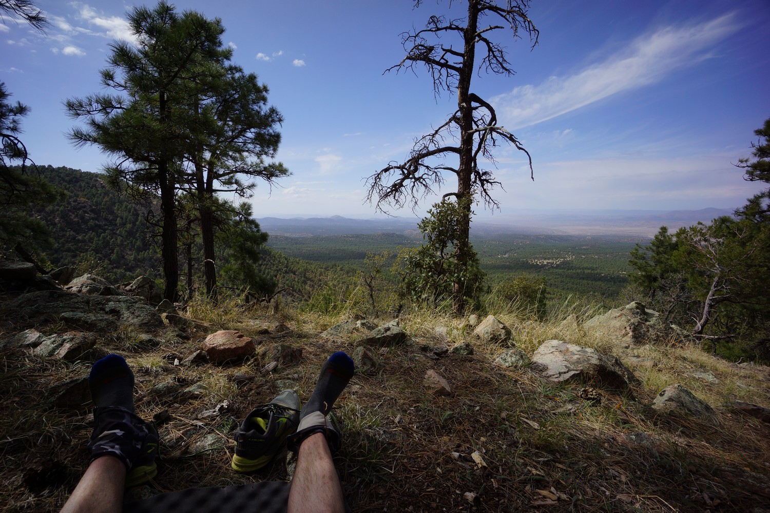
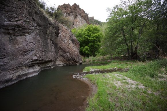
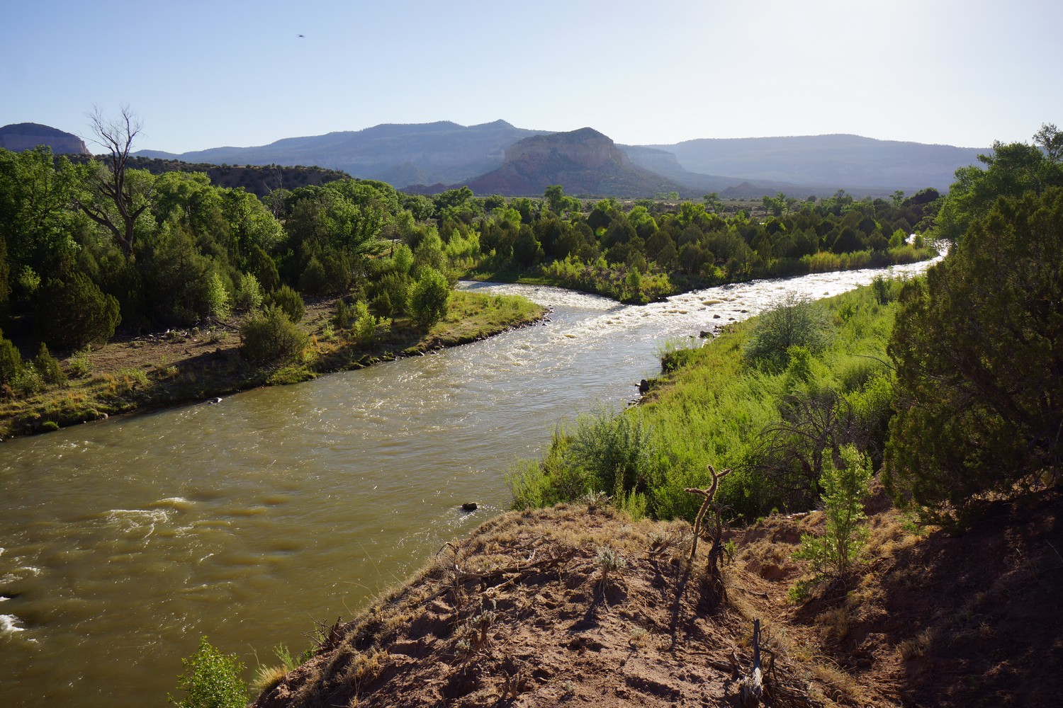
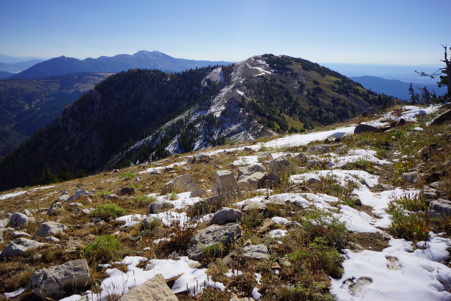
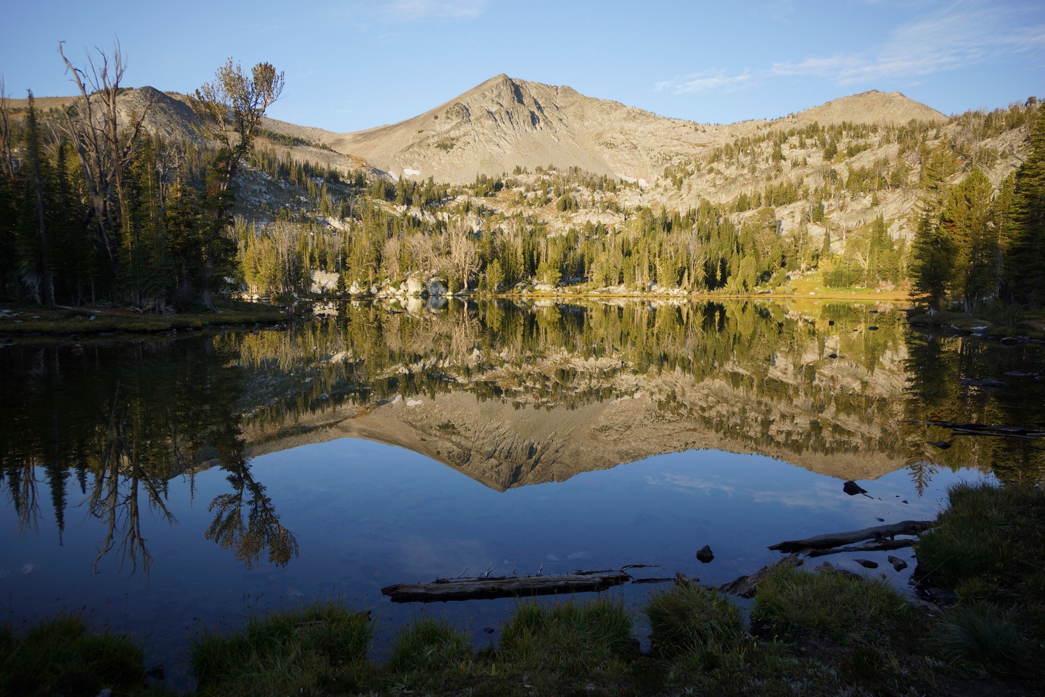
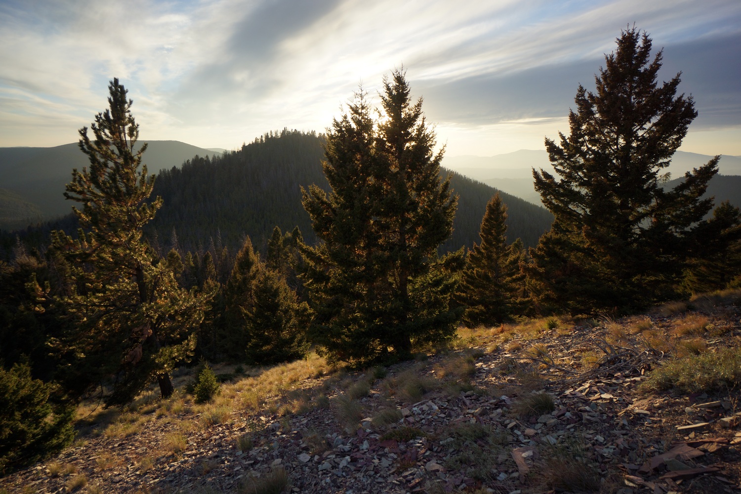
View/Hide A Descriptive Overview Of Each CDT Section Hiked The CDT starts here at Crazy Cook monument on the border of New Mexico and Mexico. There’s only a dilapidated barbed wire fence marking the border. From here, I’ll hike north through New Mexico’s Bootheel to Lordsburg. Water is scarce here… it’s dry, windy and hot! Like most desert hikes I’ve done, it has a very ancient and primitive feel to it that cannot be duplicated in any other environment. There’s also a lot more wildlife here than you’d think. Taking those first steps of a 3000 mile journey was probably the most overwhelming feeling of my life. The first part of this section, out of Lordsburg, was flat and hot. But, This is a good section because the landscape transitions from desert to rolling hills and lots of trees. It’s hard not to like that after 100+ miles of desert. Unique environment and a good sign of progress towards more interesting landscapes. After leaving Silver City, it’s a road walk up Little Walnut Creek Rd into the hills. This is the beginning of a 300+ mile stretch of no cell phone service for us AT&T customers. This stretch begins the Gila National Forest, a much anticipated section of trail. No more open desert, more trees and hills, and lots more water, towards the end of this stretch. After visiting the optional Gila Cliff Dwellings, it’s wet feet all day, hundreds of river crossings and remote country through the Middle Fork Gila River. Many deem this to be the highlight of New Mexico and a favorite section of the entire CDT. There are numerous hot springs, namely the Jordan Hot Springs. The Middle Fork Gila River ends at Snow Lake, after which the terrain resembles Wyoming briefly. The trail then wanders through what I called “The Sea of Gold”, a massive view of rolling hills and golden grasses. Then it’s a long and boring walk along Bursum Rd before climbing back up into the hills. A 40 mile road walk through seldom visited region of New Mexico finishes the final leg into Pie Town. The hike out of Pie Town is a very long road walk. Hikers have route options after reaching El Malpais… hike a roughly 55 mile semi-circle route around the lava fields or the Cibola alternate. I Chose the alternate, due to water shortages along the official El Malpais route, as most other hikers did this year. This allows one to hike the Narrows, a trail high up on a mesa overlooking El Malpais. I then hiked the northern section of El Malpais, exploring underground lava tubes and walked the rim of an old caldera volcano. This was the highlight of this section. It’s then a long road walk into Grants through Zuni Canyon. This next section includes the highest point on the CDT in New Mexico, which is Mt Taylor at 11,300ft. Having a taste of the high mountains is a bit of a tease, as the trail then heads back down into lowlands and desert scrub. The middle section of this stretch is rather boring. However, the last 2 days into Cuba were incredible. I called it “New Mexico’s monument valley”. Hoodoos, badlands, mesas, spires and all sorts of interesting formations. I also saw my only real rainstorm in New Mexico during this leg. Here hikers are given their first taste of high alpine meadows and parks in the San Pedro Parks Wilderness. No distant views, but nice scenery. The trail then descends back into the desert one last time. Approaching Ghost Ranch was some of the best desert scenery I experienced in all of New Mexico. Very colorful canyon walls line the Rio Chama, the first serious river along the CDT. Ghost Ranch itself boasts some stunningly beautiful scenery, marking the end of the desert along the CDT in New Mexico. Only a few miles out of Ghost Ranch, the last of New Mexico’s desert fades away. High mesa, rolling hills, meadows, forest and even lakes. Water is now abundant and no longer an issue. Every mile passed, New Mexico fades and Colorado grows closer. Elevation climbs to around 10k feet and stays there. The state border line, although underwhelming, is a big milestone. 25% complete with the CDT! This section has been the most difficult of the hike thusfar. More snow, highest elevation, most climbing, wettest, muddiest and all-around toughest hiking yet. But also, the most beautiful and impressive mountain scenery so far. Welcome to Colorado, snow and high mountains. Climb high, stay high! And that’s exactly what the trail does here. It follows the highest possible route without dropping down into valleys. That’s the spirit of the CDT, and this section is trial by fire. Between Pagosa Springs and Lake City, the CDT passes through the San Juan mountains and the Weminuche wilderness, Colorado’s largest. It’s a tough section with rugged mountains, alpine lakes, lots of high trail and beautiful scenery. It’s much longer than the last section, but fortunately the trail was a bit drier and less snow which allowed for slightly easier travel. But still, very challenging! The first section of trail out of Spring Creek Pass was very scenic and similar to the last stretch south of the pass. After San Luis Peak, the trail drops down and the high mountain scenery fades away. Low valleys, dirt roads, forest. Lots of climbing and no views to show for it. After about 70 miles of this, the trail finally climbs high again and hikers are rewarded with distant views once again. This too comes at a cost… dodge the mountain bikers. After about 150 miles of the CDT sharing trail with the Colorado trail, I saw my first, and 100th, mountain bikers. Watch out for these guys, they’ll run you over! The hike from Salida to Twin Lakes was tough, but a good one. Lots of great views from numerous passes and high ridges. It was very hot and the mosquitoes have really been coming out lately. Lake Ann and the pass above it was the highlight of this section for me. Highlights from the Twin Lakes to Breckenridge section of the Continental Divide Trail include Kokomo Pass, an abandoned WWII training facility, Mt Edwards and Mt Massive alternate routes, and a few scenic ridgelines overlooking the ski resorts of Copper Mountain and Breckenridge. North of Twin Lakes, the route isn’t blow-your-mind scenic, but it gradually improves and provides some excellent views. Despite the large number of roads encountered on this stretch, and the lack of a real wilderness feel to it, this one was of the more scenic sections of the CDT in Colorado in my opinion. There were lots of 4×4 vehicles and ATVs out here though. The mountains had a lot of color to them in this section… not just green, but reds and oranges too. Colorful Colorado indeed! Grays Peak and Torreys Peak are also along this route, the highest point along the Continental Divide Trail. North of I-70, the Sugarloaf Fire forced a reroute. This led me to bushwhack my own route around the closure before rejoining with the CDT. However, my return to the trail would be short lived. Thunderstorms kept me off the high ridges and forced a low route, taking me through the town of Winter Park. After rejoining the CDT yet again in the Indian Peaks Wilderness, I saw my first Moose on the CDT. This section of the CDT passes through Rocky Mountain National Park and the Never Summer Wilderness as well as the Arapaho National Forest and Routt National Forest. This area is home to lots of Moose. Some pretty good views along the way, especially from Parkview Mountain. This is the last time the official CDT route reaches 12,000′ for a northbounder. Besides a walk through the Mt. Zirkel Wilderness, gone are the days of high mountains. This section sees a transition from from the Colorado landscape to a drier and lower elevation mountain environment in Wyoming as the trail passes through the Medicine Bow-Routt National Forest. The Mt. Zirkel Wilderness is definitely the highlight of this section, which resembled the high Sierras at times. North of Encampment, the landscape abruptly changes from mountains to desert. The desert here begins as rolling hills, filled with pronghorn. It’s a long road walk into Rawlins. The views aren’t the finest, but the new landscape is interesting after so much time in the mountains. Few places to find shade and water is more scarce again. In this section I’ve decided to push for my highest mileage day on the CDT, as well as an overall push to cover the next 126 mile in as little time possible. The desert is pretty flat here and elevation gain is not much of an issue. It’s a massively vast area to be walking through. Sage brush as far as the eye can see, and not much else except an occasional wild horse or pronghorn. Much of the beauty here is in the sky… wicked looking dark clouds and vivid sunsets are common. This is some wild country. The first 30 or so miles are a lead up from the lowlands of the great divide basin desert into the high country of the Wind River Range. The next 120 miles were the most challenging, beautiful and intense hiking I’ve ever done. I had more adventure in these 10 days then the rest of the entire CDT combined. Jagged peaks, frozen lakes, glaciers, crevasses, abundant wildflowers, miles of boulders and snowfields, mountain lions, big horn sheep, steep snow traverses, scrambling and climbing, milky glacial-fed rivers, and almost NOBODY to share it with. Additionally, the majority of this route is off-trail. In my opinion, the Wind River Range easily offers the best backpacking experience in the continental US. Leaving Dubois, we had another 2.5 days of hiking to cross the northern Wind River Range. This proved to be much more difficult than anticipated, exceeding our time estimates. Road walked from Green River Lakes west to the Gros Ventre Wilderness. The Gros Ventre sees few hikers, and has few established trails as a result. Off trail adventures continued here on fields of snow and boulders, and involved some sketchy moments scrambling down steep rock faces. Once again we found ourselves low on food and hungry, only this time with a different outcome. This section was full of adventure and very scenic, among my favorites of the whole trip. After walking 2 miles into Jackson, resupplying and walking across the valley to Wilson in one day, we entered the Jedediah Smith Wilderness and Grand Teton National Park. We hiked our own version of the Teton Crest Trail winds in and out of both of these land administrations. The Tetons are pretty damn grand to say the least! North of Lake Solitude, we took a steep cross country route out of the basin and over to the west side of the divide. Lots of wildflowers, delicious berries to eat, and bushwhacking! I left Flagg Ranch and entered Yellowstone through the south entrance. The only wildlife I saw was a fox, very disappointing for a place known for it’s animals. Much of our route through Yellowstone was wet, swampy and not particularly scenic. The highlight of this section was the Bechler River and the Mr. Bubbles area. Here, we were blown away by majestic waterfalls and soaked in a natural hot spring. Back on the official CDT, the trail leaves Old Faithful via a boardwalk through some really cool geothermal features. Mostly, colorful pools and hot springs. Not the kind you soak in though, the melt your skin off kind. After leaving the boardwalk and hitting trail, we left the hoards of tourists behind for good. The trail passes by a lake and some undeveloped geothermal features just before we cross into Idaho. From here to Macks Inn, the trail is rather unremarkable. I did, however, see a bear for the first time since the Gila here. After leaving Macks Inn, the route follows roads nearly to the summit of Sawtelle Peak. It snowed up here yesterday, so it’s wet and muddy. It’s a bushwhack down a quiet little valley to rejoin with the official CDT. After this, the trail is often high on a ridgeline. The views are good but not terribly photogenic. There’s a massive valley here to the south, which was carved by past eruptions of the hotspot/super volcano presently located under Yellowstone. From here, The Tetons can be seen 60+ miles away! Lots of bear activity in this area as well. Near Lima, the fence line that represents the Idaho/Montana border becomes a frequent sight. The hike from Lima to Leadore was probably my favorite section of the CDT in Montana/Idaho. This is how I envisioned more of the state would be. The trail is often up on a ridge with a fence separating Idaho from Montana, and there’s big views all around. The vast seas of golden colored rolling hills convey a subtle yet powerful message of beauty. Other times, seemingly endless mountain ranges dominate distant views across a massive valley. Walking on the divide in the dwindling alpenglow proved to be some of the most memorable moments for me. After leaving Leadore, the CDT continued to offer some good ridgeline views, although not as frequent or quite as impressive as the Lima to Leadore section. However, it was forest fires dominated the theme of this stretch. Small and large plumes of forest fire smoke could be seen in many directions, and I was often quite close. I even walked over some active flames. Later, I found out the forest service closed the trail I was on again only hours after they gave me the go-ahead. I also encountered a momma bear and her two cubs. There was a lot of climbing in this section, with no day under 4200′. The first 30+ miles north of Chief Joseph Pass were some of my least favorite on the CDT. Partially my fault due to a crazy thick bushwhack, but mostly due to never-ending forests of dead trees and burned trees while doing lots of elevation gain. After the ugly section, the Anaconda Pintler wilderness starts and offers some redeeming views, mostly in the northern section. Bear activity was high, with lots of fresh scat. Temperatures are getting noticeably cooler now and days are getting shorter. North of Anaconda, the CDT changes from paved roads to dirt roads and finally trail. This section was not one of the most scenic on the CDT, with mundane low hills and forest dominating the views. I found the best views to be between Dana Spring and Granite Butte. Lots of hunters out in the woods at this time of year. North of Dana Spring, I ran into Hopeful. This was a great surprise and we hiked hundreds more miles together, almost to Canada. Our last day before reaching Rogers Pass, we hiked through a cloud in near zero visibility. I entered the Scapegoat Wilderness just north of Rogers Pass, where I did the most climbing I’d done in a single day on the entire CDT. However, these were the best views I’d seen in a long time. Lots of ridges with distant views. Then the trail drops down into a valley, where it’d mostly stay for the remainder of the hike to East Glacier. I picked up a package of food I had my dad send to Benchmark Ranch along the way before starting the Bob Marshall Wilderness section. Forest fires and high elevation snow forced a lower route through the Bob, so we missed the Chinese Wall and more. Winter is coming soon. With a fair amount of snow already on the ground and much more foretasted, Katie Hopeful and I set off into Glacier National Park. I was reluctant due to the weather, but Katie and Hopeful seemed optimistic. Stopped in the Two Medicine ranger station only minutes before they closed for the season. On the morning of our second day, Katie and I decided to turn back to to the weather conditions, with the idea of road walking to Canada from here. Hopeful continued to hike, alone. Katie and I regrouped in East Glacier and I ultimately set off alone the next day. A 37 mile road walk and another 11 miles in a blizzard, and I reached Port of Piegan at the Canadian border. At last, my journey on the CDT is complete! Here’s a detailed video breaking down every single item in my backpack, no matter how small. Click the link below the video to show a written gear list of every item in my pack, with weights listed and links to buy each item. The map above is a caltopo map of my completed Continental Divide Trail thru hike. It’s BIG and takes a LONG time to load, so keep waiting!! I hiked continuous footsteps from Mexico to Canada had my GPS on the whole way recording the track. That’s a lot of batteries! The route from South Pass City to Old Faithful is a 450 mile alternate route I created, so this section is NOT the official CDT nor is it a Ley alternate. You can download my entire Continental Divide Trail GPS file, or just the “Famous Alternate”, here: https://seekinglost.com/gpx-files/ I haven’t seen elevation gain discussed much the Continental Divide Trail planning guide resources I’ve read online. Not everybody takes a GPS, and almost nobody records keeps their GPS on the entire trail like I did, the only way to record a complete track and produce elevation profile like you see below. Elevation profile for my Continental Divide Trail thru hike This is the excel spreadsheet I used to plan out my resupply stops. I kept this on my phone and used it as my master reference along the hike. You can customize it to your needs, this is simply a template for you to follow. CDT thru hike Town Stop/Resupply Strategy Spreadsheet A bounce box is a box that you send from one town to the next along the trail. Since I filmed my thru hike, I needed a way to dump media and clear my memory cards. In this box I had a portable hard drive, small tablet/laptop, and a bunch of other things that are useful for the long distance hiker… gear repair items, extra sunscreen, toothpaste, opsaks (you really should be using these), and much more. I sent this box to Silver City (as a NOBO), and then every 2nd or third town from there. It’s expensive to do, but it’s a solid option if you ahve the need to dump media like I did. Thru hikers may also bounce a box as a one time (or multiple times) thing… for example, you’re hiking NOBO and you’ve sent yourself an ice axe and micro spikes to Chama. You get to Chama and realize you don’t need them, but you expect to use them north of Pagosa Spring. You “bounce” your box up to Chama. It works like this… your box is waiting for you at the PO is Chama… walk in and tell them that you have sent a box to general delivery, but you want to send it ahead to another town now. Don’t accept the package and don’t open it, if you do, you will have to pay to send it again. Tell them you want to send the box ahead to the PO at Pagosa, and it will be FREE to do this, because you haven’t accepted and opened the package. You can do this as many times as you need to. Sometimes it can be done over the phone but don’t count on it, you are usually required to be in person and show ID. I did a video on what’s in my bounce box and more of the details on this strategy: This excel spreadsheet gives you a quick overview of each day of my CDT thru hike. The spreadsheet shows the day number on trail, date, section hiked, day type (full/half/zero), miles, elevation gain, precip yes/no, where I slept, and animals seen. Post CDT thru hike stats The southern and northern terminus’ of my CDT thru hike • 2,998 Miles Miles: 750 Miles: 764 Miles: 663 Miles: 821 • Days With Any Miles Hiked: 140 • Days With 7000ft+ Elevation Gain: 1 • Backcountry Nights Tent Camped: 83 • Number Of Towns With A Bounce Box Sent: 12 • Pairs Of Shoes: 4 • Deer: 100s Lordsburg: 2464 NM Towns Total Population: 23952 Pagosa Springs: 1940 CO Towns Total Population: 35796 Riverside(Encampment): 53 WY Towns Population: 28469 Macks Inn: 272 ID/MT Towns Total Population: 12717 Total Population Of All Resupply Points: 100,267 Total Number of Resupply Points: 31 Average Resupply Point Population: 3234CDT Journal Entries – Detailed View Of Each Section Hiked

Crazy Cook to Lordsburg – 91 Miles
April 21st – April 25th, Trail Days 1-5. Total Hike Miles – 91
Lordsburg to Silver City – 55 Miles
April 26th – April 29th, Trail Days 6-9. Total Hike Miles – 146
Silver City to Doc Campbell’s Post – 65 Miles
April 30th – May 3rd, Trail Days 10-13. Total Hike Miles – 212

Doc Campbell’s Post to Pie Town – 145 Miles
May 4th – May 11th, Trail Days 14-21. Total Hike Miles – 357

Pie Town to Grants – 108 Miles
May 12th – May 17th, Trail Days 22-27. Total Hike Miles – 465

Grants to Cuba – 125 Miles
May 18th – May 23rd, Trail Days 28-33. Total Hike Miles – 589
Cuba to Ghost Ranch – 61 Miles
May 24th – May 26th, Trail Days 34-36. Total Hike Miles – 650

Ghost Ranch to Chama – 105 Miles
May 27th – June 3rd, Trail Days 37-44. Total Hike Miles – 755

Chama to Pagosa Springs – 78 Miles
June 4th – June 8th, Trail Days 45-49. Total Hike Miles – 833

Pagosa Springs to Lake City – 126 Miles
June 9th – June 16th, Trail Days 50-56. Total Hike Miles – 959

Lake City to Salida – 109 Miles
June 17th – June 23rd, Trail Days 58-63. Total Hike Miles – 1043

Salida to Twin Lakes – 82 Miles
June 24th – June 27th, Trail Days 65-68. Total Hike Miles – 1125

Twin Lakes to Breckenridge – 78 Miles
June 28th – July 2nd, Trail Days 69-73. Total Hike Miles – 1203

Breckenridge to I70 (Frisco) – 54 Miles
July 3rd – July 5th, Trail Days 74-76. Total Hike Miles – 1257

I70 (Frisco) to Grand Lake – 81 Miles
July 6th – July 10th, Trail Days 77-81. Total Hike Miles – 1338

Grand Lake to Steamboat Springs – 95 Miles
July 12th – July 15th, Trail Days 83-86. Total Hike Miles – 1429

Steamboat Springs to Encampment – 88 Miles
July 16th – July 19th, Trail Days 87-90. Total Hike Miles – 1520

Encampment to Rawlins – 65 Miles
July 20th – July 23rd , Trail Days 91-93. Total Hike Miles – 1585

Rawlins to Lander – 128 Miles
July 24th – July 28th, Trail Days 95-99. Total Hike Miles – 1713

Lander to Dubois – 151 Miles
July 29th – August 9th, Trail Days 100-111. Total Hike Miles – 1864

Dubois to Jackson – 120 Miles
August 10th – August 15th, Trail Days 112-117. Total Hike Miles – 1984

Jackson to Flagg Ranch – 106 Miles
August 16th – August 20th, Trail Days 118-122. Total Hike Miles – 2090

Flagg Ranch to Old Faithful – 55 Miles
August 22nd – August 24th, Trail Days 124-126. Total Hike Miles – 2145
Old Faithful to Macks Inn – 43 Miles
August 25th – August 27th, Trail Days 127-129. Total Hike Miles – 2188
Macks Inn to Lima – 72 Miles
August 28th – August 30th, Trail Days 130-132. Total Hike Miles – 2260

Lima to Leadore – 102 Miles
August 31st – September 3rd, Trail Days 133-136. Total Hike Miles – 2362
Leadore to Darby – 131 Miles
September 4th – September 9th, Trail Days 137-142. Total Hike Miles – 2493

Darby to Anaconda – 102 Miles
September 10th – September 13th, Trail Days 143-146. Total Hike Miles – 2595
Anaconda to Lincoln – 147 Miles
September 14th – September 20th, Trail Days 147-153. Total Hike Miles – 2742

Lincoln to East Glacier – 168 Miles
September 21st – September 28th, Trail Days 154-161. Total Hike Miles – 2910

East Glacier to Canada – 64 Miles
September 29th – October 2nd, Trail Days 162-165. Total Hike Miles – 2974
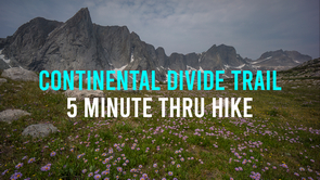
← See the CDT in 5 Minutes

Watch my 31 episode Continental Divide Trail
thru hike video series on YouTube → CDT Thru Hike Gear List
Continental Divide Trail Route & Maps
Continental Divide Trail Elevation Profile

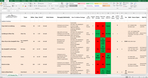
Continental Divide Trail Town Stop & Resupply Strategy Spreadsheet
CDT Thru Hike Resupply Strategy: Using A Bounce Box
Continental Divide Trail Daily Stats Spreadsheet

Statistics From My Continental Divide Trail Thru Hike

Mexico to Canada
• 165 Days, April 21st – October 2nd
• Zero Days(no hiking): 26 days
• Avg Daily Mileage(including zeros): 18.1
• Avg Daily Mileage(excluding zeros): 20.8
• Avg Daily Mileage(full days only ): 23.9
• Avg Moving MPH: 3.1
• Highest Point: 13,862ft at Mt. Edwards, CO
• Lowest Point: 4,301ft at US/MEX Border
• Total Elevation Gain: 470,284ft
• Avg Daily Elevation Gain (full days only): 3,795ft
• Percentage of Days I Hiked Alone (Est): 75%
• Most Miles In One Day: 40
• Most Elevation Gain In One Day: 7,576ft
• Longest Hike Between Resupply: 151 miles, 10 Days – Lander to Dubois
• Fastest Section Hiked: 128 Miles in 3.5 Days (36.5 miles per day), Rawlins to LanderNew Mexico
Days: 41
Zero Days: 6
Avg Daily Mileage(including zeros): 18.3
Avg Daily Mileage(excluding zeros): 21.4
Avg Daily Mileage(full days only ): 23.7
Days With Rain/Snow: 2Colorado
Days: 48
Zero Days: 11
Avg Daily Mileage(including zeros): 15.9
Avg Daily Mileage(excluding zeros): 20.6
Avg Daily Mileage(full days only ): 24.2
Days With Rain/Snow: 7Wyoming
Days: 38
Zero Days: 5
Avg Daily Mileage(including zeros): 17.4
Avg Daily Mileage(excluding zeros): 20.1
Avg Daily Mileage(full days only ): 21.3
Days With Rain/Snow: 7Idaho/Montana
Days: 38
Zero Days: 4
Avg Daily Mileage(including zeros): 21.6
Avg Daily Mileage(excluding zeros): 24.1
Avg Daily Mileage(full days only ): 26.9
Days With Rain/Snow: 12Mileage
• Days Hiked 40+ Miles: 1
• Days Hiked 35-40 MIles: 2
• Days Hiked 30-35 Miles: 8
• Days Hiked 25-30 Miles: 34
• Days Hiked 20-25 Miles: 47
• Days Hiked 15-20 Miles: 22
• Days Hiked 10-15 Miles: 19
• Days Hiked 5-10 Miles: 5
• Days Hiked >5 Miles: 1Elevation Gain
• Days With 6000ft+ Elevation Gain: 5
• Days With 5000ft+ Elevation Gain: 25
• Days With 4000ft+ Elevation Gain: 50
• Days With 3000ft+ Elevation Gain: 81
• Days With 2000ft+ Elevation Gain: 112Sleep
• Backcountry Nights Cowboy Camped: 21
• Nights In A Motel: 35
• Nights In A Hostel: 11
• Nights In A RV Park/Campground: 11
• Nights At A Trail Angel’s Home: 2
• Nights In A Cabin: 1
• Nights In A Yurt: 1
• Total Nights In A Tent: 95
• Total Backcountry Nights: 106
• Total Front country Nights: 59Towns/Resupply
• Number Of Towns/Resupply Points, Walk In: 16
• Number Of Towns/Resupply Points, Hitch In: 15Gear
• Pairs Of Socks: 10
• Gear Lost: 1 Hat, 1 Water Bottle
Animals Seen:
• Rabbit: 100+
• Elk: 100+
• Marmot: 75+
• Pronghorn: 50+
• Wild Horses: 30+
• Big Horn Sheep: 20+
• Prairie Dog: 20+
• Moose: 10+
• Mountain Goat: 10+
• Porcupine: 7
• Black Bear: 6
• Mountain Lion: 2
• Fox: 2
• Bald Eagle: 2
• Coyote: 1
• LLama: 1
• Big Foot: 0CDT Town Stop Populations (2018)
New Mexico
Silver City: 9647
Doc Campbell’s(Mimbres): 667
Pie Town: 186
Grants: 9011
Cuba: 748
Ghost Ranch(Abiquiu): 231
Chama: 998
NM Avg Town Population: 2994Colorado
Lake City: 379
Salida: 5856
Twin Lakes: 6101
Breckenridge: 4928
Frisco: 3129
Grand Lake: 498
Steamboat Springs: 12965
CO Avg Town Population: 4474Wyoming
Rawlins: 8858
Lander: 7551
Dubois: 974
Jackson: 10532
Flagg Ranch(Moran): 501
Old Faithful: ?
WY Avg Town Population: 4067Idaho/Montana
Lima: 228
Leadore: 103
Darby: 779
Anaconda: 9106
Lincoln: 1103
Benchmark (Fairfield): 730
East Glacier: 396
ID/MT Avg Town Population: 1589Related Images:


