
Oregon Desert Trail Section 3: Paisley to Lakeview (2022 Thru Hike Journal)
Day 12: Fremont National Recreation Trail
May 23rd


This morning was very relaxed. Melanie, who we met the night before at the Hot Springs, said she would drive us to Paisley this morning. We agreed on 9:30 a.m., and so We were not rushed to get ready.
After packing up, I sat out on the front porch. There are multiple cabins here on the Hot Springs Resort premises, as well as camping RV sites. I felt like it was 4th of July in northern Michigan, hanging out at a cabin on the lake. Only there’s no lake anymore!
Melanie picked us up and we drove back into Paisley. Donny mailed out his package at the post office, then we made a quick stop at the Paisley Mercantile for breakfast burritos before heading out of town along the Chewuacan River.
At the Chewuacan Crossing trailhead, we crossed the bridge over the Chewuacan River, and jumped on the Fremont national recreation trail. We’re now in the Fremont National Forest. First forest of the ODT!
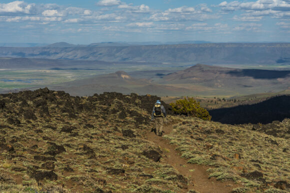
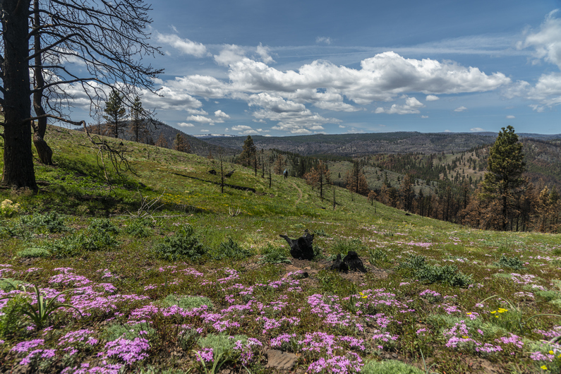
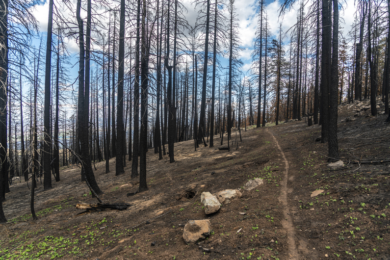
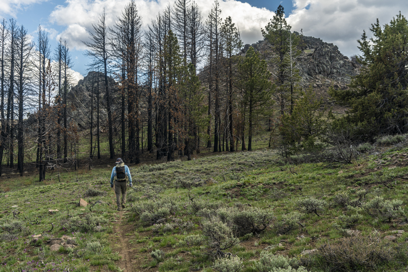
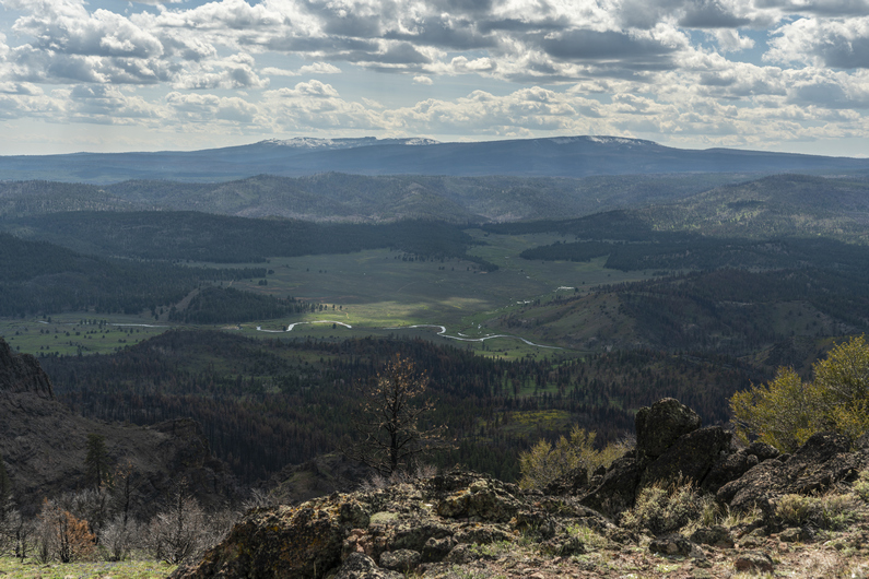
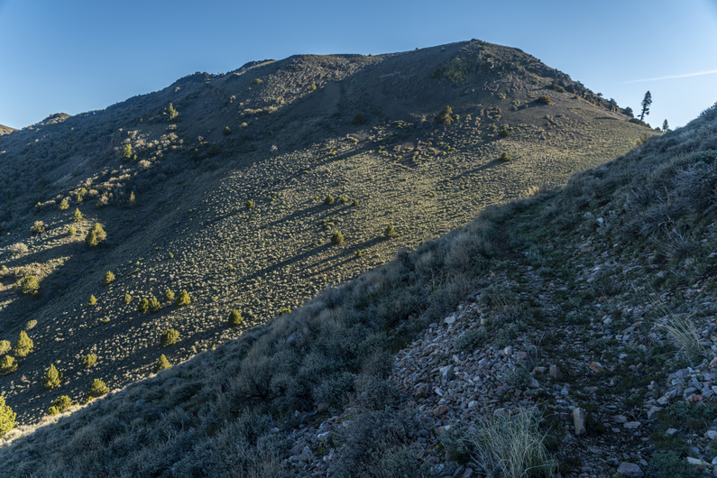
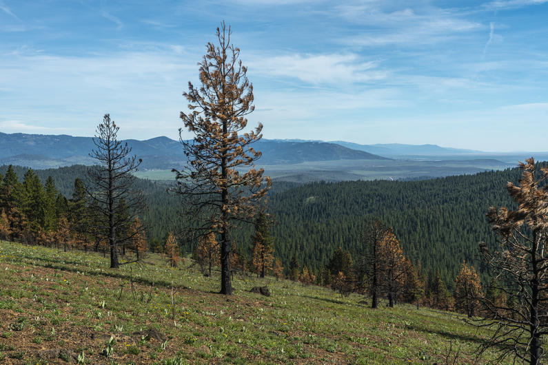
What a difference a day of hiking makes! Everything is green, there are wildflowers instead of Sagebrush, and it’s a beautiful mountain landscape with pine trees. We hike on in high spirits.
Today we will gain 2700 ft in elevation, and so the majority of the hike is uphill. It’s well graded and a legitimate single track hiking trail. Easy walking and great scenery, despite walking through occasional forest fire burn areas. There was a lot of obsidian along the trail here.
Admittingly, I don’t know what these mountains are named. They are not named on the USGS maps, nor the US Forest Service maps. I did some research online, and can’t find any reference to a name given to the mountains were are hiking right now. Diablo Rim has a name, and that’s not as tall or prominent as these mountains. I’ve seen small hills, miniscule in size and scope in comparison, that were named. This baffles me.
We stay high above the Chewuacan River, and it’s a great view looking down upon it. Of course, I can’t resist calling it the Chewbacca River. And I don’t refrain from doing so.
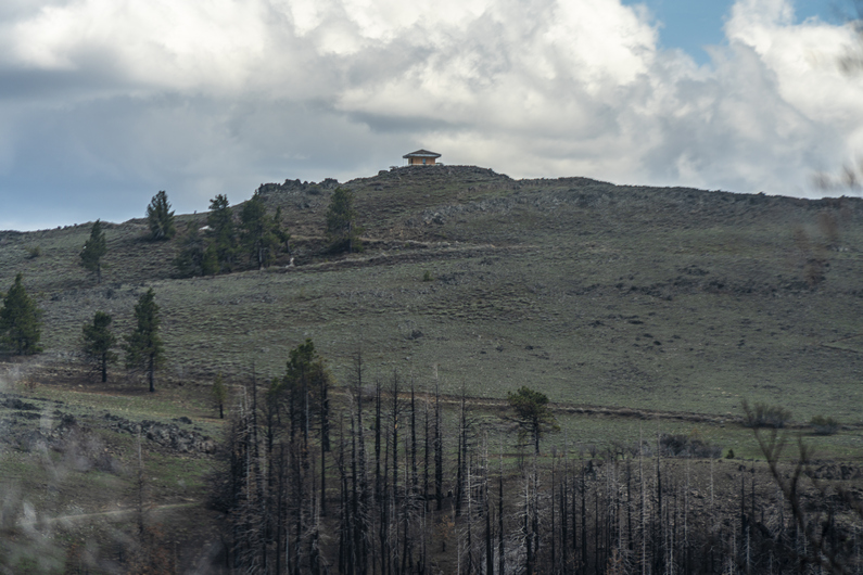
After a few hours of hiking, we gain the ridge line and get our first view of the lookout tower at Morgan Butte near Avery pass. It’s still a couple miles away. We hike on through alternating patches of pine forest and burns areas, before emerging into a clearing along the ridge. Generally pretty good hiking through here.
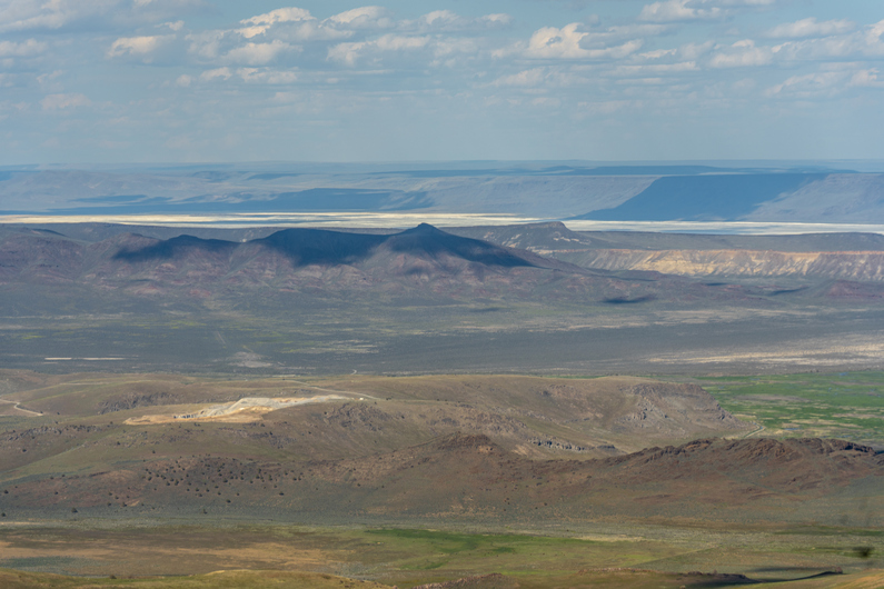
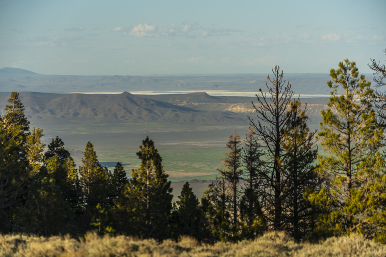
When we reached the Lookout Tower at Morgan Butte (7234ft), it was obvious that It’s either still manned or has been manned very recently. In fact, it looked like they were doing repairs on it. We stopped here for a break. The views were awesome. We could see the dried lake bed at Summer Lake, where we woke up this morning. We could see Diablo Peak and the Diablo Rim running south, along with our route ahead along the Fremont National Recreation Trail. We could see Lake Albert to the south, and a commanding view of the Chewuacan River below. Good spot for a lookout tower.
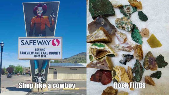
Descending Morgan Butte, I found a ton of interesting rocks. Mostly of the agate variety, some with a neat banding. Some were green, which was interesting. There is some malachite found in the general region, so that must be it.
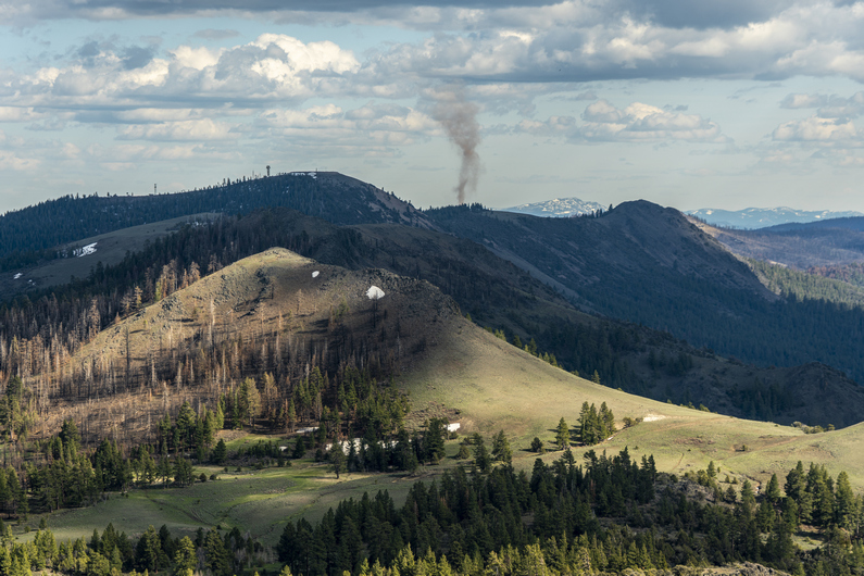
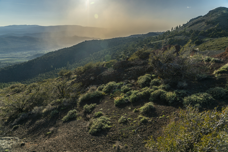
Near Myers Butte, I noticed a large cloud of dust moving into Chewaucan Valley, below. The winds had picked up and blown it in from the north, from Summer Lake. It was blocking the sun, and my view of the Chewuacan River below. Cool to see, but I hope the winds die down tonight when it’s time to camp.
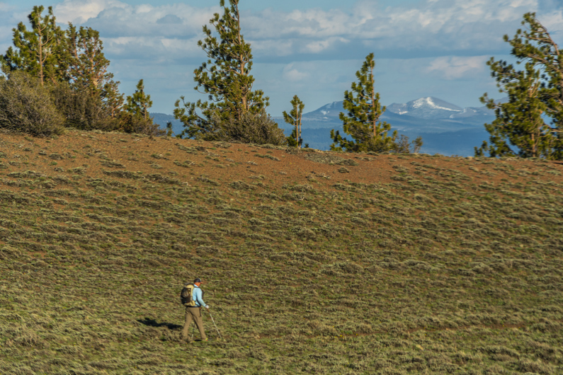
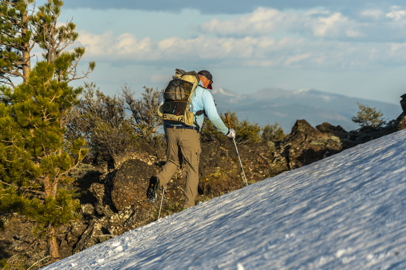
The route stays high on the ridgeline to Round Mountain. Here, we see some of our first patches of snow along the hike. We kick steps to cross one snow, but mostly walk around them.
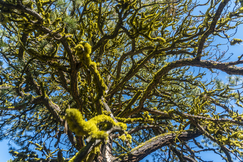
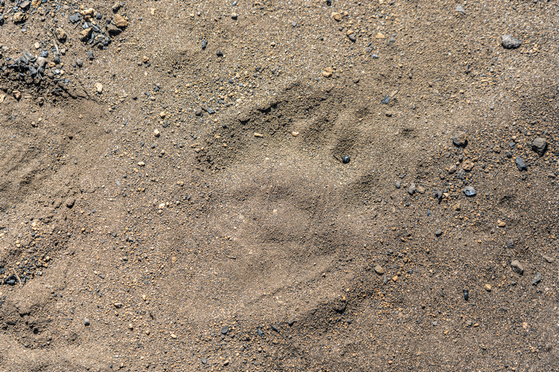
We got water from round mountain spring, and found camp just below round pass. On the way down to our campsite, I see a large pile of bear scat. It’s fresh too, only a few hours old. We find camp under some large Ponderosa Pines, their branches covered with green moss. Good protection from the wind.
ODT Day 12 Map

Day 13: Hiking The Forest Fire’s Aftermath
May 24th


We started hiking around 7:45 this morning. The trail now crosses over to the west side of the mountains. Not far past round pass, we see some pretty nice campsites. These probably would have been the better choice over what we had found last night, if we had only known.
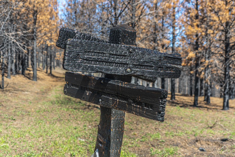
Next, we reached Moss Spring at Moss Pass. We stopped here for a break and to filter water. It looked like this area used to get a lot of traffic back in the day, since there was a pit toilet here and some pretty good campsites. However, it’s pretty clear It hasn’t been used in many years. Kind of a shame to see these kind of places falling into disrepair.
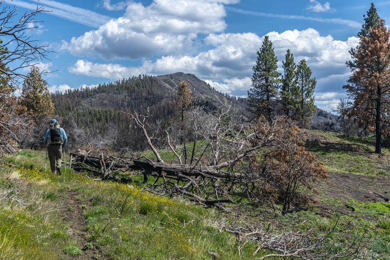
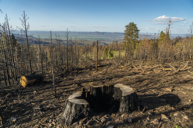
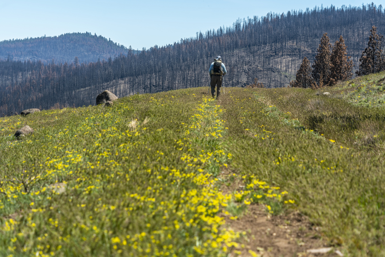
At moss pass, we continued hiking south Into a burn area. The next 15 mi or so would be pretty charred and barren. Not the most interesting hiking, but it is what it is.
We passed several creeks along the way. It’s been nice hiking along the Fremont National Recreation Trail, With water sources Generally only a few miles apart. Now we carry one to two liters, instead of the four to six we had been carrying in the desert. That’s a nice change.
After passing Counts Ranch, we took a break. About 7 mikes now to Fawn Creek, the next water and hopefully, good camping. Donny and I split up, and I went ahead. It’s nice hiking with someone, but it’s also nice to be able to hike at your own pace once in a while.
I was feeling good and strong, as well as motivated, and was on a mission to reach the creek as soon as possible. It would be nice to set up camp earlier in the day, and have someday light left to just relax. I put on some music and turned on the afterburners.
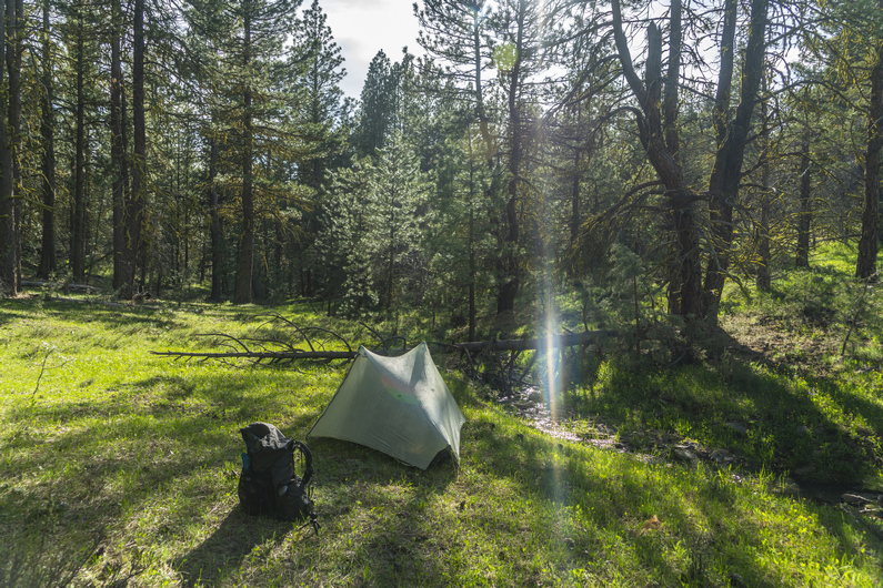
I reached Cox pass, which would have been excellent camping, if it weren’t for the fact it had no water. No worries, fawn creek is only 1.3 miles away. I made quick work of the dirt road walk and reached the creek at 5pm. I found some excellent camping along the creek among the trees. Best campsite of the ODT so far! I’m sure I’ll pay for it tomorrow morning with condensation, but what the hell.
Donny rolled in about an hour and 45 minutes later, having already stopped for a dinner break. By now I had camp set up, finished filtering water and had washed off all of the dirt and filth that accumulated on my body from walking in a dusty forest fire burn area all day. Having this creek just a few feet from camp was a real luxury. The sound of the babbling creek makes falling asleep quick work tonight.
ODT Day 13 Map

Day 14: Resupply in Lakeview
May 25th
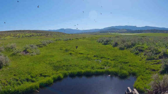


We started hiking around 8am. It’s a 5-mile dirt road walk to the main highway from here. The first mile was through public land and then the final four miles were on a public road through private ranch property. Nothing really notable happened this morning but we made good time to the highway.
We reached Highway 395, and it was time to hitch into Lakeview to resupply. After about 30 minutes, an older woman in a Prius stopped for us and drove us into town.
We got dropped off at the Safeway grocery store in Lakeview, then headed over to Jerry’s Diner for breakfast. A nice big omelet hit the spot! Then we headed over to our hotel to check in.
Today was spent washing clothes, charging electronics, and catching up on things.
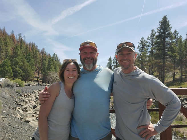
We learned that another ODT hiker named Heavy Teva made it into town this afternoon as well, and we all met up at the Eagles Nest Bar for dinner and drinks. I saw the double bacon cheeseburger on the menu, and in classic thru hiker mode, I asked them to make it a triple. This thing was a beast! The prices were excellent, with two beers and this giant burger and fries, just under 20 bucks. Not bad!
ODT Day 14 Map

Day 15: Zero Day in Lakeview
May 26th
Since Lakeview is the last big town along the Oregon Desert Trail, I used the opportunity to not only do grocery shopping for the next section, but three other sections. I went to the post office and picked up a few flat rate boxes, went to the store and filled them up with food.
We met up with Heavy Teva again for lunch, and again for dinner. We ate at the Pizza Villa, which was Pretty good. I got a large pizza, knowing I wouldn’t eat it all. This will be perfect to pack out tomorrow when we hit the trail again. Trail pizza!
–> Continue reading Oregon Desert Trail Section 4: Lakeview to Plush (56 miles)
Back to Oregon Desert Trail Thru Hiking Guide & Journal index


Leave a Reply