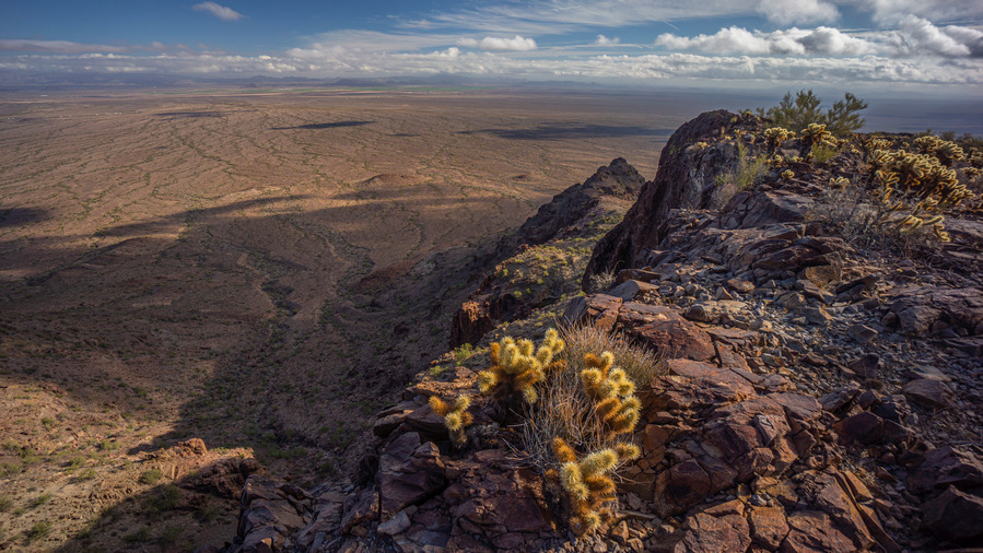
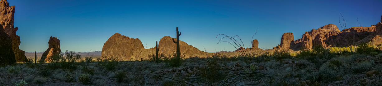
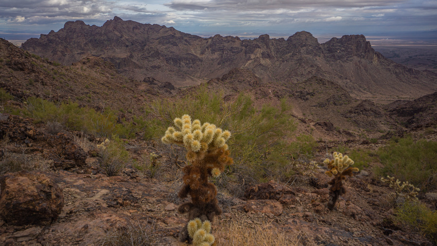
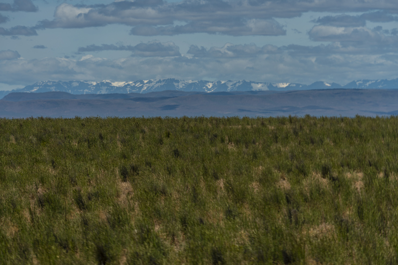
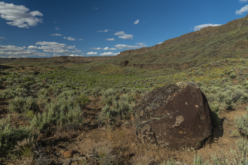
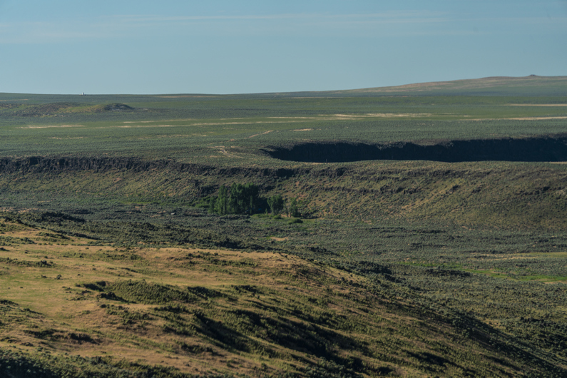
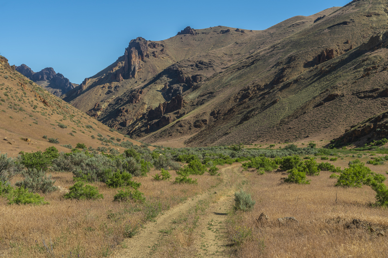
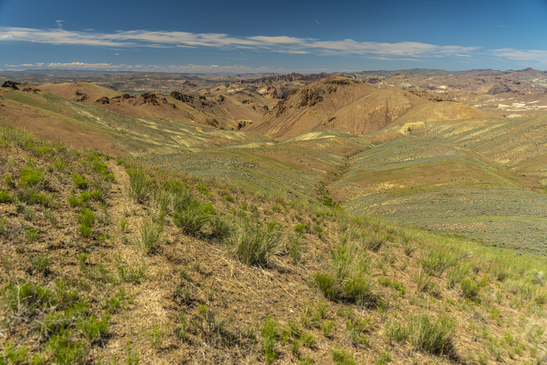
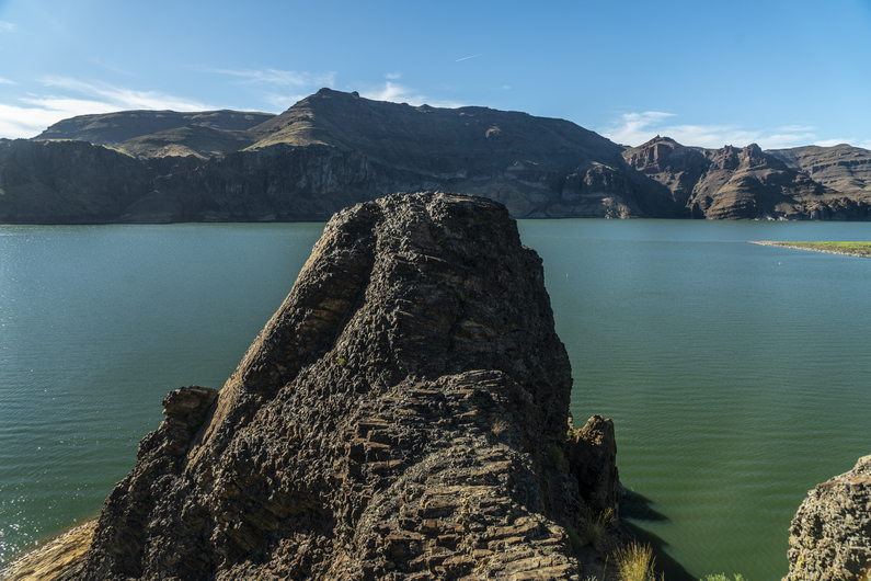
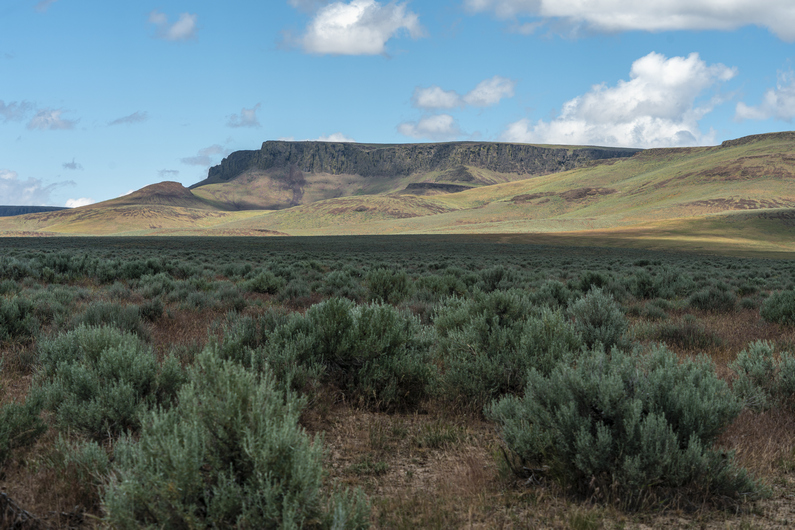
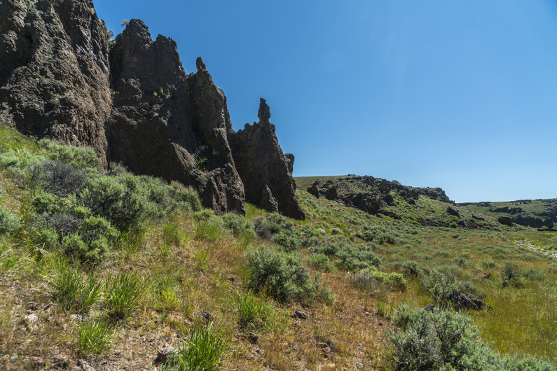
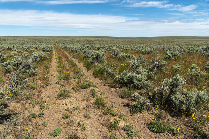
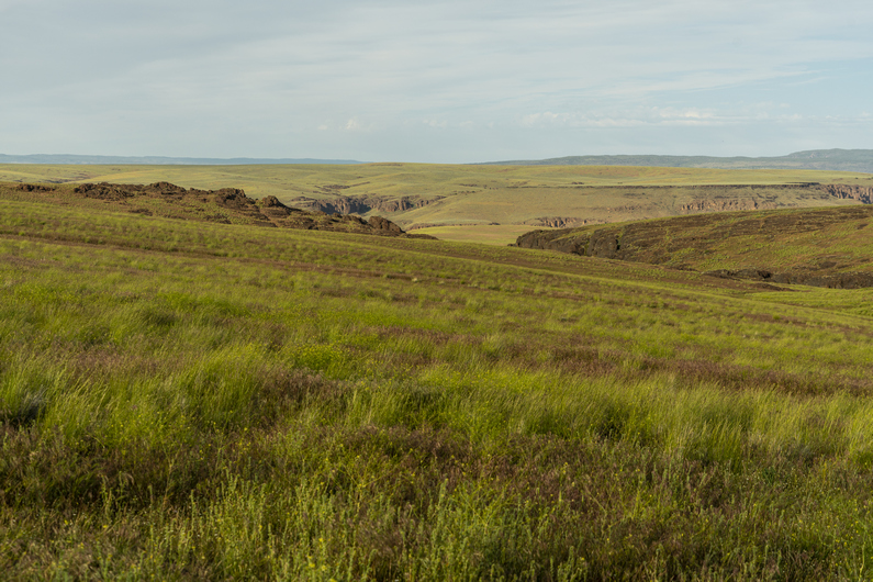
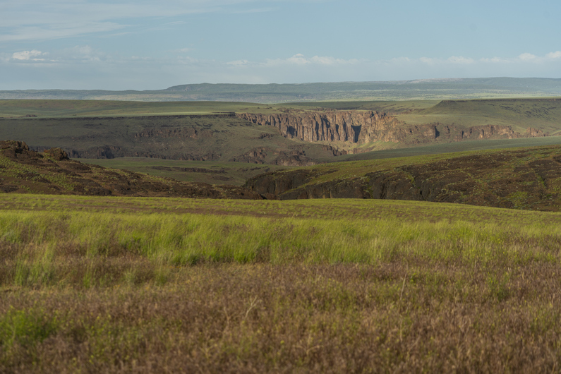
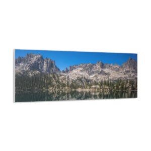
View over Renegras Plains, New Water Mountains, Section 9
It’s been nearly 5 years since I created, and first hiked, the Mojave Sonoran Trail. Since then, the route has seen a steady increase in interest, with several successful completions now by other thru hikers. With increased activity and use comes an increase in new information that future hikers should be aware of. The biggest changes are the addition of a water chart, some refinement of the route and the mapset, and the addition of Brenda, AZ as a resupply option.
NEW!! Water Chart for the Mojave Sonoran Trail
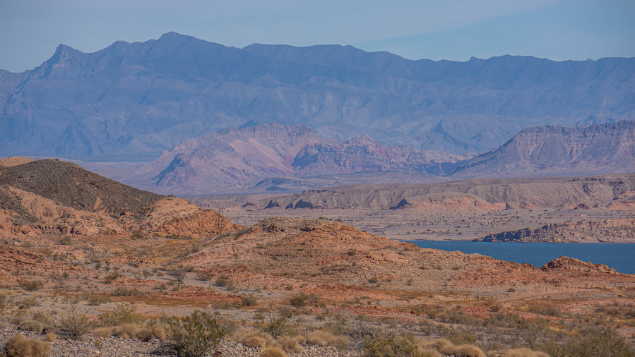
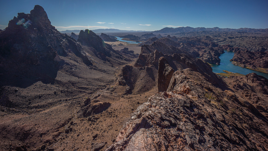
Lake Mead, Section 2
Now that a few hikers have had the chance to hike the MST, over the course of several years with varying water conditions, a water chart is available. The updated water chart now includes field observations of the water sources along the route from thru hikers in 2021, 2024 and 2026. Big thanks to Buck30 for creating the chart, and for his detailed field observations of the water sources he encountered on his Jan/Feb 2026 hike!
Updated Mojave Sonoran Trail route on caltopo. Once you’ve opened this link in caltopo, click “Export” from the top left column under Map Objects to download your own copy of the route that you can edit or upload to your GPS. Choose GPX if you’ll send the file directly to your GPS or cell phone, choose GeoJSON if you’ll upload it into your own caltopo account and do some editing. GeoJSON retains all the custom colored icons, etc while GPX will strip them and revert them all to default colors.
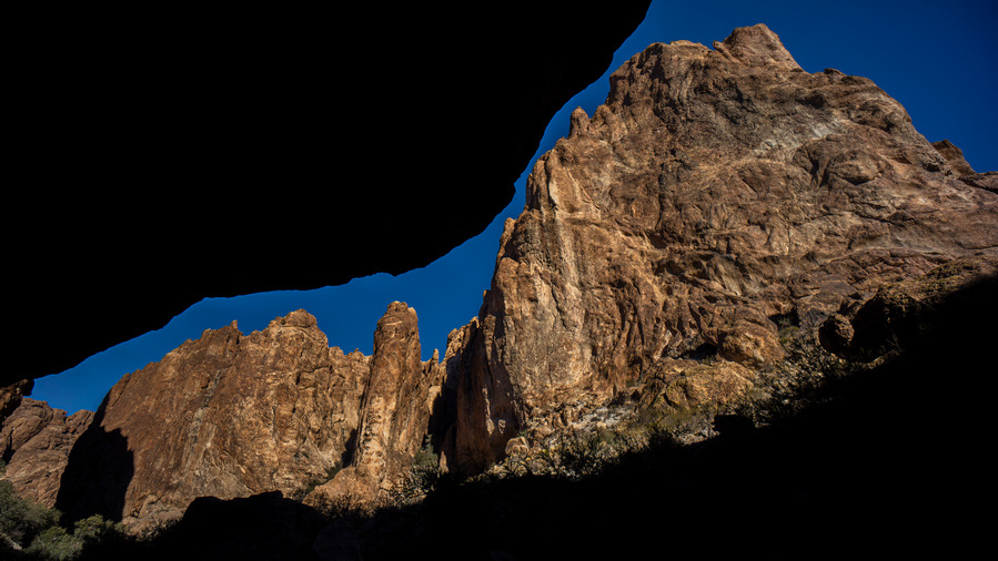
Mt Nutt Wilderness, Section 6. Narrow canyons such as these caused inaccuracies and exaggerations of my original recorded GPX track
The tracks I recorded on my original 2021 hike included a lot of extra exploration, backtracking, peak bagging etc. Not to mention the “bouncing effect” of a GPS in a deep or narrow canyon, where the position jumps around creating a scattered mess of impossibly unrealistic tracks. Big thanks to Buck30 for spearheading the effort to clean up these tracks into the more polished version I’ve linked to above.
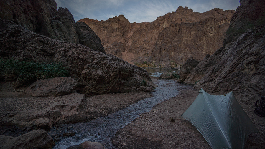
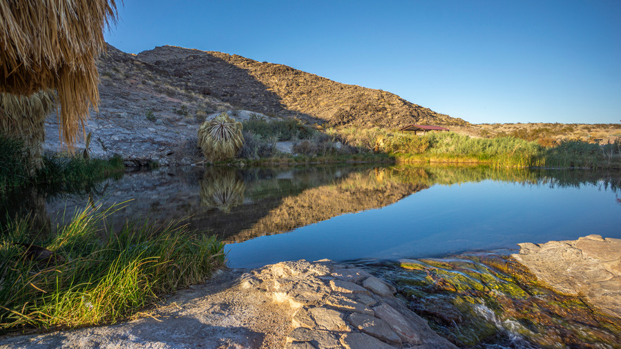
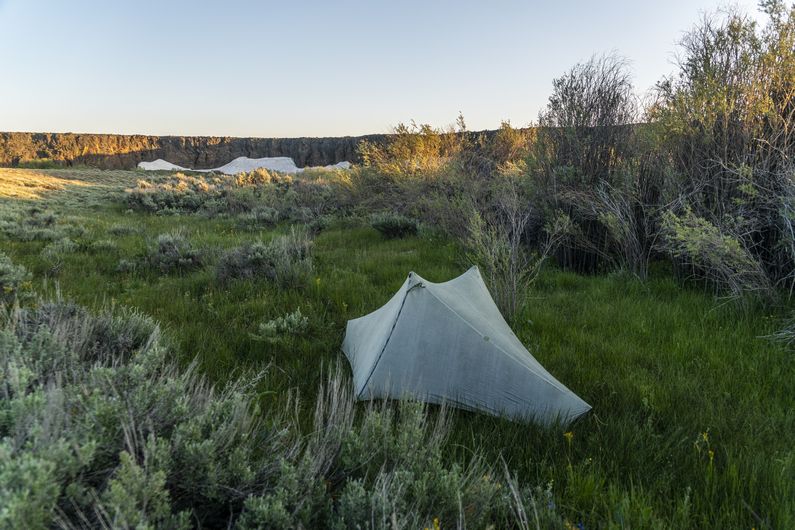
Camp near Gold Strike Hot Spring, an out-and-back alt in Section 4
I’ve also changed the route to make all “out and back” hikes their own alternate route, instead of just including them as the main route. This shaves miles off the main route in many places, making each section “shorter”. You should really consider hiking most of these out and back alts, which are usually fairly short, as they often contain highlights of the section.
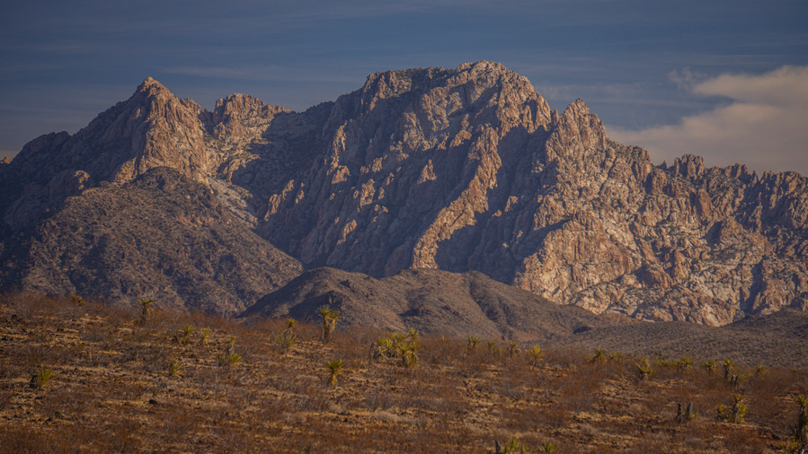
Kofa Wilderness, Section 9
Also note the addition of a new folder “B30 Alternates” in the official MST caltopo map. Some of Buck30’s alternate routes became part of the official route, as mentioned below in the changelog, and others that did not become part of the official route are presented to you here in this folder.
Route Change Log (Sobo Direction)
Rogers Spring, Section 1
Section 1 – After Rogers Spring, moved route off paved Northshore Rd making a more direct route to Echo Bay. Buck30 hiked this route in Jan 2026 and says “I took this alternate to Echo Bay, its a bit of wash and then remote powerline/jeep roads. It gets you off the pavement 3 miles early and is a fine route.” My original route explored a very steep canyon farther west of Roger’s Spring, as I was looking for a route through the Muddy Mountains if I had come up and over the ridge at Fire Alcove. The canyon proved to be too difficult and this route became the obvious choice moving forward.
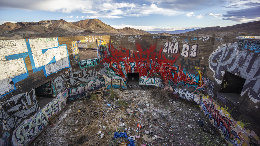
Three Kids Mine, Section 3, March 2022 before housing development leveled all this
Section 3 – Route modified to bypass new development at the site of the old Three Kids Mine, which WAS an interesting, eclectic stop along the route. This new route cuts off about a mile, is more direct and easier. RIP Three Kids.
Section 5 – Minor change to the way the route leaves town. More direct, cuts off about a half mile. Hardly worth mentioning.
Spirit Mountain, Section 5
Section 5 – A minor change to the end of this section provides some big benefits. The old route crossed over David Dam and required either a hitch into Bullhead, or a couple miles of hiking, to the north end of town. Then one would need to hitch back and continue on a pretty uneventful hike through a wash for a couple miles at the beginning of Section 6. The new route, as hiked by Buck30 in Feb 2026, heads south along the Colorado River at the Sportsman Paradise Campground and takes the hiker right into Laughlin, NV. Here there are dirt cheap casino hotels and fast food restaurants. The downside is the grocery stores are all in Bullhead City, several miles south of Laughlin on the opposite side of the Colorado River. Nonetheless, Laughlin as a resupply point seems like an enticing option compared to the sprawled out town of Bullhead City.
Havasu Wilderness, Section 6
Section 6 – Buck30’s Feb 2026 route out of Laughlin/Bullhead City will become the official route here. Basically, it follows a route south of AZ68 now, instead of north of the highway. It’s nearly 2 miles shorter, avoids private property, and is much more straightforward and direct now, following only the coincidentally named Buck Wash Rd (named after Buck30 I presume!) to Thumb Butte, where it rejoins the old route.
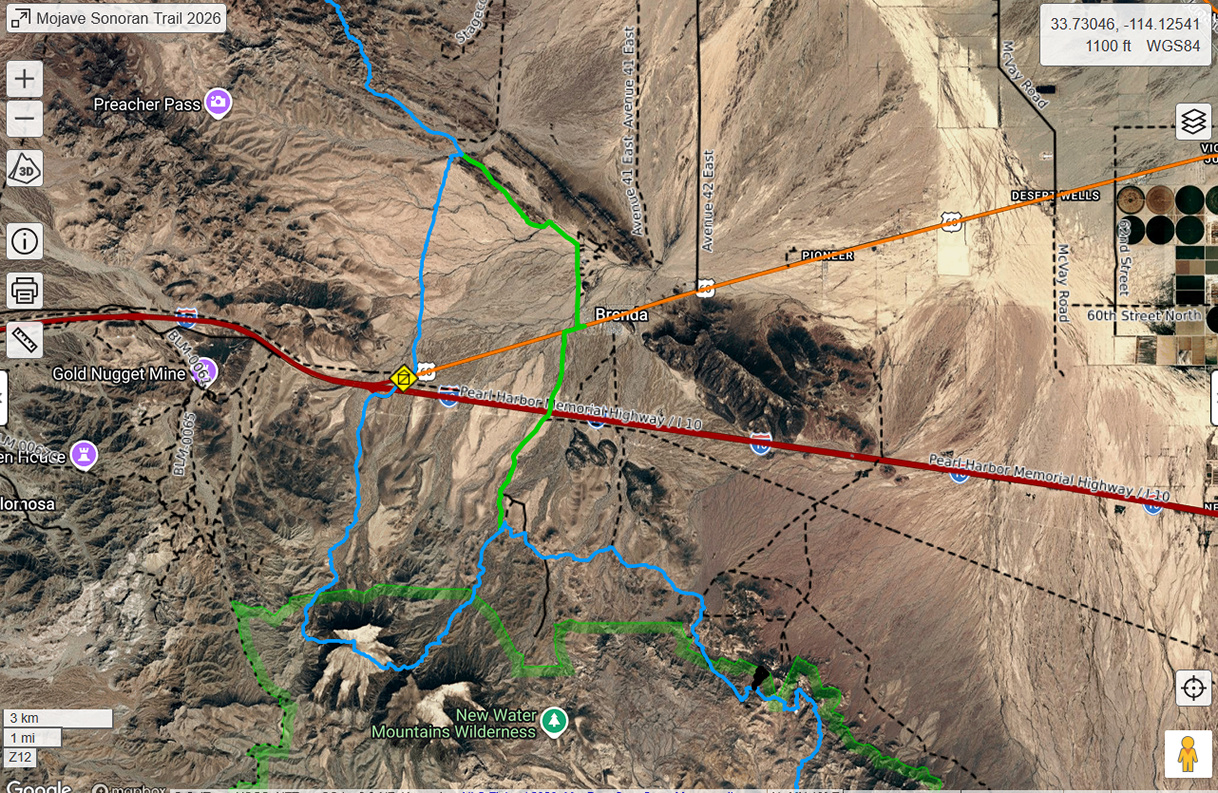
The Brenda, AZ Resupply Option
Blue is the official MST Route, green route is Buck30’s Brenda resupply route
At the end of section 8, I hitched into Quartzsite to resupply for the final section. Alternatively, Buck30 resupplied in Brenda, a small RV community 3.75 miles East of the spot along hwy 60 where I hitched. Brenda has a small convenience store(Buckaroo’s) and a restaurant. They did have an Amazon locker until recently, however it’s currently marked as temporarily closed. Water should be available, as there are several hundred RVs here. You could probably arrange to have a package held by calling the store, but this is completely unconfirmed. There may or may not be a place to spend the night, you could always ask the folks at Buckaroo’s if there is a trailer to rent.
Plamosa Mountains, Section 8. About 7 miles north of hwy 60/Brenda
If you choose to resupply in Brenda, you can just hike in without the need for hitching. This route can be found in the B30 Alternates folder of the MST caltopo map. Also note that Buck30’s route south out of Brenda cuts off the rather brutal hike up and down Black Mesa. This is probably the way to go for most hikers.
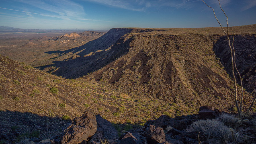
Black Mesa, southern Plomosa Mountains, Section 9
Choose to resupply in Brenda over Quartzsite if you are ok with a very limited selection of food from Buckaroo’s Market, want to avoid hitching, and looking for an easier overall route. Choose Quartzite if you need a hotel, more food selection or other town conveniences, and don’t mind a tough hitch.
After another big breakfast, we started hiking around 11am. This is typical for Donny and I, no hurry leaving town.
We begin walking a dirt road out of Rome. There’s a small plane flying overhead, about 200ft above us. He makes one pass perpendicular to the road, then another directly over the road. Then, a truck comes down the road from a nearby ranch. He tells us the plane is getting to land on the road, so we hop on the back of his truck bed while he drives us a couple hundred yards down the road to his ranch, so the plane can land. Never had that happen before, pretty cool!
The next section passes by a waypoint on our ODT route map marked “aggressive dogs”. The route we are walking is actually the alternate ODT route now, apparently ONDA rerouted this section just because of the dogs. The new route is longer and involves more cross-country, including a steep climb and a legit river Crossing. Just to avoid dogs? We’ll take our chances.
After crossing a bridge over the Owyhee River, we pass the bad dog house, and two black dogs run up to us. They don’t bark or growl, and barely seem interested in us. I’m instantly reminded of the movie Stand By Me, the scene with the junkyard dog “Chopper”. Chopper has a reputation for being a mean, killer dog, but in reality he nothing to be afraid of. Same here in this case.
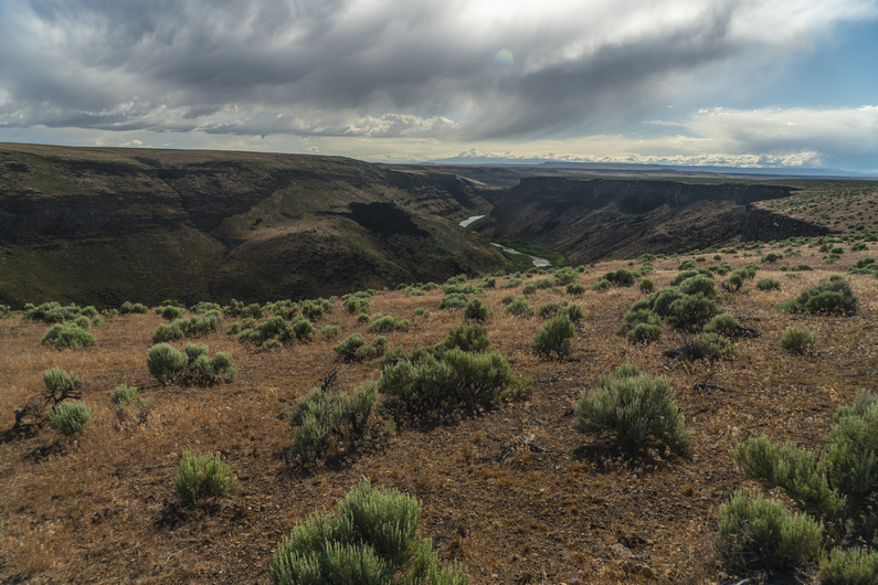
We climb up a road to reach the plateau above the Owyhee River. Back to Sage-Kansas. Occasionally, we get a distant view of the snow-capped Steens Mountains to the east, but they look more nicer through my zoom lens than with the naked eye. It’s pretty boring overall, but the fact that we’re finishing this hike in a few days motivates us. Plus, we know there are some incredible landscapes ahead in the next few days hiking the Owyhee Canyonlands, but right now, we’re up on the high plateau that separates these many of these canyons and gulches.
At one water through, there are a bunch of cows that don’t want to leave and run away, like usual. There’s barely a trickle of water coming out of a pipe, and the cows are all competing for it. Donny wants some of this water, and uses a Gatorade bottle to collect it from the dripping pipe. The cows are 6ft away, watching intensely. Inching closer. It’s pretty comical to watch, I’ve never seen cows surround a human like this.
Next, Donny and I take different routes to get to the same place; Bogus Creek, our next water source. I take a route that has more miles below the rim in Owyhee Canyon, while Donny stays high on some roads.
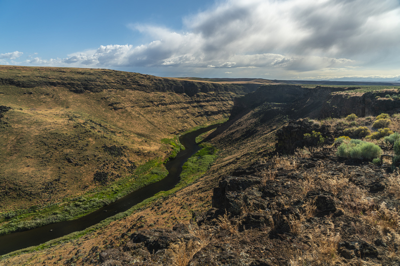
First view of Owyhee Canyon, since last section, is impressive as always. Here, I enter an area called Lambert Rocks. The roads fade, becomes a faint trail, turns into xc and then becomes a road again. A fairly decent road, too. Strange.
We meet at Bogus Creek, which had some water. However, it’s not deep and is kinda crummy water. More like a bog. There are a lot of tannins in the water, staining it yellow. The color mostly filters out, but it still smells like pond scum.
We camp next to Bogus Creek. I take a spot in the middle of the road, because it’s flat and clear, and unlikely to see any traffic. Nobody comin’ down here.
ODT Day 40 Map
Day 41: Lambert Rocks to Willow Creek Canyon
June 21st
Donny and I broke camp at 8am. Now, in mountain standard time, 8 is the new 7. We cross Bogus Creek and hike about a half mile, and start looking for a route up to the top of the rim. There is a bit of a path to follow for the first 200 ft. After that, we’re on our own.
Back up on the rim, it’s Into the Sage Kansas once again. However, on the opposite side of Owyhee Canyon, the land is higher. There’s this really cool backdrop of cliffs that contrast against the flat plateau that we’re hiking on this side of Owyhee Canyon. I like it.
Soon enough, our backdrop of cliffs fades. Most of the day will be on dirt roads, and without much of a view. There are occasional views of a distant Owyhee Canyon, but usually, we aren’t that close to the edge.
Our map says it’s a 26-mile water carry, with a possible source halfway in between. Indeed, about halfway, we find a tanker truck full of water which drains into a kiddie pool. We scare off the cows, and fill up with fairly decent water.
We find more water along the way, both in reservoirs and old tires. I almost never drink from these cow ponds. But I do drink from old tires. Gotta have standards. There are some occasional good views over Owyhee Canyon now, late this afternoon. But canyon is still somewhat distant.
I jump ahead of Donny early evening, hellbent on reaching Willow Creek tonight. Donny isn’t sure he’ll make it that far, so we prepare to meet up tomorrow in that case.
I cross a huge flat plateau, taking a series of dirt roads instead of the cross-country hiking the ODT suggests. Near glover Reservoir, I realize why ONDA has us going xc; to avoid the private ranch property I am currently hiking. However, there are no homesteads or people to be found here, just cows. No harm, no foul.
After the ranch property, I reach grasshopper spring. I am pleased to see cold, clear water running from a pipe. This is the best water I have seen in a while. I stopped to filter a couple of liters, and clean myself up while I’m waiting for my gravity filter to work.
Next, I find myself at the top of Willow Creek Canyon. I can tell it’s going to be a beautiful hike. The scenery improves as I drop down In elevation. Wow!!
Now down in the canyon, I’m surprised to see an actual flowing creek here. It’s 8:30, so I start looking for a campsite. I find the perfect backdrop, some hills with really cool rock formations running along the top and the slopes. Yeah, this is it. In fact, it’s the most scenic campsite yet for me along the Oregon Desert Trail. Donny arrives about an hour later.
ODT Day 41 Map
Day 42: Leslie Gulch, Juniper Gulch & Three Fingers Gulch
June 22nd
Like most days, Donny gets an early start, and is ahead of me by the time I break camp. I walk down the canyon and hear an engine in the distance. A four-wheeler approaches from behind, it’s a Rancher looking for cows. I tell him about the two cows I saw last night near where I camped, on the other side of the gate. He heads back up the canyon to investigate.
The road through Juniper Canyon eventually turns and goes up over a small pass which drops into Spring Creek. The official ODT route continues down Juniper Canyon as a bushwhack, but the road through Spring creek provides a much easier path to follow. The downside? It’s private property. Donnie and I had decided yesterday to take a chance and go for this road to avoid the bushwhack. Having just seen the local Rancher on his four-wheeler, I was a bit apprehensive, but continued on with the plan.
The scenery was outstanding here. In fact, coming down the pass into Spring Creek was one of the most spectacular canyons I had seen along the ODT thus far. Upon entering the private parcel, signs stated “No Hunting”, not necessarily “No Trespassing”. The vertical rock walls that formed the western side of the canyon were stunning. It appeared that there was a landing strip in the canyon, as well as a home of some sort. It was unclear whether it was currently inhabited, but it certainly didn’t look dilapidated and abandoned. Needless to say, I walked quickly down Spring Creek Canyon in order to pass through this private parcel as quickly as possible.
I pass through the private parcel right where Schoolhouse Gulch dumps into Spring Creek. I walk this for another mile before reaching another private parcel right on the Owyhee River. There is a fairly modern looking cabin here, and it’s clear that it’s used somewhat frequently, and probably not all that long ago. Donny is sitting on the porch In the shade, taking a break.
From here, we walk the shoreline of Owyhee River. Only now, it’s referred to as the Owyhee Reservoir on the map, from here to Leslie Gulch. The water level is low enough to make passage possible along the shoreline. In the spring, water levels are higher, which could make this traverse a lot more challenging. The scenery here was stunning as well, especially on the opposite shoreline.
We stop and filter water from the Owyhee Reservoir when we reach Leslie Gulch. The water here is pretty disgusting. In fact, it’s solid green, choked with algae. But, It’s the only water around, and it filters Just fine.
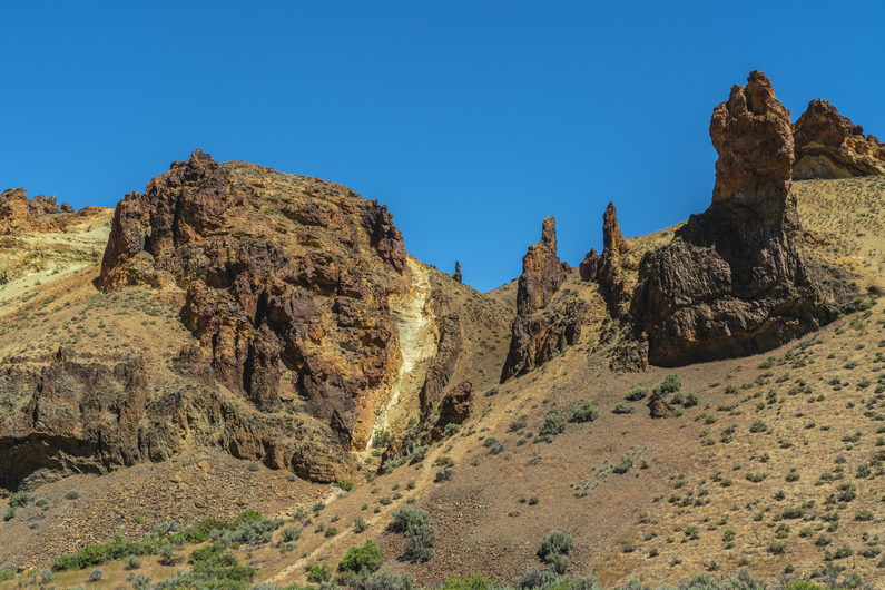
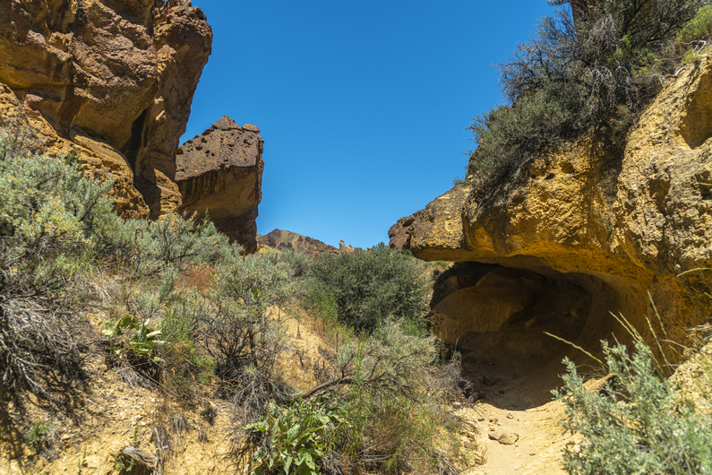
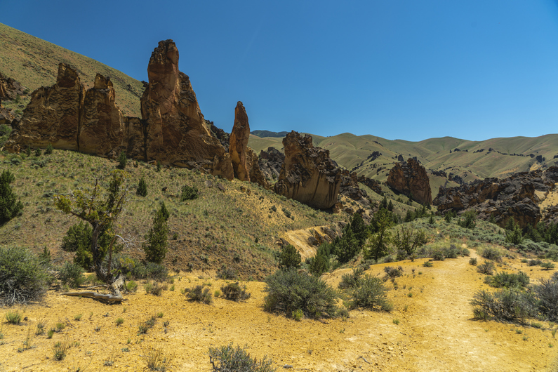
Next we hike up Leslie Gulch. There is a well-maintained dirt road here. I have visited Leslie Gulch about 5 years ago, my only prior visit to Oregon before hiking the ODT. I knew how stunning it was, but somehow, it was even better today. Just Incredible. Hard to describe how majestic this canyon really is. Both sides of the canyon are flanked with unique and impressive rock formations. Very jagged, and otherworldly.
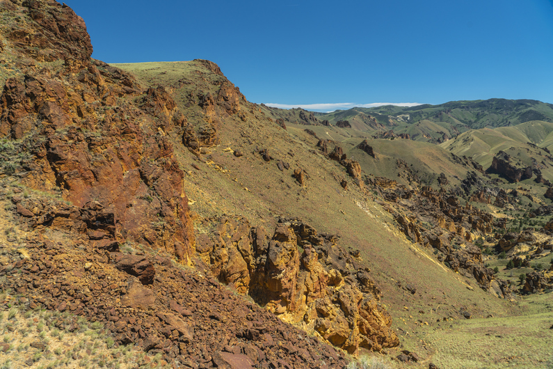
Next, we leave Leslie Gulch and hike up Juniper Gulch. It’s getting hot now, temperatures forecast to be in the low to mid-90s today. Not only that, but it felt very humid. The hike up Juniper Gulch was outstanding as well. Surprisingly, pretty good trail leading most of the way up to the top. It was a 1000ft climb to the ridgeline, and the final 500 ft were brutal. The terrain was steep and the dirt was loose, causing me to slip and fall a few times. And the heat, man was it wearing me out.
Now on the crest, I walk the ridge line for a while and see Donny taking a break. There’s no shade, but we need the break either way.
Next we drop down into an unnamed canyon. The upper reaches are not all that impressive as we bushwhack our way down hill. So far, it’s quite a pain. But then, we see signs that it will be an interesting hike, as the canyon narrows a bit.
Once we really get into this unnamed canyon, it really begins to impress. More incredible rock formations; hoodoos, spires, pillars… whatever you want to call them. Large “fins” seemed to protrude vertically into the sky, and we weave in and out of them. Progress here is slow, because of the bushwhacking and because of the incredible scenery. The canyon fights us the whole way down to the bottom.
We hiked over a small hill and find a large tire filled with water. It’s pretty disgusting though; chocolate milk colored filled with algae and bugs. Still, we need this water. We are hot and thirsty, and it’s a long ways before the next water source. Unfortunately, I lost my pre-filter earlier on this hike. Since I practically never use it, I didn’t bother to search for a replacement. Well, now would be a great time to have it. The water is so dirty that my filter needs to be back flushed every quarter of a liter. It takes two hours to filter 5.5 liters.
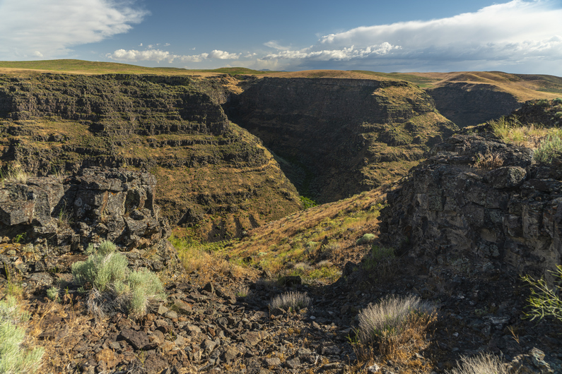
The sun is dropping lower in the sky now and it makes the walking more bearable in the heat. Next, we hike over to Three Fingers Gulch, which boasts some pretty impressive typography on the map. And in-person, it does not disappoint. Very sheer vertical rock walls form the entrance to this canyon, and damn is it stunning.
We enter Three Fingers Gulch and do a bit of bushwhacking to pass through the deepest, most narrow part of the canyon. After a half-mile or so, the canyon opens up a little bit and the terrain becomes flatter. There is good camping here, so we stop for the day. Another excellent campsite, our last of the Oregon Desert Trail.
ODT Day 42 Map
Day 43: Painted Canyon & Finish at Lake Owyhee
June 23rd (finish)
The mood Is different this morning. The finish line is immediately on my mind, and a calmness comes over me. It’s a good feeling to know the end is no longer weeks or days away, but mere hours.
The hike out of three fingers Gulch is rather easy and pleasant this morning. There is a surprisingly good trail running through here. Most likely, a cow path. In fact, it looks like an old road used to run through here at one point. Whatever the case, we have something to follow.
The route turns up a side canyon leading out of three fingers Gulch up to a pass, and then drops us down into Painted Canyon. Wow! Another stunning Canyon. None of this was a surprise to me per se, anyone with the ability to read a topo map would have seen this coming. But seeing it with your own eyes in person is never exactly what you envisioned by looking at the map. Somehow, it’s always more impressive when you see it in person.
The hiking becomes more challenging in Painted Canyon, but still, not a terrible bushwhack. In fact, there is a halfway decent wash to walk, mostly clear of vegetation. Excellent scenery.
Towards the upper end of painted Canyon, there is a short section of a little bit of scrambling over a few small boulders and pour offs. Personally, I really enjoy this type of canyon hiking. Donny, though, not so much.
We climb out of painted Canyon and hiked up to the top of a saddle. I scare up a deer in the wash, one of only a few deer I’ve seen along this hike. South sheephead spring is here, and there are only a few small pools of disgusting water left in the footprints of cows who have trampled through the mud. Naw, I’ll wait. Near the spring, I see a badger. I had seen three others in the Steens Mountains, but this time, I was able to get a great photo with my zoom lens before he retreated into his hole.
Next, we climb up to Sheephead Ridge. The suggested route is pretty annoying here; instead of gaining the ridge and walking the top, the ODT route has us sidehilling below the top. There are no horse trails here or anything, it’s just a bushwhack through sagebrush and a bunch of scattered rocks. Very frustrating. Just climb slightly higher and walk on top of the ridge, instead of sidehilling around it.
I crest the top of a ridge and see Pronghorn antlers about 40 ft away. He scampers off downhill. Probably the closest I’ve been to a pronghorn on this trip, and perhaps ever.
Now I descend to Rookie Canyon Spring. There is a herd of about 200 cattle gathered around it. As I approached, I scare off the cows, but only enough for them to walk about 20 ft away. They moo like crazy, not happy that I’ve moved them away from their water source. They stare at me while I get my water, and are quite vocal. Eventually, the majority of the cows disperse, but a few stragglers refuse to leave.
Donny arrives and gets his water, and together we leave the spring behind for a road. The official ODT route has us about 7.5 miles from the finish line now. It would be all bushwhacking to the end, but I see on the map that there is an option to take old 4×4 roads all the way to the finish line. This would add three miles, but would certainly be easier and almost certainly would take the same amount of time, or be faster. Gladly! The terrain between here and the finish line just wide open Sage Kansas, and the bushwhack actually parallels the road. Seems pretty gratuitous to me, and as far as we know, most ODT hikers take the road route over the bushwhack anyways. It just makes sense.
At the top of the hill, I check my cell phone signal. Still nothing. I use My Garmin inreach Mini to contact the Friends of Owyhee, who pick up Oregon Desert Trail hikers from the Eastern Terminus at Lake Owyhee. We give them a time, and they said they could be there tonight to pick us up. Excellent!
We walked a few more miles through Sage Kansas, and eventually reach the road that drops us down along Birch Creek. The views from this road are outstanding, an elevated view above the canyon as well as Lake Owyhee which is now clearly visible. It’s hard to understand why the official route suggests that we bushwhack through the bottom of Birch Creek, through a lot of poison ivy according to other ODT hikers, but Donny and I are glad that we chose to avoid it. Good call!
It’s about a five-mile walk down this road through a winding canyon. With the end in sight, I begin to reflect on the journey, and all the emotions that come with finishing a thru-hike begin to rush in. My fourth long-distance hike, coming to an end. While nothing can compare to the feeling of completing my first thru-hike, I do notice one similarity; there are no combination of words that can accurately describe what a hiker feels at the end.
After descending the canyon, I reach a paved road, walk through the boat launch area, and over to the final outcrop of rocks that jet out into Lake Owyhee. These rocks mark the eastern terminus of the Oregon Desert Trail, and the end of my journey. Lake Owyhee itself is beautiful, surrounded by massive cliffs. The sun is shining and reflecting on the lake. It’s perfect. It’s exactly what I envisioned at the end of a long hike, for once. I certainly didn’t get this kind of ending on my CDT thru hike, in 2018.
I climb out to the farthest, highest rock. I hoist my pack above my head, and scream at the top of my lungs. What a feeling it is to be done with this hike!
Donny arrives a few minutes later. We congratulate each other, snap a few quick photos, and head back to the day use area where we relax in the shade, sitting on a picnic table and drinking cold water from a spigot. Little luxuries, but the kind that one can only appreciate after a long hike, like this.
Sammy from the friends of the Owyhee is there to pick us up just after 8pm, and we begin the long but very scenic drive through the Owyhee Canyonlands to the town of Ontario, Oregon. Great guy!
I suppose the rest of the details don’t matter much to the average reader. Donny and I split a hotel room for the night, and I take a Greyhound bus to Boise the next day. Then I stay in a hotel near the Boise airport and fly home the day after that.
And just like that, another long hike is complete, another journey under the belt. Back to the world, where no one else understands what I’ve seen, endured and accomplished. At least on this one, I had Donny to share the experience with. One person that gets it. That’s more than I can say about my last few hikes. And for that, I am thankful. ODT complete.
After our 11am checkout time, Donny makes a stop at the library to print out a shipping label, so he can mail a faulty Lite AF backpack in for repairs. With just over a thousand miles on it, the seams were all blown out and you could stick your hand through them. I’ve never seen a backpack fail like that.
It’s after 11am now when we start hiking out of McDermitt. We start by hiking dirt roads out of town for a couple hours. We’ll need to climb up 2,000 ft to the top of a plateau in order to enter the Owyhee Canyonlands. We’ll be in the Owyhees for the rest of our hike now, another 9 hiking days. That’s a big region!
After climbing up about 1,500 ft, There’s a shelf that reveals some pretty impressive cliffs, and the final 500 ft climb. Every now and then, you stop and realize that you are walking into something special. And this was one of those times. The Owyhees have been on my radar for several years, and to finally be here at the Gates of the Owyhees, well, It was really starting to hit me.
Outstanding views as I climbed Up to the top of the plateau, topping out around 6600 ft. It was 65° in McDermitt today, and probably 55 or so up here. Add the 20 mile an hour winds, and it was quite cold.
After soaking in the final views over the valley below, I headed into Sage Kansas once again. These views always get me. Not the most beautiful, but damn, is it vast. And you gotta hike through all that. Just sage, to the horizon. Alright, let’s get into this.
The swarm of Mormon crickets had been pretty consistent all day. Wherever I hiked, they were there. They seemed way worse In town, but maybe that’s because they had fewer places to hide. I was really beginning to worry I might not be able to escape them tonight when it’s time to set up camp. And since I can’t zip up the mosquito netting in one of my vestibules of my tent, well, you can imagine why I might worry.
Even though the map shows a bunch of dirt roads up here, they barely existed, at best. It was mostly just cross-country hiking. And not the easy kind. There were many rocks to step over or on, many ways to twist an ankle. The hiking here has mostly been a pain in the ass after leaving the decent dirt road that led me up to the plateau.
By early evening, I reached Louse Canyon, home of the West Little Owyhee river. I was really surprised to see snow tucked away against some of the canyon walls. I’ll drop down here and walk this for a few miles.
West Little Owyhee River Is flowing, and there is much green grass along its banks. The canyon is not deep or narrow, but it’s much more interesting than Sage Kansas. I’m happy!
There are a couple of caves, arches and cool rock formations along the way. Hiking here in upper Louse canyon had a very raw and primitive feel to it. You could really feel a connection to our ancient ancestors that certainly called this canyon home. I’m not generally in tune with that kind of thing, but you could really feel it here.
After a few miles, the river was pushing me up against the canyon walls, and I found it easier to climb out. It was 7:30 now, and I was realizing that I was out in the middle of Sage Kansas again. That’s the term I coined on the ODT, Sage Kansas… referring to the flatness of Kansas, but with sagebrush instead of grass. Except now, There were so many rocks that these were much more of an obstacle than the sage. With several miles of this ahead, there will be no opportunity to get out of the wind and very little opportunity for a clear or flat spot to put my tent. So, I head back down into the canyon to make camp, a little earlier than I would have preferred.
It took a while, but I found a suitable spot to put the tent among some green grass. There was pretty good protection from the wind, but the downside is that I’m at the very bottom of the canyon, and not far from the water. This is going to make a cold night even colder, with the possibility of condensation, likely in the form of frost. Most nights, campsite selection requires a trade-off in one category or another.
ODT Day 34 Map
Day 35:
June 15th
Just as I expected, a very cold night, with condensation and frost. It was 20° when I woke up. This is one of the coldest nights of the entire hike. And it’s in mid-June, no less.
It was a good thing I didn’t push on past my campsite last night. This morning’s walk was slow, tedious, and absolutely nowhere to camp for miles and miles on end.
I reached Massey Canyon, and took a break. There were a couple of marmots around in the boulders here. Interesting, I was not expecting to see them here.
Massey canyon was short but pleasant, despite the cow activity. It was pretty heavily trampled by all the cattle, and cows were shitting right in the creek. It’s sad to see all the cows in places like this.
After Massey Canyon, it’s back out into the sage Kansas. I walked a series of dirt roads for a couple hours, reaching progressively larger roads. Swarms of crickets and grasshoppers came in waves. More cows, and another bull snake.
It was around 1:00pm when I reached Anderson Crossing. I had been talking with a guy named Mike on social media, who operates under the name About The Journey, and he was kind enough to offer to come bring me some trail magic. This is the time and place we had agreed upon meeting, but I didn’t see anyone here.
Crossing the West Little Owyhee River here at Anderson Crossing was mid-calf deep. I walked through the area along the road and around the bend, entering Louse Canyon. I figured I’d have lunch, filter water, and take a look at Louse Canyon while waiting an hour or so for Mike. Maybe he’s just running late? I took lunch, filtered water, and washed out my dirty socks… anything I could do to kill some time.
After stalling for a while, I decided it was time to get moving. Even though he won’t get it until he gets service, I sent him a message with my garmin inreach telling him I had to keep moving, and It’s a bummer that we missed each other.
Almost immediately upon entering Louse Canyon, I could see the challenge that lied ahead. The steep canyon walls and thick willows forced me into the water. I began hiking through the river, in water that was about crotch deep. It wasn’t long before I realized that this traverse of Louse Canyon wasn’t going to happen. It’s about 45 miles to Three Forks from here, and if the water is this deep in the very upper reaches, imagine how deep it will be farther down. Furthermore, it’s a very committing route, with few exit points. I decided it was best to turn around, head back and take the alternate route around West Little Owyhee, like literally almost every single ODT hiker does.
I was very disappointed. I had wanted to hike West Little Owyhee and Louse Canyon for years. Regardless, I backtracked through Anderson Crossing, and there was Mike. His truck was parked, and his camp was set up. His dogs rushed to greet me, and we said our hellos. This was definitely the silver lining here, getting to meet up with Mike and enjoying an afternoon of trail magic… beer and tacos!
Later in the evening, after dinner, Mike wanted to do an interview with me for his YouTube channel. In the middle of this, we had a couple of interruptions, in a good way. The first was an older guy named Charlie, who was out doing research on the number of predators (bear, mountain lion, wolf etc.) in the region. He asked us if we had come across any, and I thought back to what I had seen on this route so far. None of those in person, but tracks, and I even heard a wolf howl while in the hart mountain national antelope refuge. Charlie was pretty happy to hear that I had GPS location for this as well, since it happened while camping and I always mark my campsites. So after the hike, I’ll get in touch with him and pass on All the detailed information I have for what I’ve seen along this hike.
Our second interruption was two young women who were working for ONDA (Oregon Natural Desert Association). They were doing field work, monitoring effects of grazing on random plots of land. One of them had been working for ONDA for six summers, and said I was the first ODT thru hiker she’d come across. They were pretty excited to hear I was hiking the trail, and one of the women gave me her Oregon Desert Trail hat! That was super cool!
ODT Day 35 Map
Day 36:
June 16th
I got a late start this Morning, leaving Anderson Crossing at 9:45. Since I won’t be hiking the route through Louse Canyon, I’ll be hiking the alternate, which stays above the rim. The shaves off a couple of miles total, but probably shaves off at least a day walking due to the much easier terrain on the alternate route. I’ll be walking primitive roads all day. I figure It’s 29 miles to 5 bar, where the route crosses the main fork Owyhee River. This will be my goal for today.
Today’s walk was very dull. Besides the last few miles at the end of the day, It was all Sage-Kansas. I hike a series of dirt roads that seemed to get progressively worse. Pretty much nothing notable happened,
I saw my first and only rattlesnake of the entire Oregon Desert Trail today, alongside the road under some sage. It looks like he must have just eaten. It was a smaller snake, but very wide in the center. Well, at least now I can say I saw a rattlesnake along this hike.
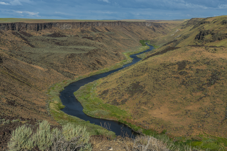
The scenery began to improve massively as I dropped down in elevation towards five bar. Louse Canyon terminates here as it meets Owyhee Canyon. The scenery is downright nuts! But, the route is anything but straightforward from here.
I get down to West Little Owyhee River and check my map. I will need to follow this downstream, but it’s choked with willows and the stream is braided. It’s just wide enough to be unjumpable, but with some ingenuity, I am able to keep my feet dry and cross.
I reach a deep pool, hemmed in on both sides by cliffs. I’ll need to cross this. It’s 30 minutes before dark, and I’m not too keen on getting my shoes or clothes wet. So, I stripped down to my underwear and put on my sandals, and went waist deep to cross it.
After that, I started working my way along the banks, and found myself walking above a small rock face. This ultimately ended up being a dead end, and I needed to backtrack. Then, I had to drop down to the river again and cross it. I push my way through some willows and get to the other side, where I could walk a gravel bar. This leads me around the bend, where I see a big cave on the other side of the river. It looks like an awesome place to camp, But I don’t feel like crossing the river again, moments before dark. So, I set up camp on the gravel bar, which still affords me an insanely awesome view!
ODT Day 36 Map
Day 37:
June 17th
I love mornings like this, where I open my tent to a view that takes my breath away. Even though I was aware of its beauty last night when I set up camp, but somehow a night of sleep diminishes our memory. Wow! I took some time admiring the towering canyon walls before packing up.
From camp, I’ve got a quarter mile hike North before I reach the Owyhee River. I’m walking through the West Little Owyhee River now, which is maybe calf deep here. Extremely scenic.
Main fork Owyhee River crossing
I reach the Owyhee River, and see a decent current and stomach deep water. Still, it doesn’t look like a raging river, and fordable. Taking Heavy Teva’s advice, I walk (bushwhack) upstream about 50 ft and cross here. It’s a little shallower. When I reach the other side, I walk down stream about 50 ft in the water and along the banks, and find a good spot to exit the water. That wasn’t bad at all. It was about crotch deep for me.
From here, the route climb steeply to the canyon. As a gain elevation, I noticed two things; the scenery is downright stunning, and the best crossing point would have been about 20 or 30 ft downstream from the confluence with West Little Owyhee River, not upstream. Here, the water was really shallow.
I can’t emphasize how incredible the landscape is here. This spot, climbing out of the Five Bar area, is my favorite along the Oregon Desert Trail. It seems like something out of a fairy tale. It really makes me want to return someday and explore these canyons more. Or just sit and stare at them.
At the top of the climb, there’s a Jeep parked along a dirt road. I really wasn’t expecting this. I follow this road across an area called Brown Ridge for several miles. It’s pretty boring here, mostly flat and rolling hills with sage. But this will connect me with three forks, which is another incredible area.
As I’m walking along brown ridge, The Jeep that was parked along the road a while back drove up behind me. Typical for me on boring stretches, I was in the zone and the Jeep scared the shit out of me as he approached. It turns out, This guy was hiking and camping down by five bar Ranch last night. He had also hiked the Idaho Centennial Trail a few years ago, which was pretty cool to hear. Very few people have hiked that trail.
Soon I reached Three Forks and the scenery once again blew me away. Pretty Incredible landscape as I dropped down from Brown Ridge around Three Forks Dome. There’s a big network of roads here, as this is probably the single most popular spot in the Owyhees. There’s a hot spring here, and they always draw a crowd. However, I didn’t make it to the hot springs myself.
The road I was walking crosses the North Fork Owyhee River. Here, the water was calf deep. A quarter mile up the road, there’s a bridge that goes over the North Fork Owyhee River. It’s a pretty awesome looking canyon, and it’s clear more water is flowing through the North Fork than normal. There was some vegetation that looks like it would normally not be underwater. Today though, the Owyhee River USGS station at Rome was only showing 270 CFM, which is really not that high.
As I walked through the Three Forks area, I saw Mike’s truck parked here. His dogs ran up and greeted me, and I stopped by for a beer. It was 12:30 or so, and I had some time to hang out for a bit. Mike has a YouTube channel of his own called About The Journey, and he tried to conduct an interview with me the other day when we met at Anderson Crossing. However, he was having some technical issues with his GoPro, and what we recorded the other day was lost. So, I sat down again with him this afternoon for another crack at it.
I hung out with Mike until around 3:15. Now, it’s time to climb up out of the three Forks area onto the canyon above Owyhee River. My map shows cross-country hiking, so it was a surprise to see an old 4×4 road leading up the canyon. There were many trees here, junipers perhaps… the first trees I’d seen in a while. I was feeling great, and powered through the hike uphill, making quick work of the 1000ft climb. The road fades near the top, and it’s a couple hundred feet of off-trail to gain the rim.
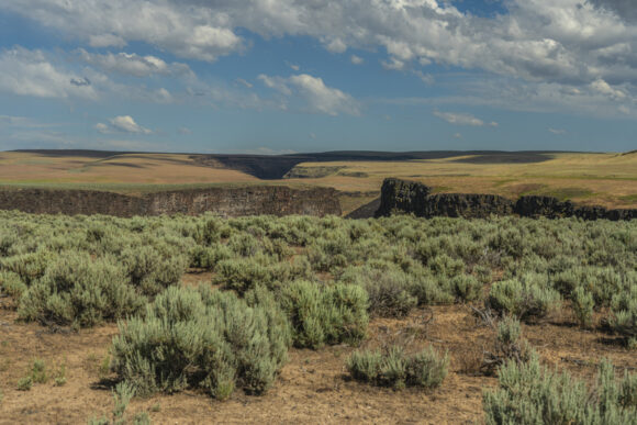
The wind was whipping pretty hard by the time I made it up to the top. And the views were stunning! Owyhee Canyon is a majestic place. Along the rim, there’s an occasional lone tree that stands out. In fact, there’s a line of trees along the rim in certain places. Certainly, a microclimate exists here. Most likely, the wind’s moisture blows up from the canyon and allow these trees to exist along the rim. They are not found more than a few feet away from it.
Now, I tried to walk the rim as long as I can. The landscape everywhere but the canyon itself is an impossibly vast and open terrain. The vegetation here is a mix between Sagebrush and grasses, with a bunch of basalt boulders scattered along the ground as tripping hazards. The cloud cover is thick, the winds are whipping really hard. It certainly has an ominous feel to it, especially the way the grass moves in the wind.
The skies grow darker, and it’s pretty clear it’s going to rain. There has been light sprinkles here and there, I think the sky can hold out much longer. I stop and take the first acceptable campsite I can find around 7:30. Moments after setting up my tent, a moderate rain begins to fall. Man, is it a good feeling when you beat the rain!
It rains for an hour or two after sunset. And there actually was a sunset tonight. I was able to peak my head out of the tent and catch a glimpse. Red and orange skies, one final treat for the day.
ODT Day 37 Map
Day 38:
June 18th
I woke up this morning to full sun beating on my tent. The tall grass blowing in the light wind, wrestling against my tent, wakes me up. It looks like It’s going to be a nice day.
Today will be a mix of walking on dirt roads and cross-country hiking. There’s a well-maintained dirt road that roughly parallels Owyhee Canyon, but because the canyon twists and curves, the road is only sometimes close to the canyon. I’ll walk the road for now, as the canyon is a ways away.
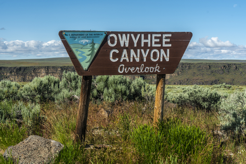
I walk the road to Owyhee Canyon overlook, and leave it here for a while I can walk the rim. Every time I see the canyon, it just takes my breath away. Incredible. Now, I hike the rim for a while before heading up over a hill and back to the road.
I stay on the road until I reach Lambing Camp Reservoir. I take a break here and then head up over a hill and drop down into Soldier Creek Canyon. There’s some water here, but also a bunch of cows. Not really drinkable water unless one is very desperate. You know, because of the cows. The climb out of the canyon affords a good view, though!
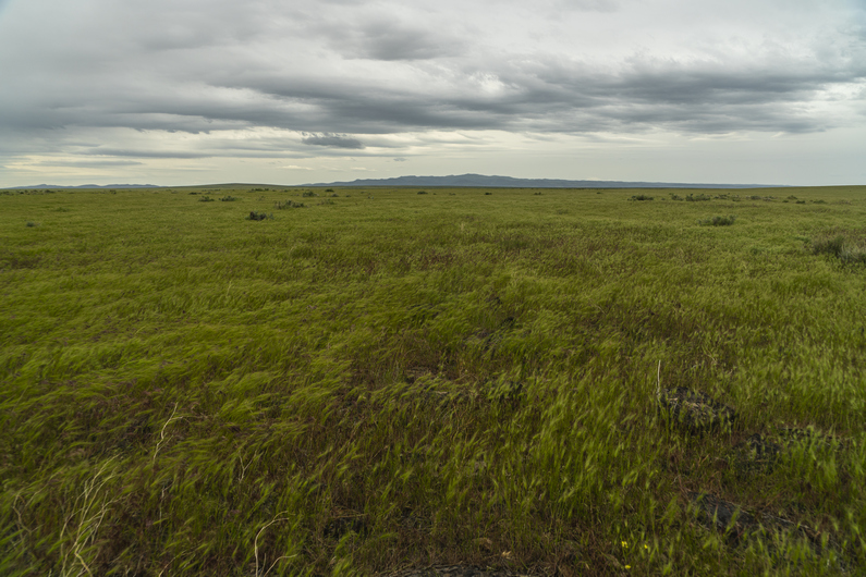
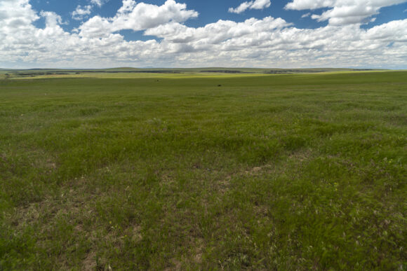
Back up on the rim, It’s no longer Sage Kansas. The landscape now is more of a, well, regular Kansas. It’s a sea of green grass, and it’s vast. Quite an incredible place to walk, really. Like hiking through that old Windows wallpaper background. The grass seemed to breathe with the wind, or perhaps, flowing like waves of water. Kind of a surreal moment.
As I drop down slightly into a canyon, the grass gives way to sage again. I meet up with another primitive road, and follow this for a mile or two.
When I leave the road, ODT route suggests that I walk the base of a small hill for a few miles. This doesn’t make any sense to me though, because It’s only a small 150 ft climb to the top, which looks like it would afford me a view of Owyhee Canyon. The walking doesn’t seem any easier on the bottom than it would be on the top, nor would it add any miles. So, I do a 5-minute walk to the top, and sure enough, there’s a view of the canyon.
First chance I get, I hike over to the edge of Owyhee Canyon. Of course, it’s just stunning. The cloud cover creates a real moody scene over the canyon, making for some great photos. Then I hike along the edge for a while, until the canyon veers away from my general trajectory. I definitely recommend this small alternate route, as an improvement over the original route. Do it!
I follow a ridge line downhill, come across the cow path, and it drops me down into a canyon. I walk through the canyon and meet up with a 4×4 road. This should mostly be the end of the xc hiking for today, although I still have too many miles left to town to truly believe that.
Soon, it’s time to stop and for a break. I found one of those tags that go through a cow’s ear, with a number on it. Surprisingly, this is the first one I’ve ever found. I think I’ll keep this one, just for the novelty of it.
From here, I think I have about 8.5 miles to Rome station, and it’s about 4:30. I have 2L of water left out of the 5 that I took with me yesterday afternoon, leaving Three Forks. I was conserving my water a little bit more, because I was thinking I was going to camp a few miles out of Rome tonight, and nearo into town tomorrow. But like always, when I get within striking distance of town, I can’t help but push in that same day. That means I’m no longer worried about conserving my water, so I can drink!
I hike on with a purpose now, hoping to reach Rome in time to get a cheeseburger before the grill closes at 8:00. To distract me though, the road I’m walking eventually veers very close to the edge of Owyhee Canyon. The edge is only 30 ft away now, and it’s very easy to stop frequently and see the canyon from new angles. And I take full advantage of this, stopping many times for photos and video.
When the road veers away from the canyon, my route has me doing a quarter mile xc hike to meet up with a different road. I walk through a field and struggle to find the road, but eventually stumble upon it. It’s here that I realize that my next turn is not really on a road, as the map shows, but it begins what appears to be a nearly 2 mile xc hike into town. Seriously? This is so like the ODT, to bushwhack your way into town. I was pretty pissed about this.
I can see that there is a very, very faint set of tire tracks that run parallel to a fence line. However, it’s through a bunch of cheat grass, which has been a real pain to walk through lately. Little bits of the grass, which are very sharp, stab my feet as they become embedded in my shoes. It can be pretty horrible to walk through for long distances. Not only this, but to descend the rim to the river on the other side, It looks like a bushwhack of a couple hundred feet as well.
I’ve got another idea. I can continue straight ahead on the road I’m currently on, instead of turning left along the fence line. This will take me to Highway 95, and will add 1 mile. I’m not worried that it will add one mile, because I’m pretty sure it will be just as fast as the official route. It should be faster hiking, with less crap in my shoes.
I reach Highway 95 and walk along the shoulder. The road curves and winds downhill, with a nice view over the Owyhee River. I crossed the bridge over the Owyhee River and marvel at its size here. It looks 10 times bigger than it did from the top of the rim.
I reach Rome Station at what I think is 7:30, having hiked 31.5 miles today. I’m surprised to see the store/grill closed. Inside the store I see a man, so I knock on the door. I tell him I’m an ODT hiker and looking for a tent site tonight, and a cabin tomorrow night, which I will split with Donny. He says they have a cabin available tonight and tomorrow night, 75 bucks a night. There are no showers otherwise, and with the 25 mile an hour winds right now, that cabin sounds pretty good. Sold!
For 75 bucks, I wasn’t expecting much. But when I opened the door to the cabin, I was pleasantly surprised. A hot shower Felt great, and I got started on my town chores… charging electronics, sink laundry etc.
ODT Day 38 Map
Day 39: Zero Day in Rome
June 19th
Donny arrived mid-morning, just in time for breakfast. And breakfast here at Rome station was excellent! Big omelettes, thick cut bacon, good hash browns. Seems like every little town in Oregon makes the best omelettes.
Not much to do today, except relax. We gorged ourselves with food and watched some TV in the cabin. Just one more section to go!
Watch my Basin and Range Trail Movie on Amazon Prime
"His breathing is measured as he narrates his journey, describing the personal allure of the great outdoors, the difference between mere hobby and real passion. He discourses on his own mortality, about getting too old to have such adventures, and striking your own path in life while you still can." - John Glionna, Las Vegas Review-Journal article on the Basin and Range Trail
Watch Pioneering Nevada's Basin and Range Trail on other Streaming Services: Tubi, Xumo, Telus and Filmocracy
Like what you see? Patreon is a service that allows you to provide monthly financial support to your favorite content creators. For your monthly pledge, at various tier levels starting at $5, you receive perks and benefits in return. For example, early access to youtube videos, stickers, t-shirt, behind the scenes info on my new thru hiking route creations, special thank you card and more! Your monthly pledge helps me bring you more quality hiking and outdoor adventure videos, trail guides and content. Thanks for your support... you ROCK!😊
Archives
DIY Van Build
Check out my AWESOME DIY stealth camper van build project!