
Oregon Desert Trail Section 7: Fields to Denio (2022 Thru Hike Journal)
Day 27: Hiking the Pueblo Mountains
June 7th


Donny and I were not in a hurry to leave Fields Station early this morning. We get breakfast, huge omelettes, and chat with the other travelers who stop in.
We hit the trail by noon, with 28 miles to Denio. 15 of these miles will be challenging xc hiking and bushwhacking though, so it won’t be a quick hike. For now, we walk a few miles of pavement.
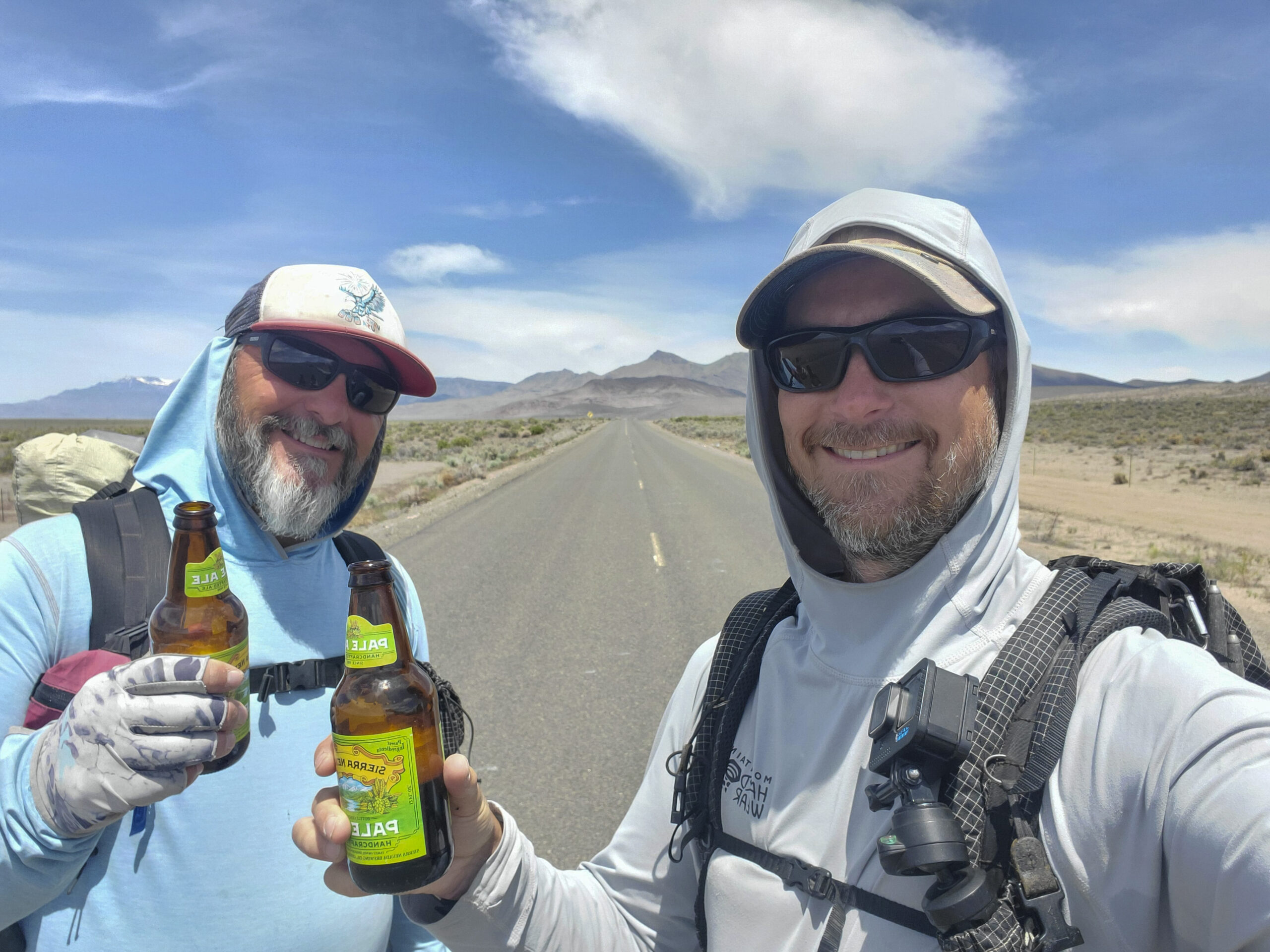
Along the highway, a car stops and asks us if we need a beer. Well, sure! With no traffic in this area, he puts it in park in the middle of the paved highway, gets out and hands us each a beer. We chat for a few minutes, and learn he’s also doing some section hiking/biking on the ODT.
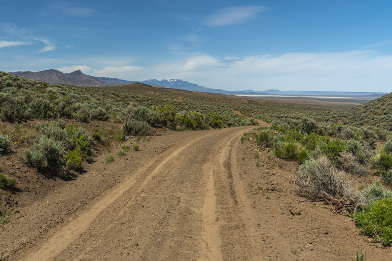
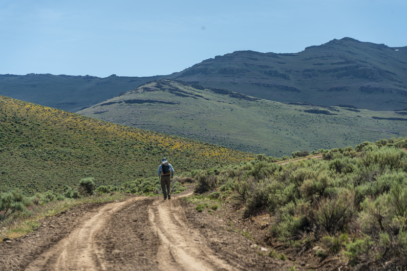
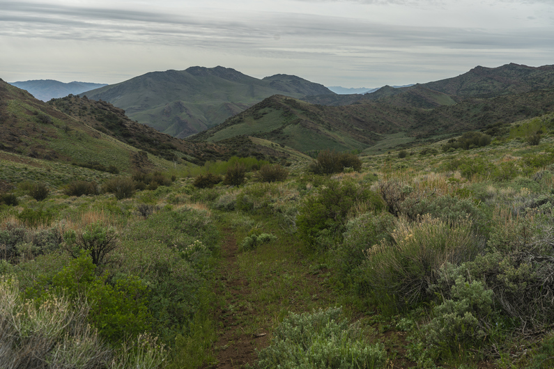
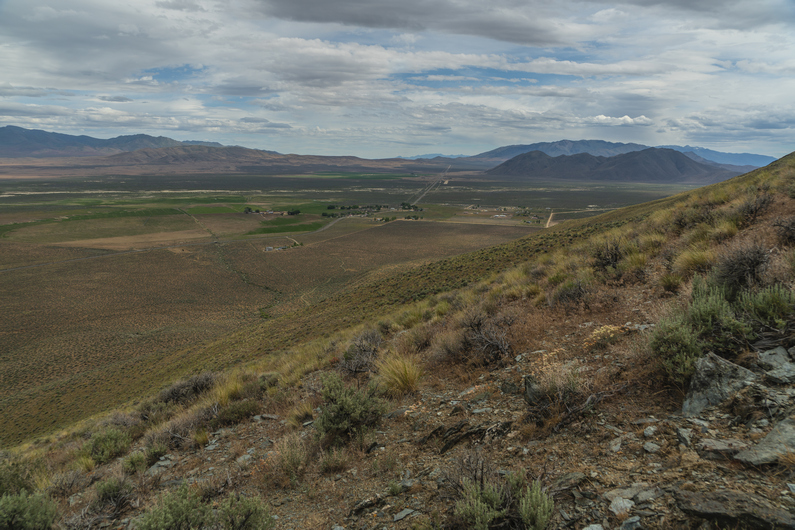
We enjoy our road beers along the hike to a dirt road, which will lead us up into the Pueblo Mountains. Now, it’s several miles of dirt road hiking along Sesena Creek.
We pass Roux Ranch, and get water from a little creek flowing from a spring. The mountains are becoming more scenic now. We follow a dirt road to a smaller 4×4 that takes us into the lower reaches of the Pueblos.


When the 4×4 road ends, the bushwhack begins. It’s thick here. We need to climb up about 1500ft now to gain the crest of the Pueblo Mountains.
The lower part of the climb was the worst. Once we climb out of the drainage, the vegetation thins, and the climb becomes easier. Not less steep, but at least, less thick.
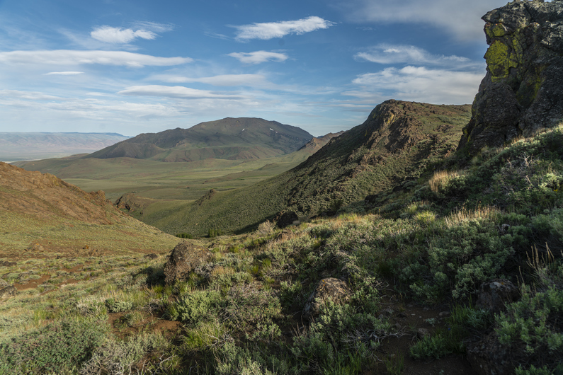
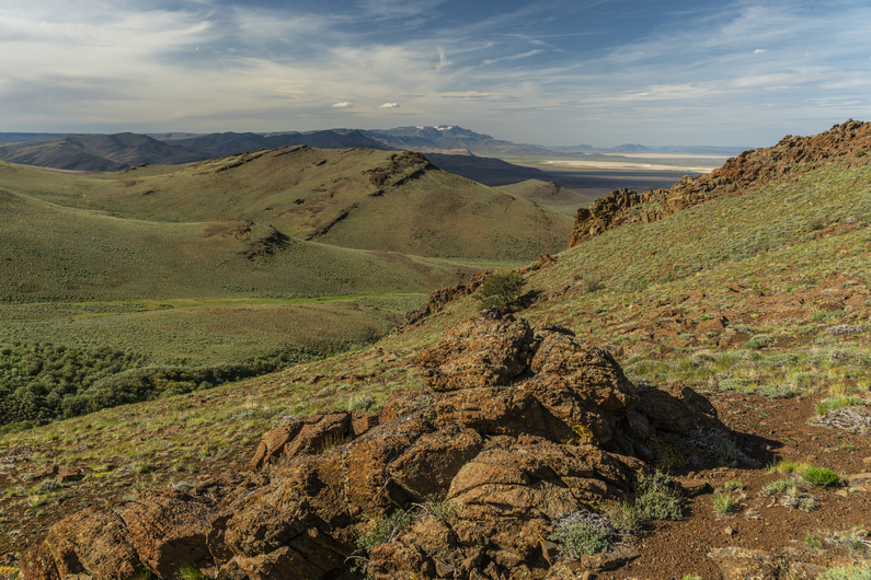
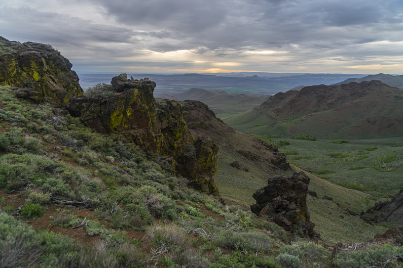
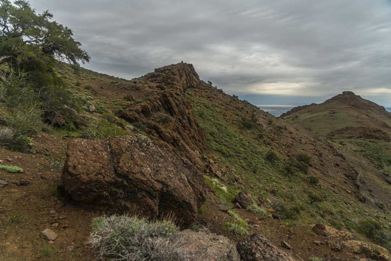
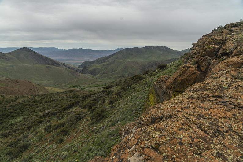
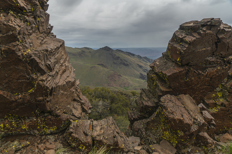
There are several small saddles and ridges to climb over on the way up. I see a couple of arrowheads in the area. The views are getting better, overlooking the Alvord Desert and Alvord Lake in the distance, as well as the snow capped south Steens mountains.

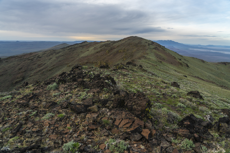
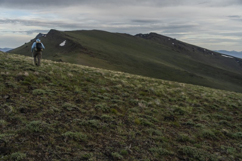


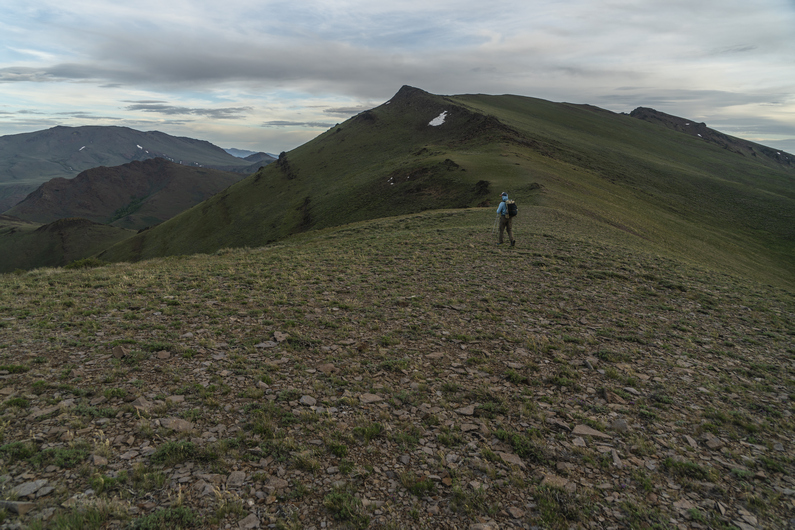
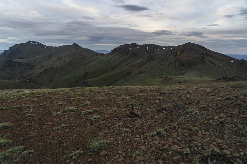
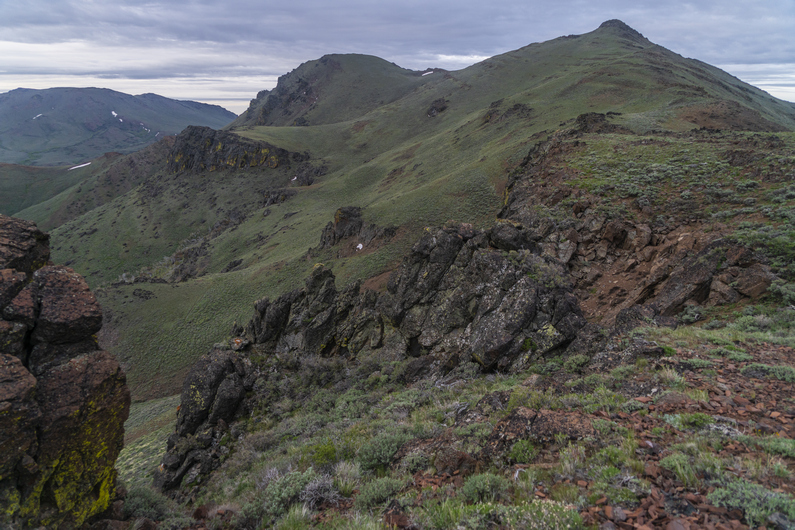
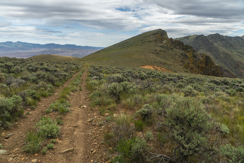
We reach the crest of the Pueblo Mountains sometime around 7pm. There’s no trail, but there are occasional faint game trails along certain ridges. Good views.
The hiking is not too hard here, along the first section of the ridge. Then we reach a section of thick bushwhacking among boulders on a hillside. We push past the thick stuff and emerge back into open terrain. We join a game trail and we’re back to good hiking along the ridgeline again.
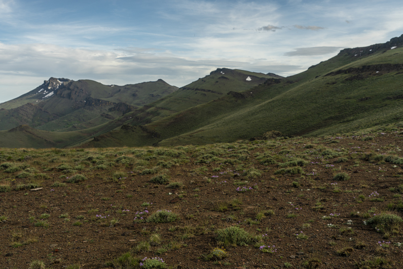
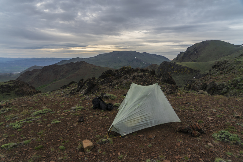
It’s getting late now and we’re looking for a campsite. We hike the east side of peak 7878 towards Cold Spring, and find a good-looking spot up high on a ridge. Excellent views, and out of the wind. I get 3 of my tent stakes in, but a large rock under the soil prevents me from getting my final stake in. In fact, while trying to pound the stake in, the head snaps off. Oh crap, I’m screwed! I don’t have an extra. But thankfully, Donny does. Whew. But I still can’t pound it in due to the same rock. So, I use rocks to weigh down the stake, which is only 1 inch into the soil. This works, but I can’t get the pitch of the tent too tight.
Great view from camp. Probably the best campsite view of my ODT thru hike so far. I go to bed feeling good tonight.
ODT Day 27 Map

Day 28: Pueblo Mountains Bushwhack, Resupply in Denio
June 8th


What began as a great campsite, turned out to be a long, awful night. The winds picked up, and my tent was flapping in the wind all night. Since I couldn’t pound in one of my tent stakes, and had to set rocks on it, I couldn’t put too much tension on the guy lines. The pitch was just too loose. I heard some sprinkles through the night. Even though I put my ear plugs in to mute the sound of the tent flapping in the wind, I hardly got 2 hours of sleep.
I woke to Donny’s voice at 5:30am, telling me he was going to hit the trail early. His tent was flapping in the wind too, making it impossible to sleep. I packed up then too, and started hiking by 6am.
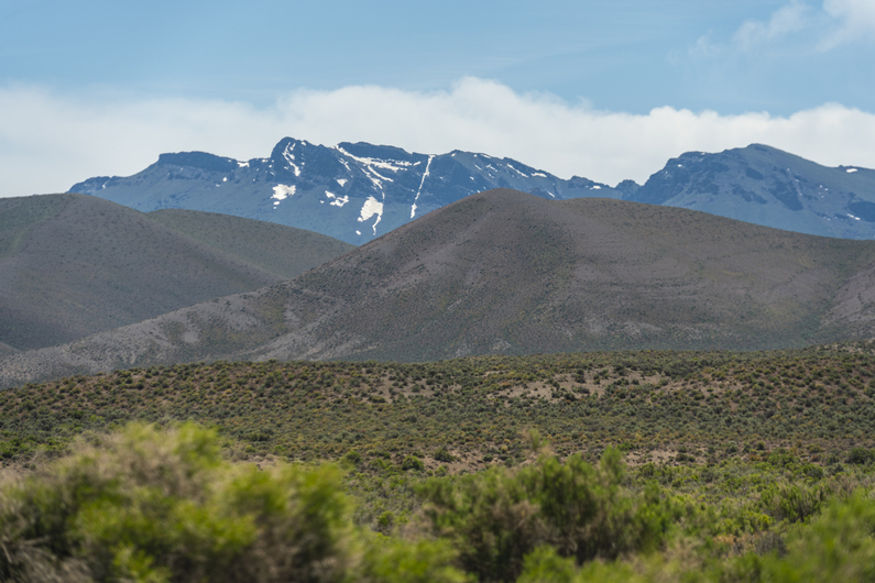
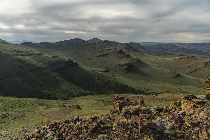
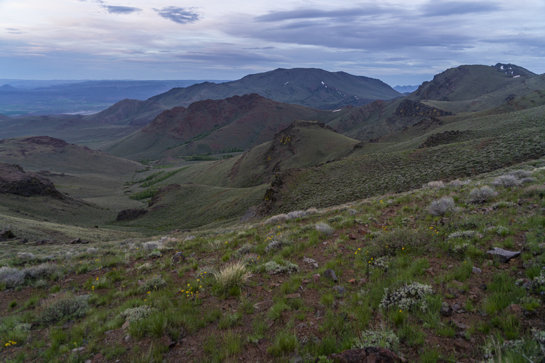
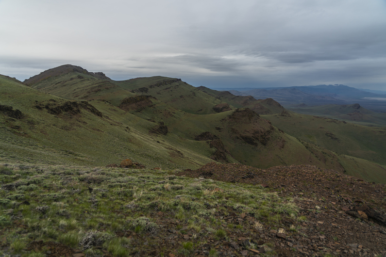
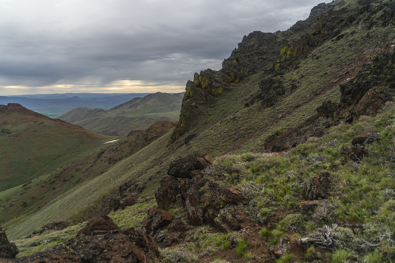
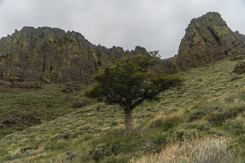
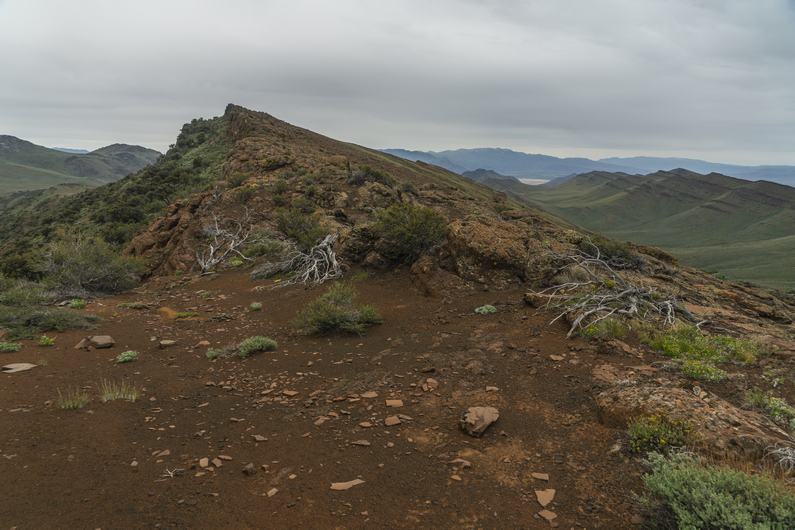
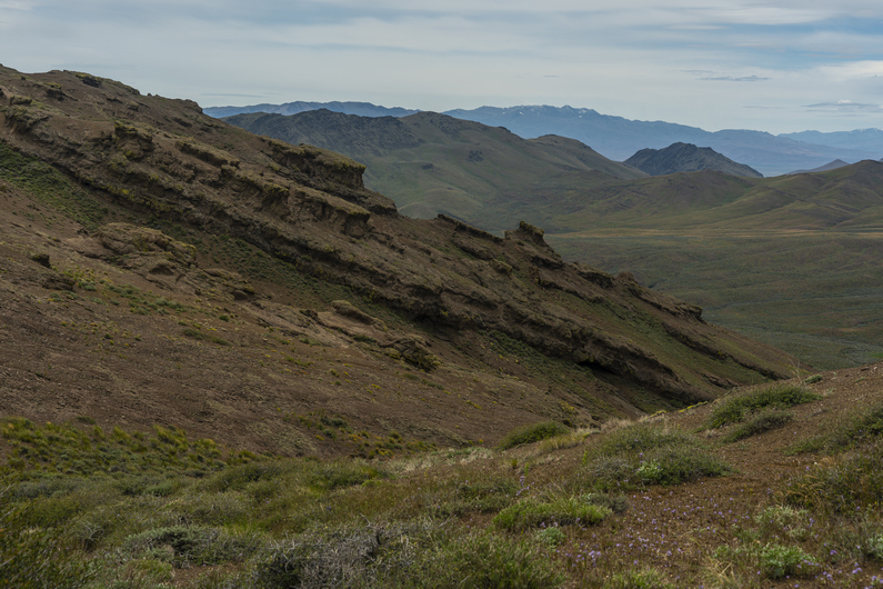
The scenery was beautiful in this area of the Pueblo Mountains. Probably the most striking landscapes of the entire section. But, the bushwhacking would also start here, above Willow Creek Pockets and around peak 8060.
Next, the route traverses a steep slope covered with thick sagebrush. It’s a real pain, this bushwhack. I stop at a small saddle to eat breakfast, since I skipped it this morning. I was so tired of hearing the tent flapping, I just wanted to get moving.
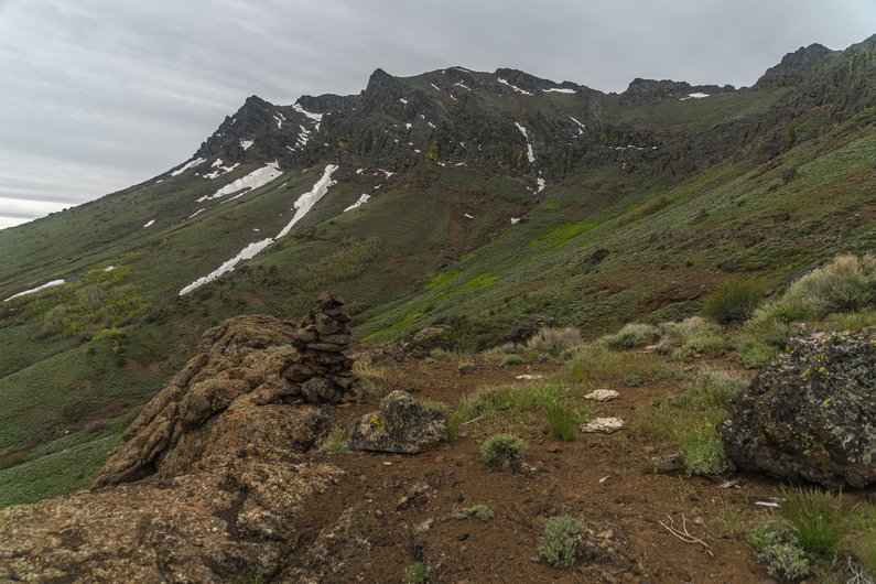
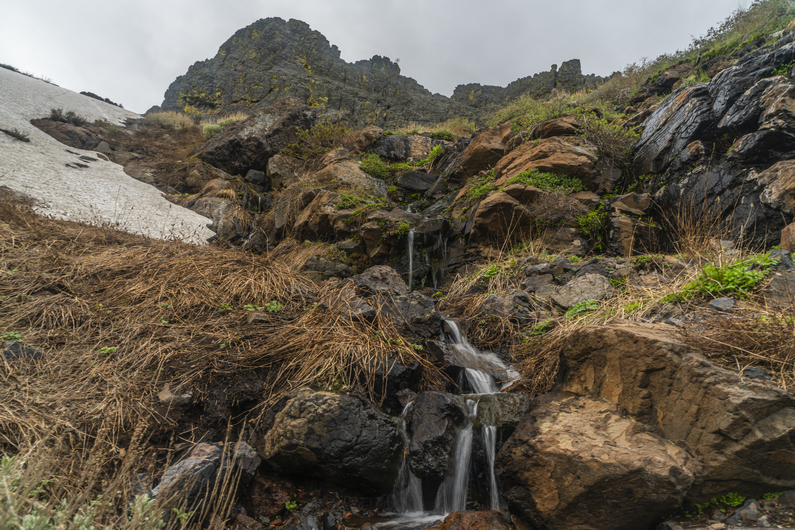

After my break, I cross a small creek. Here, I see the only patch of snow along this section.
The bushwhacking continues throughout much of the day. Especially on 2hrs of sleep, this zaps the motivation out of me, and really reduces my enthusiasm for this section. It’s really thick, and I can’t help but wonder why the route doesn’t just stay on top of the ridgeline. Sure it’d be more climbing, but it looks pretty walkable from the map and would surely be less bushwhacking. At least up there, it’d get big views for my effort. If I were to hike the ODT again, I would seriously consider giving the crest above me a go in this section.
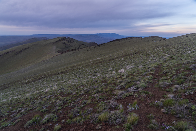
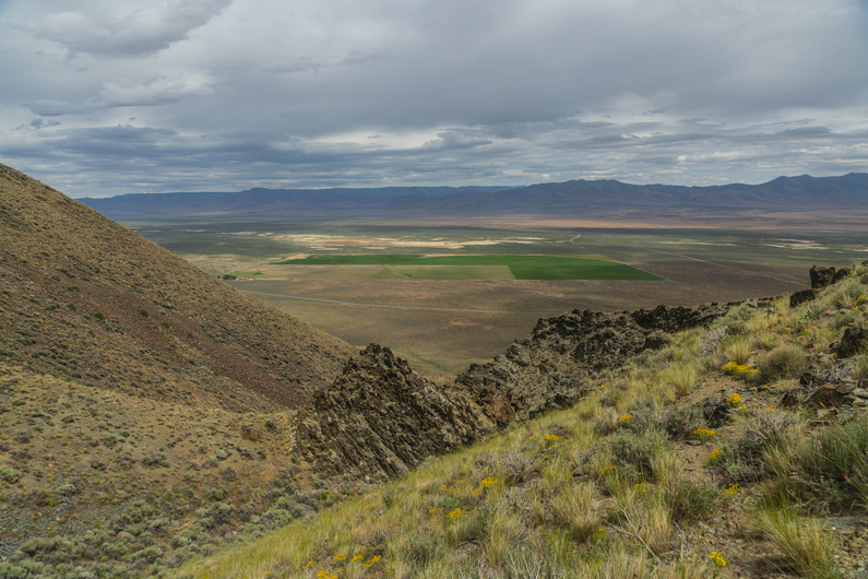
The best views of this section come before Ten Cent Meadows. After this, the route drops down into Van Horn Creek. There’s an old 4×4 track here for a short while, but this fades when it’s time to climb out of this valley and over a ridge. However, I do find some cool rocks here, so this keeps me busy. Desert Rose can be found in abundance here, which is a type of Gypsum (or Baryte) where the mineral forms like the petals of a rose.
The climb out of van horn creek is tough. Mostly because of the soft sand. On the other side of the ridge, more of the same. Now, the route climbs above a rock face that runs across the upper basin of the valley. The route contours along the top of this rock face to a saddle.

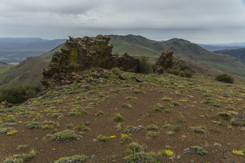
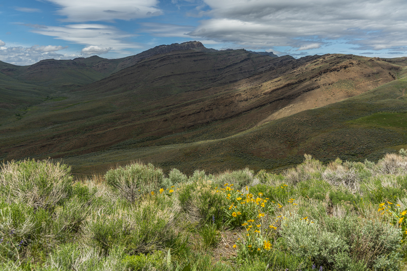
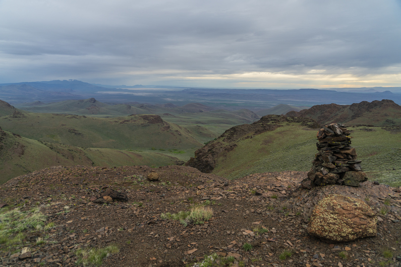
On top of the saddle, separating van horn basin from Denio basin, I see an opportunity to follow the ridgeline instead of dropping down into Denio Basin, per the official ODT route. Staying up on this ridge appears to be shorter, would have a better view, and would avoid a 500ft climb out of the basin that’s coming in a few miles. What’s the catch? Don’t know, but going to find out if there is one.
The ridge is pretty scenic, and had some really cool upheaval of rock along the crest. There is no bushwhacking here, just some small ups and downs.
Over a hill on the ridge, I see Donny. He didn’t take this ridge from the saddle, instead, he climbed up here from van horn basin. He had been way off track, and just hiking xc over ridges and drainages to get to this point.
We continue walking the ridge and reach a faint 4×4 road. We pass a 4×4 with a few guns strapped to the front. It doesn’t look like there’s anyone around, though. A mile later, we hear the 4×4 start, and approach our way. They guy driving it was surprised to see hikers here. He was out scouting for deer and chukar. We chatted for a few minutes, and he moved on.
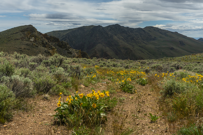


We dropped down off the ridge, then climbed up another 300 ft again. The views are pretty good now along this ridgeline. We are only about 3 miles from Denio at this point, even though town doesn’t seem close. It still feels like we are “out there” a ways.
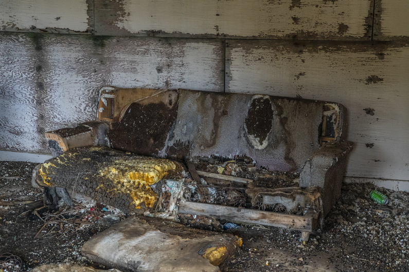
We begin the descent down an unnamed canyon along an old 4×4 road. There are some old mining cabins at the top of the canyon. There’s some furniture inside that’s been eaten by rodents and animals, and has deteriorated into a scene from a horror movie. I’ve never seen an abandoned cabin like this one.
Past the cabins, the road fades out. Not only that, the canyon gets extremely steep. I guess it’s a bushwhack from here on out. The sagebrush grows pretty thick here.
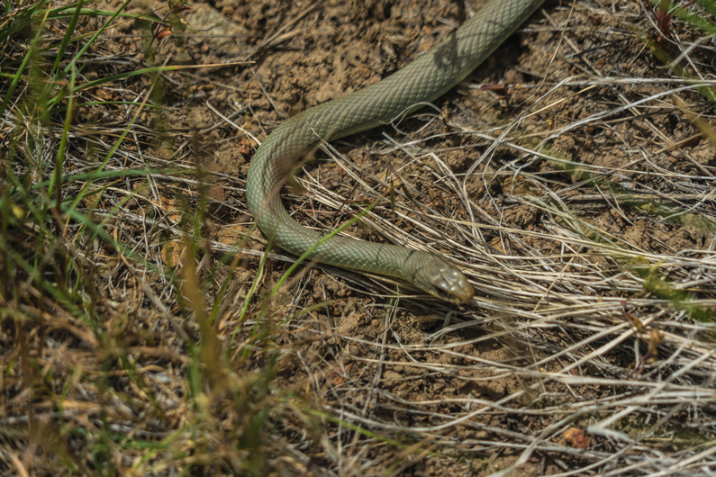
We skirt the hillside for a while before ultimately dropping down to the Creek Bed at the of the bottom of the canyon. It’s walkable, but also extremely thick. I see three snakes in one hour, but none of them are rattlers. With only one gaiter, I’m getting a ton of grass and debris in my shoe now.
Towards the bottom of the canyon, we see a game trail that stays high and skirts around the hillside is it exits the canyon. It seems like a pretty good path at first, but it faded out as we rounded the corner. Should have stayed at the bottom. Now, we bushwhack down a fairly steep hill to get to the bottom, and meet up with a dirt road leading to the highway, which takes us to Denio. Technically the section ends here, but we need to hike a couple miles into town for resupply. These are bonus miles, now.
It’s 3:00 pm now, and we have a mile and a quarter before reaching the post office in Denio, which closes at 3:30. I throw my thumb out at the first vehicle that passes by, and thankfully, he stops to give us a ride to the post office.
We pick up our resupply boxes from the post office just before close, and head next door to the Diamond Inn Bar to get some food. We are the only people inside without cowboy hats. We may have been the only ones without spurs, too. A bunch of good ol’ boys. The bartender asks us what we’ll have to drink. Donny orders a Coors Light, which is what I would have ordered if I wasn’t so dehydrated. I’ve only drank about 1.5L water all day. So I just asked for water, for now. You should have seen the look on everyone’s face in the bar. Mostly a bunch of laughs, and the bartender smirks and says, “water? Ain’t never heard that one before. You mean like in a glass?” I sighed. “Yeah. Just water”. Them cowboys had a good ‘ol laugh about it.
We ordered some burgers and eventually started talking to a younger kid named Dalton that was working there. He agreed to give us a ride down to Denio Junction, where the hotel is. This saves us a 3.5 mile walk.
We get a room at the hote,l and quickly make some friends inside the store/cafe that’s attached to it. The new owners had just bought the place, and had moved from Missouri a few months ago. Very nice people.
ODT Day 28 Map

Day 29: Zero Day in Denio
June 9th
Coming off a long day of bushwhacking on only 2 hours of sleep, I crashed hard last night. I can’t remember the last time I slept so good In a hotel.
I had a zero-day in Frenchglen, only because I arrived in town a day sooner than Donny had. Lakeview was Donny’s last zero day, so we took a day off here. The hotel was supposed to be booked for this evening, and we had actually planned to keep hiking since we had no other options for a room, but there was a cancellation and we were able to get a room for the night.
One great thing about staying here at the hotel, is that breakfast at the Cafe next door is included in the price of the room. So, a $10 breakfast for free (each), kind of sweetens the deal. Additionally, bottled water and Coke products in the convenience store, which is part of the cafe, are also included in the price of the room. Bottomless cokes!
Dalton picked us up mid-afternoon and took us back to the post office. We were able to mail a few things out, and then went back to the Diamond Inn bar. We ordered some pizzas and drank some beers. It was a different crowd in here today, the cowboy gang must have been out roping cattle today or something.
As we walked into the bar, another hiker walked in. His name was TJ, and he was section hiking the ODT. We had some beers with him, before he took off. We also ran into the guy on the four-wheeler we had met yesterday afternoon on our way into town.
I then asked Dalton to give us a ride back to the hotel, and he said he could in a few minutes. However, The guy we met on the four-wheeler yesterday, Greg, was sitting there at the bar next to me as I asked Dalton for the ride. He said he’d give us a ride right now, and so we took it. It’s amazing how these things work out when you’re a hiker, in a small town.
–> Continue reading Oregon Desert Trail Section 8: Denio to McDermitt (72 miles)
Back to Oregon Desert Trail Thru Hiking Guide & Journal index


Leave a Reply