Creating new thru-hiking routes & guides, hiking videos, outdoor documentaries, backpacking trip reports, trail journals, photos and more!

Latest

Mojave-Sonoran Trail Thru Hike 2021 – Section 1: Valley of Fire to Echo Bay
Mojave-Sonoran Trail Thru Hike 2021 – Section 1: Valley of Fire to Echo Bay

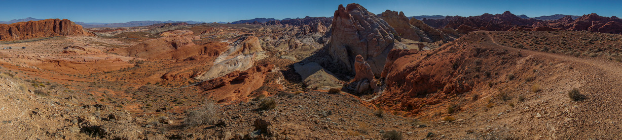
panorama view of valley of fire state park nevada

Mojave-Sonoran Trail Section 1 Map

mojave sonoran trail thru hike map of section 1

Mojave Sonoran Trail Thru-Hike Section 1 – Valley of Fire to Echo Bay, 66 Miles

The above map only represents represents section 1 of 9 on the MST. For a more detailed map and general route info, see the Mojave-Sonoran Trail Guide page.

Mojave-Sonoran Trail Thru Hike Video

Mojave-Sonoran Trail Section 1 Journal

Day 0 – November 2nd: Getting to the Northern Terminus

I’m currently doing the van life thing, living in my van in between hikes. My buddy just moved to Phoenix and has a garage where I was able to store my van for the duration of my hike. I did all of my food shopping in Phoenix, packed my gear and took a one way flight to Vegas. I took an uber from the airport to a hotel on the far northeast side of town near the Nellis Air Force Base. This would be the shortest drive for me tomorrow morning to my start point.

Day 1 – November 3rd: North Muddy Mountains, Weiser Ridge, Valley of Fire

18.15 Miles
Animals Seen: 9 big horn sheep

After a long sleepless night, it was time to rise and shine at 6:30am. By 7:15 my Uber ride was there to pick me up from my hotel. The drive took about 45 minutes, and by 8 am I was at the Hidden Valley exit on I-15 just West of Moapa Valley. My uber driver didn’t say a word about dropping me off at some random desolate exit with nothing there. “See you later”, he said.
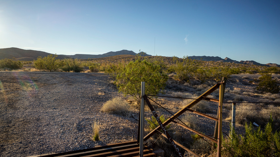
This random spot along I-15 is where I’ll start my Mojave-Sonoran Trail thru hike

My starting point is pretty arbitrary and meaningless. It only serves convince. As much as I wanted to just walk out of some small town to start my hike, this was the easiest thing to do.

Now it’s time to take my first steps on the Mojave-Sonoran Trail(MST). It’s an overwhelming feeling, a barrage of emotions. Mostly, it’s the feeling of calm before the storm; the intense physical exertion ahead weighs heavy on my mind. Even with two previous such journeys under my belt, I still wonder how such a feat is possible… especially when you are standing at the starting line. 675 miles of off-trail hiking is no joke. My pre-hike jitters are justified, but it’s go time.

First few miles on this easy road

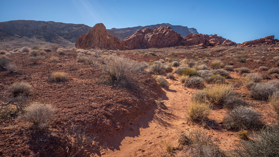
The first three or four miles are on an easy dirt road leading up into the North Muddy Mountains. Soon enough, some elevation is gained, canyon walls grow taller and the expansive desert views improve. Also, the sound of the interstate dwindles. I find myself at a locked gate that says no trespassing. Beyond the gate is a large antenna and satellite dish, with a generator running. However, nobody around, so I push on past the gate and on my way. A series of small dirt roads leads me around a Hillside, where they fade into game trails.

Views from the first pass
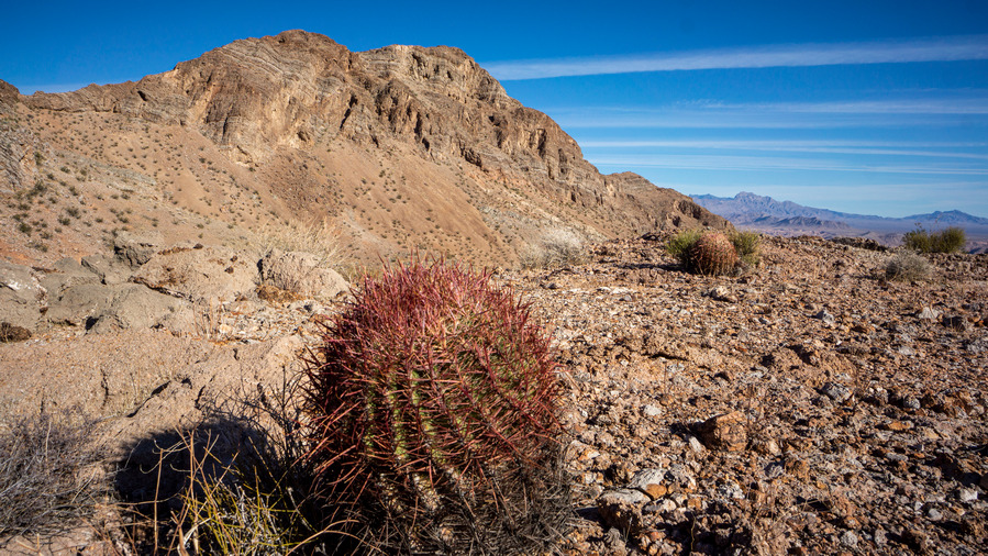
mojave sonoran trail thru hike views north muddy mountains

Glen Peak and the North Muddy Mountains

Looking down on Weiser Valley and and Weiser Ridge, where I am headed next

Now, the views are quite good. Great mountain scenery with desert valleys below. Colorful rocks, caves on the mountainside, and distant views.

colorful wash hiking in nevada

Descending the wash

colorful wash hiking in nevada

I drop down into a wash, and start downhill. The mountains behind me are an impressive backdrop, and I look back frequently. Towards the bottom, I Fell down a couple of times. Catching myself on a rock, I received a small cut. Enough blood to drip, so I took my first break. I used to wear a pair of gloves when doing hikes where I expected bushwhacking, but fell out of the habit of it in recent years. Lately I have rediscovered their merits, and brought a pair with me this trip. I’m using the Fish Monkey Fingerless fishing gloves; soft flexible leather on the palm and a thin, breathable neoprene type material on the other side. Time to put these on.

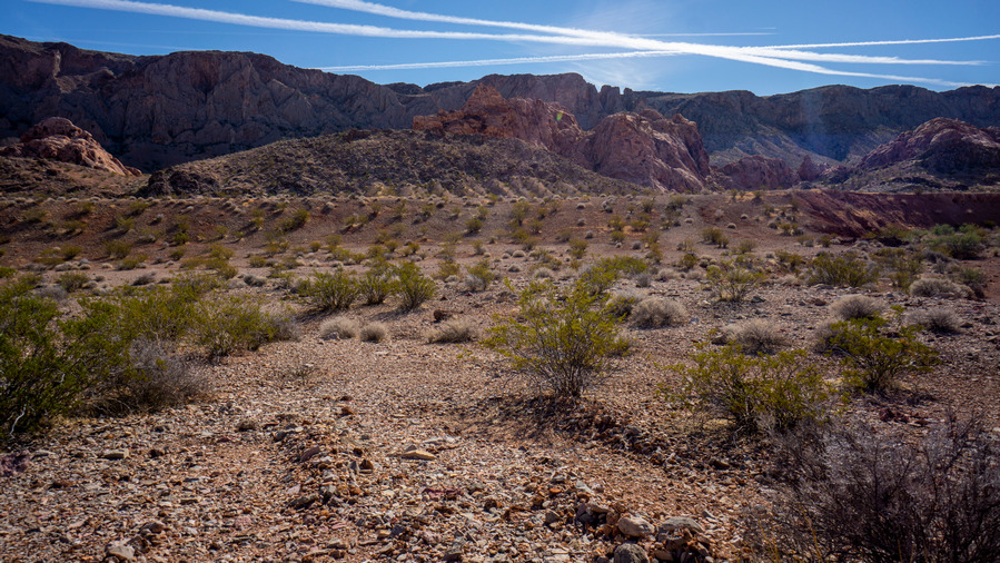
hiking weiser valley nevada

North Muddy Mountains from Weiser Valley
hiking weiser valley nevada

Weiser Ridge from Weiser Valley

Out of the wash, I cross Weiser valley. Most of the walk here is on a dirt road. Cool, a little break from the off-trail stuff, even if only for a moment.

colorful hills in nevada desert while hiking

Such a colorful landscape

hiking up to weiser ridge nevada

The route up to Weiser Ridge

colorful hills in nevada desert while hiking

Intense colors

Soon, it’s time to find a way up to the top of Weiser Ridge. It looks tall and steep from the bottom, but my route on the map doesn’t look too bad. Time to climb. Mining claims scatter the wash, but their age is unknown. Over my first ridge, a heard of about eight big horn sheep are seen running away. Day one and already a good animal sighting!

hikers view over moapa valley nevada

View north across Moapa Valley to Mormon Mountains
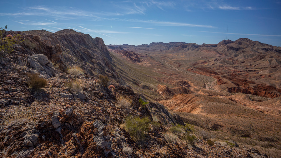
hikers view of weiser valley from weiser ridge nevada

Weiser Valley from Weiser Ridge. Not bad for day 1 views!

Before long I am on the final ascent to the crest of Weiser Ridge, and the views really begin to wow me. At the top, excellent vantage point of Weiser valley and now, valley of fire state park. The red rocks really stand out. I begin my walk south on the ridgeline, and wow!! Hard to believe views of this magnitude can be had on day one. Better than the CDT and BRT. Time for a snack and soak this all in.
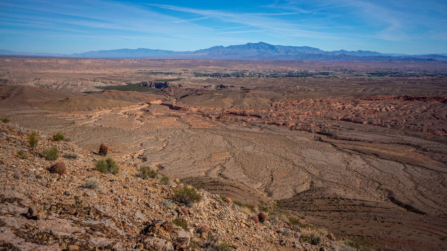
big views from weiser ridge

moapa valley view from weiser ridge

What a view!

The view north from Weiser ridge provides a sweeping view over Moapa Valley and to several distant mountain ranges. Namely, the Mormon Mountains directly north.
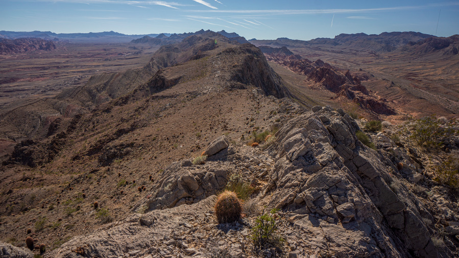
mojave sonoran trail hiking north muddy mountains

Weiser Ridge is a fairly easy walk with excellent views
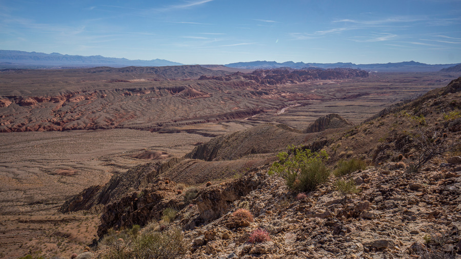
wesier ridge views

View east from Weiser Ridge

mojave sonoran trail hiking views wesier ridge

View south over Weiser Valley and the Muddy Mountains

The ridge line itself is fairly easy to walk. The rocks are extremely sharp, which makes for great shoe grip but horrible for longevity of the tread. My shoes were getting pretty torn up already. The west side of the ridge is mostly sheer cliffs and an occasional knife edge to walk. Truly excellent.

hikin weiser ridge in nevada

View east from Weiser Ridge. Looking for a way down

wesier ridge cave nevada

Small cave

When it was time to make my way down off the ridge and into the valley to the east, I found myself at a 40ft pour off. At first I thought it was not possible to climb. But then, I began to see a route down. However, it was extremely awkward to begin down climbing. I made it down the first ledge before turning back, deciding out was too dicey to risk it.

View up to the ridge as I try and work down one of the side canyons

Looking back north along Weiser Ridge

South along Weiser Ridge

Now I had to climb back uphill again and follow the ridge itself until I found another Canyon leading downhill. Unfortunately the next Canyon also featured a pour off, this one even less manageable than the last. A third canyon was even worse, a dry waterfall of perhaps 150-200ft. Not going to happen. Back up to the ridge, and keep walking south.

wesier ridge view valley of fire

View southwest. Next I’ll be hiking south though long outcrop of red rocks

hikers view up to weiser ridge nevada

Looking back up at Weiser Ridge

Finally, I found a way down to a lower ridge line by descending the hillside instead of a canyon. From below, the cliff band running across the mountain side was obvious, and quite impressive. By now, I was losing daylight, and had less than 2 hours before sun down.
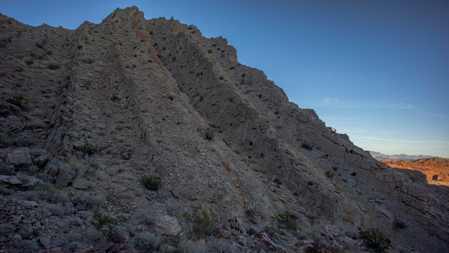
nevada geology upheaval

I believe this is called “upheaval” in geological terms

nevada geology

You can imagine the forces at that caused these rocks to be tilted vertically
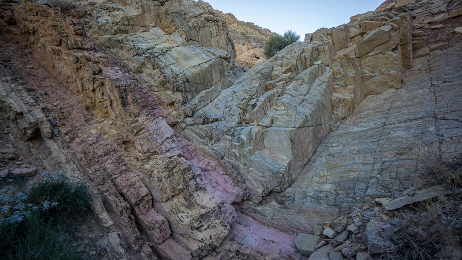
pink banding in rocks of canyon in nevada

Cool pink banding

The descent of the wash down to the valley floor was an interesting one. The geology here was tough to ignore, with large parallel dikes running vertically, flanking both sides of the wash.

Looking down the canyon to the beautiful red rocks of “tomorrow”
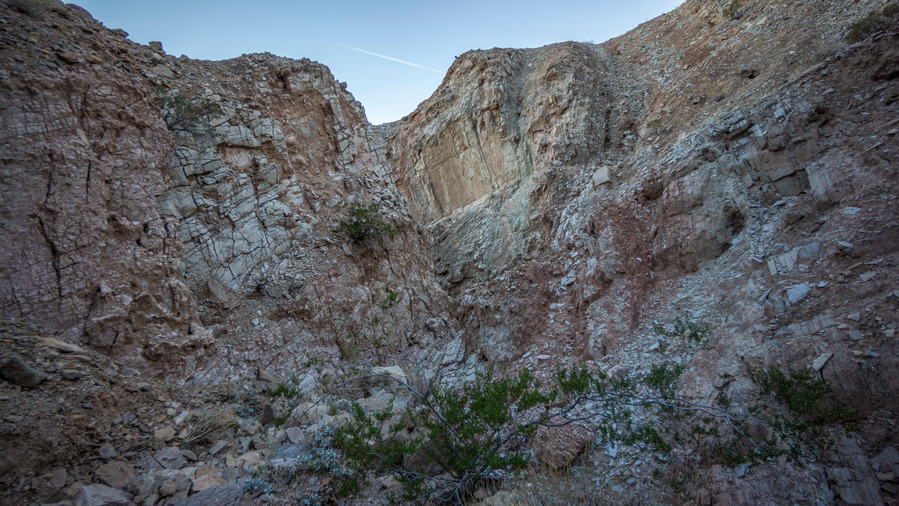
hiking a steep and narrow canyon in nevada

Rugged canyon

Interesting colors here along the walls of this canyon

Several pour offs to climb now, slow but manageable. The map doesn’t indicate anything too serious ahead, but these canyon walls are steep and narrow. Pretty nice walk though here.
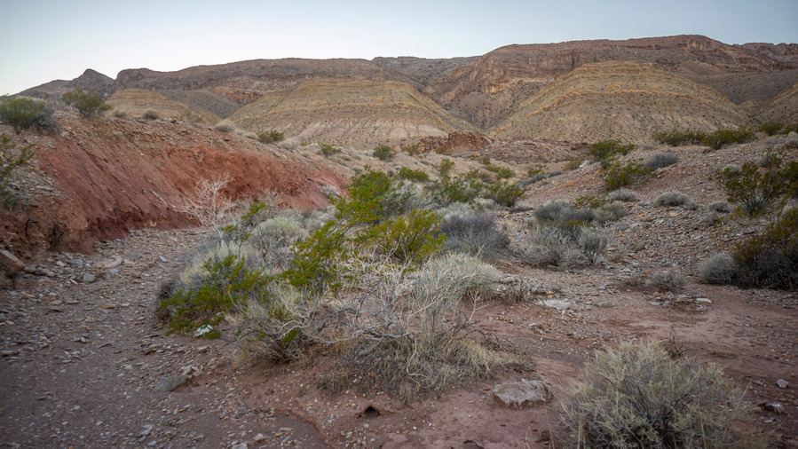
Looking back up at Weiser Ridge. I came down that

Hike across Anderson Wash through narrow strip of Valley of Fire State Park land. BLM land at the base of the red rocks

sunset at red rocks along nevada thru hike

Time to look for camp

The red rock became predominant near the bottom of the wash and the valley floor. Daylight was fading fast now, and I made my way across the valley as fast as possible. The valley is part of Valley of Fire State Park, where there is no backcountry camping allowed. . I just need to cross the valley to enter BLM land, where anything is fair game.

I found my campsite just a half mile from my first water cache. A Sandy spot suitable for cowboy camping. With 18 miles on the day, I was ready to stop. Still, I felt pretty good for day 1, mainly just hungry. I drank the rest of my Gatorade with dinner, leaving myself a half liter for tomorrow morning. Stars were shining bright by 6:30pm.

Day 2 – November 4th: Valley of Fire State Park

19.8 Miles
Animals Seen: 3 big horn sheep
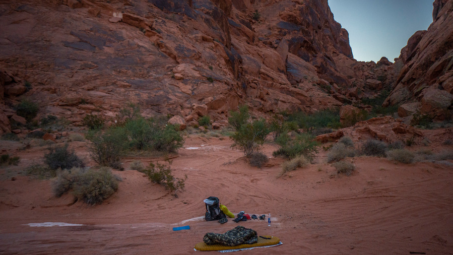
cowboy camping mojave sonoran trail thru hike

Camped under the stars last night

thru hike cowboy cmaping

Nice spot to wake up to

Beautiful night cowboy camping under the stars. Plenty of sleep, woke up feeling pretty good. 45 degrees this morning.

At the top of a small “pass” in the middle of this narrow canyon, overlooking my campsite from last night

Nice views in the canyon

Skipped breakfast and started hiking to the water cache, another half mile, over a small pass in a narrow canyon. Thankfully, my gallon jug of water was right where I left it two weeks ago. Here, I ate breakfast and distributed the water among my 1 liter smart water bottles.
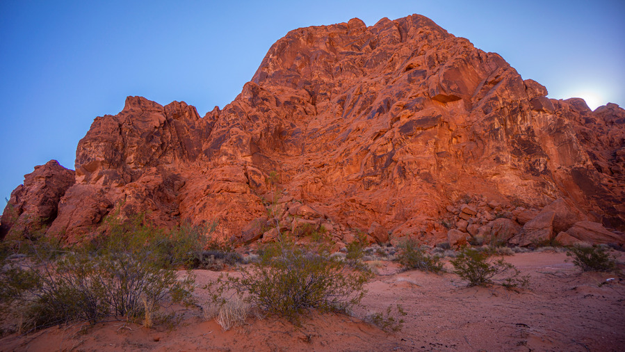
hiking red rocks nevada

Towering red rock formations

What a cool landscape to hike

hiking sand and red rocks nevada

Colorful sand and red rock landscapes

From here, it’s another 5-6 miles to the Valley of Fire state park boundary. Most of this was through deep sand, apparently a popular spot for the ORV crowd. There were tire tracks everywhere, and occasional garbage strewn across the sand. Despite these eyesores, this area was really cool. I didn’t see any 4 wheelers either, so that was nice.
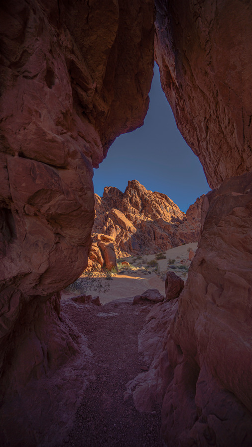
red rock arches in nevada

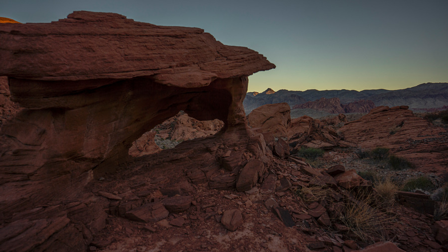
One of many small arches

petroglyphs on red rocks in nevada

Petroglyphs

colorful outcrops of red rocks in nevada valley

View down the “valley” I hiked

Red rocks, arches, small caves and alcoves, and even petroglyphs. Hiking here felt more like Utah than Nevada.

Nearing the top of the little pass

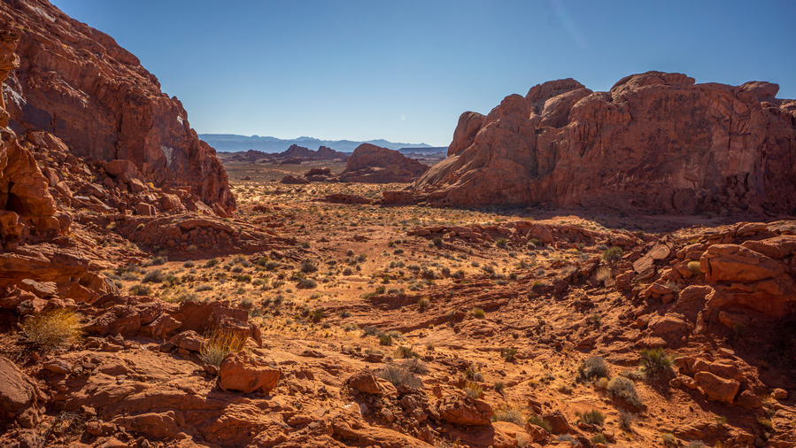
mst thru hike north fork overton wash

North Fork Overton Wash

After cresting the pass at the southern end of the canyon, I saw 3 big horn sheep. These guys are all over here. Nearing the end of the BLM land, the bulk of valley of fire state park was visible on the horizon.
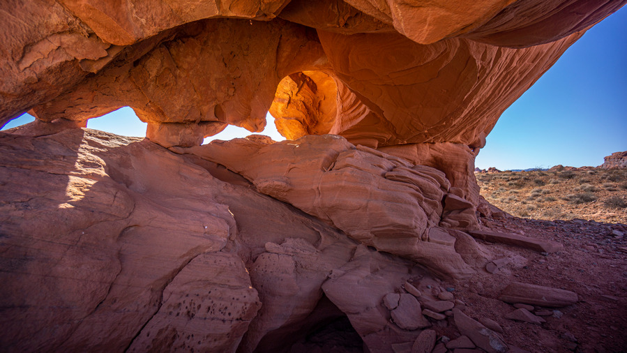
hiker takes break in arch cave nevada

Break time in this arch/cave formation

hiker looking out over nevada desert landscape

View south form my break spot. I’ll be hiking this next

I told myself I wouldn’t stop to empty all the sand out of my shoes until I reached the state park, and as soon as I found a shaded spot (under a cool arch /cave), I took a break. Always a satisfying feeling, to be sand-free again.

hiking off-trail in valley of fire red rocks nevada

Hiking this crazy red rock landscape

colorful desert scenery nevada

Impressive.

In distance I could see cars glimmering in the sun. This is the parking lot for the Fire Wave and white domes, some of the most popular attractions in the park. This made for an easy landmark to shoot for. It was a mix of cross county hiking and a couple of dirt roads, and quite scenic.
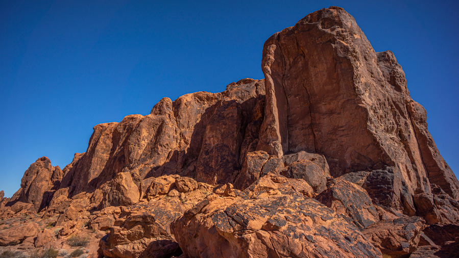
cool rock formations valley of fire state park

cool rock formations valley of fire state park

Hiking the trail to Fire Wave

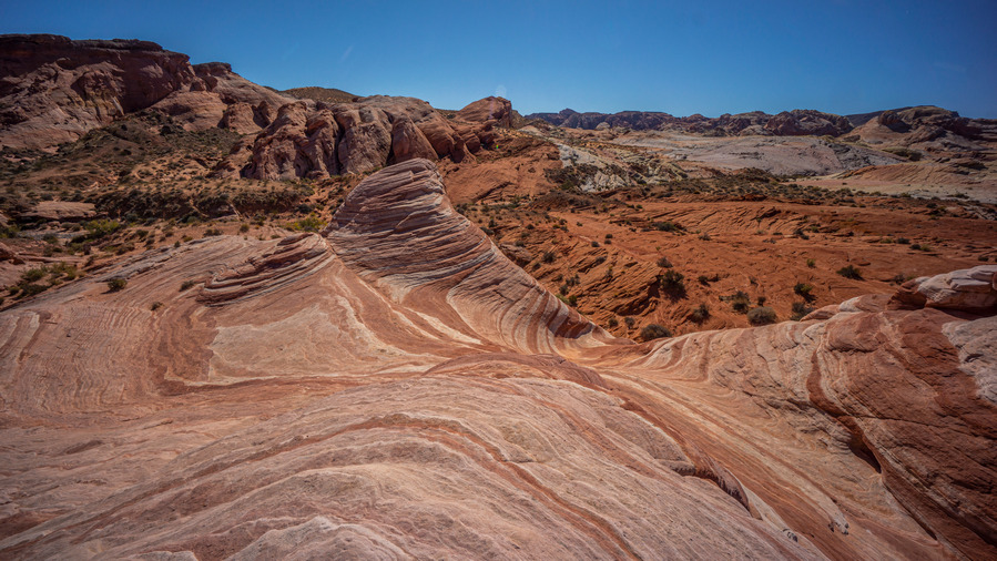
Once at the fire wave trailhead, I began the 7 wonders loop, which hits fire wave and apparently, 6 other wonders. The trail was loaded with amazing scenery, but I don’t know how official the wonder count is. It sure seemed like more than 7.
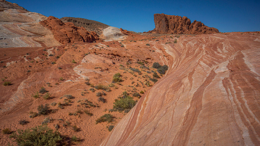
mojave sonoran trail thru hiker at fire wave

Wow!

mojave sonoran trail thru hiker at fire wave

Tons of crazy colorful rock formations near Fire Wave
mojave sonoran trail thru hiker at fire wave

Fire Wave

Fire wave wasn’t as packed as my first visit a few years ago. No problem there. This area is very photogenic, and not just fire wave. If one had the time, he could easily spend all day on little side trips exploring this area.

mojave sonoran trail thru hiker in kaolin wash

Entering Kaolin Wash

mojave sonoran trail thru hiker in kaolin wash

mojave sonoran trail thru hiker in kaolin wash

Hiking the colorful Kaolin Wash

The “trail” follows a wash leaving fire wave, and this too was cool… A slot canyon of sorts, although not very deep. It makes up for that with outstanding colors to please the eyes. I found a shaded spot and took lunch. I really wasn’t too hungry, which is pretty typical for me in the beginning of a long hike, or any multi day backpacking trip actually.

mojave sonoran trail thru route in kaolin wash

mojave sonoran trail thru route in kaolin wash

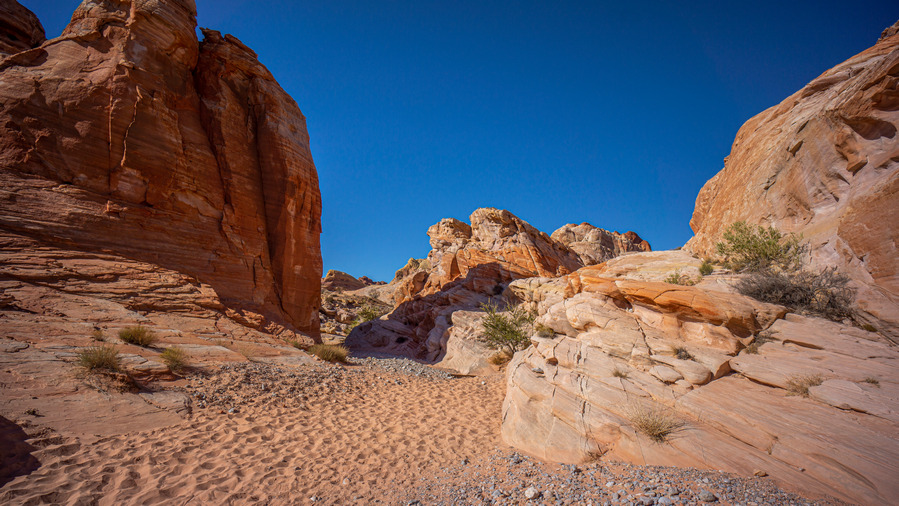
After forcing myself to eat, I continued on the 7 wonders trail up Kaolin Wash. More excellent scenery. In fact, so excellent that my pace was really slowing down, stopping around every turn to capture the landscape from a new angle. So colorful, so beautiful. Occasional sections of short slot canyons really made this hike great.
valley of fire seven wonders loop hike views

Leaving Kaolin Wash for this canyon

valley of fire seven wonders loop hike views

Short slot section

valley of fire seven wonders loop hike views

What a wicked landscape

The trail climbs out of Kaolin Wash and follows a canyon north. Kaolin Wash was awesome, but it was a small scale landscape. Here in this canyon, the views are much bigger.

valley of fire seven wonders loop hike views

A geological wonderland

valley of fire seven wonders loop hike views

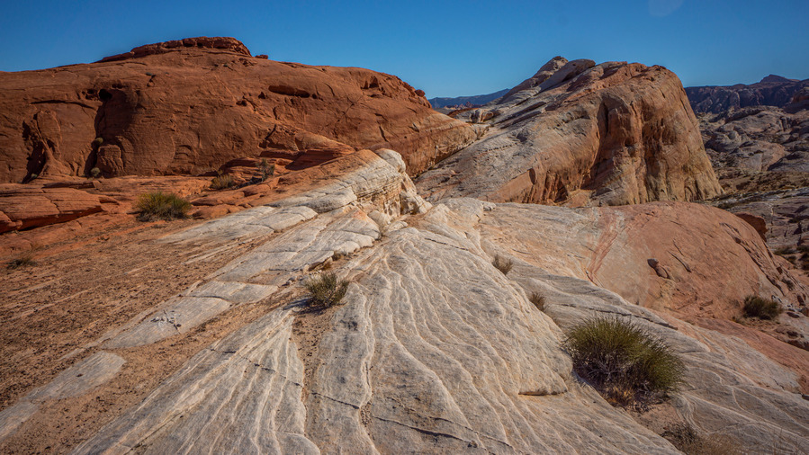
Stunning landscapes are everywhere in Valley of Fire State Park
valley of fire seven wonders loop hike views

Red to white

The trail leads back to the fire wave parking lot, where I began the loop. Not the most direct route for a thru hike, but it would be a shame to walk by the highlights of this amazing place for the sake of making good time. And this was some spectacular scenery. Few places I’ve been compare with this kind of color.

panorama view of valley of fire state park nevada

Valley of Fire State Park

valley of fire state park landscape view

valley of fire hike views

Hiking near White Domes

Back at the fire wave parking lot, I easily yogi’d some extra water from the first person I asked. Then, I continued hiking towards the white domes parking lot. The ridge route in between fire wave and white domes provides an excellent, sweeping view of the bulk of the park.
mojava sonoran trail thru hiker in kaolin wash

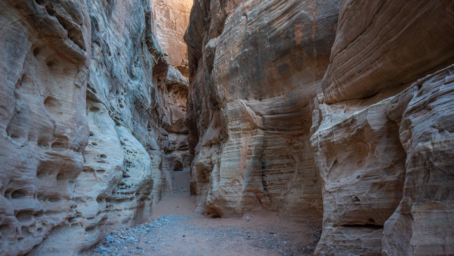
Another slot canyon section of Kaolin Wash

mojava sonoran trail thru hiker in kaolin wash

Looking back at the slot canyon section

mojava sonoran trail thru hiker in kaolin wash

Those colors are unreal

It’s a short hike on the white domes trail to an old movie set, for the 1965 film “The Professionals”. Then the trail intersects Kaolin wash again, which leads to the Prospect Trail. This isn’t a trail at all, it’s a route that’s occasionally cairned. More cool slot canyons, more colorful and jagged rocks. It’s very rugged for what a state park is claiming is a trail. Good views.

mojave sonoran trail thru hiker on the prospect trail vof nevada

Views from the Prospect Trail

mojave sonoran trail thru hiker on the prospect trail vof nevada

Mostly good walking in the wash

mojave sonoran trail thru hiker on the prospect trail vof nevada

Sometimes the wash narrows and there’s climbing obstacles

The Prospect Trail ultimately leaves Kaolin Wash for another unnamed wash that continues due south. It’s late afternoon now, and very clear that I won’t be able to hike out of the park boundary today like I had planned. There is no backcountry camping allowed in the state park (lame), so I began to think about alternate plans. At the end of the prospect trail, there is a dirt road that leads to a paved road, which leads to a drive in campground. Looks like a 3 mile or so detour, but what other options do I have, other than illegally stealth camping? The bonus of this plan is the running water at the campground. Water… Sold.

mojave sonoran trail thru hiker on the prospect trail vof nevada

Cool rock formations along the wash

mojave sonoran trail thru hiker on the prospect trail vof nevada

Hiking the Prospect Trail

mojave sonoran trail thru hiker on the prospect trail vof nevada

Leaving the wash, there is now a trail. This is one of the few trails along the entire MST route that is marked on a map!

Most of the prospect trail follows a fairly easy wash, despite occasional deep sand. There were a couple of climbing obstacles, especially if you wander off course. The hike was a good one, but I was getting tired now. I hadn’t eaten anywhere near the calories I’ve been expending, and had barely peed all day. I needed to keep pushing on though, and make it to the campground before dark.
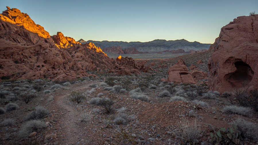
valley of fire sunset nevada

Sunset over Valley of Fire

small arch in valley of fire at sunset

After cresting a hill, I got my first view of the actual Valley of Fire, for which the park was named. I could see the campground in the distance, and with 45 minutes to dark, it was going to be close. Great desert views, enhanced by the colors of the setting sun. I left the road and took a wash that ran directly to the campground, and made my final push. I was really hitting the wall now.

I walked into the campground with the last bit of light fading fast. It was pretty full, but a couple of open spots. I used my last reserves of energy to set up my tent by headlamp, feeling weak and a little light headed. It was nice to have ruining water and be able to do a quick rinse and wash up. I tried eating, but couldn’t stomach much. It’s a weird feeling to be hungry, and not be able to eat. Nothing tastes good, and my stomach just doesn’t want anything in it.

Tonight was a perfect example of why I despise drive in campgrounds… Barking dogs, whining children, and some inconsiderate people playing some crappy music loudly, for hours. Thankfully, I bring ear plugs, for just this occasion.

I felt surprisingly good at the end of day 1, but day 2 has taken its toll. I’m feeling achy and cold, but it feels great to be able to lay down for the night. On my summer hikes, I might hike 14 hours, utilizing every bit of sunlight. But with shorter days this time of year, daily mileage is shorter, and nights are longer. This means more time to rest. And right now, I’m not complaining.

Day 3 – November 5th: Valley of Fire, Rogers Spring, Muddy Mountains

17.49 Miles
Animals Seen: Jack Rabbit

I didn’t sleep that great last night. Not because of noise, as I had my earplugs in all night. But this morning, a screaming toddler had me packing up at fast as I could. I went over my maps for a while trying to figure out my next move. The mileage I’ve hiked to get to this point was much greater than my estimates. I could backtrack to the prospect Trail and continue on my route as planned, but instead I chose a different route. The plan Now is to walk the base of the muddy mountains through valley of fire, which would all be off trail. Cool.
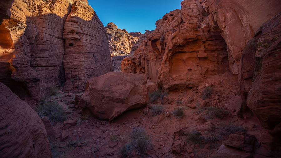
hiking valley of fire state park

Hiking in-between Arch Rock Campground and Atlatl Rock Campground
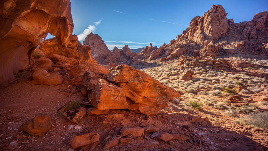
hiking valley of fire state park

Awesome scenery in between two popular campgrounds

I started today’s hike by going up and over the red rocks separating the Arch Rock campground from the Atlatl Rock Campground. This was a cool shortcut, scenic and direct. But after that, it was cross country hiking for much of the day. People in the campground gave me some strange looks as I walked through with a full backpack and set out into the open desert. With no backcountry camping allowed here, it’s just day hikers, and I stick out like a sore thumb with my full pack.
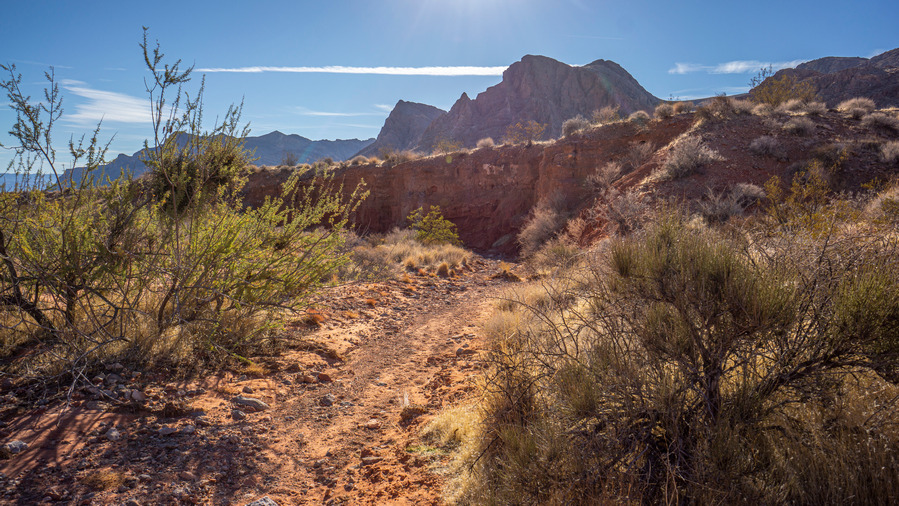
peaks of the muddy mountains sticking up over wash

Hiking a wash Valley of Fire

cholla cactus in front of the muddy mountains nevada

Muddy Mountains

The muddy mountains provided a Scenic and somewhat imposing backdrop as I wandered my way through a series of washes. At first I was quite happy with my decision to walk the base of the muddies, but that was for the first bit where I was just following a wash in the direction I wanted to go.

hikers view of the muddy mountains while walking across valley of fire nevada

The Muddy Mountains

hikers view of the muddy mountains while walking across valley of fire nevada

Up and down through all these washes…

Eventually, in order to continue on my trajectory, I had to leave the wash and go over a series of ridges that separate the washes. This became old and tedious rather fast. On top of all the PUDs (pointless ups and downs), the weather has been heating up. Today will be in the mid to upper 80s, and 90 tomorrow. At this time of year I was hoping for the 70s. It’s hard to complain though, it snowed back home in Michigan. Anything but snow. I’m a desert rat and won’t shy away from that.
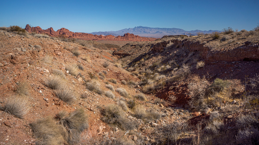
hikers view walking the valley of fire nevada

Hiking through Valley of Fire

hikers view walking the valley of fire nevada

Valley of Fire views

hikers view of the muddy mountains while walking the valley of fire nevada

Muddy Mountains

Some of these washes had a lot of what I believe to be gypsum deposits. As an amateur rockhound, I enjoy seeing anything out of the ordinary. I also saw a couple of larger pieces of semi-petrified wood. It was still brittle in spots, not quite as well formed as other specimens. Of course, there is no collecting allowed in the state park, but I didn’t want any of this stuff anyways. I’ve seen better!
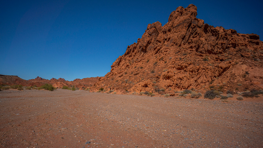
hiking valley of fire wash

Entering Valley of Fire Wash

I was feeling pretty tired this morning, but after I began waking again, felt fine. However, I drank 1.75 liters this morning before leaving camp and still haven’t had to pee. That means I’m dehydrated more than I think. I made an effort to drink more water, while also trying to stretch out my supply so I don’t run out before I reach my next water source.

hiking valley of fire state park

Valley of Fire Wash. I would have followed it further, if it didn’t take me out of the way

hiking valley of fire state park

View of Valley of Fire Wash

hiking valley of fire state park

Valley of Fire Wash

Most of the washes I hiked today were pretty small scale. However, there was one that was pretty impressive… Valley of Fire Wash. This is the main wash running through Valley of Fire.  Deep cut red rock, very alluring. I walked above it though as I needed to go over a pass. There were many small arches in this area, and a plethora of small caves and alcoves. A very interesting landscape, much like the bulk of yesterday.
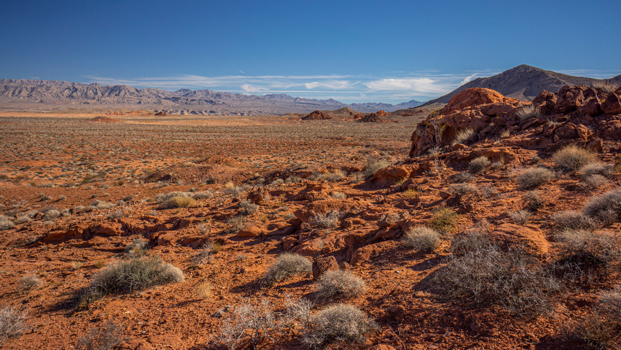
red and orange landscape of valley of fire nevada

View across Valley of Fire

hiker view walking muddy mountains nevada

Hiking around the Muddy Mountains

hiking through valley of fire

After cresting a small pass, the landscape opened up and I was only a mile and a half from my water source, Blue Point spring. I’ve walked out of the state park boundary now and entered the lake mead national recreation area. Now there was a series of game trails all leading to the same spot… The place I am going. Along the way I saw lots of horse and burro scat. Over another small hill, I could see a couple of palm trees. There’s my spring.

Once at the spring I was surprised to see how much water was flowing. I made my way to the source, where there was a USGS monitoring station and a small dam holding back half a bath tubs worth of water. The water temperature was in the eighties, not cold by any means. Good for bathing, less enticing for drinking at that temperature. But hey, beggars can’t be choosers. I began filtering water for the first time since I began this hike. It was now that I realized how slow my sawyer filter was filtering. I had used it this summer and it was working fine. Lately, I get the feeling that Sawyer filters are not good anymore after sitting a few months. This filter had definitely not seen freezing Temps, and it had been back flushed regularly. It took a solid 45 minutes to filter 4 liters. Not acceptable. I will need to replace this filter ASAP.

row of four wooly mammoth pal trees at spring in nevada

Wooly mammoth palms at Blue Splint Spring

I also took the time to rinse out my clothes and wash up a bit myself. I never use soap anymore out in the wild, I feel that rinsing is good enough. And man, did this feel good.
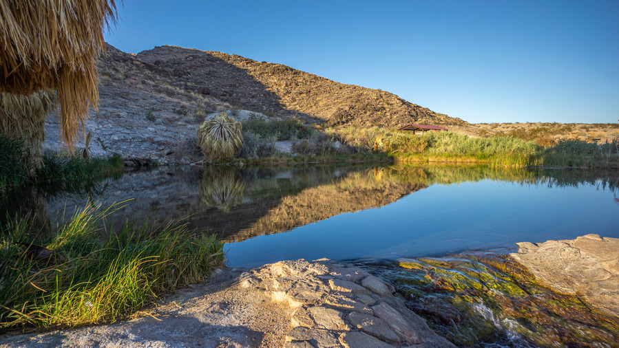
reflection on rogers spring hot spring pool lake mead national recreation area nevada

Rogers Spring. Paradise? Oh, brain eating amoebas in the water. There’s always a catch!

It was 4pm now and I have three or four miles of road walking on Northshore Drive to get to my next destination. Along the way I passed Roger’s spring. There’s a reason why I didn’t get my water from this one… The brain eating amoebas that thrive in this water source. There are signs here that advise you not to dunk your head underwater, or risk infection. Infection often causes death. While I’ve read that the amoeba can be filtered out with a one micron filter (Sawyer is .1 microns), there really is no reason to mess around with this water when there is another non-amoeba bearing water source nearby.

hiking along the base of the muddy mountains at sunset

Hiking the base of the Muddy Mountains

The thing I despise most about walking paved roads is that a solid 50% of the traffic won’t move over in inch for a human being walking on the shoulder. These are the lowest form of people. I only wish I could buzz by them in my car while they walk somewhere, but I get the feeling these folks don’t do much walking.
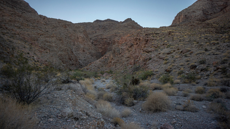
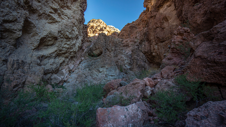
hiking a canyon in the muddy mountains nevada

Canyon entrance into the Muddy Mountains
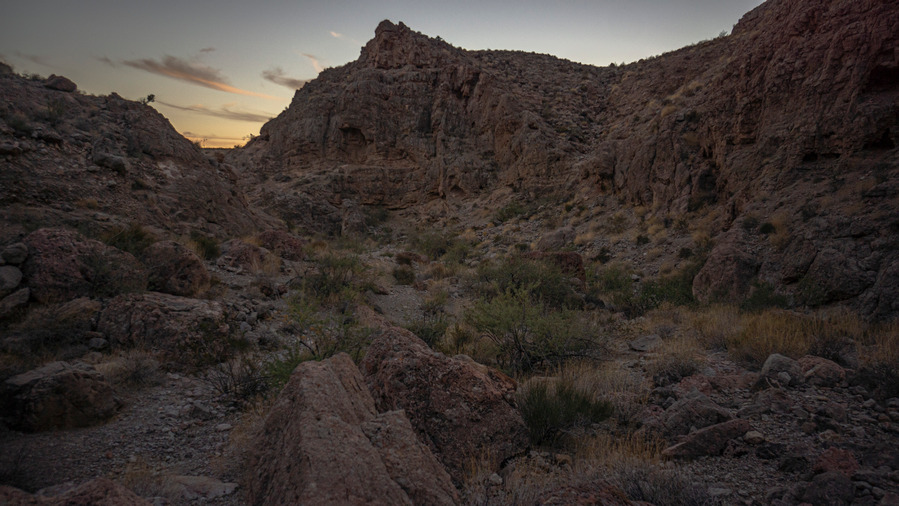
hiking a canyon in the muddy mountains nevada

Looking back out of the canyon at the base of the Muddy Mountains

As the sun went down over the muddy mountains, I left the road for a wash that paralleled it. Access into the wash is easier here than further up the road where it gets much steeper. With 30 minutes of daylight I began to work by way into the lower reaches of this deep and narrow canyon. Very impressive!
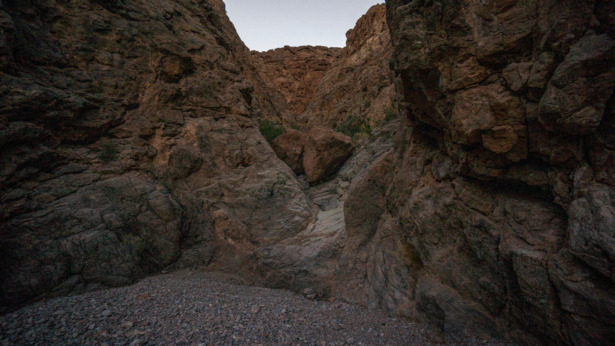
hiking a canyon in the muddy mountains nevada

Working my way up the canyon

I found my campsite, hemmed in at the base of a pour off, at a junction where the canyon splits. I finished setting up my tent utilizing some of the last daylight. I was happy to have reached camp with at least a few minutes of daylight left, unlike the previous two nights.

While this canyon is deep and narrow, where I am in the lower reaches, there is still enough open sky where I was hopeful that my Garmin inreach mini would be able to send my nightly “I’m OK” message. But after an hour and moving the thing around in every direction in position, I gave up. This thing definitely has its limitations.

Day 4 – November 6th: Muddy Mountains, Lake Mead National Rec Area

11.28 Miles (Half Day)
Animals Seen: None

Had a pack of coyotes moving in on my position around 3 AM. They were very close but when I got out of my tent and chucked a few rocks down the canyon, they went away. I heard them again at 6 am.
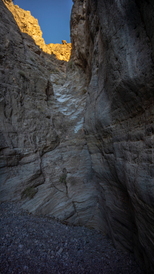
muddy mountains canyon pour off climbing

I tried climbing up the 40 foot vertical pour off that was just beyond by campsite, but I found the rock to be very slick and the lack of proper handholds would have made a descent very sketchy, if I needed to back out. And since this was an untested route, there’s a good chance I would have had to turn around. This was basically the only way to get up into the muddy mountains and continue along the route that I had planned, so I had no choice but to back out of the muddy mountains and head directly to Echo Bay Campground. Bummer, but I knew not everything I had planned along this route would work out.
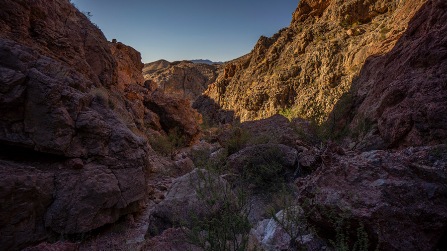
hiking a canyon in the muddy mountains nevada

Nice canyon views

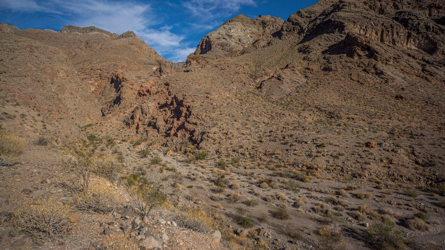
hiking a canyon in the muddy mountains nevada

hiking a canyon in the muddy mountains nevada

Views up the canyon

After trying a few scrambling routes to progress sup the canyon, I gave up and turned around. I would say that it certainly IS possible, but with a full pack on and no climbing gear, it’s much riskier. It’s too bad because this canyon would provide a critical route for a route that cuts off the walk all the way around the Muddy Mountains. There’s a pass above Fire Alcove into the Muddies from Valley of Fire, and this canyon would be the ideal route to connect to Echo Bay. But damn would it be a hairy descent down some slick rock at the spot I turned around at. It’s a shame too because it looks more open on the map above this point. I still think it’s an option for the right person.
entrance to a deep and narrow canyon in the muddy mountains nevada

Looking back at the canyon I came out of

view of the mudyd mountains from northshore dr

The Muddy Mountains

After a brief road walk on Northshore Road, I began hiking cross-country SE towards Echo Bay. At first I stayed out of the washes, they were small and somewhat choked with vegetation. After while, several washes converged into Calico Wash, and it became large enough to walk. This area really wasn’t all that interesting, but it was necessary to reach Echo Bay campground in the most direct fashion. The other option was to walk further to a road, then road walk into the campground. I’ll take the cross-country hiking instead.
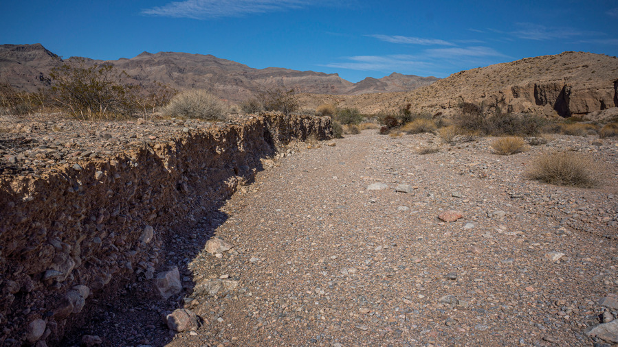
hikers view walking calico wash lake emad national rec area nevada

Hiking Calico Wash

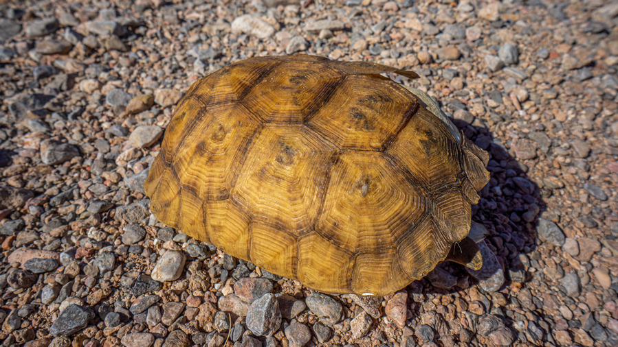
hiker find desert tortoise shell in nevada desert

Desert tortoise Shell

The most interesting thing I saw this morning was a desert tortoise shell. This is only the second time I have found one. Believe it or not, it’s actually illegal to collect the shell of a dead tortoise on any type of land. So, I snapped a picture and was on my way.

view of echo bay campground lake mead nevada

Echo Bay

When I reached Echo Bay Campground, I went into the pathetic little store and bought a couple of cold drinks. The inventory here is so small, I could almost fit all of it in my backpack. This is no joke. The only thing they sold that was a step up from the food I had in my backpack already was an egg salad sandwich, and that it was probably left over from eons ago, back when the water level of Lake Mead was higher and people actually came to Echo Bay. Now, it’s kind of like a ghost town.
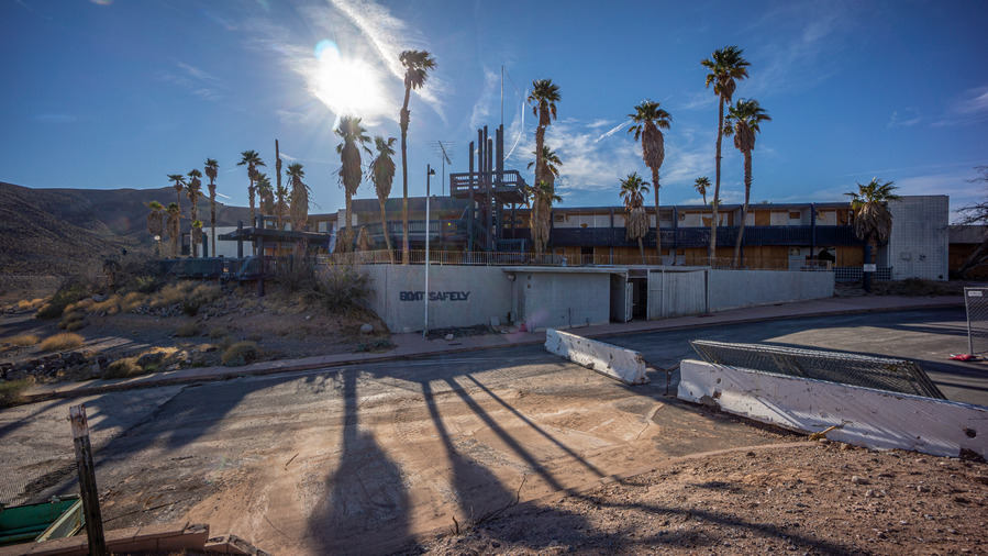
abandoned hotel at echo bay lake mead

The abandoned hotel/restaurant at Echo Bay

abandoned hotel at echo bay lake mead

A relic from a time when Lake Mead’s water level was higher

abandoned hotel at echo bay lake mead

Looks inviting

I’m also not kidding when I say Ghost town… There is an abandoned motel and restaurant across from the store. With tons of urban exploration experience under my belt, having lived in Detroit, I couldn’t pass up the opportunity to go inside this one. Access was easy, all of the windows were broken and boarded up, but some of the boards were just leaning against the windows.

graffiti in abandoned hotel at echo bay lake mead

The Room of PI Customs

graffiti in abandoned hotel at echo bay lake mead graffiti in abandoned hotel at echo bay lake mead

Inside, pretty much your standard abandoned building… Broken glass, mattresses laying everywhere, and of course, lots of graffiti. The graffiti is always interesting, and this place was no exception. This was a pretty neat little side adventure.

mst thru hiker in echo wash retrieving food cache

Echo Wash

Next, I went down into Echo Wash and dug up the food that I buried two weeks ago. Everything was still there, so that was good. Whew. Before the hike, I couldn’t find any information online that said caching wasn’t allowed in the Lake Mead NRA, but I have a feeling if one were to ask, the answer would be no. It’s unlikely that a few hikers doing this here and there would cause any impact, now would it likely attract much attention. However, alternate options for food caching at Echo Bay would be to leave it inside the abandoned motel somewhere in odor proof bags (kinda risky), or asking the little store if they will hold it for you. You can’t mail anything here, so you’d have to come in person before the hike to set this up. There are also campground hosts at Echo Bay, I bet they wouldn’t mind holding food for hikers for $10 or something.

I could have just taken my food and continued on Section 2 now, but my appetite still wasn’t there. I was having a hard time eating the food I have in my backpack already, so I wasn’t that eager to eat the stuff I just dug up. I’ve been in this situation many times before. The best way to get past it is to get a day or rest in town, and pig out on town food to kick start my appetite again.

I ended up getting a taxi, for an exorbitant price, that drove me into Overton well after dark. I got a hotel, and plan on taking a zero tomorrow for some R&R.

Day 5 – November 7th: Zero Day in Overton, NV

I wasn’t planning on coming to Overton at the end of section 1, but a day of rest and town food will do wonders for me. I didn’t have to do any food shopping since I dug up my food cache in Echo Wash, so that was a nice time saver. I washed my clothes and made small repairs/adjustments to my gear. I tried backflushing my sawyer filter a bunch of times, but it’s still slow. I’m a long ways from anywhere that sells a new Sawyer, so I’ll have to wait at least until the end of Section 3 when I get to Boulder City. I should be able to get an uber to Henderson and hit the local Walmart for that. In the mean time, slow water filtering.


Related Images:

Wallowa Mountains, OR – Eagle Cap Wilderness 3 Day Hike

Wallowa Mountains, Oregon – Eagle Cap Wilderness 3 Day, 40 Mile Hike

sunset view over glacier lake, wallowa mountains, eagle cap wilderness, oregon

  • Hike Location – Wallowa Mountains – Eagle Cap Wilderness
  • Land Administration – Wallowa National Forest
  • Hike Type – Point to Point
  • Fees & Permits – No fees or permits needed
  • Start Trailhead – Wallowa Lake
  • End Trailhead – Two Pan
  • Length Of Time Hiked – 3 days
  • Miles Hiked – 39
  • Route Difficulty – 7.5
  • Scenic Beauty – 8.5
  • Solitude – 8

Maps

Here’s the caltopo map of the 3 Day Eagle Cap Wilderness Hike: 

Elevation gain/loss chart for the 3 day Wallowa Mountains hike:wallowa mountains oregon 3 day backpacking hike route elevation chart

Video: Wallowa Mountains, Oregon – Eagle Cap Wilderness 3 Day PNW Hike

Pre-Hike Planning Notes

If you are driving a long ways to the Wallowa Mountains for your hike, you may want to camp near the trailhead to get an early start the next day. There are plenty of paid campsites at Wallowa Lake State Park and in the variety of campgrounds in the area, but The Wallowa Mountains, outside of Joseph and Enterprise, do not offer much for those looking to do any boondocking or dispersed camping on public land. We drove up Hurricane Creek, the drainage west of Wallowa Lake, and found a few crappy spots alongside the road suitable for an overnight stay in the camper van. Tent camping would be harder here. 

Joseph and Enterprise, the two gateway towns to the Wallowa Lake area, are very touristy. The Market Place grocery store offers a decent selection, probably enough for most hikers to pick up 3 days worth of food. However, if you are in doubt, get your food at a larger grocery store on your way. 

There is plenty of parking at the Wallowa Lake trailhead. Nearly all of the license plates were Oregon or Washington, which ought to tell you what a hidden gem this place. It’s an out-of-the way place, but worth the drive. 

We hiked this route in mid July. The snow had almost entirely melted out, and the mosquitoes were terrible. A mosquito head net would be a good thing to have, and perhaps bug spray.

The system of hiking trails in the Wallowa Mountains are very good. There are trails leading up just about every valley and over every saddle, so there should be little need for off-trail bushwhacking here. Besides that, the trails seem to be pretty well maintained. We encountered very few blow downs. 

The Wallowa Mountains are not very well suited for any kind of continuous ridgewalking, or high routes. Instead, the Wallowas are a series of deep valleys separating segments of high country with huge climbs. As much as I wanted to put together a more dedicated high route here, it just wasn’t possible without climbs of 7,000ft daily. The valleys are pretty incredible here, though!

After your hike, there are showers at the Wallowa Lake State Park campground. They are for campers only, but it’s a busy park and you will likely go unnoticed. 


Wallowa Mountains/Eagle Cap Wilderness 3 Day Backpacking Trip (July 2021)

Day 1 – July 9th – West Fork Wallowa River, Lake Basin, Mirror Lake, Glacier Lake

Miles Hiked – 18

hiking through pine forest near the wallowa lake trailhead oregon

Leaving the Wallowa Lake Trailhead

Sam and I left the Wallowa Lake trailhead sometime after 8am. Right away, huge pines towered above us and quickly caught our attention. The trail is wide and well beaten here as it begins a continuous climb uphill along West Fork Wallowa River.

We passed several groups of people in the first few miles. There were a lot of cars at the trailhead, but often times, the majority of these people are only hiking a few miles. We encountered a group of horseback riders, and and couple of guys who look like they had quite an adventure… one guy had blown out his show, the sole was gone. He had rigged it up with some tape the best he could, but it didn’t look like a fun walk.

eagle cap wilderness hiking west fork wallowa river trail

Hiking along West Fork Wallowa River

eagle cap wilderness hiking west fork wallowa river trail

West Fork Wallowa River

The roar of the driver grows louder when we near it. Soon we get our first view of the water, and a view up the canyon. I saw a mink running across the trail, which was a cool thing to see. I’ve only seen a couple of other mink in my life. It could also have been a pine marten, but after comparing the two animals after the hike, I think it was a mink. 

hiking through sixmile emadow in the wallowa mountains oregon

Sixmile Meadow

At Sixmile Meadow is where the scenery really starts to get good. Across this big green meadow, the high country began to show itself. We begin to notice how green and lush our surrounding are. The mountains are steep, and heavily forested. No beetle kill here, just a healthy green wonderland. 

eagle cap wilderness hiking west fork wallowa river trail

Blue waters of West Fork Wallowa River

eagle cap wilderness hiking west fork wallowa river trail

eagle cap wilderness hiking west fork wallowa river trail

View down West Fork Wallowa River from Sixmile Meadow

eagle cap wilderness hiking west fork wallowa river trail

Fording West Fork Wallowa River

We hike across Sixmile Meadow and cross West Fork Wallowa River. Here, it’s only a foot deep. A beautiful scene, too. The water is a deep turquoise blue with outstanding clarity. The river here reminded me of a past hike in Glacier National Park. 

eagle cap wilderness hiking west fork wallowa river trail

View up the valley. That’s forest fire smoke rolling in

eagle cap wilderness hiking west fork wallowa river trail

View of Peters Point ridgeline, to the east

Next the trail begins to ascend towards Lake Basin. The views open up now as we gain elevation. A sea of healthy green pines cover the entire basin, up to the treeline. 

eagle cap wilderness backpacking along horseshoe lake

Horseshoe Lake

eagle cap wilderness backpacking along horseshoe lake

Views along Horseshoe Lake

After an 1100ft climb up to the Lake Basin, we find ourselves on a flat shelf with a view of Horseshoe Lake. Very nice. The trail follows the shoreline, offering great views of this beautiful lake. 

hiking lake basin wallowa mountains oregon

hiking along deep turquoise blue alpine alke wallowa mountains oregon

hiking lake basin wallowa mountains oregon

The next segment of hiking is an enjoyable one. We hike by Lee Lake, and then Douglas Lake. The trail alternates between segments of flat ground and climbing 200ft or so. Good trail, good views.

hiking lake basin wallowa mountains oregon

Moccasin Lake

moccasin lake view hiking the wallowa mountains oregon

Upper Moccasin Lake

The trail then follows the shores of Moccasin Lake as it continues up higher into Lake Basin. The crest of the Wallowa Range is now in sight, it’s peaks and ridgelines capped in patches of snow. The upper Moccasin Lake area was really beautiful!

hiking lakes basin trail to mirror lake in wallowa mountains oregon

Trail to Mirror Lake

hiking lake basin wallowa mountains oregon

Looking back down on Moccasin Lake

We decided to take a short detour to check out Mirror Lake, since we are so close to it. Good views looking back down on Moccasin Lake from the saddle above Mirror Lake. 

hikers view of mirror lake, wallowa mountains, eagle cap wilderness oregon

Wildflowers at Mirror Lake

hikers view of mirror lake, wallowa mountains, eagle cap wilderness oregon

Eagle Cap and Mirror Lake

Mirror Lake was definitely worth the side trip. This is a top notch alpine lake with outstanding scenery. The north face of Eagle Cap peak, which we’ll summit tomorrow, provides the perfect backdrop. Indeed, this will make a fine lunch spot. 

Our lunch spot along Mirror Lake was a great place to stop, for the scenery, but perhaps the worst place we’ve been so far along our hike for bugs. The mosquitoes were thick here, and we could hardly eat a snack without also eating mosquitoes. I put on my rain gear for long sleeve protection while we ate, but really, it was one of those times where you’re just constantly swatting at the air in front of your face, just to keep the bugs at bay. Slack for a few seconds, and they’re on you again. Bastards. 

mirror alke hiking trail wallwoa lake oregon

hiking lakes basin wallowa mountians

We left Mirror Lake and hiked back downhill to Moccasin Lake, where we take a trail that will lead us to Glacier Pass. I really enjoyed this area here.

trail of rocks across water for hierk to cross stream in wallowa mountains oregon

Crossing the inlet at upper Moccasin Lake

hikers dive and swim in moccasin lake, wallowa mountains, oregon

Instant refreshment swimming in Moccasin Lake

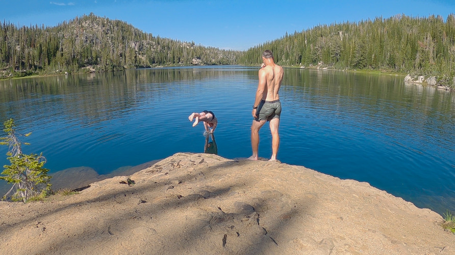
We hopped rocks to cross the inlet stream leading into Moccasin Lake. On the other wise, we found a nice spot along the lake with some rocks at the edge of a deep section of water. Perfect place to stop for a swim! We jumped in the water and enjoyed the brisk refreshment that comes from a dip in a freezing alpine lake. 

hiking up glacier pass in wallowa mountains long couloir filled with snow and water

Ravine along the trail up to Glacier Pass

hiking across snow in eagle cap wildenress, wallowa mountains backpacking trip

The hike to Glacier Pass

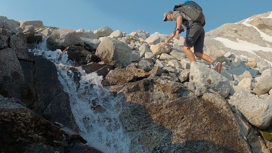
The trail begins climbing up to Glacier Pass steeply now along a deep ravine. There are patches of snow still lingering and a stream of water flowing downhill. 

hiking trail to glacier pass in wallowa mountains, oregon

View north from the trail to Glacier Pass

hiking below glacier pass, eagle cap wilderness oregon

Glacier Pass in view, Glacier Peak beyond

backpacking trail to glacier pass in wallowa mountains, oregon

Above the ravine, the views open up and Glacier Pass is in sight. The Eagle Cap peak begins to come into sight, just barely, over the ridge. Also in sight now along the ridgeline is Glacier Peak, and this one is much more prominent looking from this angle than Eagle Cap itself.

backpacker on glacier pass in eagle cap wilderness oregon

Sam enjoying the view from Glacier Pass

hikers view from glacier pass, wallowa mountains oregon

View down to Glacier Lake and Glacier Peak

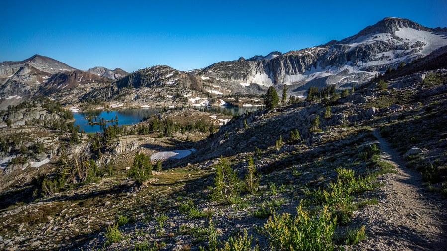
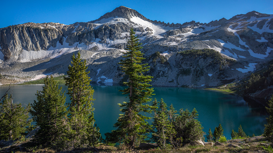
The view from the top of Glacier Pass initially isn’t that great. That is, until you drop down slightly from the pass, and Glacier Lake comes into view. Wow! This basin was pretty stunning. Glacier Peak provides an impressive backdrop behind the distant waters of Glacier Lake. There are multiple small islands in the lake, with a few pines trees growing on them. This reminded me of the Sawtooths in Idaho, while the mountains themselves were reminiscent of the Sierras. In other words, excellent views.
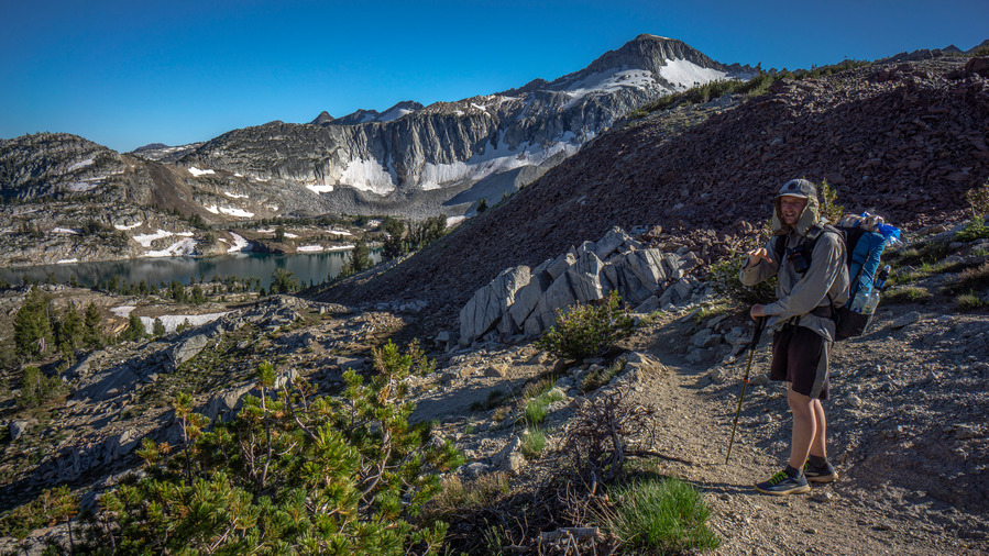
backpacking trip to glacier lake oregon

Hiking down to Glacier Lake

hikers view of turquoise blue glacier lake in wallowa mountains

Glacier Lake and Glacier Peak

glacier lake view in the wallowa moutnains

That peninsula jetting out into Glacier Lake is where we’d like to camp

As we dropped lower in elevation from Glacier Pass, we could get a decent view of the lake from above and scope out potential campsite locations. We settled on a spot, and noticed a curious scene playing out just 40 yards away… a mountain goat kicking up a ton of dirt as he digs and rolls around. He’s probably just as annoyed with the mosquitoes as we are.

hiker eating dinner at glacier lake in wallowa mountains oregon

Dinner at Glacier Lake

hikers view from cap at glacier lake, eagle cap wilderness oregon

Glacier Lake at sunset

reflection on glacier lake at sunset with wildflowers and glacier peak

The magic hour at Glacier Lake

We find a spot for our tents and eat dinner, swatting mosquitoes the entire time. It was a challenge not to eat any of the mosquitoes too, there were so many swarming my face. Besides that, we enjoyed an outstanding view of Glacier Peak with a nice reflection on Glacier Lake as the sun set. 

tarptent notch li campsite at glacier lake, eagle cap wilderness oregon

Campsite at Glacier Lake

Soon enough, we retreated to our tents, where we could be safe from the bugs. That’s always a great feeling, the moment you are able to lie down after a long day of hiking and breathe that first sigh of relief as your head hits the air mattress. About 18 miles on the day today. Tomorrow, we summit Eagle Cap peak. 


Day 2 – July 10th – Eagle Cap Peak, Horton pass, Frazier Pass, Minam River, Minam Lake

Miles Hiked – 10

glacier lake sunrise reflection eagle cap wilderness oregon

Glacier Lake reflection at sunrise

The sunrise over Glacier Lake was a great way to start the morning. We enjoyed the same beautiful reflection of Glacier Peak over the water as we witnessed for last night’s sunset. We ate breakfast by the water and filtered our water for the morning. Sam and I had just hiked a awesome 81 mile route across Dinosaur National Monument last week, where water was often an issue (except when we rafted the Green River for 6 miles!). So all this water in the Wallowa Mountains was a luxury to us.
view of glacier peak with alrge boulders in foreground and glacier lake

Scouting the route up to the saddle between Glacier Peak and Eagle Cap (not pictured)

Today we will climb Eagle Cap peak, the second highest peak in the Wallowa Mountains. The standard route to summit Eagle Cap is along the northwest ridgeline, where there is a trail to the summit. However, we wanted to hit Glacier Lake, and so we’ll approach from the east slope below the saddle directly south of Eagle Cap. 

calm as glass reflection on glacier lake oregon

Incredible reflection on Glacier Lake

hiker climbs boulder field in wallowa mountains

Looking up at Sam as he traverses the steep slopes of Glacier Lake’s northwest side

view down into alpine lake from hike across steep talus slope in wallowa mountains oregon

Steep slopes

hikers view of glacier lake from wallowa mountains backpacking trip

Looking back down on Glacier Lake

From camp we studied the mountainside in the upper basin and compared that to the route we have planned up it to Eagle Cap. We choose a line a begin working our way around the steep slopes above the northwest side of Glacier Lake. It’s steep and rocky, but we make it across. The reflection on Glacier Lake, and the color of the water, was incredible form this angle. 

purple wildflowers below eagle cap peak in wallowa mountains oregon

Wildflowers below Eagle Cap peak

hiker climbing boulder field along flowing waterfall cascades in wallowa mountains oregon

Good flow of water through this boulder field

After traversing the steep scree slope, we meet the slopes of Eagle Cap’s east face. The terrain flattens briefly, and there’s a small green meadow with colorful wildflowers. A small stream trickle through from the patches of snow lingering higher up the ridgeline. 

two hikers below wallowa mountains crest on summit hike to eagle cap peak

Up we go

hiker scrambling qbove alpine lake in wallowa mountains oregon

Now it’s a 900ft climb to the top of the ridgeline. Some mountains might be solid boulder fields now at this elevation, but here the boulders are thin enough that we are also walking in-between patches of soil. This made the going a little easier. 

eagle cap peak summit hike through boulder fields non standard route

This is NOT the standard route to summit Eagle Cap peak. But it’s a relatively easy class 2 hike up

eagle cap peak summit hike through boulder fields non standard route

Ridgeline leading to Glacier Peak

wallowa mountains peak bagging eagle cap view down to glacier lake

View down to Glacier Lake

Yesterday we noticed a bit of forest fire smoke rolling in, but the skies were predominantly blue. Today though, the smoke is winning. And it’s really starting to build up. Bummer, because we want that distant summit view.  


hiker walking through snow and boulders on off trail non standard climbing approach to eagle cap peak

Traversing the final snow patches below the crest

hiker traverses snowfield in eagle cap wilderness on summit hike

Sam traversing the snowfield

hiker traversing snow in eagle cap widlerness oregon summit hike

Sam cresting the ridgeline at the top of the snowfield

Towards the top of the climb, we encounter snow patches. Fortunately they weren’t incredibly steep, and we picked our line up. These snow patches are like mine fields though. Sam did punch through and posthole a couple of times, but I lucked out. We spotted a couple of Big Horn Sheep going up to the pass themselves, above us. 

hikers view of ridgelong along crest of the wallowa mountains, oregon

Crest of the Wallowa Mountains, view southeast to Glacier Peak

hiking trail to the summit of eagle cap peak wallowa mountains oregon

Trail to summit of Eagle Cap from the south face

At the top of the crest below Eagle Cap, the terrain becomes a very manageable walk. Not only because the boulders have mostly given way to a mostly dirt landscape, but because we’ve also stumbled upon a game trail leading up to the summit. It’s also possible that this is a social trail, perhaps from others taking a similar approach as we did from the east slopes. However, we did not see any other evidence of some sort of route up to the crest along the way… no cairns, no faint paths, nothing. 
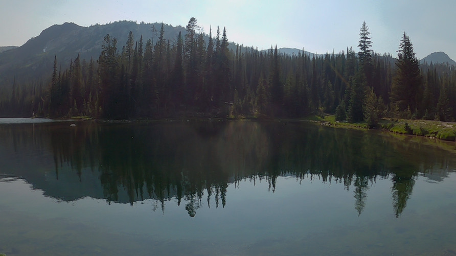
hiker walking the crest of the wallowa mountains with forest fire smoke

Easy walking now on the crest of the Wallowas. But, that forest fire smoke!!

It’s a 350ft climb up the game trail now to the summit. An easy walk. Excellent views along the ridgeline to the south, towards Glacier Peak. 

eagle cap peak summit view by wallowa mountains hiker

View north from the Eagle Cap summit

eagle cap peak summit view by wallowa mountains hiker

eagle cap peak summit view by wallowa mountains hiker

Sam measuring the vastness of the Wallowa Mountains

The summit of Eagle Cap (9,577′) is broad and flat, but with a big drop off on the north face. The view overlooking the Eagle Cap Wilderness to the north is massive. We spent some time here soaking up the summit views, despite the thick forest fire smoke limiting the distance. 

hiker stands on trail overlooking vast poregon wilderness in wallowa mountains

Sam enjoying the view as we begin the descent down from Eagle Cap

view of hiking trail in wallowa mountains high country, eagle cap wilderness

Excellent hiking along this trail

stunning mountain views in wallowa mountains oregon

Wow!

As soon as we began our decent down the northeast slope of Eagle Cap, we picked up on a trail. It was a steep descent down a series of switchbacks, but an easy trail to follow nonetheless. We passed a few people hiking up to the summit.

hiking the ridgeline down to horton pass from eagle cap peak, wallowa mountains oregon hiking the ridgeline down to horton pass from eagle cap peak, wallowa mountains oregon

hiking the ridgeline down to horton pass from eagle cap peak, wallowa mountains oregon

Horton Pass

The trail we follow now will take us to Horton pass. We enjoy excellent views here as well, and we’re very much enjoying what the Wallowa Mountains have to offer thus far. Some really excellent high mountain scenery here.

backpackers view of hiking trail in wallowa mountains east fork eagle creek

Hiking down Horton Pass into East Fork Eagle Creek

backpackers view of hiking trail in wallowa mountains east fork eagle creek

Hiking below Horton Pass

backpackers view of hiking trail in wallowa mountains east fork eagle creek

Well this is pretty nice

At Horton Pass, we take the trail leading west/south down East Fork Eagle Creek. A series of switchbacks lead down from the summit and seem to go on for a while. The trail is rougher here though, it’s rocky and there is a tiny stream occasionally flowing through it.

hiker filtering water sawyer filter and smart water bottle with wildflowers in oregon mountains

At around 7,660′, we reach a small but beautiful meadow. East Fork Eagle Creek flows through it, and we stop here to filter some water. It’s a beautiful spot, lush and green, lots of colorful wildflowers.

hiking trail in lush green mountain forest landscape oregon wallowa mountains

Good hiking down East Fork Eagle Creek, once you get below the pass

We continue downhill along the trail, which now is a bit more of a solid path. The hiking is easier now and we’re finding the walk to be quite enjoyable. It’s another heavily forest valley filled with healthy pines. I have grown accustomed to the beetle kill in the Rockies, but that seems to be much less of an issue here. 

off trail hiking in the wallowa mountains oregon

Sam crossing East Fork Eagle Creek

off trail hiking in the wallowa mountains oregon

Traversing the slope to Frazier Pass

off trail hiking in the wallowa mountains oregon

Views of the ridgeline above East Fork Eagle Creek

off trail hiking in the wallowa mountains oregon

Looking back at the slope we’ve traversed. Not terribly steep, but enough to be an obstacle

We leave the trail around the 7,425′ mark and begin contouring around the mountainside over to Frazier Pass. This will save us 2 miles and 900ft of elevation loss/gain, but we’ll have to traverse some steep slopes. We cross a creek and enter what looks to be easy-going grassy slopes. However, the grass hides a multitude of rocks to trip over and twist an ankle. Some sections of the slope were quite steep, but we could have easily dropped downhill to cope. We just didn’t want to lose any elevation.

hiker on trail up to frazier pass wallowa mountains oregon

Trail up to Frazier Pass

Eventually we regained the trail leading up to Frazier Pass. It’s patchy pine forest here, and the path leads up a dusty ravine. The steepest section is right before the top.

hiekrs view from frazier pass wallowa moutnains oregon

View from Frazier Pass

hiker walking trail in forest in eagle cap wilderness oregon

Sam hiking the switchbacks down from Frazier Pass to Minam River

hiking through downed trees in oregon wallowa mountains

Some downed trees here as we enter Minam River valley

Frazier Pass itself didn’t really offer a view, there were just too many trees. We began the descent down the west side of Frazier Pass. The trail here is really dusty, with that finer dirt that gets over everything and into your shoes so easily. The forest is thick here, and more downed trees than pretty much anywhere else we’ve been so far in the Wallowas. For a moment, I felt like I was back on the CDT. Still, the blowdowns had been cleared from the trial mostly, and wasn’t an issue.

hiker fording minam river in the wallowa mountains on a backpacking trip

Sam crossing Minam River

hiking trail running through minam river valley eagle cap wilderness oregon

View west down Minam River valley

hiker walking through wildflwoers in wallowa mountains oregon

A nice walk here

At the bottom of the descent we reach Minam River. This is the upper reaches of the river, though, and it’s pretty small here. We hop rocks across and enter a big, green valley with many wildflowers. 

purple wildflowers in minam valley, wallowa mountains, oregon

Wildflowers in Minam Valley

hiker walking trail in minam valley oregon in the eagle cap wilderness

Hiking Minam Valley below peak 8543

The hike along Minam River just north of Frazier Pass was excellent. At first, the view of the valley is simply “pleasant”. However, as we progressed up the valley towards Minam Lake, the scenery became incredible. What an amazing valley to walk through. Peak 8543′ is the high point along the ridge, which rises sharply nearly 2000′ from the valley floor. There are many colorful wildflowers here as well. 

view from the south shore of minam lake oregon

View north from the south shore of Minam Lake

The trail below Minam Lake passes through trees, and obscures the view. That is, until the trees break and we get our first view of Minam Lake. It’s nice, but nothing like Glacier Lake or Mirror Lake. Minam Lake is at 7373′ elevation, and although some lakes at this elevation are quite impressive, this really isn’t one of them. The backdrop of the mountains are less impressive, heavily forested and more rolling hills than the imposing mountain peaks and rock faces we like to see surrounding an alpine lake. 

One interesting feature of Minam Lake is that it basically sits on top of a saddle separating two valleys. The south side of the lake drains out and forms Minam River, while the north side drains out and forms Lostine River. It’s a strange feeling to hike up a valley, get to this lake at the top, and descend down another river valley. Typically, these high lakes are nestled in the upper basins, and only flow into ONE valley. 

backpacker view along east shore of minam lake oregon

Hiking along the east shore of Minam Lake

minam lake view

View west across the middle of Minam Lake

The hike around the east shore of Minam Lake mostly stays away from the shoreline, and slightly elevated. We’re looking for a place to camp now, but we’re really not seeing much.

hikers view from minam lake shoreline

Minam Lake north shore, view south

hiker crossing logjam at alpine lake outlet in wallowa mountains oregon

Sam crossing the outlet of Minam Lake

tarptent notch li at minam lake oregon campsite

Minam Lake campsite view

We hike down to the southern end of the lake, and the views are better. We find a nice campsite along the lake, with good protection from the trees. This will do.

minam lake oregon campsite view

Not a bad place to spend the evening

purple wildflowers and sunset view over minam lake with reflection on water

View of Minam Lake at sunset

We had a few hours of sunlight left today, and enjoyed our time along the lake. We soak our feet in the water and soak up the views. The sunlight fades and another great day in the Wallowa Mountains is behind us. 


Day 3 – July 11th – Minam Lake, Lostine River

Miles Hiked  – 11

sunrise view with reflection over minam lakem wallowa mountains

Minam Lake at sunrise

hiking the lostine river trail oregon

Sam crossing the Lostine River below Minam Lake

After leaving camp, we cross a network of braided streams below Minam Lake’s outlet. It’s clear animals like this area, too. There were many tracks and piles of scat here. We could hear animals moving around near the lake last night, too. We have seen no signs of bear though along our hike in the Wallowa Mountains, which always seems to be the question a hiker is asked. 

hiking trail upper lostine river wallowa mountains oregon

Hiking upper Lostine River

We’re now hiking along Lostine Creek as we leave Minam Lake. The valley is deep, and it seems to take forever for the sun rays to reach us. The forest fire smoke hasn’t built up yet for the day, and bluebird skies prevail. The upper section of Lostine River was nice, before it drops down into the forest.

boulder field along lostine river mountainside

lsotine river trail hiking

Hiking through the forest along Lostine River

hiking views along the lostine river backpacking the wallowas

Lostine River

The trail enters a thick forest, drops 400ft and Copper Creek pours into Lostine River. Many streams will pour into the Lostine as we drop down lower into the valley. We watch the river grow as the trail descends. It’s a 2200′ descent for us. and it’s a real knee buster to begin the day like this. 

hikers view from trail along the llostine river, wallowa mountains, oregon

Lostine River

hikers view from trail along the llostine river, wallowa mountains, oregon

Whitewater along the Lostine River

Lostine River continues to grow in size, and with the steep grades, is now whitewater. The roar of the river is nice to hear. Big pines, stray rays of sunlight finding their way down to the forest floor. It’s a really pleasant walk.  

two pan trailhead hiking lostine river

Hiking trail along Lostine River, near Two Pan Trailhead

spider web with sunlight behind it in oregon wallowa mountains forest

Spider web near the end of our hike

We reach Two Pan Trailhead, which has plenty of cars parked here. We really didn’t see that many people though, both along Lostine River/Minam Lake and in general throughout our Eagle Caps Wilderness hike. We kept walking down hill, passing Shady Campground, French Camp Picnic Area, before getting a hitch near the Lillyville Picnic Area. 

When we reached WHY 82 in the small town of Lostine, our ride was going north, and we need to go south. So, we stuck out our thumbs again and within 15 minutes, got our ride. She was a local on the way into Joseph to get groceries, but ended up driving us all the way up to the Wallowa Lake trailhead, where my van is parked. 

The Wallowa Mountains were awesome. I was very impressed with the scenery here. Despite the trails being good, it’s hard hiking. There is a lot of elevation gain needed to see the high country here. Otherwise, it’s all valley walks, which is still pretty nice. I would love to return to the Wallowa Mountains, and do a longer backpacking trip in the Eagle Caps Wilderness. Someday!

Related Images:

Seven Devils Mountains, Idaho – He Devil Summit Hike (July 2021)

Seven Devils Mountains, Idaho – He Devil Summit Loop Hike

hiker standing on the summit of he devil peak in the seven devils mountains, idaho

  Watch the He Devil Summit Hike Video On Youtube 

  • Hike Location – Seven Devils Mountains, Idaho – Hells Canyon Wilderness
  • Land Administration – Hells Canyon National Recreation Area, managed by the Wallowa-Whitman National Forest 
  • Hike Type – Loop
  • Fees & Permits – No fees or permits needed
  • Trailhead – Windy Saddle
  • Length Of Time Hiked – 1 day
  • Miles Hiked – 15.56
  • Route Difficulty – 7.5
  • Scenic Beauty – 8
  • Solitude – 8

Video: He Devil Summit Loop Hike – Seven Devils Mountains, ID

Pre-Hike Planning Notes

There are no fees or permits required to hike in the Seven Devils Mountains. The road up to Windy Saddle is doable by car, but it’s a bumpy ride in places with a lot of washboard roads. There are a lot of steep inclines, your vehicle will be working hard to get up here. There is a FREE campground a half mile from the Windy Saddle Trailhead called the Seven Devils Campground. This is a great place to stay the night before your hike, if doing a day hike, or perhaps the night after finishing your hike. There is no water up here. There are pit toilets at the campground and the trailhead. 

He Devil Summit Hike Maps

Here’s the caltopo map of my He Devil Summit Loop Hike: 

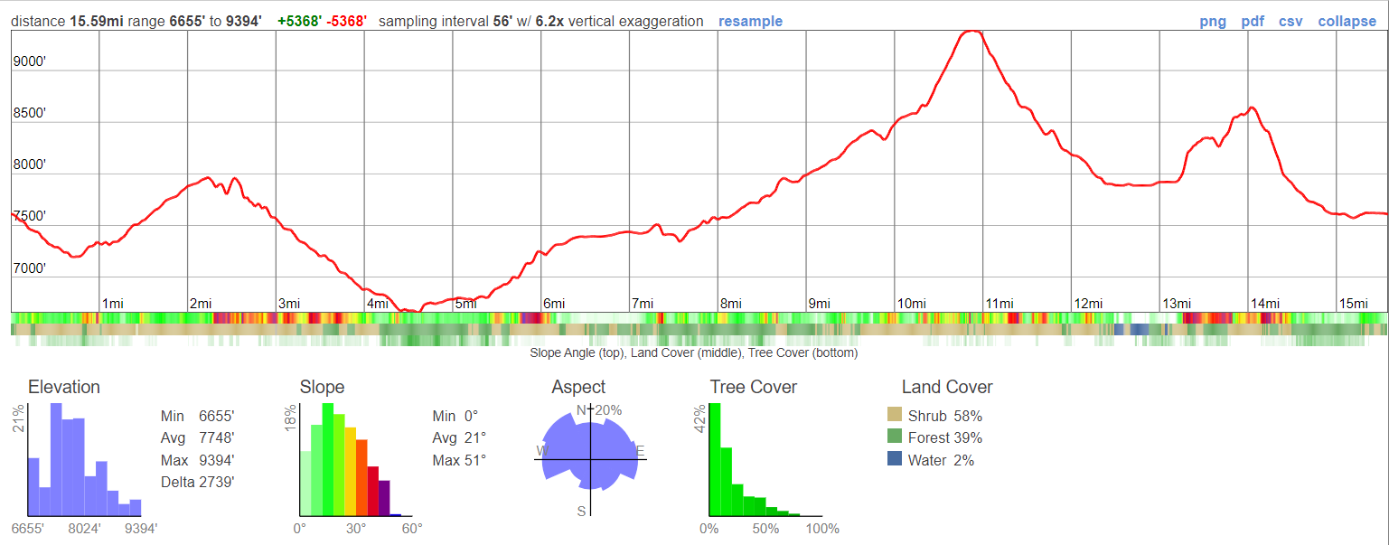
elevation gain chart for he devil summit hike loop

Download GPX file for the He Devil Summit Loop Hike


He Devil Summit Hike – July 15th, 2021

Miles Hiked – 15.56
Elevation Gain – 5300′
Route Hiked – Loop hike from Windy Saddle to He Devil Summit and back

My buddy Sam and I slept in the Seven Devils Campground last night in my camper van, about a half mile from the Windy Saddle Trailhead. This made it easy to get an early start on today’s hike, a loop that bags the summit of He Devil, the highest point in the Seven Devils Mountains of Idaho at 9,393′. We’re on the east side of Hells Canyon, the deepest gorge in the US, within the Hells Canyon National Recreation area and the Hells Canyon Wilderness. We had a much longer hike planned for this area, but because of the thick forest fire smoke and high temperatures, we’re cutting this adventure short, and just doing a day hike to the summit of He Devil. 

There were maybe 4 other vehicles parked at the Windy Saddle trailhead this morning. We started walking just as the sun crested one of the hills above the saddle. Through the thick forest fire smoke, it was an orange ball of fire. Pretty cool looking, but also pretty sad that we won’t get the distant views we were hoping for here.

he devil summit hike, walking east fork shep creek drainage through dead trees

Hiking East Fork Sheep Creek, near Windy Saddle

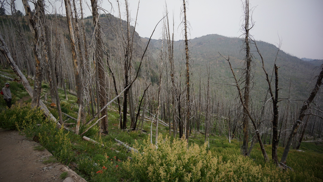
The trail begins by dropping in elevation from the trailhead and traversing a massive area of dead trees. The trail was clear, thankfully, but this area just looked dead and barren. 

forest fire smoke obscures view into hells canyon wilderness

View north to Hells Canyon Wilderness

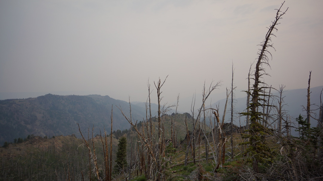
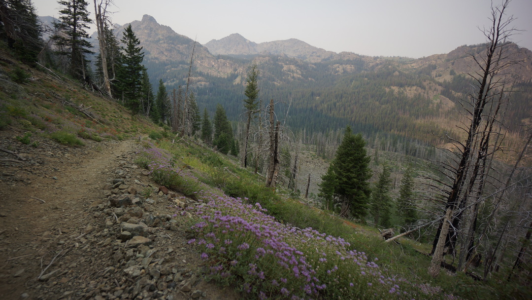
After dropping to 7,200′, the the trail quickly begins to climb up in elevation now, traversing a ridge facing northeast. We’ll climb to 8,000′ as we round the corner of a ridge. Our first big views towards Hells Canyon would have been here, but the thick forest fire smoke obscured them. There are some nice purple wildflowers up here along the trail, especially prospering in some of the old burn areas.

hells canyon wilderness wildflowers while hiking

Wildflowers in the Seven Devils Mountains, Idaho

Next we drop in elevation again, from 8,000′ to roughly 6,600′ as we drop down into the canyon with West Fork Sheep Creek. Switchbacks at the top make quick work of the biggest descent. Soon enough, we trade mountain views for the cover of the forest. Here, things are green and lush, thriving, unlike the valley we started our hike in. 

hikers view of west fork sheep creek hells canyon idaho

West Fork Sheep Creek

West Fork Sheep Creek was a solid flowing body of water, with some small cascades. Very nice, very pleasant. Then we climbed out of the forest again, and our mountain views returned. This was some pretty solid high mountain scenery, especially considering the surrounding area of Hells Canyon which doesn’t really have anything else like this nearby. 

hiking hells canyon wilderness

Hiking the Seven Devils Mountains near Lily Pad Lake

The trail leads us up and out of West Fork Sheep Creek and leads us to a pass between Dry Diggins Ridge and Lily Pad Lake. It’s pretty flat here at the moment, with a great view of the hazy mountains in the distance. There’s lot of water here now, and the route will pass by 5 small lakes on the way up.

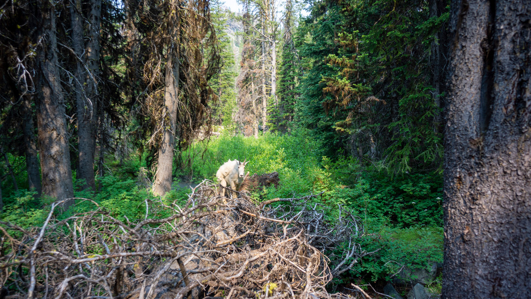
mountain goat along hiking trail in hells canyon wilderness, idaho

Mountain Goat in the Seven Devils Mountains

While hiking through another patch of forest, in between Lily Pad Lake and Basin Lake, we spotted a Mountain Goat alongside the trail. He was pretty chill, just doing his own thing. Always cool to see.

view of mountain silhouette from hiking trial in seven devils range idaho

Hiking the trail along the chain of lakes

view of gem lake from he devil summit hike trail

Gem Lake

Now the trail continues to climb uphill around Shelf Lake, and then passes Gem Lake. The trail stays a distance away from both lakes, though, staying elevated above them. Good trail, good views. 

hiker looking up at silhouette of seven devils ridgeline idaho hells canyon

View up towards the Sven Devils ridgeline

hiker in hells canoyn idaho walking up mountains

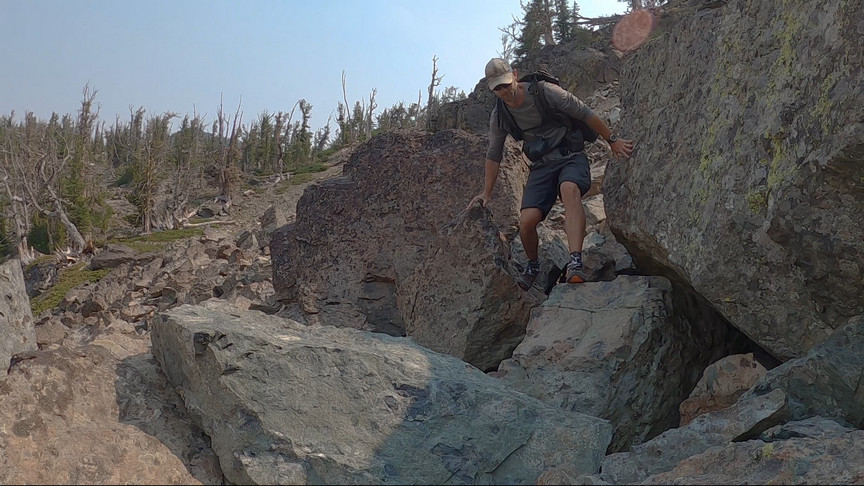
The trail climbs above Rock Island Lake, again with no real view of the lake. Soon though, we leave the trail and begin our hike off-trail through a boulder field to continue our route up to the summit of He Devil. 

hiking boulder field on he devil summit hike seen devils mountains idaho

Climbing the boulders to the ridgeline. He Devil is the jagged peak along the ridgeline

hiker climbing over boulders along mountainside in hells canyon idaho

Climbing over the boulders

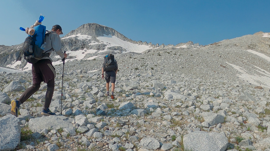
Next we worked our way out into a large boulder field in order to reach the ridgeline. The route wasn’t too bad, just slow and tedious. 

hiking now field below ridgeline seven devils mountains idaho

Snow field below ridgeline

melting two bottles of snow for water in idaho mountains

Melting snow for water

I should have stopped to fill up on water at one of the creeks we passed farther back, but I didn’t. I figured I’d gone past the last liquid water source, and I turned to a snow bank for water now. I stopped to fill up two 1 liter bottles with snow, and will let them melt as I carry them. 

view to hells canyon idaho in forest fire smoke

Hazy view towards Hells Canyon, the deepest gorge in the US… 7,993′ deep at it’s deepest point!

hiker walking up ridgeline in mountains to summit

Sam hiking up the ridgeline to He Devil

views through forest fire smoke on he devil summit hike

Good views despite the forest fire smoke

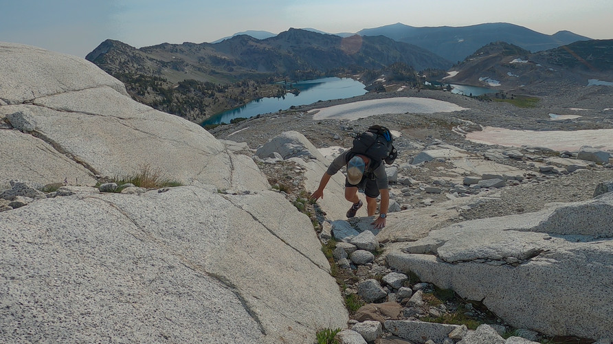
There was one steep section to climb before gaining the ridgeline. From here, it’s a straight shot up to He Devil. There’s sometimes a path to follow, but also, it’s occasionally a bit of a scramble up the boulders. The views are as good as they can be with the smoke.

He Devil Summit in Sight

It was a good hike along the ridgeline. The route is not super well defined, but easy enough to figure out on your own. It was mostly a fun walk up. The final approach to then summit block required a short bit of scrambling to reach, with no exposure. 

he devil and she devil peaks in the sevin devils mountains idaho

He Devil summit view northeast to She Devil

he devil summit view, seven devils mountains idaho

He Devil summit view south to Mt Belial & Devils Throne

hiker standing on the summit of he devil peak in the seven devils mountains, idaho

Sam on the summit of He Devil (9,393′), highest point in the Seven Devils Mountains, Idaho

The views form the summit of He Devil were awesome, even with the forest fire smoke. It’s an impressive ridgeline, with a view of the other 6 “devils”. It’s just the kind of ridgeline you want to find your self on top of. However, because of the smoke, we had practically no view of Hells Canyon, the deepest gorge in the US. I could see the outline of the Oregon side of Hells Canyon in the distance, but just barely. I wondered how the view would be, on a clear day. At it’s deepest point, Hells Canyon is 7,993′ deep. That’s a pretty serious landform, just the kind you’d want to overlook from a peak like this. 

hiker climbing down from summit of he devil peak

The initial climb down from the summit

Sam descending the mountain

hiker on summit hike to he devil mountain idaho

Sam on the ridgeline

The hike down from the summit was pretty quick and easy. Just a return hike down the same ridgeline for now. 

hiker traverses snow and boudlers below he devil peak, idaho

Sam working his way to a snow field

hiker glissading down the snow on idaho mountains

Sam glissading down the slope after a failed ski attempt

When we dropped down from the ridgeline, we took a slightly different route on the way down than we did on the way up. We made it down a section of steep and loose boulders and reached a snowfield. Sam and I had been talking about our skiing abilities, hat is, the ability to slide down the snow on your shoes, like skiing. I’m pretty decent at this, and made my run a couple hundred feet down hill with no poles, and didn’t fall. Sam bit it after a few feet, and glissaded the rest of the way down. Good times. 

hikers view of sheep lake seven devils idaho

Sheep Lake

After a tedious walk through the lower section of boulders below He Devil, we reached a more suitable hiking terrain of soil, green grasses and small rocks. We find ourselves on a saddle, which we crest for our first close view of Sheep Lake.

view of sheep lake

Hike down to Sheep Lake

sheep lake shoreline views of mountain ridges above

Excellent views nearing Sheep Lake. She Devil peak looms above

shores of sheep lake in seven devils mountains idaho

Sheep Lake from break spot

We picked up on a hiking trail again as we descended down to Sheep Lake. Now we have good trail and outstanding views. Once down at the lake, it was the obvious place for a break. I drank some of my snow melt water here, which was freezing cold. I also filtered some water from the lake, which was a much more tolerable drinking temperature. 

alpine lake view in the seven devils mountains idaho

Hiking the south side of Sheep Lake

sheep lake hiking view

View across Sheep Lake

Hiking around small off-shoot of Sheep Lake

Next we traversed the south shores of Sheep Lake, below She Devil. There’s a short section of boulders here, otherwise it’s a nice grassy walk. The shoreline wraps around to another smaller lake, an off-shoot of Sheep Lake. Nice views here too. This would make an excellent place to camp, if we were staying the night. But we aren’t, so it’s back to the van. 

hiking faint trail in the seven devils mountains

The route up. Can you spot Sam?

steep loose chute to hike up mountain

The route we hiked up

hiking trial in seven devils mountains

Narrow path along this ledge provides easy walking

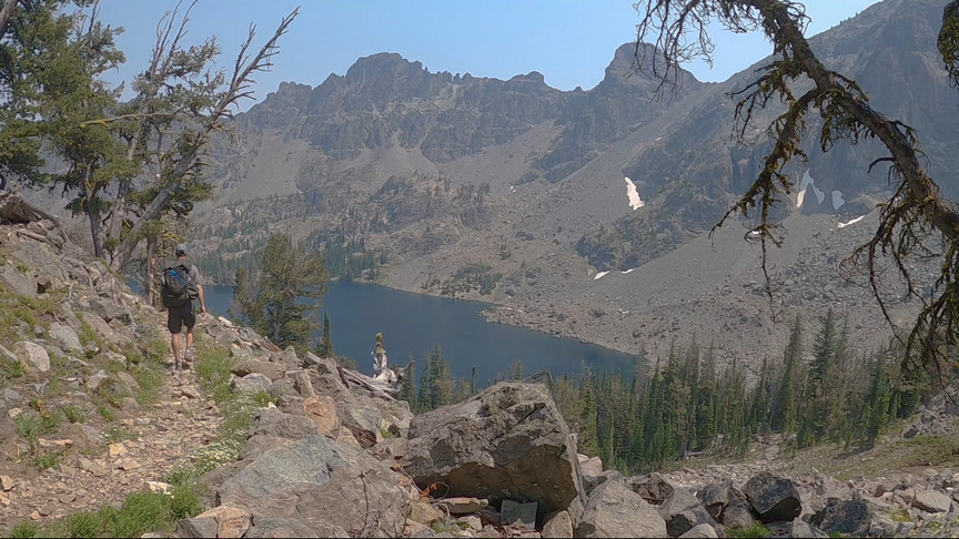
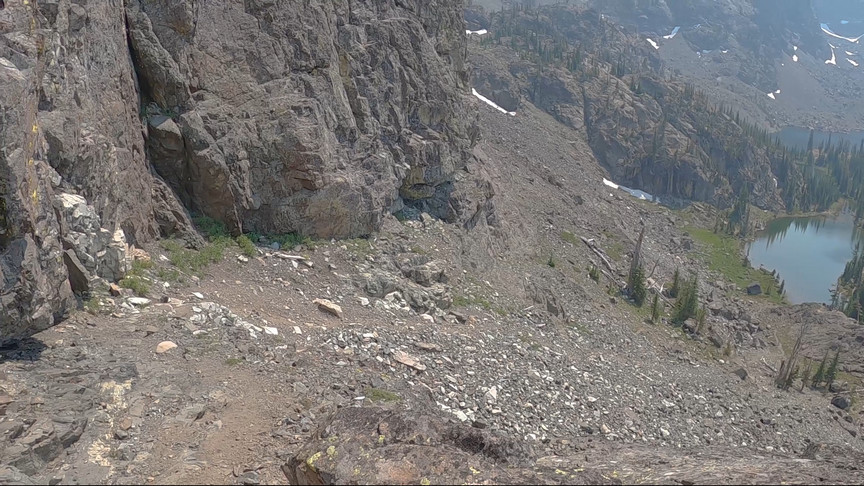
Now we are looking for a trail that could connect Sheep Lake to Mirror Lake. From the other side of Sheep Lake, it doesn’t look like it would be a good route, too steep. From up close, it looks very steep too, but we started to see a weakness in the mountainside that could allow a path to hike up. USFS and USGS maps don’t show a trail here, but OpenStreet maps does. Interesting. We thought we could see a very faint path to follow as we hiked up the steep slopes, so it was a good sign. Additionally, there was indeed a narrow ledge, more or less, that allowed for easy passage compared to the surrounding terrain. Things are looking good. 

hiking trail to mirror lake seven devils mountains idaho

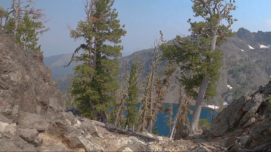
Nearing the top of the pass to Mirror Lake. 

mirror lake pass hike

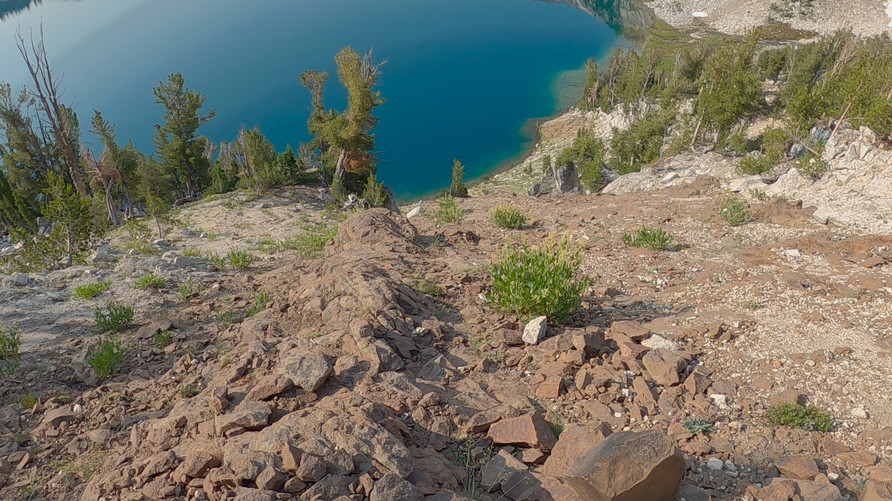
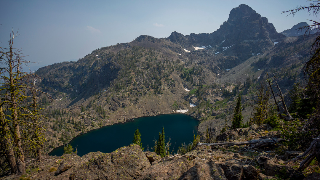
view from pass in seven devils mountains over mirror lake

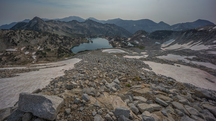
First view of Mirror Lake from pass

At one point, we had to squeeze through two rocks, a space barely big enough to fit with a backpack on. Past this, there was more steep terrain, but it’s all been manageable. This route has really worked out. This is way more direct, shaving off several miles of hiking versus the way we started the hike this morning. It’s a different route and it’s scenic, so its a win-win.

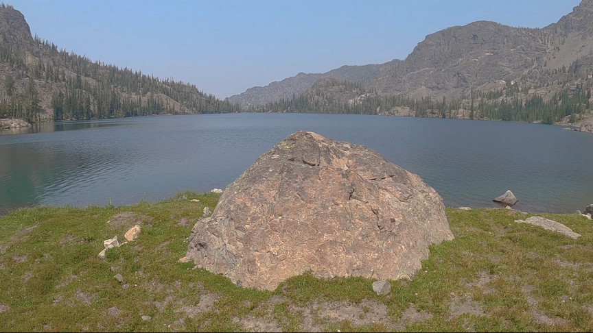
elevated view of mirror lake, seven devils mountains, idaho

Mirror Lake

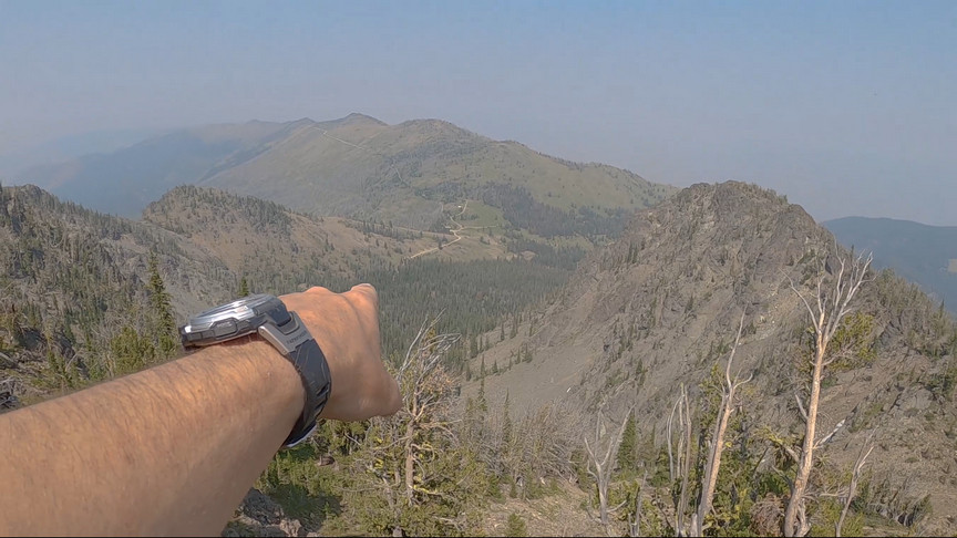
hiekrs view of windy saddle in the seven devils mountains

View of Windy Saddle Trailhead in the distance

After cresting the pass, Mirror Lake came into sight. This was a really nice lake, and well hidden from the Seven Devils Campground, but just a few hundred feet away. For now, a steep descent stand in the way. There was some slippin’ and slidin’, but we both made it down in one piece.

view of mirror lake from shoreline

Mirror Lake

We made it down off the steep slopes and hiked over to Mirror Lake to enjoy one last view of this fine alpine lake. I didn’t expect much out of this lake, because it was so close to the Seven Devils Campground and honestly, because it was tucked away in an otherwise ugly spot, with all the dead trees and such. This was a really nice surprise and a nice way to end our He Devil summit loop hike. From here, it’s about 1/2 mile back to the Windy Saddle trailhead where we parked. 


Related Images:

×