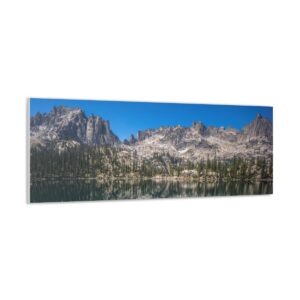
Eagles Nest Wilderness (Gore Mountains), CO – 4 Day, 25 Mile Hike July 2017
Eagles Nest Wilderness, CO – Gore Mountains 4 Day Backpacking Trip July 2017
View All Eagles Nest Wilderness Photos | Watch the Eagles Nest Wilderness Hike Video On Youtube
- Park Administration – US Forest Service – White River National Forest
- Fees & Permits – No fees to access the Eagles Nest Wilderness. Register at trailhead (although I didn’t see where!)
- Trailhead – Gore Creek Trailhead
- Length Of Time Hiked – 4 days, 3 nights
- Miles Hiked – 25
- Route Difficulty – 7.5
- Fires Allowed – Yes
- Scenic Beauty – 9
- Solitude – 7, less within 4-5 miles of trailhead
Eagles Nest Wilderness Pre-Hike Planning Notes
Gore Mountains Weather Forecast
– https://www.mountain-forecast.com/peaks/Buffalo-Mountain/forecasts/3894
Gore Mountains Road & Trail Condition Reports
– https://www.fs.usda.gov/Internet/FSE_DOCUMENTS/fseprd542981.pdf
The Eagles Nest Wilderness is a 133,496 acre tract of land located within the White River National Forest. The Gore Mountains are the backbone of this wilderness area. It’s right off I-70, giving you the impression that it’s going to be a popular, well known hiking destination, but it’s not. Apparently, this area doesn’t get much use in comparison to other Colorado backpacking hotspots. One reason for this is the fact that there are no 14ers in the Gore Mountains. Don’t let the lack of notoriety fool you, as the Gore Mountains are definitely a hidden gem.
The first thing you need to realize about hiking the Gore Mountains is that it’s a rugged place with a lot of steep terrain. Because of this, many of the valleys are “dead ends” for the average hiker, and some are completely unpassable by all except the most skilled climbers. Stringing together a long hiking route that stays high is pretty difficult here. To make long loops, you either have to be OK with spending a lot of time in the lower valleys or be a really good climber.
Access to the Eagles Nest Wilderness is said to be easier on the west side near Vail. See this map for trailhead locations in the Eagles Nest Wilderness. I parked at the Gore Creek trailhead, 2.3 miles east of Exit #180 off I-70 on Bighorn Road. This road to this trailhead is completely paved, so you can access it in any vehicle. Watch out for all the bikers on the road, there’s a tons of ’em here. Coloradans are probably used to seeing this many cyclists, but here in southeast Michigan the only people riding bicycles on the road are doing so because they have a DUI! The Gore Creek trailhead was pretty packed but many of them were bikers, not hikers.
Nearby towns of Vail, Silverthorne and Frisco should have everything you need for last minute stops. Also note that you can get a shower after your hike for $5 at the Silverthorne Rec Center if needed. The address for the Silverthorne Rec Center is 430 Rainbow Dr, Silverthorne, CO 80498.
Eagles Nest Wilderness Backpacking Maps
[sgpx gpx=”/wp-content/uploads/gpx/EaglesNestWilderenssJuly2017.gpx”]Download GPX file of this hike
Here’s my caltopo map of the route I hiked:
Day 1 – Saturday July 8th, 2017
Miles Hiked – 6.54
Elevation Gain – 3058′
Route Hiked – Gore Creek Trailhead to Gore Lake
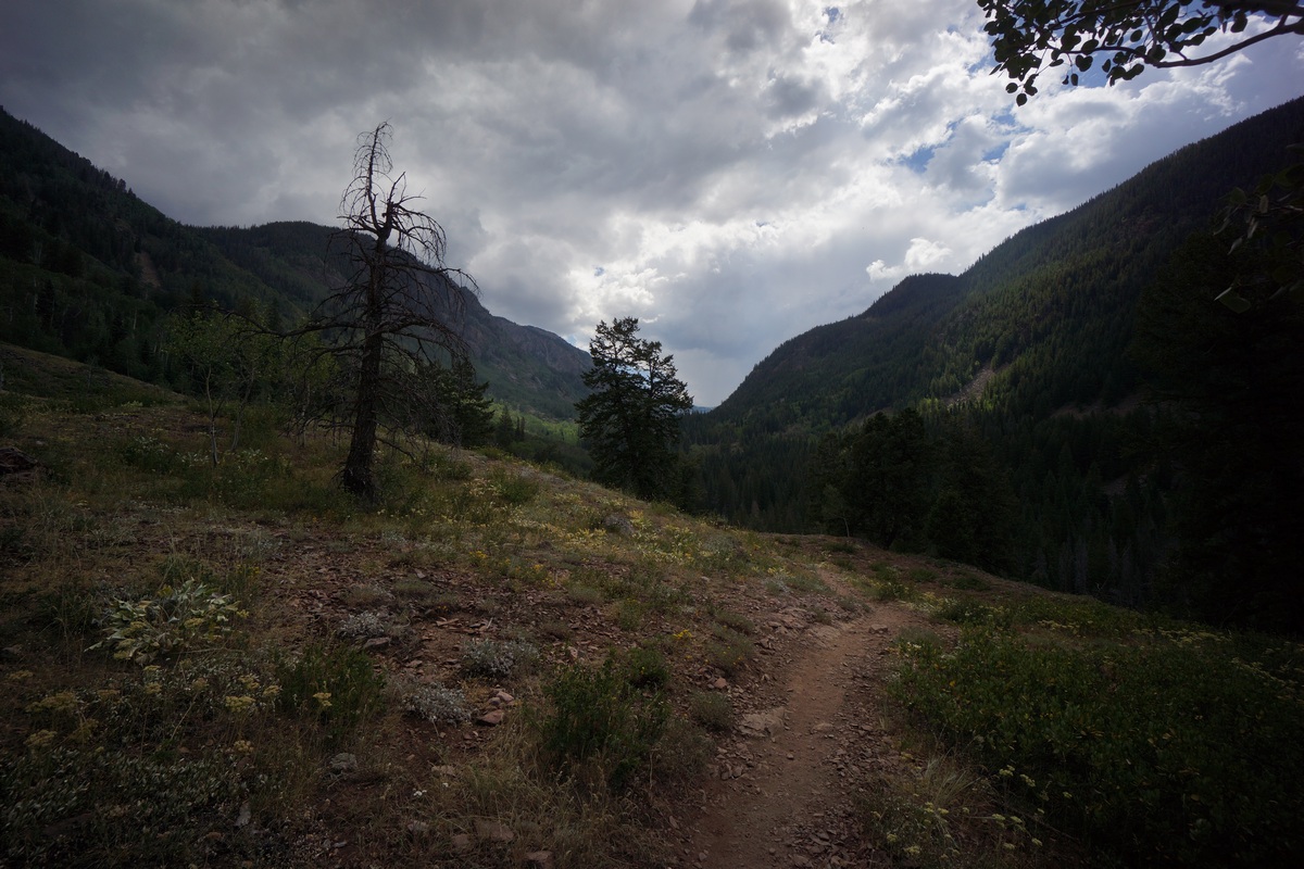
I started my hike at the Gore Creek trailhead (8688′ elevation) around 10:15 am, just in time for a few clouds to start brewing. The trail immediately begins to climb after leaving the trailhead. The trail itself is pretty well maintained here. There’s a sign marking the entry to the Eagles Nest Wilderness after about 1 mile. Once you pass the sign, the trail goes over the top of a small hill where you lose sight of I-70. The sound from the road is also gone, and replaced with that of Gore Creek. The trail winds through a few patches of aspens before the evergreens become the dominate tree with increased elevation.
The crowds of people started to thin out about two miles from the trailhead. Most of the people on the trail were older folks, and seemed to be locals coming out to get a few miles in for exercise. I stopped along a slow bend in Gore Creek after an hour to eat a little food. I didn’t see any fish, but it looked like there would be potential if one were to walk the bank looking for deeper holes.
There were few sweeping views of the valley, and the trail only occasionally swings alongside Gore Creek. The trail maintains a pretty manageable incline much of the way to the intersection with Gore Lake trail, with occasional steeper bursts. I passed a guy who said he’d just seen a large bear at the intersection, which I arrived at about 10 minutes later. No bear, fine with me.
At the intersection of Gore Creek trail & Gore Lake trail, the elevation is 10,180′. AT this point, the elevation gain is roughly 1800′ (with the ups and downs of the trail) over 4.15 miles. Now on the Gore Creek trail, I’ll climb 600’+ in about a half mile. There’s a little view of the valley below after gaining a little elevation. The trail then overlooks a creek, although don’t believe it’s the main creek flowing out of Gore Lake. I saw my first patch of snow around 10,700′.
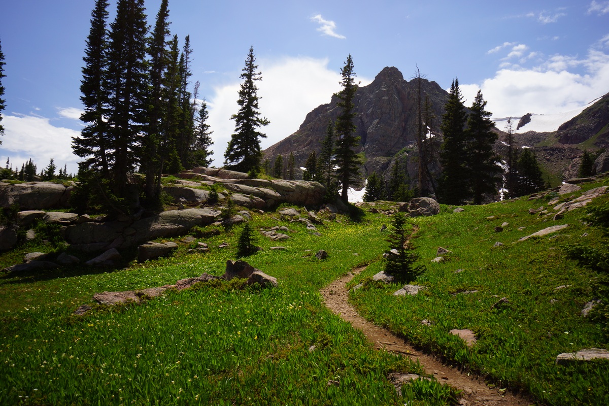
At the top of the 600′ push I was rewarded with a nice meadow. It was flat, open and green, the first of the hike. It sprinkled a little now, but not heavy enough to be a bother. The views were definitely improving now. In the meadow, jagged peaks and snow capped mountain sides loom in the distance. There were some small patches of colorful flowers here and there, still a ways off from peak bloom though.
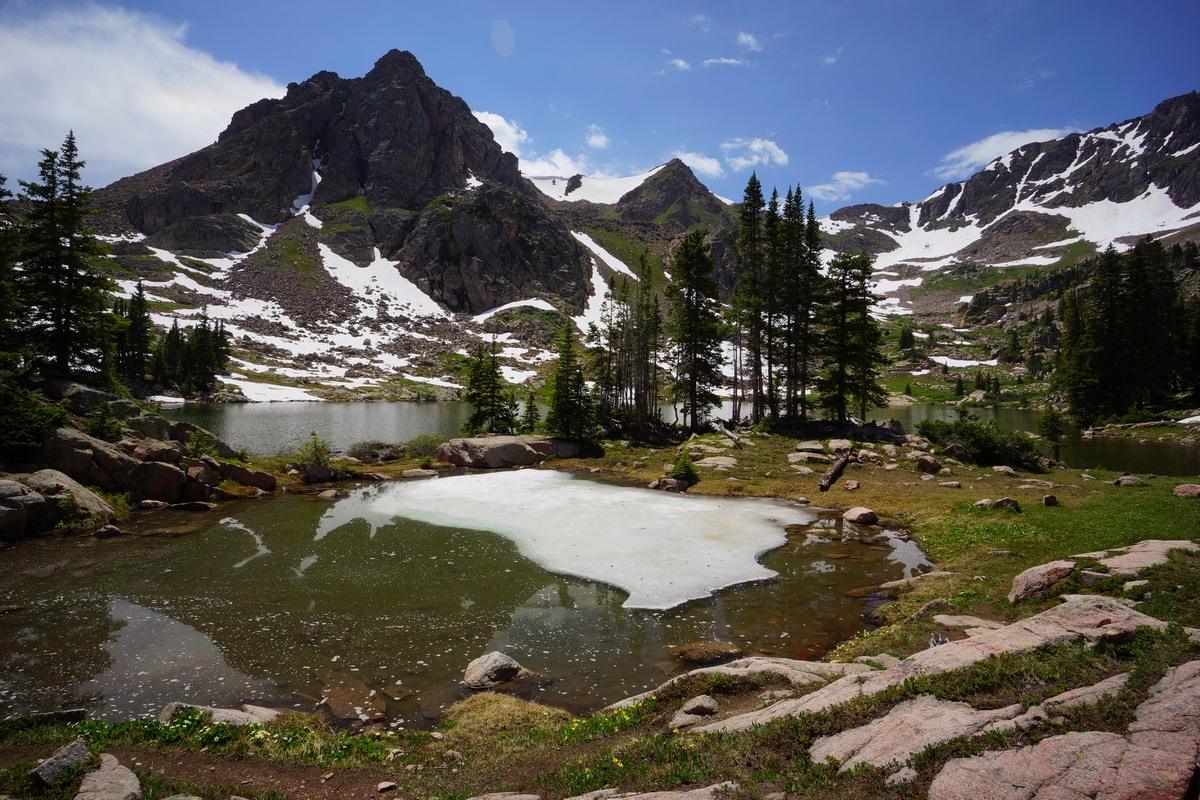
After passing through the meadow, the trail then climbs another 500′ in .6 mile along the final stretch to Gore Lake. I enjoyed the final approach to the lake, where your view of a nearby peak is hidden and then revealed as you crest the top of the final slope. A somewhat “dramatic” way to arrive at such a beautiful lake!
Elk Park/Needleton Loop – Weminuche Wilderness, CO Aug 2013 (Backpacking Trip Report)
Weminuche Wilderness, CO – Elk Park/Needleton Loop Hike
Complete Weminuche Wilderness Photo Gallery | Weminuche HD Video
- Trail Name – Elk Park/Needleton Loop
- Location – Weminuche Wilderness in the San Juan National Forest, CO
- Park Type – National Forest, Wilderness Area
- Fees & Permits – None
- Length Of Time Hiked – 6 days, 5 nights
- Trail Type – Semi loop – Train drops you off and picks you up
- Miles Hiked – 48
- Trail Difficulty – 8
- Fires Allowed – Yes (No fires in Chicago Basin or Needleton drainage)
[sgpx gpx=”/wp-content/uploads/gpx/WeminucheRouteHiked.gpx”]
Elk Park to Needleton Loop Hike Map – Weminuche Wilderness Maps
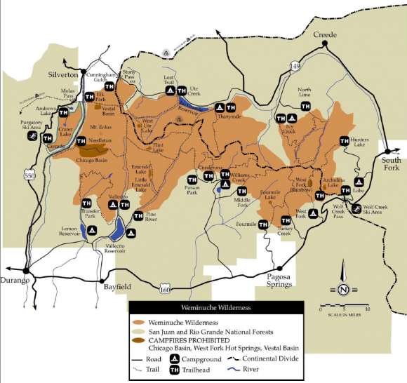
Here’s an overview map of the Weminuche Wilderness, which includes trailhead locations.
Here’s my caltopo map of the Elk Park/Needleton hike:
Fees & Permits
There are no fees or permits needed to hike or camp in the Weminuche Wilderness. However, to hike this trail as I did, you will need to secure a train reservation through the Durango & Silverton Narrow Gauge Railroad. This was $90 each person for a round trip ticket, plus $10 to each to haul your backpack. Not cheap by any means, but it was a cool way to enter and leave the wilderness.
Day 1 – Monday August 5th, 2013
Miles Hiked – 5.4
Route – Elk Park train stop to camp along Elk Creek at ~10,300ft
Finally, it was time to start this hike. We’d been in Colorado a week now, doing other cool stuff like the Colorado National Monument, Mesa Verde National Park, Denver & Boulder, Rocky Mountain National Park, Telluride, etc. This time, we were sure to be acclimated to the elevation. Lisa had a bit of trouble last year in the Maroon Bells when we hiked the Four Pass Loop, and I may have had a slight headache that first day as well. Not this time though! (more…)
Planned Hike – Maroon Bells Wilderness, CO
All summer I have been planning a trip to Isle Royale National Park, an island in Lake Superior, Michigan. For years, I’ve been wanting to go and hopefully catch a glimpse of the Northern Lights, which can be seen here with great clarity. Actually, I haven’t done much “planning” until recently, just thinking about it and putting it off. Two weeks ago I started planning the trip and by the time I called to make reservations on the ship that takes you to the island, they were booked the day I wanted to leave. Sure, I could have switched my dates around, but then that was going throw off my entire plan. To hike here, there are 3 things that need to fall into place. One, the ship that takes you to the island. Secondly, there’s a ship that circles the island. Unless you plan on hiking a 90+ mile loop, you will need to catch this ship at one end of the island to take you back to the end that you started from, so a different ship can take you back home. The third thing is lodging. I was going to leave from Copper Harbor, a very small town with only a handful of small motels which can easily be booked up this time of year. July 15th – August 15th is the most popular time to visit IR, and for some reason I just kept putting off the planning of this trip and pushed aside my fears that something wasn’t going to be available during my intended dates. Sure enough, my plans to visit Isle Royale have been thwarted yet again, for a third year in a row.
Where to now? Well, the place I had my heart set on in May is looking like a prime destination this time of year… Maroon Bells Wilderness in Colorado. When I was planning my hike in May, I really wanted to go here, but there is just too much snow still at that time of the year and I was told that mid June or later is best. I ultimately ended up in the Gila Wilderness of New Mexico as it was one of the highest elevations I could find that was not still snowed in. Now, late July/early August is looking like the perfect time to go to Maroon Bells!

Snowmass Mountain reflection in Snowmass Lake – Photo by Jack Brauer
I have chosen the Four Pass Loop as it has outstanding reviews from those who have hiked it. Here you will find the most photographed mountains in Colorado, the Maroon Bells. The scenery is absolutely stunning from the pictures, which never do any justice once seen in person.
I plan on hiking the Four Pass Loop in a clockwise direction. Here’s the intended itinerary thus far:
Day 1 – Maroon Creek Rd. trailhead to camp on east side of West Maroon Creek around 10,800 ft (4-5 miles)
Day 2 – Camp to Fravert Basin (6-7 miles)
Day 3 – Fravert Basin to Snowmass Lake (7-8 miles)
Day 4 – Summit Snowmass Lake
Day 5 – Snowmass Lake to Crater Lake (6 miles)
Day 6 – Crater Lake to trailhead (2 miles)
Total miles hiked should be around 25-29 miles, not including the summit of Snowmass Mountain. Sure, this trip could be done in 2-3 days, but I am driving 1400+ miles to get here, so why blow past it all in such a short time? I want to hike a few miles a day and have the rest of the day to fish and relax at camp, and play with my new DSLR camera, a Sony Nex-5. Photography beyond “point and shoot” is something new to me, so it’s definitely a learning experience. I bought a bunch of filters for it and have been reading up on outdoor photography, so hopefully I can capture a few good shots.
I will be staying in the Denver area the night before at around 5400ft elevation. I live at 600ft elevation, so I hope one night here is enough acclimation time. The trailhead elevation is around 9500 ft elevation, and I plan on hiking to about 10,800ft our first day. I am hoping this is not too elevation gain in one day without being acclimated a night at 7,000ft or more. I know when I was in New Mexico in May (Gila Wilderness), I had absolutely no problems at 10,600ft after camping 2 nights at 6,800ft, but I am bringing my girlfriend on this trip though and I don’t know how she will react to the elevation.
Hiking the trail in a clockwise direction will also give us a few days at elevation to acclimate before attempting to summit Snowmass Mountain on day 4. Snowmass Mountain is the 32nd highest peak in Colorado at 14,098ft. It doesn’t sound impressive when referred to as the 32nd highest, but that’s just a testament to the abundance of 14’ers in Colorado, which has 53 peaks over 14,000ft! This will be my first 14er (or 11er, 12er, and 13er for that matter), so needless to say I am excited as hell for this trip. So excited that I am not even missing the idea of Isle Royale anymore! Of course I still want to go, but that will be a trip for another time in the future.
I am leaving in about 10 days, so expect a full trip report in a few weeks.
[tcb_comment_count]


