
Jackson to Flagg Ranch – CDT Thru Hike 2018
Continental Divide Trail – Jackson to Flagg Ranch Hike Overview

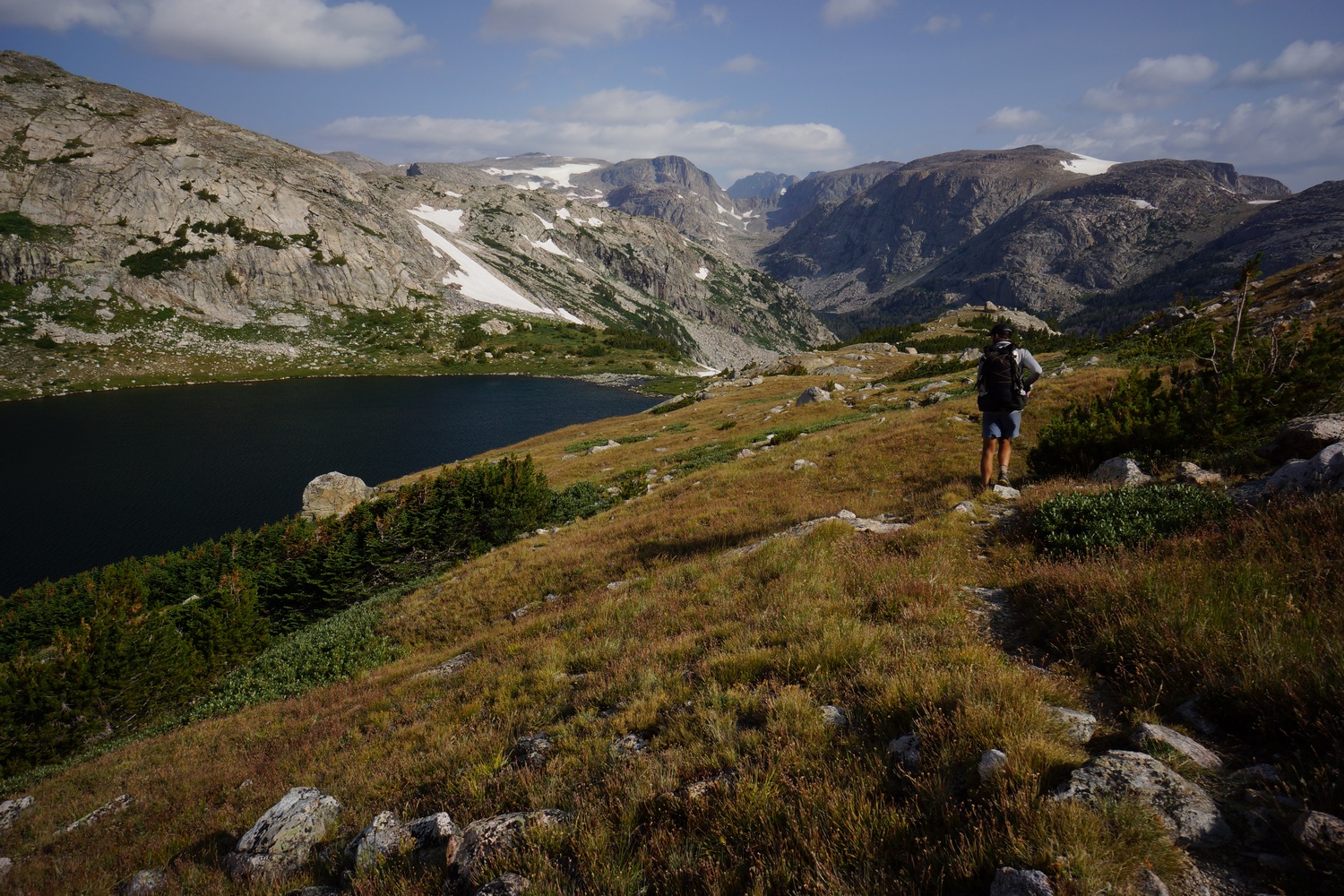
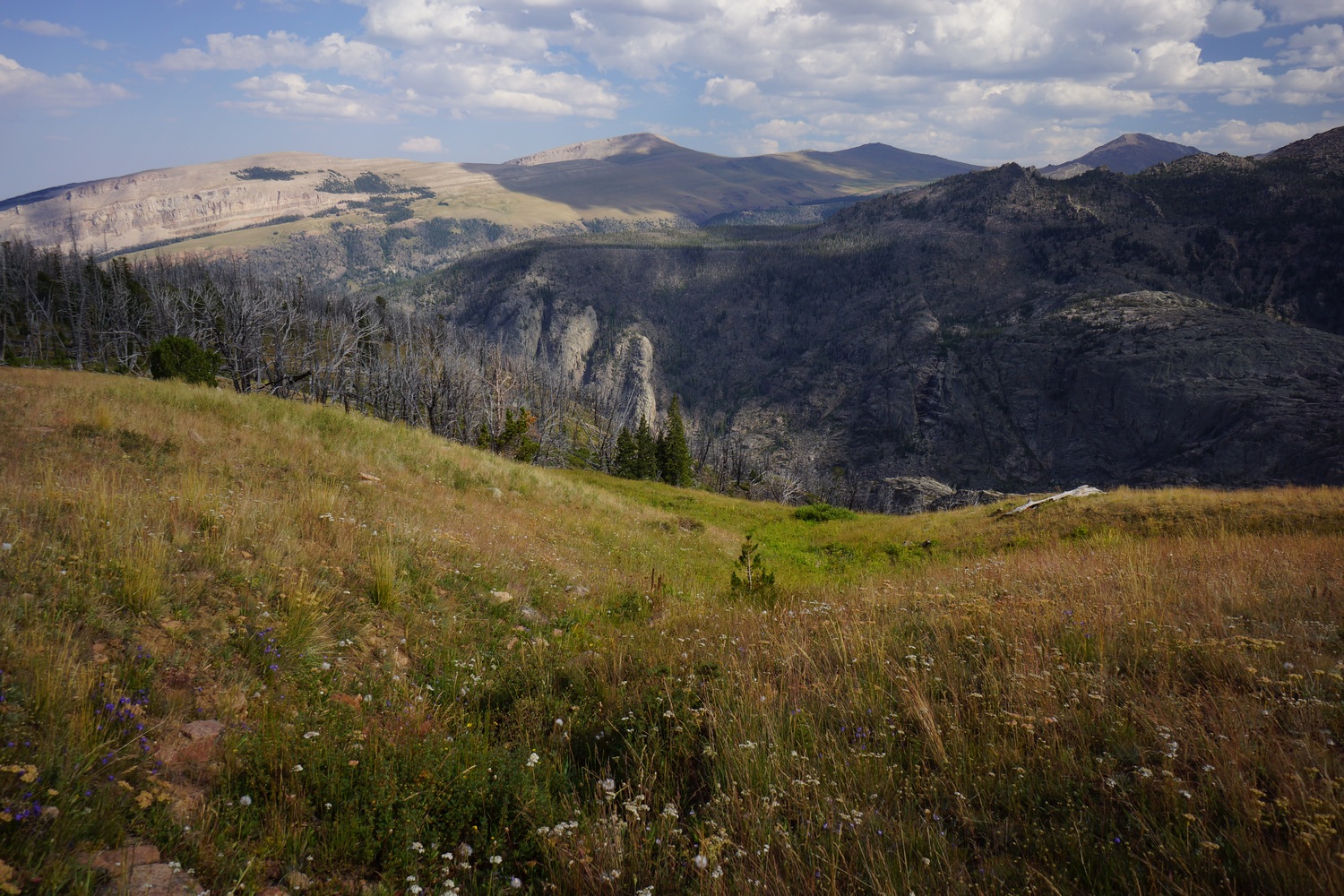
After walking 2 miles into Jackson, resupplying and walking across the valley to Wilson in one day, we entered the Jedediah Smith Wilderness and Grand Teton National Park. We hiked our own version of the Teton Crest Trail winds in and out of both of these land administrations. The Tetons are pretty damn grand to say the least! North of Lake Solitude, we took a steep cross country route out of the basin and over to the west side of the divide. Lots of wildflowers, delicious berries to eat, and bushwhacking!
Thursday August 16th – CDT Day 118
Started hiking at 7. It was less than 2 miles to the trailhead. From there, we walked into Jackson.
When we reached the downtown area, the search for a breakfast restaurant was on. We landed at The Bunnery. Good food, but pricey.
Everything in Jackson is expensive and the people are yuppity. Lots of tourists and tons of traffic. Jackson was not my favorite town stop. Fortunately, we were just getting what we need and walking out later.
We hit up an outfitter, the ranger station and a couple stores. Then we headed over to the rec center to take a shower. They had a pool, hot tub and sauna, so we spent about an hour here taking advantage of the amenities.
Lunch at DQ, then headed to the other side of town. Here, we hit the library for a few hours. Hopeful and I spent some time researching the big sky alternate. Feeling the crunch for time, in terms of reaching Canada by Oct 1st, it was a good idea to have this as a backup.
I called Patagonia to arrange for a new capiline lightweight baselayer shirt to be sent father up trail. Mine has a forearm sized hole in the back.
We then went to the grocery store for food and picked up dinner. Katie found a ride to Wilson, so hopeful and I will do the road walk and meet her there. This will set us up well for entry into the Tetons tomorrow.
I didn’t find Jackson to be very scenic. However, the views were much nicer heading west out of town. The road had a bike path next to it that we followed much of the way. We didn’t leave Jackson till after 8, so it was going to be a bit of a night hike.
There was road construction on hwy 22, next to the bike path. Lots of traffic backed up and honking horns. Kinda hard to deal with after spending so much time in the wilderness.
Katie texted us and said we could camp in the backyard of the guy who gave her a lift. She gave us an address and we headed that way.
We took what liked like a short cut, and it dead ended at a gate with a keypad. No private property signs though. We could walk around the gate. As we were contemplating what to, in the darkness, a truck came flying the corner from the opposite side of the gate. Illuminated by the headlights, all I could do was wave and see who they where and their intentions.
As it turns out, the 5 guys in the truck were trying to take a short cut themselves and avoid some of that traffic. They had just spent last week in the wind river range themselves. When we said we had been walking since April, they have us each a cold beer.
Moments later, another truck pulled up behind the first truck. This was the landowner, and she asked what we were doing. Truck guys said looking for a short cut to pass through, the woman said OK and opened the gate. We said the same thing and she wouldn’t let us walk through. We were only about .3 miles from fish creek road, half mile total from our destination. I mentioned it would be an hour or more detour for us, but she didn’t care. That really sucks!
It was 10:30pm now and we started the long walk around. Back to the road construction, then another pitch dark bike track and country roads with no street lights. I had a terrible headache, and was finding the walk difficult near the end.
We finally reached the house Katie was camping at sometime after 11:30pm. The house backed up to a river, and were told to camp there near it. Fine. I know there’ll be condensation in the morning, but I’m so tired I don’t care. Cowboy camped under the stars. Fell asleep around 12:30am.
Miles – 18
Total Miles – 1939
Rain – no
Sleep – backyard, tent
Animals – deer
Friday August 17th – CDT Day 119
Sure enough, everything was wet this morning. Got up at 7 since hopeful and Katie were already awake. Packed up and went to a bagel shop down the road for 2nd breakfast. Already ate leftover chicken strips and croissants earlier.
Stated hiking hwy 22 up to Phillips trailhead sometime around 9:30. It was already hot out. The road walk kinda sucked with all the traffic and vehicles that don’t get over a little when they pass by. Some came awfully close.
Lots of cars at the trailhead. The people faded out when the trail split off for ski lake. The views also began to open up.

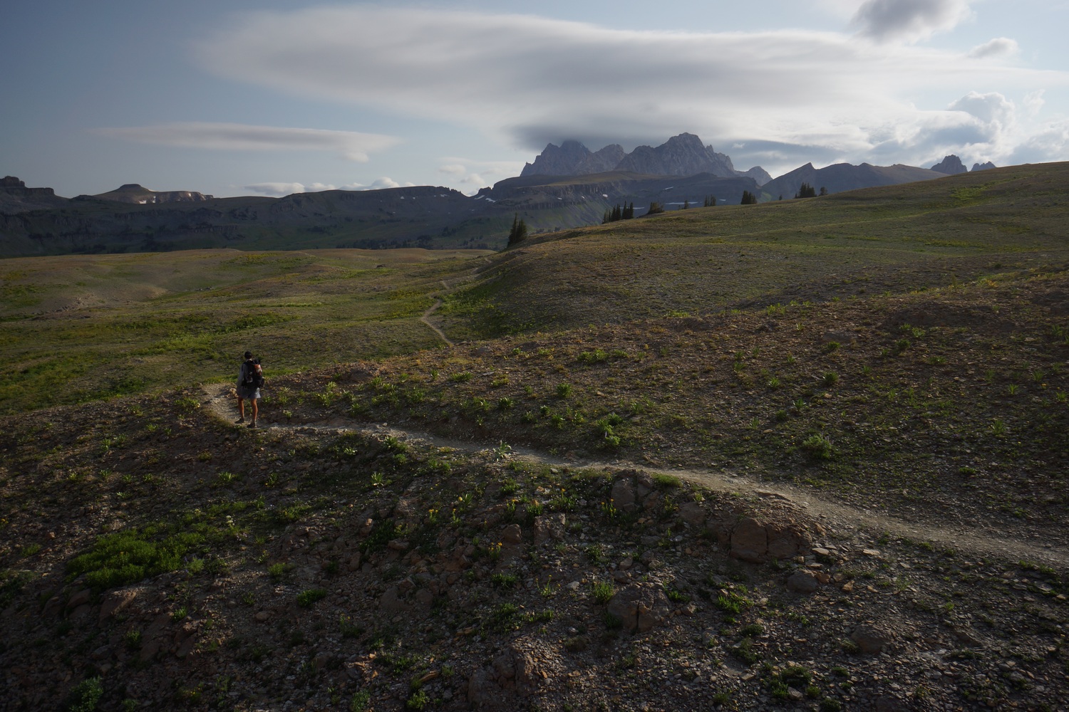
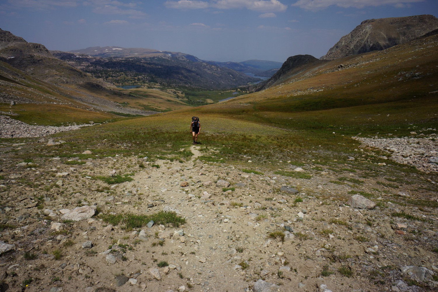
Lots of wildflowers high towards the pass. Good view at the top. Now we enter the jedidiah Smith wilderness and begin the teton crest trail.


The farther we hiked, the better the views became. The trail winds into a new valley. On the other side, rock formations that look like they’re part of a castle. Beautiful.


On the next pass, we entered grand teton National park. The trail winds back and fourth between the national park and wilderness throughout the teton crest trail.


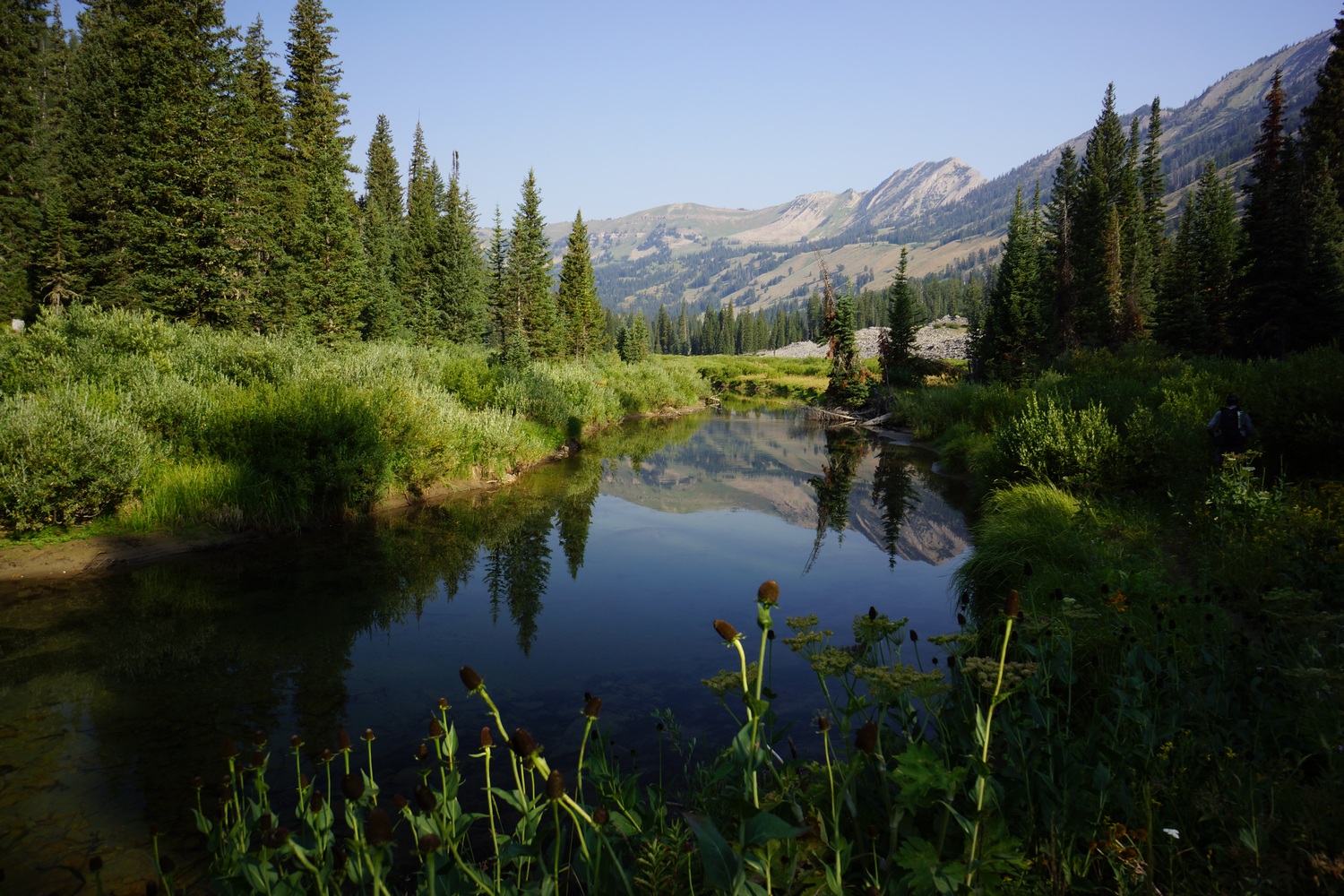
The trail passes by Marion Lake, a really nice spot. The kind of place you only dream of camping on the CDT. But as always, there’s more miles to cover before I can feel good about the day’s progress.


Great views continue. Good trail, helps to keep a good pace. There was a lot of climbing today and with heavy packs, it was tiring. I listened to some music today for the first time in a while. This helped keep me going.


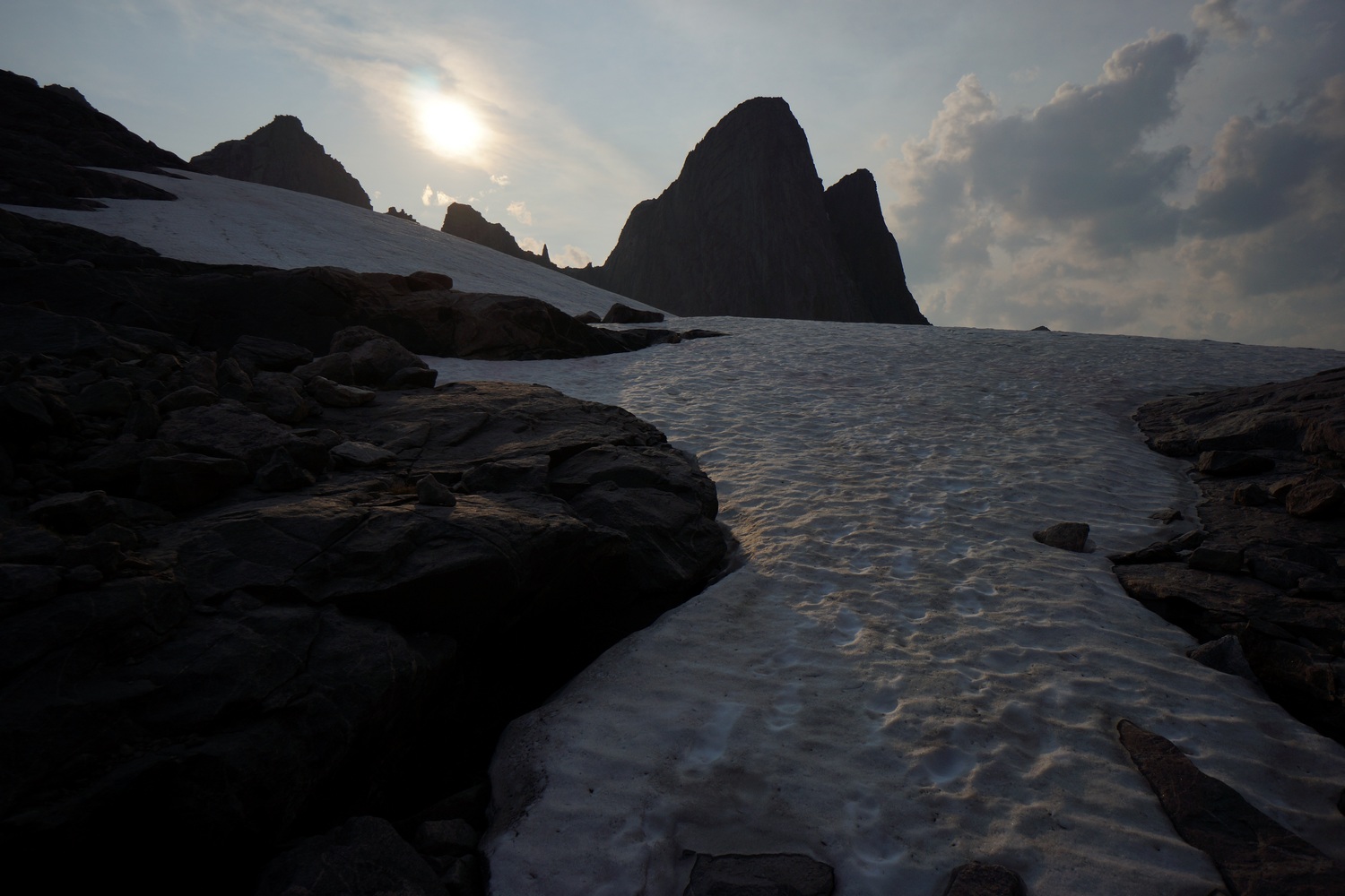
A few more scenic miles and we were approaching the final pass leading up to death shelf. I’ve seen some great pictures from this area and so I was looking forward to it.

Death shelf did not disappoint. However, it was overcast and it killed the sunlight, so it was not as photogenic at I hoped for. There’s always tomorrow.
Miles – 21
Total Miles – 1960
Rain – no
Sleep – Backcountry, tent
Animals – marmot
Saturday August 18th – CDT Day 120


Nice hike this morning coming out of death shelf.


The Tetons have been looming on the horizon for many miles now, growing bigger with every step. Amazing views in an otherworldly landscape!


Alaska basin was nice. Mainly, the northern section. Tons of wildflowers.


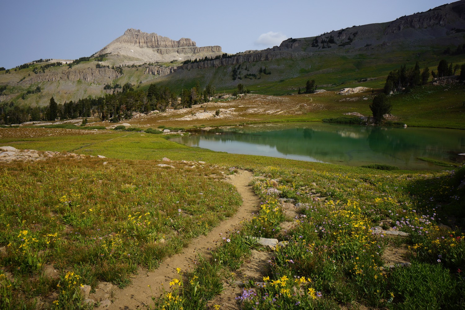
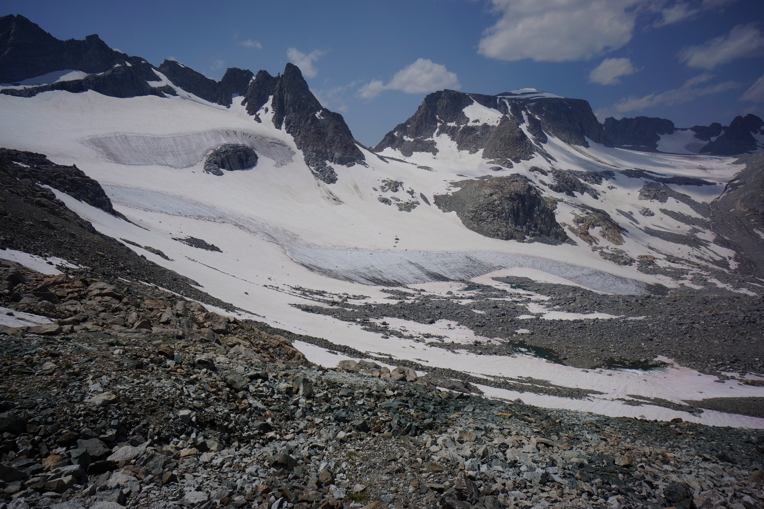
Grand Tetons and Schoolroom Glacier


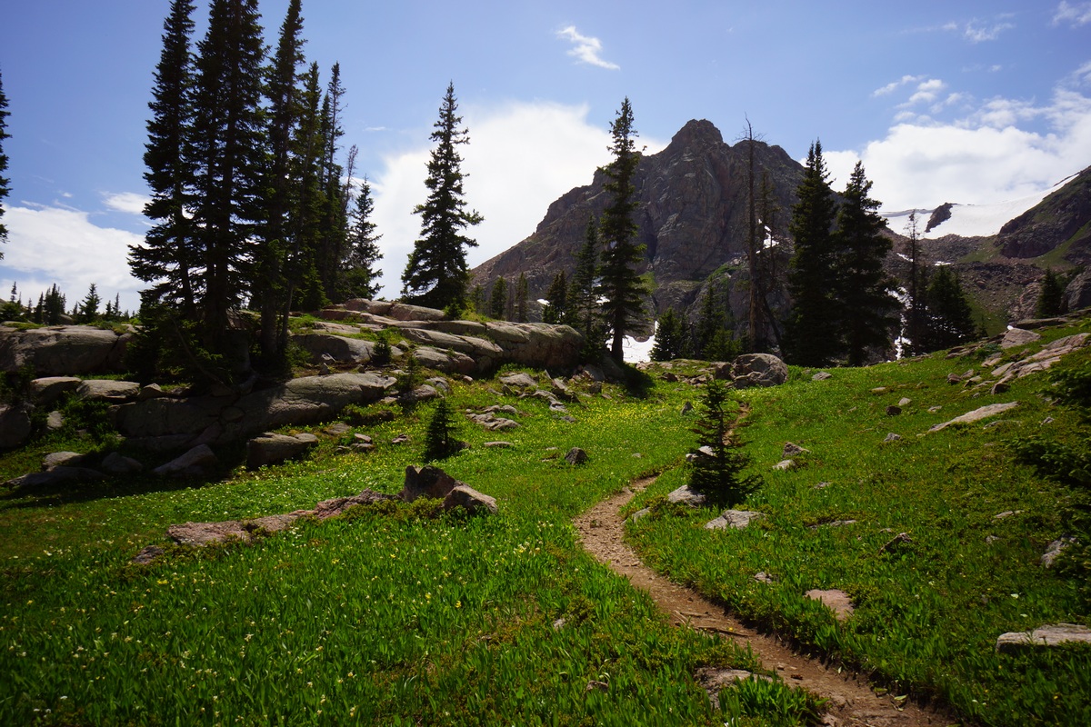
At the top of hurricane pass was our first unobstructed view of the three tetons; grand, middle and south. Incredible! Oh and fun fact, tetons is French for “tits”. French fur trappers who discovered the area named it as such because the pointy peaks reminded them of boobs. Grand Tetons literally means “big tits”.


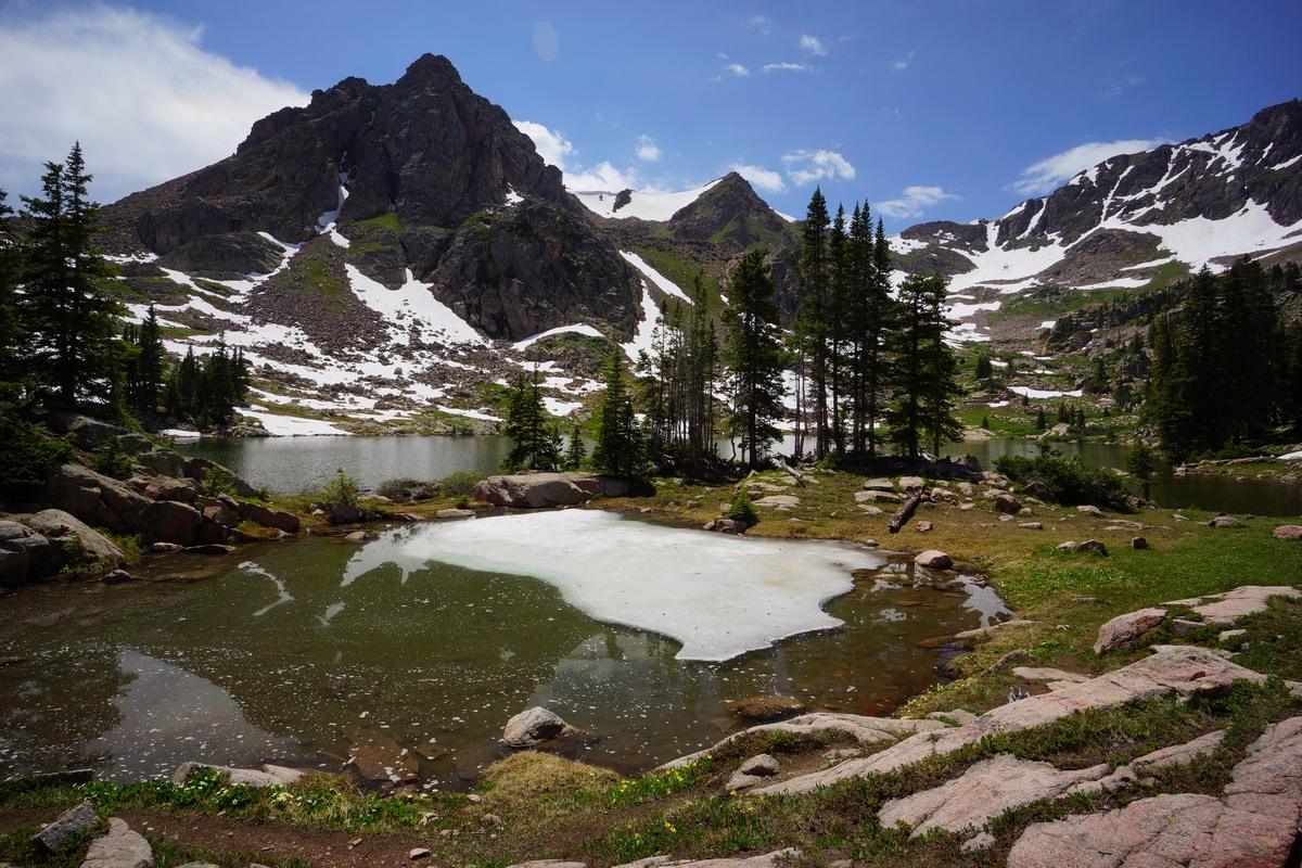
Below hurricane pass lies schoolroom glacier. It has a large moraine that was now acting as a berm to hold back a small lake. Icebergs in the lake, beautiful water.


The upper cascade creek area was just incredible. On par with the wind river range. Our pace reflected this too.


Rain clouds building on and off. Hiked down to the junction with solitude lake, and took this trail uphill. Saw a Moose on the way up.

Lake Solitude and The Grand Tetons

Awesome views from Lake Solitude. Tons of people here too. Pretty ironic name if you ask me.


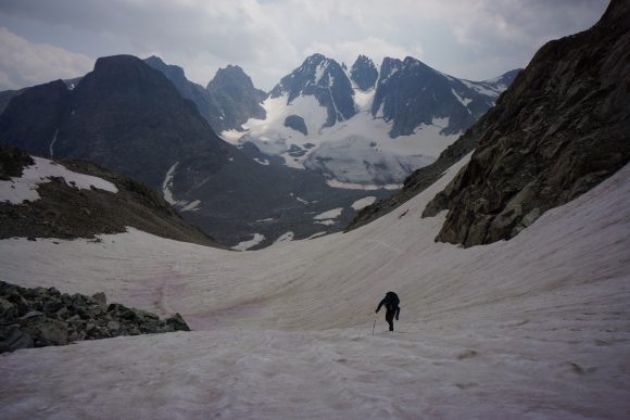
Now it’s time to climb out of the basin. Around the lake and up hill. Some steep rock climbing with limited holds involved.

Now up on the highest shelf, we could see no easy way to the top anywhere. The skies were also pitch dark and looked like rain at any moment. We made the call to head back down to the lake.
May try another way out of the basin tomorrow or head up paintbrush ridge in order to drop down to mink lake to try another way over the crest.
Miles – 20
Total Miles – 1980
Rain – yes, light
Sleep – Backcountry, tent
Animals – marmot, moose
Sunday August 19th – CDT Day 121
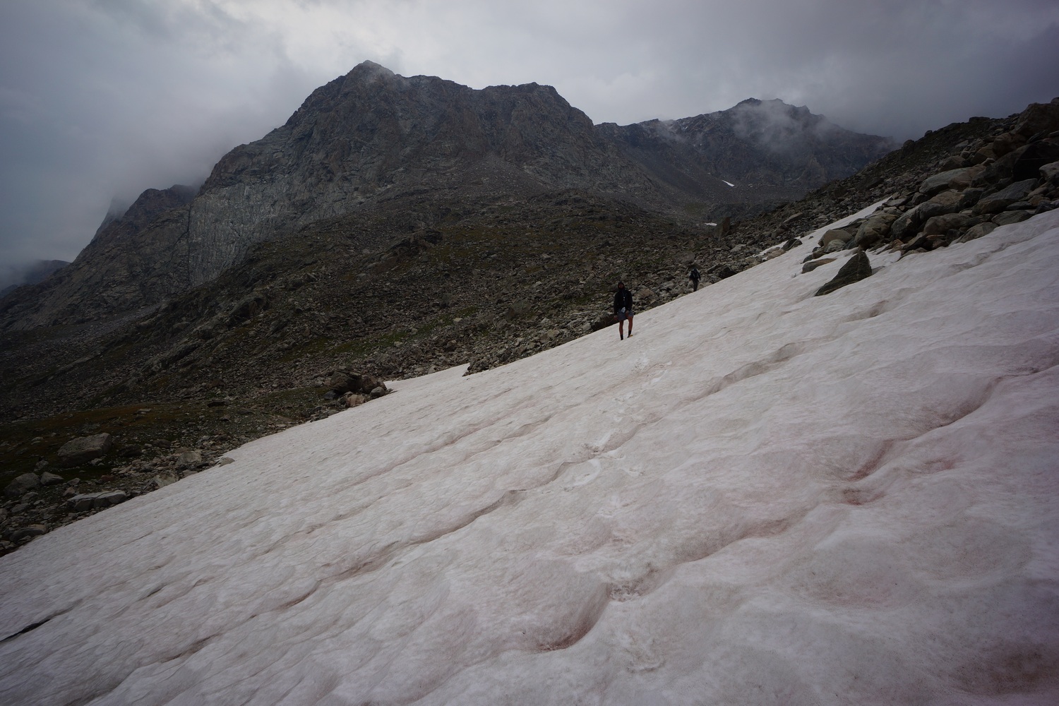
Started hiking at 6:30am. I spotted another potential exit from the lake solitude basin. It was a grassy chute that looked increasingly more appealing the closer we got. It was steep, but not as bad as last night’s failed route.
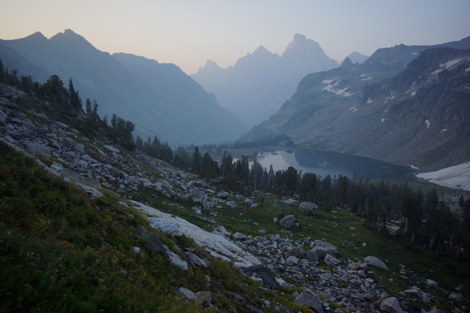


Made it to the top of the chute. It was hazy today due to forest fire smoke, coming from who knows where. Nothing close by to my knowledge. Grand Teton was a prominent feature looking through the haze. Really incredible views from here.


After the chute, we walked over some talus fields and pools of melt water on relatively flat ground. Not what you think of when you imagine mountain ridgelines. More impressive views on the other side of lake solitude.

Next we followed a ridge over to Littles peak. It was a bit of a knife edge for a hundred yards or so. Pretty cool!


We traversed around Littles peak instead of going up and over. This was mostly a great choice, avoiding elevation gain and boulders. First half was grassy and somewhat flat. Then it became steeper and took some work to find a way down.


Lunch break by a steam, then moved on. Nice walking for a while. Passed some scenic little lakes which reminded me of a scene in the Sierras for a bit.


The trail then goes up and down for a while. Nice little basins and ridges.


We took a break at a stream above bitch creek. Yep, bitch creek, that’s the name. Descended to the creek then ascended dead horse pass. Something like 1800′ in 1.1 miles. No wonder why they call it dead horse pass… The horse is dead by the time it reaches the top. Just like I felt. Great view and break spot at the top though.


We made quick work of the descent. Covered good ground through the valley and took another break before the ascent to camp lake.

The first part of the climb to camp lake was the steepest. Pretty steep for about a mile. The terrain flattens out some before the lake but I was already whooped at this point. Hopeful and Katie were ahead waiting for me at the lake. It was 7:30pm now, and we decided to stop here for the night.
I went to bed around 8:15 tonight since I was so tired. Katie and Hopeful stayed up and had a campfire. Today involved a ton of climbing, at least 5-6k feet.
Miles – 19
Total Miles – 1999
Rain – no
Sleep – Backcountry, tent
Animals – deer
Monday August 20th – CDT Day 122
Left camp lake at 8am. We’re hoping to make it to flagg ranch today, or at least very close.

We followed good trail up to a junction for nord pass. From here we needed to take a trail that was on the map but didn’t seem to exist on the ground. More bushwhacking, Yay!


We eventually picked up a faint trail that looked like it hadn’t been used or maintained in many years. Made it to the pass that will drop us down into Webb canyon and enjoyed a hazy view. I hit my 2000 mile mark here which was a nice milestone.

The route down was off trail but an easy grassy slope. We hit trail and followed it down to Moose creek. However, this is where the trail ended.
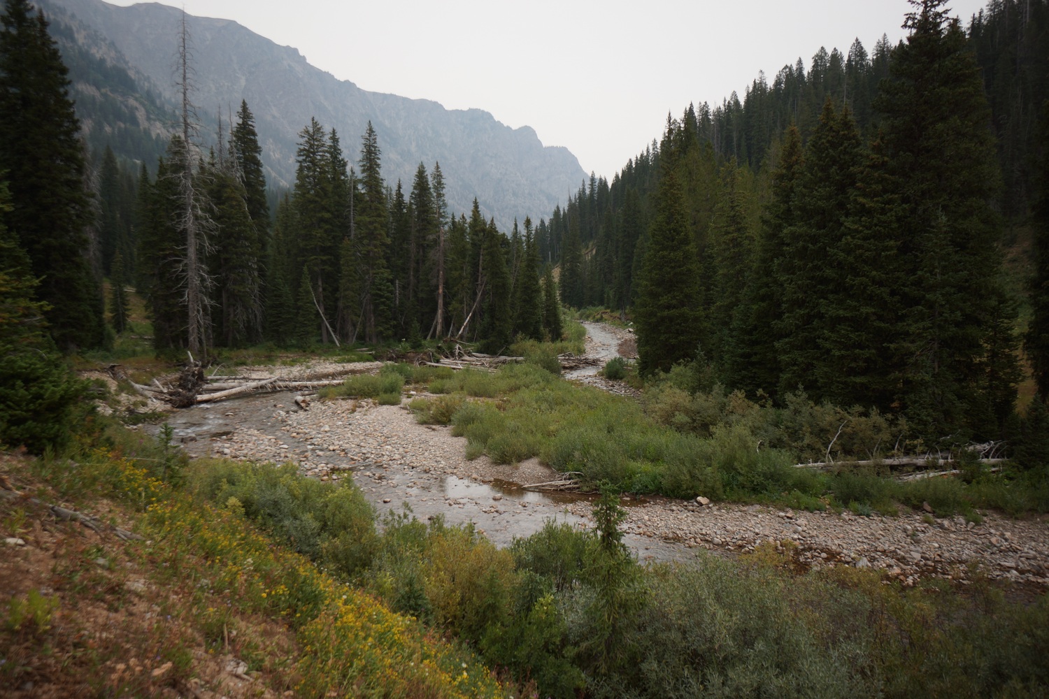


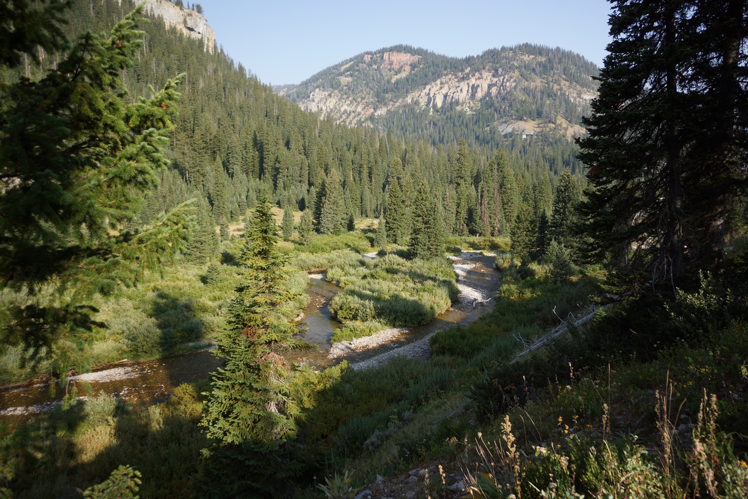
We crossed moose creek over some downed trees, the last time we’d keep our feet dry. From here on out, it was a nasty bushwhack. Steep slopes, thorn bushes, downed trees and tall vegetation hiding holes, rocks and sharp downfall. This forced is into the river a few times, just walking downstream. The water was cold though, and progress was limited to how long you could stand the pain. This was one of the most difficult sections of bushwhacking I’d face along the entire CDT.
After a couple miles of the above, we hit a poorly maintained trail that faded in and out for a mile or two. More bushwhacking, but not as nasty. After passing through a meadow, the trail seemed to be maintained like normal. Great, because we still have a lot of ground to cover now.
Took a break and was surprised to see 4 hikers coming up the trail. They were seasonal NPS workers heading up to a cabin for a week. Here, they’ll be on the lookout for big horn sheep and mountain goats, studying their numbers and location, etc. We told them, “good luck” with the trail above the meadow. We figure, once they see how shitty it is, maybe they’ll put in a work request for trail maintenance there. But if it goes by how much traffic the area gets, forget it, it’s never getting done.

The next section had some nice waterfalls, lined with vibrant wildflowers. Also, lots of blueberries and raspberries growing along the trail. We stopped to pick some along the way. Delicious!
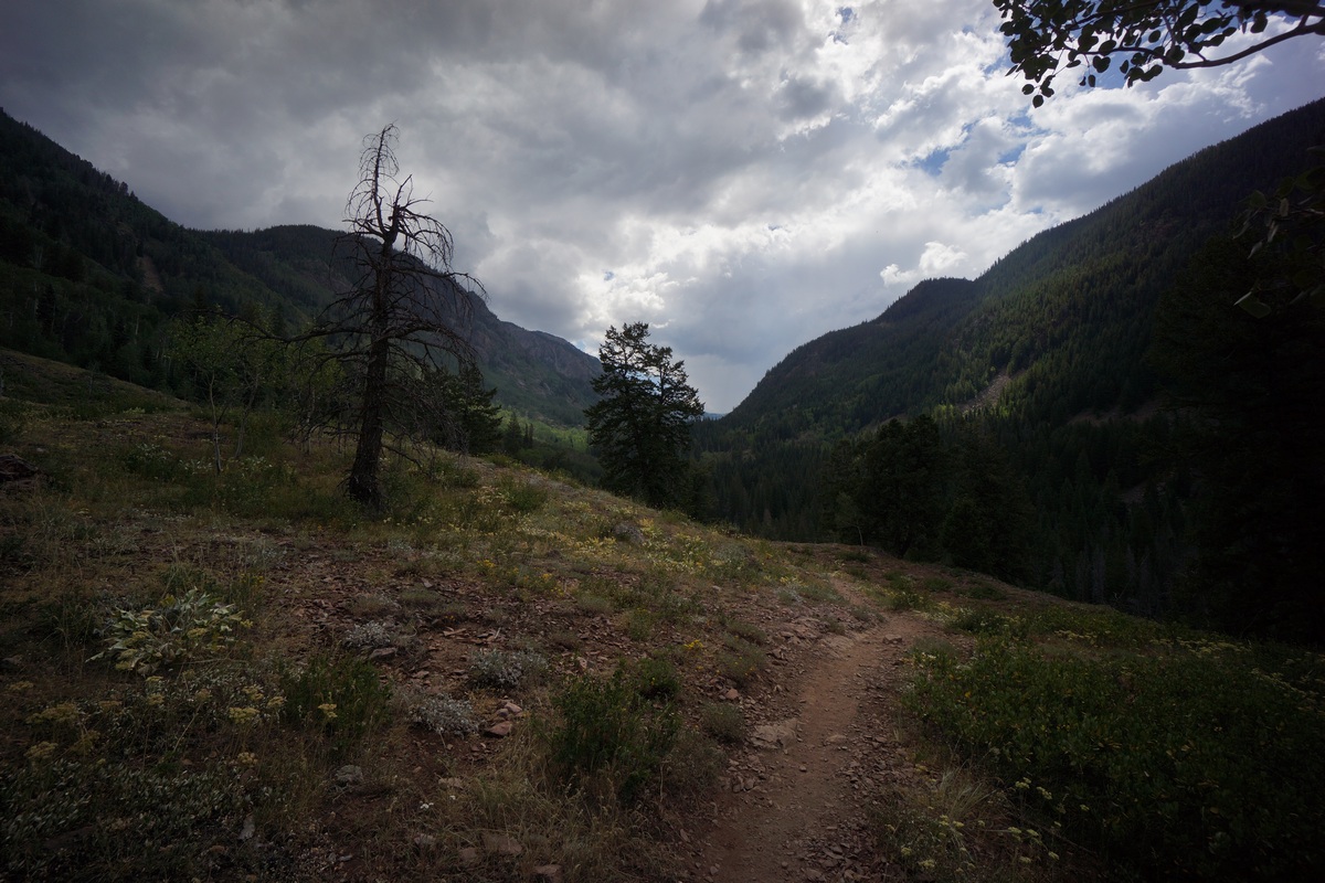
As we entered a burn area mid afternoon, it started raining. It rained for an hour or so, but we hiked through it. We could now see Jackson lake in the distance.


As we neared the lake, the weather cleared. We reached the berry creek ranger station around 4:30pm and took a break. From here it was 8 miles to grassy lake Rd, then a couple miles of road walking to flagg ranch.

After our break, we decided to go for flagg ranch. It was now sunny and we were in good spirits. The trail was not the most scenic which helped us cover good ground without many stops for pictures.
We reached grassy lake Rd a little before sundown. We walked into the darkness and made it to the ranch around 9:45pm. We checked in and got a tent site. The general store was still open so I bought a couple of hot pockets to stave off the hunger. On a side note, every time I would blow a snot rocket on trail, I get the Hot Pockets jingle stuck in my head, but using the words “Snot Rockets” instead. That’s not gonna leave ya now is it?
After setting up camp in the dark I took a nice hot shower. Almost as good as a hot tub. Looking forward to sleeping in tomorrow.
Miles – 28
Total Miles – 2027
Rain – yes
Sleep – campground, tent
Animals – deer,
Tuesday August 21st – CDT Day 123 (zero day)

Slept in til 9am. Headed over to the lodge and had the breakfast buffet. It was a bit subpar but nevertheless, I filled up. I then picked up my boxes from the front desk… Food from dad and a new pair of shoes from REI.
Today was spent organizing food and planning out the next town stops and route for Montana. Did laundry as well.
Ate dinner at the lodge. One of the best burgers I’ve had on trail. We then had a fire in camp and drank some whiskey.
Tomorrow we head into Yellowstone.
Miles – 0
Total Miles – 2027
Rain – no
Sleep – campground, tent
Animals – none
Related Images:
Dubois to Jackson – CDT Thru Hike 2018
Continental Divide Trail – Dubois to Jackson Hike Overview

Leaving Dubois, we had another 2.5 days of hiking to cross the northern Wind River Range. This proved to be much more difficult than anticipated, exceeding our time estimates. Road walked from Green River Lakes west to the Gros Ventre Wilderness. The Gros Ventre sees few hikers, and has few established trails as a result. Off trail adventures continued here on fields of snow and boulders, and involved some sketchy moments scrambling down steep rock faces. Once again we found ourselves low on food and hungry, only this time with a different outcome. This section was full of adventure and very scenic, among my favorites of the whole trip.
Friday August 10th – CDT Day 112
Woke at 7. Went to breakfast then finished packing. Liz, the owner of the motel, gave us a ride to glacier trailhead where we left off. Katie didn’t want to do a section of road walking that Hopeful and I were doing, so she had Liz drop her off about 6 miles back down the road we came in on, and we’ll meet Katie there.

The road walk was, well, a road walk. Not much to say about it other than easy walking for once.
Katie was hanging out at this wildlife viewing pavilion thing in the shade. We joined her for a while, happy to get out of the heat.
Resumed hiking around 12:45. After a short road walk, we jumped on a trail that took us over a ridge. On the other side was a scenic little valley with a ranch.
The trail took us right into the ranch. Not sure exactly where the trail continues through the ranch, we stopped at the office to ask. We were on private property, but the owners gave us permission to pass through. They also gave us ice water, cookies and a loaf of coffee cake!


The valley beyond the ranch was nice. Eventually we left the ranch and entered public land, although this boundary was not marked.

Crossed a river and then took a break. After this, the trail was thick and had lots of blow downs. Also lots of boulders and a little scrambling. Tough section. We lost the trail many times.
Came to another stream crossing. The stream had a steep cut bank that was sketchy getting down. I slipped and cut my hand. Used super glue to close the wound.
Continued uphill on an increasingly better trail. Found some raspberry bushes with some tasty berries. Reached a flat spot that had good camping near a stream, and decided to stop to make camp. We packed out two beers that we put in the stream to get cold for later.

Made a small fire, my first on trail, and enjoyed our one beer with dinner.
Miles – 15
Total Miles – 1816
Rain – no
Sleep – Backcountry, tent
Animals – none
Saturday August 11th – CDT Day 113
Woke at 6. Lots of stars last night.

The trail climbs uphill immediately after leaving camp. Went over a ridge then dropped down to a small lake. Kept going and made it to Simpson lake a short while after. Took a break at Simpson.


Followed Simpson lake’s Inlet Stream uphill. It was beautiful here with snow capped peaks, blue lakes and green grass. Stopped at pinto lake for a swim.


Next the trail goes uphill to a pass. It’s scenic and mostly gradual, but had a few steep spots. Good views on the other side of the Divide, so we stopped at the top of the pass to eat a snack.


Excellent views coming down the pass. Found our route down despite the steep grade.


Reached a cliff that forced us to hike around. The new route required some down climbing with a little exposure. This took us a while to find a doable route down, and the doing was slow and sketchy.


Down at roaring fork river, we needed to cross. The bank was very steep and loose, but we traversed it to a point where a safe river crossing was possible. This, and the cliff above, took about 3 hours!

The river Bank was thick, thorny and rocky for a ways. We ended up crossing again. Picked up a small trail and followed it downhill.
More obstacles… Boulder fields and thick vegetation. Came across 3 guys camping along the river, wasn’t expecting this here. Very little traffic in this area. They pointed us to a trail a hundred yards away. Back on track.
Walked another few miles before finding camp along the river at a bridge.
Miles – 20
Total Miles – 1836
Rain – no
Sleep – Backcountry, tent
Animals – none
Sunday August 12th – CDT Day 114
Last night, We agreed to sleep in to 7am is morning. The extra hour of sleep felt great.


Crossed the meadow with roaring fork running through it. Hiked trail on the other side of the river for a while, before it faded out.
Crossed roaring fork River again, it was cold! Took a short break after.

Trail goes over a ridge and into the valley containing green river lakes. Squaretop mountain can been seen in the distance. Beautiful.

Hiked down to the green river. It was wide but shallow enough to cross. It was a few inches above the knee on me. Fun fact: This is the Colorado river’s largest tributary.
Now it was a long road walk. Katie immediately began planning to hitch down the road to avoid it. We stopped under an awning to figure out the logistics of where to meet up later, etc.
Katie very quickly secured a ride with a guy parked on the side of the road. Hopeful and I continued on our road walk. I guessed 10-12 miles.


The Green River
The scenery was pretty nice overall. The Green river winds along the road for most of the way.
We saw Katie sitting under a tree along the road a few miles before the bridge. After a few minutes of sitting together, a couple atvs pulled up. Really nice people… Gave us cold beers, drinks and were just nice to talk to. Wyoming locals, they’ve been pretty friendly thus far. Then Katie hitched with them to the bridge while Hopeful and I walked. Continuous footsteps to Canada, that’s what it’s all about for Hopeful and I.
A few more miles and we reached the bridge. Took a food break here then moved on.
The three of us were now hiking together again. We’re now following a dirt road towards the Gros Ventre Wilderness. Nice walking.


Hiked a few more hours this evening. Nice calming and relaxing landscape. Rolling hills, sage brush and the sun low in the sky.
Found camp on a small hill along the trail at 8:30pm.
Miles – 25
Total Miles – 1861
Rain – no
Sleep – Backcountry, tent
Animals – elk, pronghorn
Monday August 13th – CDT Day 115

Hit the trail at 7am. Meadows and forest as we descended to the creek below. Passed an old mining operation.

Crossed the creek and took a break. Hopeful saw an animal that looked like a cat, and was about the same size. Probably bobcat.


Entered the Gros ventre wilderness. So far, we had trail. Passed an old wagon. Saw bear shit and tracks.


The trail disappeared as we headed up hill to the pass. It was a pain in the ass due to the thick brush, catching each step.


Passed a couple of nice lakes. Looks like very little use here.


The route up the next pass was littered with large pits under he rock towards the bottom. The hole in the ground would look small, but underneath would be a larger than expected pit. Interesting. Gonna have to watch my footing here.


On the top of the pass, it was a nice but daunting view. Lots and lots of boulders, very barren looking. Found a route down though steep and loose rock. Very sharp too. Climbed many ridges up and down to cross the main valley, and started up hill to a small saddle.


The saddle provided a view of snow and boulders. More hard work ahead.
Now to skirt the mountainside. Steep boulders, and sharp. Truly horrible. However, we did find some really cool rocks. Geode like rocks with crystals. Lots of yellow in the rock. Bagged a few to take with me.


Crossed a couple of snow fields. Micro spikes would have been nice but didn’t feel too bad without. We sent these home in Dubois after the Winds. Hopeful slipped a slid a little. A couple times actually.


Took a break after the snow fields. Lots of huge slabs of razor sharp rock to walk on now.


We headed up to the top of the ridge where we’ll cross and get down into the next valley. Only problem is, it’s all sheer cliffs. Beautiful scenery though!


Walked to the last saddle on the ridge. At first, it looked like no way down. Then I spotted a steep, but doable, chute to down-climb. Looked to be about a 60ft climb.


Hopefull went first and scouted the route. Katie followed, then myself. The climbing wasn’t as bad as it looked. However, we were now faced with a steep and loose scree field. We slid on our butts and somehow avoided cutting up our hands too badly.
Made camp right below the crazy wall we just descended. It was 8:45pm now and almost dark. Beautiful spot though.
Miles – 19
Total Miles – 1880
Rain – no
Sleep – Backcountry, tent
Animals – elk
Tuesday August 14th – CDT Day 116


Last night’s nightmare wall was this morning’s scenic view. Just awesome.


Hiked up a small pass above camp. Now we could see the long ridge we needed to walk around. Looks like lots of ups and downs on Boulder fields.


We took a lower route to Steamboat peak, which we’ll hike around.


Made it around Steamboat peak and was rewarded with an actual trail to follow. Hiked down to a small pond on a shelf. Lots of wildflowers and a great reflection.


Below the pond we came across shoal lake. Another beautiful lake. The outlet was lined with colorful wildflowers as well.


This whole drainage is just incredible. No wonder it was its own wilderness… The shoal creek wilderness study area. Great trail and awesome views.


The trail drops downhill and through an old burn area. It then crosses the creek and goes uphill again, over the opposite ridge.
The next section of trail is less scenic. Lots of woods and low brushy, weedy plants. Then a burn area. Super.

Finally, we reached the trailhead and a road. Now it was decision time. We had very little food, basically enough for the rest of the day. Jackson was still about 30 miles away, so another day of food was paramount. We didn’t want a repeat of the winds, hiking a full and difficult day on a handful of m&ms.
We walked into a nearby ranch place, which ended up being a school of some sort. There was a guy riding around on a mule, and we informed him of our food predicament. He told us to sit tight and returned with 3 bags full of food. Ham and swiss sandwiches, nuts, apple, cheese, granola and dried fruit. Perfect! This was a real help.
Still, we could use a little more food. We’re hungry thru hikers after all. We then proceeded to chat with an older woman named Jean camped by the river in a huge rv. She offered to drive us to to the granite hot springs about 2 miles up the road to check what concessions they have.
The hot springs had chips, soda, granola bars and some candy. We picked up a few items and headed back. In the parking lot, couple from Texas gave us some granola bars, cold waters and 2 beers. Jean was then nice enough to give us a huge bag of chips, 6 cokes, and some canned foods back at her rv.
Feeling good about our food supply, we headed out. We decided to hike the granite creek trail instead of the granite highline trail, since it looked like It would have a better trail and was more gradual with its elevation gain. We stopped to eat dinner in the granite campground, eating the heavy and most garbage producing foods first.
Hiked up stream along the granite creek trail about 2 miles past the hot springs and found a nice campsite.
Miles – 19
Total Miles – 1899
Rain – no
Sleep – Backcountry, tent
Animals – deer
Wednesday August 15th – CDT Day 117

Hiking at 7. Great trail, allowed us to cover good ground. Steep sided mountains and cliffs line the canyon.


Morning was very pleasant but uneventful. Just knocking out miles through beautiful country on a legit trail for once.

Made it to the top of the pass going over to cache creek around noon thirty. Lunchtime. With cokes!


The other side of the pass was beautiful too. Great hiking and very enjoyable afternoon.
Down at the bottom of the valley we hit the cache creek trail. 9 miles to Jackson according to the sign.
Good hiking but nowhere to camp along cache creek. Hiked to about a mile before the trailhead, where we found a decent spot. It was only 6pm, early for thru hikers.
I used the extra time to wash up in the creek, gather sticks for and build a fire, and catch up on some journaling. Clearly I didn’t feel like writing much today. Great evening by the fire.
Tomorrow, we Jackson!
Miles – 22
Total Miles – 1921
Rain – no
Sleep – Backcountry, tent
Animals – deer
Related Images:
Lander to Dubois – CDT Thru Hike 2018
Continental Divide Trail – Lander to Dubois Hike Overview

The first 30 or so miles are a lead up from the lowlands of the great divide basin desert into the high country of the Wind River Range. The next 120 miles were the most challenging, beautiful and amazing outdoor experience of my life. I had more adventure in these 10 days then the rest of the entire CDT combined. Jagged peaks, frozen lakes, glaciers, crevasses, abundant wildflowers, miles of boulders and snowfields, mountain lions, big horn sheep, steep snow traverses, scrambling and climbing, milky glacier fed rivers, and almost NOBODY to share it with. Additionally, the majority of this route is off-trail. In my opinion, the Wind River Range offers the best high alpine backpacking experience in the continental US.
In the southern Winds, we left the official CDT and began the 450+ mile alternate route I created. My route, now affectionately known as the “Famous Route”, takes a much higher route through the Winds and into Dubois, then back through the Winds and cross country through the Gros Ventre Wilderness and into Jackson. Next, we’ll hike west across Jackson Hole and hike the Teton Crest Trail north into Flagg Ranch. Finally, we’ll enter Yellowstone through the South Entrance and hike the Bechler area to Old Faithful where we’ll reconnect with the official CDT route.
Sunday July 29th – CDT Day 100
Slept to about 8am. Spent the morning getting food and gear together, and didn’t leave until after 11am.

Hopeful, Katie and I hiked down the main strip in Lander to hitch. We got a ride after 20 minutes from a guy named Eli. He dropped us off right where I had left off yesterday morning. Another guy was there at this gate on his way out, having just dropped off a couple of CDT hikers himself. Tim Green from South pass city. Nice guy.

We set off into the wind river range around 1pm today. It was a great feeling to finally be here again but I wasn’t feeling the best. Still worn out from the basin, and the egg casserole I had for breakfast wasn’t agreeing with me.
Today’s hike was an easy one on dirt roads and some trail. Little elevation gain. The landscape is now hills and forest, with Rocky outcroppings dotting the meadows. Looking back to the south, the basin is still clearly visible. Easily identifiable by the lack of trees.
Late this afternoon we bumped into Alex and Ariel, two CDT hikers from Missouri. We took a break together and chatted for a bit. They mentioned a campsite a little ways up and we decided to go for that tonight.


The 5 of us set off for the evening’s hike. Pretty country with mountains in the distance beyond the meadows.
The campsite was decent. Near a river and flat. Wind died down at sunset and it was a good night.
Miles – 14
Total Miles – 1664
Rain – no
Sleep – Backcountry, tent
Animals – none
Monday July 30th – CDT Day 101
Got up at 6:45. Still wishing I could sleep more to recover from the basin.

Started hiking at 7:45. The views kept getting better as the Morning progressed. Passed a couple of nice streams and rivers.
Now we have a 2000′ climb ahead of us. The grade was decent so it wasn’t bad at first.

At the top of the climb, there was a great view of little Sandy lake.
Stopped for lunch along little Sandy creek. This is also where the cirque of the towers alternate begins.
After lunch we started hiking the alternate. Mostly through forest. Some steep sections of trail, mostly short though.

Unnamed lake
We stopped at this unnamed lake this afternoon because it was so damn impressive. Favorite lake on trail so far. Jagged peaks make a great backdrop. Katie and hopeful went for a swim while I relaxed along the shoreline.

The trail was hard to follow after this. We thought it stayed high on a hillside above a valley, but eventually we saw a trail below. A short scramble had us down on flat and open ground, much easier walking.

This area, along little Sandy creek, was absolutely incredible. We were all in awe and took our time stumbling through here staring at the canyon walls. This is only the beginning of the treasures that lie ahead in the winds. I know this, but Katie and Hopeful are oblivious.

We ran into a NOLS group this evening, a fairly common sight here in the winds. We pressed on another mile or so to treeline and found a couple of campsites with a great view.
Tomorrow will be a tough day with 3 passes, and cirque of the towers.
Miles – 21
Total Miles – 1685
Rain – no
Sleep – Backcountry, tent
Animals – deer
Tuesday July 31st – CDT Day 102


Started hiking around 8am. Up to the top of a pass, which leads to temple lake. Just below the base of the pass was a beautiful lake, again with no name on my maps. The mountains surrounding the lake were very impressive as well.


Great views going up the pass. Knots was hiking up the pass at the same time, and didn’t stop at the up. We never saw him again today.


Going down the pass towards temple lake was incredible! Temple peak was a massive sheer rock face, which towers over the lake and valley below. We were all in awe.


First bit of hiking around the upper lake was slow. Boulders, snow pack, ups and downs over an occasional use trail. Stunning scenery though!


The trail improved as we headed downhill. Now the cirque of the towers could be seen ahead, especially Pingora. Very enjoyable section.

Big Sandy lake was much nicer this time. When I was here in 2014 on my wind river high route, there was a storm and I couldn’t fully appreciate the area. Lots of people around here too. Big Sandy trailhead is only a few miles away, which is probably the busiest trailhead in the winds.
The trail going up to Jackass pass starts out steep. At least I found the trail… In 2014, I Bushwhacked down the creek since I could not find a path to follow. It was rough!


Again, amazing views hiking up to Jackass pass. Lots of wildflowers and pointy mountains everywhere. Fairytale land, really.


Even though we found the trail from big Sandy lake going up, it eventually turns into a scramble up boulders. It was the heat of the day and really wearing us out.


There’s a legit trail every now and then, but often it was just a matter of hiking uphill. Below the top of Jackass pass were some of the best views of the cirque of the towers area in my opinion. These mountains just blow Colorado away. Unimaginable beauty. The kind of place you imagine in some exotic country.


We stopped for a much needed break at the top of Jackass pass. We sat here for a while looking down at lonesome lake and the whole cirque. Great spot.

Easy hike down to lonesome lake. Took another break here for water and to cook dinner.

Next we headed up Texas pass. It was really steep for the first 500ft, a little better in the middle section. More awesome views, but getting cloudy. Looks like potential rain. In 2014, low clouds engulfed all the peaks in the cirque of the towers, so it was really nice to be able to see this place in its entirety. However, we needed to get over this pass in case the weather turns.

Near the top of the pass was a long chute of snow. Same as 2014, and I was here in late August then. Not too bad going up.
Made great time to the top, and it was much easier than anticipated. Jackass pass was much harder. This was the third pass we Climbed today.

More awesome views looking down on Texas lake in the new valley. However, it was really steep going down. There was a path weaving through a Boulder field, but it consisted of fine dirt and pebbles. This made slipping a frequent hazard. We all slipped and fell a few times. Pretty treacherous.
It started sprinkling just before we reached the bottom of the Boulder field. Put on rain gear and continued. The rocks were really slippery now.
The rain quickly subsided as we traversed Texas lake. Stopped here for a break so I could address my rumbling stomach.
The next lake in the chain was Barren Lake. Another beautiful spot. Great views in both directions.


Billy’s lake was next. This lake had a sandy beach which just added to its beauty.

The sun was setting and creating a pink hue to round out the back drop. Gorgeous. We hiked down to an area just north of shadow lake. We saw a Llama grazing in the field, which was odd. It had a saddle and was probably part of a pack Llama team, but no other Llamas or people could be seen in the area. We ended up camping here in the area though.
What a great day. Easily the most scenic day on the CDT for me, and I believe Hopeful and Katie agree. They were in awe of the winds, and I’m really glad to see how much they’re enjoying it. We only hiked 16 miles though, humbling as a CDT hiker.
Time for bed, gotta recharge for another tough day ahead.
Miles – 16
Total Miles – 1701
Rain – sprinkles
Sleep – Backcountry, tent
Animals – marmot, Llama, deer
Wednesday August 1st – CDT Day 103
Hiking by 7:45am. Lots of mosquitoes this morning.

A few river Crossings this morning, but able to hop rocks and keep the feet dry. Nice views looking at the back side of the cirque behind us.


Reached the trail junction where the cirque of the towers CDT alternate splits off from our route. Hiked past skull lake, mays lake and then pyramid lakes. Mays and pyramid were beautiful!

The trail ends on the map at pyramid lake. From here it’s cross country hiking for a while. There was a decent use trail in spots but most of the time you just find your own way. There was a very scenic unnamed pond above pyramid lake as well.


We crested the top of the saddle above the east fork River. This was just as impressive as I remembered it. A long wall of imposing peaks. Very cool.


Now we climb up raid peak pass. Snow patches and Boulder fields make up the route, but it wasn’t too difficult or steep. Time consuming on the boulders though.
After a quick break on the top of the pass, we moved on. It looked like rain clouds building so we hurried over to the saddle where we drop down to Bonneville lake.

The route down to Bonneville lake looked a bit scary from the top, but looked doable once we approached it. It was steep and had some butt sliding going on, but we made it down to the Crux. Hopeful went down first, and as Katie headed down she kicked loose a tennis ball sized rock. We yelled “rock!!” down to hopeful who thankfully knew what to do… Tuck into the mountain and cover your head. The rock hit the back of his calf but he was ok. Whew! This was a tense moment. I dislodged a larger rock that just missed Katie later on. Dangerous decent to say the least.


We took a break above Bonneville lake and monitored the rain clouds. The view was incredible! Some of our favorites so far.


The hike around Bonneville lake wasn’t too hard and was beautiful. We really enjoyed this part and took our time. Hopeful and I tried glissading down a slope that ended up being too flat to go the whole way down. Still fun.
Next we hiked the pass leading from Bonneville lake to Lee lake. Bonneville pass? Not sure of the name. Great views going up.

At the top of the pass was some of the most beautiful mountains I’d ever seen. As I crested the top of the pass, covered in snow, towering peaks became larger. The sun shined just behind. This was a magical moment that words or even pictures can’t describe.
Hopeful and I had another shot at glissading with all the snow on the pass. This time we picked up a little speed, and it was quite fun. Safe runoff so no worries.


We headed over to a ridge to check out a potential campsite. Instead of traversing a steep snow field, we chose to glissade down then walk up. Great choice, fun had by all.

Although we decided not to camp here, the views from this ridge were insane. Below the towering Pronghorn Peak lies Donna lake, which was still partially frozen. Huge chunks of ice were floating in the lake. Just so cool! Where the hell am I, Patagonia??

We headed down the ridge to look for camp. Some of the best views so far of the winds, and thus, the entire CDT.
We found camp around 8:45pm. Got all our camp chores done just in time for a thunderstorm to roll in at bedtime. Heavy rain and lots of lightning. Haven’t had one in a while, and at least I’m in bed now.
Miles – 16
Total Miles – 1717
Rain – yes, heavy thunderstorms after 10pm
Sleep – Backcountry, tent
Animals – marmot, pica
Thursday August 2nd – CDT Day 104
After retreating to my tent last night, the rain started. Lots of thunder, lightning and heavy downpours. This persisted for a while, maybe two hours.


I was slow to get up this morning with everything wet. I’m glad I wasn’t the only one. Storm clouds were building this morning as well, but they quickly dissipated after we started hiking. Hit the trail after 8am.


It was a soggy hike around middle fork lake but a beautiful one. Our feet got wet crossing a river without ample rocks to hop, and our clothes were wet from the willows. The route around the lake basically goes through a cascading waterfall. Lots of wildflowers, putting our FPH numbers off the charts… Since we were covering so few miles, we decided to rate our progress in flowers per hour instead of miles per hour.


Next was some off trail hiking. Over a small saddle, into a scenic little valley and up another hill. Ran into mold and mildew, who joined us for a while. This would have been a pretty confusing area to hike without a GPS, as the land features were small and not so prominent.


The halls lake area was beautiful. It seemed much more impressive than my 2014 visit. The weather was a little better than last time and I am going in the opposite direction, which gives a whole different perspective. Stopped along the lake for lunch with mold and mildew.

After halls lake we were basically off trail. Awesome views, great hiking.


Europe canyon was cool. Steep decent. Lots of wildflowers around the lake. Lots of boulders too.

Next we climbed a small pass to long lake. Really spectacular views here.


Took a break around Long lake. Progress is slow when things are so beautiful. Also, the terrain is really tough. It was wearing us out. Up here, the ground is seldom flat and grassy, but usually super rocky or piles of boulders.

Past long lake, the clouds started to darken. They were the most menacing looking clouds I’d seen in awhile. Rain looked inevitable. Katie and hopeful had their tents set up before I could find a spot, so when the rain started I jumped into hopefuls tent to wait it out.

Waited for about an hour before the storm let up. I then found a spot of my own and watched a beautiful sunset over glacier lake.
Miles – 13
Total Miles – 1730
Rain – yes, heavy thunderstorms 7pm
Sleep – Backcountry, tent
Animals – none
Friday August 3rd – CDT Day 105


Woke up at 6, hiking by 7. Everything around glacier lake was wet, not only from last nights rain but it was soggy and swamp like. Just like I remembered from 2014.

Hiked up to Hay pass. Everything here, and all along this route, seems more impressive this time around. Maybe because I’ve already hiked 1700+ miles and this blows everything else away. Maybe I’m in better shape and not in zombie mode like 2014. Either way, it’s just beautiful around every corner.


The view of Dennis lake from Hay pass was incredible. Now we descend to the Golden lakes area. This too was a sight to be seen. A chain of lakes surrounded by green, nestled in a tight little valley.


Down at Golden lake, we took a break. Then we moved on past Louise lake and then upper golden lake. Again, just awesome. Streams, waterfalls, blue lakes and great camping.


Lake 10787


North of Golden Lakes, we hiked past Lake 10787 and an unnamed lake, just south of Douglas Peak. It’s not on the map, but I believe the pass is called Douglas Pass. Again, very scenic. I mean, what isn’t in the Winds?


Then we dropped down to camp lake. Stopped for another break then moved on. More water Crossings. Many today. In fact, I got my feet wet on probably 8 separate occasions.


Hiked over a hump separating camp lake from another lake. This unnamed lake was crazy beautiful. We crossed the stream at it’s mouth to the lake, and discovered there was basically a stream flowing into the lake and out of it at the same spot. We stopped to filter water here.


Next we climbed a steep rocky slab slope along mini cascading waterfalls. We called this waterfall pass. Quite an interesting place to be, I don’t recall another spot like it on the CDT. This took us up to the Alpine lakes area.

Hopeful realizing what the Alpine Lakes area is all about


Ledge work. This is where we jumped in the lake and walked around the cliffs

The route around the lowest alpine Lake starts out steep. Had to jump in the lake and walk along a cliff in knee deep water to get around one spot. Tough work in the boulder fields to work around this lake. But, this is only the beginning. Having been through here before, I knew how difficult the route around Alpine Lakes is.


Walking around the SW corner of the lower Alpine Lake was again, gorgeous. This is about as easy as the hiking gets around the Alpine Lakes, although still a rocky mess.


Next was a large snow field to cross. One part was rather steep and if you fell, you could slide right into the icy lake. However, ridiculously beautiful scenery!

Dark clouds overhead and few campsites ahead past the lower Alpine Lake. No way we’d make it over alpine pass tonight, and no where to camp along the upper alpine lake. I know this from prior experience. Just boulders, ledges, snow and ice. We decided to make camp at 6:45pm on the peninsula that jets out into the lower alpine lake, where i camped on my hike here in 2014. Good call!
Miles – 15
Total Miles – 1745
Rain – no
Sleep – Backcountry, tent
Animals – none
Saturday August 4th – CDT Day 106
A little windy last night. Woke at 5am, hiking by 6am.


Worked our way around the middle alpine lake. This one is not too bad compared to the upper and lower lakes. Nowhere to camp though, and the team was happy with the call made last night to camp where we did.

Do not try this at home

Crossed a river running under the snow before reaching the upper alpine lake. Huge icebergs are floating along the western shore. Hopeful hopped two floating icebergs to reach the main one, which had footprints on it. Katie and I were skeptical, so he ran the length of the iceberg/lake to scope the exit. Nothing good, scrap the iceberg idea.


This was a tough spot back in 2014 when I came from the opposite direction through here. With no shortcut across the iceberg, we headed up and over a notch in the rocks. We should have tried the low route, Because this became a long ordeal.


Now we had a large snowfield to cross. So much snow! However, the snow is easier to walk on than a sea of boulders, so that’s preferable if the angle isn’t too steep.

Two couples caught up to us as we put on our micro spikes to tackle the ascent of alpine pass. They were former CDT hikers themselves. The pass was completely covered in snow and steep. Hopeful went first and kicked steps. We angled up to a Rocky outcrop where we took a short break.


View south from Alpine Pass
The final push up alpine pass was wild. Steep and slippery. Everyone else took the Boulder field once near the top, but I just went straight up the snow field. It was awesome! Steep, but fun.

Indian Pass in the center, Knife Point Glacier below
Coming down into a new valley now, finally out of alpine lakes area. Tons of snow here. The entire upper basin was filed with snow and glaciers, specifically, knife point glacier and bull lake glacier. Very impressive. We descended boulders for a while until we reached a snowfield. We glissaded the rest of the way down. This is always fun!


Took a snow filled valley down hill. Then we entered a prehistoric looking Valley filled with a maze of streams. Crossed downstream where the channels of water had converged into one.

Then we hiked over a pass leading into another valley. Lots of wildflowers here, very nice.


The next area we entered was north fork bull lake creek. Super long name, I know. Huge impressive peaks, lots of snow. The river was this milky blue green turquoise color, so beautiful. This was one of my favorite places so far.

Crossing North Fork Bull Lake Creek


Crossed the river and made camp partially up the climb to blaurock pass. It was 6:45pm, not enough time to make it over the pass and down safely the other side to find camp there. So again, we stopped early. Only 12 miles today. Beautiful views from camp though!
Miles – 12
Total Miles – 1757
Rain – no
Sleep – Backcountry, tent
Animals – none
Sunday August 5th – CDT Day 107
Start hiking at 6am. The sun never came up though, it was obscured by clouds today. These clouds looked like trouble, too.

Almost immediately after leaving camp, we found ourselves in a massive boulder field that leads up to Blaurock Pass. These were some pretty big boulders, with big gaps in between. Tough to work your way through. To make matters worse, it was beginning to snow. This made the boulder field even more treacherous, as the rock was now slippery too.


Whiteout conditions pose a serious threat for us at the top of Blaurock Pass
The snowfall became heavier as we climbed higher. It wasn’t long before the conditions had deteriorated severely, and we found ourselves in a complete whiteout. There were less big boulders to contend with now, and mostly just snowpack. On top of the pass, we could see nothing. On the other side, the topo map appeared to be steeper. Going down in these conditions seemed like a poor idea, but we had no cover either. We considered waiting it out under an emergency blanket. As we discussed our options, the snow began to clear up and visibility improved. Good thing, because this moment was one that had the three of us pretty worried.


Going down the north side of Blaurock pass wasn’t as bad as we anticipated. The grade was steep but the mountainside was littered with scree and not big boulders. Much better to work with, but still not easy. The weather improved as we dropped in elevation.


After losing more elevation, we stepped off the snow and scree fields and onto a grassy hill. Around this time, the clouds cleared momentarily and the sun shined through. The surrounding mountains became visible and knocked our socks off. This place has an otherworldly feel to it. The kind of stuff people dream up, but never see in real life.
The weather changed rapidly throughout the rest of the day. From sunny to storm clouds and back to sunny all within 10 minutes. Get used to it.


We continued downhill, traversing a couple more snow fields along the way.


Once we reached Dinwoody Creek on the map, we followed this uphill again towards Dinwoody Glacier. The small ponds here were an intense turquoise blue color, due to all the minerals in the water. Water like this always had a way of mesmerizing me.


Dinwoody Glacier
Above the mesmerizing turquoise ponds lies a massive boulder field, which likely would have been covered by Dinwoody Glacier only decades ago. It probably would have made walking through this area easier had it been glacial ice and not boulders.


Next we began the climb up West Sentinel Pass. The best route appeared to be a high one in the snow above a bowl. We began the traverse along a steep snow slope, kicking in steps as we went. The closer we got to the top of the pass, the more steep it became. In an instant, Jay had slipped and slid 150′ down the snow into the bowl. Fortunately, the slide was not a dangerous one with boulders or a cliff below. Moments later, I too slipped and fell down into the bowl. Poor Katie was left alone up there, and decided to glissade down herself. It’s a bit easier when it’s on purpose.

On top of West Sentinel Pass

The three of us took a more direct route up the pass this time, no issues. At the top of West Sentinel Pass, we entered Gannett Glacier. This was the largest glacier we’ve been on yet, covering the entire upper basin we were standing in. Massive.


Hiking across Gannett Glacier

Straddling a crevasse on Gannett Glacier
We worked our way across the glacier until we encountered some melt out. Going down straight down would just mean more water, and the map shows crevasses here. We decided to go up and around the melt out, and then back down. Still, this had us weaving in and out of crevasse territory. We encountered several crevasses, mostly smaller ones. Down in a gully below us, only an unintentional glissade away, we could hear the roar of water flowing under the snow.

Gannett Glacier terminus
After dropping in elevation, we reached the terminus of the glacier. This is quite an interesting place to be. Much of this ice is dirty ice, a mix with mud and debris. The ground below the terminus is freshly exposed for the first time in potentially thousands of years. I wanted to search for interesting rocks, if only I had more time. It started raining around this time, and we continued downhill in search of cover where we could take a break. The clouds had really moved in fast.
By the time we reached Gannett Creek, the rain had subsided and it was sunny again. No cover but we stopped here for our break.

We worked our way up Gannett Creek, which was more like a series of ponds and small lakes with an occasional stream in between. Beautiful color.


We continued uphill through a sea of rocks until we reached a snowfield above an icy pond. We thought about traversing the slopes above it, but the team was not up for it without an ice axe after this afternoon’s slip down West Sentinel Pass. Instead, we dropped down to the pond and found a narrow spot to hop boulders across. We followed the other side of the pond until we were clear of the pond, then continued the ascent up an unnamed pass NE of Bastion Peak.

From the top of the pass there was a good view of Bastion Peak behind us, and Grasshopper Glacier to the north. The closer we got to Grasshopper, the more prominent the terminus of the glacier was. A wall of ice at least 50′ tall marked the edge. And that’s where we need to go tomorrow!
We found a place to camp near the temrinus of Grasshopper Glacier. The ground was a fine sand/silt, a little wet and soft. It seemed this area was usually covered in snow and or ice, and only recently exposed. Not the ideal campsite, but a unique one for sure.
Miles – 12
Total Miles – 1769
Rain – 2″ snow, complete whiteout. Rain, hail
Sleep – Backcountry, tent
Animals – pronghorn sheep?, marmot
Monday August 6th – CDT Day 108
Hiking at 6am. Cold night, Frost inside tent.

Grasshopper Glacier terminus

Walked up to the edge of grasshopper glacier. The terminus of the glacier must be 60+ feet tall. Never seen anything like that up close. Hiked up the glacier to the snowpack, uphill for a while.


Huge snow fields. Just massive. Easy walking too!


Hiked up to the Continental Divide. Followed the ridge for a while, fairly easy walking.

Iceberg and Baker Lakes

Iceberg Lake

Reached baker lake and iceberg lake. The latter was really cool. Another tall glacial terminus. Lots of icebergs too!


Next we Climbed uphill and followed the Divide for a while.

Reached a saddle a mile before downs mountain. On the map, We saw what looked like a route down to our end point the glacier trailhead. Skirted the mountainside along the least steep terrain the topo showed. This looked easier than the Ley alternate coming down from the summit of downs mountain.


We spent 5 hours working our way down a series of ledges and steep boulders on the mountainside that ended at a really steep snowfield. This appeared to be steeper than we could safely cross, but I went down for a closer look. I attempted to take the first step off the boulders and onto the snow, but the angle was so steep that step kicking may not cut it. Right then, Katie and Hopeful said they weren’t going to follow me even if I go for it, due to the danger of it. I stopped and assessed the situation and they were right. The runoff below is boulders or a cliff. Without ice axes, it would just be stupid. Reluctantly, we turned around and headed back uphill to find another way.


Back at the saddle we started from, we headed up the ridge to downs mountain. We weren’t going to be able to drop down into the valley we saw this earlier from here though. Instead, we’ll have to continue many miles north and take a completely different route. Awesome views from the climb up Downs mountain though. Lots of boulders, hard work and sometimes sketchy. We were already rationing food for the last several days, and nearly out. We planned on getting to the trailhead tonight, but that’s not gonna happen now.


Tired and hungry, we worked our way around the west side of downs mountain instead of doing the climbing up it. Lots of boulders either way. Mentally exhausting. Saw some big horn sheep on the ridge above us, that was cool. Basically right on top of Downs Mountain.

Continental Glacier

Hiking across Continental Glacier

At the saddle after Downs, we set foot on Continental glacier. It’s all snowpack up here. Absolutely enormous!
Hiked to 8pm. We descended the glacier instead of staying high above it on a ridge to find camp. Cleared rocks in a debris field for campsites. Dinner was 1 granola Bar. Can’t wait for town tomorrow, I hope we finally make it.
Miles – 15
Total Miles – 1784
Rain – no
Sleep – Backcountry, tent
Animals – big horn sheep
Tuesday August 7th – CDT Day 109

Another cold night sleeping in a debris field next to a glacier. Woke at 6, didn’t start hiking until almost 8am.
Today is our 10th day in the winds. We ate the last of our food for breakfast, which was basically starvation rations to begin with. We only planned on 7 days of food.


Walked over some boulders and back down to Continental glacier. Hiked on the glacier since it was much easier travel than rocks and boulders.


Walked up shale mountain next. Fairly easy walking, for the winds anyways.


Crossed a large snow field with a collapsed section where a stream runs underneath. Some crevasses as well.


Made it to the top of the pass that leads down to the ross lakes area. Really steep. Took a break at the top, couldn’t see much of a way down. For the record, I don’t think this is really a pass at all. Just a possible route down for those willing.


Found a ridge to follow down. Walked down a snowy slope to a patch of boulders. Another snow slope below the boulders, but this one was steep. Hopeful went first, no micro spikes, and slipped. He slid about 40 feet and crashed into a large Boulder. He turned at the last moment and his backpack took the brunt of the impact, but still hit his ankle. Fortunately he was alright.
Although the slide down was scary, it was really the only good looking way to continue downhill. I kicked some super deep steps with my spikes on and made it down safely. Katie went last and also made it safely.

Down on the valley floor, we filtered water from a steam. Just downhill, I saw 2 mountain lions standing in some large boulders. Side profile, tail curled up in the air. Big cats. They saw and heard us, and ran off. These were the first mountain lions I’d ever seen.
Next we went through a section of blown down trees in thick brush. Kinda where the mountain lions were. I tripped a few times and cut my hand. Pain in the ass. Would be nice to have some calories in my stomach.

Ross Lake
Climbed over one last hill before mostly heading downhill. Awesome view of Ross lakes from here.


Picked up a trail at the bottom of the hill. You don’t know how good it felt to reach this trail! Now it’s time to haul ass to the trailhead. We were just empty shells now, running on a couple hundred calories and less than 2 liters of water all day. Hopeful hiked the day on 12 M&Ms. Running serious deficits that cannot be sustained.
Reached the trailhead around 6pm and luckily ran into a guy named Stephen. He was headed back to Dubois and so he had no problem giving us a lift. He also had a couple of ice cold beers for us, which tasted amazing! Keystone Light never tasted so good.
We ate at the noon Rock pizza place in Dubois with our new friend Stephen. Pizza and wings really hit the spot! Got a room at the black bear inn which was very hiker friendly. I think we all went to bed with an enormous sense of satisfaction having just completed the greatest adventure of our lives. I know I did.
Miles – 17
Total Miles – 1801
Rain – no
Sleep – hotel
Animals – 2 mountain lions, marmots
Wednesday August 8th – CDT Day 110 (zero day)
Slept in today which felt amazing! Ate breakfast and got started on town chores.
Picked up packages at the longhorn ranch, which we intended on staying at. However, the allure of a hotel was much too great. The ranch was kind enough to give us the packages at no charge, even though I offered to pay a reasonable fee for the service.

Did laundry, ate at the cowboy Cafe (2 entrées), and backed up photos and GoPro videos.
Thursday August 9th – CDT Day 111 (zero day)
Hurried to pack up and get ready to hike. However, it was obvious I had too much to do today, and we could all use a little more rest. So the decision was made to stay another day. This gave me all the time I needed to check off items on my to-do list, like sending in a couple pairs of Darn Tough socks for warranty, etc.


The motel we were staying at was the Black Bear Inn. Super hiker friendly. They had a river flowing through the property and there was a sweet patio setup down by the water… BBQ grills, tables, hammocks, christmas lights. Bumped into a few other hikers today in town and invited them over to grill out with us and drink some beers. We made grilled cheese sandwhiches and italian sausages. So naturally, we combined them… yum!
Back on trail tomorrow.
Related Images:
Sawtooth Wilderness, ID High Route – 8 Day Solo Hike Aug 2017

Sawtooth Wilderness High Route – 8 Day Solo Hike August 2017
View All Sawtooth Wilderness Photos | Watch the Sawtooth Wilderness Hike Video On Youtube
- Park Administration – National Forest Service
- Fees & Permits – No fees to access the Sawtooth Wilderness. You need a permit which is FREE. Permits are available via self-registration at the trailheads.
- Trailhead – Tin Cup Trailhead at Pettit Lake
- Length Of Time Hiked – 8 Days, 7 NIghts
- Miles Hiked – 67
- Route Difficulty – On marked trails, 6. Off trail sections, 9
- Fires Allowed – Yes, on a fire pan or fire blanket. Campfires are not allowed: Off-trail from July 1st through Labor Day. In the following drainages: Alice/Twin Lakes, Toxaway/Farley Lakes, Goat Creek (tributary of the South Fork of the Payette River), or Alpine Creek. Within 200 yards of Sawtooth Lake, Goat Lake and Alpine Lake near Iron Creek, Alpine and Saddleback Lakes in the Redfish drainage, and Scenic Lakes.
- Scenic Beauty – 9
- Solitude – 4 on Trail, 9 Off Trail
Sawtooth Wilderness Pre-Hike Planning Notes
Actually, the route I set out to hike was much longer, closer to 90 miles and over 25k feet of elevation gain. Averaging 8517′ over 89 miles, I called it “The Ultimate Sawtooths High Route”. Over 50 miles of the 89 mile route was off trail. A route like this would have a lot higher chance for successful completion if one had firsthand knowledge of what to expect in key sections. I didn’t have that luxury though, this will be my first visit to the Sawtooths, and first to the sate of Idaho. I will be sharing more info on the Ultimate Sawtooths High Route later on.
My goal with the route was to to stay as high as possible, while hitting as many of the places I could that were on my “must see” list. As far as planning a hike goes in the Sawtooths, you’ll find information from scattered sources online but there is no dedicated forum or “go-to” resource for the Sawtooths. I gathered what info I could about my route between trip reports and pictures, google earth, and studying the topo maps to create the route.
Sawtooth Wilderness Weather Forecasts
For weather in the Sawtooth Wilderness, I was using mountain-forecast.com for Mount Cramer:
https://www.mountain-forecast.com/peaks/Mount-Cramer/forecasts/2500
Sawtooth Wilderness Backpacking Maps & Route Information
Here’s my caltopo map I used to plan my route:

Download GPX file of this hike
Day 1 – Friday August 18th, 2017
Miles Hiked – 6.35
Elevation Gain – 2090′
Route Hiked – Pettit Lake to Alice Lake
The road to Pettit Lake from ID-75 was well graded and in great shape for a dirt road. I was driving a Chevy Cruze, and wouldn’t hesitate to take the smallest car. High clearance not need whatsoever. I arrived at the Tin Cup Trailhead (located at Pettit Lake) around 6pm, and man was it packed. I was able to find a spot, but there were’t many left if any at all. I changed clothes and did my final packing, and was on the trail at 6:30pm.
My destination tonight is Alice Lake, hopefully. I have 2.5 hours of daylight max to work with, better get moving. I quickly passed several groups of hikers, walked past the lake and hit the Wilderness Boundary sign. Here is where you self register for your permit.
The trail is mostly forested for the first few miles. Eventually, it emerges into a couple of open areas where boulders and talus have spilled down the slopes above. Hiking is still easy through these sections because this is such a well traveled trail, and in great shape. Once the first set of switchbacks are encountered, roughly half the way there to Alice, you start to get some nice elevated views. The Sun was already going down fast at this point.

Hiking to Alice Lake

The hike to Alice Lake was pretty nice for a day 1 hike. Normally, the trail taking you to the high country is in a low valley, long and rather uneventful. I would say the trail to Alice Lake is much more interesting, and if nothing else, shorter than many of the approach hikes I’m used to.

Dusk near Alice Lake

Alice Lake at sundown
Right before I reached Alice Lake is a couple of small ponds, with great views and lots of people already camped there. Farther up the trail, at Alice Lake proper, I was again out of luck finding a campsite in a prime location such as the outlet. With the Sun fading quickly I hurried on farther along the lake. The trail starts to climb above the lake offering no viable campsites.
Towards the center of the lake, at a point where the trail had veered farther from the water, I found a place to hang my hammock. Not the most scenic spot, but who cares, it was already time to bust out the headlamp. Nothin’ to see here tonight. No need to use the tarp over my hammock, skies are looking clear and will remain so for the next couple of days according to the weather forecast.
I arrived at camp around 9pm, and after setting up headed to bed at 10. I’ve got a long week ahead of me!
Related Images:
Eagles Nest Wilderness (Gore Mountains), CO – 4 Day, 25 Mile Hike July 2017
Eagles Nest Wilderness, CO – Gore Mountains 4 Day Backpacking Trip July 2017

View All Eagles Nest Wilderness Photos | Watch the Eagles Nest Wilderness Hike Video On Youtube
- Park Administration – US Forest Service – White River National Forest
- Fees & Permits – No fees to access the Eagles Nest Wilderness. Register at trailhead (although I didn’t see where!)
- Trailhead – Gore Creek Trailhead
- Length Of Time Hiked – 4 days, 3 nights
- Miles Hiked – 25
- Route Difficulty – 7.5
- Fires Allowed – Yes
- Scenic Beauty – 9
- Solitude – 7, less within 4-5 miles of trailhead
Eagles Nest Wilderness Pre-Hike Planning Notes
Gore Mountains Weather Forecast
– https://www.mountain-forecast.com/peaks/Buffalo-Mountain/forecasts/3894
Gore Mountains Road & Trail Condition Reports
– https://www.fs.usda.gov/Internet/FSE_DOCUMENTS/fseprd542981.pdf
The Eagles Nest Wilderness is a 133,496 acre tract of land located within the White River National Forest. The Gore Mountains are the backbone of this wilderness area. It’s right off I-70, giving you the impression that it’s going to be a popular, well known hiking destination, but it’s not. Apparently, this area doesn’t get much use in comparison to other Colorado backpacking hotspots. One reason for this is the fact that there are no 14ers in the Gore Mountains. Don’t let the lack of notoriety fool you, as the Gore Mountains are definitely a hidden gem.
The first thing you need to realize about hiking the Gore Mountains is that it’s a rugged place with a lot of steep terrain. Because of this, many of the valleys are “dead ends” for the average hiker, and some are completely unpassable by all except the most skilled climbers. Stringing together a long hiking route that stays high is pretty difficult here. To make long loops, you either have to be OK with spending a lot of time in the lower valleys or be a really good climber.
Access to the Eagles Nest Wilderness is said to be easier on the west side near Vail. See this map for trailhead locations in the Eagles Nest Wilderness. I parked at the Gore Creek trailhead, 2.3 miles east of Exit #180 off I-70 on Bighorn Road. This road to this trailhead is completely paved, so you can access it in any vehicle. Watch out for all the bikers on the road, there’s a tons of ’em here. Coloradans are probably used to seeing this many cyclists, but here in southeast Michigan the only people riding bicycles on the road are doing so because they have a DUI! The Gore Creek trailhead was pretty packed but many of them were bikers, not hikers.
Nearby towns of Vail, Silverthorne and Frisco should have everything you need for last minute stops. Also note that you can get a shower after your hike for $5 at the Silverthorne Rec Center if needed. The address for the Silverthorne Rec Center is 430 Rainbow Dr, Silverthorne, CO 80498.
Eagles Nest Wilderness Backpacking Maps
Download GPX file of this hike
Here’s my caltopo map of the route I hiked:
Day 1 – Saturday July 8th, 2017
Miles Hiked – 6.54
Elevation Gain – 3058′
Route Hiked – Gore Creek Trailhead to Gore Lake
I started my hike at the Gore Creek trailhead (8688′ elevation) around 10:15 am, just in time for a few clouds to start brewing. The trail immediately begins to climb after leaving the trailhead. The trail itself is pretty well maintained here. There’s a sign marking the entry to the Eagles Nest Wilderness after about 1 mile. Once you pass the sign, the trail goes over the top of a small hill where you lose sight of I-70. The sound from the road is also gone, and replaced with that of Gore Creek. The trail winds through a few patches of aspens before the evergreens become the dominate tree with increased elevation.
On the Gore Creek trail
The crowds of people started to thin out about two miles from the trailhead. Most of the people on the trail were older folks, and seemed to be locals coming out to get a few miles in for exercise. I stopped along a slow bend in Gore Creek after an hour to eat a little food. I didn’t see any fish, but it looked like there would be potential if one were to walk the bank looking for deeper holes.

Gore Creek
There were few sweeping views of the valley, and the trail only occasionally swings alongside Gore Creek. The trail maintains a pretty manageable incline much of the way to the intersection with Gore Lake trail, with occasional steeper bursts. I passed a guy who said he’d just seen a large bear at the intersection, which I arrived at about 10 minutes later. No bear, fine with me.
At the intersection of Gore Creek trail & Gore Lake trail, the elevation is 10,180′. AT this point, the elevation gain is roughly 1800′ (with the ups and downs of the trail) over 4.15 miles. Now on the Gore Creek trail, I’ll climb 600’+ in about a half mile. There’s a little view of the valley below after gaining a little elevation. The trail then overlooks a creek, although don’t believe it’s the main creek flowing out of Gore Lake. I saw my first patch of snow around 10,700′.

At the top of the 600′ push I was rewarded with a nice meadow. It was flat, open and green, the first of the hike. It sprinkled a little now, but not heavy enough to be a bother. The views were definitely improving now. In the meadow, jagged peaks and snow capped mountain sides loom in the distance. There were some small patches of colorful flowers here and there, still a ways off from peak bloom though.

Approaching Gore Lake
After passing through the meadow, the trail then climbs another 500′ in .6 mile along the final stretch to Gore Lake. I enjoyed the final approach to the lake, where your view of a nearby peak is hidden and then revealed as you crest the top of the final slope. A somewhat “dramatic” way to arrive at such a beautiful lake!
First view of Gore Lake
Related Images:
Pinto Valley Wilderness, NV (LMNRA) – 3 Day 25 Mile Loop Hike March 2017
Backpacking The Pinto Valley Wilderness, Nevada (Lake Mead National Recreation Area)
View All Pinto Valley Wilderness Photos | Watch the Pinto Valley Wilderness Hike Video On Youtube
- Park Administration – National Park Service (Lake Mead National Recreation Area)
- Fees & Permits – No fees or permits to access the Pinto Valley Wilderness, but there IS a fee to enter the Lake Mead National Recreation Area (in which the Pinto Valley Wilderness is located)
- Trailhead – Northshore Summit Trail parking lot off Northshore Rd.
- Length Of Time Hiked – 3 days, 2 nights
- Miles Hiked – 25
- Route Difficulty – 6.5, except where on descent into Pinto Valley near the “choke point” on my GPS file where it’s an 8.5
- Fires Allowed – Yes, but only if you bring your own, or use driftwood below the high water line of Lake Mead (which is not nearby)
- Scenic Beauty – 9
- Solitude – 8
Pinto Valley Wilderness Pre-Hike Planning Notes
The Pinto Valley Wilderness is relatively new, only being designated a wilderness in 2002. Therefore there are not a whole lot of references to this wilderness online. Many people just refer to the area as the Lake Mead National Recreation Area, which is technically also correct since the Pinto Valley Wilderness is located within the LMNRA.
The northern boundary of the Pinto Valley Wilderness is Northshore Rd, and this is pretty much the only place to park unless you have a 4×4. Here, there are several pull-offs along the road where you can park for a day hike. But what about overnight hikes? Well, you aren’t supposed to park in the pull-offs overnight, and even that was OK with the park service, would you want to leave your car there? Probably not. For me, the only real option was parking in the Northshore Summit Trail parking lot. It’s located approximately a half mile east of mile marker 20 on Northshore Rd. The southern boundary of the wilderness is Lake Mead, the western border is Callville Wash Rd and the eastern boundary is Boathouse Cove Rd. Also not that Boathouse Cove Rd separates the Pinto Valley Wilderness (39,173 acres) from the Jimbilnan Wilderness (18,879 acres) to the east. You can access the Pinto Valley Wilderness from the east, west and southern boundaries, but by far the easiest is Northshore Rd.
Water sources in the Pinto Valley Wilderness are limited. While there are likely other water sources located in the Pinto Valley Wilderness, the two most prominent sources (from my pre-hike research) are Sandstone Spring and Cottonwood Spring. I did not make it to Sandstone Spring to check if it was flowing. I passed by Cottonwood Spring, but did not search for the source. I did see that an animal had dug down into the wash near Cottonwood Spring and there was a pool of water about 6 inches down. Neither one of these springs are reliable enough to count on as a easy water source (you might have to dig for water). Pack in all water you will need for this hike and assume you will not find any!
It does not appear that backcountry camping is very popular in the Pinto Valley Wilderness. The lack of trail heads with overnight parking, marked trails and water sources seem to indicate that most people use the area for day hikes. However, the off-trail enthusiast will find that the Pinto Valley Wilderness provides some excellent 2-3 day hikes to those willing to haul their own water.
Pinto Valley Wilderness Backpacking Maps
Download GPX file of this hike
Here’s my caltopo map I used to plan my route:
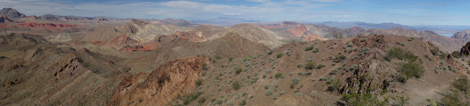
Day 1 – Saturday March 25th, 2017
Miles Hiked – 8.26
Elevation Gain – 1228′
Route Hiked – Northshore Summit Trail parking lot to Pinto Valley near Sentinel Peak

Driving along Northshore Rd
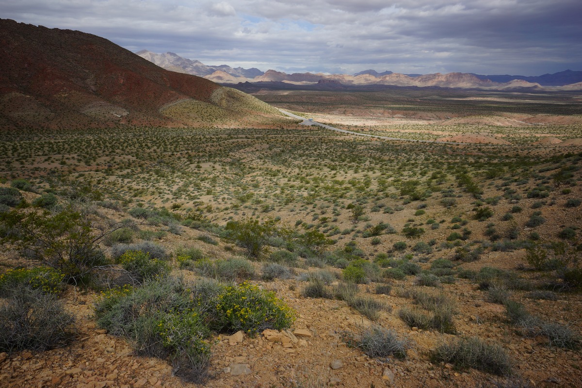
Dan and I spent the previous day in the nearby Valley of Fire State Park, and camped in the Arch Rock campground. From here, it was about a 30 minute drive to the Northshore Summit trail head. It was cloudy this morning and was sprinkling when we were packing up our gear, but that quickly faded away. The drive along Northshore Rd was very scenic, and worthy of spending some time here by itself. However, we did not have the extra time, and drove directly to the parking lot.
When we arrived at the Northshore Summit Trail parking lot, we were the only ones there. Good sign. Yesterday, Valley of Fire State Park was packed. There’s a bathroom and garbage cans here, but that’s it. We left the parking lot around 9:30am and started walking east on Northshore Rd. While road walks are never ideal, this was the best route I could come up with that fit together a starting point, the destinations I wanted to hit and the time frame. Despite walking this paved road for 2 miles, it was beautiful country. Big views to the north, looking across Bitter Spring Valley.
Leaving Northshore Rd behind

Climbing up Pinto Ridge

We found this turtle shell hiking up Pinto Ridge
After 2 miles, we reached a pull-off where another vehicle was parked. Here, we leave the road and head south towards the Pinto Ridge. We hiked up over a small ridge to start the climb up. The terrain is pretty jagged here, with lots of sharp rocks. As we climbed up the ridge, I came across a turtle shell. The turtle itself was long gone, but the shell was an interesting find. A few hundred feet farther and I saw a second shell.

On the “pass” at the top of Pinto Ridge
Farther up the ridge, the path narrows as we reached the top of the “pass”. The vegetation was a little greener, thicker, and thornier here. Lots of wildflowers in bloom, and some of the cacti as well. There’s not much of a view form the high point, but this changes as you descend into Pinto Valley.

Descending into Pinto Valley
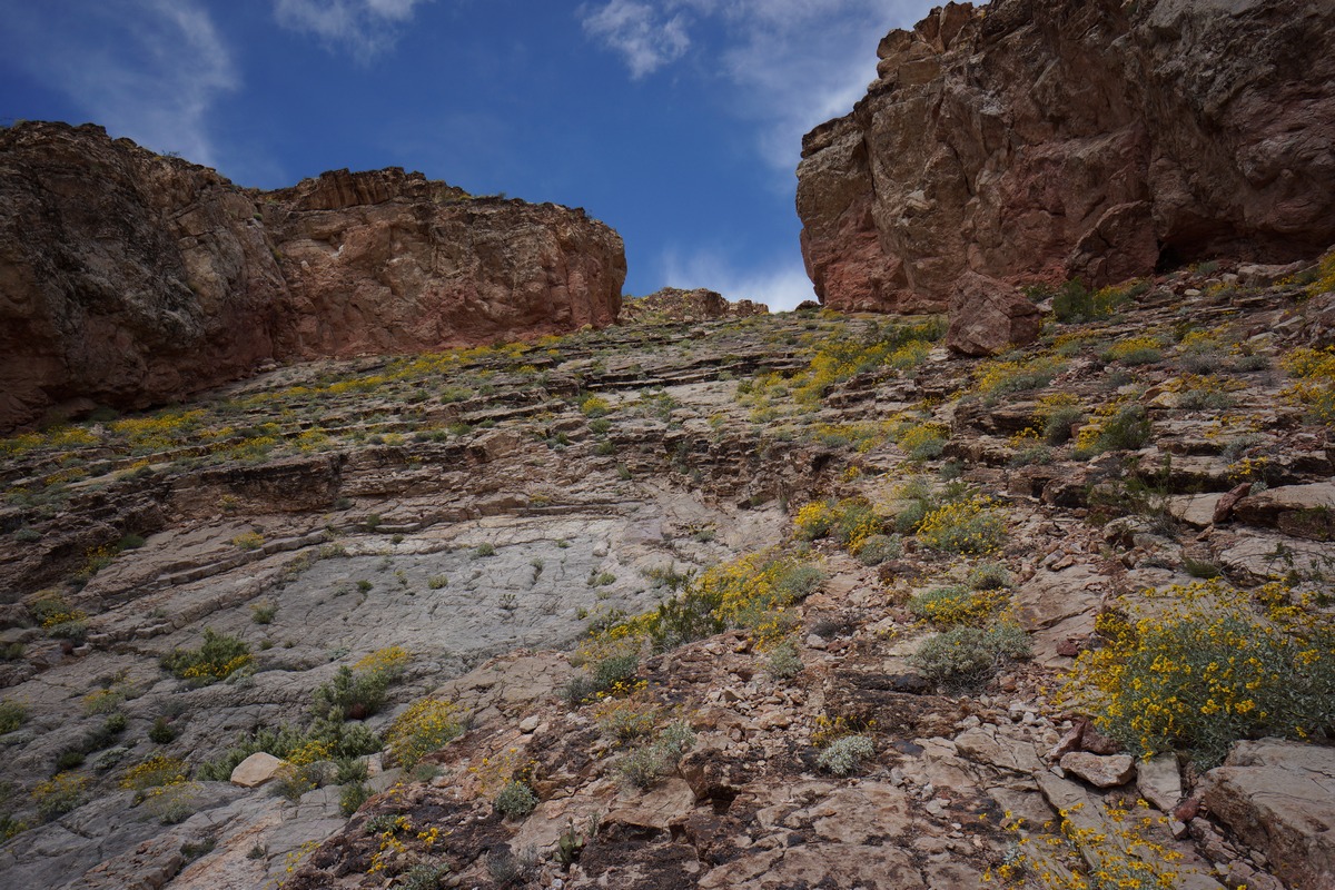
Looking back up the way we came. Very steep!

The descent from the top is pretty gradual at first. We could tell there was a steeper section ahead, which I anticipated. Now the views of Pinto Valley were materializing, and they were impressive. However, the immediate problem was the terrain that lies between us and the valley below. The steepness would have been enough to worry about, but of course, loose rocks and debris compounded the difficulty. The angle was such that you could grip decently walking down slowly, but only just. Any steeper and this would have been questionable. I crab crawled in a few spots after watching Dan fall a couple of times.

The chute funnels you to this choke point
It took a good amount of time to safely work our way down this steep slab, only to be led to a choke point… a couple of boulders wedged between the steep, narrow canyon walls. There’s no easy way to climb down it, but there’s a route around it. Backtrack about 50 feet from the boulders and go up a ridge on your left (to the east). Here, there’s a more manageable route down and the rest of the way is less frightening.
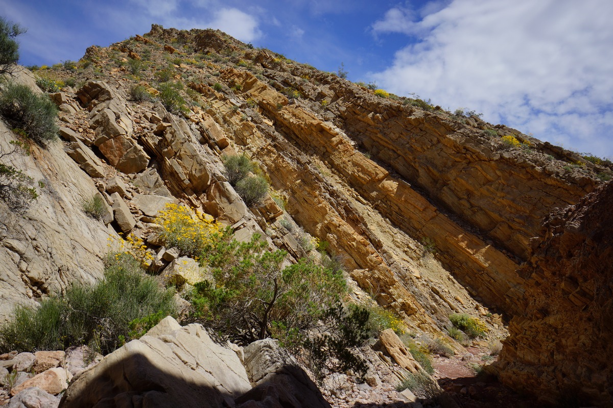

Them rocks ain’t supposed to be angled like that!
Now down off the worst of Pinto Ridge, jumped down into one of the two washes, which merge, and headed out into the valley. It’s a whole new landscape here. In the wash we could see chunk of earth pushed upright, with a variety of layers visible. This isn’t solid rock like granite, though. It’s made up of compacted, crumbly dirt and smaller rocks.
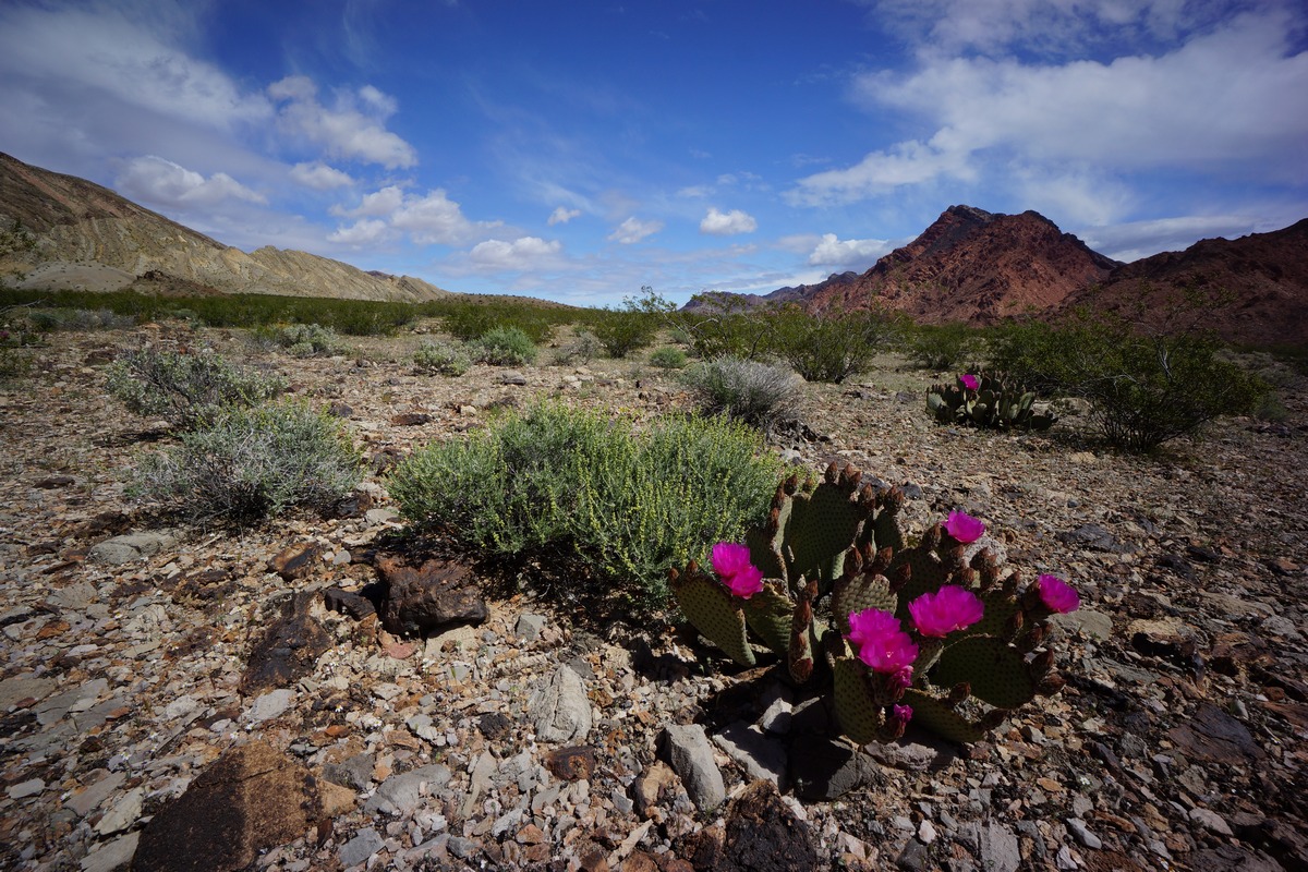
Sentinel Peak behind a blooming Prickly Pear cactus

Vibrant colors of Pinto Ridge

Looking west into Pinto Valley. Pinto Ridge on the right
After emerging from the wash, we found ourselves in the expansive Pinto Valley. Sentinel Peak was in front of us, dominating the view with shades of orange and red. We decided to camp here, on the north side of the valley, so we could have a good view of Sentinel.

My campsite in Pinto Valley. That’s Sentinel Peak in the background
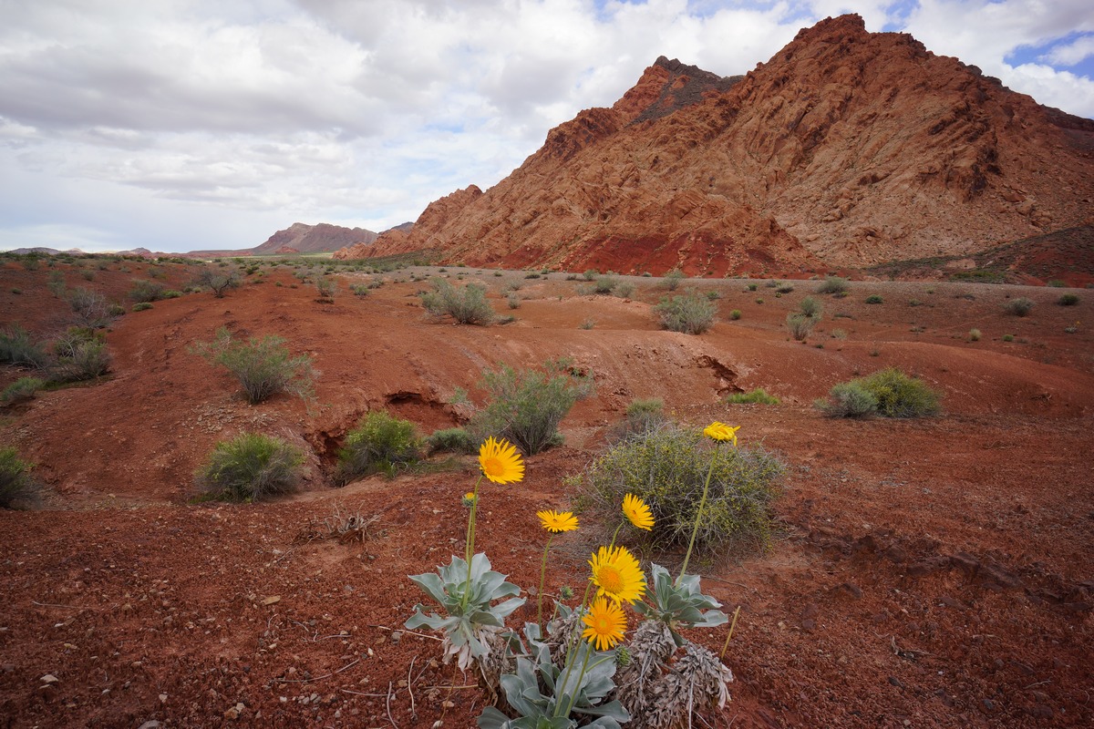
Sentinel Peak from Pinto Valley
We found a couple of flati-ish spots and cleared the sharp rocks to make way for our tents. The view was great, but there’s no shade anywhere nearby. After setting up camp, we took a break for lunch. Afterwards, Dan rested while I took some pictures.

Approaching Sentinel Peak
After our break, we headed over towards Sentinel in an attempt to climb to it’s summit at around 2:30pm. The path to Sentinel from our camp involved dropping down into and climbing out of several washes along the way, before finding the main wash that runs through Pinto Valley. We took this to the Base of Sentinel where the route I had planned begins. The path up to the top was not very obvious from here, so I was hoping the track I created in Caltopo, based off someone else’s route up Sentinel, was accurate.

At the base of Sentinel Peak

Climbing up Sentinel Peak
We started climbing up Sentinel, and quickly found the most promising route to be blocked by a huge boulder. We moved farther east and started uphill here. Dan wanted to go right up the mountainside whichever place looked easiest from his point of view, while I wanted to try and stick to the GPS route I created ahead of time. We both pursued various route options but keep finding ourselves in tough spots. I ended up breaking one of my Gossamer Gear LT4 trekking poles, again. Looking back, I think I’ve broken more of these poles than I have completed hikes with them. I don’t think I can use those poles anymore, need something beefier.

Dan carefully walking across a rock face with a healthy fall below

Coming own Sentinel Peak looking north towards Pinto Ridge
The climb was a lot harder than we anticipated. While we probably could have made it to the top and back to camp if we continued, we decided that it was getting late in the afternoon and didn’t really want to be getting back right at dark or after if the route continued to be as challenging. We turned around and headed back to camp, somewhat defeated. At least there’s Hamblin Mountain tomorrow, which should have an easier route up.

Main wash running through Pinto Valley
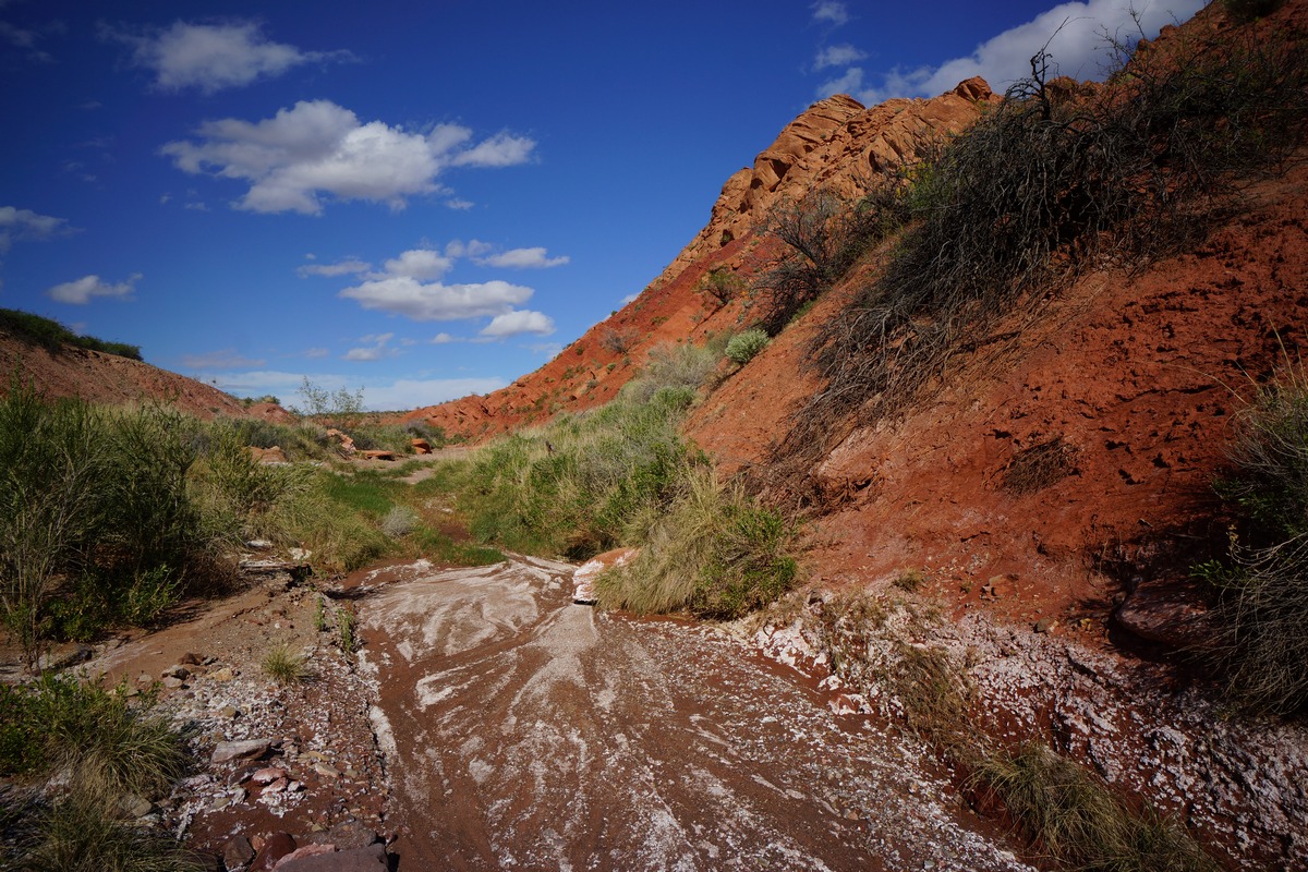
While we walked back to camp in one of the washes, we saw what looked to be bobcat tracks and poop. We saw lots of similar tracks throughout our hike, but of course, never saw anything.

When we got back to camp we still had no shade. Dan set up his emergency blanket (he was using it as a footprint under his tent) as a lean-to, and we had a nice shaded spot to escape the sun for a while.
There was a TON of plane and helicopter traffic overhead in this region. Commercial planes I understand as we’re not that far from Las Vegas. The helicopter though, I don’t understand why there were so many. Throughout the day we saw a couple per hour. Right before nightfall, I saw 6 in row, flying the same flight path spaced about 1 minute apart. Maybe some sort of training exercise?
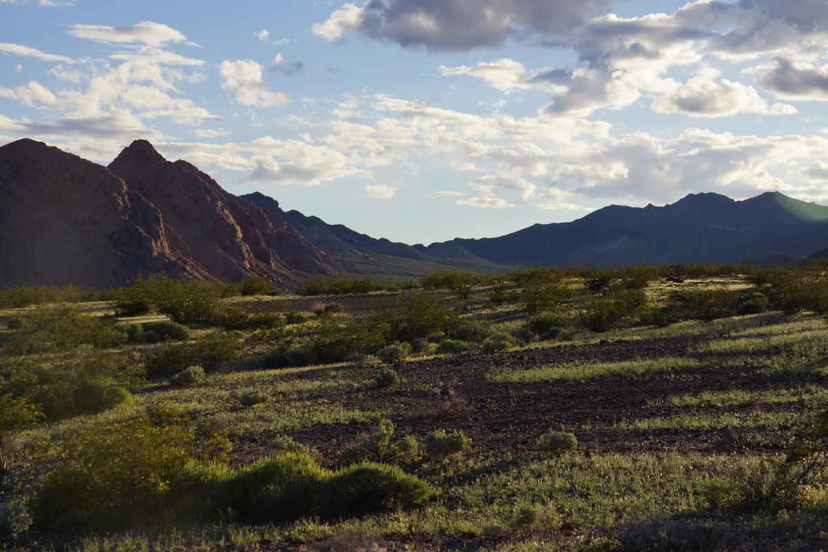
View to the west before sunset
Looking to the east, the views of Sentinel and the mountains beyond were colorfully illuminated by the sun now. To the west, the distant landscape looked lush and green as the sun shined on it, although it in reality the vegetation is much more sparse up close. Dan said it looked like Jurassic Park. I watched the sun set and headed to bed shortly after.
Day 2 – Sunday March 26th, 2017
Miles Hiked – 9.88
Elevation Gain – 2173′
Route Hiked – Pinto Valley near Sentinel Peak to Pinto Valley Castle
It was a calm night with no animal sounds or high winds. The only sound I could hear was Dan snoring, as we set up our tents a little too close together. I got up around 6:30 to watch the sunrise, and tried to wake Dan. Of course, Dan continued to sleep and didn’t get up until 7:30 or later.
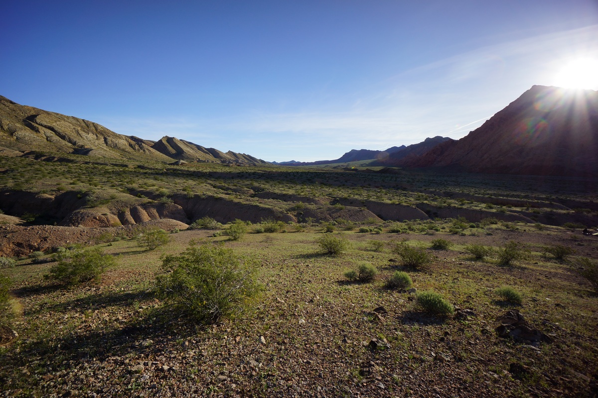
Sunrise in Pinto Valley
While Dan wrestled with the agony of leaving his tent, I sat on a small hill near camp and took some pictures. The sunrise was not very impressive from this spot though as it was so high in the sky by the time it peaked out over the top of Sentinel Peak. I was already packed and ready to go by the time the sun rose and Dan finally left his tent.

View of Hamblin Mountain from our camp in Pinto Valley
We broke camp around 8:30, following the nearest wash to the main wash running through Pinto Valley. Walking in the washes is the easiest route through Pinto Valley. This is not because the terrain outside of the washes is difficult, but because the washes are cut steeply and often deep into the surrounding earth. Hiking in and out of them gets old after a while.

Hiking west through the main wash through Pinto Valley

Hiking the main wash was very easy. We made good time as we traveled west through Pinto Valley. We passed an outcrop of rocks and boulders that people have been signing their names on for years, dating back to the 1920s. Even though some of the writing is nearly 100 years old, it still looks brand new. Is is really that old then? Surely they would have been weathered somewhat in 100 years, right?

Wash leading to Pinto Valley Castle (the tallest point in the very center of the horizon)

What a mad place!

West of the rocks with writing along the main wash, we could start to see the colors of Pinto Valley Castle in the distance. Soon we left the main wash, and headed up another wash towards Pinto Valley Castle. This is a really interesting area, visually and geologically. Lots of upheaval going on, exposing many different layers of sediment. Small patches of “badlands” can be found all over here too.
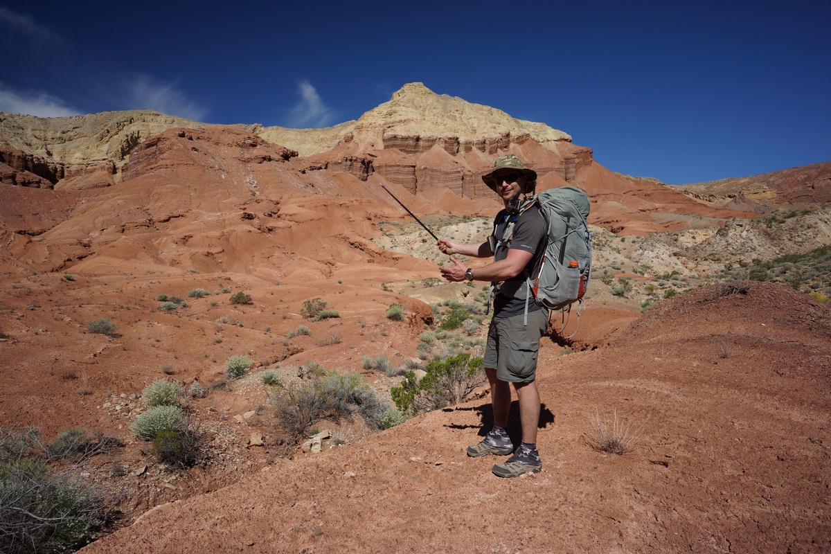
“And behind me is Pinto Valley Castle…”
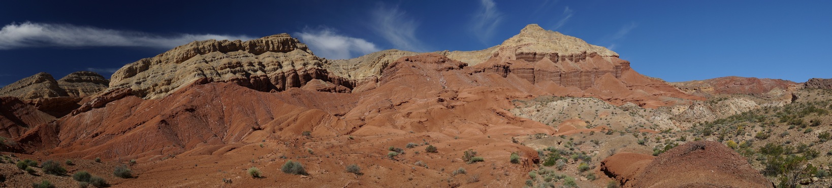


View south near Pinto Valley Castle

Pinto Valley Castle
Pinto Valley Castle was impressive. Erosion has shaped the walls of PVC in an unusual way, with sharp edges and symmetry. The top is made up of some lighter colored sediment, while the bottom is comprised of a contrasting red color.


Looking northeast from the small pass, where we just came from
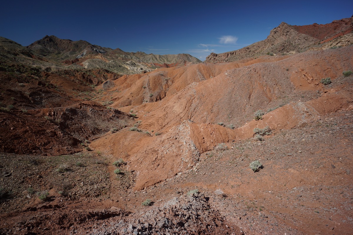
Looking southwest from the small pass, towards Hamblin Mountain
After heading general north for a while through the Pinto Valley Castle area, we abruptly turned west after passing by PVC. After hiking through a small patch of badlands, we noticed an obvious path up one of the ridges, which led us to the top of a small pass. This is the general area I wanted to camp, since it looked so colorful from the satellite maps I studied before coming out here. It certainly lived up to the hype I had in my mind. Now, we just needed to find a place to set up camp.

Campsite 1/4 mile west of Pinto Valley Castle
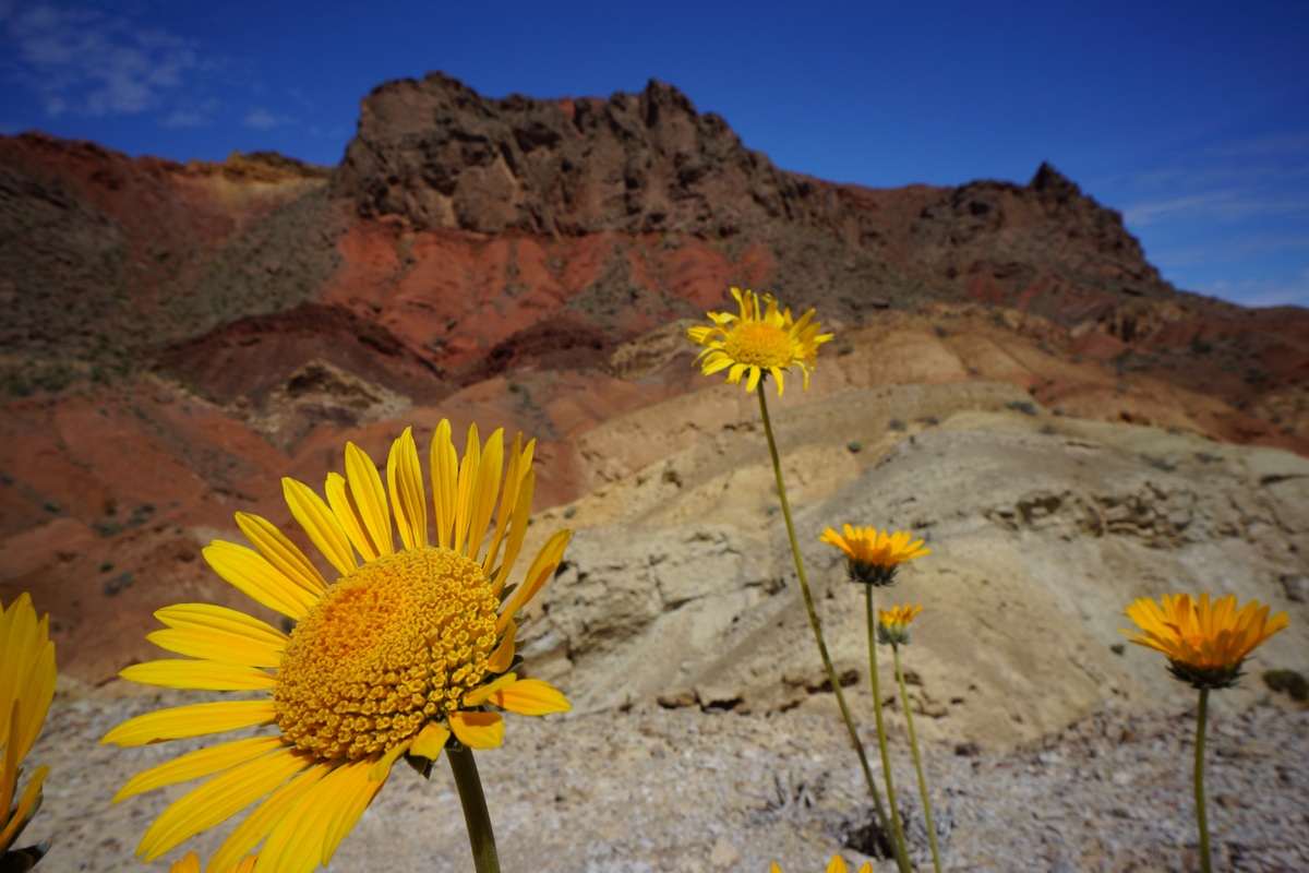
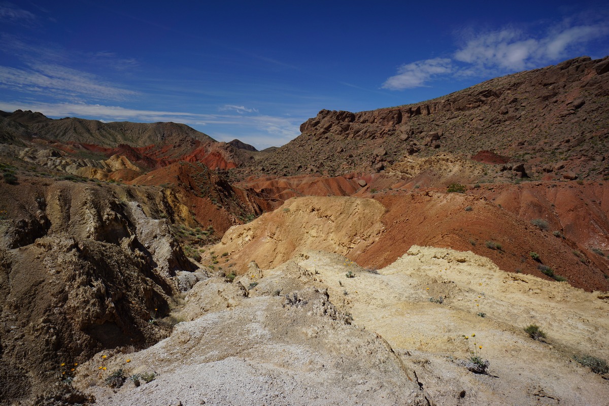
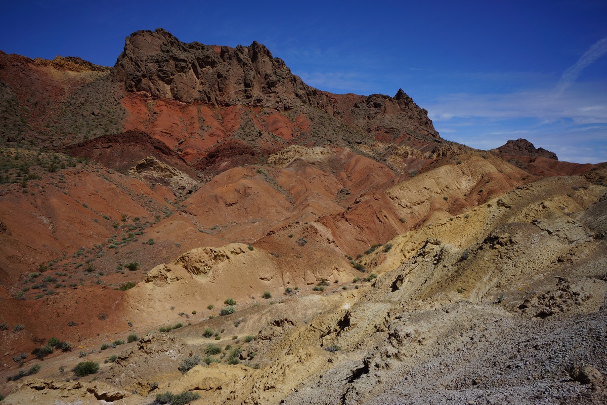
Coming down from the little pass, we followed an obvious path down and along the side of the high ground. This path appeared to be an old mining road or something. We followed it a short ways before find a couple of small flat areas for our tents. Excellent views, and enough space to spread out more than we did last night.

After setting up camp and eating lunch, we headed out to climb Hamblin Mountain. From camp, it appeared that there was a high and low path to take. We opted to take the high ground since we were already up here. This path led us generally where we wanted to go, but then started curving south. We backtracked a little and realized we had to go over a ridge to get to where we wanted to go. We should have taken the low ground from camp as it would have gone around this ridge, but I didn’t realize that at the time.

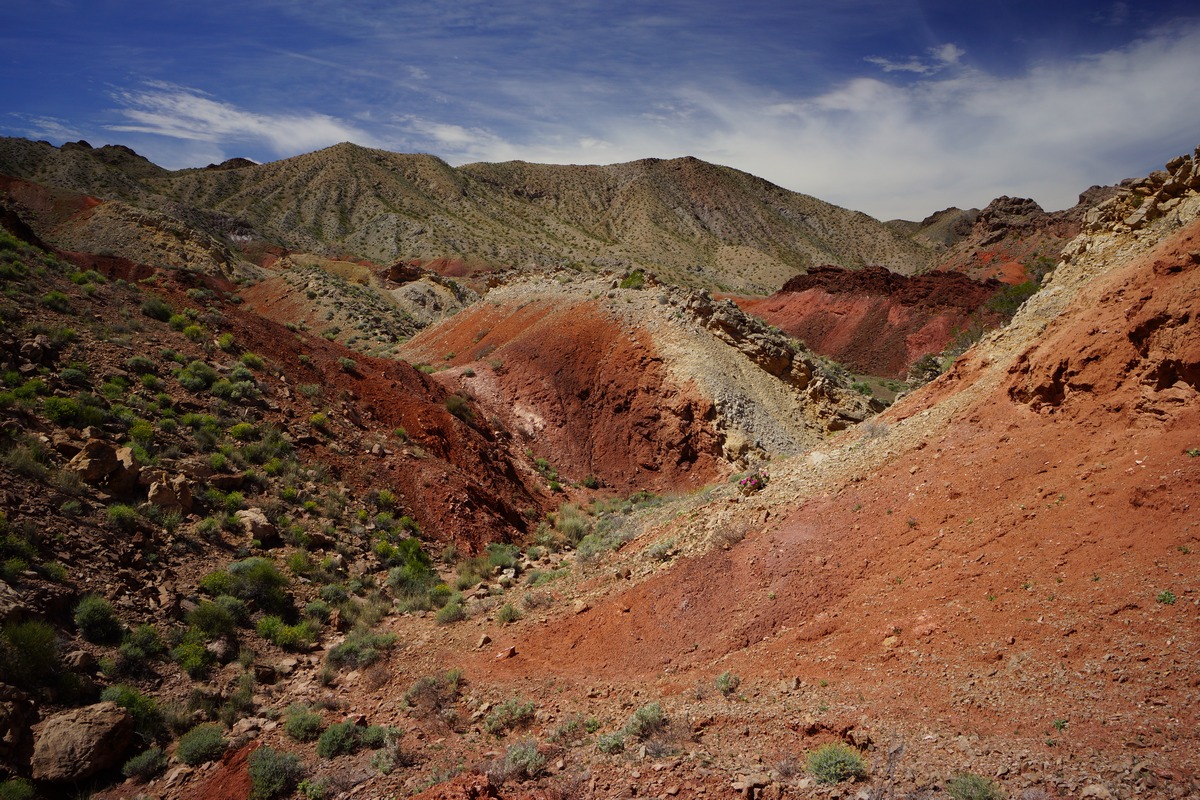
Wow!


Still not on the trail yet
We followed the ridge for a while looking for a weakness. After a short but steep climb over it, we still didn’t see an obvious route to follow. We headed down hill and along the top of a very deep cut wash below. On the other side we could see a trail, but we needed to cross this wash. We found a spot to descend, and even saw a cairn in the wash. We figured we were on the right path now.

A faint path led up hill

Looking back the way we came

The land was changing from red washes and badlands to green, rocky mountainous terrain. We followed our new trail up a ridge and along the mountainside. The path was very narrow and barely cut into the steep slopes. Eventually this path merged with a larger one, and it was much easier to follow from here on out. We hiked a short ways before seeing a path that led down into the wash below, which looked easier and more direct than the route we took up here. We noted this and decided to go this was on the descent.
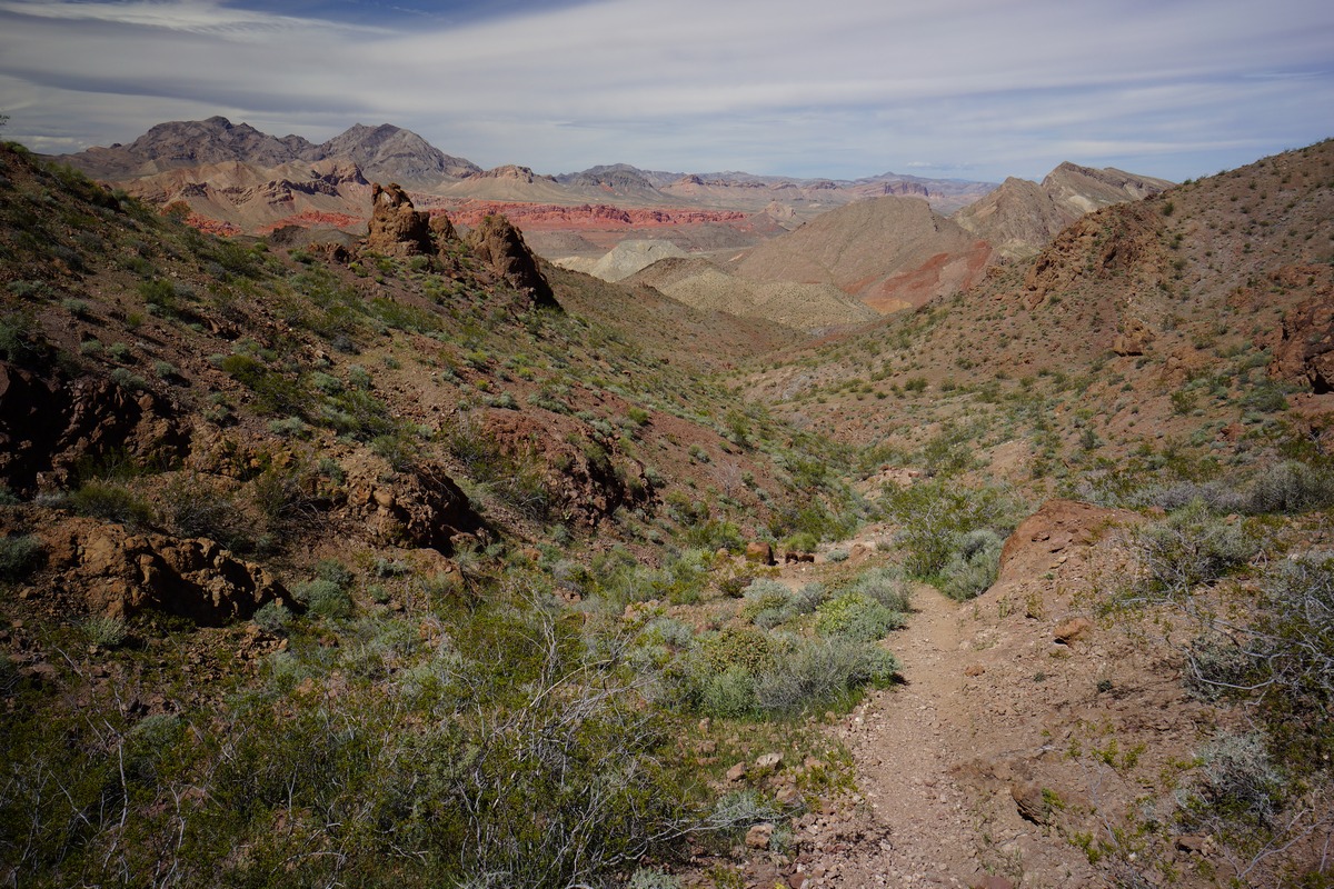
Next we encountered are first humans of the trip, a couple from Henderson, NV who a had just left the summit of Hamblin Mountain. We chatted for a few minutes and parted ways, knowing they had only been hiking 25 minutes from the top. I was really looking forward to this view!

The hike up was not technically challenging or particularly steep, but there were a few false summits. Really great views as your near the top. Not far from the summit, we passed an older couple from Colorado making their way down. The woman seemed bewildered that we had “large” backpacks on, and asked if we were camping at the top. Ha, nope. Just carrying our water, snacks, camera gear, etc.
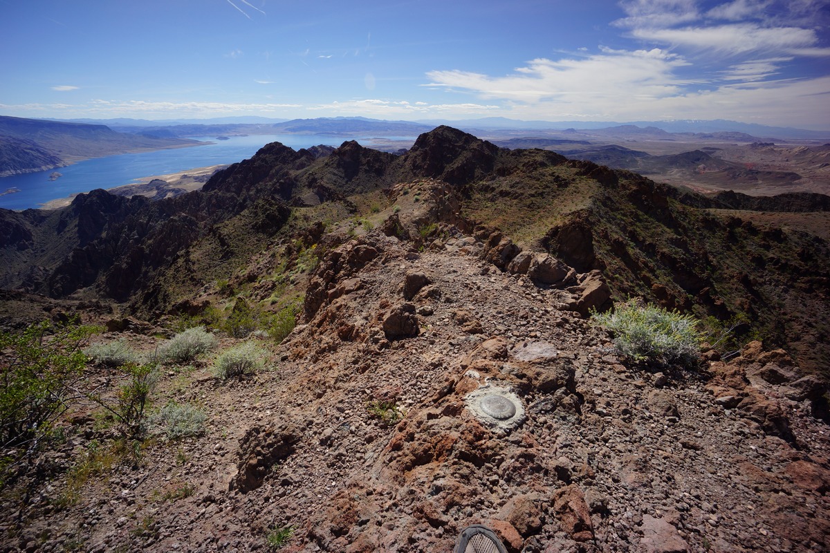
View southwest over Lake Mead from Hamblin Mountain

View south/southeast from Hamblin Mountain summit

Lake Mead from Hamblin Mountain. The narrows is just out of frame to the left (east)

Hamblin Mountain Panorama

Sentinel Peak from summit of Hamblin Mountain
We had the summit of Hamblin Mountain to ourselves when we made it up here at 2:30. It had taken us 2 hours from camp. From the top I could see Lake Mead, Bowl of Fire, Sentinel Peak, Pinto Valley and all the other landmarks for many miles. Las Vegas lies hidden from view in a valley, but beyond that the snow-capped peaks of Mt. Charleston can been seen. Several USGS markers dot the summit as well as a summit log/register.

Hamblin Mountain Summit View

Muddy Mountains to the north

Pinto Valley & Sentinel Peak Viewed From Hamblin Mountain Summit

View northeast from Hamblin Mountain
We stayed on the summit for about an hour taking pictures and soaking in the view. However, we were also soaking in quite a bit of sun, and with no shade, it was time to head back to camp.

Trail down Hamblin Mountain

Dan went ahead of me as I snapped a bunch of pictures on the way down. For some reason, I enjoyed the view better going down than up.

Before we knew it, we reached the path that leads down into the wash that we noted on the way up. We headed down here and found this route to be quite obvious, and in fact, the actual route. The first trail we found on our way up was actually an alternate route the just happened to meet up with this main trail. This was confirmed by passing the same cairn that we passed in the wash on our way up. We originally thought the cairn marked the way to the main path that we took, instead, it marks the main path which we crossed right over without realizing.

Almost back to camp
Our path in the wash was leading us directly back to camp now. We passed the junction of the old 4×4 road that passes by Cottonwood Spring and heads out to Northshore Rd. This would be the route the day hikers would have taken, parking at a pull-off along the highway. We walked past this junction and the path led us right back to camp in a very direct way, much more so than the way we took up the mountain. We made it back to camp in only 1 hour from the top of Hamblin, half the time it took to reach the top.
Back at camp, we sought out the only shade around and exploited it for a while. Having not eaten anything since noon, which was just some snacks, I devoured my bacon & cheese wrap for dinner. Dan was running lower on water than I, so I gave him a half liter. That’s about all I had left myself when I went to bed.
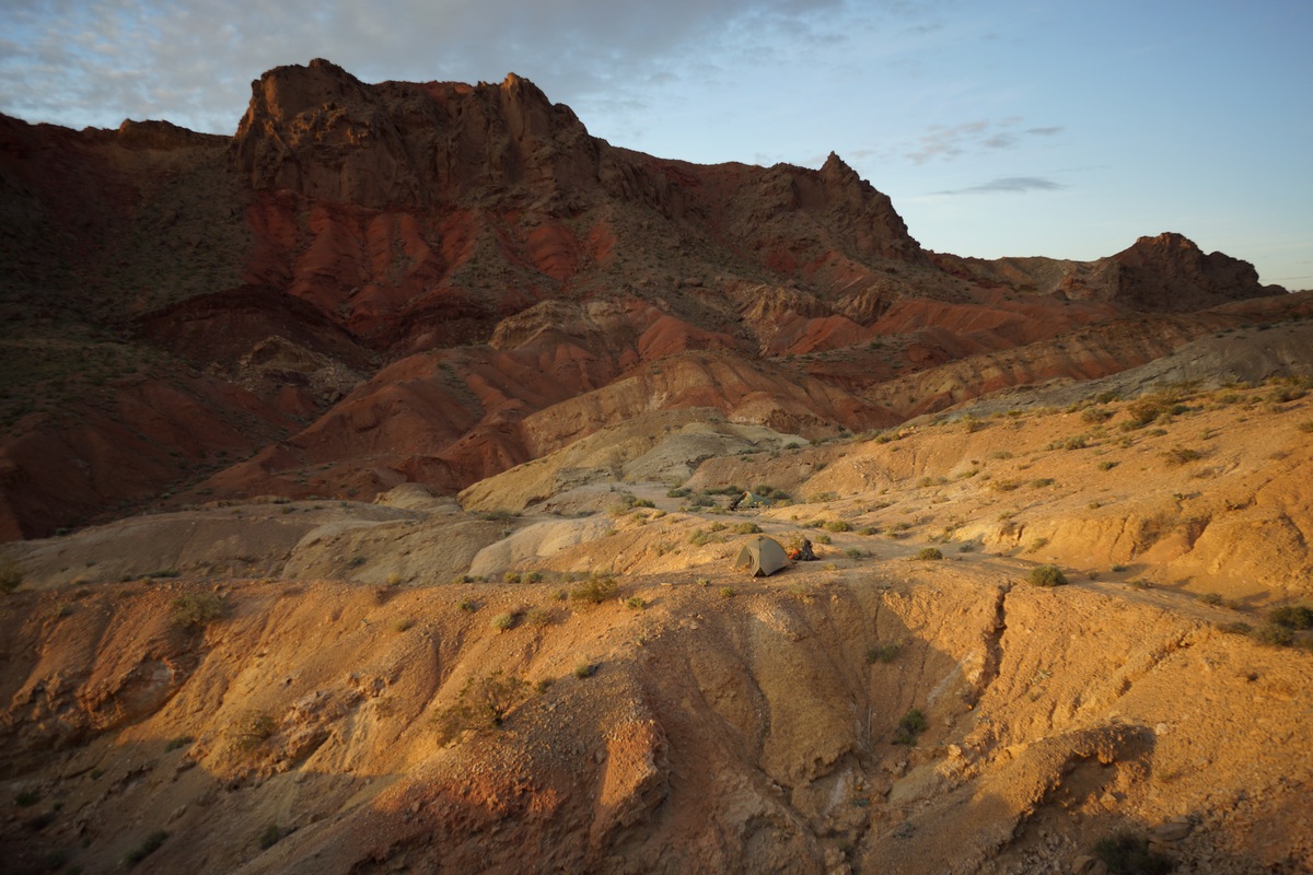
Sunset at camp
Dan was whooped and went to bed at 6pm. With another hour and a half of daylight left, I couldn’t do that. I found a decent spot to sit and wait for sundown. Several bats were out at dusk, and flying closely overhead too.
Day 3 – Monday March 27th, 2017
Miles Hiked – 4.99
Elevation Gain – 531′
Route Hiked – Pinto Valley Castle to Northshore Summit Trail parking lot
I woke up at 5:45 this morning. From my tent I yelled, “Hey Dan, time to get up”. To my surprise, he actually did get up without any additional prodding. That’s good, because I have a plane to catch at 12:45pm this afternoon, and we need to hike back to the car, drive back to Vegas, get some food and clean up. Originally I planned to hike an off-trail route back to the car, but worried about time, we opted to take the route the Hamblin Mountain day hikers use to get to Northshore Rd, then road walk a few miles back to the car. This would be the safest route from a time perspective.
We packed up quickly this morning and were moving by 6:30. We took the low ground this time for a direct route to the junction with the old 4×4 road, now called the Cottonwood Wash Trail.

Cottonwood Wash Trail

Hiking the Cottonwood Wash trail was easy. Some spots were more narrow than others, and made you wonder how a vehicle passed through. Much of it is wider though. This road would have been in use up until 2002 or prior, when the area was designated as the Pinto Valley Wilderness.

Lone tree at Cottonwood Spring

Cottonwood Spring
A lone Cottonwood tree stands in the middle of the wash at Cottonwood Spring, hence the name. I did not see an obvious source, but I didn’t look around much either. There were lots of thick, green shrubs and bushes in some areas, an indicator of water, but I had no desire to wade through them looking for water. We did see a small hole dug in the middle of the wash with water about 6 inches down, but no natural emergence of water to the surface.

Cottonwood Wash Trail
After leaving Cottonwood Spring, we headed down the home stretch. This was offered the same interesting geological features as others, a variety of rock and sediment layers exposed by upheaval.

Road walk along Northshore Rd
When we reached Northshore Rd, we headed east. We still had about 3 miles to cover before getting back to the parking lot. I didn’t even mind walking the road so much since the views were so great. It was a steady incline the rest of the hike back.
We reached the Northshore Summit trailhead at 8:30, plenty of time to take care of my pre-flight needs. Another successful adventure under the belt.
Final Thoughts About Hiking The Pinto Valley Wilderness
This place exceeded my expectations. It’s uniquely colorful, and an all around cool place. Access is tough and some of the off trail segments can be challenging. Lots of aerial traffic remind you of how close this place is to civilization, yet we still felt solitude. Especially at night. The nights were calm and silent, with no animal sounds. We saw few animals the entire trip, just a couple of chipmunks and birds. The vegetation wasn’t too thick or thorny overall, only a few short spots where we encountered that. We saw no snakes or spiders, just a couple of butterflies and a beetle. I was expecting wildlife to be a little more active this time of year.
Camp on our second night was my favorite. You can’t go wrong pitching your tent anywhere near Pinto Valley Castle in my opinion. Hamblin Mountain is an easy hike with a great view, and would make a great day hike (as the two couples we passed had done).
Related Images:
Coxcomb Mountains 3 Day Hike – Joshua Tree NP, CA – Dec 2016
Joshua Tree National Park – Coxcomb Mountains 3 Day Hike

View All Coxcomb Mountains Photos | Watch the Coxcomb Mountains Hike Video On Youtube
- Park Administration – Joshua Tree National Park
- Fees & Permits – Free permit, self register at one of 12 backcountry registration boards (none near the Coxcomb Mountains) or at one of the Joshua Tree national park visitor centers
- Travel Logistics – Flew into Ontario, CA airport, drove (with a local friend) to Joshua Tree NP
- Trailhead – There is no dedicated trailhead to access the Coxcombs. However, you can park along Hwy 62 (TwentyNine Palms Rd) at 34.095135, -115.420799. This is 11.9 miles west of the Hwy 62/Hwy 177 junction. This starting point is recognized by the park though as the main point of access to the Coxcombs. BEWARE of deep sand here at the parking area! We found another place to park (north side of hwy 62) a half mile or so east of the designated spot if you don’t have a 4×4.
- Length Of Time Hiked – 3 days, 2 nights
- Miles Hiked – 25
- Route Difficulty – 7.5
- Fires Allowed – No
- Scenic Beauty – 7
- Solitude – 9.5
Coxcomb Mountains Pre-Hike Planning Notes
The Coxcomb Mountains are situated in the northeast corner of Joshua Tree National Park. This region is seldom visited, and considered the most rugged area of Joshua Tree with many jagged peaks. The highest peak in the Coxcombs is Aqua Peak. Although most maps label the high point as Aqua Peak, Aqua actually refers to 3 separate peaks… Spectre, Tensor and Dyadic. Tensor Peak is the lowest, and Aqua is the tallest at 4,416′.
There are no dedicated campsites in the Coxcomb Mountains.
There are no reliable water sources in the Coxcombs. We hauled our own water in for this 3 day hike.
The Inner Basin and Aqua Peaks are day-use only, but I could not find any official information on this within the Joshua Tree National park website. There’s no signs telling you where you can/can’t camp, and there’s nobody around to enforce it, but still you should try and honor these regulations as the are set in place to protect the local population of Big Horn Sheep. When I arrived at the park to get my permit, I asked the ranger to show me on the map the boundaries of the day use area. His map was a Trails Illustration/Nat Geo map of Joshua Tree National Park, and it the boundary was clearly marked on it. Later at home, I created this image to show the boundary of the day use area in the Inner Basin of the Coxcomb Mountains:
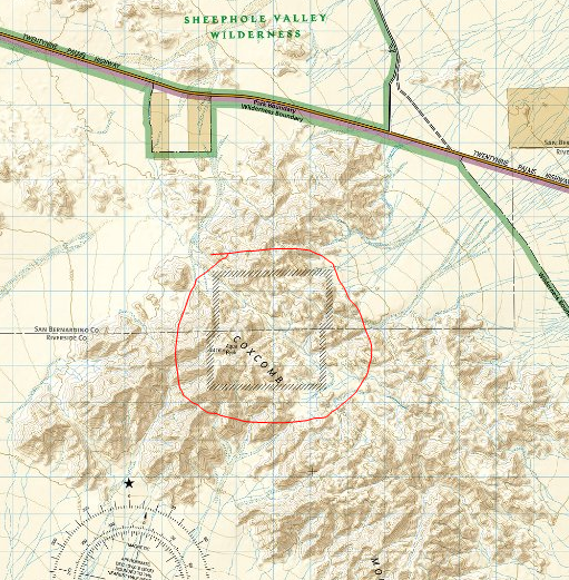
The day use boundary for the Inner Basin area of the Coxcomb Mountains can be seen on this map
Coxcomb Mountains Hike Maps
Download GPX file of this hike
This is the caltopo map of the route I hiked. I’ve highlighted the Inner Basin day use are for your convenience.
Day 1 – Friday December 2nd, 2016
Miles Hiked – 7
Elevation Gain – 1704′

Dan’s Mustang stuck in the sand
When it came time to park at the trailhead, we tried to drive on some sand that was way too soft for my friend’s Mustang, and the car got stuck. Very stuck. We had to call a tow truck to pull it out, which was a 4 hour ordeal. The only reason we we able to call that tow truck is due to a passing motorist, who stopped and drove Dan to an intersection several miles away that had cell service.
We didn’t start hiking today until around 2pm. I was hoping to make it past the Inner Basin today, but was also considering camping before the Inner Basin if it didn’t look like we could make it before sundown.
We parked about .85 miles east of the “designated” spot. From here, it would be slightly out of the way to walk back towards the standard route. which runs west of the outcrop of small mountains (marked 806T on my caltopo map). Instead, we started hiking south and aimed east of the 806T benchmark. This wash appeared to be easy and take us to the same place, so we felt confident about of choice and headed out into the desert.
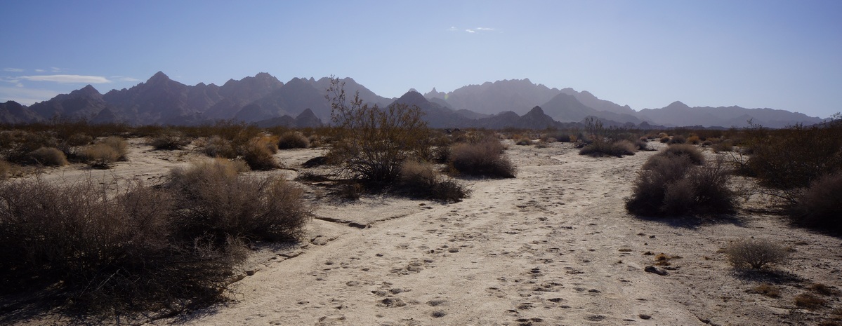
Coxcomb Mountains from the wash near Hwy 62
The desert floor consisted of soft sand in the washes, and slightly firmer sand elsewhere. Not the hard-packed desert soil I’ve hiked in much of the time in the past, in the Sonoran and Chihuahuan deserts. Vegetation consisted of low brush, much of it very thorny. No Joshua Trees here on this side of the park. We saw an occasional Prickly Pear and even a Sotol plant. Along the washes were some larger trees, at least compared to the rest of the scrub.

Not 10 minutes into the hike, and we saw a tarantula walking around, making it’s way back into it’s hole. This was the first time either Dan or myself had seen one in the wild. It was only about 55 degrees today, and being December I thought most of the snakes and spiders would be laying low somewhere. Cool to see!

I’m not sure it would have been any easier had we taken the standard route, but walking along the wash east of the outcrop was really easy. We made great time through here. Looking back towards the car, we couldn’t see hwy 62 running through the desert. Pretty quickly you feel isolated here. The mountains around us were really rugged looking, especially compared to the rounded boulders of the iconic Joshua Tree landscape.
When we reached the point along our route where it intersects with the standard route, right before it heads uphill to Inner Basin Pass, we had a decision to make: camp here, or push on and hope we make it out of the Inner Basin before dark. We’d made great time so far, so we decided to chance it and keep moving. The terrain here remains easy, hiking up a sandy wash as the canyon narrows. I saw a jackrabbit darting through the wash, just about the only wildlife wee’d see this whole trip.

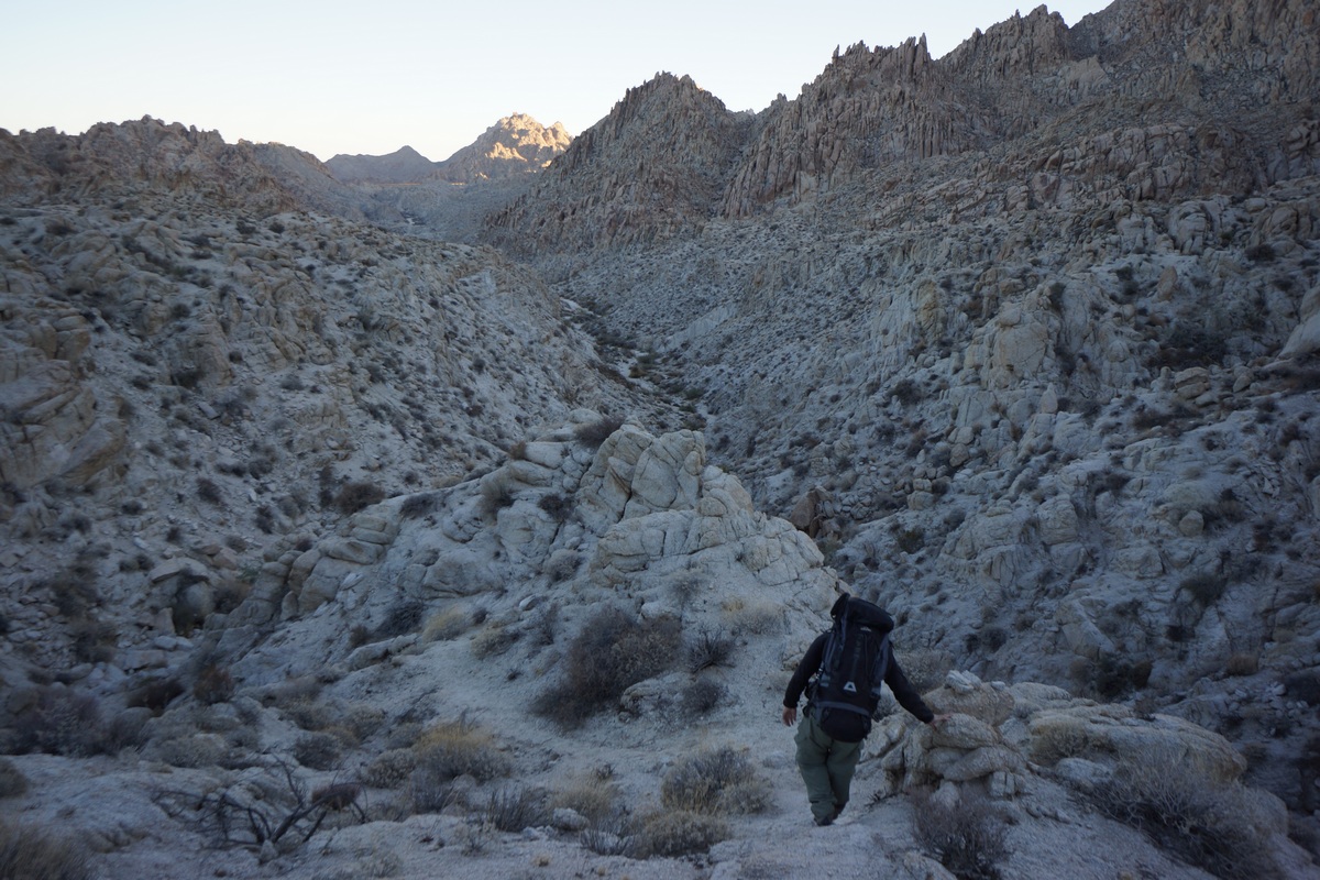
Hiking down the pass into the Inner Basin
Eventually, our route in the sandy wash becomes a boulder climb. Not terribly difficult or long, but a bit of a scramble in spots. Once at the top, it’s actually a bit of a flat plateau. Our first views of the Inner Basin were impressive, but the view is best right before the trail drops down in elevation.

After dropping down into Inner Basin, it was back to an easy walk in a sandy wash. There’s a lot of thorny bushes around to snag clothing, but nothing too thick. The sun was really disappearing now, and the entire basin was shaded at this point.
When we reached the end of the Inner Basin, there were cairns leading southwest. I was expecting the route to continue southeast and up hill. I could have taken the route I had marked on the map, but I just followed the cairns. The route winded through some narrow canyons and involved a little more boulders. Eventually, we popped out into the large flat area nestled in the heart of the mountains seen from my map. I originally thought this was the Inner Basin, based on the look of it on the map and the piss-poor descriptions available on the web. To be clear, I am talking about the open area on the map at these coordinates: 34.0195, -115.3733. Since this area is not part of the day use area, we started to look for a campsite. It was really windy, so we walked to several outcrops of rocks to see if they provided ample wind break. Wind always seemed to be hitting us no matter where we stood, so we just picked a spot. I had to use my headlamp to finish setting up my tent. The sandy soil was so soft, I had to weigh down my stakes with rocks to keep the tent from blowing over.
After setting up camp, Dan and I ate dinner. It was 5:30 now and the stars were shining bright already. In fact, we could clearly see the milky way despite competing with the moon’s light. It was also getting pretty cold. Tonight was supposed to get down to near freezing. After shivering in the wind for a while, Dan and I decided to turn in around 6:30. Nights in the desert are long in the winter!
Day 2 – Saturday December 3rd, 2016
Miles Hiked – 10
Elevation Gain – 1671′
I woke up at 5:50 this morning, hoping to get in position for the sunrise. I walked over to Dan’s tent and woke him, but he didn’t get out of his tent by the time I was ready. In fact. he was snoring again. So, I let him sleep while I climbed up rocks behind our camp.
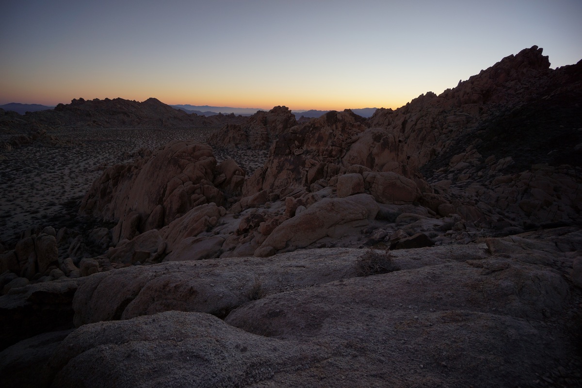
Sunrise in the Coxcomb Mountains
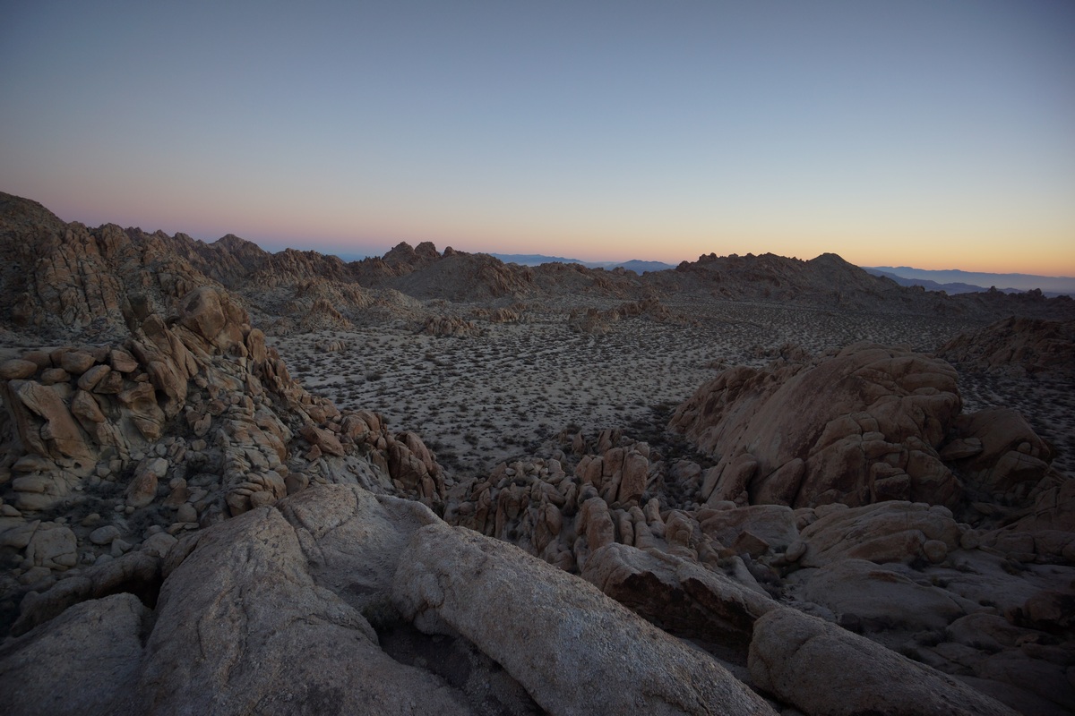

My camp is along the base of the rocks I’m on
From my spot on top of the rocks, I had a pretty good view of the large flat basin in which we’re camped. I could tell the sun wasn’t going to be directly in view, but I had had a good spot to capture the glow of light in the distance.


I spent a good while up here taking pictures of the sunrise and enjoying the excellent scenery. This was one of the better views of the whole trip.
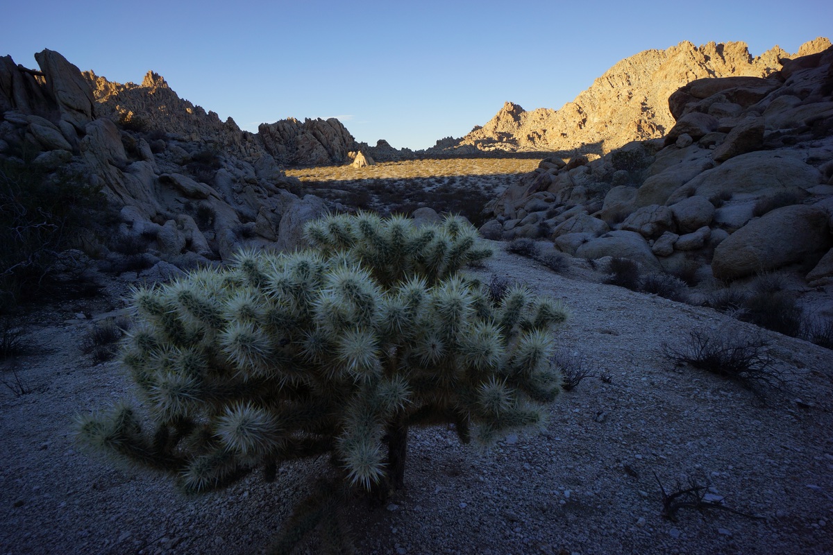
Some variety of Cholla Cactus

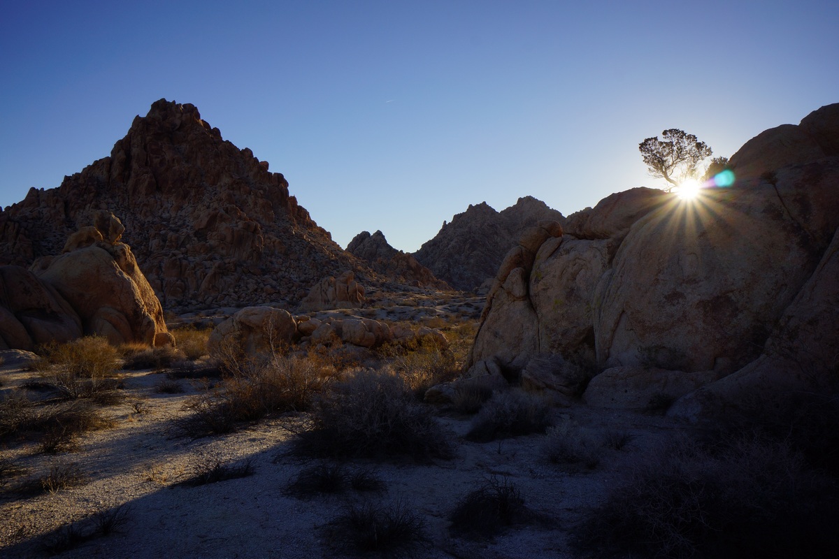
When I returned to camp, Dan was still snoring. Again, I let him be and continued with my search for some good early morning photo ops. Next, I headed southwest from camp to the edge of this flat open area. Here, the map shows a large drop off down to Pinto Basin below.

View of Pinto Basin and the Pinto Mountains beyond

Once at my destination, I realized most of it lies within the shade currently. maybe this would be better to return to this evening. I took a few pictures here before moving around some, trying to get to a higher vantage point. I bounced around from spot to spot along the tops of the nearby hills, but eventually I gave up on the area and decided to head back to camp.
Dan still wasn’t up when I returned after 8am now, so I tried waking him again. This time, it worked. After Dan ate breakfast and got ready, we headed out to do some exploring. Today, our plan is to go wherever we feel like going!

A small cave in the Coxcomb Mountains

First, Dan wanted to check out a small cave we saw last night as we exited the Inner Basin area and entered the flat open area we camped in. The cave was a rounded cavity in a rock face, sitting about 8-10ft above the ground. With some effort, it’s possible to climb into it from below.
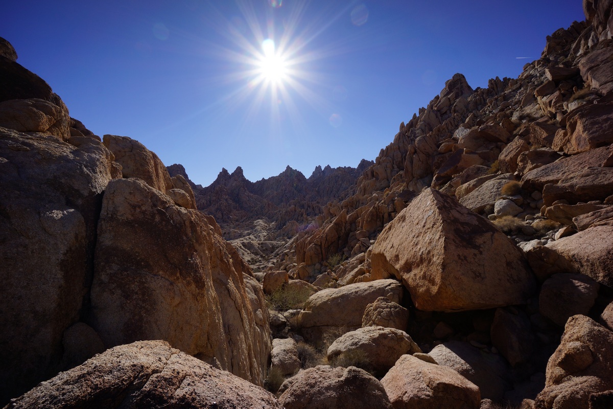
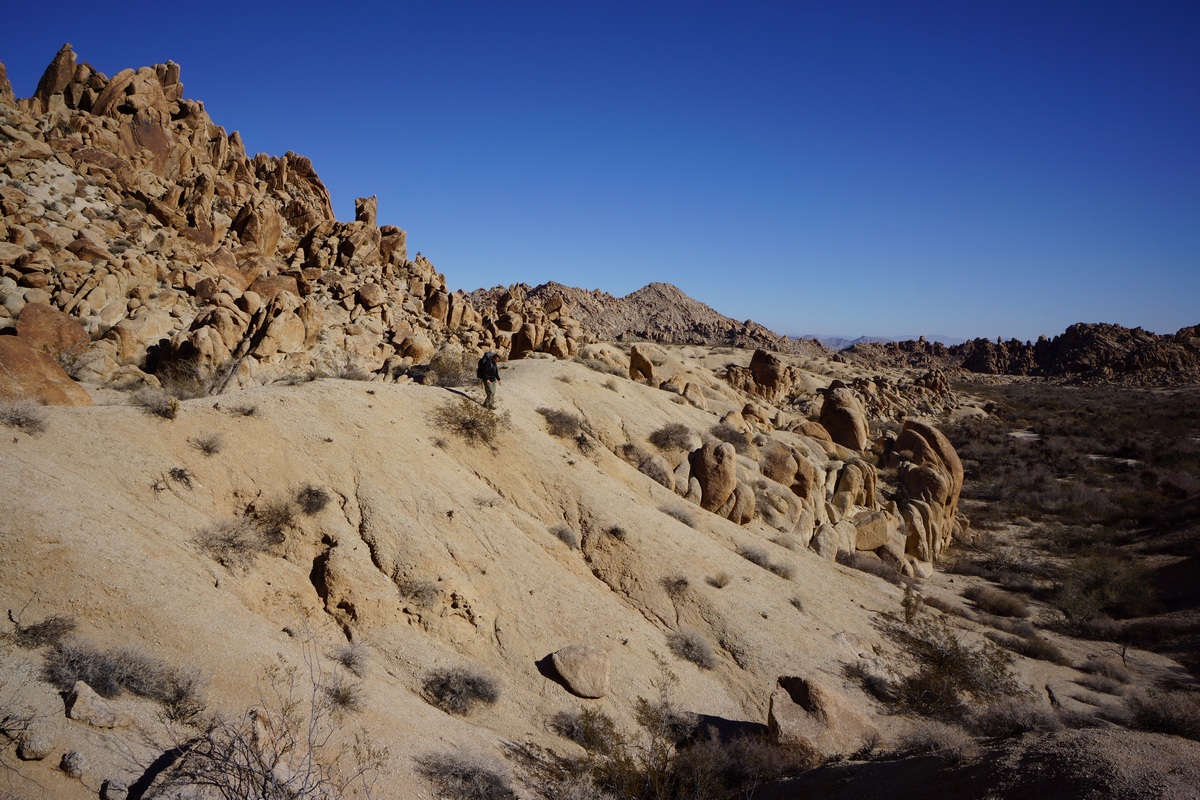
Dropping down into the wash below
After this, we headed south across the open flat area. We hiked up over some boulders and dropped down into a wash below. We followed this was downhill for a ways. I had this marked on my map as a potential spot of interest, as the canyon looks like it narrows further down and is flanked by some cliffs ranging from 400′-1200′ plus. Might be worth checking out.

The hike down this wash was pretty easy at first. There were some occasional boulders that needed to be climbed in order to continue along our path. We had no intentions of following this canyon out into the desert, just to follow it for a ways. We didn’t see much of interest here, so we decided to turn back at our first real obstacle. There was a short drop off along the wash that might have been hard to get back up if we had continued down past it, so we figured this was a good turn around point.

We hiked back uphill and eventually made it back to the spot where we had originally entered the wash. From here, I suggested hiking higher up the same wash. On the satellite maps I saw at home, I saw a sizable patch of green here, which might indicate a spring or seep. Since thee was nothing marked on the map and no info on natural water sources in the Coxcombs online, we decided it might be an interesting destination.
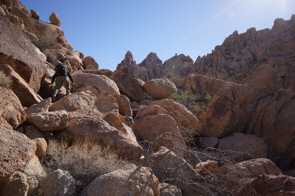
Climbing up the rock chute

View north from the rock chute

Dan enjoying himself
At first, our hike was again easy, winding through a sandy wash. Soon enough though, it turned into a boulder climb. This was a fairly long and sometimes challenging scramble, too. There were large boulders here, stacked on top of each other creating huge spaces in between them in which to fall. Sometimes, traversing the boulders meant walking along steep faces of the boulder with little or nothing to grip. A slip could result in a slide down the boulder and then a fall of up to 25ft onto various size and shapes of boulders below. Not exactly a high exposure type danger, but a real risk of injury if one step is out of place.
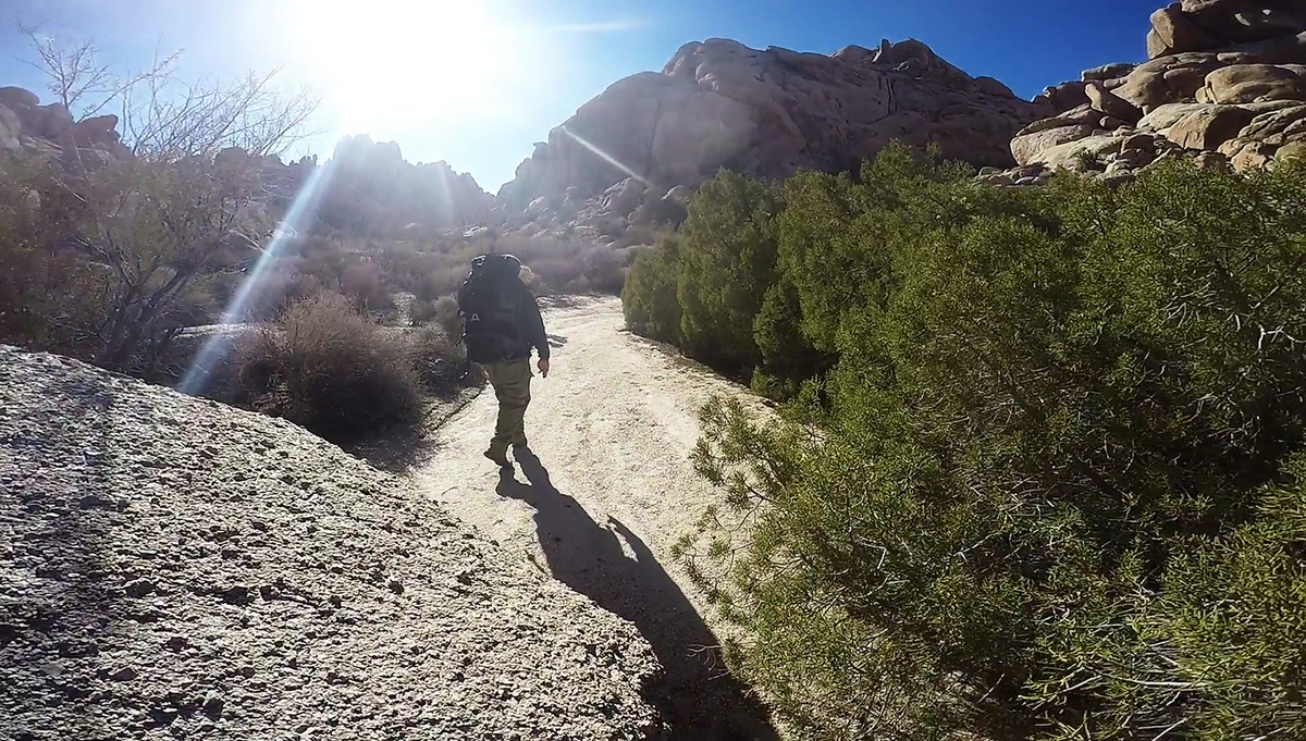
Lots of green around. I didn’t see water, but this is the closest to it I’ve seen out here
After a tough scramble to the top, there wasn’t much to see. The vegetation was thicker up here, and this meant mostly more thorn bushes. We had already been cut up pretty good during the rest of today’s hike, but the worst of it seemed to be up here. We pushed through the thorn bushes and headed for the spot of green I saw on the satellite map. Once at the spot, we did see a high concentration of some coniferous trees, the exact species, I’m not sure. They were so thick that I couldn’t penetrate them to check for existence of water, either.
We took a break here in the sun and relaxed for a while. We debated taking another route down, but that would require traversing some steep territory. Who knows what that will look like when we get there. It was early afternoon now and we end to start thinking about heading back to camp. We ultimately decided to take the same route back as we know it’s traversable already.

Descending the chute

Red rocks. Yup

Big Horn Sheep skull

The jagged peaks that surrounded us looked more impressive going down than it did when we went up. It was hard work, but offered up some of the best views of the day. We also saw a big horn sheep skull that we didn’t see on our way up. It had both horns intact.
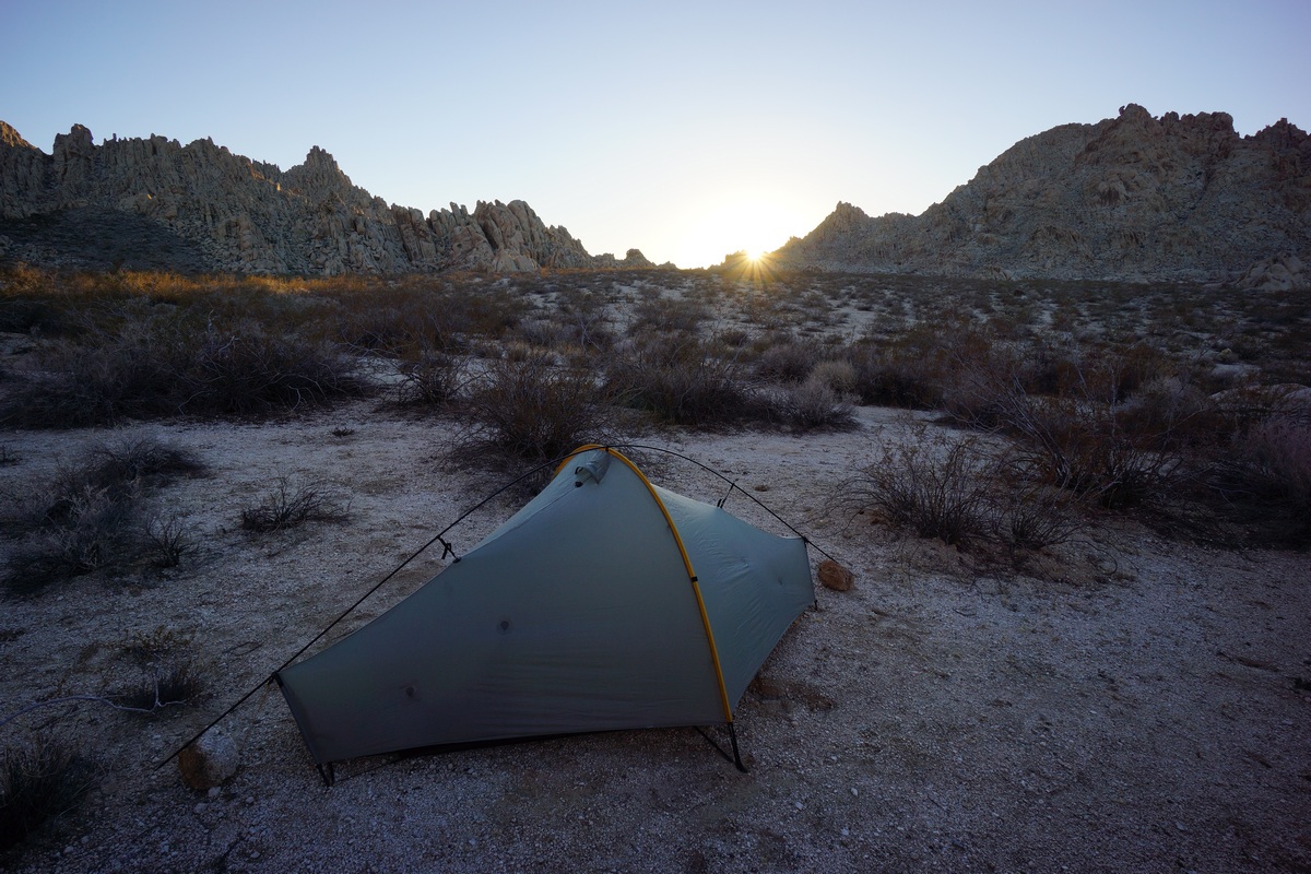
My campsite
Coming down was a little easier. Before long we were in the sandy wash again and headed back to the place where we entered this wash. We could go over the little ridge we did this morning, or take another route, running northeast from benchmark 927T. We opted for the second choice. This took us back to camp, where we relaxed and rehydrated.
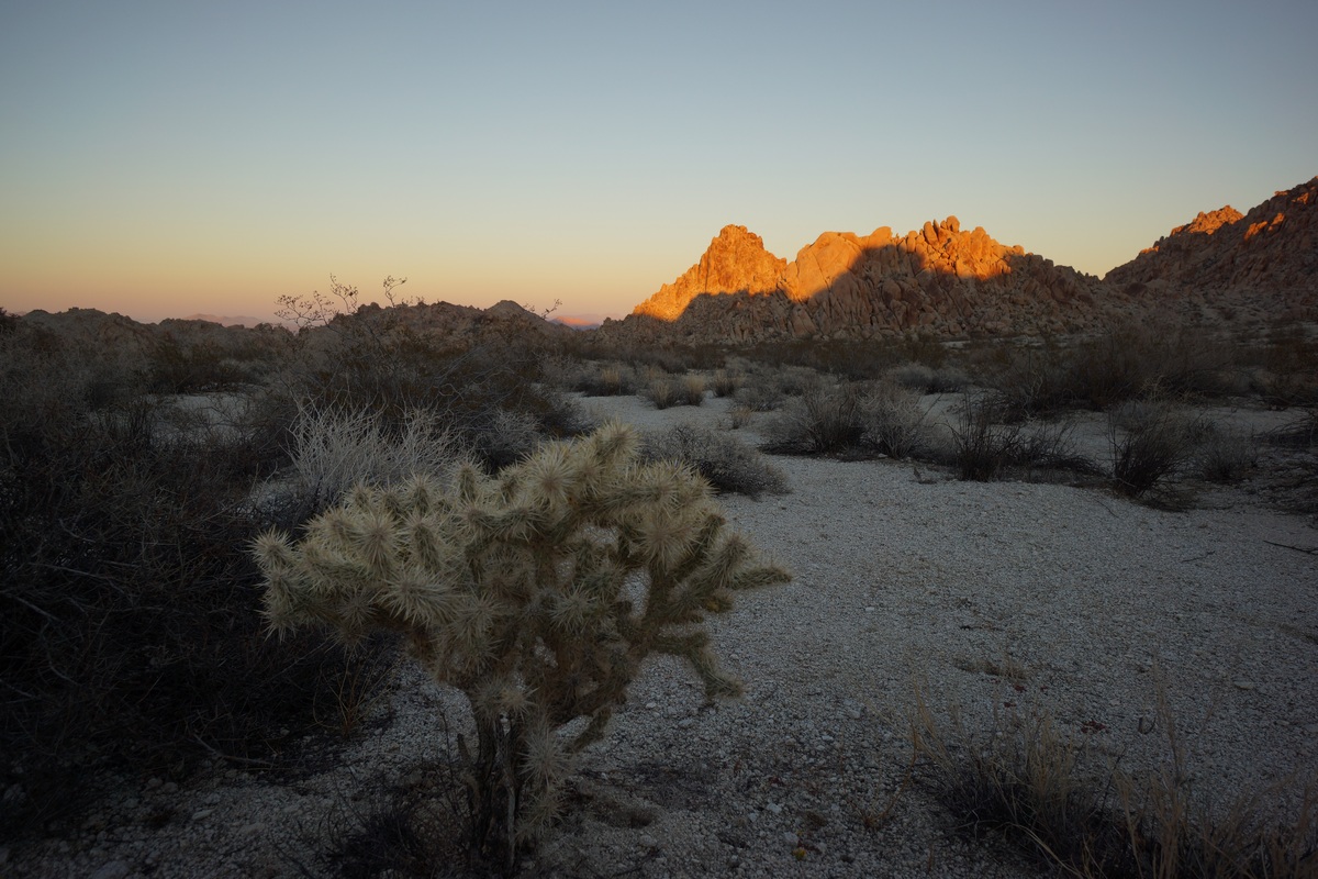

Sunset over the Pinto Basin

It wasn’t long before the sun was on it’s way down again, and fast. We decided to head back to the spot I visited this morning, on the southeast corner of the large open area. It was aonly a 10 minute walk to get there, but when we did the sun was just going down over the Pinto Mountains. It wasn’t the best vantage point base don the angle of the sun, but I snapped a few photos I was happy with. We ate dinner here as we watched the glow of the sun disappear.
Back at camp, we pretty much mirrored last night: sit on the rocks, watch the stars and chat. By 7pm we were both in bed again, seeking the relative comfort of the tent and the warm it provides.
Day 3 – Sunday December 4th, 2016
Miles Hiked – 7
Elevation Gain – 375′
I woke at 6am this morning, and Dan even woke on the first try. My original plan for today was to bag Tensor and Spectre peaks today on the way back to the car. However, Dan was not really wanting to do that after the climbing we did yesterday. He’d rather get back to the car early and spend the rest of the day driving through Joshua Tree or other areas nearby. While I was really looking forward to the great views from Aqua Peak (the name for Spectre, Tensor and Didiac Peaks), you really can’t go wrong with his plan either. So, I went along with the idea and started packing up my gear.


Hiking through the Inner Basin
We started hiking at 7am. It was a little warmer last night, and so this morning was easier to get moving. He hiked back towards the elevated cave, then down into the narrow wash leading into the Inner Basin.
We were able to follow our tracks back through most of the wash, not that that was necessary. The route is very straight forward, just follow the wash through the canyon. There is one large side canyon running northeast, but it’s obviously not the main path. This is the alternate route that’s marked on my caltopo map. I know nothing about this alternate route though, and skipped it because it looked like it would involve more climbing and steeper terrain that we won’t have to deal with if we continue the way we came.
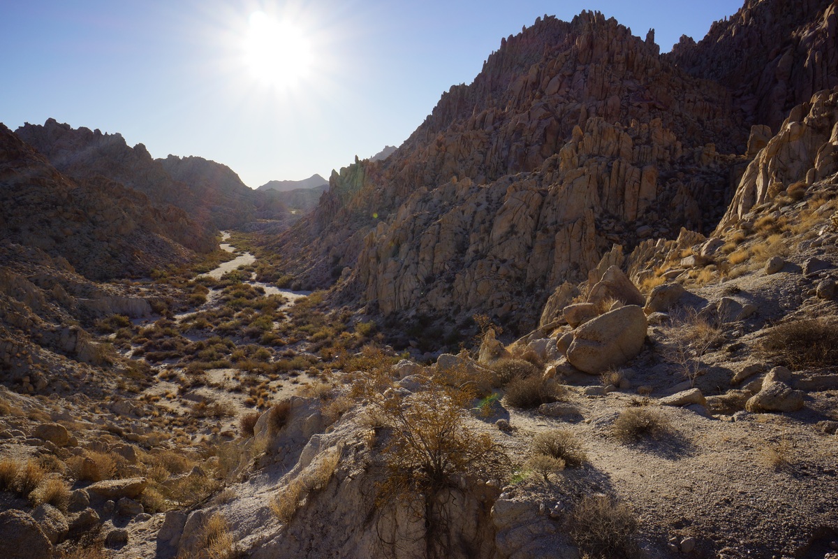
Looking south into the Inner Basin

Inner Basin Pass, looking south
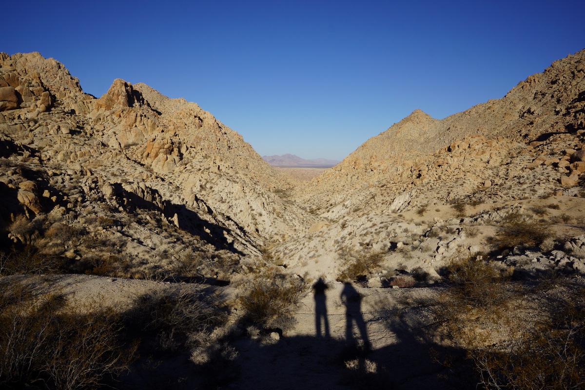
Heading out of the Coxcomb Mountains
We made it to the top of Inner Basin pass in good time, and had some nice views of the basin. We continued on down hill through a couple of patches of boulders, but the rest is pretty much sandy wash from here on out.
Back down in the main wash, we followed it out of the canyon and took the same path we took in two days earlier. We followed our own footsteps on and off as we hiked through the small canyon. I saw another jackrabbit through here, and wondered if it was the same one I saw Friday. It was practically the same area.
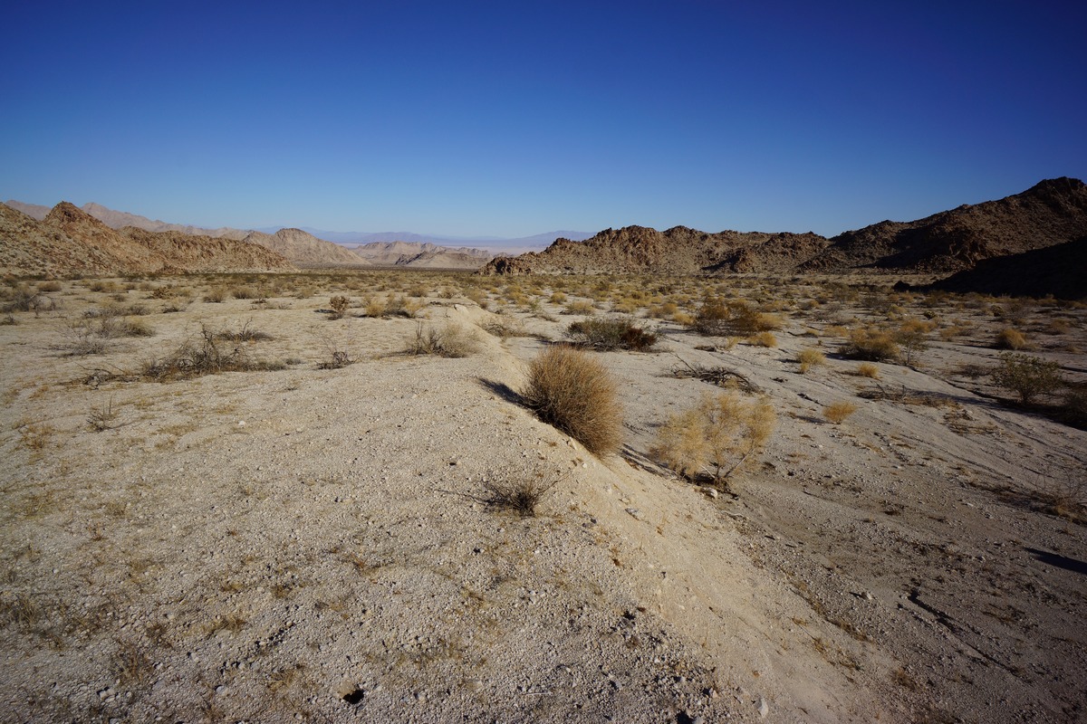
The landscape looked unfamiliar as we returned, as we now had a huge open desert in front of us. On Friday, all that was at our back and we only saw it as we turned back. It was nice to have this contrast as we left the mountains and now entered the desert.

The final stretch of desert had us talking about our dreams of a hot lunch. It took a while to actually spot hwy 62. The car was parked behind some boulders along side the road where others had clearly camped, and we headed for a graffitied rock that marked the spot. We were relieved to see that the car had not been broken into. The time was just before 10am, so almost a 3 hour hike from our camp.
From here, we headed back into 29 Palms and ate ate the Andreas restaurant. Good burgers, they really hit the spot! After this, we headed into Joshua Tree National Park on Utah Drive road to explore the park by car.
Final Thoughts About Hiking In The Coxcomb Mountains
The Coxcomb Mountains are a great place for a weekend hike, provided you’re OK with hauling in all the water you’ll need. Without a reliable water source though, longer trips aren’t really possible here. It doesn’t look like this place gets much use. The access probably keeps many people away, as well as the day use restriction in what might otherwise be the best camping spot.
As always, questions and comments are welcome!
If you found my trip report useful, please don’t hesitate to leave a comment! Alternatively, if you feel you have any information you’d like to share with others regarding this hike, please feel free to leave that below in a comment as well.
Related Images:
Pigeon River Country State Forest, MI – January 2015 (Trip Report)
Overview
- Location – Pigeon River Country State Forest, MI
- Park Type – State Forest
- Miles Driven To Destination – 500 miles Round trip
- Length Of Time Hiked – 4 days, 3 nights
- Miles Hiked – 11
- Trail Type – Basecamp, off trail
- Trail Difficulty – 5/10
- Fires Allowed – Yes
- Solitude – 7.5
Notes
If you plan on camping in the backcountry (on State Forest land, but outside of a state forest campground), the Michigan DNR (Department of Natural Resources) requires you to fill out a camp registration card. You need to fill it out in PENCIL and leave this card where you camped, tied to a tree or secured in some other way. This system is pretty dumb if you ask me. You need to carry a card for each camp you stay at, and a pencil… who brings a pencil backpacking? And why on Earth do they want you to leave it in the woods where it will likely be destroyed by the weather long before any DNR officer ever finds it? Regardless, you can print out your camp registration card (they are free) by opening the link below:
http://www.michigan.gov/dnr/0,1607,7-153-30301_30505_30731-31303–,00.html
Getting There
Many of the “roads” on the map in the Pigeon River Country State Forest aren’t really roads that you can drive on. These roads may have been old logging roads, but now are only passable by 4×4 vehicles with a high clearance. Many of these roads have downed trees blocking the path, or even new trees growing in the road. Some of the roads on the map simply weren’t there as well. Google earth showed roads on the map that were not there when reached that area.
From I-75, Sturgeon Valley Rd. coming from Vanderbilt is the main access road for the southern portion of the state forest, and Webb Rd through Wolverine is the main access road for the northern section.
Day 1 – January 2nd, 2015
Miles Hiked – 1.5
Route – Parking spot at Chaffe Rd & Osmun Rd to camp near Little McMasters Creek
Parking at Osmun Rd & Chaffe Rd
We arrived at our parking spot at the intersection of Osmun Rd and Chaffe Rd later than anticipated due to my car GPS taking us down some ridiculous route down non-existent roads. There was no parking area, but the intersection was very large and provided enough room to park two vehicles without being in the way of anyone driving down the road. Since we saw no tire tracks in the snow on any roads for the last 30+ minutes, we figured this spot would be acceptable. Actually, we tried driving east on Chaffe a ways first to see if we could park farther down, but quickly found that this would not be possible with one of the vehicles in our convoy due to huge ruts, downed trees and steep hills.
We loaded up our gear and started walking around 2:30, much later than I hoped. Fortunately, this trip is not about hiking a ton of miles and moving from camp to camp, but instead we planned on setting up a basecamp and just exploring the area. Before leaving home, I used Garmin Basecamp and Google Earth to pick an area that would be suitable for camp. From our parking spot, camp was mostly a straight shot down Chaffe Rd, and then off trail a short ways.
We saw elk tracks almost immediately after leaving the car behind. In addition, we also saw coyote and rabbit prints in the snow along Chaffe Rd. This section was hilly, and would be very hard to drive up in all but the beefiest 4x4s. Right now there was about 2 inches of snow on the ground, but we were expecting a few more inches this weekend. The walk was pretty quick and eventually the road ended. From here, we cut a path through the forest towards the area I had picked for camp. After a short distance, we reached a large clearing. The area had clearly been logged, but also seemed to have a lot of downed trees. Little McMasters Creek flowed through here, originating from this marshy area according to the map. We saw cattails and other signs that told us the ground we were walking on wasn’t completely solid. We headed towards the treeline once we had the chance.
As soon as we exited the logging area, we found ourselves in a thin stretch of cedar swamp lining the edges of the marsh. In the summer this probably wouldn’t have been a great place to camp, but right now it looked pretty decent as soggy areas were mostly frozen and there were obviously no bugs that typically plague these areas. There was a flat spot with good cover from the trees for Bryan’s tent, good space between the trees to hang my hammock (first time using one!), and an uprooted tree that would provide a good wind block for our fire. Most importantly, the close proximity to water. The creek was about 100 yards from camp which was very convenient. Yup, this is it, home for the next 3 nights.

Marshy area with Little McMasters Creek flowing through it
Now about 3:30, it was time to start setting up camp. Daylight is scare this time of year, and we had about 2 hours of light left to work with. Marc didn’t have to worry about setting up a tent, since he planned to hike back to the parking spot each night and sleep in the back of his minivan. Instead, he went to town on gathering firewood. He brought a hand saw and loppers which proved invaluable throughout the trip.
I mentioned that I would be sleeping in a hammock. I have been dying to try one for the last 2 years and finally have the chance to after receiving one for Christmas. The Grand Trunk brand hammock has no mesh bug liner or anything fancy about it, but for this trip it should suffice. I had ordered the Grand Trunk Funky Forest tarp to use with this hammock a few days earlier, but apparently UPS doesn’t deliver on New Year’s Eve or New Year’s Day, only air mail. Needless to say, I didn’t receive it in time. I had to use some lightweight blue tarps I bought at REI. The largest tarp I had was a little too short for the hammock but I had multiple tarps with me. For the first night, I just used one tarp overhead and one below me to set my gear on.
Bryan and I decided to go out for a short walk after setting up camp. We headed through the cedar swamp towards the east end of the marsh. Not far from camp, we picked up some coyote tracks that led right where we were already going, so we followed them. At the end of the marshy area the tracks ran along the top of a small burm or levee, separating this area from another large open marshy area to the east, which had a very thin line of trees blocking the view. The creek flowed from one open area to the other through a gap in the burm.
Once the sun went down it was time to get a fire going. I tried lighting the fire with some cattails and a spark from my firesteel, but that was a no go. Most of the wood was a little wet and snow covered, so the fire took some effort to get going. Finally, I was successful using a lighter and the stalks of the cattails, constantly feeding the fire with stalks since they go out fairly quickly. Now it was time to cook some italian sausages for dinner. How could they possibly be any better? Try eating them on cheesebread with shredded cheddar cheese sprinkled on top. No noodles in a bag for me!
After eating dinner and hanging out for a while, Marc headed back to his van. He was hesitant about sleeping in a tent this weekend since the temps were forecast to be in the low single digits on night 3. To each his own I guess.
The moon was nearly full and illuminated the marsh by our camp. The crisp air, dead silence and stillness of the night was very peaceful. I actually had the feeling of being in a remote location despite this being the lower peninsula of Michigan. There was a good chance we were the only ones sleeping out here tonight, as this place isn’t all that crowded with hikers and backpackers in the summer either. In May of 2013, I hiked the High Country Pathway, an 80 mile loop trail that runs through this area, and I didn’t see a single hiker. I highly doubt there will be anyone out here now.
When I went to brush my teeth tonight, my toothpaste was almost frozen. I had been trying to keep my water and any food that I planned on eating soon warm by putting it in my pockets, but I guess I’ll have to do the same for toothpaste and contact lens solution.
Tonight was going to be interesting. First night in a hammock, and I have never slept in temps this low (around 13 tonight). I gave my 0 degree bag to Bryan, and I took the 20 degree bag. I planned on sleeping in my clothes for extra warmth. I don’t have an underquilt to use under the hammock, so I used two inflatable sleeping pads (Thermarest ProLite and Klymit Inertia X-Frame) instead to block heat loss from below. We’ll see how the night turns out.
Day 2 – January 3rd, 2015
Miles Hiked – 4.1
Route – Logging roads, off trail
My first night in the hammock wasn’t the greatest. I had to get up once to put some more slack in the straps for the hammock so it wasn’t so tipsy. The extra slack helped a lot. My feet were cold but I was only wearing 1 pair of sock liners and one pair of smartwool socks. Tonight I will add another pair of smartwool socks, that ought to help. Also, as I had anticipated, not being able to turn over and lay on my stomach or sides was annoying.

Freshly fallen sow
There was a dusting of snow overnight, which was on my gear below me. Not too much so no big deal, but I’ll have to address that later. Right now I had to concentrate on warming up my feet, they were very cold! I ran up the hill behind camp and did a bunch of jumping jacks at the top and ran back down. That wasn’t enough so I used my hands to massage the feeling back to my toes. Definitely going to need to have wood ready for a fire tomorrow morning.

Built this to keep the firewood from getting buried in snow
After Bryan got up and we both ate, we started gathering more firewood. Then we realized that the snow coming later today and tomorrow is just going to bury our wood, so we decided to make a bit of a shelter for the firewood to keep it dry. There was a ton of great wood around as there were many downed trees near camp, so finding all the materials needed was easy.

Not the prettiest solution but for such short notice, it will suffice

After building a storage area for our firewood, I decided to beef up my tarp system to keep me and my gear protected from the snow. I repositioned the tarp over the hammock to be closer to one tree than the other, then added a second tarp on the exposed end. Also, I placed another small tarp over my gear below. This was a pretty ghetto solution but functional, and the best I could come up with on short notice. After all, I started planned this trip only 5 days earlier.
Marc finally made his way back to camp by late morning. My MSR Miniworks water filter wasn’t pumping water, so when Marc returned with his Katadyn filter we were finally able to fill our water bottles. I’m not sure what the problem was with mine, other than the fact that it was cold out, and I have never used it in temps this low yet. I have been using my SteriPen Opti for the last 2 years due to it’s smaller size and weight.


We were anticipating several inches of snow over the next few days and thought it would be nice to have a bit of shelter overhead while we sat in front of the fire, so we made a quick lean-to. There weren’t many downed pine or cedar trees around though so we were short on roofing materials. Still, it will act as a wind block and provide at least some protection from the snow.
Once we were done with improvements to basecamp, we headed out for a day hike. We didn’t have any set location to head to, we were just out wandering around for the most part, following anything we thought may be interesting. We headed south from camp, which took us up hill and into a large clearing with a single huge pine in the open. There were a few sets of coyote prints here, which we followed through the field. At the other end of the field was a huge pine tree, alone out in the open. We then entered the woods again, following a faint pathway between the trees.
Eventually we ran into an old logging road, which we followed until it dead ended into another logging road. This road actually showed up on my GPS and was Little McMasters Creek Trail. The road had tons of animal prints on it, including coyote, deer, and elk. We took a right and followed the road a ways until we came across a field to the west. On the other side of the field, the land looked more hilly, and we decide to head that way.
There was no trail or road to follow now, so we cut a path trough into the woods through unbroken snow. There was maybe 3 inches on the ground, so it wasn’t too difficult to walk through. It was slippery in spots, especially going up and down hills. It was nice walking through here but with three guys, I am pretty sure we scared off any animals that were around. Several times we came upon some extremely fresh tracks, deer mostly.
The temperature was warming up today and was forecast to be around 32 for the high, which would be the high for the entire trip as well. We were pretty warm from climbing up the hills with all our layers on, so we took a break to cool off before breaking too much of a sweat.
After our break, we started heading in the direction of camp. The GPS showed a nice loop forming as we cut a direct path back. There were occasionally some logging roads the we crossed but eventually stopped following them as they would often curve and lead us away from camp. The woods weren’t extremely thick but there were a lot of smaller trees that were perfect for eye poking. It was nice to finally make it out of the woods and back into the large field with the lone pine tree near camp. From here we followed our tracks back. Today’s hike was 2.5 hours and about 4.5 miles.
For dinner tonight I had some bacon, sausage and flatbread with olive oil drizzled on it, among other snacks. I cooked the bacon and sausage in aluminum foil over the fire. After losing 15+ pounds in 8 days on my hike in the Wind River Range this summer, I was determined not to lose any weight this trip. It took me 3 months to gain that weight back in the gym. This time, I brought 9 pounds of food for 2 full days and 2 half days, and was not having any problem chowing down like a madman. One of my favorite things about hiking is eating a bunch of good food (fatty animal meats for instance) I normally wouldn’t get to eat at home because I try to eat healthy. Out here, I need all the calories I can get!
We were getting some flurries this evening but nothing serious. I weren’t sure exactly when the bulk of the snow was coming but knew it was sometime tonight or tomorrow. Our firewood storage structure was full of wood and ready to fuel the fire tonight and tomorrow morning. After waking up with freezing feet this morning, I wanted to make sure I could get a fire going in the morning asap.
While sitting by the fire we heard several coyotes howling in the distance. Between breaks in the clouds we could see that moon was now almost full too. Now, it was time for Marc to hike back to the van for the evening. I’m sure glad I didn’t have to do that every night, especially after dinner. Speaking of after dinner, it was time for more food… chocolate to warm me up before bed!
Day 3 – January 4th, 2015
Miles Hiked – 3.7
Route – Logging roads, off trail
I slept much better last night. I was more used to the hammock and was more comfortable in it. I added an extra pair of smartwool socks to keep my feet warm, and put my feet and legs into the arms of my rain jacket. Sounds silly but this has worked for me in the past on cold nights. Actually though, last night wasn’t that cold, it was the warmest while we were out here, with lows in the mid 20s or so. This morning was much more bearable.
About 2 inches of snow fell over night. Good thing I added the extra tarps to my setup, that helped keep the snow out. I was getting some condensation buildup on the inside of the tarp though. This freezes and falls on my sleeping bag throughout the night, especially when I would shake the tarp to knock off snow that has accumulated on the outside. Even so, I was dry all night so I can’t complain.
Our 3 sided firewood storage area allowed some snow in but not nearly as much as without it. I got a fire going and started cooking some bacon bacon for breakfast. Afterwards, Bryan and I filtered some water from the creek.
Marc showed up a little earlier this morning, and we then proceeded to gather firewood for tonight and tomorrow morning, which we anticipate to be the coldest of the trip.

Little McMasters Creek flowing through a large open area. Much of this was soggy and partially frozen.
We headed out for another day hike around noon. This time we thought we would follow the marsh east. We hiked through the woods along the marsh for a while before trying to venture out into the open area, which looked more like a normal field now than a marsh. However, it wasn’t long before my foot went through a soft spot on the ground and some water got into my boot. We headed back into the woods where the ground should be more solid. This was true for a short while, but eventually we reached an area where there was pools of water pretty much everywhere as we were basically still in a cedar swamp. We decided that it wasn’t worth walking through this area and headed back towards the way we came.


Overlooking a logging area just west of Canada Creek Ranch
On our way back towards camp we hit Little McMasters Creek Trail again, north of where we hiked it yesterday. We walked south on this road for a short while before heading east through a field. We saw some human footprints in this field that were probably a day or two old, as the prints were visible but had new snowfall on them. I figured they led into the Canada Creek Ranch which was not far from here. We decided to follow them and see where they went. The footprints led us down a series of logging roads, fields, and pathways in the woods before we reached an area that had been logged. Since the Canada Creek Ranch is private property, we figured this would be a good place to turn around since we were pretty close to it now.
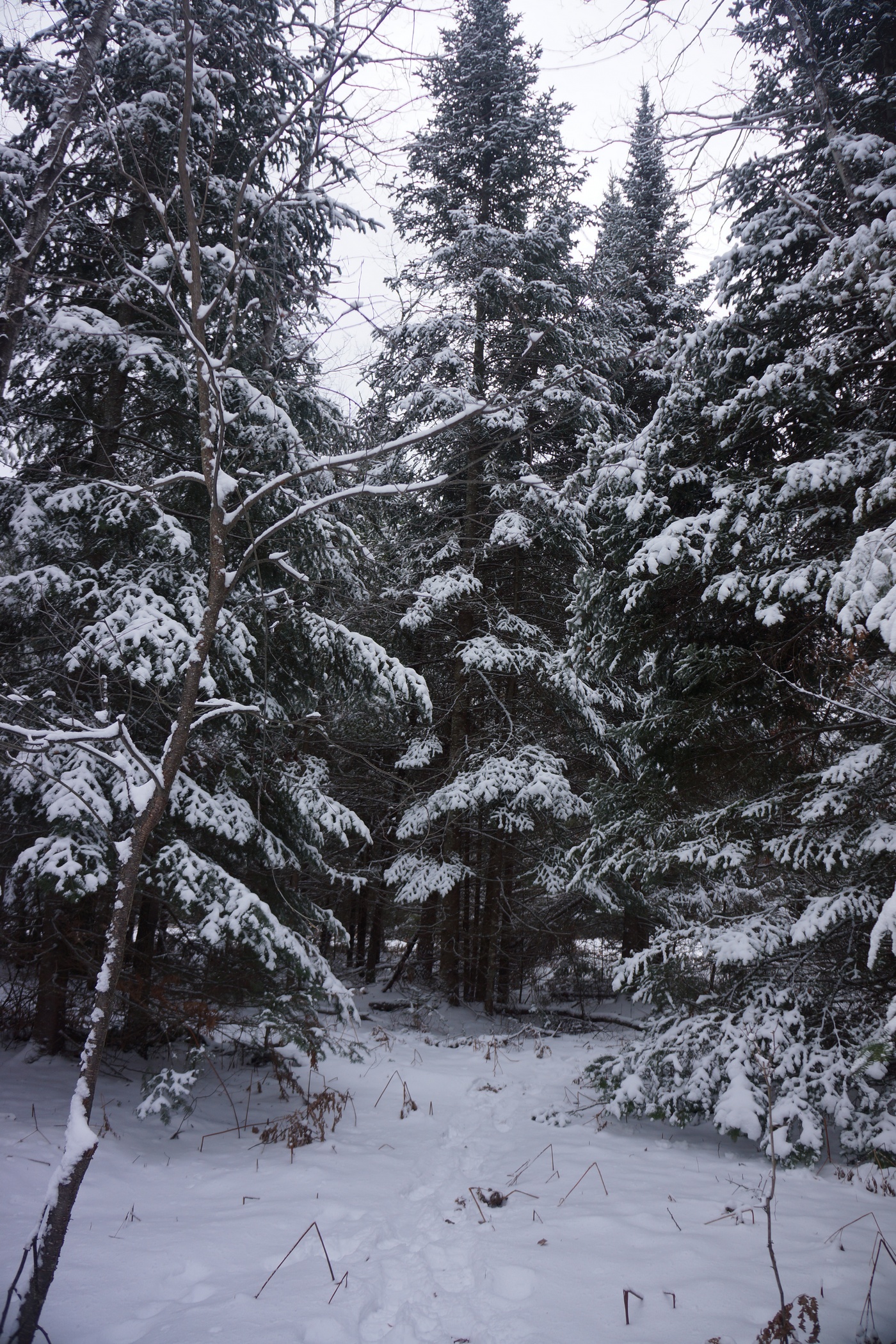
Walking among these snow covered pines was beautiful

The hike up to this point was very pretty with lots of huge, snow-covered pines. This was what I was envisioning for a winter hike. The snow was coming down a little bit here and there all day long, never very heavy at any time though.
We returned back to camp in mid afternoon. The temperature was really starting to drop. A few minutes of sitting and I was cold. It was hard to stay warm now since we weren’t moving. After eating some food and relaxing for a while, we headed out for another short hike. This time, we wanted to head north, which meant crossing the marsh. We didn’t want to cut through it near camp, so we headed west a ways before turning north, hoping to go around any wet areas. However, this area was looking pretty thick and we decided that it wasn’t worth the effort. Instead we just headed back to camp again, this time for the night.
We got the fire going early tonight since it was so cold now. There was intermittent wind in addition to on and off flurries. We hovered by the fire for warmth all night while we cooked dinner and waited for bedtime. This was definitely one of those times when you didn’t want to leave the fire. It’s easy to forget how cold it is just a few feet away. My watch can read the temperature, but apparently not when it’s this cold. Everything else on the watch was functioning properly, but when I left the watch out in the cold for a few minutes the temperature wouldn’t register. After warming it up with my hands for a few seconds it read 14 degrees, so I know it was colder than that. It was only going to get colder as the night goes on.
Day 4- January 5th, 2015
Miles Hiked – 1.6
Route – Camp near Little McMasters Creek to parking spot at Osmun Rd. & Chaffe Rd.
I did everything I did the night before to stay warm, but my feet were cold again tonight. My body was mostly warm despite a few shivers throughout the night. All in all, the night was pretty tolerable though considering it was likely several degrees below 0 with the wind chill. We got a few more inches of snow overnight bringing the total up to 6-8 inches.
The worst thing about today was that my boots were frozen. I had shoved my gloves into the boots and put them under a tarp, but they were quite solid when I attempted to put my feet in them. I had to piss so bad after being in the hammock for 10 hours, so I just forced my feet in there so I could get out of bed. I immediately lit a fire and began thawing out my boots, and my feet. It’s amazing how quickly those boots sucked out any remaining heat that was left in my feet. I spent a good 15 minutes regaining feeling in my toes before moving on to other chores.
Bryan had to be back downstate by 6pm for work tonight, so we tried to pack up camp as quickly as possible this morning. He wasn’t feeling good from something he ate yesterday so he didn’t cook any breakfast. I was going to cook some sausage links but decided to save time and just eat a Metrx bar.
Packing up camp was a pain because every time the wind blew, huge clumps of snow would fall on me and my gear. Once I packed the tarps I had no protection from the falling snow, which got inside my backpack and over other things. The good news is that it was so cold that the snow wasn’t wet at all, and it was easy to shake out. The fire was essential for warming my hands every so often.
We left camp around 10:30 this morning. Marc was sleeping in his van, so there was no need for him to come to camp this morning. Instead, we would hike back to him and our vehicles. This was a lot easier a few days ago when there was less snow. Now, there was a good 8 inches in spots, and the hike back was rather hilly. Bryan was worn out from not eating any food over the past day due to his stomach, so he was having trouble with the walk back. Good thing it’s only 1.5 miles. Felt like 5 miles though.
Once we reached our vehicles, Marc was there to greet us. He had to jump start his van this morning with Bryan’s truck. It sure was nice having two vehicle here this time. Bryan’s truck read 3 degrees outside, and this was at 11:30. I wonder how cold it was at 6am?
We took a different route back to Sturgeon Valley Rd, the main road leading back to Vanderbilt and I-75. I was concerned about Marc’s minivan making through the unplowed roads but we made it out without issues. Woohoo, first winter camping trip under my belt!
Final Thoughts
This trip was more of a learning experience for me than anything else. I wanted to see what it was like and what it takes to camp in cold weather. Specifically, what gear I found useful and which I could do without. The first thing I would leave behind next time is the shovel. I was envisioning more snow and the need to dig out an area for the tent, near the campfire, etc. Unless there was at least a foot of snow on the ground or the snow was hard and icy, I don’t see a need for it in this area. Maybe in the mountains but not Michigan’s Lower Peninsula. I definitely need to get a longer rain jacket too as mine is shorter than my insulation jacket below it. It’s a tight fit with all those layers on.
Sleeping in the hammock was comfortable overall, much more than sleeping on the ground. When sleeping on the ground I felt like I was waking up every 20-30 minutes when my arm or leg would go numb from laying on it. Coming up with a rainfly setup for the hammock is my next challenge.
The Pigeon River Country State Forest is, in my opinion, the most wild area in Michigan’s Lower Peninsula. We didn’t see anyone else out here, not even tire tracks in the snow on any state forest road. Lots of animal tracks as expected but with three guys traveling together I didn’t expect to see much. It was kind of discouraging seeing all the “roads” that criss cross through this area on the map, but in reality, many of these roads aren’t used at all, since they are impassible by car or simply non existent. I have been through this area twice before in the summer, and never saw any hikers either time. This time was no different, didn’t see a soul. Not surprising given the weather.
As always, questions and comments are welcome!
If you found my trip report useful, please don’t hesitate to leave a comment! Alternatively, if you feel you have any information you’d like to share with others regarding this hike, please feel free to leave that below in a comment as well.
Related Images:
Wind River Range Traverse, WY – August 2014 (Backpacking Trip Report)


Wind River Range High Route Hike Overview
View ALL my pictures from the hike here: Wind River Range Traverse Photos
View an HD video of this hike on youtube: Wind River Range Traverse
- Location – Wind River Range, Wyoming
- Park Type – National Forest, Wilderness
- Miles Driven To Destination – ~3500 miles Round trip
- Trailheads – Start at Green River Lakes TH, end at Big Sandy Trailhead
- Length Of Time Hiked – 8 days, 7 nights
- Trail Type – Point to point
- Miles Hiked – 100.9
- Trail Difficulty – 9.5/10
- Solitude – 9 (except near trailheads or Cirque of the Towers)
- Scenic Beauty – 10
- Fires Allowed – Yes
Notes About the Wind River Range

The Wind River Range is a mountain range located southeast of Yellowstone and Grand Teton National Parks, running NW-SE. Lander is the main town on the east side of the range, and Pinedale is the popular staging town on the west side of the range. It’s so rugged that there isn’t a single road that crosses the 100 mile mountain chain, forcing you to drive around it. The Continental Divide trail runs through the Winds, as they are called for short, and is often labeled one of the most spectacular sections of the entire 3,000 mile hike. The Winds are home to Gannett Peak, Wyoming’s tallest at 13,804ft, and more than 40 other 13ers. It’s home to the largest network of glaciers in the American Rockies. Grizzly and Black Bear roam these mountains, as well as Big Horn Sheep, Elk, Moose, Wolverine, and Wolves. World class trout fishing can be had in the Winds as well, in the rivers or many alpine lakes. Despite it’s popularity, it’s one of the most remote backpacking destinations in the lower 48, with spots as much as 20 miles from the nearest trailhead. Ok, are you drooling yet?? Yeah, this place is every bit is awesome as it sounds.
Wind River Range High Route Maps
Download a GPX file of this hike here: Wind River Range Traverse GPX File
Here’s my caltopo map for the Wind River Range High Route as I hiked it:
Getting There
The night before I left home, my hiking partner Marc and I were running around doing last minute errands. It was raining, than it rained some more, and then all of the sudden it was a Florida-like outburst of torrential rain that did not let up for over an hour. Large pools of water started forming on the roads as we pulled into a gas station for our last stop. The rain had just started to let up, and now extent of the flooding was fully evident. Looking out onto the main road, water was mid door height on the cars brave enough to ford the water. Waves of water sloshed into the gas station parking lot, and into the neighboring shopping plaza, where water looked to be about 3 feet. This is crazy, Michigan doesn’t get this type of flooding. Locals are calling it a “once in 50 years” type of storm. Later we found out that some spots received over 6 inches of rain in only a few hours. It was reported that 1.24″ of rain fell in just 24 minutes at Detroit Metro airport!
Even though I only had a 1/4 mile to drive from the gas station, I just barely made it home myself due to the depth of the water. Side streets were filled with dead cars, casualties of the flooding. Absolutely crazy, I have never been through anything like this. My neighbors’ basements were flooding, as were friends in the area. So far, mine was holding tight.
The plan was to get up at 6am tomorrow and start driving, but at 11pm I noticed my basement was starting to take on water. Good thing Marc was here with me, it was great having an extra hand to get everything of value off the floor before it got wet. Also, we had to rip out some carpeting before it got water logged. The basement ended up with about 1-2 inches of water in the deepest spots. By 1am, I had done all I could do, and tried to get some sleep. Now, I was unsure if I would even be able to leave, considering the circumstances.
The water was receding at 6am when I woke up, and was fully drained by 8am. I turned on a dehumidifier, several fans and turned down the central AC. I figured this was pretty much all I could do even if I was stuck here dealing with it. I was uneasy about leaving the house but wasn’t about to miss this hike! I was out the door about an hour and a half behind schedule. Not bad considering the circumstances! I also had a friend come by a few days later to check on the house, just in case.
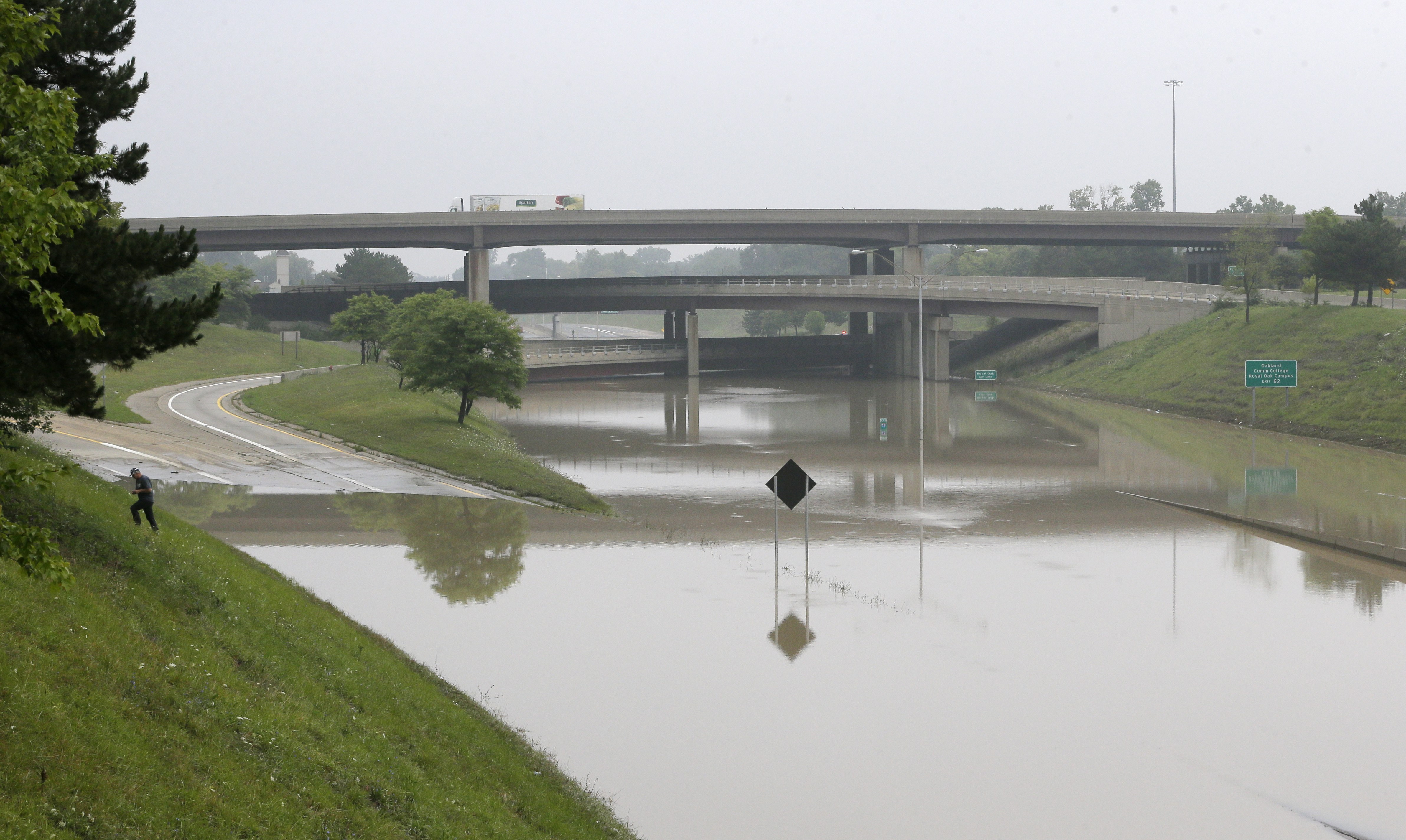
Yeah, I don’t think the freeways are an option right now…
It was tough getting out of metro Detroit once we finally got on the road. Almost every road in my area was flooded, damaged, had dead cars in the middle of the road or some other obstacle. Marc played navigator, checking traffic on google maps. Freeways were out of the question, since they were filled to the top with water last night and completely out of commission today. We snaked our way through side streets and tried to avoid major road closures, which were pretty much everywhere. We would have spent hours trying to get out of town if it wasn’t for google traffic.
Once out of Southeast Michigan, the next 1,000 miles were pretty boring. Corn, as far as the eye can see for hundreds of miles. Once into Wyoming, the landscape became much more interesting. This was the first time I had ever been to the “Cowboy State”, which is the least populated state in America and the 2nd least in terms of population density. In other words, there’s a lot of open land here. Incredibly vast amounts of it. But, a great drive with lots of variation in land formations.
We arrived in Lander, WY late in the afternoon, where we had a hotel booked for the night. There was a Safeway grocery store in town for last minute shopping needs. We ate dinner at the Dairy Land drive-in. This place serves deep fried cheeseburgers called a “cheese wheel”. I highly recommend it if you happen to find yourself in Lander!

The long road to Big Sandy
The next day, we drove to Big Sandy trailhead on the west side of the Wind River Range. This is the southernmost trailhead in the Wind River Range. Once we turned off HWY 28 onto Lander Cutoff Rd, it was about 36 miles to Big Sandy campground. The landscape was a desert scrub with some rolling hills, and some interesting land formations. The transition between the desert and the mountains was much more drastic than I thought. As far as the road condition goes, the first third of the 36 miles was pretty rough, the middle third was pretty good, and the final third was rough. But hey, if a mid 90s Saturn can make it, so can whatever you’re driving.
From here, we parked the car and waited for out pre-scheduled shuttle service to pick us up and take us to Green River Lakes campground, the northernmost trailhead in the Winds. The Great Outdoor Shop in Pinedale, WY offers this service. You might also try to contact taxi companies in Pinedale to shuttle you from one trailhead to another, if you aren’t hiking a loop.
As soon as our shuttle service dropped us off at Green River Lakes campground, it started raining a little. I was able to get my tent up pretty quick, but Marc struggled with his due to being unfamiliar with it. By the time we got everything set up, we decided not to get in our tents and instead to wait out the rain in our rain gear underneath the awning of a little building nearby. It was some sort of maintenance shed, and the doors were locked. We got a little wet, but the weather cleared up after an hour or so.
After the rain let up, we walked down to Green River Lake. Squaretop Mountain dominates the view to the south. We haven’t even started the hike yet and already the scenery was incredible.

View from the Green River Lakes campground
Day 1 – Friday August 15th, 2014
Miles Hiked – 12.6
Route – Green River Lakes trailhead to Three Forks Park
Today’s Map

I woke up today at 6am. It was very foggy, with visibility only a few hundred feet. It rained last night and everything was wet. We were slow to leave camp this morning since this was Marc’s first overnight backpacking trip. He hasn’t yet familiarized himself with his equipment (much of it is borrowed from me), nor has he developed a system for setting up or breaking down camp. So, this is going to be a learning experience for him.

The outhouses at Green River Lakes campground where the nicest I have ever seen. Definitely not going to have that luxury for the next week, so we made one final stop here. We left the campground around 8:15 and made our way down to the lake to find the trail. Once we were on the path, it promptly crosses the Green River, where it winds through a meadow. The sun was burning off the fog, and already we where blown away by the beauty of this place. The plan for today is to hike upstream along the Green River and find camp in Three Forks Park.
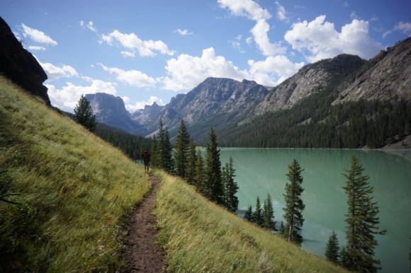

The sun wasn’t high enough in the sky to see the true color of the first lake, but the next lake up in the chain was properly illuminated. We stopped for a gear adjustment and quick snack here. Such amazing color, that green. Some hikes seem like they take a while to “get to the good stuff”. Not this one, right into it from the beginning.


After passing the second lake, the Green River snakes its way through various meadows and woodlands. Again, the color of this river is mesmerizing. The trail follows close to the water most of the remainder of today’s hike.Also, the trail was very easy to follow all day.

We passed a few people here and there today, but nothing crazy. Far less than I was expecting. Marc seemed to do well on the trail today. He kept up a good pace wasn’t having any trouble breathing.
Although Beaver Park had some camping opportunities, we chose Three Forks Park because it’s pretty much the southernmost camping area along the trail before it starts going up in elevation. We hiked 12+ miles today before stopping to set up camp at around 2:15. There weren’t an abundance of good campsites here though, at least not obviously visible from the trail or near it.

Camp was nice, it had all the amenities… close to the river, fire pit, good cover from large, healthy pine trees, and a bear hang rope already set up in one of the nearby trees.

View from our campsite in Three Forks Park
While Marc set up his tent and experimented with his hiking routine/gear set up, I took full advantage of this sunny afternoon by fishing in the Green River. I brought a small collapsible fishing rod (brakes down to 5 pieces, and maybe 15″ in length) and a tiny reel with 4lb test line. For tackle, I mostly used spinners. Didn’t catch anything here, and I was a little disappointed considering the hype this place has for trout fishing. However, the countless alpine lakes still lay ahead. Better luck next time.

Marc had spent most of the afternoon setting up his camp, and making adjustments to his gear. He had a blister forming on one heel, but he attributed that to an improperly cut insole he added to his shoes. He trimmed that up some more and various other adjustments.
Firewood was fairly abundant nearby, and we had a campfire going come early evening. Marc pulled a “Dan”, and burned some of his gear tonight in an effort to save weight. His glasses case and a spare pair of underwear met their demise in the campfire tonight. All I could do was laugh.
Tomorrow is shaping up to be one of the hardest days of the trip, based on the elevation gain and distance. Right now we are at 8,300ft elevation in Three Forks Park, and Knapsack Col (a col is like a pass) is over 12,200ft, plus all the other ups and downs of a 13+ mile hike. We decided to go to bed early at get an early start.
Day 2 – Saturday August 16th, 2014
Miles Hiked – 13.7
Route – Three Forks Park to Titcomb Basin
Today’s Map
I woke up at 5:15 this morning. Shortly after Marc got up, he informed me that his breathing was a real concern and he wanted to turn around and go back. I was shocked that he was saying this right now. He spent a quite a bit of money on his clothing and various other items for this trip, along with the time and money spent getting all the way out here. It must be bad if he is willing to turn around now. However, I’m not turning around. I’m not cutting my trip short. I’m going to continue on solo and finish this hike!
We talked for a while about how we were going to handle this situation logistically. His plan was to hike back to Green River Lakes campground. From there, his options consisted of camping at Green Lakes for a few days, hitching a ride to Pinedale for a few days, or hitching to Big Sandy and camping there. Or, a combination of all three. Either way, he must end up at Big Sandy campground in a week to meet me at the end of my hike. He threw out the possibility that he may try to join me in the Cirque of the Towers my last night if his breathing is up to par. In this case, we would meet at Lonesome Lake at 6pm next Thursday night. If he’s not there, meet at my car at Big Sandy campground as planned the next day at 2pm.
It was a strange feeling to part like this. However, I must continue on now, solo. I hit the trail around 7, and it quickly starts climbing. After about 1,000ft elevation gain through some switchbacks, the trail crosses Trail Creek. This was one of two streams I actually had to put on my water shoes to cross during the trip. It was less than knee deep, but not able to cross by hoping rocks.


Descending Vista Pass, looking towards Cube Rock Pass
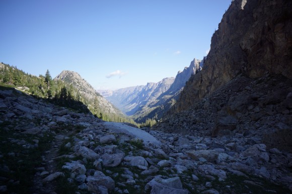
Looking back the way I came up
Once past Trail Creek, I saw a few other campers set up here in Trail Creek Park. The trail then continues to climb another 1,000ft or so to Vista Pass. Above 10,000ft now, the land opens up a bit and finally starts to look the alpine hike I expected. The trail descends the pass briefly and then continues up through a long, rocky gully.

Dale Lake

Peak Lake
After climbing up another 600ft or so, I reached Dale Lake. Now the scenery was turning from great to stunning. As I continued on, I could see Peak Lake in the distance. I started to slow down quite a bit now as the scenery required more stops for photos.

Traversing Peak Lake’s north side
As I made my way across the north side of Peak Lake, a forest ranger passed by, carrying an axe in his hands. He asked me where I was headed and that was pretty much it, he was on his way. The first half of the traverse around Peak Lake was up high above the lake, in a field of large and steeply stacked boulders. Then the trail drops rather abruptly down to lake level, where the trail remains for the second half.

Looking back at Peak Lake

Nearing the source of the Green River
Past Peak Lake, the breathtaking views continue to amaze. From this point on, I can follow the Green River up to its source below Knapsack Col. Standing on the very spot where water trickles out of the ground and forms such an iconic river of the west was pretty cool. It’s hard to believe that this little stream becomes the main tributary for the Colorado River, which cuts through the Grand Canyon.

At the base of Knapsack Col, and the source of the Green River
Now at the base of Knapsack Col, I could see the challenge that lay ahead of me. It was only about 600 vertical feet to the top, but it looked damn near vertical. Scrambling up the steep boulders was brutal. I snapped one of my trekking poles, a Gossamer Gear LT4. I was pretty bummed about that.
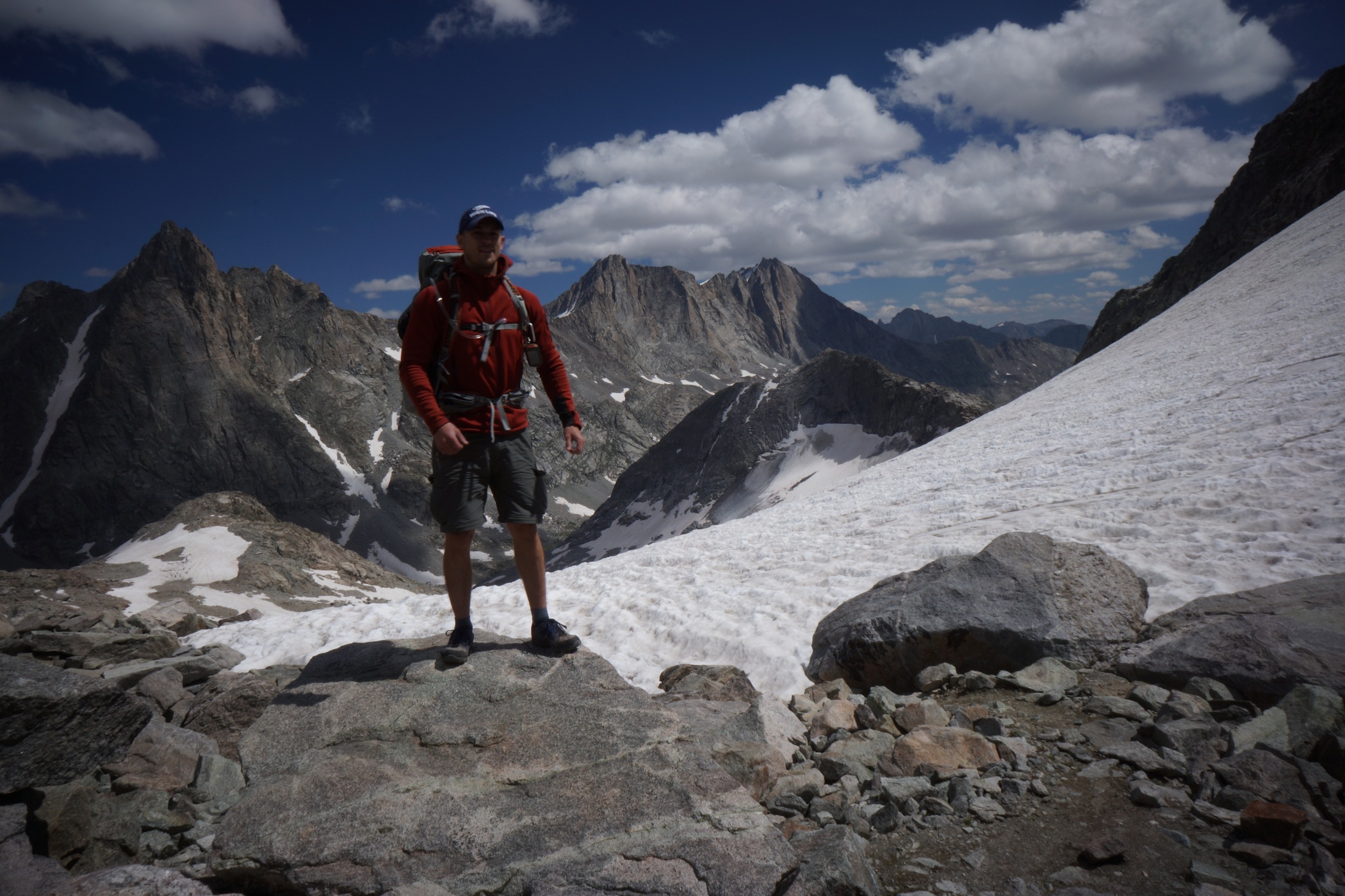
On top of Knapsack Col
At the top of Knapsack Col, ~12,260ft, there was a group of about 10 people who just came up the other side. At first I thought they might be part of NOLS, but they were part of a community college trip of some sort. One guy had cell phone service up here, but I did not.

Descending Knapsack Col onto Twins Glacier

Looking back up Knapsack Col
Now it’s time to head down Knapsack Col and onto Twins Glacier. The top section was mostly rock and dirt, now snow or ice. However, it was very steep. After a few hundred feet I took my first steps in the snow. My Inov8 Roclite 315 trail runners have handled everything else well up to this point, but they were pretty slippery here. It was pretty steep, and I ended up just glissading down the top section. I my camera out, which got a little wet from the snow flying up everywhere. The bottom of my backpack also got pretty wet from dragging in the snow a little bit. No big deal, but next time, I’m going to put the rain cover over my pack and put my camera under my jacket when I glissade. Definitely fun though!

Twins Glacier
One scary thing about hiking on the glacier was that occasionally, I would take a step and one leg would fall through the snow and I would be up to my crotch. I just kept hoping that I didn’t fall into something larger. Once off Twins Glacier, the remainder of the hike into Titcomb Basin was rocky and soggy. Lots of water flows through the rocks up here, and under the snow in spots. I was getting pretty tired now and looking forward to finding camp. There was one campsite high up in the basin, well before the first lake. I wanted to make it farther today, so I pressed on.


Upper Titcomb Basin, looking south

Titcomb Basin, looking north over Titcomb Lake
The Titcomb Lakes were huge once I got up to them. The hike around the first lake was nice. I could see a few tents up in the distance, but I was not seeing any good campsites along the trail where I was yet. Any campsites I have seen thus far have all been behind large boulders for wind protection.
Finally, I settled on a spot in between the Titcomb Lakes, perched up on a little hill. I didn’t know how much farther I’d have to hike before I found another suitable camp, and I was exhausted. It was 4:45 by the time I stopped today. Although there was no huge boulders here, there was a rock wall. At least I had some protection from the wind.


My water source for the evening
I spent much of the evening reinforcing my rock wall and positioning my tent out of the wind as much as possible. I hate sleeping in high winds. I’ve had my tent blown over in the middle of the night a few times before, it’s not fun. When the wind wasn’t blowing, the mosquitoes were out!

Watching the sunset from camp
The sunset was nice, and the winds started dying down some after dark. I was in bed pretty early tonight. Another long day lies ahead of my tomorrow.
Day 3 – Sunday August 17th, 2014
Miles Hiked – 13.4
Route – Titcomb Basin to Alpine Lakes
Today’s Map
I woke up at 6 today and was on the trail by 7. My intended campsite for today is at Camp Lake. Starting this morning, I won’t see anyone for 2.5 days from this point on.


I wish I had more time to explore the Island Lake area, but I have a lot of ground to cover today. The trail was great in some spots, and tough to follow in others.


Indian Pass Trail winding through Indian Basin
Indian Basin. Simply incredible.
The hike through Indian Basin was beautiful, especially the upper portions of the basin. The weather looked like it might possibly rain for a minute, then it cleared back up. Nice, more blue skies!

Using my tripod as I near the top of Indian Pass

View from Indian Pass

Another view from Indian Pass

Knifepoint Glacier from Indian Pass

That’s my glissade mark on the right
Once on top of Indian Pass, I could see Knifepoint Glacier, which I had to descend next. The descent was very steep at the top. I tried to follow the talus down for a while to someplace less steep before stepping onto the snow. Now, I could glissade my way down again. This time, I prepared myself better, and everything went much more smoothly. I didn’t get wet and neither did my camera. Great success!

Hiking on Knifepoint Glacier
At one point, my leg went through the snow again, only this time there was a large rock in the space below the snow for me to bang my leg on. My forward momentum of my upper body kept moving forward as my leg remained stationary, and this seemed to stress the knee. While this didn’t hurt too bad initially, I think it may have played a role in the knee pain I would experience later on during the hike, and as I write this now, 6 weeks later.

Knifepoiot Glacier terminus

Knifepoiot Glacier
I continued to head down the glacier, until I realized that I was of course. I was supposed to follow the 11,640ft contour line to the base of Alpine Pass. Instead, I hiked too far down. When I realized my mistake, I had to re-plot my course. The most direct route now involved descending the glacier completely. This was a rather interesting experience. Water could be heard flowing beneath the snow in many spots. It was steep in spots and quite slippery in trail runners. However, I did get to do more glissading! I turned around on my stomach and used my trekking pole as a brake. This slowed me down some, but certainly didn’t stop me. Without the brake, I was picking up some speed.

Knifepoint Glacier viewed from alpine pass

Standing on Alpine Pass, looking southeast at the Alpine Lakes chain

Waterslide of doom
The climb up to Alpine Pass was about 750ft. Seemingly everything here in the Winds is steep and rocky. At the top, I got my first glimpse of the Alpine Lakes area. Unlike the rest of the hike so far (since the top of Indian Pass actually), there is no trail on the map. I have 3 alpine lakes to hike around before reaching Camp Lake. I’m taking the western shoreline of all three lakes. Once I got down to lake level, there was a narrow snow slope to cross before continuing on. There were lots of these along the hike, where it slid straight into the icy water. I kicked in some steps along the slope as I walked along here, and much higher above the water, away from the overhang at the edge.

The next couple hours sucked. The shoreline wasn’t passable, and I had to head up another steep slope in search of a way around this lake. A passable route was never clear, so moving forward was a matter of going a little ways and peeking around the next ledge or boulder. Sometimes it was a dead end. This ate up a lot of time and energy. At one point, I had to climb down a class 3 ledge system with a 40ft drop to continue along.There were definitely some sketchy moments along the ledges up here.


While moving across a large boulder field, I slipped and braced my fall with my left hand, smashing it on a boulder, palm first. The thumb and hand ended up getting pretty bruised and swollen later on. I believe it was a sprain. Most of the time it didn’t bother me too much afterwards, but there were a few painful mishaps with it later on in the week. Both knees were also starting to hurt as well.
It was late afternoon now, and I was past the first lake. Battered, hungry and tired, I accepted the fact that I wasn’t going to make it to Camp Lake today. Instead, I would try to hike a little farther, to the southernmost Alpine Lake. That is, if there is even a decent campsite there. I haven’t yet seen anywhere I’d want to or even could camp at yet in the Alpine Lakes area.

Camp at Alpine Lakes
The second lake in the chain was much easier to get around. Nothing here was protected from the wind though. I could see a bit of a peninsula that jets out into the 3rd lake in the distance, so I head for that. Sure enough, I found a spot up there. It was situated behind a very large rock slab protruding from the ground and in a bit of a bowl, protected from the wind. This will have to do! It was already 6:15 , much later than I wanted to be hiking.

View from camp
The mosquitoes were bad at camp tonight, just as they have the previous nights. After refilling water and eating dinner, I didn’t have the time or energy to do anything else. I went to bed as the sun went down. Another long, hard day. The last two days have been some of the most difficult hiking I have ever done.
Day 4- Monday August 18th, 2104
Miles Hiked – 12.8
Route – Alpine Lakes to Glacier Lake
Today’s Map
Woke at 6:30, left camp at 7:45. Today’s hike was supposed to take me from Camp Lake to Europe Canyon, however, I was now a few miles behind schedule. We’ll have to see how far I make it today.


Trying to work my way round the ledges on the right

The southernmost Alpine Lake
Immediately after leaving camp, I continued on my course from yesterday, traversing around the last of the 3 Alpine Lakes. The research I had done before this hike had shown a route past this lake on the north/east side of the lake. However, this route was supposedly pretty step and had a class 4 maneuver. The south side of the lake looks much more benign on the map, and this is the route I chose. The first half of the lake was fairly easy, but the second half was more of a challenge. Eventually, I was stopped by some steep cliffs that required a steep climb up loose boulders to the top of a ridge. From here, I could now go around the cliffs. There were a few more narrow ledges to negotiate, as well as some dead ends, before finally making past the last of the Apline Lakes. Good riddance! This was the toughest section of the hike for me.

Past the last Alpine Lake, about to descend to Camp Lake
By now I could see the route ahead was about to dip below the treeline. I started following a small ridge down, but quickly realized that I was going to have to make my way down off the ridge and walk along side it. To get down, I had to climb down a 30ft section of steep rock with dense shrubbery. The whole rockface was covered in these pine tree-like shrubs, barely supporting my weight as I gingerly tested out each step on the way down. Now, I could continue on downhill with a little more ease.
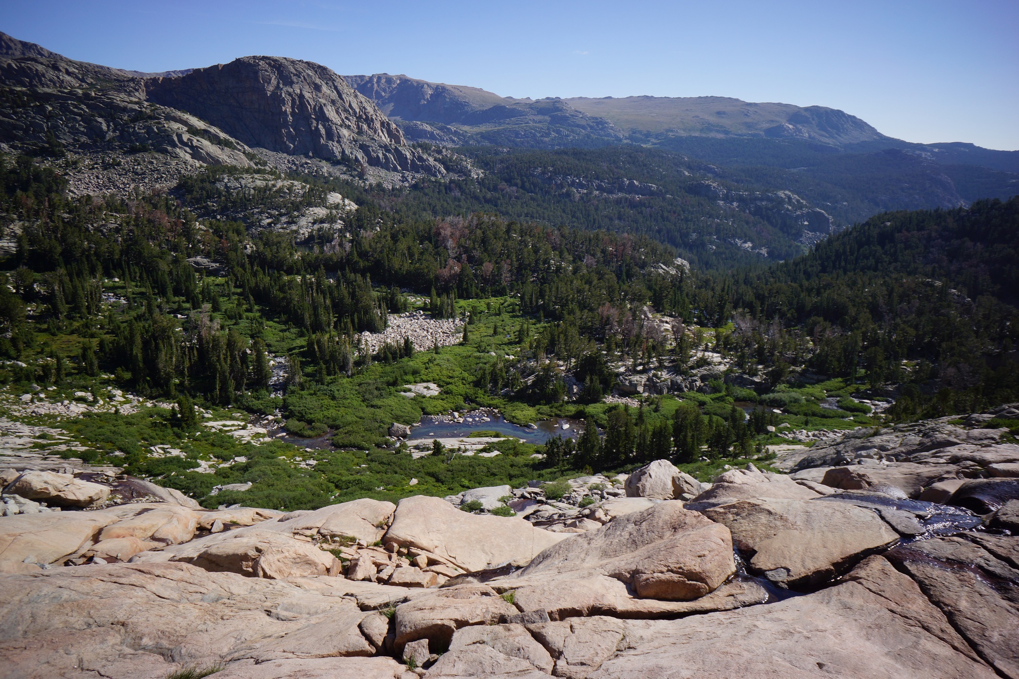
Going down this


After heading downhill a short ways, my route had me descending another steep rockface. This time, it was much more wide open and clear, other than various streams running down it, making for some slippery spots. The rock was smooth and resembled a big slide, one that I did not want to test out. It was very beautiful coming down this section though.

Unnamed Lake

Camp Lake
Once down off the rockface, I was rewarded with a trail to follow, at least for a little while. Unnamed Lake was now visible, and boy was it beautiful. It looked like a great spot to camp, and I wished I had made it here last night. Oh well, moving on. After passing Unnamed Lake, the trial goes up and over a small hill before the approach to Camp Lake. I fully expected the walk around this Lake to be easier than it was. At the top of the hill, I could see now that the only way down to the lake was a steep decent of huge boulders. Sometimes, the boulders are so large that climbing on them and moving from one to another becomes a real chore. That was the case here.

View from the east shore of Camp Lake
Now out of the boulder field, the trail picks up again and makes it’s way around the east side of the lake. Despite the name, I didn’t see any good spots to camp along Camp Lake. I wasn’t looking too hard though either, since I wasn’t going to be camping here anymore. It sure was pretty though.

The next lake above Camp Lake

After passing Camp Lake, the trail starts to climb again. The next section wasn’t super steep, and there was actually a decent trail to follow. I made good time up to the top of the pass, which didn’t seem to have a name according to my GPS and maps.

Unnamed pass connecting the Camp Lake and Golden Lakes area

Upper Golden Lake
After descending the pass, I found myself overlooking the Golden Lakes area. The trail was excellent in this area, and there were plenty of great campsites to be found. I fully expected to see some people here, but I didn’t. I made good time through this area with an easy trail to follow over relatively easy terrain. I stopped for lunch near lower Golden Lake, and got devoured by mosquitoes and biting flies.

Golden Lake

Hiking up to Hay Pass. Started seeing bear crap here

Dennis Lake
After lunch, I continued on the trail and headed up and over Hay Pass. At this point, I started seeing some bear crap, near Dennis Lake. It was pretty wide open up here though, so at least I shouldn’t stumble across a bear without seeing him from a distance. Hopefully. The bugs where horrendous up here as well. Even while walking, I couldn’t escape the biting flies. This is crazy, I thought… must I wear my mosquito net while hiking, too? I wasn’t willing to hike in long sleeves today though since the sun was shining and it would have been too hot. Therefore, I had no choice butt to be eaten alive much of the day.


The trail was easy to follow along North Fork Boulder Creek, until I had to leave it to stay on course towards Glacier Lake. The hiking was easy up here, but pretty soggy. Lots of wildflowers and huge, open valleys. Not as spectacular as other areas, but this is where I am going to set up camp for the day, alongside Glacier Lake. I could have kept going an tried to make it to my intended campsite in Europe Canyon, but I decided to call it a day at 4:15.

Camp at Glacier Lake
There wasn’t much for campsites beside Glacier Lake. I found a decent spot behind a large boulder after some searching. Definitely not the best campsite, but it will do.

Cutthroat Trout
After setting up camp, I headed down to the lake for water, and to do some fishing. First cast, 12″ Cutthroat Trout. Awesome, but there’s no wood up here to burn. I didn’t bring a stove, so I had no way to cook it. Catch and release, I guess. I ended up catching about 8 trout in 30 minutes, all in the 10-13″ range. Caught them all on a#2 Mepps spinner. That was fun, but I really wanted fresh trout for dinner! Maybe another day, when camp is below treeline.
My knees hurt a little today, but less than expecting. I had another fall while hiking trough a boulder field, and again, I used my left had to brace my fall. Surprisingly, I didn’t seem to do any further damage to my already swollen hand. Back at camp, the bugs were the worst I have ever experienced. My head net quickly became one of the most valuable items in my kit.
Day 5 – Tuesday August 19th, 2104
Miles Hiked – 14.2
Route – Glacier Lake to Bonneville Lake
Today’s Map
I was up at 5:45 this morning, and broke camp by 7. The sky was pretty grey today, and only got worse as the day went on. I have had excellent weather the last few days, so I suppose some bad weather is about due.

Long Lake

South end of Long Lake
The main reason I stopped last night where I did was that I wasn’t sure how difficult is was going to be getting around Long Lake, which is situated between Glacier Lake and Europe Canyon. Given the difficulties I had going around Alpine Lakes, I didn’t want to get into anything too serious last night, and figured that was best left for this morning. In reality, it wasn’t too bad going around the lake.


Long Lake, looking northwest
Parts of Long Lake seemed to flow into the horizon, dropping off into nothingness. Somewhat like one of those “infinity pools”. This was a pretty cool effect. I only wish the sky was blue, these grey clouds are awful for pictures. To be honest, the lakes were starting to blend in to me now at this point. Don’t get me wrong, they were beautiful, but some of them were not named on my map/GPS, and there were just so many of them. This was a stark contrast to my previous hikes in the Rockies, both in Colorado, where there were relatively few lakes in comparison.

Unnamed lake in Europe Canyon
Once I go to Europe Canyon, I was looking for campsite locations out of curiosity, since I would have stayed here last night. I didn’t stray from my course though, and didn’t see anything great nearby. However, the area looked ripe with potential if one were willing to spend some time searching.
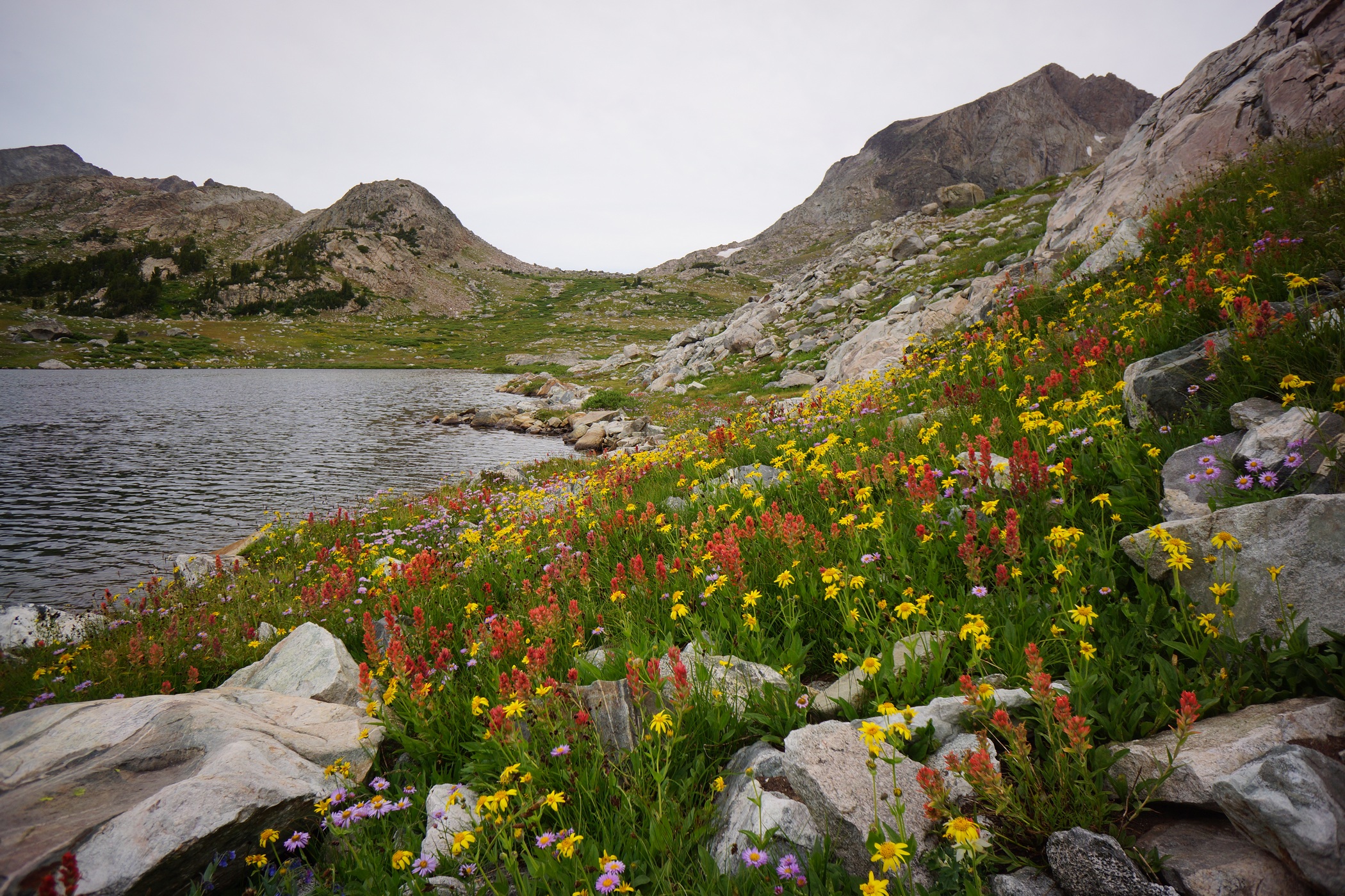

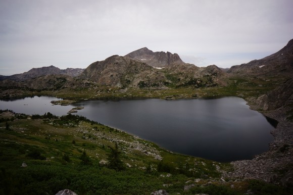
I had been off trail since yesterday afternoon, and will continue to be until later portion of today. Passing through Europe Canyon, my route now skirts around the east side of an unnamed lake up over a small hill. On the map, the contour lines made it look like it was going to be steep and difficult, but it was actually not bad, this time.

East of Medina Mountain
I’m seeing lots more bear crap now as I headed down the hill leaving Europe Canyon and down towards Halls Lake. One pile of crap looked particularly large, possibly Grizzly. I figure, better start making a little more noise, since I am by myself. I started yelling “Yo bear!” every so often.

I saw the black bear on the rock face to the left
While working my way down to Halls Lake, I did run into a small black bear, maybe 100 pounds. I was coming down a hillside along a rockface, and the bear was foraging for food alongside it. It was about 150ft downhill. My first thought was that there could be a mother bear nearby. As I reached for my bear spray, I was also yelling and making noise. The bear immediately scampered up the steep slope like it was nothing. My heart pounding and hands on the bear spray, I scanned the area for signs of the mother. Nothing but silence. I moved on with a new sense of awareness, and you can bet my “Yo bear” calls got louder and more frequent.

Halls Creek
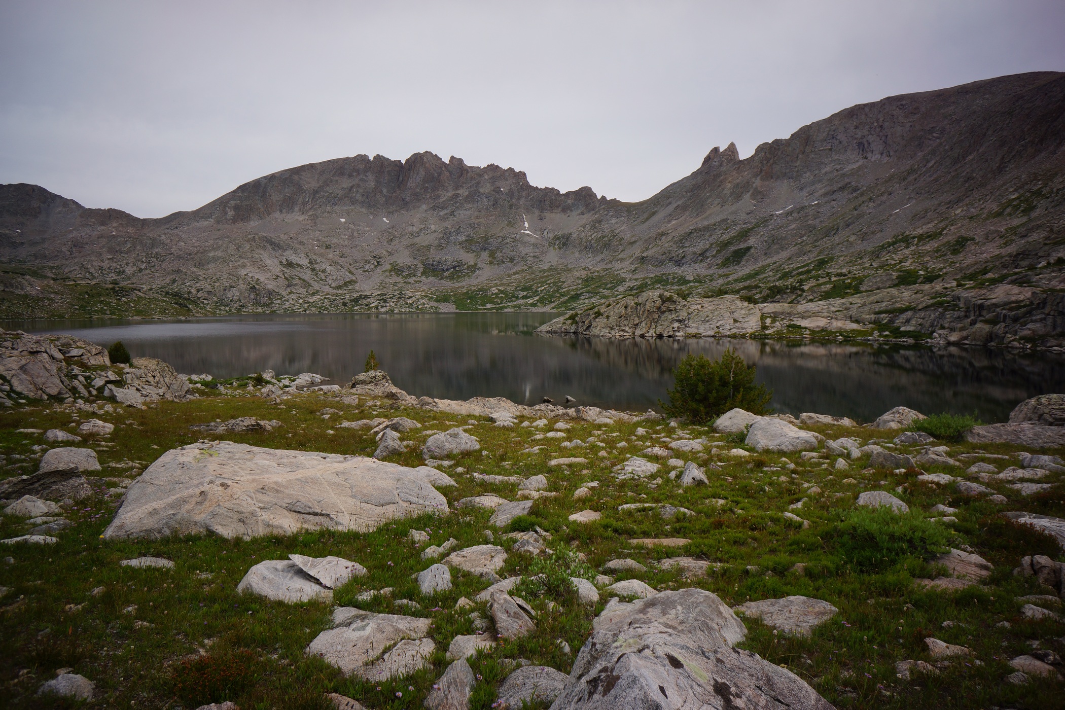
Halls Lake


Middle Fork Lake in the distance
Once I approached Halls Lake, I realized that I should have crossed Halls Creek a little sooner. After some scouting around I was able to find a crossing point at the mouth. I started thinking about taking an alternate route now, as I approached Middle Fork Boulder Creek. I had planned on hiking along Middle Fork Lake, Lee Lake, and going up over Bonneville Pass. Instead, I chose to cross Middle Fork Boulder Creek and stay to the west of Dragon Head Peak and Pronghorn Peak, hiking along Rainbow Lake and Sunrise Lake. I would still end up at lower Bonneville Lake, but would avoid a major pass and possibly shave off a mile or two. Yup, that’s the plan.
Crossing Middle Ford Boulder Creek was the second of my two river crossings that required my water shoes during this hike. The was a lot of water flowing through the area and several branches of the creek to cross. From there, I had to climb up another 600ft to reach Rainbow Lake.
While hiking alongside Rainbow Lake, I saw a guy and his dog camped higher up the hillside. This was the first person I had seen in 2.5 days. I would also see a few more people before the end of the day. There was a good trail to follow, but it quickly petered out after Rainbow Lake.

Rainbow Lake
The Rainbow Lake and Sunrise Lake area had some excellent camping, and looked like a great spot to fish. In fact, I saw a few guys taking some trout back to their camp, and I was jealous. However, I still wanted to keep going, and make it to Bonneville Lake.
The Hike from Sunrise Lake to Bonneville Lake involved an awkward traverse of a hillside, where hugging the same contour line across was the best approach. Despite the lack of cairns throughout much of the Winds, there were some helpful ones throughout this section.

Bonneville Lake
The Bonneville Lakes area was incredible! Too bad the weather was looking worse and worse, with rain imminent. Someone took the primo spot, but I found a good site on the southwest side of the lake with some decent cover under pine trees.. This was closer to where I needed to head tomorrow morning anyways.

I set up camp around 4, with very light sprinkles on and off for a while. I was able to get everything set up and get some food in me before the rain got heavier around 5. While raining, I took a nap for a while until it stopped around 7:30.
I was glad to be “caught up” and on schedule now. The next 3 days should be relatively easy, with mileage in the 7-9 range. Hopefully the weather is nice and I can enjoy the extra time I have at camp.
Day 6 – Wednesday August 20th, 2014
Miles Hiked – 7.1
Route – Bonneville Lake to Skull Lake
Today’s Map
I had set my alarm for 5:45, but ended up sleeping in til 7. It rained last night, and everything was wet. It was 41°F in my tent this morning. Since I only had to hike 7 miles today, I decided to take it easy this morning. The last 4 days were tough, I earned it!

The sunrise over Bonneville Lake was awesome. I wish I had more time to spend here. The weather was looking good this morning, blue skies over the lake. I left camp at 8:20, and shortly thereafter the skies turned grey again..
 \
\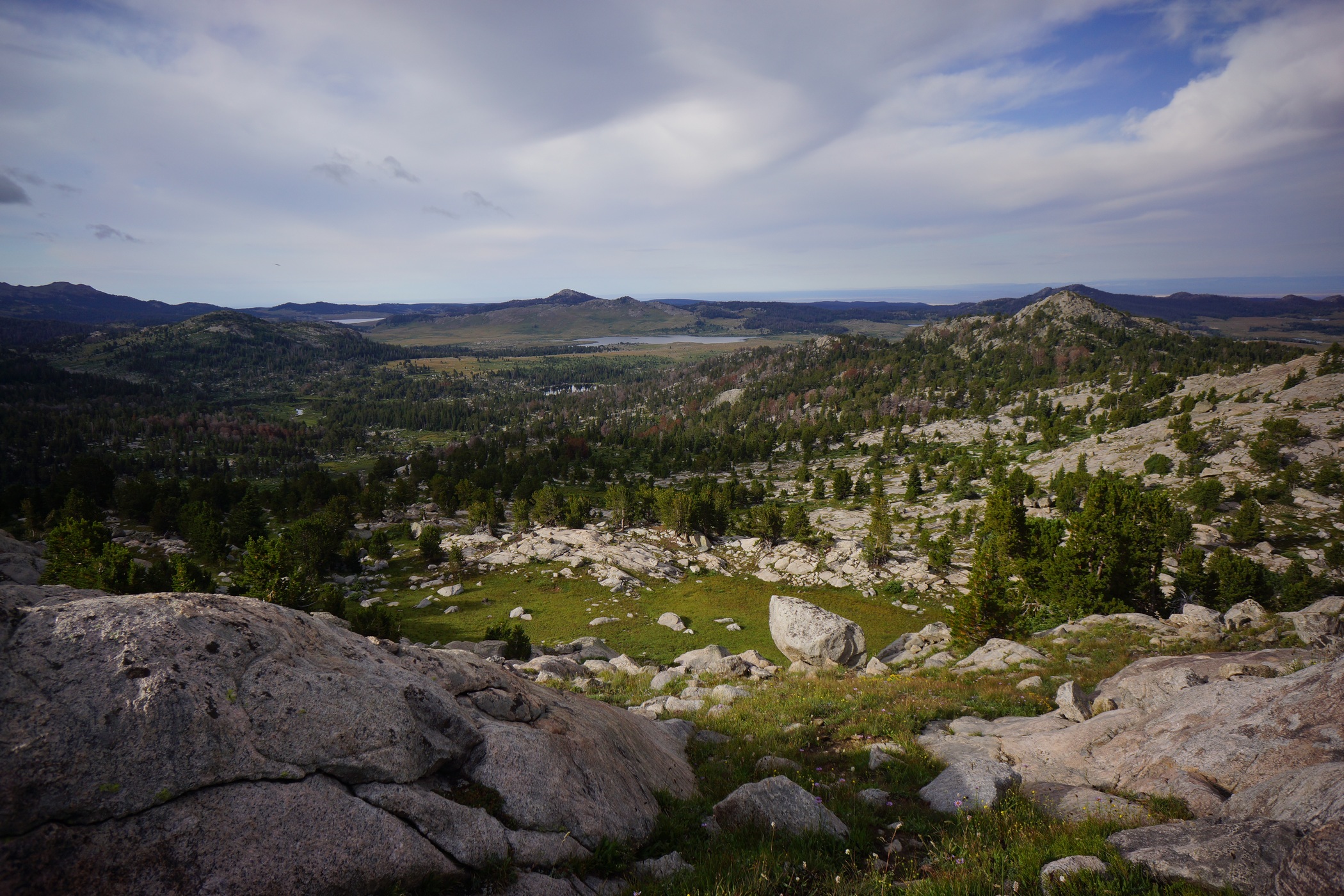
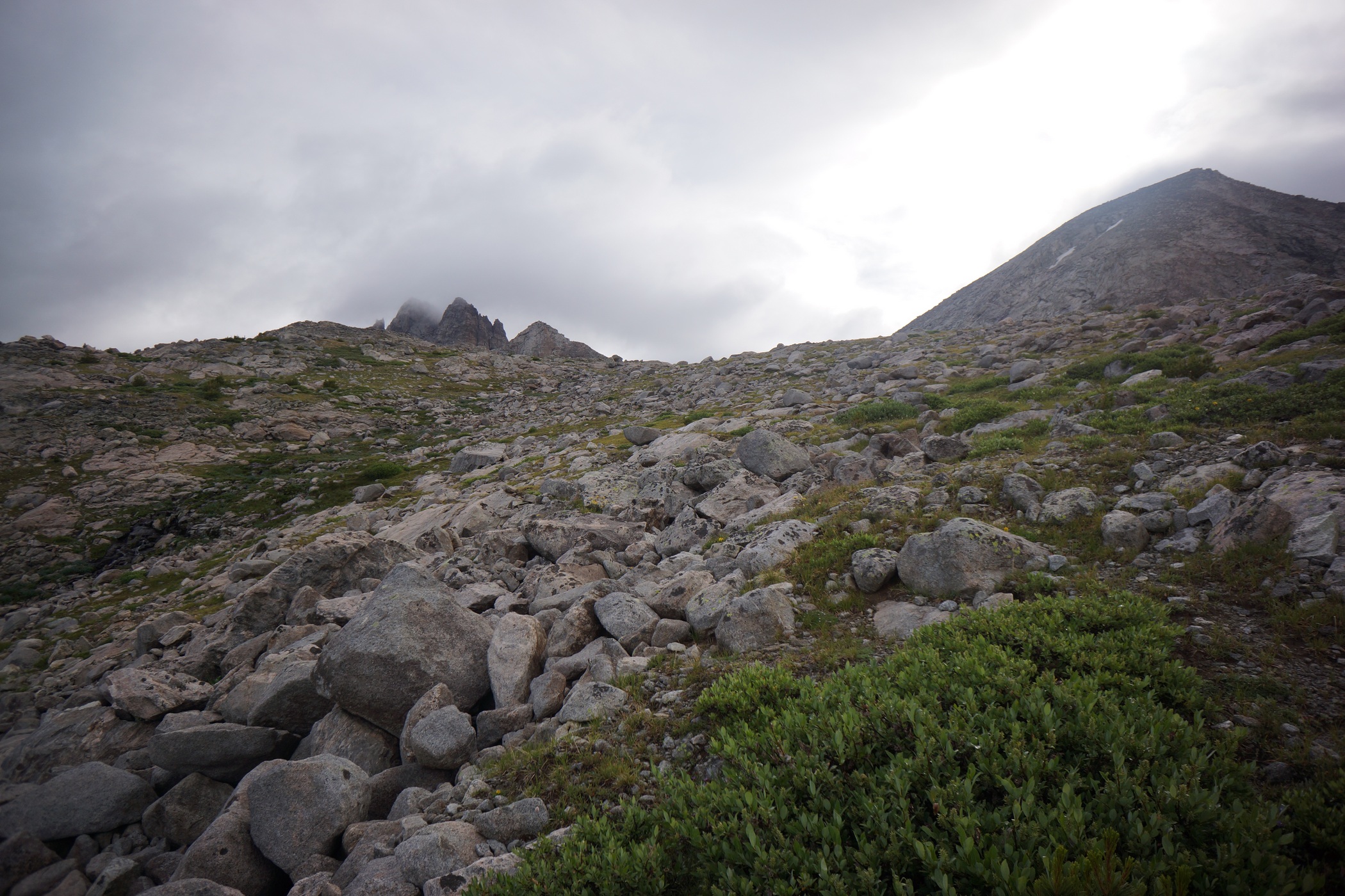
Mount Bonneville on the left
The hardest part of my day today should be the pass I am about to hike up now. I couldn’t tell exactly where the route would take me until I got right up to the base of it. I’m not sure what the name of this pass is, or if it’s even named, but it’s between Mount Bonneville and Raid Peak. There is a creek running down the mountain here and flowing into the southeast corner of lower Bonneville Lake. Stay to the right of this creek, as it’s too steep to go right up. I crossed it at about the 11,200 mark.

I could see Mount Bonneville now, which was engulfed in clouds. The rest of the way up to the pass was fairly easy, and I was at the top by 9:30.
 \
\
From the top of the pass, I had great views of this new valley. There wasn’t a name for this valley on my map or GPS, but it certainly looked large enough to be named. The East Fork River flows through here, so East Fork Valley sounds fitting to me. There was a steep descent of boulders at the top, then a long boulder field to navigate through. I was really impressed with the beauty of this area.
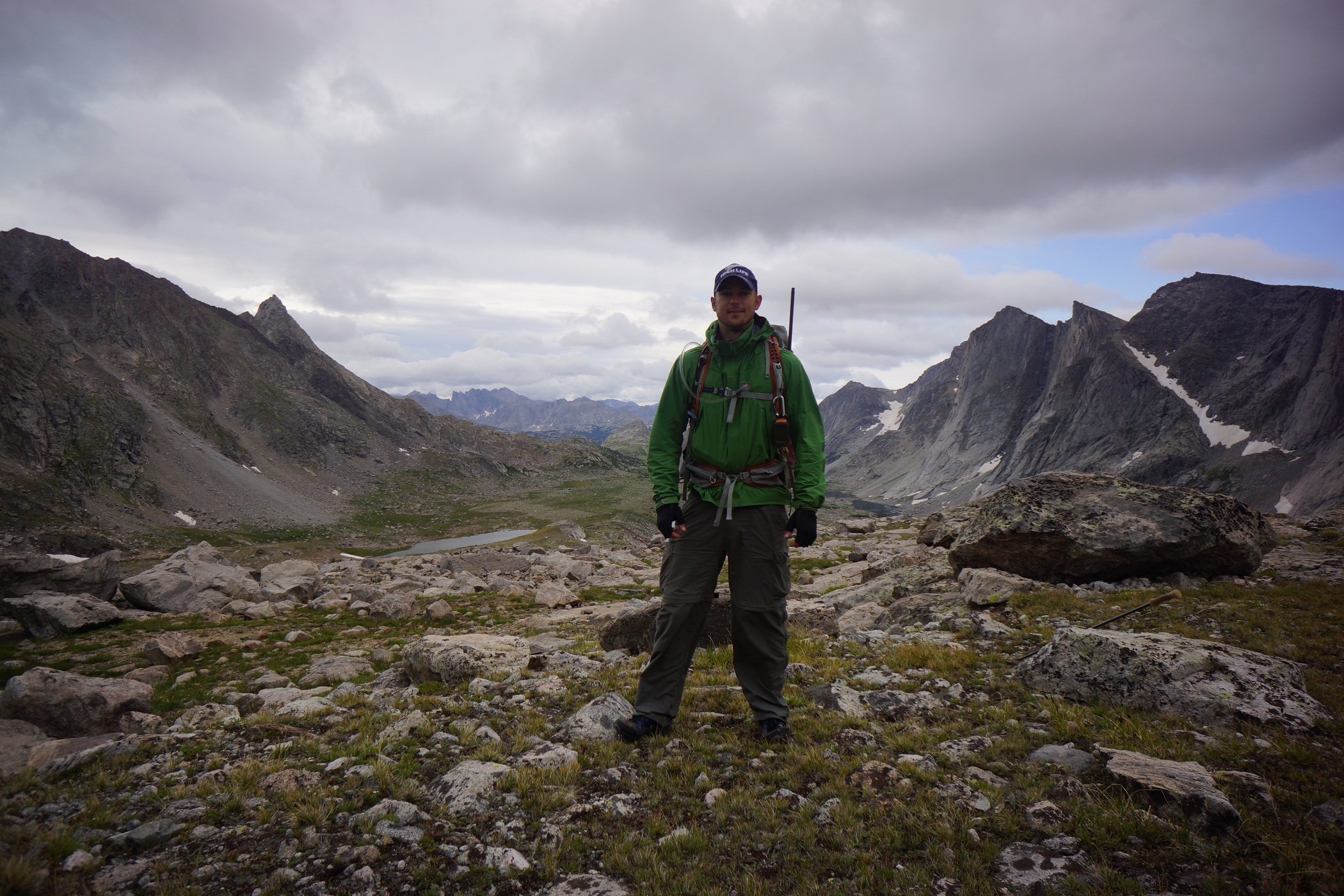


As I made my way down from the pass, the views got better and better. The valley really opens up and shows it’s size. To the east lies Mount Hooker, Tower Peak and Pyramid Peak. On the west, Mount Geikie and Ambush Peak. The view to the west was stunning, a solid wall of imposing peaks running for about 3 miles north to south. Simply incredible.

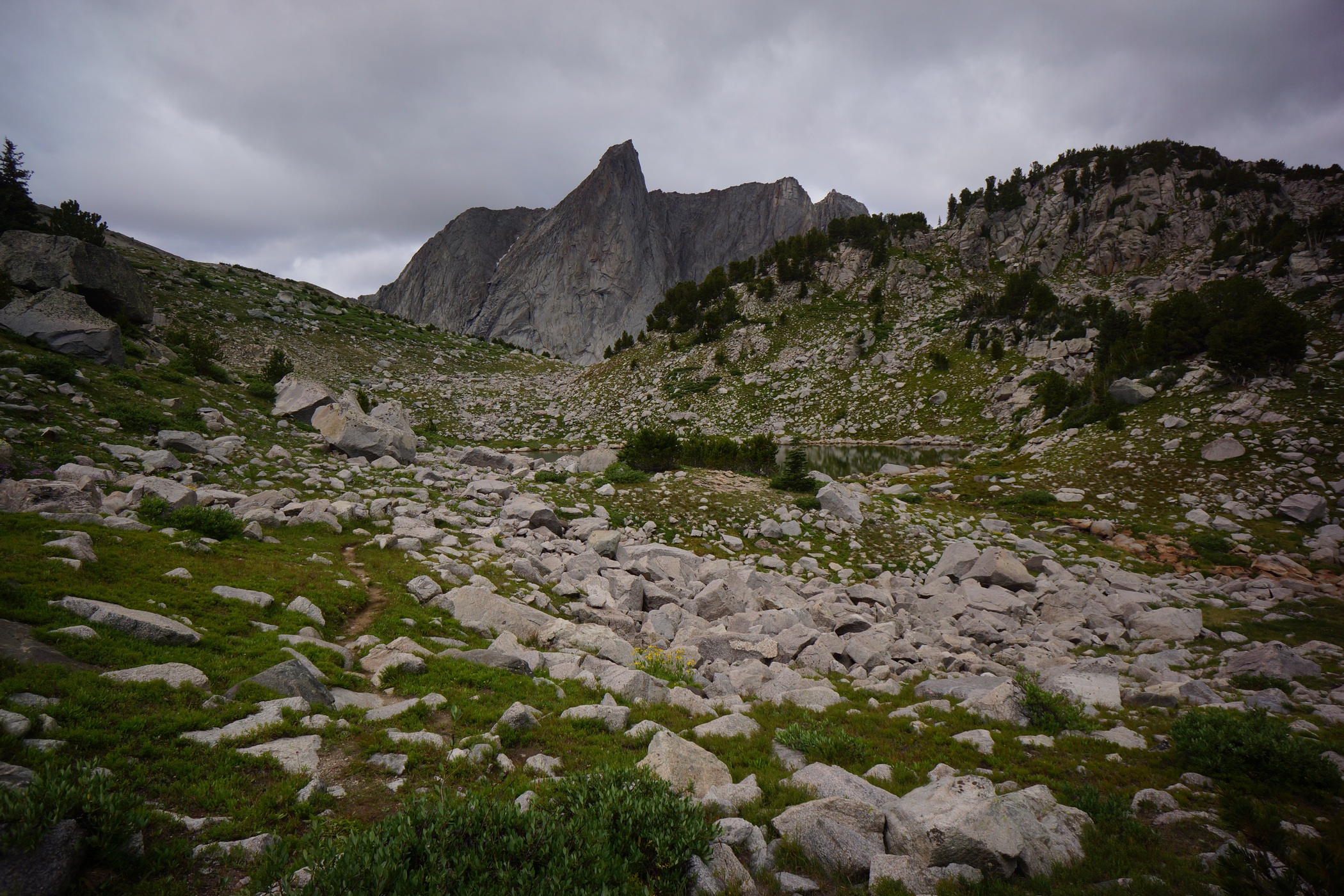
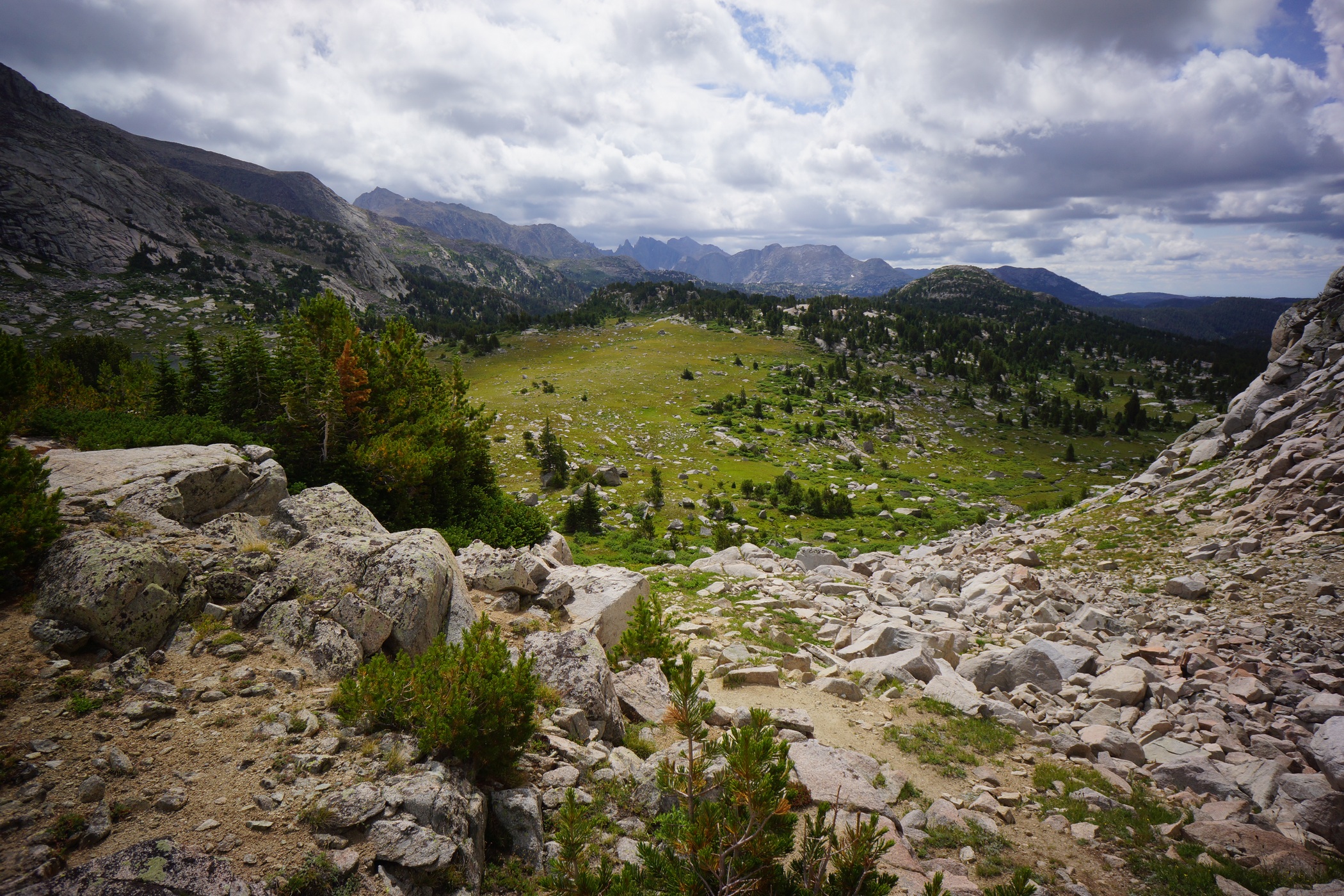
South of Pyramid Lake
I hiked out of the valley and down towards Pyramid Lake. I saw a few more people here in this area. There was a pretty well beaten path to follow at this point. My GPS is calling it the Haily Pass Trail. I remembered that I hadn’t seen any bear crap since going over the Pass this morning, which was good.


North of Skull Lake
After leaving Pyramid Lake, the trail passes by Mays Lake. From here, it was only about another mile to Skull Lake where I intend to camp for the night. It was easy hiking through this section, and I made it to Skull Lake at 12:20. Only 4 hours of hiking for me today.

My campsite overlooking Skull Lake
I set up on a spot overlooking the lake. I could see the Cirque of the Towers now in the distance from camp. The weather started to improve in the early afternoon, with increasing sun, despite huge cumulus clouds forming all around. I knew it was going to rain eventually, but for now, it was fishin’ weather!
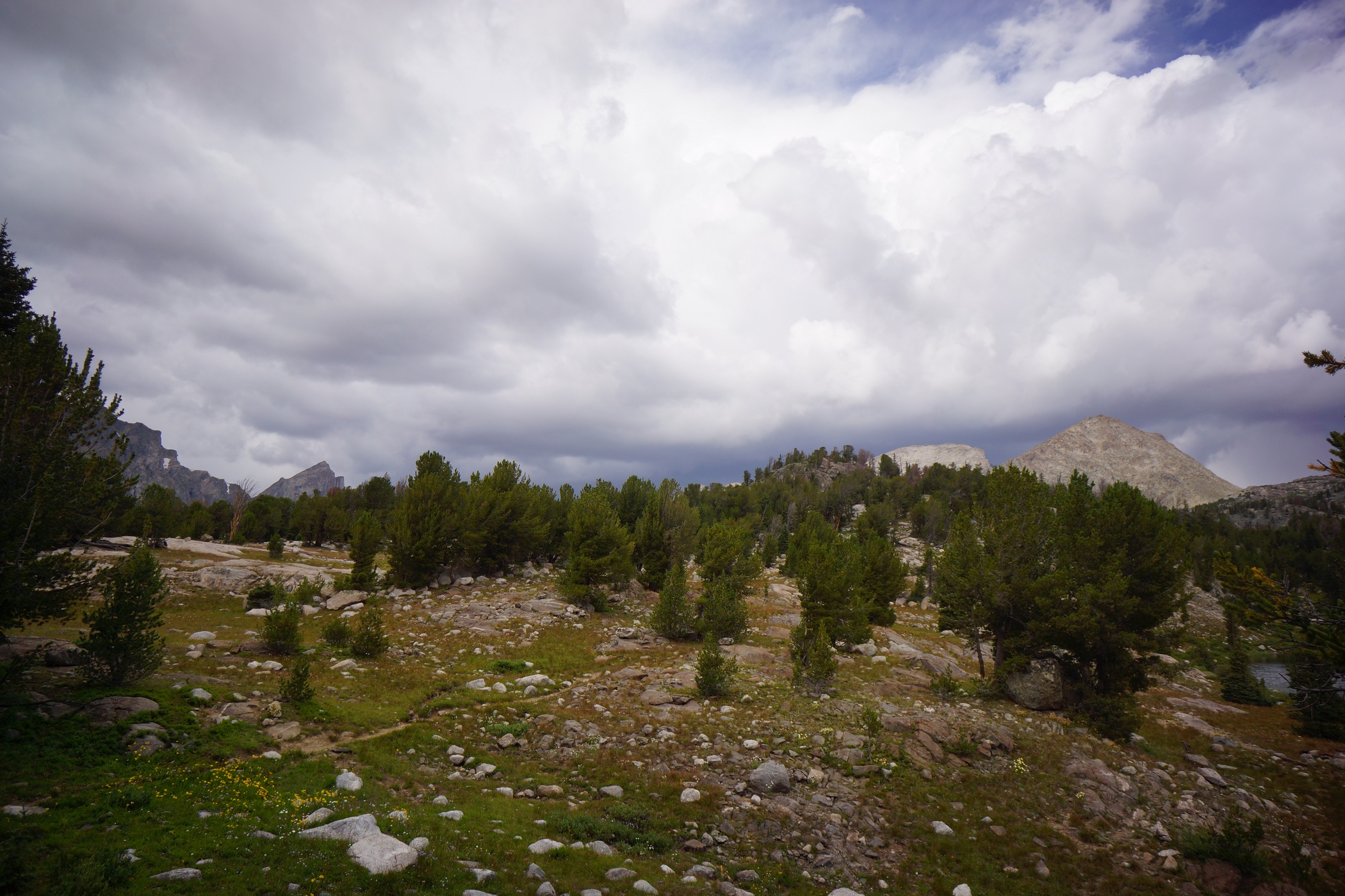
Near camp by Skull Lake
I headed down to the lake to do some angling. I know there is plenty of wood around to burn, so that’s not going to be an issue today. Same deal today, basically every cast is either a catch or a bite. However, these weren’t cutthroat trout, I believe they where Brown or Brook trout. Either way, they were on the small side at only about 7-8″, so I threw them all back. Damn, I was really hoping for fish tonight. Today would have been perfect too, since I have so much time at my disposal.

Pack llamas walking around Skull Lake
While down at the lake, a group of people passed by on the trail above with pack llamas. First time I had ever seen a llama on the trail. Many other people passed by my camp throughout the day, on foot and on horseback. Must be a popular area.

Skull Lake
By 3:30, the rain was here. I sat in my tent until 5 when it stopped. The, I fished some more. It was fun catching them, even with no intentions of keeping them. It was just so easy!

Clouds creeping in as the sun fades on night 6
My knees really stared to hurt today. I’m glad I don’t have many miles left. I’ve been relatively lucky with the weather so far, and I’m hoping that it holds out for another 2 days. The peaks were all engulfed in clouds by the time the sun went down. Hopefully this passes overnight.
Day 7- Thursday August 21st, 2014
Miles Hiked – 9.1
Route – Skull Lake to Cirque of the Towers
Today’s Map
I woke up at 6:45 this morning, but ended up sleeping in til 8. It didn’t rain much last night, but enough for everything to be soaked this morning. By 8:45 I had left camp, en route to the Cirque of the Towers.

Looking north from the south end of Skull Lake
It looked pretty nasty out this morning, and I knew I was going to be wet today. After leaving Skull Lake, I saw several people along the trail. I’ve come to realize that the southern end of the Winds is more popular than the northern end. I expected as much with the Cirque of the Towers drawing so many people to the south.

After crossing Washakie Creek, I hooked up with the Shadow Lake Trail and headed east. It was raining now as I made my way through the open valley towards Shadow Lake. My trail runners offered no protection from the water and my feet were soaked at this point. Still, my feet were plenty warm, as long as I’m moving anyways.

Along the Shadow Lake trail

Shadow Lake
Once I reached Shadow Lake, the weather was looking worse, and I decided to wait a while to see if the weather clears before heading up over Texas Pass. I sat under a tree for a while, with my knees at my chest and arms around my legs. I was still getting rained on, but kept hoping this was going to clear up.

Waiting out the rain
After 45 minutes, I got up and started looking for a better temporary shelter. I figured I’m going to be here a while and might as well try to get out of the elements a little more. I discovered an area surrounded by three garage-sized boulders offering some protection from the wind. On top of that, there was a bit of an overhang on one of the boulders, and it looked like a great spot to have a fire. It was pretty cold out and now I wasn’t moving around at all.
It’s amazing what you can find to burn, even when it’s raining out. With plenty of wood at my disposal, I made the best out of the afternoon here in my little hideout. I stayed here for a few hours until there was a little break in the weather. Not much, but maybe enough to go over the pass.

Between Shadow Lake and Billy’s Lake

Billy’s Lake
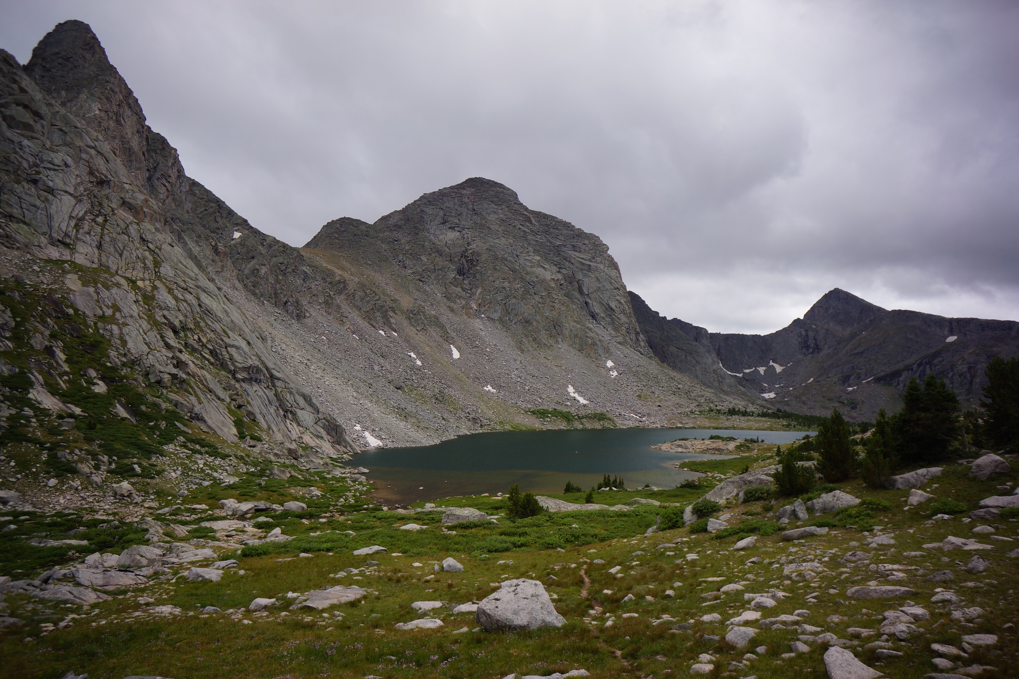
Looking down on Billy’s Lake

Texas Lake
After leaving Shadow Lake, the the next lake up in the chain was Billy’s Lake, then Barren Lake and finally Texas Lake. I’m sure the views would have been spectacular if they were not hindered by the clouds. The trail up Texas Pass was pretty good, well beaten and generally easy to follow. I expected as much from such a popular area. The weather held out until the final push up Texas Pass, when it started to rain lightly. Better than hail and lightning. I’ll take it!

Descending Texas Pass into the Cirque of the Towers area

Looking back up at Texas Pass
Coming down Texas Pass, there was some snow pack for the first few hundred yards of descent. I headed downhill through some talus fields and then the landscape gave way to grass. I figured there would be an obvious trial to follow down to Lonesome Lake from here, but that was not the case. There would be short sections of trail that would vanish without a trace. I expected the hike down to be relatively easy, but it was actually quite a pain.

First views of Pingora and the Cirque of the Towers


As I started to drop down into the valley, the Cirque of the Towers and surrounds peaks loomed above, with the tops of the peaks obscured by the thick clouds. I tried to imagine how beautiful it would be on a clear, sunny day.

Pingora Peak

Lonesome Lake
Pingora Peak was really impressive. It dominates your view of the landscape most of the way down to Lonesome Lake.


Hiking around the rugged west/southwest side of Lonesome Lake
My knees were hurting quite a bit now on the steep descent. It wasn’t until a few hundred vertical feet above the lake until I was able to follow an actual trail. Once down to the lake level, I had to make my way to the other side. This involved traversing the west/southwest side of the lake, which was also quite a pain. There were huge boulders all along the shoreline which made for some unwanted scrambling.

View from my campsite
It was now about 6pm as I made it around the lake. I couldn’t see anyone near the lake, and figured Marc wasn’t going to come up here anyways. I headed straight for the higher ground above the lake to find camp. I passed a handful of people up here camping, not as many as I expected. I found a spot and dropped my pack around 6:15.
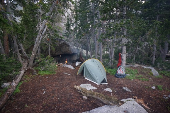
My shoes and pant legs were soaked from hiking through tall, dense wet vegetation the whole way down from Texas Pass. After setting up my tent, the next order of business is to start a fire and try to dry out my clothes and shoes. There was a large overhang on boulder at my campsite that was excellent for fires. It was large enough to store extra firewood underneath as well. The fire was great, much needed. My feet were pruned from being wet so long.
I wanted to explore the area more, but I just didn’t have the time. I got to camp so late today that I didn’t have time to do anything but gather wood and dry out my clothes. I was running pretty low on food now. I wasn’t overly hungry throughout the trip, but was a little tonight as I rationed my remaining supply to last me through tomorrow. I had brought about 14 pounds of food, however, my food it not nearly as dense as some of the more hardcore backpacker’s diets. I’m picky, and would rather carry more weight in food as long as it’s food I like. I don’t want to be choking down some nasty kibble just for the sake of saving weight.
I enjoyed a nice fire on my final evening in the Wind River Range, reflecting on the wonders and hardships of the trip. It’s a good thing the rewards are so great hiking here, because it’s equally as challenging. I’m ready for a hot shower and big, hot meal tomorrow!
Day 8 – Friday August 22nd, 2014
Miles Hiked – 9.3
Route – Cirque of the Towers to Big Sandy trailhead
Today’s Map
There were storms with heavy rain and wind all throughout the night. It was definitely colder this morning than it had been all week. The peaks above had a dusting of snow this morning as well, albeit very little. I slept in until 9:45, trying to wait out the weather for the climb over Jackass Pass. Dark clouds loomed above, with occasional thunder. However, I have a schedule to keep… Marc is waiting for me at the parking lot today and expecting me at 2pm.

The weather is “clearing”… time to move
I was packed up and ready to head back to Big Sandy trailhead by 10:30. I figured that the hike back is all downhill after Jackass Pass, and there should be a good trail to follow. Should is the key word here.

Hiking up Jackass Pass
The weather still wasn’t clear as I headed up the pass, but I couldn’t wait any longer due to my time constraints. The weather was fine until I reached the top, where there was high winds with rain/hail whipping me in the face. I had to put on my sunglasses! I wanted to take some pictures, but I didn’t want my camera to get wet.

This is about where I saw the fighter jets overhead
After I made my way down off Jackass Pass and to the vicinity of Arrowhead Lake, I heard an incredible noise overhead. I looked up to see an F-16 style fighter jet screaming across the sky. The trajectory suggested that it had just taken off from somewhere west of here. Seconds later, another jet followed, punching through the rising clouds above one of the peaks. I’ll never forget the sound they made as they echoed through the wilderness. That’s the sound of freedom right there! ‘Merica.
Once I reached North Lake, my route had me going around the east side of the lake. However, the west side looked like it would be easier, and that’s what I chose to do. Big mistake. It looked manageable at first, but quickly became the most treacherous boulder field of the entire trip. These boulders were enormous, some the size of garages or small homes. These were stacked and strewn about, with huge gaps between them This made hoping from one to the other impossible in spots. Not only that, but these boulders were so huge that they had an entire sub-chamber of smaller boulders beneath them. Sometimes there would be as much as a 20ft drop from the boulder I was standing on to the next one below. To make matters worse, it was wet and slippery. Lots of dead ends, backtracking and frustration. The worst part was how slow moving it was. Like I said, I’ve got a schedule to keep!

Following North Creek down hill. AVOID!!
Finally past North Lake, I thought my troubles were over. Again, I was wrong. Any trail I found just disappeared after a short ways. So, I started following North Creek down, thinking this was the easiest route. This was tough too as the slopes of the creek banks were steep and hard to walk along without losing my footing. All the vegetation was thick, thorny and soaking wet as well. Later, I realized the trail probably stayed higher up out of the ravine on the west side where the slope is more mild, along the 10,080ft contour line.

Big Sandy Lake
When I finally did reach Big Sandy Lake, I started seeing legitimate trails, and plenty of people. My maps showed an easy hike back to the trailhead now, but you never know.

Hiking the home stretch. Almost there!
The rest of the hike back to the Big Sandy campground was extremely fast and easy. I was on a mission now as I was just a little behind schedule. I passed a forest ranger headed towards Big Sandy lake who told me that I was getting out just in time, as the weather was going to be in the 20s tomorrow and they were expecting a few inches of snow. Yeah, definitely good timing!
I arrived at the trailhead at 3, 1 hour late. Marc was sitting in my car waiting for me. Walking back into the trailhead was a great feeling after such a brutal hike. I changed into some clean clothes and put on my sandals. Finally, I can air out my feet! And even though I had to drive now, sitting in such a comfortable seat seemed like a luxury now. Ah, back to civilization.
Marc and I exchanged stories of what happened in the past week now as we drove through the 35+ mile network of dirt roads back to the main highway. He ended up spraining his ankle on the way back to Green River Lakes campground the day we split up. He hobbled back to the trailhead, and hitched a ride back to Pinedale. He got a hotel and rested for a few days. When he felt a little better, he walked around town and hung out at a bar, playing pool with the locals. Then, he took a cab out here to the trailhead to meet me this afternoon.
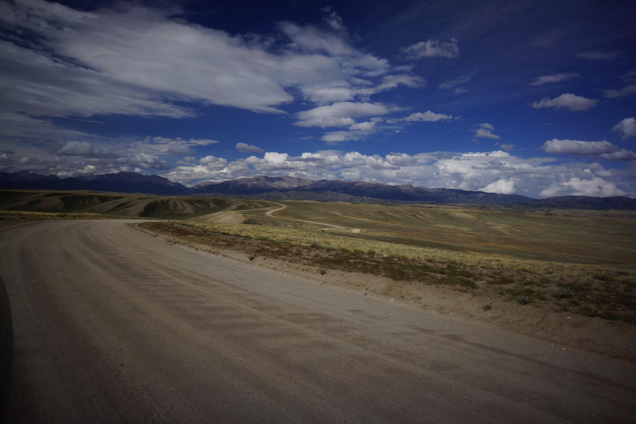


The drive back to HWY 28 through the 35 mile dirt road maze was pretty cool too. The landscape is completely different here compared to the alpine environment only a few miles away in the Winds. Vast, arid, and strangely beautiful. A huge storm was brewing to the west, and the sky was looking dark as hell. Good thing we’re going east.
From here we headed to Casper, WY where we got a hotel with an indoor pool and hot tub. It’s always nice to relax in a hot tub after a long hike! We ate at Poor Boys Steakhouse, which wasn’t as good as the reviews online made it out to be, but still satisfying after 8 days on the trail.
Final Thoughts
Well, the first thing that comes to mind is how much more challenging this hike was than I expected. I figured, the Rockies are the Rockies. I’ve hiked in Colorado, this will be just like that. No way. This is a step above that for sure. The hikes I went on in Colorado did not require any climbing at all. The High Route through the Wind River Range is largely off-trail, is requires much scrambling. Going over some of the passes here was similar to a class 2/3 summit of a Colorado 14er, climbing wise. Lots of boulder fields to traverse, lots of climbing. Even when you aren’t going over passes, there was a lot of climbing involved on this route. I’m not talking about sheer cliff faces with a 1,00ft death drop or anything, but plenty of spots where slipping could prove fatal.
The northern end of the Winds seemed to be the most remote and offered the most solitude. While previously used campsites were more common in the southern sections, they were tough to find in the northern end, mainly the Alpine Lakes area.
Mosquitoes and biting flies were unbearable in some spots, so make sure you don’t forget your head net. Food storage-wise, I used the bear hang that was at our campsite in Three Forks Park, but other than that, I relied on my OPsaks for food storage and smell resistance, and stored that away from camp at night in a larger roll-top bag. I didn’t have one problem with my food storage system, which is always a concern in bear country. Especially when you have seen a bear already!
Boulders… get used to hiking on them. Many, many miles of boulders, of all shapes and sizes. Some are steep, so steep you fear disturbing one will bury you in a landslide. Others are so large, they’re difficult to move from one to the other. A large portion of this trail is spent traversing boulder fields, so be prepared for that.
Hiking over the glaciers was awesome. Having crampons would have been nice but they certainly aren’t necessary. I was able to move through here with trail runners. It was slippery in spots, but not too bad. I wouldn’t want to do it without a trekking pole though. I guess I’m lucky I only broke one pole going up Knapsack Col.
I didn’t bring enough food this time, even though I had about 13+ pounds. I should have known better. I wasn’t hungry throughout the trip, except maybe the last night. I didn’t weight myself immediately after the hike, but 3 days later after pigging out on fast food the whole way home I had still lost about 15 pounds. I didn’t need to lose any weight really, and ended up losing several pounds of muscle. The physical effort needed for this hike was much more than I anticipated. Realistically, I’m not sure I’d even be able to stomach as many calories as my body would burn out here. I’m going to have to work on getting more calories in my food next time.
I felt bad for Marc and how his week turned out. I assumed he would camp at the trailhead or near it for a few days since he has all his food and equipment. But since he hurt his ankle, he just wanted to get in town and rest up properly, in a hotel. So, this trip was pretty costly for Marc, especially since he needed to buy almost all his clothing and a pair of shoes. I was disappointed that we couldn’t continue together, but was glad that I was prepared to continue on alone. Had Marc continued, he very well may have sprained his ankle on the trail somewhere more remote. I’m glad I didn’t get hurt myself. This route was no joke.
My right knee is still bothering me, more than 2 months later. I’ve been able to do squats and deadlfts, but can’t run on it, and I certainly wouldn’t trust it out on another 100 mile trek just yet. I guess it’s a decent time for a nagging injury, if there is such a time, since I don’t have any hikes planned for the future right now. With that said, I can’t wait til the next one. Get better, knee. Get better.
As always, questions and comments are welcome!
If you found my trip report useful, please don’t hesitate to leave a comment! Alternatively, if you feel you have any information you’d like to share with others regarding this hike, please feel free to leave that below in a comment as well.
[tcb_comment_count]


