
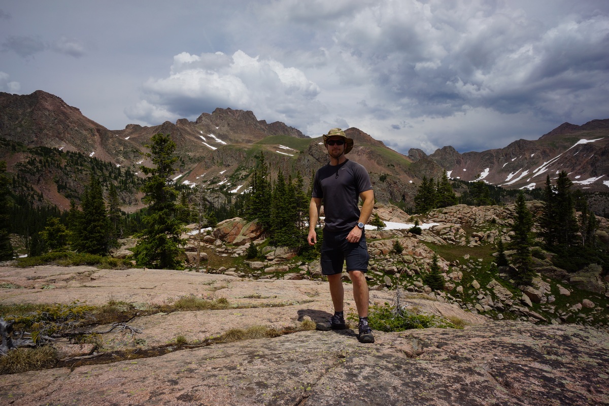
Eagles Nest Wilderness (Gore Mountains), CO – 4 Day, 25 Mile Hike July 2017
Eagles Nest Wilderness, CO – Gore Mountains 4 Day Backpacking Trip July 2017

View All Eagles Nest Wilderness Photos | Watch the Eagles Nest Wilderness Hike Video On Youtube
- Park Administration – US Forest Service – White River National Forest
- Fees & Permits – No fees to access the Eagles Nest Wilderness. Register at trailhead (although I didn’t see where!)
- Trailhead – Gore Creek Trailhead
- Length Of Time Hiked – 4 days, 3 nights
- Miles Hiked – 25
- Route Difficulty – 7.5
- Fires Allowed – Yes
- Scenic Beauty – 9
- Solitude – 7, less within 4-5 miles of trailhead
Eagles Nest Wilderness Pre-Hike Planning Notes
Gore Mountains Weather Forecast
– https://www.mountain-forecast.com/peaks/Buffalo-Mountain/forecasts/3894
Gore Mountains Road & Trail Condition Reports
– https://www.fs.usda.gov/Internet/FSE_DOCUMENTS/fseprd542981.pdf
The Eagles Nest Wilderness is a 133,496 acre tract of land located within the White River National Forest. The Gore Mountains are the backbone of this wilderness area. It’s right off I-70, giving you the impression that it’s going to be a popular, well known hiking destination, but it’s not. Apparently, this area doesn’t get much use in comparison to other Colorado backpacking hotspots. One reason for this is the fact that there are no 14ers in the Gore Mountains. Don’t let the lack of notoriety fool you, as the Gore Mountains are definitely a hidden gem.
The first thing you need to realize about hiking the Gore Mountains is that it’s a rugged place with a lot of steep terrain. Because of this, many of the valleys are “dead ends” for the average hiker, and some are completely unpassable by all except the most skilled climbers. Stringing together a long hiking route that stays high is pretty difficult here. To make long loops, you either have to be OK with spending a lot of time in the lower valleys or be a really good climber.
Access to the Eagles Nest Wilderness is said to be easier on the west side near Vail. See this map for trailhead locations in the Eagles Nest Wilderness. I parked at the Gore Creek trailhead, 2.3 miles east of Exit #180 off I-70 on Bighorn Road. This road to this trailhead is completely paved, so you can access it in any vehicle. Watch out for all the bikers on the road, there’s a tons of ’em here. Coloradans are probably used to seeing this many cyclists, but here in southeast Michigan the only people riding bicycles on the road are doing so because they have a DUI! The Gore Creek trailhead was pretty packed but many of them were bikers, not hikers.
Nearby towns of Vail, Silverthorne and Frisco should have everything you need for last minute stops. Also note that you can get a shower after your hike for $5 at the Silverthorne Rec Center if needed. The address for the Silverthorne Rec Center is 430 Rainbow Dr, Silverthorne, CO 80498.
Eagles Nest Wilderness Backpacking Maps
Download GPX file of this hike
Here’s my caltopo map of the route I hiked:
Day 1 – Saturday July 8th, 2017
Miles Hiked – 6.54
Elevation Gain – 3058′
Route Hiked – Gore Creek Trailhead to Gore Lake
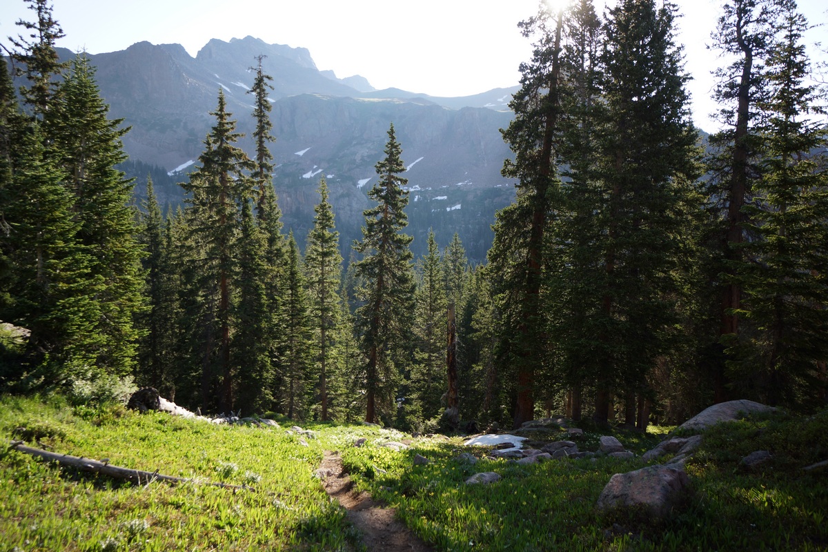
I started my hike at the Gore Creek trailhead (8688′ elevation) around 10:15 am, just in time for a few clouds to start brewing. The trail immediately begins to climb after leaving the trailhead. The trail itself is pretty well maintained here. There’s a sign marking the entry to the Eagles Nest Wilderness after about 1 mile. Once you pass the sign, the trail goes over the top of a small hill where you lose sight of I-70. The sound from the road is also gone, and replaced with that of Gore Creek. The trail winds through a few patches of aspens before the evergreens become the dominate tree with increased elevation.
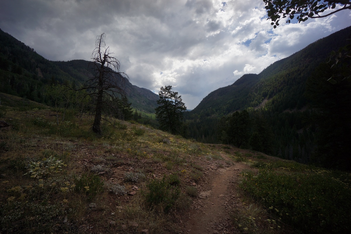
On the Gore Creek trail
The crowds of people started to thin out about two miles from the trailhead. Most of the people on the trail were older folks, and seemed to be locals coming out to get a few miles in for exercise. I stopped along a slow bend in Gore Creek after an hour to eat a little food. I didn’t see any fish, but it looked like there would be potential if one were to walk the bank looking for deeper holes.

Gore Creek
There were few sweeping views of the valley, and the trail only occasionally swings alongside Gore Creek. The trail maintains a pretty manageable incline much of the way to the intersection with Gore Lake trail, with occasional steeper bursts. I passed a guy who said he’d just seen a large bear at the intersection, which I arrived at about 10 minutes later. No bear, fine with me.
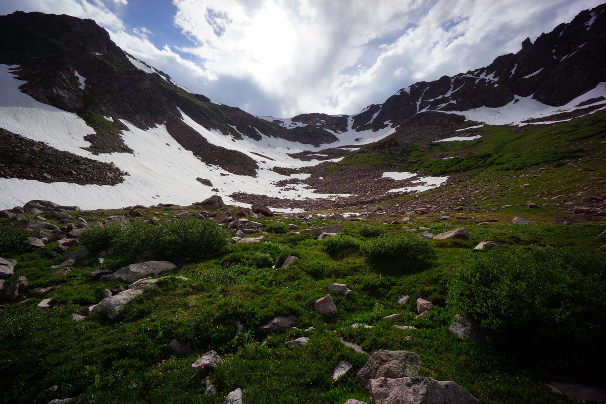
At the intersection of Gore Creek trail & Gore Lake trail, the elevation is 10,180′. AT this point, the elevation gain is roughly 1800′ (with the ups and downs of the trail) over 4.15 miles. Now on the Gore Creek trail, I’ll climb 600’+ in about a half mile. There’s a little view of the valley below after gaining a little elevation. The trail then overlooks a creek, although don’t believe it’s the main creek flowing out of Gore Lake. I saw my first patch of snow around 10,700′.

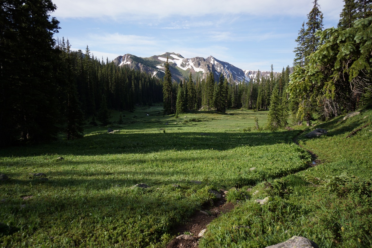
At the top of the 600′ push I was rewarded with a nice meadow. It was flat, open and green, the first of the hike. It sprinkled a little now, but not heavy enough to be a bother. The views were definitely improving now. In the meadow, jagged peaks and snow capped mountain sides loom in the distance. There were some small patches of colorful flowers here and there, still a ways off from peak bloom though.

Approaching Gore Lake
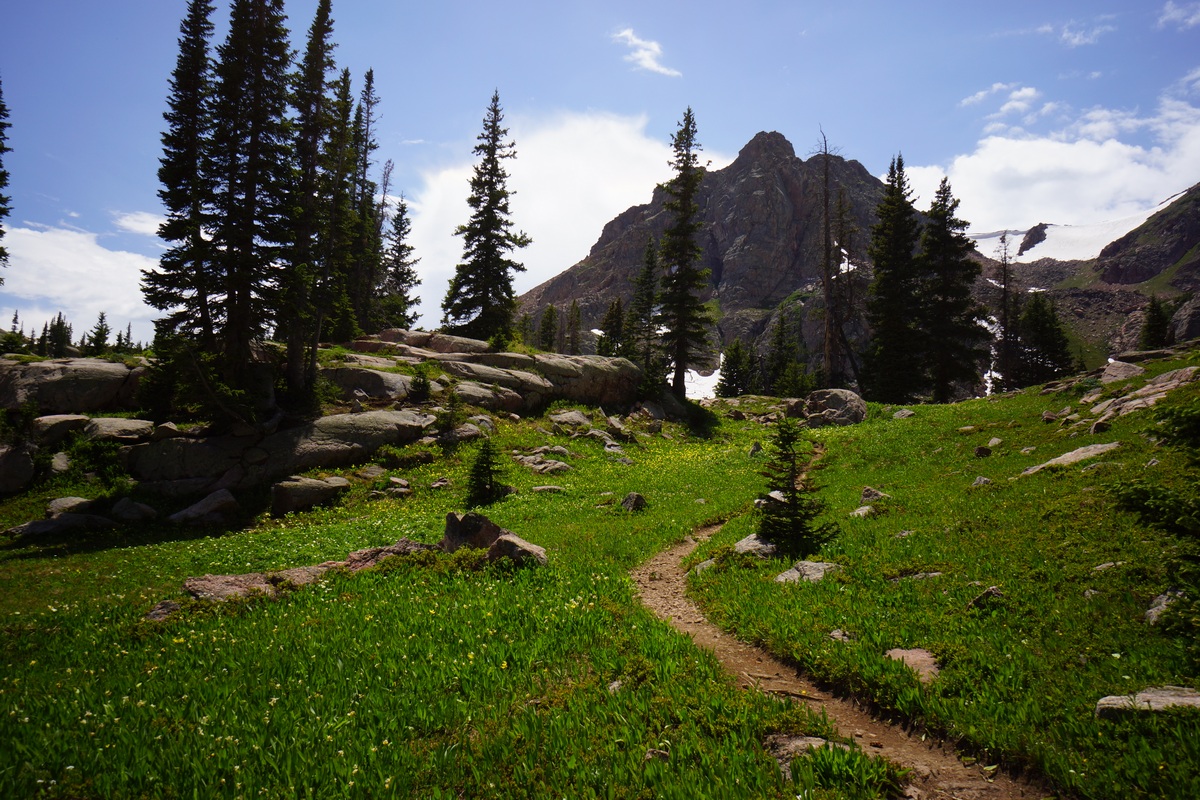
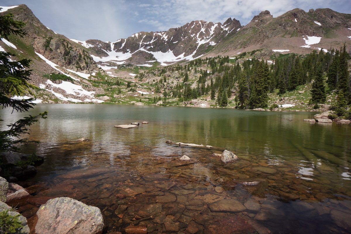
After passing through the meadow, the trail then climbs another 500′ in .6 mile along the final stretch to Gore Lake. I enjoyed the final approach to the lake, where your view of a nearby peak is hidden and then revealed as you crest the top of the final slope. A somewhat “dramatic” way to arrive at such a beautiful lake!
First view of Gore Lake
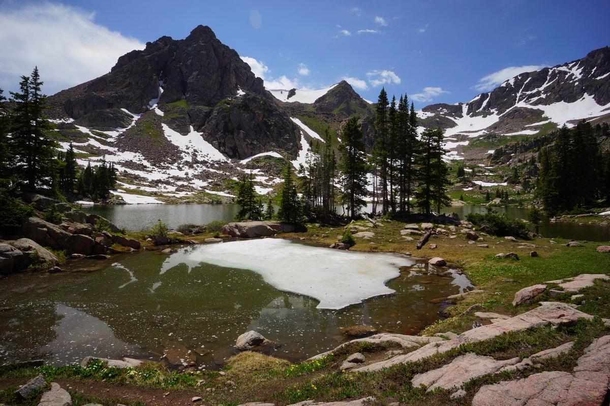
Once at the the lake I could go left for the south shore or right for the north shore. I headed towards the south shore, passing by a few small pools of water adjacent to the lake. One of these pools had ice covering about 1/4 of the surface still. There was more snow up here as well. Following the trail around the lake’s outlet on the east shore, I passed by 3 younger guys (teenagers?) camping. They had all had hammocks and I immediately wished I had brought mine. I only brought the tent this time because I wanted to ensure I was able to have a great campsite without relying on tree size, spacing etc. Ah well!

Camp along the south shore of Gore Lake
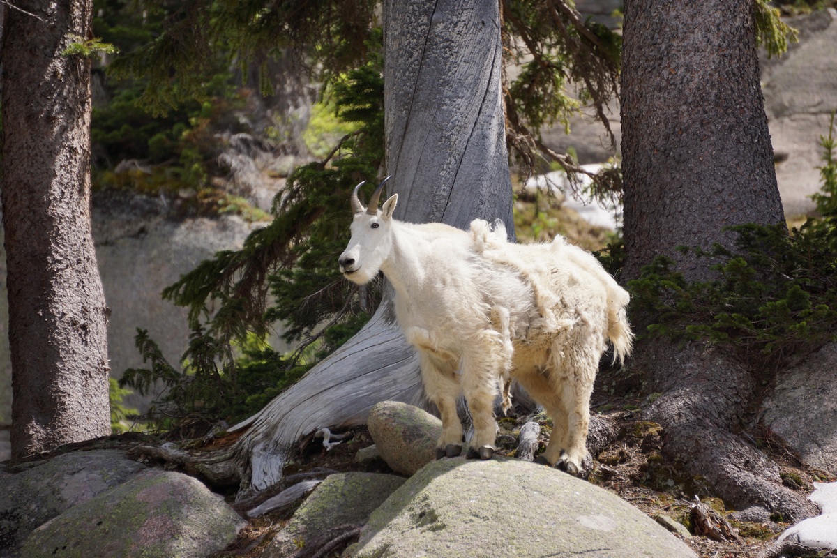
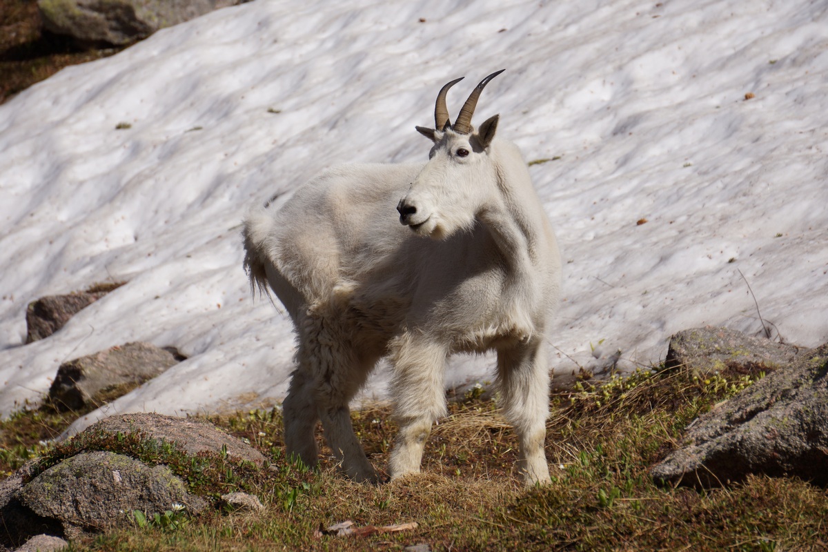
It didn’t take long to find a great campsite along the south shore of Gore Lake. The spot I chose had several large pine trees that looked healthy, a fire ring with a log seat, several larger rocks and boulders to sit on, and an excellent view of the lake. There was a large mountain goat walking around nearby as I set up camp, and several more nearby.
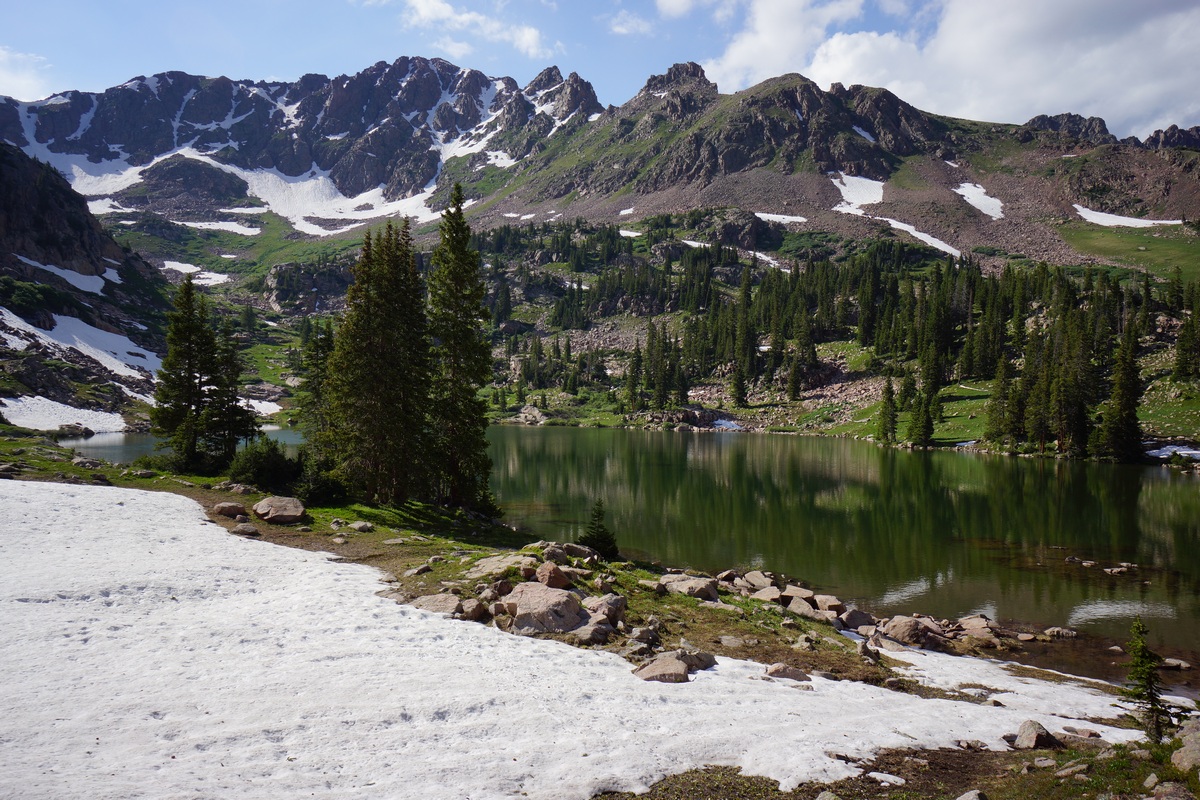
View of Gore Lake from camp
It was around 2:30pm now after settling into camp, and the skies were getting darker. By 3pm I decided to lay down for a while, anticipating rain soon. Plus, I was pretty damn tired. I had only hiked about 7 miles today, but with 3000′ elevation gain. Considering that I had gone from 350′ at home to 5000′ in Denver to 11,400′ here at Gore Lake in about 18 hours, it’s no surprise today’s hike has me feeling beat. I don’t typically have a problem with the thinner air in terms of breathing, but the altitude definitely affects my appetite and even how my food tastes. The rain eventually started around 3:45, and I took the opportunity to take a short nap.

Mountain goat stalking me
When the rain stopped at 4:30, I left the tent to filter water. I’m going to try to eat and drink as much as I can get acclimated as quickly as possible. I choked down my food, stuff I normally like but out here it tastes so bland. My chocolate protein bar tasted like chalk, could barely finish it. All during this, I am chasing hoards of mountain goats away form camp. These guys were not afraid of people. In fact, they always seem to trot slowly towards you when they see you until you are able to scare them off. Throwing both arms up in the air very quickly is my go-to goat deterrent, usually sends ’em running.


While grabbing water from the lake earlier I saw a couple of decent size fish cruising along the shoreline. I headed down there to do some fishing. I had no luck on the south shore, so I headed towards the lake outlet. The three young guys all had fly rods and were fishing near the outlet themselves, so I headed a little out of their way but still close enough to the outlet to be able to cast to the fish that were congregating here. I managed to catch a cutthroat about 10-11″, but I threw it back. I didn’t have my stove or frying pan with me to cook the fish anyways. I stopped at Walmart in Lakewood and Frisco to buy fuel for my stove (can’t bring it on an airplane), and both locations were sold out of the butane/propane mix. I didn’t have time to drive to a 3rd place looking for it so I just left the stove behind. I usually don’t bring a stove when hiking, I do stoveless meals.
After catching the one cutthroat, I had a tangle in my line. I had to cut about half of the line I had on my tiny reel. After another couple of casts, another tangle! I had to cut this too, leaving me with no more line. Crap, I guess fishing is over this trip. Lesson learned, bring extra line. I never had to in the past, a full reel of line was always enough.
I decided not to have a fire tonight (or any night) for a few reasons. I didn’t really want to be up real late, I’d rather get up early, Secondly, the’s very little firewood around as it is. It would have been nice to get some relief from the mosquitoes though, those bastards have been relentless most of the day. I kept covered up with long sleeves but they still bite through that. I ended up going to bed around 9:45. It was exactly this time when I started to miss my hammock. A lot.
Day 2 – Sunday July 9th, 2017
Miles Hiked – 6.5
Elevation Gain – 2137′
Route Hiked – Gore Lake to Snow Pass and back to Gore Lake
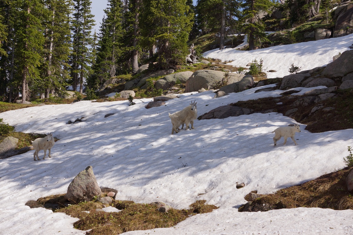
How many mountain goats can you spot?

Bahhh. Baaahhahh. That’s the sound of mountains goats moving through camp at 5:45am. Early goat gets the grass, I guess. I got up at 6:30 to a beautiful morning, just clear skies.
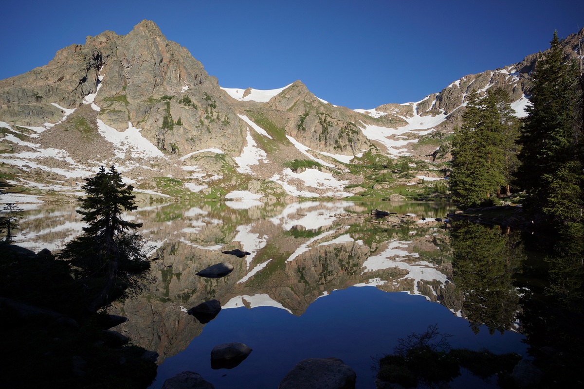
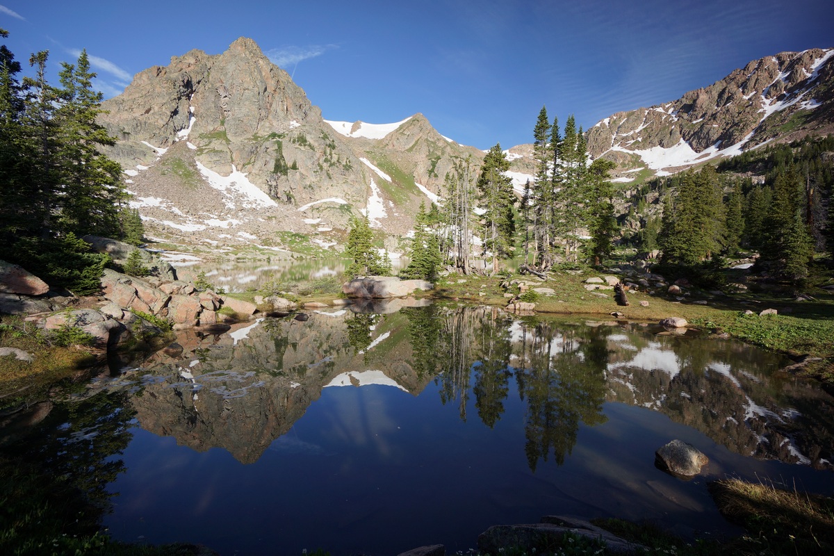
Gore Lake reflection

I left basecamp around 7:15 this morning, headed towards Snow Lake. The reflection on Gore Lake was awesome, one of the best I’ve seen in a while.

Entering “Snow Valley”
After leaving Gore Lake, I followed the trail down a little ways before veering off trail towards my destination. I made my way through the forest, over downed trees and through brush until I emerged into a small meadow. The grass down here was soaking wet, and now so was I. Feet, anyways. I found a way up over a ridge on the other side of the meadow, giving me a glimpse of the valley I was about to enter.
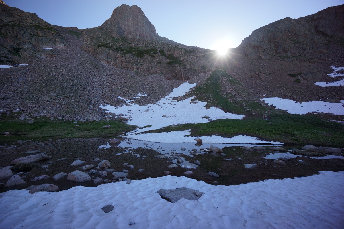
The sun rising right above the chute that leads up to Zodiac Peak
Near the entrance to Snow Valley, as I called it, is a chute that looks like it could be a route up to Zodiac View, which I was considering going for later in the trip. The sun was peaking over the top of this chute just as I pondered its “doability”. I wondered if there was a trail running through here, but haven’t seen one yet.


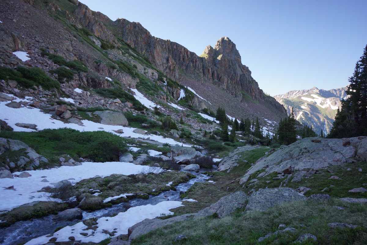
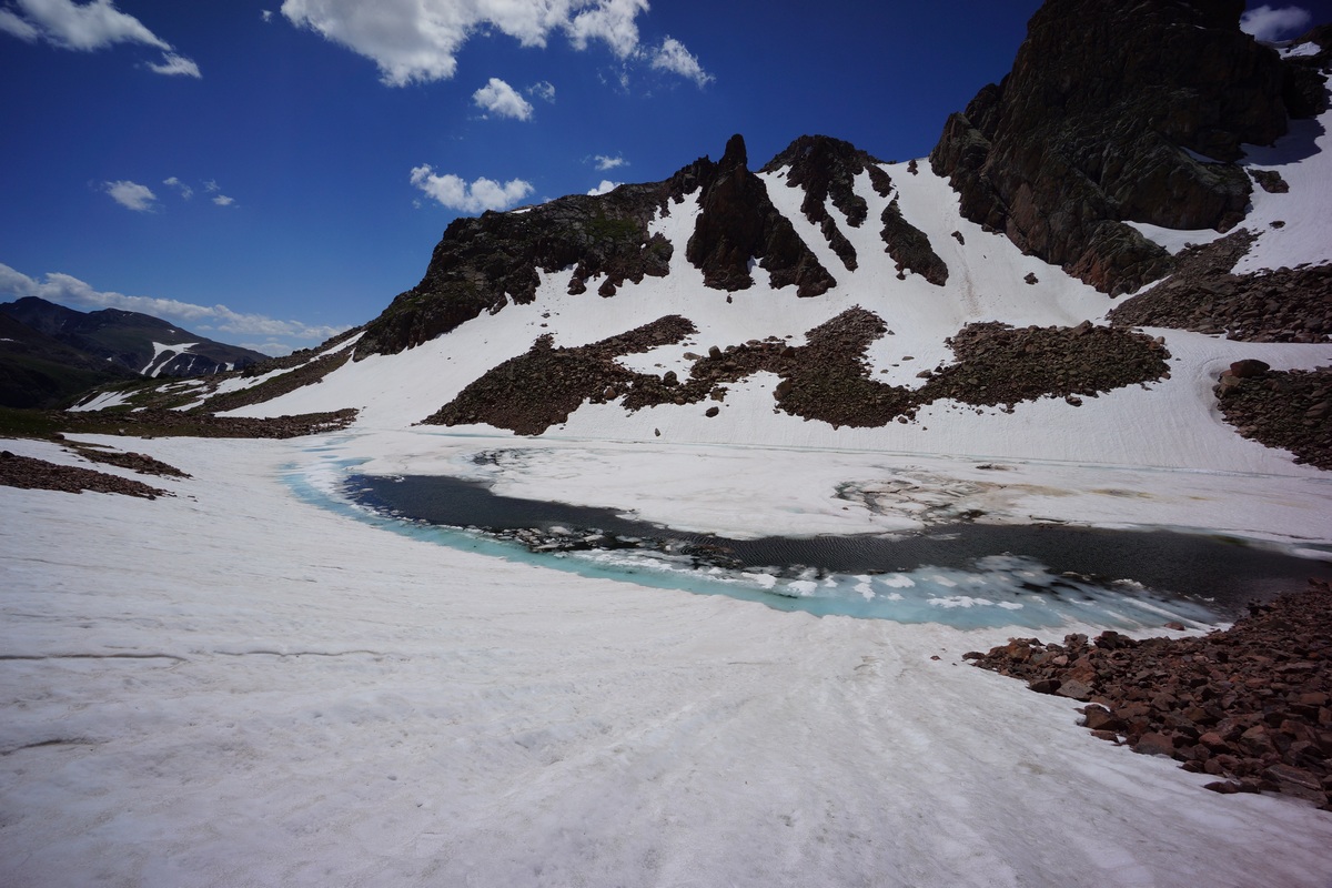
Stream running from Snow Lake

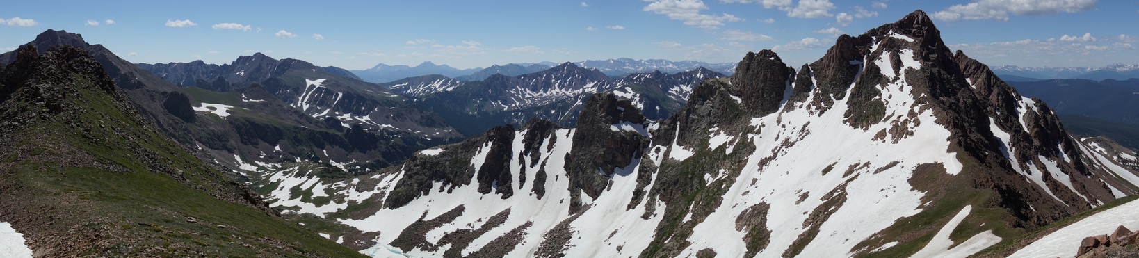
There was still a good amount of snow on the slopes of the valley. At one point I did see a trail, but then it disappeared underneath a large patch of snow. Everything was pretty soggy here with all the snow melt, but it was a really nice hike through this section. Lots of jagged peaks line the valley.
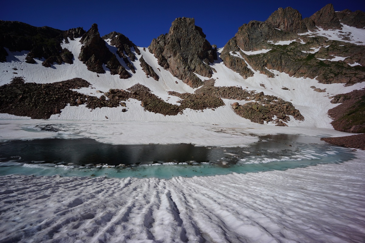
Snow Lake July 9th

Once I reached Snow Lake, I saw it was still mostly frozen, and there was quite a bit of snow around the lake. I stopped here for a quick break and some photos. While sitting by the lake I saw a young woman (18ish?) coming down from Snow Pass. I had been sitting here a while and didn’t even see her until she was mostly downhill. She said she was headed to Gore Lake to meet her friends, the 3 young guys camped there.
Looking back at Snow Lake as I work my way up to Snow Pass

I started hiking around Snow Lake, a bit higher up the slope. Boulders turn to snow, where a few hundred foot section had to be crossed. The slope wasn’t incredibly steep and I was hiking horizontally across so it wasn’t a problem. Once past the snowfields, others await. However, some of them would require a vertical ascent unless avoided, so that’s what I did. I just have trail runners on. This meant following the fields of talus or grass around snow patches until I was clear of the steeper terrain.
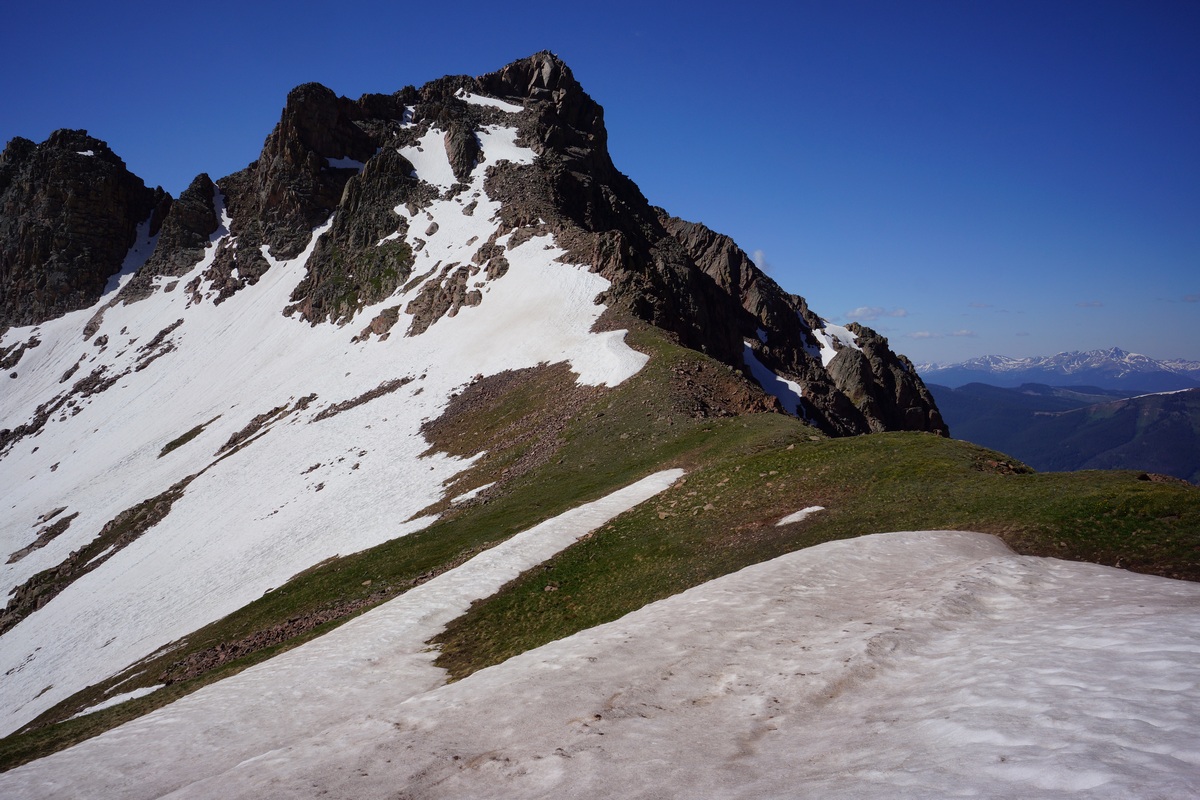
Snow Peak from Snow Pass
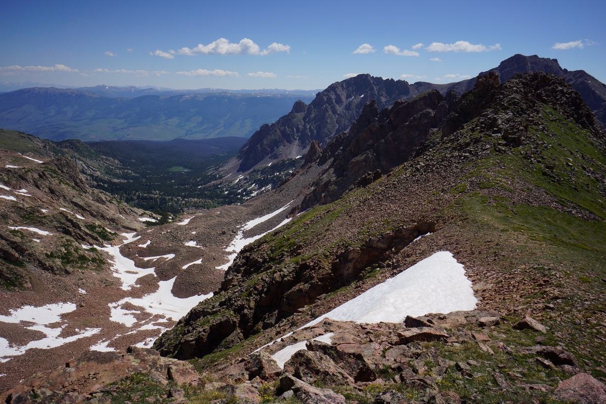
Overlooking Deluge Lake from Snow Pass
Views from the top of Snow Pass are awesome… Snow Peak to the south, and peak 12,835′ to the north. Great overlook of Deluge Lake too.
Trail from Snow Pass to Deluge Lake
On the Deluge Lake side, there was a clear trail heading own from the pass. I did see a trail heading up Snow Pas from Snow Lake initially, but it was higher up the slope than where I started from and went right through some snowfields, obscuring it. I never picked it up further up the pass either, even where the snow had melted out.
I hung out on the pass for a while taking pictures. I didn’t have much else I wanted to do today so I was in no hurry to leave. It was 10am now, so I still had the morning sun to the east. Great views of Hail Peak, Zodiac View and the rest of Snow Valley, except my photos are all washed out.


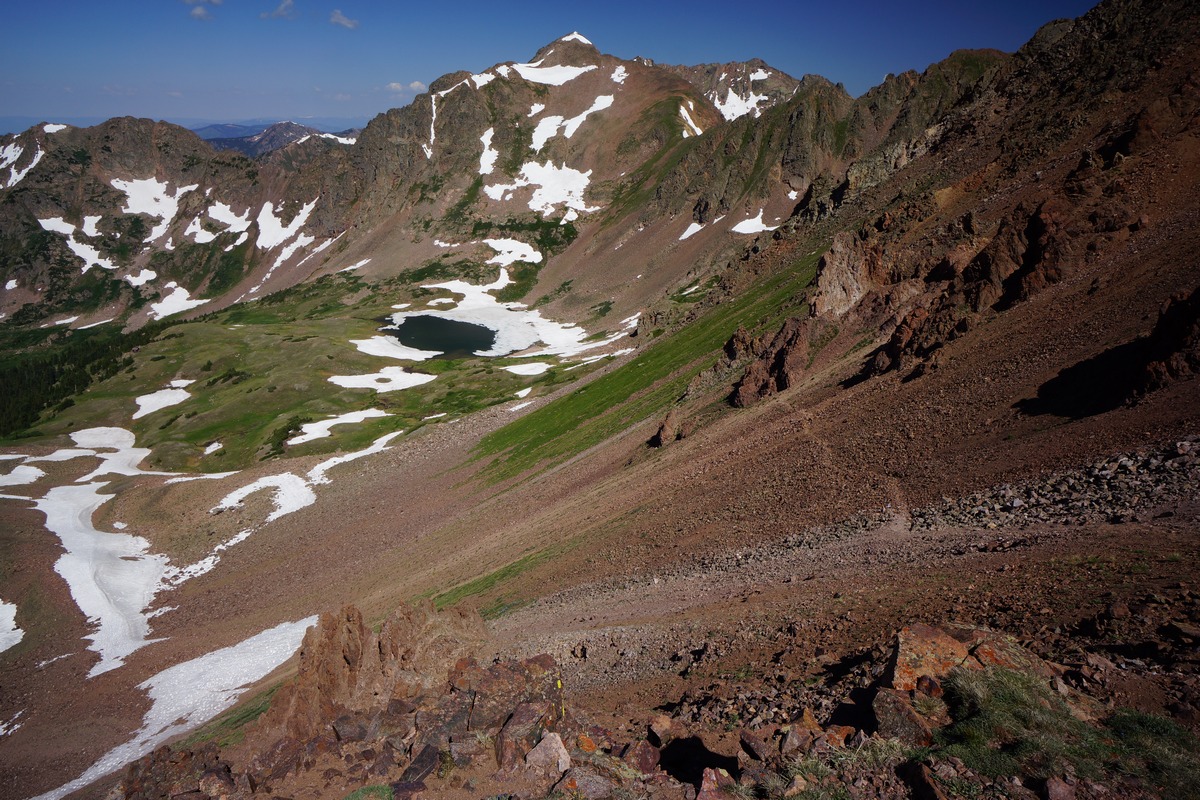
Looking east along the ridgeline below Peak 12,835′
Eventually I decided it was time to move on, and I headed up toward peak 12,835′. From the pass it was only another 300′ or so, and up a grassy slope. The top of the ridge here was grass covered and easy to walk along just as it had been below on Snow Pass. I highly recommend the side trip up here if you’re already going over Snow Pass, the views are excellent!
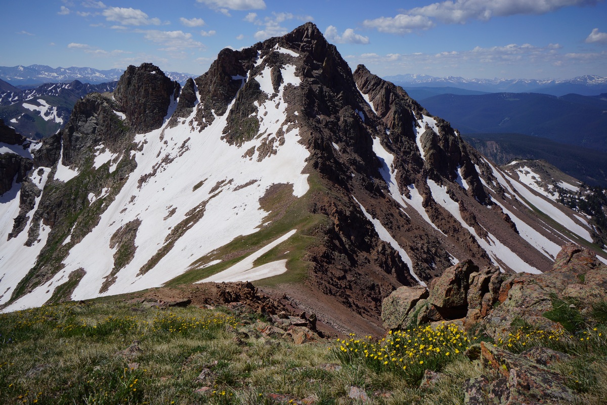
Snow Peak from Peak 12,835′

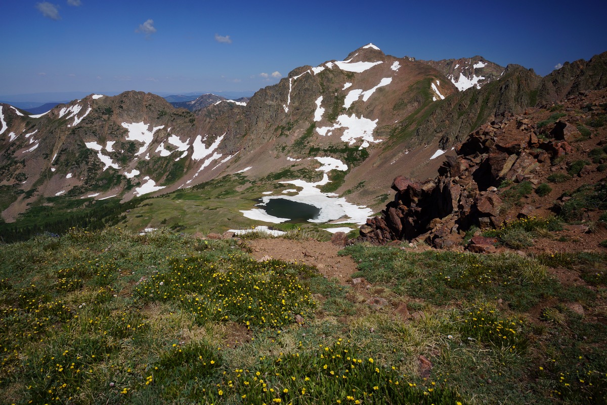
South Rock Creek basin
From the peak 12,835′ vicinity there was a good view into the South Rock Creek basin. I got the impression that basin is seldom traveled. Snow peak was very photogenic from this position, and I got some great shots.
Coming down the pass
When it was time to head down, I just headed downhill from where I was along the ridgeline instead of backtracking the way I came. This put me right where I needed to be on my way down in order to follow the route I came up to Snow Pass on. There were some steep spots, but the terrain was often grassy which made for great traction. There was a fair amount of talus too with the occasional small loose rocks over solid rock slabs which requires slow going.
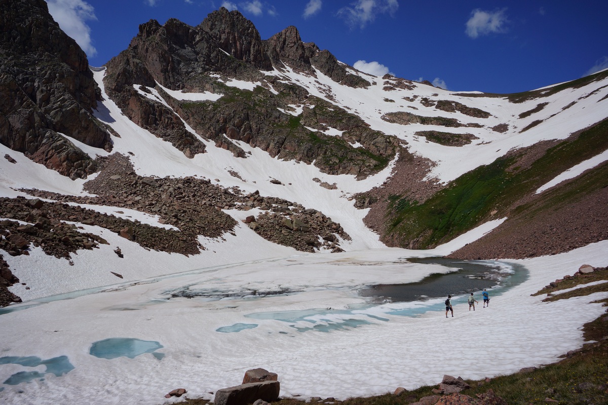
While heading around Snow Lake, I saw the 3 guys that were camped at Gore Lake. They had their fly rods, hoping to do some fishing. The only spot along the shoreline that wasn’t frozen was near the inlet on the northwest side of the lake. I didn’t have a chance to talk to them again to see how they did.
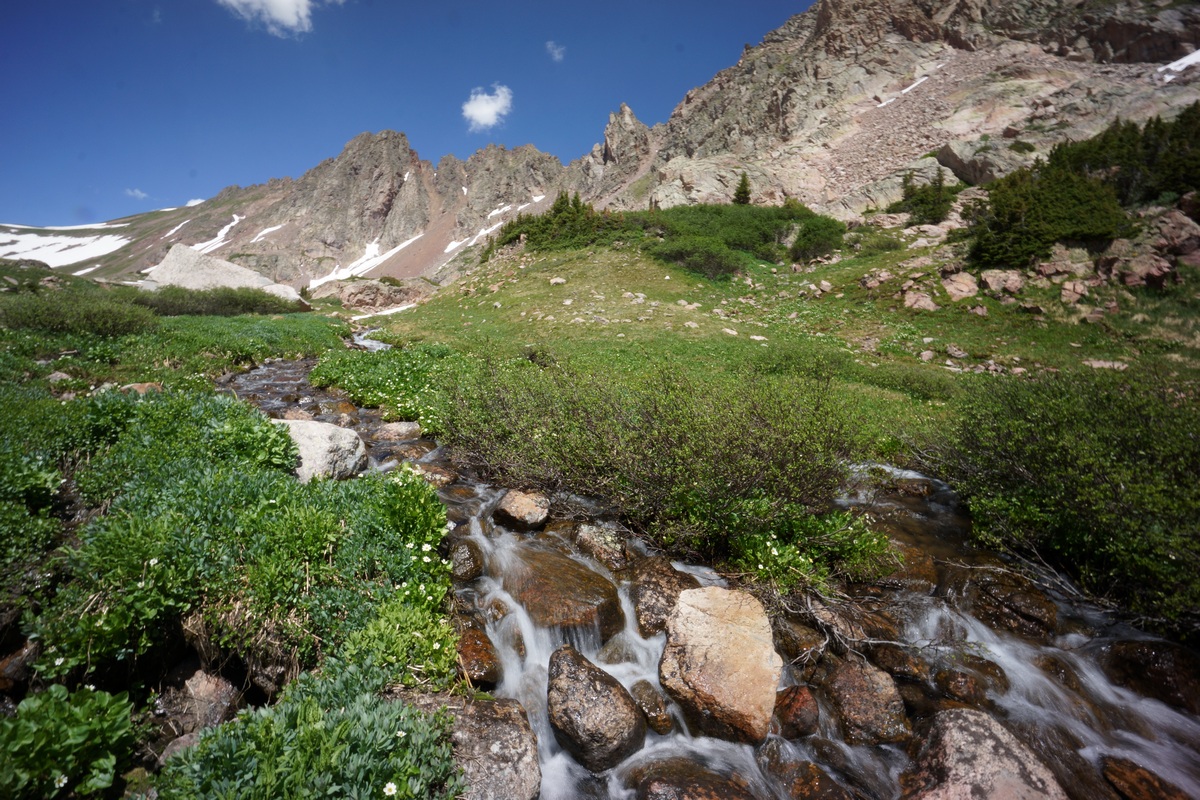
Stream originating from Snow Lake

Walking back through the valley was really nice. Sunny and blue skies, not too hot, beautiful scenery. I would love to be here during peak wildflower season. The snow is really nice too though, I typically have done my alpine hikes in August where all the snow that’s going to melt, has.

Once I started to drop down into the little meadow that was below Gore Lake, I saw a guy fast hiking down a hill behind me. He had just come from Hail Peak and the ridgeline I was on. I never saw him earlier in the day as I hiked through the area. He was surprised to see me though, he said he rarely sees other people here away from the main areas like Gore Lake. “That’s why I chose this place”, I said when he asked how I settled on the Gores. That, and it looks rugged and beautiful, two additional qualities I typical seek in a hike. So far the Eagles Nest Wilderness has fit the bill. Most people seem to just refer to the area as “The Gores” though.

Back at Gore Lake
North shore of Gore lake

When I arrived back at basecamp around 1pm, I was greeted by several mountain goats hanging out by my tent. After shooing them away I spent some time relaxing by the lake and trying to eat some food. It really sucks I can’t fish, that would be a great way to spend the afternoon. Still almost no clouds.


With all this time on my hands, I decided to get some pictures of those pesky mountain goats. Lots of them around still, they are persistent. I switched over to my zoom lens and got some good close ups. I did see a bunch of marmots today, but none when I had my zoom lens at hand.

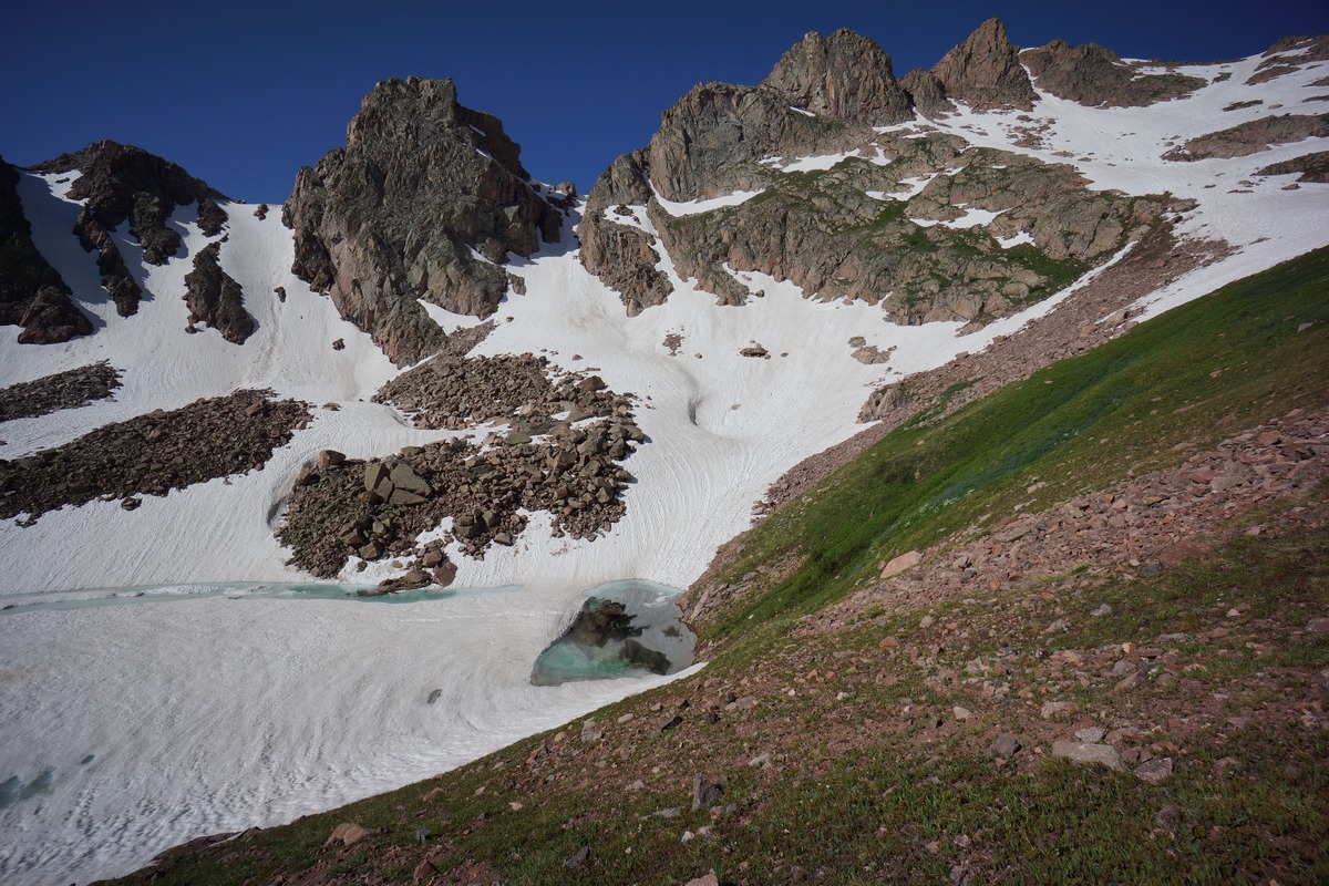
Snow Algae above Gore Lake’s south shore

Looking east towards Red Peak and Zodiac View from Gore Lake’s west side

Later in the afternoon I decided to take a hike up the inlet of Gore Lake. I followed the south/west shore from camp. There are a couple of nice vantage points of the lake from the western shore as you gain a little elevation.

I followed the inlet up into a nice little cirque, as the clouds started to build. There was a still a good amount of snow tucked away in these peaks. I headed back down and took the north side of the lake back, which I hadn’t hiked yet. The 3 guys camped at the outlet had packed up and left, but another 2 guys arrived and took at campsite father from the lake and more out of view.
Without a fire there wasn’t much reason to stay up so I headed to bed when the sun went down. I could always use the extra sleep out here.
Day 3 – Monday July 10th, 2017
Miles Hiked – 2.56
Elevation Gain – 630′
Route Hiked – Gore Lake to meadow below Gore Lake and back

Morning at Gore Lake
I got up at 6:30 again this morning to another beautiful clear day. The clouds and wind that were building last night dissipated after the sun went down and all was well.
Trail heading down from Gore Lake

I had though about heading up to Zodiac View today, but I wasn’t really feeling that motivated. I headed down the Gore Lake trail towards the meadow anyways, trying to convince myself to start the bushwhack. It wasn’t possible to hop rocks across the creek here in the meadow and I realized I should have crossed the creek farther upstream, near Gore Lake. By the time I headed uphill far enough to cross, I decided to just head back to the lake. I had my heart set on one day to relax by the lake, and I had an idea to maybe get some fishing in.

Along the way back, I followed the creek a little ways off the trail and got some nice shots of some small cascades.

Gore Lake outlet
Gore Lake at the outlet

Outlet flowing out of Gore Lake into a small pond
When I got back to camp at 9:30, the 2 guys that arrived last night were packing up and on their way out. Got the lake to meself now. I posted up near the outlet and wow, what a great spot. Gore Lake flows into a small stream that runs maybe 100 feet and pours into a small pond, then off the shelf and downhill. This was a really tranquil place, and I was perfectly fine lounging around here for the next few hours.
I decided to try and untangle some fishing line, no matter how long it took. I’ll spare you the details, and just say I got about 25ft of line. I figured this would be enough to jig, or use a hook and live bait, if I can find some. I never did find any worms or other live baits, so I tried jigging with mepps and some other lures. No luck. These fish are just not interested in anything right now.

After giving up on the rod and reel, I decided to try something I’ve never done… trout tickling. I’ve seen a method of catching fish where one reaches under a log of bank and feels for a fish. When a fish is found, press it up against the log or bank and pull it out of the water. Normally I wouldn’t just randomly guess where fish are, but since I can see them hiding under logs and not moving when I am near them, I figure it’s worth a shot.

Monster cutthroat trout (picture taken from my gopro footage)
I put my water shoes on and hopped in the water. It was about mid calf height and cold at first, but surprisingly OK after a minute. Maybe it was because of the adrenaline. I knew there was a large trout right under this log. On the other side of the log is a few inches of water and then soil, so the fish can’t really go out that way unless he wants to beach himself, which would be alright with me. With one hand under the log, I felt the fish’s underbelly. It didn’t move when I touched him, so I came in with both hands. After getting both hands on it, I started pressing up towards the log. However, this was a BIG fish, approaching the size of my fully extended arm. I wasn’t pressing hard enough and he wiggled out of my grip. The fish left the log but came back after a few minutes.
My second attempt was very similar to my first, and also not a success. I intended to continue for a while after a break, but a couple of day hikers showed up and I decided not to be the crazy guys doing something weird over there in the water. Crazy and weird, until I catch a monster trophy fish with my bare hands! I’d really like to give that another shot someday.


Could have been a marmot but blaming it on the goats
When I was done fishing I returned to camp to find one of my Black Diamond Alpine Carbon Cork trekking pole handles all chewed up. Mountain goats are the likely culprit, although it could have been a marmot too. Either way the cork handle was all gnawed away. When I got home from the trip, I contacted Black Diamond to buy a replacement top section but the only sell the middle and lower sections. That sucks.


Looking towards the divide from atop a ridge above Gore Lake’s south side
Later in the afternoon I climbed to the top of the ridge directly south of camp. The views here were outstanding in all directions. Rain was dumping in the distance beyond Red Buffalo Pass, and dark clouds were forming everywhere else. The jagged divide of the Gore Mountains was especially impressive looking in the direction of Zodiac View.

View of camp by Gore Lake as I descend the ridge


Snow meets melt-water
I headed back down towards camp, and then back to the small pool near the Gore Lake outlet. The mountains in the distance to the east are illuminated nicely at sunset, but the clouds didn’t look like they were going to break to give me the photo op i was waiting for.
Back at camp, the weather only started looking worse. I got some things together to make the pack up in the morning tomorrow easier, and went to bed when it started raining around 8:30. It rained moderately for a few hours, letting up around midnight.
Day 4 – Tuesday July 11th, 2017
Miles Hiked – 6.35
Elevation Gain – 365′
Route Hiked – Gore Lake to Gore Creek Trailhead
I woke up at 6 today, giving myself extra time to pack up my wet gear. There was some water in my tent, coming from a small hole in the bottom that I later discovered. Probably from me setting rocks on my tyvek footprint to keep it from making so much noise in high winds, the material just rubbed on the rock. Gotta patch that when I get home.
You really can’t ask for much better than this
Everything was soaked this morning. I waited for the sun to rise to dry out some items a bit before packing them away, and hit the trail shortly after. Another stellar reflection on the lake this morning.

Leaving Gore Lake
I made good time heading downhill through the forest below Gore Lake and then the soggy meadow below that. The trail through the meadow has Peak 12,578′ and the snow capped mountains to the south looming on the the near horizon. As you approach, the trail drops back down into forest and downhill. This section was a lot better going down that it was going up.

Back down at the intersection of Gore Lake trail and Gore Creek trail, there’s a grave, for whom Gore Lake/Creek was named for. Not sure the backstory on those guys but I assume they spent a lot of time here or even lived in these mountains. What a beautiful place to have spent so much time, it sounds like a life well lived.

Gore Creek
There are a couple of places to snap a nice shot of Gore Creek, but not many. The final few miles went quick as I moved downhill. I saw more and more people as I neared the trailhead, which I arrived at around 10:15. I believe it was roughly a 3 hour hike down from Gore Lake, which took me about 4 hours going up.
I packed away my gear and headed to the Silverthorne Rec Center for a much needed shower ($5). Beats washing up in a gas station bathroom, and I’m sure the people sitting next to me on the plane home will appreciate it.
Final Thoughts About Hiking The Eagles Nest Wilderness
Mosquitoes were pretty bad this whole trip. Head net is a must. Have a plan to keep your gear safe from animals when you’re not around it. On 2 or 3 hikes in Colorado now, I’ve had animals chew up gear.
This is a really beautiful place. Unfortunately for those looking to string together a longer, multi night route here, you’re kind of shit out of luck. Many of the valleys are dead ends, too steep for most. There’s a few opportunities, don’t get me wrong, but this place would be really tough to do a north to south traverse, for example. Instead, think about making a loop between two adjacent valleys or basecamping high up in the drainages. I don’t care how I do it, I just want to come back and see more of this place!


Nice journal. Thanks for sharing.
April 24, 2022 at 3:53 pm