Gila Wilderness, NM – Mogollon Mountains Backpacking Overview
Complete Gila Wilderness Photo Gallery | Gila Wilderness HD Video
- Location – Mogollon Mountains in the Gila Wilderness, New Mexico
- Park – Gila National Forest
- Trail Hiked – Custom Route
- Miles Driven To Destination – 3700 miles roundtrip
- Length Of Time Hiked – 6 days, 5 nights
- Trail Type – Loop
- Miles Hiked – 45
- Trail Difficulty – 8/10
- Fires Allowed – Yes

When I went to order topographical maps to use in the Gila Wilderness, I realized that I’d actually need to buy 6 maps to cover all the quads that my route was passing through. Instead, I ordered a custom printed map that covers only the area I will be hiking in, allowing you to pick sections of quads and print them. This is what I ordered for this trip:
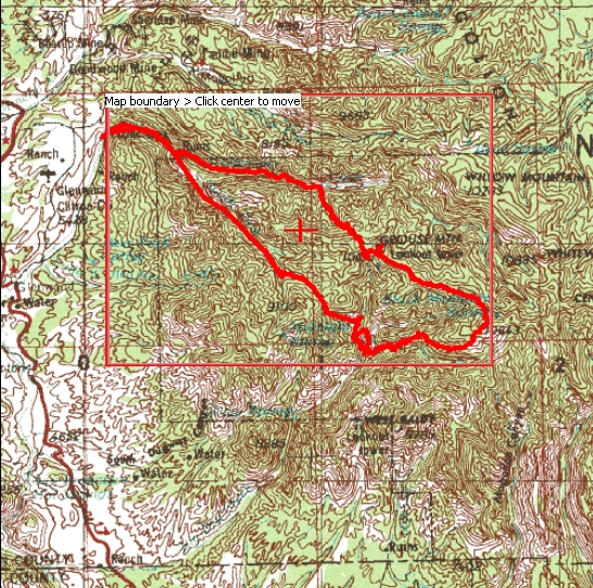
If you plan on hiking the same route as me, you can order the map I bought here: Mogollon Mountains Topo Map
Here’s another map of my route, showing you where I camped and where the forest fire was (read about that later):

Soon after getting back from my hike in Big Bend National Park, TX I started planning a spring trip. I had my hopes set on somewhere mountainous, like Colorado or Northern New Mexico, specifically The Pecos Wilderness. However, the weather in May just doesn’t allow for snow-free access in those regions this time of year, so I either had to move farther south, or lower in elevation. The Truchas peaks, at 13,000 feet, would have been awesome… but I after checking snotel and word of mouth from those who’ve hiked it this time of year, I realized that early June is the earliest access to that region. However, I was told about the Gila Wilderness in Southwestern New Mexico. After a little research, I concluded that the Gila (pronounced hee-la) would be a perfect place for me to go at this time of the year.
The Gila Wilderness is part of the Gila National Forest, which is only separated from the Aldo Leopold Wilderness by one small 4×4 road. Combined, the two areas cover around 750,000 acres. I chose the Mogollon Mountains region of the Gila Wilderness, which is on the extreme West side of the park, close to Arizona. The temperature was forecast to be anywhere from 50-80 degrees during the day, depending on elevation, and around 35-65 at night. Temperature wise, I figured this would be perfect. May is also the driest time of year here, so I also figured that rain wouldn’t be a problem. The rivers should also be lower, making stream crossings easier. And, campfires are allowed as long is there is not an alert in place… check the Forest Service website here http://www.fs.usda.gov/alerts/gila/alerts-notices. There was no alert or fire ban in place when I went, however, lightning caused 2 fires in the Mogollon Mountains while I was in the park. This fire has now grown to be the largest wildfire in New Mexico’s history! We had some excellent views of the fire from the top of Grouse Mountain, of which I have some nice pictures and video, but I’ll get into that later.
Getting There
With an 1,850 mile drive ahead of me, I left home in southeastern Michigan at 7:30am on Friday, May 11th and headed for Springfield, IL to pick up my hiking partner. I made it all the way to Springfield around 2:30pm on one tank of gas, 462 miles. We promptly ran out of gas looking for a gas station, but luckily I plan ahead for most things, and it was as simple as getting the gas can out of the trunk which I filled ahead of time, just in case. This got us to the next gas station, and we drove until 11:30pm. We stopped at a crappy Budget Inn type of motel in Pratt, Kansas and got the best room $55 could buy.
The next morning we got on the road at 7:30am, and began the long boring drive through Kansas. At this point, we figured we’d arrive at the trailhead at around 6pm today. We were making such good time that we had a decision to make: stop in the last town that has a hotel (which looked like Socorro on the map, which was a 3 hour drive from our destination) and head to the trailhead in the morning, or camp at/near the trailhead somewhere and leave early morning to hit the trail. We choose to drive all the way to the trailhead, and ended up making it there around 7pm. We camped in a small campground on highway 180, literally right across the street from the entrance to the Whitewater Picnic Area. There is NO CAMPING at the Whitewater Picnic Area, it’s day use only. This is where you park your car, which will run you a whopping $3/day. Not bad since there are no other fees or permits required to hike or camp in the Gila Wilderness. Just park your car and go.
Notes
There are 2 main trailheads in the Gila Wilderness and several smaller ones. For the Mogollon Mountains region, the Whitewater Picnic Area is the most popular. The other is the Gila Wilderness visitor center on the East side of the park, which is at the end of State Hwy 527 (also called Hwy 15), which is near the Cliff Dwellings. There are several other trailheads along Bursum Rd on the North side of the park, and many more. These are usually marked on a topographical map, which you should have if you are hiking here anyways.
Day 1 – May 13th, 2012

Catwalk Trail
We hit the trail around 8:30am on Sunday May 13th.The first mile of our hike was on the Catwalk trail, a developed area with paved trails and a metal catwalk that allows you to walk over the rugged terrain without getting your feet wet. This area was pretty cool and easy to see why it was a popular day hike. At the terminus of the Catwalk trail, we thought we’d be at the junction of the Whitewater Trail #207 and the South Fork Trail #212. Instead, the end of the Catwalk Trail becomes the beginning of the Whitewater Trail, and we had about another mile to go before we reach the above junction.

Our plan was pretty loosely formed at this point… I had picked a point on my topographic map that we determined to be about 10.5 miles away where the Golden Link Trail crosses Big Dry Creek. We would hike the Catwalk trail to the Whitewater trail, to the South Fork Trail, which later becomes the Golden link trail after you pass Camp Creek Saddle. Our plan was to hike to this point today, set up a basecamp, and spend the next 1-2 days exploring Big Dry Creek, Spider Creek, and Spruce Creek as there are numerous waterfalls in this area. I found an awesome site that tells you about all of the waterfalls in New Mexico, including many in the Gila Wilderness. It has pictures, descriptions and even GPS coordinates of the falls. It’s http://www.dougscottart.com/hobbies/waterfalls.htm and the falls in the Gila Wilderness are numbered K4 – L3, just to save you some time plotting them on the map. After this, we had no plan… to be determined as we go!

After leaving the Catwalk trail behind, we saw a handful of other hikers, maybe 4 between 2 groups before hitting the South Fork Trail. At this point, my hiking partner, Dan, began to slow down quite a bit. It got got to the point where we’d hike for 3 or 4 minutes and then take a 2 minute break. I was getting agitated with the stop and go pace we had adopted, and I told Dan we need to pick up the pace. His response was “What’s the rush? We have until 9pm.” This was Dan’s 2nd hike ever, and he thinks it’s not going to be a big deal hiking until complete darkness and then trying to find a campsite. He was totally fine with this. Well, not me. “I’d rather cover my mileage in as few hours as possible, and have the rest of the day to explore and relax as I see fit,” I said. Dan snapped, “Well, I don’t want to be rushed. Go ahead and get to the campsite then, I’ll get there.” Even though I know I shouldn’t have, I left Dan behind and continued on the trail at my own pace. We both had a map and knew where to meet, and as long as he followed the trail, we’d meet up. That was my thinking at that point.

South Fork Trail… basically, the stream is the trail

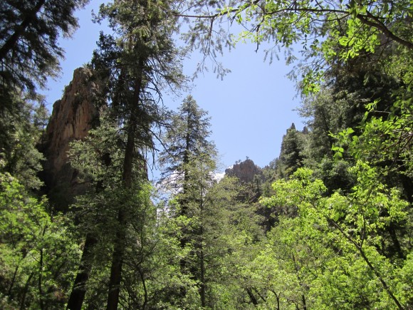
Hiking solo, I pushed on for another hour and a half before stopping for lunch. A pastrami and cheese sandwich was on the menu, which I ate as I air dried my feet near the creek. They were already soaking wet with sweat, but were dry after 25 minutes. I figured after 25 minutes, maybe Dan would have caught up to me, but he didn’t. I hit the trail again, and was really enjoying the hike along he South Fork Whitewater Creek. The canyons were very steep on both sides, and the trail criss-crossed the river many times. It was easy to hop rocks across the river in nearly every crossing because the water level was lower, so that made it easier. It was about 30 minutes after eating lunch that I began to feel like crap. I think t was a combination of dehydration and maybe that sandwich. I know I didn’t drink enough during the car ride, didn’t want to stop every hour to take a piss. So, I found a comfortable spot on the rocks beside the South Fork Whitewater Creek and laid down for 45 minutes. I hit the trail again once I felt a little better, but still no sign of Dan. At this point I thought he may have turned around and went back to the car, and planned on camping across the street at the campground we stayed at the night before. Or, he’s just incredibly slow!

I now realized that I was not going to make it to our planned destination today. My new plan was to continue hiking the South Fork Trail until I passed the junction of the Little Whitewater Trail/East Fork Trail, and start looking for a campsite. After passing the above junction, I found a campsite a few hundred yards down the trail. It was within view of the trail, so if Dan was hiking by here, he’d definitely see me. By nightfall, I still hasn’t seen him. Now, I though for sure he’d turned around. My dilemma was to continue without him or to turn around and make sure he was ok. Knowing he had everything he needed to get by on his own, I decided that I’ve driven too far to call off the hike. I really enjoyed my only prior solo hike, a 25 mile loop through the Porcupine Mountains in the Upper Peninsula of Michigan in October of 2011 and did not mind at all doing another 5 days here by myself if need be. With that in mind, I started a fire and cooked some italian sausages that I kept frozen (well, partially frozen) in my cooler on the car ride here. I always opt for something good my first night such as a burger or brats, since they keep just fine for 1-2 days if kept frozen until you hit the trail… and DAMN, were they delicious!
Day 2 – May 14th, 2012

Junction of the Holt-Apache Trail and the South Fork/Golden Link Trail
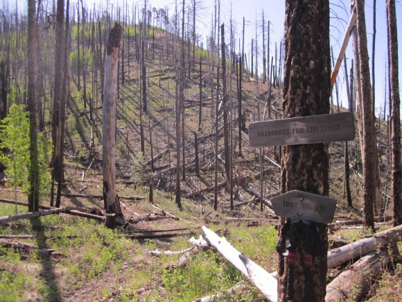
After filtering some water and refilling my water supply, a 2L Osprey hydration bladder and a 1L water bottle, I hit the trail at 8am. I was making good time and made it to Camp Creek Saddle about 1.5 hours later. I stopped and dropped my pack to climb a small hill to get a view of my surroundings and snap some pictures, then proceeded down the Golden Link Trail towards yesterday’s original destination at the junction of the Golden Link Trail and Big Dry Creek. Little did I know that this was going to be an all day adventure… what was supposed to only be a hike of 3 miles max ended up taking me the entire day! The Golden Link Trail was very difficult to follow in the section Southeast of Camp Creek Saddle, and I was constantly losing the trail and trying to find it again. If the trail was on one of the hillsides next to Camp Creek, I didn’t see it. They were pretty steep anyways, so I opted to hop down into Camp Creek and hike through the river bed. This was very slow going due to huge boulders, flash flood debris, and tons of downed trees. I knew the trail followed the creek, so I wasn’t too worried about finding it again, which I eventually did.
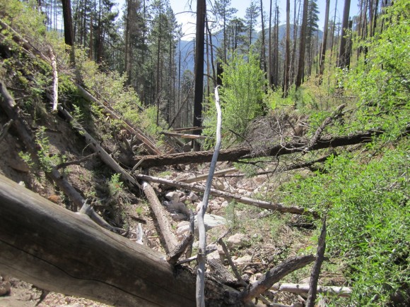
Upper Camp Creek, all dry!

Quite the logjam here
Where the Golden Link Trail crosses Spider Creek, I dropped my pack to air out my feet and have a snack. Knowing that there are a few waterfalls farther up Spider Creek, I hiked upstream for about 15 minutes. I had planned on exploring Big Dry Creek and Spruce Creek the next day, without my pack, so I decided to turn around and cover more ground today. Now, this is where things began to get really interesting for me. After crossing Spider Creek, I could not find the Golden Link Trail for the life of me. There were cairns stacked on the other side of Spider Creek, so I hopped up there to look for the trail but simply could not find it. I followed several little foot paths on this steep hillside, only to find dead ends and dense shrubbery. I spent about an hour looking for this trail with no luck.I decided to follow Spider Creek downstream to the point where it meets Big Dry Creek, and this point was only a half mile or so from where I was planning on meeting up with Dan.

Hiking Spider Creek
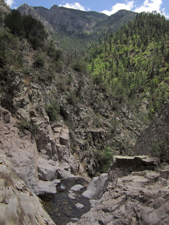
The top of Lower Spider Falls
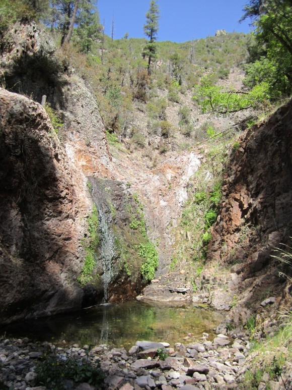
I really enjoyed following Spider Creek as it felt very remote. There was no trail here, just following the river. Actually, hiking through it in spots. The canyon walls around me got steeper as I progressed downstream until eventually I was stopped in my tracks by a waterfall that appeared to be 40-60 feet. This was Lower Spider Falls. From my topographical map, I could see this as a potential problem before I began hiking this way, but couldn’t be sure if it was passable of not. Well, it was definitely not passable as sheer cliffs came together in one small point for the water to flow over the edge. I had no choice but to backtrack the way I came. I hiked about halfway back to the Golden Link Trail before finding an area that seemed to have the “least steep” slope, and decided to just hike to the top of the hill that towers over Spider Creek, as I knew the Golden Link Trail was on top of that hill somewhere. If I hike straight up this thing, I have to hit the trail. This was a bitch… having a 50lb pack and hiking through dense vegetation was not helping. I don’t remember how long this took, maybe 45 minutes or an hour, but it was a 700 ft elevation gain. I tried to follow little game trails where I could, but no matter which way I went I was getting scratched up by all the thorn bushes. Finally, near the top of the ridge I hit the Golden Link Trail and was back on track.

View from the Golden Link Trail
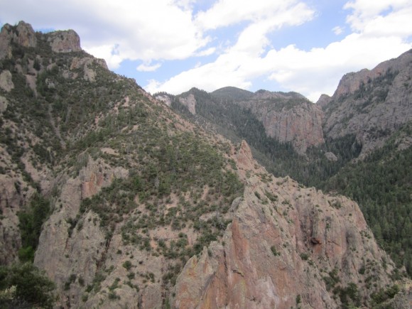
View from the Golden Link Trail near Big Dry Creek
By this time, it was mid to late afternoon. The trail was now descending into Big Dry Canyon via steep switchbacks. This section of the trail was very beautiful, with excellent views of sheer canyon walls all around. I eventually made my way down to Big Dry Creek, which is where Dan and I planned on meeting up the night before. I was planning on camping here tonight regardless, but to my surprise, Dan was already there and had set up his camp just a few minutes earlier. Honestly, we were both surprised to see each other, as he thought I was way ahead of him, and I thought he’d gone back to the car. Although Dan had reached our destination before I had, he did not lose the trail as I did and was hiking the whole day to get to this point.
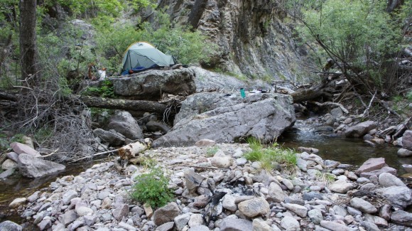
Camp for nights 2 and 3
From the topographical map, this area looked like it would be a good place to camp as the banks of the river looked wide. In reality though, like everywhere else in the Mogollon Mountains, there were no flat areas to camp, at least not like I had expected. Dan found a small area on the hillside that was just large enough to fit his tent, while I set mine up on a large, semi-flat rock that sat about 8 feet above Big Dry Creek. However, it was not as flat as it looked and no matter which way I positioned the tent, it was pretty slanted. I found some flat rocks to put underneath my tent to level it out, and it was almost comfortable. Good enough, now it’s time to start thinking about a fire. There was a bit of an “island” in the center of the creek with just rocks and gravel, and this is where we made our fire.
We began to plan out our next move on the map as we ate and enjoyed the fire. Tomorrow, we’d stick to our original plan, which was to have our 3rd day as an “exploration day”. The plan was to follow Big Dry Creek and find some waterfalls, and explore off trail.
Day 3 – May 15th, 2012
We woke up around 7am, ate breakfast, and headed up the Big Dry Creek by 8am. I chose to wear my hiking boots while exploring upstream over my water shoes. Most of the time we were hoping rocks and hiking right through the creek itself because the banks were either too steep or covered with thick vegetation. As rocky as this creek was, my feet were sore as hell from trekking a 1/4 mile in them the night before, so I opted for comfort. I’m glad I did, because I don’t think my feet could have taken that kind of beating for an entire day. Sure, my boots got soaked as they were occasionally dunked in the water halfway up my shins, but at the end of the day it was a good decision. Dan chose to wear his Vibram FiveFinger shoes, which were a lot more sturdy than my water shoes. Although his feet were sore at the end of the day, I know they provided a lot more protection than my cheapo Walmart water shoes would have. Maybe I’ll pick up a pair before my next trip.

Hiking upstream through Big Dry Creek

Dan climbing his way up Big Dry Creek

Posing in front of a waterfall. Later, we’d swim here
Hiking up Big Dry Creek was awesome. We encountered several smaller sized waterfalls, with the largest being around 15 feet or so. The farther we went upstream, the more rugged the terrain became. Every so often, we’d run into something we weren’t sure we’d be able to get around, such as some extremely large boulders or steep canyon walls. At one point we had to squeeze through a narrow opening at the end of a small cave to continue up river. We took our time and enjoyed this relaxing day, because tomorrow we’ll have to hike up to Black Mountain, a 4,000 ft elevation gain from our current campsite.

Dan squeezing through a small opening in a small cave
We turned around sometime in the early afternoon and headed back. We stopped at one of the waterfalls we passed earlier in the day and were tempted to swim in the pool at it’s base. We were both filthy from 3 days of backcountry travel, and although the water was freezing, the warm weather and beauty of the waterfall proved to be irresistible. Dan jumped first after taking a few minutes to build up the courage. As soon as he resurfaced, he quickly swam ashore. I laughed at his reaction to the icy water, but it was my turn next. My feet hit bottom, and I guessed it was around 8 feet deep. I lasted no longer than Dan, and instantly got out. That water was numbingly cold, but it felt great to be somewhat “clean” again.
We got back to camp in the late afternoon, and after a quick break, we headed downstream on the Big Dry Creek. I wanted to get to the bottom of Lower Spider Falls, the waterfall that stopped me in my tracks the day earlier. I had scouted this area earlier, and only made it a few hundred feet from our camp before the canyon walls narrowed and the water dumped into a pool that appeared to be 6 feet deep or so, even at the edges. We found an area on the hillside that looked manageable to climb up and go over the canyon wall, but it was steep. We made it over and only a few hundred feet downstream, we were again stopped by a similar situation. Another deep pool with no way around it. I found another way around, but this hill was steeper and much taller than the last. It was maybe 200ft up, and it was getting a bit hairy. I used a stick as an improvised “ice axe” to keep from sliding down which really helped. After making it to the top of this ridge, we could see Lower Spider Falls. However, the ridge we were on appeared to get very steep and we didn’t see an easy way down to the river again. It was around 6:30 at this point and we decided to turn around.
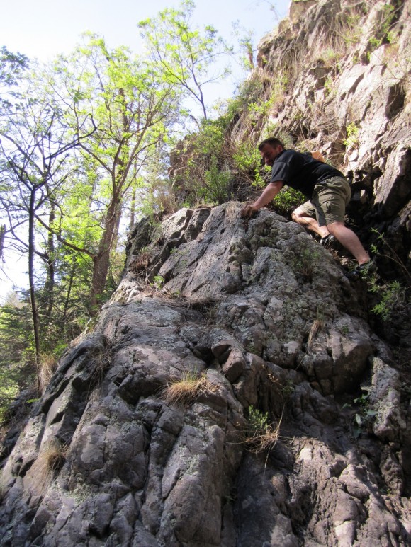
Trying to progress downstream on the Big Dry Creek

View of Lower Spider Falls. I wish we could have gotten closer!
For dinner I thought I’d try one of those freeze-dried meals. It was the Natural High brand, honey lime chicken. After pouring boiling into the bag, it says to wait 10-12 minutes or so. Mine was in there for a half hour or so, next to the fire keeping it warm, and it never absorbed all the water. Yuk. Dan, however, was really impressed with his Mountain House meals, especially the lasagna. We sat by the fire and ate some sour patch kids and watched the stars for a while before turning in around 10:30.
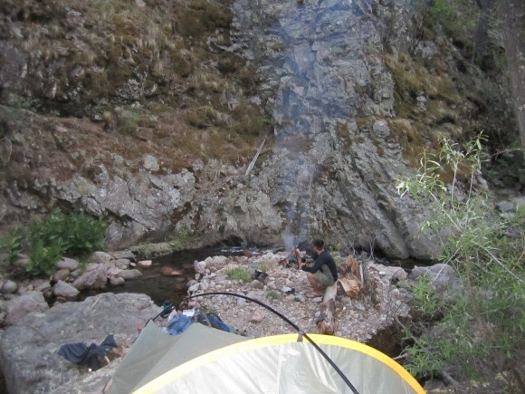
Enjoying a fire at camp
Day 4 – May 16th, 2012

Exploring an old mine along the Golden Link Trail

Today is the day Dan has been dreading. A 4,000ft elevation gain up to Black Mountain on the Golden Link Trail, and then we’ll push on to Spruce Creek Saddle via the Holt Apache Trail. After hiking for about a half hour, we passed an older man with his dogs camping alongside the trail. This was the only person we saw out here our entire trip, beside people near the trailhead and along the Whitewater Trail. A little farther down the trail we passed the Golden Link Cabin. It’s always amazing to me seeing something like this in such a remote place. The next section of the trail offered some great views, but the switchback were relentless! We also found a old mine which was not blocked off, so we decided to explore inside. We dropped our packs and with our headlamps on, entered the mine and were only able to make it a few hundred feet in before it dead ended. There was nothing of interest to see in here so we hit the trail again.

Hiking the Golden Link Trail up to Black Mountain
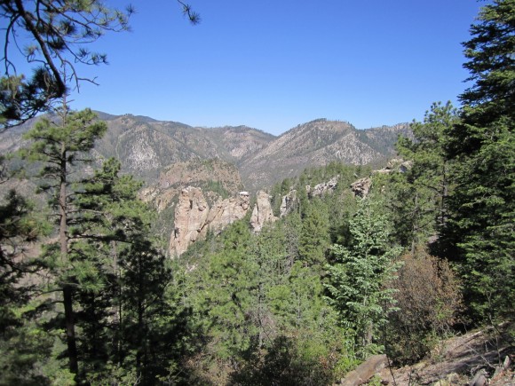
Heading up to Black Mountain
By late morning, we made it to the point where the Golden Link Trail crosses Big Dry Creek. We had hoped to filter water here, but at this altitude, the creek was nothing more than a trickle. We were almost out of water and there wasn’t going to be any water for quite a while, so it as imperative to fill up here. We followed it “downstream” a ways and found a small pool that was suitable for drawing water from. After loading up on H2O and eating lunch, we headed for the top of Black Mountain. On our way up, we noticed a fire not far in the distance, over the next ridge. We did not see any flames, but plenty of white smoke billowing up from the forest and staying somewhat low in the valley. Because of it’s small size, I thought it may have been a controlled burn. We moved on eventually made it to the summit, but we were sorely disappointed to find that there was no view as it was blocked by thick tree cover. Nothing to do now but push on to Spruce Creek Saddle. Now on the Holt Apache Trail, the terrain was not as steep which was a nice break. We hiked another hour or so before reaching our destination. Camp Creek Saddle is a large open meadow, a welcome sight in the Gila. Everywhere we’ve been so far was steep, rocky, and covered with thick fauna. Although we were not near a water source, there was a large fire pit area and plenty of firewood at hand.

First view of the Gila Fire on our way up Black Mountain
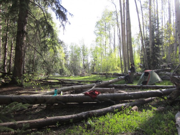
Spruce Creek Saddle
Although we were a good ways away from the fire we saw earlier, it was still on my mind. I turned on my cell phone and was surprised to have signal, albeit only one bar. FYI, I have Sprint. I was able to search google for “gila fire” and the first result was from the forest service’s website, and in the description it mentioned a prescribed burn scheduled for May 9th that was postponed. I tried to click on it to read more but apparently I did not have “enough signal”, as the page would not load. So, I optimistically assumed that this fire was a controlled burn. This was comforting and helped us sleep a little better.
Day 5 – May 17th, 2012
Today we will hike the Holt Apache Trail to Spider Saddle, then take the Deloche Trail through Winn Canyon and finally to the Whitewater Creek Trail. This day was going to be almost all downhill, which was a relief after a hard day yesterday. We would also cover more ground than any other day, 13.8 miles.
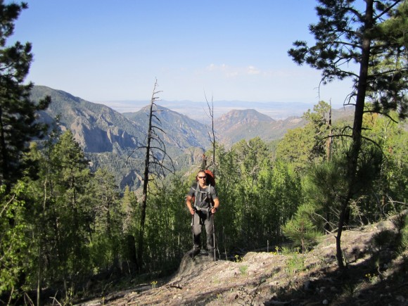
View from the Holt Apache Trail between Indian Peak & Grouse Mountain
I woke up at 6am as I have been doing most days on this trip. Like every morning, I walk over to Dan’s tent and wake him up since he doesn’t have a watch with an alarm. And, like every morning, he says “Ok, I’m up”, but continues to sleep until I wake him again in a half hour. Eventually, we get moving and hike the Holt Apache towards Grouse Mountain. The topo shows a clearing near the summit, and we were hellbent on getting some mountaintop views one way or another. We dropped our packs on the trail, put on our Camelbaks, and hiked the 1 mile trail to the summit. The trail was difficult to follow after a certain point, and we ended up just bushwacking our way to the top. Even up here, there were remnants of an old cabin or mining operation. Pieces of metal bed frames and other objects littered the summit .

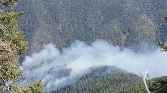
Helicopter flying through the smoke of the fire

When we got to the top, we found ourselves on the edge of a cliff with a spectacular view of the Mogollon Mountains. We saw another forest fire burning in the valley below, which appeared to be in Lipsey canyon near Redstone Park along the Whitewater Trail. We spent a good hour up here scrambling down to various ledges to get pictures of ourselves and the fire below, eating lunch and relaxing. We even saw a helicopter flying through the smoke surveying the fire. Little did we know that this fire would grow into the largest fire in New Mexico state history! It’s still burning as of June 10th 2012 and is now 278,000 acres, or 434 square miles.
With a lot of ground to cover, we descended Grouse Mountain and jumped back on the Holt Apache. Shortly thereafter, we made a wrong turn and headed down a side trail to Nabours Spring instead of staying on the main trail. We were going down steep switchbacks for a while and eventually the trail just ended. We found ourselves on the side of a steep slop with a long way to go to the top. We stopped and I consulted my GPS and topo, and discovered our mistake. If we continue to head down, this will put us in a canyon with no trails and difficult terrain. Our only choice was to head back up the way we came. This probably set us back an hour, but it happens.

Filtering water from Whitewater Creek

Whitewater Trail
Back on track, we found the Deloche Trail and hiked towards Whitewater Creek. Somewhere along this trail, we both ran out of water. We didn’t have much farther until we reached the creek so we kept a good pace all the way there. Once we hit Whitewater, we began to see a steady flow of other hikers in the area. We passed a group of guys who had just left Redstone Park the day earlier, and asked us if we saw any rattlesnakes. We hadn’t but he said he’d seen three. With all the climbing we did, we were surprised to hear that, and lucky we hadn’t. We stopped along the creek to filter water and cool off. Down in the bottom of the canyons was much hotter than it was a day earlier at 10,000+ feet.
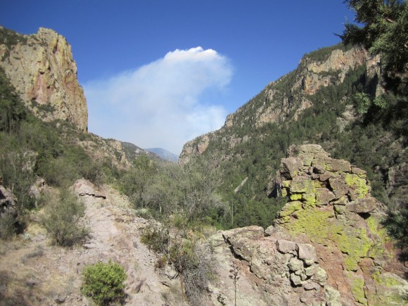
Smoke from the forest fire behind us

Night 5 campsite along Whitewater Creek
We were worn out now, but needed to cover a few more miles today so that our hike back to the car tomorrow morning is a short one. We hiked another 4.3 miles until we reached a campsite at the junction of the Whitewater Trail and South Fork Trail. After making camp, we filtered more water and tried to rehydrate. I had been pissing dark yellow for a while now and chugged a few liters over the course of the night. We had a fire going, but it was pretty warm out and we were too tired to keep it going. Our last night in the Gila Wilderness was pretty low key. We both passed out around 9:30 or so, maybe earlier.
Day 6 – May 18th, 2012
I don’t think it matters where you are, but for me, I am ready to go home on my last day anywhere. Today was no different, and our car was only a 2.8 mile hike away. I ate the last of my food for breakfast, something I’ve never done before. Usually, I pack a little too much food. In all fairness though, I did plan this trip for 5 days, but since we made such good time driving we were able to get a sixth day in. Now foodless, we hit the trail and embarked on what seemed like a much longer trek than when we hiked this stretch on our first day.

Whitewater Trail nearing the Catwalk Trail

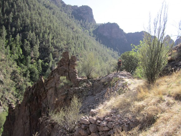
I hadn’t noticed hiking through here a few days earlier, but the the two sides of the canyon seemed to have very different types of ecosystems. One side was dry and looked like a desert, complete with cacti, while the other was forested and more lush looking. Looking back the way we came, we could see the smoke from the fire we saw earlier over the mountains.
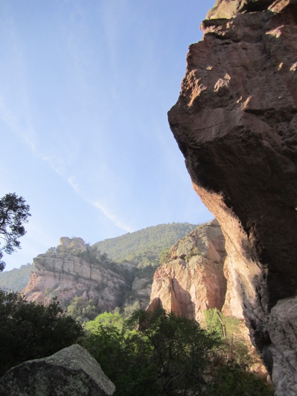
Near the Whitewater Trail/Catwalk Trail junction
Now on the Catwalk Trail, we passed an older couple on a day hike. They asked if that was my “small black car” in the parking lot, and I said yes. Apparently we were now the only ones here. When we finally reached the car, there was a forest ranger there who told us they had just sent in rangers on horseback to look for any hikers still out there, as they have closed all the trails in this area due to the fire. He told us that lightning caused the fires and that it was around 400 acres as of this morning.
After changing out of our dirty clothes and packing our gear into the car, we left the Whitewater Picnic area around 10:30am. On our way back home, we thought it might be cool to check out the Mogollon Ghost Town nearby. Supposedly the town was abandoned in the 1940’s when WWII broke out. After the price of silver plummeted, the town went under and it was abandoned. Heading north on hwy 180, make a right on Bursum Rd and go down about 10 miles. The drive in was more impressive than the ghost town though. The road was steep and had no guard rails, and had great views of the land below. There were farms that butt upp to this road that had no fences, and there were cows wandering in the road at times. Once we got into the “ghost town”, we saw at least 3 houses the were inhabited. One guy had his sprinkler on and had a green lawn. There was a small museum and some other types of shops here, among a few old buildings like a saloon. From what I had read though, it was supposed to be abandoned, but clearly it was not. We turned around and headed back to hwy 180 and began the long drive back home.
Final Thoughts
The Gila Wilderness is an ass-kicker! The terrain is rocky and rough everywhere you go. The trails can be difficult to follow, and it would be easy to get lost here without a GPS or a topographic map (and knowing how to use it). It’s a very rugged place with a real feeling of solitude everywhere except for the Catwalk and Whitewater Trails, as this is where all but one of the people we encountered were. There are opportunities abound for those wishing to explore off trail, but in doing so you will find that the terrain can be a real challenge. Although we were able to hop rocks across every stream we encountered, other times of the year you would certainly need water shoes for stream crossings.
All in all, it was an excellent trip and I would love to visit another area of the park someday. Hopefully the forest fire doesn’t destroy the entire park, as it would be a shame to see this beautiful place scarred on such a massive level. I’m glad I got to see it before (and during) the fire, and I hope they are able to contain it soon so that others can enjoy it in the future.
Complete Gila Wilderness Photo Gallery
As always, questions and comments are welcome!
If you found my trip report useful, please don’t hesitate to leave a comment! Alternatively, if you feel you have any information you’d like to share with others regarding this hike, please feel free to leave that below in a comment as well.
[tcb_comment_count]
Related Images: