Creating new thru-hiking routes & guides, hiking videos, outdoor documentaries, backpacking trip reports, trail journals, photos and more!

Latest

Backpacking The Linville Gorge Wilderness, NC – Oct 2012

Linville Gorge Wilderness Backpacking Overview

Complete Linville Gorge Wilderness Photo Gallery | Linville Gorge Wilderness HD Video

  • Location – Linville Gorge Wilderness, NC
  • Park – Pisgah National Forest
  • Trail Hiked – Custom Loop (Based on the ITAYG loop)
  • Miles Driven To Destination – 1320 miles Round trip
  • Length Of Time Hiked – 5 days, 4 nights
  • Trail Type – Loop
  • Miles Hiked – 33.22
  • Trail Difficulty – 8/10
  • Fires Allowed – Yes


Download a GPX file of my hike (right click and choose “save as”): Linville Gorge Loop Hike

Linville Gorge Trip Properties

Add 1.32 miles to the trip total above for a total of 33.22 miles.

Get a printed topographical map of the above GPX route here: Linville Gorge Wilderness Topo Map
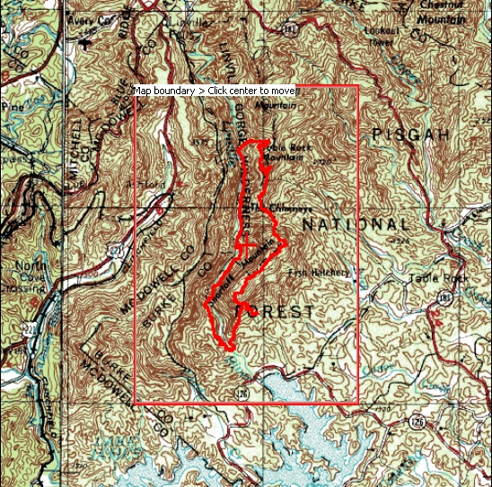
Linville Gorge "Is that all you got" loop hike map

Linville Gorge “Is that all you got” loop hike map

Linville Gorge ITAYG Loop Topo Map

Below is a screenshot of the flow rate of the Linville River prior to and during our hike. Before I left for my trip here, I was trying to determine at what flow rate is the Linville River not safe for crossing at Devil’s Hole. I couldn’t find any information on this, so I decided to share my findings. Although I did not personally make it down to blue hole (read about that on day 2), other hikers told me it was NOT safe for crossing.

linville river water crossing flow rate chart

This chart may be helpful for others deciding when the river is and isn’t safe to cross at Devil’s Hole
http://waterdata.usgs.gov/nwis/uv?cb_all_00060_00065=on&cb_00060=on&cb_00065=on&format=gif_stats&period=&begin_date=2012-09-16&end_date=2012-10-05&site_no=02138500 

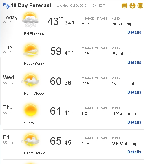
 weather for our hike in linville gorge

Although my cousin Bryan had been following some of my previous hikes, after seeing pictures of my latest trek in Colorado he decided that it was time to give backpacking a try. He was open to hike anywhere, and I suggested the Linville Gorge Wilderness. Located in North Carolina and less than 12 hours away, I figured this would be a good hike to squeeze in before winter.

I’ve had the Linville Gorge Wilderness on my list for the last year or so, and already had bits and pieces of information together for a trip here. I had been looking at a trail dubbed the “is that all ya got” loop”, or ITAYG. This is basically a combination of trails in the Linville Gorge that form a large loop. I added in a side trip to Sitting Bear Mountain and Gingercake Mountain to the route as well.


Day 1 – Monday October 8th, 2012

Miles Hiked – 3.4
Route – Spence Ridge trailhead to Sitting Bear Mountain

After only about 5 hours of sleep, I woke up at 2:45am and was on the road by 3:15am. From southeast Michigan, we had about a 12 hour drive ahead of us. Most of the drive was pretty uneventful, but sometime into West Virginia we encountered low clouds/ fog and rain. This didn’t really effect the drive, but little did I know we’d be hiking in it too!

Finding the trailhead took us a little while, especially in the increasingly dense fog. The trailheads weren’t marked at all. There weren’t any signs for a hiking trail or parking, anything. Most palaces I’ve been to at least have that. We eventually found the trailhead at Spence Ridge, but were now a little behind schedule. By the time we got all our gear packed, boots on, food from the cooler packed, etc it was around 3:45pm. There were 2 other cars parked here when we left, which was a good sign to me that it wasn’t going to be very crowed. Not that I was expecting it to be in this weather, it was forecast to be 34 and raining tonight.

To reach Sitting Bear from the Spence Ridge TH, we would have to hike about a mile back the way we came on Table Rock Rd and meet up with the trail near Hawksbill Mountain. I turned on my GPS, but it couldn’t find signal before we left the car. I figured it would have picked up the satellites while hiking the road, but it didn’t. Once at the Hawksbill TH, we left the road and hit the actual trail. A few tenths of a mile later, my GPS finally got signal. I estimated the mileage from the car to this point to be about 1.5 miles, and I made it a point to remember to add that figure to the total trip mileage shown on my GPS at the end of the trip. Shortly thereafter, we saw the split for the summit of Hawksbill Mountain and decided to check it out, even though there was no chance of a view. We didn’t stay at the top very long since there wasn’t much to see, and headed back down after about 15 minutes.


Now back on the main trail, which I believe was the Jonas Ridge trail, we headed for Sitting Bear Mountain. Everything was pretty wet at this point. We were basically in the clouds and the moisture seemed to be just collecting on the leaves. Then the wind would blow and water would fall from the leaves. I don’t think it actually rained, but either way, everything was wet.

After gaining about 200 ft in elevation and then losing 400+, we were nearing Sitting Bear. The trail became increasingly steep at this point, until using our hands became necessary. This was one of the steepest sections of trail we’d face on this trip. The slippery wet leaves and roots were not making the ascent any easier either. Once past the steep climb, Sitting Bear Mountain levels off somewhat. We roamed around for a while, somewhat disoriented due to the ever present fog until we finally stumbled upon the campsite. It was large enough to fit 2-3 one man tents, had a fire pit, and was only 30ft from the cliff’s edge. This would have offered a sweet view but the clouds never lifted while we were here.

It was 6:30 or so by the time we rolled into camp, and we weren’t going to have much daylight left. This was Bryan’s first backpacking trip, so I also had the added responsibility of showing him how to set everything up. He was borrowing my Alps Mountaineering Zephyr 1 and my older Thermarest sleeping pad, as well as Lisa’s Sleeping bag ( Silver City Eureka 30°F, same as mine) and her Osprey Crestrail 65 backpack. That’s right, I said he borrowed her backpack. Bryan didn’t want to spend a ton of money on gear since it was his first trip. And rightfully so, but he still needed the backpack. I figured that Lisa’s backpack would fit him and should be pretty comfortable. It was also red, and didn’t look girly at all. It also offered us the opportunity to make several jokes about the hip belt not fitting his womanly figure right.

Now that the tents are up and the gear is stowed away out of the rain, it was time for dinner. It was nearly dark now, and I opted not to try for a fire. Everything was too damp, better luck tomorrow night. Tonight we cook on the stove, and a 1/2 pound burger is sure to please. Gotta love first night meals! The only thing that sucks is how long it takes to cook, and you can only cook one burger at a time. Then you must clean the greasy pan, so a fair amount of drinking water can easily be used, especially if one isn’t careful. No matter how much of a pain burgers may be to cook in the wild, they beat noodles in a bag hands down!

It was getting very cold now and we headed for our tents not long after 9pm. I normally sleep pretty hot, but tonight I had to wear my long johns and a pair of socks to stay warm in my sleeping bag.


Day 2 – Tuesday October 9th, 2012

Miles Hiked – 8.7
Route – Sitting Bear to Conley Cove

When I woke up at 6:30, the sky was crystal clear. A short walk out to the cliff’s edge revealed a fog filled gorge. This reminded me of the amazing sunrise on my last day in the Dolly Sods Wilderness of West Virginia a few months prior. It was at this time that I realized that I had forgotten my tripod. Crap! Oh well, there are worse things I could have left behind.

When the sun peaked over the horizon, the clouds followed. Within 30 minutes of the sun rising, the entire sky was covered with the same dense fog that lingered last night. It was pretty strange watching the sky become overtaken by the fog… I assumed it would have just “burnt up” like it did in the Dolly Sods. So, another great view ruined. I was hoping to get some pictures up here as I’ve read about and seen some amazing photos taken from Celestial Point and Sitting bear. I was pretty disappointed with this as I like to take a lot of pictures.

As the sun rose, we explored the area and searched for photographic opportunities. However, the fog was just too thick and we eventually gave up. We hiked to Gingercake Mountain, but this was uneventful too due to the fog. There were a few different trails that split off the main trail to Gingercake Mtn, but we decided to get back to camp and pack up instead.

linville gorge foggy forest

Back on the trail, the hike down Sitting Bear wasn’t quite as bad as I remembered it yesterday going up. Still, it was very wet and slippery. Once past the steepest section of trail on the entire trip (although there was other sections that certainly rival this), the fog made the forest below look rather eerie. Bryan was playing with his Go Pro camera now at this point, and we made good time through this section on our way to the Devil’s Hole trail junction.

We made it about a third of the way down to the Linville River along the Devil’s Hole trail when we encountered a group of 5 or 6 hikers coming up from the river. I assumed they had just crossed from the other side, but they said that they were going to cross from this side. Once they got down to the river they decided that the water was too high and fast flowing. They said they were part of some group and they had rules that they follow for safety, and wouldn’t cross without a PFD. They suggested we might be able to cross since we looked more “in shape”. They also had an injured hiker in their group, so they suggested that we make up our minds now… go down and try to cross, or go back up and go ahead of them since they were going to be moving slowly. I decided that it was not worth hiking down the rest of this steep trail to MAYBE be able to cross here. While it was no where near as steep as Sitting Bear, this trail was not going to be fun hiking up, and it’s  much longer. We headed back uphill ahead of the other group. Time for plan B, crossing at Spence Ridge, where I parked my car.

After making it halfway back up the trail, Bryan realized he had left his  camera on a log somewhere further down hill at a previous resting point, and had to turn back to get it. Of course it had to happen on a steep trail! The hike up seemed shorter than the hike down somehow, and before we knew it we were back on the Jonas Ridge trail.

From here we headed back to the car. It was a very odd feeling to be back at my car in the middle of a hike, but I guess that’s what happens when things don’t go as planned. I am glad we had a plan B in mind, and still happy with my decision to turn around at this point. Getting back to the car allowed us to top off our water, get a few things, eat lunch and sit down on the fence in the parking area. Also, I was able to track the distance of the same section of trail that my GPS wasn’t able to count towards the total trip miles due to it taking an hour to find the satellites. This section, from the area where my GPS came alive near Hawksbill Mountain to my car ended up being 1.32 miles. So, I’ll just have to remember to add 1.32 miles to my total for yesterday and the trip total as well.

Now it was a straight shot down to the river from here, where there is a foot bridge and no worry of high river levels, although the bridge was underwater twice in the last month due to flash floods. Water levels were not THAT high for us though, so we should be safe. The hike down to the river was short. We passed a smaller “waterfall” near the bottom of the gorge, and then all of the sudden you could hear the roar of the river in the distance. It was a welcome sight to finally see the river.
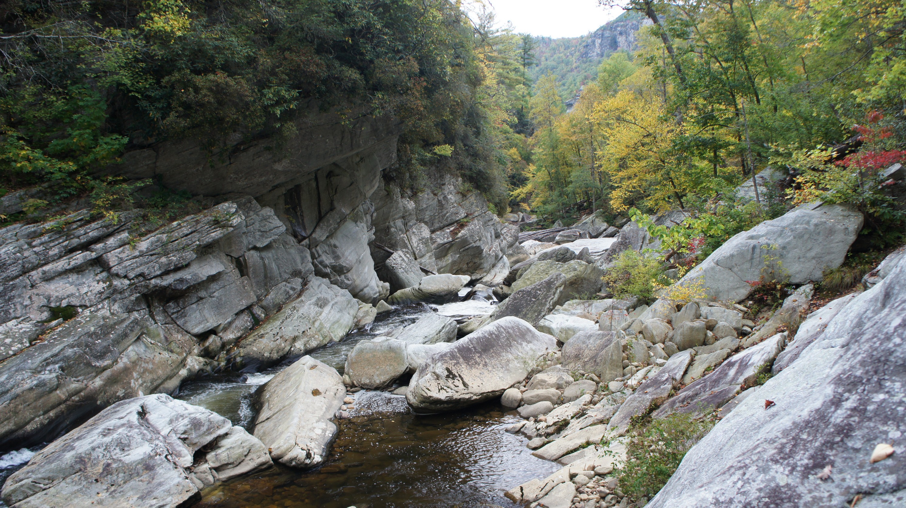
We hung out near the bridge for about 45 minutes exploring the banks and taking pictures. Bryan is an avid fisherman, and loves the water. I do as well, but but this is really his thing. I prefer high places and picturesque vistas, so I was really hoping to have views on Hawksbill & Sitting Bear. Bryan was much less disappointed. Nevertheless, we were both enjoying ourselves. And you know what? The sun even popped out for a second for the first time on the hike! That was short lived though, and soon it was cloudy again.

Once we crossed the Linville River, it felt as if we had entered a whole new phase of the hike. It felt great to finally be in the gorge! The terrain here is extremely rugged, and I now see why it would not be possible to bushwhack your way from Devil’s Hole to Spence Ridge along the East bank. I thought this might be an option for a plan B or C in the event the river was not crossable, but quickly disregarded it after some research. The sides of the gorge are extremely steep and are lined with large boulders, jagged rocks, and mini caves. In many cases, there didn’t appear to be any way up and over the ridge, your only option is to follow the river.

Heading downstream now, we passed some kayakers in the water. They asked us how far up Conley Cove was, and after referring to my topo map I concluded it was only a few tenths of a mile down river. This was good news for both us and the kayakers; we were going to be camping in the Conley Cove area and that was their take out point. I was relieved to hear that because, if you couldn’t tell from my previous trip reports, I don’t like crowds. These would be the last people we’d see until mid day on our 4th day.

Our campsite at Conley Cove. There were about 4 more campsites in the area.

View from our campsite at Conley Cove

As the kayakers began carrying their kayaks all the way up the Conley Cover trail, we began to hunt for campsites. There were several decent ones in the area, all near the river and large campsites with fire pits. One thing I have to say about Linville Gorge is there is A LOT of trash at almost every campsite. This is easily the most trashed place I’ve ever hiked. Some campsites had crap and toilet paper just sitting on the ground as we passed by. Disgusting! Anyways, we took the southernmost campsite and began to set up camp. My tent was wet when I set it up but it quickly dried in the breeze. Bryan’s sleeping pad, bag, and tent were still pretty soaked at this point. The campsite just to the North of us had plenty of firewood, so we grabbed that and began the hunt for tinder. Everything was still a little damp at this point, but I was confident a fire would be no problem tonight. Our site was close to the river, and you could hear a pretty load constant roar which is always nice for getting to sleep at night!

Fog lingers in the gorge as night falls.

Tonight was the first time we had to filter water, so I showed Bryan how it’s done and then let him have at it. It was completely cloudy still at this point, but didn’t look like rain. After topping off our H2O supply, I sat down to write in my hiking journal. This was the first time I carried one, and the first time I wrote in it since I was too busy the night before. At 7:15 it became too dark to write, so I decided it was time for a fire. I first tried to light the fire with charcloth and a spark from my firesteel, but it just wasn’t catching the tinder. I then added some cotton balls slathered in petroleum jelly which did the trick… sort of. The fire burned a bit and then went out. I probably spent 45 minutes messing with the fire before finally giving up and resorting to using a lighter. Even still, the dampness of the tinder and kindling were a problem. Eventually I got the fire going after building and elaborate platform suspended over a small pit to allow for airflow underneath. This worked very well and the fire was blazin’ in no time. That’s good news because tonight was italian sausage night, and I didn’t plan on using my stove. We roasted them over the fire and had another delicious hot meal.


Day 3 – Wednesday October 10th, 2012

Miles Hiked – 9.3
Route – Conley Cove to MST river crossing site just outside of the Wilderness zone on the south end of the gorge

I awoke today at 7am to clear blue skies. What a relief… no more clouds and fog! All of our equipment was dry now, and would stay dry the rest of the trip. Breakfast today consisted of a whole wheat bagel, metrx bar, and some dried fruit… great energy for the trail, and damn will we need it today!

The condition of the trail kept getting worse as we went on today. Contrary to our hike to this point, there were many downed trees over the trail and thick vegetation that made it difficult to follow. We “lost” the trail several times, and found it again only after continuing in the same general direction for a while. Lots of obstacles around every corner, and pretty slow going in general. I expected this section of the trail to be among the easiest parts of our whole hike, due to it being generally downhill and close proximity to the river.

As we progressed downriver, the river itself became less rugged and eventually began to widen out some. The trail was still crude in many spots, with occasional sections of “relief” where the trail was flatter, wider and more obvious. We ran into a snake along the leaf covered trail sometime around mid afternoon, just before reaching the junction of Pinchin trail. We later identified it as a Black Snake. Bryan was fooling around with his GoPro camera, sticking it in the snake’s face until he struck the lens. This was entertaining for a few minutes, but it was time to get moving again.

Shortoff Mountain

Soon we were at the Blue Hole and Daffodil Flats campsites, which were decent sites but nothing spectacular. We kept moving and soon we found ourselves on Leadmine trail. Lots of ups and downs here, and some were quite steep. It was around this point that my left knee starting hurting on the downhill stints. I’ve had my knees hurt going downhill before, but never like this. I blocked out the pain and pushed on through this relatively boring section of the hike. The trail distances itself from the river here, and although it gains some elevation there was only one point where we had a decent view of anything. This trail had a lot of  hoof prints and horse crap on it too.

Bryan climbing up a steep section of the Leadmine trail

View of Shortoff Mountain from the Leadmine trail

It early evening by the time we rolled into camp today. We took the campsite between the dirt road and the river just outside of the wilderness boundary, near the MST crossing point. There was a lot of trash here too, and it was very obvious that people drove here all the time and camped because there were plenty of fresh tires tracks in camp. There were old tires and all sorts of garbage in and near the river, as well as the carcass of a dead deer that was really stinking up the place. The river did not look like it was very shallow from our camp though, so we had to scout along the banks for a better crossing point for the morning. Downstream didn’t look promising, so we headed upstream a few hundred yards and found a pretty obvious crossing point, complete with blaze marks on trees on both sides of the river. Bingo, here’s our spot. Nice and shallow, maybe knee deep at the deepest from the looks of it. Good, one less thing to worry about in the morning.

Campsite outside of the wilderness boundary near the MST river crossing

Tonight I constructed my fire in the same manner as the night before with similar success. Tonight though, I “cheated” and used my lighter. I was too tired to want to mess with the fire much, and since we were going to be cooking hot dogs I wanted the fire NOW… I was hungry!

Today was a hard day and in my opinion, we didn’t see much. I don’t mind the hard days, but I like to be rewarded with awesome views or something unique to explore. The stars were very bright tonight though, and I know that tomorrow is going to have some great views in store as we climb back out of the gorge.


Day 4 – Thursday October 11th, 2012

Miles Hiked – 8.8
Route – MST campsite to the Chimneys

Linville River MST Crossing Point

Got up at 7, packed up camp and ate a quick breakfast. My knee was still hurting today, and I took some Ibuprofen to help with any swelling before heading over to the crossing point. The sun was just coming into the gorge at this point, and I could tell it was going to be a beautiful day! We dropped our packs at the bank of the river, took off our pants and boots, and put on our water shoes for the crossing. I went first, with Bryan and his GoPro filming behind me. The deepest part of the river was the banks on both sides, about knee deep. The water was cold, but after a minute in the water the numbness becomes pretty bearable. The rocks weren’t too slippery either. The width here was maybe 200 feet, with the center portion being the shallowest. Once across, we toweled off, got dressed and headed on our way.

The hike up Shortoff Mountain

The path up shortoff was pretty clearly marked near the river, but quickly disappeared. We had to bushwhack our way up the hillside for a while until we finally reached a defined trail to follow. We were now on the MST trail (Mountain to Sea), and things looked a lot different here than on the other side of the river. The landscape was scarred from a fire that rolled through here a few years ago. The soil was a lot drier, and almost desert like scrub growth everywhere. It was an interesting environment, especially compared to the rest of our hike through the Linville Gorge. As we gained a bit of altitude, our view of Lake James improved. We were completely exposed to the sun here though, and it was getting pretty warm. We took a quick break under a small patch of shade when we could and ate some snacks. Dried strawberries and jerky, mmm!

Towards the top of Shortoff Mountain, we we beginning to see some excellent views of not only Lake James but now the Gorge itself for the first time on our trip! This was what I was waiting for, and what we should have experienced on our first and second days had it not been for that damn fog. Our paced slowed considerably at this point as I wanted to explore every little trail that looked like it might be heading near the cliff’s edge. I had my Sony Nex-5 out shooting as many pictures as I could. I brought several batteries, so my only real limitation was the 16GB card. I still hadn’t deleted a bunch of pictures from my Colorado hike in August, so eventually I had to stop and do that. Between switching lenses, filters, etc I spent much more time up here than I was planning to.Still, this is what I came here to see, and to hike right past this stuff would defeat the purpose of going. Time justified!

One of my favorite views of the trip. Many AWESOME campsites near here.

The views were awesome to the north, you could see all the way up the Gorge past Hawksbill Mountain from here. It was nice to be up to the ridge now and look down at where we came from. The river looks calm from up here, a far cry from the raging torrent that was thundering down the northern section of the gorge when we crossed at Spence Ridge. The leaves were just beginning to change colors, but from up here everything still looked pretty green.There were a LOT of excellent campsites up here too. Possibly the best ones I saw throughout the entire trip were up here on Shortoff, but as much as I wanted to camp here, we needed to cover more ground today.

View from Shortoff as we ate lunch

A flat section on the top of Shortoff had a small pond, I was not expecting that. I didn’t remember seeing anything on the maps or reading about anything there in the forums before I left. We stopped for lunch on a series of rocky ledges once we started descending Shortoff. We now had a different view of the gorge ahead with Table Rock dominating the landscape. While we sat here and ate, we saw another group of hikers pass by. These were the first people we’d seen in nearly 48 hours.

Back on the trail, I was feeling pretty sluggish after eating. My knee was starting to hurt from the descent into Chimney Gap, which was a nice hike otherwise. I’m glad we didn’t plan on camping at Chimney Gap though, because this site had nothing to offer other. The climb out of Chimney gap and up into the Chimneys was pretty steep, much steeper than it looked on the topo. For a while, the trail follows a water runoff path that carved it’s way into the dirt forming a gulley about 2 feet deep and 18 inches wide. Those are always fun to walk through.  We were whooped by the time we got to the top, but we were very close to our intended campsite and the scenery was spectacular up here.

I saw a small trail lead up a ledge above the main trail, but after climbing up there I saw a tent setup there already. As far as I knew, there was only one campsite up here in the Chimneys, and I was pretty bummed it was taken. Really, really pissed actually. I thought we were going to have to hike all the way to Table Rock from here and camp near a parking lot. Then we bumped into about 8 rock climbers a few minutes down the trail, and they said that wasn’t their spot, they were just here for the day, parked at Table Rock. They said they didn’t see any other campsites. However, our luck would turn 10 minutes later as we found another campsite that was available, and a very badass one at that. I was excited as hell, and had everything set up in 15 minutes.

There was so much to see and explore up here! From our campsite, just through the trees about 20 feet was a sheer cliff with an excellent view of the Pisgah National Forest to the east. We passed a ton of rock formations on the way to camp that I wanted to go back and check out. And right above our campsite was another set of rock formations that we just begging to be climbed. Plenty of cliffs and high points, along with many interesting rock formations created endless photo opportunities, especially as the sun dipped closer to the horizon. Watching the sun go down from my spot high up on the rocks overlooking the gorge, well, this is what I was waiting for. Bryan really appreciated the views up here too, he was loving it. He was shocked by the beauty of it all, and finally could understand why I like taking the high route whenever possible.

I took well over 100 pictures tonight alone. As the sun set, I sat on a rock near the cliff’s edge overlooking the gorge  an took out my journal. I wrote until it was too dark to see, and then by headlamp for a little bit. Today was a really hard day, as was the whole trip, but it’s moments like these that make it worth every step. We had a great fire and ate tortillas with pepperoni and cheese for dinner. It was nice not having to cook tonight. Time to eat the last of my sour patch kids and my once per trip dessert, a fudge brownie.

Campsite at the Chimneys

While we were sitting by the fire, I thought I heard a rustle in the bushes near the large boulder that we set most of our gear on. We didn’t see anything though, and the noise went away, so that was the end of that… until I went to look for my socks that were drying out on the boulder. One was missing, and was nowhere to be found. I searched for a while but to no avail… it was gone! Mouse? We’ll never know.

Looking to the east again from the cliff nearest to our campsite, many “city” lights could be seen in the distance. During the day, you could hardly tell there was any development down there except for a few small areas, but at night you could really see the lights. Not only that, but the stars were bright too. In the distance, you could hear a train go by quite often, and much louder than you’d expect up here. Oh well, it was an awesome day and I went to bed happy.

Day 5 – Friday October 12th, 2012

Miles Hiked – 3
Route – Chimneys to car (Spence Ridge TH)

A little late for flowers? Not complaining…

I got up at 6:30 this morning and packed up camp while waiting for the sun to rise. It was cold out, as every morning was, so I had my metrx bar and bagel in my pockets to warm them up before attempting to eat them. It’s always easier to eat food when it’s not half frozen. It was somewhat cloudy as the sun rose, but this made for some beautiful colors in the sky. Bryan and I snapped some pictures and chatted with a local who had hiked here from Table Rock this morning to take a few pictures himself.

View of Linville Gorge from Table Rock

Looking north from Table Rock

After the sun rose it became very cloudy and looked like it might rain. We decided to try and haul ass back to the car, but I still wanted to summit Table Rock on the way. It was a short hike to the Table Rock trailhead, which had a few cars in the parking lot when we passed through. The hike up to the top wasn’t bad, and we were alone at the summit. Great views of the entire gorge, especially the views to the south. We co9uld still see Lake James from here. After 25 minutes or so we descended, and ended up missing the MST on our way down. We went the wrong way on another trail for a few minutes before catching my mistake, and backtracked to find the MST again.

After leaving Table Rock, it was all downhill from here. Bad news for my knee, which was still hurting. This section of the trail was rather boring and didn’t offer much to keep us interested. No mat ter though, at this point we were gunning for the car and ready to head home. I am never ready to leave, except for the last day.

When we finally arrived at the car, I was greeted with a flat tire. I’ve known about this slow leak for a while, and was prepared with my 12v air compressor that I keep in my trunk. Also, I popped the hood to check my oil before leaving and noticed that an animal had built a nest on top of my valve cover. He probably found my engine bay on the day we arrived in an effort to stay warm. At least nothing was chewed up, I’ve heard some horror stories about hikers returning to their vehicle only to find that wires under the hood have been chewed through by some type of animal. I changed in the parking lot, and realized now that I forgot my sandals. I always try to air out my feet on the drive home since they’ve been trapped in boots for a week.

It felt great to get in the car and sit in a comfortable seat. However, my car is a stick shift, so I use my left leg to operate the clutch. That’s the knee that’s been hurting for the last few days. Driving home was actually pretty painful. Bryan couldn’t drive a stick, so I had to tough it out… for 650+ miles. Even after I got back home, my knee hurt for 3-4 weeks. It’s feeling fine now, but it makes me wonder if I am going to have more problems with it in the future. I have some big plans for the next few years, and want to stay as healthy as I can.! I might look into joint supplements if this continues, but for now I don’t have any hikes planned during the winter.


 Final Thoughts

I really underestimated the difficulty of the terrain here. I thought this place was going to be a walk in the park, but it ended up being an ass kicker. There were some sections of trail here that were steeper than anything we encountered in Colorado (except Snowmass Mountain). The Linville River trail was really over grown and hard to follow i spots, especially with the downed trees. This was one of the dirtiest backpacking destinations I’ve visited though, lots of garbage strewn about. Mainly at the campsites, but damn it was a lot. I’m glad I didn’t bring my fishing pole this time.

If I were to come back here, I would really want to camp up on Shortoff Mountain. I would have stayed a night there on this trip had I known they were such great sites. The fog robbed us of what would have been some amazing views on days 1 and 2, but our day 4 made up for it.  Bryan did really well, the best of anyone I have brought with me so far. He kept up a good pace and didn’t complain. That’s a good hiking partner in my book.

Complete Linville Gorge Wilderness Photo Gallery


As always, questions and comments are welcome!

If you found my trip report useful, please don’t hesitate to leave a comment! Alternatively, if you feel you have any information you’d like to share with others regarding this hike, please feel free to leave that below in a comment as well.

[tcb_comment_count]


Related Images:

Planned Hike – Linville Gorge, NC In October


table rock panoramic photo - linville gorge north carolina

Linville Gorge in North Carolina has been on my list for over a year now. This place is called “The Grand Canyon of the East”, and supposedly has some of the most rugged terrain East of the Mississippi.

According to wikipedia, Linville Gorge is one of only two wilderness gorges in the Southern United States (with Bald River Gorge Wilderness in Tennessee). Maintained by the United States Forest Service, it comprises 11,786 acres around the Linville River, and is situated inside the Pisgah National Forest. The river is approximately 1,400 feet below the ridge, thus hiking in and out of the Gorge is challenging and enjoyable for those who like serious hiking. The plant and animal community is extremely diverse, with a dense hardwood/pine forest and a wide variety of smaller trees and other plants as well as bear, fox, raccoon, trout, grouse, turkey, vultures, owls, hawks, copperheads, and timber rattlesnakes.

I am looking at hiking the “Is that all ya got” loop during the second week of October. This route follows the East side of the gorge, crosses the Linville River, and follows the West side of the Linville River back. The hike should be around 22-26 miles, and from what I hear is somewhat strenuous due to the ups and downs. Not a big deal for me, but I’m bring along another first timer, my cousin. It’s about a 12 hour drive to get there, so the plan is to get a very early start the first day, drive there and hike in a few miles to camp on night one, have 3 full days of hiking, and then a short hike back to the car on day 5.

On my list of things I need to do before this trip include replacing the bite valve on my Osprey Hydration Bladder, picking a trailhead, plan campsite locations,  and choosing a route. I’m still not sure if I want to follow the entire ITAYG loop as intended or possibly include the West side of the gorge, I need to look into that further. I also need to order my topo map of the Linville Gorge.

Here in Michigan, the fall colors will have already begun to change, but I’m not sure of when exactly they start changing in North Carolina. The unusually warm weather of 2012 may also have an effect on when the leaves change colors, whether it be earlier or later, I’m not sure. My guess is earlier… in Michigan, we saw temps in the 80s for a week in March, which caused the trees to start budding 2 months early. Don’t know what happened in NC, but I guess we’ll see.

This will likely be my last “warm weather” hike of the year. Temps should be in the mid 60s during the day and low 40s at night, perfect for backpacking. Fishing wise, I’ve heard mixed reports. Mostly though, I’ve read the fishing is not good in the Linville River, so I won’t count on that. I’m getting tired of buying expensive non-resident 5 day fishing licenses that I never even use, so I know I won’t be buying one this time around.

As always, I’ll get a trip report up here as soon as I can!

[tcb_comment_count]


Related Images:

Four Pass Loop – Maroon Bells Wilderness, CO Aug 2012 (Backpacking Trip Report)

Maroon Bells Wilderness, CO – Four Pass Loop Backpacking Overview

Complete Maroon Bells Wilderness Photo Gallery | Maroon Bells Wilderness HD Video

  • Location – Maroon Bells Wilderness, CO
  • Park – White River National Forest
  • Trail Hiked – Four Pass Loop
  • Miles Driven To Destination – 2980 miles Round trip
  • Length Of Time Hiked – 6 days, 5 nights
  • Trail Type – Loop
  • Miles Hiked – 38 (includes summit of Snowmass Mountain)
  • Trail Difficulty – 8/10
  • Fires Allowed – Yes


Download a GPX file of my hike (right click and choose “save as”): Four Pass Loop – Maroon Bells Wilderness, CO


The Maroon Bells Wilderness caught my attention this spring when planning a backpacking trip during the month of May. I had read about the Four Pass Loop and after seeing some incredible pictures of this place, and I knew this was one hike I couldn’t pass up. There was too much snowfall on the ground still in May, and instead I hiked the Gila Wilderness in New Mexico. However, I would not have to wait long for my chance to hike here. I decided that the Four Pass Loop would be my destination of choice for my mid summer trip after my plans for Isle Royale fell through yet again. The plan was to hike the Loop, but camp an extra night at Snowmass Lake and summit Snowmass Mountain on the extra day. It would be a step above all my previous hikes in most aspects, especially elevation. Wikipedia has this to say regarding Altitude Sickness: “It is hard to determine who will be affected by altitude sickness, as there are no specific factors that correlate with a susceptibility to altitude sickness.”

The area we planned on hiking lies in the Elk Mountain Range in the Maroon Bells Wilderness, just outside of Aspen, CO. This is within the White River National Forest.

Prior to this trip, the highest elevation I’ve hiked t was 10,643ft (Black Mountain, Gila Wilderness, NM). This trip would raise that number by 3,455ft if I can summit Snowmass Mountain, 14,098ft. If not, the Four Pass Loop is comprised of four mountain passes between 12,400 and 12,500ft, so I’ll still surpass my highest elevation by more than 1,850ft anyways. I didn’t have a problem with the elevation in New Mexico this past May, but this was going to be the real test!

My girlfriend was coming with me on this trip.  I was a little concerned with how she will handle the elevation, as well as the rigors of a big hike like this. She had gone with me on my trip to Manistee River last fall, a really easy hike, but that was her only prior backpacking experience. She was short some gear and had to buy rain pants, hiking boots, socks, sleeping bag, and a backpack. There was no way she could use my crappy High Sierra backpack I have as a “spare” for a trip like this. In fact, she used it last year at Manistee with maybe 20 pounds in it, and even that was uncomfortable. The only gear I had to buy for this trip was a few more OPsaks so the critters can’t smell our food. I didn’t even have to make a last minute trip to REI for something… nice.


Getting There

I won’t bore you with much details of driving here, it was pretty uneventful. Almost 1500 miles of farmland is enough to put anyone to sleep. We left Detroit on Saturday July 28th and drove about 15 hours before stopping in North Platte, Nebraska. We assumed that there would be plenty of hotel rooms available, but every hotel was pretty much booked. There were a few events going on, such as a soccer tournament. We had to settle for a smoking room at a Days Inn I think it was. It smelled awful, and apparently pets are welcome in the hotel because we heard dogs barking all night. It was pretty ghetto, but it was either this place or nothing since there were no other towns around.

The next day, we only had about 4 hours left to Denver where, where we planned on staying with Lisa’s friend. It was a pretty gradual rise in elevation the rest of the drive. We were relieved to finally see the Rockies about 30 miles outside of Denver. We arrived early in the afternoon, so we decided to grab a bite to eat and check out the Red Rocks area just outside of town. After that, we went to bed early and tried to get as much rest as possible before setting out on the final stretch tomorrow morning.


Day 1 – Monday July 30th, 2012

Miles Hiked – 4
Route – Maroon Creek Rd. Trailhead (West Maroon Portal Parking Lot) to camp along West Maroon Creek at 10,800ft

We left The Denver area around 5:45am today after spending the night at a friends apartment, which was about 4 hours from the trailhead in Aspen. After leaving Denver on I-70w, the drive was all mountains. It was a beautiful drive and really built up my anticipation for the hike. We stopped for breakfast at the Golden Burro in Leadville, which was pretty good. Their menus were full of history of the town, which included things like Doc Holiday’s last shootout. I recommend this place if you are passing through… good food, big portions, cool atmosphere.

After leaving Leadville, we passed over the Continental Divide at Independence Pass. We stopped here for a couple of pictures, but didn’t stay long. After this, the road really winds through the mountains, and offered some great views. It was a white knuckle drive though, thanks to the swarms of cyclists on the road. These guys were all over between Independence Pass and the Maroon Creed Rd. Trailhead in Aspen. They don’t move out of the way either, they ride in the middle of the road as if they are a car. I was ready to get out of the car by the time we reached Aspen, where I was picking up my fishing license I had ordered online. I was looking for “King Sooper’s”, which I thought was some type of gas station. There seem to be no visible addresses on buildings in Aspen, but I stopped where my GPS said the address was. We got out and walked around for a while trying to find it before figuring out that King Sooper’s was actually a grocery store called “City Market”. Apparently, it’s called King Sooper’s City Market, but how the hell would anyone know that from the sign outside that says “City Market”?

entrance road to the maroon bells wilderness

After grabbing the license, we dodged about a 1,000 more cyclists before reaching the entrance to the Maroon Bells Wilderness. We paid the $10 entrance fee and were told that the overnight parking lot was full and that we needed to park at the West Portal lot. This lot was packed with cars too, but we found a spot and began to gear up. I always bring a scale with me to the trailhead so I can weigh my pack right before the hike. Mine was 52+ pounds, Lisa’s was 34. Intersecting the parking lot was a trail that headed into the woods in the direction we wanted to go, but it was not clear where it was going. So, we hiked the pavement, following other hikers we saw leaving the parking lot. It was probably another 1/3 mile or so before we reached a bus loading/unloading area where they drop off hoards of day hikers shuttled in from somewhere. We weren’t sure where we needed to obtain the free permit needed to hike here, but after following the cement pathway we came to a small building that had some info on the wildlife and whatnot. There was another hiker in here filling out a permit, but there were none left on the counter and no park employees around. It was already around 11:30 and we couldn’t wait around for anyone to get us a permit, so I rummaged through the drawers on the other side of the counter and found a stack of permits, which I placed on the counter for everyone to use.

Finally, we were on our way. Today, we were going to hike about 4 miles and find camp somewhere near 10,800ft along West Maroon Creek. I had read that there were not many campsites past this mark, unless you plan on going over West Maroon Pass.

Maroon Lake is right there by the place we got the permit, with the Bells visible from the start. It was very beautiful but I was a little discouraged by the massive amounts of people in the area. I know that the trailhead area is always the most crowded, but I was having a hard time believing we were going to have any type of solitude here. However, many of these people had nothing on their backs and were clearly only here for the day, so we figured it would clear up after Crater Lake.

View of the Maroon Bells in between Maroon & Crater Lake

View Of Maroon Bells From Crater Lake

View Of Maroon Bells From Crater Lake

After leaving Maroon Lake, we hiked through a short wooded section before hiking a mile or so of rocky ups and downs leading to Crater Lake. The entire way here we encountered people coming or going every minute or two, and often much more frequently that that. Crater Lake was pretty dry, evidence of the drought this area has been experiencing. Only a week prior the fire ban was lifted for the White River National Forest, which was good news for us. Who doesn’t love a good campfire?

The Base Of North Maroon Peak

We should have scoped out the campsites near Crater Lake while we were here, since this was our intended campsite for night 5. However, since we were not making very good time today, we didn’t stay long. After passing the lake, we began to see less and less people, which was a good thing. Although we hadn’t hiked too far, it had been a while now since breakfast so we stopped for lunch at the base of a talus field below North Maroon Peak. Here, we caught our first glimpse of a Marmot. Lisa and I had never seen one, so watching them run around on the rocks was entertaining. We also saw our first Pika in this area, and saw our last person for the day… finally, some solitude!

After finishing up with lunch, we put our packs back on and immediately Lisa noticed a large water leak coming from her backpack. It was obviously the hydration bladder as this was the only item with water in it, but upon inspection we did not see any leaks or even a wet spot on the bladder itself. We were stumped as to where the leak came from, but my best guess is that the quick connect mechanism for the bladder’s tube had too much pressure on it causing the hose to be partially open. It’s just odd that there was no water in this area, nor was it wet. We kept our fingers crossed and hoped this would not happen again, and thankfully it didn’t.

four pass loop clockwise day 1

colorado mountain goats

These goats weren’t happy to see us

Now late afternoon, it was pretty hot out at this point. We were both a little dehydrated, despite drinking tons of water in the morning and throughout our hike today. I had a bit of a headache, which I blamed on the elevation and dehydration. Lisa wasn’t feeling good, and was ready to stop. I wanted to make it to around 10,800ft today as I’ve read that there are not many good campsites past this mark. As we pushed on towards our destination, we encountered a few mountain goats grazing alongside the trail, maybe 30 feet away. I took a few pictures, and moved in closer to shoot a video of them. One of the goats turned and started trotting towards me, so I backed off and let them be. These guys were big, and I did not want to find out what they were capable of.

west maroon creek stream crossing

four pass loop west maroon campsite view

Night 1 campsite near West Maroon Creek, around 10,800ft

After leaving the goats behind, we crossed over to the East side of West Maroon Creek. I decided to start looking for a place to make camp for the night and dropped my pack to scout the area. We were just below the Len Shoemaker Ridge at this point. Leaving the trail and hiking up the hillside towards the ridge, I found a nice campsite on a hill with some good tree cover and a nice view. As we set up camp we could see several other mountain goats on the slopes South of Maroon Peak and above us near the Len Shoemaker Ridge. Great, hope these guys leave us alone!

maroon bells len shoemaker ridge

The Len Shoemaker Ridge

Next, we headed back down to West Maroon Creek to filter some water. My MSR Miniworks water filter was usually good for 2-4 liters of water before needing to be cleaned, but the water was so clean here that I filtered 8 liters without the flow slowing down much. Of course, Giardia is still a threat no matter how clean the water looks and this water must be filtered or boiled in order to drink it. I chugged a liter of water while I was filtering, which I typically do in order to rehydrate and still leave with a full supply of water. After taking an asprin and downing that liter of water, my headache was gone.

Now it was time to hang our food. There are VERY few good places to hang food along the Four Pass Loop as most of the trees are coniferous and do not have long branches. My first attempt at a bear hang here ended up in the loss of my cordage, as it got tangled in the jagged branches of a leaning tree. I tried climbing this tree as well as the one next to it to get my rope back, but after a half hour I gave up. Fortunately I had a spare rope, but it wasn’t as long as it really needed to be. I brought a large dry sack to keep our food in, which was stored in my OPsaks. Being in the OPsaks, I didn’t worry too much about the quality of the hang as these bags seem to do an excellent job of masking the smell of it’s contents. I’ve never had a problem yet with animals getting into anything I have stored in these bags.

camping below len shoemaker ridge

Eating dinner on the scree slope below the Len Shoemaker Ridge

We ate our dinner in the talus field below the Len Shoemaker Ridge, about 200ft from our campsite. I happened to glance at our camp and noticed a large buck wandering around near our tent. So far, we had seen quite a bit of wildlife and this made us think what we were in for in the upcoming days. After finishing up with dinner we had a nice fire on the rocks below our camp and watched the stars for a while, before the brightness of the moon took over. We decided to call it a day around 10 or 10:30. Tomorrow is going to be a long day with two mountain passes to traverse.


Day 2 – Tuesday July 31st, 2012

Miles Hiked – 7.5
Route – Camp to Fravert Basin

west maroon creek campsite view

View from our campsite on the morning of day 2

I awoke on our second day to an awesome view of the unnamed peaks to the North. It was a relief to see daylight after a pretty uncomfortable night’s sleep. I felt great today, but my thermarest air mattress had a small leak in it that I thought I had patched up during my last trip to the Dolly Sods Wilderness of West Virginia. Apparently there was another leak somewhere as it was completely deflated. Then I checked my half-assed bear hang, which I was happy to see untouched. Being our first morning, and Lisa’s first hike since our trip to Manistee almost a year ago, we were pretty slow to break camp this morning. I also went down to the creek to top off our water supply which took an extra half hour. We have two mountain passes to climb today, West Maroon Pass and Frigid Air Pass, so I wanted to make sure we had enough water.

I think it was around 9am when we hit the trail today. After hiking about a half mile, we passed another group of hikers getting a slower start than us, still sitting around in camp. Around this point we began to see a ton of hikers going up West Maroon Pass, and I couldn’t figure where they all came from. Many of these people had nothing on their backs, so they were day hiking from somewhere, maybe their campsite nearby? Doubt they came all the way from the visitor’s center at this time of day. We probably passed 30 people going up to the top of this pass, way more than I was expecting.

approaching west maroon pass

below west maroon pass

colorado wildflowers

Wildflowers line the trail up to West Maroon Pass

We hiked in and out of small pockets of wooded areas, but it was mostly low brush. Wildflowers were pretty abundant here, we passed several varieties that got Lisa’s attention. After crossing West Maroon Creek again, we crossed a few more small streams before the landscape really began to open up. The view of the mountains surrounding us was incredible, even more so as we climbed higher. We couldn’t see the exact path of the trail leading up to West Maroon Pass until we were almost near the final 1/2 mile or so ascent.

climbing up west maroon pass

Near the top of West Maroon Pass

west maroon pass view to the east

Looking east from the top of West Maroon Pass

Once at the top of West Maroon Pass (12,500ft), we were greeted by several other hikers. The first thing I did was pull of my boots and let my feet air out while we had the chance. It was noticeably colder and windier up here, but my feet needed to breathe. We ate lunch up here as well, and the chipmunks were already out investigating and begging for food. Obviously, they were pretty used to people, they were not afraid of us in the least. While I was sitting on a rock eating a sandwich, one crawled up my back! Crazy little bastards.

chipmunk on mountain pass

Tons of these guys up here.

west maroon pass view

Beautiful view from West Maroon Pass!

west maroon pass view looking west

View to the west

I also took this opportunity to pull out my Sony Nex-5 camera and take some pictures. Before I left for my hike in West Virgina in June, I ordered a bunch of camera equipment that didn’t arrive until after I got back, so this was my first trip that I had took with my new graduated neutral density filters, polarizer lens, etc. I set up the tripod and got a few decent pictures, but I still need to learn/practice more. Fortunately, the beauty of this place does most of the work for you, and there is no shortage of amazing things to photograph here!

west maroon pass ridgeline

Now on our way down West Maroon Pass and northwest towards Frigid Air Pass, the trail quickly gives way to a much gentler slope. It was really nice through here, just rolling green hills and meadows with tons of wildflowers. It was mostly downhill for quite a while, but not to the point where it’s hard on the knees. This was a relief after having just hiked 1700ft up the last pass. We only encountered one or two other hikers in this section before Frigid Air Pass, and played leapfrog with one of them for the last half of the section.

descending west maroon pass west side

Between West Maroon Pass & Frigid Air Pass

looking up at the pass from below

Looking back at West Maroon Pass

maroon bells wildflowers

East Fork Crystal River leading into Crystal Canyon

East Fork Crystal River leading into Crystal Canyon

At the base of Frigid Air Pass, there was a dried up pond and a sign indicating the direction of the trail. This pass was much short in distance, but would turn out to be pretty damn steep near the top. Once over this, it was all downhill for the rest of the day.

below frigid air pass

Frigid Air Pass in the background

Just below Frigid Air Pass

Just below Frigid Air Pass

At the top of Frigid Air Pass, we were again presented with unbelievable views, this time of the vast Fravert Basin. We decided to take a break up here before descending, so it was time again to air out the feet and have a snack.

upper fravert basin panorama

Upper Fravert Basin from Frigid Air Pass

fravert basin view from frigid air pass

Overlooking Fravert basin

We saw at least 3 marmots up here and this time I was able to get a few good pictures of one up close. Camp for the night was going to be somewhere down in the Fravert Basin, wherever we find a decent site. However, the clouds were really starting to move in, and we weren’t sure exactly how far we’d have to go until we find a good spot. We this in mind, we cut our break short and descended into the basin as quickly as possible. After all, it was late afternoon now, and I’d hoped to be at camp already.

a marmot bumbling around on a mountain pass

Marmot hanging out on Frigid Air Pass

hiking down frigid air pass into fravert basin

Descending Frigid Air Pass

upper fravert basin hiking

We made great time getting down from the pass, and before we knew it we had made it to the forested area near the bottom. I knew there was a river down here and somewhere near it was going to be our best bet for a campsite. Once we got close enough to actually see the river, I left the trail and began to look for potential campsites. I didn’t see any previously used ones, but found a descent site on the opposite bank of the river. It was a tall grassy area situated a few hundred feet from the bank, forming a clearing around 30′ in diameter. I wasn’t too pleased with the site myself, but we we tired and the weather was looking pretty nasty.

north fork crystal river crossing

Crossing the North Fork Crystal River to find a campsite

view of campsite in fravert basin

Night 2 campsite in the Fravert Basin

The good news about this site was that the ground beneath us was pretty soft, so we should sleep good tonight. Well, as good as you can with a deflated air mattress. It was also much closer to a water source than our site last night, which was a huge bonus. On the downside, there was nowhere to hang food here, not one tree. I climbed up the rocky hillside above our campsite and found a dead tree trunk on which I set our food bag. I didn’t like the idea of letting it sit out like that, but here was nowhere to hang the food near our site. I felt pretty confident that the OPsaks would do their job, and those were stuffed inside the dry sack, so I didn’t feel too bad about it.

dark skies over campsite in maroon bells wilderness

Right before we started seeing lightning…

As it got dark, it began to sprinkle a little bit on and off. The rain wasn’t a worry, but the winds were picking up and lightning was flashing all around us. At one point we saw a bolt strike the unnamed 13’er that towered above our campsite. This was the nearest peak and had us a little worried, but after an hour or two the weather calmed down and we were finally able to get some rest.


Day 3 – Wednesday August 1st, 2012

Miles Hiked – 9
Route – Fravert Basin to Snowmass Lake

I woke up around 6am today, determined to get an earlier start than the day before. It was very cold this morning, and everything was wet from the rain last night. Fortunately, all of our gear stayed dry and our food bag was untouched once again. I headed down to the creek to top of our water while Lisa packed up the gear inside the tent. This became our morning routine… I took care of the outside stuff like the bear hang & filtering water while she rolled up the sleeping bags, the air mattresses, etc. I took some of Lisa’s weight when were packing our backpacks so that today might be easier for her. I would have taken more, but there’s only so much room in my pack! After eating a met-rx bar and whole wheat bagel for breakfast, we were on the trail today by roughly 8am.

North Fork Crystal River From Above

As soon as we we back on the trail, we passed several campsites. I knew we had to be close yesterday, but you never know… could have hiked another mile or two before finding a suitable site. We also passed several hikers in the first hour of today’s hike. After about an hour, the trail leads you to a nice overlook of a river in the valley below. A waterfall can also been seen just off the trail. I tried to take some pictures up here, but the lighting wasn’t the greatest at this time of day. Lisa went ahead of me while I took some pictures, and when I was done I caught up with her. After a sharp decent of a couple hundred feet, we were on the valley floor.

crystal river waterfall up close

Crystal river waterfall

Now looking back up to our overlook spot above, I was tempted to try and get some pictures of that waterfall. this would require a short off trail hike, maybe 1/2 mile. Lisa didn’t want to go, so she stayed behind as I worked my way towards the falls. The vegetation was still covered with last night’s rain, and soon I was too. The route I chose to the falls was much thicker than I thought, but I eventually made it. I took a few quick pictures before heading back. Lisa was waiting for me so I didn’t want to stay too long. Instead of  working my way through the woods again, I opted to follow the waterfall down. It was very rocky but it looked like there was less vegetation on the rocks and this offered a glimmer of hope for not becoming completely soaked. However, even here existed thick shrubs that had me drenched by the time I made it to the bottom. Lisa was glad she didn’t go when she saw me!

The next section was fairly flat and wandered though a pine forest with a ton of downed trees before hugging the North Fork Crystal River. There were a few nice campsites through here that I really would have loved to have stayed at had we hiked this far yesterday. This was a really peaceful hike… didn’t see a soul and it wasn’t too difficult. It seemed like we covered some good ground too.

North Fork Crystal River

North Fork Crystal River

crystal river lead king basin trail maroon bells wilderness

Heading up Trail Rider Pass. That’s Lead King Basin on the left

hiking colorados maroon bells wilderness

beautiful lead king basin

Some of my favorite pictures were here, of the Lead King Basin

After crossing the North Fork Crystal River, the trail remained somewhat flat for another mile or so before steep switchbacks led the way to Trail Rider Pass. I think we both agreed that this was the longest and most difficult pass of the trip. Now in direct sunlight, I put on my hat so I didn’t get to burnt. Lisa didn’t have a hat though, and was getting quite red even with the application of sunscreen. The views of Lead King Basin were incredible though!

geneva lake trail rider pass trail juntion

Trail Rider Pass junction with Geneva Lake Trail

Elk Mountains in the maroon bells wilderness colorado

Elk Mountains

The entire way up, we couldn’t really see where Trail Rider Pass was exactly. After a short climb to the top of the hill above the Geneva Lake Trail intersection, we reached a bit of a plateau. There was a small lake up here, and this made me think how awesome it would be to camp up here. However, this didn’t fit with our plans, and knowing that Snowmass Lake is on the other side of the pass I quickly forgot about the idea. From here, we could finally see where the trail was heading. It seemed like a really long way to go still, especially after the long hike up to where we were now.

snowmass lake viewed from trail rider pass

First view of Snowmass Lake!

view of ridgeline on trail rider pass

view from trail rider pass

Looking south/west from Trail Rider Pass

The “plateau” was a nice break from the steep inclines, but soon the path up Trail Rider Pass became just as steep as any of the passes before it. Once again, I was blown away at the view! Snowmass Lake looked incredible, and we couldn’t wait to get down to it. This was the only pass that we did not share with any other hikers, which was nice. It was very cold and windy up here, even after sweating our way up to the top. We hung out up here for about 45 minutes to air out our feet, eat, and take pictures before heading down.

trail rider apss decent to snowmass lake

Descending Trail Rider Pass

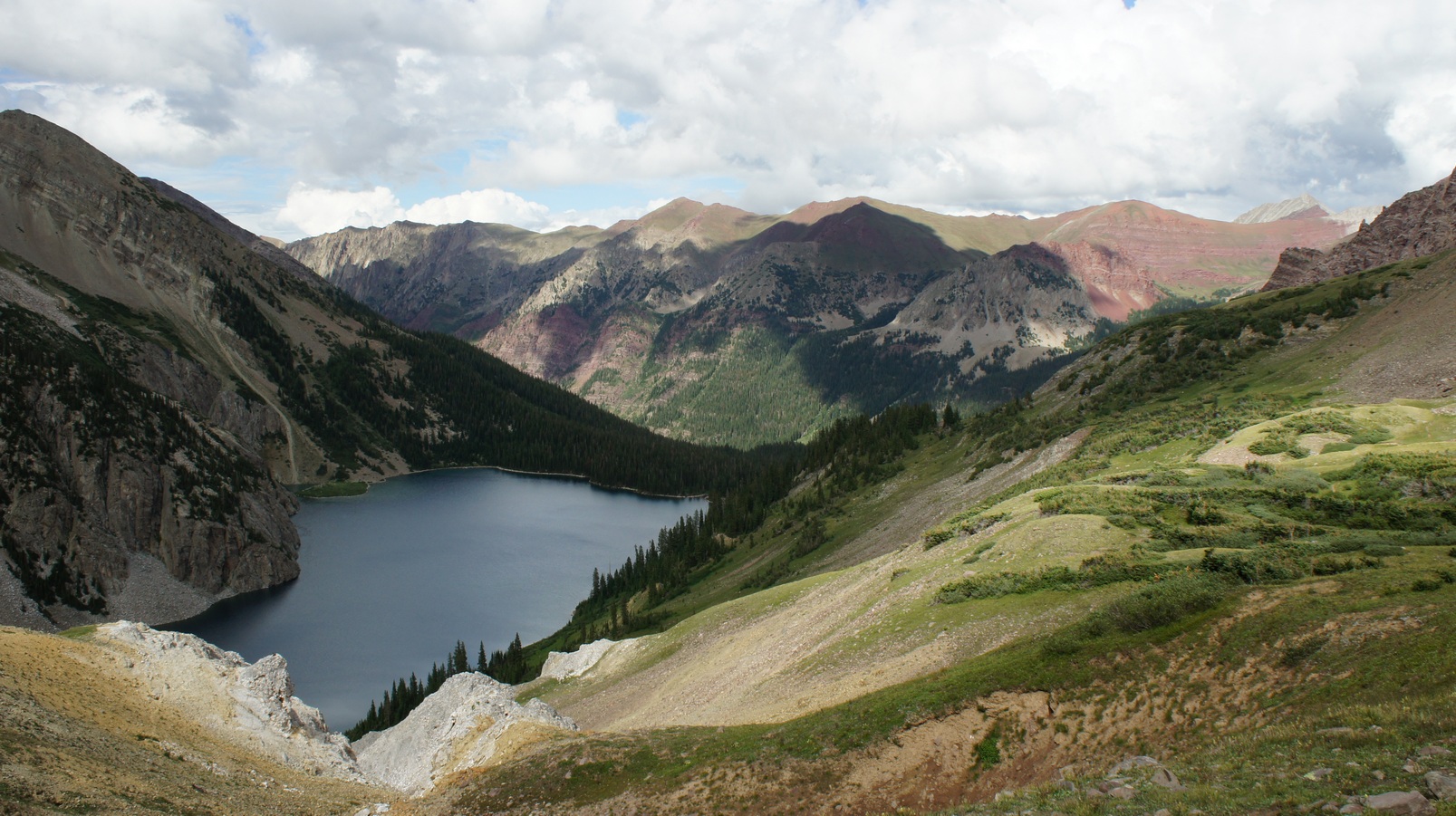
snowmass lake

Snowmass Peak on the left, and Snowmass Mountain in the middle,

The trail was very visible on the mountainside, and it could be seen for quite a ways here. Some of the gullies still had snow in them, and this was the closest we’d come to them yet. Once we got our first view of Snowmass Mountain, I pointed it out to Lisa. Although we had planned on climbing it together, after seeing it first hand, she decided against it. This was somewhat of a relief to hear because I had a feeling this was a little more than she could handle.  I have to admit that I was having second thoughts as well, since I had never climbed anything like this before. Not even close. But, I had my mind set on it and that was that.

amazing blue color of snowmass lake

Beautiful hike down to Snowmass Lake

Waterfall By Snowmass Lake

Waterfall By Snowmass Lake

We made great time hiking through this next section as we were both pretty eager to get to camp. There were some cool views of the lake as we emerged from small patches of wooded areas. The water was an incredibly vibrant turquoise blueish color that seemed to change every time we looked at it. It didn’t seem like Snowmass Lake was too far, but the hike ended up taking much longer than I thought. I wasn’t exactly sure where the campsites were located along the lake, and I assumed they were scattered along all sides. However, the trail took us to the far end of the lake and past it. Now, I wasn’t sure if we had missed a trail leading to the lake. Eventually we crossed the river and the trail headed up towards the lake again. While there must have been a shorter route, the way we ended up hiking seemed like it added another 45 minutes by the time we passed the lake and had to hike uphill again to get to the campsites. Just before the lake were two good sized waterfalls, and pools filled with Brook Trout. We passed a few guys who had caught some, which I hoped to do tomorrow!

campsite at snowmass lake

Campsite for nights 3 & 4

Once we reached Snowmass Lake, we were surprised to see how many people there were here. Of course, all of the good campsites were taken now that it was 6:30pm. We settled on a less than prime campsite, which was disappointing knowing that we were spending 2 nights here. We could always move sites tomorrow when others clear out, but is it really worth the time and effort? I’ll be climbing Snowmass Mountain tomorrow, so will I want to move when I get back? Probably not. The site wasn’t all bad though. Being set a little farther back from the lake, it seemed like it offered more privacy than some of the other sites. And, people weren’t walking past our site every 2 minutes since it was off the main path. However, there are no campfires allowed within 1/2 mile of Snowmass Lake, which was another disappointment. There were signs posted warning of a $325 fine for having a fire!

view from snowmass lake shore near camp

View from Snowmass Lake

Despite being in a wooded area, there is nowhere good to hang food near the lake. My bear hang ended up being maybe 5 feet off the ground, suspended in between 2 trees that were about 12 feet apart. Not ideal, but better than nothing. I saw many others with half-assed bear hangs as well. After setting up camp and finding a bear hang location, we headed down to the river to filter some water and take pictures. There were no colors on the mountains tonight to reflect in the water as I have seen in some pictures online, but I have one more sunset and 2 sunrises still to look forward to here! It sprinkled on and off for the rest of the night, but not hard enough to keep people out of their tents.

Back at camp, I packed my Camelbak for tomorrow’s climb. I had debated on the necessity of bringing the Camelbak, but knew it would be perfect for my climb and was worth the extra weight in my pack. I figured 2 liters of water would be enough, stored in my Osprey bladder. I packed my map, compass, gps, first aid kit, food, and camera equipment. I took out some moleskin so that it was ready for me to put on in the morning to cover the blisters on the back of my heels, which fortunately were not hurting too bad. Packed and ready for tomorrow, I was in bed by 10pm.


Day 4- Thursday August 2nd, 2012

Miles Hiked – 5.7
Route – Summit Snowmass Mountain, same campsite

To be honest, I didn’t sleep much last night. I was pretty nervous about climbing my first 14er, and doing it solo. Sleeping on a deflated air mattress also doesn’t help either. When my alarm went off at 5am, I was having a hard time getting myself up to do this, but after a few minutes I got up and moving. The weather was clear, and I could still see the stars quite well. I retrieved our food from the bear hang, ate some breakfast and packed my lunch into the Camelbak.

snowmass lake before sunrise

Time To Climb!

route to climb snowmass mountain

Snowmass Mountian climbing route

snowmass mountain summit base of climb

Base of the scree field

I left camp around 5:30-5:45am and began the hike around the lake. This was actually one of the worst parts about the entire climb! The trail was cut through thick vegetation that one could not help but to brush up against, which was still wet. It winds along the lake, sometimes on the shore and sometimes on the hillside. There were many roots sticking up that you either trip over or slip on. After 10 minutes, I was soaked to the bone. My boots were full of water, and at this point I felt like it would have been easier to walk through the lake itself! Near the other side of the lake now, I found it easier to follow the very narrow shoreline of the lake instead of the trail itself. In doing so, I missed where the trail went and I ended up scouring the shore for a route inwards toward the base of the scree field, unsuccessfully. Blocking my path was some very thick vegetation, a stream, and some very soft ground. I had to turn back and find the trail. I saw another group of climbers making their way around the lake as well, so I watched where they went and took the same route out onto the scree field.

snowmass mountain base scree field

Leaving the scree field

sunrise over snowmass

Sunrise over Snowmass Lake

There were 2 climbers already working their way up the scree field when I passed another group of 5 stopped at the bottom putting on their helmets and checking their gear. I was able to follow the path of the 2 climbers above me through the scree field, which was not as bad as many people had made it out to be. It was steep and loose in spots, but I was expecting worse. The steepest section of the scree field was near the top, below the grassy area.

snowmass mountain climb middle section

The middle section of the climb was the easiest

Now on the grass, I passed the 2 climbers that were above me. We stopped briefly to chat, discussing routes up the mountain. I was planning on doing the typical over-the-ridge route, but now that I was up here I was thinking about the shorter route that people take when there is no snow. I opted for the shorter route, while the other 2 hikers were going to ascend via the standard route.

It was nice to be off that scree field. The grassy area was a nice break, although still a climb. There were many small streams of water flowing through this area, with lots of large boulders dotting the landscape. I made pretty good time going up through this section as it gave way to larger boulders. Now you must hop from rock to rock, and sometimes climb from one to another. Some tilt, move, or shift when you step on them, so being conscious of where you step is crucial. The entire way up, I could hear rocks falling in the distance from Snowmass Peak (not Snowmass Mountain).

Once I got close enough to the top of the ridge to see some detail, I could see that it was pretty damn steep. It got steeper and steeper towards the top, until the last 20 feet or so became almost vertical. This climb definitely had some exposure. Although a fall from this height isn’t likely to be fatal, the terrain below was very steep and rocky. You would certainly tumble down the mountainside along with a ton of rocks, which could easily be lethal. So, I hesitated for a few minutes before attempting this climb. After all, I was by myself, and If I get hurt, who would even know?

View form the top of the ridge

The summit is hidden from this view

My adrenaline was pumping like crazy as I started climbing. The handholds on the rock face were good, but extremely crumbly. Even large handholds would just fall right off, so it was vital to test each hold before committing to it. I made the mistake of looking down once, which made me a little dizzy. I turned around and calmed myself down by concentrating on what’s above me and not thinking about what’s below. This worked well and I made it to the top of the ridge. I was a little shaken, so I stopped here for 10 minutes to plan my final ascent to the top and regain my composure. This was the scariest part of the entire climb for me.

The final ascent along the backside of the ridge looked daunting when I first saw it, but once you start moving you can start to see the lines. There are some cairns here and there, follow them when you see them. The summit itself is hidden for most of the ascent and only visible near the top.

Even at 14k feet, I didn’t feel like it was difficult breathing. I felt perfectly fine, and did not feel any shortness of breath whatsoever. I was really surprised at this, but certainly not complaining. This made me wonder how high I’d have to climb before experiencing any breathing problems. I had never been this high up in elevation, so it was nice to know what my body is capable of for future trips.

I made it to the summit of Snowmass Mountain around 9:30am. My GPS said 14,061ft but I am going to trust the folks at the USGS over Garmin and go with the 14,098ft figure they claim. The weather was surprisingly calm and not too windy, but it was turning cloudy fast. The view was so incredible, I just wish the skies were blue for my pictures and it would have been perfect! Views of the red colors on the mountains contrasting against the greens were especially beautiful, never seen anything like that. I could see Geneva Lake below, which would have been a nice place to camp had I planned my trip to include a night there. Maybe on a trip in the future? I could see myself coming back here!

View from Snowmass Mountain

Snowmass Lake from the top of Snowmass Mountain

About 15 minutes after I reached the top, the 2 climbers I passed earlier had joined me. I was taking pictures at this point, and we exchanged some of each other before moving on to our lunches. We chatted and ate for about 45 minutes before heading down around 10:30am.

The other 2 climbers descending Snowmass Mountain. This is just over the ridge, along the standard route

I didn’t want to down climb that death wall I climbed up earlier to get over the ridge, so I decided to take the longer route that the other climbers had taken. I missed the route up over the ridge going this way and had to backtrack a little to find it, but I was over the ridge by 11am. The next few hundred feet of my descent  involved climbing down and jumping from rock to rock, which were surprisingly stable. Once I got the hang of moving on these large boulders near the top, I was flying downhill at a good pace. Before I knew it, I could no longer see the other 2 climbers, who went over the ridge at the same time as I did.

Now at the top of the scree field, I was searching for the route I took up but didn’t see it. The route I  ended up taking put me in the scree field higher up than the way I ascended, and this meant steeper terrain and more time in the gully. Parts of this gully had water flowing down it, and it was pretty slippery. At one point I slipped and fell on my ass, and slid about 5 feet down before stopping myself. I’m just glad I didn’t pick up any real speed. Going down the rest of the scree field wasn’t too bad though. The easiest way to move here was to walk downhill “sideways”, and slide down the rocks in a controlled manner.

Near the very bottom of the scree field, I was crossing over a small stream when I slipped on some roots and fell on a boulder, right on my hip. This fall hurt but I was ok. Later on, this would turn into a softball sized bruise. Going around Snowmass Lake was still a pain in the ass, even now that it was mostly dry. I fell once or twice making my way around the lake. It’s funny that the the most treacherous part of the climb wasn’t even up on the mountain!

I made it back to camp early afternoon, around 1pm. Just then, it started sprinkling. What great timing, I thought. I had neglected to bring any rain gear with me since it wouldn’t fit in my Camelbak, which in hindsight was probably a mistake on my part. Especially since I could have used it in the morning when traveling around the perimeter of the lake. My first priority was removing my boots and getting some air to my feet, and secondly, chugging some water. I had only drank about 1.5 liters of water during the climb, as well as a full liter in the morning before leaving camp. I wasn’t feeling dehydrated, but my pee was pretty yellow.

While I was gone climbing, Lisa took a few pictures with the Canon Powershot:

After getting my fill of h20 and filtering more water, I had the rest of the day to relax. Lisa was happy to sleep in and use today as a recuperation day, and had a very laid back morning by the lake. We thought about moving camp to a better site, but decided that it didn’t matter and the time spent moving would be better used fishing, exploring, etc. We headed down to the lake shore, and hung out here for a while taking pictures and getting some sun. It was pretty hot when it wasn’t cloudy, but pretty cool otherwise. Lisa and I laid out on a large rock at the edge of the shore for a while before trying my hand at fishing. I didn’t bring much for gear, and other than a Mepps spinner and a spoon I didn’t have anything for trout. I completely forgot to pick up some worms when we stopped for my fishing license in Aspen. Needless to say, I didn’t catch anything in the lake. Back by the mouth of the river, we saw a mink or weasel, not sure exactly. It appeared to have a mouse in it’s mouth as it scurried along a log protruding into the water.

trout fishing below snowmass lake

There are trout in here, but I didn’t get any

I also fished the pool below the 2nd waterfall on Snowmass Creek, heading away from the Lake. I could see several trout in here, maybe 15 or so. There were a few that were 10″ plus, but they didn’t want anything to do with my tackle. After a few snags and no bites, I gave up. I wouldn’t have been able to eat them anyways, since I left my stove behind for this trip and opted for easier to prepare food, and there are no fires allowed by the lake. So either way, it was going to be catch and release.

Closer to sundown, I set up my camera equipment in hopes of capturing some colors on Snowmass Peak reflecting in the lake. There were no colors yet again, but it was still very picturesque! We pigged out on some sour patch kids as the sun went down. Without being able to have a fire, there wasn’t much else to do but go to sleep. We did hear a coyote howl shortly after lying down though. After it’s 2nd or third howl, someone camping near the lake did his own coyote call to mock it. I could have gone without that.


Day 5 – Friday August 3rd, 2012

Miles Hiked – 5.6
Route – Snowmass Lake to Minnehaha Gulch campsite

early morning snowmass lake

My alarm went off at 6:15 today. I wanted to catch the sunrise and hopefully capture some great photos. The water was like glass and so far the sky was completely clear. Absolutely perfect conditions! I set up the tripod and got my camera ready while Lisa filtered water. We hung out here for quite a while taking pictures, eating, and just taking in the beauty of this place before we hit the trail at 9:15.

The hike back to the main trail seemed much longer than I remembered. Maybe 20 minutes after leaving camp, we passed a large pile of boulders that housed a family of marmots. These guys were all over the place… I wasn’t expecting to see so many! Finally back on the main trail and heading towards Buckskin Pass, we only passed a handful of hikers, mostly closer to Snowmass Lake.

Today’s hike had us traveling through more forests than the other days it seemed. I was surprised to find out how wide open everything is here, I wasn’t expecting to have huge views almost every step of the way. That’s how it is here though… huge, spanning views everywhere. Seldomly did we find ourselves in a forest area for more than a few hundred feet at a time. Being in the shade was a welcome feeling, especially for Lisa who had gotten quite a bit of sun by this point.

beaver damn in the maroon bells wilderness

Beaver dam

After crossing Snowmass Creek late in the morning, we saw a beaver dam. We saw the “lodge” off in the distance, but no beavers. A waterfall lies downstream of the dam, but I didn’t stop to explore. The trail follows the creek a short ways before splitting off in a V. The funny thing is that in between the fork lies a tree with a sign on it that just says “Trail” and doesn’t point in either direction. It’s placement in the fork doesn’t indicate which direction to go, so the sign is completely useless! I chose the one that went up, and apparently I chose wisely.

The trail worked it’s way up the mountainside for a while before emerging from the tress and once again exposing us to intense sunlight for the ascent of our final mountain pass. On the bright side, Buckskin Pass was probably the easiest one of the four, at least in the clockwise direction we hiked it.

Pika

Buckskin Pass

We saw several more pikas and marmots on the way up. The marmots had burrowed into parts of the trail, leaving large holes in places. We still couldn’t see where the trail was taking us, or where exactly the pass itself was. By the time we could see where the trail was taking us, we were almost at the top. It didn’t seem as long or steep as the other passes, and we made it to the top by midday.

Of course, there were several other hikers up here already. We ate lunch and chatted with a woman who was by herself. She told us that a climber had died on North Maroon Peak the week before. This made me feel glad to have returned from my solo climb unscathed. Very sad to hear though. We saw a man descending Buckskin Mountain as we sat eating lunch, who eventually came over our way. I asked him about his climb and he on his way rather quickly.

Snowmass Peak & Snowmass Mountain viewed from Buckskin Pass

North Maroon Peak viewed from Buckskin Pass

Pyramid Peak behind me

The cool thing about this view from Buckskin Pass is the different perspective you get of Snowmass Mountain and Snowmass Peak. From Snowmass Lake, Peak looks taller than Mountain. But from here, you can clearly see that Snowmass Mountain is taller. North Maroon Peak can be seen to the south and Pyramid Peak dominates the landscape to the southeast.

Rain over Pyramid Peak

The east side of Buckskin Pass was much steeper, thankfully we were going down it. The weather was threatening to rain on and off like always, so we were trying to hurry up and get to our intended campsite at Crater Lake asap. However, after descending about 1300ft we camp across a campsite that had a pretty badass view, and was only a few hundred feet from a small stream. I knew Crater Lake was going to have a ton of people, and if you haven’t guessed yet, I like my solitude. Tomorrow’s hike was only going to be 2 miles back to the car, so adding 2 more miles of downhill hiking wasn’t really an issue. This is it, our final campsite of the trip.

It was 3pm when we stopped for the day, which was our earliest time yet. It sprinkled briefly as we set up the tent. While we were setting up camp, a group of 3 or 4 people passed by on horseback, with about 10 horses total. We had seen piles of horse shit here and there, but this was the first time we’d actually seen people on horseback. This site had a rope tied between 2 trees about 15 feet up, so this was the easiest bear hang of the whole trip. We really wanted a fire tonight since we only had one on our first night. We gathered some wood and stored it under the base of a pine tree to keep the wood dry, just in case it rains. We filtered water from the creek, which would be enough for tonight and tomorrow since it’s an easy hike back to the car. Filtering water always seems like it takes a long time, but as clean as the water was here in the Maroon Bells Wilderness, it went a lot faster not having to stop every other liter to clean the filter.

Night 5 campsite

Looking towards Buckskin Pass from our campsite

Back at camp, we were sitting around on a log when an overly territorial bird started messing with us. We later found that it was a Grey Jay.  Just as it did in a previous campsite, the bird would circle us, hopping or flying 10 feet or so at a time. It would look at us for a few seconds before moving to another position. After making a complete circle, the bird stood on a stump facing away from us. It then proceeded to do a 180, stared at us for a few seconds, then flew directly at us! It turned away only 6 feet from our heads. We must have been near it’s nest or something, but I had never seen a bird act like that. It was pretty comical!

Sometime later, the thong piece on my sandal had come off and it was now almost impossible to walk in them. The thong had separated from the foam body of the sandal, taking with it a chunk of the foam. I sliced a narrow hole through the body of the sandal underneath the area of foam that was missing, just large enough to force the foam chunk attached to the thong through. I was skeptical of the longevity of this solution, but it felt great and was still intact by the end of our trip. Good fix, but now I’m in the market for another pair of sandals before my next trip.

Sleeping Sexton & North Marron Peak on the left

Our campsite offered excellent views of Pyramid Peak, Sleeping Sexton, and North Maroon Peak. We spent most of the evening lounging around, just enjoying the view. Below our campsite, it was evident that an avalanche had been through this area at some point. All of the trees were uprooted and a path was cleared through the forest. We didn’t get a direct view of the sunset, but there were some cool colors going on in the sky behind Pyramid Peak. It was actually fairly dark when all of the sudden the sun, which was behind Buckskin Pass somewhere, started shining on the clouds behind Pyramid Peak somehow. This seemed to defy all logic, but gave us a 5 minute window of some beautiful reds and oranges before finally going down for the night.

The stars came out very bright tonight as it was mostly clear. However, the moon was almost full and drowned out the stars by around 10pm. I was really hoping to see the night sky with great clarity on this trip, but between the weather and moonlight, that never happened. Being from the city, I don’t get to see very much of the night sky, so I always look forward to it when I go backpacking. Next time, I might try to plan a trip concurrent with the phases of the moon for best results. We stared at our campfire for a little while longer before calling it a day.


Day 6 – Saturday August 4th, 2012

Miles Hiked – 4.2
Route – Camp to car

This morning I awoke at 6:30 with the hopes of viewing the sunrise, but again there was no direct line of sight as it rose behind a ridge blocking my view. I’m sure the Maroon Bells would have looked spectacular this morning viewed from Crater Lake, but I was not regretting my decision to avoid the crowds. The weather was cool and clear as it was every morning here, and looked like a gorgeous day. As beautiful as it was here, we were ready to go back to the car and have a taste of civilization. We packed up camp and were en route back to the trailhead by 9:15am.

North Maroon Peak

Below Sleeping Sexton & North Maroon Peak

After leaving camp we hiked through the avalanche area that we overlooked yesterday. It’s pretty amazing to think that snow can literally wipe out everything in it’s path like this. The rest of the hike to Crater Lake was downhill from here, and mostly covered by trees once we passed the avalanche zone.

View of Crater Lake

View of the Maroon Bells from Crater Lake

Crater Lake

Once we neared Crater Lake, you could see how dried up it was from above. This must be a far cry from last year, which I was told had near record snowfall, so I’m sure the water level was much higher then. There weren’t any other people around yet, but that’s because it was still a little too early. After leaving Crater Lake, we were once again confronted with an army of day hikers. They come in by the busload at the visitor’s center, and seem to hike no farther than Crater Lake for the most part.

Approaching Maroon Lake

It seemed that the trail in between Crater and Maroon Lakes was much shorter this time around. Our large packs gave us away to the day hikers, who frequently stopped us to ask about our trip. I don’t mind stopping to chat, but after 6 days, we were ready to get back to the car, with a shower as our ultimate goal for the day. That, and a hot meal.

The Maroon Bells behind Maroon Lake

This sign was near Maroon Lake

By the time we reached Maroon Lake, the day hikers were out in full force. We stopped for a minute at the lake for few final pictures. I couldn’t help but look back at the Maroon Bells and reflect upon the most amazing backpacking trip of my life.

The hike back to the car seemed much longer from here though, despite being downhill this time. We made it back to the car around 11am, just in time to avoid the heat of the day. It felt great to finally change into shorts and sandals, and to sit on a comfortable seat instead of a log.

On the drive through Aspen, there were even more cyclists than I remember. We passed over a small bridge that had so many bikers that they had to get off their bikes and walk them across. There must have been 50 bikers on a bridge that was only 100 feet long! It was a biker traffic jam, pretty ridiculous if you ask me. There also seems to be a shortage of gas stations in this town. The ONE we stopped at was cleaning it’s bathroom so we had to look elsewhere. We ended up going to the King Sooper’s “City Market” grocery store again. I saw a few bikers almost get clobbered by cars backing out of parking spaces, and I almost hit a few myself. This place is a nightmare with all the pedestrians!

I was relieved to be out of Aspen, but we weren’t out of the woods yet. There were still tons of cyclists on the narrow mountain roads going all the way up to Independence Pass. After going over the pass they seemed to disappear from the roads and I felt much more comfortable driving.

We stopped in Leadville again for some food, and there was some sort of festival going on. We parked a few blocks off the main strip and headed towards a cool looking place called the Silver Dollar Saloon. The place was packed because of the festival, but a busboy showed us to a seat right away. The atmosphere was very cool in here, very old looking with lots of cool artifacts on the walls. There were several guys in here with handlebar mustaches, cowboy hats, and had pistols holstered on their side. We sat there for about 20 minutes and didn’t see ONE waitress anywhere in the entire restaurant. The only employees we saw were the busboy and one bartender, and nobody came by to give us a menu or take our drink order. We left and went to another place down the street called the Pasttime Bar. We were served immediately here, despite them being very busy as well. The food was great and the service was so-so.

We got back to the Denver area by late afternoon and immediately jumped in the shower. Finally, the moment I had been waiting for! After getting clean, we headed to downtown Denver for dinner before going to bed around 10pm. Tomorrow we would drive straight through to Detroit, but for now, it was time to get some good sleep on a real bed.


Final Thoughts

The Maroon Bells Wilderness is absolutely beautiful! This was easily the best hike of my life, no questions about it. This is the trip that all others will be measured against in the future. On top of the non-stop postcard perfect views, abundant wildlife, and sense of real adventure, the weather was pretty damn good. We didn’t get rained on once during our hike, only light rain at camp and slightly heavier rain our second night. No injuries, no altitude sickness beyond a bit of acclimation woes our first day, and overall just a smooth trip. Everything went according to plan, which is always a great feeling.

The downside is that there were a lot of people hiking here, which takes away from the whole experience in my opinion. At this time of the year though, crowds are to be expected, so I wasn’t holding out hope for a whole lot of solitude. Still, there were many more people than I had anticipated.

Climbing my first 14er, and doing it by myself was a huge thing for me. Just a great feeling that I really can’t describe. So glad I did it and hoping to do another someday soon!

I was disappointed with the fishing aspect of the trip, which is becoming the norm for me unfortunately. I don’t pick my trips with fishing as the main goal though, so when it doesn’t pan out it’s not too big of a deal. I didn’t get to see the stars like I’d hoped, nor was I able to photograph any good sunrises or sunsets. You can’t win them all though, and I still got some great pictures.

 Complete Maroon Bells Photo Gallery


As always, questions and comments are welcome!

If you found my trip report useful, please don’t hesitate to leave a comment! Alternatively, if you feel you have any information you’d like to share with others regarding this hike, please feel free to leave that below in a comment as well.

[tcb_comment_count]


Related Images:

×