Wind River Range High Route Hike Overview
View ALL my pictures from the hike here: Wind River Range Traverse Photos
View an HD video of this hike on youtube: Wind River Range Traverse
- Location – Wind River Range, Wyoming
- Park Type – National Forest, Wilderness
- Miles Driven To Destination – ~3500 miles Round trip
- Trailheads – Start at Green River Lakes TH, end at Big Sandy Trailhead
- Length Of Time Hiked – 8 days, 7 nights
- Trail Type – Point to point
- Miles Hiked – 100.9
- Trail Difficulty – 9.5/10
- Solitude – 9 (except near trailheads or Cirque of the Towers)
- Scenic Beauty – 10
- Fires Allowed – Yes
Notes About the Wind River Range

The Wind River Range is a mountain range located southeast of Yellowstone and Grand Teton National Parks, running NW-SE. Lander is the main town on the east side of the range, and Pinedale is the popular staging town on the west side of the range. It’s so rugged that there isn’t a single road that crosses the 100 mile mountain chain, forcing you to drive around it. The Continental Divide trail runs through the Winds, as they are called for short, and is often labeled one of the most spectacular sections of the entire 3,000 mile hike. The Winds are home to Gannett Peak, Wyoming’s tallest at 13,804ft, and more than 40 other 13ers. It’s home to the largest network of glaciers in the American Rockies. Grizzly and Black Bear roam these mountains, as well as Big Horn Sheep, Elk, Moose, Wolverine, and Wolves. World class trout fishing can be had in the Winds as well, in the rivers or many alpine lakes. Despite it’s popularity, it’s one of the most remote backpacking destinations in the lower 48, with spots as much as 20 miles from the nearest trailhead. Ok, are you drooling yet?? Yeah, this place is every bit is awesome as it sounds.
Wind River Range High Route Maps
Download a GPX file of this hike here: Wind River Range Traverse GPX File
Here’s my caltopo map for the Wind River Range High Route as I hiked it:
Getting There
The night before I left home, my hiking partner Marc and I were running around doing last minute errands. It was raining, than it rained some more, and then all of the sudden it was a Florida-like outburst of torrential rain that did not let up for over an hour. Large pools of water started forming on the roads as we pulled into a gas station for our last stop. The rain had just started to let up, and now extent of the flooding was fully evident. Looking out onto the main road, water was mid door height on the cars brave enough to ford the water. Waves of water sloshed into the gas station parking lot, and into the neighboring shopping plaza, where water looked to be about 3 feet. This is crazy, Michigan doesn’t get this type of flooding. Locals are calling it a “once in 50 years” type of storm. Later we found out that some spots received over 6 inches of rain in only a few hours. It was reported that 1.24″ of rain fell in just 24 minutes at Detroit Metro airport!
Even though I only had a 1/4 mile to drive from the gas station, I just barely made it home myself due to the depth of the water. Side streets were filled with dead cars, casualties of the flooding. Absolutely crazy, I have never been through anything like this. My neighbors’ basements were flooding, as were friends in the area. So far, mine was holding tight.
The plan was to get up at 6am tomorrow and start driving, but at 11pm I noticed my basement was starting to take on water. Good thing Marc was here with me, it was great having an extra hand to get everything of value off the floor before it got wet. Also, we had to rip out some carpeting before it got water logged. The basement ended up with about 1-2 inches of water in the deepest spots. By 1am, I had done all I could do, and tried to get some sleep. Now, I was unsure if I would even be able to leave, considering the circumstances.
The water was receding at 6am when I woke up, and was fully drained by 8am. I turned on a dehumidifier, several fans and turned down the central AC. I figured this was pretty much all I could do even if I was stuck here dealing with it. I was uneasy about leaving the house but wasn’t about to miss this hike! I was out the door about an hour and a half behind schedule. Not bad considering the circumstances! I also had a friend come by a few days later to check on the house, just in case.
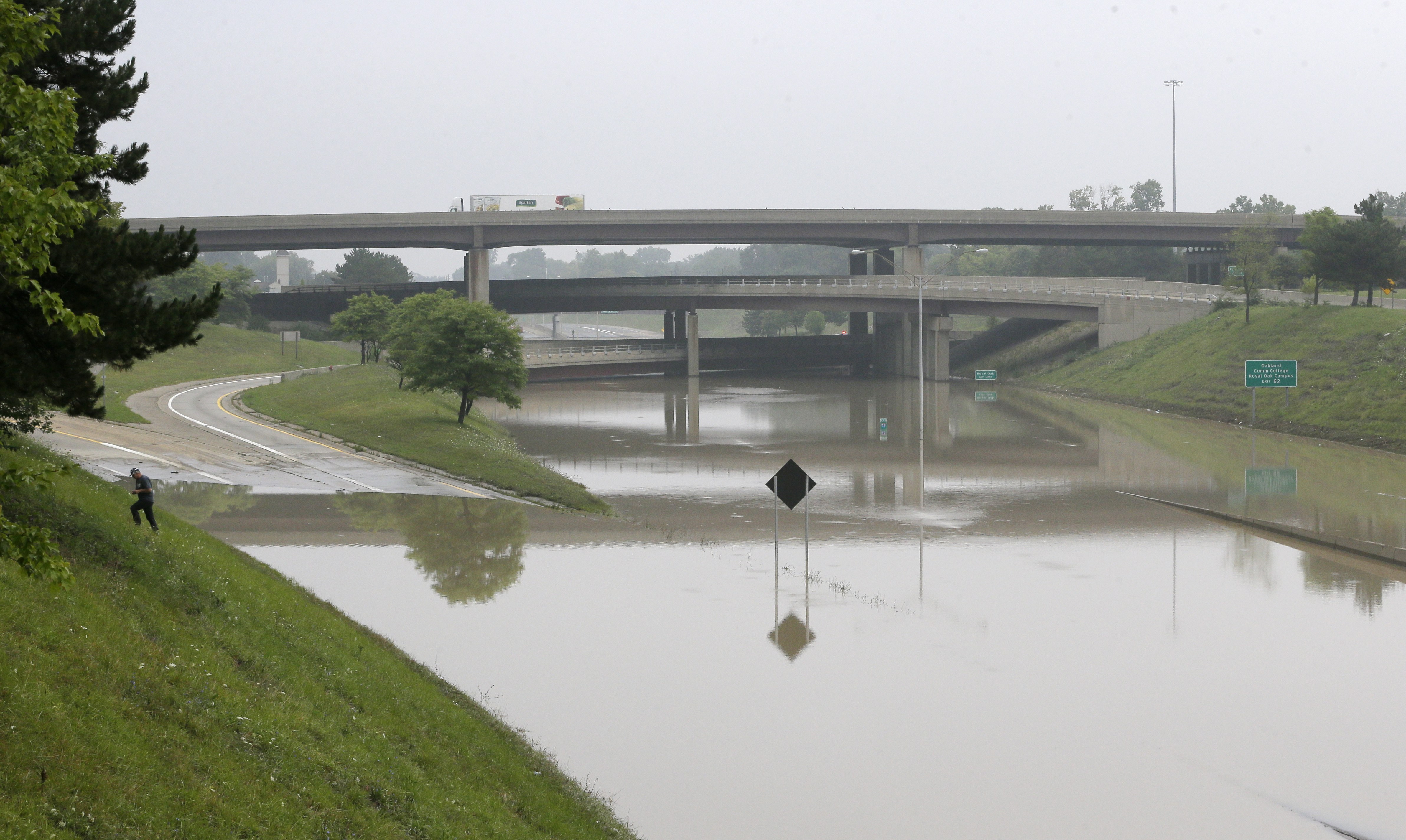
Yeah, I don’t think the freeways are an option right now…
It was tough getting out of metro Detroit once we finally got on the road. Almost every road in my area was flooded, damaged, had dead cars in the middle of the road or some other obstacle. Marc played navigator, checking traffic on google maps. Freeways were out of the question, since they were filled to the top with water last night and completely out of commission today. We snaked our way through side streets and tried to avoid major road closures, which were pretty much everywhere. We would have spent hours trying to get out of town if it wasn’t for google traffic.
Once out of Southeast Michigan, the next 1,000 miles were pretty boring. Corn, as far as the eye can see for hundreds of miles. Once into Wyoming, the landscape became much more interesting. This was the first time I had ever been to the “Cowboy State”, which is the least populated state in America and the 2nd least in terms of population density. In other words, there’s a lot of open land here. Incredibly vast amounts of it. But, a great drive with lots of variation in land formations.
We arrived in Lander, WY late in the afternoon, where we had a hotel booked for the night. There was a Safeway grocery store in town for last minute shopping needs. We ate dinner at the Dairy Land drive-in. This place serves deep fried cheeseburgers called a “cheese wheel”. I highly recommend it if you happen to find yourself in Lander!

The long road to Big Sandy
The next day, we drove to Big Sandy trailhead on the west side of the Wind River Range. This is the southernmost trailhead in the Wind River Range. Once we turned off HWY 28 onto Lander Cutoff Rd, it was about 36 miles to Big Sandy campground. The landscape was a desert scrub with some rolling hills, and some interesting land formations. The transition between the desert and the mountains was much more drastic than I thought. As far as the road condition goes, the first third of the 36 miles was pretty rough, the middle third was pretty good, and the final third was rough. But hey, if a mid 90s Saturn can make it, so can whatever you’re driving.
From here, we parked the car and waited for out pre-scheduled shuttle service to pick us up and take us to Green River Lakes campground, the northernmost trailhead in the Winds. The Great Outdoor Shop in Pinedale, WY offers this service. You might also try to contact taxi companies in Pinedale to shuttle you from one trailhead to another, if you aren’t hiking a loop.
As soon as our shuttle service dropped us off at Green River Lakes campground, it started raining a little. I was able to get my tent up pretty quick, but Marc struggled with his due to being unfamiliar with it. By the time we got everything set up, we decided not to get in our tents and instead to wait out the rain in our rain gear underneath the awning of a little building nearby. It was some sort of maintenance shed, and the doors were locked. We got a little wet, but the weather cleared up after an hour or so.
After the rain let up, we walked down to Green River Lake. Squaretop Mountain dominates the view to the south. We haven’t even started the hike yet and already the scenery was incredible.

View from the Green River Lakes campground
Day 1 – Friday August 15th, 2014
Miles Hiked – 12.6
Route – Green River Lakes trailhead to Three Forks Park
Today’s Map

I woke up today at 6am. It was very foggy, with visibility only a few hundred feet. It rained last night and everything was wet. We were slow to leave camp this morning since this was Marc’s first overnight backpacking trip. He hasn’t yet familiarized himself with his equipment (much of it is borrowed from me), nor has he developed a system for setting up or breaking down camp. So, this is going to be a learning experience for him.

The outhouses at Green River Lakes campground where the nicest I have ever seen. Definitely not going to have that luxury for the next week, so we made one final stop here. We left the campground around 8:15 and made our way down to the lake to find the trail. Once we were on the path, it promptly crosses the Green River, where it winds through a meadow. The sun was burning off the fog, and already we where blown away by the beauty of this place. The plan for today is to hike upstream along the Green River and find camp in Three Forks Park.
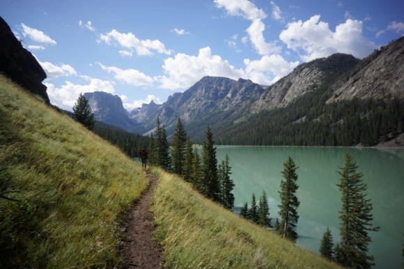

The sun wasn’t high enough in the sky to see the true color of the first lake, but the next lake up in the chain was properly illuminated. We stopped for a gear adjustment and quick snack here. Such amazing color, that green. Some hikes seem like they take a while to “get to the good stuff”. Not this one, right into it from the beginning.


After passing the second lake, the Green River snakes its way through various meadows and woodlands. Again, the color of this river is mesmerizing. The trail follows close to the water most of the remainder of today’s hike.Also, the trail was very easy to follow all day.

We passed a few people here and there today, but nothing crazy. Far less than I was expecting. Marc seemed to do well on the trail today. He kept up a good pace wasn’t having any trouble breathing.
Although Beaver Park had some camping opportunities, we chose Three Forks Park because it’s pretty much the southernmost camping area along the trail before it starts going up in elevation. We hiked 12+ miles today before stopping to set up camp at around 2:15. There weren’t an abundance of good campsites here though, at least not obviously visible from the trail or near it.

Camp was nice, it had all the amenities… close to the river, fire pit, good cover from large, healthy pine trees, and a bear hang rope already set up in one of the nearby trees.

View from our campsite in Three Forks Park
While Marc set up his tent and experimented with his hiking routine/gear set up, I took full advantage of this sunny afternoon by fishing in the Green River. I brought a small collapsible fishing rod (brakes down to 5 pieces, and maybe 15″ in length) and a tiny reel with 4lb test line. For tackle, I mostly used spinners. Didn’t catch anything here, and I was a little disappointed considering the hype this place has for trout fishing. However, the countless alpine lakes still lay ahead. Better luck next time.

Marc had spent most of the afternoon setting up his camp, and making adjustments to his gear. He had a blister forming on one heel, but he attributed that to an improperly cut insole he added to his shoes. He trimmed that up some more and various other adjustments.
Firewood was fairly abundant nearby, and we had a campfire going come early evening. Marc pulled a “Dan”, and burned some of his gear tonight in an effort to save weight. His glasses case and a spare pair of underwear met their demise in the campfire tonight. All I could do was laugh.
Tomorrow is shaping up to be one of the hardest days of the trip, based on the elevation gain and distance. Right now we are at 8,300ft elevation in Three Forks Park, and Knapsack Col (a col is like a pass) is over 12,200ft, plus all the other ups and downs of a 13+ mile hike. We decided to go to bed early at get an early start.
Day 2 – Saturday August 16th, 2014
Miles Hiked – 13.7
Route – Three Forks Park to Titcomb Basin
Today’s Map
I woke up at 5:15 this morning. Shortly after Marc got up, he informed me that his breathing was a real concern and he wanted to turn around and go back. I was shocked that he was saying this right now. He spent a quite a bit of money on his clothing and various other items for this trip, along with the time and money spent getting all the way out here. It must be bad if he is willing to turn around now. However, I’m not turning around. I’m not cutting my trip short. I’m going to continue on solo and finish this hike!
We talked for a while about how we were going to handle this situation logistically. His plan was to hike back to Green River Lakes campground. From there, his options consisted of camping at Green Lakes for a few days, hitching a ride to Pinedale for a few days, or hitching to Big Sandy and camping there. Or, a combination of all three. Either way, he must end up at Big Sandy campground in a week to meet me at the end of my hike. He threw out the possibility that he may try to join me in the Cirque of the Towers my last night if his breathing is up to par. In this case, we would meet at Lonesome Lake at 6pm next Thursday night. If he’s not there, meet at my car at Big Sandy campground as planned the next day at 2pm.
It was a strange feeling to part like this. However, I must continue on now, solo. I hit the trail around 7, and it quickly starts climbing. After about 1,000ft elevation gain through some switchbacks, the trail crosses Trail Creek. This was one of two streams I actually had to put on my water shoes to cross during the trip. It was less than knee deep, but not able to cross by hoping rocks.


Descending Vista Pass, looking towards Cube Rock Pass
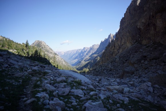
Looking back the way I came up
Once past Trail Creek, I saw a few other campers set up here in Trail Creek Park. The trail then continues to climb another 1,000ft or so to Vista Pass. Above 10,000ft now, the land opens up a bit and finally starts to look the alpine hike I expected. The trail descends the pass briefly and then continues up through a long, rocky gully.

Dale Lake

Peak Lake
After climbing up another 600ft or so, I reached Dale Lake. Now the scenery was turning from great to stunning. As I continued on, I could see Peak Lake in the distance. I started to slow down quite a bit now as the scenery required more stops for photos.

Traversing Peak Lake’s north side
As I made my way across the north side of Peak Lake, a forest ranger passed by, carrying an axe in his hands. He asked me where I was headed and that was pretty much it, he was on his way. The first half of the traverse around Peak Lake was up high above the lake, in a field of large and steeply stacked boulders. Then the trail drops rather abruptly down to lake level, where the trail remains for the second half.

Looking back at Peak Lake

Nearing the source of the Green River
Past Peak Lake, the breathtaking views continue to amaze. From this point on, I can follow the Green River up to its source below Knapsack Col. Standing on the very spot where water trickles out of the ground and forms such an iconic river of the west was pretty cool. It’s hard to believe that this little stream becomes the main tributary for the Colorado River, which cuts through the Grand Canyon.

At the base of Knapsack Col, and the source of the Green River
Now at the base of Knapsack Col, I could see the challenge that lay ahead of me. It was only about 600 vertical feet to the top, but it looked damn near vertical. Scrambling up the steep boulders was brutal. I snapped one of my trekking poles, a Gossamer Gear LT4. I was pretty bummed about that.
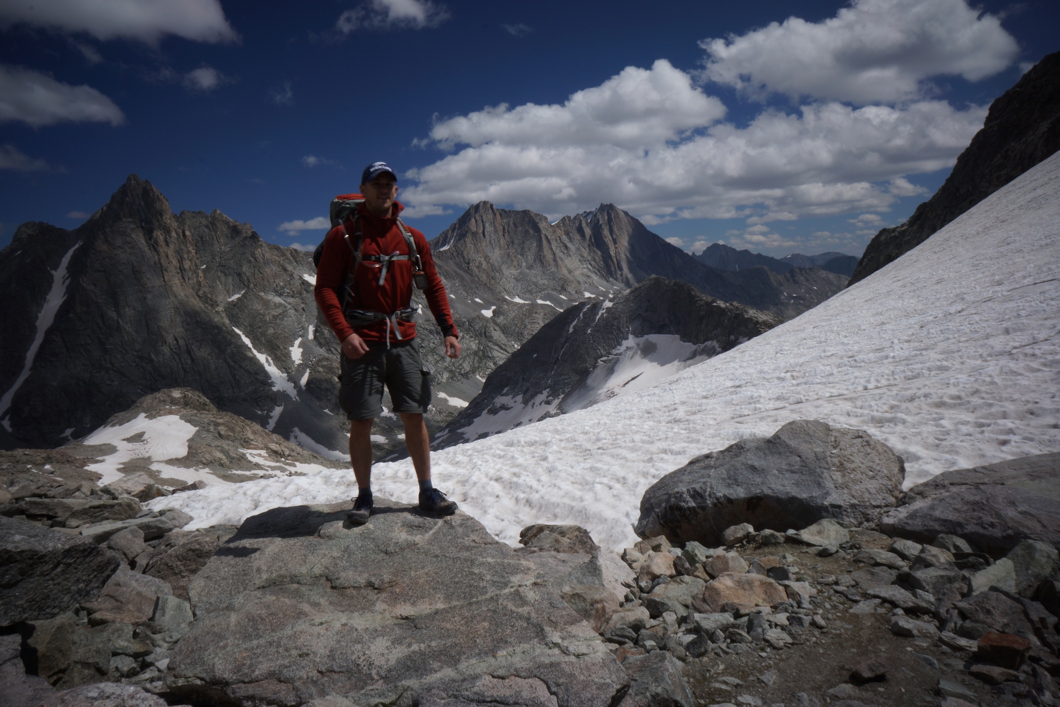
On top of Knapsack Col
At the top of Knapsack Col, ~12,260ft, there was a group of about 10 people who just came up the other side. At first I thought they might be part of NOLS, but they were part of a community college trip of some sort. One guy had cell phone service up here, but I did not.

Descending Knapsack Col onto Twins Glacier

Looking back up Knapsack Col
Now it’s time to head down Knapsack Col and onto Twins Glacier. The top section was mostly rock and dirt, now snow or ice. However, it was very steep. After a few hundred feet I took my first steps in the snow. My Inov8 Roclite 315 trail runners have handled everything else well up to this point, but they were pretty slippery here. It was pretty steep, and I ended up just glissading down the top section. I my camera out, which got a little wet from the snow flying up everywhere. The bottom of my backpack also got pretty wet from dragging in the snow a little bit. No big deal, but next time, I’m going to put the rain cover over my pack and put my camera under my jacket when I glissade. Definitely fun though!

Twins Glacier
One scary thing about hiking on the glacier was that occasionally, I would take a step and one leg would fall through the snow and I would be up to my crotch. I just kept hoping that I didn’t fall into something larger. Once off Twins Glacier, the remainder of the hike into Titcomb Basin was rocky and soggy. Lots of water flows through the rocks up here, and under the snow in spots. I was getting pretty tired now and looking forward to finding camp. There was one campsite high up in the basin, well before the first lake. I wanted to make it farther today, so I pressed on.


Upper Titcomb Basin, looking south

Titcomb Basin, looking north over Titcomb Lake
The Titcomb Lakes were huge once I got up to them. The hike around the first lake was nice. I could see a few tents up in the distance, but I was not seeing any good campsites along the trail where I was yet. Any campsites I have seen thus far have all been behind large boulders for wind protection.
Finally, I settled on a spot in between the Titcomb Lakes, perched up on a little hill. I didn’t know how much farther I’d have to hike before I found another suitable camp, and I was exhausted. It was 4:45 by the time I stopped today. Although there was no huge boulders here, there was a rock wall. At least I had some protection from the wind.


My water source for the evening
I spent much of the evening reinforcing my rock wall and positioning my tent out of the wind as much as possible. I hate sleeping in high winds. I’ve had my tent blown over in the middle of the night a few times before, it’s not fun. When the wind wasn’t blowing, the mosquitoes were out!

Watching the sunset from camp
The sunset was nice, and the winds started dying down some after dark. I was in bed pretty early tonight. Another long day lies ahead of my tomorrow.
Day 3 – Sunday August 17th, 2014
Miles Hiked – 13.4
Route – Titcomb Basin to Alpine Lakes
Today’s Map
I woke up at 6 today and was on the trail by 7. My intended campsite for today is at Camp Lake. Starting this morning, I won’t see anyone for 2.5 days from this point on.


I wish I had more time to explore the Island Lake area, but I have a lot of ground to cover today. The trail was great in some spots, and tough to follow in others.


Indian Pass Trail winding through Indian Basin
Indian Basin. Simply incredible.
The hike through Indian Basin was beautiful, especially the upper portions of the basin. The weather looked like it might possibly rain for a minute, then it cleared back up. Nice, more blue skies!

Using my tripod as I near the top of Indian Pass

View from Indian Pass

Another view from Indian Pass

Knifepoint Glacier from Indian Pass

That’s my glissade mark on the right
Once on top of Indian Pass, I could see Knifepoint Glacier, which I had to descend next. The descent was very steep at the top. I tried to follow the talus down for a while to someplace less steep before stepping onto the snow. Now, I could glissade my way down again. This time, I prepared myself better, and everything went much more smoothly. I didn’t get wet and neither did my camera. Great success!

Hiking on Knifepoint Glacier
At one point, my leg went through the snow again, only this time there was a large rock in the space below the snow for me to bang my leg on. My forward momentum of my upper body kept moving forward as my leg remained stationary, and this seemed to stress the knee. While this didn’t hurt too bad initially, I think it may have played a role in the knee pain I would experience later on during the hike, and as I write this now, 6 weeks later.

Knifepoiot Glacier terminus

Knifepoiot Glacier
I continued to head down the glacier, until I realized that I was of course. I was supposed to follow the 11,640ft contour line to the base of Alpine Pass. Instead, I hiked too far down. When I realized my mistake, I had to re-plot my course. The most direct route now involved descending the glacier completely. This was a rather interesting experience. Water could be heard flowing beneath the snow in many spots. It was steep in spots and quite slippery in trail runners. However, I did get to do more glissading! I turned around on my stomach and used my trekking pole as a brake. This slowed me down some, but certainly didn’t stop me. Without the brake, I was picking up some speed.

Knifepoint Glacier viewed from alpine pass

Standing on Alpine Pass, looking southeast at the Alpine Lakes chain

Waterslide of doom
The climb up to Alpine Pass was about 750ft. Seemingly everything here in the Winds is steep and rocky. At the top, I got my first glimpse of the Alpine Lakes area. Unlike the rest of the hike so far (since the top of Indian Pass actually), there is no trail on the map. I have 3 alpine lakes to hike around before reaching Camp Lake. I’m taking the western shoreline of all three lakes. Once I got down to lake level, there was a narrow snow slope to cross before continuing on. There were lots of these along the hike, where it slid straight into the icy water. I kicked in some steps along the slope as I walked along here, and much higher above the water, away from the overhang at the edge.

The next couple hours sucked. The shoreline wasn’t passable, and I had to head up another steep slope in search of a way around this lake. A passable route was never clear, so moving forward was a matter of going a little ways and peeking around the next ledge or boulder. Sometimes it was a dead end. This ate up a lot of time and energy. At one point, I had to climb down a class 3 ledge system with a 40ft drop to continue along.There were definitely some sketchy moments along the ledges up here.


While moving across a large boulder field, I slipped and braced my fall with my left hand, smashing it on a boulder, palm first. The thumb and hand ended up getting pretty bruised and swollen later on. I believe it was a sprain. Most of the time it didn’t bother me too much afterwards, but there were a few painful mishaps with it later on in the week. Both knees were also starting to hurt as well.
It was late afternoon now, and I was past the first lake. Battered, hungry and tired, I accepted the fact that I wasn’t going to make it to Camp Lake today. Instead, I would try to hike a little farther, to the southernmost Alpine Lake. That is, if there is even a decent campsite there. I haven’t yet seen anywhere I’d want to or even could camp at yet in the Alpine Lakes area.

Camp at Alpine Lakes
The second lake in the chain was much easier to get around. Nothing here was protected from the wind though. I could see a bit of a peninsula that jets out into the 3rd lake in the distance, so I head for that. Sure enough, I found a spot up there. It was situated behind a very large rock slab protruding from the ground and in a bit of a bowl, protected from the wind. This will have to do! It was already 6:15 , much later than I wanted to be hiking.

View from camp
The mosquitoes were bad at camp tonight, just as they have the previous nights. After refilling water and eating dinner, I didn’t have the time or energy to do anything else. I went to bed as the sun went down. Another long, hard day. The last two days have been some of the most difficult hiking I have ever done.
Day 4- Monday August 18th, 2104
Miles Hiked – 12.8
Route – Alpine Lakes to Glacier Lake
Today’s Map
Woke at 6:30, left camp at 7:45. Today’s hike was supposed to take me from Camp Lake to Europe Canyon, however, I was now a few miles behind schedule. We’ll have to see how far I make it today.


Trying to work my way round the ledges on the right

The southernmost Alpine Lake
Immediately after leaving camp, I continued on my course from yesterday, traversing around the last of the 3 Alpine Lakes. The research I had done before this hike had shown a route past this lake on the north/east side of the lake. However, this route was supposedly pretty step and had a class 4 maneuver. The south side of the lake looks much more benign on the map, and this is the route I chose. The first half of the lake was fairly easy, but the second half was more of a challenge. Eventually, I was stopped by some steep cliffs that required a steep climb up loose boulders to the top of a ridge. From here, I could now go around the cliffs. There were a few more narrow ledges to negotiate, as well as some dead ends, before finally making past the last of the Apline Lakes. Good riddance! This was the toughest section of the hike for me.

Past the last Alpine Lake, about to descend to Camp Lake
By now I could see the route ahead was about to dip below the treeline. I started following a small ridge down, but quickly realized that I was going to have to make my way down off the ridge and walk along side it. To get down, I had to climb down a 30ft section of steep rock with dense shrubbery. The whole rockface was covered in these pine tree-like shrubs, barely supporting my weight as I gingerly tested out each step on the way down. Now, I could continue on downhill with a little more ease.
Going down this


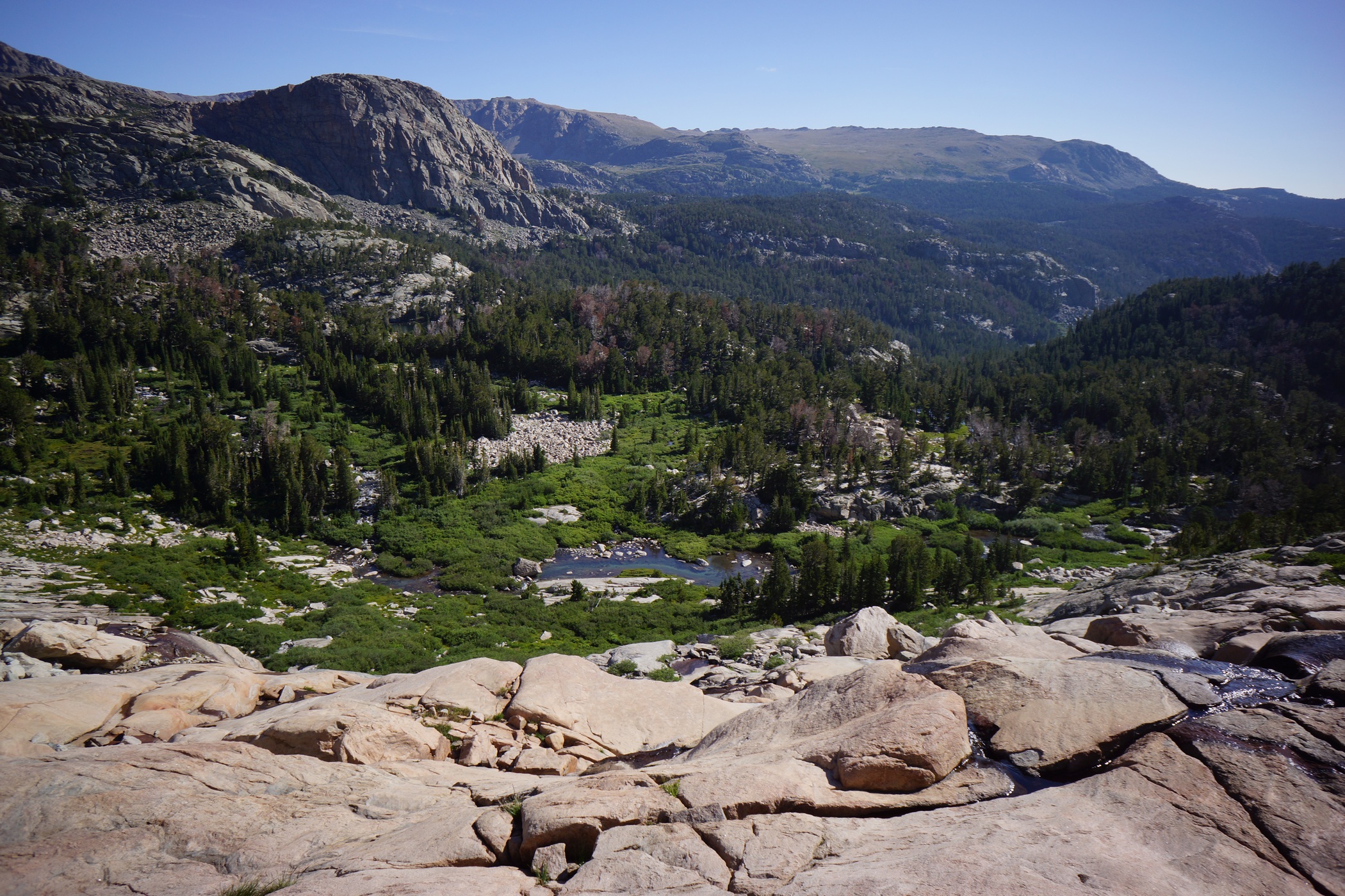
After heading downhill a short ways, my route had me descending another steep rockface. This time, it was much more wide open and clear, other than various streams running down it, making for some slippery spots. The rock was smooth and resembled a big slide, one that I did not want to test out. It was very beautiful coming down this section though.

Unnamed Lake

Camp Lake
Once down off the rockface, I was rewarded with a trail to follow, at least for a little while. Unnamed Lake was now visible, and boy was it beautiful. It looked like a great spot to camp, and I wished I had made it here last night. Oh well, moving on. After passing Unnamed Lake, the trial goes up and over a small hill before the approach to Camp Lake. I fully expected the walk around this Lake to be easier than it was. At the top of the hill, I could see now that the only way down to the lake was a steep decent of huge boulders. Sometimes, the boulders are so large that climbing on them and moving from one to another becomes a real chore. That was the case here.

View from the east shore of Camp Lake
Now out of the boulder field, the trail picks up again and makes it’s way around the east side of the lake. Despite the name, I didn’t see any good spots to camp along Camp Lake. I wasn’t looking too hard though either, since I wasn’t going to be camping here anymore. It sure was pretty though.

The next lake above Camp Lake

After passing Camp Lake, the trail starts to climb again. The next section wasn’t super steep, and there was actually a decent trail to follow. I made good time up to the top of the pass, which didn’t seem to have a name according to my GPS and maps.

Unnamed pass connecting the Camp Lake and Golden Lakes area

Upper Golden Lake
After descending the pass, I found myself overlooking the Golden Lakes area. The trail was excellent in this area, and there were plenty of great campsites to be found. I fully expected to see some people here, but I didn’t. I made good time through this area with an easy trail to follow over relatively easy terrain. I stopped for lunch near lower Golden Lake, and got devoured by mosquitoes and biting flies.

Golden Lake

Hiking up to Hay Pass. Started seeing bear crap here

Dennis Lake
After lunch, I continued on the trail and headed up and over Hay Pass. At this point, I started seeing some bear crap, near Dennis Lake. It was pretty wide open up here though, so at least I shouldn’t stumble across a bear without seeing him from a distance. Hopefully. The bugs where horrendous up here as well. Even while walking, I couldn’t escape the biting flies. This is crazy, I thought… must I wear my mosquito net while hiking, too? I wasn’t willing to hike in long sleeves today though since the sun was shining and it would have been too hot. Therefore, I had no choice butt to be eaten alive much of the day.


The trail was easy to follow along North Fork Boulder Creek, until I had to leave it to stay on course towards Glacier Lake. The hiking was easy up here, but pretty soggy. Lots of wildflowers and huge, open valleys. Not as spectacular as other areas, but this is where I am going to set up camp for the day, alongside Glacier Lake. I could have kept going an tried to make it to my intended campsite in Europe Canyon, but I decided to call it a day at 4:15.

Camp at Glacier Lake
There wasn’t much for campsites beside Glacier Lake. I found a decent spot behind a large boulder after some searching. Definitely not the best campsite, but it will do.

Cutthroat Trout
After setting up camp, I headed down to the lake for water, and to do some fishing. First cast, 12″ Cutthroat Trout. Awesome, but there’s no wood up here to burn. I didn’t bring a stove, so I had no way to cook it. Catch and release, I guess. I ended up catching about 8 trout in 30 minutes, all in the 10-13″ range. Caught them all on a#2 Mepps spinner. That was fun, but I really wanted fresh trout for dinner! Maybe another day, when camp is below treeline.
My knees hurt a little today, but less than expecting. I had another fall while hiking trough a boulder field, and again, I used my left had to brace my fall. Surprisingly, I didn’t seem to do any further damage to my already swollen hand. Back at camp, the bugs were the worst I have ever experienced. My head net quickly became one of the most valuable items in my kit.
Day 5 – Tuesday August 19th, 2104
Miles Hiked – 14.2
Route – Glacier Lake to Bonneville Lake
Today’s Map
I was up at 5:45 this morning, and broke camp by 7. The sky was pretty grey today, and only got worse as the day went on. I have had excellent weather the last few days, so I suppose some bad weather is about due.

Long Lake

South end of Long Lake
The main reason I stopped last night where I did was that I wasn’t sure how difficult is was going to be getting around Long Lake, which is situated between Glacier Lake and Europe Canyon. Given the difficulties I had going around Alpine Lakes, I didn’t want to get into anything too serious last night, and figured that was best left for this morning. In reality, it wasn’t too bad going around the lake.


Long Lake, looking northwest
Parts of Long Lake seemed to flow into the horizon, dropping off into nothingness. Somewhat like one of those “infinity pools”. This was a pretty cool effect. I only wish the sky was blue, these grey clouds are awful for pictures. To be honest, the lakes were starting to blend in to me now at this point. Don’t get me wrong, they were beautiful, but some of them were not named on my map/GPS, and there were just so many of them. This was a stark contrast to my previous hikes in the Rockies, both in Colorado, where there were relatively few lakes in comparison.

Unnamed lake in Europe Canyon
Once I go to Europe Canyon, I was looking for campsite locations out of curiosity, since I would have stayed here last night. I didn’t stray from my course though, and didn’t see anything great nearby. However, the area looked ripe with potential if one were willing to spend some time searching.
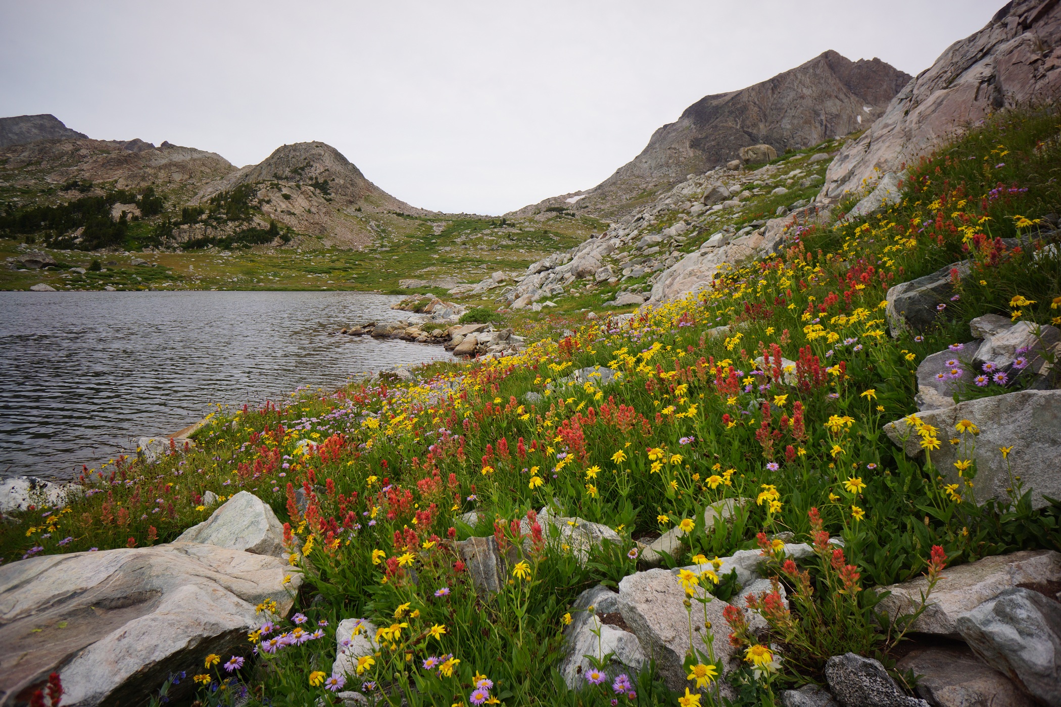

I had been off trail since yesterday afternoon, and will continue to be until later portion of today. Passing through Europe Canyon, my route now skirts around the east side of an unnamed lake up over a small hill. On the map, the contour lines made it look like it was going to be steep and difficult, but it was actually not bad, this time.

East of Medina Mountain
I’m seeing lots more bear crap now as I headed down the hill leaving Europe Canyon and down towards Halls Lake. One pile of crap looked particularly large, possibly Grizzly. I figure, better start making a little more noise, since I am by myself. I started yelling “Yo bear!” every so often.

I saw the black bear on the rock face to the left
While working my way down to Halls Lake, I did run into a small black bear, maybe 100 pounds. I was coming down a hillside along a rockface, and the bear was foraging for food alongside it. It was about 150ft downhill. My first thought was that there could be a mother bear nearby. As I reached for my bear spray, I was also yelling and making noise. The bear immediately scampered up the steep slope like it was nothing. My heart pounding and hands on the bear spray, I scanned the area for signs of the mother. Nothing but silence. I moved on with a new sense of awareness, and you can bet my “Yo bear” calls got louder and more frequent.

Halls Creek
Halls Lake


Middle Fork Lake in the distance
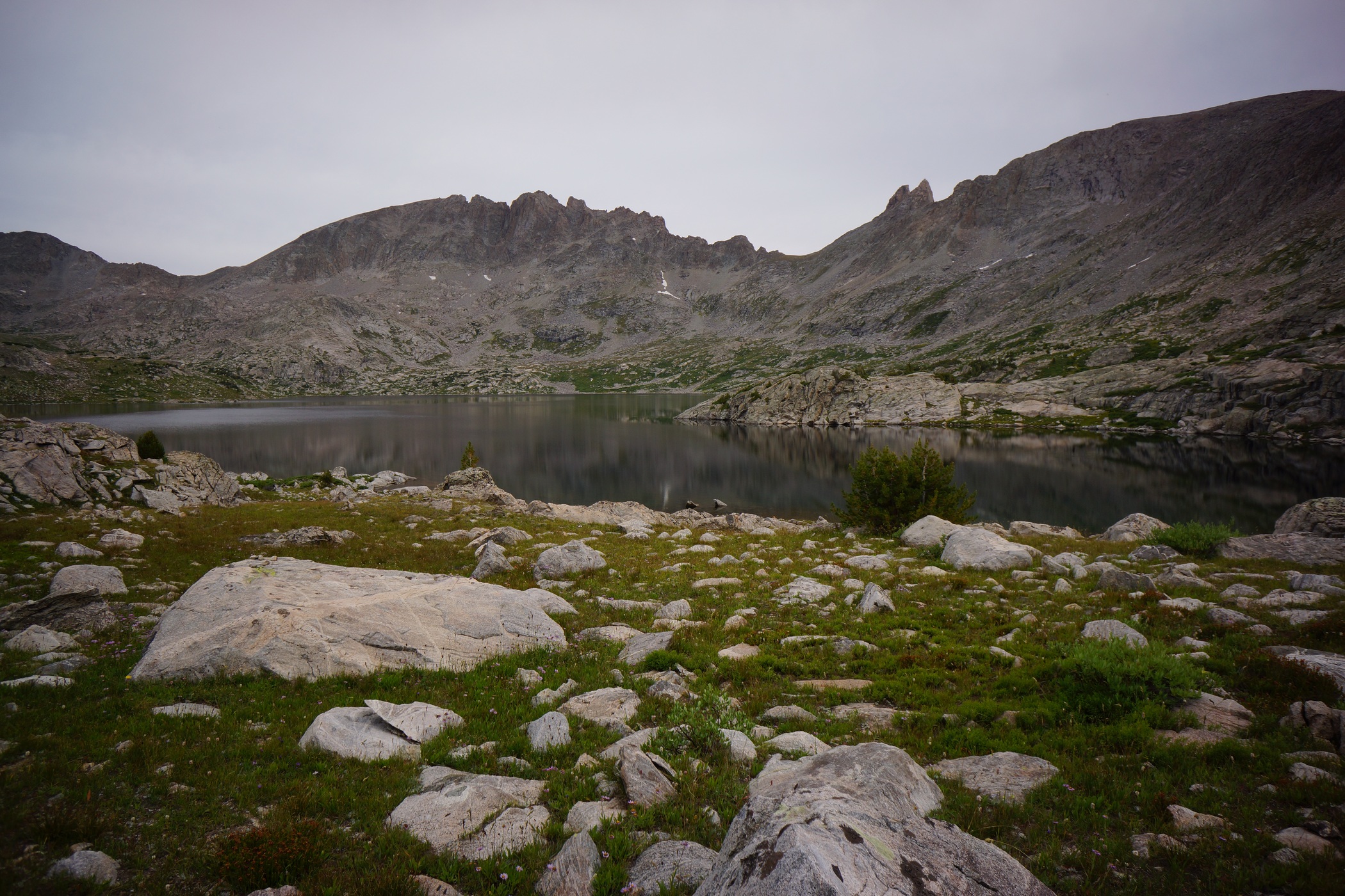
Once I approached Halls Lake, I realized that I should have crossed Halls Creek a little sooner. After some scouting around I was able to find a crossing point at the mouth. I started thinking about taking an alternate route now, as I approached Middle Fork Boulder Creek. I had planned on hiking along Middle Fork Lake, Lee Lake, and going up over Bonneville Pass. Instead, I chose to cross Middle Fork Boulder Creek and stay to the west of Dragon Head Peak and Pronghorn Peak, hiking along Rainbow Lake and Sunrise Lake. I would still end up at lower Bonneville Lake, but would avoid a major pass and possibly shave off a mile or two. Yup, that’s the plan.
Crossing Middle Ford Boulder Creek was the second of my two river crossings that required my water shoes during this hike. The was a lot of water flowing through the area and several branches of the creek to cross. From there, I had to climb up another 600ft to reach Rainbow Lake.
While hiking alongside Rainbow Lake, I saw a guy and his dog camped higher up the hillside. This was the first person I had seen in 2.5 days. I would also see a few more people before the end of the day. There was a good trail to follow, but it quickly petered out after Rainbow Lake.

Rainbow Lake
The Rainbow Lake and Sunrise Lake area had some excellent camping, and looked like a great spot to fish. In fact, I saw a few guys taking some trout back to their camp, and I was jealous. However, I still wanted to keep going, and make it to Bonneville Lake.
The Hike from Sunrise Lake to Bonneville Lake involved an awkward traverse of a hillside, where hugging the same contour line across was the best approach. Despite the lack of cairns throughout much of the Winds, there were some helpful ones throughout this section.

Bonneville Lake
The Bonneville Lakes area was incredible! Too bad the weather was looking worse and worse, with rain imminent. Someone took the primo spot, but I found a good site on the southwest side of the lake with some decent cover under pine trees.. This was closer to where I needed to head tomorrow morning anyways.

I set up camp around 4, with very light sprinkles on and off for a while. I was able to get everything set up and get some food in me before the rain got heavier around 5. While raining, I took a nap for a while until it stopped around 7:30.
I was glad to be “caught up” and on schedule now. The next 3 days should be relatively easy, with mileage in the 7-9 range. Hopefully the weather is nice and I can enjoy the extra time I have at camp.
Day 6 – Wednesday August 20th, 2014
Miles Hiked – 7.1
Route – Bonneville Lake to Skull Lake
Today’s Map
I had set my alarm for 5:45, but ended up sleeping in til 7. It rained last night, and everything was wet. It was 41°F in my tent this morning. Since I only had to hike 7 miles today, I decided to take it easy this morning. The last 4 days were tough, I earned it!

The sunrise over Bonneville Lake was awesome. I wish I had more time to spend here. The weather was looking good this morning, blue skies over the lake. I left camp at 8:20, and shortly thereafter the skies turned grey again..
 \
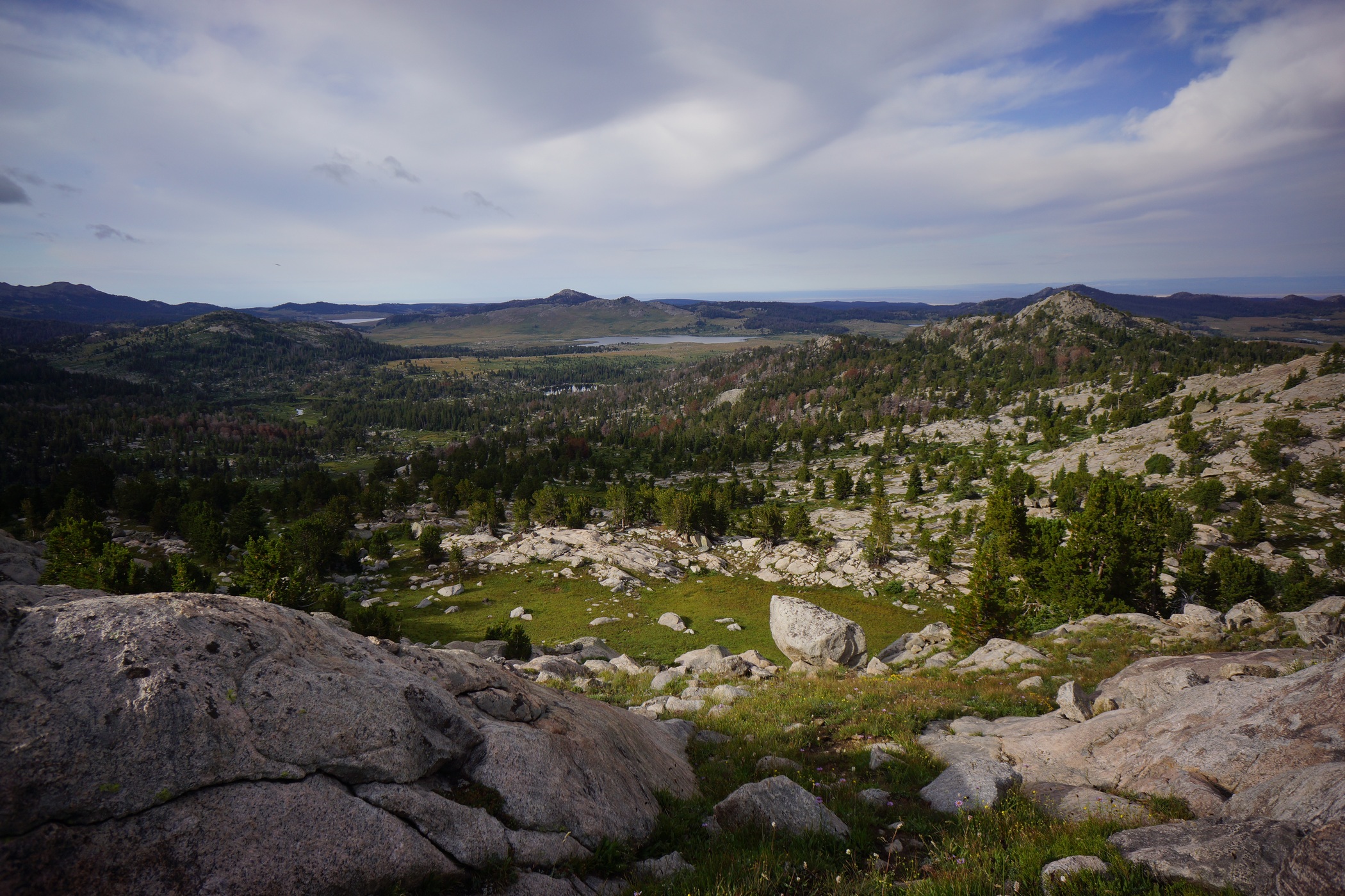
\
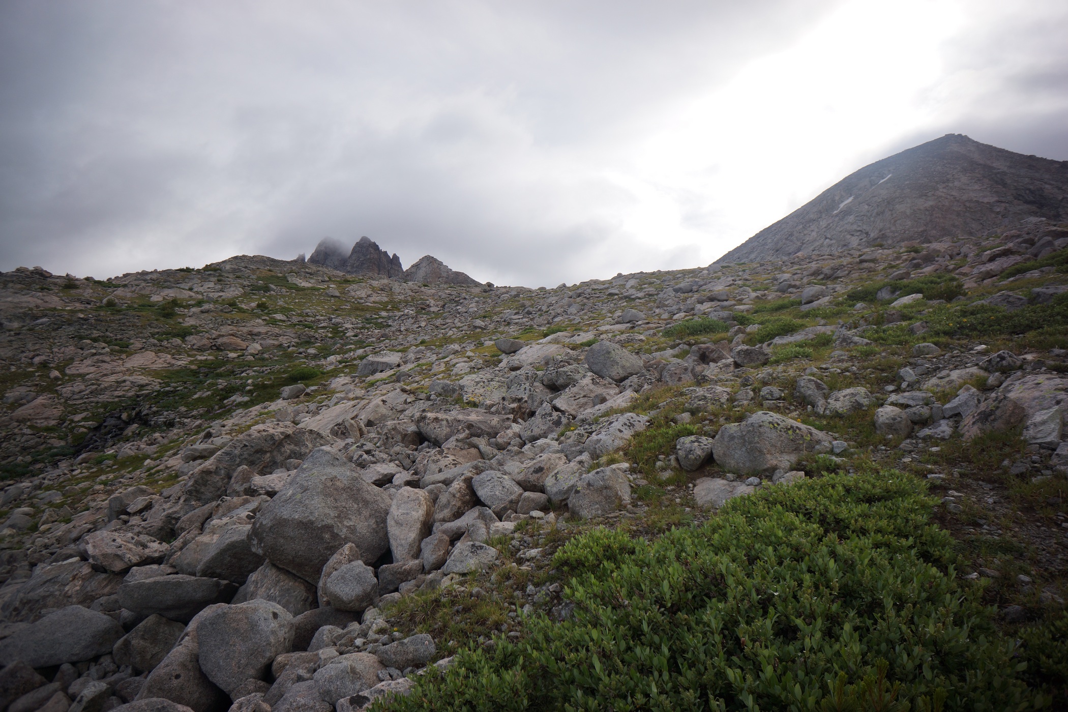
Mount Bonneville on the left
The hardest part of my day today should be the pass I am about to hike up now. I couldn’t tell exactly where the route would take me until I got right up to the base of it. I’m not sure what the name of this pass is, or if it’s even named, but it’s between Mount Bonneville and Raid Peak. There is a creek running down the mountain here and flowing into the southeast corner of lower Bonneville Lake. Stay to the right of this creek, as it’s too steep to go right up. I crossed it at about the 11,200 mark.

I could see Mount Bonneville now, which was engulfed in clouds. The rest of the way up to the pass was fairly easy, and I was at the top by 9:30.
 \
\
From the top of the pass, I had great views of this new valley. There wasn’t a name for this valley on my map or GPS, but it certainly looked large enough to be named. The East Fork River flows through here, so East Fork Valley sounds fitting to me. There was a steep descent of boulders at the top, then a long boulder field to navigate through. I was really impressed with the beauty of this area.
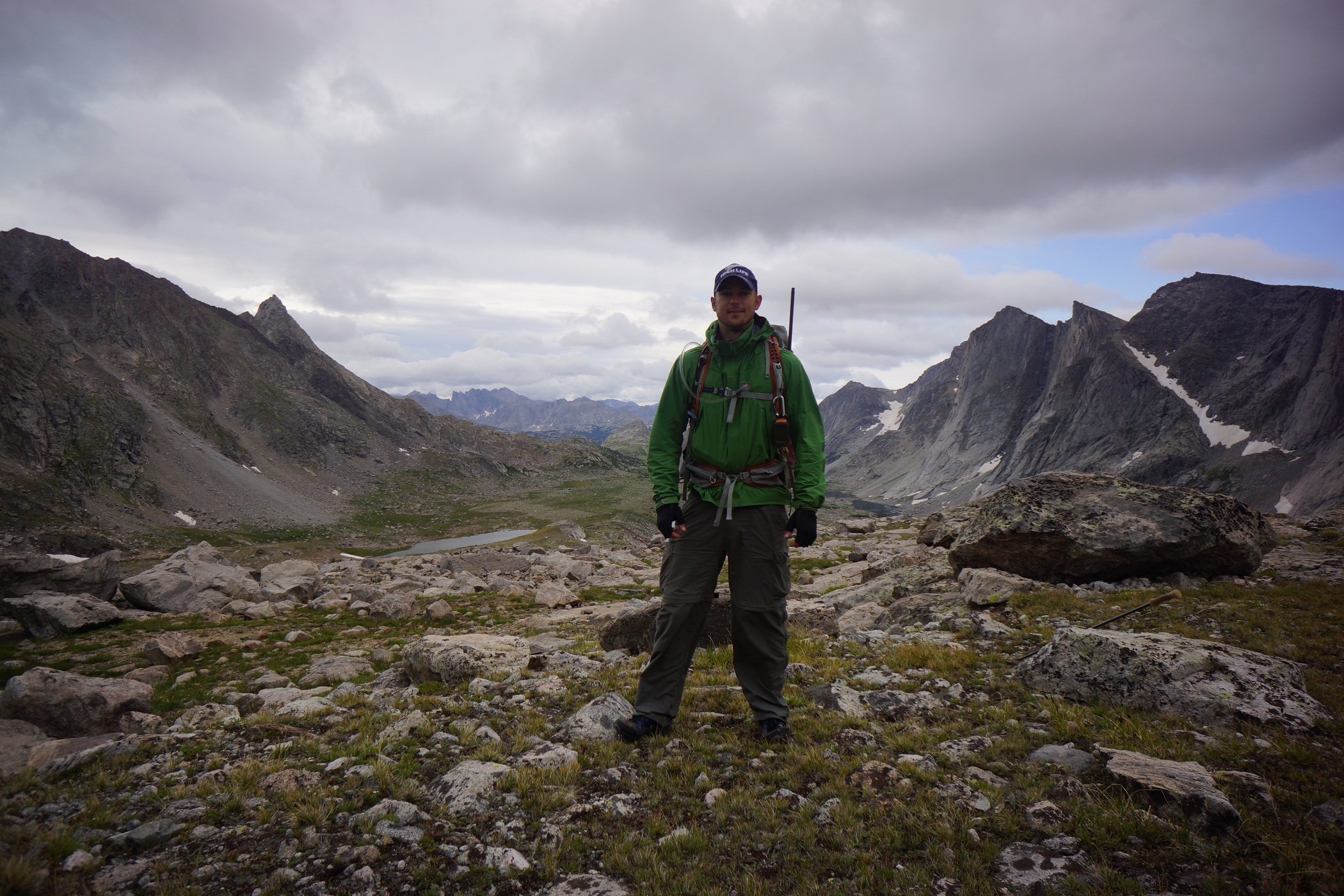


As I made my way down from the pass, the views got better and better. The valley really opens up and shows it’s size. To the east lies Mount Hooker, Tower Peak and Pyramid Peak. On the west, Mount Geikie and Ambush Peak. The view to the west was stunning, a solid wall of imposing peaks running for about 3 miles north to south. Simply incredible.

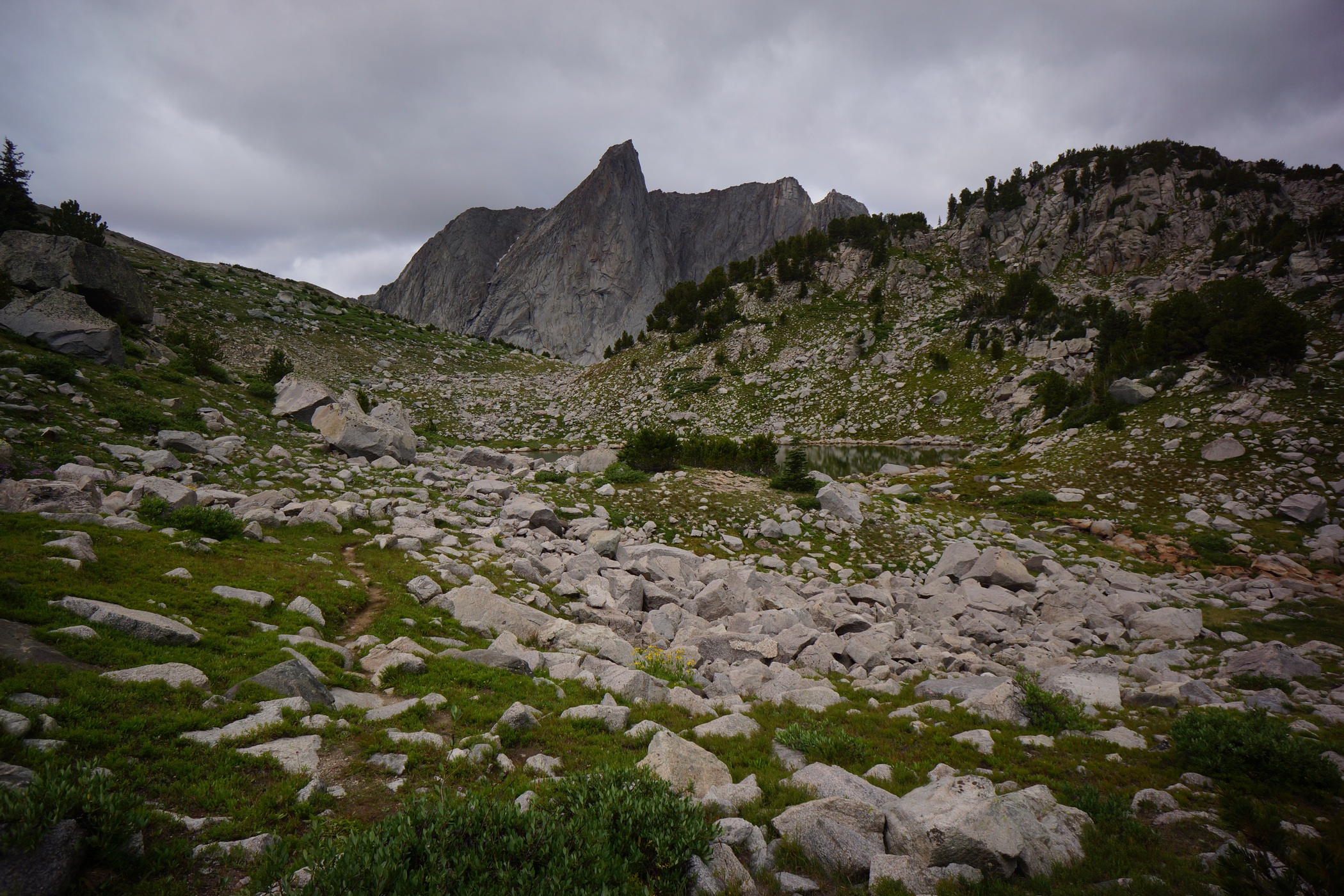
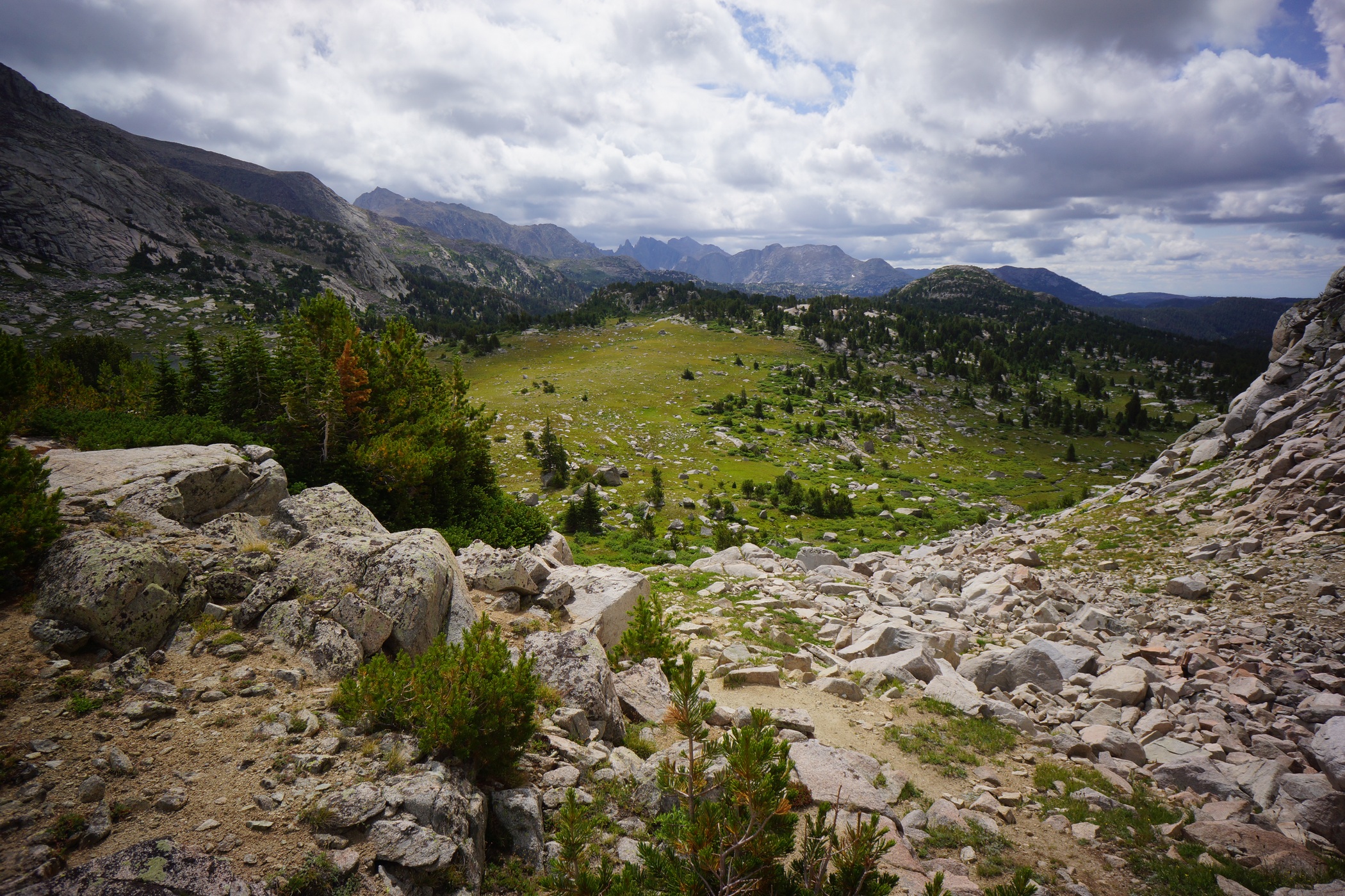
South of Pyramid Lake
I hiked out of the valley and down towards Pyramid Lake. I saw a few more people here in this area. There was a pretty well beaten path to follow at this point. My GPS is calling it the Haily Pass Trail. I remembered that I hadn’t seen any bear crap since going over the Pass this morning, which was good.


North of Skull Lake
After leaving Pyramid Lake, the trail passes by Mays Lake. From here, it was only about another mile to Skull Lake where I intend to camp for the night. It was easy hiking through this section, and I made it to Skull Lake at 12:20. Only 4 hours of hiking for me today.

My campsite overlooking Skull Lake
I set up on a spot overlooking the lake. I could see the Cirque of the Towers now in the distance from camp. The weather started to improve in the early afternoon, with increasing sun, despite huge cumulus clouds forming all around. I knew it was going to rain eventually, but for now, it was fishin’ weather!
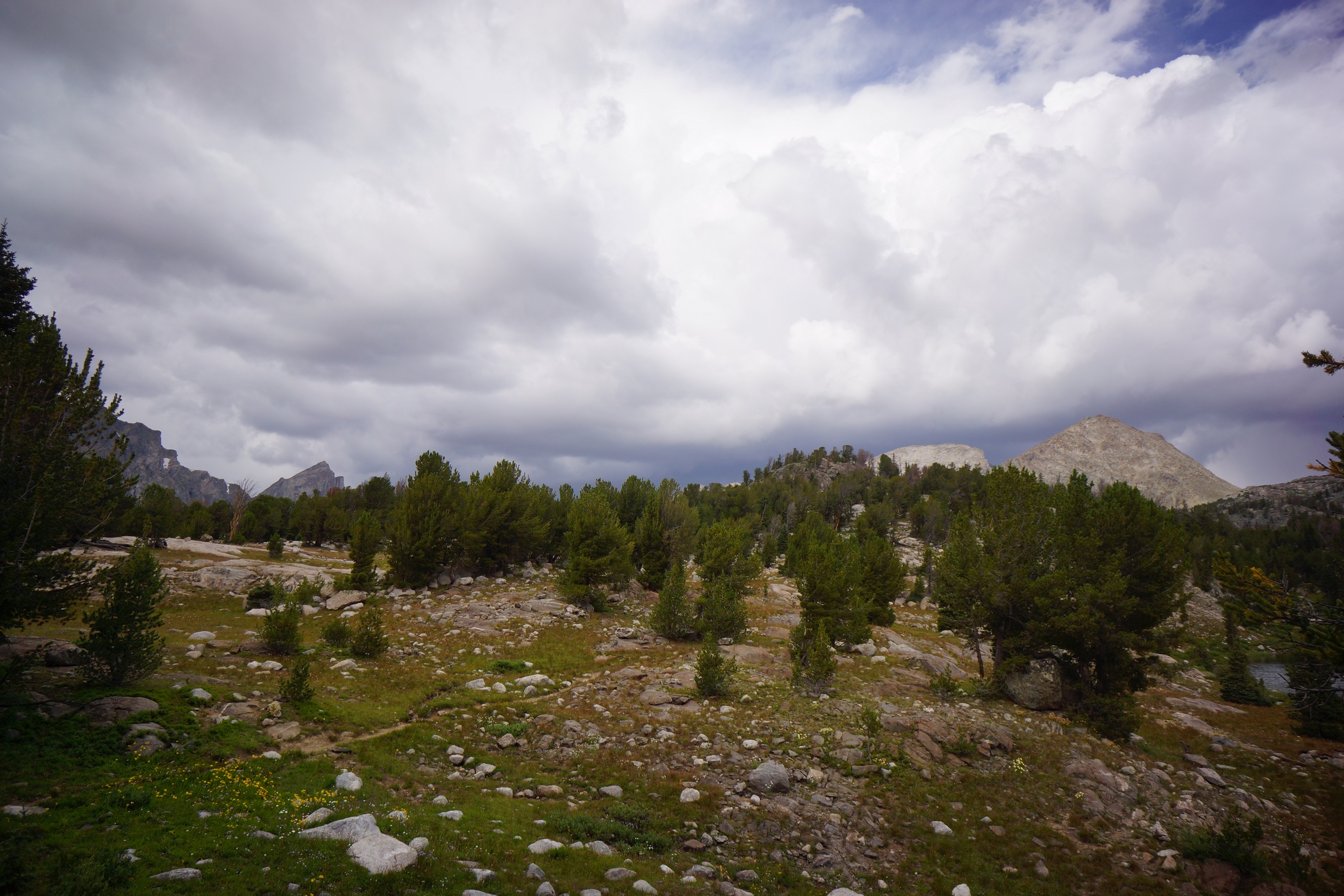
Near camp by Skull Lake
I headed down to the lake to do some angling. I know there is plenty of wood around to burn, so that’s not going to be an issue today. Same deal today, basically every cast is either a catch or a bite. However, these weren’t cutthroat trout, I believe they where Brown or Brook trout. Either way, they were on the small side at only about 7-8″, so I threw them all back. Damn, I was really hoping for fish tonight. Today would have been perfect too, since I have so much time at my disposal.

Pack llamas walking around Skull Lake
While down at the lake, a group of people passed by on the trail above with pack llamas. First time I had ever seen a llama on the trail. Many other people passed by my camp throughout the day, on foot and on horseback. Must be a popular area.

Skull Lake
By 3:30, the rain was here. I sat in my tent until 5 when it stopped. The, I fished some more. It was fun catching them, even with no intentions of keeping them. It was just so easy!

Clouds creeping in as the sun fades on night 6
My knees really stared to hurt today. I’m glad I don’t have many miles left. I’ve been relatively lucky with the weather so far, and I’m hoping that it holds out for another 2 days. The peaks were all engulfed in clouds by the time the sun went down. Hopefully this passes overnight.
Day 7- Thursday August 21st, 2014
Miles Hiked – 9.1
Route – Skull Lake to Cirque of the Towers
Today’s Map
I woke up at 6:45 this morning, but ended up sleeping in til 8. It didn’t rain much last night, but enough for everything to be soaked this morning. By 8:45 I had left camp, en route to the Cirque of the Towers.

Looking north from the south end of Skull Lake
It looked pretty nasty out this morning, and I knew I was going to be wet today. After leaving Skull Lake, I saw several people along the trail. I’ve come to realize that the southern end of the Winds is more popular than the northern end. I expected as much with the Cirque of the Towers drawing so many people to the south.

After crossing Washakie Creek, I hooked up with the Shadow Lake Trail and headed east. It was raining now as I made my way through the open valley towards Shadow Lake. My trail runners offered no protection from the water and my feet were soaked at this point. Still, my feet were plenty warm, as long as I’m moving anyways.

Along the Shadow Lake trail

Shadow Lake
Once I reached Shadow Lake, the weather was looking worse, and I decided to wait a while to see if the weather clears before heading up over Texas Pass. I sat under a tree for a while, with my knees at my chest and arms around my legs. I was still getting rained on, but kept hoping this was going to clear up.

Waiting out the rain
After 45 minutes, I got up and started looking for a better temporary shelter. I figured I’m going to be here a while and might as well try to get out of the elements a little more. I discovered an area surrounded by three garage-sized boulders offering some protection from the wind. On top of that, there was a bit of an overhang on one of the boulders, and it looked like a great spot to have a fire. It was pretty cold out and now I wasn’t moving around at all.
It’s amazing what you can find to burn, even when it’s raining out. With plenty of wood at my disposal, I made the best out of the afternoon here in my little hideout. I stayed here for a few hours until there was a little break in the weather. Not much, but maybe enough to go over the pass.

Between Shadow Lake and Billy’s Lake

Billy’s Lake
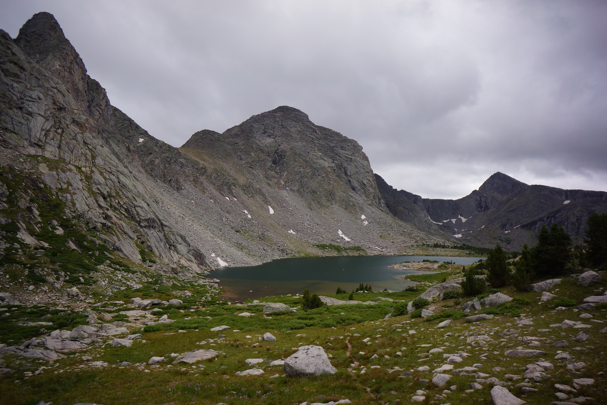
Looking down on Billy’s Lake

Texas Lake
After leaving Shadow Lake, the the next lake up in the chain was Billy’s Lake, then Barren Lake and finally Texas Lake. I’m sure the views would have been spectacular if they were not hindered by the clouds. The trail up Texas Pass was pretty good, well beaten and generally easy to follow. I expected as much from such a popular area. The weather held out until the final push up Texas Pass, when it started to rain lightly. Better than hail and lightning. I’ll take it!

Descending Texas Pass into the Cirque of the Towers area

Looking back up at Texas Pass
Coming down Texas Pass, there was some snow pack for the first few hundred yards of descent. I headed downhill through some talus fields and then the landscape gave way to grass. I figured there would be an obvious trial to follow down to Lonesome Lake from here, but that was not the case. There would be short sections of trail that would vanish without a trace. I expected the hike down to be relatively easy, but it was actually quite a pain.

First views of Pingora and the Cirque of the Towers


As I started to drop down into the valley, the Cirque of the Towers and surrounds peaks loomed above, with the tops of the peaks obscured by the thick clouds. I tried to imagine how beautiful it would be on a clear, sunny day.

Pingora Peak

Lonesome Lake
Pingora Peak was really impressive. It dominates your view of the landscape most of the way down to Lonesome Lake.


Hiking around the rugged west/southwest side of Lonesome Lake
My knees were hurting quite a bit now on the steep descent. It wasn’t until a few hundred vertical feet above the lake until I was able to follow an actual trail. Once down to the lake level, I had to make my way to the other side. This involved traversing the west/southwest side of the lake, which was also quite a pain. There were huge boulders all along the shoreline which made for some unwanted scrambling.

View from my campsite
It was now about 6pm as I made it around the lake. I couldn’t see anyone near the lake, and figured Marc wasn’t going to come up here anyways. I headed straight for the higher ground above the lake to find camp. I passed a handful of people up here camping, not as many as I expected. I found a spot and dropped my pack around 6:15.
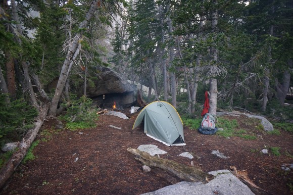
My shoes and pant legs were soaked from hiking through tall, dense wet vegetation the whole way down from Texas Pass. After setting up my tent, the next order of business is to start a fire and try to dry out my clothes and shoes. There was a large overhang on boulder at my campsite that was excellent for fires. It was large enough to store extra firewood underneath as well. The fire was great, much needed. My feet were pruned from being wet so long.
I wanted to explore the area more, but I just didn’t have the time. I got to camp so late today that I didn’t have time to do anything but gather wood and dry out my clothes. I was running pretty low on food now. I wasn’t overly hungry throughout the trip, but was a little tonight as I rationed my remaining supply to last me through tomorrow. I had brought about 14 pounds of food, however, my food it not nearly as dense as some of the more hardcore backpacker’s diets. I’m picky, and would rather carry more weight in food as long as it’s food I like. I don’t want to be choking down some nasty kibble just for the sake of saving weight.
I enjoyed a nice fire on my final evening in the Wind River Range, reflecting on the wonders and hardships of the trip. It’s a good thing the rewards are so great hiking here, because it’s equally as challenging. I’m ready for a hot shower and big, hot meal tomorrow!
Day 8 – Friday August 22nd, 2014
Miles Hiked – 9.3
Route – Cirque of the Towers to Big Sandy trailhead
Today’s Map
There were storms with heavy rain and wind all throughout the night. It was definitely colder this morning than it had been all week. The peaks above had a dusting of snow this morning as well, albeit very little. I slept in until 9:45, trying to wait out the weather for the climb over Jackass Pass. Dark clouds loomed above, with occasional thunder. However, I have a schedule to keep… Marc is waiting for me at the parking lot today and expecting me at 2pm.

The weather is “clearing”… time to move
I was packed up and ready to head back to Big Sandy trailhead by 10:30. I figured that the hike back is all downhill after Jackass Pass, and there should be a good trail to follow. Should is the key word here.

Hiking up Jackass Pass
The weather still wasn’t clear as I headed up the pass, but I couldn’t wait any longer due to my time constraints. The weather was fine until I reached the top, where there was high winds with rain/hail whipping me in the face. I had to put on my sunglasses! I wanted to take some pictures, but I didn’t want my camera to get wet.

This is about where I saw the fighter jets overhead
After I made my way down off Jackass Pass and to the vicinity of Arrowhead Lake, I heard an incredible noise overhead. I looked up to see an F-16 style fighter jet screaming across the sky. The trajectory suggested that it had just taken off from somewhere west of here. Seconds later, another jet followed, punching through the rising clouds above one of the peaks. I’ll never forget the sound they made as they echoed through the wilderness. That’s the sound of freedom right there! ‘Merica.
Once I reached North Lake, my route had me going around the east side of the lake. However, the west side looked like it would be easier, and that’s what I chose to do. Big mistake. It looked manageable at first, but quickly became the most treacherous boulder field of the entire trip. These boulders were enormous, some the size of garages or small homes. These were stacked and strewn about, with huge gaps between them This made hoping from one to the other impossible in spots. Not only that, but these boulders were so huge that they had an entire sub-chamber of smaller boulders beneath them. Sometimes there would be as much as a 20ft drop from the boulder I was standing on to the next one below. To make matters worse, it was wet and slippery. Lots of dead ends, backtracking and frustration. The worst part was how slow moving it was. Like I said, I’ve got a schedule to keep!

Following North Creek down hill. AVOID!!
Finally past North Lake, I thought my troubles were over. Again, I was wrong. Any trail I found just disappeared after a short ways. So, I started following North Creek down, thinking this was the easiest route. This was tough too as the slopes of the creek banks were steep and hard to walk along without losing my footing. All the vegetation was thick, thorny and soaking wet as well. Later, I realized the trail probably stayed higher up out of the ravine on the west side where the slope is more mild, along the 10,080ft contour line.

Big Sandy Lake
When I finally did reach Big Sandy Lake, I started seeing legitimate trails, and plenty of people. My maps showed an easy hike back to the trailhead now, but you never know.

Hiking the home stretch. Almost there!
The rest of the hike back to the Big Sandy campground was extremely fast and easy. I was on a mission now as I was just a little behind schedule. I passed a forest ranger headed towards Big Sandy lake who told me that I was getting out just in time, as the weather was going to be in the 20s tomorrow and they were expecting a few inches of snow. Yeah, definitely good timing!
I arrived at the trailhead at 3, 1 hour late. Marc was sitting in my car waiting for me. Walking back into the trailhead was a great feeling after such a brutal hike. I changed into some clean clothes and put on my sandals. Finally, I can air out my feet! And even though I had to drive now, sitting in such a comfortable seat seemed like a luxury now. Ah, back to civilization.
Marc and I exchanged stories of what happened in the past week now as we drove through the 35+ mile network of dirt roads back to the main highway. He ended up spraining his ankle on the way back to Green River Lakes campground the day we split up. He hobbled back to the trailhead, and hitched a ride back to Pinedale. He got a hotel and rested for a few days. When he felt a little better, he walked around town and hung out at a bar, playing pool with the locals. Then, he took a cab out here to the trailhead to meet me this afternoon.
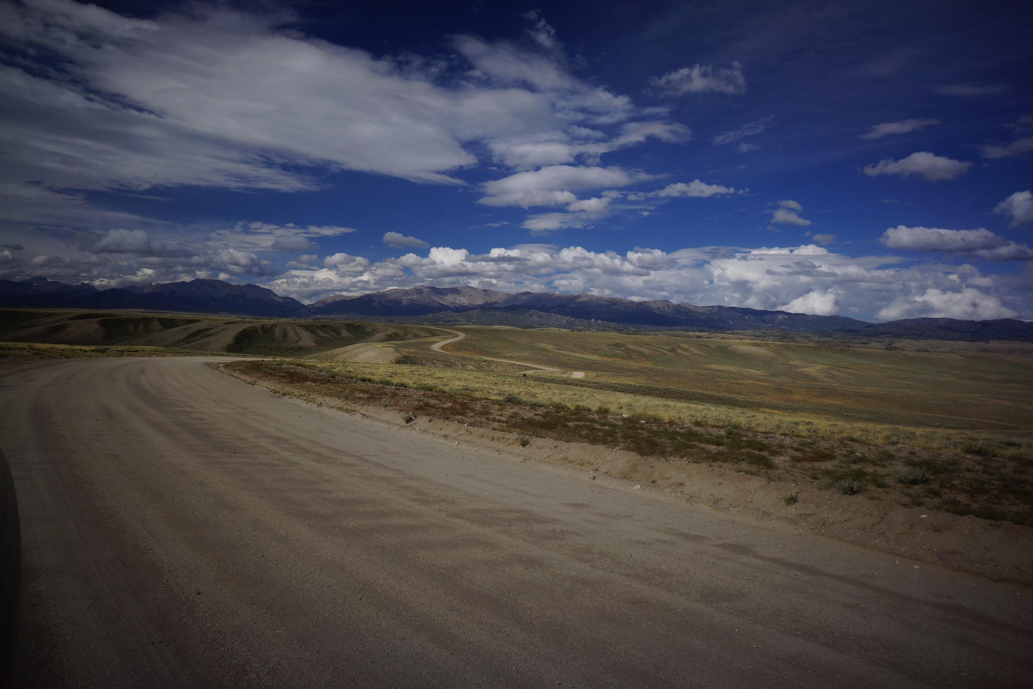


The drive back to HWY 28 through the 35 mile dirt road maze was pretty cool too. The landscape is completely different here compared to the alpine environment only a few miles away in the Winds. Vast, arid, and strangely beautiful. A huge storm was brewing to the west, and the sky was looking dark as hell. Good thing we’re going east.
From here we headed to Casper, WY where we got a hotel with an indoor pool and hot tub. It’s always nice to relax in a hot tub after a long hike! We ate at Poor Boys Steakhouse, which wasn’t as good as the reviews online made it out to be, but still satisfying after 8 days on the trail.
Final Thoughts
Well, the first thing that comes to mind is how much more challenging this hike was than I expected. I figured, the Rockies are the Rockies. I’ve hiked in Colorado, this will be just like that. No way. This is a step above that for sure. The hikes I went on in Colorado did not require any climbing at all. The High Route through the Wind River Range is largely off-trail, is requires much scrambling. Going over some of the passes here was similar to a class 2/3 summit of a Colorado 14er, climbing wise. Lots of boulder fields to traverse, lots of climbing. Even when you aren’t going over passes, there was a lot of climbing involved on this route. I’m not talking about sheer cliff faces with a 1,00ft death drop or anything, but plenty of spots where slipping could prove fatal.
The northern end of the Winds seemed to be the most remote and offered the most solitude. While previously used campsites were more common in the southern sections, they were tough to find in the northern end, mainly the Alpine Lakes area.
Mosquitoes and biting flies were unbearable in some spots, so make sure you don’t forget your head net. Food storage-wise, I used the bear hang that was at our campsite in Three Forks Park, but other than that, I relied on my OPsaks for food storage and smell resistance, and stored that away from camp at night in a larger roll-top bag. I didn’t have one problem with my food storage system, which is always a concern in bear country. Especially when you have seen a bear already!
Boulders… get used to hiking on them. Many, many miles of boulders, of all shapes and sizes. Some are steep, so steep you fear disturbing one will bury you in a landslide. Others are so large, they’re difficult to move from one to the other. A large portion of this trail is spent traversing boulder fields, so be prepared for that.
Hiking over the glaciers was awesome. Having crampons would have been nice but they certainly aren’t necessary. I was able to move through here with trail runners. It was slippery in spots, but not too bad. I wouldn’t want to do it without a trekking pole though. I guess I’m lucky I only broke one pole going up Knapsack Col.
I didn’t bring enough food this time, even though I had about 13+ pounds. I should have known better. I wasn’t hungry throughout the trip, except maybe the last night. I didn’t weight myself immediately after the hike, but 3 days later after pigging out on fast food the whole way home I had still lost about 15 pounds. I didn’t need to lose any weight really, and ended up losing several pounds of muscle. The physical effort needed for this hike was much more than I anticipated. Realistically, I’m not sure I’d even be able to stomach as many calories as my body would burn out here. I’m going to have to work on getting more calories in my food next time.
I felt bad for Marc and how his week turned out. I assumed he would camp at the trailhead or near it for a few days since he has all his food and equipment. But since he hurt his ankle, he just wanted to get in town and rest up properly, in a hotel. So, this trip was pretty costly for Marc, especially since he needed to buy almost all his clothing and a pair of shoes. I was disappointed that we couldn’t continue together, but was glad that I was prepared to continue on alone. Had Marc continued, he very well may have sprained his ankle on the trail somewhere more remote. I’m glad I didn’t get hurt myself. This route was no joke.
My right knee is still bothering me, more than 2 months later. I’ve been able to do squats and deadlfts, but can’t run on it, and I certainly wouldn’t trust it out on another 100 mile trek just yet. I guess it’s a decent time for a nagging injury, if there is such a time, since I don’t have any hikes planned for the future right now. With that said, I can’t wait til the next one. Get better, knee. Get better.
As always, questions and comments are welcome!
If you found my trip report useful, please don’t hesitate to leave a comment! Alternatively, if you feel you have any information you’d like to share with others regarding this hike, please feel free to leave that below in a comment as well.
[tcb_comment_count]