
Jordan River Pathway, MI – May 2014 | Backpacking Trip Report
Jordan River Pathway Backpacking Overview
View all of my Jordan River Pathway pictures
- Location – Jordan River Valley, Michigan (Mackinaw State Forest)
- Trail – Jordan River Pathway
- Trailhead – From M-32 & US 131 in Elmira, go south on 131 for 1.5 miles, turn right (west) on Deadman’s Hill Rd. Road dead ends at trailhead
- Park Type – State Forest
- Fees & Permits – None to hike or park, but $13 per campsite per night at Pinney Bridge campground
- Length Of Time Hiked – 2 days, 1 night
- Trail Type – Loop
- Miles Hiked – 21
- Trail Difficulty – 3/10
- Solitude – 2
- Fires Allowed – Yes (in designated campsites only)


Map of my route along the Jordan River Pathway

Map for both the Warner Creek Pathway and Jordan River Pathway
Notes
Pinney Bridge campground is the only place for hikers to camp along the Jordan River Pathway trail. There is potable water at the campground, as well as toilets.
Day 1 – Monday June 20th, 2011
Miles Hiked – 9.2
Route – Trailhead to Pinney Bridge campground

The weather was supposed to be nice today, but it was very foggy and raining lightly on and off when we arrived at the trailhead. I had already pushed this hike back a few days due to crappy weather, and could not push it back any farther. There was only one other vehicle parked here when we arrived.

We chose to hike the north side of the trail first, supposedly 8 miles. At times, the Jordan River Pathway merges with the North Country Trail. The hike starts off by dropping about 350ft into the valley. The landscape consisted of soggy meadows and various patches of forest.

It wasn’t long before we reached a detour sign due to a bridge being out on the trail. The map we have showed only one river crossing on this side of the trail, and it was a ways away. Regardless, we followed the detour uphill. The detour followed the Deadman’s Hill Loop, the section that connects both sides of the Jordan River Pathway. After about a mile, we reached the end of the detour. Now, we were on the opposite side of the loop, which we were going to hike tomorrow. The detour had us hike south a very short distance, maybe a few hundred feet, before heading downhill again. Soon enough, we were back on the northern side of the loop. Looking at the map, there was a pond or small lake along side the trail where the bridge was most likely located.

The trail meanders through the woods for a while before crossing the Jordan River along a dirt road. We stopped here for a while so Bryan could fish this area while I ate some snacks. Cedar swamp lined the banks of the river, which was fairly shallow here. It looked like it had a lot of downed tress and branches to snag on. After 20-30 minutes, we moved on.

The next section of trail was probably the coolest part of the hike today. It passed along the river for a while allowing us to get down to the banks. The trail was mostly above the river a ways in other parts, so this was nice. There is a fish hatchery located along the river on the opposite side that was now visible. Well, visible when the trail was elevated above the river… once down at the water level, the hatchery could not be seen. We had originally wanted to check this out but there didn’t appear to be any easy way to get across the river here.

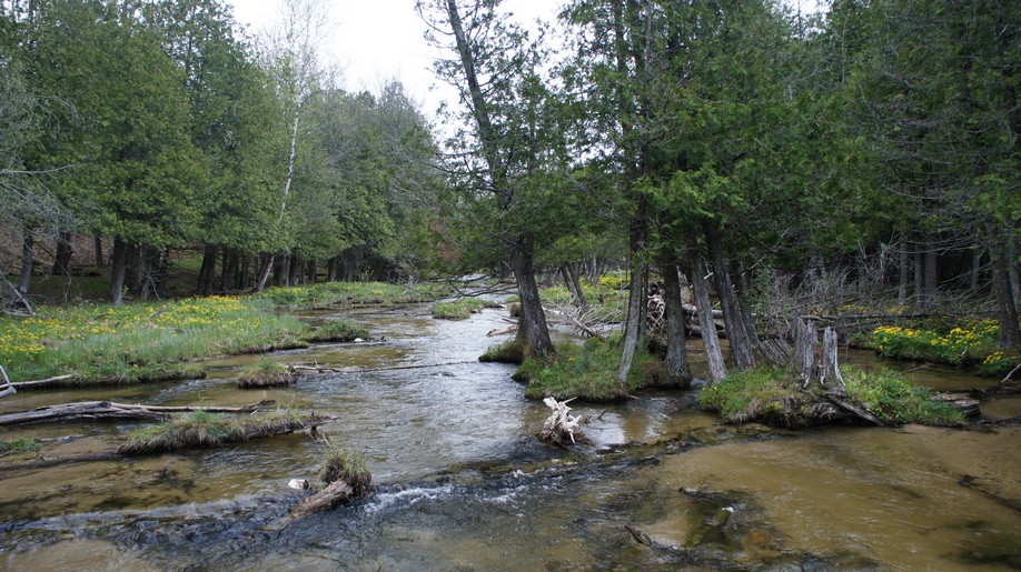
We followed the trail south along the river for a while, taking pictures and enjoying the views. There were a ton of yellow flowers along the river’s banks which added some nice color to the freshly sprouted greenery blanketing the landscape. There were many downed trees here protruding into the river, some of which had a large amount of soil on top of them allowing a good amount of grass to grow. You could easily walk out onto them and stand in the middle of the river on the 1 foot wide “planks”.

The trail eventually leaves the river and heads uphill. There was nothing steep here, but some gradual inclines. Now in the forest and away from the water, the yellow flowers disappeared and were replaced with tons of white ones. If you couldn’t tell, I don’t know my flowers very well!

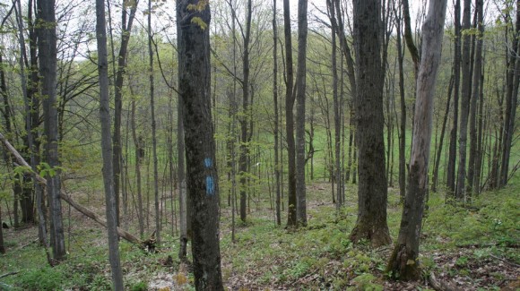
Approaching the southern end of the trail now, we were presented with a view on an open hilltop. Nothing spectacular, but still more than we see in southeastern Michigan. Around this time we passed a group of 4 people doing trail maintenance. Much thanks to the folks who maintain this and all the other trails out there. We found the Jordan River Pathway to be well maintained and easy to traverse just about everywhere.

From here, the trail drops a a little bit before passing through Pinney Bridge campground. The campground is located in a large open field, and is “hike-in” only. There are 15 sites here, each has a picnic table and a fire ring. There is also a hand pump well and pit toilets here. The cost if $13 per night, per campsite and is set up as a self-pay system. You must put cash or check in an envelope, fill out the form and deposit the money in a pole next to the registration area. Before depositing your envelope in the pole, tear off the receipt and post it on the numbered pole next to your chosen campsite.
The campground itself is not much to look at, being just an open field and all. However, it’s located just a short walk away from Pinney Bridge, which crossed the Jordan River on the very southern end of the loop. After setting up camp, we headed down to the river to do some fishing.

I was a little surprised at how nice the river looked once we got down to the bridge. The water was flowing pretty fast, but at least there are some deeper holes here to fish than we had seen upstream. Bryan and I went our separate ways as we both explored different sides of the river, hiking through the cedar swamps along the banks. I quickly found that the river is very braided here making walking along the banks more challenging. To get anywhere, one must hop from island to island over countless small channels of water flowing through the swamp.

Not long after getting down to the river, the sun finally came out. Coincidentally, the mosquitoes and black flies also came out around this time. They really came out in force, too. Although it was warming up now, I was forced to wear a long sleeved jacket with my hoodie on to keep my skin covered. I also had a mosquito head net which helped a lot. It’s difficult to see through and just annoying to have in your face all the time, but better than being eaten alive by bugs I suppose.


After having no luck on the downstream side of the bridge, I headed upstream. More of the same braided streams passing through cedar swamp on the other side. I could see many animal tracks in the mud through here. As with most spots along the river, there was a lot of downed trees and tons of things to snag on. I kept moving upstream for a while, having more fun exploring the banks of the river than actually fishing. Bryan was fishing on the other side of the river, and had just told me that he spotted a steelhead earlier. The snags in the water and ruggedness of the banks made it difficult to reach many of the best looking holes though, and he was not able to cast towards it. I made it quite a ways upstream before the various offshoots of water led me too far away from the Jordan River, and I decided to turn back.

After a few hours on the river, we wanted a break from the bugs and headed back to camp to see if they were any better there. They weren’t. We gathered firewood and got a fire ready to go for later this evening.
After an hour or so back at camp, we decided to head back down to the river to try our hand at fishing one more time. I had no luck and eventually gave up. It was really peaceful just sitting on the bridge next to the water, and this was good enough for me. Bryan headed back into the swamp in search of the steelhead he saw earlier. While sitting on the bridge, people occasionally passed by. Mostly, they were mushroom hunters, picking Morels. There are a lot of people out in the woods this time of the year picking Morels in Michigan. Bryan did end up catching one small rainbow trout, so at least one of us caught something.
Back at camp, we got a fire going pretty quickly to battle the bugs. I cooked italian sausages over the fire while Bryan ate a power bar and some beef sticks. The clouds returned as the sunlight faded away. We went to bed around 11pm.
Day 2 – Tuesday June 21st, 2011
Miles Hiked – 10.8
Route – Pinney Bridge campground to trailhead
I slept decently last night, and it wasn’t too cold. However, the clouds remained, and I was beginning to doubt today’s forecast of “sunny”.

We hit the trail around 9am this morning. Today’s hike should be around 10 miles back to the trailhead. The southern side of the loop is further from the Jordan River, but is supposed to have a few high points with views. We passed a marker along the trail indicating that we are crossing the 45th parallel, the half way mark between the equator and North Pole.


Next we crossed Cascade Creek. Lots of downed trees here along the water. The trail follows along the creek for a short distance.


He’s standing on solid ground
The trail then climbs up to Landslide Overlook. There were two other people up here leaving as we arrived. They had no backpacks or any other hiking gear, so I assumed there was a road nearby that they accessed this area from. At this high point, you can see for quite a ways. Views like this are few and far between in Michigan, especially in the Lower Peninsula. So, I figured this would be a good time to take a break and eat some food and take some pictures.

After leaving Landslide Overlook, the trail heads down to Section 13 Creek. Yup, Section 13 Creek. Awesome name, very creative. The trail follows the creek for about a half mile, which was nice.

The rest of the hike today was rather boring, from Section 13 Creek north to the trailhead. There were no more creeks to cross and no more vistas until we reach the parking lot. We were just hiking through nondescript forest for the last 5 miles or so. The forest was starting to come alive again with lush greenery though, and in a few more weeks, the trail may be overgrown in spots.


Bryan’s knees were starting to hurt by the time we reached Deadman’s Hill, which was just around the corner from where our car was parked. This was the other well-known vista this trail has to offer. The view was definitely better than Landslide Overlook. Here, you had a much more open view, and the scenery was better. To the north, the Jordan looks like a trickle of a creek winding through a marshy lowland area. To the south, the river cannot really be seen due to the thick patch of cedar trees along its banks. From up here, the dark green color of the cedar trees really stands out among the deciduous trees farther from the river.
The parking lot was packed when we returned around 2pm. We hiked around 11 miles today, and about 21 total for the trip.
Final Thoughts
I was glad to have finally done this hike as it is known for being one of the best in the Lower Peninsula, albeit a rather unknown one. There were some really pretty areas here, again, for Michigan’s Lower Peninsula. This is not a challenging hike, despite a few ups and downs here and there.
I was hoping the fishing would have been better, but isn’t that always the case? There were just too many logs in the water to snag on, and most of the fish we saw were tiny. However, for me, Pinney Bridge was the highlight of the trip. It was a beautiful spot to fish or just hang out by the river. It was a popular spot though, as I saw several people passing through here. There is a parking area near the bridge along Pinney Bridge Rd.
Pinney Bridge campground was convenient. It was convenient having the hand pump well there and the toilets, but the campground makes you feel like you are car camping at a state park, not along a hiking trail.
I would definitely hike here again, but the Manistee River is still my favorite Lower Peninsula hike.
As always, questions and comments are welcome!
If you found my trip report useful, please don’t hesitate to leave a comment! Alternatively, if you feel you have any information you’d like to share with others regarding this hike, please feel free to leave that below in a comment as well.
[tcb_comment_count]


