Continental Divide Trail – Flagg Ranch to Old Faithful Hike Overview
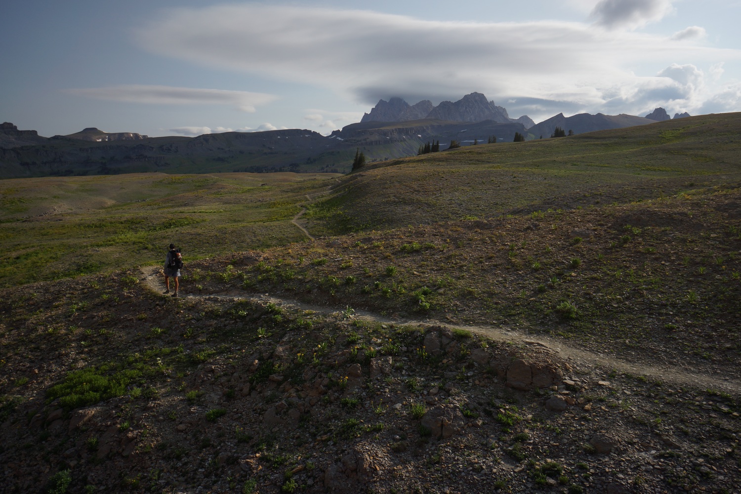
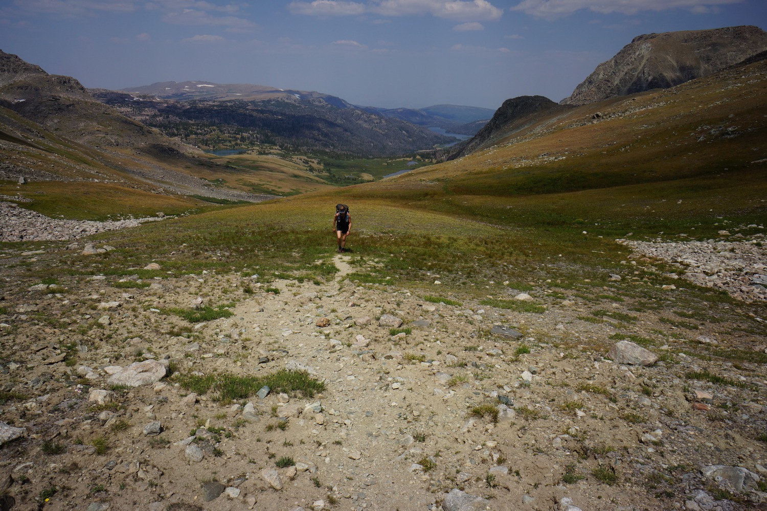
After leaving Flagg Ranch, we enter Yellowstone through the south entrance. The only wildlife I saw was a fox, very disappointing for a place known for it’s animals. Much of our route through Yellowstone was wet, swampy and not particularly scenic. The highlight of this section was the Bechler River and the Mr. Bubbles area. Here, we were blown away by majestic waterfalls and soaked in a natural hot spring.
Wednesday August 22nd – CDT Day 124
Woke at 7am. Packed up camp, just in time to beat the rain. Headed over to the lodge to grab breakfast and ate by the fireplace. Didn’t start hiking till after 10.
Walked hwy 191 north about 3 miles to the Yellowstone south entrance. Got our Backcountry permits at the snake River ranger Station.
My GPS showed the South boundary trail starting from a road that was signed “employees only”, but we followed anyways. Sure enough, the was trail was there. Hmmm.
The south boundary trail was pretty boring. Kinda like walking power lines or a pipeline, just a staight line through the trees. There were a couple of creek fords. Bridges are pretty much non-existent in Yellowstone.
Filtered water from the outlet below grassy lake dam. Shortly after, we crossed a river. This one looked bigger than it was. Crossed with no issues.
Shortly after, the skies darkened. It was thundering and lightning in the distance. The wind picked up and eventually it started pouring. There was some hail involved as well.
We hiked a few more miles in the cold and rain. The rain let up but the damage was done, being soaked. When we reached our campsite, we were greeted by a sign warning of a bear frequenting the area. Oh boy.
I ate dinner in my wet clothes as the temperature dropped. Hit the tent as soon as possible, around 9:30pm.
Miles – 20
Total Miles – 2047
Rain – yes
Sleep – Backcountry, tent
Animals – none
Thursday August 23rd – CDT Day 125
Everything was soaking wet in the morning, and it was cold. Cold and wet shoes, socks, boxers and shirt. The skies were still dark and looked like rain. We were all slow to leave our tents and get going.
Most of the morning was spent fording small creeks and sloshing through swampy fields. It was not very scenic either, so our spirits were low.
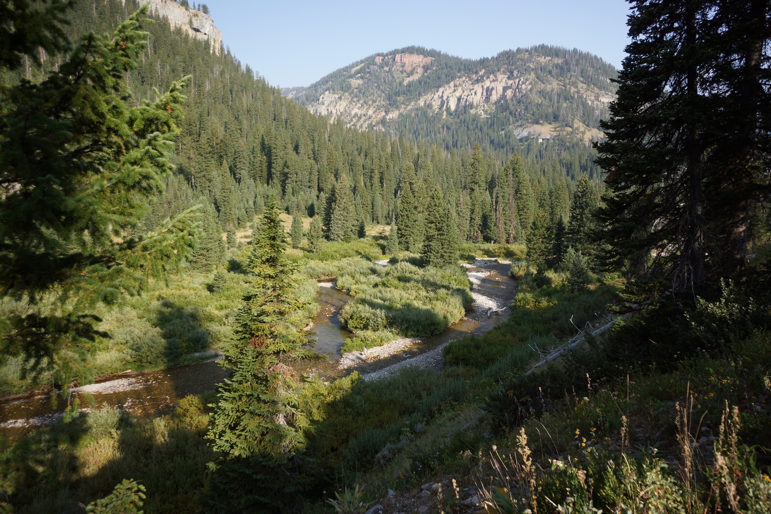
Reached the bechler river. It flows through a large meadow here. Hopeful and I were in front and Katie was behind. When she caught up, she had seen a black bear momma and cub, only minutes behind us. Pretty cool.
Now the trail follows the bechler River. This was the most scenic thing we’d seen in Yellowstone thus far.
As we hiked up stream, we encountered several waterfalls. Some were huge, really huge! You could feel the mist really far away. Very impressive.
Father upstream, there were many cascades. This river is wild. We really enjoyed this section.
We forded the river a couple times. Water was mid-thigh deep and swift, but manageable. Ran into trail crews working in this area, they have to Ford the river twice a day.
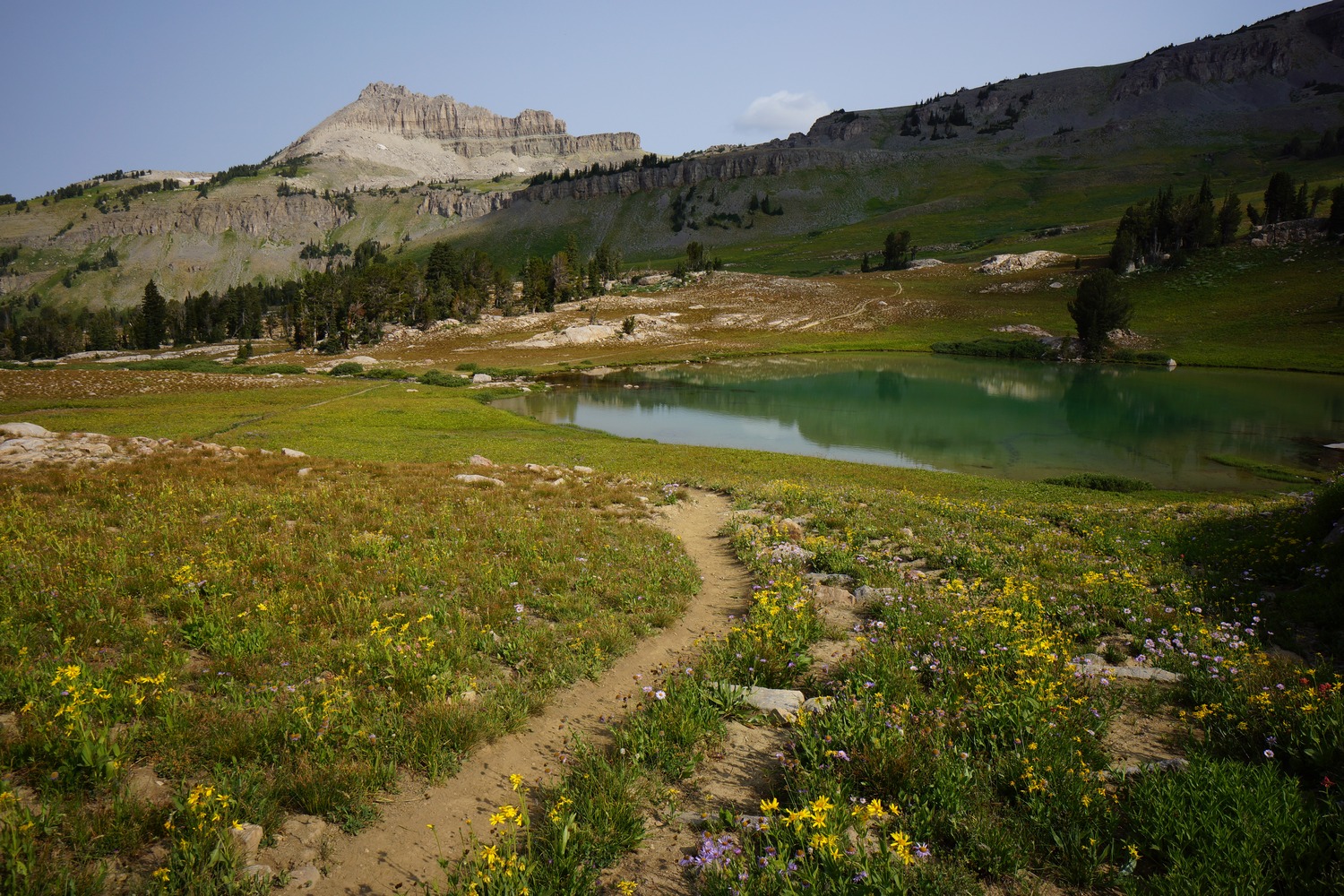
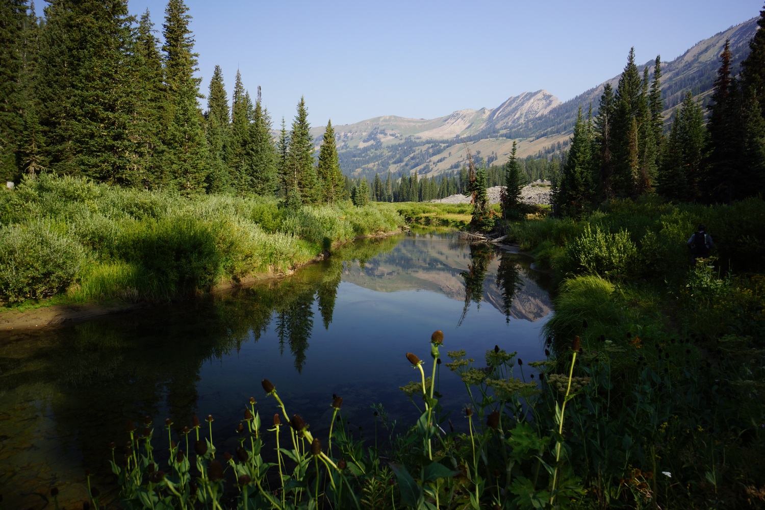
There were some geothermal features in the meadows now. Hot pools of Sulphur smelling water.
We reached the junction for a hot spring named Mr. Bubbles. It was a half mile walk to get to the spring, and we could see large plumes of steam rising in the distance.
Approaching the spring, there were several geothermal features nearby, mainly on the opposite side of the creek. One large one resembled mammoth hot springs, for reference. We thought this was Mr. Bubbles at first until we followed the trail to something more obvious.
Mr. Bubbles hot spring
Mr Bubbles itself was not as impressive visually, but makes up for it by being a great soak. There were a couple guys in the spring when we arrived, who later left us alone. We soaked for a while and really enjoyed this spot. What a wild place to be. Natures hot tub!
Miles – 18
Total Miles – 2065
Rain – no
Sleep – Backcountry, tent
Animals – none
Friday August 24th – CDT Day 126
Stated hiking around 7:45. Along the bechler was a couple more interesting spots like twister falls, but nothing like yesterday.
Must of the hike into old Faithful was pretty boring to be honest. Just woods and not much to see. I covered great ground though. There were a couple of geothermal features near firehole River.
Reached old Faithful at 1pm. Ate at the geyser grill. Food here is subpar at best. Got a shower at the old Faithful inn. Showers are free for CDT hikers. Nice!
Didn’t need much from the general store for resupply, since I carried extra food from Flagg ranch. Just some almonds to add to my m&ms.
Hopeful, Katie and I agreed to meet up by the front entrance to the general store. Let’s go and Reed were here as well, who are southbounders. Later, we all ate dinner together at the bear pit restaurant in old Faithful inn. Another northbounder named old scout joined too.
Katie met a guy who worked here at the park who offered to let us camp at the RV park site. After dinner, we headed there and set up for the evening. Sat by the fire for a while and in bed around 11.
Miles – 17
Total Miles – 2082
Rain – no
Sleep – Backcountry, tent
Animals – fox
Continental Divide Trail – Jackson to Flagg Ranch Hike Overview
After walking 2 miles into Jackson, resupplying and walking across the valley to Wilson in one day, we entered the Jedediah Smith Wilderness and Grand Teton National Park. We hiked our own version of the Teton Crest Trail winds in and out of both of these land administrations. The Tetons are pretty damn grand to say the least! North of Lake Solitude, we took a steep cross country route out of the basin and over to the west side of the divide. Lots of wildflowers, delicious berries to eat, and bushwhacking!
Thursday August 16th – CDT Day 118
Started hiking at 7. It was less than 2 miles to the trailhead. From there, we walked into Jackson.
When we reached the downtown area, the search for a breakfast restaurant was on. We landed at The Bunnery. Good food, but pricey.
Everything in Jackson is expensive and the people are yuppity. Lots of tourists and tons of traffic. Jackson was not my favorite town stop. Fortunately, we were just getting what we need and walking out later.
We hit up an outfitter, the ranger station and a couple stores. Then we headed over to the rec center to take a shower. They had a pool, hot tub and sauna, so we spent about an hour here taking advantage of the amenities.
Lunch at DQ, then headed to the other side of town. Here, we hit the library for a few hours. Hopeful and I spent some time researching the big sky alternate. Feeling the crunch for time, in terms of reaching Canada by Oct 1st, it was a good idea to have this as a backup.
I called Patagonia to arrange for a new capiline lightweight baselayer shirt to be sent father up trail. Mine has a forearm sized hole in the back.
We then went to the grocery store for food and picked up dinner. Katie found a ride to Wilson, so hopeful and I will do the road walk and meet her there. This will set us up well for entry into the Tetons tomorrow.
I didn’t find Jackson to be very scenic. However, the views were much nicer heading west out of town. The road had a bike path next to it that we followed much of the way. We didn’t leave Jackson till after 8, so it was going to be a bit of a night hike.
There was road construction on hwy 22, next to the bike path. Lots of traffic backed up and honking horns. Kinda hard to deal with after spending so much time in the wilderness.
Katie texted us and said we could camp in the backyard of the guy who gave her a lift. She gave us an address and we headed that way.
We took what liked like a short cut, and it dead ended at a gate with a keypad. No private property signs though. We could walk around the gate. As we were contemplating what to, in the darkness, a truck came flying the corner from the opposite side of the gate. Illuminated by the headlights, all I could do was wave and see who they where and their intentions.
As it turns out, the 5 guys in the truck were trying to take a short cut themselves and avoid some of that traffic. They had just spent last week in the wind river range themselves. When we said we had been walking since April, they have us each a cold beer.
Moments later, another truck pulled up behind the first truck. This was the landowner, and she asked what we were doing. Truck guys said looking for a short cut to pass through, the woman said OK and opened the gate. We said the same thing and she wouldn’t let us walk through. We were only about .3 miles from fish creek road, half mile total from our destination. I mentioned it would be an hour or more detour for us, but she didn’t care. That really sucks!
It was 10:30pm now and we started the long walk around. Back to the road construction, then another pitch dark bike track and country roads with no street lights. I had a terrible headache, and was finding the walk difficult near the end.
We finally reached the house Katie was camping at sometime after 11:30pm. The house backed up to a river, and were told to camp there near it. Fine. I know there’ll be condensation in the morning, but I’m so tired I don’t care. Cowboy camped under the stars. Fell asleep around 12:30am.
Miles – 18
Total Miles – 1939
Rain – no
Sleep – backyard, tent
Animals – deer
Friday August 17th – CDT Day 119
Sure enough, everything was wet this morning. Got up at 7 since hopeful and Katie were already awake. Packed up and went to a bagel shop down the road for 2nd breakfast. Already ate leftover chicken strips and croissants earlier.
Stated hiking hwy 22 up to Phillips trailhead sometime around 9:30. It was already hot out. The road walk kinda sucked with all the traffic and vehicles that don’t get over a little when they pass by. Some came awfully close.
Lots of cars at the trailhead. The people faded out when the trail split off for ski lake. The views also began to open up.
Lots of wildflowers high towards the pass. Good view at the top. Now we enter the jedidiah Smith wilderness and begin the teton crest trail.
The farther we hiked, the better the views became. The trail winds into a new valley. On the other side, rock formations that look like they’re part of a castle. Beautiful.
On the next pass, we entered grand teton National park. The trail winds back and fourth between the national park and wilderness throughout the teton crest trail.
The trail passes by Marion Lake, a really nice spot. The kind of place you only dream of camping on the CDT. But as always, there’s more miles to cover before I can feel good about the day’s progress.
Great views continue. Good trail, helps to keep a good pace. There was a lot of climbing today and with heavy packs, it was tiring. I listened to some music today for the first time in a while. This helped keep me going.
A few more scenic miles and we were approaching the final pass leading up to death shelf. I’ve seen some great pictures from this area and so I was looking forward to it.
Death shelf did not disappoint. However, it was overcast and it killed the sunlight, so it was not as photogenic at I hoped for. There’s always tomorrow.
Miles – 21
Total Miles – 1960
Rain – no
Sleep – Backcountry, tent
Animals – marmot
Saturday August 18th – CDT Day 120
Nice hike this morning coming out of death shelf.
The Tetons have been looming on the horizon for many miles now, growing bigger with every step. Amazing views in an otherworldly landscape!
Alaska basin was nice. Mainly, the northern section. Tons of wildflowers.
Grand Tetons and Schoolroom Glacier
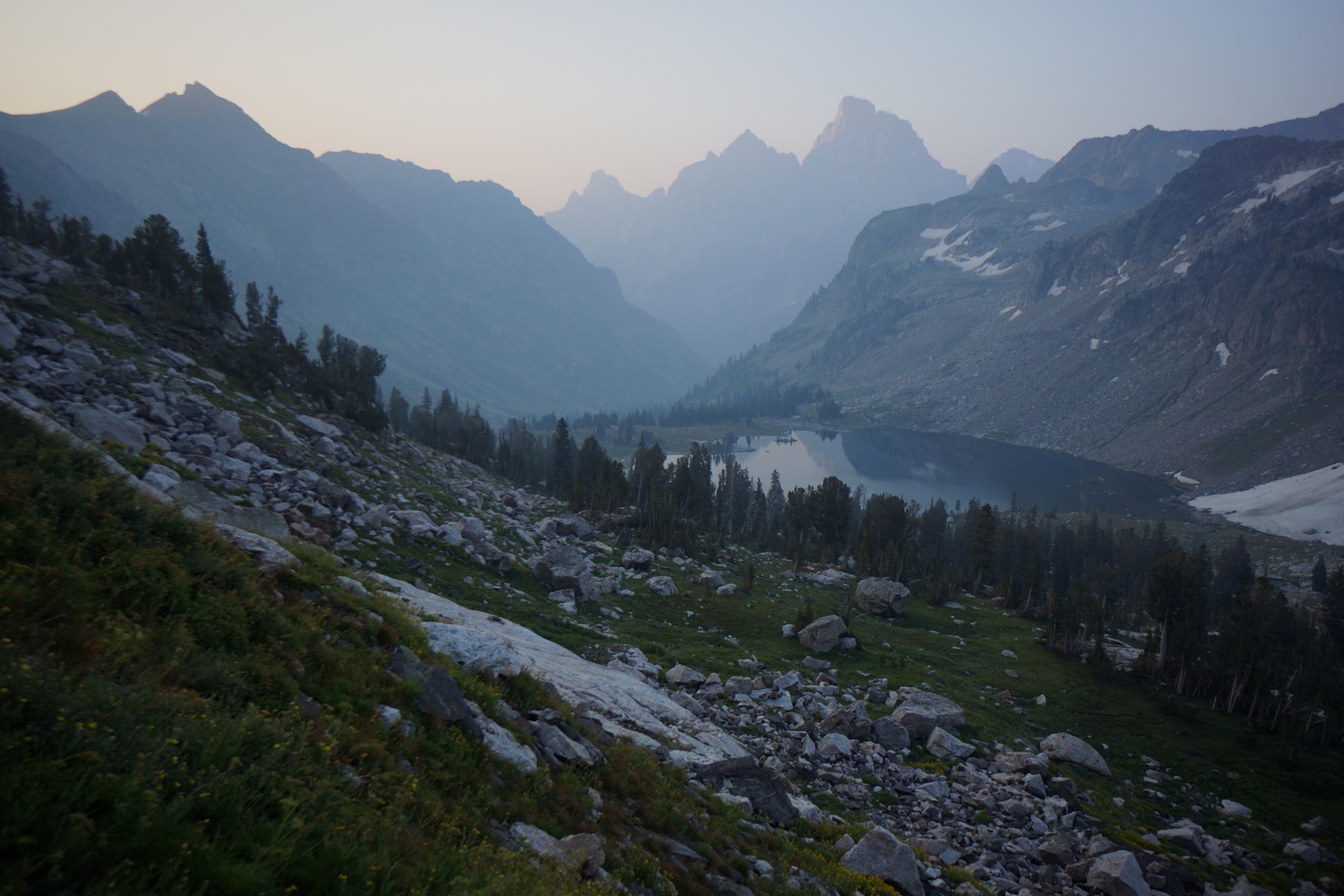
At the top of hurricane pass was our first unobstructed view of the three tetons; grand, middle and south. Incredible! Oh and fun fact, tetons is French for “tits”. French fur trappers who discovered the area named it as such because the pointy peaks reminded them of boobs. Grand Tetons literally means “big tits”.
Below hurricane pass lies schoolroom glacier. It has a large moraine that was now acting as a berm to hold back a small lake. Icebergs in the lake, beautiful water.
The upper cascade creek area was just incredible. On par with the wind river range. Our pace reflected this too.
Rain clouds building on and off. Hiked down to the junction with solitude lake, and took this trail uphill. Saw a Moose on the way up.
Lake Solitude and The Grand Tetons
Awesome views from Lake Solitude. Tons of people here too. Pretty ironic name if you ask me.
Now it’s time to climb out of the basin. Around the lake and up hill. Some steep rock climbing with limited holds involved.
Now up on the highest shelf, we could see no easy way to the top anywhere. The skies were also pitch dark and looked like rain at any moment. We made the call to head back down to the lake.
May try another way out of the basin tomorrow or head up paintbrush ridge in order to drop down to mink lake to try another way over the crest.
Miles – 20
Total Miles – 1980
Rain – yes, light
Sleep – Backcountry, tent
Animals – marmot, moose
Sunday August 19th – CDT Day 121
Started hiking at 6:30am. I spotted another potential exit from the lake solitude basin. It was a grassy chute that looked increasingly more appealing the closer we got. It was steep, but not as bad as last night’s failed route.
Made it to the top of the chute. It was hazy today due to forest fire smoke, coming from who knows where. Nothing close by to my knowledge. Grand Teton was a prominent feature looking through the haze. Really incredible views from here.
After the chute, we walked over some talus fields and pools of melt water on relatively flat ground. Not what you think of when you imagine mountain ridgelines. More impressive views on the other side of lake solitude.
Next we followed a ridge over to Littles peak. It was a bit of a knife edge for a hundred yards or so. Pretty cool!
We traversed around Littles peak instead of going up and over. This was mostly a great choice, avoiding elevation gain and boulders. First half was grassy and somewhat flat. Then it became steeper and took some work to find a way down.
Lunch break by a steam, then moved on. Nice walking for a while. Passed some scenic little lakes which reminded me of a scene in the Sierras for a bit.
The trail then goes up and down for a while. Nice little basins and ridges.
We took a break at a stream above bitch creek. Yep, bitch creek, that’s the name. Descended to the creek then ascended dead horse pass. Something like 1800′ in 1.1 miles. No wonder why they call it dead horse pass… The horse is dead by the time it reaches the top. Just like I felt. Great view and break spot at the top though.
We made quick work of the descent. Covered good ground through the valley and took another break before the ascent to camp lake.
The first part of the climb to camp lake was the steepest. Pretty steep for about a mile. The terrain flattens out some before the lake but I was already whooped at this point. Hopeful and Katie were ahead waiting for me at the lake. It was 7:30pm now, and we decided to stop here for the night.
I went to bed around 8:15 tonight since I was so tired. Katie and Hopeful stayed up and had a campfire. Today involved a ton of climbing, at least 5-6k feet.
Miles – 19
Total Miles – 1999
Rain – no
Sleep – Backcountry, tent
Animals – deer
Monday August 20th – CDT Day 122
Left camp lake at 8am. We’re hoping to make it to flagg ranch today, or at least very close.
We followed good trail up to a junction for nord pass. From here we needed to take a trail that was on the map but didn’t seem to exist on the ground. More bushwhacking, Yay!
We eventually picked up a faint trail that looked like it hadn’t been used or maintained in many years. Made it to the pass that will drop us down into Webb canyon and enjoyed a hazy view. I hit my 2000 mile mark here which was a nice milestone.
The route down was off trail but an easy grassy slope. We hit trail and followed it down to Moose creek. However, this is where the trail ended.
We crossed moose creek over some downed trees, the last time we’d keep our feet dry. From here on out, it was a nasty bushwhack. Steep slopes, thorn bushes, downed trees and tall vegetation hiding holes, rocks and sharp downfall. This forced is into the river a few times, just walking downstream. The water was cold though, and progress was limited to how long you could stand the pain. This was one of the most difficult sections of bushwhacking I’d face along the entire CDT.
After a couple miles of the above, we hit a poorly maintained trail that faded in and out for a mile or two. More bushwhacking, but not as nasty. After passing through a meadow, the trail seemed to be maintained like normal. Great, because we still have a lot of ground to cover now.
Took a break and was surprised to see 4 hikers coming up the trail. They were seasonal NPS workers heading up to a cabin for a week. Here, they’ll be on the lookout for big horn sheep and mountain goats, studying their numbers and location, etc. We told them, “good luck” with the trail above the meadow. We figure, once they see how shitty it is, maybe they’ll put in a work request for trail maintenance there. But if it goes by how much traffic the area gets, forget it, it’s never getting done.
The next section had some nice waterfalls, lined with vibrant wildflowers. Also, lots of blueberries and raspberries growing along the trail. We stopped to pick some along the way. Delicious!
As we entered a burn area mid afternoon, it started raining. It rained for an hour or so, but we hiked through it. We could now see Jackson lake in the distance.
As we neared the lake, the weather cleared. We reached the berry creek ranger station around 4:30pm and took a break. From here it was 8 miles to grassy lake Rd, then a couple miles of road walking to flagg ranch.
After our break, we decided to go for flagg ranch. It was now sunny and we were in good spirits. The trail was not the most scenic which helped us cover good ground without many stops for pictures.
We reached grassy lake Rd a little before sundown. We walked into the darkness and made it to the ranch around 9:45pm. We checked in and got a tent site. The general store was still open so I bought a couple of hot pockets to stave off the hunger. On a side note, every time I would blow a snot rocket on trail, I get the Hot Pockets jingle stuck in my head, but using the words “Snot Rockets” instead. That’s not gonna leave ya now is it?
After setting up camp in the dark I took a nice hot shower. Almost as good as a hot tub. Looking forward to sleeping in tomorrow.
Miles – 28
Total Miles – 2027
Rain – yes
Sleep – campground, tent
Animals – deer,
Tuesday August 21st – CDT Day 123 (zero day)
Slept in til 9am. Headed over to the lodge and had the breakfast buffet. It was a bit subpar but nevertheless, I filled up. I then picked up my boxes from the front desk… Food from dad and a new pair of shoes from REI.
Today was spent organizing food and planning out the next town stops and route for Montana. Did laundry as well.
Ate dinner at the lodge. One of the best burgers I’ve had on trail. We then had a fire in camp and drank some whiskey.
Tomorrow we head into Yellowstone.
Miles – 0
Total Miles – 2027
Rain – no
Sleep – campground, tent
Animals – none
Continental Divide Trail – Dubois to Jackson Hike Overview
Leaving Dubois, we had another 2.5 days of hiking to cross the northern Wind River Range. This proved to be much more difficult than anticipated, exceeding our time estimates. Road walked from Green River Lakes west to the Gros Ventre Wilderness. The Gros Ventre sees few hikers, and has few established trails as a result. Off trail adventures continued here on fields of snow and boulders, and involved some sketchy moments scrambling down steep rock faces. Once again we found ourselves low on food and hungry, only this time with a different outcome. This section was full of adventure and very scenic, among my favorites of the whole trip.
Friday August 10th – CDT Day 112
Woke at 7. Went to breakfast then finished packing. Liz, the owner of the motel, gave us a ride to glacier trailhead where we left off. Katie didn’t want to do a section of road walking that Hopeful and I were doing, so she had Liz drop her off about 6 miles back down the road we came in on, and we’ll meet Katie there.
The road walk was, well, a road walk. Not much to say about it other than easy walking for once.
Katie was hanging out at this wildlife viewing pavilion thing in the shade. We joined her for a while, happy to get out of the heat.
Resumed hiking around 12:45. After a short road walk, we jumped on a trail that took us over a ridge. On the other side was a scenic little valley with a ranch.
The trail took us right into the ranch. Not sure exactly where the trail continues through the ranch, we stopped at the office to ask. We were on private property, but the owners gave us permission to pass through. They also gave us ice water, cookies and a loaf of coffee cake!
The valley beyond the ranch was nice. Eventually we left the ranch and entered public land, although this boundary was not marked.
Crossed a river and then took a break. After this, the trail was thick and had lots of blow downs. Also lots of boulders and a little scrambling. Tough section. We lost the trail many times.
Came to another stream crossing. The stream had a steep cut bank that was sketchy getting down. I slipped and cut my hand. Used super glue to close the wound.
Continued uphill on an increasingly better trail. Found some raspberry bushes with some tasty berries. Reached a flat spot that had good camping near a stream, and decided to stop to make camp. We packed out two beers that we put in the stream to get cold for later.
Made a small fire, my first on trail, and enjoyed our one beer with dinner.
Miles – 15
Total Miles – 1816
Rain – no
Sleep – Backcountry, tent
Animals – none
Saturday August 11th – CDT Day 113
Woke at 6. Lots of stars last night.
The trail climbs uphill immediately after leaving camp. Went over a ridge then dropped down to a small lake. Kept going and made it to Simpson lake a short while after. Took a break at Simpson.
Followed Simpson lake’s Inlet Stream uphill. It was beautiful here with snow capped peaks, blue lakes and green grass. Stopped at pinto lake for a swim.
Next the trail goes uphill to a pass. It’s scenic and mostly gradual, but had a few steep spots. Good views on the other side of the Divide, so we stopped at the top of the pass to eat a snack.
Excellent views coming down the pass. Found our route down despite the steep grade.
Reached a cliff that forced us to hike around. The new route required some down climbing with a little exposure. This took us a while to find a doable route down, and the doing was slow and sketchy.
Down at roaring fork river, we needed to cross. The bank was very steep and loose, but we traversed it to a point where a safe river crossing was possible. This, and the cliff above, took about 3 hours!
The river Bank was thick, thorny and rocky for a ways. We ended up crossing again. Picked up a small trail and followed it downhill.
More obstacles… Boulder fields and thick vegetation. Came across 3 guys camping along the river, wasn’t expecting this here. Very little traffic in this area. They pointed us to a trail a hundred yards away. Back on track.
Walked another few miles before finding camp along the river at a bridge.
Miles – 20
Total Miles – 1836
Rain – no
Sleep – Backcountry, tent
Animals – none
Sunday August 12th – CDT Day 114
Last night, We agreed to sleep in to 7am is morning. The extra hour of sleep felt great.
Crossed the meadow with roaring fork running through it. Hiked trail on the other side of the river for a while, before it faded out.
Crossed roaring fork River again, it was cold! Took a short break after.
Trail goes over a ridge and into the valley containing green river lakes. Squaretop mountain can been seen in the distance. Beautiful.
Hiked down to the green river. It was wide but shallow enough to cross. It was a few inches above the knee on me. Fun fact: This is the Colorado river’s largest tributary.
Now it was a long road walk. Katie immediately began planning to hitch down the road to avoid it. We stopped under an awning to figure out the logistics of where to meet up later, etc.
Katie very quickly secured a ride with a guy parked on the side of the road. Hopeful and I continued on our road walk. I guessed 10-12 miles.
The Green River
The scenery was pretty nice overall. The Green river winds along the road for most of the way.
We saw Katie sitting under a tree along the road a few miles before the bridge. After a few minutes of sitting together, a couple atvs pulled up. Really nice people… Gave us cold beers, drinks and were just nice to talk to. Wyoming locals, they’ve been pretty friendly thus far. Then Katie hitched with them to the bridge while Hopeful and I walked. Continuous footsteps to Canada, that’s what it’s all about for Hopeful and I.
A few more miles and we reached the bridge. Took a food break here then moved on.
The three of us were now hiking together again. We’re now following a dirt road towards the Gros Ventre Wilderness. Nice walking.
Hiked a few more hours this evening. Nice calming and relaxing landscape. Rolling hills, sage brush and the sun low in the sky.
Found camp on a small hill along the trail at 8:30pm.
Miles – 25
Total Miles – 1861
Rain – no
Sleep – Backcountry, tent
Animals – elk, pronghorn
Monday August 13th – CDT Day 115
Hit the trail at 7am. Meadows and forest as we descended to the creek below. Passed an old mining operation.
Crossed the creek and took a break. Hopeful saw an animal that looked like a cat, and was about the same size. Probably bobcat.
Entered the Gros ventre wilderness. So far, we had trail. Passed an old wagon. Saw bear shit and tracks.
The trail disappeared as we headed up hill to the pass. It was a pain in the ass due to the thick brush, catching each step.
Passed a couple of nice lakes. Looks like very little use here.
The route up the next pass was littered with large pits under he rock towards the bottom. The hole in the ground would look small, but underneath would be a larger than expected pit. Interesting. Gonna have to watch my footing here.
On the top of the pass, it was a nice but daunting view. Lots and lots of boulders, very barren looking. Found a route down though steep and loose rock. Very sharp too. Climbed many ridges up and down to cross the main valley, and started up hill to a small saddle.
The saddle provided a view of snow and boulders. More hard work ahead.
Now to skirt the mountainside. Steep boulders, and sharp. Truly horrible. However, we did find some really cool rocks. Geode like rocks with crystals. Lots of yellow in the rock. Bagged a few to take with me.
Crossed a couple of snow fields. Micro spikes would have been nice but didn’t feel too bad without. We sent these home in Dubois after the Winds. Hopeful slipped a slid a little. A couple times actually.
Took a break after the snow fields. Lots of huge slabs of razor sharp rock to walk on now.
We headed up to the top of the ridge where we’ll cross and get down into the next valley. Only problem is, it’s all sheer cliffs. Beautiful scenery though!
Walked to the last saddle on the ridge. At first, it looked like no way down. Then I spotted a steep, but doable, chute to down-climb. Looked to be about a 60ft climb.
Hopefull went first and scouted the route. Katie followed, then myself. The climbing wasn’t as bad as it looked. However, we were now faced with a steep and loose scree field. We slid on our butts and somehow avoided cutting up our hands too badly.
Made camp right below the crazy wall we just descended. It was 8:45pm now and almost dark. Beautiful spot though.
Miles – 19
Total Miles – 1880
Rain – no
Sleep – Backcountry, tent
Animals – elk
Tuesday August 14th – CDT Day 116
Last night’s nightmare wall was this morning’s scenic view. Just awesome.
Hiked up a small pass above camp. Now we could see the long ridge we needed to walk around. Looks like lots of ups and downs on Boulder fields.
We took a lower route to Steamboat peak, which we’ll hike around.
Made it around Steamboat peak and was rewarded with an actual trail to follow. Hiked down to a small pond on a shelf. Lots of wildflowers and a great reflection.
Below the pond we came across shoal lake. Another beautiful lake. The outlet was lined with colorful wildflowers as well.
This whole drainage is just incredible. No wonder it was its own wilderness… The shoal creek wilderness study area. Great trail and awesome views.
The trail drops downhill and through an old burn area. It then crosses the creek and goes uphill again, over the opposite ridge.
The next section of trail is less scenic. Lots of woods and low brushy, weedy plants. Then a burn area. Super.
Finally, we reached the trailhead and a road. Now it was decision time. We had very little food, basically enough for the rest of the day. Jackson was still about 30 miles away, so another day of food was paramount. We didn’t want a repeat of the winds, hiking a full and difficult day on a handful of m&ms.
We walked into a nearby ranch place, which ended up being a school of some sort. There was a guy riding around on a mule, and we informed him of our food predicament. He told us to sit tight and returned with 3 bags full of food. Ham and swiss sandwiches, nuts, apple, cheese, granola and dried fruit. Perfect! This was a real help.
Still, we could use a little more food. We’re hungry thru hikers after all. We then proceeded to chat with an older woman named Jean camped by the river in a huge rv. She offered to drive us to to the granite hot springs about 2 miles up the road to check what concessions they have.
The hot springs had chips, soda, granola bars and some candy. We picked up a few items and headed back. In the parking lot, couple from Texas gave us some granola bars, cold waters and 2 beers. Jean was then nice enough to give us a huge bag of chips, 6 cokes, and some canned foods back at her rv.
Feeling good about our food supply, we headed out. We decided to hike the granite creek trail instead of the granite highline trail, since it looked like It would have a better trail and was more gradual with its elevation gain. We stopped to eat dinner in the granite campground, eating the heavy and most garbage producing foods first.
Hiked up stream along the granite creek trail about 2 miles past the hot springs and found a nice campsite.
Miles – 19
Total Miles – 1899
Rain – no
Sleep – Backcountry, tent
Animals – deer
Wednesday August 15th – CDT Day 117
Hiking at 7. Great trail, allowed us to cover good ground. Steep sided mountains and cliffs line the canyon.
Morning was very pleasant but uneventful. Just knocking out miles through beautiful country on a legit trail for once.
Made it to the top of the pass going over to cache creek around noon thirty. Lunchtime. With cokes!
The other side of the pass was beautiful too. Great hiking and very enjoyable afternoon.
Down at the bottom of the valley we hit the cache creek trail. 9 miles to Jackson according to the sign.
Good hiking but nowhere to camp along cache creek. Hiked to about a mile before the trailhead, where we found a decent spot. It was only 6pm, early for thru hikers.
I used the extra time to wash up in the creek, gather sticks for and build a fire, and catch up on some journaling. Clearly I didn’t feel like writing much today. Great evening by the fire.
Tomorrow, we Jackson!
Miles – 22
Total Miles – 1921
Rain – no
Sleep – Backcountry, tent
Animals – deer
Watch my Basin and Range Trail Movie on Amazon Prime
"His breathing is measured as he narrates his journey, describing the personal allure of the great outdoors, the difference between mere hobby and real passion. He discourses on his own mortality, about getting too old to have such adventures, and striking your own path in life while you still can." - John Glionna, Las Vegas Review-Journal article on the Basin and Range Trail
Watch Pioneering Nevada's Basin and Range Trail on other Streaming Services: Tubi, Xumo, Telus and Filmocracy
Like what you see? Patreon is a service that allows you to provide monthly financial support to your favorite content creators. For your monthly pledge, at various tier levels starting at $5, you receive perks and benefits in return. For example, early access to youtube videos, stickers, t-shirt, behind the scenes info on my new thru hiking route creations, special thank you card and more! Your monthly pledge helps me bring you more quality hiking and outdoor adventure videos, trail guides and content. Thanks for your support... you ROCK!😊
Archives
DIY Van Build
Check out my AWESOME DIY stealth camper van build project!