Basin and Range Trail Thru Hike Section 2 Map

Video: Basin and Range Trail Thru Hike Section 2
In addition to this trail journal, I also filmed my Basin and Range Trail thru hike. I’ve produced a detailed documentary series (11+ hours runtime) documenting this thru hike adventure, the product of over 1,000 hours of video editing. I highly recommending watching the Basin and Range Trail vlog series for an in-depth look at thru-hiking the Great Basin and central Nevada.
Basin and Range Trail Thru Hike Section 2 Journal
Day 8 – June 8th: White River Valley, Hot Creek Spring
I am fortunate that I didn’t have to hitch back down to the Sunnyside area along HWY 318 where I left off, since Henry from the motel had offered to give me a ride down there this morning. Henry knocked on the door around 8 and we were off.
The bad weather that was lingering over the weekend had mostly moved out, but had left behind some cold temperatures. The overnight low in Ely was 24, and the high temperature today is only predicted to be 56. The Utah news station said this was the lowest daytime high temperature for this date, ever. Today maybe the only day I wear my long pants. I’m a shorts guy myself.

Crossing White River Valley, view west to the Grant Range
It’s an 11 Mile Road walk to Hot Spring Creek from here. Not very exciting. Many cars drove past, and a couple of them stopped to ask if I was okay. I told them about my hike and watched their eyes get big. The reactions people give when I tell them I’m walking 1000 miles through the state is priceless.
I past David Deacon Campground, which had a couple campers there. Shortly thereafter I found Hot Creek Spring. I had to step over barbed wire fences and walked along the fence line all the way to the parking area.

Hot Creek Spring, White River Valley
Wow! Really, wow!! This water was crystal clear and had a deep blue tint to it. The banks were developed, lined with large Boulders. I stripped down to my underwear and jumped in. Literally jumped in, Cannonball Style. The water temperature was so much warmer than the air and it felt great, despite water temps only in the low 80s. It’s a warm spring, not a hot spring. Good enough for me!

This warm spring is roughly 85 degrees. Great place for a swim!
I swam for a while, and two dirt bikers showed up. We said our hellos, they gave the water a brief look and moved on. Then I tested the waterproof feature of the GoPro 8. To be honest I was quite worried, but it held up under water without a leak.
As soon as I was done swimming, I changed out of my wet boxers, thankful no one else was around. The low temperatures and blowing wind made it really cold. As I was leaving, a Nevada Department of Wildlife employee showed up. He asked where I was camping tonight, and I proceeded to tell him about my hike. He thought I was nuts! Just like everyone else, but in a good way, I think. He was about my age, Brady was his name. He asked if I was filming the hike and I told him my plans to do so. I also asked him if he would like to say a few words for my movie project, but he declined. He mentioned a mountain lion and Cubs in the grant range, where I am heading next.
Feeling refreshed, I hit the road again. Walked past a large ranch, Moon Ranch I believe. From here, the traffic stopped. Not a single car. It would be a long time before I see anyone else again. It was a long straight away, with some large power lines crossing the road at one point. I stopped in the shade of a large water tank, with a dry trough. Still feeling pretty good, I ate a quick snack. Not too dehydrated or anything, despite only drinking one liter so far today other than the water I chugged before I left the hotel.

View of the Grant Range and Troy Peak from White River Valley
I reached Forest home spring around 5 pm. There was a small homestead here that seemed to control the water source, making it off limits for me. It’s too bad because this is a critical water source for me, perhaps the last before I enter the Grant Range and walk its crest. I wish I had done my research a little better on this one, because I still believe there to be water a ways west of here, it looks promising on the satellite. It is the spring that feeds this homestead, so it must have water. Unfortunately, in a spur-of-the-moment decision, I chose to abandon my plan to go up to Timber Mountain and begin my ridge walk north of Troy Peak. I was really looking forward to this, but at the time, based on the research I did, I made the best decisions I could.
The plan now is to follow a different dirt road up a different Valley towards teaspoon spring and Wiregrass spring, both of which appeared on a big brown sign leaving the main road. However, I did not see any signs of water on satellite. Still, I have no choice. I dipped down into the Valley below the road to check for water in the wash, hoping for a damp spot along a shaded bend in the wash as it had recently rained. No luck, everything bone dry.

View from foothills of the Grant Range, looking east across White River Valley towards the Egan Range
Walked the road a little while longer and found a camp spot a few feet off the road. Decent view actually, overlooking the little Valley below the road. I’m feeling thirsty now, with only one liter left to get me through dinner and breakfast, as well as reach the next water source. Pretty tired now that I have stopped. GPS is still not accurate, saying I hiked over 30 miles today when I did about 23-25 if I had to guess.
Wind dies down at sunset every night, thankfully. Snacked lightly for dinner and drank half a liter. Getting nervous about tomorrow. If I can be honest, this entire section has me nervous. This whole route has me nervous! Maybe everyone is right, maybe I am nuts. But no doubt is it exciting.
Day 9 – June 9th: Garden Valley, Scofield Canyon, Grant Range

Campsite in the foothills of the Grant Range
Slept pretty good last night. Sipped on a few ounces of water and left camp with half a liter. Spent a good half-hour looking at my map, planning out the day.

Hiking the lower elevations of the Grant Range
New plan. Skip teaspoon spring and Wiregrass spring, skip Troy Peak. Bummer, I know. Seems like I have to skip a lot of things. But logistically, I would have to fill up water at one of the Springs, backtrack to get back to Timber Mountain, and have a minimum of two full days without another water source. Plus the elevation gained and off Trail hiking.

New plan is to hit a guzzler on the way to Scofield Canyon, then hike up Scofield Canyon. Camp near the top, next day walk the Ridgeline and exit to the guzzler on the Railroad Valley side.
It was a nice hike this morning. The 4×4 Road wandered through some short pine trees. I love the smell of the pine trees and Sage brush. I found horse spring and filtered a liter and a half. It took 30 to 40 minutes to collect that water from the dripping pipe. I would have dipped into the trough, but there was a dead bird with maggots on it in the water. I also saw a puddle in the fenced-in area, but would rather collect from the pipe. I would have collected more water but it was so slow. I only drink about 1.75L yesterday after leaving the motel, so I really needed to spend some time at a water source cameling up.

Hiking along the base of the Grant Range over to Scofield Canyon
I started following a dirt road in the direction of Scofield Canyon. However, there was a split in the road that I didn’t see and I started viewing off on a different Road. I cross country hiked through some low scrub to find the dirt road. However, this road had not been used in a long time. It was intermittent at best. So basically, I continued to hike off Trail. I thought about the threat of rattlesnakes in the tall grass and piles of wood, but have yet to see one.

Hiking a dirt road through Garden Valley

Hiking along the base of the Grant Range through Garden valley
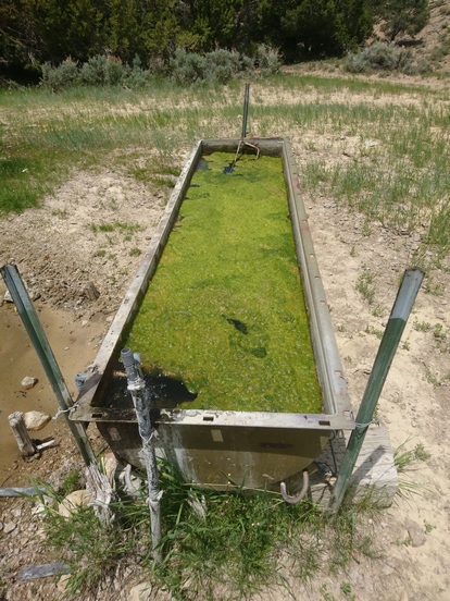
Finally, I reached a more legitimate road. While hiking towards the guzzler I saw something not far off the road. I decided to check it out. I’m glad I did because it was a trough overflowing with water. This water source was not marked on the map at all. Great flow coming out of the pipe feeding the trough. I stayed here for a while, filtering water and eating lunch. I filtered 9 liters total, two liters to chug, and 7 to take with me. My capacity is 6 L but I also filled my dirty water bottle, which I can filter later on. I enjoyed massive views of Garden Valley to the east. This too looked desolate, yet alluring.

Overflowing water trough in Garden Valley
While sitting down and filtering water, I saw a herd of wild horses approaching from the distance. They got within 30 yards, and stopped. I was down wind, they could likely smell me, in addition to seeing my movements as I filtered water. There were about 8 horses, including a young one. Eventually I stopped trying to hide or limit my movements and the horses backed off. You could tell they wanted this water, they just hung out in the distance staring at me.
The terrain now was pretty wide open. Fields of golden grass right up to the Piedmont. Troy Peak along with the rest of the high grant range became more impressive the closer I got to them. I followed a faint 4×4 Road at times, other times I just hiked cross country. At one point, the old 4×4 Road reached a deep ditch. It was too deep and narrow to drive across, yet the road continued on the other side. What do people do, jump it?

Old 4×4 road leading into Scofield Canyon. This soon becomes washed out, and hasn’t been used in years
Eventually I reached the road leading into Scofield Canyon. I was relieved to have a good road to follow for a while. With seven liters of water and 6 days of food left, my pack was the heaviest of the trip so far.

View east over Garden Valley and the Egan Range
For much of the hike through Scofield Canyon, the road was intermittent. Eventually, this road ended. Here, I was standing 100 ft above the wash below, and Cliffed out. I walked along the cliffs for a while and found a weakness. I made my way down to the wash and continued on.

Looking up into Scofield Canyon and the Grant Range

Hiking through lower Scofield Canyon
From here on out, the road was Hit or Miss. And when it was not there, it was gnarly! Seriously rough, and made me question whether or not it was actually “the way”. The middle part of the canyon was probably the worst. At one point I followed a wash that was 7 ft deep and 3 feet wide at the top, but shaped like a V.
Eventually, I reached a point where I saw the road again. I was actually surprised, but extremely relieved. And when I say I saw the road, I mean I saw the remnants of it. It was overgrown, clearly had not been used in a long time. At some point, the road had gotten washed out in decades past, and after this no vehicles have ever been able to get through it.

Hiking the wash through Scofield Canyon
Farther up the canyon, I walked through miles of old forest fire burn area. The burn area continued all the way to the upper reaches of Scofield canyon. The route continued to challenge me. I was seriously sweating with my heavy pack, but at the same time, feeling pretty good all things considered.

Small cave in Scofield Canyon
I reached my first good size cave just a little ways above the wash. This looks like a great place for a break. Here, I could see lots of evidence of birds or bats nesting inside, with some sort of brown droppings piling up on the Ledges. It would ooze down the walls, forming a cone where it lands. On the ground there were many animal bones, and a few mountain lion turds. I also found a piece of obsidian, it looked like it had been worked into a cutting tool. This was the first piece of obsidian I had seen on this hike. There aren’t any occurrences of obsidian in the Grant Range, but several a few mountain ranges away.

Hiking up Scofield Canyon. The canyon walls are taller now and more impressive
I continued up the canyon and came across some piles of old rusty metal, remnants of either an old mining operation or maybe just a homestead. Metal mattress frame with Springs, old barrels, etc.

Cave entrance

Large cave in Scofield Canyon, Grant Range, Nevada
Farther up the canyon, at the point on the map where the four-wheel drive Road splits left and right, just on the right side of the fork, I saw huge cave. I was already working my way down the left side when I looked back and saw it. Not all that far from my destination this evening, I decided to walk over there and check out the cave. This one was like the other, with lots of bird or bat droppings on the walls and Ledges, but the biggest I’d seen yet. I climbed up to the highest and deepest point in the cave and was rewarded with a beautiful view looking out at sheer cliffs on the other side of the canyon. At the bottom of the cave there were more bones and mountain lion turds, even a deer or elk leg with hoof. Clearly the mountain lions use these caves, although none of these signs looked recent. Recall though, how the NDOW officer I spoke with yesterday near Hot Creek Spring mentioned the mountain lion activity in the Grant Range. He wasn’t “lion”. Ha!

Making progress into Scofield Canyon
Following the left fork of the 4×4 road now, I saw a badger bumbling around the edge of the wash. I tried to get a little closer, although not too close, but I spooked him. Seconds later, I saw an elk. A female or younger male. The canyon walls were extremely impressive now, pretty much sheer rock faces just towering above the canyon floor.

Upper Scofield Canyon

Upper Scofield Canyon, below the crest of the Grant Range
Near the very upper reaches of Scofield Canyon I saw several more elk. 5 at one time, four of them were big males with huge antlers. It was now time to look for a campsite, but nothing was looking flat or very appealing in the bottom reaches of the Canyon. I worked my way up and Hillside, expecting a flat spot on the top. However, it was never flat, it just kept continuing up at an unacceptable angle. I had hoped to camp up here because of the amazing 360 view. Instead, I dropped down off of this Ridge into a wash and up the ridge that I will ultimately take tomorrow. Here I had the same issue, no flat ground. It was very Rocky and not steep, but not an angle at which you would pitch your tent.

Upper Scofield Canyon view
Eventually I settled on a spot high up the ridge under a tree. This was the flattest spot I had seen, although still not flat. I spent some time digging out rocks from the ground and using my foot to try and carve out a flat spot in the dirt. Eventually I created a campsite that was acceptable for my standards. Yes, I have standards, especially when quality sleep is at stake. And the view from this spot was actually pretty damn great! Tower and Cliffs above me, hemmed in by a little cirque. This will do!
When I took my shoes off this evening, I was surprised to see a hole in my sock, above the pinky toe. I have never had a hole in Darn Tough socks in this location. The Nevada terrain is rough on the shoes, that’s for sure.
Even with the hard work of Bushwhacking for what seemed like more than half of the day, I felt pretty good. I set up camp and ate dinner, which was no problem tonight. Good to have an appetite again. I enjoyed an excellent view of the mountains while I ate.

Campsite in Upper Scofield Canyon
Man, what a day. I can’t remember the last time I experienced so much adventure. This is what I came out here for. I’m finally feeling good and strong, and was really happy to have experienced all that I did today.
Day 10 – June 10th
The Sun was shining on me around 5:30 am. Minutes before 6, a loud explosion could be heard. I have no idea where it came from, but the echo through the canyon was incredible. There are no mining operations nearby that I know of, unless it was a private prospector or something. I was pretty stumped on what could have caused it.

Morning in upper Scofield Canyon
The view I woke up to was spectacular. I felt really good this morning. Really good, at peace with the world. All of the sudden I had a really peculiar feeling overcome me; the thought I might die today. I don’t know why, it doesn’t really make any sense. Sure I had an ambitious Ridge walk planned, but none of it looked particularly gnarly. Still somehow I was at peace with world. Odd start to the morning for sure.

Hiking out of Scofield Canyon

Burn area in Scofield Canyon
Leaving Camp, I immediately begin ascending up to 3000 ft. There was no Trail, and it was steep. I had 4L of water on me I, and still weighed down with 5 plus days of food. Burnt trees are everywhere still, some of them rather large. The slope was such that I could only walk about 30 seconds before getting super winded and tired.

Crest of the Grant Range, looking east over Garden Valley
I battled my way up Hill for about 2 hours before I reached the crest of the grant range. Right before I reached the crest, I saw two bull Elk. I Contoured around the summit of the 11000 plus foot Peak I was aiming for. I stopped to take a break as soon as I reach the crest. It was cold when the wind blows.

Hiking the crest of the Grant Range, south of Troy Peak

View of the Quinn Canyon Range from the crest of the Grant Range

View east from the crest of the Grant Range
Now I’m following the Ridgeline, Crest of the grant range. It’s fairly wooded at times, a variety of pine trees. It’s also pretty Rocky. The terrain was not too difficult, but there were a lot of ups and downs. All around me where burnt trees, in Rimrock Canyon and beyond. Even still, it was pretty nice. I wondered what it all would have looked like as a sea of green.

Grant Range ridgewalk

Pretty easy hike here

Hiking the crest of the Grant Range
The first mile or two of the ridgewalk along the crest of the Grant Range was the easiest. Besides some occasional trees and rocks for obstacles, it was not too steep and really just a nice walk.
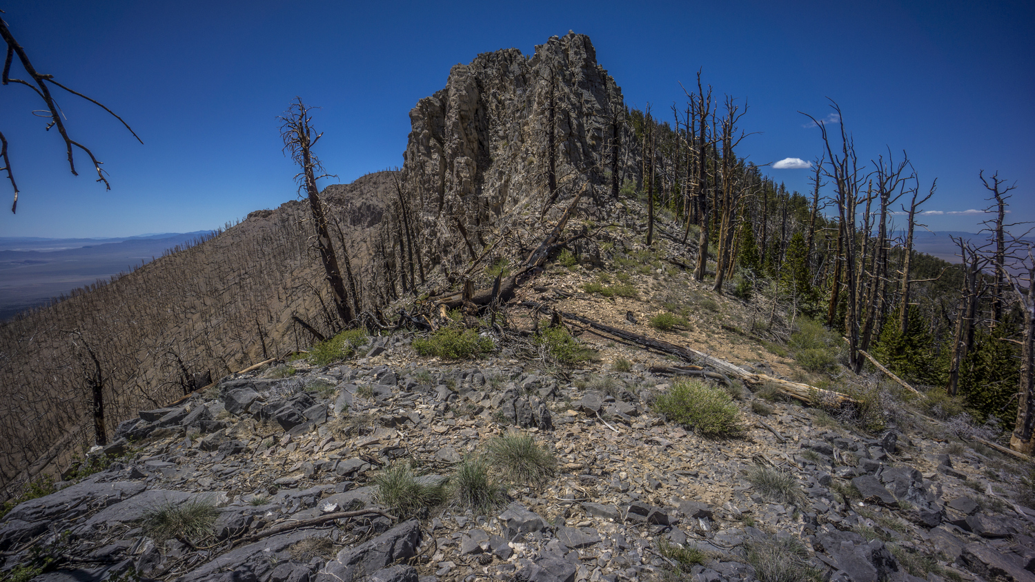
Terrain becoming more challenging along the crest

By midday, the hike was getting pretty hard. Peak 10396 proved to be much more difficult than it looks like on the map. This was typical of everything along this Ridgeline. Very steep terrain with loose rock made for a challenging Traverse up and around this peak. Scrambling was involved at times, and the rock was horrible. Even larger boulders that looked solid would just crumble away in your hands. It was very sketchy at times, one must be careful of each foot hold. Loose, Sliding rock. But eventually I made it. Looking down, I don’t know how. I’m glad I was going up, because if I was going down I would have looked for another way!

Hiking the jagged ridgeline of the Grant Range
Other sections of the crest proved difficult. There was one section where there were a couple of spires protruding into the sky, but with a window in between them. Nearby was a singular vertical shaft of Rock, Rising maybe 30 ft above everything else. Sticking up on its own. Impressive, for sure, but certainly imposing up close. Once I got right up on it, a route became obvious. Most of the routes through this type of Terrain involved scrambling and climbing over downed trees.

View of Railroad Valley to the west from the crest of the Grant Range

Grant Range ridgeline, and the Quinn Canyon Range in the distance, to the right/top of the photo
Next was Bordoli Peak. When I approach this, it looked impossible. Sheer Cliffs, maybe 40 ft above the ground I was standing on. Certainly it would have been possible to climb up, with the right skills, but with a pack it wouldn’t be my first choice. Eventually I discovered a game trail that skirts the side of the peak. Within 15 minutes I was around it, looking back at a wall of rock. Game trails are great.

Awesome cliffs along the crest of the Grant Range

View east over Basin and Range National Monument and the Golden Gate Range from the crest of the Grant Range

A “window” view from the Grant Range own into Basin and Range National Monument
Next was peak 10292. Again, I took a game trail that followed a lower route Around the peak. However, when I reached the South side, I was blown away. Best views of the day for sure. And the whole trip so far. At first, two large vertical Cliffs on each side with a window in between offered an impressive View. As I continued along the crest, I walked the edge of sheer Cliffs. Favorite moment of the hike so far. The views of Garden Valley, Golden Gate range, White Pine Valley and the Egans Beyond were absolutely stunning. Again it made me wonder why nobody comes out here. Is the terrain too difficult? Lack of water? Lack of access? Is it just Troy Peak that gets all the attention? Do people even know it exists?

One of my favorite views from the crest of the Grant Range. Hiking south, towards the Quinn Canyon Range

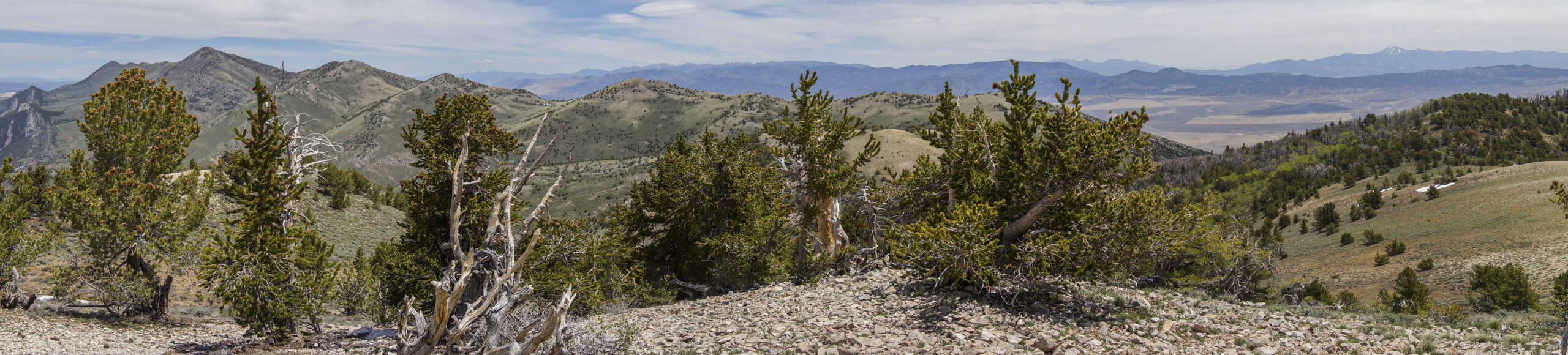
Panorama view from the crest of the Grant Range, looking northeast

Grant Range views
I took my time walking this section of the Ridgeline. In fact, I couldn’t leave, every few steps offered a new and interesting perspective. Then I noticed the bristlecone pine trees. These are the oldest living trees on Earth! They can reach ages of 4000 years or more. In fact, the oldest living tree ever discovered on Earth was 4900 years old, in Great Basin National Park.
I worked my way around one last Peak, 10147. Again I followed a game Trail. At times these were steep, and it was a real pain to always be sliding in One Direction with my right foot. This was definitely aggravating my blisters now. Eventually the game Trail led me to a bit of a saddle, where I had planned an emergency campsite based on satellite views. This would have certainly worked out; it was flat, mostly clear, and actually a pretty decent spot. In fact, there were a couple places along the crest where one could have camped. It was now about 3:30 and I decided to make the push down hill so I could hit the next water source tonight, hopefully.

Quinn Canyon Range, viewed from the Grant Range
Eventually I came to the point along the ridge where I had planned to drop down. The first bit was actually fairly easy and straightforward. The terrain wasn’t too steep nor was it too thick with vegetation. As I progressed down, there were patches of mahogany trees, occasionally thicker.

The route down from the Grant Range, Railroad Valley in the distance
The farther down I went, the harder it was. Towards the middle, there were more Ledges, although small. These were somewhat easy to work around, but did require a little bit of route finding.
Below Benchmark 8625 is where things got interesting. And when I say interesting, I mean quite frightening. The Topo maps don’t show anything of real significance here. The Contour lines and slope angle shading on CalTopo did not reflect the dangers that existed in real life. I was getting Cliffed out rather often. Some of these drop offs appeared to be more than 40 ft to me, and should have been reflected on the topo maps. Others were certainly below the 40 ft threshold, easily hiding within the Contour lines.
After getting cliffed out, I was working my way around the hillside looking for a way down. The slope was improving and I could see a potential way down. Then I stepped on a boulder, maybe 3 ft by 3 ft, and the boulder gave way. One leg ended up being in front of the boulder and the other behind it. The boulder was essentially pushing me down hill now as it slid straight towards a cliff, only about 10 ft away. I was able to get my leading leg out of the boulders way and it came to a stop right at the edge of the cliff. Had the boulder been any larger and heavier, I don’t know that I would have been able to get my leg out of the way. Both legs suffered some damage, pretty much just a scrape on the back of the right leg, and a nice big cut on my left shin.
Shaken up, I took a break right then and there. I used an alcohol pad to try and clean the cut on my left shin, which now had blood dripping into my socks. It wasn’t a terrible wound or anything, but certainly a reminder of how close I came to being shoved off that cliff. The cliff itself was maybe 20 ft, not an instant death drop by any means but even a drop of 20 ft has the potential to seriously injure or kill if I had fallen on my head or neck, or if the boulder followed me off the cliff landed on me, or if a rock slide ensued, etc. Sure I am carrying a satellite communication device, but in a fall like that, it could easily get smashed and be rendered useless.
I sat down for about 10 or 15 minutes to collect my composure before continuing on. From here on out, I was operating on pure adrenaline for the rest of the day. The rest of the day was extremely difficult and painful at times, nevertheless I felt very lucky to be continuing on with only a flesh wound. I found a route down a Series of Ledges and eventually reached a more favorable slope angle.

Slow going in this thick, narrow canyon
Eventually I reached a point where I left the Ridgeline and dropped down into a Canyon. It was a small narrow Canyon choked with vegetation. The farther I went down stream, the more difficult it became. There weren’t a whole lot of options to get down off the rest of the grant range, this was the shortest of the two. The other one certainly would have had its own set of challenges as well.
At the bottom of this Canyon, the vegetation was unavoidably thick. A variety of vegetation exists here, from pine trees and grasses to Thorn bushes and Cactus. There was no choice but to push through the vegetation, no matter what kind. I got pretty scratched up, and frequently I had Thorn bushes scraping away at my existing wounds. As a progressed, I cared less and less about the vegetation. I forced my way through it without even trying to avoid pain. Many of these trees had dead limbs, and I would just walk through them like they weren’t there. My main concern was my eyes, but with sunglasses on I had the proper protection. Otherwise I didn’t care anymore.
The walls of the canyon began to narrow as I progressed further down. My maps indicate potential for a box Canyon, with sheer cliffs on both sides. I was unsure if it was even possible to make it through this Canyon, as the possibility of an unclimbable pour off was on my mind. Topo maps can easily hide such things, a lesson I have learned many times in the past and as recently as an hour ago. Still, I’m here and must get out of this Canyon.
At one point the walls narrowed to about 5 ft wide. Of course thick vegetation was growing here, so I waded between trees on one side and a sheer rock face on the other. Then I reached the pour off. I was relieved to see that it was only about 8 ft. At the top was a plant that had grown in between the cracks of the rock, and was obscuring my ability to negotiate this climb. I grabbed it and ripped it out, chucked it out of my way. This opened up more possibilities for foot holds and allowed the down climb to become more obvious. In the end, I wedged myself in between the rock and shimmied my way down, with my pack on. It was at this point I remembered that I probably should have brought a small length of 550 cord or something for just this kind of thing.
I made it down into another narrow passage way filled with vegetation. Beyond this, I could see what looked like another potential pour off. I was relieved to see that was not the case when I got closer. Still, the thick vegetation remained, and I continued to fight my way down the Canyon.
The canyon walls were impressive, despite the nightmare of my reality. At one point I saw a cave opening about 60 ft above the canyon floor. I wondered how far back it went, but it would have been really steep to climb up to it.

Exiting the canyon, looking back up into the Grant Range

Quinn Canyon Range in the distance
Shortly after the pour off, the canyon began to open up a little bit. It was slow, but eventually it widened. Now I am walking on talus, with only the occasional tree. I turned around and looked back at the opening of the canyon. I breathed a sigh of relief Knowing I had made it to “safety” tonight. I let out a loud victory scream before dropping to my knees and letting this joyous victory moment soak in.

Railroad Valley at sunset
I was now only one mile from my intended water source, but this too was all off Trail. I followed a contour line around the hillside which led into blind Canyon. No such name was marked on the map, but I learned this later on when I reached my water source. The contouring part was actually pretty easy. Soft ground, trees were not too close together. It was amazing to walk such easy ground.

Blind Canyon, Grant Range, Nevada
When I reached blind Canyon, I was blown away by its beauty. I could tell from the topo map that it was going to be impressive, but nothing could have prepared me for what I saw. Absolutely massive and sheer cliffs surrounding this Canyon. I’ve been a lot of places and I can’t think of another Canyon that compares.
The walk through Blind canyon was not easy either. Lots of foot sized rocks in a wash, with a series of ups and downs over ridges, Hills and gullies, with a bunch of Sagebrush and Thorn bushes mixed in. It was almost 8 pm now, so I was trying to move as fast as I can in order to beat the approaching darkness. I reached the end of the canyon and discovered a series of narrow chutes and pour offs. I have no doubt somebody could climb it, but it wasn’t going to be me. I had expected my water source, a guzzler, to be here. However, no water and no guzzler.

Big Game Guzzler in Blind Canyon
I turned back around and began searching parallel to the route I walked in, and moments later discovered the guzzler. It was a flying saucer looking object just through the trees. I walked around the saucer and saw an opening. There was plenty of water, so I dropped my pack and promptly began filtering water. I dipped my dirty bottle in, trying to push all of the dead bugs aside, and pulled it out to discover only a slight green tint. Good enough for me, my Sawyer filter will take care of the rest. I immediately chugged the first liter I filtered. I needed this. I only had a few ounces of water left now and was quite thirsty after the such a strenuous day in the mountains.
Then I filtered 5L to take with me. The sun set while I was filtering, so I moved fast. I took out my headlamp in case I needed it. I walked back out of the Canyon as fast as I could, jogging at times with limited light. When I got a ways out of the canyon, I was still not seeing any good spots to set up camp. Just a rocky wash with a lot of vegetation. So, I left the wash and went back up the hill side that I had Contoured around. Sure enough, up the first little Hill was a nice flat spot with pretty soft ground. This will do!
I’ve realized my campsite selection was not as flat as I was hoping for, pretty much like every night. Fortunately, with the ground a soft as it was, I had no problem using my foot to remove some Earth from the high side and ended up making a pretty nice flat spot for the floor of my tent. I set up by headlamp, with the last remaining raise of light fading away as I finished.
I cleaned up my wounds a bit and applied some iodine. I hadn’t eaten since lunch, maybe 12:30. Okay I had one granola bar at 3 pm. Still, not enough to keep me going. I had mentioned adrenaline, which has now faded away and replaced with proper hunger. I snacked on some random items, anything salty tasted great.
Today was one of the most difficult days of hiking I’ve ever experienced. I’m not sure I even covered 10 miles. I feel lucky to be alive and well, to have made it to a proper camp and to have the opportunity to do it all over again tomorrow. My body feels surprisingly well for the extremes I asked of it today. I definitely lost some muscle today, I did not eat enough for sure and I could smell that horrible smell that comes when muscle is converted into energy as the body’s last resort.
Day 11 – June 11th: Quinn Canyon Range, Cherry Creek
Didn’t sleep that great last night. It was a warm night, too warm for my 40F quilt but too cold to go without it. I was extremely sore and tired this morning, but I didn’t feel that way at all last night. It must have been the adrenaline. Woke up at 7 am., about an hour after I have been getting up the rest of this trip. This was mostly due to the Sun needing to rise over the Cliffs that made up blind Canyon. This works out for me though, I could really use the extra sleep this morning.

Campsite near Blind Canyon, Grant Range, Nevada
Just an all-around excellent view from Camp this morning with blind Canyon behind. The views from the west side of the Grant Range are very impressive; here, the slopes are steeper and provide a much more dramatic backdrop compared to the east side.

Walking fenceline on the west side of the Grant Range

Railroad Valley, with the Pancake Range in the distance
After leaving Camp, I had to cover some cross-country ground again, backtracking the way I came last night. Eventually I hit a fence line with a bit of a clearing alongside it, so I followed that for a while. This took me to a wash with an old 4×4 Road, so I followed that downhill ways until I hit the main road that cuts through the Grant and Quinn Canyon Wilderness, separating the two.
The road walk up to The Summit was not that interesting. In fact it was extremely boring. However, it was a great mental break from all of the ridiculous stuff I was doing the day before. Plus, I could finally cover some miles. One can not fully appreciate the convenience of a trail or road until you have gone some time without one.

Entering the Quinn Canyon Range
On the other side of the summit, the walk became more interesting. Better views of the mountains and more interesting rocks. Lots of different colored rocks from green red orange and yellow, but nothing special. The type that has some sort of Micah or muscavite that glistens in the sun, tricking you to bend down and pick it up, when in fact it’s worthless.
When I reached the road for the Cherry Creek Campground, a stream was flowing alongside it. This is a great sign. I thought for sure there would be people camping in the campground, and I had hopes of someone running a generator so that I could charge my backup battery pack. However, the campground was empty.
While I didn’t Explore More, it seems like the campground consists of just one campsite, a picnic table fire ring and Creek side access, all with a less than ideal slanted ground. The campground was riddled with bullet shells, and someone even pounded them into the picnic table. How clever.
I took my time here at the campground, utilizing the picnic table which is actually quite the luxury for a hiker. I also utilize the stream to rinse out my dirty clothes, and let them dry out in the sun while I filtered a couple liters of cold water. No sense on stocking up, I know the creek will be flowing a ways up the canyon. I saw several trout in the creek here and Upstream from the campground.

Lush vegetation of Cherry Creek
This marks a bit of a milestone in this hike, the first foot Trail along the Route. It starts right here at the campground. Maybe 50 ft after leaving the campground, I could tell this was going to be a lot of work. Several large down trees over the trail, and it was overgrown. However, it was extremely impressive! The creek was flowing and lined with very Lush green vegetation, almost jungle-like. All of this was hemmed in by vertical Cliffs, the likes of which I haven’t seen yet in Nevada. Red Rock, rounded, similar to what I would expect in Utah. Overall, I compare this Creek to something in New Mexico, perhaps a less maintained quasi-Gila River experience, on a much smaller scale.

Cool canyon along Cherry Creek
The first section right out of the campground was through a bit of a box Canyon. This is why It was so Lush and jungle-y. My progress was slow here, frequently turning around and looking up with great Grandeur. The trail winds back-and-forth, following both sides of the creek. I crossed the creek about 15 times. Sometimes there were logs and sometimes there were rocks, but I managed to keep my feet dry.

A nice green meadow, with a lot of cow activity

Cherry Creek flowing
Before long, Cherry Creek Canyon opened up. Even though the canyon was wider and one was not forced to stay by the creek, the going was still tough. The Trail was intermittent, and passed through a lot of thick brush. Sagebrush mostly, as well as thorn bushes and the occasional odd ball plant. And now, signs of cows. Cow patties and prints, turning a nice creek into a muddy wasteland. It stinks like cows. Damn cows ruin everything they touch. Still, it was a pretty Canyon.

Rock formations along Creek Creek
Eventually the creek went dry, so I backtracked a bit to the point where the water began to flow from a spring. I drew 6 liters from here, not really knowing where my next water source was going to be. After following Cherry Creek to its upper reaches, I will have two options: go over a pass to Cooper Canyon or Willow Canyon. I still have not decided which I want to do.

Hiking through Cherry Creek Canyon
After filtering my water, the hiking got even tougher. Even thicker brush. I suppose I could have put on my pant legs, but every time I do so I end up getting a heat rash or something on my legs. Plus it’s just downright hot to wear them. So, I made my way through the brush in shorts, subjecting my already wounded Shins to an onslaught of brush. Nothing like thorn bushes scratching yesterday’s wounds.

Upper Cherry Creek
I barreled through the brush for hours, thinking about how this is prime rattlesnake country. I have yet to see one. I did see a couple of cows eventually, including a bull only about 30 ft away. He did not see me, and that’s probably for the best. It’s much more rare to see bulls free roaming.
Now in the upper reaches of Cherry Creek Canyon, it was decision time. I had already been leaning towards the route that would take me over to Willow Creek Canyon, so I started heading up that way. I was looking for a campsite now, but there was nothing good. There was one or two spots that could have worked, but they were not good campsites. I kept heading up hill.
I found another spot that could have worked, but again it was pretty sub par, more of an absolute last resort. The drainage I was following up to the pass or saddle to Willow Creek was now getting narrow and was subjected to all of the same thick brush and blow downs as the rest of the canyon. Only here, it was harder to navigate around and avoid. I did not have any good options now. I could go back down and take a crappy campsite, or I could continue to head up the drainage and see if the trees clear out.
Next I thought, maybe I can camp on the saddle. I was only about 200 ft below the saddle now, but some of the hardest terrain lies ahead. It was a gamble to try and make it up there. The saddle is only so big, what if there is nowhere to camp? What if it’s too rocky, too many trees, or all cliffs?

I need to climb these cliffs to reach the saddle, and gain the ridgeline
Just below the saddle there were 30 ft rock walls blocking the way. From Below they looked impenetrable. I was getting nervous. I made my way to the base of the cliffs and a route became obvious. It was not going to be easy, but it was better than a vertical rock climb.
I began to work my way up a small chute. At first it was manageable. Then, it got really steep. I was on all fours now, using feet and hands to climb. It was a combination of loose soil and loose rocks. I took my time to find solid hand holds and continued the climb. This was the type of climb that you go up and not down. I can’t imagine down climbing this one. 6L of water on my back didn’t help either.

Sunset over the Quinn Canyon Range, from my campsite on the saddle
Eventually I made it past the Steep section and I could see the remaining route to the saddle. Once at the top, I was relieved to see a few relatively flat spots with decent ground, small rocks that could be moved aside. I was also rewarded with an excellent view of mountains on the Willow Creek side. Impressive, reminded me of the Egans.
I don’t know what the criteria is for saying no man has ever been here before. Do they mean this Valley? This saddle? This quarter mile radius, this 10ft radius? I don’t know the answer, but I felt like there was a good chance nobody climbed up the canyon and the chute that I did to reach this saddle. Of course, some miner in the 1800s probably made his way up here, and undoubtedly, indigenous peoples of the past have done so as well. But that’s the beauty of places like this. You can still feel like you are the first to step foot somewhere, even if that’s not actually the case. Either way, I ended this day again with an incredible feeling of adventure. It’s hard to describe really, the feeling you get from reaching hard to get places.

Campsite in the Quinn Canyon Range
I can’t think of a better feeling than a long, hard day of hiking coming to a close. Where you finally are able to lay down on your air mattress knowing you won’t have to sit back up again until the morning. What an incredible relief. The winds are not incredibly strong up here on this saddle, but gusting strong enough to raise anxiety. The winds generally die down at night here in Nevada, so I’m banking on that. Also, pulled my first tick off my leg while getting into my tent this evening.
Day 12 – June 12th: Quinn Canyon Range, Willow Creek, Railroad Valley
Didn’t sleep well last night. The winds did not die down at all. They weren’t terrible, not in danger of blowing my tent over or anything, but enough to keep me awake most of the night. Then, around 5am, I heard another loud explosion, like the one I heard in Scofield Canyon the other day. Then I realized… It’s a military plane doing a fly over, it’s a sonic boom! How’s that for a wake-up call?
Got up at 6 am, ready to be done with the sound of the wind blowing on my tent. One side was higher than the other side due to setting up the tent on a little ledge of sorts. This prevented the tent from being taught on one side, and caused a lot of flapping in the Wind. So annoying.

Descending the canyon in upper Willow Creek
I had high hopes that it would be easier going down the Ravine this morning then the other side when I came up last night. Not really easier at all though, probably about the same. Trees were thick, many dead branches to snap off so I couldn’t make my way through. Had to duck under many trees, forced my way through others. Sometimes worked my way along a steep talus slope to avoid the vegetation. Basically just weaved my way in and out of all of the obstacles, and sometimes right through them. I fell down twice I think, once near the top almost first thing this morning.
I saw water a couple of times in the Ravine, but it was always short-lived. Water would trickle out for a hundred feet so and then disappear. It would be somewhat difficult to collect from these pools, but possible. Because the water flows over Rock, you can’t really dig a deeper pool to collect from.
Coming down took something like 2 hours. Now I am on the main Valley floor, and my maps indicate a foot trail that leads to a road. I found the foot Trail higher up the canyon then I expected, so I had high hopes for this. Found a balloon that said “welcome back”. I found many balloons like this over the years in Pretty remote areas. This always pisses me off. Welcome back, let’s commemorate the moment by depositing a piece of trash in your name in an otherwise pristine Wilderness. Screw you. Letting balloons go into the sky should be considered littering just like throwing a piece of trash out of your car window. It’s no different.

Thick vegetation in Willow Creek to bushwhack through
Eventually I realized the foot path was intermittent. Extremely intermittent. The trail would be good for a while and then just disappear. Then you’d find it again and it would be pretty decent. This wasn’t really an issue since there was no water this high up in the canyon. Therefore the vegetation was similar to everything else I’d already gone through.
The real issues began when the creek started flowing. Along any body of water grows different vegetation; much thicker and much thornier. Hear a variety of Sagebrush, Willow, and a plethora of thorn bushes could be found. Thick patches of thorn bushes, the kind that you generally look at and say, well that’s impossible, I’ll go a different way. At first this was possible, I would just go around them. But eventually, I had to go through them.
The worst part of Willow Creek Canyon was where the map showed the road. And this pissed me off because it was supposed to be the easiest section, due to the road. At Best, an intermittent foot Trail was all to be found. It was so hard to follow, but it seemed to cross the creek from time to time. This intermittent Trail offered no easy route through the insane vegetation along the Creek. Instead, it presented a nightmarish challenge.
It’s hard to describe how awful this Bushwhack was. I hesitate to even mention the intermittent trail because it could give the idea that sometimes the going was easy. It never was. It was truly horrible. Oftentimes the creek was situated 8 ft down in a wash with it’s banks cut vertically from flash floods. Guarding this were thorn bushes. Then there was the Willow and Sage. Both grew vigorously here. Imagine vegetation so dense that your feet never touch the ground. Sometimes I couldn’t see the ground at all. I was literally wading in vegetation.
For much of the day I had my shorts on so my legs continued to get cut up. New cuts and more damage to existing wounds. I thought my legs would turn into leather by the end of this hike. Then I remembered my pant legs, and decided to put them on despite the fact that I typically get heat rash when wearing them. This helps significantly. Still, the nightmare Bushwhack continued.
I needed to cross the creek at one point, with no other way forward due to steep Canyon walls. I had to literally sit and crawl on the ground to get under the Willow branches. I pushed my way through, hoping this was the only time this would be needed. Wishful thinking, of course.

Entrance to gold mine hidden in Willow Creek

Exploring an old mine tunnel in the Willow Creek
I was traversing a steep Rocky slope when I stumbled upon a mine entrance. The opening was hidden by thick brush, it would have been nearly impossible to see except up close. So of course I went in to check it out. I went in about 20 ft and dropped my pack, and put on my headlamp. Walked back a ways around the first corner and came to one side tunnel that was a dead-end after a few feet, and continued on. I would say the mine went back 500ft total. The walls where lined with many quartz veins, so I assumed they were looking for gold or silver. I wonder what they pulled out of here, how much. I scoured the walls for any signs of gold, but to no avail.
While coming out of the mine I noticed that I was missing my external microphone for my Gopro. Pretty sure I lost it while forcing my way under those willow trees crossing the creek. No way I was going back for that. I was really bummed. I also lost a water bottle at some point battling the brush. So now 6 L capacity down to 5, unless I use my dirty water bags.

A nightmare thicket to hike through
Leaving the mine, there were a couple times where I had to scramble over some rocks, using all fours to climb short sections. Ultimately I couldn’t progress forward, and had to backtrack. Had to drop down into the wash and cross. Here, I faced probably the thickest thorn patch of this whole bushwhack. This led me to a vertical rock face. I really had nowhere else to go. After doing my best to push aside the thorn branches, I climbed a 15 foot Rockwall and got past the obstacle.
This continued for a couple hours. I handled the bushwhacking sections of the rest of this trip pretty well, but towards the end I was losing my mind on this one. The worst part was that I was expecting a trail and then a road. It should have been easy.

Old truck along the 4×4 road in lower Willow Creek Canyon
Then, after a creek crossing, there was a decent gravel road. It hadn’t been used in many years, but it was an obvious old path. According to the map, this road should have been miles up the canyon! Nevertheless I was extremely happy to be done with the bushwhack.

Can you see the waterfall below?
Once on the road, the canyon opened up a bit and vegetation became more sparse. I still had not filtered water, waiting until the lower reaches of the canyon so I could fill up just before hitting the valley floor. As the road left the creek for the last time, I decided to follow the creek downhill off Trail a short ways. I was using a game Trail that gave me an elevated view of the creek. From here I spotted a small waterfall. A Waterfall!!

Waterfall along Willow Creek in the Quinn Canyon Range, Nevada
This was the spot I was looking for. I carved out a spot to sit under a large Sagebrush and took a break. Chugged some water, filtered some more. Washed my socks and clothes, and of course took a shower in the waterfall. This literally brought tears to my eyes. Being able to take a brisk shower immediately after fighting through all that dense brush was just incredible. A reward I deserved, no doubt. This afternoon’s Bushwhack was perhaps the worst of my life. In fact, I know it was. I’ve seen brush that thick before and did not think it was possible to progress through it. But when you have to, anything is possible.
I spent a solid hour and a half here at the waterfall. From here I could look out into Railroad Valley. It was getting very windy, kicking up a lot of dust and sand from the dried Lake bed. Still, I was relieved that it was in the 70s and cloudy, with a strong breeze. This will Bode well for crossing this massive Valley.

Quinn Canyon Range, Nevada viewed from Willow Creek in Railroad Valley

Railroad Valley and the Quinn Canyon Range
Leaving Willow Creek, I follow the hill sides South for a while instead of following the dirt road out to the main road. This was more direct. A large agricultural operation could be seen out in the valley, surely possible only because of Willow Creek. Otherwise, this huge Valley was pretty empty looking. On the other side the pancake range makes up the horizon.

View into Railroad Valley towards the Pancake Range
Finally I took my last steps off the Foothills and on to the valley floor. Easy walking, vegetation spaced out well enough. There really was no sense in following dirt roads since they were only marginally easier walking then just going cross-country. So that’s what I did, I picked a point on the horizon around where my next water source will be and headed for that. I crossed a couple of roads but continued on my trajectory.
The wind was whipping, and getting stronger. Visibility to the north was low. I was glad the wind was blowing in the direction it was, if it were the opposite and blowing to the South all of that dust would be coming towards me.

Hiking across a dried lake bed in Railroad Valley, with the Quinn Canyon Range in the distance
I walked across a decent sized dried Lake bed. I don’t know why, but I’ve always wanted to do this. A bigger one would be even more impressive. I was feeling good and feeling strong, now reflecting on the trip as a whole a bit. That’s what I enjoy about the Basins; A break from the hard stuff up in the mountains, and a chance to let your experiences sink in.

Pancake Range from Railroad Valley
The wind now was easily 30 MPH or more. I kept thinking about how awful tonight will be if I have to sleep out in the wind. My next water source is a place on the map called Stonewall Corral. I wasn’t really expecting water here, so I was wishing I had filtered more than 6L to take with me from Willow Creek. I noticed that the water source I am heading to is pretty close to a small series of Rocky Hills jetting out from the desert floor. The water source was about a mile from these, so once I got close to the hills I changed my trajectory to the water tank which was now visible.

View east from Railroad Valley to the Quinn Canyon Range (right) and the Grant Range (left)
Approaching the water tank, I noticed a lot of signs of cow, as well as some sort of trailer next to the water tank. I had very high hopes now. I was relieved to see a trough full of water when I arrived. The large water tank also seem to have water in it. The trailer was actually an old pickup bed converted to a trailer, and it had a generator strapped in. This ran a small pump. Put this together and you have a reliable water source. Well, if the local rancher has his cows nearby.

Water trough in Railroad Valley
Chugged 1.5L, then filtered water to top off my supply. So that’s 5L, plus I brought 1L in a dedicated dirty Gatorade bottle. Then I field up my platypus bag, normally reserved for dirty water. So I have five filtered, clean liters and 3 dirty liters to be filtered later for a total of 8L. This should be totally fine to get me through another day and a half.

Sunset in Railroad Valley

Small outcrop of rocks in the middle of Railroad Valley provide the only cover for miles
It was about a mile to the Rocky out cropping of Hills after leaving the water tank. I was hoping to use part of these Hills as a wind block. When I reach the Hills, I found a couple of spots that probably would have worked. But my curiosity got the best of me and I kept going. Then I spotted a small cave. When I approached I realized it was too small. Bummer, I was kind of hoping to sleep in a cave at some point. I also spotted a circular Stonewall down on the valley floor right next to the Hills. After dropping down here, I realized the wind was blowing right into the only opening in the circle, so that’s out. I thought about camping on the other side of the wall, but it was still too windy.

Campsite in Railroad Valley
Eventually I found a place to camp, just as the sun had crested behind the pancake range. There was a large Boulder that provided a decent wind break. I set up behind this Boulder, knowing that the wind will probably change directions at some point in the evening. Better than anything else I’ve seen though.
Now lying in tent, the wind had shifted briefly. Sand was being blown all over inside the tent, and even into my mouth. Yuck! Then the wind died down, or at least shifted directions.
Day 13 – June 13th: Railroad Valley, Pancake Range, Lunar Crater Volcanic Field

Morning in Railroad Valley
The wind shifted a couple of times during the night and was momentarily a nuisance. However, when I woke up it was dead silent. You could hear a cricket chirping from a mile away. To be in such a massive Valley with absolutely no sound at all was relaxing. Light cloud cover to begin the day.

Small cave in Railroad Valley, in The Wall Wilderness Study Area
Without the pressure of finding a spot out of the wind before the sunset, I had a chance to soak in my surroundings. I realized the outcrop of Hills I was camping alongside was an old Indian camp or hunting ground. Many signs of arrowheads here, mostly just fragments from the arrowhead making process, but I found one fully intact Arrowhead made of chert. Several small caves littered the hills, not really big enough to be utilized by humans other than to squat in for shelter or to get out of the Sun. These Hills were just barely within The Wall Wilderness Study Area.

Hiking Railroad Valley, looking back at the Quinn Canyon Range and the Grant Range
With the winds gone, I Had A Renewed sense of excitement as I left camp this morning. I spent some time exploring the Hills, but I quickly left them behind a long a dirt road seemingly leading to nowhere. I had crossed the majority of railroad Valley yesterday, with only a couple more miles to go before I entered the Hills making up the western side of the valley. I saw several horned lizards scurrying about. As true of the last few miles last night, much of this morning’s hike, and even much of the day’s hike really, was through very loose and deep sand. This was a real pain to walk through.

Hiking Railroad Valley through The Wall Wilderness Study Area towards Big Fault Mesa
This area had a completely different feel from anything else I had walked through so far. It’s not just a wide-open valley, but a series of Hills, mesas, and interesting rock formations spread out across an extremely desolate and mysterious land. I stress mysterious, along with raw and primitive. One can’t help but think of the past when walking through a place like this. Who else has come before me? Why were they here, what were they doing? Surely this land holds many Secrets, known to only a privileged few.
Even here, seemingly the farthest place from civilization one could imagine, signs of cows were everywhere. I couldn’t help but think that the only people that ever visit this land are the nearby Ranchers. I can’t see this land drawing any visitors for recreation, Beyond the locals. Even then, travel here would be on horseback, Maybe. It’s a Wilderness study area, so there’s no access to dirt bikes or ATV’s. In Wilderness areas, it’s somewhat common (unfortunately) to see tracks in the sand. But not here, just some piles of cow shit. I must say that this, even though it may seem small, really dampers the Wilderness experience.

Large volcanic boulders litter the hills as I approach the Pancake Range
My route now was mostly a cross-country Meander in between various land forms. However, now that I’m here it doesn’t make sense to follow a line I drew on the map at home. It makes sense to follow what your eyes see, what intrigues you at the moment. That is the spirit of Adventure in my eyes. So I left my planned route behind, and began to walk towards a series of hills that looked interesting. A bunch of random large boulders dotted landscape, and fragmented rock formations jetted up into the sky.

View from random volcanic hills I climbed on the way to the Pancake Range. Big Fault Ridge (right), Quinn Canyon Range in the distance (left)
I made it to the top of the small set of Hills and was rewarded with a great view. Pretty much any elevated position over a massive landscape such as this will please the eyes and soul. Yes, this is where I will take my late morning lunch break. Here one can reflect upon many aspects of life. How small and insignificant we are as individuals. Here, a person feels like an ant. And not even an ant that’s part of a colony, but a rogue ant. perhaps the only ant left after his entire colony had been had been destroyed. Last of his kind, beginning a lifelong search for any remaining survivors. It’s just you now, Roaming the world all alone, searching for a purpose. A promise of a new and better life.
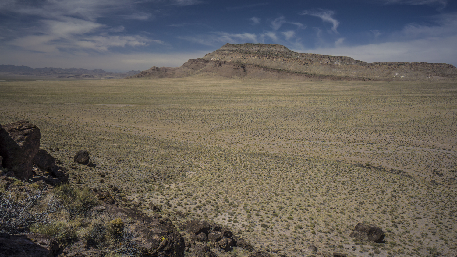
Big Fault Ridge, Pancake Range, Nevada

Sandy wash with volcanic rock
One could stay on top the hill like this all day and lend time to all sorts of random thoughts. But then, of course, one would miss out on all of the discoveries that lie ahead. I emptied the sand out of my shoes and dropped back down to the desert floor. Here, I followed a Sandy wash towards a gap between two land formations. There were random outcrops of black rocks in an otherwise Brown and Sandy landscape. There were even a few lone trees, which seemed very much out of place.

Lone Tree in the desert as I enter the Pancake Range
I followed the wash for a while and began to walk cross-country through the desert again. I eventually reached a well graded dirt road. This was a relief to be able to get out of the deep sand. As a hiker, we are generally not too fond of walking roads. However, I must say that in certain Landscapes, like the one I’m walking through right now, walking cross-country offers little to no benefit over a road. The same views can be had at a fraction of the effort expended. With that said, I highly recommend hiking cross-country through the desert at least once to know and understand what it means to do so. This is best done where the ground is firm and the vegetation is well spaced apart. Soft Sand and/or thick sagebrush are not pleasant and will not enhance your hiking experience. In this case, take the road!

Hiking Chuck Wagon Flat in the Pancake Range

Cool rock formations hiking in between The Wall and Palisades Mesa Wilderness Study Areas

Chuck Wagon Flat, The Wall & Palisades Mesa Wilderness Study Areas
I was impressed with the views of the surrounding land formations. They didn’t look like much from afar, but the closer I got the more I enjoyed them. Again, I wondered if anyone ever comes out here to hike, climb, or camp. The only signs of usage here where again, cows and Ranchers.

Hiking across Chuck Wagon Flat in Nevada’s Pancake Range. The route straddles two Wilderness Study Areas; The Wall and Palisades Mesa

Palisades Mesa Wilderness Study Area, Nevada
The road I’m walking now straddles two Wilderness study areas. The Wall wsa on the East, and Palisades Mesa to the West. These are obscure lands by any measurement. Several land formations caught my eye, and begged to the explored. However, I wanted to spend more time at lunar crater, so I made it my goal to reach it as soon as possible. Several miles off in the distance, I noticed A glimmering white object on a Ridgeline. I had no idea what it was, but I was heading that way.

Pancake Range and Lunar Lake

Lunar Lake in the distance, a dried lake bed in the Pancake Range
Walking with quick and easy along the road, but eventually I came to a point where I would leave the road and hike cross-country to a high point overlooking lunar crater. After hiking across fields of volcanic rock for a while, a bit of inspiration struck me. When I left for this hike, most people I spoke to projected their fears on to me. They told me that it would be too hot, there wouldn’t be enough water, the snakes and scorpions would get me. But you know what? None of those people have hiked Nevada! When people tell you that you can’t do something, most of the time it’s because they can’t do it themselves, or aren’t willing to. It’s important to keep an open mind, but at the same time, don’t let the opinions of an unqualified third-party influence your dreams and goals in life. They don’t know what you’re capable of, and what you’re willing to do. Only YOU know that.

Hiking the Pancake Range near Lunar Crater
I followed the route I created at home on the map towards a rather insignificant looking hill. Lunar crater is just on the other side, but you would never know. As I approached the hill, I could see that the glimmering white object I saw from a distance was a truck. There was a strange blue object on top, my assumption was that it was some type of camper. At one point I could see two people standing on the Ridgeline. I assumed they could see me, maybe the screen of my GPS or my watch reflecting in the Sun. I continued to weave my way in between sagebrush towards the top of the hill. Eventually I hit a small two track Road that I followed to a saddle, and then up a ways on the hill itself. From there, it was a short scramble up some black rock formations with orange lichen growing on them. I always enjoyed that contrast of orange on black, looks like lava.

View over the Pancake Range and the Lunar Crater Volcanic Field

Lunar Crater, Nevada
I expected a view of lunar crater once I crested the highest point here, but there was a very short ridgewalk that remained. Following the Ridgeline, the crater came into view as I neared the edge of the Hill. Wow! It was every bit as impressive as I expected. A giant hole in the Earth, 400 acres in size, 3600ft across and 430ft deep. Lunar crater sits in the middle of the 100 square mile Lunar Crater Volcanic Field, perhaps the highlight of the pancake range. The crater (this type is called a “Maar”) was created by a volcanic eruption around 38,000 years ago. This isn’t all that long in geologic terms.

Lunar Crater National Natural Landmark
I stood up on the top of this hill for quite awhile. This is a place I’ve long wanted to see. An obscure Landmark for sure. I considered my possibilities to further enjoy this area… Camp up on the top of this hill for an amazing sunrise and sunset view? Maybe capture some night photography and the Milky Way overlooking this crater? Drop down into the crater for the unique experience of camping inside? All good options. Ultimately, I chose to drop down the hill and make my way down to the rim. A road runs almost all the way along the circumference of the crater. Just below the hill was the white vehicle with the camper top. The Allure of a cold drink, perhaps a Gatorade, was too much. So I approached the vehicle, which looked empty at the moment. I figured they had gone for a walk, maybe down low into the crater.

Lunar Crater Natural Natural Landmark, Nevada
I approached the vehicle cautiously, never wanting to startle someone out here. Now within a few yards, I said “hello, anyone home”? Then little access door on a homemade blue camper top popped open and a man stuck his head out. He was very surprised to see someone. He asked where I came from, and I pointed out into the desert. “what do you mean, you walked? From where?” I proceeded to tell him my story, and this began a very fluid series of events that lasted for nearly the next day.
Matt and his son Casey, who had just graduated from high school, were on a road trip across America. They had driven here all the way from Florida. They had their dog Shay with them, who right off the bat seem to like me. That’s always a great sign I think, when a dog is so trusting of a stranger.
We chatted for a few minutes, and then I was offered a water and a seat inside the vehicle. A comfy seat is one of my most sought after luxuries after an extended wilderness trip. Once I sat in that seat, I felt a great deal of relaxation. I was even more relaxed when I was offered to share the joint they passed around. It’s not hard to understand why Marijuana and the outdoors go so well together.
Over the years, I’ve realized that I have a tendency to underestimate my knowledge and abilities. I am the type of person that thanks the bar is extremely high in order to be considered an expert, and never I think I am good enough when comparing myself to others in the same field or category. I think the turning point in my life was when I was hired by a large corporation to do search engine optimization. While there is no degree for this skill, I did not think that my basic knowledge of the field, acquired during the course of some hobby projects, was sufficient. I couldn’t believe I got the job. Certainly there are many more qualified people out there, but the bar was set low enough I was hired. This really changed my perception of things and my outlook on life. I’m not saying I wasn’t qualified or I was bad at my job. Quite the opposite.
I only mentioned the previous paragraph because of the conversations I had with my new friends Matt and Casey. They knew nothing of the area, and very little about outdoors in general. While we were sitting at lunar crater, I pointed out several other craters in the distance. They had been up here for a while, and had not even noticed them. I began to tell them about how these land formations came to be, a product of volcanic eruptions. They were under the impression it was a meteor impact site, which is an extremely Fair assumption. This too was my assumption when I first learned of lunar crater. But I had been doing my research. I have been researching Nevada for over a year in the process of creating this route, and another separate route. I felt like their tour guide, giving them information about a land I had never been to. To them I may have been an expert. But on a personal level, I barely felt qualified to convey this information. I don’t want to take away from all this to sound like you only need to know more than the person you’re talking to be considered an expert. Instead, we should not underestimate ourselves and to be confident in our perceived strengths. I have spent hundreds of hours researching Nevada and everything that goes along with hiking it in the course of planning the Basin and Range Trail route. There will always be someone that is better than you in your field, but that doesn’t mean you aren’t qualified yourself.

Easy Chair Crater, Nevada
Upon discovering easy chair crater in the distance, Matt suggested we drive over to that crater to have a look. Sounds good to me. A short drive later we were there, overlooking another impressive landform and hiking around its rim.
Upon returning to the vehicle, we discussed the low pressure in one of the tires. Matt said the tire was not that low yesterday. If it’s losing air pressure that fast, I suggested that he drive into town this evening before he’s not able to drive out tomorrow. After all, there is no cell phone service out here. I do have my Garmin satellite messaging device, but better not to push it. The nearest town is Tonopah, where I’m going. It’s also on the way to where they are headed, Mammoth California. It seems it was meant to be. My only qualm with the situation is that I still needed to walk the 6 miles from lunar crater to Highway 6. On the CDT it was very important for me to walk every mile, out of principle. People skip hundreds of miles of Trail and claim they walked the whole thing. I did my continuous footsteps on the CDT, for myself. But now here on the Basin and Range Trail, My goals for this route are different. Since there are no meaningful start and end points (say, Mexico or Canada), I don’t see the point in being a stickler about continuous footsteps here. I’m out here for the adventure and the experiences.
This was going to be one of the hardest hitches on the entire route. 80 miles to Tonopah, or about 90 to Ely. People often use the term middle of nowhere, but this literally is the exact middle of nowhere… Right in the middle of a 167 Mile Stretch with no gas between Ely and Tonopah. There is very little traffic, and hitching here would certainly take some time. I felt thankful to be able to get a ride with no effort or wasted time.
When we arrived in Tonopah, first things first, we put air in the tire. Next up, and perhaps most importantly, we put food in our stomachs. We ate at Hometown Pizza, my treat. We split an extra large 6 meat Pizza, which we finished off no problem. Of course, I could have eaten much more. Sitting at the table next to us was to older gentleman with hiking gear on, DSLR cameras with huge lenses and computers. Clearly downloading photos. Stopped a minute to talk to them and see what they were up to. I should have known, night photography. That’s what this area is known for.
Next I went into the mizpah hotel to check in at the old Brewery hostel, which is under their ownership. Matt and Casey just need a place to park their Suburban to sleep. So they drove me to the hostel and they slept outside in the parking lot. It worked out for them, I let them come inside to use the bathroom when needed.
Day 14 – June 14th: Zero Day in Tonopah, NV
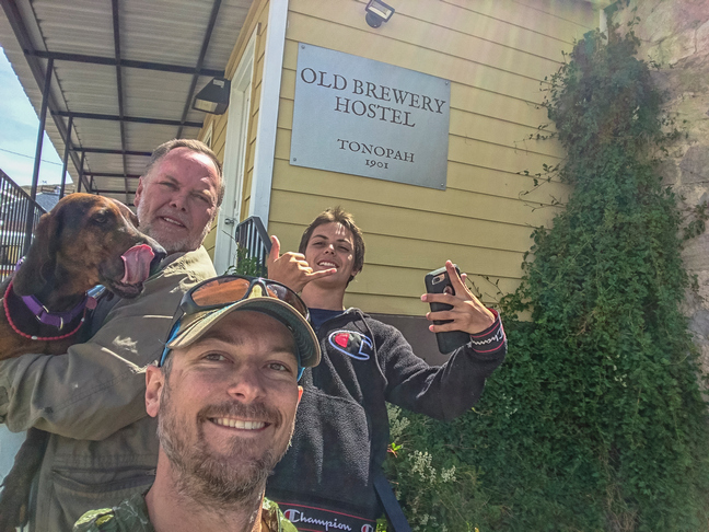
It was a really cold morning. Around 8 am. we left the hostel and headed down to Burger King for breakfast. From memory I thought it was a McDonald’s, but hey, it’ll do. They were serving a couple of lunch menu items even during breakfast, so I got the large bacon King combo. It was actually pretty huge, and really hit the spot. I was starved! By mid day, Matt and Casey left town and continued on their road trip.
I began town chores today. I needed to replace the microphone for my camera that I lost in the bushwhack in Willow Creek, and I needed a few more micro sd cards to continue filming the next section. I ordered these today and will need to stay in town until they arrive, unfortunately. This will be a long and expensive stay, but these are the kind of situations that come with filming and documenting these hikes.
Day 15 – June 15th: Zero Day in Tonopah, NV
Without much else to do today, I walked out of town and through some of the old mining areas on BLM land. Here, I did some rockhounding. Supposedly Tonopah is a great area. However, it has been heavily mined over the years, and any place worth digging is already claimed. Still, I found a few somewhat interesting rocks, but nothing like the turquoise nugget I was hoping for.
Back at the hostel, there was a guy named Tony staying there as well, a contractor working on a job. He saw my rocks and we began talking. Turns out, he had worked in some mines and was very knowledgeable about rocks and minerals. He ended up giving me his jeweler’s loupe as a gift. So kind!
Day 16 – June 16th: Zero Day in Tonopah, NV
Did my grocery shopping today. Raley’s Grocery has a good selection and is considered a “full” resupply. Grocery is located about a mile from the Hostel/Mizpah.
Someone in town told me that the Western Store in town sells cell phones, and that they might have micro sd cards for sale. I figured I’d stop in and see if I could pick one up, even though I had already ordered a few. Inside, I could see they only had the most basic selection. The owner, Paul, asked me what I needed them for and I told him about my hike. He offered to give me the 16GB card right out of his own cell phone! Unfortunately, I need much more storage than that. But what a nice gesture. He also mentioned someone that might be able to give me a ride back out to Lunar Crater tomorrow, which really caught my attention. I told him I’d come back tomorrow if/when my cards arrive in the mail.