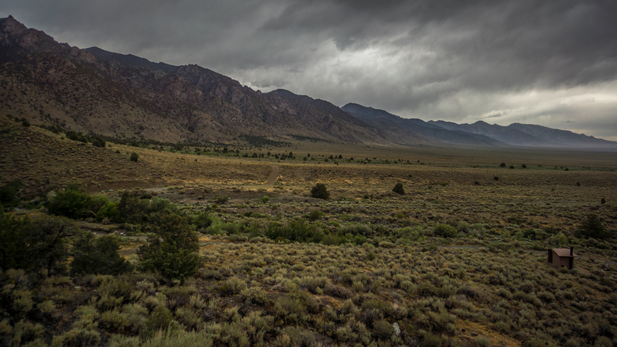
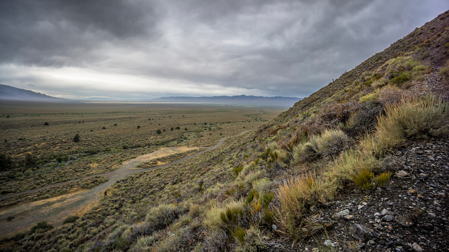
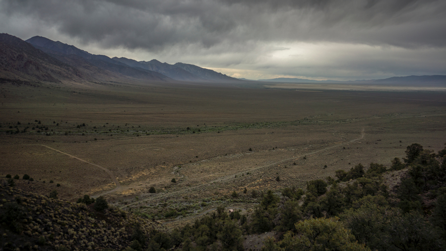
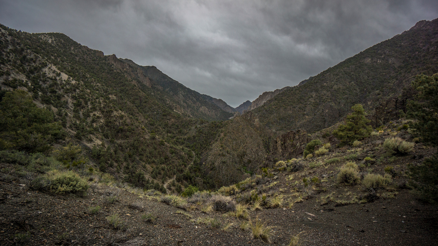
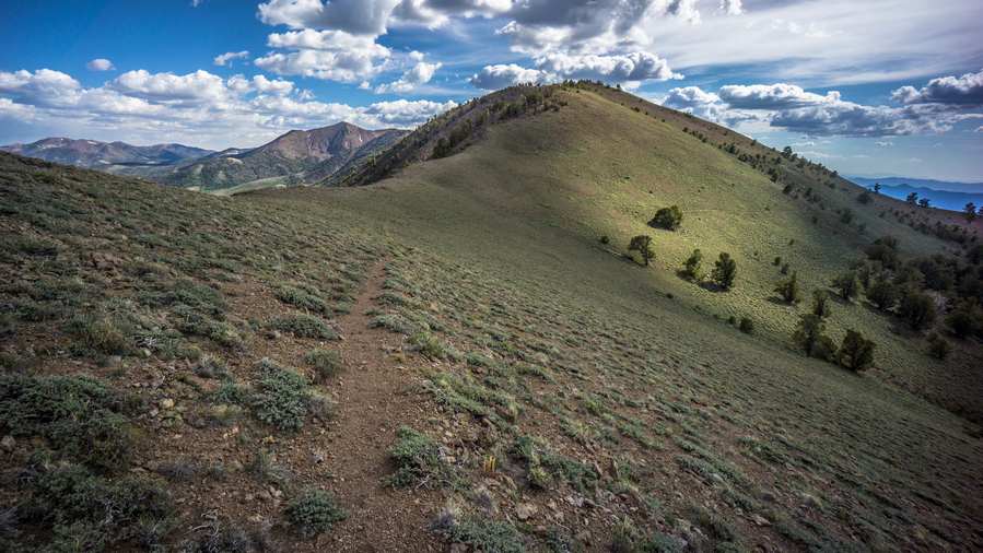
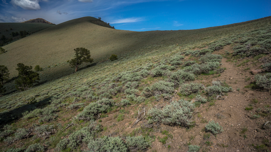
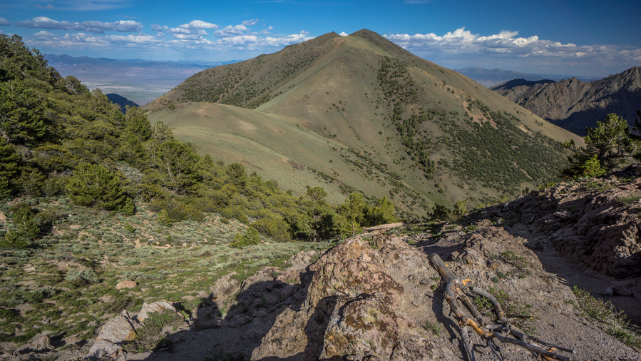
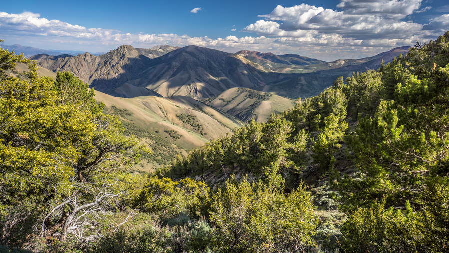
In addition to this trail journal, I also filmed my Basin and Range Trail thru hike. I’ve produced a detailed documentary series (11+ hours runtime) documenting this thru hike adventure, the product of over 1,000 hours of video editing. I highly recommending watching the Basin and Range Trail vlog series for an in-depth look at thru-hiking the Great Basin and central Nevada.
Basin and Range Trail Thru Hike Section 5 Journal
Day 32 – July 2nd: Loneliest Highway in America, Big Smoky Valley, Spencer Hot Spring, Linka Mine
Sarah made me some Farm Fresh eggs with sea salt and a piece of toast for breakfast. These eggs were definitely much better than store-bought eggs. I also had a sausage biscuit and muffin. I gave Sarah my bounce box to send out at the post office since I wouldn’t get there before the post office opens at 10am.
It was 9am when I left the motel and began my walk to Eureka. I walked out of town until I reached a wash, which parallels Highway 50. This avoids a big climb, but doesn’t avoid all the climbing. Always hard to leave town, both mentally and physically. This was no exception. It was rough going at first, with a heavy pack and in the heat.
Pretty green over there, the northern end of the Toiyabe Range
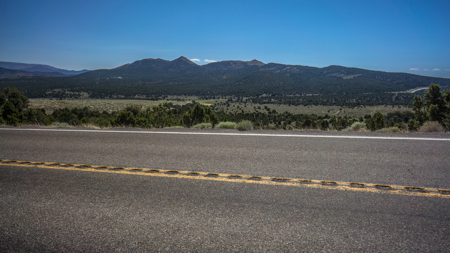
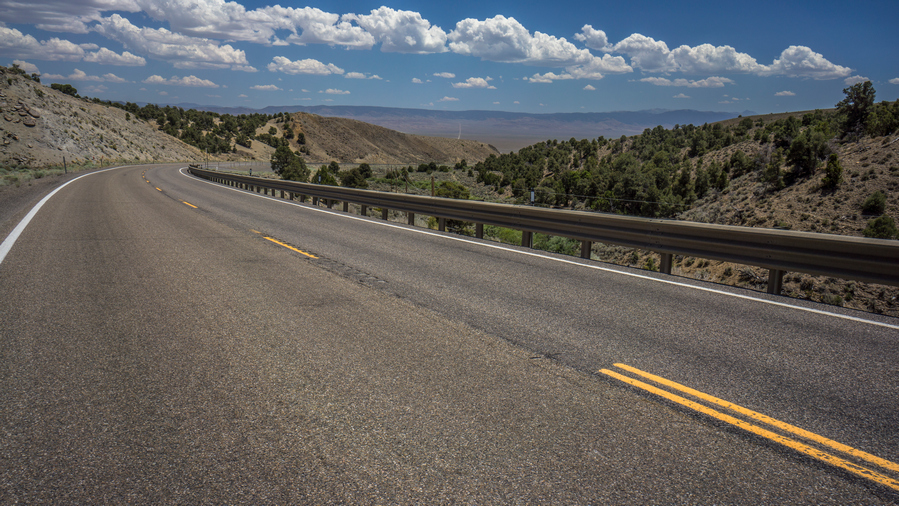
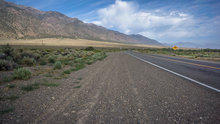
After reaching Austin Summit it was a road walk along Highway 50, the Loneliest Highway in America. However, it didn’t feel that lonely. The shoulders weren’t always very large. I was surprised at how wooded and green it was here along the highway.
Walking the Loneliest highway in America
Leaving “the land of many uses”
I stopped to take a break at a campground/rest area, and realized I had 4g service for the first time in Nevada. Ironic, along the loneliest Highway in America.
Road to Spencer Hot Springs
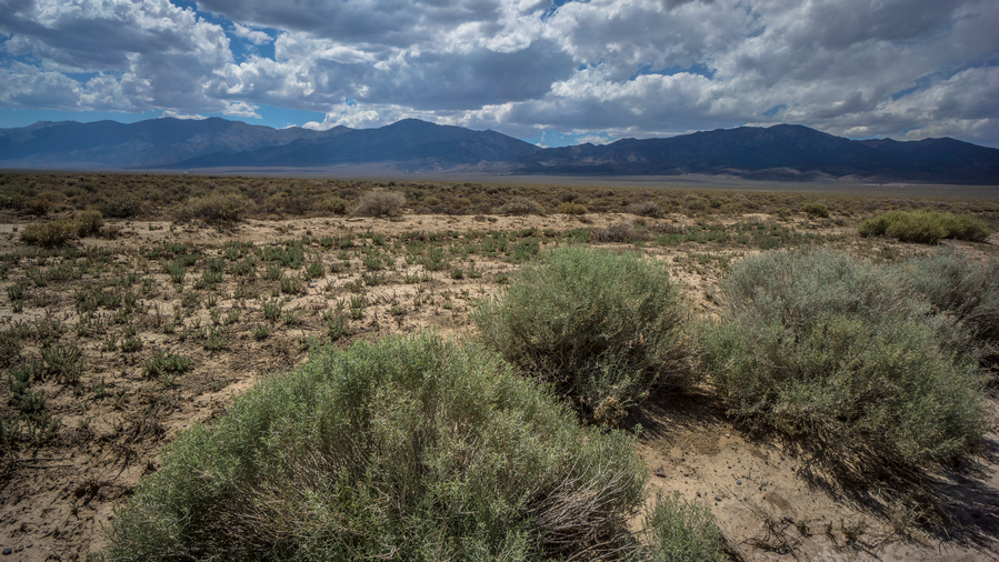
View of the Toiyabe Range from Big Smoky Valley
Big Smoky Valley
Reached the junction for Highway 376, the road South to Carvers. This road was a little lonelier. Short walk along this road before I reached the junction to Spencer Hot Springs. Even this road had a fair amount of traffic.
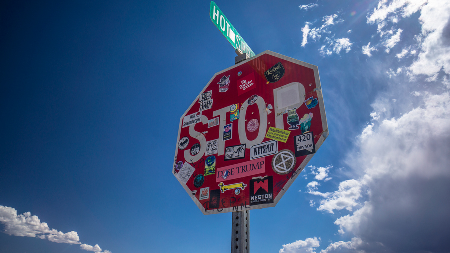
Stop sign with stickers near Spencer Hot Springs
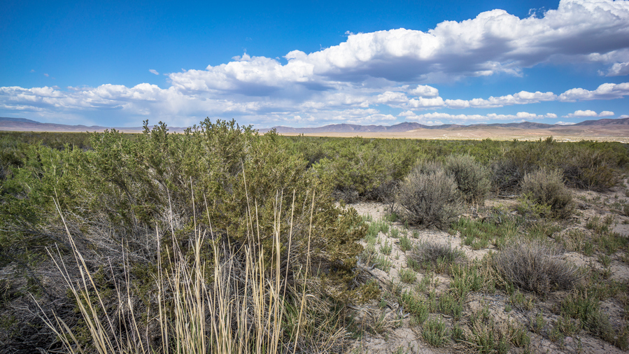
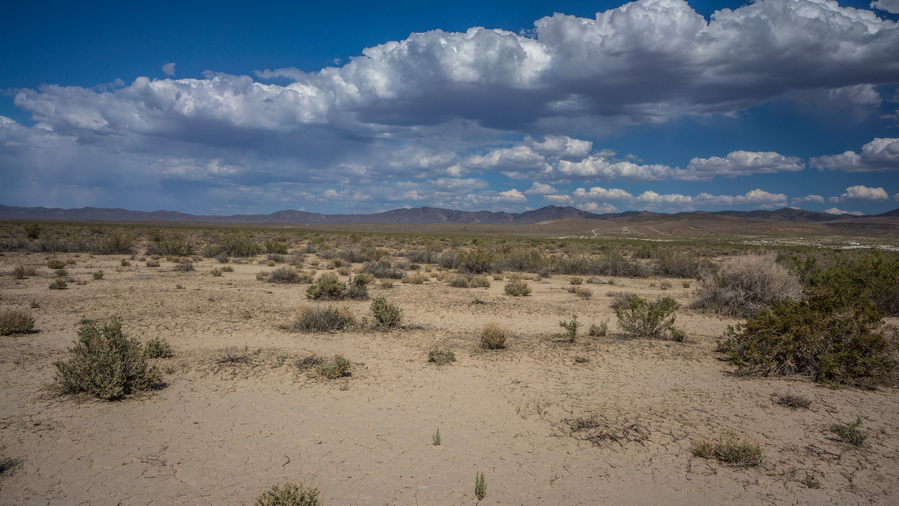
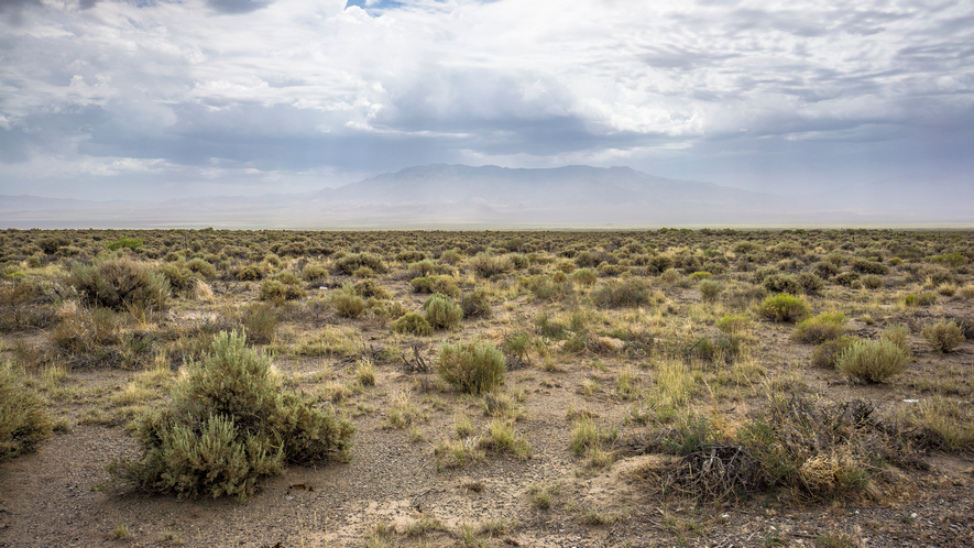
Desert views in Big Smoky Valley
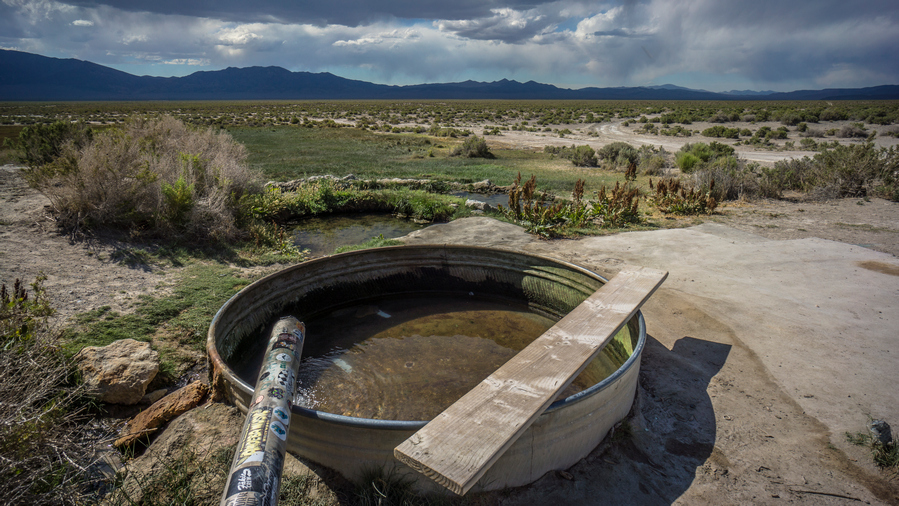
Near Spencer Hot Springs, the stop sign, and other signs, are decorated with stickers from various travelers who have visited the area. You generally know you are somewhere kinda cool when people bother to put stickers on things. Except when it’s in a pristine area, then it’s not cool. Spencer Hot Springs is NOT pristine, it’s heavily trafficked.
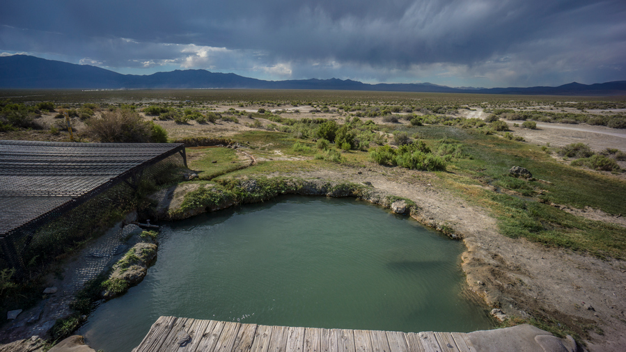
The main soaking pool at Spencer Hot Springs
Spencer Hot Springs. There are multiple springs here, not just this one.
Reached Spencer Hot Springs around 5pm. Dark clouds in the sky now over the Toiyabes. Ate some food and chatted with a woman from Estonia on a motorcycle tour across the US.
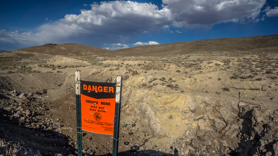
Linka Mine
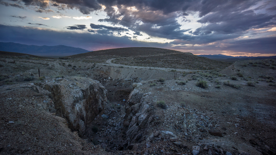
Some of the best rocks and minerals were found here in this section of the Linka Mine. However, it was filled in on my 2021 visit, and there is no more access to this area
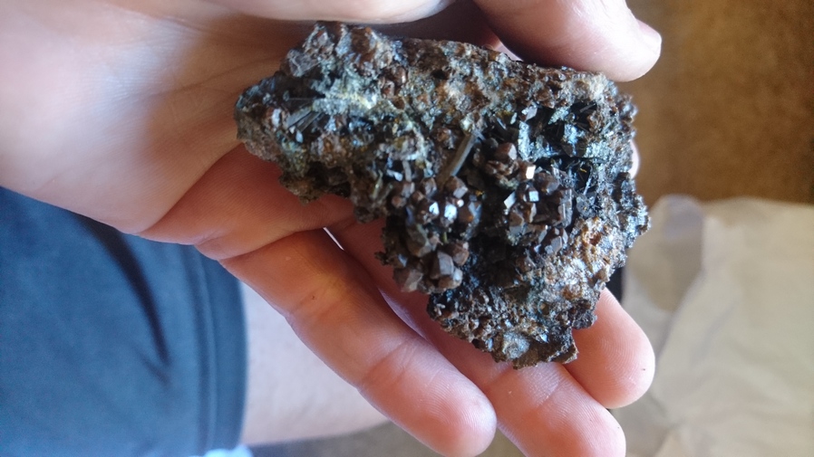
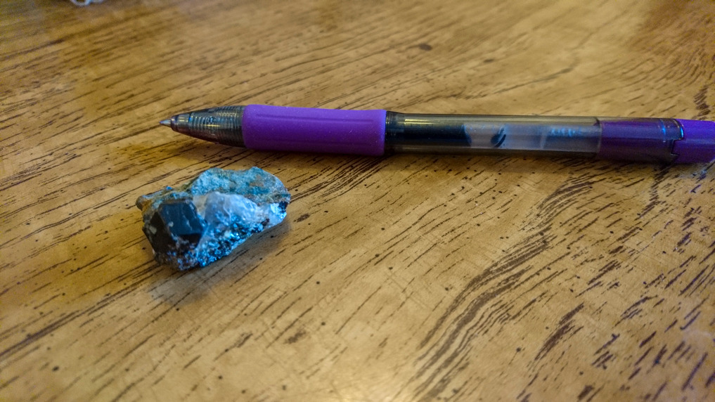
Garnet & epidote specimen from the Linka Mine
Garnet found in the Linka Mine
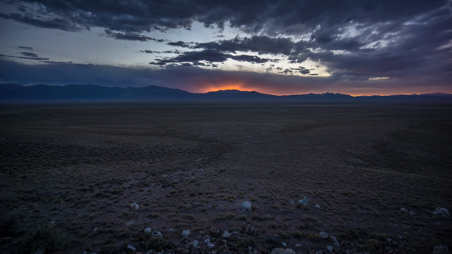
Then walked over to the Linka mine. Stayed here for about 2.5 hours cracking rocks open. Found a whole bunch of interesting rocks and minerals. Perhaps the most interesting I’ve ever found. I found many garnets, a few larger ones and many small clusters of garnets on quartz veins. I also had a nice specimen of epidote. Pyrite can be found here, as well as either galena or molybdenum. Dark clouds loomed over the mine, but they eventually turned to a nice red sunset beyond the Toiyabe Range.
Sunset over the Toiyabe Range
Set up camp in the dark 1/14 mile from Spencer Hot Spring. There were Burros everywhere making noise. Sarah and Cassidy meet me at the hot spring after 10pm, had a soak and brought me a gallon of water. Full moon, too. Went to bed after 11:30pm, much later than my normal hiking routine.
Day 33 – July 3rd: Big Smoky Valley, Linka Mine, Toquima Range, Monitor Valley, Monitor Range
Burros made a lot of noise throughout the night, stomping near my tent and making ridiculous noises. Didn’t get a lot of sleep.
Walked to Spencer hot spring after packing up. Talked to the people here, Rick and Maria. They were from California. Chatted for a while. He asked if I needed water, and I almost never turn that down. Took a few liters, and discarded the empty gallon jug that Sarah brought night before.
Walked past the Linka Mine again this morning. There was a truck parked here, I said hello. It was a young college kid, mining engineer intern, about to head down into the open pit to do some rockhounding himself. We talked for a bit then I showed him what I found last night. His eyes got big, and he said you found that down there? He was pretty excited now.
Hiking through the Linka Mine
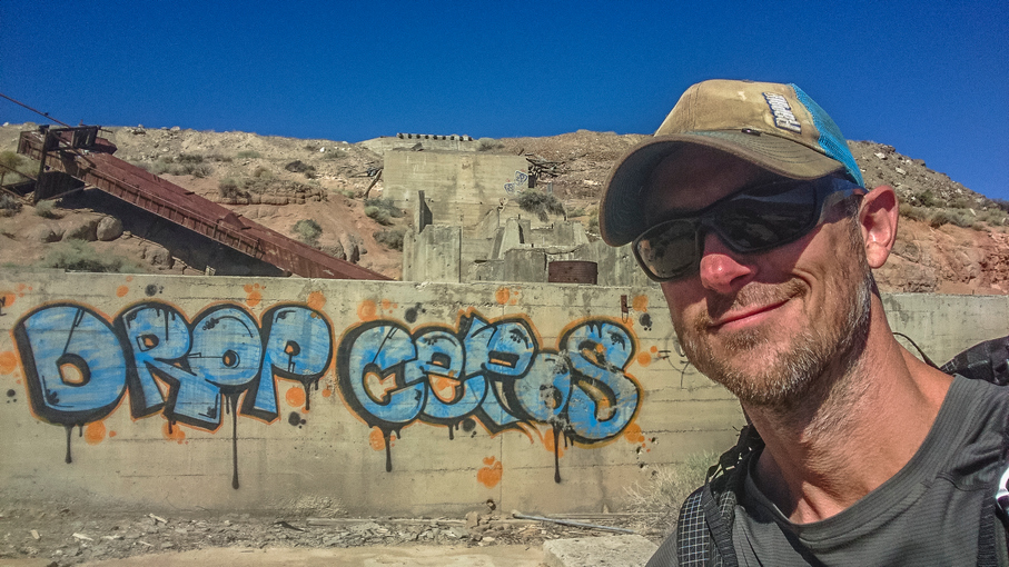
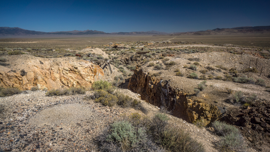
Down the Road, past the part of the Linka Mine I was ‘hounding yesterday, there are some more elaborate ruins of the mine left. Some large concrete pads/structures and such.
Conquest mine
Walked past the conquest mine next. This was deeper and steeper, and completely fenced off. Went down for a look, didn’t see anything too interesting though.
Hiking Big Smoky Valley to the northern Toquima Range
After leaving the mines, the landscape becomes very barren and I felt alone again. The road was loose sand, hard to walk. This was tiring and demoralizing. Saw burros and wild horses.
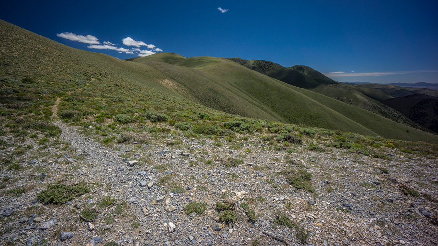
Stopped for a break at the base of the Toquima range, which is a much smaller obstacle compared to the Mt Jefferson area in the south. That is, until one is at the base of it. Still, it’s small for a mountain range, as this is the extreme northern end.
Hiking up the northern end of the Toquima Range. View west across Big Smoky Valley to the Toiyabe Range
The road dead ends into a wash. From here, it’s up to me to find my way up and over. Now I realized how hot it was. Even though it wasn’t very tall, it was still a several hundred foot climb, and had me breathing hard. Weaving in between the pinyon pine and mahogany trees.
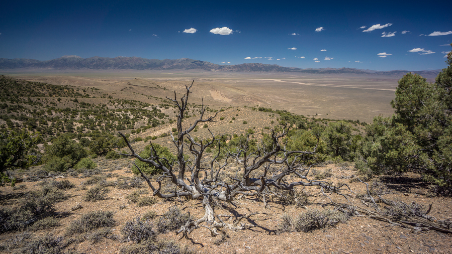
View west from the crest of the northern Toquima Range
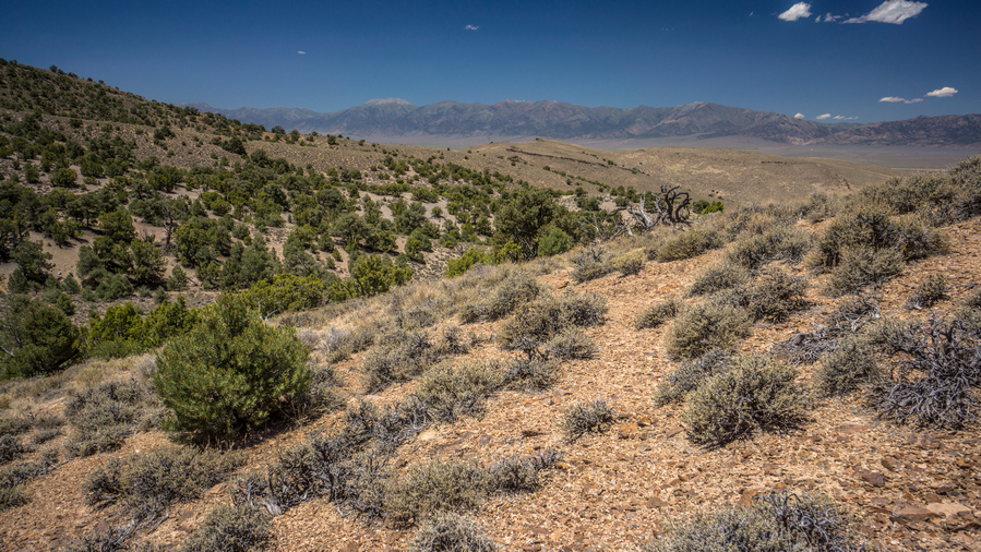
At the top, nice views of big Smoky Valley, but not much view of monitor valley… Lots of trees, rolling hills. Now the descent. Pretty plain looking, just weaving in between trees through red-orange Sandy soil.
Last trees before hiking Monitor Valley
Before I hiked past the last trees and was at the mercy of the relentless sun, I stopped for a break. This is my routine now, and one that I think almost desert hiker mimics… Take a break under the last shade tree.
Toquima Range, view from Monitor Valley. What was a prominent landform in the south, is now a meager set of hills in the north
After passing the last trees, I entered a sea of sage brush. I dread this, but no other way forward. I need to walk through miles of sage brush before I reach a road. At first, it’s a pain. Then it snowballs into more of a nightmare. In the beginning of this hike, this was more manageable mentally. Everything is, spirits are high and even the worst of things seem easier to deal with. After a month though, that feeling fades. Waking miles of sage brush in a hot valley with no shade can test the mental toughness of just about anyone.
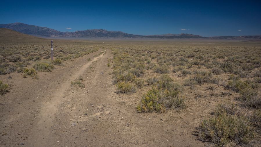
Old 4×4 road in Monitor Valley
Monitor valley looks very barren here. Empty, remote. No signs of roads anywhere. Then, all of the sudden, I stumbled on an old dirt road, only visible from 50ft away. What a relief!
Dry well in Monitor Valley
Followed this north to another road that intersects it heading east. This is what I want, now heading across the valley towards the monitor range. A well/tank can be seen in the distance, about the only thing that stands out from the sage. The road passes by, but there doesn’t appear to be any water.
Hiking across Monitor Valley
I followed the dusty road for a couple hours until I reached the main road that runs north and south through the valley. I crossed the road and headed towards Wallace canyon.
My right leg had been giving me trouble today, a dull pain in the thigh. It was sore and tender to the touch. Becoming more of a concern as the day goes on. I debated what to do… Follow the road north to hwy 50? Try to cross the monitors, with 5,000ft of elevation gain? Hike a low route through the monitor range? I took a couple ibuprofen and kept going.
Approaching the Monitor Range
Just then, a truck passed by. Two hunters out scouting, Keith and Johnny. They were super impressed with what I was doing and offered to help in any way they could. They filled all my water bottles and gave me their last piece of KFC fried chicken. Who only knows where the nearest KFC is, but I can tell you its a couple of hours away. This was a real mood booster. I left Keith and Johnny feeling really good, both physically and mentally. My leg was feeling better and my mood massively improved.
Wallace Canyon
Walked into Wallace canyon, saw the first trees of the Monitor Range. Stopped for a dinner break, at a little campsite that had a few scattered deer legs on the ground. I guess people/animals don’t eat those.
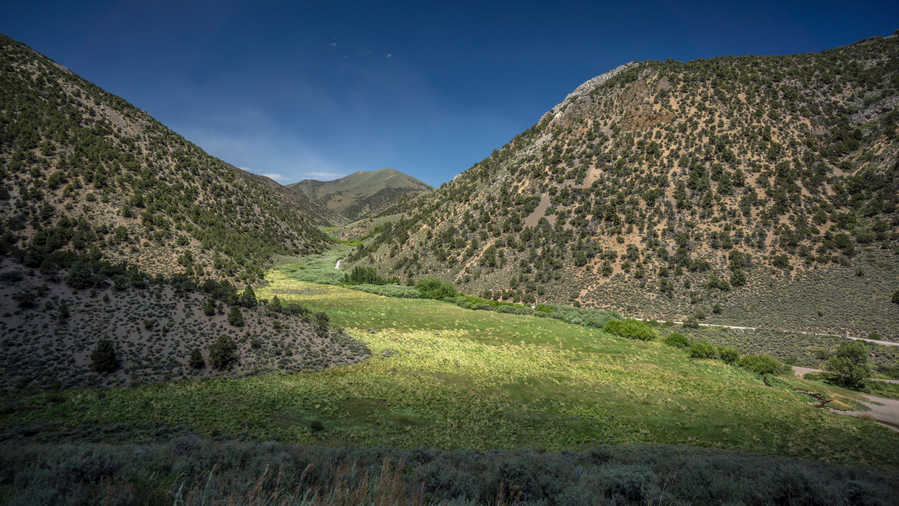
There was a small spring in Wallace canyon with huge willows and vegetation lining the road. The rest of tonight’s walk was rather uneventful. The canyon looked pretty thick, and I was glad to have a road. Saw a couple of deer. Some groves of aspen with a subpar campsite below the pass. Thought about camping here but pushed on.
Campsite in the northern Monitor Range
Not a bad view from camp tonight
At the top of the pass, where the high and low routes split, there were a few camp options. Of course, I Climbed a hill above the pass for the best view, and found a decent campsite here. More than decent, damn good spot considering what else was around. Sun going down, a really nice sunset. And, 4g just on this hill!
Day 34 – July 4th: Monitor Range, Summit Mountain, Trail Magic
Woke at 6, great sleep last night. Amazing sleep actually. Feeling much better this morning. No leg pain. Lots of bees buzzing around here. Lots of prickly pear cacti on this little hill.
Wallace Canyon
The route up to Big Flat from Wallace Canyon
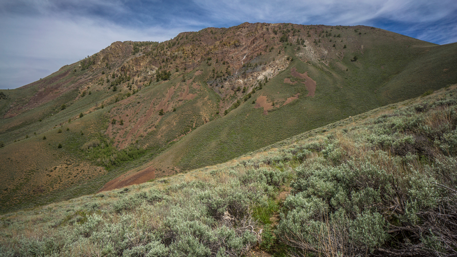
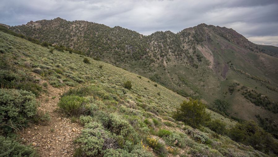
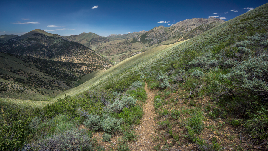
Decided to take the “high route”. It will offer better views, despite the hugely additional elevation gain. I almost instantly regretted it. Dripping wet with sweat at 8am. Steep 4×4 roads that were poorly laid out for the hiker… Up and down constantly instead of contouring around hill sides. This was demoralizing. It’s demoralizing because the views aren’t really that great, even from the “high route”. In the northern portion of the Monitor Range, it’s mostly a series of hills, not serious mountains like in the south. But that’s the issue with Section 5 in general. It’s just not going to be spectacular no matter which route one takes from Austin to Eureka. I think every thru-hike has some type of filler section, and on the Basin and Range Trail, this is it.
Nearing the top of Wallace Canyon
4×4 roads running along the crest of the Monitor Range
It was a rather tough morning. I struggled through it. There was little water compared to what I thought would be here. Very small trickles of water, only occasionally. To collect from these, one would need to follow the water and definitely dig out a hole to collect from. I had a couple of liters, so I kept going.
Monitor Range vistas
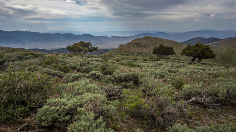
The best views of the day were pretty weak compared to what I’m used to. For a brief moment, I enjoyed a scenic little hill with a distant view of the Monitor Range.
Summit Mountain, aka Broken Back #2
Saw about 20 horses in the valley below as I worked my way along an upper Ridgeline. Now, summit mountain (marked on some maps as broken back #2) was clearly in sight. The plan is to go up and over. Looks steep on the map, but doable.
I took a game trail around the final hill that lies between me and the saddle below summit mountain. This worked well at first, then turned into a sage brush bushwhack.
I took a break at the saddle below summit mountain. From here it looked very steep and intimidating, although it doesn’t look bad at all on the topo maps. Not Rocky/Bouldery, but a mix of low grass and small rocks.
Just then, I heard the sound of a distant engine. It grew louder and louder, until I realized someone was coming up the canyon below. This was Allison creek, a route I was considering to avoid summit mountain. Two rzrs came up the hill into view, and I wished them a happy 4th of July. They were just as surprised to see me as I was to see them. In fact, they were probably more surprised that I was there, especially without a vehicle.
Naturally we stopped and talked for a while. Quite a long while actually. I would say a solid 45 minutes. This was the Terras family, currently living in Elko. Travis, Gaye, Cody, Tim and Jim. They offered me water, Gatorade, and beer.
This was basically their stomping ground. Monitor Valley in general. Hunting, camping, relatives in the area, you name it. Central Nevada is what they know. They were very interested in my hike, with my route going through territory that was so near and dear to them. We discussed the typical topics that I get asked; water, food, navigation, animal sightings. They all had binoculars around their necks, trying to spot wildlife. Had they been just 15 minutes later, they would have seen me scrambling up Summit Mountain, probably pretty confused that a person was out here trying to climb it.
They offered to give me a ride anywhere needed to go. One of the options I was looking at was Peddler Creek, where I could then bushwhack up to a saddle between Antelope Peak and Summit Mountain. This would take me over to Falkner Creek where I was headed. Of course, me being hard headed and stubborn, I didn’t want to take a ride. At the same time, I didn’t really want to hike over that mountain, and the other options to go around it where just as long and likely more arduous.
They were headed over the pass and in the direction of peddler Creek anyway. My map shows the trail ends at the Saddle, although it clearly went down the other side. Their goal was to see how far that road went, assuming it connected to Peddler Creek. I fought with myself for a while, debating what I want to do. They had been tempting me with beer and steak, offering to let me camp with them this evening. I figured I would at least take the ride down to Peddler Creek, that is if the road even exists. So I jumped in the rzr with them and went barely more than a hundred yards down hill before the road ends in a Grove of Aspens.
It was now after 1pm, and I had spent over an hour with the Terras family. The goal is to get into Eureka by 8pm tomorrow night. If I go back up to the top of the saddle and try to head over Summit Mountain, I know it will be a long hike. I likely would fall behind schedule.
I considered this section a filler from the beginning, far from a highlight of the Basin and Range Trail. Simply a connector between Austin and Eureka. Having already explored the Linka mine and taking a soak in Spencer Hot Springs, I had already done the things I was interested in doing throughout this section. It was a tough choice, but ultimately I accepted their offer to drink beer and eat steak with them. They have even offered to drive me into Eureka as this was on their way back to Elko, if needed.
You might ask yourself why this was such a hard decision to make. I asked myself that very same question. What do I have to prove? What do I have to prove to myself, to anyone else? I was adamant about walking continuous footsteps from Mexico to Canada on my Continental Divide Trail thru hike, but that made sense to me. You can’t say you walked from Mexico to Canada if you skipped a bunch of it. But here, on the Basin and Range Trail, I am not even hiking a complete loop, just a random route from one arbitrary place to another. Continuous footsteps is not my goal here on the BRT. Adventure and a great experience is what I’m after.
So, reluctantly, I accepted their offer and basically stopped hiking halfway through this section. It was a relief at the same time. Now, I could enjoy the 4th of July like a normal human being, spending it with other people.
As soon as I said I would join them and camp with them, they said great, now you can drink beer with us! Gladly, I said. I need to catch up!
We spent the next couple of hours cruising around on the side by sides. Finding little hills with a view, finding hidden campsites, exploring the countryside while having somewhat deep conversations at the same time. It was incredibly satisfying to be able to take a break like this in the middle of a hike. A physical and mental break. And on the 4th of July, it really meant a lot to be able to kick back and just enjoy the moment, with some super friendly folks.
We found one campsite nestled in the Aspens on a little Hill that had a granite countertop installed in between a couple of Aspen trees. That’s right, a granite countertop! This perked our interest and was an obvious place to stop for lunch. The granite countertop was a great place to lay out all the food, crackers, cheese, summer sausage etc. It felt like a real luxury for the outdoors.
I had never ridden in a side-by-side before. I was really impressed at how well they handled the terrain. Just this morning, I was wondering how it’s possible to drive a vehicle up some of these roads. Now I know. They have really low gearing for the downhill sections, and the suspension is incredible. Many times it felt like the vehicle would just tip over, but it kept going, handling it like a beast.
We got back to camp Terras late afternoon. Camp was a long a small Creek, surrounded by Aspens. Not the most level ground, but I found a nice spot pretty close to the creek. They had all the luxuries of car camping… Fold out chairs, table, cooking stove Etc. It was nice to sit in a comfy chair. One of the things I miss most when hiking.
Hanging with my new friends
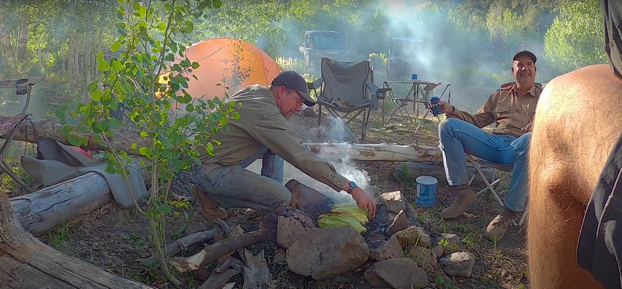
They got started on dinner shortly after 5 PM. They utilized the fire ring to cook corn over a metal grate. Mostly, it was being smoked at first. Then burned a bit. Methods used to cook this corn became the topic of laughter. In the end, it came out just fine. Meanwhile, Travis cooked the steaks. I felt a bit useless, just standing back while everybody else did something. Course I asked to help, and was told to just sit back and relax. This is always a bit hard for me to do.
After dinner we lounged around and exchange stories. Me being the guest, I think it was my obligation to contribute in that way, with stories. Having hiked and traveled quite a bit, I enjoyed sharing my experiences, and maybe more importantly, my insight on these experiences. The older I get the more I realize how these travels and experiences have shaped me as a person. In a positive way. I look at my life in Detroit before my CDT hike, and not being much of a people person. In fact, hiking in general was a way to get away from people. And now, I see long distance hiking as a way to connect with people, from all walks of life. I’ve always been the type of person that has a hard time accepting anything from anyone. Even when expected, such as on my birthday, I feel very appreciative of a gift or anything that has been given to me. So when people take me in like this, I barely have the words to describe my gratitude.
Day 35 – July 5th: Trail Magic, Antelope Valley
I woke up at 7:30. Tim was already cooking bacon, the sound and smell was great to wake up to. I asked Travis how he was feeling this morning, and he said, I must have been pretty drunk, everyone has asked that!
They were a little low on food for breakfast, so I ate some of my own food but I still Had a small portion of bacon and eggs. Delicious! After that we packed up camp pretty promptly. They seem to be pretty efficient at that, breaking everything down pretty quick. We loaded up the side by sides and headed downhill.
On the way down, Tim stopped here and there for burls. These are the knots on a tree that form when a branch breaks off, and the tree heals itself. A big ugly looking brain, or mushroom look. He cuts these off and uses them in his woodworking projects. Maybe a vase, lamp post or whatever. He turns them on his lathe. also makes something called dragon eggs, where he mixes resin into the wood fill the gaps. The grain of the wood Mixed with the resin was really cool looking, from the pictures he showed me. These are the kind of projects that it seems very few people do, almost like blacksmithing, like a forgotten art. Pretty neat actually.
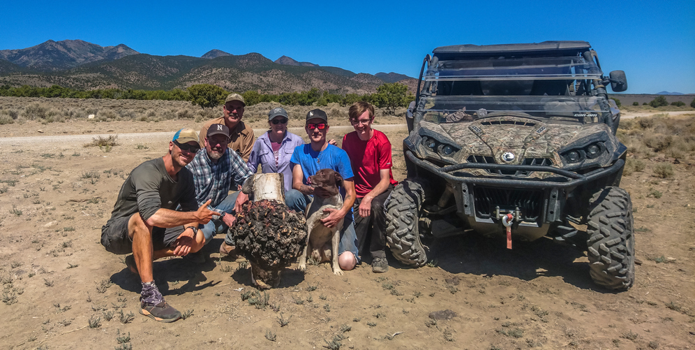
Group photo with the Terras Family and I
A few miles down hill, the valley opens up and we reached the spot where they parked their trucks and trailers that haul the side by sides. It was pretty hot now down in Antelope Valley. While loading up the side by sides, I got everyone together for a group picture. We got the largest burl and posed on front of it of the side by sides. This was great, I love these group pictures. They are pretty tough to come by, but perhaps some of the most meaningful pictures at the end of the day.
Soon we were all loaded up, and I jumped in the truck with Travis and Gaye. They were passing through Eureka anyway, so it wasn’t a bother for them to take me here. My goal was to reach Eureka by 8pm tonight. Had I walked from the spot they Park their trucks and trailers, I would not have reached Eureka this evening. Skipping so much of the planned route, about 40 miles, was a bit hard for me to swallow mentally, but I had already accepted the situation. Now down in Antelope Valley, I certainly wasn’t disappointed to have skipped this section, in the sense that I felt I was missing something, because it was a rather bland looking valley. The temperatures in June were rather mild, but now, in the low-90s, Crossing these valleys is a lot less appealing.
When we reached the Sundown Motel in Eureka, Travis and Gaye got out of the truck and we said our goodbyes. We had exchanged phone numbers and tentatively planned on meeting up again when I finish the Rubies. Since I’m coming out in Lamoille, it’s just a short ways from Spring Creek and Elko. They were more than happy to offer any help they can when I reach their Hometown.
Checked in to the sundown motel. My box was waiting for me in the lobby, a new pair of shoes. Checked into the room, showered, then walked across the street to the Owl Club. Funny, it has the same name as the place in Austin, even though they say they are not related. Seems like a strange coincidence to me. Ordered their biggest burger, double bacon cheeseburger and fries. It was probably one pound, and of course, put it down with ease.
Ate dinner again at the owl club. Made eye contact with a guy at the bar who is about my age. We kind of did “the nod”. I asked him how the 4th of July was, knowing they have a big Fourth of July party in town. He said he just got in today, and missed it. He asked me about mine, I told him about my story with the folks in the monitor range, part of my 1100 mile hike. He did not seem impressed, and that was the end of the conversation. He literally shrugged his shoulders and turned his back on me after hearing about my hike across Nevada. But that’s Eureka for you. This felt like one of the least welcoming towns along my hike.
Day 36 – July 6th: Zero Day in Eureka, NV
Breakfast from the gas station, a couple sausage biscuits and muffin. Spent all day doing chores; Paid Bills, called dad to have him send a box to the Spring Creek (Elko) Post Office with new gaiters, boxers and a new Patagonia capilene daily wear shirt.
Walked up to the Pony Express Deli at the end of town for lunch. Went off to the Post Office and mailed back rocks I found over this past section, and my old shoes. I still wear these when mowing the lawn or whatever, even if they are no longer trail worthy. Then walked up to the grocery store. This was a mile or more out of town. For such a big store, the selection was pretty terrible. I cobbled together what I needed for the upcoming 8 Day hike across the Diamond Range and Ruby Mountains.
I’ve been talking with Cody Terras today about meeting up in Lamoille. He wants to join for a section in the rubies, which would be awesome! So maybe the section north of Lamoille Canyon. Plans to be determined later.
In addition to this trail journal, I also filmed my Basin and Range Trail thru hike. I’ve produced a detailed documentary series (11+ hours runtime) documenting this thru hike adventure, the product of over 1,000 hours of video editing. I highly recommending watching the Basin and Range Trail vlog series for an in-depth look at thru-hiking the Great Basin and central Nevada.
Basin and Range Trail Thru Hike Section 4 Journal
Day 25 – June 25th: Big Smoky Valley, South Twin River, Toiyabe Range, Toiyabe Crest Trail
Woke at 8. Called the Sundown motel in Eureka to ask if I can send a box. They said sure, so I called my dad to relay the message… Send new shoes to Eureka.
Packed my gear and hit the road around 9:45am. Feeling good physically, better than yesterday. My back is feeling fine now, thankfully. Weather shows afternoon thunderstorms, 70% chance of like 0.02 inches.
Toquima Range obscured by haze, view across Big Smoky Valley
The walk out of town along highway 376 was nice, for a road walk. It was really hazy looking today, and the Toquima Range eventually disappeared from sight. Still, the massive Toiyabe Range looms high above me as I walk the base of it north, looking for my way in.
One guy stopped in the road to ask if I was ok. He seemed extremely confused to see a hiker. I told him I was walking 1000 miles across Nevada, I’m good and don’t need any help. I got a blank look. Super confused. I reassured him I’m good, and he drove off, confused. Classic reaction.
Shortly after, I turned down the road that leads to Twin River, start of the Toiyabe Crest Trail. Around this time, the Dark Skies turn to rain. Not very heavy at first. Then some tiny hail. Then thunder. Then lighting. Then windy. Fortunately, I found shelter in the bathroom at the parking area around noon. There was one truck here, but he must be out hiking in this. Yuk!
Storm clouds over the Toiyabe Range
It seems like were getting more than the .02 inches of rain the weather was forecasting. Constant lightning and thunder, sounds really nasty. I waited out the worst of it here. When the thunder and lightning subsided, I made my move.
Massive view across Big Smoky Valley
View over Big Smoky Valley and the Toiyabe Range
The trail climb steeply from the parking lot. However, almost immediately I was rewarded with expansive views of Big Smoky Valley, and great look north at the Toiyabe Range.
View into South Twin River canyon
South Twin River entrance along the Toiyabe Crest Trail
Toiyabe Crest Trail enters South Twin River
Soon the trail leads me to the canyon entrance to South Twin River. Once over the first little hill, I had my first view into South Twin River Valley. Wow! Really, wow! Steep and Jagged rock formations everywhere. Walk 50 ft, stop and look around with awe. Walk another 50ft, and repeat. All while watching your footing on the Steep Hill sides. I could tell I was going to like this place.
Lush green vegetation lines South Twin River
South Twin River
The trail sits up high above the river for a bit to avoid a narrow section of the canyon. Before long, it drops down to South Twin river. Similar to Pine Creek in the Toquima range, it was thick, lush and thorny, with steep Canyon walls surrounding you. However, decent trail. Very nice indeed.
Hiking South Twin River
One of many stream crossings along South Twin River
The first River Crossing I was able to jump across the river. Certainly the river is up a little bit from the recent rain today, I’m sure there would have been rocks to hop across otherwise. At the second River Crossing, I was not so lucky. I accepted the fact that my feet were going to get wet today and just walked through the river. This would be the 1st of at least 30 River Crossings.
Amazing canyon section along South Twin River
Vertical rock formation with a cave in it!
After one of the first couple River Crossings, I was blown away by what I saw. At first, on my left was a giant Rockwall that was several hundred feet high, straight up. And not on a slant or anything, literally vertical. Just a little farther up the trail was an 80ft vertical pillar just protruding from the ground on it’s own. My reaction was probably pretty comical, think I said something like, “are you kidding me?? Come on!” I was on awe. Just when I thought it couldn’t get any better, I walked further up the trail and on one side of the Rock pillar was a cave! A cave in a vertical rock pillar! I thought I was in a fairytale book, things like this don’t exist in real life. Unfortunately the cave was difficult to reach, especially with the wet rock from the rain and my increasingly worn shoes.
Towering canyon walls in South Twin River
South Twin River hike proves to be very scenic
Hiking the Toiyabe Crest Trail through lower South Twin River Canyon
More Majestic scenery throughout the next couple miles. What an impressive Canyon. However, vegetation was thick and thorny. It was also wet, so it was a pain to move through.
One of many river crossings along South Twin River
Through the hike up South Twin River, there were river crossings at frequent intervals. Perhaps there would be less water flowing if it hadn’t rained recently, but chances are, you’ll be getting your feet wet hiking here.
At one point there was a steep Hillside with loose rock, at the junction of South Twin River and South Fork South Twin River. Looking up, there was a narrow Passage with a large tree. For some reason I had a hunch that there was something up there, maybe a hidden cave, I don’t know. But I felt compelled to check it out.
Junction of South Twin River and South Fork South Twin River
These canyon views really impressed me
Rock was wet and treacherous. I made my way up to the large tree, expecting to see a cave entrance or something. But there was nothing here. I could have kept chasing my hunch up increasingly steep and more treacherous boulder chutes, but I gave up and went back down. The way down provided an amazing view of vertical rock formations throughout the canyon. This was almost worth it on its own, a really unique view amongst all that I have seen on the Basin and Range Trail.
Jagged ridgeline along the cliffs that tower above South Twin River
Past a couple of campsites at a trail Junction. They were a long the river though, I almost never camp in these. Too much condensation overnight. Not that tonight will be dry anywhere. Besides, it was still too early, so I kept moving.
The next section of trail was really thick with vegetation. And lots of River Crossings. Jungle-like. Thorny. Everything was wet. I was wet. I was ready to get to camp. I had seen a couple of small caves, including the one in the pillar, and was really hoping to find a suitable cave to sleep in. To be out of the elements, and dry my things off.
To my surprise, I reached a bit of an open clearing with a Rockwall. Along this Rockwall was a small cave, with the grassy Hillside below. From the trail, it looked absolutely perfect. The kind of cave I had been waiting for! I’ve never been able to find a suitable cave to sleep in, at the right time. I climbed up to the cave, and my initial thought was that it was too small. I thought maybe I could set up my tent in front of the cave on the grassy Hillside. Which I certainly could have done. Ultimately, I decided to cowboy camp inside the cave.
Cave in South Twin River. Good place to camp on a wet and soggy night
Sunset in South Twin River canyon from my cave campsite
The cave was small enough that there were no animals living in it, and no obvious signs of holes or burrowing. The ground was flat, and pretty clear overall. I had space to set up my gear and hopefully let things dry out a little bit overnight. The rain looked like it was over, but who knows.
Day 26 – June 26th: South Twin River, Toiyabe Range, Toiyabe Crest Trail
Cowboy camping in a cave in South Twin River Canyon
Didn’t get much sleep last night. My air mattress now has a slow leak, and needs to be refilled every 2 hours or so. It was pretty cool sleeping in a cave though!
View back down South Twin River, where I came from
Trail junction: left for the Toiyabe Crest Trail, right for the North Twin River Trail
Looking up South Twin River towards the crest of the Toiyabes
Everything was soaking wet from the rain yesterday. And of course, the vegetation continued to be thick. Also, there were a bunch more stream Crossings. At least the stream was smaller now, and mostly I just jumped over it.
South Twin River still flowing in it’s upper reaches
The scenery in Upper South Twin River Canyon was much less impressive than the lower portion. It was pretty much just bushwhacking through wet and sharp vegetation. Very frustrating at times. The section of the trail is in dire need of maintenance.
I waited until the last minute to get water out of the Stream before the final climb out of South Twin. There was a lot of cow shit here, and it was fresh too. I know this because I slipped in it. It was that soft. But I didn’t see any cows or hear them. Filtered some water and took 2.5L with me.
Dusting of snow on the Toiyabe Range from yesterday’s storm
The final climb up to the saddle below Arc Dome was a pain. The trail literally followed the bottom of a drainage. It should have followed the hillside and kept you out of the thick brush and rocks. This seemed to take forever. To the south was a couple of mountain peaks covered in fresh snow. I guess that was from yesterday, while I got the rain high elevations got the snow.
First distant view in the Toiyabe Range
Saddle below Arc Dome
Hiking below Arc Dome
Finally up on the saddle, I could enjoy my first long-distance view. Very nice! Arc Dome still loomed above, and I contemplated climbing it. The original plan was to bag it, as an out and back. However, I am behind schedule with the thunderstorm yesterday that I waited out. So after following the trail up to the saddle below Ark Dome, I decided to pass. It was the smart call to stay on schedule for getting into Austin.
Hiking along the ridgeline below Arc Dome
View north along the crest of the Toiyabe Range
Break spot, with a rgeat view of the Toiyabe Range
I took a break at the edge of some cliffs with rock seats and a nice view. Here, I could take off my shoes and dry my shoes, feet and socks in the Wind and sun. And that’s just what I did. Man what a difference that makes, having dry feet again.
Looking back at Arc Dome
Hiking north along the TCT
Panorama view of the Toiyabe Range from the TCT
After my break, I was hiking good trail now on the Toiyabe Crest Trail, or TCT. Excellent views, nice solid trail, mostly. It was mostly a climb up a couple of consecutive Hills, and then it really flattened out. A lot like the table mountains in a way. Better views though.
Snow capped ridgeline of the Toiyabe Range
Big views along the TCT
Big open views along flat sections of the Toiyabe Crest Trail
I really enjoyed most of today’s hike. Great views of the Shoshone range to the west and big Smokey Valley to the east.
Beautiful high mountain scenery along the Toiyabe Crest Trail
View from the TCT
The Toiyabe Crest Trail offers excellent hiking
The trail here was good. Easy to follow, seemed to be well maintained. Not a lot of brush, easy walking, other than the big climbs. Even then, there wasn’t anything too big, couple hundred feet maybe. This added to the enjoyment level.
Looking back on a section of the TCT
View west to the Shoshone Range from the Toiyabe Crest Trail
View east across Big Smoky Valley from the crest of the Toiyabes
I only brought 2.5L of water from South Twin River Canyon up to the crest. This decision was pretty short sided, in that I just didn’t want to haul a bunch of water up and already steep and brutal climb to the crest. Of course, I should have brought more. I had to ration my water all day.
Expansive views while hiking the Toiyabe Crest Trail
View south from the TCT
Rolling ridgelines along the crest of the Toiyabe Range
One thing I did to mitigate my water problem was collect snow from the cornices at the top of passes and ridges. I filled both of my Gatorade bottles, because they have the wide mouth opening, with snow. Later, I came across another snow bank. Then, I took the water that has melted from one bottle and poured it into the other. I added more snow to the other bottle. In the end, I got about 1.5L of water from these two 1L Gatorade bottles. Not Bad!
View over the Toiyabes
View south
Toiyabe Crest Trail panorama
I was feeling pretty tired from todays hike and took a break around 5:30. Ate food, drank a little bit of water and moved on. I was feeling much better, just in time for a great evening walk.
The crest of the Toiyabes is a great hike
The TCT often follows the ridgeline proper
View east into Big Smoky Valley
The walk along the Ridgeline tonight was awesome. This must have been up there with some of my favorite Ridge walks of all time. Beautiful scenery, trail stays really high and beautiful sunset. At one of the passes, a road runs up and over. Here, a Subaru Outback was parked. I expected to see someone in the vehicle, but I did not. I assumed they were out hiking, and wondered if I would run into them. I didn’t.
Sunset in the Toiyabe Range
View north along the TCT
Tonight was the night of the never-ending sunset. It seems like the sun was low in the sky forever. It set in slow motion, and literally felt like the longest sunset of all time. I’m not complaining, this was quite amazing actually. To be able to stretch out such an amazing sunset provided seemingly endless photo ops.
View east into Big Smoky Valley from the Toiyabe Crest Trail
The Toiyabe Crest is an incredible place to walk at sunset
The never ending sunset!
I had been looking for a campsite before the sunset began, but no such luck. Pre-existing campsites are few and far between up here. Pretty much just have to look for a clearing, that doesn’t have too much cow shit. To my surprise, I made it to the next spring on my map. I wasn’t thinking I was going to make it this far tonight, but it was such a great walk that it kept me going a little bit later than usual.
Views along the TCT
Sun setting over the Shoshone Range
Colorful sky as the sun dips below the horizon
I didn’t actually make it to the spring, I camped on the saddle above it. There was a couple of green patches blow the saddle, but I couldn’t quite tell for sure if there was water. Either way, I’ll check it out in the morning. Not enough light left to do it now.
Cowboy camped on this saddle
I cowboy camped on the saddle, having to move cow shit to make room for my air mattress and ground sheet. I probably would have set up my tent, but it’s easier to Cowboy camp when there is limited space such as this. Plus, if you think there could be any wind, it’s lower profile and is easier to ride out the wind gusts. But of course, the winds died down at night like they usually do in Nevada.
Day 27 – June 27th: Toiyabe Range, Toiyabe Crest Trail
Great spot to camp, sun was on me almost first thing in the morning. I heard one animal in the middle of the night, but this is to be expected since I’m on the top of a pass like this. I packed up my gear and headed down to the spring.
Filtered a couple of liters of water at the spring and actually enjoyed the moment. Normally, filtering water is one of my least favorite hiking chores. But on this morning, the Sun was shining and I was out of the wind, warm in the sun and appreciated a moment where I could just sit down in a comfortable environment and relax. While I squeezed a platypus bag, of course.
The Toiyabe Crest Trail runs across the mountainside
I couldn’t see an obvious Trail leading away from the spring and back up to the Toiyabe Crest Trail, so I Bushwhacked a bit. Yay, my favorite. Eventually I hit a trail that contoured around the Hillside back over to the main Toiyabe Crest Trail. Whew.
TCT view west
Good trail to follow
The next couple miles were nice. Good quality Trail. Contoured the hillside for a while, going by a couple of creeks in the drainages. Looks like today will have more water than yesterday.
French Peak on the right. The Middle Toiyabe High Route Alternate takes the ridge on the right, avoiding dropping down into the valleys and would provide excellent views
After contouring around the hillside, I began to notice how much I’ve dropped in elevation. This is never a good thing for the hiker unless it’s your final descent out of the mountains. It just means more climbing ahead.
The Toiyabe Crest Trail is no longer following the crest here. Bummer. Should have taken the Middle Toiyabe High Route alternate
There were several water sources I passed. At the bottom of the descent was a small Creek. I thought this was the bottom, until I climbed up over another hill and drop down just a little bit farther than the other Creek. Tierney creek, the bottom of the decent, under 8500′.
The trail consisted of 4×4 roads at this point. These were quite steep, and the worst kind. Small, loose pebbles sitting on hard packed dirt. At this slope angle, its a slip and fall accident waiting to happen. I found myself walking among the Sagebrush alongside the road at times instead, less of a slipping hazard. It was also rather hot down low in the valley.
Now the climb up begins. I stopped at a small Creek to eat lunch. I was feeling my blisters now, aggravated by all of the sand in my shoes. Put my sandals on and soak my feet in the creek, and filtered some water to go.
Panorama view west to Shoshone Range
Shortly after my lunch break I saw a pronghorn. Not long after, I saw two more pronghorn and a baby. I wondered, are these called fawns too? Or Pronghornlets, perhaps? Ha.
Good views as the route traverses around Toiyabe Range Peak
Nice hiking here
Ridgeline of the Toiyabes
Some of the best scenery of the day came in the afternoon as the Toiyabe Crest Trail skirts around Toiyabe Range Peak.
Overlooking the Reese River Valley and the Shoshone Range
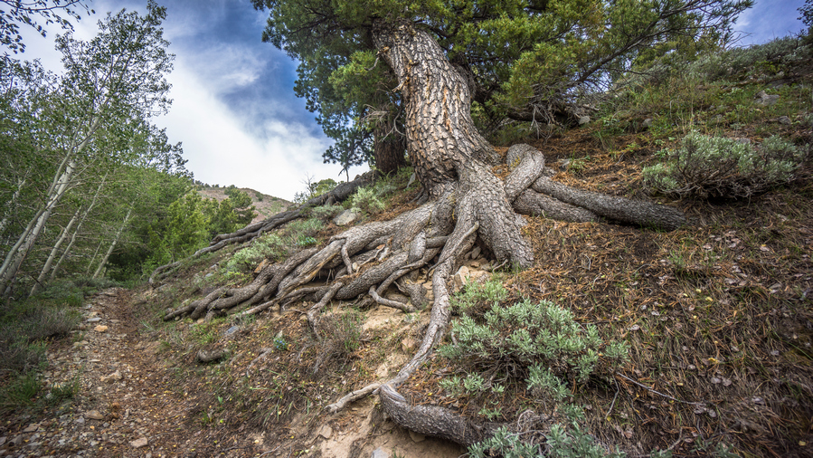
The roots of this huge tree are growing practically vertical along the trail
The Toiyabe Crest Trail is less maintained in the middle section
The day was dragging on now, thanks to the increased heat and decrease in scenic views. Cow shit on all the small passes. Lots of it. Pretty uneventful day overall. There were some great views, but they weren’t as constant as they were yesterday, in the Southern Toiyabes. The trail was not as good here either as it was up on the crest yesterday.
Sun setting soon over the Shoshone Range
Ran into my first person in almost 400 miles of hiking. A guy named Alex, and his dog. Alex was from Grand Rapids Michigan, now living in Vegas. But he just took an internship in Round Mountain for the summer. So now he gets to explore the mountains here. Alex hiked the PCT in 2018 and had the trail name Nuts. Probably because he went through the Sierras in April and May!
Tarptent Notch Li in the Toiyabe Range
Found a great spot to camp along a Ridgeline Above a pass. Hidden behind some rocks, well protected from the wind. Good thing because it was windy, even after dark. A spring was only a few hundred yards down hill. Found an arrowhead on the pass. A metal sign for the Toiyabe crest trail was here too, the first one Id seen up here.
Day 28 – June 28th: Toiyabe Range, Toiyabe Crest Trail, Kingston Creek, Big Creek
The wind didn’t die down until midnight, so I didn’t get any sleep until after that. Excellent campsite, was pretty well shielded from the wind for most of the night. But the sound of the howling wind still kept me up.
Hiking up Washington Creek, back to the crest of the Toiyabe Range
Dropped down off the pass and into a Cirque that was full of water. Filtered 4L last night so I didn’t need any. Stopped to wash my socks in one of the streams, and a mouse hopped away. Today was a really long day. It’s funny now that I write in my journal, I can barely even remember this morning. It seems like 3 weeks ago. The days are just so long out here.
Feet feeling better today than they were yesterday. Holes in my Darn Tough socks are getting big. Good thing I have a couple new pairs in my bounce box waiting for me in Austin.
View back down Washington Creek as I near the crest
The climb out of the valley with all the water took a little bit longer than expected but still, I feel like I made good progress. As soon as I reached the top of the pass, I was hit with 40 MPH winds. It was cold too! First thing I did was put on my wind jacket, kept me a little warmer plus I wore the hood to make sure my hat didn’t fly off. It was crazy windy.
Outstanding views again as the Toiyabe Crest Trail finally returns to the crest
Excellent views now that I was back up on the crest of the Toiyabe Range. The kind where it was hard to make progress because I was constantly stopping to re-analyze the landscape, seeing new angles and shots.
Scenic view into Reese River Valley from northern section of the Toiyabe Crest Trail
Toiyabe Range, Reese River Valley and the Shoshone Range viewed from the Toiyabe Crest Trail
The wind was blowing in from the West, so as long as I was on the east side of the Divide, it wasn’t too bad. But without something blocking the wind, it was pretty wild. The hood on my wind jacket was constantly being battered, and was really loud on the ears. And sometimes, some of the straps from my backpack would get blown around violently & slap me in the face. I was literally being bitch slapped by my own backpack.
View west to Reese River Valley, Shoshone Range and Smith Creek Valley
Excellent hiking along the northern section of the TCT
Once I got a good View to the West, I could see a dried lake bed on the other side of what I believe was still the Shoshone range. The winds where kicking up dust and sand into the atmosphere, with a brown layer of debris hoovering low in the air.
Stopped to eat behind an outcrop of rocks. They really weren’t that big, but they did the job, providing enough protection from the brutal winds to be able to eat without my things being blown away. I was running out of space on both my camera and my phone, so I deleted pictures and data from both so I could continue taking pictures on both devices. Man, I really need to send my bounce box to every second or third town instead of 4 towns, so I can dump media more often.
The wind is kicking up dust from the dried lake bed in Smith Creek Valley
After my break, it was back into the wind. Now, I had a decent climb up a hill that was totally exposed to the winds from the West. Here, the winds were gusting 50 to 60 miles per hour. Almost blowing me off my feet at times. I would lean into the winds to try and counteract the force, but when the winds died down suddenly, I found myself almost falling over. The winds would come out of nowhere and catch me by surprise.
Bunker Hill Peak
Look at all that dust getting kicked up into the atmosphere. It’s coming this way…
Some spots along the Ridgeline had interesting rocks. Lots of quartz veins visible. The walk along the Ridgeline today was not all that long, but the views were excellent. The winds were extremely taxing on the mind and body. It really wears you down walking through high winds.
Looking south along the TCT before dropping down to Groves Lake
Descending to Groves Lake
I was relieved to reach the saddle where the trail finally drops down to Groves Lake. This is the official end of the Toiyabe Crest Trail, the northern terminus. I made very quick time of the descent, jogging whenever possible. This has always worked well for me to minimize knee pain. One reason knee pain occurs on downhill sections is that we are trying to walk at a pace that is slower than momentum, and in order to maintain our pace we strain our knees in the process. By jogging a bit, or going with the flow, you can minimize knee pain. That’s my theory, anyway.
Straight Canyon
Groves Lake
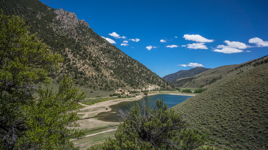
Groves Lake was definitely low on water. It’s a man-made lake, with a dam on one end. There was a truck with a couple of guys fishing there. Really nice views into Straight Canyon from the lower reaches of the trail.
When I reached the lake, I didn’t bother going for the shoreline, there was no shelter from the sun or wind. Instead, I found a small patch of trees in the parking lot to take a break under. Ate lunch here and aired out my feet. It was decision time. The original plan was to follow a high route extension that began just a little further north from here. However, with the high winds, that plan is not a good one. Not only do I not want to walk in 50 mile an hour winds, I certainly don’t want to have to camp in them. So that’s out. Good thing I had made a low route alternate before coming out here. I’ll take that.
Kingston Guard Station
Inside the abandoned Kingston Guard Station
Next I continued down Kingston canyon Rd. This was a very well maintained dirt Road, with a little bit of traffic here and there. A little ways up the road I encountered the Kingston Guard Station. This was an abandoned ranger station, housing for the Rangers and some other buildings. From the road I could tell it was abandoned, windows were broken out and one of the doors was wide open. I went in to have a look and was very disappointed and what I saw. The entire place had been looted, ransacked and destroyed. The brick work on the fireplace had been dismantled, beer cans in the fireplace. Anything of value have either been stolen or removed when funding had been cut for this facility. I walked into another building next door, and there was some sort of bird Nested inside one of the walls behind a cupboard. Another building was like a storage shed. There was a can of green paint that had been opened and someone had smeared it all over. Garbage lay on the floor. There where a bunch of shelves, and someone had opened all the boxes and dumped out the contents. There were literally thousands of plastic knives and forks laying around.
It was a real shame to see the ranger station in this condition. It was a beautiful spot, good view. I just imagined the people that worked there for years, the memories they had there. I am trying to imagine what it was like when the place was open. Was there really that much recreational traffic here to warrant the ranger station?
After leaving the guard station, the next Valley up there was pit toilets and a parking lot. Here, I noticed a sign that said TCT. I’ve never seen a map or read anything that indicates the Toiyabe Crest Trail continuing north from Groves Lake, but the sign is here. I doubt much of a trail exists anymore, but its certainly interesting to see the sign. Also in this parking lot, I noticed a bird that kept swooping down near the same tree. After the bird dive bombed the tree a few times, I noticed a fox or coyote emerge with something in its mouth. It quickly moved on to another set of bushes for cover, and the bird persistently continued to try and protect its nest, its young.
A nice meadow along Kingston Creek
Walking the road was fairly Pleasant, good scenery. There were large Green Meadows with tall grass. And when the wind blew, the grass moved like waves in the sea. That was actually pretty cool looking. However, no signs of cows anywhere in this valley. This blows my mind. I guess they are all up in the High Country. The low lands are not good enough for these cows.
Dust storm approaching. This dust has come from the dried lake bed in Smith Creek Valley, two valleys west
Before the climb up the next pass, I filtered 2 liters of water. Now, I could see dust being blown in from the dried lake to the West. All around me it was moving in, seemingly in every direction.
Big Creek
Now I descended into Big Creek Canyon. The road was still pretty good. I saw a couple of car campers along the way, but just the vehicles parked. No humans in sight. After dropping down from the pass, it seems like the temperature had dropped 20 degrees in 10 minutes. I stopped to put on my wind jacket. With all this wind, a cold front is surely on the way.
At the bottom of Big Creek Canyon, I was supposed to take a right and head up North Big Creek. However, I noticed on my map that there was a historical town marked, called Watertown. It looked to be about a half mile away if I just continue down Big Creek Canyon. Thinking it was a ghost town, I decided to check it out. I was disappointed when I arrived to see absolutely nothing there. It was only 10 minutes out of my way each way, so it didn’t set me back too much.
Junction of Big Creek and North Fork Big Creek
Now I noticed a large dark cloud that had been parked right over the mountains for about an hour now. But it wasn’t any normal dark cloud, it had an odd look to it. Didn’t look like a rain cloud. The weather was just weird today.
I headed up North Big Creek now. It had been 2 hours since I stopped for 10 minutes to filter water, and 4 hours since I had eaten last. I was overdue for a break. There just weren’t any good places to stop. Finally, I just stopped at a small rock to sit on. I ate dinner here, and realized how cold I was. I put my pant legs on, and added a couple layers up top. I now had my hiking shirt, wind jacket, fleece, and rain jacket on. I also switched from my baseball hat to my warm fleece hat. It felt like it was in the low 40s.
North Big Creek Canyon became more impressive as I made progress uphill. A 4×4 Road off shoots the main road into another Canyon. Here, at this intersection, was a Green Meadow. It was lined with trees. I thought this might be a decent place to camp, so I went to have a closer look. But of course, most of it was wet, lumpy, extremely tall, and provided no cover from the wind. I never camp in places like this, ever. But it was worth checking none-the-less.
North Fork Big Creek
On the other side of the meadow I noticed a large rock overhang just up the hillside. It looked too interesting to pass up. It was getting late in the day and I was tired, but it was so close that I had to have a closer look. When I got up there, there really wasn’t much to it. Yes it was a rock overhang, but it was on a good slant, and not to deep. Ok, saw it.
Excellent views in North Fork Big Creek
Still looking for a campsite, I continued up the canyon. It was about 7:30. The creek eventually dried up as I gained elevation. I passed through a couple of patches of trees that gave me a glimmer of hope, but I did not see anything close to a suitable campsite. Of course, if I weren’t so picky about my campsites, I would have just stopped in some random field with tall grass and pitched my tent. But of course, this would provide no cover from the wind, which is a big concern tonight.
Pass between North Fork Big Creek and Birch Creek. Notice the sheep herder’s tent on the saddle
Eventually I had walked all the way to the top of the valley, and was just below the pass. I had come too far to head back down, so I went up. It was about 8:15 at this point. At the top of the pass, there was a Teepee tent, two horses and several dogs. There was a barbed wire gate here. I stopped at the gate while the dogs went crazy barking at me. I hollered hello a couple of times, but never got a response. I guess nobody was home. I hopped over the barbed wire gate and risked the dogs coming at me. They were actually pretty good about keeping their distance, but they kept barking at me for a half mile. My last GoPro battery had just died heading up the pass due to the cold temperatures, otherwise I would have gotten these events on film. Also, in the distance was a beautiful sunset over the mountains. However, this new view was filled with dark clouds. Looks like rain.
From the top of the pass, I jogged downhill for at least a mile. It was literally a race against time. I had to get downhill before dark to find a campsite, unless I wanted to do it by headlamp. No thank you.
Eventually I reached a spot where the road does a 180 degree turn, with a small patch of land at the curve. This was just above the valley floor. I could hear a ton of sheep bahhing in the near distance, presumably on the valley floor. With the last remaining bits of Twilight, I set up my tent.
Almost immediately after setting up my tent and getting inside, it started sprinkling. Great timing.
Day 29 – June 29th: Toiyabe Range, Birch Creek, Reese River Valley, Stokes Castle
It was actually a very still night. Almost no wind. However, it sprinkled for a little bit right after bed. That didn’t last long. Cold night, too.
My tent was just out of the path of the sun this morning, I was waiting for it to hit my tent but the sound of barking dogs and sheep eventually drove me out of my bed anyway. It was probably closer to 7 when the sun finally hit my tent. The dogs sounded like they were getting closer, and not wanting an encounter with angry sheepdogs, I hurried up and packed things as quick as possible.
At the bottom of the Valley, just below where I camped, there was a creek. However, I wasn’t too eager to filter from it since it was just Downstream from where all the sheep are. And the smell was horrible! So I skipped this water source.
You can see all the switchbacks in the road, These are not marked on the map!
Next, I followed the road for a short ways before my map indicated I needed to climb up hill on a road. This road didn’t seem to exist. So I headed up to Hillside anyway. All of those Terraces I saw cut into the hillsides were actually roads. I hit the first level of the Terrace, and still needed to climb up one more. From the top, looking down, I could see they had a zig zag fashion. I could have just followed a road the whole way up. But, my maps did not show this, it only showed one road straight up the hillside which clearly didn’t exist.
Open pit mine in Birch Creek Canyon
Now following the upper Terrace Road, a large mine came into site. I was on the side that had all of the tailings, which covered an entire Hillside. In fact, I could see a man standing on top of the rest of what was likely the mine. I was going to be walking right through this mine territory, which is private land. However, it’s on a public road, so I shouldn’t have any issues. This was the case. Still, I wondered if he heard me talking to my GoPro. Ha.
Hiking the crest of the northern Toiyabe Range. There is a network of old 4×4 roads here.
While passing through the mining land, there were a couple of sheep on the hillside above me. This was the closest I’ve gotten to any of them. Then the road goes up a couple of Hills. Of course, many of these were steep. This is where it got really cold and windy. It felt like it was in the 20s or maybe low 30s. I couldn’t feel my fingers or my nose. I stopped to layer up again.
View south along the Toiyabe Range
The northern Toiyabe Range is still impressive!
Most of the four by four roads went straight up over the hills and they were quite steep. The kind that you could easily slip and fall on, so on The Descent I would just walk through the Sagebrush alongside the road instead. That is, if I didn’t follow a game Trail around the side of the Hill.
Mormon Crickets. Saddle up!
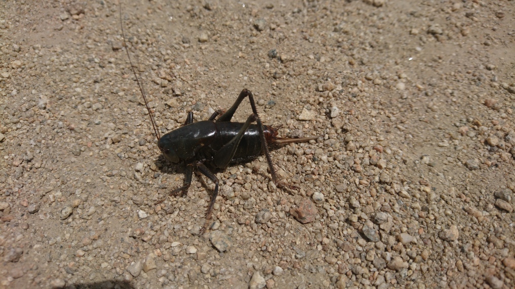
All over along the ground this morning were giant crickets, called Mormon Crickets. They are a few inches long and as thick as your big toe. Thousands of them. It must have been their mating season. It was hard to avoid them, a few of them got stepped on, walking under my shoes as I walked.
Descending into Veatch Canyon. Reese River Valley in the distance
Eventually I reached my Junction, an even smaller dirt road that veered off the crest of the hillside and took me down to Veatch Canyon. Stopped at the top of The Descent for a quick food break, and a bit of a breather. Took my first gopro time lapse of the entire hike so far here, since there were actually clouds in the sky. Without clouds, there is no motion to capture in a time lapse.
Hiking Veatch Canyon
There were some aggressive birds at the top of Veatch canyon. They kept dive bombing me and squawking at me for a half mile or so. The canyon was quite wooded, and the upper reaches featured some jagged outcroppings. Water was barely a trickle at the top, so I had to keep following it Downstream. There was muddy road Crossings though, one challenging one in particular to get around. There was a down tree, and I had to break a bunch of branches and crawl under it on some gravel that kept me from sinking into the mud.
Eventually I reached a spot where I could filter water. Still, it was very shallow. I have only drank about a half liter this morning, and had maybe a quarter liter left. I was hoping to make it into town, just hurry and get there. To be honest I was still feeling a bit out of it, a bit miserable from the cold although it was warming up a bit now. I just wasn’t feeling the same high I normally get when I walk into town.
As soon as I dropped my pack to filter that water, the urge hit me to take my morning shit that I skipped. I was hoping to make it into town. After taking a shit, Filter in a liter of water and eating a snack, I was feeling infinitely better.
Reese River Valley
The canyon opened up just a short ways after my break. Now, I had a great view of the Reese River Valley. And I began to feel that great feeling that I often get walking into town after completing a section. Still, I had a ways to go. Another hour plus of walking. I reflected on the true meaning of freedom. We talk a lot about freedom in America, but relatively few truly experience the freedom that one feels on a long adventure… no job, obligations or connections to the outside world. Simply wake up and experience whatever the day has in store for you. That is true freedom.
Hiking Reese River Valley
I really enjoyed the walk on the dirt road along the base of the mountains that butt up against the Reese River Valley. There were many mining claims here, past and present.
Stokes Castle
Inside Stokes Castle
After a couple miles of ups and downs, and more mining relics, I reached Stokes Castle. This is one of the most photographed landmarks in Nevada. It’s a three story medieval style castle, built in 1897 by a railroad Tycoon for his sons. It was fenced off, but there was a couple of holes in the fence. Of course, I went inside. Who can resist an abandoned castle?
It was a short walk down to Highway 50 from here. Loneliest Highway in America, my ass! I think that title goes to Highway 6, between Ely and Tonopah. Highway 50 was under construction, and the road that I walked out of the Hills took me right into town. Basically dumped me off into a gas station parking lot, with two cops parked talking to each other. The highway was down to one lane, with a construction worker car that would drive through the one lane with the traffic following. Nothing about this strikes me as lonely.
Cozy Mountain Motel was only a block away. Super convenient! As I was reading the sign on the front door, that had my name on it, the door opened. It was Cassidy, whom Sarah, the owner told me about. She is going to be hiking the Washington section of the PCT this August. Inside the extremely small Lobby, we chatted for quite a while. There were many rocks and minerals up on the windowsill, and quaintly decorated. I like this place already.
I’m my room, my two packages were waiting for me, with a personal note from Sarah. She had gone down to Vegas for a few days with her boyfriend, and would not be here. That was a great touch, and made me feel very special. The room was small but very nice. You could tell the walls used to be wood paneling, And they painted them white. The beds had upgraded Linens, same with the towels, and nice vanity in the bathroom. Nice little upgrades that make a big difference, certainly stands out from all the motels I’ve been in Nevada so far.
First things first, took a shower. The color of the tub hid most of color of the dirt I washed off, but of course I knew it was there. I opened my bounce box, started backing up my SD cards, and got wifi going on my phone. Called Dad, got caught up on things.
Cassidy’s shift at the motel ends at 4, and then she bartends at the owl Club down the street. It’s pizza night, so I’ll be there! I walked in just before 5pm, I was the only one there for a while. The first person to walk in the door with an older guy, with a Sonic the Hedgehog shirt on. He was the owner of the place, popping in to check on things. An Irishman, with a thick accent. Pretty comical guy, even if you couldn’t always understand him. The dynamic between Cassidy and him was funny.
The pizza was delicious. And they had Louisiana hot sauce too, which is my favorite on pizza. Almost nobody carries Louisiana hot sauce, so I liked this place based on that alone.
Other people began to trickle into the bar. First was the two surveyors that were also staying at the Cozy Mountain Motel. I saw them pull in as I was on the phone with Dad. They probably overheard me giving The Rundown on the last Section, but they asked what I was doing in town anyway. So I got to tell my story once again. One of the guys was from the Ruby mountains area, and had spent a lot of time in the mountains growing up. Nothing extended, But he was still pretty interested in what I was doing. We talked about rocks, Gold, mining.
Next, a couple of Road workers showed up. They have the reflective vests still on. They were doing shots of Fireball. I commented about how Fireball seems to be the most common liquor bottle found along side of the road, which got a few laughs.
At one point, the sheriff walked in. If there was ever a stereotypical small town sheriff, he looked exactly like what you would imagine. Big guy, probably 6’3″, late forties, khaki colored uniform, aviator sunglasses and a light colored cowboy hat. I’m not sure why exactly he walked in, Probably just out of boredom. He gave Cassidy a little bit of shit about burning some of the pizzas, crack some jokes and then walked out after about 10 minutes. As he was walking out the door, which stays wide open for all to see, a semi truck flew down the street at a speed far exceeding the 25 MPH limit. the sheriff’s reaction was priceless… he stood in this middle of the street with both hands on his hips and said something to the effect of, “boy, I know you didn’t just speed through my town”! After a moment, he ran into his police truck and began to chase after him. Not in my town, boy Classic!
I walked back to the motel just before 9 and continued backing up my SD cards throughout the night, anticipating a long process That I didn’t want to consume the entire next day. I’ll tell you what though, that bed felt amazing!
Day 30 – June 30th: Zero Day in Austin, NV
Chickens roaming the parking lot of the motel
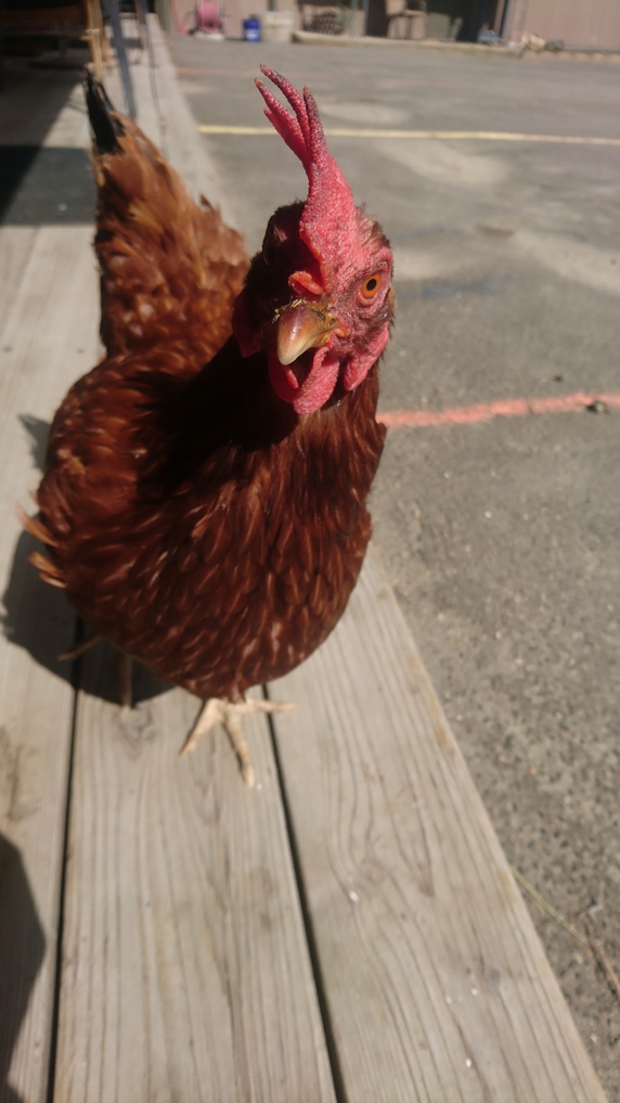
On the chair outside my motel room, Cassidy had left me two breakfast burritos, AND a bottle of Louisiana hot sauce. So thoughtful! As I ate them on the motel porch outside my room, There were several chickens in the parking lot, and they were begging for my food. Sarah The owner keeps the chickens here, and has about 30 more across the street. They hang out in the parking lot pecking away At whatever they can find. They use them for eggs, and the plan is eventually to harvest the meat. Although Cassidy says Sarah probably won’t be able to go through with it, as all the chickens have names now. I had a few crumbs left on my plate, which I donated to the chickens. They eat bacon and even egg, apparently!
Most of the day was spent doing chores, mostly dealing with the Micro SD card backups. I started going through the video footage, because I couldn’t resist. Good stuff. But also, I wanted to make sure that all of the footage was indeed backed up on my WD Passport hard drive. Since I had no idea which cards were which, it was hard to verify that no data had been skipped. So I began to organize it all… created folders for each section, then moved all of the Footage Into the appropriate folder, verifying that no date had been skipped. When did the same with all of my Still photos. Then backed up my Garmin GPS. Then my cell phone. Then moved all of my Photos and everything else that was on my Phone’s SD card Over to a larger SD card. The 32 gig card with almost full, So 64 gigs should do it Until the end of the hike.
I guess it should come as no surprise, but on my zero days I find myself very tired. Not physically tired, but sleepy tired. I could barely keep my eyes open as I worked through my photos and videos. I spent pretty much all day on this.
Washed my clothes, and found the leak in my thermarest air mattress. I filled up the bathtub and dunked the air mattress. There was a pinhole leak on the bottom of the mattress, probably why it was so slow to leak… weight presses down on the hole, causing it to leak very slowly. I used my patch kit from my bounce box, so I still have the one I carry with me while hiking.
I had planned to go up to the Owl Club for dinner but just felt like staying in. Terminator was on TV, so that played in the background well I did other chores an updated my journal. I ended up going up to the gas station to pick up a chicken sandwich and a bag of chips. I had my neck gaiter on for a covid mask, and As I was walking out, the sheriff walked in. He made a joke with the guy behind the counter, asking if he was okay, if the place is being robbed. Kind of a ballsy move, but I used my hand to make a pretend gun and pointed it at the sheriff, which got a laugh from him. Man I love Austin.
I had planned on leaving tomorrow, to head to Eureka. However, it’s only 91 miles, I only need four days for that. I had originally told the Sundown Motel and Eureka that I would be there on July 6th. If I leave on July 1st I’ll get there the 4th, and I know there won’t be any hotel rooms because Eureka just a big July 4th event. So I called the Sundown motel and ask them if they have availability for the 5th, which they do. So now I plan on staying in Austin until the second, and arriving the fifth in Eureka. That makes sense.
Day 31 – July 1st: Zero Day in Austin, NV
When I woke up, I went outside and on the chair outside my room on the patio was another breakfast burrito plus the box I was expecting, containing my two new Anker battery packs. The one 20,000 mAh battery I am currently using is not enough to keep my electronics charged through a full section.
Today was mostly more town chores. It’s amazing how long this stuff takes. Charge the new battery packs (like 12 hours), clear micro SD cards, save Caltopo layers to cache, post office etc.
Sarah, the motel owner, returned from Vegas today, so I finally got to meet her. She had hiked the Washington section of the PCT and the El Camino Trail.
Went up to the owl Club for dinner with Sarah and Brandon, her boyfriend. Cassidy was cooking chicken wings this evening. Sarah suggested we go to Spencer Springs tonight, but I mentioned that I was hiking there tomorrow and camping there. So she said she would come by tomorrow night, and we can have a soak. Perfect!!
In addition to this trail journal, I also filmed my Basin and Range Trail thru hike. I’ve produced a detailed documentary series (11+ hours runtime) documenting this thru hike adventure, the product over over 1,000 hours of video editing. I highly recommending watching the Basin and Range Trail vlog series for an in-depth look at thru-hiking the Great Basin and central Nevada.
Basin and Range Trail Thru-Hike Section 3 Journal
Day 17 – June 17th: Big Sand Springs Valley
Slept into almost 9am this morning. It’s been great getting rest, but I’m getting antsy. First thing I did was check the tracking number for the shipment of SD cards I’m expecting today. When I went to bed, it was in Memphis Tennessee. Now, it’s in Las Vegas. That was as of 7 am. Prospects look good, I think I will get out of town today.
Very cold morning, wind was whipping 35 + miles an hour last night. Walked up to the Mizpah to get a couple of haunted muffins for breakfast. Last night, Jennifer at the front desk was telling me about some of the ghost encounters she had there, as the hotel is supposed to be very haunted. Apparently she saw two of the muffins move, literally switch place. Haunted muffins!
Went into the Western store to talk to Paul, the owner. I wanted to let him know that I’m expecting my package today and Didn’t want to come in last minute and say, hey I need a ride. He told me last minute was actually best, so I told him I’d come back in when I received the package.
My package arrived around 1pm. Next I ran up to the Western store. I’ll let Paul know that I’m ready for a ride anytime. He got on the horn and called up a woman named Patty, who was there within minutes. While waiting for her to arrive, I ran back to the hostel to finish packing up my stuff. I called Mickey at the jumping jack motel in Carvers to let her know my new ETA. Then I called Dad to update him on my ETA, and let him know I was expecting a package shipped to the house. As soon as that arrives, a new GoPro audio adapter Mount(which broke on the last section), throw it into my bounce box and send it to Austin.
Ran back up to the Western store, and on my way Tony saw me walking by and came out of the building he was working on to say goodbye. I thanked him for everything, the conversations and the Jewelers Loupe. Great guy. Goodbye friend.
I met Patty And we chatted about rocks and such for a few minutes before we jumped in the car and took off. After a quick stop at Burger King for lunch, we hit the road.
Patty was 50 something, and a bit of a Chatterbox. No problem, I like the conversation. We chatted about rocks, hunting, wild animals and such. The 80 Mile Drive went by pretty quick. I guess that’s because she was going 75 miles per hour, and Matt was going about 45 or 50 the whole way when I got my ride in from lunar crater. Of course, he had a homemade wooden camper thing bolted to the top of his Suburban, and he was likely worried it would get ripped off the roof. From the looks of it, I can understand why he drove so slowly.
Once we got to the spot on the road where my next section begins, she pulled over and turned the car off. We got outside and she began to show me some of the rocks she had collected, sitting in her back seat. And then, we started looking at the rocks alongside the road. Here, we both found a couple of pieces of petrified wood, and I found a piece of Wonder Stone. Pretty cool!
I asked Patty how much I owe her for the ride. She said nothing, but I insisted to at least pay for her gas. We said our goodbyes and just like that I was on my own again. It’s amazing the feeling you get when your ride drives away and it’s time to walk again. Like flipping a light switch, life changes from easy mode too hard mode.
Abandoned Highway in Big Sand Springs Valley
Sagebrush growing through blacktop highway
My task now is to hike off-trail across Big Sand Springs Valley over to the Hot Creek Range. I only took a few steps from Highway 6 before I saw a road running parallel to the highway. It was a black top Road, with Sagebrush growing in between it’s cracks. It’s funny, I thought of Highway 50, loneliest Highway in America. Surely this one is a bit lonelier.
Hiking Big Sand Springs Valley, in between Lunar Crater and the Hot Creek Range
The terrain here was, you guessed it, Sagebrush covered basin. Just feet from the road, the interesting rocks fade away. Everything looks the same. The ground is mostly soft sand, with occasionally slightly harder packed ground. Morey Peak can be seen in the distance, the obvious high point. That’s where I’m going.
Hiking across Big Sand Springs Valley
Looking back at the hills I just hiked in Big Sand Springs Valley
The first hour and a half was rather boring. This should be expected as one leaves the highway. Then I approached a small set of Hills. I could walk around them or over them. I chose to walk over them, not over the highest point but one of the lower saddles. This was good enough to get a bit of an elevated view without needlessly expending too much effort. Of course there were cows in the area, and a few bulls.
Look at me, I’m a deer now
Coming down out of the Hills, I was looking ahead at the terrain. It looks very flat for a while, with no hills or rocks or anywhere to hide from the wind. While it wasn’t too windy, I really didn’t want to have the wind battering my tent all night. I could have stayed here in the Hills, but they didn’t provide much protection either. So I headed out into the open desert to get a few more miles in before sunset.
Eventually I found a small clearing in the Sagebrush, slightly higher than the surrounding Terrain. I decided that I would cowboy camp tonight. Less issues with wind, quicker to set up and I can see the Stars. I haven’t seen much in the way of bugs, and still no snakes or scorpions. I could tell it was going to be a cool night, which means they will not be out tonight. So a good night to lay on the ground!
Sunset over Morey Peak, Hot Creek Range, Nevada
I sent up camp in the shadows of Morey peak, with an awesome orange glow on the horizon.
Day 18 – June 18th: Big Sand Springs Valley, Morey Canyon, Hot Creek Range
Cowboy camping in Big Sand Springs Valley, view of Morey Peak and the Hot Creek Range
It was a calm night, and cold. Bright stars. It was 38 degrees when I woke up.
Hot Creek Range
Deep wash in Big Sand Springs Valley
Continued hiking cross country towards Morey Peak. Deep sand, pain in the ass but could be worse. I’m hiking closer to the base of the Hot Creek Range now, paralleling it, looking for my way up.
Hiking along the base of the Hot Creek Range
Found water along the road in 6 large plastic tubs. No spring or piped water, must have been dropped off by water truck. So this location is not reliable. Crossed the road and continued hiking cross-country.
I was shooting for a pipeline on the map, but it ended up being a dirt road. I followed this all the way to project faultless. Faultless was the site of an underground nuclear test in the 60s. A shaft was drilled 3300ft down and a nuclear device with a yield of 1 megaton was detonated here. Apparently the site is safe to visit.
Warning signs near Project Faultless
Project Faultless nuclear test site
When I approached project faultless I only saw three white markers, like an obelisk, with signs on them that said not to dig or excavator because the soil was petroleum soaked or something. I scanned the Horizon and about 100 yards away I saw the tube I was looking for.
A nuclear device with a yield of 1 megaton was detonated 3200ft underground here at Project Faultless
Project faultless doesn’t really have much do offer. However, it is a unique piece of American history, in that it is one of only two sites in the United States where a nuclear bomb was detonated underground. The other being project Shoal. Project adiago was about 2 miles away, they would have dropped another bomb there but there was too much seismic damage here from Faultless. I skipped that Adiago since it was out of the way.
The shaft that the nuke was dropped down into was originally flush with the surface, but after the explosion the ground in the area sank 9 feet. I thought this would be a good lunch spot, leaning against the exposed shaft in the shade.
The Hot Creek Range rises sharply above Big Sand Springs Valley
First trees in days as I enter the Hot Creek Range
Flowing creek in the Hot Creek Range, a surprise
After leaving the test site, I followed a road. This turned up a canyon, and quickly the road dissipated. Back to Bushwhacking. There was a small Creek that flowed alongside the road. This makes for thick vegetation. The road was intermittently decent. Eventually I crossed the stream and followed another road out of the wash. I believe there was a road running all the way up this Hillside above the wash this whole time. This would have been a better option. It was wide open and offered good views, and was not a bushwhack.
Entering Morey Canyon, Hot Creek Range
Green grass meadow in Morey Canyon
Stone foundation is all that remains of this old mining camp in Morey Canyon
Looking back down Morey Canyon to Big Sand Springs Valley
Next I entered Morey Canyon. There was a small Green Meadow here with a couple pools of water, but of course, lots of cow shit. Such a bad smell for a beautiful area. Uphill from here there was remnants of an old mining camp. Mostly just a stone Foundation.
Abandoned structures in Morey Canyon
Inside abandoned cabin in Morey Canyon, Hot Creek Range
Farther up the canyon I could see a few abandoned buildings, but they looked a bit newer and better condition. Sure enough, these were a bit more modern, one even had wallpaper and drywall inside. But, the roof was caved in and walls were buckling. That was the first house.
3 more abandoned buildings
Morey Canyon cabins
Old cabin in Morey Canyon
Across the road were three more abandoned structures. The first one had a door that was closed, and an exhaust pipe from a wood-burning stove protruding out of the wall. I opened this one and saw a chair facing me in the middle of the room, with two beds alongside the wall. A creepy vibe, but I quickly realized that this was a little cabin that was open to anyone who could reach it. Not unlike some of the cabins I saw on the CDT. Still, I wouldn’t stay in this one, it was pretty dirty. There was a dead mouse inside the wood-burning stove. Writing on the wall, and I recognized a couple names… Otteson. They own the turquoise mines in Tonopah. I utilized the chair and the shade to take a little break. This was nice, a bit of Comfort if you could call it that.
Hiking Morey Canyon
That’s a lot of trees
Hiking the Hot Creek Range
Next the road climbs out of Morey Canyon. The road here was surprisingly good. I saw another cabin or two on the way up. Good views as I gained elevation. Eventually the canyon reaches a high point, and then the road follows North Canyon. I found a spring here alongside the road that was not on the map. It was guarded by Thorn bushes, but I found way around. I stopped here and filtered some water. I discovered I have a leak in my platypus bag, where it folds on the bottom. I attempted to fix it by patching it with a piece of dyneema, which only slowed the leak. Still, this patch was good enough to last the rest of the hike.
Hiking higher up into the Hot Creek Range
Next the road becomes steep. And top of that, the crazy ants were back and wouldn’t leave me alone. So I kept moving, and tried not to stand in one place for more than a few seconds.
Old 4×4 road continues up North Canyon
North Canyon views
Looking down on the route I came up through North Canyon
When I reached the point where the road ends on the map, I was surprised to see it continue all the way up to a saddle. Great views on the way up of North Canyon and beyond.
Outstanding views in the Hot Creek Range
Morey Peak now visible in the distance (center)
Crest of the Hot Creek Range
Big views from the Hot Creek Range
Even better views from the top of the pass. Here, the road splits. I took the one that heads over towards 6 Mile Canyon. These roads were not on the map! I was really happy to have a road to follow, and even happier with the extremely beautiful views. Rolling Green Hills, rock spires and outcrops.
Sixmile Summit & Devil’s Cave Ridge
Cool knife edge rock formation begging to be climbed upon
Horse trail on Sixmile Summit
Eventually my road splits off, towards Morey Peak to the left and 6 Mile Canyon to the right. Even though I’m going left, I couldn’t resist going right, just to have a look. The road quickly turns into a trail, but again, not on the map. Most likely, horse trail. The Trail passes by a Rocky outcrop, a Jagged knife Edge covered with orange lichen. So of course I checked that out, climbing out on it and such. Then I went up over the little pass over Devils Cave ridge. Excellent views of 6 Mile Canyon. I would be happy to hike here, if I hadn’t already decided to bag Morey.
More cool rock formations along the crest
View of Devil’s Cave Ridge (right) as I hike the crest of the Hot Creek Range
Trail to Morey Peak on the crest of the Hot Creek Range
I made my way back down to the Road that heads towards Morey Peak. This too quickly turned into a hiking trail. I’m not sure how long this Trail will exist, but in the meantime I’m happy to have one. I took a break overlooking a canyon, ate dinner, and was happy to see the trail continue along the hillside to the next saddle.
The incredible Hot Creek Range
Hot Creek Range looking south towards Morey Peak
Made it to the next saddle and was then blown away by more excellent views of Nevada wilderness. The Fandango Wilderness and the monitor range in the distance, the Sun creating a hazy effect. Absolutely gorgeous. And the Trail persists!
Basin and Range topography
I’m looking for a campsite now, but being picky. I want a great view, I just don’t see a good clearing for my tent or to Cowboy camp. So I kept going.
Sun setting in the Hot Creek Range
The great views continued and I was moving rather slow. That’s okay, this has probably been my favorite part of this entire route so far. Even better than the views from the grant range. Ok, hard to compare, and why bother? Some great miles to be hiked here.
Looking east into Big Sand Springs Valley, Lunar Crater and the Pancake Range, and beyond
I went up many small Hills and each time I was disappointed to not find a campsite. So I continued on. The sun was setting soon, so I kept walking. I crested another saddle, this one had a flat spot that I could have camped on. But it was a bit plain looking. I so once again I kept going. On the other side of this saddle the Sun was no longer shining here. It was approaching 8pm when I finally I found a spot that I liked. A Little clearing in the Shadows of Morey Peak, highlighted by the last fading rays of sunlight. There was also an overlook of Big Sand Springs Valley, where I came from earlier this morning. A couple trees around, and did not feel too exposed. Good campsite.
The ‘ol Tarptent Notch Li, in the shadows of Morey Peak
I’ve had a lot of these moments on this route, where I thought I was going to get stuck with a crappy campsite but ended up with a really nice one. Unlike the CDT, where just about every night seemed like a subpar campsite.
Morey looks intimidating from here, and I’m unsure about my route down in to 6 Mile Canyon. It’s probably going to be another cold night, so I have my tent set up and a little extra clothes on.
Day 19 – June 19th: Hot Creek Range, Morey Peak, Sixmile Canyon, Fandango Wilderness
Morning in the Hot Creek Range
Slept pretty good last night. Got up at 6:15, when the sun hit my tent. Great views of Morey peak. Not as cold as I was expecting./
View north from the crest of the Hot Creek Range
Left camp and continued to follow the Trail towards Morey Peak. The trail is much more faint now, and fading quickly. There were really no big climbs, only small ones to little saddles and ridges. Each one provided an excellent view. Beautiful blue skies, no wind. Perfect day to Summit a peak.
Hiking the route up to Morey Peak
Bristlecone pine tree in Morey Peak Wilderness
The rest of the route was fairly easy. No real exposure, not too technical. A couple of spots with some loose rock and a few short sections of scrambling. A couple of bristlecone pine trees could be found on the saddle just below the summit. These impress me, their massive size and incredible age.
Final scramble to the summit of Morey Peak
After a couple of false Summits, the final Summit block of Morey Peak was in view. Like many of the cliff faces around here, it was covered in lichen. Orange and Neon green. This contrast always makes for a great photo.
Summit view (looking south) from Morey Peak, 10,246ft. Highest point of the Hot Creek Range, Nevada
Summit view (looking north) from Morey Peak, 10,246ft. Highest point of the Hot Creek Range, Nevada
A short scramble with minimal exposure brought me to the summit of Morey Peak, the high point of the Hot Creek Range at 10,246ft. Woohoo! Absolutely incredible view. I reckon a 125 to 150 mile View, based on the fact that I could see what I think was wheeler peak in Great Basin National Park. I had measured that at 100 air miles away from the ridge I walked along the grant range, and now I am a few ranges even further away. There were three usgs Summit markers but no Summit register. No summit register on the high point of an entire mountain range? Ok, Nevada. I guess with 310+ mountain ranges, not every range high point gets a register.
Hot Creek Range viewed from Morey Peak summit
Morey Peak summit view north
I spent about 30 minutes on the summit. With the effort it takes to get here, a break is well deserved. Again, absolutely incredible views. Surrounded by mountains as far as the eye could see. I could clearly make out the route I walked all the way from the Quinn Canyon range. I love the way the light Reflects off the dried Lake bed of lunar Lake. Morey Peak was one of my favorite summits along the Basin and Range Trail.
Looking back at Morey Peak
Now it was time to get down off Morey Peak and continue on my route. I think most people who climb this peak come in from Morey Canyon and then North Canyon like I did, then backtrack the way they came. In retrospect, that’s what I should have done too. Instead, I chose to go down a random Canyon. So I descended the summit, which was rather steep and loose, and headed for said Canyon, having picked the one that looked the least steep from my map.
This canyon is my route down. Wish me luck…
Looking back up the canyon, what I’ve hiked down so far
When I reached the top of the saddle where I would drop down into the canyon, I could tell it wasn’t going to be easy. It looked steep, but better than Willow Canyon, more wide open and less vegetation. Still, it was slow going. I was mostly following a dried Creek bed.
Looking up towards Morey Peak. It’s getting steep now
It was slow and tedious but I was making decent progress. That is, until I reached a point where I had to jump from one small Creek bed over a little hump into another small Creek bed. This is where it got really steep and even slower. There was more vegetation and awkwardly stacked boulders creating small but cumbersome obstacles.
Then I looked at my map and realize this was the point I needed to begin to Contour around the mountain side. Unfortunately, it was extremely thick vegetation. There were no game trails. Sometimes it would take a few minutes to go 10ft. When you look at it, it does not look humanly possible to Traverse it. Sometimes I was crawling on my hands and knees, but most times I simply had to break branches to clear a path in the direction I need to go. Another nightmare bushwhack, exactly what I was fearing.
The beautiful Hot Creek Range and Morey Peak Wilderness
Fortunately I only needed to go about a quarter mile. Still, this was extremely exhausting. I walked away with a couple of cuts on my legs and hands, the ones on my hands from breaking branches. A good set of gloves would have been really nice. Finally the trees thinned out and I made my way to the saddle I was aiming for. Climbed to the top of a High point and took a while deserved break. Ate lunch and fueled up for the next section. Great views looking back up at the Morey ridgeline. Truly outstanding views, actually!
Looking down at the rest of the descent into Sixmile Canyon. I’ll take the ridge right/center
My original plan was to walk down the valley, but after this latest bush whack, I wanted nothing to do with it. Instead, I followed a Ridgeline above the Canyon. This had a decent game trail running across the top. At one point progress slowed because of a steep descent. I had to Contour around the hillside to meet up with another Ridgeline.
Looking back up at the Morey Peak ridgeline
I followed the Ridgeline all the way down in to 6 Mile Canyon. Before reaching the bottom, I could see a four-wheel drive Road running up the canyon that I Originally wanted to walk. You never really know if a 4×4 road on the map here in Nevada will actually exist on the ground. The road was only visible on the lower reaches of the canyon, plus it was a bit steep to get down to. Thus, I stayed on the Ridgeline the whole way.
Hot Creek Range from Sixmile Canyon
Down in 6 Mile Canyon, I found water almost immediately. There is a creek running downhill, and the road running through the canyon crosses it several times. However, there really weren’t any good collection points. It was shallow and it’s banks were covered with thick and thorny vegetation. I kept walking uphill towards 6 Mile Summit, hoping for a better spot to collect water from.
Vibrant wildflowers of Sixmile Canyon
There was a section with some beautiful blue wildflowers just completely covering the ground. Before the summit, I found the source of the spring. Probably best to collect from here since there was a lot of cow activity Downstream. Just like everywhere. Even here it was a bit difficult to collect water, but I made it work. It felt great to wash off a bit in the Stream after that horrendous Bushwhack!
Sixmile Canyon, view south
Walked up over Six Mile Summit and dropped into a new Valley. Not incredibly impressive, certainly a better view from above… This is the spot that impressed me last night, right before I began the walk along the Ridgeline to Morey. I had spent almost an entire day hiking a big semi-loop, just to bag Morey Peak, and have only made about a mile of forward progress along my route. Still, it was worth it. There were many green Meadows along the way as I made my way downhill. Also, many horses. Saw 7 or 8, including a pony, in the upper reaches. There were seeps and springs forming a couple of small creeks. Farther down, I saw another five or six horses. I even saw large clumps of horse hair on the ground.
Then I left the main road and headed up hill into an unnamed Canyon. This too was pretty green. The middle section of the climb was extremely Lush. A spring formed a small Creek, with lots of trees. Beautiful stands of Aspen. Again, the ants were quite a problem. I could not stand still without getting bombarded. So I made my way up hill quickly. When I emerged from the thick Lush area, above the spring, I saw another five or six horses. I scared them up over the pass that I was headed for.
Entering the Fandango Wilderness
Descending unnamed pass north of Mahogany Peak
The pass itself didn’t have much of a view. The view looking down into the canyon I was headed into was nice, but not blow you away nice. I followed a game trail downhill, probably built by horses. This Upper Canyon was Pleasant, a different vibe then some of the other mountains I had been too. Not too Jagged, kind of a Rolling Green look.
Small spring. Notice the horse in the distance
I followed a drainage down to the upper reaches of this Canyon. Here, a horse was getting a drink from a spring. A creek flowed through the canyon. Lots of water here, and all around this afternoon actually. The upper reaches of this Canyon was really nice, very green.
Big Cow Canyon, Fandango Wilderness
Now there was a 4×4 Road to follow. I enjoyed the walk downhill, as The sun was getting lower in the sky and the temperatures were pretty mild. A relaxing walk.
Distant view of Little Fish lake Valley and the Monitor Range from the Fandango Wilderness
Followed another dirt road out of Big cow Canyon, over to Little cow Canyon. I found a flowing Creek here. It was 7pm, so I stopped to fill up water and eat dinner. Filtered 6L. Chugged one with dinner and took 5 with me. I’ll chug another with breakfast, and that gives me 4 liters to make it out of little cow Canyon and across little Fish Creek Valley tomorrow.
Sunset in the Fandango Wilderness
I only walked another half mile before setting up camp. I found an interesting colored Sandy hill to setup on. It was now about 8:15, sun was going down. Feet were a bit tired today. Also, feeling like I’m a little short on food for this section.
Day 20 – June 20th: Little Cow Canyon, Little Fish Lake Valley, Clover Creek
Campsite in the Fandango Wilderness
Woke up around 6:30. Followed the road downhill until it disappeared. Then it was off Trail, following a creek bed. This Dry Creek bed hit a junction with another drainage, which did have water. Then I followed that Creek downhill.
Entering narrow box canyon in Little Cow Canyon, Fandango Wilderness
Small cave in Little Cow Canyon
I’m in Little cow Canyon now. Map shows a box Canyon for a short ways. I could see the entrance, some rocks and Cliffs, a small cave. It was really nice. There were a couple of pour offs, but in the 10 to 20 ft range and climbable. Not crazy thick with vegetation. Pretty enjoyable walk, actually.
Hiking Little Cow Canyon
After passing the narrow part, Little Cow Canyon opens up again. There were decent game trails to follow most of the way. None of this was very difficult. What a relief!
Looking north in Little Fish Lake Valley. Hot Creek Range on the right
The lower reaches of Little Cow Canyon where less impressive. When I finally exited the canyon and entered Little Fish Lake valley, it became obvious it was just one Branch of a large Network of alluvial fans. The road I had followed out of the canyon disappeared, and I was left on my own to hike cross country. I know there is a private ranch in the valley that I must walk around. Unfortunately, it runs North and South through the valley for quite a ways.
View across Little Fish Lake Valley to the Monitor Range
I walked across the ups and downs of the alluvial fans, staying near the trees as much as possible. Found a great place to take a break overlooking the whole valley. Couldn’t really see anything going on down there. Once again, I felt like the only one live, last one on Earth.
View east to the Hot Creek Range and Fandango Wilderness
Eventually I approach the ranch. I was on a pretty solid road, and I was hoping it would pass right through the ranch. Like an access point to public land. Fortunately, I hit a fence line. The road appeared to be only usable by the ranch, even though it was on public land. So now I had to decision to make… Hike north or south. Either way I have to walk around the ranch. It would have been a shorter hike to hike North, but it would have been out of the way. So I opted to hike South, the direction I need to go, and hope for a road that passes through the ranch, like one for public access to the hot Creek range and Fandangos.
Little Fish Lake Valley
The hike along the ranch sucked. Fence line as far as the eye could see. And to make matters worse, it was the finest possible type of sand. Not even sand, each foot step created the finest dust cloud imaginable. I later learned a better term for this type of soil poof dirt. Before long my shoes were full this fine powder. Every time I thought the fence line was going to end, it’s simply turned in a different direction. I followed the fence line for about an hour and a half.
I went up over a hill and saw that the fence line continued to the horizon, as far as I could see. Unfortunately, the road that I want to take into the monitor range was directly west of me right now. There’s no way I’m going to hike miles out of my way just to go around this stupid Ranch. The ranch itself, and all of the cow activity, was further north. With nothing in sight, and only about half mile to cross the open ranch land, I decided to hop the fence and go for it.
The first little ways, I was walking behind a bit of a hill, pretty much hidden and out of sight. The final 2/3 or so we’re a little bit more out in the open. However, there was a road that runs right towards the main road running perpendicular to it through the valley. The Sagebrush was tall, maybe about chest height. I walked very quickly and kind of hunched over a bit, hoping to stay hidden from site as much as possible. Realistically, I was pretty far south of anyone that could see me.
Hiking Little Fish Lake Valley
When I reached the main road running through the valley, there was no fence line like there was separating the public land side on the hot Creek range. I crossed the road and continued West along another road that leads into the monitor range along Clover Creek. Pass through a gate, should be on public land now.
Follow the road up ways, towards a spring I had marked on the map. There was a mother cow and calf on the road. The mother ran away, and the calf stayed. I continued my course, walking the road. All of the sudden, the calf started to charge me from about 100 yards away. It ran at me and only stopped 10ft away, as I was yelling at it and waving my arms. It was kind of weird, I’ve never had a cow charge me like that, especially not a calf. What’s gotten into that one?
Walked up to the spring, which was dry. Actually, there was more than just a spring here, there was an old cabin. It was more like a trailer. However, it had signs of recent use… The window was open, only guarded by a screen. The deck had been replaced at some point, and had newer screws in it. I could see through the window, and there were shelves that were stocked with a few items, a modern lighter sitting on the table, etc. I yelled, anyone home? No response. It looks like the type of cabin that’s open for anyone to use since it’s on public land. I tried to open the door, but it was blocked from the inside, I think something was sitting on the ground right behind the door. The door was basically falling apart as I tried to open it, so I’ll let it be. There was an old wooden outhouse stocked with toilet paper. Clearly people have been using this, like this year. There were also some recent tire tracks leading up to the place. Either way, not much for me here, especially if I cant get inside.
After leaving the cabin, I begin to feel a bit off. I was feeling really hot and really thirsty. I only had 1L water left, and not sure of my next water source. I was beginning to get a bit of a headache as well.
The lower reaches of Clover Creek canyon were a bit boring, not unlike many of the other ranges. The lower elevations of these mountain ranges are usually not super interesting. I passed one spring on my map that I had marked dry, and I found it dry. However, there was insanely thick Willow and Thorn bushes along the creek.
The next spring was a couple of miles away. Before I can reach it, I found a flowing Creek along the side of the road. I kept following it up stream until I found a good spot to take a break and filter from. I was really happy to have found water here, I wasn’t feeling my best. I took my shirt off and begin to splash water in my face arms and cool off. This alone felt amazing. Then I filtered a couple liters, chugged two. I left this spot with only one liter, once again rolling the dice that there would be more water Upstream. I never considered myself a gambling man until these last couple weeks.
First view of the Monitor Range high country from Clover Creek
Sure enough, there was plenty of water Upstream. There was a couple of times where it looked like the road was going to fade away, but it was only a short section with tall vegetation, and then the road continued on in good shape. Eventually the canyon opened up a bit and the High Country of the Monitor Range was now visible. The views were getting better and I was starting to get excited about what lies ahead.
Old farming equipment in Clover Creek Canyon
A very lush and green section of Clover Creek
The road eventually stops at a point where it crosses Clover creek. There were several nice campsite here, but not nice enough. Ha! I could tell I can afford to be picky here. There were some Jagged rock formations up ahead, this is what I was shooting for. A foot path continues on from here, through some very thick stands of Aspen, Willow, and Thorn bushes. Very thick! Good thing for this trail.
Made it into an open Meadow along Clover Creek that was quite Majestic. The centerpiece of the meadow featured a Jagged Sawtooth-looking rock formation. Behind that, Rolling Green Hills, with the sun behind them. Behind me, the way I came, was another large rock formation. Everything about this little Valley was breathtaking. Except, when you took a breath, it smelled like cow shit. Cow patties as far as the eye could see. I am beginning to notice a pattern of cows in the higher elevations of these Nevada Mountain ranges.
My Tarptent Notch Li in the Monitor Range
I had to clear several piles of cow shit to make room for my tent. The entire Valley was basically trampled, no green grass, just brown dirt. Only near the spring was there a small patch of grass. I set up near here. Excellent views.
Campsite in Clover Canyon
It was a real luxury to have a water source so close to camp. I was able to soak my feet and clean them properly, clean my socks and Gaiters. Filtered a couple liters and rehydrated. Big climb tomorrow up to the crest of the Monitor Range. The views are going to be awesome!
Day 21 – June 21st: Clover Creek, Monitor Range, Table Mountains Wilderness
A large animal was heard walking near my tent last night. My guess is, horse. I yelled a few times, then got my headlamp on and got out of the tent. Didn’t see anything.
Hiking upper Clover Creek Canyon
The first bit of hiking this morning was okay. Pretty much the same as always, Sagebrush, cow shit, some trees to dodge. Nothing too crazy, nothing too steep. That is, until it got steep. Its 2000 ft climb up to the top of the crest now.
My route up to the crest of the Monitor Range
View east down into Clover Creek, where I had come from. Hot Creek Range is in the distance
My GPS map had a trail marked, Clover Trail number 24052. How funny, you can count the number of trails in Nevada on one hand. They certainly don’t have 24 thousand. Either way, the trail did not exist. I followed its general route until I decided to leave it for a route my eyes saw as the way.
I encountered my first rattlesnake of this hike this morning. It was about 10 ft away under a Sagebrush. I was just shy of 10,000ft in elevation here, not exactly where I was expecting to see this snake, either. Got to keep an eye out now I guess!
Final route to the top of the Monitor Range. I’ll climb right of the cliffs, but a thicket of Aspens stand in the way
Just below the top, there were a few stands of Aspen to work through. Somewhat thick, and on a Steep slope. There were a few false Summits along the way to tease me, of course.
Crest of the Monitor Range, view east into Clover Creek, Little Fish Lake Valley and the Hot Creek Range
Finally, I climbed over the highest ledge and found myself on a massive flat plateau at 10k feet. I’m now on the crest of the Monitor Range, and have entered the Table Mountain Wilderness. Great View, and it felt great to be done with the big climb. Much more climbing to be done today though as I hike the crest of the Monitor Range north.
View north along the crest of the Monitor Range
View south along the crest of the Monitor Range
The first bit of walking was a long a Cliff with excellent views. Then the route veers away from the edge. Here it was a bit of a depression in the plateau, and it was filled with Sagebrush. Hard to believe this is 10,000ft. There were some rather large stands of Aspen on the plateau as well.
Old 4×4 road, view south into the Table Mountain Wilderness
Hiking the Table Mountain Wilderness
Found a very old and faded 4×4 Road, which today serves as the trail here. It was heading up Hill, the kind of ascent where you can’t see anything except the hill and the sky. Kind of reminded me of Colorado, the section in the San Juans with the Colorado Trail High Point.
First view west to the Toquima Range
Soon I would have my first views of the Toquima range to the west. A little snow on top, but not much.
Hiking the Monitor Range north through the Table Mountain Wilderness
View east across Little Fish Lake Valley and the Hot Creek Range
Table Mountain Wilderness view southeast
Then, awesome views! Here, there was an excellent vantage point over the route I had just came up, as well as back towards the Fandango Wilderness and the hot Creek range on the east side of Little Fish Lake Valley.
Ups and downs hiking the crest of the Monitor Range
Next was the first real high point at 10500 ft. I stopped here to check for cell phone service, but again, no. It was really windy now. Stopped here and ate lunch.
Hiking the crest of the Monitor Range
Views from the Monitor Range
The rest of the afternoon was an enjoyable walk along the ridge with similar views. The east side of the Monitor Range crest had the steepest drop offs, while the west side was rolling hills. Small patches of snow could be seen just below the crest in a few spots, but not many.
View from Danville Peak (10,888ft), highest point in the Monitor Range
Next I summiting Danville Mountain, the high point of the Monitor Range at 10,888ft. This wasn’t much of a summit, just barely higher than everything else. Still, a cool view over a steep, twisting ridgeline.
Time to drop down off the crest of the Monitor Range into North Fork mosquito Creek
Now its time to drop down into North Fork Mosquito Creek. I could see there was a lot of thick vegetation ahead and likely, bushwhacking. I opted to follow a Ridgeline down, hoping the south side of the Ridgeline has less vegetation then the north. I was correct, but there were still bushes to be whacked.
Hiking good “trail” through the aspens
My route took me straight into the thick aspens. Instead of continuing along my route, I noticed a game trail that seem to be skirting around the edge of the trees. Good call, game. This took me around the aspens and led me to a foot Trail. I followed this trail through the Aspen trees, bewildered that a trail on the map actually exist on the ground. A rare moment on the Basin and Range Trail.
Looking back at the route I cam down, through the aspen trees. I would not have thought that was a good route had I been hiking up.
Followed the trail to a spring. However, I missed my turn, I was supposed to cross the creek a little earlier. So I back tracked, assuming the creek would still be flowing when I crossed it. It took me awhile to find my way down to the creek and find this Trail, but when I did, the creek was dry. I could backtrack to where the spring was, but decided to roll the dice and walk another 2 miles to another spot where there could be water. Gamblin’ man, at it again.
The trail became faint pretty quickly after leaving the creek. Then it disappeared. I got off track a couple of times, but eventually made it to the next spring. This whole Creek bed was dry. However, I was on a good horse Trail now. I was also a bit off my route. I followed the horse trail a ways, and then decided to go further off my route to another spring a mile away. Along the way, I stopped to check my map. All of the sudden I heard something in the bushes behind me, maybe 15 ft away. It was two fawns, and their mother… They were bedding down and apparently I scared them. In the process they scared me pretty good!
Not long after, I was on my way to the spring when I saw a small buck in the wash. Cool. Not long after this, I found myself at the spring. There was water, but it was covered in clovers and green plants. So I followed it Downstream. Here, I saw a couple of big bull Elk drinking from the creek, just beyond a downed tree. There were four of them, and one had some pretty massive antlers. I watched them for a minute, before they got wind of me and ran away. Water is all mine now!
Sunset in the Monitor Range
Filtered four liters and ate dinner. Feeling much better now, I decided to keep walking. It was 7:30 now. I could have camped in this little Valley, there was a Green Meadow. But I was wanting to get back on my route. I hadn’t seen any campsites all day, and definitely not within the past 30 minutes before reaching the spring. Still, I rolled the dice and moved on.
The flattest, clearest place I can find. Still, not large enough for a tent, will have to make it work
I was feeling pretty good for the first hour. Sun low in the sky, some food and my belly and water and my stomach. It wasn’t long before the pack Trail on the map I was following disappeared. Now, I was on a sloping Hill, working my way around to another hill with a steep slope. My maps indicate a pack Trail here, so that’s what I’m heading for. Unfortunately, I didn’t see it when I got there. Sun is going down, and I have nowhere to camp. It was so thick here, nothing remotely clear or level. I ended up hiking back up to the crest of the Monitor Range again. Even here, I barely had a place to put my tent. I was forced to uproot a couple of sagebrushes in order to make room for my tent, and just barely. The sun had long set, but the alpenglow lingered over the hot Creek range in the distance.
Day 22 – June 22nd: North Fork Mosquito Creek, Monitor Valley, Pine Creek, Tqouima Range
Horse trail going over the crest of the Monitor Range, looking east. I placed my tent on top of this “trail” last night
Didn’t sleep as well as I had hoped last night. I woke up with a headache, neck tension. Feeling pretty rough honestly. Pretty whooped from yesterday. Not much wind last night which was good. Its always a gamble when camping up high on a ridge or saddle. Also, the sun was on me right away since I was pretty exposed up here.
Checked my maps in the tent this morning, trying to figure out the day. First plan is to look for the trail that I could not find last night. After leaving Camp, I followed a game Trail from the saddle down a hill. The game Trail faded quick. I put around the hillside looking for the trail on the map, but gave up. It was really Rocky and sometimes thick with trees.
I started hiking back towards the way I came last night. This meant contouring around a steep Hillside. There wasn’t any trail for this section either. My thinking was, head back until I found one of the trails I was walking last night. From there, I remember seeing a horse trail go over a hill and heading downhill towards the valley. This was an option. Also, mosquito Creek. It looked big enough to where there might be some sort of Trail, although none are marked on the map here.
I started walking towards the hillside that I would Contour around, and realized I needed to gain some elevation. I began to look around and noticed that the vegetation wasn’t insanely thick, it looks like there were narrow paths in between it. I started thinking about game trails, and how animals always seem to have the best route up and down things. So, I decided to just head down hill even though there was no Trail anywhere near here on the map. Technically, the trail I wanted to find last night and this morning was parallel in my path downhill, but on the other side of a ravine.
I worked my way down hill for a while, just weaving in and out of vegetation. Eventually I noticed my path was taking me towards a spring. When I reached the spring, I was surprised to see an actual Trail leading towards it, and away from it on the other side. I stopped to filter water here. I had to dig out a hole to dip my bottle into. Actually, the whole Creek was covered with a clover-like Vine or something. I cleared out the vegetation, then moved a few rocks, then dug out a small hole. Eventually I had a nice little pool to dip my water bottle into. I was pretty thirsty, feeling like I have been always running just a little on the dehydrated side.
Hiking lower North Fork mosquito Creek, view over Monitor Range to the Toquima Range
I was extremely relieved to be on an actual trail now. It had been maintained too, a wide path cut alongside it, branches cleared and everything. Nothing to do now but haul ass downhill. I had been worried about making it to Carvers at the end of tomorrow, and now this Trail gives me a sporting shot at it.
Water in Monitor Valley
Soon I was approaching the valley floor. The Toquima range loomed in the distance across Monitor Valley, with a few patches of snow along the crest. But my immediate surroundings were, you guessed it, Sagebrush. And some of it pretty tall too. I was surprised to see a flowing Creek flowing across the valley. It pooled up at a road Crossing. Almost wanted to jump in and wash off, but it wasn’t quite deep enough. Besides, I can do that when I finish crossing this Valley, at the Pine Creek Campground.
Hiking across Monitor Valley
The Toquima Range from Monitor Valley
Walking across monitor Valley wasn’t too bad. I had a nice road to follow most of the way. I passed one Ranch that looks abandoned, if it weren’t for all the cows. There was another one in the distance. I took a break under some sort of old wooden bridge. It was nice to get out of the sun, this was literally the only shade across the entire Valley. Today felt a little bit hotter than the last several days, but nothing unbearable by any means.
The campground was pretty nice. I was very impressed with the size of Pine Creek, definitely the biggest Creek on the route so far. Campsites along the river, picnic tables, Grill, toilets. The creek had a bunch of rocks built up in a way where there was a pool that one could swim in, or at least soak in. Very tempting!
Took a break here at the campground. Enjoyed a picnic table in the shade, filtered couple liters, and washed up in the creek. The creek was very cold but felt amazing. I took off my shirt and washed it, and boy did it need it. I was tired of smelling myself. Rinsed my face and hair, armpits. Cleaned my socks. Soak my feet and clean them, which really needed it. They were extremely dirty from yesterday and I had no way to clean them last night other than using my precious water.
Entering the Toquima Range Canyon via Pine Creek
Entering the Alta Toquima Wilderness
I left the campground feeling great. There was an actual Trail leaving here, and I could tell I was going to like it. Well maintained, and really nice views of steep Canyon walls. The trail followed the creek, so the vegetation was always green and jungle-like.
Pine Creek, Alta Toquima Wilderness
Soon enough I was crossing the creek. The first of at least 20 stream Crossings today. Along the creek, the vegetation was really thick, but again the trail was well maintained. All of the crossings had either rocks to hop across or some downed logs to step on.
Hiking Pine Creek
Jaggedrock formations along the canyon walls above Pine Creek
Views along the trail in Pine Creek Canyon
Really enjoyed the first few miles. In fact this was some of my favorite moments of the route so far. At one point the trail emerges into a bit of a clearing, which provided excellent views of the extremely Jagged Cliffs. It was at this point I realized I was supposed to make a turn for the North Fork Pine Creek Trail. However, I didn’t see any other trails to take. I end up back tracking a ways to see if I missed the trail back there. Couldn’t find it, so I headed back to the opening with the Jagged Cliffs. I started looking around and walking in the direction I thought it would be. I did see what I think was the trail, but it was extremely overgrown. I’d rather stick with the good Trail that I was following. This was a shorter route, as it eliminates a lot of the High Ridgeline walking. I wanted to walk the longer Ridgeline route, but I would probably not make it to Carvers tomorrow night if I do so. Ill still bag Mount Jefferson south Summit, highest in the range, so I’m good with the shorter route up Pine Creek..
Following the hiking trail uphill into the Toquima Range
Pine creek continues to flow as I hike uphill
So now I’m following the South Fork Trail. The trail emerges from the creek for a while, providing open views. Not quite as spectacular as the area with Confluence of North and South Fork trails. I thought the trail would stay out in the open for a while, but it dips back down towards the creek again, many more times. However, much of this section was on steeper slopes with lots of Aspen trees. Very pretty looking.
Making progress up Pine Creek now
Small cascades along Pine Creek
I stopped for a break at a small Cascade along the creek. Filtered 2L water. Chugged one, even though I had drank plenty of water today i still felt thirsty. Climbing up mountains is hard work! I’ve climbed 2000ft since I left the campground, and still have another 2000 to go to get to the Crest, the Ridgeline below the summit of Mount Jefferson. This was my goal now, to get up there so I could say I have walked a r2r. Normally this reference is a rim to rim hike in the Grand Canyon, but to me it has a new meaning… Range to Range. I woke on the crest of the monitor range, and I had a solid shot of going to bed on the crest of the Toquima range.
After refueling with food and water, I was ready to tackle the second half of the climb. From here it was steeper, about 1000ft of vertical elevation gain per mile. It’s always a bit harder after a break, but soon enough you get back into the rhythm.
Approaching the upper basin of Pine Creek
After a few sections of Aspen trees and Bouldery trail, I emerged into a grassy clearing alongside the creek. What do you know, cow shit.
Eventually I reached the upper basin, the Cirque below the Ridgeline. This head strong Colorado vibes. Rolling Green grass with a couple of boulders here and there. A spring feeding the creek.. even this had cow shit.
Campsite in the upper basin of Pine Creek, just below the crest of the Toquima Range
Filtered 2L. The sun was going down quickly. I was planning on trying to make it to the top of the Ridgeline tonight, for my r2r. However, the logical side of me said to camp here. Realistically, it’s going to be Boulder-y and windy up top. So I decided to camp here in the Cirque, at 11000 ft. This is only 400 ft below Ridgeline. I had plenty of time to do it, but didn’t want to deal with the potential lack of campsites. Still, this could be considered an r2r. I felt good about it at least.
Campsite was a bit slanted but was in a great position to accept the morning sunrise tomorrow. The sunset was really nice, lots of strong pink colors.
Day 23 – June 23rd: Toquima Range, Mt Jefferson South Summit, Jefferson Canyon, Big Smoky Valley
Slept okay last night. Slanted campsite didn’t help. Woke up at 6:15 with the sun on my tent, just as I planned. This really was a pretty good campsite other than the slant. I used the remaining juice in my backup battery to charge my phone and a GoPro battery overnight. When I woke this morning, I had 80% on my phone, and 95% on the GoPro battery. That is better than I was expecting!
Because I had 80% on my phone, I could now play some music today. I took the opportunity to jam a few tunes while I got ready this morning. I left camp pumped and ready to go. I need the motivation, because the town of Carvers is a good 25 miles away, and I’d really like to reach it tonight.
Final climb to the top of the Toquimas
It was a pretty short climb up to the Ridgeline after leaving camp. However, there was a lot more climbing to go. The terrain was flat and small rolling sections, a lot like Shale mountain in the Wind River range. Barren, Rocky, and not really what you expect to see on the crest of any mountain range. Just brought back strong memories of Day 10 in the Winds on my 2018 CDT thru hike. How could I ever forget that day!
Hiking the crest of the Toquima Range
View from the crest of the Toquima Range over Big Smoky Valley. Toiyabe Range in the distance
Toquima Range ridgeline, view north. It would be an easy walk coming in from the north along the Toquima High Route Alternate route
There wasn’t much of a trail anymore, you pretty much just pick your line to the top. Great views at the top of the Ridgeline, but I still had a ways to go to the summit of Mt Jefferson. It was pretty Rocky, lots of Talus and small boulders. No real risk of of major rock slides, but certainly a high potential for a leg slipping in between two boulders and snapping in half. For some reason this has always been a fear for me in Boulder fields. Certainly a worst-case scenario type thing, but you can see how it could happen.
The route to Mt Jefferson South Summit
Looking down Pine Creek, the route I hiked up yesterday
There were several false Summits along the way, but good views none-the-less. There’s always another summit to, uh, summit. The side of the mountain facing Carvers was a sheer cliff in most places, with lots of colorful lichen. So it was pretty scenic in that sense, a great backdrop. I was beginning to realize just how many Bugs there were up here. There were an insane amount of flies and gnats.
Mt Jefferson South Summit (11,941ft), highest point in the Toquima Range. View north
Mt Jefferson South Summit view south
Eventually the summit was in sight. There were a couple of large sticks and poles protruding into the air to mark it. Here it is, Mt Jefferson South Summit, 11,941ft, highest point of the Toquima Range. Woohoo! So now I’ve bagged 3 high points of 3 different mountain ranges in 5 days. This was a cool feat that really made this section of the Basin and Range Trail a great one.
However, the summit of Mt Jefferson looked pretty flat. I could see what I thought were a couple of shelters. Instead, they were small structures that housed Communications equipment. The first one looked like an ice Shanty that had been patched together with solder. This one was unlocked, so of course I opened it. When I did, about a hundred flies flew out, and it was empty inside. I kind of laughed about that one.
Close by there was another structure, this one much newer and locked. Clearly, this one replaced the older ghetto looking one with a bunch of flies in it. There were a couple of solar panels, and the large poles I saw from afar had something to do with the communications equipment. So really, nothing too interesting for the hiker.
The summit views weren’t the greatest. The views were better from the Ridgeline on the way up. At least there, one overlooks sheer cliffs over Big Smoky Valley rather than a broad, flat top. Well there were good views Of course, being the highest point around, this was far from my favorite Peak. I took some pictures and Begin The Descent. The bugs were too bothersome to want to stay here very long.
View south over the Toquima Range as I descend from Mt Jefferson south summit
Ridgeline descent down from the summit
Descending Mt Jefferson South Summit
The Descent down the Ridgeline looked interesting at first. And exposed, almost knife edge like. While the Ridgeline looked appealing, and I did walk it for a bit, I noticed a bit of a path running below the top. This made more sense, and of course was safer. But this turned into a Traverse over Boulder fields, and was a bit tedious in its own way.
Eventually the route goes around the boulders and gives a good view of the Ridgeline all the way down to Jefferson summit… The name given to the pass below at around 8700ft. This is the lowest spot on the Ridgeline for me, where I would then drop down into Jefferson canyon which takes me to Carvers. A little higher up the Ridgeline than Jefferson summit, I could see a white truck parked. I assumed he was camping, but you never really know what people are doing. It’s a bit of a curiosity thing.
Looking back up at the route down the south slopes of Mt Jefferson
View south on the hike down from Mt Jefferson
View east from the ridgeline
I really enjoyed the walk down this Ridgeline. Absolutely amazing views. Beautiful green hills, ridges and peaks surrounded me, and with the luxury of heading downhill, these were Some of my favorite moments of the entire section. I’ve been saying that frequently now some of my favorite moments. That’s how you know this was a good section!
This being the final day of this section, knowing I would most likely get to town tonight, I slipped into my favorite mindset of hiking. It’s hard to describe. Reflecting on the section, insightful thoughts, inspired and perhaps the most uplifting mood one can experience ever in life. Basically, a high that rivals any drug on earth. Extremely difficult to describe, indeed.
The trail down from Mt Jefferson
While walking the Ridgeline down, I was pondering difference between a hobby and a passion. I concluded that emotion was the key difference. I like to fish, but it doesn’t give me a high like one gets after completing an ambitious hiking route. Fishing is relaxing, but it lacks the extreme satisfaction of completing a long, arduous journey. In fact, I’m not sure what else compares to a challenging wilderness journey. It’s almost in a league of its own. I laugh when people say, isn’t hiking just walking? I suppose in it’s simplest form, yes. Walking through unknown terrain, where you do not know if you will be able to make it down the mountain without getting cliffed out, if you can make it through that box Canyon without reaching an unclimbable pour off, without getting Rimrocked, when or where your next water will be, surprise animal encounters, near death experiences on steep slopes, bushwhacking through thickets that no other human has bothered to, discovering hidden caves and mines, and all the other trials and Triumphs of the unknown. Sure, it’s just waking.
When I reached the high point above the white truck that was parked along the Ridgeline, I could see a man doing something with his door open. I could see his truck for miles, I assumed he could see me as I approached. Especially now, I figured he would have seen me. I was only 30 or 40ft from his truck when I said hello, and I scared him. This is somewhat typical, I can see the vehicle from afar but most people don’t notice a hiker approaching, we blend in to the terrain a lot better than a vehicle reflecting in the sun.
His name is Alex, he hunts for antler sheds. He had a big horn sheep head and I think a whole body lying in the back of his truck. He had pulled it off of the west side of Mt Jefferson. I was surprised to learn the value of some of these antlers. Apparently, $15 a pound for basic deer antlers. And once they get larger, they branch off in unique ways and become much more valuable. Of course, Bighorn sheep horns are a different thing. He was very interested in my journey, quite impressed with the places I had traversed. We chatted for a while about The Adventure, the mountain ranges I passed through, animals, rocks and Indian artifacts discovered. He offered to give me a ride into Belmont, but of course I declined. I didn’t think there was anything in Belmont other than a hotel where you can only stay if you do work to fix it up. At least, that was from my research for my 2021 hike. Besides, Belmont is in the opposite direction of Carvers.
Hiking to Jefferson Summit. The pass, not an actual summit
It was almost noon when I parted ways with Alex. I had a long way to go to get into town from here, and was beginning to worry how late I would get there. Still, I was feeling great. Downright amazing, actually. The Ridgeline continued to impress with its beauty. The look back at Mt Jefferson was more impressive as I made distance from it, while the mountains to the south beyond Jefferson summit started to show their true character as I drew closer. For the first time on this hike, there were big puffy white clouds in the sky, providing a beautiful contrast for photos while also creating an amazing play of light on the mountains. I’ll admit, I was mesmerized. To further enhance my high, I put on some music. A Couple of the right songs took me to a place I cannot describe. I could feel the most intense energy coursing through my veins, in awe of where I was, what I have done and what I am doing.
And just then, I slipped on some loose Gravel on the dirt road and fell, my right hand taking the brunt of the fall. My hand was bleeding a little, so I wrapped it with my snot rag. This did absolutely nothing to kill my mood. In fact, a little bit of adrenaline only enhanced it. I walked on feeling like I was on top of the world. I felt unstoppable, invincible even! What a feeling it is to stop and realize that you are in the middle of the greatest adventure of your life. If that doesn’t give you goosebumps, you need to check your pulse.
Hiking Jefferson Canyon out of the Toquima Range
At Jefferson summit, I took the road down into Jefferson canyon. I was amazed that anyone could, or would bother to, drive this road up here. The road was extremely rough, the middle portion of it had been washed out and was 3 feet deep. Great views though, some outcrops of Jagged rocks protruding from the otherwise green and grassy Hill sides. I say grassy, although in reality, most of the green that makes up the mountains is actually Sagebrush. Ha.
Before long I crossed the first flowing water in Jefferson Creek. It was just a trickle here, but would continue to get bigger as I went downhill. The upper reaches of Jefferson Canyon were pleasant. As I dropped in elevation, I could feel the temperature rising. This of course, comes along with the time of day, with the late afternoon being the hottest. The middle portion of the canyon was perhaps the least interesting. Exposed, warm, Rocky Road. The valley floor still looked a long ways away.
Many portions of the road along the creek were very thick with vegetation. In fact, the road would not be seen from satellite or above. The Willow grew in a rhododendron tunnel-like fashion, pretty neat actually.
The first stone building in the upper Jefferson townsite
It’s much cooler inside this crumbling old building from the late 1800s
Eventually I reached an abandoned Stone House, part of the old Jefferson town site. Jefferson had a population of several hundred people back in the late 1800s, when this area was booming with mining activity. The Jefferson town site consists of an upper and lower part of town. This stone house was the first building in the upper part of town, and marked the beginning of a large area of mining ruins. I took a break here, utilizing the shade of the building. It was largely intact, at least compared to the other buildings downhill. One couldn’t help but appreciate the stone architecture, and the fact that this building is still standing after about 140 years. Right across the road from this Stone House was Jefferson creek. I filtered 2 liters, while putting my existing 2 one litter water bottles in the creek to cool them off. Nothing worse than drinking warm water, especially in the Heat of the day.
Tailings from old mining townsite of Jefferson, Nevada
Lower section of the Jefferson townsite, or “ghost town”
It was about 3pm now when I left the stone house. Downhill from here, it was like walking through time. All around where old minds, tailings from the mines, structures that supported the mining operations, and many many Stone homes just like the one I took a break in, except in much worse condition. I passed at least 30 Stone structures, and that’s just the ones that I saw or noticed. There were likely many more here, either hidden from view or completely destroyed. Many of these homes had Stone fireplaces built-in, and still intact.
While walking the Road, I heard some commotion in the thick vegetation along for Creek. Something big was back there, and moving. I laughed when a couple of cows Darted out from the bushes and into the road, running downhill and away from me. It’s a Stampede of beef! The best kind of stampede. Man I want a big, juicy burger right now.
For the next several miles, I continued to drive the cows downhill. It’s always a bit funny to me how they were completely fine in the thick brush, but yet when they run away, it seems the only option their tiny cow brains can conceive is to stay on the road.
Ruins from the lower section of Jefferson. The stone work of these buildings were much nice than the ones in the upper townsite
The mining ruins continued, although much more spread out now. There were a couple of mines along the road but their entrances were blocked off. Some Hill sides showed the effects of upheaval, geology in action. There were portions of rock that were completely twisted, most notably, one that was Twisted in a half-circle shape. Just imagine the forces that created rock like that.
Lower Jefferson Canyon views as I hike out of the Toquima Range
The canyon was opening up now, and soon I got my first sight of the round Mountain gold mine. This is one of the largest open pit gold mines in the world (supposedly). It was very warm now. When I crossed Jefferson creek for the last time, I made sure to dunk my hat and sun flap in the water, as well as splash water on my head and neck to cool off.
Round Mountain Gold Mine
As the road exits Jefferson canyon, it parallels the round Mountain gold mine. Then, the road I was walking hit a barbed wire fence. On the other side of the fence was a road that exits the mine and runs across the valley, parallel to the Toquima range. This road wasn’t on my map. I had not anticipated this in my planning. Clearly, this road had recently been constructed. This isn’t the kind of place I want to jump the fence and just start walking through.
Crossing under the road to the Round Mountain Gold Mine in a culvert
I contemplated what to do for a bit and ultimately started walking the fence line away from the mine. After a couple hundred yards, I found a culvert that runs under the road. The fence line runs right to each side of the Culvert, but not across it. I dropped my pack and walked through the culvert under the road, which was a hundred feet long or so. On the other side, it was the same thing, the fence line runs to the opening of the Culvert but not across it. Therefore, I am good to go in terms of walking through the culvert and continuing on the other side. So that’s what I did, went for the light at the end of the tunnel. The places I find myself!
Old truck in the middle of Big Smoky Valley
Now on the other side of the road to the gold mine, it was a hike across open desert in Big Smoky Valley. At least until I figured out there was a road. However, it was a 4×4 Road, with deep sand. It really wasn’t any better than just walking through the desert, except it there was no Sagebrush on the road. Plus, the road seem to disappear intermittently. Welcome to Nevada.
View across Big Smoky Valley back towards the Toquima Range and Mt Jefferson
Dark clouds began to build all around me, especially behind me over Mount Jefferson, and towards the Toiyabe range. It was nice that it was cooler now, but the threat of rain lingered. Alongside the road, while it still existed, was a very old truck that was just sitting there in the desert. It have been mostly stripped and was just a frame at this point. Still, a pretty neat little prop for a photo.
The Toiyabe Range stands tall on the horizon as I approach the small community of Carvers
Eventually I hit a better Road, and stopped to empty the sand out of my shoes. Time for the last few miles into town along a network of random dirt roads.
I reached Highway 376, a paved Road. From here it was a road walk all the way to the motel. I was expecting it to be about 1 to 2 miles, but it was more like 4. I passed the Shoshone Market, really the only convenience store in town. I was going to stop here for some food to eat tonight, but figured the motel was just a little further and would stop there first. The spot I had marked on the map for the motel was wrong. The spot I had marked was for an RV/mobile home park, and the motel was even farther down the road.
I was really tired and ready for the motel. My feet were pretty sore now, specifically my right foot which is been giving me slight problems over the last few days. I have a blister on the ball of my foot that is about the size of a quarter that had popped. Dirt was getting trapped inside the flap of skin, and soreness was pretty much constant in that spot.
The jumping jack motel ended up being on the extreme north end of town. I guess that’ll save a bit of walking when I start the next section. Once I reached the Motel, I realized just how tired I was. Feet were sore and just feeling overall worn out. Checked in with Mickey, who runs the place. My resupply box was sitting right there in the office. She had said that the hotel owner was very weary of it, thinking it was somehow a scam or someone sending drugs with the mail. She reassured him I was legit, as I had called several times to keep them posted on the ETA of the package and and my arrival.
Mickey and I chatted for a while about the surrounding area, the mountains, and of course, my hike. I mentioned that I was hungry I’m looking for a place to get food tonight. There’s a bar and grill next door, but it’s closed on Monday and Tuesday, today being one of those days. Mickey offered to give me a ride up to the Shoshone Market, about 2 miles back. I was planning on just walking over to the market after checking in, but this will save me some time and save the wear and tear on my weary body. They have a deli inside, and they also serve burgers! So of course, I asked what their biggest burger was which was a double, and I asked for a triple. I got it to go, along with a couple other items to get me through breakfast in the morning.
After eating and showering, I was pretty much physically incapacitated. My feet sore, even my quads were sore, which is extremely rare for me. Only once on the CDT can I remember having sore quads. Also, I was laying in bed for 20 minutes writing in my journal and when I tried to get up, I couldn’t. Like I threw out my back. It was so painful, I didn’t think I was going to be able to get out of bed at all. After a couple of minutes, I forced myself to get up, needing to get the charging cable for my phone. I forced myself to walk across the room, trembling the whole way. It was a bit frightening to be honest, to go from seemingly completely fine to on the verge of being crippled in 20 minutes. I’ve often felt pretty good walking into town, but as soon as I reach the safety of a hotel, will get extremely tired. But nothing like this. It always amazes me how the body seems to know that it’s over, it’s safe now, you can relax. The amazing thing is, if I had a few more days of hiking ahead of me, this never would have happened. The body just knows. Truly amazing, really.
I took two Ibuprofen and Made my way back to the bed. I passed out a little after 9 pm. So thankful for the ride up to the market, I don’t know if I would have been physically able to walk up there and back. It was either that or go to bed hungry!
Day 24 – June 24th: Zero Day in Carvers, NV
I got about 11 hours of sleep last night. For the first couple hours, it was a mix of hot and cold sweats. I was able to turn over in the bed at least without any pain.
Spent the day charging my devices, updating my journal, making phone calls and making purchases online. That is when I had Wi-Fi. Wi-Fi I only worked between 11 and 1 p.m. Then worked fine after about 4pm.
Still feeling tired and worn out. I hope I am in good enough shape to continue on the next section tomorrow.
Ate at the Carvers Cafe next door. I believe Mickey’s brother owned it. Demolished the 1 lb double bacon cheeseburger and fries. Got a grilled cheese and chicken strips to go, this will be breakfast in the morning since there is nowhere else to go.
The winds where howling tonight, easily 45 MPH or more, and some really nasty looking clouds lingering over the Toiyabes. Will I be ready tomorrow?
Watch my Basin and Range Trail Movie on Amazon Prime
"His breathing is measured as he narrates his journey, describing the personal allure of the great outdoors, the difference between mere hobby and real passion. He discourses on his own mortality, about getting too old to have such adventures, and striking your own path in life while you still can." - John Glionna, Las Vegas Review-Journal article on the Basin and Range Trail
Watch Pioneering Nevada's Basin and Range Trail on other Streaming Services: Tubi, Xumo, Telus and Filmocracy
Like what you see? Patreon is a service that allows you to provide monthly financial support to your favorite content creators. For your monthly pledge, at various tier levels starting at $5, you receive perks and benefits in return. For example, early access to youtube videos, stickers, t-shirt, behind the scenes info on my new thru hiking route creations, special thank you card and more! Your monthly pledge helps me bring you more quality hiking and outdoor adventure videos, trail guides and content. Thanks for your support... you ROCK!😊
Archives
DIY Van Build
Check out my AWESOME DIY stealth camper van build project!