Creating new thru-hiking routes & guides, hiking videos, outdoor documentaries, backpacking trip reports, trail journals, photos and more!

Latest

Basin and Range Trail Thru Hike 2020 – Section 8: Wells to Wendover

Basin and Range Trail Thru Hike Section 8 Map
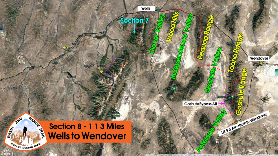
map of section 8 on the basin and range trail

Video: Basin and Range Trail Thru Hike Section 8


In addition to this trail journal, I also filmed my Basin and Range Trail thru hike. I’ve produced a detailed series (11+ hours runtime) documenting this thru hike adventure, the product of over 1,000 hours of video editing. I highly recommending watching the Basin and Range Trail vlog series for an in-depth look at thru-hiking the Great Basin and central Nevada. 
 

Basin and Range Trail Thru Hike Section 8 Journal

Day 50 – July 20th: Clover Valley, Wood Hills, Independence Valley, Pequop Range, Trail Magic

Woke 730. Walked to post office, which opened at 830. That was an hour round-trip. Started walking 9:45. While waking out of Wells I passed a younger guy, he said hey man come here a second. He thought I was homeless and was trying to give me his extra salad from a restaurant. But then saw my gear and realized I was a bit more well off. I told him what I was doing and he said “mondo respect”. His car was broken down and said he was stuck in Wells for a month. He asked if I wanted to come play video games with him in his motel. Kinda weird and random, but honestly, I would have if I weren’t walking out of town! You do weird and random stuff on a long hike like this, and find yourself in all sorts of situations. If you say yes, they typically work out pretty well.

hiker walking blacktop on thru hike

Walking out of Wells

thru hiker walking along interstate 80 on the basin and range trail

Hiking the 4×4 road along the interstate. This road is only a few hundred feet from the highway

I expect today to be the single most boring day of hiking on the Basin and Range Trail. Its going to be a hike of roughly 20 miles along Interstate 80 in order to connect the East Humboldt Range with the Pequop Range. Today, Ill walk across Clover Valley, Wood Hills, and Independence Valley, but on a track that’s only about 100 yards from the interstate. That’s because this area is all checkerboard land, an alternating pattern of public and private land. The long story short is that there is no legal way to cross this land, so its best to stay on a public road. I chose to follow the I80 service drive road that parallels the freeway to make the quickest time across this area, which was not going to be a highlight of the hike anyways. Every long hike seems to have one or two sections of filler to connect all of the great places it traverses. I am willing to sacrifice ONE day to connect the East Humboldt Range to the Pequop and Goshute Ranges. 

Some cows along the route today. Passed through a gravel pit which also had cows. One cattle Trough about 5 miles west of Wells with water. Didn’t need it, so I moved on. Stopped for break as I hiked through the northern portion of the Wood Hills range. This area consisted of low hills and small trees, as the name Wood Hills might imply.
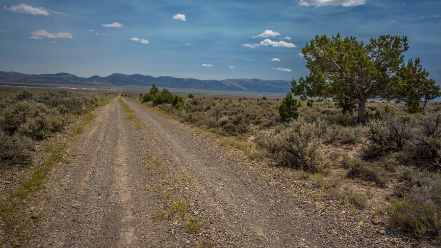
dirt road though independence valley nevada

Entering Independence Valley

hiking Independence Valley valley nevada

View south into Independence Valley

East of the Wood Hills Range, I entered Independence Valley. It was wide open and huge. Took another break at the independence valley exit along I80, in shadow of some abandoned metal crate thing for utilities.
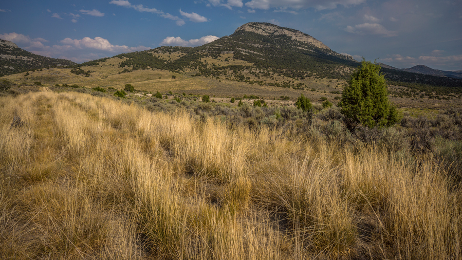
view of pequop mountains nevada

Getting closer to the Pequop Range

view of the pequop range from low

Looking up into the Pequops

By mid afternoon, I was starting to feel a bit off. I was really hot, tired and thirsty. I thought I had drank enough today, but my body just wasn’t having this walk today. Every day now the temps are low to mid 90s. My water was very hot, barely drinkable. However, as I approached the Pequop Range, the scenery was starting to get better. I wasn’t expecting much out of the Pequops, but they are starting to look like they have more potential as I draw near. 

hiking fenceline along interstate 80 in northern nevada

Interstate 80

Once I reached maverick canyon, where interstate passes through the Pequop mountains, the canyon narrowed. I began to get wedged in between steep hill sides and a fence. I was really whooped now. 
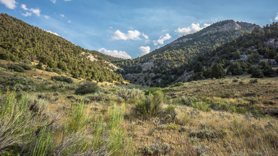
 

hiking into pequop range

Hiking unnamed canyon to pass below Quop Peak
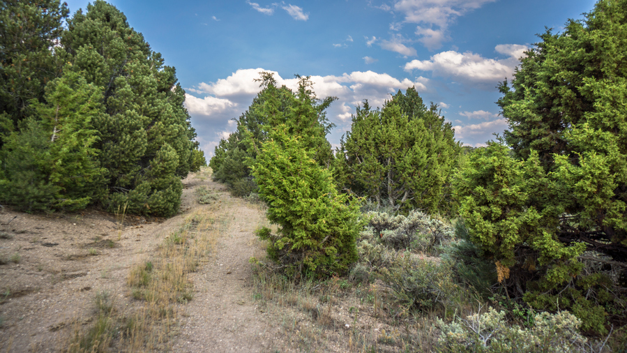
road to quop peak pass

Road to the top of the pass below Quop Peak

Left the interstate and started walking up a canyon on a dirt road. Left the dirt road for secondary road. My side was starting to hurt a bit so I had to stop again for a break. Thirsty for cold water, and not much appetite.

hiking dirt road in the pequop range

views of the pequop range

The Pequop Range

Once at the Top of the pass, the scenery began to get beautiful. Not stunning, but simple beauty. Rolling hills, excellent view East towards the Toano Range and the Goshute Mountains. The play of Light and shadows with the clouds over the mountains was peaceful.
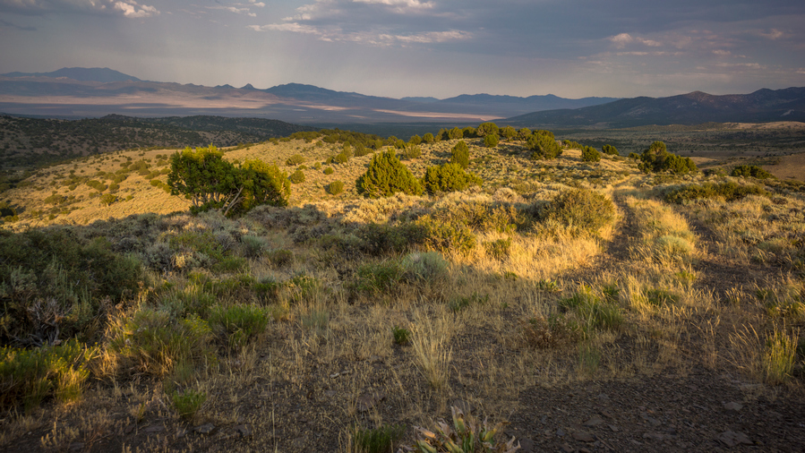
hikers view at sunset from pequop range nevada

Views over Goshute Valley and the Toano Range

hikers view of water source in the northern nevada mountains

Looking down on Nanny Creek

I walked up and down a series of rolling hills towards my next water source Nanny Creek. Looking down into the canyon below, I could see a large pond. Sweet! Just need to get down the steep hill side to get to it. I was struggling now to finish out the day. Exhausted from the heat, presumably, even though I seemed to handle the same temperatures much better throughout the rest of this hike. Still, I was tired, had cramps, feeling light-headed and just slow.
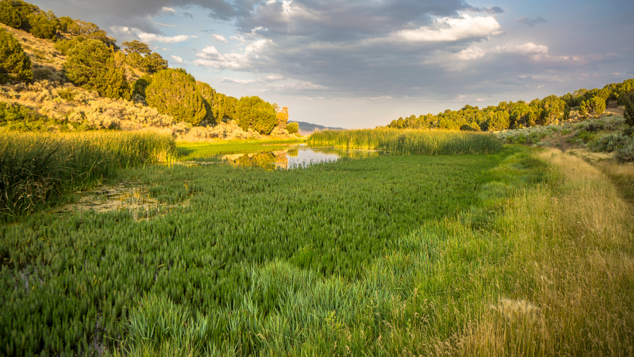
view of nanny creek in the pequop range, nevada

Nanny Creek

Nanny Creek was swampy. There is a man-made embankment on the downstream end forming a small pond. No way to get to water, the banks were shallow water with thick grass protruding a few feet into the water. Tried downstream, but no access either. I was on my way upstream to check the source when I heard an engine approaching. It was an older guy on dirt bike with weed whacker. Interesting!
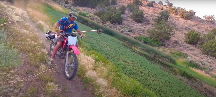
man on dirt bike carrying weed whacker

Kem, the local rancher

Kem, local rancher and mountain bike enthusiast, was out maintaining some dirt bike trails for the mtb project. We talked for about 15 minutes, and I was having a hard time concentrating… So tired, thirsty. Occasional stomach cramps. Dizzy. Ears plugged and could barely hear myself talk correctly. Dropped my pack while we talked and I had to sit down.

Kem offered to let me stay at his ranch this evening and join for dinner. Yes please! It was only a mile downhill. So that was that portion of private property I saw on my map.
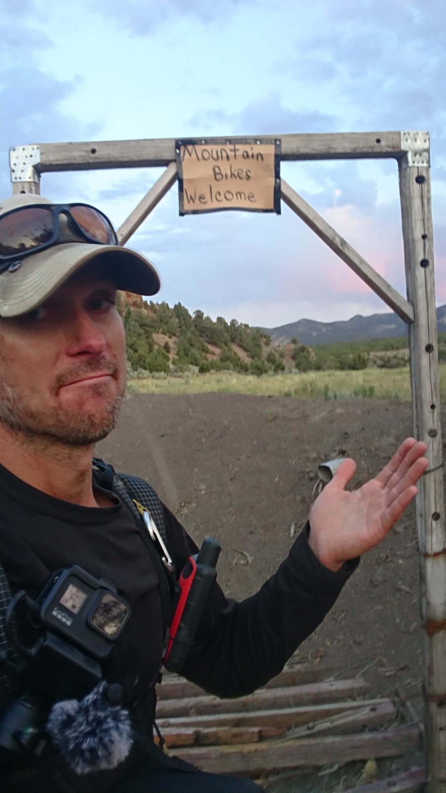
basin and range trail thru hiker posing below mountain bikers welcome sign

Close enough!

sunset at nevada ranch

Sunset view from Kem’s Ranch

Walked down to his ranch, a nice walk. The entrance to his property is marked with a sign that says Mountain bikes welcome. Beautiful property, lush green, rock formations, sprinklers ruining, horses, Llamas etc. Nice farm house. Greeted by barking dogs which quickly warmed up to me.

Kem’s wife Donna prepared Salmon and rice for dinner, which was very good, but I could barely eat. So exhausted from the heat that it was messing with my appetite. Drank 2L water and 2 glasses of red wine. We talked about the route I’ve hiked through Nevada so far, and I went over my plans for this coming section, in Kem’s backyard basically. Kem was familiar with some of my route through the Pequops to the south of here, as his mountain bike trails and dirt bike trails run through this area. Ultimately, Kem decided to join me tomorrow as I continue my hike south through the Pequops. Hell bring the dogs and hike a day or so south with me, before turning back around, as I continue south.

Took a shower and had a nice comfy bed to sleep in. Wow what an unexpected way to end the day. To have been in such rough shape earlier, and having just walked the worst section of the Basin and Range Trail, to bump into Kem like this was an incredible moment. It couldn’t have come at a better time.

Day 51 – July 21st: Trail Magic, P

Barely slept last night even though I had such a comfy bed. Had horrible cramp in my calf in middle of night, still sore this morning. I Was really out of it last night and not feeling great, heat wore me out I guess. Roosters outside bedroom woke me at 5am. Slept to 630.

Kem and Donna were up when I walked out of bedroom. Donna had already made breakfast, pancakes and fruit. Delicious!

two hikers posing in green meadow ranch in northern nevada

Kem and I ready to tackle the Pequop Range

Kem and I left for our hike around 8am, with 4 dogs in tow. Left the ranch and walked the dirt road back up into the Pequops. It was nice to follow Kem and have no navigating to do for once.

hiking view in the pequop mountains nevada

The Pequop Range is starting to look pretty nice!

Kem was in the air force, and flew C130 transport places. After his military service, he flew for Delta, and is now retired.
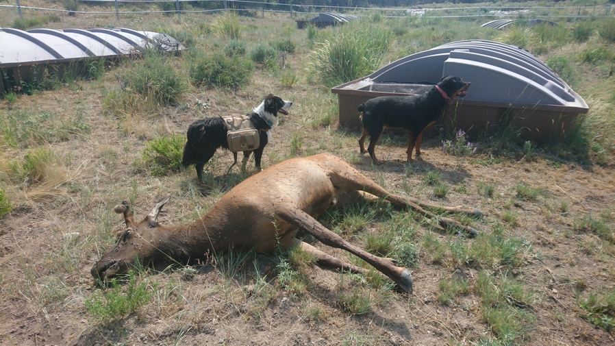
dogs standing next to dead elk at a nevada guzzler

A dead Elk just feet from the water at this guzzler

In the northern Pequops there are a couple of guzzlers. When we reached the first guzzler, it was nasty water. Brown, like a cattle pond. The dogs jumped in the guzzler to cool off. Well, I’m not drinking that water now. Oh, and there was a dead elk a few feet away from the water. It had just recently died, within the last couple of days. This guzzler was not plotted on my Calopo map… Did I miss it in my research? Kem says another one higher up, so well get water from that one. Hopefully, its better water.
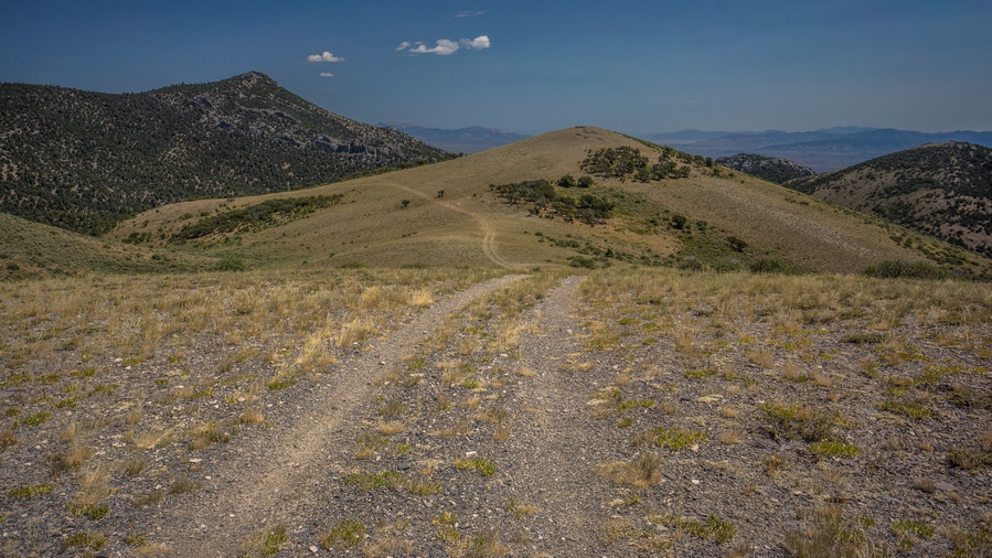
hiking dirt road in pequop range

Good walking along the ridge

dog stands on ridge in pequop mountains, nevada

The dogs were enjoying the hike, too

Good views now that we’ve gained some elevation. Rolling ridges, really Nice. We filled up our water at the second guzzler. Clear water, no green tint. There were four separate troughs here at this guzzler. The dogs jumped in first one. We used second one until one dog jumped in, then we used third tank. I took 7L, expecting no water for a solid day plus across Goshute Valley and into Morgan basin.

view hiking the crest of the pequop range nevada

Pequop crest view northwest, over Independence Valley

pequop range hiking trail on the ridgeline

This trail is mostly used by mountain bikers and dirt bike riders, and is lightly trafficked
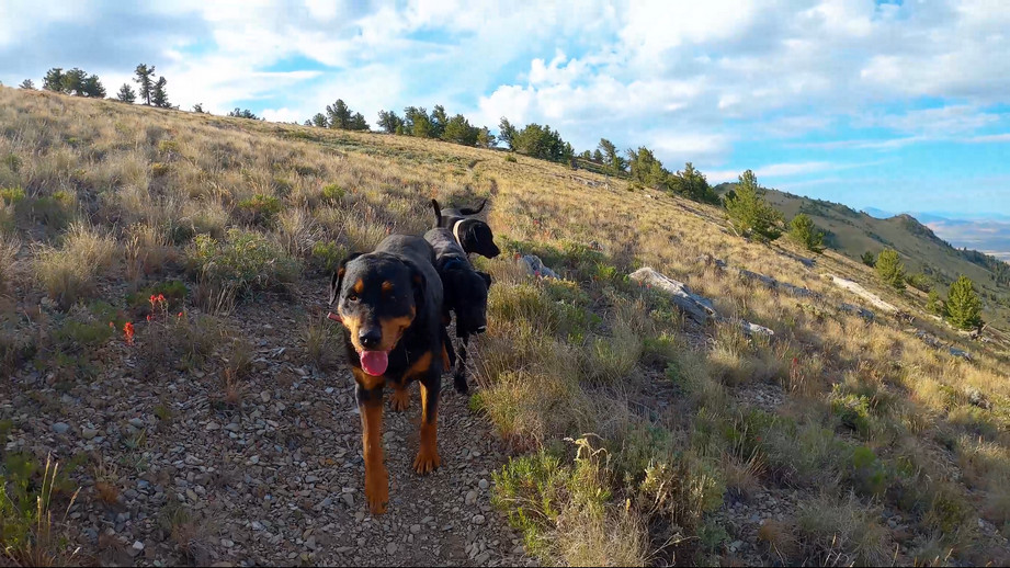
hiking with dogs in the pequop mountains nevada

The convoy

Clouds building now, getting a little windier, Temps cooling. Hiked the crest of Pequops south and a network of game and bike trails that were mostly pretty good. Nice place to walk, pretty easy now. Mostly open terrain, some limber pines. Kem says these can grow to be over 1000 years old.

backpackers walking the ridgeline in the pequop range

Looks like rain…

view of goshute valley from pequop range nevada

Crest of the Pequops, and Goshute Valley to the east

Great conversations with Kem. Talked about exercise, nutrition, family, adventures, economics etc. Kem is a great guy to talk to, seems very educated, reasonable and open minded.
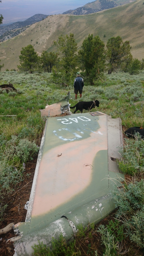
tail from f-111 plane crash in the pequop mountains nevada

Tail from the F-111 plane crash

parts scattered on mountainsside from f-111 plane crash

Scattered parts from the F-111 crash

Next we reached an F-111 plane crash by South Peqoup Mountain. Debris scattered everywhere, even over the ridgeline to the east. We could see it from a distance. The clouds were dark now and rain appeared imminent, with a visible shelf cloud approaching. It started to rain as we reached the crash site. Took shelter under a pine tree along trail. It was getting cold now, and I put on my wind pants/jacket. One of the few times along the Basin and Range Trail where I put on my wind pants, but at only 1oz, I’m glad I carried them.

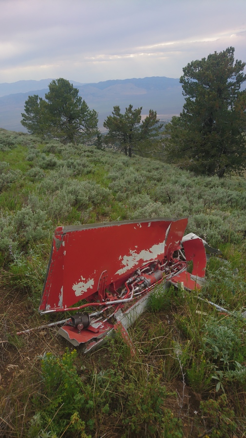
pequop range f-111 plane crash debris scattered in mountainside

piece from f-111 plane crash in Pequop mountains

The rain cleared around 5pm and we continued to scour the F-111 crash site. Lots of debris, random parts. Hydraulic lines and valves, fuselage parts, circuit boards and wires, hatch, tail piece etc.

dark clouds over the peuop mountains nevada

Dark clouds remain at sunset

pequop range nevada camping

Campsite in the Pequops

We set up camp not far form the crash site, on the crest of the Pequop Mountains. We had some cover from the wind thanks to a nice short, fat pine tree.

m61 vulcan gatling gun found at f-111 crash site in nevada

We found the F-111’s M61 Gatling gun!

After dinner, we walked east side of ridge and found the M61 Vulcan Gatling gun from the F-111! The barrels were twisted and full of dirt, but it was unmistakable. 

Day 52 – July 22nd: Trail Magic, Hiking With Kem the Rancher, Pequop Range, F-111 Plane Crash

Woke at 545. The ground was lump and not at all flat, but I slept good because I was so tired. Rain for 20 seconds over night around 4am. Good campsite though, in the sense that there was a large tree that blocked most of the wind that otherwise would have hit our tents. Still some clouds over Goshute Valley to the east. A nice play of Shadows over the Basin.

dog on mountain ridge in pequop range nevada

This morning, one of Kem’s dogs laid next to my tent, and put too much pressure on the string that holds the stake to the tent and snapped it off. My Tarptent Notch Li is made from a Dyneema fabric, and I really don’t know much about the nuances of sewing this type of fabric. Kem assured me Donna could sew the string back on to the tent, but Id need to follow him back to his ranch instead of continuing on south along my route traversing the crest of the Pequop Range. My tent is not functional without it, and I would likely not be able to find anyone to repair it in Wendover, my next town stop. So, what option do I have other than to head back to Kem’s ranch?

clouds over the pequop range

hiking the pequop ridgeline

Pequop Ridgeline

We hiked back to Kem’s Ranch mostly the same way we came in, except the final stretch. Again we had good conversations together. We talked about ancient civilizations and tribes, complex problems of the future, economics etc.

independence valley view from pequop mountains

View west over Independence Valley

We’ve reached the area where Jack, one of the dogs, lost his saddlebags yesterday. He likes to rub up against the bushes, even if he doesn’t have the saddlebags, to scratch his back. So we each took a side of the trail and began to scour the brush. Kem found it hidden in the bushes as we expected.
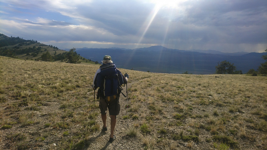
hiker walking the crest of the pequop range

We passed the highest guzzler, but not needing water we didn’t stay long. We gave the dogs a chance to rehydrate. BB, the biggest dog, was having the hardest time. She jumped in guzzler to cool off, as some of the other dogs did. Only problem is, she could barely get out!

Instead of taking McKitchenson canyon, as we did the hiking up yesterday, we took solar coaster, Kem’s favorite mountain bike trail. He builds mountain bike trails in the woods and besides riding them himself, tries to get other riders to ride his trails through the mtb project. He says in a normal year he might get 100 riders passed through his trails. Some may stay at his Ranch, as I did. He mentioned I was the first hiker to wander through his area, though.

hiker and dog standing under the largest juniper tree in nevada

Kem standing under the largest juniper tree in Nevada

On the route we took back to Kem’s Ranch, we passed by a tree that Kem said is the largest known Juniper tree in Nevada. When he found it years ago, he had called the biologist for the BLM in the area, and they came out and measured it in various ways. There is a certain point stem, based on height, width, crown, etc and apparently, this tree is the biggest Juniper in the state. Pretty cool.
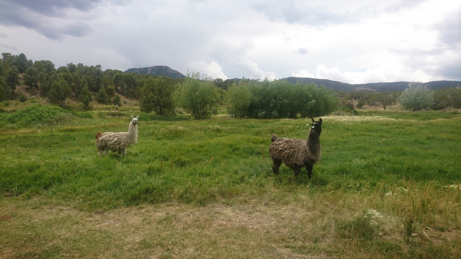
two llama in pasture of nevada ranch

Back at the ranch

Looks like rain clouds building. Dark Skies by the time we got back to the ranch. When we got to the house, Kem offered me a monster energy drink. I was surprised to see he drinks those, but it just so happens they are my guilty pleasure, same as him. So we both enjoyed an ice cold monster.

Donna was able to sew up my tent in a matter of minutes. I checked the radar and it looked like rain clouds are continuing to build and move into the area. It was 1pm. now when we got back. Kem was going golfing with his buddies at 4pm, a regular event he does to get together with friends. The plan now is to drive me up to Morgan Basin in the Goshute mountains, rather than hike the northern Pequops again for the third time to in order stay on my track. But with the weather moving in, is that a good idea? It looks like an almost two hour drive to Morgan Basin from the ranch, which is kind of hard to believe since it was basically just across the valley, so Kem was reluctant to do it this afternoon since he didn’t want to be late for golf. Understandable. He asked Donna to drive me, but I could tell she was hesitant, unsure of her abilities to drive the truck on such a rough road as she said the visibility wasn’t the greatest in that truck. They suggested we wait until the morning. I’m okay with that, in fact I was only wanting to go this afternoon because I didn’t want to be a burden, impose or over stay my welcome.

I chatted with Donna for a while and she made me dinner, farm fresh eggs, bacon and cream cheese bagels. Very good! We chatted some more this evening, about her son’s Adventures as white water rafting guide in Idaho, and work for the mines. Kem mentioned his sons several times, they all seem to have quite a bit of outdoor experience and knowledge. One of their sons was into survival, and would go out into places like the Sierras with only a knife and water bottle. Apparently he had a lot of knowledge of plants as well, which to eat and which to use for medicine.

I went to bed a bit early tonight, at 9. I need to catch up on some sleep.


Day 53 – July 23rd: Goshute Valley, Hiking With Kem the Rancher, Goshute Range

Woke 6:15. Donna was up already, filling the hummingbird feeders and surveying the damage left from the elk. Apparently they have elk come in many nights and they eat the plants around the farm.

Donna made us breakfast, bagels with cream cheese and lots of fruit. Kem and I loaded up the truck and we left the ranch around 7:45. The dogs jumped in the back of the bed, wanting to go. But it wasn’t going to happen today.

The ride out to the Goshute mountains was interesting. Its really dry, in fact this area is among the driest along the entire Basin and Range Trail route. There was one spot along the railroad tracks that looked like a puddle of water on satellite, but that’s likely all it was a puddle after a recent rain. We saw no water in Goshute Valley.
After crossing the railroad tracks, I was surprised to see how wide open and free of Sagebrush this Valley was. There was Golden grass as far as the eye could see. Now, Kem told me the land looked over grazed. The grass that grows in here is called cheat grass. He said the original vegetation that grew here was some sort of rye. The first herd of wild horses we saw was about 20 strong. In the distance, we could see other herds of 10 or 20.

railroad tie marker for the california trail

These ties are used to mark the historic California Trail throughout the Great Basin

We stopped along the road to check out a railroad tie marker for the California Trail. These can be found scattered throughout the Great Basin along sections of the California Trail. I saw these at Overland Pass, in the Ruby Mountains, and Huntington Valley. 
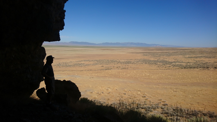
man standing in the shadows of a small cave overlooking goshute valley

Goshute Valley view from small cave

goshute valley view

Kem’s truck parked below in Goshute Valley

We also stopped to check out a small cave on a hill. It ended up being quite small and having no interest or significance, but it was a fun little side adventure.

As we made our way south, the rugged nature of the Goshute Range revealed itself. The Limestone Cliffs first start around Morgan Canyon. This is our entrance into the Goshutes. The road goes up and over Morgan pass. It can be driven in a truck, as we have done, although most probably do it in a side-by-side.

goshute range nevada morgan pass view

View east from Morgan Pass

old wooden cabin at morgan pass nevada

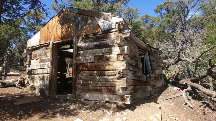
Cabin at Morgan Pass

We parked on top of Morgan pass in a small clearing. From there we walked up the Ridgeline of the Goshutes south to meet up with the route that I had mapped. There was a small cabin here in very bad shape. However, there were actually horse trails to follow. This is very encouraging and gave us a lot of hope, specifically me, about the prospect of the rest of this route across the Goshute Range panning out well.
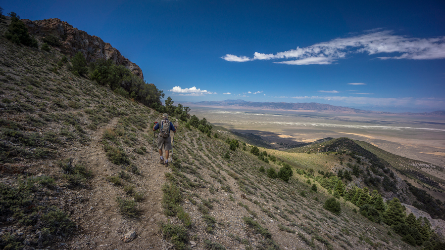
hiker on trail in the goshute range

Kem following a decent game trail

View northeast, Goshute Range and Bonneville Salt Flats
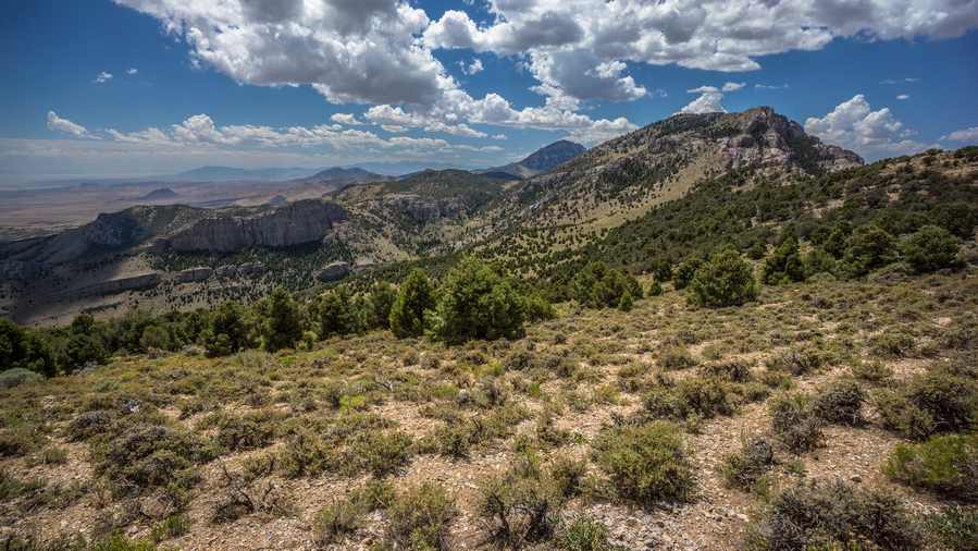
hiking the goshute range nevada

The Goshute Range is becoming quite beautiful

We went up and over a couple of Ridge and contoured around a few Hill sides. The father we went, the more beautiful the landscape became. Down the valley to the east lied a large Limestone rock formation carved out in almost a smooth manner. And farther to the east is the Bonneville salt flats. While the official measurement is roughly 30,000 acres, or 46 square miles, when one looks at the map the salt flats are only one small part of the much larger dried lake bed, Lake Bonneville. A rough measurement of this on the map is over 100 miles long!

limestone cliffs along the goshute ridegline

Rugged limestone cliffs along the west side of the Goshute Range. Basin and Range geology in action right here
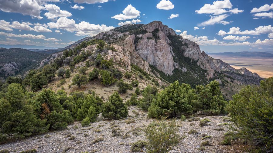
views from the crest of the goshute range

Excellent hiking along the crest of the Goshute Range here. Still good game trails to follow
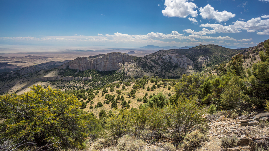
goshute range views

Impressive limestone cliffs rise from the hills all through the Goshute Range

We continue to hiking South until we reached a spot on the map that required a bit of work to get around. We should have stayed higher up on the Ridgeline, and so we needed to gain about 200 ft elevation. We climbed up towards the Ridgeline, and a small natural arch became visible. We took lunch here in the shadow of the arch. Looking Through the arch was a very impressive view of random rock formations and the Bonneville salt flats in the distance. Rain clouds began to form, thunderclouds billowing. I even saw one bolt of lightning.

bonneville salt flats behind natural arch in the goshute range

Natural Arch and the Bonneville Salt Flats to the east

hiker posing inside small natural arch in nevadas goshute range

Cool natural arch at our break spot

After lunch, Kem and I separated. This was roughly the point he wanted to hike to before turning around. He had about a 2 hour walk to get back to the car, then his plan was to play some golf in Wendover. And of course, he must factor in the long drive back home. Looking back, I didn’t realize how far this would be for him and really appreciate the ride out here. Not only that, everything Kem and Donna had done for me… I stayed two nights at their house, Donna had made multiple meals, washed my clothes, I was able to shower etc. Its amazing what people are willing to do for a stranger. It makes me eager for the opportunity to return the favor to others someday.
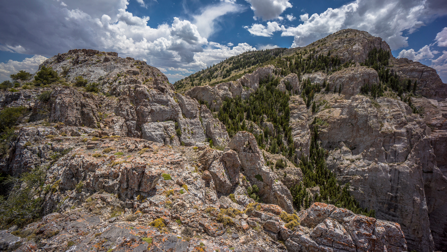
goshute range nevada great basin thru hike

Following this ridgeline is a fun scramble with crazy good views

panorama view from goshure range ridgeine nevada

Are you kidding me? The best views of the Basin and Range Trail, in the Goshute Range? Maybe!

hiking along sheer cliffs in the goshute range nevada

Looking back at the ridge I just came down

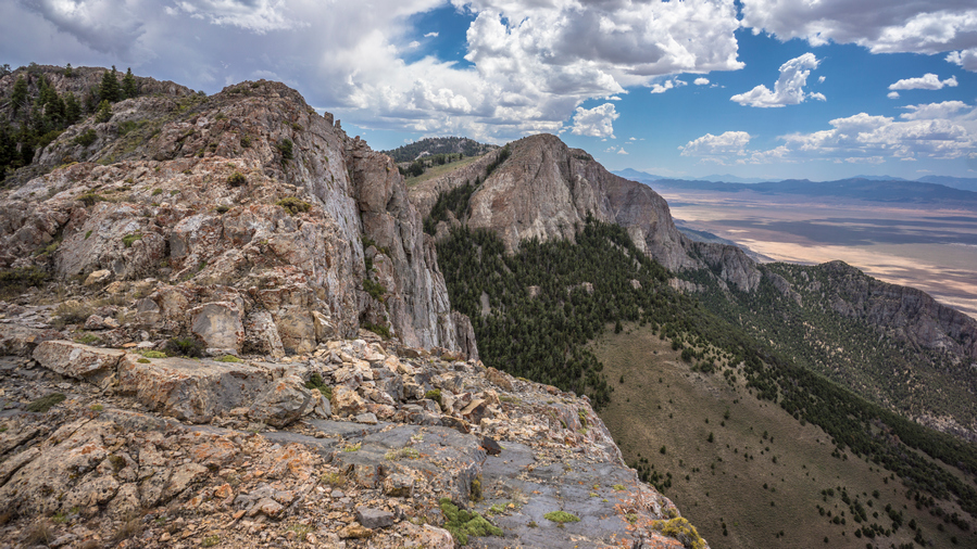
Now on my own again, I had to climb up to the crest of the Goshute Range and the true nature of the challenge presented itself. I found myself out on a Rocky Ridgeline that at first looked like it was going to require quite a bit of climbing. There were some scrambling sections for sure. One side had quite a bit of exposure, the other side a little bit less. Two sections of the Ridgeline were separated by a small gap, that required either a leap of faith or to climb down and around. I chose to climb around. The views here though are downright stunning. I am in awe of the Goshute Range, and completely surprised by it’s overwhelming beauty. 

panorama view of the goshute range nevada

Excellent views all day in the Goshute Range
views from the crest of the goshute range in nevada

I love the Goshute Ridgeline!

goshute range panorama views by hiker on rigeline

The next couple miles offered outstanding views. In fact, some of the most Scenic miles of the entire Basin and Range Trail. I say that often, but the beauty Goshute Range really stands out in my memories of this hike. The thing is, the horse trails have disappeared now, and it’s largely an off-Trail scramble. Still, not that hard considering there is not that much vegetation. Excellent views of Goshute Valley to the west and massive sweeping views of the Bonneville salt Flats to the east. Dark Skies Loom in the distance, though. A bit ominous, but the provided an excellent backdrop to the stunning landscape that surrounded me.

view of Bonneville salt flats from the crest of the goshute range nevada

View east into Utah and the Bonneville Salt Flats

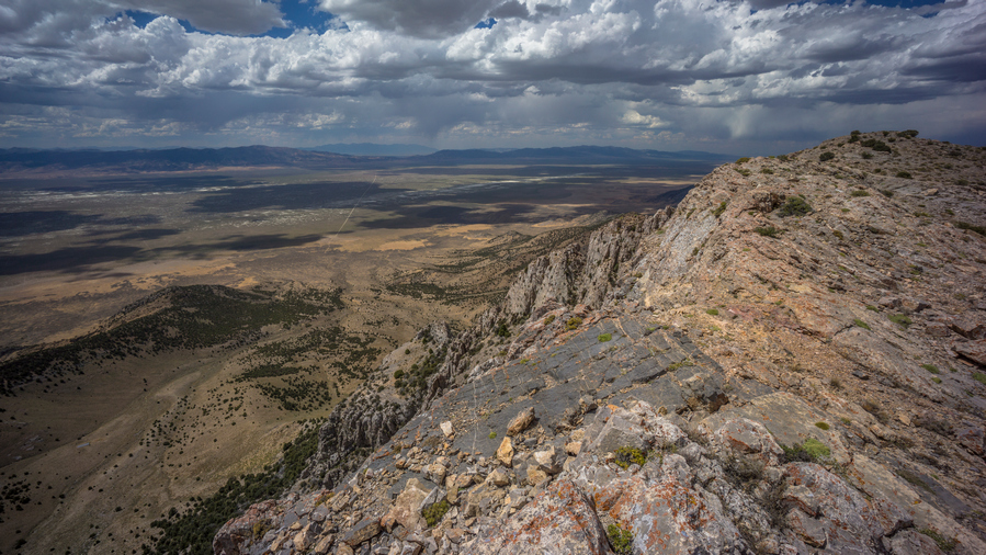
Looking east, where the Goshute mountains end and the salt flats begin is roughly the Nevada-Utah border. The town of Wendover can be seen in the distance from here as well. To the north, Pilot Peak is the prominent, volcanic-looking, Peak that dominates the horizon.
goshure range view into goshure valley

View out over Goshute Valley

goshute range view of pilot peak summit Nevada

Notice Pilot Peak in the center, along the horizon
view from hike along the goshute range ridgeline

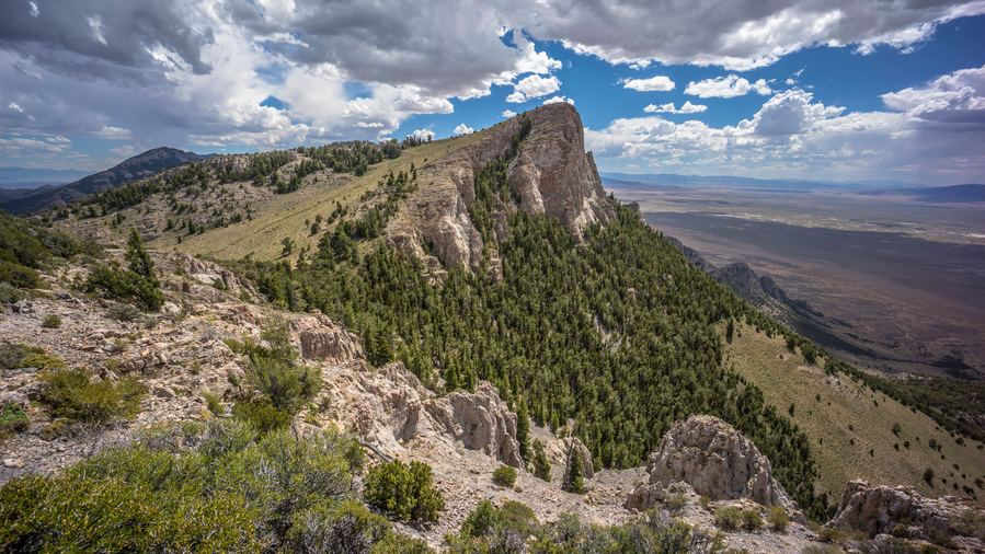
Ridgeline views hiking the Goshute Range

Working my way along the Ridgeline, the horse trails follow the edge of some cliffs. It was heavily wooded to the east, forcing me to stay along the cliff Edge. Eventually, the horse trails pass through the trees. This wasn’t really a bushwhack per se, but forced me to walk in a crouched down position to stay under the vegetation. Then, I passed a small cave. Couldn’t quite get to it without having to descend a small steep chute with a long run out, and so it was just not worth it.
hiking the crest og the goshute range along cliffs

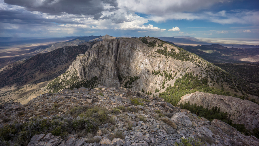
Looking north along the Goshute Ridgeline. I was walking the top of that an hour ago!
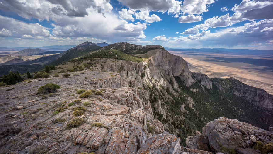
BRT thru hiker view from crest of the goshute range in nevada

Hiking the Goshute ridgeline south

zpacks arc haul packpack on mountain summit on great basin thru hike

My zpacks Arc Haul backpack enjoying the view

This brought me to a saddle below Peak 8735. Across the way was a small cave, somewhat hidden with some trees by the entrance. I will hit this on the way down from the peak. Going up, you just pick your route and walk straight up. Great views up at the top looking back the way I came, it was a massive vertical limestone rockwall. Very impressive! Stopped to take a quick break while I Let a GoPro timelapse play out, hoping to get some movement on the storm moving across the valley.

After coming back down to the saddle, I made my way over to the small cave. There were some deer legs and a pelvis near the entrance, which always makes me think of mountain lions. I rounded a corner and saw the cave entrance. It was pretty small though, maybe four feet high at the entrance and slanted down to the ground about 10 ft deep. I could see a rodent sticking his head out in the back of the cave.
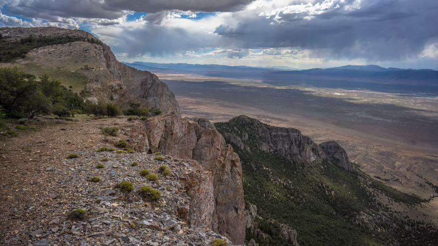
goshure range ridgeline hiking

Walking the ridgeline

hikers view into utah from goshute range nevada

View east into Utah

herd of wild horses in goshute range with bonneville salt flats in the background

Wild horses with an unreal backdrop of the Bonneville Salt Flats

Next I followed the Cliffside for a while. Saw another 8 or so wild horses. I followed some horse trails and contoured around a hillside a bit before climbing up to a ridge. The horse trails disappeared on the way up. There didn’t really seem to be a good route around this Ridge, it was Cliffy on one side and heavily wooded and steep on the other. This is where things started getting tough. Very tough.

thick forest in goshute range

Crap. East side of the crest is not hikable
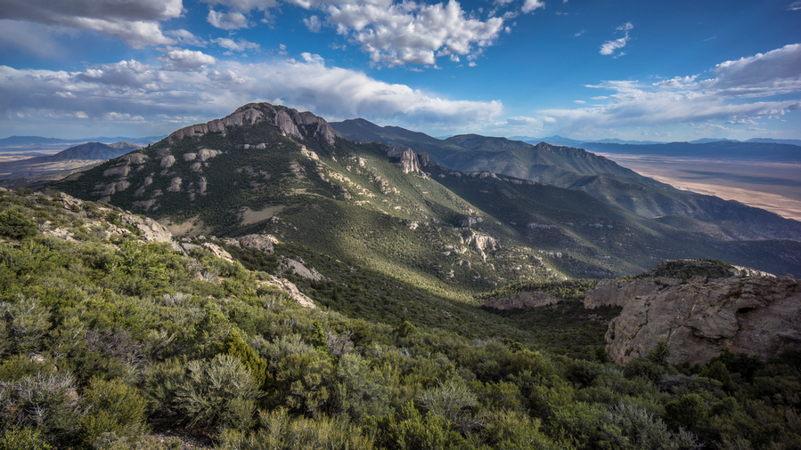
heavily forested mountainsides in the goshute range nevada

A monumental bushwhack lies ahead

I couldn’t really follow the very top of the Ridgeline, at the high point marked as 8780, as it was Rocky and too much vegetation. So I followed the steep hillsides about 50 feet below the top. Even here, the vegetation was thick. I weaved my way in and out of the trees. These were mostly mahogany, maybe some junipers. Eventually made it around the top of the Ridge and came to a Ridgeline that leads down to a saddle at 7990. This was a very disheartening sight. At the top, the Ridgeline leading down to the saddle was often a knife edge Style, with extremely thick vegetation to boot. There was no way to follow the knife-edge, it was too steep to the left / East, so I had to stay to the West. Here, it was a bit of a bowl-shaped Valley with a sea of green. An impenetrable wall of vegetation, a nightmare Thicket. Very disheartening indeed.

I began my descent through the brush. There were no horse trails, there was no obvious path or route, there was no section that looked less thick than others. It was literally one solid mass of green. I knew this was going to be awful. I pushed ahead, literally, pushing through the trees. They stood so thick together that it took a lot of force to bend the branches enough for me to fit through. These branches were not soft and limber, they were solid.
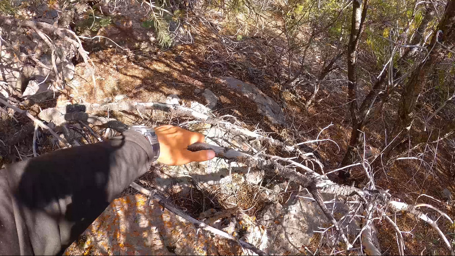
hiker bushwhacking through trees in the goshute range

Bushwhacking for hours through this stuff

Bushwhacking here scraped away at my skin, drawing blood more times than I can count. Scrapers and stabbers galore. Pushing the branches aside and trying to squeeze through was one approach. The other was to break branches. This works better on older and dead trees than Lush and limber ones. Using my hands, it was easy to get cut, poke and stab wounds. If possible, I prefer to use my feet. I would kick the branches and try to break them off that way if they were low enough, waist-high or slightly above. This was the best approach overall, but it was slow and only worked with certain trees. I fell a couple of times in the process. 

At one point I checked my watch and realized I had only moved about 250 ft down from The High Point in nearly an hour. This is about the worst feeling you could imagine. It was pretty overwhelming to find myself completely surrounded by thick brush, not having any way out, and knowing that it would still take a massive amount of effort to reach safety again. It’s hard enough to have worked your way into the situation, but I thought to myself what a nightmare this would be if you dropped somebody off in this scenario and left them to find their way out. I can’t imagine how a person would handle this situation. It’s super easy to lose your cool here.

I now I had several large cuts on my leg, many puncture type wounds on my legs and hands, and a cut on my forehead. This one was the worst as it took my hat off, so the cut sits about an inch above my eye and extends into my hairline, right where my hat sits.
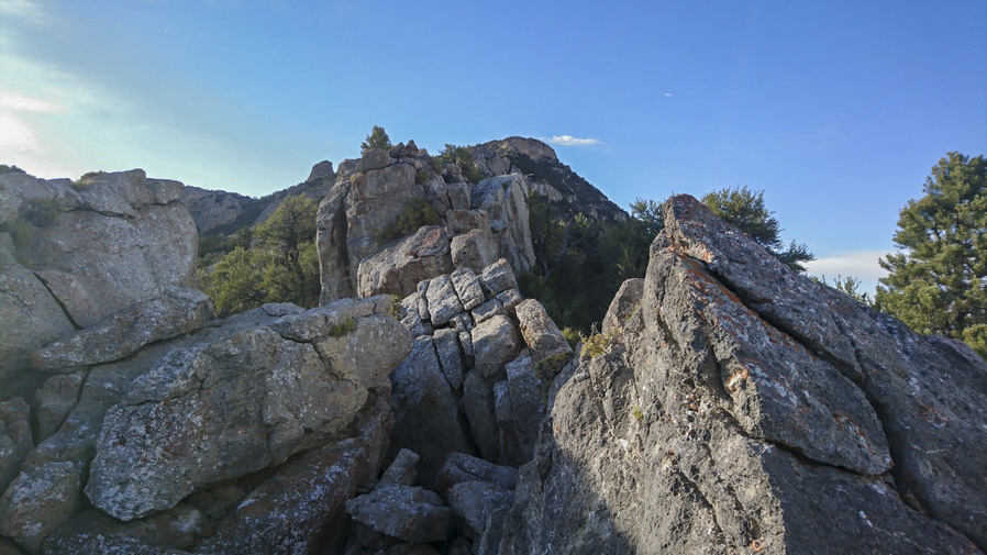
bushwhacking in the goshute range nevada

What a shit show this ridgeline is

I made it back to the Ridgeline, which was somewhat less knife-edge like at this point now. I hopped over the other side, now on the east side, to see if the going was any better here. Somewhat, at times, but overall pretty much just as hard. I was now on a steep slope, and I stepped on a boulder which I dislodged. I was able to get my leg out of the way, but I slipped and fell and my forearm took the brunt of the fall on another Boulder. The dislodged Rock tumbled down the hill, and took out a downed tree limb, before tumbling another few hundred feet.

bushwhacking on the basin and range trail

2 hours to come down this one ridge,. Worst bushwhack on the BRT

Eventually made it to the saddle at 7990. I checked my watch and realized it took me two hours to go about a mile. Wow. I don’t know how many times on this trip I told myself that I never want to do that again. Then time and time again, I find myself in that same situation.

It was now about 6:45. I stopped to take a break to eat dinner. I had a solid view of Peak 9174, my next obstacle, while coming down through the thick brush. Now on the saddle, it was time to make a decision. It wasn’t really a hard decision at all, there was no way in hell I was going up and over that like I had planned. This Peak is heavily wooded, just like the one I came down, but with many limestone outcrops, ridges and Spires protruding from the trees. 1/2 mile an hour pace isn’t going to cut it, and there’s just no reason to put yourself through that kind of stress unless there is a more specific goal/purpose.
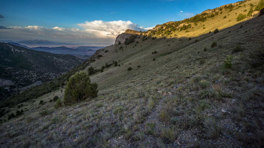
goshute range sunset hiking

Finally, some easy walking

After my break, I began to follow horse trails around Peak 9174, contouring the hillside. At first, the horse trail led me right into some thick brush. And for another 10 minutes or so, it was a pretty shitty bushwhack again. This is where you just want to flip out. I had just got done doing this for 2 hours and now I’m right back into it again, with the sun going down soon. Fortunately, it was a short patch of brush and I emerged into a clearing again. From here, there was a very solid Horse Trail that led around the Mountainside, completely clear of all brush. I followed that and made quick progress.

pilot peak viewed from goshute mountains

Pilot Peak on the horizon to the north

My path up and over the Ridgeline requires leaving the horse trail and climbing 200 feet the hillside. When I got to the top, I was hoping to find a good spot to camp, but there was nothing. On the other side, it was pretty windy. The sun was going down soon and I didn’t want to commit to the other side of the ridge, being exposed to the wind and not really having a solid sightline of what the coming terrain would look like. So I was pretty set on camping on this side of the ridge. But where?

After walking back and forth for about 20 minutes, I finally settled on a spot. It was a small Spot barely big enough to Cowboy camp, but I was determined to make my tent work tonight. I got started by pulling rocks up out of the ground, using my tent Stakes as a digging tool. Some of these rocks were 3 ft long! Then, I started pulling up sagebrush. I use my shoe to kick all the rocks out of the way and clear a relatively flat spot. I was able to get my tent up, although it was slanted in spots and one tent pole sat down in the hole where a rock was, about 10 in lower than the other side. setting up a tent in this scenario is not easy, and basically impossible to get everything tight and taught.

Dirty and bloody, I began to clean myself up as best I could before settling in for the night. This was one of those days I was just happy to be done hiking.

Day 54 – July 24th: Goshute Range, Goshute Valey, Antelope Valley
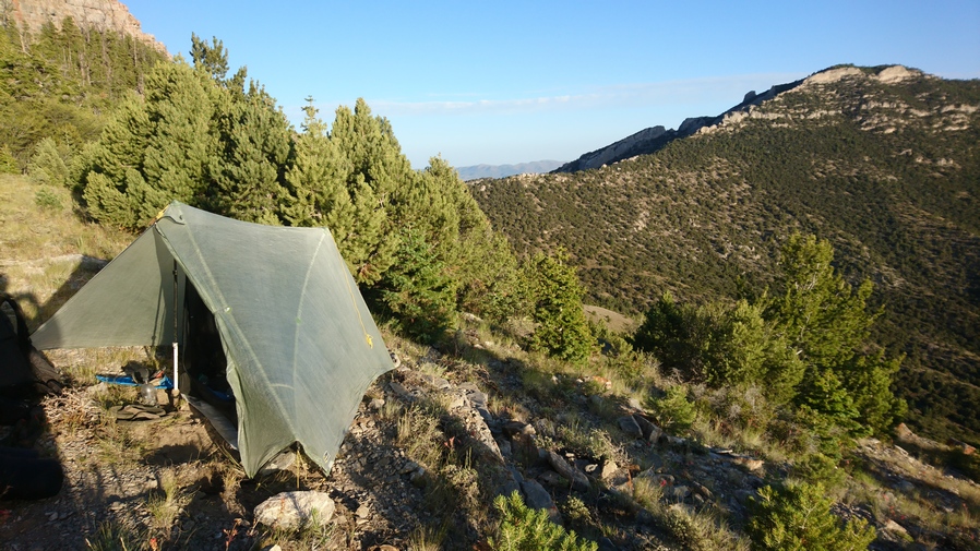
basin and range trail thru hike campsite in the goshute range

What a view to wake up to

Woke around 5:45. There were many bees buzzing around my tent this morning, and even a hummingbird. Over the past several weeks my sleeping pad was becoming a bit dirtier as I usually sleep in boxers now, no base layer bottoms. There were many more smears of Blood on the air mattress now from my leg wounds sustained during yesterday’s bushwhack.
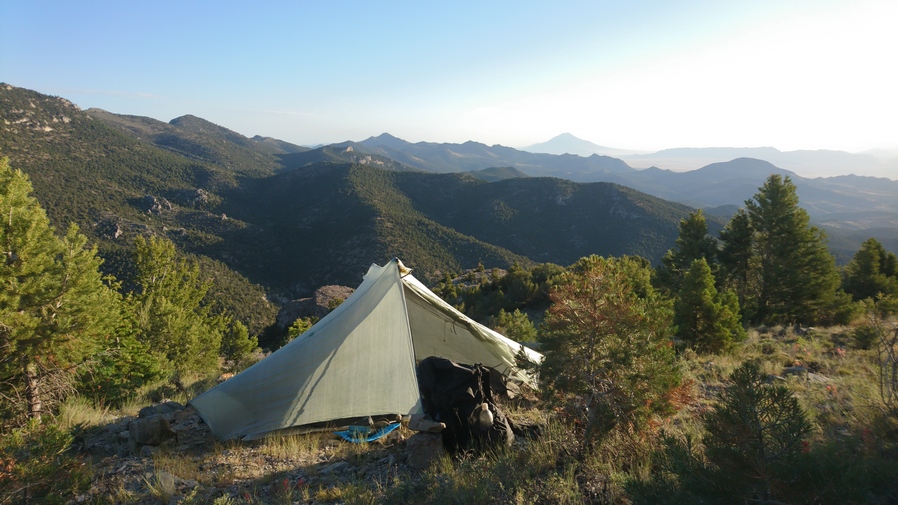
goshute range campsite with taptent notch li tent on basin and range trail thru hike

Good view, but not a comfortable campsite

It’s amazing what a night of sleep will do for you. It can be frustrating going to bed right after a difficult bushwhack, and then the added stress of needing to construct a suitable, or even subpar, campsite out of nothing. But this morning, I was feeling better about things.

I was walking by around 7am. I continued around the ridge that I stopped at last night, and began to scope out the route. From here, not only did I need to Contour the hillside, but I needed to gain a little elevation to maneuver around a slightly steep section. Fortunately, there were good horse trails to follow here. It really wasn’t an issue finding my way. This was a relief, especially in early morning. It’s difficult mentally to start the day with a bushwhack.
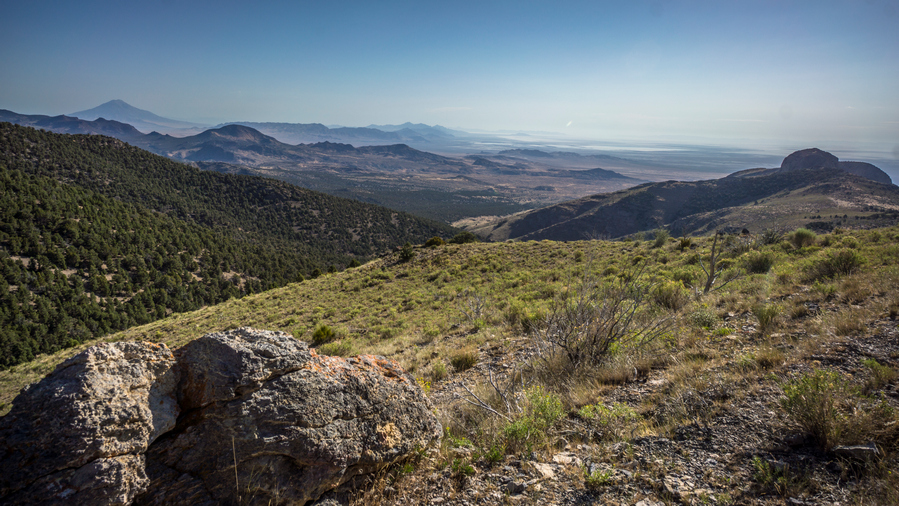
hiking the goshute range in the morning

This morning’s hike was pleasant. I could still see Pilot Peak behind me which I really enjoyed. For some reason, I thought it had a primitive look to it, adding a unique feel to the area.

I saw a horse contouring around the hillside, coming out of a bit of a gully or ravine. The Horse had the sun behind him, and stood on a small Ridge or piece of high ground. It looked somewhat Majestic as he debated his next move, and walked along this High Ground.

hiking old burn area goshute range

hiking goshute ridgeline south view

View south along the ridgeline

hiking game trail the Goshutes

Game trail at the top of the Pass. The ridgeline ahead looks heavily forested, almost certainly more bushwhacking

After rounding the corner, coming out of the Ravine, I was overlooking a burn area now. This has been rare to see lately. It wasn’t long before I reached the saddle where I would drop down to a guzzler to get my water for the day. Here, there were many horse trails and an obvious Road up to the top of the saddle. I stopped here and had a look at the route to the South. If I continue South along the Ridgeline, that means going up a hillside that looked very thick with trees and vegetation. I know it clears out a little bit south of that as I approached Goshute Peak, but from there on South, My Maps show a heavily forested and super thick Ridgeline, complete with steep Terrain. If I wanted to continue South along the Ridgeline, that would mean dropping down about 450 ft to the guzzler, then climbing back up to the saddle, and then proceeding south on the ridge. From there it would be about 20 miles of Ridge walking, 100% off-trail, to Highway 93. To me that just didn’t seem realistic given yesterday’s bushwhack at a half mile an hour pace. The only logical Choice was to head downhill to the guzzler, get my water, and then proceeded down to Goshute valley and walk along the base of the mountains South to Highway 93. So that’s what I settled on.
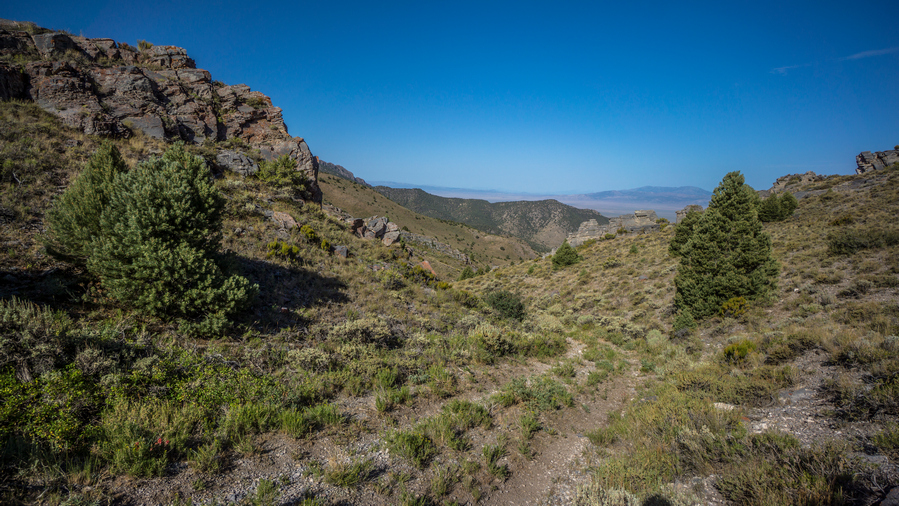
goshute range 4x4 road in canyon

$x4 road leading down to guzzler

goshute range nevada guzzler

Guzzler

nasty green water in guzzler along basin and range trail thru hike

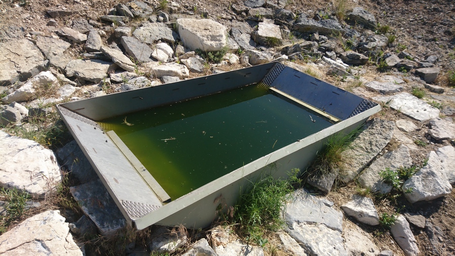
I’m in luck, the guzzler isn’t filled with water, but… Lemon Lime Gatorade! Score! Electrolytes… it’s what hikers crave

Following the 4×4 road, it was quick progress down to the guzzler. This one was a completely different style than the other ones I’ve seen so far. This guzzler was basically a large piece of metal, like a metal roof, on a slight angle to collect all the rain water which funnels into a gutter, and then drains into an underground tank. From there, it’s piped over to a trough. The trough was full of very green water, with a lot of dead bugs in it, and many more flying around. But this is the only water available, so it’s what I will drink. There were two game cameras set up pointing at the guzzler. One of them had a sticker on it that said, “hello this is not hunting, College project, thanks”. The other one did not have a sticker.

thru hiker filtering green water

Do your thing, Sawyer

It took quite a while to filter this water. I took 5 L with me. I backflush my filter after about 4 liters when I noticed it was getting really slow. Extremely green water came out, about the same color as what I was putting into it. Then I backflushed the filter again after my 5th liter so that the gunk didn’t stay in the filter.
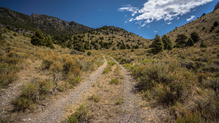
view of goshute range from 4x4 road

4×4 Road leading out of the Goshute Range

I walked maybe a quarter mile downhill from the guzzler and a Truck approached. I was pretty surprised, but assumed they were going to look at the guzzler. Course they were just as surprised to see me. I told them I was hiking 1100 miles to Nevada and that always gets their attention. They were indeed Hunters, scouting out the area, here to look at the guzzler for signs of elk. They asked if I needed water or food or anything, and I told them I was all good, I had just filled up with all the water I need for today and have 3 days of food for a 1-day walk. But they were persistent and convinced me to chug one of their liters of water and Help them eat some of their salami cheese and crackers. So I stopped for a while and chatted with them. Bradley and his son Dylan, and Brad’s friend Pat.

After talking with them for 20 or 30 minutes, I continued downhill. I walked down the valley, more or less enjoying the hike. There were some rocky formations among the hillsides, and I think more than anything, I was just enjoying the fact that I could walk without having to put any effort into off-trail hiking. It’s kind of a luxury now walking a road, compared to the past where I’ve often despised it.

basin and range trail view of goshute peak

View south to Goshute Peak

panorama view of goshute valley

Goshute Valley

I walked South for a while, enjoying the view of the Goshute mountains with the golden grass waving in the Wind down low in the valley. Cheat Grass, I remembered. I could see a couple of buildings, structures and a Corral in the distance. I knew this was Shafter well #4 as marked on my map.

old homestead site in antelope valley nevada

Approaching Shafter Well #4 and an old homestead
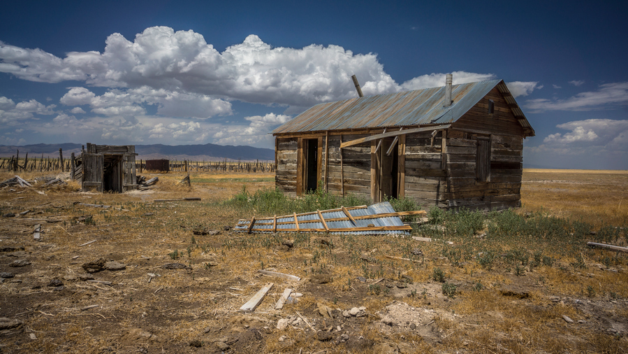
shafter well 4 homestead

An old home

creepy messages written on walls of abandoned homestead in rural nevada

All are welcome

At Shafter well #4, there were a couple of buildings… A main house, the entrance to what looks like an underground bunker or basement storage type area, a chicken coop like building, and a 3 sided Barn. There were also many corrals, which looked super raggedy. The doors to the main house were wide open. The floor was littered with hay and it was clear that Animals had been living in there. There were piles of cow shit inside the house. The doors had interesting things written on them, such as “escape room and telephone”, and “looters and loafers beware, survivors will be prosecuted”. How Nevada.

animal pen in front of goshute mountains

old barn at homestead in nevada desert

The Barn

shafter well 4 animal pen

The three sided Barn was somewhat interesting in the sense that it was the most intact building. You could really get a sense of how this place was used back in the day. Ther were various animal pens and other small wooden structures. There is now water at Shafter Well #4, unfortunately. 
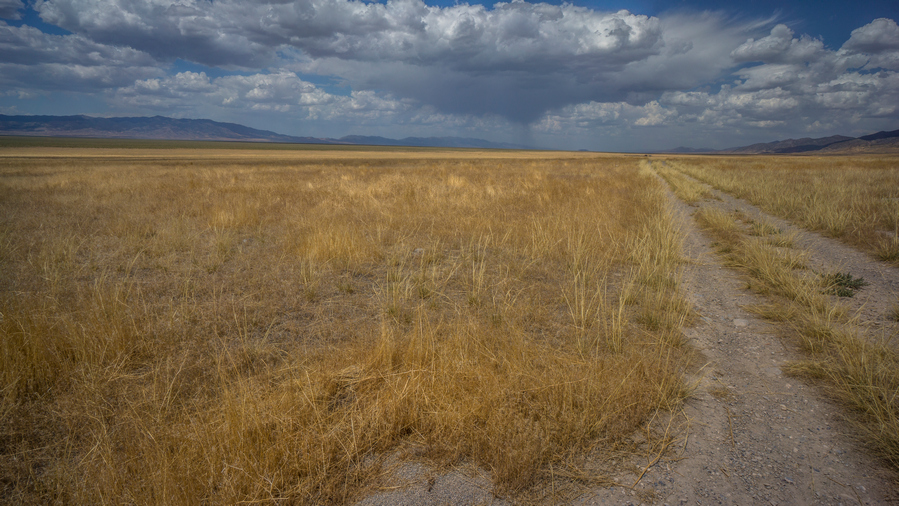
hjikers view of goshute valley nevada along the basin and range trail

View north into Goshute Valley

thru hiking goshute valley great basin nevada

Goshute Mountains from Goshute Valley

goshute valley view of goshute range

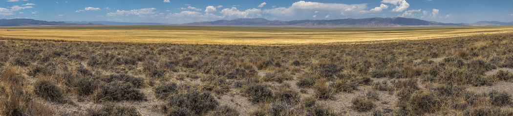
Moving on from Shafter number four, it was back into the sun, the heat of the day. The clouds were building now and it looked like a bit of rain to the north. The clouds were intermittent where I was, providing some shade here and there. Even so, it wasn’t as hot as other days. The view of the Goshute mountains to the East were nice, as this was the rugged Cliff side of the thrust fault Mountain geology. This is one reason why walking this side of the mountains was so Pleasant, through Goshute Valley. I always feel defeated and disappointed in myself when I back out from a plan, such as walking the Ridgeline of the Goshutes. But in all honesty, I was really enjoying this walk down here. All of the other valleys, or basins, I’ve hiked along the Basin and Range Trail were thick with sagebrush and had a much more desert-like feel to them. This one was full of that golden grass, and just had a completely different feel to it. The cliff-like mountains on one side, golden grass, absolutely massive Valley stretching far to the West, with the South Pequop Range, Spruce Mountain range, and Cherry Creek range on the horizon. It’s tough to explain why exactly I liked this Valley so much. It was just so massive and empty. I thought back to my time on the CDT And the area just north of Snow Lake in the Gila Wilderness. The area I called a sea of gold. This was a lot like that, in a way.

hiker walking through fields of golden grass with mountains behind in goshute valley nevada

Hiking in Goshute/Antelope Valley. Where’s the boundary?

I stopped for lunch under a Lone Tree on a hillside that had about four small caves. They were high enough up on the hillside and small enough that it wasn’t worth going up there to explore, but still cool to see. At some point around here, Goshute Valley becomes Antelope Valley, according to the map. On the ground, I can see nothing that would indicate any sort of geological boundary line that separates the two valleys. It seems like they just merge in the middle of a great vastness, with no obvious landmarks or features that would dictate such a change.

antelope valley nevada dirt road

4×4 road through Antelope Valley, view south

hikers view of goshute range from antelope valley

Goshute Range from Antelope Valley

basin and range trail thru hiker view antelope valley

Antelope Valley, view west to Spruce Mountain and the Pequop Range

I walked on, enjoying Myself much more than I expected for a low route. In fact, I found myself feeling exhilarated. Something about Wide Open Spaces, hard to explain. I couldn’t help but smile. Let out a couple loud woohoo sounds with no one around to hear them.

view of us 93 alt at whitehorse pass nevada

View west along US 93 Alt at Whitehorse Pass
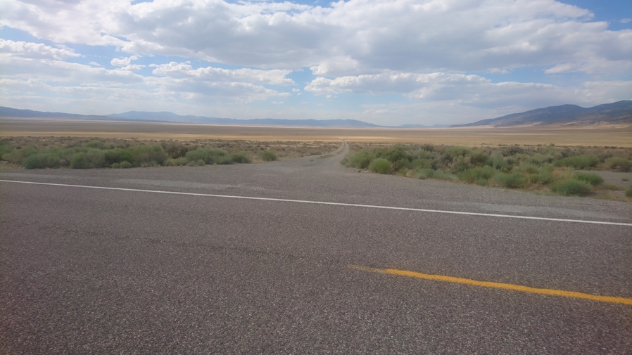
hwy at goshute range

The road through Antelope Valley meets US 93 Alt

When I reached US 93-Alt, it was time to hitch 33 miles north into Wendover. Five or six Vehicles passed by, in a span of about 30 minutes, with no luck. A stake truck drove by who also passed me up, but then I could hear the vehicle stop a few hundred yards up. I turned around and indeed saw him backing up a bit and moving over to the shoulder. I grabbed my pack and ran up the road. He said a ride to Wendover is no problem, hop in.

His name was David and he was from Provo Utah. He runs a handyman business, as well as driving the truck that he was in. Some sort of manufacturing company. He grew up in Utah and had lots of fun memories about outdoor trips, hunting arrowheads and such. It was about a 30-minute Drive into Wendover.

When we reached Wendover, he asked where I needed to go. I said drop me off near Smith’s grocery store, please. So he dropped me off there at the parking lot. There were no hotels here though, that was the problem. They were all about two and a half miles east, across the state line into Utah on the Wendover side. The Nevada side is called West Wendover. No problem though, I will just do my grocery shopping here and now and then walk over to the Utah side afterwards and grab a motel. This way I don’t have to do it tomorrow, and it will save me two and a half miles of walking as part of a round trip.

I made a quick hotel reservation on Priceline and then threw my backpack in a shopping cart and went inside the store. I had a feeling people were looking at me a bit funny. When I was done, I discarded most of the extra packaging for the food outside of the store and threw it away so that I could put my newly bought food into my backpack with minimal space. This worked out as I walked across town.

wendover will statue in west wendover nevada

Wendover Will welcomes you to West Wendover

So now it was a 40+ minute walk across town to my hotel. In the middle of the street in West Wendover, is a giant cowboy sign/statue. It says, “Wendover Will welcomes you to West Wendover”. What a tongue twister. Pretty goofy. This was in the median of the street. The statue is probably 50 or 60 ft tall. In the median is a small patch of grass, and a pronghorn was feeding here in broad daylight. Aha, Town wildlife.

As I walked into the Utah side, I passed by a small gas station with a Subway. Outside was a couple of guys who looked homeless. One of them saw my backpack and his eyes lit up. He gave me a thumbs up and said something to the effect of “way to go brother”.

I was a bit disappointed that my hotel was on the extreme east side of town, pretty much passed everything on the walk in. But I guess that is to be expected for one of the lowest priced hotels in town. Even still, it was $71 a night, which might be my most expensive night yet along this whole route. And on the Utah side, the taxes were quite a bit higher then in Nevada.
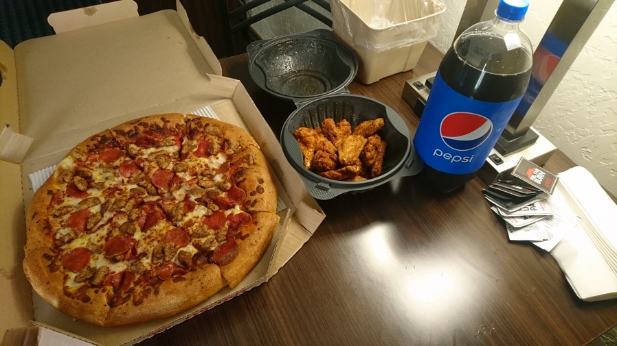
thru hiker food after hiking

Celebratory pizza and wings

Not wanting to leave my room and walk across town again for food, I ordered Pizza Hut delivery… Large 3 topping pizza, 12 chicken wings and a two liter of Coke. Took a shower and when I got out as the delivery guy was just arriving. Perfect timing.

Washed my clothes and started charging my batteries. Now I could relax and watch a little TV for a bit before becoming so tired I couldn’t keep my eyes open.

Day 55 – July 25th: Zero Day in Wendover, UT

Slept great. Slow start to the morning like many zero days. Laid in bed and updated my journal. I’ve been having a hard time keeping up with it at night on trail, I usually fall asleep before I can finish it.

Wendover Army Air Base
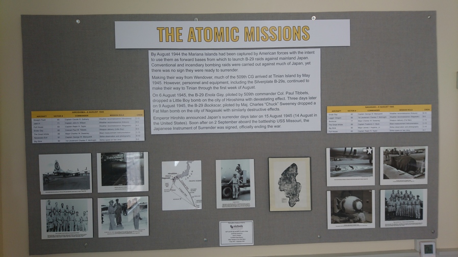
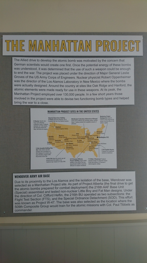
wendover army air base tourthe atomic missions

Today I went up to the Wendover Army Air Base Museum on the edge of the Bonneville Salt Flats. This is a historic Air Base, playing a huge role in World War II. This place was heavily involved in the Manhattan Project as well, with the training and deployment of the first atomic bombs dropped on Japan.
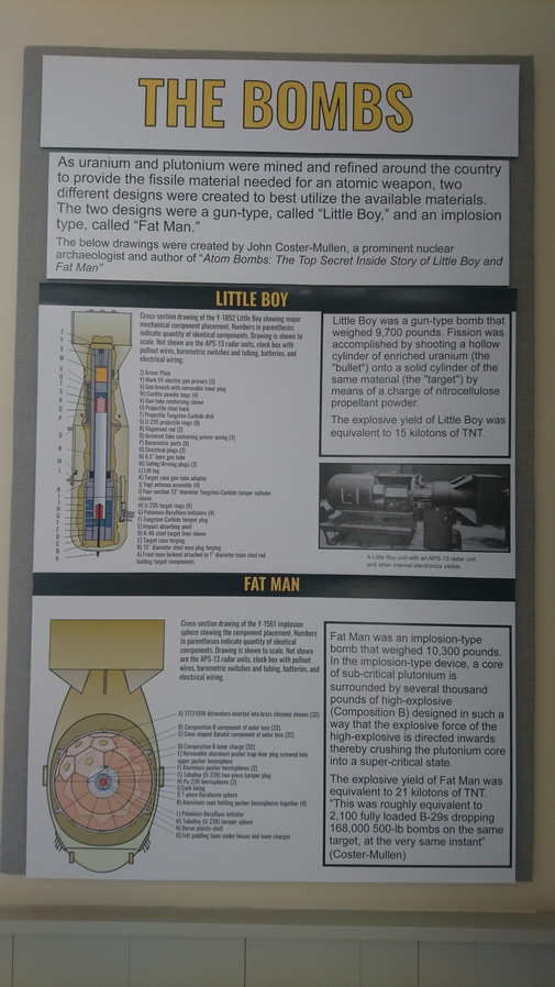
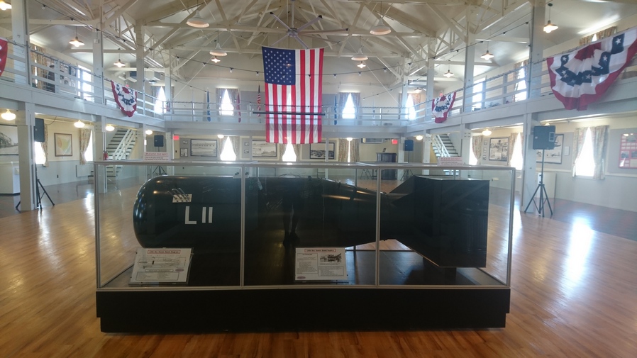
Wendover Army Air Base museum tour

atomic bomb replica in museum

Replica atomic bomb

I watched an 8 minute video inside the museum, and then walked around looking at the various artifacts inside. During World War II, The Wendover Army Air Base was a training base for B-17 and B-24 bomber crews., as well as playing a vital role in the Manhattan Project. It was the training site of the 509th Composite Group, the B-29 unit that carried out the atomic bombings of Hiroshima and Nagasaki.
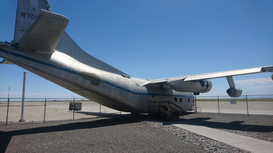
conair movie prop plane the jailbird at wendover army air base utah

This is the actual “Jailbird” plane used in the movie Conair
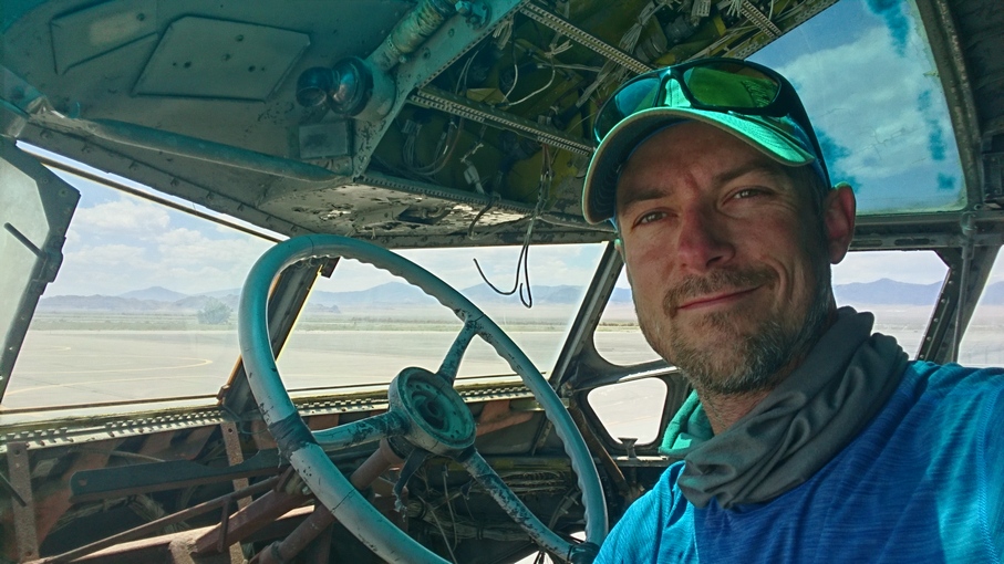
in the cockpit of the jailbord movie prop plane from conair

Move over, Swamp Thing. I’m flying the Jailbird now
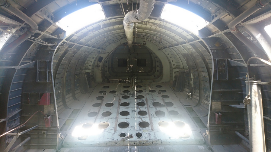
inside the hull of the jailbird

Cameron Poe, Garland Green and Cyrus the Virus once sat here!

inside the conair movie plane the jailbird

View towards the cockpit

In addition to the military significance of the Wendover Army Air Base, Scenes from the movie Conair and Independence Day were also filmed here. There is a C130 transport plane here that is open to walk into. This was the exact plane, the Jailbird, used in the movie Conair, for the Lerner Airfield scenes. After filming the movie, it was left here to the museum. Now you can self tour the Jailbird for yourself, and look out from cockpit into the Bonneville Salt Flats. How cool!

Wendover itself doesn’t have much to offer, but it was cool having the Wendover Army Air Base museum here to explore on my zero day. That’s more than I can say about the rest of the town stops along the Basin and Range Trail.

Related Images:

Basin and Range Trail Thru Hike 2020 – Section 7: Lamoille to Wells

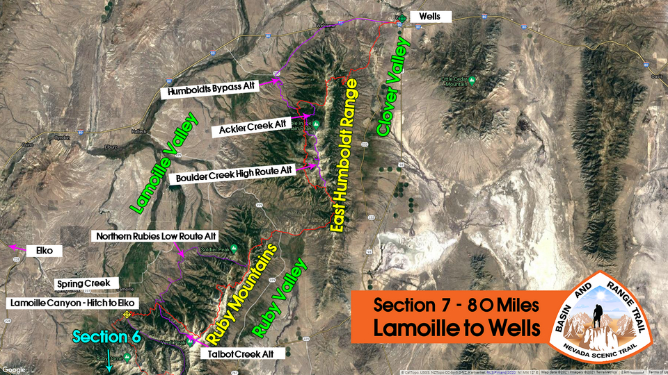
Basin and Range Trail Thru Hike Section 7 Map

overview map section 7 basin and range trail

Video: Basin and Range Trail Thru Hike Section 7


In addition to this trail journal, I also filmed my Basin and Range Trail thru hike. I’ve produced a detailed series (11+ hours runtime) documenting this thru hike adventure, the product of over 1,000 hours of video editing. I highly recommending watching the Basin and Range Trail vlog series for an in-depth look at thru-hiking the Great Basin and central Nevada. 

Basin and Range Trail Thru Hike Section 7 Journal

Day 44 – July 14th: Lamoille Canyon, Ruby Mountains

Cody picked me up around 830. I called the Sharon Hotel in Wells on the way to the trailhead, to update my ETA. I figure I will be there the 18th and 19th, instead of the 19th and 20th. Unfortunately they are booked the days I will be there. They suggested a different hotel. They also have my bounce box which is good news.

There weren’t a whole lot of good options for me to continue my northbound track coming out of Lamoille Canyon. High in Lamoille canyon, I would have had to climb over a very, very steep ridge to drop down into another basin. And I would have had to do this several times to continue on my Northern trajectory. This would have been the most scenic route, but also very difficult, with no guarantees of safety or success. So, in order to maintain a good pace And schedule, I figured a lower route would be in order. Also, the fact that Cody was joining me for this section made the low route the obvious choice. Cody will join me for an overnight hike from the Powerhouse Trailhead to Soldier Creek, roughly 20 miles.

two hiking buddies getting ready to hike the rubies

Cody and I at the Powerhouse Trailhead in lower Lamoille Canyon

hiking north of powerhouse trailhead ruby mountains

An actual hiking trail exists north of Powerhouse Trailhead, for now

Left the powerhouse trailhead in lower Lamoille Canyon around 9:45am. This was an old burn area. Lots of switch backs going straight up the hill. Good trail though.


Eventually we realized the trail we were on was not following the path marked on the map. Our Trail was climbing much higher. This had us a bit worried. Where’s the trail taking us to, the High Country? Because the rest of our route was not going this way. I theorized that the trail had been rerouted above the old burn area, around the new growth. This proved to be right, after we climbed a ways, the trail paralleled the lower version of the route marked on the map. Good deal.

northern ruby mountains view

A view up towards the high country. It would be a thick, rugged hike up there, but beautiful

We won’t be going up into the high country today, but at least we get a glimpse of it. Typical views up the many drainages we will cross on today’s hike along the base of the Rubies.

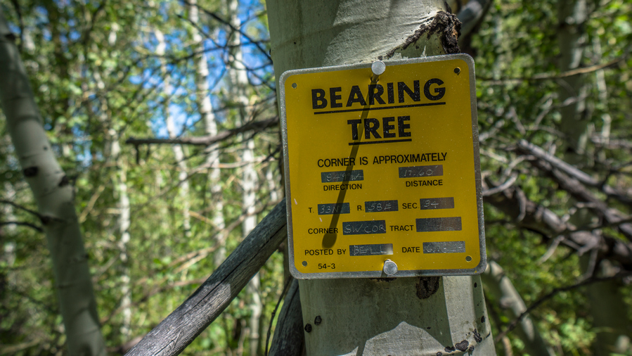
bearing tree metal sign nailed to aspen tree in ruby mountains nevada

Now that I have my bearings…

Cody was super excited to be out there, and I was really glad to have someone here with me. I know he was a bit worried about slowing me down, but he had a good pace and that was not an issue. He had everything he needed for the hike, Although our gear setups couldn’t be more different. He had a small backpack, but was able to fit everything he needed for an overnight hike. He had a white cotton t-shirt, cotton shorts and heavy steel toe boots. Off his backpack hung a small stainless steel cup that clanked against something else on his backpack, perhaps the metal zipper. Kind of like a bear Bell.

Cody had lived in Idaho in Colorado for the last couple of years, and had just returned home to this area. He knew a good deal about the area from his childhood years here. He fed me bits of info here and there about the land and its history. However, he had no knowledge of the trail we were walking or really much about the land north of Lamoille Canyon in general. With good reason, this area was largely On the Border of private land and offered no real access to the High Country. At least, not legal access.

hiking buddies in the ruby mountains nevada

Just two goons hiking the Basin and Range Trail, don’t mind us

Hiking today was a lot of fun with Cody here. Even the bushwhacks were tolerable, with someone to do them with. Having someone to talk to really takes your mind off things. Sometimes being left alone with your thoughts for too long is not a good thing. It’s fine when times are good, but I think it’s much more challenging to weather the bad stuff as a solo hiker. 

hiker drinking water from mountain stream

Break spot at Conrad Creek

Now the trail contours around the hillside, weaving in and out of small Canyons. The trail was getting more overgrown. We began to pass a couple of small Creeks, but good water sources. I had plenty of water and didn’t need any. Cody on the other hand stopped at every water source and drank directly from the streams with his cup. There didn’t appear to be much cow activity in the area and so he wasn’t worried. 

talbot creek view ruby mountains

Talbot Creek. This is a rugged canyon that would likely be incredible. The map shows a trail, but it probably doesn’t exist. The proposed BRT route here is the ridgeline on the right. Stays out of the thick stuff and would offer an elevated view

As the day went on, the difficulty of the route increased. By the time we reached Talbot Creek, the trail had pretty much disappeared. We were navigating by wooden posts that were about 1 foot high, marked with the word Trail. These were barely visible among the sagebrush, and spaced far apart. The route I had planned took us a mile or two into Talbot Canyon, crosses the creek and then goes right back out another mile or two to where we Came from, but on the other side. It was about 400 feet down into a drainage, and Cody thought This would be better than walking up the canyon. I figured the canyon would be pretty scenic, judging by the relief on the topographical maps, but since the trail basically faded out, this probably would add quite a bit of time and difficulty. So Cody’s plan to drop down the Talbot drainage here and take a direct route across seems reasonable. Let’s do it.

hiker overlooking drainage

Cody looking for the route down

Much of today’s route weaves in and out of private property, and this was one of the first sections I really had to deal with that. There was a fence line running down the canyon, And we had to jump it in order to continue. We jumped many fences today. At the same time, there were some ranches and homes perched up on the hillsides that could see us. So everything we did, we try to do With a stealthy approach.

hiking through drainanges

Crossing another drainage

More Sagebrush, cows, fences to jump over and private land to weave in and out of. next we followed a bit of a dirt road, until we had to leave the dirt road To follow our Planned route. Dropped down into Another drainage To cross a creek, now on the opposite side of one of the ranches that was perched on a hillside. This was extremely thick vegetation, thickest of the day. Cody was wading through it, breaking branches, but not exactly clearing me a path. Many times, our feet didn’t even touch the ground, since there were so many branches to keep us elevated above the dirt. That’s how thick it was.

Made it down to a small Creek where we took a break. Cody could really appreciate the bushwhacking aspect of what I’ve gone through so far on the Basin and Range Trail. I’m glad he got the full experience.
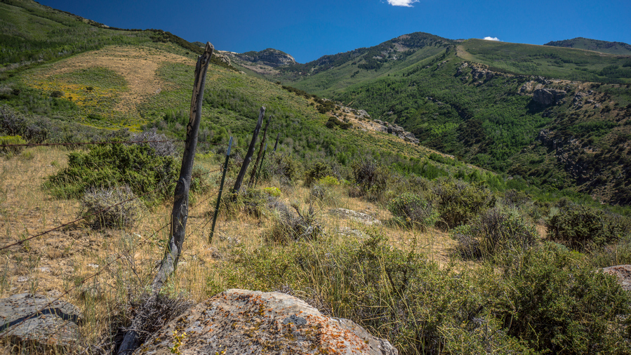
4x4 road following fence line in nevada

Walkin’ fenceline

We’ve pretty much given up on following anything that said Trail on the map, and now just went for dirt roads. We finally hit one sign that said private property, looked like it was leading to the ranch up on the hillside. So we followed the fence line on the legal side. Many times though, we were never really sure which side was the legal side. It was never posted. Cody, being a local, also said that many of these land owners likely wouldn’t care that we were out here hiking, especially not along the wrong side of the fence line.

view up thorpe creek in the ruby mountains

Thorpe Creek

Our last real challenge of the day was one really large drainage. This one was deep and steep. At the bottom was a decent-sized creek. There are actually some decent Camp spots here, but we still wanted to cover some more miles, and make it to Cold Creek. The creek was too large to hop rocks across, but there was a pile of logs here alongside the river, presumably leftovers from making the fence line that went up the hill. So we threw a few logs in the water to step on, making our own Crossing Point. In the end, my foot slipped off one and got wet anyway.

hikers view from campsite in the ruby mountains

View from tonight’s camp

hikers camp view of sunset behind tarptent notch li tent

Sunset at camp

We walked another two miles or so before reaching South Fork gold Creek. This was barely a blip on the map, but was actually a good running creek that feeds the main Cold Creek. We found a clearing a few yards from the creek, and it was actually a good campsite. So this is where we set up. The water was only 4 feet wide but maybe a foot deep. Rarely along the trip has I camped this close to water, in fact it was probably the closest. So it was a real luxury to be able to have water at Camp, be able to soak my feet and clean my legs.

After the sun set, the night sky populated itself with a million stars. We stood outside our tents looking up at the stars, talking about all of this stuff that humans wonder about Under the Stars… The infinitude of space, science, technology, the problems of our world and how to solve them.

Day 45 – July 15th: Ruby Mountains, Soldier Creek, Ruby Valley, Pole Canyon, East Humboldt Range

Woke at 6:30. Hiking by about 7:45. Cody did not sleep that well. It took him a few hours to get to sleep.

After leaving camp we followed the road we camped along until we reached the point where it crosses Cold Creek. Here, there was some sort of ranch, although it looked abandoned. There were horses and animals there though, hard to tell if someone was living there or not. We climbed the fence and walked alongside it until we found an old dirt road that leads down to the river. Another decent size Creek. We were able to cross without getting our feet wet by hopping rocks.

We climbed out of the Ravine holding Cold Creek and reached another fence line. We followed this one to the end and found a dirt road that paralleled it. Basically, the rest of the morning consisted of walking poorly maintained dirt roads, walking and jumping fence lines.

clear blue water in nevada desert

Crystal clear water

We reached warm spring Creek, which was not warm at all, but cool. And it was crystal clear, with a strong blue tint. Looks like a great swimming hole, despite coming out of a culvert. If it were hotter out, and Cody wasn’t on a time schedule, we would have swim here. But he told his dad to pick him up at 9:30, when we estimated to arrive at Soldier Creek.

When we reached the road for Soldier Creek, we looked back and saw a no trespassing sign on the property we were on. However, we didn’t see any where we entered the property. His dad was stuck in construction and so we Dropped our packs and waited a little while.

Cody and I had hiked about 20 miles in the last 24 hours. Most of which was yesterday. Cody did a great job and he got the full experience by doing some pretty gnarly bushwhacking. I just wish we had a little bit better scenery. Still, we both enjoyed the experience.

two hikers on the basin and range trail nevada

After Travis arrived, we all chatted for about 15 minutes, and had Travis take a picture of Cody and I. We said our goodbyes, and I was on my own once again.

hiking soldier creek canyon ruby mountains

Entering Soldier Creek canyon

dirt road soldier creek canyon nevada

Looking back down the road leading up into Soldier Creek

Next I began to hike up the road along Soldier Creek. Nice walk with somewhat steep Canyon walls, but not crazy. There was a pit toilet at the Soldier Creek trailhead, but really nothing else here.

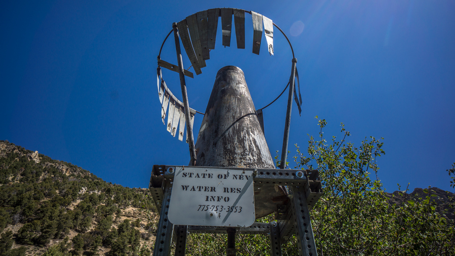
nevada water rainfall measurement instrument in the wilderness

Weather instrument

view of mountain ridgeline in soldier creek ruby mountains

The scenery is starting to improve as I hike up Soldier Creek

There was a gravestone right along Soldier Creek, right next to the trailhead. Someone had created a bit of a soaking pool by digging out rocks underwater and shaping them into a mini tub.

hiking soldier creek in the ruby mountains nevada

Hiking Soldier Creek

hikers view of canyon walls in soldier creek nevada

The canyon narrows a bit, but stops short of an impressive box canyon-style experience

flowing water in soldier creek nevada

Soldier Creek

I was thinking the hike up Soldier Creek would be better than what it was. There is no water access as the banks were too steep and thick with vegetation. The trail itself often looked like a jungle, very cool looking at times.

hiking trail along soldier creek in the ruby mountains nevada

The trail emerges from the jungle into a clearing

view of soldier peak and soldier creek

Soldier Peak viewed from Soldier Creek

colorful yellow wildflowers in field below a mountain peak in the ruby range nevada

Wildflowers along Soldier Creek

After walking through the jungle awhile, the canyon opens up and I was able to access the water in Soldier Creek. I stopped here for a break, looking up at soldier peak. What a nice spot. 

view of hiking trial in upper soldier creek

This trail leads to Soldier Lake, not to the crest. Time to leave it and hike off trail

bushwhack in upper soldier creek ruby range nevada

Found trail again, after bushwhacking through all of the dense vegetation in the center of the photo

Next the trail climbs up to the ridge, the crest of the rubies once again. At first there was no Trail. My map shows one, but I couldn’t find it. So I began to bushwhack uphill. This was pretty awful. I say things like this was awful, but its hard to convey just how shitty these bushwhacks can be. Eventually, I came across the trail. It was definitely not visible from the lower trail that goes over to Soldier Lake and Hidden Lakes, but man was I glad to have found it.

hikers view of john day peak in the ruby mountains from hiking trail

View southwest to John Day Peak and, hidden from view, Hidden Lake

I was getting a headache, so I stopped and took one extra strength Excedrin and one ibuprofen. A little combo action. The trail now starts to weave through a couple of trees. From here it’s not that far to the top. Excellent views as I gain elevation. 

panorama photo from soldier pass ruby mountains nevada

View from “Soldier Pass”

panorama photo from soldier pass ruby mountains nevada

Another view from the pass

The view from the top of the pass was really good. I don’t know what the pass is called, it’s not named on the map, so I called it Soldier Pass. 

hiking enar soldier peak in the rubies

Ridge leading to Soldier Peak

northern ruby mountains view

Extreme northern end of Ruby Valley, and the extreme southern end of the East Humboldt Range

view of northern ruby mountains ridgeline

A look back at the ridge leading down from the pass

I stopped many times to take pictures, the landscape constantly changing and evolving as I see it from different angles. Soldier Peak looked more impressive the further I got from the pass. It was really nice to walk the crest, with the trail, good weather, and great views.

view of lamoille valley from ruby mountains

View northwest to Lamoille Valley

basin and range trial thru hiker in the northern ruby range

A great walk along this ridgeline

Eventually I reached a saddle where a trail goes downhill. However, my plan was to continue walking the ridge North the ways, and then meet up with another trail. So, I kept going.

When I reached the area where I expected a trail to be, I was very disappointed to see nothing. Lots of thick brush to walk through now. One of them got my leg pretty good and it started bleeding.

view of secret peak from ruby mountains ridgeline hiking trail

Looking north to Secret Peak

I could have continued north from here, to Secret Peak and Secret Pass, which would be the only way to avoid private property coming down from this part of the Rubies, now the extreme northern end. However, that route then means a longer road walk into the East Humboldt Range, my next destination after I cross the valley. A more direct route involves a short section of private property crossing, which I opted for instead.

hiker on mountainside south of secret pass

Dropping down off the crest of the Rubies for the final time

sea of new growth aspen trees on hillside in nevada

Welcome to Aspen Hell

Eventually I the area where the trail stops skirting the Mountainside and begins to descend down to the valley below. That’s what the trail is supposed to do, but I don’t see a trail now. Then I reached a ridiculous wall of new growth aspens, among the worst I seen yet on Trail. Started through it for a few feet, before backing out and realizing this was not going to work. I backtracked and found a faint trail that was extremely overgrown. It went right into the brush. Amazingly, it seemed to be cleared out a little bit, but it was more like a canopy underneath the brush. It was manageable, but still really thick. Surely this was the trail, just overgrown from many decades of vegetation growth.

More insane bushwhacking. Eventually I reached a saddle where a trail was supposed to follow a ravine, but of course it did not exist. I decided to go the opposite direction, as it was more direct, and still a bushwhack. After a few moments of skirting a hillside, I noticed a road on the other side. A faint 4×4 road. So I dropped down into a valley, and this Hillside to meet the road. I walked right over at the first time, it was so faint. But, I eventually found it and followed it. It was waist high grass.

hiking through tall grass in the northern rubies

Tall grass to walk through along the base of the northern Rubies

The next couple of miles were more of the same, grass knee to waist high. Crossed a couple of creeks. Saw a couple of deer. You could tell this area gets little to no use. Eventually reached a gate.

a cow standing in the trees in nevada

Would you kindly mooo-ve out of my way?

Now I am on a private ranch. Cows everywhere. I checked my satellite and saw a route that I could take that would not pass right by the ranch when I reach the main road. So I went for that, walking fast as I could.

hiking dirt road near secret pass northern rubies

Hiking North Ruby Valley Rd, east of Secret Pass

Reached the main road and hopped the fence. Now I was following a paved Road, before quickly turning off onto another dirt road. Sun was setting and it was actually pleasant to be on a main road. Followed this for an hour before having to jump another fence that said private property, but also on the same sign said National Forest land 1 mile. Huh. So, its legal then??

sunset view over northern ruby valley

View south to the extreme northern end of Ruby Valley and the Ruby Mountains

Now I am following Franklin River and pole Canyon, entering the East Humboldt Range. There are cows everywhere, and these ones are very vocal. The kind that make ridiculous noises, as if they were zombies. I found a small hill to Camp upon, in between piles of cow crap and salt licks.

Day 46 – July 16th: Pole Canyon, East Humboldt Range, East Humboldt highline Trail

tarptent notch li campsite in east humboldt range nevada

Campsite in Pole Canyon

Woke up at 6:30. The cows were moaning like zombies. I heard an owl pretty close to camp throughout the night. I could hear a four-wheeler somewhere down low in the valley.

Lots of cows this morning, looking forward to getting up Hill and above them. There was lots of water, but I would not want to filter my water here due to all the cow activity.

After a short while I reached a locked gate with a no trespassing sign. This is where the National Forest land ends. There is public land up the road again, but a section of private land blocking access to the public land. Since I have walked all the way up here, and don’t really have any other options, I climbed gate and moved on.

I walked maybe one mile and heard a four-wheeler approaching. I thought about hiding in the bushes, but just decided to let the situation play out. As the man on the four wheeler approached, I stepped aside on the trail and waved. He stopped and asked what I was doing. Almost immediately I recognized that he was in Nevada Department of Wildlife officer, not the land owner. I said I was walking across Nevada, I’m 46 days into this hike. He said you know you’re on private land right? But also acknowledged this wasn’t his land. I said yes, I’m not going to lie to you, I saw the fence with the sign that said no trespassing and I went over it anyway. I had walked all the way up here and didn’t want to turn around and look for another way, just to avoid a couple miles of private land blocking access to the rest of this public land. I told him I’m trying to get to Wells, via the East Humboldt Highline Trail. We chatted for a solid 20 minutes about my route and things. He was pretty chill, had no interest in Making trouble for me. He also said the land owner probably wouldn’t mind that I was here anyway. I believe they were mostly concerned about illegal hunting, not some hiker just passing through. He was on his way up Mountain to pick up a goat carcass or head or something. After while he moved on. This is one of those situations where honesty prevails.

hiker crossing the franklin river in the eats humboldt range

Franklin River

Next the trail got pretty steep. Found a creek near the spring source to filter my water from. I am above most of the cow activity now, at least, a good chunk of it. This water should be cleaner than downstream, where I avoided drawing water from. 

east humboldt range pole canyon 4x4 road view

The upper reaches of the 4×4 road in Pole Canyon

hiking the east humboldt range

View of route up to pass above First Boulder Creek. USFS maps show the East Humboldt Highline Trail starting around here. Hmm. 

panorama view of upper pole canyon in the east humboldt range nevada

Upper Pole Canyon

Kept hiking uphill until I reached a fork in the valley. Pole Canyon and Franklin River to the right and the route up to 1st Boulder Creek on the left. The USFS maps show the East Humboldt Highline Trail starting around here, but I don’t see it. It looked like it would be all off-trail hiking going up first Boulder, and quite daunting. But at the same time, I could tell it was going to be a very beautiful hike. Very impressive rock walls with Rocky crags.

rocky cras and spires along ridgeline in east humboldt range

Views from the route up an unnamed canyon to pass above First Boulder Creek

hiking the eats humboldt range in nevada

East Humboldt Range is impressive so far

hikers view in th east humboldt mountains

Really enjoyable hike as I enter the East Humboldt Range high country

After a short while I picked up on a faint trail. There were even cairns occasionally. Although it was tough going, I really enjoyed hiking up this Canyon. Very beautiful, among some of the best scenery of this whole hike.

southern east humboldt range hiking view

Looking south at the southern East Humboldt Range

east humboldt range hiking views

Nearing the pass to first boulder creek

I wondered how often this area is hiked, with the lack of proper public access. From a handful of cairns, it’s clear it gets “some” traffic, but how many… 5 hikers a year? It would be impossible to guess. 

east humboldt range view from pass above first boulder lake

View from the pass, down the canyon I hiked up

first boulder creek pass

View from the pass

hikers view from east huboldt highline trial pass

View of First Boulder Creek from the Pass

The views from the pass over First Boulder Creek were good, but not excellent. I think enjoyed the hike up more than the view from the top. 

view of first boulder lake in the east humboldt range nevada

First Boulder Lake. She ain’t much to look at.

view from first boulder creek east humboldt range

View of peak 10,292′ from First Boulder Creek

east humboldt highline trail hike

Hiking the East Humboldt Highline Trail to Second Boulder Creek Pass

Next I dropped down from the pass and began the short descent to First Boulder Lake. The “lake” is more like a pond, shallow and muddy. Lots of bugs and lots of flies. The map shows a trail marked East Humboldt Highline Trail that practically traverses this whole range, and at the moment there was indeed a fairly good trail on the ground. However, with little public access to the East Humboldt Range, few people hike here. That means this place gets no trail maintenance, either. Supposedly the East Humboldt Highline Trail gets really thick and overgrown, and the trail eventually disappears. The NDOW officer I spoke with earlier today confirmed this. I told him my plans to hike the East Humboldt Highline Trail, and he said, good luck.

panorama view first and second boulder creek nevada

View of First Boulder Creek from pass to Second Boulder Creek

Hiking second boulder creek along the east humboldt highline trail

Dropping down to Second Boulder Creek

Hiking second boulder creek along the east humboldt highline trail

First views into Second Boulder Creek

It was a short pass going over to 2nd Boulder Creek. From the top of this pass, it was quite a drop down to the bottom. I could tell the rest of the day was going to be difficult, looking at this hike down and how the map looked for the rest of the boulder creeks. There are four parallel drainages here in the East Humboldt Range, named first, second, third and fourth Boulder Creek. As I dropped down in elevation, the Cirque became more impressive. These upper basins were just massive, sheer rock faces. Quite Majestic actually. Intermittent Trail now, though.

hiker crossing second boulder creek in the east humboldt range, Nevada

Crossing Second Boulder Creek along my East Humboldt Highline Trail hike

I reached the bottom and stopped at the second boulder creek. Right where the trail crosses, there was a bag with a bar of soap and a small bottle of liquid soap. Apparently, somebody was here at one point and bathed a little bit. I was really surprised to see this, but it gave me hope that there would be good Trail the rest of the day. Ha, I should have known better.

view of ssecond boulder creek valley in nevada

The impressive Second Boulder Creek

east humboldt range second boulder creek hiking view

View down Second Boulder Creek Canyon

east humboldt range hiking second boulder creek

View up Second Boulder Creek on the hike to the pass above Third Boulder Creek

Going up the pass from second to third Boulder Creek was a pain. The trail pretty much disappeared and I was left to follow a couple of cairns. The Rock piles led me the wrong way, through Thick Aspen stands and vegetation. Eventually I Bushwhacked my way back to the trail. I use the word “trail” lightly. The diamond range had better game trails than this “hiking trail”. The East Humboldt Highline Trail is intermittent, at best. And when it’s not there, the going is slow; thick bushwhacking, steep inclines and an all-around pain in the ass.

view from pass in east humboldt mountains nevada

Pass between Second and Third Boulder Creeks. This was my favorite pass in the East Humboldt Range

panorama view from east humboldt highline trail pass by hiker

Second and Third Boulder Creeks

Eventually I made my way to the top of the pass. The view from the pass between Second and Third Boulder Creeks was my favorite along the East Humboldt Highline Trail. The hike had been easy at times today, when there was good section of trail, but lately it has been more of a challenge. 

east humboldt mountains view of peak from trail

Looking back up at the pass above Third Boulder Creek

view of third boulder creek from east humboldt highline hiking trail

View of Third Boulder Creek

I dropped down to 3rd Boulder Creek, which had a couple of small lakes. From the pass, the Basin doesn’t look too impressive. Just like the previous basins. However, upon dropping down an elevation, the Cirque shows itself, and once again blew me away. So impressive! The East Humboldt Range was definitely on par with the Ruby Mountains.

view of mountain peak from third boulder creek

View from Third Boulder Creek

I stopped at third Boulder Creek for a break, filtered water, ate food, washed my socks and soaked my feet. There was a small Beaver pond just Upstream. The creek really wasn’t that cold, probably due to the lake and Beaver Pond Upstream. After my break, I followed a couple of cairns across the valley until I came across a wooden sign. Each Basin seemed to have one. East Humboldt Highline Trail one way, whatever number Boulder Creek the other way, pointing downhill. Funny thing is, there were no trails at all here at this sign!

tree roots growing over boulder

Aspen tree growing on top of a boulder!

Heading up the pass between third and fourth boulder creek, I followed cairns a ways uphill until they once again let me astray. The cairns Definitely indicated the trail went one way, but it led me through thick brush, Only to have to turn around and eventually hike back through that brush again. It was also wet and soggy along the hillside. I slipped and fell a few times. It was a real pain in the ass. My feet were getting wet sloshing around in the soggy ground, which I couldn’t really see with the thick brush obscuring it.

third boulder creek view

View down on Third Boulder Creek from the hike up the pass above Fourth Boulder Creek

Eventually I found some rock piles again. I knew I was on the right path, although it disappeared again very quickly. I gave up on following the trail and just walked straight up the hill to the pass. This was a pain, but at least I could choose my own path and not be led astray by poorly placed piles of rocks. Whatever was left of the East Humboldt highline Trail is so overgrown that its not always worth trying to follow it.

hiekrs view of rock formation at the top of a mountain pass in the east humboldt range, nevada

Near the top of the pass separating Third and Fourth Boulder Creek

view from east humboldt highline trail apss to fourth boulder creek

View into Fourth Boulder Creek

east humboldt range high country hiking view

View over Third Boulder Creek from pass to Fourth Boulder Creek

Reached the pass above fourth Boulder creek. I’m noticing that the trails going down these passes, on the north side, has been better. The north sides feature more rock and less thick, green vegetation which can easily over take the trail. Once again this Basin was the same as the others, very impressive, and much more so as one drops in elevation.

hiking 4th boulder creek nevada mountains

Looking back up at the pass between Third and Fourth Boulder Creek

fourth boulder creek hiking along the east humboldt highline trail

Excellent hiking coming down from the pass into Fourth Boulder Creek. A trail exists here, but will soon disappear again

views from a hike in fourth boudler creek, east humboldt range

Impressive view in Fourth Boulder Creek

When I reached the general area where the junction would be for the Fourth Boulder Creek Trail going downhill and the East Humboldt Highline Trail, I had to make a decision. The East Humboldt Highline Trail follows the Mountainside about halfway up, and takes a very long route to get up to the pass. So Far, none of these trails have been very good. This route would be very committing, and take a long time to get to the pass. There were some pretty steep sections along the way. I have zero faith that this trail will exist. In the distance, I could see Thunder clouds building. It just didn’t make sense to commit to a really long, nonexistent Trail along a steep Hillside. If I’m going be bushwhacking, I might as well take a shorter bushwhack route. 

view of tent mountain in the east humboldt range

High point on the left is Tent Mountain. I’ll hike straight up the thick green stuff below the saddle. It’s a 1,000ft climb

Instead, I just decided to follow the fourth Boulder Creek Trail downhill. This would leave me to a spot just below the pass near Tent Mountain, where I could contemplate going straight up the Mountainside from there. Of course it looked very thick with vegetation and very steep, but my other option would be to just follow fourth Boulder Creek Trail downhill all the way to a road and walk around the East Humboldts. 

a hikers bushwhack view from fourth boulder creek

Bushwhack in Fourth boulder Creek

Following the fourth Boulder Creek Trail was not easy either. It was also pretty much non-existent. A couple of cairns here and there, off-Trail hiking through Sagebrush. Worked my way down some Rocky Ledges, then a thick Stand of aspens. Then had to cross fourth Boulder Creek, and some wetlands.

hikers view of a bushwhack uphill in the east humboldt range

View from the bottom of the climb. 1,000ft straight up, through this. Yay.

Now I am at the base of my climb up to the saddle/pass east of Tent Mountain, should I choose to do it. It’s a 1,000ft climb through a solid wall of really thick vegetation, on some steep slopes. From below, it barely looked possible. I’ve never done anything like this. I kept walking closer to get a better look, slowly walking uphill. Next thing you know, I was 200ft up. I guess I’m doing this.

The climb was exhausting. One must step on the bush while grabbing another branch Above you, to help pull yourself up. I felt like I was swimming uphill. Completely tangled in branches, I fell a few times. The first 400 feet were the hardest. The vegetation was thickest here. An absolute nightmare to say the least.

About halfway up, the vegetation thinned out a bit. Steep grassy slopes, much easier to work with. Eventually though, I passed through some old growth Aspen. Much easier than that new growth shit. I was getting closer to the point on my map where it showed a trail. Of course, I never saw it. I just kept hiking towards the pass, making my own path as I saw fit.

view toawrds hole in the mountain peak in the east humboldt range

View east to Hole in the Mountain Peak, high point of the East Humboldt Range

hiker below hole in the wall peak east humboldt range nevda

Pass between Fourth Boulder Creek and Ackler Creek

view from pass above fourth boulder creek

Overlooking Fourth Boulder Creek

When I reached the top, I was pretty ecstatic. It’s hard to describe the feeling. Actually, I kind of felt like I did when I got done skydiving. Like a big rush of adrenaline. My face was tingling and I was having a hard time holding back tears of joy. I had hiked up what I thought was an impossible slope, in only 50 minutes. To think I had considered walking down hill, bailing. In your face, fourth boulder creek!! The view here was outstanding.

However, I still have to worry about a trail on the other side. Took a break shortly after coming down from the pass. I really needed it, that was a very intense workout.

views from hiking the east humboldt highline trail

Pretty awesome scenery, when looking up at the crest of the East Humboldt Range

Good Trail coming down hill. I was feeling good about this. Passed a few campsites, some really nice ones. I’m thinking things will be better now, hopeful the East Humboldt Highline Trail will be solid from here. When I get down hill father, I passed a couple of springs, and a few small creeks. I stopped at one to filter water and clean up my legs a little bit. Downhill from here, it was really muddy and swampy. Dead looking Aspen trees line the swamp. This is the worst possible area to be when looking for camp. It was 8pm now, so I tried to rush out of here.

east humboldt range sunset

Losing daylight, and nowhere to camp

Made it past the swamp area to dry ground. Went downhill a short ways and realized that I needed to go back up Hill because the East Humboldt Highline Trail branches off near the swamp. Got back up to the swamp area and started bushwhacking through the horrible Aspen tree Forest. I was right on the trail according to the map, and the trail was extremely faint. Looking ahead, all I could see was more Aspen trees, and I only had 20 minutes of daylight left. This is not good.

I decided it was a horrible idea to continue on through the aspens with night approaching, so I began to look for a place to Cowboy camp in the short segment of open ground in between the stands of Aspen trees. Nothing good at all, but I made a spot work. No room to set up a tent, so Ill be cowboy camping tonight.

Looking at my map, CalTopo US Forest Service layer shows the East Humboldt Highline Trail in a different location than the USGS maps. I’m thinking that if I had continued on the trail that I was on, there would be a better East Humboldt Highline Trail to follow further Downstream from where I am now, which would have avoided the aspens. So, I will have to backtrack tomorrow morning to the trail that I was originally following downhill before I turned around. If there is a decent Junction there for the East Humboldt Highline Trail, I might go ahead and follow it. However, I am very tempted to just follow the trail downhill to a road and walk the rest of the way around the east Humboldts. I’m just fed up with trails that don’t exist, with horrible Bushwhacking in between. I would like to get to Wells tomorrow night, and that’s kind of a gamble if I stay on the Highline Trail. A rough estimate of 16 miles to Angel Lake, on the Highline Trail. So it would probably be closer to 25 + if I was to hike all the way to Wells on the Highline Trail. I’m thinking that if I stay on the Highline Trail, I can probably get a ride from Angel Lake down to Wells if I get to the lake early enough. It’s a Friday night so there should be some traffic. I’ll just have to see how things play out tomorrow morning.

Day 47 – July 17th: East Humboldt Range, East Humboldt Highline Trail, Starr Valley

east humboldt highline trail camp site

Cowboy camp spot. Lucky to have found this much clear/flat space.

Woke up around 6:30 the sound of a Zombie Cow. The groaning sounded just like a zombie. Cows don’t always make a moo sound. It was a cold night. I had my base layer top and bottom on, and my wind jacket. I had my watch inside my backpack, which said 42 when I pulled it out. So more than likely, mid-thirties.

I walked through the Aspens back to the main trail. Just off the trail were a couple of cows, and they started running through the forest knocking down trees when they saw me. Those goons.

Good trail here, but doesn’t go where I need to go

hiking east humboldts

Walked down the trail a ways and kept looking for a Junction with the east Humboldt highline trail. When I checked my map, the trail I was on was taking me somewhere that wasn’t even marked on My map as a trail. In other words, I was way off any trail now according to the map. What the hell. Trails that are on the map don’t exist on the ground. Trails on the ground don’t match up with any trails that are on the map. I’m so tired of the trails in the east Humboldt range.

ackler creek hiking view of the east humboldt mountains

View of the East Humboldt Mountains from Ackler Creek

So now my decision was easy… Walk down hill, I’m done with the Humboldts. Of course this always feels like defeat to me, not completing what I set out to do. I made it half way through the east Humboldts. Hiking the rest would mean I’m a full day behind, and I only have food for the rest of the day. And that would be some horrible bushwhacking. It’s a shame that such a beautiful place has such horrible trail systems. But what can i expect? Most of the land around the mountains is private so why would the national forest maintain trails that nobody can access? Another public land issue.

view of starr valley nevada from the east humboldt range

View west into Starr Valley

So now I’m following a trail that goes who knows where. I had a feeling it follows the ridge down hill instead of taking a route through the thick forest, mostly stupid aspens. Really starting to hate these trees, even though most people love them. That’s because they only think of old growth aspens, not thick new growth stuff. Anyways, I was right, the trail goes high up to a Ridgeline which is open and free of trees. For now.

From the ridge I could see down into Starr Valley to the west. There was a lot of agriculture and private ranches, farms. Lots of green. All the land below the ridge was private on my map. How to get to the main road now without blatantly walking through someone’s property, by their home? I plotted a route and began the descent. Off-trail hiking, easy at first, then looked like thick aspens below.

Fortunately, I came up on a road pretty quick. I followed this downhill, through the thick Aspen stands. without this road, wow it would have been a nightmare bushwhack! Followed a series of Roads through various clearings and fences, Gates.

private property and public access boundary in the east humboldt range nevada

Eventually made it to a fence where I saw a sign that said National Forest boundary. I didn’t see any no trespassing signs or private property signs, but I did see a private property sign laying on the ground along the corner of the fence line. I knew it was private property because my map indicated it was, but if it’s not clearly marked, I will plead ignorance. I have nowhere to go otherwise, there is no National Forest land that I can walk all the way to the main road. It’s all private land blocking the public land.

Went through the gate and continued on the dirt road. Before long, I reached another gated and fenced area. No signs on this one. This was lost creek/alles creek. Stopped here to filter water, maybe my last chance before waking the main road 20+ miles into Wells. Lots of cow activity upstream, better filter this water.

dirt road in the east humboldt range nevada

View of East Humboldt Range from Starr Valley

Continue down the road through the fenced area. Not much to see here, just a big open field. Down the road, the land really clears out and it’s a pretty barren area. I debated which road to take down to the main Highway. The one along lost Creek has no houses along it except for right on the other side of the main road, once I reach it. That’s probably my best bet, as I didn’t want to walk right along a house on private property. However, while I was walking this road, it veered off to a different location than my map indicated. Instead of backtracking, I continue to follow this road, as it seemed to be well defined and basically the main road for the area. I looked at my map and this dumps me out further north, which is a good thing. However, it looks like it goes right through a bunch of properties. Still, it’s a main road, so I will take my chances.

ackler creek in nevada

Crossing Ackler Creek

The road took me to a winding Hillside overlooking Some Farms. There were tons of cows in the valley. I reached a gate, and once on the other side I saw that it was for a private Ranch. Still, there were no signs that said no trespassing. Farther down hill, I passed through a couple more Farms, with open Gates. I didn’t see any people out working, and no one bothered me. All good.

Finally I reached the main road, Nevada 230. It was a paved Road through a very farmy area. Green Pastures with bales of hay rolled up in the fields, with the East Humboldt range as a backdrop. Very pretty actually.

brt thru hike road walk east humboldts

Road walk along NV-230

I walked the country road for several miles before getting a hitch to avoid the hike along I80. My rides name was Ray, who had just bought a place here and retired from a career in well drilling. Ray dropped me off at the Sharon Motel, where my bounce box I was waiting for me. I had intended to stay here, but my estimated arrival dates were the 19th and 20th. Today was the 17th. I had called a few days earlier to see if they had any availability for the 17th 18th and 19th instead, but they were sold out. So I made reservations at the Rest Inn instead. I always feel bad when these kind of things happen, a hotel accepts my bounce box but I don’t end up staying there. I offered to pay a fee for accepting the box but they said that wasn’t necessary. Hey, I tried.

It was less than a mile walk to the Rest Inn from the Sharon Motel. Walking through this area of Wells was a bit weird. There really wasn’t much here, kind of an in between segment of Town. When I got to the Rest Inn, the woman at the front desk gave me a suite, and at the reduced CDL trucker rate. That was awfully nice of her! There really wasn’t much special about the suite, I guess except for the fact that there was a small table and couch, and a phone right next to the toilet! I was hoping for a Jacuzzi hot tub but no such luck. Ill have to settle for a corded phone next to the shitter.

The hotel is located right across the street from a couple of popular truck stops, so there really wasn’t any great restaurants or anything nearby. Just some overpriced places, the iron skillet and the Bella restaurant which closes in the afternoon. So, I ate at Burger King for lunch. Iron skillet take out for dinner, got two chicken strip meals. Backed up my SD cards.

Day 48 – July 18th: Zero Day in Wells, NV

Terminator 1 & 2 were on TV this morning, nice. Watched that while I got started on Town chores, laundry, sorting my media on my SD cards, beard trim, etc. 

Got a gas station pizza to go for lunch. Filling. Spent the majority of the afternoon and evening working on changes to the rest of my route. I’m going to finish at Great Basin National Park, and so I had to modify my route a bit to make that my end point. Also, instead of going from West Wendover to Shelbourne pass in the middle of the Schell Creek range and then hitching down to McGill to resupply, I’m just going to go from West Wendover all the way to Cave Lake State Park and hitch to Ely from there, doing the Schell Creek range in one segment. From there I will hike to the snake range, Great Basin National Park and end at Baker. So I figure I have another 360 miles or so to go.

Day 49 – July 19th: Zero Day in Wells, NV

Another day doing town chores. The grocery store was a bit of a walk to the other side of town. The selection is decent, not as good as a Safeway or anything, but enough to work just fine. Wells isn’t an exciting town. The truck stop side of town is a little more depressing than the rest of it, though, in all fairness. There are some nicer homes in the center of town, a nice green park with modern facilities, etc. But there just doesn’t seem to be any real draw to this town, other than being located along interstate 80. 

Related Images:

Basin and Range Trail Thru Hike 2020 – Section 6: Eureka to Lamoille

Basin and Range Trail Thru Hike Section 6 Map

map of section 6 of the basin and range trail 

Video: Basin and Range Trail Thru Hike Section 6


In addition to this trail journal, I also filmed my Basin and Range Trail thru hike. I’ve produced a detailed documentary series (11+ hours runtime) documenting this thru hike adventure, the product of over 1,000 hours of video editing. I highly recommending watching the Basin and Range Trail vlog series for an in-depth look at thru-hiking the Great Basin and central Nevada. 

Basin and Range Trail Thru Hike Section 6 Journal

Day 37 – July 7th: Diamond Mountians

Started hiking at 9am. When I checked out of the hotel, the woman who works the front desk wished me good luck on my hike, and mentioned that she wanted to hike the Pacific Rim Trail. I always kind of crack up when people Call it The Rim Trail instead of the crest trail. Still, it’s an admirable goal and I told her I’d be rooting for her.

hiking out of eureka nevada on the basin and range trial

Eureka, NV

It was a short walk out of Eureka as it was only a few blocks before I turned off the main road and began a climb up and around a small hill. So, it felt like it only took about 10 minutes to get out of town. Now it was a dirt road that makes its way towards Diamond Peak and the Diamond Range.

I had been excited about this section for a while. The Diamond Range and Ruby Mountains both have gemstone names, they’ve gotta be pretty good, right?

Simpson Creek had water, but it looked very nasty. There were a bunch of cows here, and oddly enough, they kind of follow you around, of course with a fence blocking them in. Normally, they run as soon as they see you. These cows wanted attention.

a dirt road heading towards the diamond range nevada

4×4 road leading into the Diamond Mountains

The road begins to climb after leaving the ranch that Simpson Creek passes through. Very slowly though, which is a great way to ease into the first day out of town.

The diamond mountains don’t look like much from below. Plain, Brown, and maybe a little green. Not too Rocky or Jagged. The lower reaches of the road had some trees, but they quickly fizzle out. I normally hike in roughly two hour blocks, in between breaks. I was ready for a break, but there was no shade now. So I just had on the road and took my break anyway after about two and a half hours.

diamond mountains road along the ridge

Enjoying the last bit of easy walking along this road

Now the road begins to climb a little steeper. There’s a water source marked on my map just above, but I have to Contour around a whole side to shortcut around a road. This was off Trail, through Sagebrush.

view of diamond spring in the diamond mountains nevada

A look back at Diamond Spring

When I reached the saddle I could see cows at Diamond Spring. That’s good, almost guarantees water. When I got there, I was pleasantly surprised to see a pipe with water flowing out. No trough, no muddy puddles, no cow shit to deal with. Just Clear water running out of a pipe, easy to collect from. This is nice little break spot.

diamond peak hike view from crest of the diamond range

Crest of the Diamond Range, south of Diamond Peak

After leaving this spring, the road gets extremely steep. Fortunately, it doesn’t last all that long. It brings you to a Saddle, with an excellent view. Now I’m on the crest of the Diamond range. Woohoo!

diamond valley view from diamond mountains

View of Diamond Valley from southern Diamond Range

nevada's diamond mountains view while hiking

View south along the Diamond Mountains ridgeline

I was surprised to see a pretty good Trail here, since there is none marked on the map. There was even a cairn marking it. Now the trail follows the top of the ridgeline. Fairly easy walking with very good views. It was hard to make progress because it was so pleasant, the scenery was distracting me.

incredible hiking views from diamond mountains nevada

View northwest to Diamond Valley and Diamond Peak

dried lake bed in newark valley viewed from diamond mountains nevada

First view of Newark Valley, east of the Diamond Range

panorama photo of trail on crest of nevada mountain range

Ridgeline view south of Diamond Peak

Then the trail fades out as it goes over some rougher terrain. Horse trails lead the way, but even they fade out, and you’re left to put together your own route in between small segments of easy walking. In other words, this was pretty good hiking for the Basin and Range Trail. 
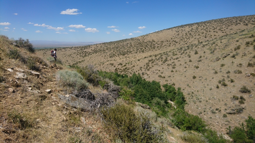
view of diamond peak

Diamond Peak

diamond mountains nevada shale deposit

Colorful shale on the crest of the Diamond Range

view of mountain scenery in the diamond range nevada

View south of Diamond Peak

Closer to Diamond Peak, the scenery was excellent. I was more impressed with the diamond Range so far than I had anticipated. 

diamond range views

View south

dried lake bed in newark valley nevada

View east, to the dried lake bed of Newark Valley

Once at the base of Diamond Peak, there were game trails that appear to skirt the side of the peak. This looks a lot more appealing then going up and over at the moment, with 8 days of food and 5L of water on my back.

hiking diamond peak east face

Skirting the hillsides around Diamond Peak

view of newark valley dried lake bed

Newark Valley dried lake bed

I skirted around Diamond Peak, and continued to follow the game trails. I was expecting them to leave me up to the top of the ridge at some point, after the Ridgeline loses elevation. However, that never happened. Horse trails became faint and continue to traverse increasingly steep terrain. Eventually, I realized my best route forward was to just head straight up to the ridgeline below Diamond Peak. A 30 minute climb up a steep slope and I was there.

hiking the diamond range in nevada

Crest of the Diamond Range, north of Diamond Peak

Now on the crest of the diamond range again. It was around 6pm now, a very pleasant time to be up here and walk the ridge. It was very Smokey today, forest fires burning west in California. The walking on the ridge alternates between easy challenging. The horse trails generally do a good job of avoiding the steepest terrain, but they also fade out often and leave you not sure which way to go.

diamond range nevada backpacking

Hiking the crest of the Diamond Range

diamond range view

View north along the crest of the Diamond Range

Sometimes, the Ridgelines turned into a knife edge or very undesirable climbing. I had to backtrack a bit at times, as well as climb down some steep and loose chutes. I saw one pronghorn as I made my way around one of the game trails. Also, I had 4G service all day.

view over dried lake bed from nevada mountains

Dried lake bed view

hiking in the diamond range, nevada

Diamond Range Hiking

The views hiking the crest of the Diamond Range were excellent all evening. This is the kind of thing I dreamed of when I was planning this route. Up high on the spine of a mountain range, straddling two massive, desolate valleys on both sides, hiking to sunset. And here I am, living that dream. 

diamond mountains sunset

Sunset in the Diamond Range

sunset while hiking the diamonds

Sunset over the crest of the Diamond Mountains

diamond valley sunset nevada

Sunset over Diamond Valley

As the sun started going down, I found myself on somewhat of a knife Edge Ridge. Very Rocky and steep. Once I had a bunch of thick trees, and that’s the side I ended up hiking. This was just as the sun was going down below the horizon. Then I made it to a saddle, which did have a flat spot that I could have camped on. But of course, I kept going. Followed a game trail along the hill side until it was almost dark. I was on the crest again, going downhill now.

Finally, I found a spot. Sub par, but it will get me through the night. It was just on the side of the crest that is protected from the wind, about 3 ft down below the crest and protected by a small bush. The ground was actually flat too. It was windy though, so I needed this protection, even if it was very minor.

I set up camp as quickly as possible, and got in my sleeping bag. I cowboy camped tonight, no room for a tent and too windy for it anyways. I was literally camping on the crest, with a 360 degree view. Amazing.


Day 38 – July 8th: Diamond Mountains, Newark Valley

thermarest neo air and zpacks arc haul cowboy camping on thru hike

Cowboy camping on the crest of the Diamond Range

The wind died down about an hour after I went to bed. Lots of Lights shining in both Diamond Valley and Newark Valley. I remember seeing the earliest rays of light started to rise over the mountains, with the rest of the sky still black. Too early for me. Then woke exactly at 6 with the sun on me. Hiking by 6:45.

hiking on the top of the diamond range in nevada

Hiking the Diamond Range

hiker walks the crest of the diamond range in nevada

The crest looks like easy hiking, but the route always seems to have more obstacles up close

Followed The Ridge, and horse trails. Walked for 10 or 15 minutes before realizing I was at the spring on the map, the first one of only two along the entire Diamond Mountains route. I would need to drop wayyy down off the ridge to reach it though, and since I had a little over two liters, that wasn’t necessary. Instead, I’ll push on to the spring that is about 8 air miles away. There was also some flat spots on the saddle where I could have camped, if only I pushed 10 minutes further last night.

dead horse skeleton and skull on the diamond range ridgeline

Horse skeleton

Next I followed a horse trail well below the crest. Eventually though, I had to reach the top of the crest, so it was a climb straight up the hill side. Walked the rest of the ridge for a while, before needing to choose the east or west side of the crest to drop down, and try to follow game trails. The east side of the crest looks less steep and Jagged, so that’s what I chose.

diamond range hiking

Easy hiking, for now

difficult hiking in the diamond range nevada

Difficult hiking

I didn’t see any game trails on the east side at first, but then there was an obvious path. These game trails, they can be really solid and then Fade Into nothing in a matter of a few feet. Sometimes it worked out, other times was kind of horrible… Boulder fields, Sagebrush etc. The typical stuff I guess.

agriculture and farming in diamond valley nevada

Agriculture in Diamond Valley

Saw an elk sitting under a tree a few hundred feet below me. Of course, he quickly ran away as soon as he saw and heard me. Diamond Valley on the West Side of the crest had a lot of Agriculture, large green circles pretty much spanned the valley at this point. On the east side is Newark Valley, still following the dry Lake bed, but agriculture in between the mountains and the lake bed now.

diamond range hikers view over newark valley

View over Newark Valley, looking southeast

hiking above a massive dried lake bed in the mountains of nevada

I really enjoyed the views over these dried lake beds

horse trail on diamond range

Notice the game trail skirting the mountainside? That’s my route

The game trails were intermittent. Even when they did exist, it was still a constant matter of fighting sagebrush. It wasn’t a fullon bushwhack, but there was enough vegetation to scrape, cut and stab my legs. Needless to say, the route along the crest of the Diamond Range is slow going, despite looking relatively easy from afar. 

Eventually I reached the last Ridge before I had to drop down and get water from a spring. This was the last spring I had marked on my map until the end of the entire diamond range. Unfortunately it’s many hundreds of feet below the Ridgeline. From here I had a choice to make, follow the game trails to the east or west side of the ridge. I really wanted to be on the east side, that’s what the spring is. However, the game trails leading east looked pretty weak. They looked pretty strong on the west side, so that’s the route I took.

I was thinking I would be able to just follow a game Trail back to where I needed to go, on the east side of the ridge, but that didn’t work out. I realized the game trails were taking me a bit out of the way after I turned the corner around one side of the mountain. So, I had to go straight up the mountain side through very thick brush and trees. This part was awful. It was around this time when the Flies started getting really bad. They weren’t a problem or earlier today, or any other day, but all the sudden there were 40 or 50 flying around me at all times. Super annoying! To make matters worse, the brush was so thick going up that I had to put my pant legs on. Now I was protected a bit, but at a great cost… Sweating like crazy.

view of central nevada landscape from mountains

Time to descend into this canyon, east of peak 8802′, to look for water

At the top of the ridge, I couldn’t really see this spring at all. The flies followed me over the ridge and we’re still all over me. Started making my way down the somewhat steep Hillside. It was mostly loose dirt and rock, smaller rock, the kind you could just dig your feet into, and kind of slide down the hill in a controlled manner

I could see a lot of thick green vegetation in the ravine, and this is where I was generally headed. I was super disappointed to see no water In the creek bed though when I reached it. To follow it downhill looks terrible, it looks really thick.

Eventually I reached a point where I couldn’t go any further. All directions, except up, we’re completely covered in thick green vegetation. It looks really, really thick! I put on my pant legs, and chose a spot that looked like it would be the shortest section of vegetation to traverse. I stumbled through it, getting snagged by all the branches, having to push many out of the way, before stumbling on a tiny trickle of water. However, vegetation was so thick here, there was nowhere to even bend down to touch the water, let alone collect it. I was getting cut up by Thorn bushes, covered with flies, hand in Tangled by the vegetation. What a nightmare.

bushwhacking in nevada mountain range

This canyon looked like an easy walk, but was a real pain

After the bushwhack, there was still a lot of side-hilling to do, and I had a lot of debris in my shoes at this point. My feet were pretty sore and tender now from running on all of this debris while walking these steeply angled slopes. At the moment, I remember thinking that this Canyon was one of the worst experiences of the whole hike.

I walked along the Hillside, above the thick vegetation that choked the Ravine. As I dropped lower in elevation, I dropped down to the Ravine to check if there was water. It was dry. This was a bit devastating. I kept walking down hill, that’s all I could do. Closer to the bottom, I dropped down to the Ravine again to check. It’s really thick and hard to reach, but here I did find a little water. And, I actually had enough space to sit down next to the creek and filter water. Up high, I couldn’t even bend down to collect the water if I tried there was too much vegetation. It would have been more pleasant without the Flies, but still, it was shaded and there was water. I had to dig out a pool to collect from. There was a bunch of squiggly little swimmers in the water. I spent a good while here, filtering water and eating lunch. I chugged 2L of water and took one with me. I would have taken more but the map showed a lot of water coming up, now that Im down low in the valley and off the ridge.

canyon with thick vegetation and bushwhacking in diamond range

looking back up at the canyon I just came down. Doesn’t look like much, but man, what a pain that was.

I wasn’t far from the bottom of the canyon now. No way in hell I am going back up that Canyon. So I guess I am done walking the crest of the diamond mountains. I would have to carry my maximum water capacity, which was now 5L, plus one dirty water bottle. Instead, I’ll just have to walk the road through Newark valley around the northern section of the diamonds.

I was the google satellite images in my pre-hike planning to try and determine whether or not water would be at a marked spring, or anywhere else. However, in this section of the Diamond Mountains, the satellite imagery shows snow on the ground. This makes the satellite imagery useless for my needs, and adds to the difficulty of planning a route through the Diamond Range. However, after returning home from this hike, I found the ESRI satellite layer, which shows the Diamond range without snow. Using the ESRI layer, I was able to locate another spring that wouldn’t require dropping down over 1,000ft to reach it. This means for anyone else hiking the Basin and Range Trail, you shouldn’t have to drop down off the crest of the Diamonds as far as I did, and you should be able to stay high up on the crest for the remainder of the hike to Corta Spring, where the BRT would drop down off the ridge.

dreid alke bed in newark valley nevada

View of Newark Valley dried lake bed

After filtering water, the rest of the hike down the canyon continued to be a pain in the ass. Eventually though, I reached a small little road that leads out of the canyon and into Newark Valley. For this I was very thankful.

lush green grass at fairy dell in newark valley nevada

Ferry Dell, Newark Valley

Now I’m on a road that parallels the main road through Newark valley. The map shows several water sources here, such as fairy Dell. In reality, these were fenced off. I could have access them if I wanted, but didn’t really need to at this point.

It was much warmer down here in Newark valley. But I didn’t care, the ease of walking more than made up for it. Many of the Canyons leading up into the diamond mountains looked similar to the one I came down, a ton of green, looks like a pain to hike.

road walking while thu hiking nevada great basin

HWY 892, Strawberry Road, running through Newark Valley along the Diamond Range

road sign with bullet holes in nevada

Beef, it’s what’s for dinner

Now on the main road through the valley, I was surprised to see it paved. I’d be on this road the rest of the day. It really wasn’t that interesting. The dried Lake bed ends and turns into farms and agriculture on the northern end of Newark valley.

view of nevada mountain range at sunset

Diamond Mountains from Newark Valley

view of cold creek reservoir in nevada

Cold Creek Reservoir

There wasn’t much traffic on the road. Not a single vehicle stopped for me, unlike a dirt road, where everyone stops. So now I am heading to a place called Cold Creek Reservoir, the next water source on my map. I walked 3 hours straight from my last water source to reach it. It’s very well hidden from the road When approaching, I didn’t think it was going to exist. But sure enough, a little dirt road leaves the main road and leads down to hidden reservoir. Boy I was thankful for that. Water level was low. There were a couple of campers parked around it and a family fishing. I stopped at the creek that feeds the reservoir and sat there for about an hour, I filtered several liters of water, chugging a few and collecting 4 to take with me. Ate dinner, washed my socks etc.

sunset behind sagebrush and mountain range in nevada

Sunset behind the Diamond Range

hiking newark valley nevada

Northern Newark Valley. The dried lake bed was situated in the south, and here, it’s much more green

I left the reservoir around 6:30pm. More Road walking this evening, headed towards the Pony Express route that runs into the southern rubies across Huntington Valley. I was really hoping to make it to the Jacob’s Well Pony Express station, which would have surely provided a flat spot to camp if nothing else. However, it was 9 plus miles away. I wasn’t going to make it before dark. It would have been cool to say I slept in an old Pony Express station.

tent camping under tree at sunset in huntington valley nevada

Campsite in Huntington Valley

The paved road turns into a dirt road. There is a turn-off for Bald Mountain with a sign that said Kinross. Apparently, that’s a mine. I kept walking and eventually found a spot under a tree, surrounded by cow crap around 8:30, just as it was getting dark. Perfect timing.

Day 39 – July 9th: Huntington Valley, Pony Express Trail, Overton Pass, Southern Ruby Mountains

Slept pretty good. Finish writing in my journal this morning since I fell asleep during it last night. This is pretty common for me. Started hiking around 7:30.

hiker in front of pony express sign huntington valley nevada

Hiking the historic Pony Express Route

map and info about the pony express route

Pony Express route information

jacobs well pony express station

Everything you ever wanted to know about the Jacob’s Well Pony Express Station

Continued walking the road north. After while, I hit the Pony Express route. This is marked by a couple of brown signs. I turned right, heading roughly east and after a few miles I hit the Jacob’s Well Pony Express station. There really wasn’t anything here, just a clearing, which was fenced off. There was a marker made out of railroad ties, and these were all over the Pony Express route. And a couple of signs that described what went on in this area.

water tank at jacobs well in huntington valley nevada

Jacobs Well water source. Water here in 2020, water was OFF in 2021

A few miles up the road I hit Jacob’s Well, the water source. This was a large tank filled with water that fed tires and Troughs. There were cows here but they were fenced off. I could access the well without being in the same area as the cows. There was a spigot on the well, which was very handy. I was able to wash my socks, with some pressure. I chugged 2 liters of water and took 5 with me.

view of the nortnern diamond range with sagebrush valley

Northern Diamond Range

road along the pony express route in nevada

Hiking the Pony Express route in Huntington Valley

a dry windmill water source in huntington valley nevada

She dry

Now it was a long road walk from here, still along the Pony Express route. I didn’t see single car drive by. I crossed the main road running through Huntington valley here, and continued hiking the Pony Express route. A truck past, the woman stopped asked if I was okay. She said she was hiking the John Muir Trail later this month. That’s awesome!

I stopped along the road for a break under a tree. It was getting really hot today, forecast to be in the low 90s. I continued walking the road, and saw maybe five other vehicles drive by, all coming up over Overland pass from The Ruby Valley side. On the top of Overland pass, looking to the north there was a large burn area. Haven’t seen many of these in Nevada, the only one I can remember is in the grant range.

old road leading through nevada mountain range and forest

Fading 4×4 road leading into the Ruby Mountains

hiking north of overland pass in the ruby range

Route into the southern Ruby Range, looking back at the way I came from Overland Pass

Finally I hit the road that takes me up into the Ruby’s. It look the same as every other mountain range for the most part; at it lower reaches, plain dirt road with some small pine trees. I was really struggling now with the heat. Just having a hard time walking up the road and finding the motivation to keep walking.

hiking the rubies

I hiked up the canyon on the right

view of southern ruby valley from the mountains

First view of Ruby Valley

It took roughly two hours to get to the top. My mouth was dry, I was thirsty and hot. I had already drank two liters of the five I took from Jacob’s Well. Then I drank another liter at my break, which I took after reaching the hill above the climb I just did. This break was nice, under a tree and a good view.

View west

ruby marshes in ruby valley view from ruby range

First view of the Ruby Marshes

hiking trail southern ruby mountains

Route uphill. Sometimes there is a path, sometimes there isn’t

My route now continues uphill, along the crest or just below it. From the top, I could see a long way; the Diamond range where I just came from, and down into the Ruby marshes below in Ruby Valley. There was a lot of water down there, and had its own unique look a braided network of ponds and channels, spreading out like a spider web. Maybe, a spider that was drunk or something. Really nice views now, nice to have some reward for all the hard work I put in today.

view south from the southern ruby mountanis

Looking south, where I’ve come from

hiking above ruby marshes nv

View north along the crest of the Southern Rubies

Climbed up to the top of the ridge, and then found a trail that dips down on the other side. It’s skirts the hillside, with a good view to the east of the Ruby Marshes. Now, I’m in the Basin that holds burro Lake. I wish it was a lake, because i was pretty thirsty now. But of course, it was dry as a bone.

hiking burro lake ruby range

Burro lake (dry), view north to the route along the ridge

view of burro lake from the ruby mountains

Looking down on the Burro Lake area

ruby marshes overlook vista from ruby range

Ruby Marshes viewed from crest south of Sherman Mountain

I followed the crest up The Ridge, knowing I would have to ultimately find my way up a pass. It was easy going at first, a nice game trail. Then it was a difficult off Trail climb. Difficult because it was steep and I was tired. Had one tick on me, that’s three now for this whole hike. Saw two horses in the woods on my way up the pass.

The climb up this unnamed pass near really hit me. At this moment, I was feeling pretty tired of doing this hike to be honest. The off-trail stuff is just so hard. I’m always thirsty, hungry, tired, dirty, sore, feet hurt etc. I was stumbling up the hill, like I was on autopilot. This really is nothing at all like hiking the Continental Divide Trail. The challenges are far greater. Seldom can one just walk without much thought. Everything here is a battle.
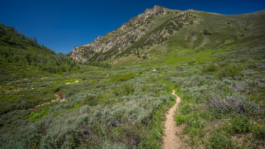
I sat down for a minute at the top of the pass, looking to Sherman Mountain to the north. With the wind blowing, it was quite cold actually. Headed down hill through a forest, following game trails where I could. I got down to a clearing, and decided to start looking for camp. I checked one green area for water, no luck. I walked over to a patch of trees, and saw another 10 horses. They ran is I approached. I thought I might camp where they were, though.

sunset in the ruby mountains

Sunset view

However, before I set up camp, I decided to have a look around the Mountainside to see if I could spot tomorrow’s water source. I had given up on reaching it tonight, its too far. It would either be a large climb, say 800 or thousand feet, or skirt around the mountain side. I was leaning towards the latter. So, I started walking around the mountain side on some game trails. Before I knew it, I had gone too far and had committed to the route. The water was too far away to see, but I think it’s going to work based on the terrain and potential for game trails.

sunset view over the ruby marshes in nevada

An awe-inspiring view over the Ruby Marshes at sunset

The view over Ruby Marshes was incredible. This was a unique view, no doubt about it. The way the fading rays of sunlight reflect upon the braided channels and pools of water below in the Ruby Marshes was something Ill never forget. I forgot I was in Nevada for a moment, this place looked nothing like the rest of the state I have hiked thus far. For all the challenges, the heat, thirst, bushwhacking etc, this is my reward. The cruel thing is about these hikes is that the payoff is so short lived. For all that I endured today, my reward is so brief, in comparison to the effort involved to reach this place.

Now after 8pm, it was time to find camp. It was a moderately steep Hillside, and nowhere to camp. There were certain spots that where basically small Ledges, although filled with rocks. I found a spot where I cleared a bunch of rocks, and decided this would be camp for the night. I had planned on cowboy camping this evening, mostly due to the lack of space for a tent.

I used my foot to clear out the small rocks, and had to dig out the big rocks. Eventually I cleared a spot the size my tents footprint. I put the Tyvek down, I blew up my air mattress, and then realized they were too many ants around. I haven’t had much problem with ants at night so I figured cowboy camping would work. However, there was just too many ants. They were crawling all over my stuff, and all over my sleeping pad.

The problem now is, it was Dark now and there were no other options for other campsites. The spot was very small. I didn’t think I could get tent in here, if I did, it would be on a huge slant… but that’s just what I did, not having much other choice. What a pain in the ass this was. It felt like amateur hour. It took a long time to set up the tent, my poles were off at odd angles, there were rocks underneath the tent that needed to be moved, and when I did, it stirred up the ants nest. I cut my hand somehow trying to remove some plant from underneath the tent. Basically everything went wrong. But in the end, the air mattress is flat and I’m tired enough that it doesn’t matter.

Just under 1 liter of water left. If Tomorrow is water source doesn’t work out, I will have to dip down out of the mountains again, as there are no other water sources for a long, long ways up on the crest of the Ruby Mountains.

Day 40 – July 10th: Southern Ruby Mountains, Ruby Marshes & Ruby Valley, Pearl Peak

tarptent notch li campsite above ruby marshes nevada along basin and range trail thru hike

What a view to wake up to!

Slept good because I was so tired, but sure was a shitshow of a campsite. Wind died down a little bit but was still kind of gusty throughout the night. Could not get the tent pitched taught, so I had to listen to the tent flapping around in the wind all night.

ruby valley aerial view of the ruby marshes

Such a unique view. The Great Basin doesn’t usually have this much water

sun rise reflections over the pools of the ruby marshes

Ruby Marshes overlook at sunsrise

I continued working my way around the hillside, contouring around along the same elevation. Intermittent trails, faint at best. Saw a tank just before I reached the drainage where I had marked water, but this was dry.

ruby mountains nevada potential water source

Ravine east of peak 9835′ that should (hopefully) have water

Looking down the drainage

ruby mountains drainage with water

More water as I climb higher, a good sign…

When I reached the drainage where I marked water on the map, this too was dry. Actually, it was damp. So now I could follow it up Hill or downhill. It makes more sense to follow it uphill and try and find the source. However, the canyon was steep and narrow. Still, I didn’t have a whole lot of options, I was a long way from water no matter what I did. So I went up hill. There was a ton of bugs here though, flies and mosquitoes.

hiker filling water bottle from trickle of water in the ruby mountains

Just a trickle of water, but that’s all I need

Found a couples trickles of water coming off a rock, but the ground itself was still just damp, no running water. I kept going uphill, and finally found a 2-3ft pour off, with a few trickles of water running down that. First thing I did was dunk my head under the water. It was nice and cold, it felt amazing! Really amazing. I wont lie, I got a little emotional finding this water source. You know you are living when finding water brings a tear to your eye. I couldn’t help but scream at the top of my lungs Woohooo!!

After soaking my head and washing off a little, I chugged the half a liter of water I had left, and started to filter more. All in all, I drank 2.5L here, and took 5 with me.

hiking the southern ruby range along the ridgeline

A 4×4 road can be seen running north along the crest now

trees growing sideways because of exposure to high winds

Which way do you suppose the wind was blowing?

ruby mountains nevada large pine tree

Very green. And look at the size of that pine tree!

Next it was a steep climb out of the ravine, although a short one. More side-hilling for a while, then reached a 4×4 road. This was a relief. Now, I could just relax and walk for a couple of miles, before going off-trail again later today. Now at a saddle, the road climbs up. The trees where practically growing sideways here, very exposed to the wind.

beautiful mountain scenery southern ruby mountains nevada

View from rock formation

ruby mountains ridgeline

View north along ridgeline

hiker walking along ridgeline in the rubies

Hiking in the southern Rubies

 I stopped to check out a big rock formation that looked like it might be worth exploring. There really wasn’t anything interesting here, other than some cool views!

dirt road in nevada mountains

Descending the pass

rock formations and ruby valley from ruby ridgeline

View east into Ruby Valley

4x4 roads along the crest of the ruby mountains

View back south along the ridgeline

Went over another pass. Road passes through some trees on the side of a hill. Pleasant hiking for a bit. Pretty nice views all around. 

bristlecone limber pine tree ruby mountains nevada view

view along the crest of the ruby range south of cass house peak

Some excellent hiking here!

Then, another 900 ft climb. In the middle of the climb, I saw 8 horses.

view east from ruby mountains

View east to Ruby Valley, Maverick Springs Range, Medicine Range and Cherry Creek Range

4x4 road to cass house peak in the ruby montains

Hiking south of Cass Couse Peak

This climb wasn’t too bad, didn’t seem like 900 ft. This is where I thought the road would end, at the top of this hill. Very very steep 4×4 Road leading to the top. At the top, the road continue to along the Ridgeline towards the next high point.

rockhounding in the ruby mountains nevada

Copper-lead specimens, with secondary minerals of malachite and azurite

Along the Ridgeline, near Cass House Peak, I found some very interesting rocks and minerals. There was a small hole that someone had dug here, and the ground was littered with rocks bearing colors of green, blue and silver. I am pretty sure this was a copper/lead deposit. The green indicates Malachite, the blue was probably azurite, and these colors are a strong indicator of copper. The silver metallic mineral was likely Lead (galena), which is often found with copper. A very cool find!

route to pearl peak summit ruby mountains nevada

Excellent hike south of Pearl Peak

view south from ruby ridgeline south of pearl peak

View south along the crest of the southern Ruby Mountains

Followed the road to the top of the next high point. This is where the road ends. Then it was a ridge walk down crossed a few other high points. Finally, Pearl Peak was in view. The climb up didn’t look too bad. It was going down I was worried about, from looking at the topo maps.

dead tree on ridgeline of nevada mountain range

Beauty of the Great Basin

The hike to the summit of Pearl Peak was pretty easy, all things considered. There was an intermittent game trail at times, and the grade was not too steep. Good views along the way.

hikers view from the summit of pearl peak, ruby mountains

View from the summit of Pearl Peak, looking north

view south from the summit of pearl peak nevada

View southeast from the summit of Pearl Peak

panorama photo from the summit of pearl peak, ruby mountains nevada

View north from Pearl Peak summit

panorama photo from the summit of pearl peak

View southeast from Pearl Peak summit

The summit of Pearl Peak offered an excellent view. Especially to the north over the rest of the Ruby Mountains. The Rubies are a long range, and the section that most people hike (Ruby Crest Trail) is a 40 mile section, north of here. Where I am though, in the southern Rubies, few people hike this.

view of pearl peak from ruby mountains ridgeline

View south to Pearl Peak

ruby mountains summit view from peak 10,664

View north from peak 10,664′

Now it’s a slow and tedious descent down from Pearl Peak on loose rock and talus. I’ll dip down to a saddle below peak 10,664′, then hike up to the top of it.

huntington valley viewed from ruby mountains

View west across Huntington Valley

view of ruby mountains summit peak 10,664

Peak 10,664′

panorama photo view from ruby mountains summit

View south from peak 10,528′

ruby mountains summit view from peak 10,528

View north from peak 10,528′

Coming down form 10,664′, I drop down to another saddle before going right back up to peak 10,528′. From the top of this one, I couldn’t see over the edge to get eyes on the route down until I got started descending it. It was steep! But, quite manageable. 

ruby mountains hiking north of pearl peak

Looking south to peak 10,528′

traversing ridgeline in the ruby range nevada

I need to get down this, and follow the ridgeline

When I reached the ridge I was worried about, it had me very nervous. Extremely steep descent. On my map, the caltopo slope angle shading was solid red for 1000 ft. Darker colors indicate a steeper slope. Took a break here, ate food drink water, and went for it.

This is the type of terrain where you just dig your heels and feet into the dirt and rock and just let it slide, basically a controlled slide. Hopefully its a controlled slide anyways, much better than an uncontrolled slide. I fell numerous times on the way down. Still, it was somehow more manageable than I was expecting. My feet hurt, there were pebbles in my shoes and they were rubbing on my feet, making them sore.

shadows on ridgelines leading to mountain summit

Play of shadows as I look back upon the route I traversed down from Pearl Peak

ruby ridgeline nevada

View north along the ridgeline

Finally worked my way down the steep slope and over to the ridge itself. Now you could hear a bunch of sheep down in the valley, and I could see the sheep herders white tent on a ridge. Following the ridge was still hard; it was slippery with loose rock, caught myself many times from falling. Sometimes I didn’t catch myself though!

off-trail hiking in the ruby mountains

Not the easiest hike along this ridgeline, but it’s a beautiful one

Now I had to go up a series of ridges and Hills, all off Trail. I was absolutely wiped out, basically stumbling around. Beautiful views, just so much hard work. Some of these ridges were a bit of a knife edge at times.
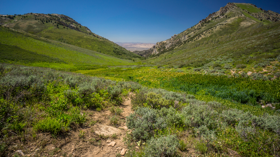
sunset in nevada mountain range while hiking

Beautiful sunset this evening

Eventually, I reached the last Ridgeline of the Basin that held a couple Springs. I begin The Descent, off Trail, instead of just following Ridgeline a ways more to a Road. Big mistake. I found myself at a wall of trees, totally impenetrable, with only a tiny bit of daylight left. No way!!

I went back up the hill side, very steep. Worked my way around the trees, and was literally running downhill through Sagebrush, with no care given to my legs. My legs got pretty cut up, they were bleeding and completely black and brown from being dirty. But, I reached the bottom, and then eventually, the road.

I continued to jog along the road, as there is almost no daylight left now. I reached the general area where the spring was on the map, but it was too dark to find the water. I had no choice but to continue along the road, following it up Hill until I found a subpar place to camp alongside it. There was just a little bit of sand over a huge rocks slab, so I couldn’t get my tent up, the stakes wouldn’t go into the ground more than a half inch. Couldn’t even find a single rock to try and pound stakes in! So I ended up cowboy camping, even though the mosquitoes were out. I don’t care, I was too wrecked to give a shit otherwise. 9pm now, another 14+ hour day of hiking.

Day 41 – July 11th: Harrison Pass, Ruby Crest Trail, Ruby Mountains, Overland Lake

thru hikers legs covered with cuts scrapes dirt and blood after bushwhacking

I thought they looked pretty clean last night, but I guess not

Woke at 6:45. Feeling wrecked! Thirsty. Tired. Sore. Legs still really dirty, despite cleaning them last night with wet ones. I guess I missed a few spots, like the entire leg. Ha.

upper corral creek canyon nevada

Upper Corral Creek basin, looking back at the ridge I came down last night

Walked down hill to the spring I passed last night in the dark. Found it, in thick brush. A small flowing creek. Found a spot to sit down, thick canopy but open enough to sit on grass. Actually pretty nice.

scenic canyon in the ruby mountains

Impressive hoodoos and rock walls in upper Corral Creek basin

The Basin I camped in last night was really nice, lots of Rock hoodoos everywhere. There probably would have been some great camping spots I had time to explore in the daylight. I followed the road North towards Harrison pass.

At Harrison pass, there were three vehicles parked. An actual hiking Trailhead, with a couple of cars. I haven’t really seen many actual hiking trailheads in Nevada along my route, and they usually don’t have cars at them. Welcome to hiking central Nevada.

ruby mountains near harrison pass

North of Harrison Pass

hiking north of harrison pass in the ruby range

View north into the Ruby Mountains

Continued North on the road above Harrison pass. A sign said Ruby Crest Trailhead 2.8 miles, wilderness boundary 6 miles. The road is rough ahead, so most people park at Harrison Pass, which ought to be considered the official Ruby Crest Trailhead. The road here was also lined with Rock hoodoos and interesting formations, and some pretty excellent campsites for the car camper. I passed one spot that must have had 10 tents. I also passed a couple of Runners coming down Road, they said you picked a good Day to come out, referring to the heat. Today was supposed to be 98 in Spring Creek. Of course, I can’t pick and choose my hiking dates around the weather.

Along the road, I saw a couple Beaver ponds along the creek, I think it was Gardner Creek. Farther up, I reached the Ruby Crest Trail head. There were three trucks parked here. I was surprised to see anything parked here because the road was pretty washed out and deeply rutted in spots.

ugly brush along the ruby crest trail

Before the Ruby Crest Trail gets “good”

The next many miles were not that interesting. It looks like the area had previously burned and low brush was growing back. Just a sea of bushes that were only knee high. Pretty horrible actually, but good thing for the trail. The views were not that great here either. Also, the trail here has a lot of small ups and downs, and even though I was putting in a lot of work, was not really getting anywhere elevation wise.

Saw my second hikers in Nevada. A younger couple that had just left Overland Lake, going back to Harrison pass. They had giant backpacks, with REI tags on them. Looks like they rented their gear.

There were many small trickles of water over the trail. The small streams, probably could have collected from them if I tried, but instead, just used the water to wet my head, hat, and Sun flap. This felt amazing in the heat. It was really hot.

I reached McCutcheon Creek Which is really nice, good flowing Creek and the backdrop of pointy mountains was finally starting to show itself. Hiking North, the scenery didn’t look that great still, but now, looking back to the South, the Ruby mountains began to look bit more impressive.

ruby mountains scenery near smith creek

Scenery is starting to improve

hiking above south form smith creek ruby mountains nevada

Cresting a ridge above South Fork Smith Creek

ruby crest trail near south fork smith creek

Descending to South Fork Smith Creek

Went over a pass with a nice View, before dropping down to South Fork Smith Creek. Saw two more people with the dog taking a break under a tree. It was a nice hike down to the creek. Good views, Big Valley. Still not amazing, but getting better.

hiking above south fork smith creek

Dropping down to South Fork Smith Creek

Down at the creek, I was hoping to have water large enough to have a swim. It was only a few inches deep though, with slightly deeper pools here and there. There was a large campsite along the river, really the first pre-existing backcountry campsite I’ve seen in the rubies.

ruby mountains view of beaver ponds along river

Beaver Ponds along South Fork Smith Creek

ruby mountains south fork smith creek canyon view

View up South Fork Smith Creek

Next the trail climbs up over a ridge. Good views at the top, then it drops down to Middle Fork Smith Creek. Roughly the same size as South Fork. I stopped here to filter water.

hiking trail in the ruby mountains

Route up to Overland Lake from North Fork Smith Creek canyon

ruby crest trail in North Fork Smith Creek canyon

View down North Fork Smith Creek canyon

pass above North Fork Smith Creek canyon

Near the top of the pass above North Fork Smith Creek canyon

The trail climbs up over another Ridge, and then begins its Ascent to the pass above Overland Lake. Trail all the way up to the switchbacks at the end of the basin was actually pretty easy. All of the climbing came in the form of switchbacks, about 1,000 feet straight up. I saw two horses in the upper portion of the basin. This felt like a really long climb, there were many times I thought the leg of the Switchback I was on was the last one, like a false Summit.

ruby mountains view of sawtooth peaks

View south from the pass above Overland Lake

snow in the ruby mountains

Snow near the pass above Overland Lake

panorama view from overland lake pass

View south from the pass above Overland Lake

The View from the top of the pass was excellent. Looking back to the South, there were two pointy Peaks staggered in such a way that it looked like sawtooths if there were more of them. There was a snow cornice too. I turned my on phone to check for service, had 4g. I sent Cody a message, letting him know that I expect to reach roads end trailhead in upper Lamoille canyon by tomorrow night and was looking for a ride into Elko. After sending the message, I lost my signal, and it never came back! Funny how the wind blows cell phone signal I guess.

view of overland lake in the ruby mountains from a mountain pass

Overland Lake view from Pass

hiking the ruby crest trail above overland lake

Ruby Crest Trail descends to Overland Lake

jagged mountain peaks and two alpine lakes in the ruby range

Overland Lake and Ruby Valley view

The view of Overland Lake… Wow! Way more impressive than I was expecting. Two small lakes, the trail sitting very high over the Basin. This was a very impressive little Cirque. I can’t say wow enough. Even from the top, I got Wind River range vibes. This whole cirque was lined with Jagged Rocky spires and impressive sheer rock slabs. the sun had just gone down over the Ridge, so my pictures of this area are not what I was hoping for. Still, my eyes could see the beauty. Wow.

view of upper overland lake in the ruby mountains nevada

Upper Overland Lake

overland lake view ruby range

Looking down to lower Overland Lake from the upper Lake

Followed the Steep switchbacks down to the upper Overland Lake. Stopping every so often to take in the scenery, see the place from a different angle. Upper Overland Lake was incredible, but the Lower Lake is usually the main event. I could see a tent down there, so there was at least one person camping, which I expected.

view of overland lake in the ruby range nevada

Overland Lake

Along the lower Overland Lake, I saw it about 10 tents along the shore now. There was an abandoned cabin here too. There’s a group of people, the closest person was a guy with a big long beard. I said hello, and kept going. I climbed up the hill above their campsite area and found my own. Pretty good spot with an excellent view of Overland Lake, slightly elevated above it.

Next I headed down to the lake to get water, wash up and eat dinner. The group was mostly ultra marathon runners, and they just happened to be doing this hike together. They weren’t really avid hikers, although one person in the group had hiked the PCT in 2019. Marlene, (trail name fa-fa). She was a SOBO hiker, and made it 30 miles from Mexico of Mexico and suffered a fractured hip. I cant imagine walking all that way, being that close and having that happen right at the end. Just heartbreaking.

Day 42 – July 12th: Overton Lake, Liberty Lake, Ruby Mountains, Ruby Crest Trail, Lamoille Canyon

overland lake campsite ruby mountains nevada

Campsite at Overland Lake

view of overland lake in the ruby mountains form campsite

Overland Lake campsite view

Beautiful morning. When I woke up, I noticed a campsite perched almost at the end of a small hill overlooking the lake, about a hundred feet from where I camped. This would have been a better view for sure, although more exposed to the wind. And really, what’s the difference when I didn’t have any time at camp in the sunlight anyway.

hiking overland creek canyon in the ruby mountains

View of Overland Creek Canyon

The views were excellent leaving Overland lake. There was a bit of a haze in the air in the distance, as I look down into Ruby valley out of the Ruby mountains and into the desert. It was really amazing how one could Traverse so many different environments in one day, by climbing up on Valley. Here, you can go from desert to alpine/sub-alpine environment in a matter of hours.

ruby crest trail in overland creek

Can you spot the waterfall?

Good trail to follow. The trail drops down a little bit into a valley and then Contours around the Mountainside for quite a ways. As I made some distance from Overland Lake, the scenery became too impressive to ignore. Incredible towering Rock faces, at least 1,000 feet vertical. In the distance, I could see 2 waterfalls at least 40 to 60 feet high. Lush green environment. Absolutely nothing like the rest of Nevada!

waterfall along the ruby crest trail in nevada

Waterfall!

I was pleased that the trail was routed right underneath one of the waterfalls. The only other waterfall I had come across in Nevada was about 3 ft high. Now I was at the base of a 40ft waterfall. Amazing!

hiking upper overland creek rct nevada

I really enjoyed hiking the Overland Creek area

I was feeling really good as I walked away from the waterfall. I could tell today was going to be one of the best days on trail. I was taking a lot of photos and video, could barely make any forward progress it seemed.

hiking the ruby crest trail

Some cool rock formations along the Ruby Crest Trail

two thru hikers on the ruby crest trail nevada

So good to hike with someone!

I went around a corner on the trail and ran into Marlene, who I was speaking with last night. we ended up hiking the rest of the day together. Marlene is an artist and farmer. One unique thing about her, she is a master pumpkin carver and will carve pumpkins for businesses around Halloween time. Pretty unique Niche there!

ruby crest hiking trail in central nevada great basin

View south

ruby crest trail views

hiking the ruby crest trail in nevada

Good trail along the ridgeline

It seems like much of the day we were hiking on a Ridgeline that kind of connects two larger segments of mountainous masses, the North and South. The map of made it look like we just stay high on this Ridgeline, which we do, but there was a lot more ups and downs than I thought. Great views, although they kind of looked the same over each Ridgeline.


woman hiking the ruby crest trail in nevada

Marlene hiking over Wines Peak Pass

hiking the crest of the ruby range in nevada

Descending Wines Peak to Furlong Creek and North Furlong Lake

ruby crest trail hikers view into ruby valley

Last views of Ruby Valley

The hike in-between Overland Lake and Lamoille is definitely the best part of the Ruby Crest Trail. Everything south of Overland Lake is just not at the same level. Here, there are constant sweeping views and excellent hiking. The trail is good, the route is easy. Very enjoyable indeed. 
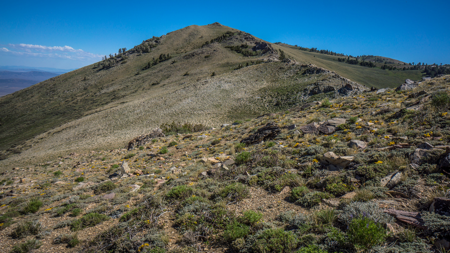
hiker stands along the ruby crest trail

Marlene along the Ruby Crest Trail above Farve Lake

Kleckner Canyon in the ruby mountains

Kleckner Canyon view

By late afternoon we made it up over the last pass the drops us down into the Basin with Favre Lake. We kept saying, where’s the lake? We had to drop down all the to the lake itself before it was visible. I will continue on to Lamoille Canyon this evening, but Marlene needed to find a place for her entire group to camp. They were still behind, we didn’t see them all day. Apparently ultra-marathon running doesn’t translate well to hiking. That, and their packs are really heavy.

ruby crest trail near farve lake nevada

Farve Lake

view of farve lake form the shoreline in the rubies

Shoreline of Farve Lake

Farve Lake itself was nice, but not nearly as nice as Overland Lake. The Shoreline was muddy, and the water had some green algae in it. The lake itself looks a bit barren.

ruby crest trail views of farve lake backdrop

Ridgeline south of Farve Lake

shoreline view of liberty lake in the ruby mountains

Liberty lake shoreline view north to Liberty Pass

After parting ways with Marlene, I continued my hike up towards Liberty Pass, which connects Farve Lake to Lamoille Canyon. In upper Lamoille Canyon is Roads End Trailhead, where I will meet up with Cody Terras. Cody was one of the guys I met on 4th of July, he had given me his number and said he would pick me up since he only lives a short ways away. I had no service, so I use my satellite Messenger to send him a text here to let him know my ETA.

view of liberty lake in the ruby range nevada

Liberty Lake

The hike up Liberty Pass was nice. From Favre Lake, it was almost like a two-tier pass. One Mini pass up to Liberty Lake, and then another mini pass up to Liberty Pass. There were many people hanging out around Liberty Lake. Liberty Lake was a large and impressive Alpine Lake. Not unlike what you would see in the Sierras, for example.

wooden sign for the ruby mountains wilderness nevada

The Ruby Mountains Wilderness boundary is roughly at the top of Liberty Pass

lamoille canyon viewed from liberty pass ruby crest hiking trail

First view into Lamoille Canyon

Coming down Liberty Pass down into Lamoille Canyon, I was surprised to see how rugged it was and how much snow remained up here. There were many switchbacks and they were very close together, snaking the way down Hill, looking like they make almost no progress. I could tell this pass was going to take longer than I thought.

snow along the ruby crest trail in july

Lots of snow in upper Lamoille Canyon

I had to walk over several patches of snow. Trail itself was very Rocky. It was indeed time-consuming. At the same time, it was really impressive to look back up at Liberty Pass. Steep rock walls and snow.

view of lamoille lake in the ruby mountains

Lamoille Lake

I could see Lamoille Lake from above. A deep green turquoise color. I didn’t really have any time to go down to the lake, and the trail stays a little ways away from it anyhow. I tried to run downhill when I could, trying to reach the trailhead by 6pm, the time I had told Cody to be there.

hiking the ruby crest trail through lamoille canoyon

Hiking Lamoille Canyon

I had a bit longer route planned for this section. I had a high route mapped that would connect upper Lamoille Canyon to Echo lake and drop down into Seitz Canyon, ending this section at the Powerhouse Trailhead in lower Lamoille Canyon. However, that would add another day of hiking and logistically, it just worked out to have Cody pick me up here today. Make no mistake, the high route from Lamoille to Seitz would be stunning, based on the maps. I will have to save this route for another time. You just cant do it all on on a thru-hike.

I reached the trailhead around 6:15pm, pretty happy only being 15 minutes late. Cody was sitting there on a rock at the edge of the parking lot, he had been watching me come down hill. He had a cooler waiting for me with a water or beer, drink of my choice. I went for the cold water. Jumped in his car and we took off.
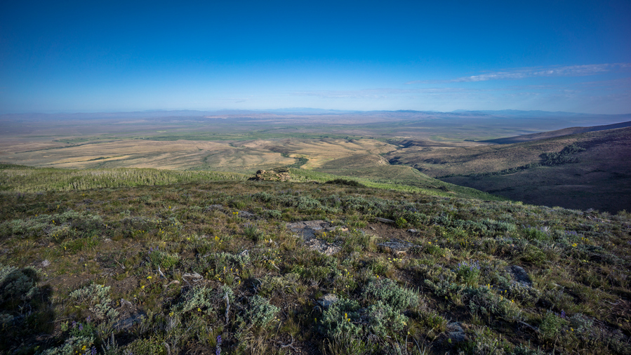
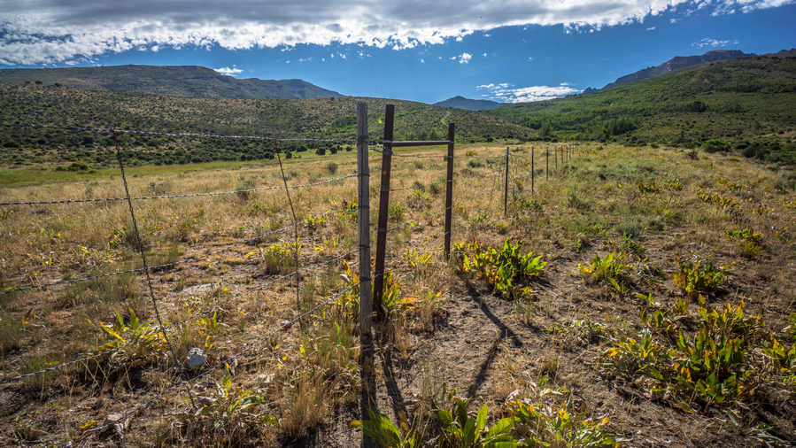
we made our way to Elko, while I decided which hotel to stay at and where to eat. Cody suggested Round Table Pizza, which sounds good to me. I was in my hiking clothes still an extremely dirty. There was a huge hole in the back of my shirt. But Cody insisted with the miners in town, I would fit right in. Works for me.

we made pretty good progress on an extra large meat lovers pizza, and I took the rest with me. From there we went back downtown Elko, and I got a room at the Econo Lodge

Day 43 – July 13: Zero Day in Elko, NV

socks hanging in front of vent in hotel room

Doing some laundry

Town chore day. Usually I’m tired and out of it, but I felt really good today. Besides grocery shopping, I had all of my chores done by late morning. Washed my clothes, washed my tent and the zippers to try and restore the functionality. One of the zippers no longer closes properly. Too much sand and Grime in the zippers. I gave Cody a call and asked him if he could take me to the grocery store and the post office This afternoon. He said he would swing by mid-day.

Luckily the grocery store and post office in Spring Creek shared the same parking lot. I picked up my package that Dad had sent containing a new shirt, gaiters and new pair of boxers. Then I did my grocery shopping. I picked up a case of beer for Cody’s folks to return the favor for the generosity on the 4th of July. Then we went back to his place for a bit.

thru hiker play guitar on zero day in twon

Jamming on my zero day with Cody, and his son

Travis, Cody’s dad, was out fishing for the day, and his mom was out somewhere too. We hung out in the garage and jammed a little bit on the acoustic electric guitar. Their house was situated on the end of the street, last house before you reach The Ruby mountains. What a backyard that was!

I took Cody out to eat at a local restaurant to return the favor for driving me around town. I spent the rest of the day relaxing in the motel and getting ready for the next section. Cody will join me for a day or two in the beginning, which will be great to have the company!

Related Images:

×