
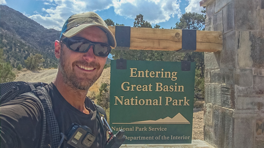
Ruby Mountains, NV: High Route Hike Lamoille Canyon to Seitz Canyon
Ruby Mountains, NV – High Route Hike Lamoille Canyon to Seitz Canyon
- Hike Location – Ruby Mountains, Nevada – Ruby Mountains Wilderness
- Land Administration – Humboldt National Forest
- Hike Type – Point to Point
- Fees & Permits – No fees or permits needed
- Start Trailhead – Roads End
- End Trailhead – Powerhouse
- Length Of Time Hiked – 14.5 hours
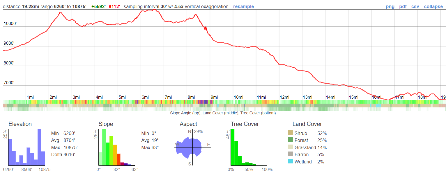
- Miles Hiked – 19.28
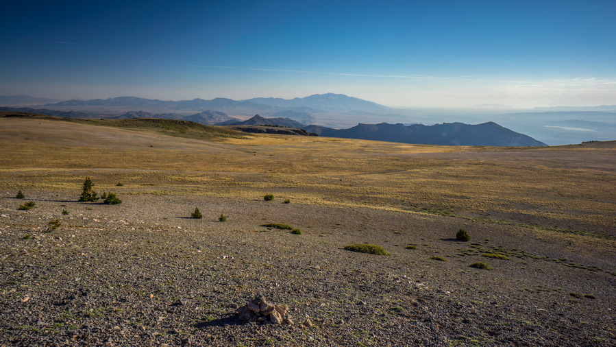
- Route Difficulty – 8
- Scenic Beauty – 9
- Solitude – 9
Video: Ruby Mountains, NV – High Route Hike Lamoille Canyon to Seitz Canyon
Ruby Mountains Hike Maps
Here’s the caltopo map of the Lamoille to Seitz Canyon High Route Hike:
Download GPX file for the Lamoille to Seitz Canyon High Route Hike
Pre-Hike Planning Notes
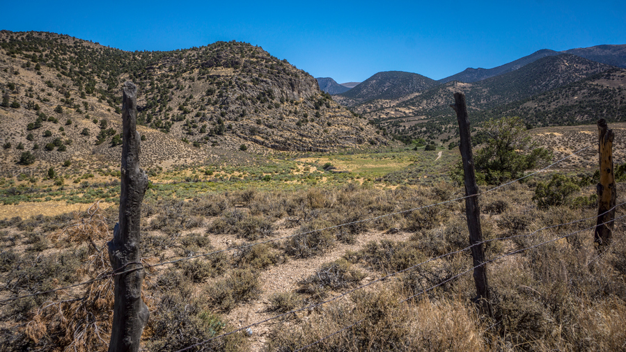
There are no fees or permits required to hike in the Ruby Mountains. Thomas Canyon and Terraces Campgrounds are available in Lamoille Canyon to camp the night before/after your hike, or simply pull off the road and camp in the National Forest land. You should also be able to camp in a van/camper at the trailhead for one night, there was nobody there to check or bother us. Spring Creek is the nearest anything, and 30 minutes away is Elko which is a big town for Nevada.
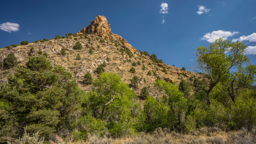
This hike is a route that I wanted to do on my 2020 Basin and Range Trail thru hike, but wasn’t able to fit in, logistically. My route along section 6 of the BRT ended at Roads End Trailhead in upper Lamoille Canyon. The route we will hike here is a route that connects upper Lamoille Canyon with Seitz Canyon, leading to the Powerhouse Trailhead in lower Lamoille Canyon. This route should be very scenic, and will offer a spectacular finish to an already great section of the BRT. The Ruby Crest Trail was nice, but I have a feeling this will be nicer.
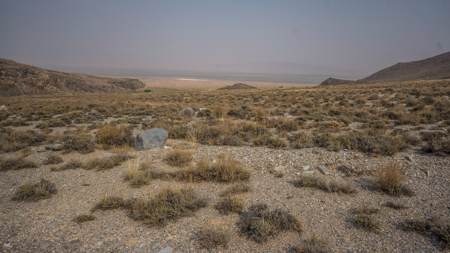
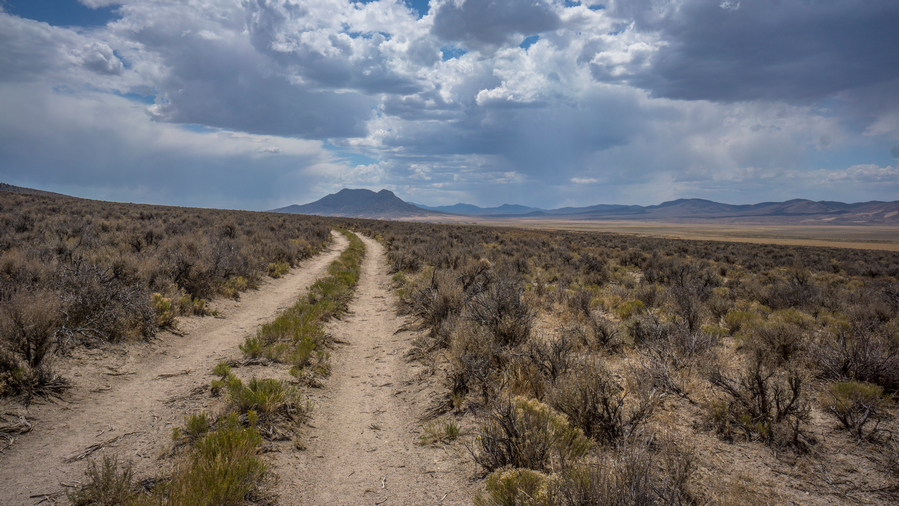
This route is almost entirely off-trail. There were only a few sections of this route, like in Seitz Canyon, where a trail is marked on the map. On the ground though, it barely existed. Just a fading trail that hasn’t seen maintenance in decades. In other words, most of this route is off-trail, and there is some bushwhacking involved… mostly in Seitz Canyon. With that said, it’s an awesome route that is challenging, rewarding and gets you off the beaten path in the Rubies. The Ruby Crest Trail gets most of the traffic in the Rubies, but there are many other great spots here, such as Echo Lake.
This hike can be done a long day hike, but it would be best to split this hike up into two days, camping at Echo Lake. There are multiple excellent campsites along Echo Lake.
Three final things:
- Beware of the private land at the entrance to Seitz Canyon. That’s why the route goes along the hillside at the end to reach Powerhouse Trailhead. There is an active ranch here with a few homes.
- This hike can be done as a day hike, but it may take all day, as it did for us. Make sure to bring a headlamp, just in case. We wish we did…
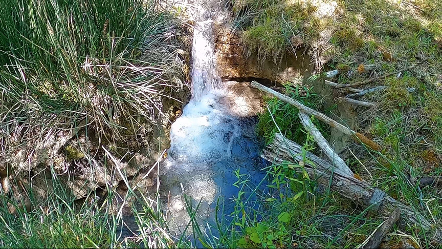
- Water is abundant, you won’t hike more than a few miles without it.
July 17th, 2021 – Ruby Mountains, NV High Route Hike Lamoille Canyon to Seitz Canyon
Miles Hiked – 19.28
Elevation Gain – 5,592′

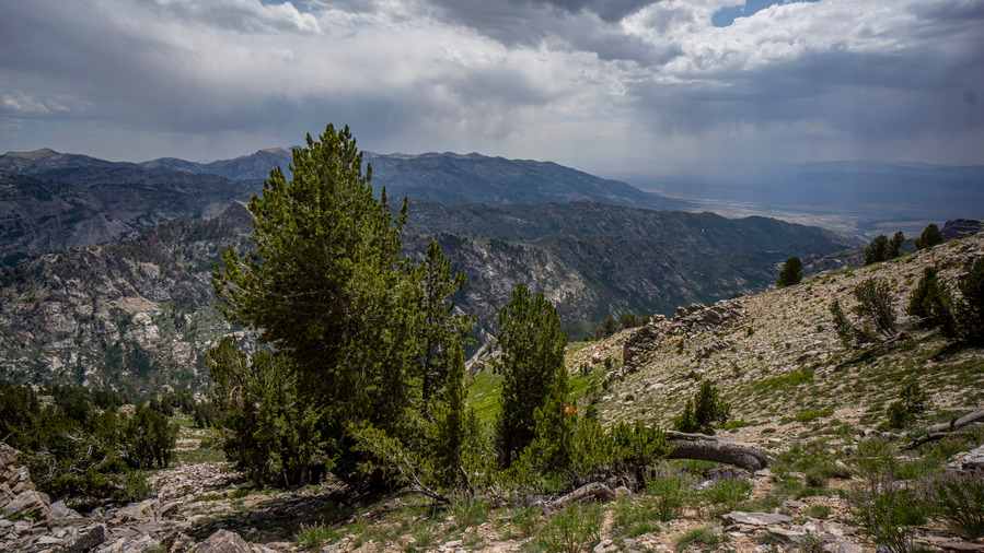
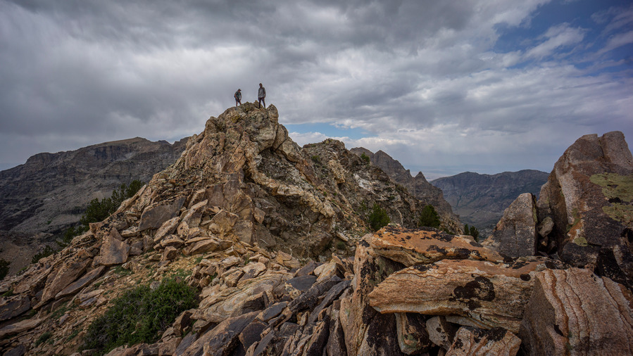
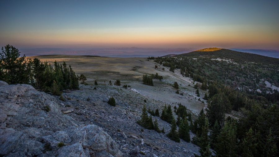
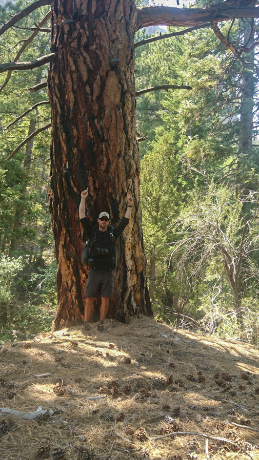
Sam, Ken and I above Echo Lake
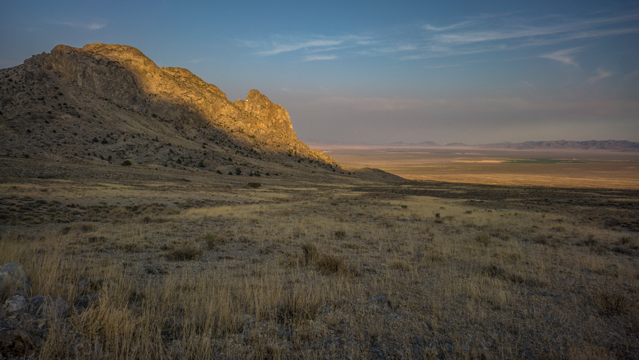
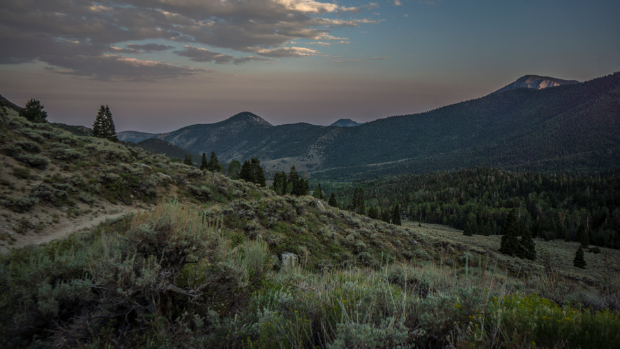
My friends Sam and Ken (2020 CDT thru hikers) will join me for this hike. Last night, we slept off the road in National Forest Land near Camp Lamoille at the entrance to Right Fork Lamoille Creek Canyon. Descent spot, good views of Lamoille Canyon especially at sunset.
In the morning, We drove Ken’s Explorer down to the Powerhouse Trailhead in lower Lamoille Canyon, then drove my van up to Roads End Trailhead in upper Lamoille Canyon. We’ll walk back to Ken’s Explorer today, and then he’ll drive me back up to Roads End to get my van.

Wildflowers in Lamoille Canyon
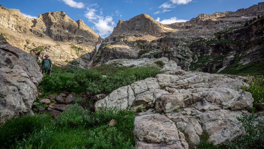
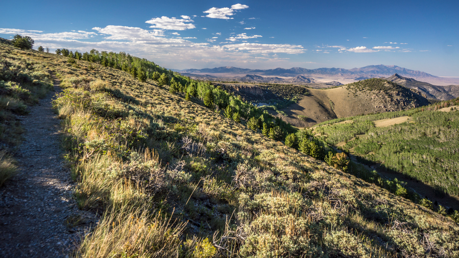
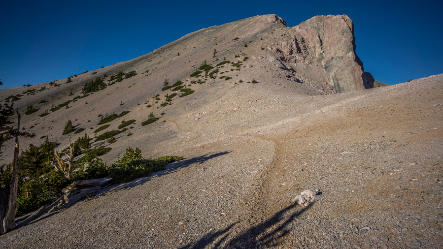
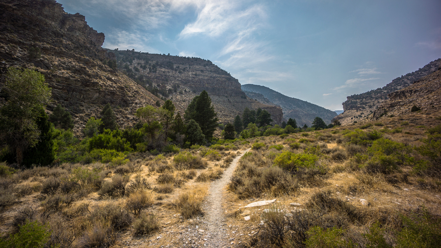
We left the trailhead around 8am following a trail up Lamoille Canyon. Soon enough, we realized this one was taking us up to Dollar Lake instead of Lamoille Lake. We began hiking off-trail sooner than anticipated, and headed for a horse trail that runs higher up the hillside in the canyon. I know this, because that’s the route I hiked down from Liberty Pass last year on my BRT thru hike.
The off-trail stuff here was mostly our fault for not taking the horse trail in the first place. I should have known better. Now, we spent some time walking through tall bushes and grasses, thankfully not crazy thick.

Hiking the horse trail up Lamoille Canyon
We hit the horse trail and followed that a ways uphill. We stopped for a quick break at the spot where we leave the horse trail and begin out hike uphill to our off-trail pass below Snow Lake Peak, leading over to Thomas Canyon.
Sam had just flown to the US from England a few weeks ago, and had bought some cheapo Walmart shirt to hike in for the summer. It was a long sleeved, collared shirt, the kind your cheap dad might wear when he’s forced to dress up. Ok, me too. I joked with Sam about this, and the need for a tie to complete the ensemble. After all, it looked like he was here for a business interview. Well, from the waist up, anyways.

Thankfully not like this the whole way
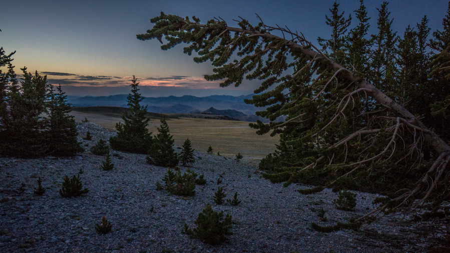
View over upper Lamoille Canyon
Nearing the top of the pass
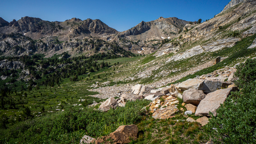
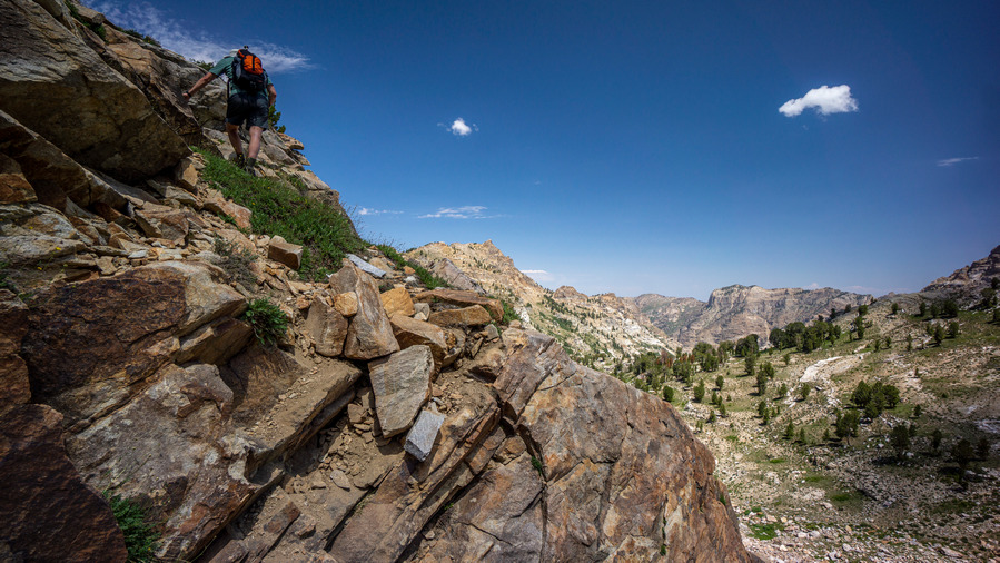
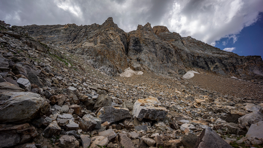
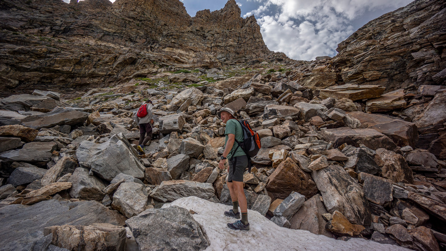
The route up to the pass was steep and had us winded, but it was an easy walk. No bushwhacking, no huge extended boulder fields, it was mostly just a steep incline.

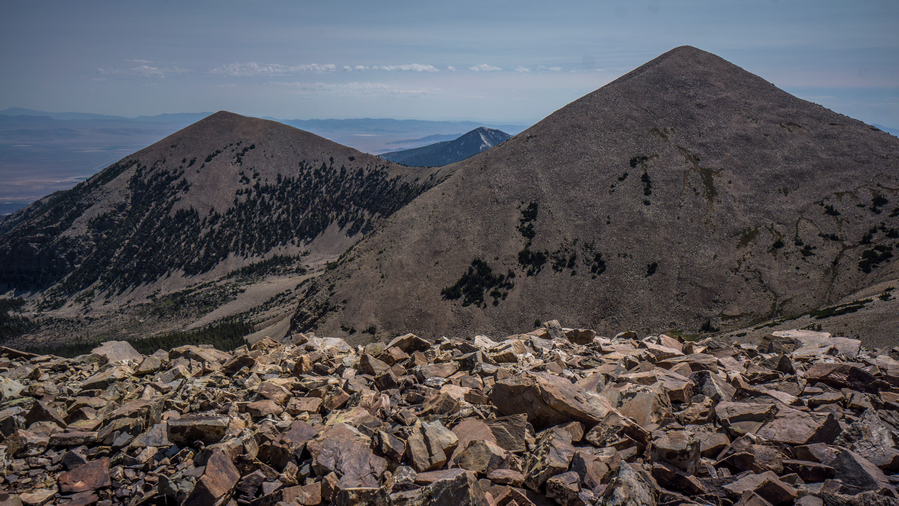
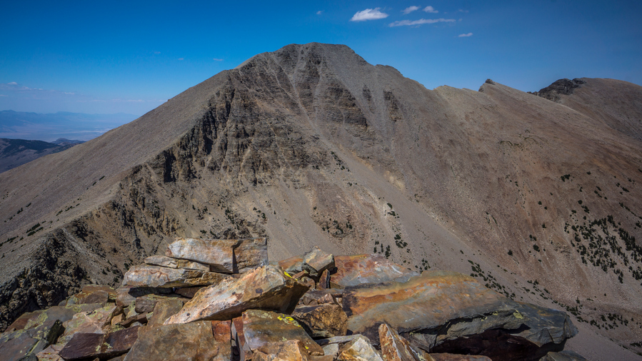
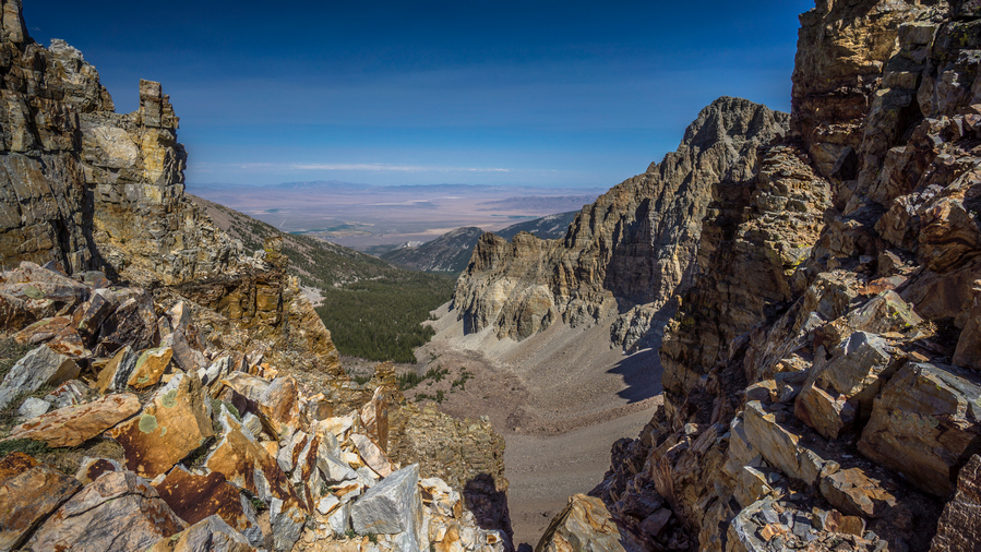
View of Snow Lake Peak from unnamed pass
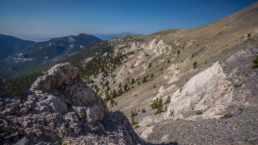
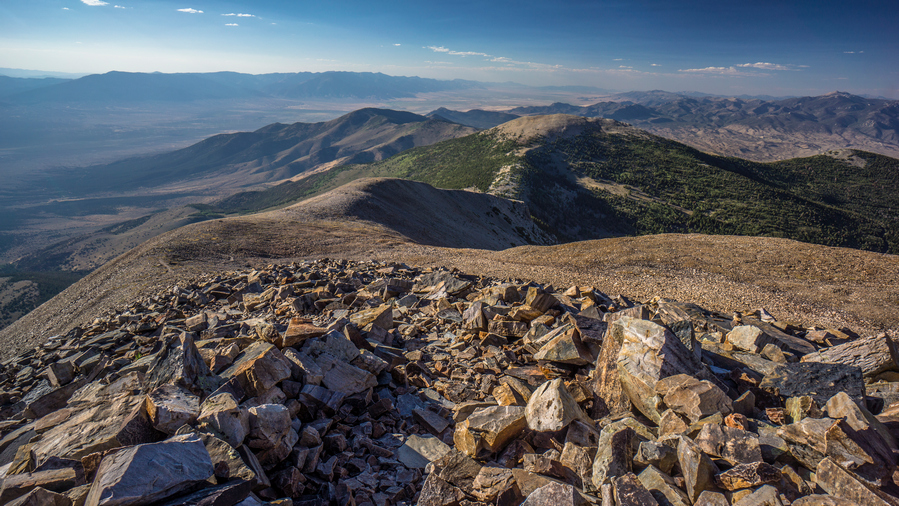
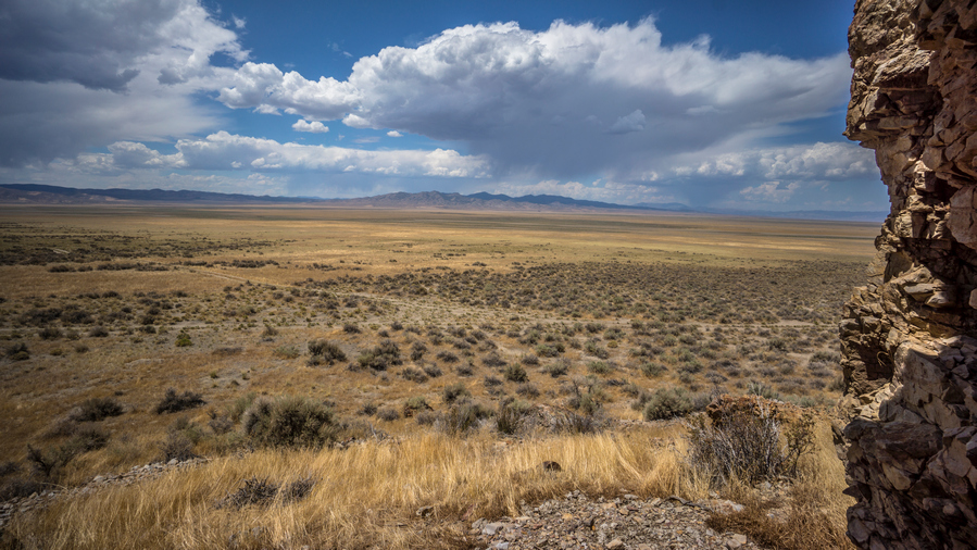
At the top of the pass, we enjoyed great views down into Lamoille Canyon and Thomas Canyon. To the south was Snow Lake Peak. The Snow Lake Peak was eroding was very obvious, and we joked that the Forest Service needed to come out here and “repair” these crumbling mountains. “A few more years and we won’t even have a Snow Lake Mountain”. Ha!

Full House Peak and Thomas Canyon
We stopped for a break on the pass, soaked in the excellent views and scouted our next move. The plan was to stay high up on the ridgeline and contour around the mountainside towards Mt Fitzgerald. It looked kinda steep though, and we contemplated taking a route a bit lower, meaning more elevation gain and climbing.

Water flowing in upper Thomas Canyon

Snow Lake Peak

View down Thomas Canyon to Thomas Peak
The descent form the pass into Thomas Canyon was steep, but short. Below the pass, a green and grassy patch of land with water flowing through it. A nice hike here.
Finding our way around the mountainside
Ken above on our route uphill
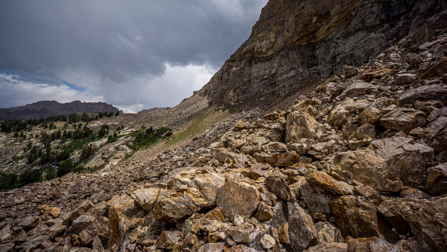
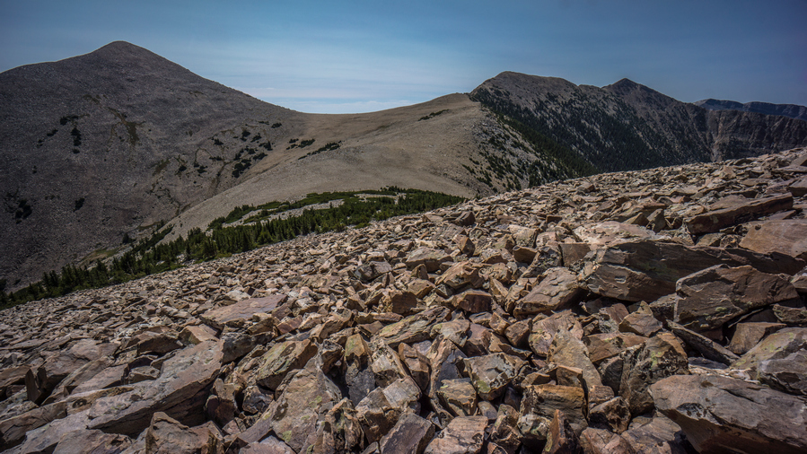
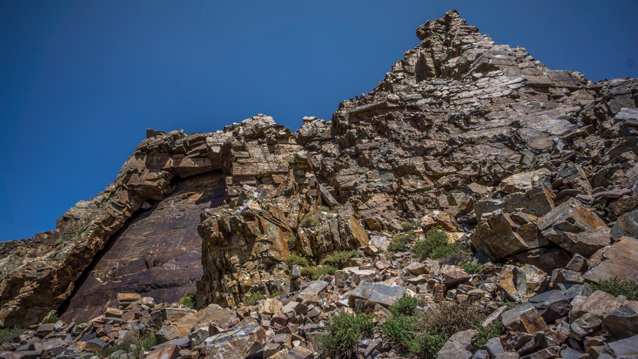
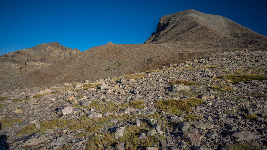
Next we climbed back up in elevation some to reach our desired contouring line. This was intermittently hard/easy. We’d be climbing up steep, loose rock and boulders one minute, then walking short sections of flat, easy going terrain. All with great views of Thomas Canyon, though.
Boulders.
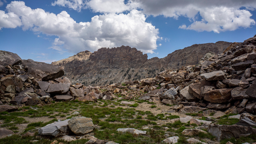
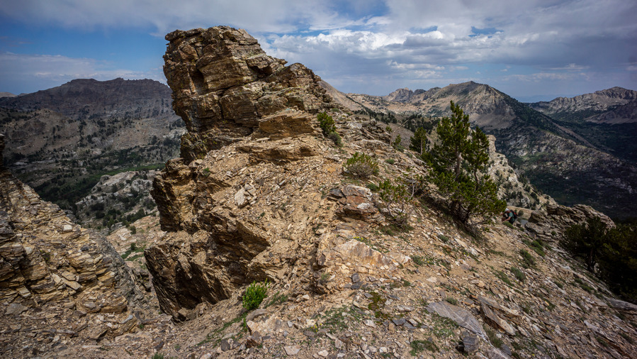
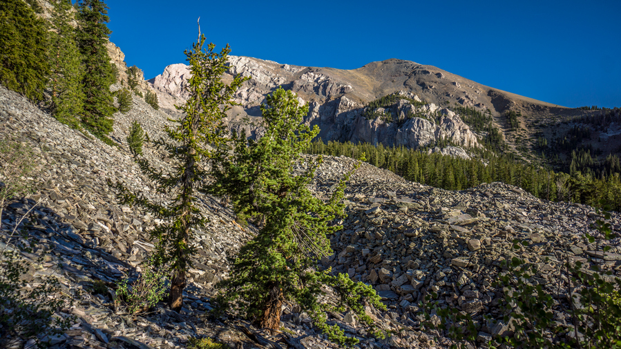
When we rounded the northwest-facing ridge before Mt Fitzgerald, we were met with an entire mountainside filled with boulders. Not what I like to see, but Sam loves the stuff. It was a big view though over Thomas Canyon. It was very green down below, but we were well above that, in the boulders.

A fine gulch

Upper Thomas Canyon views

Outstanding scenery in upper Thomas Canyon
The mountain scenery here was very impressive. The hiking here is more akin to a Sierra High Route or Wind River Range High Route. We are surrounded by towering mountain peaks and rock faces, in a sea of boulders. Slow going, but worth it.
Hiking below Mt Fitzgerald

Directly below Mt Fitzgerald was an imposing place to be. The peak towered above us, as we worked our line around the base of it. Even through the boulder fields along the slopes, we routinely cross trickles of water and small streams. There is no shortage of water here.

Ken hiking the boulder field
View across Right Fork Lamoille Creek Canyon to Mt Gilbert
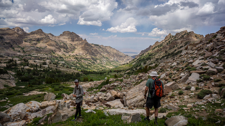
Sam and Ken hiking into upper Right Fork Lamoille Creek Canyon
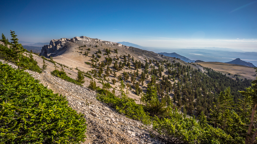
After Mt Fitzgerald, we went up and over a ridgeline separating Thomas Canyon with Right Fork Lamoille Canyon. The same excellent scenery extends into this canyon as well. Superb views here.
I came across a pile of a few boulders that had some minerals that caught my eye. I’ve been seeing a lot of large books of mica around, but that was it until now. Here though, in upper Thomas Canyon below Mt Fitzgerald, I found garnets. They were embedded in the host rock though, and I couldn’t do much with them without tools to extract them. Still, a cool find. Fun fact, the early explorers who first passed through the Rubies named them the Ruby Mountains because they thought these garnets were actually rubies. And now, I can see why.
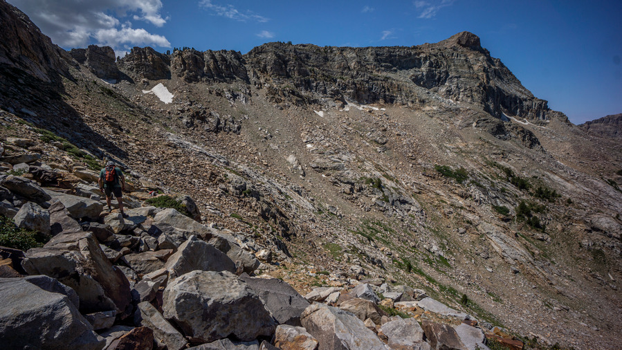
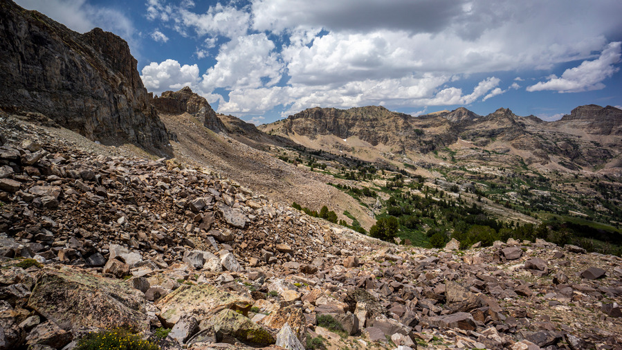
The route we’ve traversed so far
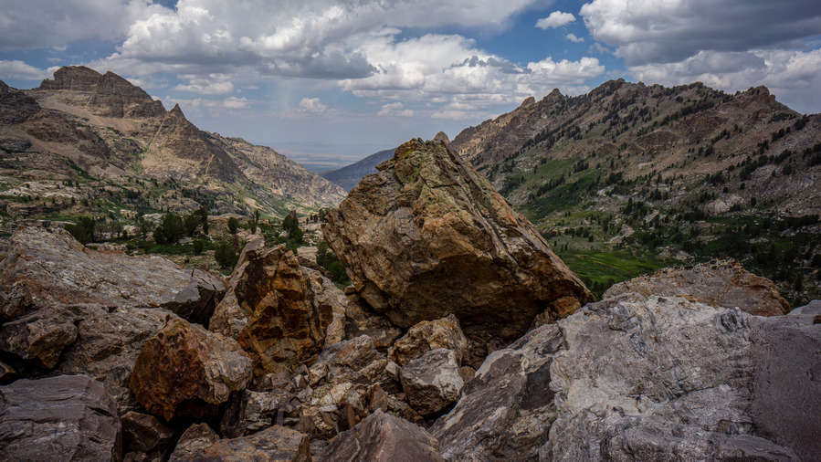
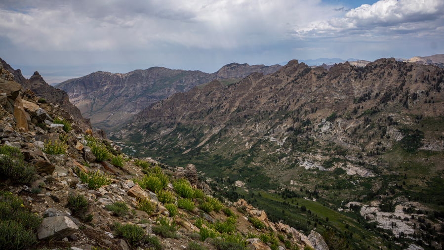
Right Fork Lamoille Creek Canyon
Right Fork Lamoille Canyon continued to impress us the entire route around its upper slopes. We have been walking mostly on boulders for quite some time now, though, and it’s tiring.
View from the pass

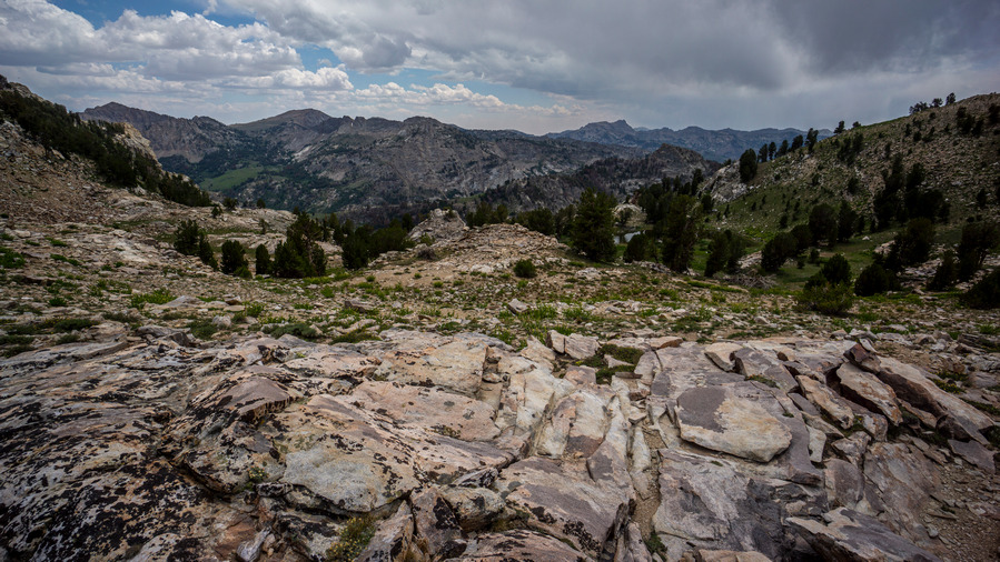
View west to No Echo Knob and the ridgeline we’re about to walk
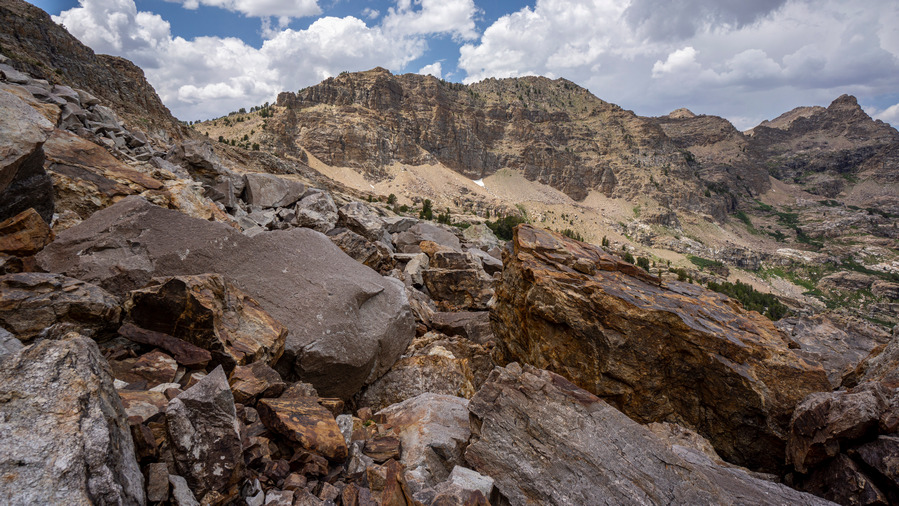
Eventually, we reached a saddle in between peaks 10,528′ and 10,882′, at the top of Right Fork Lamoille Canyon. The wind was really picking up now. We followed the ridgeline towards No Echo Knob.

Sam and Right Fork Lamoille Creek Canyon
View west, Ruby Mountains and Lamoille Valley
Cool ridgeline
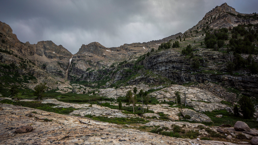
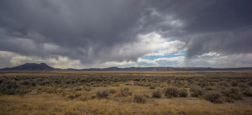
Along the way up to the ridgeline, we enjoyed excellent views of the Ruby Mountains. There were some sheer cliffs to stand at the edge of overlooking Right Fork Lamoille Canyon. It looked like the potential for rain now, although nothing directly nearby threatening us at the moment.

Sam on top of the ridge
View of the ridgewalk ahead of us

Looking back at what we’ve traversed so far
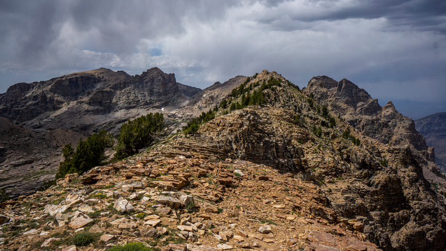
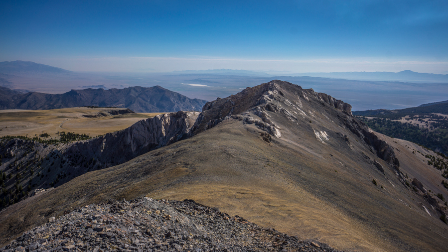
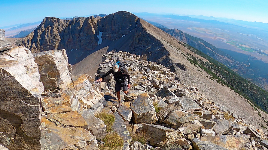
At the top of the ridge leading to No Echo Knob was perhaps some of the best distant views of the day. It was our most proper ridgewalk of the day, as well. The views were just stunning in every direction. A truly magical place.

Sam and Ken hiking the ridge to No Echo Knob
View over Right Fork Lamoille Canyon
Sam and Ken on No Echo Knob
We summited No Echo Knob, high point of the ridge. It was here that Sam, hiking for the first time in Nevada, realized the hidden gem that he’d stumbled upon. “Why is it that so few people visit this place”, he wondered. Nevermind why, we have it to ourselves today.

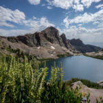
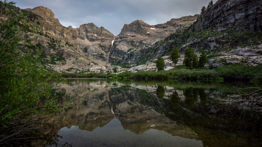
First views of Echo Lake. Wow!


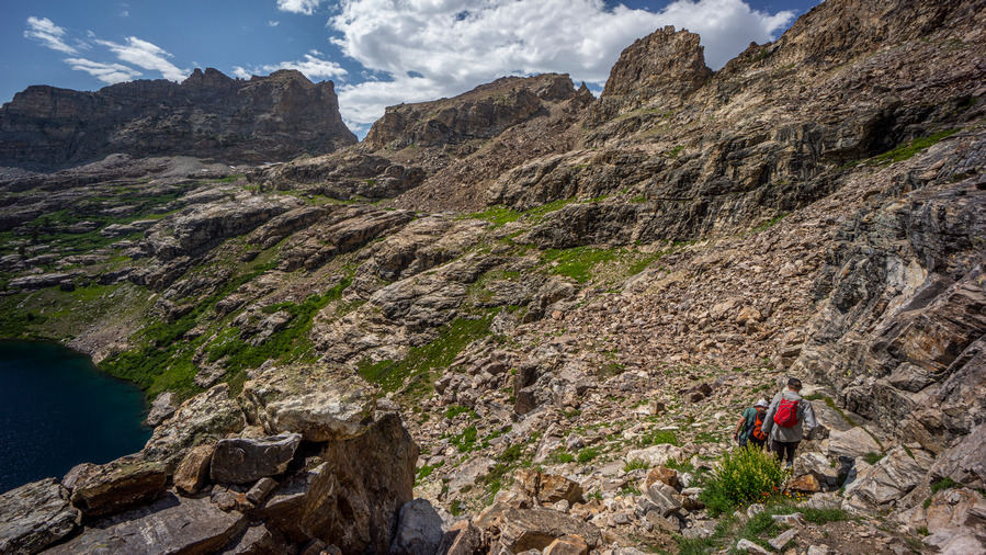
Sam and Ken above Echo Lake
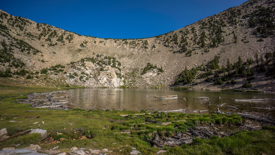
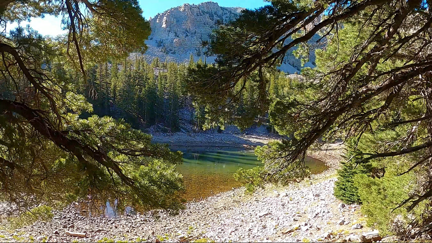
The descent form No Echo Knob to Echo Lake was outstanding. Echo Lake is hard to ignore; it’s surrounded by a tall, steep cirque of mountains, and the lake itself is a deep blue color. It’s large and looks to be deep. It certainly commands your attention, and respect.
A pretty good route can be seen ahead
Our original plan was to drop down to the lake to traverse around it’s east shore, but from our elevated position, we saw a better route. We’ll stay higher above the shoreline, and contour around the lake. This way, we minimize our total elevation gain traversing around it. There looks to be a route we can follow, but who knows. Let’s try it!
Hiking around Echo lake
The entire hike around Echo Lake was stunning. The views were constantly changing, with seemingly better and better angles and lighting. The hike itself wasn’t too hard. There was no real path to follow, but it was easy to pick from numerous lines that traverse the east side of the lake.
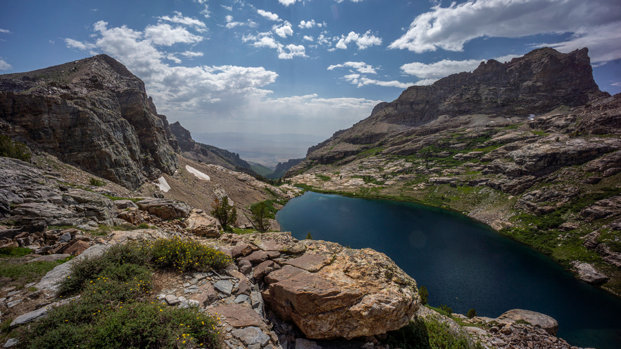
Looking down Echo Canyon above Echo Lake
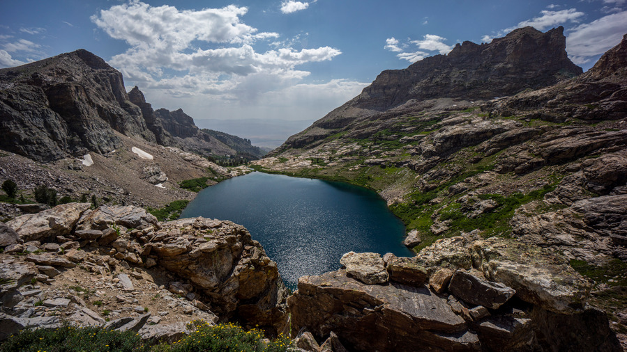
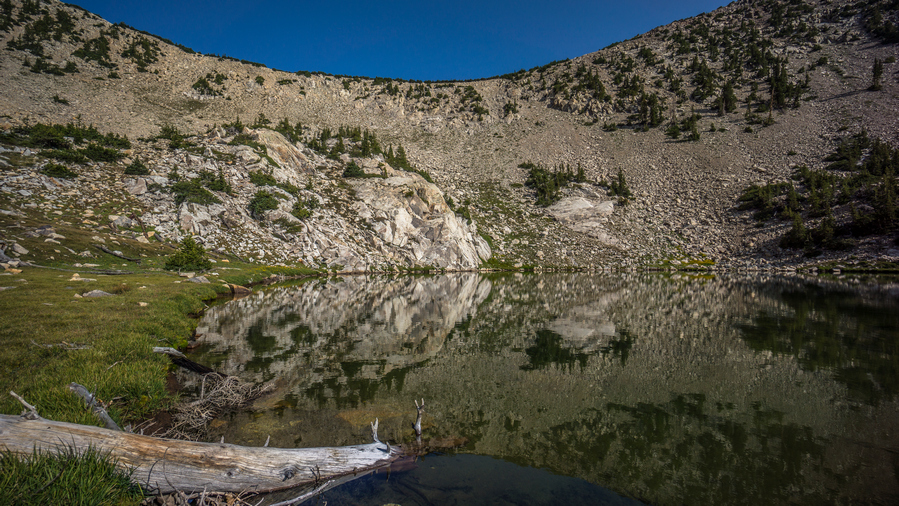
Echo Lake
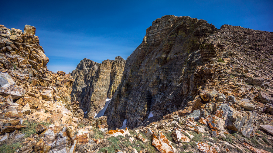
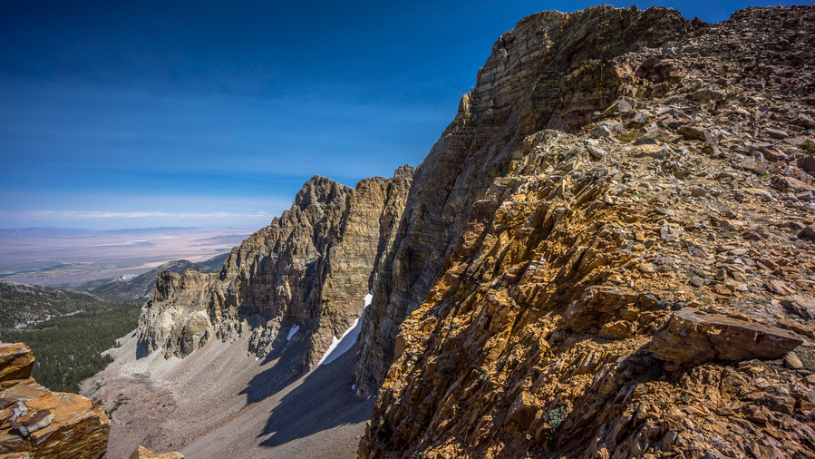
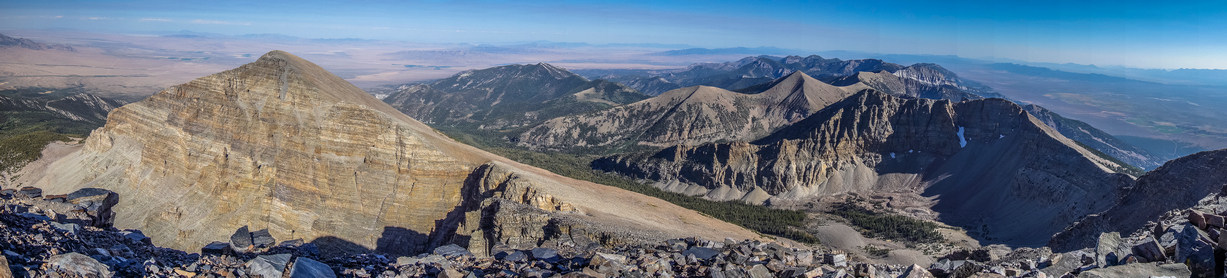
The views from the extreme east side of Echo Lake were probably the most impressive to me. Here, the lake looks the biggest, and one has a great view down Echo Canyon. Lining Echo Canyon is Mt Silliman, peak 11,330, and Echo Box Peak. These peaks, and the ridgelines leading up to them, form huge, towering walls above Echo Lake, making this the beautiful place that it is.

Climbing up to the pass

Echo Canyon
We stopped along a small creek for a break. There was a great camp spot here, overlooking Echo Lake. If only we were camping!

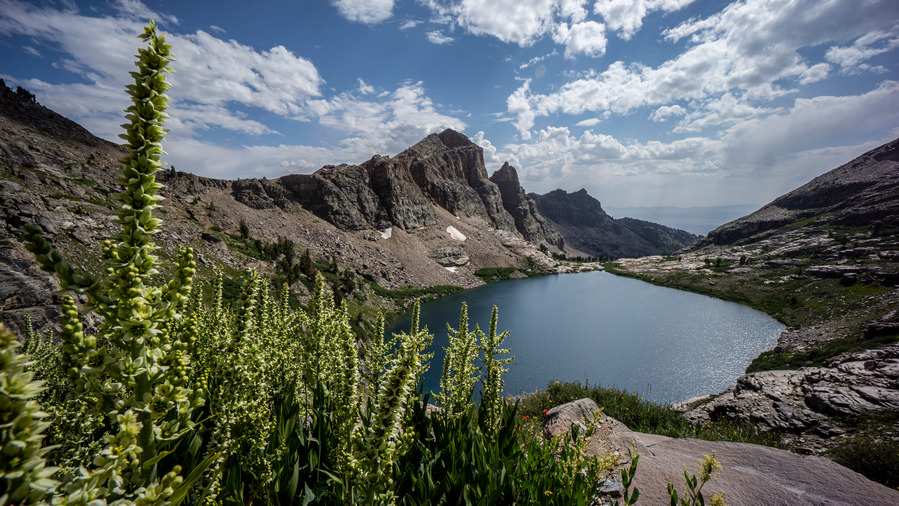
Echo Lake and Echo Box Peak

After the break, we continued traversing around Echo Lake. Of course, we had to stop and test the echo properties of Echo Canyon at some point. The echo is indeed impressive! We also took the time to test out our skiing skills on some of the snow slopes. I made a successful run down a hundred feet or so, which is always fun to do in shoes.
Ken and Sam ascending the pass below Mt Silliman
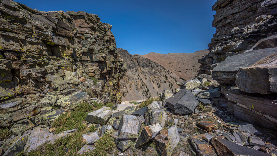
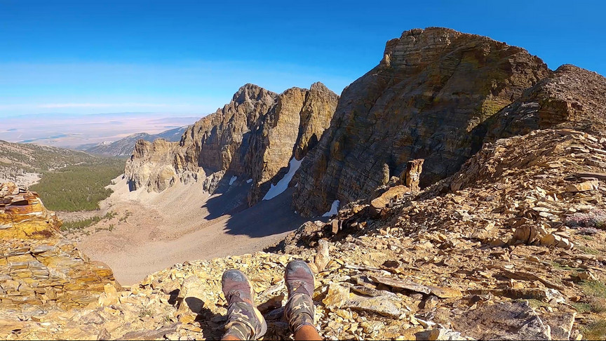
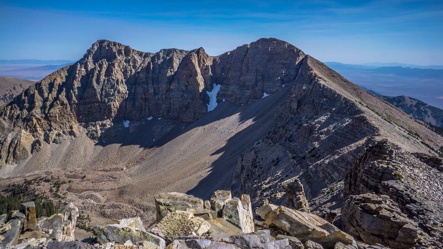
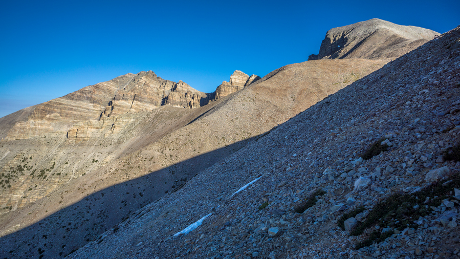
After contouring around Echo Lake, it was time to head up to a pass below Mt Silliman. From here, it was a climb of about 350′ to the top. It was a very manageable climb up boulders, and we made quick work of this one.

View into Seitz Canyon

Mt Silliman

Echo Box Peak from pass
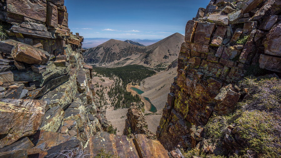
At the top of the pass, we had our first view into Seitz Canyon. Nice, but the north face of Echo Box Peak on the Echo Canyon side was more impressive.
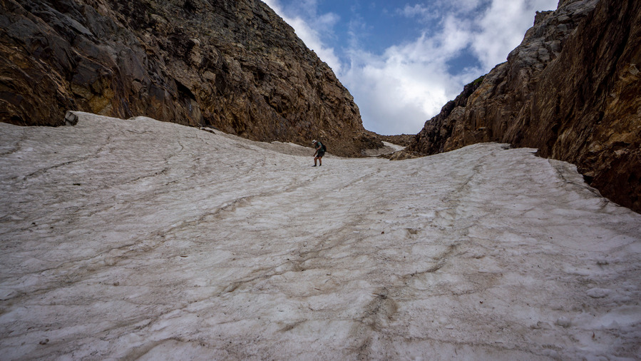
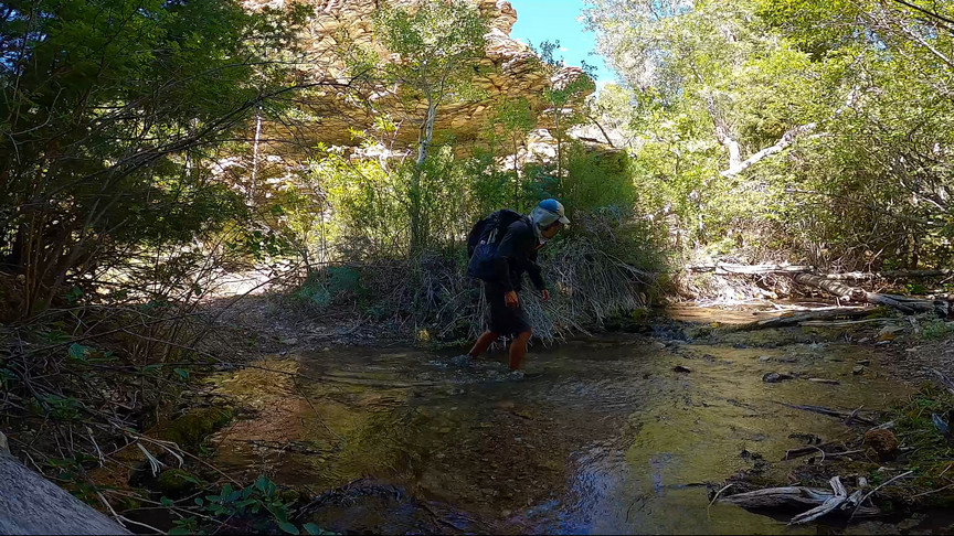
Now for the route down into Seitz Canyon. Our plan was to contour around the north face of Mt Silliman and work our way down a diagonal line Seitz Lake below, avoiding the steep and narrow Seitz Canyon route which is more direct. I thought it would be best to avoid Seitz Canyon when planning this route from home, based on the slope angle shading/steepness of the grade, but now that we’re here, it does indeed look doable. Sam, Ken and I discussed our options, and we settled on the direct route down Seitz Canyon.

First we need to work down to the snowfield
So from the top of the pass, it’s 1400ft down this steep, narrow chute filled with snow, ice and boulders. We traversed a sketchy section of loose boulders just to get down to the snow field in the center of the canyon. Past the boulders, we take our first footsteps in the snow. The slope angle is steep, seemingly close to 45 at times. Sam went first, kicking steps on his way down. I went next, and Ken at the top.

Ken making his way down

View down Seitz Canyon
The snow was mostly soft enough to kick steps in. Ken and I had the advantage of using Sam’s steps to walk down into, without expending as much energy as Sam. However, it was still slow and tedious. I took out a trekking pole for the first time today, almost never using them anymore, except to support my tent. But here, a trekking pole was great to have. I used my upper hand to balance myself in the snow as I hiked down, which makes your hand quite cold soon enough. So then, I’d switch sides, putting my opposite leg first as the leading leg, giving my other hand a chance to warm up again. Yeah, didn’t think of bringing gloves for this hike. Nor micro spikes or ice axe, but having them here would have been nice.
Ken descending Seitz Canyon
No way around it, it was slow going down Seitz Canyon. Descending the snow field was enough to get your heart rate up a bit, but also not feel overly worried about the dangers of falling. Maybe that’s just my confidence in the snow. Either way, this slope was not glissade-able… safely.

Nearing the bottom of the second snow field
There were two sets of snow fields in the chute. The upper one was the steepest. There was a short section of boulders separating the two snow fields, and then it was on to descend the lower one. Sam was below and hollered up that it was icier than above. Ken, having hiked with Sam on the CDT in 2020, joked that Sam doesn’t kick great steps anyways. It was fun to see the dynamic between these two, it was the first time I hiked with them together.
View back up the boulder chute we’ve been climbing down

Sam near the bottom of Seitz Canyon. The end is in sight!
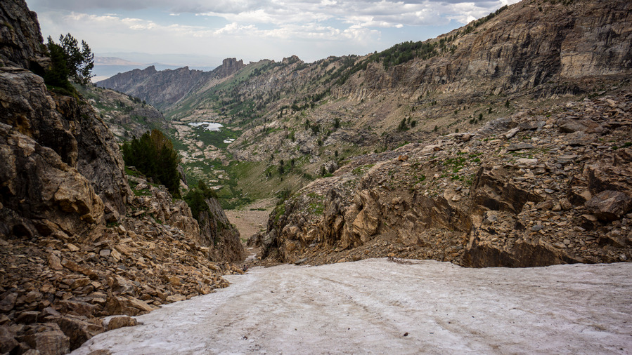
Past the second snow field, we were roughly halfway down the chute. It’s all steep boulders here now, and I wondered which I would rather have; the boulders, or the snow. I say, the snow.

Bottom of Seitz Canyon. Glad to be out of this one!

Flat ,open ground!

View back at the chute we came down
We took a break near the bottom of Seitz Canyon, and I ate a snack. I hadn’t eaten in several hours, and really needed the boost. I was indeed feeling better now. We exited Seitz Canyon on a bit of a high, looking back at the increasingly crazier looking chute we had descended. I let out a loud scream into the canyon, which had an incredible echo to it with a delay of a few seconds.
Can’t stop looking back at that view!


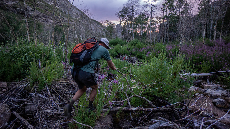
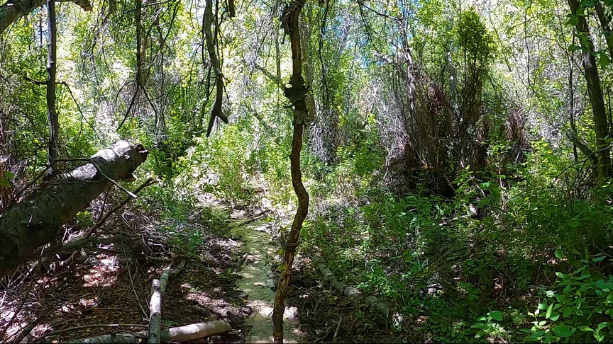
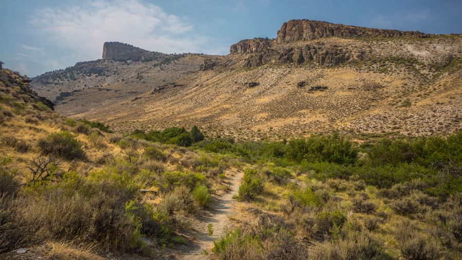
As we covered distance downhill now and entered a flat, open valley above Seitz Lake, we entered a new phase of the hike… bushwhacking. There will be a lot of it in Seitz Canyon, unfortunately. The upper section of the canyon is thick and wet. The views looking back were outstanding, though!
Seitz Lake
Seitz Canyon and Ruby Dome
The bushwhacking continued to Seitz Lake. There really wasn’t any good access to Seitz Lake, surprisingly. The shoreline was thick with vegetation. The view sure was nice looking across the lake and up the canyon, though. We assumed the trail would become more obvious downhill from here, but that was wishful thinking.


The most perfect sunset
Below the lake, we continued to be fooled into thinking we had stumbled on the trail every time we came across the slightest hint of a beaten path. However, the setting sun created an extremely pleasant sunset this evening. We had a few sprinkles briefly, but the cloud cover provided the backdrop for those oranges and reds.


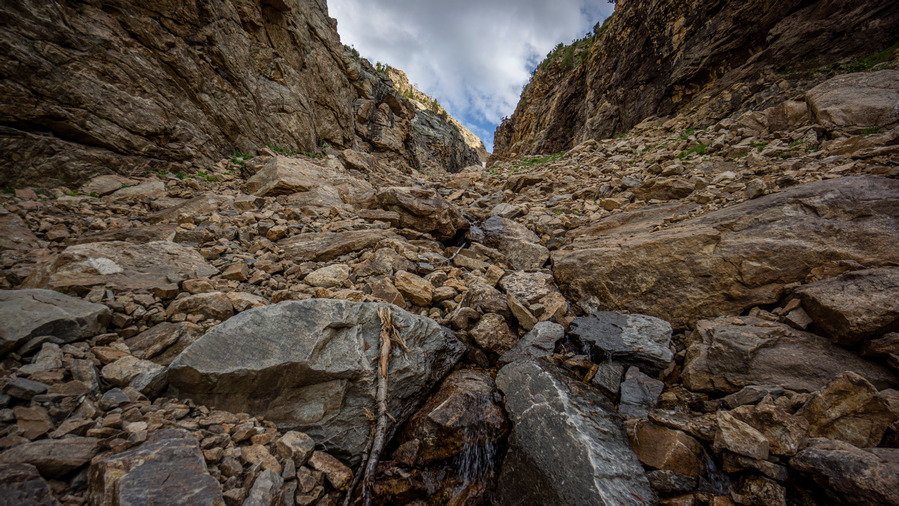
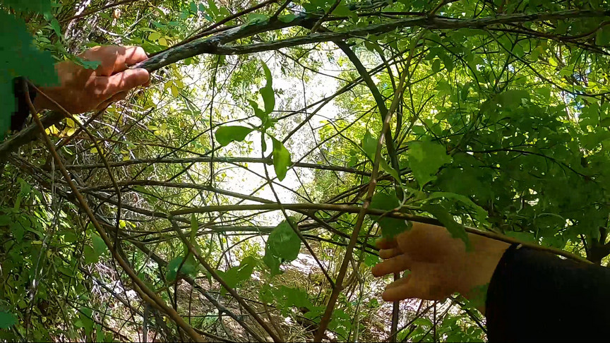
We came across a good sized waterfall around the 8200′ mark as we continued to hunt for the trail. We’re right on it according to the map, but we see nothing 95% of the time. It’s a steep descent down the hillside in thick brush. We reach the creek below and stumble upon a ribbon on a tree. You can tell the forest has been cleared out a litter wider in places, but that it’s overgrown for decades without maintenance.

Bushes, as far as the eye can see, just begging to be whacked
The trail fades in and out and we continue to doubt our ability to stay on whatever the trail is supposed to be. We continue to surprise ourselves though, and routinely see signs that we are on the right path, even if the path is now gone. We saw more ribbons on the trees, scattered randomly along the way, but it’s still a bushwhack.
Ken fighting the brush in the creek bed
We hit a creek bed that we followed for a while, which was dry. However, it was full of tress, plants and debris that made this an obstacle course.
Losing light now, Ken stumbles in the thick brush and falls. He’s alright, but a symbol of how were are all feeling… tired. After a helping hand, he’s up and at it again.
Day turns into night as we continue hiking down the canyon. Sam and I have our phones for light, and Ken also has a headlamp. So, one headlamp for the 3 of us. We hit a slightly better path lower down in the canyon, then some type of 4×4 road.
Now we reach the lower reaches of Seitz Canyon, or Rabbit Canyon as the map now marks it here. This is where the private property begins. Following the road out into the valley means walking through private property. There is a ranch here too, and the road goes right behind a couple of homes. So, to avoid them you must contour around the hills above the private property. Fortunately, in the lower reaches of the canyon here, it’s not thick and green, it’s drier and more barren. Open and easier to walk. Still, it’s dark now.
Pick your poison here… walk the hillsides in the dark or drop down to the private property after passing by the homes and walk a nice road out to Lamoille Canyon. I won’t tell you what to do. Just be aware of the property lines, is all. Use the caltopo app and turn on the public lands layer.
We reached Lamoille Canyon sometime around 10:30pm, having hiked a solid two hours in the dark. That’s a 14.5 hour day of hiking for us. It was a very dark night, too. We could barely see Ken’s Explorer until we where right up on it at the Powerhouse Trailhead.
Ken drove us up to the Roads End Trailhead, and we slept in our vehicles for the night. What a killer hike!!
Lamoille to Seitz Canyon Route Verified As New Leg of the Basin and Range Trail
The route we hiked today was challenging, but repeatable. It was not technical nor was there any real exposure. There is plenty of water, excellent camping and outstanding views. Plan to bushwhack Seitz Canyon, though.
So, I am happy to report that the hike we did today will become the new “standard route” for the Basin and Range Trail to end Section 6. The alternate route would be to hike down Lamoille Canyon, or simply hitch down. The route we hiked today was easily equal to the scenery along the Ruby Crest Trail, if not greater. And not only greater scenery, but far more rewarding. Anyone can hike the well-manicured Ruby Crest Trail, but the off-trail stuff we did today provides a greater adventure in my book. The standard BRT route will still hit the Ruby Crest Trail in it’s entirety (except the final mile or two to Roads end trailhead in upper Lamoille Canyon), and so this new route will only enhance the Basin and Range Trail hiking experience.
Related Images:
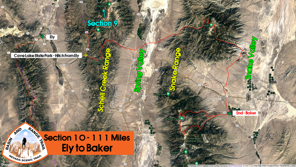
Basin and Range Trail Thru Hike 2020 – Section 10: Ely to Baker
Basin and Range Trail Thru Hike Section 10 Map
Video: Basin and Range Trail Thru Hike Section 10
In addition to this trail journal, I also filmed my Basin and Range Trail thru hike. I’ve produced a detailed series (11+ hours runtime) documenting this thru hike adventure, the product of over 1,000 hours of video editing. I highly recommending watching the Basin and Range Trail vlog series for an in-depth look at thru-hiking the Great Basin and central Nevada.
Basin and Range Trail Thru Hike Section 10 Journal
Day 63 – August 2nd: Deerhead Canyon, Mt Moriah Wilderness, The Table, Snake Range
Terri called me at 7:30am and asked if I was ready. I said no, I was sleeping because you said you wouldn’t be here till 9. I said give me a half hour and I’m ready.
Terri and her boyfriend Ronnie picked me up from the Motel 6 parking lot, right outside my door. She was driving a really shitty Ford Escort from the 90s. I guess Raj had bought her the car, I guess you got to do what you got to do to get people to work for you at the motel in a small town. The trunk was held down with bungee cords, there was a big gash in one of the side doors that prevented the window from operating properly, no AC, shocks were completely gone and it leaked oil. But hey, it only needs to get me an hour away!
We stopped at McDonald’s for breakfast, then the Love’s station for gas and oil, as well as drinks. I filled up her gas tank, which was only 15 bucks. We agreed on a hundred bucks for the ride, not bad for 2 hours of work on her end.
The drive was pretty slow, Terri is a slow driver, have to nurse that car I guess so it doesn’t blow up. Decent drive, got to see some different country and a view of Spring Valley, Mount Moriah and Wheeler Peak.
Once we turned on to White Pine County Road 36, the dirt road going into Spring Valley, the going was pretty slow. The dirt road itself was in great shape, but Terri’s car was not. With no struts, she was going like 7 miles an hour the whole way. Still the dirt road section was pretty slow. Lots of windmills in Spring Valley. This is somewhat unusual for Nevada, I have not seen this yet.
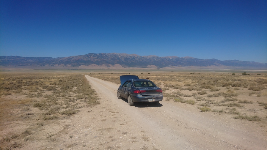
Shuttle ride to Snake Range
It was even slower when we turned onto the next dirt road that let us to Deerhead Canyon. Eventually, we reached a cattle guard along and open fence line. There was a spot to turn around here, so I said this is good enough. They were a bit apprehensive to drop me off in the middle of nowhere, in this kind of heat, but I assured them I’ll be alright. I paid her the $100, they checked their oil, and they were on their way. Alone again, for the final section.
There was indeed a ranch, or at least some type of home, down in the ditch along the road. I was glad to see that the road was not blocked by no trespassing signs, this public Road went through private land and allowed me to access the public land on the other side. This is not always possible in Nevada, so this was a big win for me.
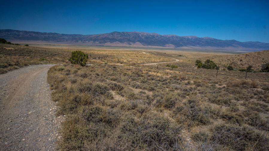
View across Spring Valley to Schell Creek Range
View up Deerhead Canyon
I began the hike up Deerhead Canyon. Before long, I found a spot that had flowing water. Good flow to it actually. This was good, I didn’t have to worry about water today. However, there were signs of cows, and this became more of an issue as I progressed up the canyon.

The canyon is becoming more impressive as I gain elevation
The canyon itself became more green and Lush the higher I went. At first, it was just a Thicket along the creek, but the road was so good that it was no problem. I saw one Sagebrush Bush that was 8 to 9 feet tall, perhaps the largest I have seen on the Basin and Range Trail.

Game trail remains where the road ends
There are several side Canyons that intersect Negro Creek in Deerhead Canyon. Eventually, after a junction with another Canyon, the road pretty much died out. All of the sudden, it was a thick bush whack through thorn bushes long the creek. Then I found a way around it, and the trail was a little better. But it was a trail now, not a road.

Jungle-like hike in Deerhead Canyon
A hidden jungle in the Nevada wilderness
Buskwhacking through thorn bushes
A little further Upstream was where things got really bad. I’m wondering if I missed the main Trail, because the bushwhacking was so bad that I thought the trail was going to fade out completely. Along the creek it was like a jungle. Green, Lush, Vines hanging from the trees. Several Creek Crossings, lots of mud and muddy fields, and at times the trail itself was a flowing Creek. My backpack would catch on everything, all of the branches. This was a major pain, but eventually I emerged into a small field where things cleared out a bit and a better Trail existed.

Interesting rock formations now

Those vertical towers, behind the trees!

Really cool rock formations in Deerhead Canyon
Now, the canyon was lined with interesting rock formations. A lot of Flat Rock stacked on each other. These would tower over the Canyon in interesting ways. Fingers, crags, spires. Even saw a small cave, but I could not reach it without doing some climbing. This was a cool area.
The trail itself did have some maintenance done to it in a few random sections. There were cut logs here and there. There is also a lot of cow shit. It was clear to me that the Rancher at the head of the canyon had done the maintenance himself, so that his cows could reach the high country and Graze there.
One of several creek crossings
Very small waterfall

Difficult route up Deerhead Canyon, but a beautiful hike
The route up Deerhead Canyon continues to intermittently have some path to follow, while crossing the creek and a few small waterfalls, casacdes.
Today was supposed to be 101 degrees in Baker. It was certainly hot, but I felt hotter a few days ago on a climb in the Shell Creek range. I was pleased at how well I was handling the heat today. I took the opportunity to dunk my head in the water every chance I could. Didn’t drink as much water as I thought, though. Typical for me.

Upper Deerhead Canyon

Last water before the climb up to Mt Moriah
Last time the trail crosses the creek, I stopped in the shade to filter two liters of water. One to chug, one to take with me. This gives me 5L to carry. This is enough to get up to the table, Summit Mount Moriah, and come down into Henry’s Creek where I know there’s water.
The route up Deerhead Canyon

Awesome cliffs and rock formations now in upper Deerhead Canyon
The trail almost completely disappeared now as I was in the upper reaches of the canyon. All That Remains is a faint cow Trail through the Sagebrush, and eventually, Aspen. The grade of the trail got a bit steeper here as well, which got me breathing hard for the first time today. The rest of the trail Downstream from here was pretty well graded.

Once at the top of Deerhead Canyon, there is a 4×4 road

Break spot in the aspens
Made it out of the canyon around 5pm. I immediately hit a dirt road, which I was thankful for. Now I have a good road to follow. It was mostly wide open Hills now, slightly rolling, with patches of Aspen here and there. I walked a ways down the road before finding a spot to take a break in the shade and eat.
After a quick break I continued on the dirt road. While walking up this road, a side-by-side was coming down. It was two guys, probably in their 30s, all dressed up and camo. I asked if they were out scouting for Elk, they said no, chasing cows. Well just as fun, I said. They asked what I was doing, and I told them this was day 63 for me on a long-distance hike through Nevada. They made a quick joke about being like a mountain goat, said alright have a good evening, and left.

Mt Moriah view from trail in Big Creek Canyon
View northeast to Snake Valley, into Utah
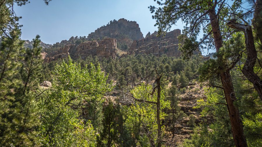
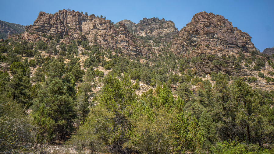
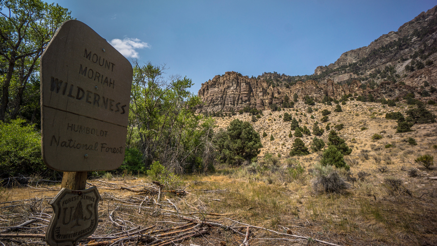
Next I entered the Mt. Moriah Wilderness, proper. There was a sign here for a Trail, Big Creek Trail I think. It said the table, 2 miles. I could see Mount Moriah very well now, the back side of it, the rugged side.
The rugged backside of Mt Moriah
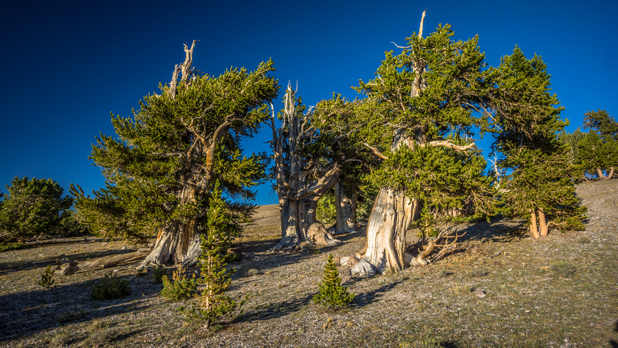
Bristlecone Pine Trees

Look at the size of this tree!
The trail climbs up out of Big Creek Canyon to a a flat plateau at 11,000ft called “The Table”. Near the top of the climb, there is a stand of bristlecone pine trees. These trees were huge! Bristlecone pines are the oldest living organisms on Earth. These trees can live to be over 4900 years old! One was massive, its trunk was wider than the width of my arms extended. Next to it was a tree I called the T-Rex. Big, fat and tall, but with two stubby little branches on the sides like T-Rex arms.
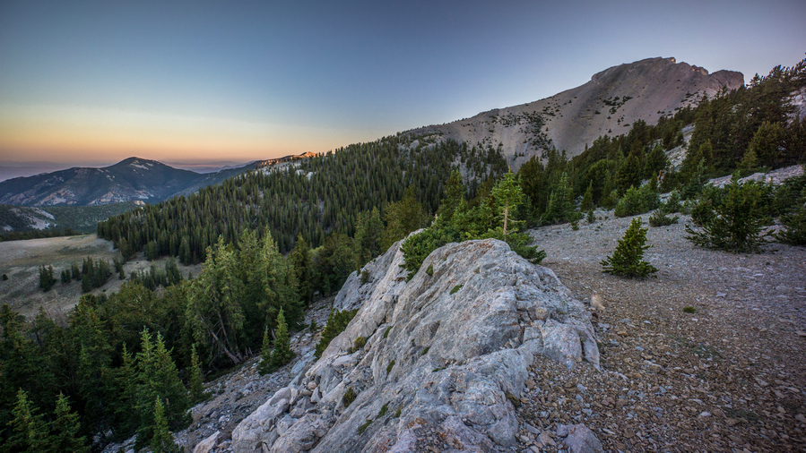
It was 5:30 now, and I had hopes of reaching the table by 6:30 or so and setting up camp. If I could do that, I had a shot at Summit in Mount Moriah this evening. The plan would be to make a base camp, then I could run up the mountain with minimum weight on my back.

Hiking up to The Table
The climb up to the table really wore me out. I had already climbed about 4000 ft today, but this was all on fairly well graded terrain. Now, the trail was extremely steep, and I had 1200 ft elevation gain to go. Found a spring that wasn’t on the map, just like I did in the upper reaches of Deerhead Canyon.

View of Mt Moriah on The Table

Hiking The Table at sunset
Farther along the table, The terrain becomes flat and open, with patches of trees. Great view of Mount Moriah from here. There were several good campsites, but I was intent on camping wherever the climbers Trail up to the summit meets this trail. That way, when I’m done climbing the peak in the morning, I don’t have to backtrack to my campsite. It was 7pm now and I had decided not to go for the summit. Clearly, I didn’t have the time to do it.

Shadows of the last trees

View out into Utah
At one point the trail emerges from the last patch of trees and out into a very open and flat area. Hard to believe I was at 11,000 ft. From here, I could see into snake Valley and into Utah. It looked pretty desolate. But, there’s Beauty in desolation, and this was a perfect example.
Even though the terrain was now flat and open, there was still a bit of a Ridge or High Point on the horizon, even if it was not that much higher than everything else. On top of this high point was a bull elk. Then I noticed another Elk next to him in the shadows. As I moved closer, they ran away. It was around this point when I noticed the first cairn leading up the Ridgeline to Mount Moriah. I found the climbers Trail, so now it’s time to look for a campsite.
View of Mt Morah from camp. The summit is hidden from view
View into Snake Valley and Utah
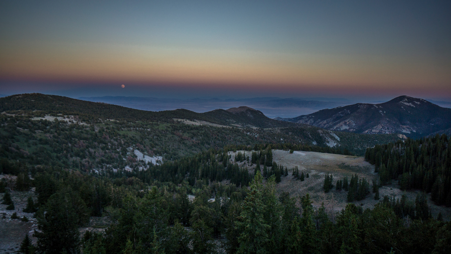
A mesmerizing sight, watching the full moon rise over a massive, desolate landscape
Fortunately I didn’t have to look long. I climbed up the Ridgeline a short ways to a patch of trees, and found a small Rockwall that someone had built to block the wind. I didn’t set up my Camp behind this Rockwall, because the wind was blowing in a different direction, but I still was able to find a pretty good spot here.

Excellent view from camp tonight with a full moon
View from camp
Excellent views to the east out into Utah, as this campsite sits on a bit of a High Point along the Ridgeline. The moon was full, or almost full now, and just starting to rise from the horizon. I set up my GoPro for a time lapse while I set up my tent.
I was hoping to be able to Summit mount Moriah today since its my birthday, that would have been a memorable moment. Oh well, I’ll bag it tomorrow morning. I’m pretty tired now anyways, and was actually feeling a bit short of breath coming up the climb to the table. A night of rest will be good.
Day 64 – August 3rd: Mt Moriah Summit, Snake Range, Hendry’s Creek, Snake Valley
Left camp around 6:45am to climb Mount Moriah. Pack was very light, only carried 2L water, toilet paper, camera, GoPro and GPS. In fact it was awkward carrying the pack without any weight in it, it didn’t sit right on me and the water in my side pockets moved around a lot.
Small pile of rocks marking the social trail to the summit of Mt Moriah

Hiking up to Mt Moriah
Went back to the area where the cairns marked the climbers trail for Mt Moriah. Down below on the table, I saw 4 Bighorn sheep. At least, that’s what I think they were. They were too far to tell for sure.

The route up to Mt Moriah
A good trail exists in spots
After a little climbing, the trail goes to the left of a ridge. From here, it goes to a saddle between the ridge I skirted around another prominent High Point. Great views of this high point, the same one that I could see from my camp. One would think it was Mount Moriah itself, but the summit is hidden from view behind this.

View northwest to Spring Valley and Schell Creek Range

Awesome views from the saddle below Mt Moriah
At the saddle, I took a little time to explore the small High Point. This gave great views of the backside of Moriah, which was basically sheer Cliffs. Then I continued on the trail around the high point. Eventually reached an area where I had my first view of Mount Moriah proper. It did not look impressive at all, at least not compared to the high point that I skirted around.
Looking back at the route I’ve hiked so far along the ridgeline

View down Hendry’s Creek, where I’ll be hiking later today
The route up to the summit wasn’t exactly straightforward, though. From the trail, I chose to leave it and go straight up a steep and loose Hillside. It looked like the trail went around to the south side of Moriah, maybe there was another route up that way. Maybe the trail I was on was just a game Trail. Either way, I made my way up to the saddle just below the summit, and then eventually the summit itself.

Mt Moriah summit view. The flat plateau below is the area I hiked last night called The Table. If it wasn’t obvious why last night, it certainly is from this perspective

Summit view south to Wheeler Peak and Greta Basin National Park. My end point is in sight now!
Mt Moriah Summit view west over Spring Valley to Schell Creek Range

Standing tall on the summit of Mt Moriah, 12,067′
Great views from The Summit of Mt Moriah at 12,067. Forest fire smoke rolling in from California, so everything was a bit hazy. It’s always nice to have a crystal clear view, but with the angle of the early morning sun, the haze added a mystical vibe to the view. Found the summit register, which was basically full. I wrote on the back. It had just been climbed about a week ago. I had cell phone service on the top, but it was going in and out. Quasi-4G.
Cool ridgeline views coming down from Mt Moriah summit

Hiking across the rocky slopes on the descent from Mt Moriah
Good views all around on the Mt Moriah summit hike
The hike back down from Mt Moriah was quick and mostly easy. There was a bit of scree sliding to do, which I actually enjoy. Dig your heels in and slide!
Made my way back down to camp. Packed everything up and started hiking around 10am. It was a weird feeling getting such a late start on the actual hike of the day. I don’t typically make a base camp to bag a peak in the middle of a hike, its usually either along the route or it isn’t.
View of Mt Moriah from the trail dropping down into Hendry’s Creek
I went back down to the trail that ran across the table, and followed that to the Hendry’s Creek Trail. There was a sign marking the trail, an obvious path and lots of carins. I was hopeful that it this would continue all the way down through the end of the canyon and out to Snake Valley, but that’s a lot to ask for.

Upper Hendry’s Creek views
The upper reaches of Hendry’s Creek canyon were okay. There was no water yet, but a bit of a view of the surrounding Cirque. Besides that, it was not all that interesting.

Spring forming a flowing creek in upper Hendry’s Creek Canyon
Soon the trail drops down off of the hill sides and into the bottom of the canyon. Almost immediately, I found a spring creating a small Creek. From here on out, I would have water almost all the way down to the mouth of the canyon.

Hiking trail through a nice forest in Hendry’s Creek

Hiking the Hendry’s Creek Trail through stand of aspens
Immediately Downstream of the spring, the trees grew thicker and provided shade. There was a nice Trail through the forest. When the creek got large enough, I stopped to filter water and eat some food.

Hendry’s Creek flowing throughout the hike down the canyon

Rock formations beginning to pop up throughout the canyon
The upper reaches of Henry’s creek where Pleasant in the sense that I had a solid Trail to walk, it was going downhill, and I was in shade. Also along a nice water source. Some of the pools in the Creek had trout in them. Passed a clearing in the forest that had a cooler just sitting out. I opened it up to find a large rock inside, that was it. Okay then.
Majestic view in Hendry’s Creek Canyon

Towering rockwalls line Hendry’s Creek

Around the middle section of Hendry’s Creek canyon, the rock formations and sheer Cliffs began to command attention. When the tree cover subsided for a moment, the canyon walls were there to impress. And big time! I found myself in awe of the canyon walls, now with a smile on my face and walking slower. Taking more pictures, and filling my GoPro SD card quicker. Looking up at some of the cliffs, they must have been 1000 ft straight up. Looking up into a side Canyon, there would be layers of Cliffs that had haze in between them from the incoming forest fire smoke. Pretty cool looking, actually.
Huge pine tree!
There were some extremely large pine trees along the trail as well. The trunks of these were as wide as I could stretch my arms horizontally. I really like this Trail. I began to reflect on my Basin and Range Trail thru-hike as a whole, as the miles and days count down.
Big views in Hendry’s Creek Canyon
Good views as the trail drops lower in Hendry’s Creek
Leaving the Mt Moriah Wilderness
As I got lower in the canyon, the water in the creek dried up. This had me worried, but then a few hundred feet down Trail, there was water again. And then a few hundred feet later, it was gone. So next time I saw water, I made sure to stop and fill up. It was mostly flowing after that.

Hiking Lower Hendry’s Creek Trail

An imposing rockwall

Massive landforms line the canyon walls on the hike out of Hendry’s Creek Canyon
The very lower section of Hendry’s Creek canyon was interesting. It was mostly open now, and becoming much less green. But the Canyon walls were still impressive, they just had a different style to them. Some of them resemble more typical desert rock formations, while on the other side of the canyon there were still a few lingering sheer cliffs. It was an impressive view up the canyons. Water was still flowing too. I passed a very large group of chukars. Thinking this was the last time I was crossing the creek, I took my shirt off and washed it in the water, mostly for the purpose of cooling off.
Looking back up Hendry Creek Canyon
Much more desert-like, barren landforms here as Hendry’s Creek Canyon opens up
Excellent hiking in lower Hendry’s Creek
Junction of Hendry’s Creek and South Fork Hendry’s Creek
The lower segment of Hendry’s Creek Canyon continued to impress. Definitely drier and more barren looking, but a different kind of beautiful.
Desolate views into Snake Valley. The forest fire smoke doesn’t help any

As I reached the mouth of the canyon, things looked extremely dry and desolate now. There was a junction in the road, and I took a turn heading towards Great Basin National Park. Now, I would skirt the hillside for several miles, going up over a few hills and small passes. First, I follow some roads up the Hill, where the road disappears. I side-hilled over to a ridge/pass. I marveled at just how desolate it felt now, such a far cry from the beautiful Canyon only a few miles away.

Fenceline above “The Cove”

View of Wheeler Peak beyond “Gun Sight Pass”
Now I dropped down into an area marked on the map as the Cove. There were a series of roads weaving in and out of here, an old Quarry of sorts. And the distance, I could see the pass I wanted to go over. It looked like a gun sight, and in the distance be on the gun sight was Wheeler Peak, standing out among the haze. Something about this stood out to me. My final destination lies straight ahead, through this gun sight pass, in the mysterious haze. It was beautiful. It was symbolic.

Awesome views of the Mt Moriah Wilderness from The Cove
At first when I dropped down into the Cove, it was not that scenic. However, the Final Approach up to the pass, the gun sight, was very beautiful. The peaks of the Snake Range to the north now show their true character. They were tall, Jagged and imposing. In the foreground was fields of golden grass. I really enjoyed the walk up this pass, it felt like a cross between Goshute valley and, well, I don’t know, someplace with Majestic mountains. With the sun setting behind them, it was just really nice.

Descending Gun Sight Pass to what appears to be a water source in the valley below
Eventually I crested gun sight pass. Wheeler Peak showed itself on my last few steps up to the pass. The same Peaks I had been admiring to the north remained, but now I could also see Wheeler Peak and the rest of the Great Basin National Park Ridgeline. Additionally, I could see a patch of green below the pass. I had nothing on my map marking a spring or any water source here, but that’s sure what it looks like from here. Better check it out.

This spring wasn’t marked on my map. What a nice surprise. Good water, too!

Water overflowing from this trough
When I dropped down off the pass, sure enough, there was a spring among the green. It was a round metal trough with a hole in it, and water squirting out like a faucet. There was a lot of algae in the water, but the water itself was crystal clear. Additionally, there was a wooden sign here that said Craig spring. This was a really great find. My original plan was to leave the road and walk up Hill a ways to a guzzler. This would have been at least a 200 ft climb up the hill. So this spring saved me time and hassle of seeking out the guzzler, which surely would have been a lesser quality water source. Ate dinner here, filtered several liters, chugged a few, and washed up a bit. It was now closer to 7pm, and the sun and finally gone down behind the mountains and cooled off. Today was forecast to be 99 degrees in Baker, so it was a hot day and this was a welcome relief.
Nice hike this evening along the base of the MT Moriah Wilderness, overlooking Snake Valley

From here I followed a road that basically skirted the hillside for a couple miles. I overlooked snake Valley as the sun went down. Forest fire smoke lingered in the air. My feet were feeling a bit sore actually, mostly in a way that resemble them being wet and being rubbed raw. However, my feet really weren’t wet today.
It was a surreal feeling walking towards Wheeler Peak on my hike this evening. The end point of my entire 2+ month long thru-hike of Nevada is now in plain sight. On one hand, I am ready to be done. I don’t want to do any more climbing, no more bushwhacking, I just want to rest. But on the other hand, I’m not looking forward to piecing together some sort of meaningful life again when I return from this hike. Out here, I have meaning and purpose, but back at home, I always feel like Im just living life in-between adventures.

A spring coming right of out the road!
As I made a turn onto another dirt road, I saw a spring that was flowing right out of the center of the road. I have never seen anything like this. The pool was probably about 15 inches in diameter, and deep enough to dip a bottle into easily. Crystal Clear water, a great source actually! Just a strange place for it, in the middle of a dirt road.
Camping in the shadows of Wheeler Peak and Great Basin National Park
Now around 8pm, the sun was fading. There were many spots to camp alongside the road, so I just chose a random clearing. There were more lights down in the valley than I thought. The Moon Rose to the east, it was full and extremely red looking. Probably thank the forest fire smoke for that. I called it the Super Ultra Mega Ultimate Harvest Vampire Blood Moon, like all the ridiculous names they give full moons on the Weather Channel.
Hot night, don’t even need sleeping bag. Hope I can sleep.
Day 65 – August 4th: Snake Range, Snake Valley, Baker, Snake Creek, Great Basin National Park

Morning views from camp in Snake Valley
Woke 6am. Hot night. Must have been tired, slept like a rock.

Following this 4×4 road out of the mountains

Hiking towards Baker. Wheeler Peak in the distance
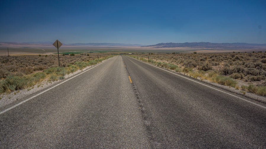
Its a road walk into Baker now, mostly along some old 4×4 roads to begin the morning.
While planning the BRT route, I came across a GPX file marking a bunch of old plane crash sites across Nevada. I plotted these out over my route and if they are close enough, will investigate the marker to see if there is anything there. This morning was one of those opportunities. I headed a few miles cross-country to a waypoint I marked for an old plane crash site from the 60s. When I reached the coordinates, there were no signs of anything here. No debris, no physical evidence of a crash, nothing.

Hiking the powerlines

Cobrarod, eh? Sounds pretty badass. Found these tags on the powerline posts
Silver Creek Reservoir
Followed road along some powerlines thinking it was the correct road, but apparently it wasn’t. Took me at least a mile out of the way to Silver creek reservoir.
At one point this morning, my GoPro fell off a fence post and cracked the screen protector. At least, I hoped only the screen protector was cracked, and not the lens behind it. However, since I will be walking through the town of Baker today, I figured Id just stop at the post office, get my bounce box, and slap on a new screen protector that I keep on hand for just such an occasion. Otherwise, I wondered if a hairline crack would be visible on the footage taken now with the GoPro.

Crossing Hwy 50/6
The walk into Baker seemed like it took forever. It didn’t look far away, but man did it drag on. Crossed hwy 50\6,then another 4 miles into town.
Baker is a very small town. In fact, its downright pathetic for a National Park gateway city. The population is only 58. Baker has one motel, an rv park, no breakfast places, no lunch places, and only one place to eat dinner, on certain days of the week, which is operated by the motel. Baker is so small, the gas station here doesn’t even have a convenience store attached. You can only pay at the pump. The Stargazer Motel offers a small selection of snacks, but is only open in the late afternoon for like 4 hours, on certain days of the week. You cant just go to the store and buy something simple like a Pepsi in Baker. Crazy, for the closest own to a National Park. That ought to give you an idea of how little visitation Great Basin National Park gets, if the closest town isn’t even large enough to support such basic services.
Stopped in the great basin National Park visitor center on my hike into Baker, bought a couple stickers. Did the free Backcountry camping reservation, even though its not technically required. Believe it or not, the visitation is so low in Great Basin National Park that there is no permit required for backcountry camping. You can just drive there, park, and hike overnight without doing anything else. In a National park!! This sums up my experience hiking in Nevada.

While waiting for the post office to open I saw this flyer on the bulletin board
Stopped at the Post Office when I reached Baker. Closed till noon, and the post master was 10min late returning from lunch. Picked up my bounce box, she said I need to pay the 21 bucks again if I open it, even if I just grab something out of it. Asked where to eat, but there was nowhere in town that’s open. Just the coffee place next door, a small food cart.
Coffee shack thing has picnic tables and shade. Got an Italian soda and ate my own food while I opened the bounce box and put on the new Gopro screen protector. Charge batts with remaining juice in 20000 mAh pack, will put that back in BB. Put stickers and rocks in BB. Will try to leave BB with a motel before leaving town today so I don’t have to pay for postage again. Today is Tuesday, and will try to finish Thursday night.
Walked across the street to Stargazers Motel, with bounce box in tow. The office wasn’t open for another half hour, but since the UPS truck was there making a delivery, the door was open and I talked to the owner. I recognized the owner, I just saw her in the post office picking up her mail from a PO box. I asked if they had any rooms available for Thursday night, and they had one. 78 bucks, no fridge or microwave. Whatever, it’s not like there’s a convenience store to buy things from anyway! I said sure let’s do it. They also had a restaurant that was only open Thursday through Sunday, 4 to 8pm. Man the hours people work in small towns. Can’t blame them, but on the other hand, it’s super inconvenient when you happen to be there outside of those hours. I’m just lucky I will be there for dinner, because I’m going to want to eat after finishing this hike! I also asked if I could leave my bounce box there with them until Thursday, and they said no problem. And finally, I asked for a couple of liters of water to take with me.
I started walking down the road out of Baker to continue south. I’m trying to reach Snake Creek, the canyon that will take me to Johnson lake, my route up to the high country. Somewhere in Baker was the lowest point along my route here through Snake Valley, roughly 5,200. From here, Ill be climbing to over 13,000, and that’s without all of the ups and downs in-between. A 7,800 climb, in this heat, sounds daunting.

Enter Snake Creek Canyon
It was mid afternoon now when I reached Snake Creek and began the hike up to Johnson Lake. Its 2000ft to Johnson Lake, mostly along a road that leads up the canyon. Also interesting to note, Mt Moriah was part of the Snake Range. The Snake Range actually continues south of Hwy 50/6 into Great Basin National Park. Great Basin NP and the Mt Moriah area look like completely different mountain ranges, but apparently, they are part of the same range.
So now I have about 48 hours left on the Basin and Range Trail. This kind of hit me all of the sudden, realizing it after I made my hotel reservation. Realistically, I’ll get back into Baker mid-afternoon. Wow, only 48 hours to go! I feel like I should have some profound Revelations, some deep and meaningful thoughts about the whole adventure as it comes to an end. But, for some reason my mind is just blank. A bit like the CDT in a way, not what I was expecting at the end. But I still have 48 hours to go. 48 hours to reflect, Ponder and look back on this experience. Tomorrow will be my last full day… That thought just hit me as well!
The lower reaches of the canyon consisted of a rearing station, I guess this is like a fish hatchery. Up the road from this was some private property for about a half a mile. This parcel of private property seemed to be pretty adamant about no trespassing. His gate had numerous no trespassing signs, including a handwritten sign that said “there is nothing on this property worth losing your life for”. Looking into the property, it look like some sort of compound. Like a polygamist compound, or maybe just some loony prepper.
Entering Great Basin National Park
Father up the canyon, after the private property ended, there was a sign that said entering Great Basin National Park. Around here, was the first time you could access the stream that flows along the road, Snake Creek. I stopped to take my shirt off and wash it in the water, and put on a cold shirt. You wouldn’t believe how much of a difference this makes, it really takes the heat down a few notches. And of course, dunked my head a bit and tried to cool off.
Views while hiking up Snake Creek Canyon
Views form Snake Creek
I saw several deer on the way up to Canyon. A few at a time, and different places. There were some spots that had rock formations that were similar to Hendry’s Creek or Deerhead Canyon of the Mt Moriah area, but overall, the canyon was not that interesting. It was a bit disappointing, actually. But then again, its just the lower reaches of the canyon, and many canyons don’t get good until the upper reaches. Every so often, there were pit toilet bathrooms and a couple of campsites along the road. National Park has funding for all this, but not enough to take care of the horrible washboard road here. The only thing that sucks more than walking on a washboard Road is driving on one.

The high country is in sight
While Snake Creek was flowing in the lower potion of the canyon, it Was dry now in the middle section. The stream began to flow again as I approached the lower Campground, Eagle Peak or Eagle Pass, something like that. This wasn’t the campground at the end of the road, but about 2 miles before that.
When I reached the end of the road, there was a pit toilet and Trailhead parking. You could park here and walk into a couple of campsites they were nearby. I stopped here at the trailhead parking lot to eat dinner. The national park has these nice little stone walls that are about a foot and a half tall, perfect to sit on. But pretty useless otherwise! Again, would rather have a non-washboard road than a little decorative wall. I felt like I’d covered a lot of ground today, but still wanted to make more progress. After all, it was only 6:30 or so now after dinner.
The Johnson Lake Trail starts here from the trailhead. It’s 3.9 miles and 2600 elevation gain to Johnson Lake, which is just below the crest of the Snake Range here in Great Basin National Park. I doubt I would make it tonight, but at least want to put a dent in that elevation gain. Tomorrow is going to have enough climbing already.

Views uphill from the trailhead
After leaving the trailhead, the trail passes through one of those walk-in campsites, which had a few people camping here. The two guys that were camped there were walking in right behind me. Up the trail, past the walk-in campsite, was a wooden bridge over the creek. I thought about it, and this might be the first bridge that I’ve come across on the Basin and range Trail.
At the creek with the bridge, I stopped to filter one liter of water. While I set up my gravity system, I washed my socks and my legs with my wash rag. Looking over at my water filter, It was clear that something was wrong, it was leaking too much. I removed the filter from the platypus bag and noticed that my gasket was messed up. That was from putting the water filter on upside down last night, when I was hot and tired. Stupid mistake. Now the gasket is all chewed up. Fortunately, I have a couple of extras. So it was no big deal to swap it out with a new one. I just felt a little dumb for doing that.
Sunset over Snake Creek
Upstream, I saw a couple more deer. Some nice Aspens alongside the trail. Eventually the trail weaves in and out and emerges in an open spot. For the first time today, I felt like I was in the high country. Still had a ways to go, though. Not all that much to say about I tonight’s hike, it wasn’t that interesting overall, compared to a lot of other places I’ve been along this route. The trails are well maintained, all of the downed logs have been cleared. But a lot of the time it just felt like I was walking through a forest with no view and climbing uphill quite a bit.
Found a spot to camp just before 8pm. A really good spot Actually, about a hundred feet off Trail, with a perfect area of flat ground that has already been cleared.
Left pinky toe has been sore all day. Looks like maybe a small blister on the inside, but really, more than that, something to do with the callus on the bottom of the toe and some rubbing issues there. Overall pretty tired. Just two more nights to go!
Day 66 – August 5th: Great Basin National Park, Snake Range, Johnson Lake, Great Basin NP High Route Traverse, Wheeler Peak Summit

Campsite below Johnson Lake
Have been feeling a bit more tired than normal last few nights. Slept pretty good. Felt a little rough when I woke up, but fine once I start moving. Rough in the sense that I just feel overall tired and worn out. Today is my last full day of hiking on the Basin and Range Trail.

Cabin down at the mill site. There are more buildings uphill
Still another 1200 ft to climb up to Johnson like. Passed the Johnson Lake Mill, where tungsten ore was sent down from mines near the lake for processing in the early 1900s. The trail was steep and Rocky. I could hear a creek flowing near the Johnson Mill.
My thought was, today was going to be tough with a lot of climbing but since there were so few miles to cover, that I would have plenty of time, making it a somewhat leisurely day. I was in a really good mood this morning. However, I’m struggling to make sense of my emotions on this last full day of hiking. My mind is all over the place.

Johnson Lake Cabin

The most intact cabin at Johnson Lake
At Johnson Lake, there were several cabins. Some in better condition than others. Lots of Rusty cans, bottles, random mining equipment like Transmissions, gear shafts and Motors, rusty old barrels, fuel canisters.

Hiking up to Johnson Lake
Johnson Lake
Johnson Lake reflection

Reflection on Johnson Lake
I stopped along the shores of Johnson Lake to filter some water. I could hear voices somewhere, assuming they were up on the Ridgeline above the lake, but I couldn’t see anyone. I knew there was someone camping here based on the trail register at the trailhead last night. I could hear a tent rustling in the wind over in the trees, didn’t know if there was anyone there right now though. While I was filtering water, a guy walked up and started filtering water about 50 ft away from me. I asked him where he was going today, he said Wheeler Peak and then down to the Trailhead below wheeler. That’s what I’m doing too, I said. He had a very small and light day pack. He said he was just going to chug some water and take one liter with him for the whole way. Wow, that’s it?

An old trolly, with the cable still intact

Climbing the pass above Johnson Lake
I started the climb up to the pass above Johnson Lake. A little ways up, there was a metal cable running from one part of the mountain up to a higher part of the mountain with a little trolley on it. A relic of the old Johnson mine. Nice view looking down on Johnson Lake. The lake is pretty small, but hey, it’s a lake, in Nevada. What more can you ask for?

Last view of Johnson Lake and Snake Creek
View of the Great Basin National Park Ridgeline to Wheeler Peak
Made it to the top of the pass. Walking away from Johnson Lake, there were some cairns that led down to Baker Lake. In the distance, an imposing Ridgeline Loomed. Baker Peak and Wheeler Peak, along with the unnamed high points in between them. I took the trail down to Baker Lake to the point where it was about even with the saddle I was heading for, and then I was off Trail for most of the rest of the day from there.
Johnson Lake is below the pass in the center, Pyramid Peak is to the left
Pyramid Peak

Climbing up the boulders
Once I reached the saddle, it was pretty much just a boulder field. I was hoping this was just a temporary thing, but this was pretty much consistent with the rest of the day. Definitely a bit more intense than I had anticipated. I’m glad I had more than just one liter of water on me!

The route across the ridgeline

View south along the ridgeline
It was extremely slow going. Very slow. I assumed there would be a path around some of these unnamed high points, like a horse Trail or social trail. But since it was just a giant Boulder field, there was nothing. I was forced to mostly stay on the Ridgeline proper, which meant more elevation gain. And it was as slow as you could imagine moving through a giant field of Boulders. Reminiscent of the Wind River range high route, or perhaps the Sierras.

Rugged ridgeline hiking ahead

Working my way along the ridgeline
Moving around the first High Point was slow. After I dropped down to a saddle in between the first and second High Point, I got a good look at the second high point, which was basically the back wall of the cirque of Baker Lake. It was extremely Jagged looking, a collection of spires and hoodoos. It didn’t really look possible to walk that Ridgeline, so I took a path below it, skirting the mountain side. Here it was a steep field of boulders. Many of them moved under my feet. It was slow, tedious, and frightening at times.
An interesting looking rockwall

Jagged ridgeline above Baker Lake
Eventually I made my way up to the top of the Ridgeline, tired of skirting the hillside through steep boulders. To my surprise, it was easier walking up here then it was down below. Additionally, the views were spectacular!

Ledge jetting out over Baker Lake

What an awesome ridgewalk! Baker Lake below
On the Baker Lake side of the crest, massive sheer cliffs dropped down what looked like a thousand feet. The Ridgeline was segmented, little inlets and valleys, massive death chutes, that looked like a gun sight. They were too many of these to count. They required a little bit of work to go around them, but they were so darn impressive. The entire ridgeline above Baker Lake was outstanding.
Baker Lake seen from a “window”, one of many along the ridgeline
Life was a bit more pleasant now that I am walking the Jagged Ridgeline, even though it’s still tedious in slow going. At least I had amazing views to make it all worthwhile. Talk about saving some of the best scenery on the entire Basin and Range Trail for last. That’s exactly how today felt, I was just blown away by The Incredible landscapes. What a way to end my BRT thru-hike, with a Great Basin National Park high route across the rugged crest of the Snake Range.

View west across Spring Valley and the Schell Creek Range

Views south along the ridgeline
In between Baker Lake and Baker Peak, the hiking was a little easier. Here, it was just a walk along talus, with no steep slopes to contend with.

The ascent to Baker Peak


Baker Peak view southeast over the Snake Range, Snake Valley and Ferguson Desert
Next I began the Ascent of Baker Peak. It was less steep, so it made hiking on the boulders a bit easier. But it was still a boulder walk. Everything was today, all the way up to Wheeler Peak. Once at the top of Baker, I enjoyed excellent views in all directions. At 12,305, Baker Peak is the 4th highest mountain in Nevada.
Wheeler Peak
Now I had a clear view of Wheeler Peak, and the Ridgeline leading up to it. The path ahead looked very steep, and needed to find a way down to the Ridgeline.

Ridgeline to Wheeler Peak
Baker Peak north face
Outstanding views along the north face of Baker Peak
It was steep coming down the Ridgeline from Baker Peaks north side. Once I dropped down in elevation some, then it was time to skirt around to the Ridgeline. This was perhaps one of the most impressive segments of trail today in terms of pure Scenic Beauty. Looking back at Baker, it was just so damn impressive. A massive vertical rock face. A couple of them actually, dominated The View to the South. I couldn’t stop looking back.

Killer lunch break spot
Gotta soak in this view, it will all be over tomorrow!
I ended up taking a break here to eat some food. Sat right up on top of the fridge, and dangled my feet over the edge. The north face of Baker Peak is said to be one of the tallest vertical rockwalls in the entire Great Basin, perhaps only second to its neighbor to the north, Wheeler Peak. Seems like good spot to sit for a minute.

Ridgeline to Wheeler Peak. Awesome!

Excellent hiking along the ridgeline
I really enjoyed this Ridgeline. Eventually, I reached the saddle, the low point between Baker Peak and Wheeler Peak, and began the 1200 ft Ascent up to Wheeler.
View of Baker Peak from climb to Wheeler Peak
South face ridgeline hike to the summit of Wheeler Peak
The Climb to Wheeler Peak wasn’t too bad, in the sense that the boulders were mostly pretty secure, didn’t move too much. There really wasn’t a path per se, but at times I felt like there were little patches of grass in between the boulders that made it seem like that was the right way to go.
Wheeler Peak summit view south
Reached the summit of Wheeler Peak around 5pm. At 13,065′, Wheeler Peak is the 2nd tallest peak in Nevada. The highest peak in Nevada is Boundary Peak, and it’s right on the border or California and Nevada. Since Boundary Peak straddles two states, does it only “half count” as the tallest in Nevada? Wheeler Peak may be 2nd tallest, but it’s the highest point on the Basin and Range Trail.

Jeff Davis Peak

Summit view south to Baker Peak, Pyramid Peak and the rest of the Snake Range

View north along the Snake Range, and Mt Moriah

High point of the Basin and Range Trail, 13,065′
I took my time on the summit of Wheeler Peak. I looked over the Great Basin, straddling two states here, soaking in the view. It was a pretty hazy day, still feeling the effects of the California wildfires in the form of forest fire smoke. This created that layered effect on the distant mountain ranges. I thought about my first distant views when I first started this hike, and saw Wheel Peak in the distance for the first time. I could see it from 100 miles away, in the Grant Range, and 140 miles away, in the Hot Creek range on Morey Peak. I thought about how looking out into the Nevada Wilderness meant mystery, in the beginning. Now, I look out and I see memories. That’s the reward of an arduous journey such as a thru-hike. To be able to look back on all that one has seen, endured, accomplished and gain a new perspective. To turn the unknown into the known. Mysteries to Memories.
Descending the trail down the ridgeline on the north face of Wheeler Peak
Time to descend Wheeler Peak
Wheeler & Jeff Davis Peaks
Headed down off Wheeler Peak, the wind was picking up now. There was a trail to follow now, which helped me make much better time. Even so, the trail was not great, in the sense that it was basically still all rocks. It was just a path through the rocks.

Good trail now to pas above Stella Lake

Wheeler and Jeff Davis Peaks from below
Dropping down to Stella Lake, view back up to Wheeler and Jeff Davis Peaks
Made it to the pass above Stella Lake. Excellent view of wheeler from here. Started down the trail around 7pm. So many deer this evening, probably around 12.

Stella Lake
Stella Lake was beautiful, great view of Wheeler Peak from the lake. However, no good campsites. Really, no pre-made campsites anywhere along the lake. I was really surprised by this. I found a spot under a tree, a small clearing, that had three rocks in the center. Didn’t think anything of it at the time, but when I moved the rocks to set up my tent, of course there was toilet paper under them. There was nowhere else to camp, so I pretty much had to camp here anyway. The tp looked older, and I made sure to put some dirt over it so that it doesn’t come in contact with my Tyvek. I’m camping here.
Day 67 – August 6th: Stella Lake, Snake Range, Great Basin National Park, Lehman Creek
Couldn’t sleep last night. Wind was howling, but I was protected and so was Stella lake. But still, the sounds of the wind kept me up. Used ear plugs after mid night, that helped, and I was able to sleep a little. Besides the wind, I had a million thoughts on my mind with the end of the hike upon me, and I’m not sure how much sleep I would have gotten on a calm night.
Packed up and left camp, unsure with how to deal with the last day of the hike. My head was a mess, I could barely think straight. I want to be done, but I’m not ready to be done.
Theresa Lake
I walked around Stella Lake to Theresa Lake, which was clearly very low on water. I wondered how many more years Stella Lake would even be around. I could have hiked over to Rock Glacier, adding another 1.5 miles each way, but I didn’t. I regret it now. Rock Glacier is the only remaining glacier in Nevada, which sits below Wheeler Peak. Its only 2 acres, so this too will be gone in a matter of years.
Below Theresa Lake, the trail is a well-beaten pathway, totally unlike anything else along the Basin and Range Trail. Soon, I passed through the Bristlecone/Alpine Lake Trailhead. This is the main access point for the Wheeler Peak area. It was here I learned that Stella Lake was a day use only area, and no overnight camping was allowed. Ooops. The rangers at the visitor center neglected to mention that to me when I mentioned my route, and this information was not readily posted in many areas. Oh well, at least I can say I practice leave no trace principles.
Below the trailhead, a short trail leads to the Wheeler Peak campground. It was closed for the season as they did improvements, adding some large cement structures for fire pits and picnic areas. Man, this kind of camping really loses its appeal after spending so much time camping in the backcountry.


Below Wheeler Peak Campground, a good trail leads downhill for a few miles. It winds through forest, along a babbling creek, and through some meadows that look up at Wheeler Peak. Not bad! All of the sudden, I could see the transition in vegetation from the typical lush mountain environment to a drier, more desert-like one.

Last views of the Snake Range
Final road walk into Baker to end my BRT thru hike

Almost into town…
Eventually I hit the lower Wheeler Peak Campground, and it was a paved road walk into Baker from here. And I didn’t even mind this one. It gave me the time I needed to come to terms with the end of my great basin thru-hike journey.

An awkward and forced celebration to the end of my Basin and Range Trail thru hike
Only about two miles from town now, I stopped in the middle of this lonely road to try and eek out some type of meager celebration, because I feel obligated to do something to recognize the significance of the moment. I let out a few screams of joy in the middle of the road, dropped to my knees and kissed the paved along the yellow line. What else can I really do? Unlike the CDT, the start and end points of this hike are arbitrary and meaningless. There are no monuments to mark the start or the end. The end point here is just so underwhelming. For me though, the summit of Wheeler Peak was my symbolic end point. I just need to reach the physical end point now, the town of Baker.
I walked the final two miles or so into Baker, reaching town early afternoon. The town is empty, so little here. I walked over to the Stargazer motel, and waited a couple hours for it to open, at 3pm. I checked in, got a shower, and headed over to the little restaurant they operate, attached to the motel. It was actually quite good food!

Post hike food meal

At the motel, there was this really nice, but super creepy looking cat roaming around
I stayed the night here in the motel and got a ride out of Baker the next day from Marlene, whom I met in the Rubies a few weeks prior. She drove me to Reno, I flew home to Michigan, and just like that, my Basin and Range Trail thru hike was a fading memory. Its funny how quickly these memories fade, too.
My takeaway from my Basin and Range Trail thru hike is that there is only right now, and to spend less time thinking about the past. You cant live life in the past, you can only live life NOW.
I think the one thing that makes ending this hike a little easier for me is not to think of it as the end of the greatest adventure of my life, but a stepping stone to an even greater one. No, I am not done, this is only the beginning for me.
Related Images:
Basin and Range Trail Thru Hike 2020 – Section 9: Wendover to Ely
Basin and Range Trail Thru Hike Section 9 Map

Video: Basin and Range Trail Thru Hike Section 9
In addition to this trail journal, I also filmed my Basin and Range Trail thru hike. I’ve produced a detailed series (11+ hours runtime) documenting this thru hike adventure, the product of over 1,000 hours of video editing. I highly recommending watching the Basin and Range Trail vlog series for an in-depth look at thru-hiking the Great Basin and central Nevada.
Basin and Rage Trail Thru Hike Section 9 Journal
Day 56 – July 26th: Antelope Valley, Southern Goshute Range, Kinsley Range, Gold Mine, Antelope Peak
Like most nights in town, I was up later than I would be if I were camping. I was up until 11:30 or so last night going over the next section of the route, posting a few pictures to facebook and catching up with emails, bills and friends. Therefore, I didn’t get up until almost 8am this morning.

Walking out of Wendover, south along US 93 Alt
Breakfast was two bananas, muffin and a sausage egg and cheese biscuit. Packed up and walked out the hotel around 9:30. Had to walk about a mile and a half to the junction with US 93 alternate, and then walked another mile South out of town. There was a lot of traffic that was driving about 1/2 mile to a mile south of town and then turning into a couple of businesses. So, I had to get south of that to eliminate all of the town traffic.

The hiker version of this sign should read, “130 Miles to Next Cheeseburger”
Once I walked past the edge of town, there was almost no traffic. There was maybe three cars that went by, and none of them stopped. It’s always hard to get a ride from town into the middle of nowhere, versus the other way around. I stopped at a road sign that said next gas 130 miles, thinking this would be a good place to thumb it.
I didn’t try to hitch for too long before giving up and calling a taxi. I was eager to get started walking, and didn’t feel like waiting around all day. There was only one taxi service in town, and they charged me 80 bucks. He was there within 5 minutes to pick me up and I was at my destination before I knew it.
The taxi driver was used to drive a snow plow for NDOT, but he rolled it a few years ago and got seriously injured. Broke his back, had glass stuck in his face. Gnarly. He rolled it almost right where I needed to be dropped off, so he knew exactly where it was. Whitehorse Pass, as its marked on the map. The lady on the phone when I called and said I needed a ride to the southern end of the Goshute range had no idea what I was talking about, haha. You know, that mountain range that forms the skyline of the town you live in. That one. You don’t know the name?
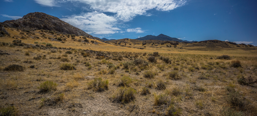
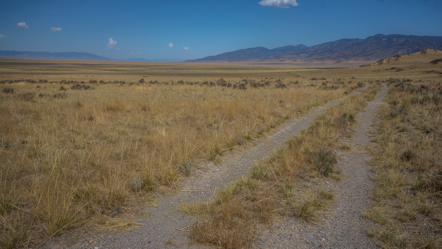
Antelope Valley
I had planned on walking the east side of Whitehorse Mountain, the high point of the extreme southern end of the Goshute Range, which lies just south of US 93 Alt. On the ride here though, it didn’t look all that appealing. He dropped me off right where I got my ride into town, which was closer to the west side of the range. This was shorter, and more scenic. This made more sense, so I walked the west side instead, changing my plans on the fly. I love the flexibility offered when making your own route. I’ll hike where my eyes and my heart takes me, not confined to a trail or even a route I planned from home.

South of Whitehorse Pass
Extreme southern end of the Goshutes

A Sea of Gold!
I was really digging the walk-through Antelope Valley, just as I had before I got my ride into town at the end of the last section. Normally, the start and end points of a section are not that exciting. But here, I actually enjoyed the beginning of this section.
View north, where I’ve come from

Massive views hiking Antelope Valley
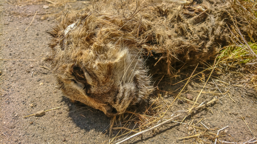
Dead bobcat
I found a dead bobcat along the road. First time I’ve ever seen a bobcat. I’d prefer to see a live one, but this is a start.
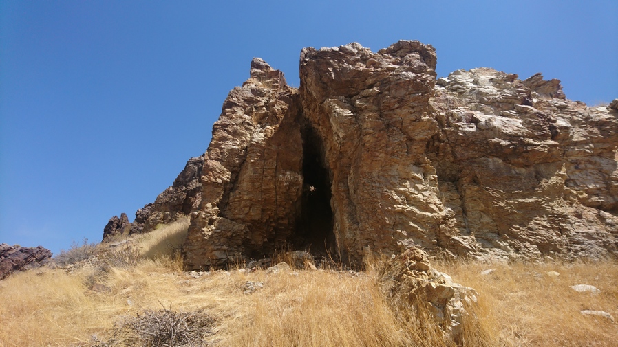
Small cave. Better check it out

Antelope Valley from small cave
Antelope Valley
Nearly right next to the Bobcat, up the hill was a small cave. This was more of a tall but narrow style cave, and you could see right through the back side of it. through a small opening. Interesting. It sure was a cool view out over the massive Antelope Valley.

First view of the Kinsley Range, center
It didn’t take long to walk around the Whitehorse mountains. A couple of hours. I could see the Kinsley mountains now, and in between the two mountain ranges was a bit of a gravel pit. As I look back to the north, the skies were getting pretty dark. It looks like some rain with falling, and a low Thunder could be heard in the distance.
Clouds approaching
Dark clouds rolling in through Antelope Valley. I am the highest thing around
The north side of the Kinsley mountains looked a bit steep and more rugged than I thought. My plan was to climb up to the Ridgeline here and walk the whole thing. However, dark clouds were building and taking over the sky in my immediate area. I saw bolts of lightning on the Leading Edge of the rain clouds, not that far away from me. Then moments later, a very strong bolt of lightning struck the Ridgeline that I had planned on walking. There was almost no time in between the lightning bolt in the Thunder, which was extremely loud. I’m glad I’m down on the road, but I still feel exposed, being basically the tallest thing around down in this valley.


Hiking towards the Kinsley Range
I walked around the East Side of the Kinsley mountains now, hoping the rain and thunderstorms will clear. The Kinsley Mountains aren’t known for much, but right in the center of the mountain range there is a gold mine. It has change hands a few times in the last few years and I was told it was not currently in operation. Good news for me, because I want to walk through it. I have also been told it there is a water source at the gold mine location somewhere, on the east side.
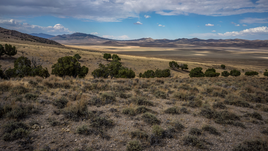
Excellent views across Antelope Valley
When I first saw the tailings from the gold mine, I left the road I was walking and hiked off Trail to the entrance, trying to save time and distance. I saw about seven or eight
ses. Pretty nice view of Antelope Valley now as I gained a little elevation and looked back.

Hiking up a pile of tailings to enter the gold mine
This pit was massive!
I walked up alongside a pile of tailings, instead of taking the main road into the mine. I wish I would have taken the main road, at least then I could have seen if there was a water source. Instead, when I got to the top of the tailings, I reached a road and ended up walking down hill a bit. These are where the large pit mines are, as well as the excavator. I saw an antelope here as well.
At the Kinsley Gold Mine

No Beber? But I must!
Alongside the two large open pits were an excavator and a Porta-Potty. Next to the porta potty was a station to wash your hands. It was a big blue plastic thing. There were soap dispensers and paper towels. There was a foot pedal you could push that would draw water out of the tank and pump it up so that you could wash your hands with it. Written on the station where the words, not for drinking, and in Spanish, no beber. But I have a water filter, and I must beber. I only filtered 1 liter, mainly because I didn’t want to carry more than 4 and my pack was already heavy. Plus the water taste is a bit funky, even though I filtered it. A chemical-type taste.

Nice chunk of Wonderstone. I’ll look for a smaller piece to keep
After I got my water, I continue to head up Hill, to the crest. This became a bit of a confusing network of roads. It’s not too confusing if you just want to follow the main road, but I could see the road I wanted to follow up the hillside to the crest and I couldn’t figure out how to get to it for a while. I kind of wasted a lot of time here. I did find a couple good pieces of Wonder Stone on the ground, though.
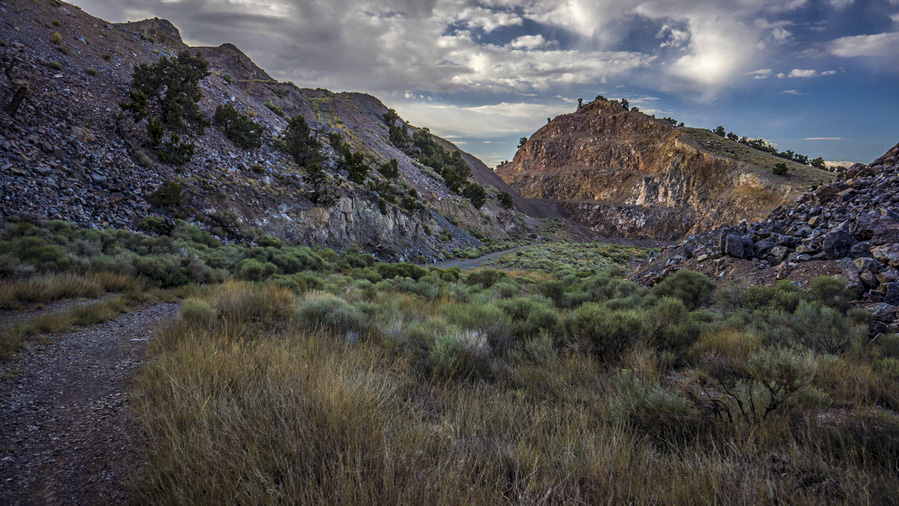
The gold mine operations extend to the crest of the Kinsley Range
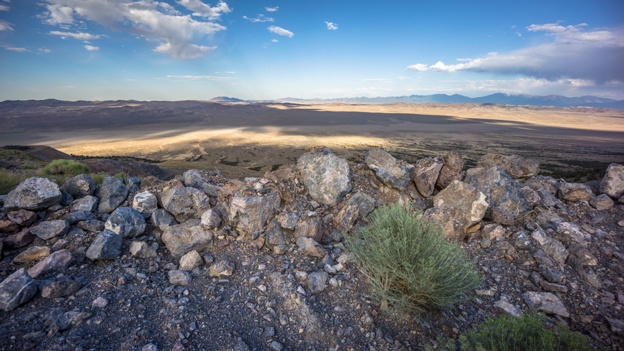
View east over the Antelope Range. Beyond that, the amps marks this area as “badlands”
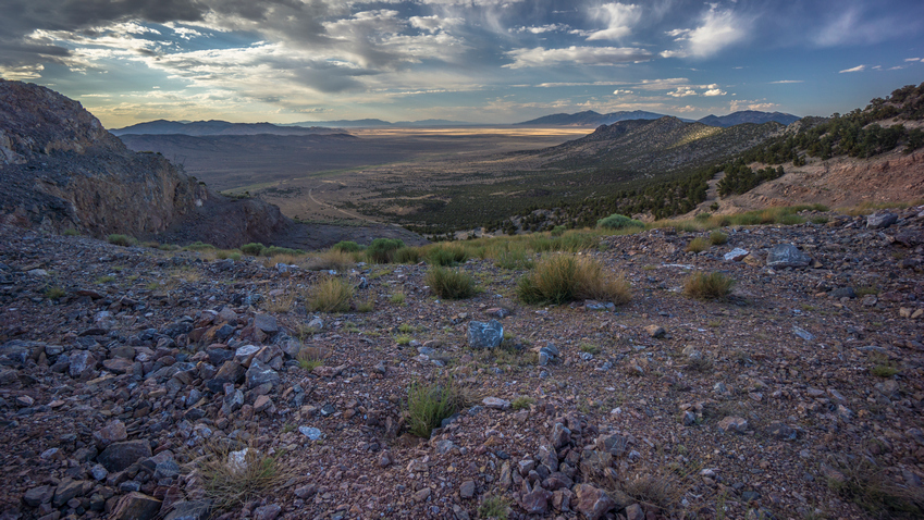
View northwest over Kinsley Draw and into Antelope Valley
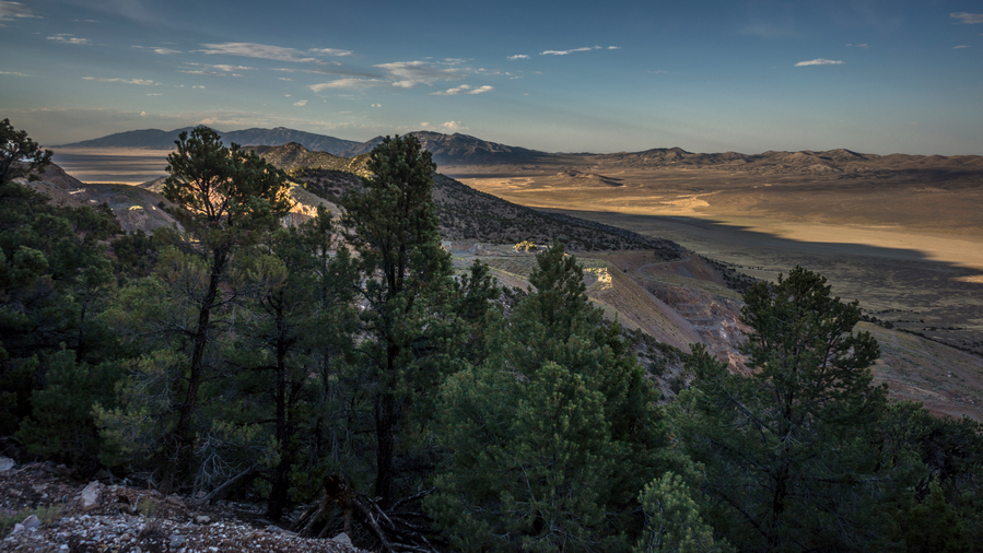
Crest of the Kinsley Range, view north
Eventually got to my road that leads up to the crest. This road was barely a road, but it was a pretty decent substitute for a trail. It was very slanted into the hillside, not really an angle which you would drive a vehicle across. I followed this road until it ended at the crest of the Kinsley Range. On the other side was an actual hiking trail, and I saw one cairn. Interesting.

View southeast over Antelope Valley from the Kinsley Range

View from the Kinsley Range
The Ridge was pretty pleasant. Not too thick with vegetation, fairly easy to walk actually. I began to head south, towards Antelope Peak. One Small Knob obstructing my view. This was off Trail now, but still easy.
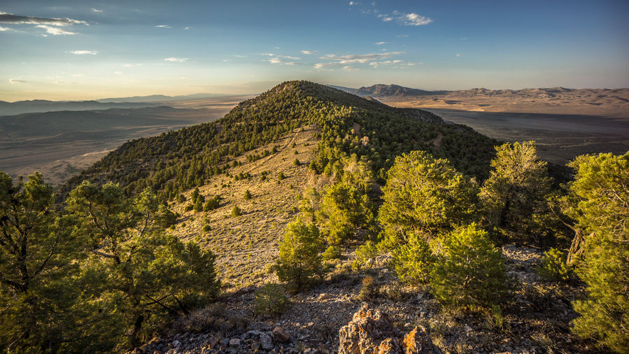
Views from the crest of the Kinsley Range
I found a couple of pretty good campsites along the Ridgeline before you reach Antelope Peak, high point of the Kinsley Range. However, it was only 7:20, and I was confident I could make it up and over given the conditions. So I went for it.

Easy hiking to the summit of Antelope Peak
It was a pretty short ascent up Antelope Peak. There was a Rocky Ridgeline, not quite a knife Edge but close. It was a nice and easy scramble up to the top with no problems. On the summit, there was a Summit register in an old ammo box. This is the first Summit register I’ve seen in Nevada! There were only five other entries in it dating back to 2003. Beautiful views on the summit just as the sun was going down.
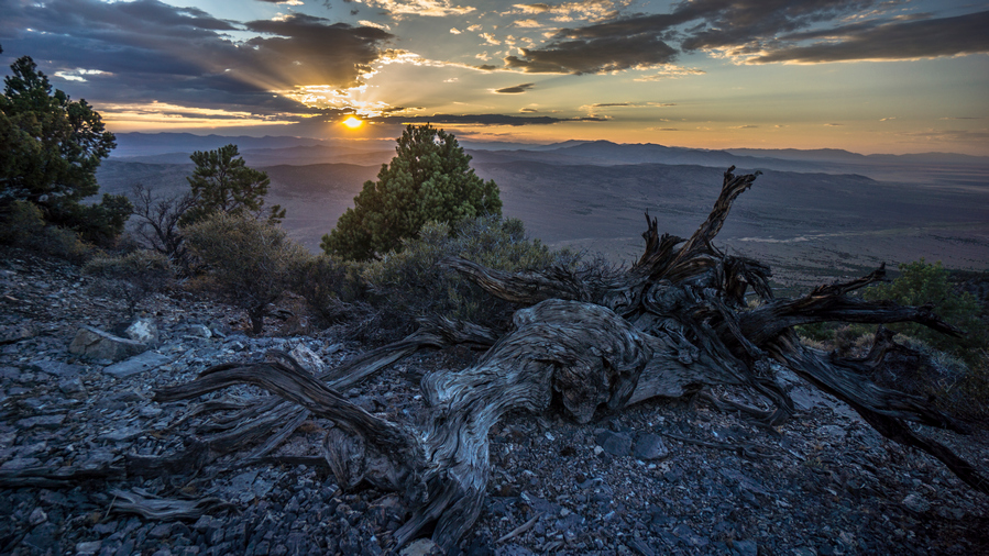
Antelope Peak (7,881′), Kinsley Range High Point, Summit view at sunset
The Summit of Antelope Peak (7780) has some flat areas and will make a good place to camp for the night. Camping on a Summit, woohoo! Only problem is, my tent Stakes only go into the ground about 1 inch. So, I had to set really heavy rocks on them. Good thing its not windy tonight.
Day 57 – July 27th: Antelope Peak, Antelope Valley, Antelope Range, Becky Peak Wilderness
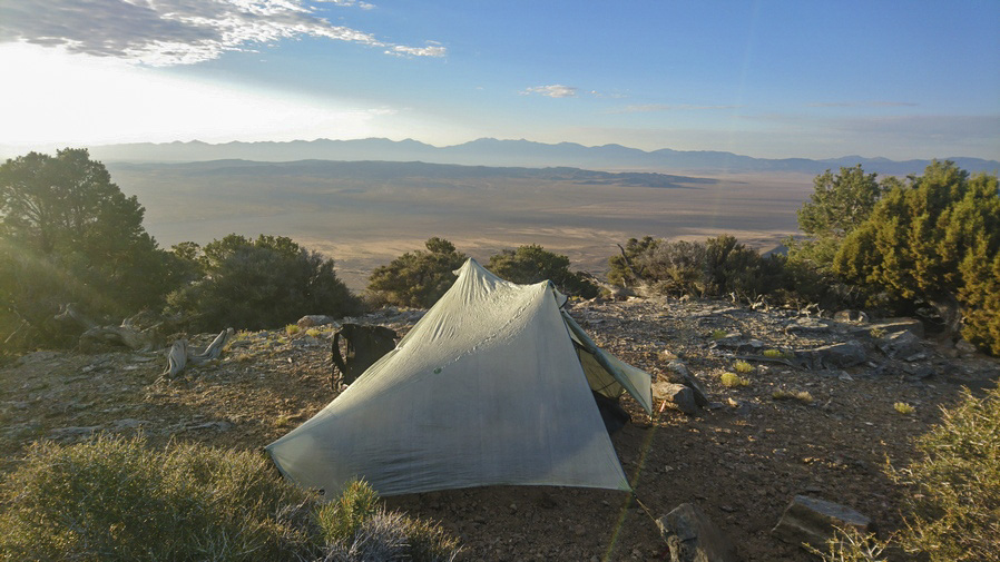
Campsite on the summit of Antelope Peak

View north along the crest of the Kinsley Range
Slept great last night. Woke up at 6am on the dot. Nice to wake up on a mountain peak! Thankfully there was no wind last night. There isna’t any one landform here that is stunning, but this area has a simple beauty to it that’s hard to ignore.
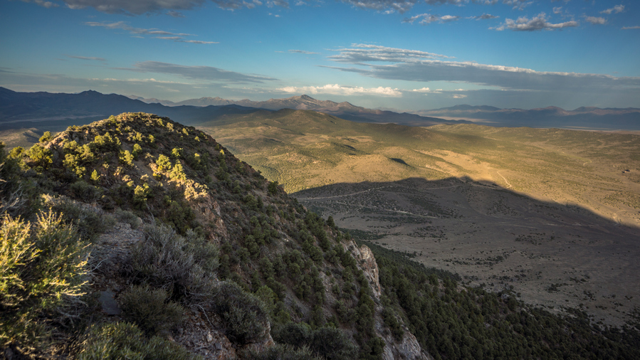
View southwest from Kinsley Range

Hiking down off the southern end of the Kinsley Range
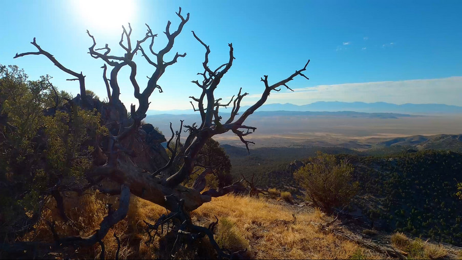
View from the southern end of the Kinsleys
Now to work my way down the Ridgeline off of the Kinsley mountains. At first it going was pretty easy. The vegetation wasn’t too thick. There were many times where I crested a small saddle, only to be presented with basically the exact same view. Towards the bottom of the Ridgeline, the going got a little bit tougher. It was a bit more cliffy, and eventually I abandoned the ridge for a side Canyon that had a dirt road. It was a little out of the way, but worth it.

Don’t mind if I do
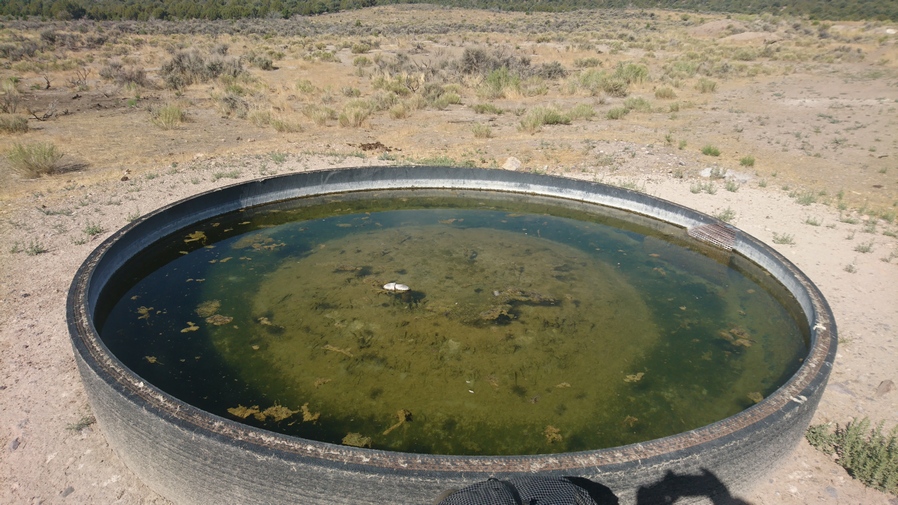
A tire full of water. It’s New Mexico on the Continental Divide Trail all over again
When I reached the road at the end of the Kinsley mountains, Kinsley spring was there. This was on private land, but there is a public road that goes through it. The sign on the gate says, private property – enter at your own risk. It doesn’t say do not enter, or no trespassing. It said, enter. At your own risk. Permission granted in my book. Kinsley spring was actually pretty decent. It was a large tire filled with water, but the water wasn’t too green or thick with algae. Pretty clear. This one reminded me of my time thru-hiking the CDT in New Mexico.

From here I had a choice to walk through the Antelope mountains or around them. These are more like Hills. Low, wooded Hills, with a dirt road going through. It was about the same distance either way, and looks like only a thousand foot of elevation gain or so, so I went for the Antelope mountains route.
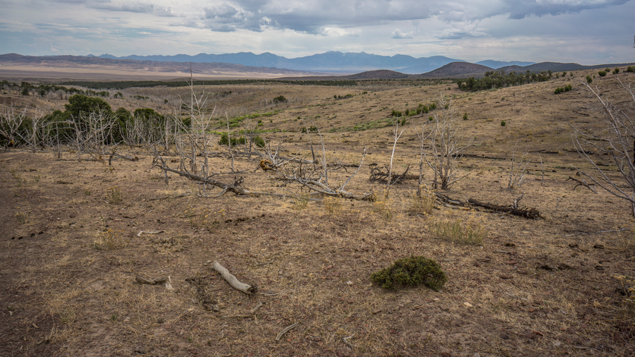
Hiking the Antelope Range. Not much to see here
It was mid-morning now, and I could tell something different was going on with the weather today. The sky was cloudy already, which was unusual. In June, it was just blue skies everyday with no clouds. For the last couple weeks, it would be blue skies in the morning, then white puffy clouds in the afternoon that could form thunderstorms. But today, it was just a random Patchwork of gray clouds.

A herd of wild/feral horses
The Antelope mountains were a pretty boring range. Not any more interesting than it looked from Kinsley spring. Just some run-of-the-mill low Woodland scrub. A couple areas that had been burned by a fire. A couple of nasty Springs, ruined by cows. Saw a herd of about 6 or 7 antelope in a burn area. In one clearing, I saw a herd of about 20 horses and right next to them, a little bit higher on another Hill, a herd of another 15+ horses.
I felt like the first half of the Antelope mountains went by pretty quick, and I didn’t mind them so much. But the second half seems like it dragged on. The climb up to the last saddle seemed slow, and I began to doubt my estimate of 1000 foot elevation gain for this whole range.
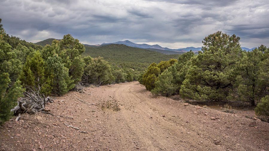
Dirt road in the Antelope Range

Dark clouds over the Antelope Range

View into Steptoe Valley as I hike out of the Antelope Range
Once I dropped down the last saddle out of the Antelope mountains, I got a view of Steptoe Valley and the Cherry Creek range. With the storm clouds in the distance and random rays of sunlight shining on the mountains, it was pretty pleasant.

Flat Spring. I should have filled up water here
I checked my phone and I was surprised to see 4G service here once again. The clouds began to clear up and it was mostly sunny overhead. I took a break under a juniper tree for lunch, and this provided a good amount of shade. More storm clouds were moving in, but these looked like they would pass to the north. It was sunny now where I was, and quite hot. There was a spring here, flat spring, that was on the map I had missed this one in my planning and research, and it wasn’t marked as a potential water source. I was surprised to see another big tire here full of crystal clear water. I should have filled up here, but I kept going.
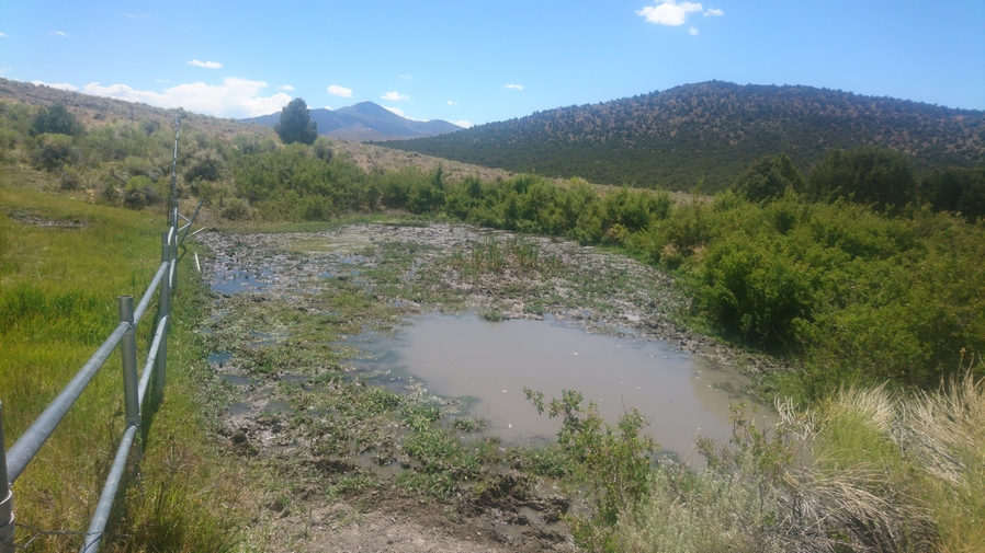
Cress Spring. No thanks
Then I passed Cress spring, another spring that was marked on the map but one that I had not marked as a way point. This one was nasty! A cow shit swamp, I wouldn’t drink this one unless I was about to die.

Hiking a dirt road at the base of the Antelope Range
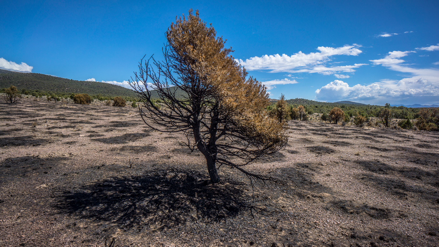
This one survived
I made pretty good progress through this next section. It was really hot now, and for some reason this motivated me to walk fast. Probably to get to the next water source, which seemed very far away. I didn’t see anything for water ahead until I reach Becky Peak. Passed through a good sized burn area. The burn line stops abruptly on one side of a 4×4 road, leading me to believe it was a controlled burn. Just a guess, I suppose it could also have ended abruptly as the road is a natural break line for the firefighters to protect.

This poor guy had all sorts of issues
While walking the dirt road, I came across a young horse. The mother was nowhere to be found. This guy was walking face-first into a small tree, almost as if you couldn’t see it or as if he was stuck. But I didn’t see anything that was holding him there, he was just constantly trying to walk into it. I cautiously approached, and he didn’t back away. I reached out and touched his back, at first he twitched, but then, he calmed and let me pet him. I wasn’t sure if he needed help or what. His eyes looked pretty red, I wondered if he had an eye injury or if he was just blind or something. Then he started trying to walk under a few branches but was getting stuck. I tried to break the branches, and a combination of him pushing on the branches and me pulling on them did the trick. Success, freed the little guy. I tried to give him some water, by dumping it on his head. But he didn’t get it, I was hoping he would open his mouth and go for the water. Oh well, I didn’t have much to spare anyway. I am pretty sure this guy was going to die soon one way or another.

Beck Peak, northern end of the Schell Creek Range
After passing the horse, I walked to a junction in the road. I went right, heading west now, towards Becky Peak and the Schell Creek range. I was getting pretty tired now, hadn’t had a break in a while and pushed through all that hot weather.

Dark clouds building over the Beck Peak Wilderness
Dark clouds were building again over the Schell Creek range. I checked the weather on my phone and there was quite a bit of activity coming from the south, in waves.
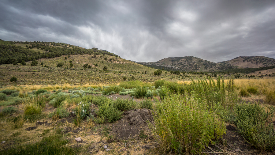
Rain is coming, I can smell it now
I reached an area of private property again, but like earlier in the day, there was a sign that said enter at your own risk. Since this is the shortest and most direct route, also likely has water, that’s the route I’m taking! When I entered the private property, I could see several hundred domestic sheep on the other side of the canyon, and these guys were on the move. I thought for sure I would run into a sheep herder, but I didn’t see anyone.
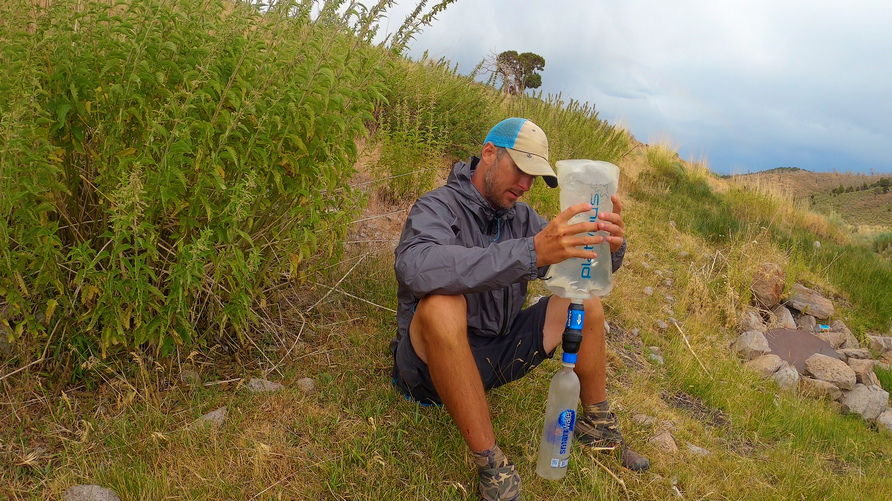
As I worked my way up Sampson Creek, it began to rain. There was some water flowing down the creek in spots, particularly up stream, but it didn’t look appealing. I kept following an uphill until I reach the source a metal lid propped up by rocks that topped off a tank underground. Water was coming up from this tank and spilling over the top. The Rocks keep the animals away. This was a nice feature, I was able to get my bottle into the tank collect crystal clear water. However, it decided to rain at this moment. It has been 4 hours since I took my last break, and I was almost out of water. I was hungry, thirsty and tired. I really needed this break, especially since the next section has me going uphill to Becky Peak, a big elevation gain.

Hiking along Sampson Creek to Becky Peak

After the break, I finished walking through the segment of private property and entered public land again. I saw more horses and more pronghorn. I saw horses scattered throughout the day actually, too many times to count. At one point while walking the road to Becky Peak, I could hear the clip-clop of horses running. It was getting louder and louder, and eventually they emerged from the trees, running right at me. They were about 10 yards away or so and as soon as they saw me they change course and ran away from me.

Small pond along Sampson Creek. It’s pretty nasty, follow it upstream to its source instead
I began the final ascent up to Becky Peak on a dirt road along Sampson Creek. This looks to be about 1,700 feet elevation gain. There’s a sizeable pond along Sampson Creek at the base of the climb, but I’d follow it uphill to its source if I needed water. But I don’t. As I neared a junction, I decided to stop for the night. The clouds continued to build above Becky Peak and I did not want to be camping high up on the ridge line tonight. So I stopped lower in the canyon than I normally would have. It was only 7:30, early for me.

Storm clouds behind my Tarptent Notch Li. Batten down the hatches, it’s gonna get windy
Set up my tent and got a few time-lapses going of the sunset and building clouds behind my tent and Becky Peak. Then it started to rain. It was quite windy at times, but largely my fault cuz I set up the tent in a manner that catches the wind. I continued to hear rainfall on my tent for a few hours tonight as I tried to sleep.
Day 58 – July 28th: Becky Peak, Becky Peak Wilderness, Schell Creek Range

Looking back at the 4×4 road up Sampson Creek to the Becky Peak Wilderness
I started the morning off with a climb up to camp spring. It was another couple hundred ft from my campsite. At the top of the climb was a sign welcoming you to the Becky Peak Wilderness. It lists Becky peek at 9859 ft but my map says 10002ft. That is quite a large discrepancy. I wonder which is right. I prefer the version that is 10k!

Camp Spring view
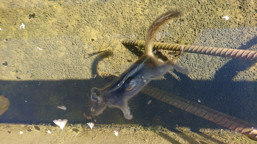
I’ll filter from the other trough
Shortly after I came across camp spring. There were two troughs, one of them was overflowing and feeding a pond. The pond was held back by sandbags and rocks, and then flow downhill. One of the troughs had two dead Chipmunks in it. Better filter from the other one. Otherwise, the water looked crystal clear.
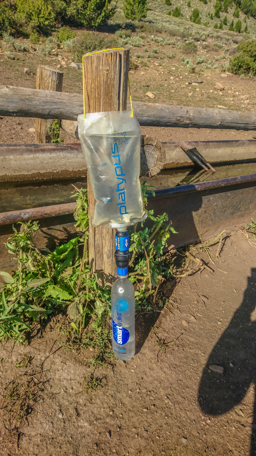
Rigged up a string to the top of the platy bag, and now I have a gravity feed system
My sawyer filter has been filtering pretty slow. I’ve back flushed it, and its still slow. The whole process of filtering water takes a long time now. Also, when I filter a liter of water, I want to chug a liter while I’m filtering more water. So I finally made a bit of a gravity system. The bottom of the platypus bag has a couple of guides for cutouts, so I poked a hole in these with my knife and used my spare guy line to run a string through the holes that I just punctured, and tied a series of knots behind it. Now I can hang this from a tree or post, and let it filter while I do other things, like drink the previous liter of water I just filtered, or wash my socks.

The approach to Becky Peak
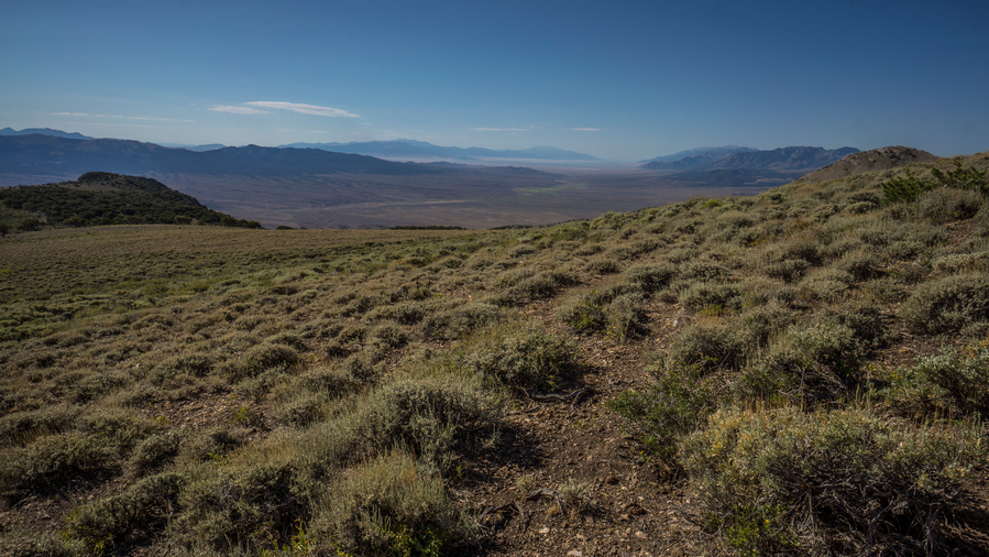
Next I climbed up the northeast side of the Ridgeline leaving to Becky Peak. It looks deep from far away, and when I got right up close to it, it still look pretty steep. Steep, but very manageable. It was mostly loose dirt and rock, but not loose enough to where it was a one step forward two steps back kind of deal.
While working my way up the Mountain, I came across my second rattlesnake of the trip. Much like the last one, it was hiding under a rock in the shade on a slope below a Summit, near 10k feet. I was probably 7 or 8 feet away when I heard his rattle. Thankfully they give a warning.

View north along the Schell Creek Range on the climb to the summit of Beaky Peak
As I neared the summit, I could hear the sheep dogs and the sheep, and see two trucks in the valley far below. Just below the Summit of Becky Peak, there was a mangled pile of metal. It was pretty obvious what it was, as I had seen these before… Basically a weather station. At least, it collects rainwater. I had seen one of these in Soldier Creek in the Rubies, and elsewhere. I believe it was USGS. This one was laying on the ground, with the top instrumentation part separate from the post.

Becky Peak summit view, south
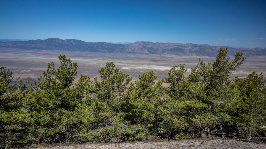
View west across Steptoe Valley, to the Cherry Creek Range

View east to Antelope Valley and the Antelope Range
The Summit of Becky Peak was pretty nice. Great view of the Cherry Creek range across Steptoe Valley. On the other side, the Antelope range continues south, and remains unimpressive. There was a Summit register on this peak as well. There was no more paper to be signed, so I added a small piece from my junk drawer bag. There were 13 summits in the past 2 years, and one of them was last week! I was not expecting that.

Becky Peak ridgeline view south

Schell Creek Range
Next I continue South long the crest of the Schell Creek Range, through the Becky Peak Wilderness. I thought the best views of the Becky Peak area where here, descending the summit and hiking south along the ridge. Pretty easy-going at first. A good mix of horse trails and overall easy terrain. I enjoyed massive sweeping views of the Schell Creek range to the South. Also, I think I can see Wheel Peak in Great Basin National Park now, far off in the distance. That’s basically my end point for this hike, so that’s a significant landmark for me.
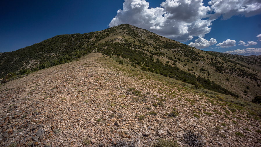
Route down from Becky Peak
After following horse trails around a high point, it was time to head down a Ridgeline. This was more of the slow off-trail stuff I was used to. It took a while getting to the Ridgeline, having to side Hill my way there. Once on the Ridgeline itself, it was a mixture of small rocks, the kind packed into the dirt, and small trees. Fortunately not too bad of a Bushwhack.


Need to hike through this stuff…
Made it down to a saddle separating the Ridgeline I came down and another tall peak, another 800 or 1000 foot climb or so. I really didn’t want to climb up that peak, so I took horse trails around the mountain side instead. In this case, I probably should have just gone up and over. There was a lot of Sagebrush to walk through, and the horse trails were intermittent at times. In following the horse trails around the Mountainside, I had to still go up over a small pass. This one was heavily wooded when I got to the other side. It looks like the best way forward was to Contour around the hillside to Dolan Trap spring.
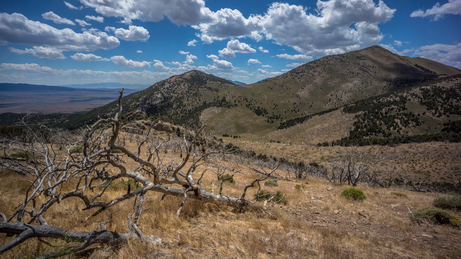
Off Trail hiking to link up with road at Dolan Trap Spring
The off-trail hiking along the steep hillside proved to be quite a pain in the ass. The ground beneath my feet was very loose… Loose dirt, loose rocks on fairly steep terrain. I fell a couple of times. I worked my way around the mountain at this elevation for a while, before reaching a Ridgeline that suffered a forest fire. I continued to contour around the mountain through the burn area over to the spring.

Break spot at Dolan Trap Spring (dry)
Dolan Trap spring was dry, as my notes said it would be. But there were two large pipes or tanks here, and they provided shade. This will be my lunch spot.

I’ll be shooting for the pass on the right

Hiking up and over this unnamed pass
After lunch I headed uphill a couple hundred feet to another pass. I was on an old dirt road now, even though I’m in the wilderness, old Roads sometimes still exist. This one was being reclaimed back to Nature. I followed the road down from the pass into a valley, and then up Dry Canyon towards another pass. This one would be another thousand or 1200 ft elevation gain.
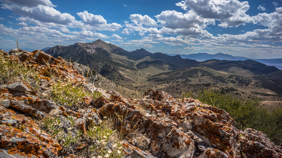
Views south from unnamed pass. North Lovell Peak on the left
At the top of this pass were some pretty great views. Looking South I could see North Lovell Peak and “The Nipple”.
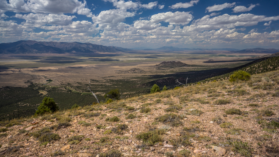
Steptoe Valley and the Cherry Creek Range
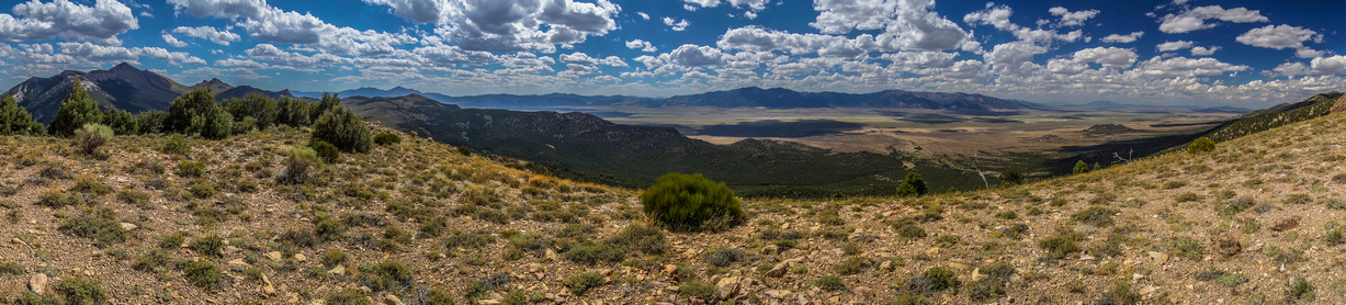
Steptoe Valley Panorama
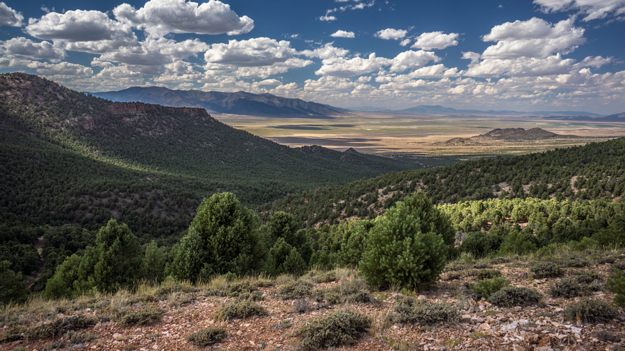
Steptoe Valley view from Schell Creek Range
There was a short section of side-hilling, and following horse paths, before I could reach back up with another road on a ridge. Pretty great views all around here in every direction. Very enjoyable walk.
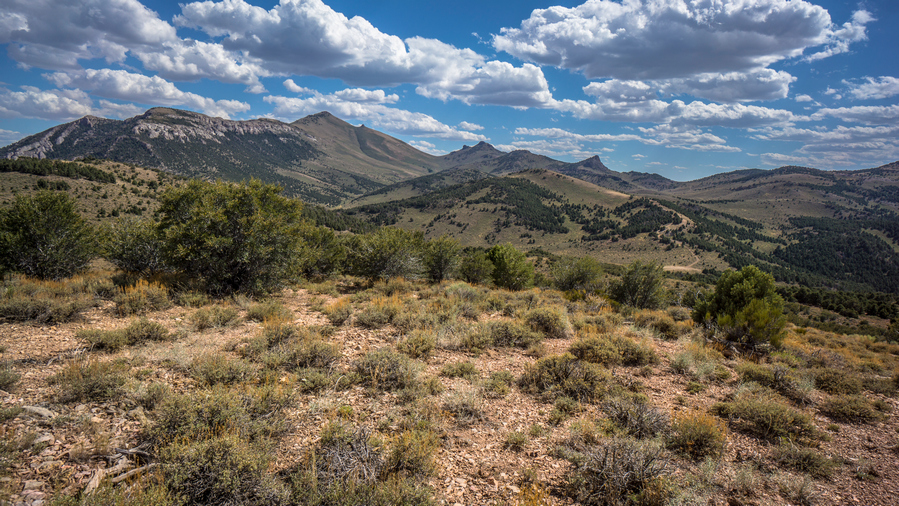
View south to my route

This route drops lower into the valley and swings buy a couple of springs on the map, but takes me slightly out of the way from where I need to go. I reached the first spring, which was dry. My route had me going off Trail, side hilling through a bunch of Sagebrush. No thanks! I’m done with that, if I can avoid it. Instead, I followed the road downhill about a mile and losing about 400 ft, and then another mile and 400 ft uphill around a big Knoll. Probably roughly the same amount of time and definitely worth avoiding the hassle of the off-trail traverse.
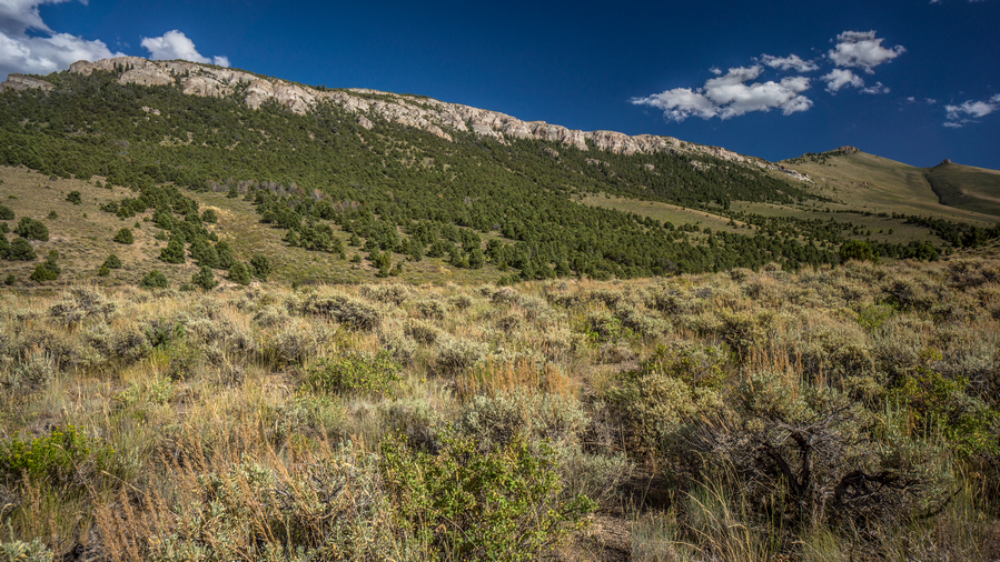
Hiking up to the saddle below north Lovell Peak
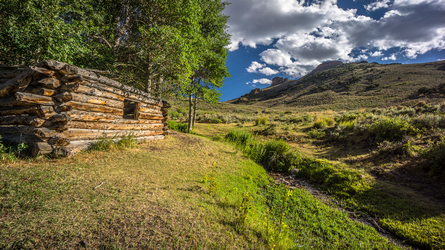
Cooley Cabin
Take a quick snack break under the shade of a tree, one of few trees around. Continued uphill through the canyon that will lead me over the pass, just below the nipple. Good views, pretty wide open. The other reaches of this Canyon had water, just below Cooley cabin. I stopped here to filter a couple liters of water, cool off and wash some of my clothes.
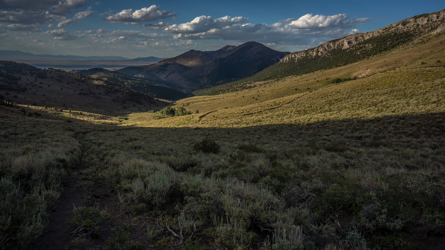
View north, the where I’ve come from

View from the pass
It was another couple hundred feet uphill to reach the pass after my water break. At the top of the pass, I was surprised at the quality of the views. There were some limestone rock formations at the top of the pass that were nice, but more than that, looking further to the south the rock formations along the Ridgeline with Lovell Peak where excellent. Reminded me of the Goshute mountains, and the Egans.
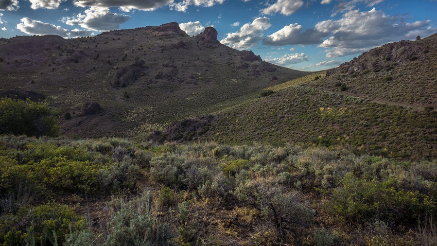
Descending into McMaughn Canyon

Awesome limestone cliffs in upper McMaughn Canyon
With the big climb of the day done, the sun below the rest of the ridge, it was an enjoyable walk the rest of the evening down McMaughn Canyon. The limestone cliffs along the eastern side of McMaughn Canyon where very appealing, and I wished I could hike closer to them for a better view.
They were a couple of decent places to camp in the upper reaches of the canyon, but as I got lower, it was just low Sagebrush. It was getting dark and I was looking for a spot. My map had a spot called McIntosh Place marked. Apparently, this was an Old Homestead. This was overgrown and did not provide a suitable campsite either. Fortunately, just down the road I found an open spot alongside the road, a few feet away, just a clearing in the dirt. Works for me!
Day 59 – July 29th: Schellbourne Pass, Schell Creek Range, Ranger Trail
I slept for about an hour last night before I heard an animal about 20 ft away. I turned on my headlamp and saw something scurrying away from a tree, about the size of a raccoon. Not really sure what it was. I didn’t really sleep that well after that. A couple hours later, I heard some horses walking down the road that I was camped alongside.

CR-18, road to Schellbourne Pass
From my campsite, I was less than a mile from CR-18, a paved road that cuts through the Schell Creek Range and goes over Schellbourne Pass. From there I made my way down to the road that I had planned on Crossing through Shellbourne Ranch on. Unfortunately, this was a private Ranch entryway with a sign that said keep out. I was in a good mood until I saw this. There’s public land on the other side, but no way to access it due to this Ranch.
So now I need to figure out another way to get into the mountains from here. The only thing I could come up with was a walk up and over Shellbourne pass to another road that was about four or five miles out of the way. No choice, so I started walking uphill.
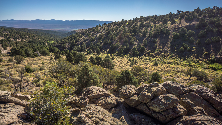
Route up to Basin Spring

Basin Spring. Lots of horse activity here
It was a few miles of road walking to go over Shellbourne Pass and reach an old 4×4 road leading up into the mountains. I started walking up the road, and made it to Basin spring, where I stopped to filter water. This was a clearing with a spring tickling downhill, the grass all trampled by horses. The water looked pretty gross. I had no way to collect from the source. Instead, I went slightly downhill, where the water was flowing out of a stagnant pond. I was able to fill up my water bottle from the water flowing off of a 10 inch waterfall. It looks clear, and my water filter will take care of the rest.

I’ll shoot for the saddle in the center to gain the crest of the Schell Creek Range again

Back up on the crest again, south of Schellbourne Pass
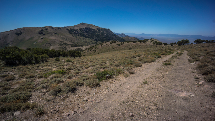
Crest of the Schell Creek Range
Now I had to climb a steep 4×4 Road up to the crest of the Schell Creek range. I was really sweating and working to make my way up this one. I thought I was at the top, but it was a false Summit. So, more climbing to go. Finally at the top, I took a break in a patch of trees. The shade felt great, and I ate lunch.
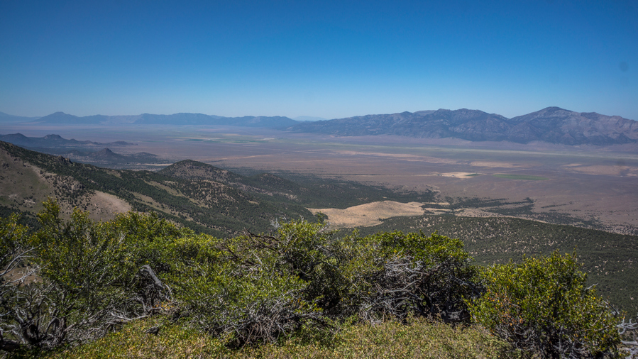
Massive views over Steptoe Valley. The Cherry Creek Range has ended, and now, the Egan Range runs parallel to the Schell Creek Range to the west

Schell Creek ridgeline
The trail drops a bit to a saddle, then climbs up higher once again. I could tell today was going to be a lot of work. Although there might be a lot of climbing, at least it’s easy hiking, for the most part.
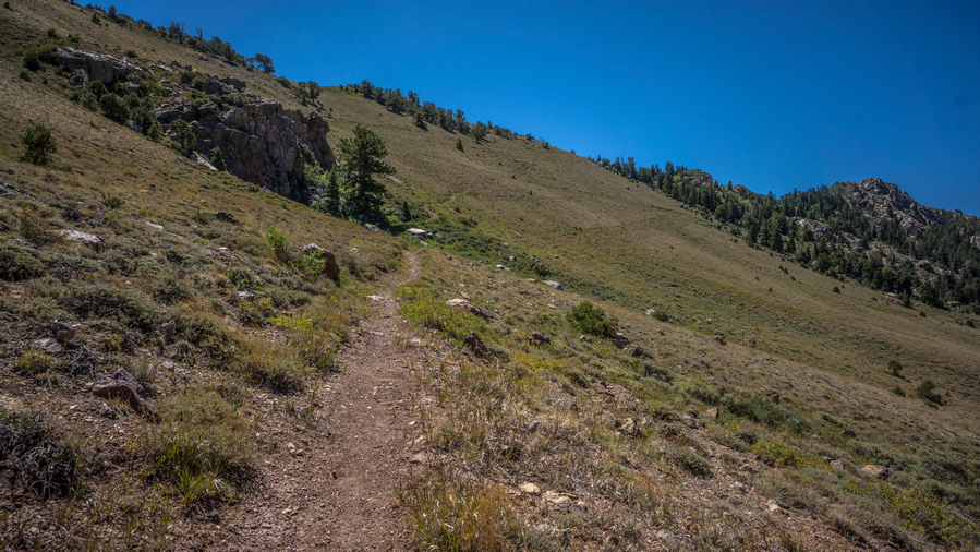
Single track trail

View north along the ridgeline, where I’ve come from
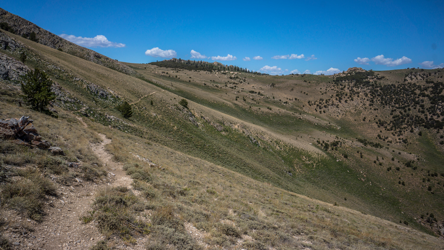
Hiking the east side of the crest now
While hiking up the next pass, the 4×4 road I was on turned into a single track trail. Nice! I followed this uphill and dropped down into the next Valley. Here, I saw several rock cairns too. Excellent Trail, well maintained.

Excellent section of hiking on an actual hiking trail
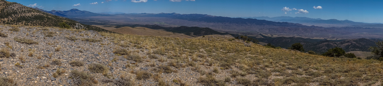
Antelope Valley panorama. Becky Peak left, Antelope Range right
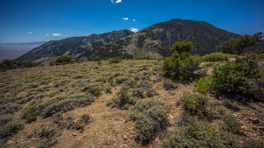
Views south along the ridgeline
The trail skirts the hillside now for a mile or two, avoiding climbing up and over another high point. Sounds good to me! The trail stays on the East Side of the Range and provided excellent views… I could see North to Becky Peak, and south to what was likely the snake range, Mount Moriah. I could see where the Antelope range ends, as well as Spring valley.
The trail passes by a spring now, this one was a nice surprise because I hadn’t had it marked on my map. Water was flowing out of a pipe, easy to collect from. I didn’t need any water at this time, not to filter anyways. So I filled up my water bottle and dumped it over my head. This felt great!

The trail goes through that heavily forested mountainside next
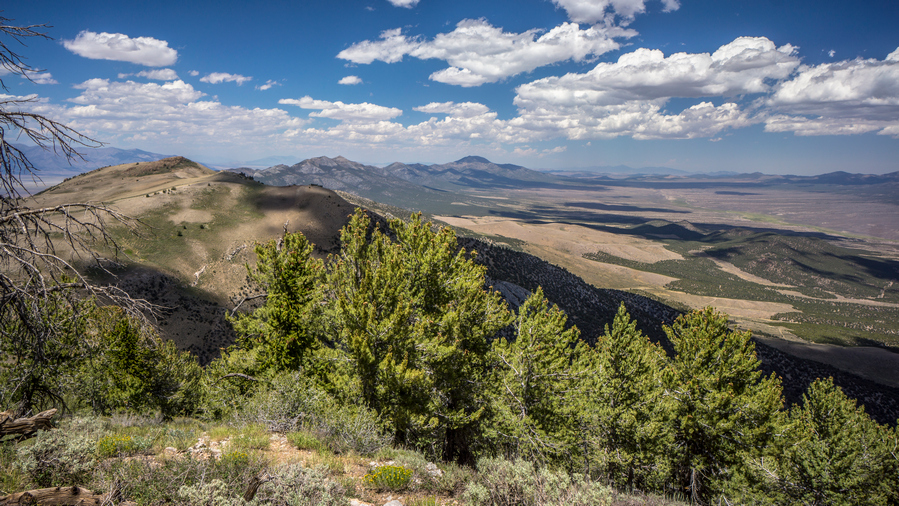
Schell Creek Ridgeline and Antelope Valley

Good trail remains along the ridgeline
Next the trail passes through a heavily wooded Hillside. This was a real pain in the ass section, because the trail seemed like it kept climbing forever. Steep trail, too.
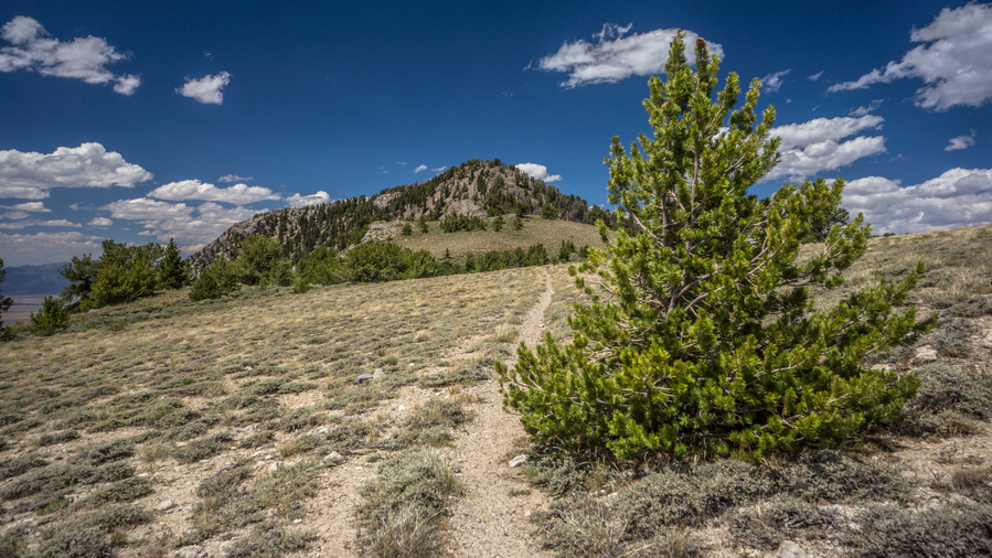
Hiking the ridgeline on good trail

Steptoe Valley
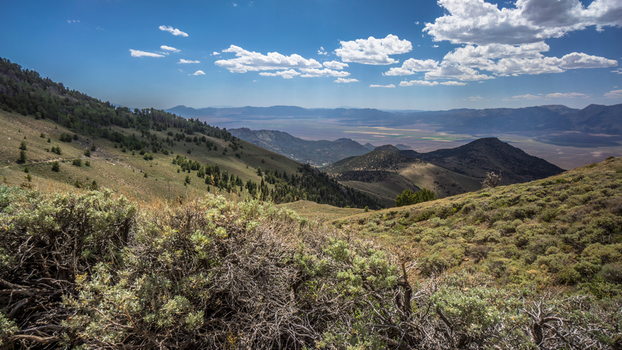
Excellent hiking, great views over Steptoe Valley
Next the Trail emerges on a high open Ridgeline. Moving on, the trail drops down significantly in elevation. Excellent views. About 100 ft down the hill below the road was an old truck, which lay in ruins. Apparently the truck drove off the road and rolled down hill.

Outcrops of limestone along the Schell Creek Range mountainside
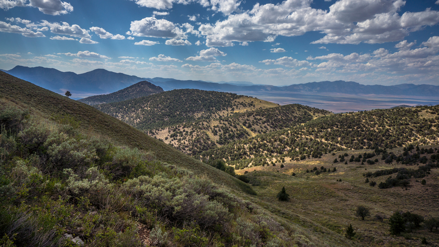
I enjoyed good views of increasingly more impressive limestone cliffs along the crest of the Schell Creek Range, now visible as I see it from a new angle.

The heat is getting to me today
I reached a point where the trail was supposed to skirt the hillside, but there was no trail or road. Instead, it dropped down another 400 ft or so. Then it was another thousand foot climb. It was probably 4:30pm now, and I was in direct sunlight. This was perhaps the hardest part of the day for me, and if I am honest, one of the lowest points I can remember on the whole Basin and range trail. I felt completely overwhelmed, being so extremely tired, exhausted and hot, and having so much further to go. With my pack on I sat down on the Steep 4×4 Road and debated what to do. I looked at my map, considering heading down hill and looking for alternate routes to avoid all this climbing. But there really weren’t any good routes, and somehow I mustered the strength to keep going. It helped that the sun went behind a cloud for a solid 20 minutes, while a slight breeze was in the air.

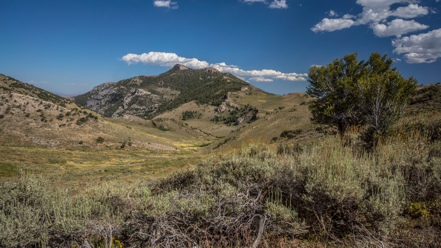
Hiking towards Ruby Creek
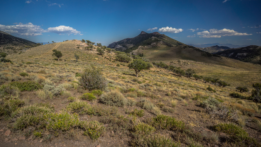
After this pass, the trail goes up on another Ridgeline. From here the trail drops down to Ruby Creek, my next water source.
Ruby Creek
Down at Ruby Creek, I found a very small trickle of a stream, and had to hunt for a spot to collect from. There was a lot of green alongside a Dry Creek bed, and I went up stream until I found a willow Thicket that produced water. Then, I had to get my trowel and dig out a pool to collect from. Fortunately there was shade here, so I was able to sit and relax while the pool filled and the murky water dissipated.
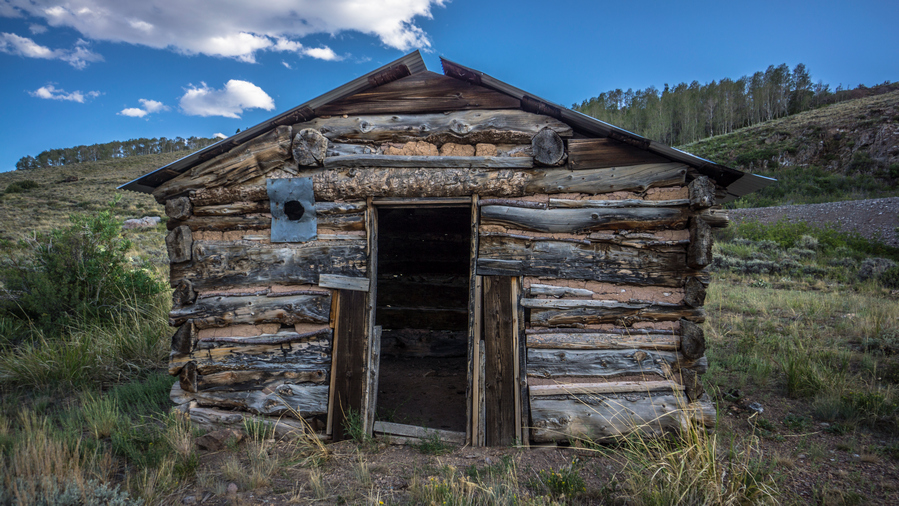
Cabin near Ruby Mine

Roof leak? Try rocks and dirt.
Then the trail climbs uphill again for another 800 ft. It passes Ruby mine, which had two old cabins. I saw no rubies, and no interesting rocks. I don’t poke around all that long, either. I saw 4 deer around here, though.
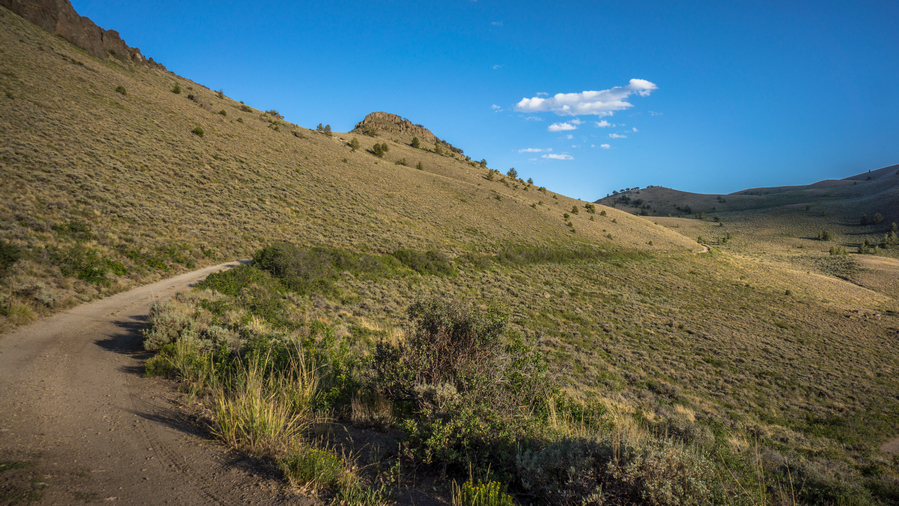
The Ranger Trail
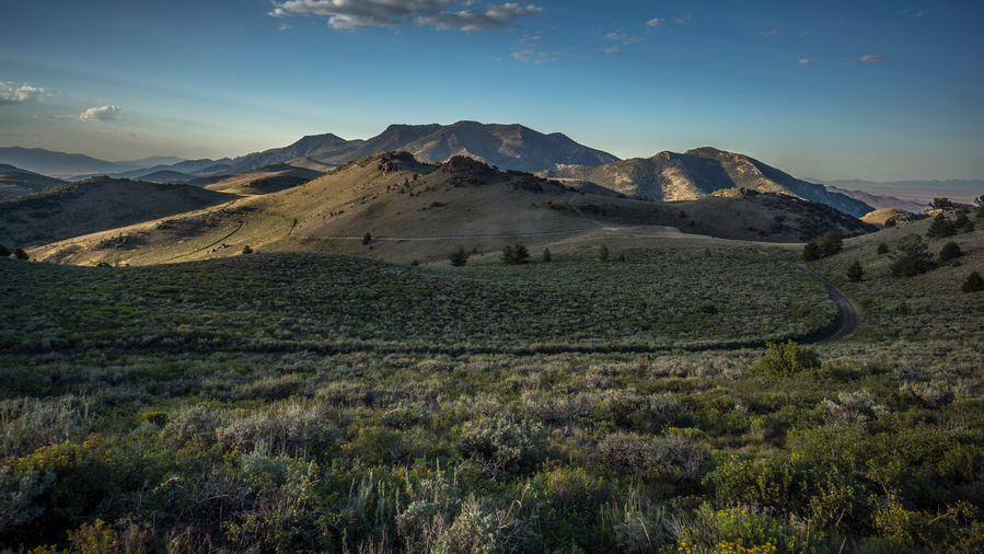
The Ranger Trail snakes its way across the crest of the Schell Creek Range
After this, there was a series of random Ridge lines, but the trail more less stays at an even elevation with climbs no more than 200 ft, and well graded. There was even a couple of signs that marked the ranger Trail along the road. From this point on, the evening was really nice.
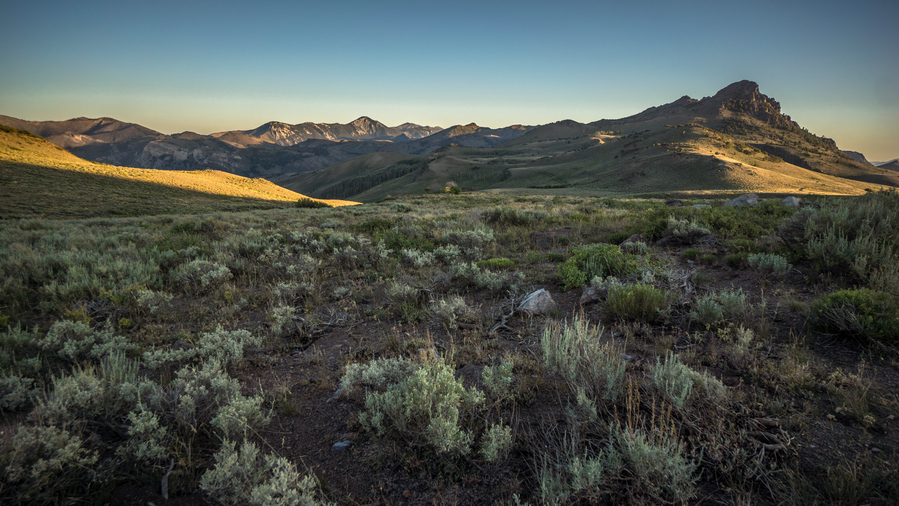
View south to the High Schells Wilderness
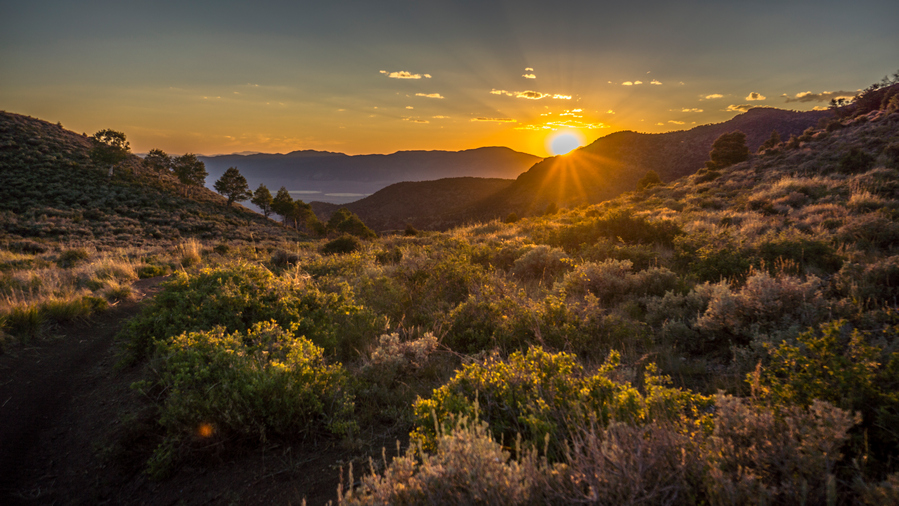
Sunset in the Schell Creek Range

Full moon behind Schell Creek Ridgeline
The sun had gone down behind the ridge, the temperature had cooled, and the lighting was just magical. Some really excellent hiking here. Beautiful views, Jagged Peaks to the South. All I could think about was how awesome this hiking was, and how much work I had to put in to just be able to have one hour of nice hiking in a day. 12 hours of extremely hot hiking, lots of climbing and filled with bugs… All for one hour of good hiking. And somehow, its worth it in the end.

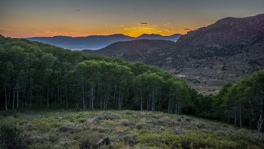
Brilliant sunset this evening
It was around 8pm and I was looking for a campsite. I got really lucky and found a nice open field along the road with many places to camp, and a small stream about 50 yards away. For once, a good campsite that didn’t require a lot of work, at the right time. I was really thankful for this tonight.
Day 60 – July 30th: Schell Creek Range, Duck Creek Valley, Cave Lake State Park Fishing, Timber Creek CG
Heard something walking pretty close to camp last night, sounded like horses. Yelled out at them, and like always, nothing happened of it.
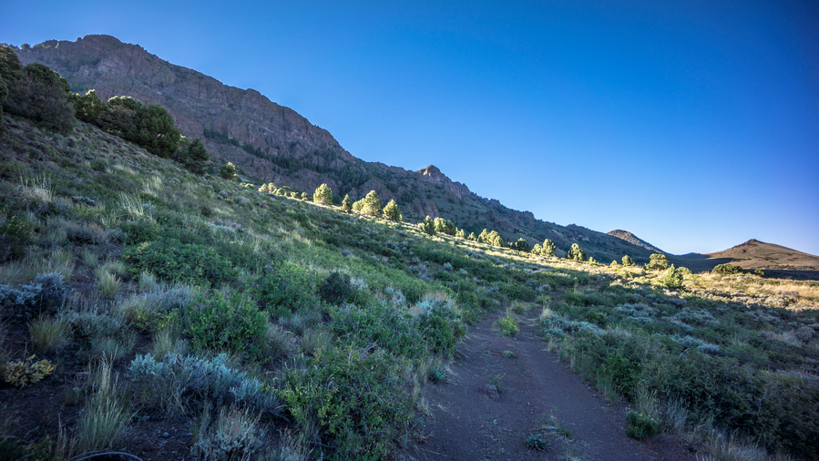
The Ranger Trail above Fitzhugh Creek

Hiking the Ranger Trail south
The views started out pretty good today, the Jagged Ridge towering above the ranger trail makes sure of that. Passed By a small spring, a trickle of water flowing through a patch of Aspen trees. Past another spring father up the trail, at least I believe it was a spring, as it was green and there were cows standing around it. Saw some sort of weather station in a field. This one was definitely functional and intact.

View west to Steptoe Valley and the Egan Range

At the beginning of the big climb of the day, while I was walking uphill, I saw a guy coming down hill. And he had two dogs. I waved, and said good morning. He said hi back, in a thick Spanish accent. Around the same time, I first started hearing sheep, and I realized he was a sheep herder. Sure enough, I saw his horse right up the hill, and down into the next Valley, a couple hundred sheep. Bah. Bahhh!

Pretty nice views going up this pass. This would be the last good views of the day, at least from a high Point. On the other side, my enemy… poof dirt. The trail dips down into a large Aspen tree patch. I could see the sheep herders camp in the woods, an old school looking canvas tent, coolers, bails of hay for his horse.

Trail disappears descending into North Creek. The High Schells Wilderness looms on the horizon now
Next I went up over a very small saddle. On the other side, the trail was pretty faint. It drops down into North Creek. I lost the trail for a little bit, and feared a terrible bush whack down this steep Canyon. Eventually I picked up on the trail again, thankfully. It led me to a small wooded area with a creek flowing through it. Perfect, shade trees and some good water to drink. Break time.

Brief bushwhack to find the Ranger Trail again
The trail was thick and overgrown sometimes, but it eventually led me to a road. It’s funny how I feel about roads now, having done so much bushwhacking. I don’t mind them as much now, at least, in short increments.
It was really hot now, but a decently enjoyable experience walking down the canyon. It must have experienced a recent burn, I can still smell it in the air and see all of the burnt Sagebrush. With the valley opening up now, and a view to the south of the Schell Creek range, I debated my options. The plan was to follow the Ranger trail along the hillside to bird Campground. But last night I decided after looking at maps that I could actually follow the Ranger trail to timber creek Campground, which meant I could stay off the high Ridgeline before North Schell peak for longer. But now that I could see the next few miles of my route, which appear to skirt the hillside of the high shells, it didn’t look too appealing. It kind of reminded me of the Lamoille Canyon to Soldier Creek hike in the Rubies. Is it worth the effort? I also considered walking around the entire Ranger Trail completely by going through Duck Valley, which would mean a road walk. This probably would be faster, and certainly less elevation gain, and didn’t look like I would be missing too much on the scenery front. Certainly more miles, though. So I was considering this.
Saw a guy and his wife on a side-by-side, a two-person vehicle. They were going uphill as I was coming down. After passing them, I realized I was supposed to make a turn where they did to stay on the ranger trail. I didn’t really feel like going back up hill. So this made my decision easy, I’m taking the low route through Duck Creek Valley to Timber Creek Campground. Timber Creek is the preferred way to access North Schell peak.
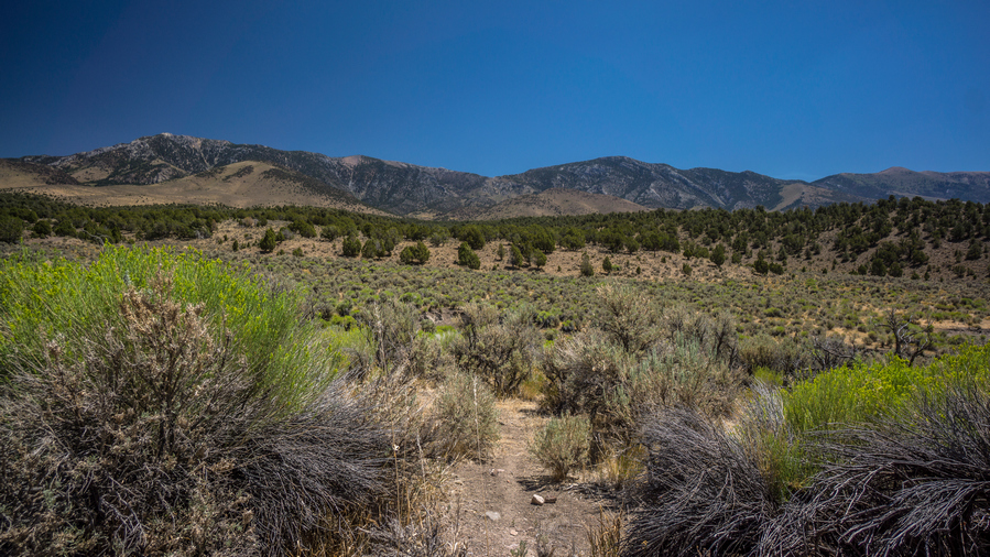
Duck Creek Valley view of Schell Creek Ridgeline

Walked down a pretty uneventful Canyon along North Creek, until reaching a residential area. Eventually reached the main Highway running North and south through Duck Creek Valley. I believe this was Highway 486. This was a paved Road. 10 vehicles drove by in the opposite direction, only 1 the way I want to go.
Finally, a jeep driving the opposite direction stopped even though I didn’t have my thumb out. They asked if I need a ride, I said yeah but the way you just came from, to timber creek campground. They said that’s where they were camped. They said sure we’ll give you a ride there. Then they said, were on our way to go fishing, you want to join? I said sure!
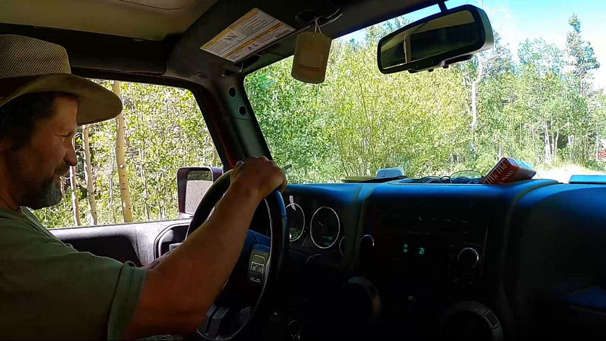
Dave the Gold Miner
Introductions, Dave and Donna from Cali. Dave is out here to do some gold mining. Waiting to hear from a friend on a location to do some dredging. So, he’s just exploring in the mean time.
So, in a matter of moments, I go from hiking to the timber creek campground to on the way to a small lake to go fishing. How random is that? We drove into Ely, bought worms. I bought a huge box of chicken and fries from the gas station. Hungry! Lady at the gas station had never fished Bassett lake, where we were going. She suggested cave lake instead (where I was ultimately planning to end this section at). So that’s where we headed.

Cave Lake

My new pal Dave

Getting my line wet. Had a few bites, but no takers
Cave Lake was beautiful. Water levels were low, like everything out here. Nice water color, a vibrant turquoise blue. Dave had some tiny fishing poles, like for ice fishing. They felt like kids equipment. I used a gold kastmaster, had some follows and bites but didn’t catch anything.
Sat under a tree on a picnic table in the shade. We discussed rocks, mining and treasure. Dave said he was going to pan/dredge/high bank for gold tomorrow and I was welcome to join. Always wanted to look for gold, with someone who knows what they are doing. I’m in!
Drove back through Ely and hit the gas station for beer, ice, supplies, then drove back to the campground. Sat around camp and listened to music on Bluetooth speaker.
Dave had a generator, which powered a small TV ,and we watched some horrible old van Damme movie, Black eagle. Wow. It was after dark and he had the generator running, and the TV up pretty loud. It was clear he lacked the proper camping etiquette, but I didn’t want to be the one to scold him.
After I went to bed he watched another movie, and had the generator running. He had some sort of bright light on throughout the night. I just put in my earplugs and zonked.
Day 61 – July 31st: Timber Creek Campground, Zero Day in Ely, NV
Got up after 8am. Dave and Donna were already up, tending to the fire pit. I could hear it crackle from my tent. They made corned beef hash for breakfast, cooked on a pan over the fire.
After breakfast we started to load up the Jeep with the mining equipment he thought we would need for today. The plan was to take samples from several different Creek beds and see what we found. Then concentrate on any Creek that showed promise. The Jeep was so filled with garbage, but they refused to clean it out. I was trying to be helpful, every time I grabbed something to throw out, he would say, oh we need that, there’s an email address or a password written on it. And sure enough, there was. But there was lots of other things that could be thrown out, instead, we had to squeeze in between tools, equipment, cooler, and garbage.
We left the campground and started driving down the dirt road back towards the main Highway in Duck Creek Valley. On the way out, we past the pay station where one pays the nightly fee. Dave noticed that it said fee station, and said, oh, we were supposed to pay for this campground? I found it a little hard to believe that he was camped here for several days and had not noticed this already, let alone on the first day. None-the-less, he balked at the 35 per night fee for the double campsite he had occupied. In his defense, this was really steep, especially compared to the $8 a night for a single site. So now, Dave and Donna decided that the best course of action was to head back to the campsite, pack everything up, and leave. So, back to the campsite we went.
We packed everything up quickly and This of course made the Jeep and the trailer even more jam-packed. Dave figured that he could just camp for free on National Forest land, which is true. So that was his plan now. I should have just parted ways with him here, while I was still at Timber Creek, so I could do the North Schell to South Schell Peak Traverse and finish this section as planned, but I was still enticed by the Prospect of gold mining.
Now we drove into Ely so Dave could buy a gold detector from the sports store. Donna and I waited outside while he went in and tried to purchase it. However, his debit card was declined. So he came back outside and spent a good while on the phone with Bank of America trying to straighten it out. The only thing is, Dave is not very tech savvy. He is 55 and Donna is 60, and they are both pot heads to boot. His bank tried to send him an email, and he was having serious trouble retrieving it on his phone. To complicate the matter, he bought like 4 new phones, and was never really sure which one he was using. In the end, the lady on the phone verified his identity in some other way. For whatever reason, the transaction still did not go through.
Now Dave was trying to find a Bank of America Branch location to physically drive to. The lady on the phone told him there was one that was 100 miles away. I looked on Google Maps, and could not find anything closer than Vegas, 4 hours away. Dave never bothered to ask which town the Bank of America was in, but now he was set on driving 100 miles to a Bank of America branch to try and pull out money, to then come back and buy the gold detector. It was already 1pm At this point the day was shot from my perspective. Since they are not going back to the Timber Creek Campground, where I would need to go to continue my hike, and I am already in Ely, where I am looking to end my hike, it just made sense to have him drop me off at a motel while I was here.
Of course I was disappointed that I could not do the Schell Creek Ridgeline Traverse, but at the same time, I’m more concerned about the logistics of ending the route next week at Great Basin National Park. I had sent my bounce box to the post office in Baker, which is only open Monday through Friday and they close at 3pm. So if I get there on the weekend, I would have to wait until Monday to get my box. This normally wouldn’t be too much of a problem, but I am also trying to set up a ride out of Baker to a major city where I could catch a plane home. Marlene, who I met in the Rubies and lives in Reno, offered to drive 5 hours each way to Great Basin National Park and pick me up. Finishing by Friday at 3pm would be best for her schedule, so that’s my new goal. Getting dropped off in Ely now almost ensures that I will Make that goal. Had I not done that, that timeline wouldn’t have worked.
So, Dave dropped me off at the Motel 6, where I stayed before I started the hike. While checking in, I asked Raj, the owner or manager, if he knew of anyone that could drive me out to the middle of nowhere so I can start the 10th and final section of the Basin and Range Trail. There was no taxi service in town, Uber or anything. To my surprise, he immediately had someone in mind. He gave me Terri’s number, whom works here as well. Great!
First thing I did was order an extra large meat lovers Pizza from Hometown Pizza, with a 2 liter of Coke, delivered. I took a shower in the meantime, and then Pigged out. Gotta feed the hiker hunger.
Didn’t really accomplish much the rest of the day. Typical stuff, wash some clothes, charge batteries and made some phone calls. Called Dad and had him send a box to Baker containing a laundry bag that I used to protect my backpack when I check it at the airport, my small Osprey backpack that I use for my carry-on so I can put my camera gear in it, as well as a pair of clothes to wear. I called Terri in the evening and left a message. She got back to me later in the evening by text and we began to discuss plans to take me out to my starting point for the next Section.
Day 62 – August 1st (Zero day)
I Started looking at the next section and made some route modifications. I had planned on walking the Ridgeline south of Mount Moriah, but that would have meant a crappy bushwhack down into Hendry’s Creek. So I modified the route to Make a base camp below Mount Moriah and then Summit it, then come back the way I came and down into Henry’s Creek. This will still be faster. Also, the route going up to Wheeler Peak did not look realistic. I checked the satellite view and it was up a couple thousand feet through trees. No way! So, I created another alternate route that goes around the east side of Great Basin National Park, up a different Creek than I had planned, up to the Ridgeline by Mount Washington, cutting off Mount Lincoln, and making my way over to Wheeler Peak. This would save the best for last, and also allow for a hike down to Stella Lake. But, I’ll walk though the town of Baker once on my way into Great Basin, forming a little loop as I return to Baker to complete the Basin and Range Trail.
Also, I had to figure out where I wanted Terri to drop me off. The original plan was Cave Lake State Park, but that would mean going up in over the Schell Creek range, which I’ve already pretty much written off at this point. That would also mean a walk across Spring Valley, in 101 degree heat. So, I made the decision to knock off another 25 miles and have her drop me off at the entrance of Deerhead Canyon, along negro Creek, below Mount Moriah.
Related Images:
Basin and Range Trail Thru Hike 2020 – Section 8: Wells to Wendover
Basin and Range Trail Thru Hike Section 8 Map
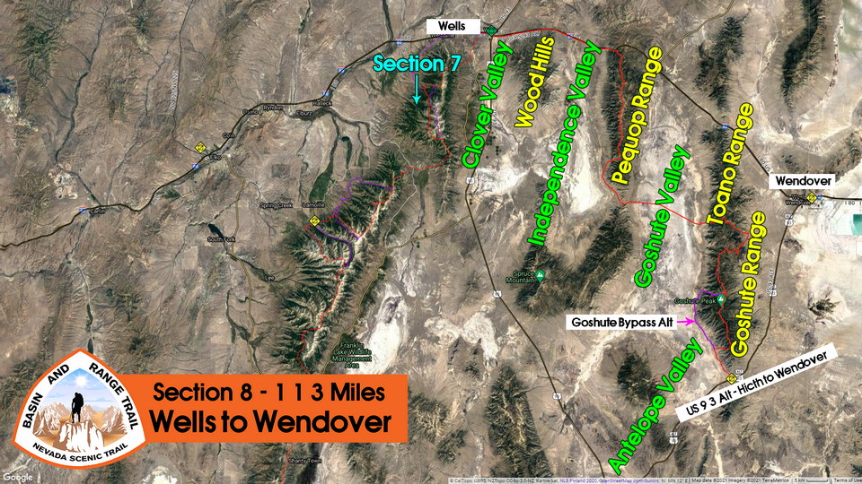
Video: Basin and Range Trail Thru Hike Section 8
In addition to this trail journal, I also filmed my Basin and Range Trail thru hike. I’ve produced a detailed series (11+ hours runtime) documenting this thru hike adventure, the product of over 1,000 hours of video editing. I highly recommending watching the Basin and Range Trail vlog series for an in-depth look at thru-hiking the Great Basin and central Nevada.
Basin and Range Trail Thru Hike Section 8 Journal
Day 50 – July 20th: Clover Valley, Wood Hills, Independence Valley, Pequop Range, Trail Magic
Woke 730. Walked to post office, which opened at 830. That was an hour round-trip. Started walking 9:45. While waking out of Wells I passed a younger guy, he said hey man come here a second. He thought I was homeless and was trying to give me his extra salad from a restaurant. But then saw my gear and realized I was a bit more well off. I told him what I was doing and he said “mondo respect”. His car was broken down and said he was stuck in Wells for a month. He asked if I wanted to come play video games with him in his motel. Kinda weird and random, but honestly, I would have if I weren’t walking out of town! You do weird and random stuff on a long hike like this, and find yourself in all sorts of situations. If you say yes, they typically work out pretty well.

Walking out of Wells
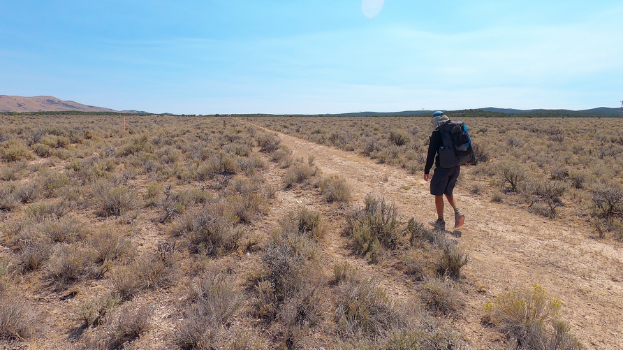
Hiking the 4×4 road along the interstate. This road is only a few hundred feet from the highway
I expect today to be the single most boring day of hiking on the Basin and Range Trail. Its going to be a hike of roughly 20 miles along Interstate 80 in order to connect the East Humboldt Range with the Pequop Range. Today, Ill walk across Clover Valley, Wood Hills, and Independence Valley, but on a track that’s only about 100 yards from the interstate. That’s because this area is all checkerboard land, an alternating pattern of public and private land. The long story short is that there is no legal way to cross this land, so its best to stay on a public road. I chose to follow the I80 service drive road that parallels the freeway to make the quickest time across this area, which was not going to be a highlight of the hike anyways. Every long hike seems to have one or two sections of filler to connect all of the great places it traverses. I am willing to sacrifice ONE day to connect the East Humboldt Range to the Pequop and Goshute Ranges.
Some cows along the route today. Passed through a gravel pit which also had cows. One cattle Trough about 5 miles west of Wells with water. Didn’t need it, so I moved on. Stopped for break as I hiked through the northern portion of the Wood Hills range. This area consisted of low hills and small trees, as the name Wood Hills might imply.
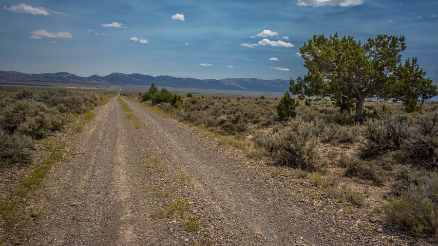
Entering Independence Valley
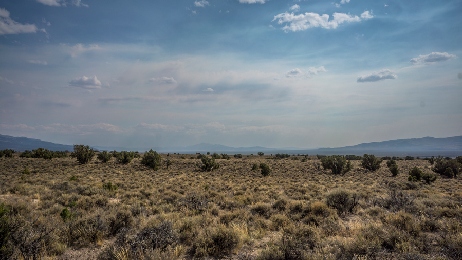
View south into Independence Valley
East of the Wood Hills Range, I entered Independence Valley. It was wide open and huge. Took another break at the independence valley exit along I80, in shadow of some abandoned metal crate thing for utilities.
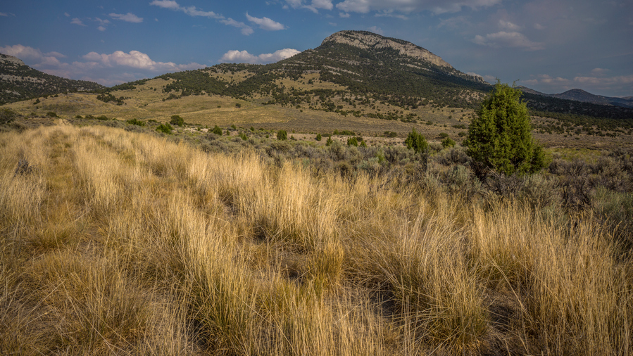
Getting closer to the Pequop Range

Looking up into the Pequops
By mid afternoon, I was starting to feel a bit off. I was really hot, tired and thirsty. I thought I had drank enough today, but my body just wasn’t having this walk today. Every day now the temps are low to mid 90s. My water was very hot, barely drinkable. However, as I approached the Pequop Range, the scenery was starting to get better. I wasn’t expecting much out of the Pequops, but they are starting to look like they have more potential as I draw near.

Interstate 80
Once I reached maverick canyon, where interstate passes through the Pequop mountains, the canyon narrowed. I began to get wedged in between steep hill sides and a fence. I was really whooped now.
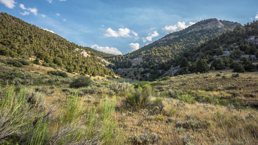
Hiking unnamed canyon to pass below Quop Peak
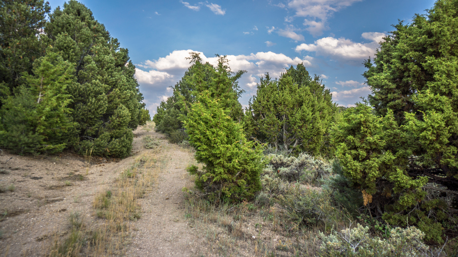
Road to the top of the pass below Quop Peak
Left the interstate and started walking up a canyon on a dirt road. Left the dirt road for secondary road. My side was starting to hurt a bit so I had to stop again for a break. Thirsty for cold water, and not much appetite.


The Pequop Range
Once at the Top of the pass, the scenery began to get beautiful. Not stunning, but simple beauty. Rolling hills, excellent view East towards the Toano Range and the Goshute Mountains. The play of Light and shadows with the clouds over the mountains was peaceful.
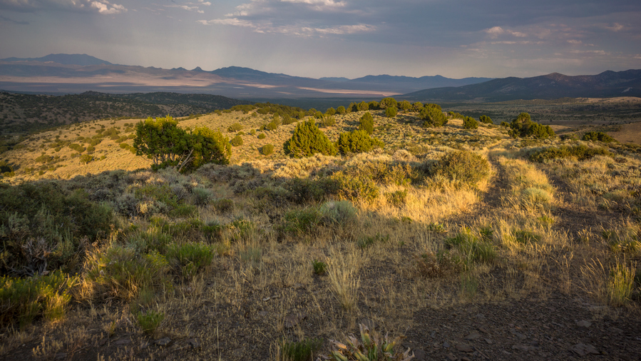
Views over Goshute Valley and the Toano Range

Looking down on Nanny Creek
I walked up and down a series of rolling hills towards my next water source Nanny Creek. Looking down into the canyon below, I could see a large pond. Sweet! Just need to get down the steep hill side to get to it. I was struggling now to finish out the day. Exhausted from the heat, presumably, even though I seemed to handle the same temperatures much better throughout the rest of this hike. Still, I was tired, had cramps, feeling light-headed and just slow.
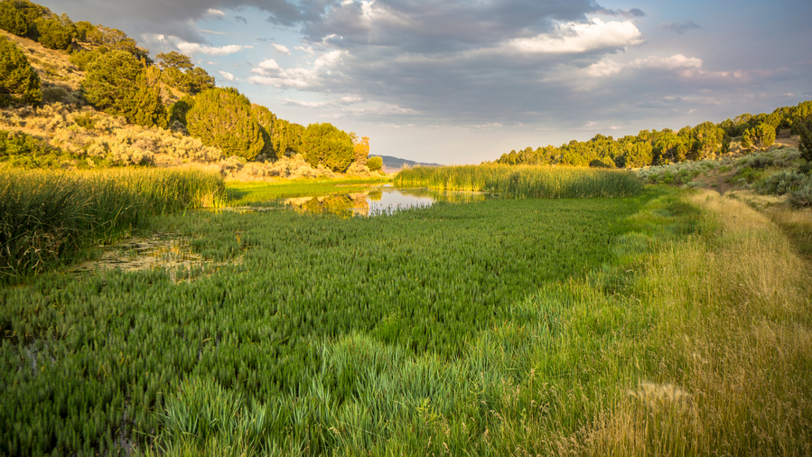
Nanny Creek
Nanny Creek was swampy. There is a man-made embankment on the downstream end forming a small pond. No way to get to water, the banks were shallow water with thick grass protruding a few feet into the water. Tried downstream, but no access either. I was on my way upstream to check the source when I heard an engine approaching. It was an older guy on dirt bike with weed whacker. Interesting!
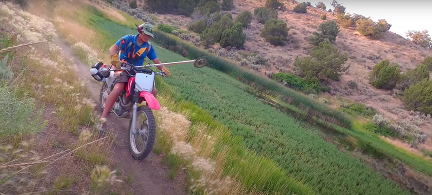
Kem, the local rancher
Kem, local rancher and mountain bike enthusiast, was out maintaining some dirt bike trails for the mtb project. We talked for about 15 minutes, and I was having a hard time concentrating… So tired, thirsty. Occasional stomach cramps. Dizzy. Ears plugged and could barely hear myself talk correctly. Dropped my pack while we talked and I had to sit down.
Kem offered to let me stay at his ranch this evening and join for dinner. Yes please! It was only a mile downhill. So that was that portion of private property I saw on my map.
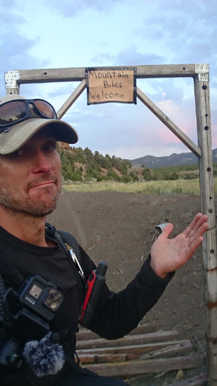
Close enough!

Sunset view from Kem’s Ranch
Walked down to his ranch, a nice walk. The entrance to his property is marked with a sign that says Mountain bikes welcome. Beautiful property, lush green, rock formations, sprinklers ruining, horses, Llamas etc. Nice farm house. Greeted by barking dogs which quickly warmed up to me.
Kem’s wife Donna prepared Salmon and rice for dinner, which was very good, but I could barely eat. So exhausted from the heat that it was messing with my appetite. Drank 2L water and 2 glasses of red wine. We talked about the route I’ve hiked through Nevada so far, and I went over my plans for this coming section, in Kem’s backyard basically. Kem was familiar with some of my route through the Pequops to the south of here, as his mountain bike trails and dirt bike trails run through this area. Ultimately, Kem decided to join me tomorrow as I continue my hike south through the Pequops. Hell bring the dogs and hike a day or so south with me, before turning back around, as I continue south.
Took a shower and had a nice comfy bed to sleep in. Wow what an unexpected way to end the day. To have been in such rough shape earlier, and having just walked the worst section of the Basin and Range Trail, to bump into Kem like this was an incredible moment. It couldn’t have come at a better time.
Day 51 – July 21st: Trail Magic, P
Barely slept last night even though I had such a comfy bed. Had horrible cramp in my calf in middle of night, still sore this morning. I Was really out of it last night and not feeling great, heat wore me out I guess. Roosters outside bedroom woke me at 5am. Slept to 630.
Kem and Donna were up when I walked out of bedroom. Donna had already made breakfast, pancakes and fruit. Delicious!

Kem and I ready to tackle the Pequop Range
Kem and I left for our hike around 8am, with 4 dogs in tow. Left the ranch and walked the dirt road back up into the Pequops. It was nice to follow Kem and have no navigating to do for once.

The Pequop Range is starting to look pretty nice!
Kem was in the air force, and flew C130 transport places. After his military service, he flew for Delta, and is now retired.
A dead Elk just feet from the water at this guzzler
In the northern Pequops there are a couple of guzzlers. When we reached the first guzzler, it was nasty water. Brown, like a cattle pond. The dogs jumped in the guzzler to cool off. Well, I’m not drinking that water now. Oh, and there was a dead elk a few feet away from the water. It had just recently died, within the last couple of days. This guzzler was not plotted on my Calopo map… Did I miss it in my research? Kem says another one higher up, so well get water from that one. Hopefully, its better water.
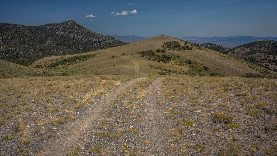
Good walking along the ridge
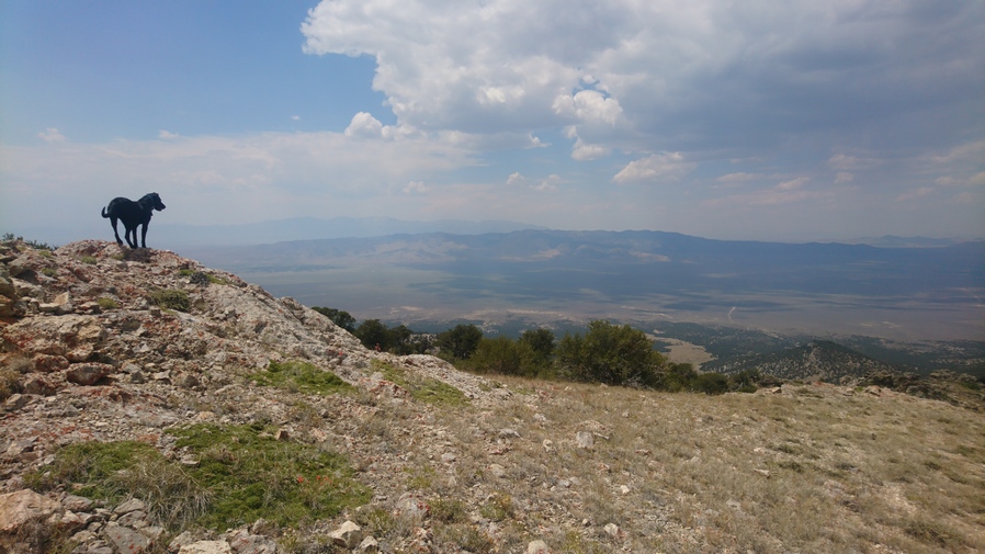
The dogs were enjoying the hike, too
Good views now that we’ve gained some elevation. Rolling ridges, really Nice. We filled up our water at the second guzzler. Clear water, no green tint. There were four separate troughs here at this guzzler. The dogs jumped in first one. We used second one until one dog jumped in, then we used third tank. I took 7L, expecting no water for a solid day plus across Goshute Valley and into Morgan basin.

Pequop crest view northwest, over Independence Valley

This trail is mostly used by mountain bikers and dirt bike riders, and is lightly trafficked
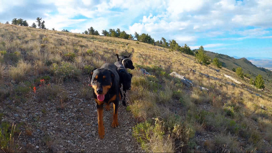
The convoy
Clouds building now, getting a little windier, Temps cooling. Hiked the crest of Pequops south and a network of game and bike trails that were mostly pretty good. Nice place to walk, pretty easy now. Mostly open terrain, some limber pines. Kem says these can grow to be over 1000 years old.

Looks like rain…
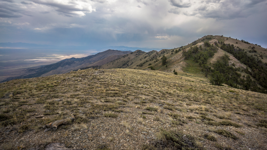
Crest of the Pequops, and Goshute Valley to the east
Great conversations with Kem. Talked about exercise, nutrition, family, adventures, economics etc. Kem is a great guy to talk to, seems very educated, reasonable and open minded.
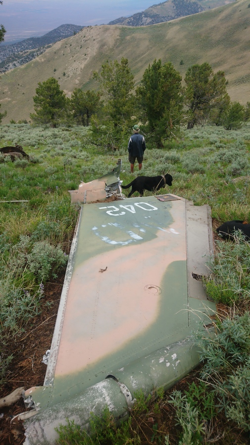
Tail from the F-111 plane crash

Scattered parts from the F-111 crash
Next we reached an F-111 plane crash by South Peqoup Mountain. Debris scattered everywhere, even over the ridgeline to the east. We could see it from a distance. The clouds were dark now and rain appeared imminent, with a visible shelf cloud approaching. It started to rain as we reached the crash site. Took shelter under a pine tree along trail. It was getting cold now, and I put on my wind pants/jacket. One of the few times along the Basin and Range Trail where I put on my wind pants, but at only 1oz, I’m glad I carried them.

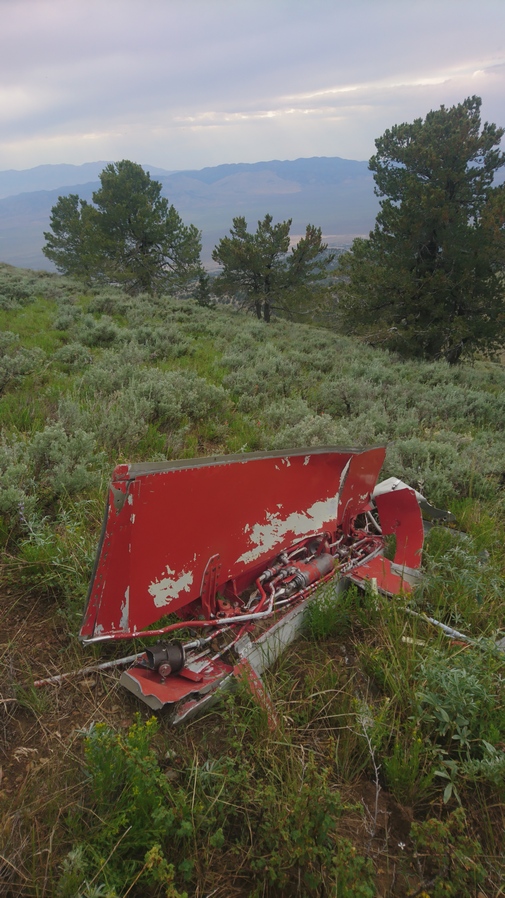
The rain cleared around 5pm and we continued to scour the F-111 crash site. Lots of debris, random parts. Hydraulic lines and valves, fuselage parts, circuit boards and wires, hatch, tail piece etc.

Dark clouds remain at sunset

Campsite in the Pequops
We set up camp not far form the crash site, on the crest of the Pequop Mountains. We had some cover from the wind thanks to a nice short, fat pine tree.

We found the F-111’s M61 Gatling gun!
After dinner, we walked east side of ridge and found the M61 Vulcan Gatling gun from the F-111! The barrels were twisted and full of dirt, but it was unmistakable.
Day 52 – July 22nd: Trail Magic, Hiking With Kem the Rancher, Pequop Range, F-111 Plane Crash
Woke at 545. The ground was lump and not at all flat, but I slept good because I was so tired. Rain for 20 seconds over night around 4am. Good campsite though, in the sense that there was a large tree that blocked most of the wind that otherwise would have hit our tents. Still some clouds over Goshute Valley to the east. A nice play of Shadows over the Basin.

This morning, one of Kem’s dogs laid next to my tent, and put too much pressure on the string that holds the stake to the tent and snapped it off. My Tarptent Notch Li is made from a Dyneema fabric, and I really don’t know much about the nuances of sewing this type of fabric. Kem assured me Donna could sew the string back on to the tent, but Id need to follow him back to his ranch instead of continuing on south along my route traversing the crest of the Pequop Range. My tent is not functional without it, and I would likely not be able to find anyone to repair it in Wendover, my next town stop. So, what option do I have other than to head back to Kem’s ranch?


Pequop Ridgeline
We hiked back to Kem’s Ranch mostly the same way we came in, except the final stretch. Again we had good conversations together. We talked about ancient civilizations and tribes, complex problems of the future, economics etc.

View west over Independence Valley
We’ve reached the area where Jack, one of the dogs, lost his saddlebags yesterday. He likes to rub up against the bushes, even if he doesn’t have the saddlebags, to scratch his back. So we each took a side of the trail and began to scour the brush. Kem found it hidden in the bushes as we expected.
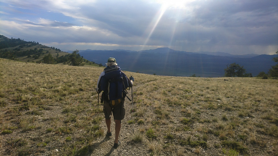
We passed the highest guzzler, but not needing water we didn’t stay long. We gave the dogs a chance to rehydrate. BB, the biggest dog, was having the hardest time. She jumped in guzzler to cool off, as some of the other dogs did. Only problem is, she could barely get out!
Instead of taking McKitchenson canyon, as we did the hiking up yesterday, we took solar coaster, Kem’s favorite mountain bike trail. He builds mountain bike trails in the woods and besides riding them himself, tries to get other riders to ride his trails through the mtb project. He says in a normal year he might get 100 riders passed through his trails. Some may stay at his Ranch, as I did. He mentioned I was the first hiker to wander through his area, though.

Kem standing under the largest juniper tree in Nevada
On the route we took back to Kem’s Ranch, we passed by a tree that Kem said is the largest known Juniper tree in Nevada. When he found it years ago, he had called the biologist for the BLM in the area, and they came out and measured it in various ways. There is a certain point stem, based on height, width, crown, etc and apparently, this tree is the biggest Juniper in the state. Pretty cool.
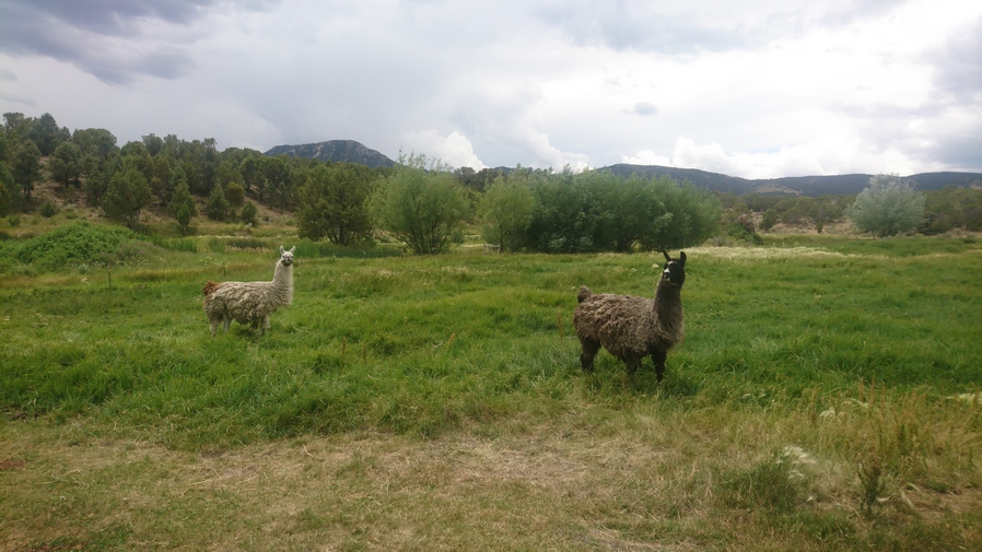
Back at the ranch
Looks like rain clouds building. Dark Skies by the time we got back to the ranch. When we got to the house, Kem offered me a monster energy drink. I was surprised to see he drinks those, but it just so happens they are my guilty pleasure, same as him. So we both enjoyed an ice cold monster.
Donna was able to sew up my tent in a matter of minutes. I checked the radar and it looked like rain clouds are continuing to build and move into the area. It was 1pm. now when we got back. Kem was going golfing with his buddies at 4pm, a regular event he does to get together with friends. The plan now is to drive me up to Morgan Basin in the Goshute mountains, rather than hike the northern Pequops again for the third time to in order stay on my track. But with the weather moving in, is that a good idea? It looks like an almost two hour drive to Morgan Basin from the ranch, which is kind of hard to believe since it was basically just across the valley, so Kem was reluctant to do it this afternoon since he didn’t want to be late for golf. Understandable. He asked Donna to drive me, but I could tell she was hesitant, unsure of her abilities to drive the truck on such a rough road as she said the visibility wasn’t the greatest in that truck. They suggested we wait until the morning. I’m okay with that, in fact I was only wanting to go this afternoon because I didn’t want to be a burden, impose or over stay my welcome.
I chatted with Donna for a while and she made me dinner, farm fresh eggs, bacon and cream cheese bagels. Very good! We chatted some more this evening, about her son’s Adventures as white water rafting guide in Idaho, and work for the mines. Kem mentioned his sons several times, they all seem to have quite a bit of outdoor experience and knowledge. One of their sons was into survival, and would go out into places like the Sierras with only a knife and water bottle. Apparently he had a lot of knowledge of plants as well, which to eat and which to use for medicine.
I went to bed a bit early tonight, at 9. I need to catch up on some sleep.
Day 53 – July 23rd: Goshute Valley, Hiking With Kem the Rancher, Goshute Range
Woke 6:15. Donna was up already, filling the hummingbird feeders and surveying the damage left from the elk. Apparently they have elk come in many nights and they eat the plants around the farm.
Donna made us breakfast, bagels with cream cheese and lots of fruit. Kem and I loaded up the truck and we left the ranch around 7:45. The dogs jumped in the back of the bed, wanting to go. But it wasn’t going to happen today.
The ride out to the Goshute mountains was interesting. Its really dry, in fact this area is among the driest along the entire Basin and Range Trail route. There was one spot along the railroad tracks that looked like a puddle of water on satellite, but that’s likely all it was a puddle after a recent rain. We saw no water in Goshute Valley.
After crossing the railroad tracks, I was surprised to see how wide open and free of Sagebrush this Valley was. There was Golden grass as far as the eye could see. Now, Kem told me the land looked over grazed. The grass that grows in here is called cheat grass. He said the original vegetation that grew here was some sort of rye. The first herd of wild horses we saw was about 20 strong. In the distance, we could see other herds of 10 or 20.

These ties are used to mark the historic California Trail throughout the Great Basin
We stopped along the road to check out a railroad tie marker for the California Trail. These can be found scattered throughout the Great Basin along sections of the California Trail. I saw these at Overland Pass, in the Ruby Mountains, and Huntington Valley.
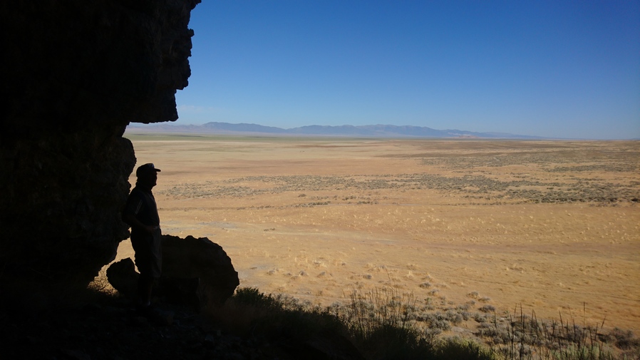
Goshute Valley view from small cave

Kem’s truck parked below in Goshute Valley
We also stopped to check out a small cave on a hill. It ended up being quite small and having no interest or significance, but it was a fun little side adventure.
As we made our way south, the rugged nature of the Goshute Range revealed itself. The Limestone Cliffs first start around Morgan Canyon. This is our entrance into the Goshutes. The road goes up and over Morgan pass. It can be driven in a truck, as we have done, although most probably do it in a side-by-side.

View east from Morgan Pass
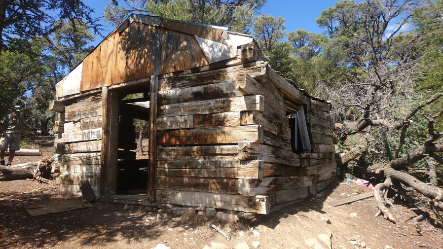
Cabin at Morgan Pass
We parked on top of Morgan pass in a small clearing. From there we walked up the Ridgeline of the Goshutes south to meet up with the route that I had mapped. There was a small cabin here in very bad shape. However, there were actually horse trails to follow. This is very encouraging and gave us a lot of hope, specifically me, about the prospect of the rest of this route across the Goshute Range panning out well.
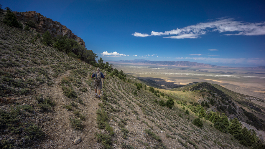
Kem following a decent game trail

View northeast, Goshute Range and Bonneville Salt Flats
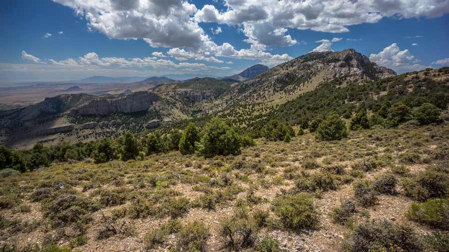
The Goshute Range is becoming quite beautiful
We went up and over a couple of Ridge and contoured around a few Hill sides. The father we went, the more beautiful the landscape became. Down the valley to the east lied a large Limestone rock formation carved out in almost a smooth manner. And farther to the east is the Bonneville salt flats. While the official measurement is roughly 30,000 acres, or 46 square miles, when one looks at the map the salt flats are only one small part of the much larger dried lake bed, Lake Bonneville. A rough measurement of this on the map is over 100 miles long!

Rugged limestone cliffs along the west side of the Goshute Range. Basin and Range geology in action right here
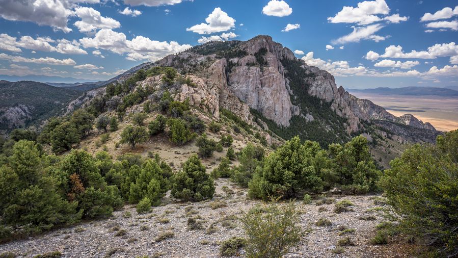
Excellent hiking along the crest of the Goshute Range here. Still good game trails to follow
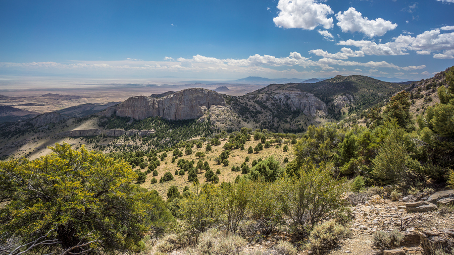
Impressive limestone cliffs rise from the hills all through the Goshute Range
We continue to hiking South until we reached a spot on the map that required a bit of work to get around. We should have stayed higher up on the Ridgeline, and so we needed to gain about 200 ft elevation. We climbed up towards the Ridgeline, and a small natural arch became visible. We took lunch here in the shadow of the arch. Looking Through the arch was a very impressive view of random rock formations and the Bonneville salt flats in the distance. Rain clouds began to form, thunderclouds billowing. I even saw one bolt of lightning.

Natural Arch and the Bonneville Salt Flats to the east

Cool natural arch at our break spot
After lunch, Kem and I separated. This was roughly the point he wanted to hike to before turning around. He had about a 2 hour walk to get back to the car, then his plan was to play some golf in Wendover. And of course, he must factor in the long drive back home. Looking back, I didn’t realize how far this would be for him and really appreciate the ride out here. Not only that, everything Kem and Donna had done for me… I stayed two nights at their house, Donna had made multiple meals, washed my clothes, I was able to shower etc. Its amazing what people are willing to do for a stranger. It makes me eager for the opportunity to return the favor to others someday.
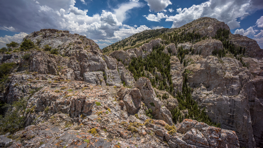
Following this ridgeline is a fun scramble with crazy good views

Are you kidding me? The best views of the Basin and Range Trail, in the Goshute Range? Maybe!

Looking back at the ridge I just came down
Now on my own again, I had to climb up to the crest of the Goshute Range and the true nature of the challenge presented itself. I found myself out on a Rocky Ridgeline that at first looked like it was going to require quite a bit of climbing. There were some scrambling sections for sure. One side had quite a bit of exposure, the other side a little bit less. Two sections of the Ridgeline were separated by a small gap, that required either a leap of faith or to climb down and around. I chose to climb around. The views here though are downright stunning. I am in awe of the Goshute Range, and completely surprised by it’s overwhelming beauty.

Excellent views all day in the Goshute Range
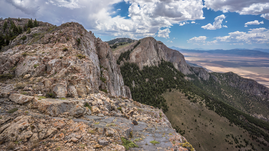
I love the Goshute Ridgeline!
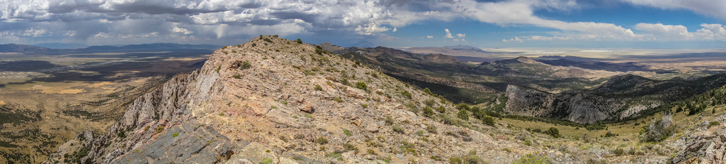
The next couple miles offered outstanding views. In fact, some of the most Scenic miles of the entire Basin and Range Trail. I say that often, but the beauty Goshute Range really stands out in my memories of this hike. The thing is, the horse trails have disappeared now, and it’s largely an off-Trail scramble. Still, not that hard considering there is not that much vegetation. Excellent views of Goshute Valley to the west and massive sweeping views of the Bonneville salt Flats to the east. Dark Skies Loom in the distance, though. A bit ominous, but the provided an excellent backdrop to the stunning landscape that surrounded me.

View east into Utah and the Bonneville Salt Flats
Looking east, where the Goshute mountains end and the salt flats begin is roughly the Nevada-Utah border. The town of Wendover can be seen in the distance from here as well. To the north, Pilot Peak is the prominent, volcanic-looking, Peak that dominates the horizon.
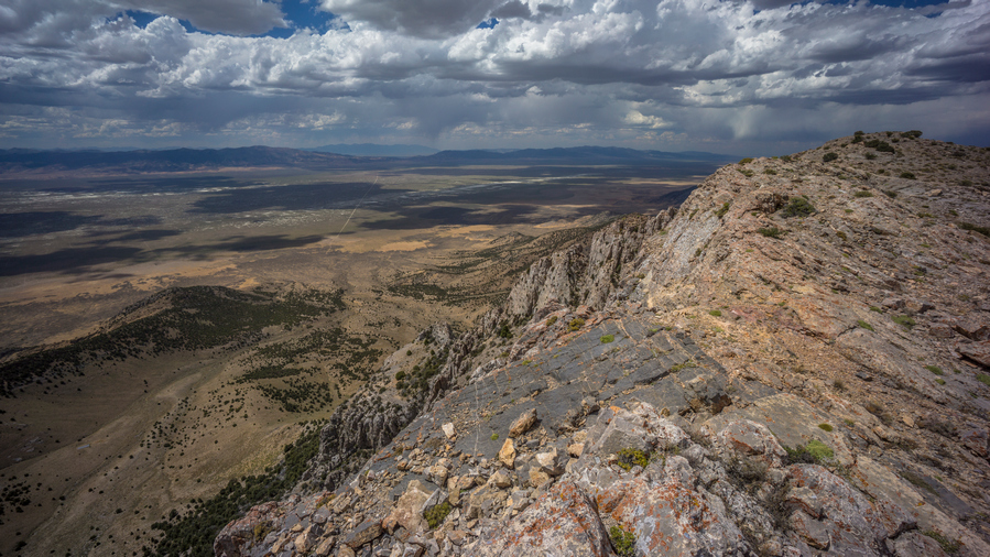
View out over Goshute Valley

Notice Pilot Peak in the center, along the horizon
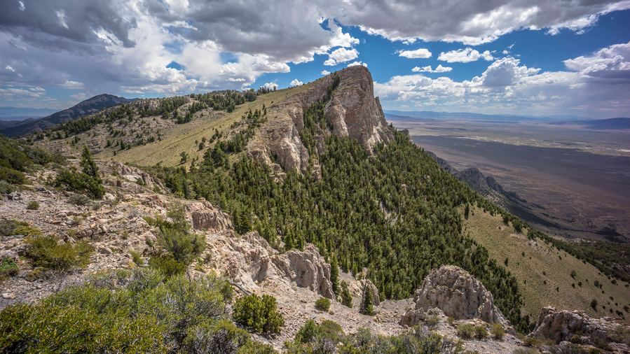
Ridgeline views hiking the Goshute Range
Working my way along the Ridgeline, the horse trails follow the edge of some cliffs. It was heavily wooded to the east, forcing me to stay along the cliff Edge. Eventually, the horse trails pass through the trees. This wasn’t really a bushwhack per se, but forced me to walk in a crouched down position to stay under the vegetation. Then, I passed a small cave. Couldn’t quite get to it without having to descend a small steep chute with a long run out, and so it was just not worth it.
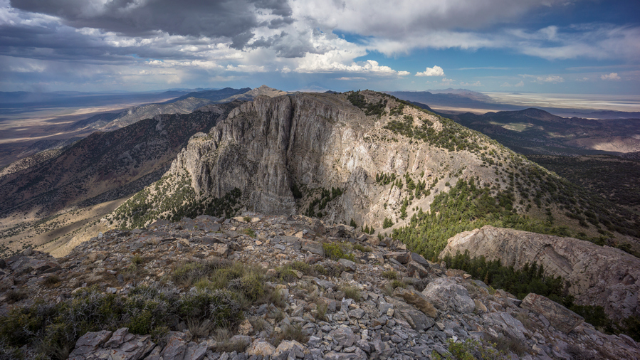
Looking north along the Goshute Ridgeline. I was walking the top of that an hour ago!
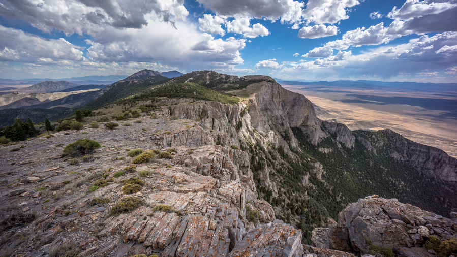
Hiking the Goshute ridgeline south

My zpacks Arc Haul backpack enjoying the view
This brought me to a saddle below Peak 8735. Across the way was a small cave, somewhat hidden with some trees by the entrance. I will hit this on the way down from the peak. Going up, you just pick your route and walk straight up. Great views up at the top looking back the way I came, it was a massive vertical limestone rockwall. Very impressive! Stopped to take a quick break while I Let a GoPro timelapse play out, hoping to get some movement on the storm moving across the valley.
After coming back down to the saddle, I made my way over to the small cave. There were some deer legs and a pelvis near the entrance, which always makes me think of mountain lions. I rounded a corner and saw the cave entrance. It was pretty small though, maybe four feet high at the entrance and slanted down to the ground about 10 ft deep. I could see a rodent sticking his head out in the back of the cave.
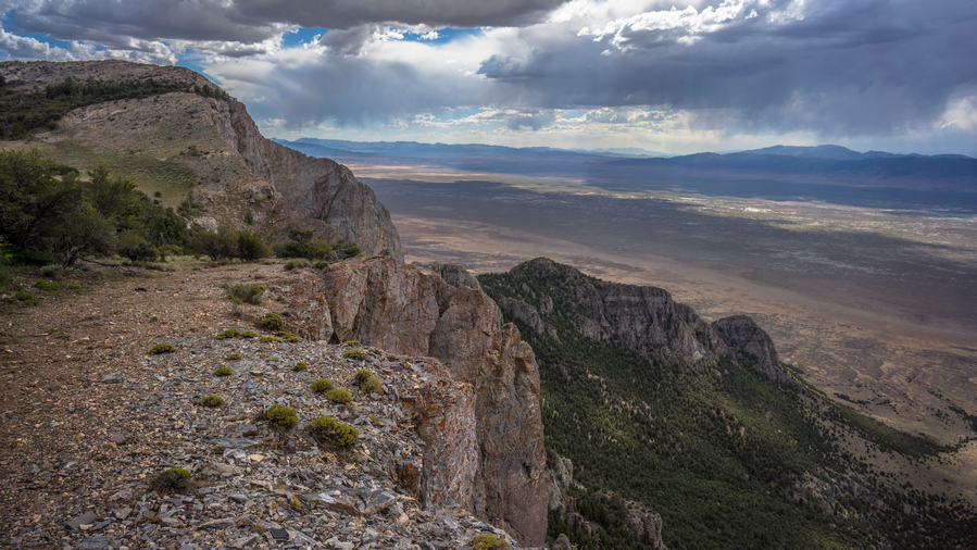
Walking the ridgeline
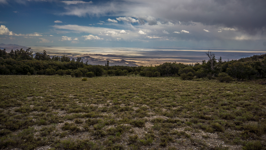
View east into Utah

Wild horses with an unreal backdrop of the Bonneville Salt Flats
Next I followed the Cliffside for a while. Saw another 8 or so wild horses. I followed some horse trails and contoured around a hillside a bit before climbing up to a ridge. The horse trails disappeared on the way up. There didn’t really seem to be a good route around this Ridge, it was Cliffy on one side and heavily wooded and steep on the other. This is where things started getting tough. Very tough.

Crap. East side of the crest is not hikable
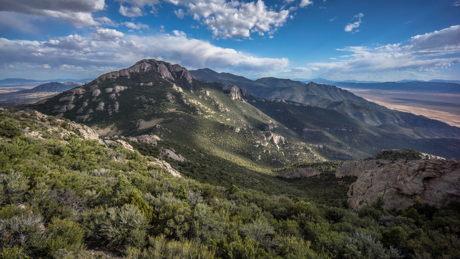
A monumental bushwhack lies ahead
I couldn’t really follow the very top of the Ridgeline, at the high point marked as 8780, as it was Rocky and too much vegetation. So I followed the steep hillsides about 50 feet below the top. Even here, the vegetation was thick. I weaved my way in and out of the trees. These were mostly mahogany, maybe some junipers. Eventually made it around the top of the Ridge and came to a Ridgeline that leads down to a saddle at 7990. This was a very disheartening sight. At the top, the Ridgeline leading down to the saddle was often a knife edge Style, with extremely thick vegetation to boot. There was no way to follow the knife-edge, it was too steep to the left / East, so I had to stay to the West. Here, it was a bit of a bowl-shaped Valley with a sea of green. An impenetrable wall of vegetation, a nightmare Thicket. Very disheartening indeed.
I began my descent through the brush. There were no horse trails, there was no obvious path or route, there was no section that looked less thick than others. It was literally one solid mass of green. I knew this was going to be awful. I pushed ahead, literally, pushing through the trees. They stood so thick together that it took a lot of force to bend the branches enough for me to fit through. These branches were not soft and limber, they were solid.
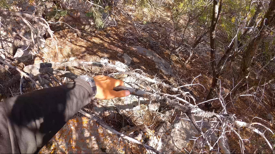
Bushwhacking for hours through this stuff
Bushwhacking here scraped away at my skin, drawing blood more times than I can count. Scrapers and stabbers galore. Pushing the branches aside and trying to squeeze through was one approach. The other was to break branches. This works better on older and dead trees than Lush and limber ones. Using my hands, it was easy to get cut, poke and stab wounds. If possible, I prefer to use my feet. I would kick the branches and try to break them off that way if they were low enough, waist-high or slightly above. This was the best approach overall, but it was slow and only worked with certain trees. I fell a couple of times in the process.
At one point I checked my watch and realized I had only moved about 250 ft down from The High Point in nearly an hour. This is about the worst feeling you could imagine. It was pretty overwhelming to find myself completely surrounded by thick brush, not having any way out, and knowing that it would still take a massive amount of effort to reach safety again. It’s hard enough to have worked your way into the situation, but I thought to myself what a nightmare this would be if you dropped somebody off in this scenario and left them to find their way out. I can’t imagine how a person would handle this situation. It’s super easy to lose your cool here.
I now I had several large cuts on my leg, many puncture type wounds on my legs and hands, and a cut on my forehead. This one was the worst as it took my hat off, so the cut sits about an inch above my eye and extends into my hairline, right where my hat sits.
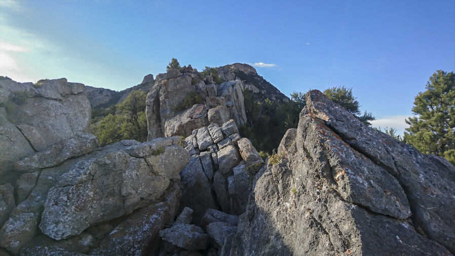
What a shit show this ridgeline is
I made it back to the Ridgeline, which was somewhat less knife-edge like at this point now. I hopped over the other side, now on the east side, to see if the going was any better here. Somewhat, at times, but overall pretty much just as hard. I was now on a steep slope, and I stepped on a boulder which I dislodged. I was able to get my leg out of the way, but I slipped and fell and my forearm took the brunt of the fall on another Boulder. The dislodged Rock tumbled down the hill, and took out a downed tree limb, before tumbling another few hundred feet.

2 hours to come down this one ridge,. Worst bushwhack on the BRT
Eventually made it to the saddle at 7990. I checked my watch and realized it took me two hours to go about a mile. Wow. I don’t know how many times on this trip I told myself that I never want to do that again. Then time and time again, I find myself in that same situation.
It was now about 6:45. I stopped to take a break to eat dinner. I had a solid view of Peak 9174, my next obstacle, while coming down through the thick brush. Now on the saddle, it was time to make a decision. It wasn’t really a hard decision at all, there was no way in hell I was going up and over that like I had planned. This Peak is heavily wooded, just like the one I came down, but with many limestone outcrops, ridges and Spires protruding from the trees. 1/2 mile an hour pace isn’t going to cut it, and there’s just no reason to put yourself through that kind of stress unless there is a more specific goal/purpose.
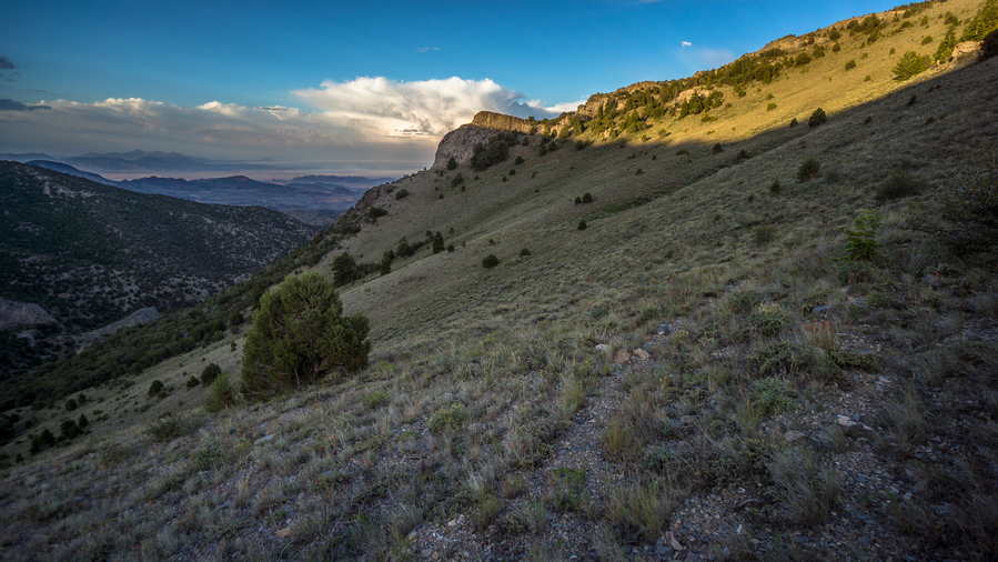
Finally, some easy walking
After my break, I began to follow horse trails around Peak 9174, contouring the hillside. At first, the horse trail led me right into some thick brush. And for another 10 minutes or so, it was a pretty shitty bushwhack again. This is where you just want to flip out. I had just got done doing this for 2 hours and now I’m right back into it again, with the sun going down soon. Fortunately, it was a short patch of brush and I emerged into a clearing again. From here, there was a very solid Horse Trail that led around the Mountainside, completely clear of all brush. I followed that and made quick progress.

Pilot Peak on the horizon to the north
My path up and over the Ridgeline requires leaving the horse trail and climbing 200 feet the hillside. When I got to the top, I was hoping to find a good spot to camp, but there was nothing. On the other side, it was pretty windy. The sun was going down soon and I didn’t want to commit to the other side of the ridge, being exposed to the wind and not really having a solid sightline of what the coming terrain would look like. So I was pretty set on camping on this side of the ridge. But where?
After walking back and forth for about 20 minutes, I finally settled on a spot. It was a small Spot barely big enough to Cowboy camp, but I was determined to make my tent work tonight. I got started by pulling rocks up out of the ground, using my tent Stakes as a digging tool. Some of these rocks were 3 ft long! Then, I started pulling up sagebrush. I use my shoe to kick all the rocks out of the way and clear a relatively flat spot. I was able to get my tent up, although it was slanted in spots and one tent pole sat down in the hole where a rock was, about 10 in lower than the other side. setting up a tent in this scenario is not easy, and basically impossible to get everything tight and taught.
Dirty and bloody, I began to clean myself up as best I could before settling in for the night. This was one of those days I was just happy to be done hiking.
Day 54 – July 24th: Goshute Range, Goshute Valey, Antelope Valley
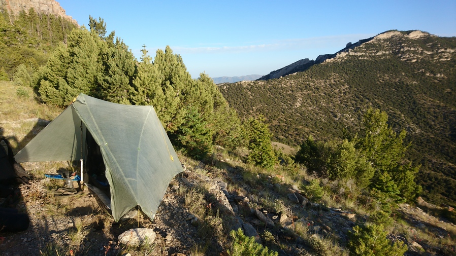
What a view to wake up to
Woke around 5:45. There were many bees buzzing around my tent this morning, and even a hummingbird. Over the past several weeks my sleeping pad was becoming a bit dirtier as I usually sleep in boxers now, no base layer bottoms. There were many more smears of Blood on the air mattress now from my leg wounds sustained during yesterday’s bushwhack.
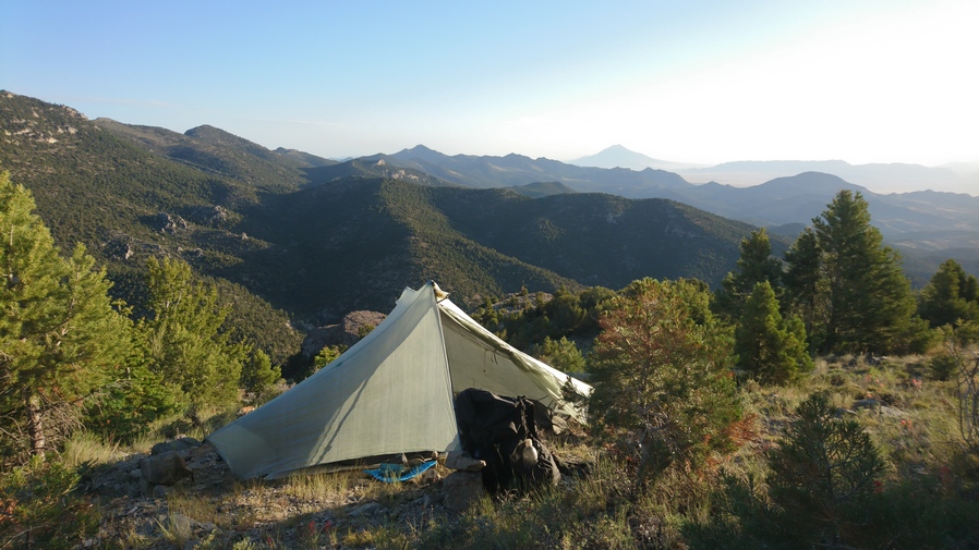
Good view, but not a comfortable campsite
It’s amazing what a night of sleep will do for you. It can be frustrating going to bed right after a difficult bushwhack, and then the added stress of needing to construct a suitable, or even subpar, campsite out of nothing. But this morning, I was feeling better about things.
I was walking by around 7am. I continued around the ridge that I stopped at last night, and began to scope out the route. From here, not only did I need to Contour the hillside, but I needed to gain a little elevation to maneuver around a slightly steep section. Fortunately, there were good horse trails to follow here. It really wasn’t an issue finding my way. This was a relief, especially in early morning. It’s difficult mentally to start the day with a bushwhack.
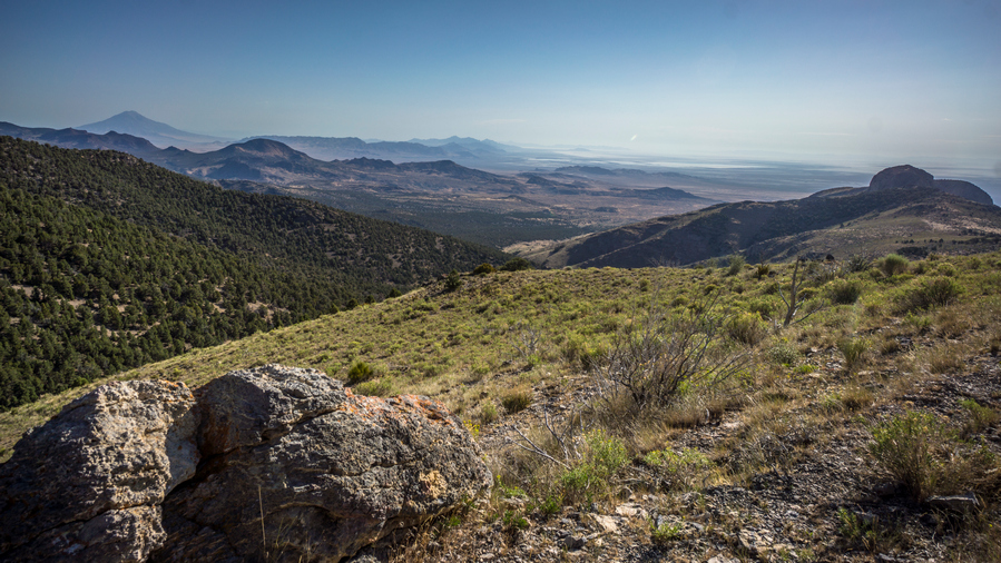
This morning’s hike was pleasant. I could still see Pilot Peak behind me which I really enjoyed. For some reason, I thought it had a primitive look to it, adding a unique feel to the area.
I saw a horse contouring around the hillside, coming out of a bit of a gully or ravine. The Horse had the sun behind him, and stood on a small Ridge or piece of high ground. It looked somewhat Majestic as he debated his next move, and walked along this High Ground.


View south along the ridgeline
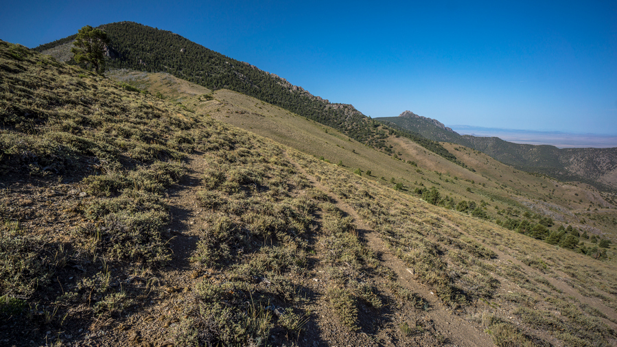
Game trail at the top of the Pass. The ridgeline ahead looks heavily forested, almost certainly more bushwhacking
After rounding the corner, coming out of the Ravine, I was overlooking a burn area now. This has been rare to see lately. It wasn’t long before I reached the saddle where I would drop down to a guzzler to get my water for the day. Here, there were many horse trails and an obvious Road up to the top of the saddle. I stopped here and had a look at the route to the South. If I continue South along the Ridgeline, that means going up a hillside that looked very thick with trees and vegetation. I know it clears out a little bit south of that as I approached Goshute Peak, but from there on South, My Maps show a heavily forested and super thick Ridgeline, complete with steep Terrain. If I wanted to continue South along the Ridgeline, that would mean dropping down about 450 ft to the guzzler, then climbing back up to the saddle, and then proceeding south on the ridge. From there it would be about 20 miles of Ridge walking, 100% off-trail, to Highway 93. To me that just didn’t seem realistic given yesterday’s bushwhack at a half mile an hour pace. The only logical Choice was to head downhill to the guzzler, get my water, and then proceeded down to Goshute valley and walk along the base of the mountains South to Highway 93. So that’s what I settled on.
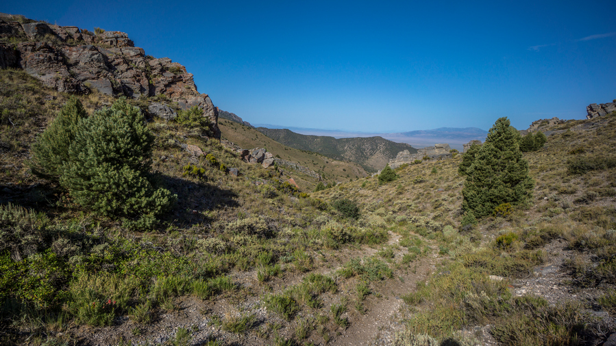
$x4 road leading down to guzzler

Guzzler
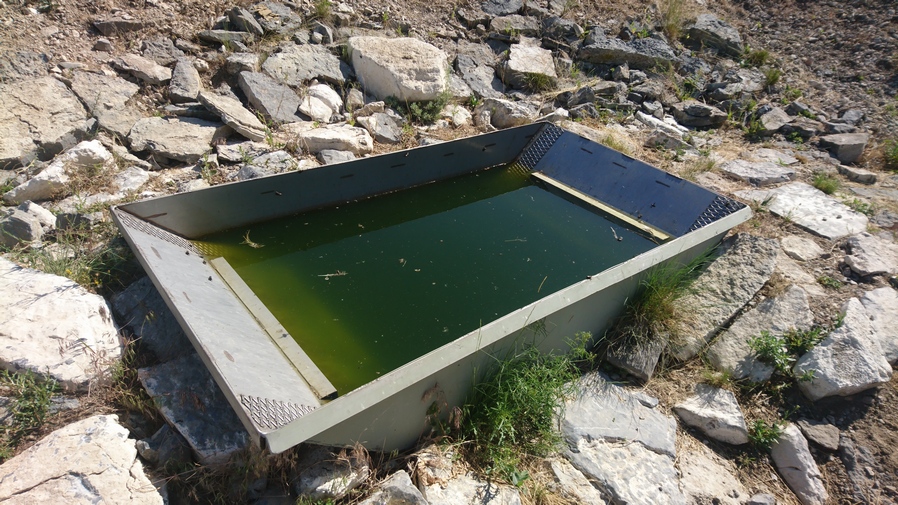
I’m in luck, the guzzler isn’t filled with water, but… Lemon Lime Gatorade! Score! Electrolytes… it’s what hikers crave
Following the 4×4 road, it was quick progress down to the guzzler. This one was a completely different style than the other ones I’ve seen so far. This guzzler was basically a large piece of metal, like a metal roof, on a slight angle to collect all the rain water which funnels into a gutter, and then drains into an underground tank. From there, it’s piped over to a trough. The trough was full of very green water, with a lot of dead bugs in it, and many more flying around. But this is the only water available, so it’s what I will drink. There were two game cameras set up pointing at the guzzler. One of them had a sticker on it that said, “hello this is not hunting, College project, thanks”. The other one did not have a sticker.

Do your thing, Sawyer
It took quite a while to filter this water. I took 5 L with me. I backflush my filter after about 4 liters when I noticed it was getting really slow. Extremely green water came out, about the same color as what I was putting into it. Then I backflushed the filter again after my 5th liter so that the gunk didn’t stay in the filter.
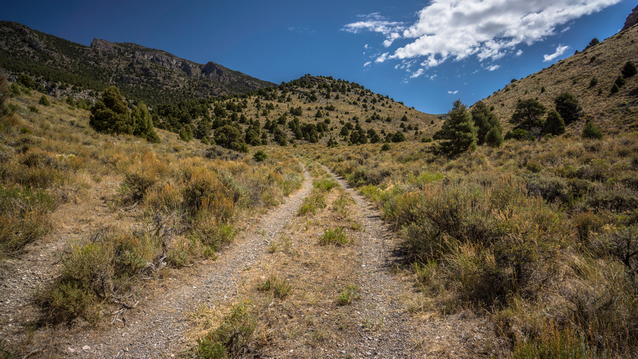
4×4 Road leading out of the Goshute Range
I walked maybe a quarter mile downhill from the guzzler and a Truck approached. I was pretty surprised, but assumed they were going to look at the guzzler. Course they were just as surprised to see me. I told them I was hiking 1100 miles to Nevada and that always gets their attention. They were indeed Hunters, scouting out the area, here to look at the guzzler for signs of elk. They asked if I needed water or food or anything, and I told them I was all good, I had just filled up with all the water I need for today and have 3 days of food for a 1-day walk. But they were persistent and convinced me to chug one of their liters of water and Help them eat some of their salami cheese and crackers. So I stopped for a while and chatted with them. Bradley and his son Dylan, and Brad’s friend Pat.
After talking with them for 20 or 30 minutes, I continued downhill. I walked down the valley, more or less enjoying the hike. There were some rocky formations among the hillsides, and I think more than anything, I was just enjoying the fact that I could walk without having to put any effort into off-trail hiking. It’s kind of a luxury now walking a road, compared to the past where I’ve often despised it.

View south to Goshute Peak
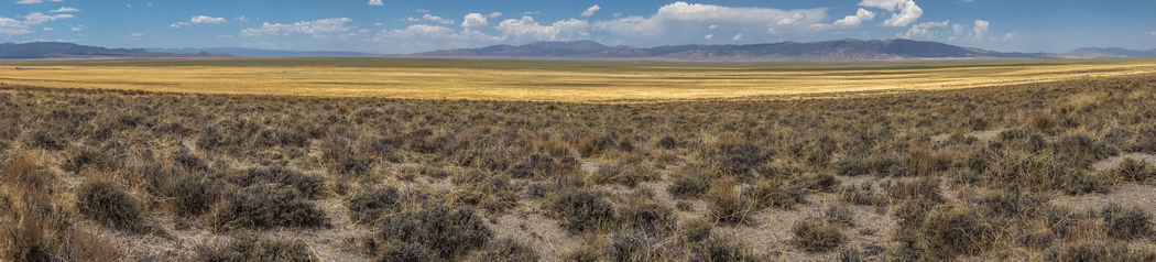
Goshute Valley
I walked South for a while, enjoying the view of the Goshute mountains with the golden grass waving in the Wind down low in the valley. Cheat Grass, I remembered. I could see a couple of buildings, structures and a Corral in the distance. I knew this was Shafter well #4 as marked on my map.

Approaching Shafter Well #4 and an old homestead
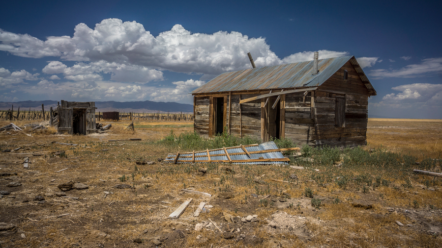
An old home

All are welcome
At Shafter well #4, there were a couple of buildings… A main house, the entrance to what looks like an underground bunker or basement storage type area, a chicken coop like building, and a 3 sided Barn. There were also many corrals, which looked super raggedy. The doors to the main house were wide open. The floor was littered with hay and it was clear that Animals had been living in there. There were piles of cow shit inside the house. The doors had interesting things written on them, such as “escape room and telephone”, and “looters and loafers beware, survivors will be prosecuted”. How Nevada.


The Barn

The three sided Barn was somewhat interesting in the sense that it was the most intact building. You could really get a sense of how this place was used back in the day. Ther were various animal pens and other small wooden structures. There is now water at Shafter Well #4, unfortunately.
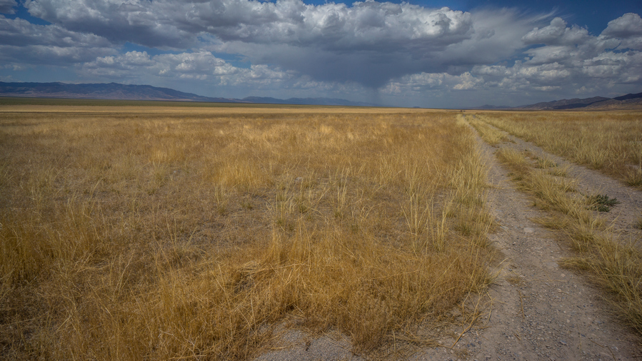
View north into Goshute Valley

Goshute Mountains from Goshute Valley

Moving on from Shafter number four, it was back into the sun, the heat of the day. The clouds were building now and it looked like a bit of rain to the north. The clouds were intermittent where I was, providing some shade here and there. Even so, it wasn’t as hot as other days. The view of the Goshute mountains to the East were nice, as this was the rugged Cliff side of the thrust fault Mountain geology. This is one reason why walking this side of the mountains was so Pleasant, through Goshute Valley. I always feel defeated and disappointed in myself when I back out from a plan, such as walking the Ridgeline of the Goshutes. But in all honesty, I was really enjoying this walk down here. All of the other valleys, or basins, I’ve hiked along the Basin and Range Trail were thick with sagebrush and had a much more desert-like feel to them. This one was full of that golden grass, and just had a completely different feel to it. The cliff-like mountains on one side, golden grass, absolutely massive Valley stretching far to the West, with the South Pequop Range, Spruce Mountain range, and Cherry Creek range on the horizon. It’s tough to explain why exactly I liked this Valley so much. It was just so massive and empty. I thought back to my time on the CDT And the area just north of Snow Lake in the Gila Wilderness. The area I called a sea of gold. This was a lot like that, in a way.

Hiking in Goshute/Antelope Valley. Where’s the boundary?
I stopped for lunch under a Lone Tree on a hillside that had about four small caves. They were high enough up on the hillside and small enough that it wasn’t worth going up there to explore, but still cool to see. At some point around here, Goshute Valley becomes Antelope Valley, according to the map. On the ground, I can see nothing that would indicate any sort of geological boundary line that separates the two valleys. It seems like they just merge in the middle of a great vastness, with no obvious landmarks or features that would dictate such a change.

4×4 road through Antelope Valley, view south

Goshute Range from Antelope Valley

Antelope Valley, view west to Spruce Mountain and the Pequop Range
I walked on, enjoying Myself much more than I expected for a low route. In fact, I found myself feeling exhilarated. Something about Wide Open Spaces, hard to explain. I couldn’t help but smile. Let out a couple loud woohoo sounds with no one around to hear them.

View west along US 93 Alt at Whitehorse Pass
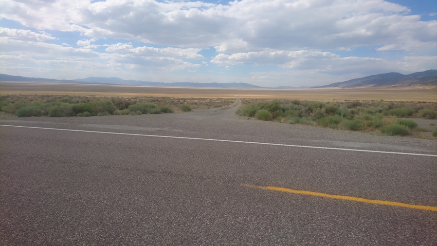
The road through Antelope Valley meets US 93 Alt
When I reached US 93-Alt, it was time to hitch 33 miles north into Wendover. Five or six Vehicles passed by, in a span of about 30 minutes, with no luck. A stake truck drove by who also passed me up, but then I could hear the vehicle stop a few hundred yards up. I turned around and indeed saw him backing up a bit and moving over to the shoulder. I grabbed my pack and ran up the road. He said a ride to Wendover is no problem, hop in.
His name was David and he was from Provo Utah. He runs a handyman business, as well as driving the truck that he was in. Some sort of manufacturing company. He grew up in Utah and had lots of fun memories about outdoor trips, hunting arrowheads and such. It was about a 30-minute Drive into Wendover.
When we reached Wendover, he asked where I needed to go. I said drop me off near Smith’s grocery store, please. So he dropped me off there at the parking lot. There were no hotels here though, that was the problem. They were all about two and a half miles east, across the state line into Utah on the Wendover side. The Nevada side is called West Wendover. No problem though, I will just do my grocery shopping here and now and then walk over to the Utah side afterwards and grab a motel. This way I don’t have to do it tomorrow, and it will save me two and a half miles of walking as part of a round trip.
I made a quick hotel reservation on Priceline and then threw my backpack in a shopping cart and went inside the store. I had a feeling people were looking at me a bit funny. When I was done, I discarded most of the extra packaging for the food outside of the store and threw it away so that I could put my newly bought food into my backpack with minimal space. This worked out as I walked across town.

Wendover Will welcomes you to West Wendover
So now it was a 40+ minute walk across town to my hotel. In the middle of the street in West Wendover, is a giant cowboy sign/statue. It says, “Wendover Will welcomes you to West Wendover”. What a tongue twister. Pretty goofy. This was in the median of the street. The statue is probably 50 or 60 ft tall. In the median is a small patch of grass, and a pronghorn was feeding here in broad daylight. Aha, Town wildlife.
As I walked into the Utah side, I passed by a small gas station with a Subway. Outside was a couple of guys who looked homeless. One of them saw my backpack and his eyes lit up. He gave me a thumbs up and said something to the effect of “way to go brother”.
I was a bit disappointed that my hotel was on the extreme east side of town, pretty much passed everything on the walk in. But I guess that is to be expected for one of the lowest priced hotels in town. Even still, it was $71 a night, which might be my most expensive night yet along this whole route. And on the Utah side, the taxes were quite a bit higher then in Nevada.
Celebratory pizza and wings
Not wanting to leave my room and walk across town again for food, I ordered Pizza Hut delivery… Large 3 topping pizza, 12 chicken wings and a two liter of Coke. Took a shower and when I got out as the delivery guy was just arriving. Perfect timing.
Washed my clothes and started charging my batteries. Now I could relax and watch a little TV for a bit before becoming so tired I couldn’t keep my eyes open.
Day 55 – July 25th: Zero Day in Wendover, UT
Slept great. Slow start to the morning like many zero days. Laid in bed and updated my journal. I’ve been having a hard time keeping up with it at night on trail, I usually fall asleep before I can finish it.

Wendover Army Air Base
Today I went up to the Wendover Army Air Base Museum on the edge of the Bonneville Salt Flats. This is a historic Air Base, playing a huge role in World War II. This place was heavily involved in the Manhattan Project as well, with the training and deployment of the first atomic bombs dropped on Japan.
Replica atomic bomb
I watched an 8 minute video inside the museum, and then walked around looking at the various artifacts inside. During World War II, The Wendover Army Air Base was a training base for B-17 and B-24 bomber crews., as well as playing a vital role in the Manhattan Project. It was the training site of the 509th Composite Group, the B-29 unit that carried out the atomic bombings of Hiroshima and Nagasaki.
This is the actual “Jailbird” plane used in the movie Conair
Move over, Swamp Thing. I’m flying the Jailbird now
Cameron Poe, Garland Green and Cyrus the Virus once sat here!

View towards the cockpit
In addition to the military significance of the Wendover Army Air Base, Scenes from the movie Conair and Independence Day were also filmed here. There is a C130 transport plane here that is open to walk into. This was the exact plane, the Jailbird, used in the movie Conair, for the Lerner Airfield scenes. After filming the movie, it was left here to the museum. Now you can self tour the Jailbird for yourself, and look out from cockpit into the Bonneville Salt Flats. How cool!
Wendover itself doesn’t have much to offer, but it was cool having the Wendover Army Air Base museum here to explore on my zero day. That’s more than I can say about the rest of the town stops along the Basin and Range Trail.
Related Images:
Basin and Range Trail Thru Hike 2020 – Section 7: Lamoille to Wells
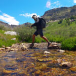
Basin and Range Trail Thru Hike Section 7 Map
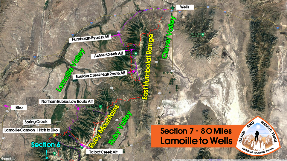
Video: Basin and Range Trail Thru Hike Section 7
In addition to this trail journal, I also filmed my Basin and Range Trail thru hike. I’ve produced a detailed series (11+ hours runtime) documenting this thru hike adventure, the product of over 1,000 hours of video editing. I highly recommending watching the Basin and Range Trail vlog series for an in-depth look at thru-hiking the Great Basin and central Nevada.
Basin and Range Trail Thru Hike Section 7 Journal
Day 44 – July 14th: Lamoille Canyon, Ruby Mountains
Cody picked me up around 830. I called the Sharon Hotel in Wells on the way to the trailhead, to update my ETA. I figure I will be there the 18th and 19th, instead of the 19th and 20th. Unfortunately they are booked the days I will be there. They suggested a different hotel. They also have my bounce box which is good news.
There weren’t a whole lot of good options for me to continue my northbound track coming out of Lamoille Canyon. High in Lamoille canyon, I would have had to climb over a very, very steep ridge to drop down into another basin. And I would have had to do this several times to continue on my Northern trajectory. This would have been the most scenic route, but also very difficult, with no guarantees of safety or success. So, in order to maintain a good pace And schedule, I figured a lower route would be in order. Also, the fact that Cody was joining me for this section made the low route the obvious choice. Cody will join me for an overnight hike from the Powerhouse Trailhead to Soldier Creek, roughly 20 miles.

Cody and I at the Powerhouse Trailhead in lower Lamoille Canyon

An actual hiking trail exists north of Powerhouse Trailhead, for now
Left the powerhouse trailhead in lower Lamoille Canyon around 9:45am. This was an old burn area. Lots of switch backs going straight up the hill. Good trail though.

Eventually we realized the trail we were on was not following the path marked on the map. Our Trail was climbing much higher. This had us a bit worried. Where’s the trail taking us to, the High Country? Because the rest of our route was not going this way. I theorized that the trail had been rerouted above the old burn area, around the new growth. This proved to be right, after we climbed a ways, the trail paralleled the lower version of the route marked on the map. Good deal.

A view up towards the high country. It would be a thick, rugged hike up there, but beautiful
We won’t be going up into the high country today, but at least we get a glimpse of it. Typical views up the many drainages we will cross on today’s hike along the base of the Rubies.
Now that I have my bearings…
Cody was super excited to be out there, and I was really glad to have someone here with me. I know he was a bit worried about slowing me down, but he had a good pace and that was not an issue. He had everything he needed for the hike, Although our gear setups couldn’t be more different. He had a small backpack, but was able to fit everything he needed for an overnight hike. He had a white cotton t-shirt, cotton shorts and heavy steel toe boots. Off his backpack hung a small stainless steel cup that clanked against something else on his backpack, perhaps the metal zipper. Kind of like a bear Bell.

Cody had lived in Idaho in Colorado for the last couple of years, and had just returned home to this area. He knew a good deal about the area from his childhood years here. He fed me bits of info here and there about the land and its history. However, he had no knowledge of the trail we were walking or really much about the land north of Lamoille Canyon in general. With good reason, this area was largely On the Border of private land and offered no real access to the High Country. At least, not legal access.

Just two goons hiking the Basin and Range Trail, don’t mind us
Hiking today was a lot of fun with Cody here. Even the bushwhacks were tolerable, with someone to do them with. Having someone to talk to really takes your mind off things. Sometimes being left alone with your thoughts for too long is not a good thing. It’s fine when times are good, but I think it’s much more challenging to weather the bad stuff as a solo hiker.

Break spot at Conrad Creek
Now the trail contours around the hillside, weaving in and out of small Canyons. The trail was getting more overgrown. We began to pass a couple of small Creeks, but good water sources. I had plenty of water and didn’t need any. Cody on the other hand stopped at every water source and drank directly from the streams with his cup. There didn’t appear to be much cow activity in the area and so he wasn’t worried.
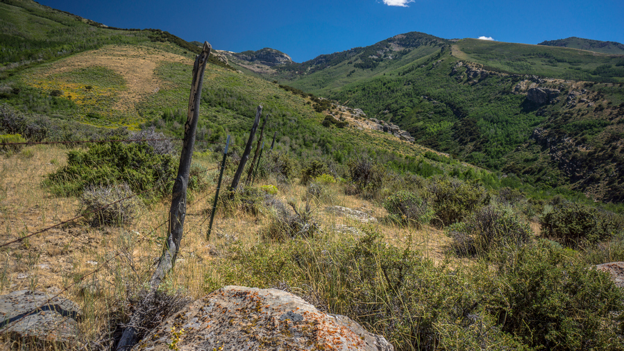
Talbot Creek. This is a rugged canyon that would likely be incredible. The map shows a trail, but it probably doesn’t exist. The proposed BRT route here is the ridgeline on the right. Stays out of the thick stuff and would offer an elevated view
As the day went on, the difficulty of the route increased. By the time we reached Talbot Creek, the trail had pretty much disappeared. We were navigating by wooden posts that were about 1 foot high, marked with the word Trail. These were barely visible among the sagebrush, and spaced far apart. The route I had planned took us a mile or two into Talbot Canyon, crosses the creek and then goes right back out another mile or two to where we Came from, but on the other side. It was about 400 feet down into a drainage, and Cody thought This would be better than walking up the canyon. I figured the canyon would be pretty scenic, judging by the relief on the topographical maps, but since the trail basically faded out, this probably would add quite a bit of time and difficulty. So Cody’s plan to drop down the Talbot drainage here and take a direct route across seems reasonable. Let’s do it.
Cody looking for the route down
Much of today’s route weaves in and out of private property, and this was one of the first sections I really had to deal with that. There was a fence line running down the canyon, And we had to jump it in order to continue. We jumped many fences today. At the same time, there were some ranches and homes perched up on the hillsides that could see us. So everything we did, we try to do With a stealthy approach.

Crossing another drainage
More Sagebrush, cows, fences to jump over and private land to weave in and out of. next we followed a bit of a dirt road, until we had to leave the dirt road To follow our Planned route. Dropped down into Another drainage To cross a creek, now on the opposite side of one of the ranches that was perched on a hillside. This was extremely thick vegetation, thickest of the day. Cody was wading through it, breaking branches, but not exactly clearing me a path. Many times, our feet didn’t even touch the ground, since there were so many branches to keep us elevated above the dirt. That’s how thick it was.
Made it down to a small Creek where we took a break. Cody could really appreciate the bushwhacking aspect of what I’ve gone through so far on the Basin and Range Trail. I’m glad he got the full experience.

Walkin’ fenceline
We’ve pretty much given up on following anything that said Trail on the map, and now just went for dirt roads. We finally hit one sign that said private property, looked like it was leading to the ranch up on the hillside. So we followed the fence line on the legal side. Many times though, we were never really sure which side was the legal side. It was never posted. Cody, being a local, also said that many of these land owners likely wouldn’t care that we were out here hiking, especially not along the wrong side of the fence line.
Thorpe Creek
Our last real challenge of the day was one really large drainage. This one was deep and steep. At the bottom was a decent-sized creek. There are actually some decent Camp spots here, but we still wanted to cover some more miles, and make it to Cold Creek. The creek was too large to hop rocks across, but there was a pile of logs here alongside the river, presumably leftovers from making the fence line that went up the hill. So we threw a few logs in the water to step on, making our own Crossing Point. In the end, my foot slipped off one and got wet anyway.
View from tonight’s camp
Sunset at camp
We walked another two miles or so before reaching South Fork gold Creek. This was barely a blip on the map, but was actually a good running creek that feeds the main Cold Creek. We found a clearing a few yards from the creek, and it was actually a good campsite. So this is where we set up. The water was only 4 feet wide but maybe a foot deep. Rarely along the trip has I camped this close to water, in fact it was probably the closest. So it was a real luxury to be able to have water at Camp, be able to soak my feet and clean my legs.
After the sun set, the night sky populated itself with a million stars. We stood outside our tents looking up at the stars, talking about all of this stuff that humans wonder about Under the Stars… The infinitude of space, science, technology, the problems of our world and how to solve them.
Day 45 – July 15th: Ruby Mountains, Soldier Creek, Ruby Valley, Pole Canyon, East Humboldt Range
Woke at 6:30. Hiking by about 7:45. Cody did not sleep that well. It took him a few hours to get to sleep.
After leaving camp we followed the road we camped along until we reached the point where it crosses Cold Creek. Here, there was some sort of ranch, although it looked abandoned. There were horses and animals there though, hard to tell if someone was living there or not. We climbed the fence and walked alongside it until we found an old dirt road that leads down to the river. Another decent size Creek. We were able to cross without getting our feet wet by hopping rocks.
We climbed out of the Ravine holding Cold Creek and reached another fence line. We followed this one to the end and found a dirt road that paralleled it. Basically, the rest of the morning consisted of walking poorly maintained dirt roads, walking and jumping fence lines.
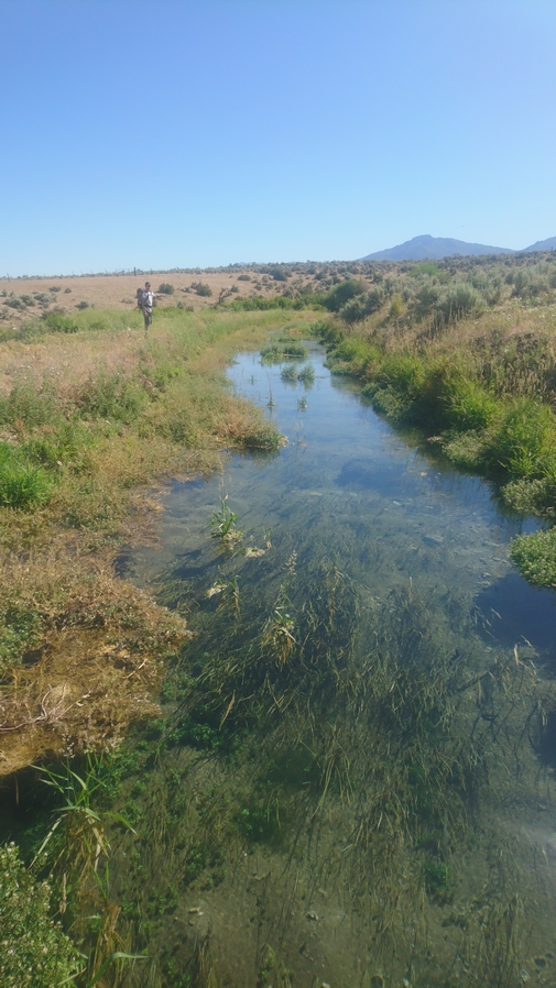
Crystal clear water
We reached warm spring Creek, which was not warm at all, but cool. And it was crystal clear, with a strong blue tint. Looks like a great swimming hole, despite coming out of a culvert. If it were hotter out, and Cody wasn’t on a time schedule, we would have swim here. But he told his dad to pick him up at 9:30, when we estimated to arrive at Soldier Creek.
When we reached the road for Soldier Creek, we looked back and saw a no trespassing sign on the property we were on. However, we didn’t see any where we entered the property. His dad was stuck in construction and so we Dropped our packs and waited a little while.
Cody and I had hiked about 20 miles in the last 24 hours. Most of which was yesterday. Cody did a great job and he got the full experience by doing some pretty gnarly bushwhacking. I just wish we had a little bit better scenery. Still, we both enjoyed the experience.

After Travis arrived, we all chatted for about 15 minutes, and had Travis take a picture of Cody and I. We said our goodbyes, and I was on my own once again.

Entering Soldier Creek canyon

Looking back down the road leading up into Soldier Creek
Next I began to hike up the road along Soldier Creek. Nice walk with somewhat steep Canyon walls, but not crazy. There was a pit toilet at the Soldier Creek trailhead, but really nothing else here.
Weather instrument

The scenery is starting to improve as I hike up Soldier Creek
There was a gravestone right along Soldier Creek, right next to the trailhead. Someone had created a bit of a soaking pool by digging out rocks underwater and shaping them into a mini tub.
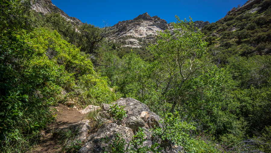
Hiking Soldier Creek
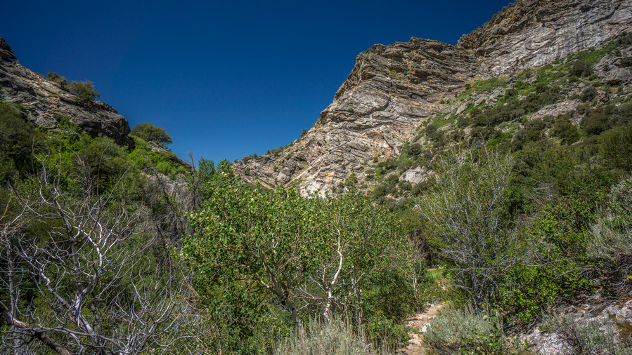
The canyon narrows a bit, but stops short of an impressive box canyon-style experience
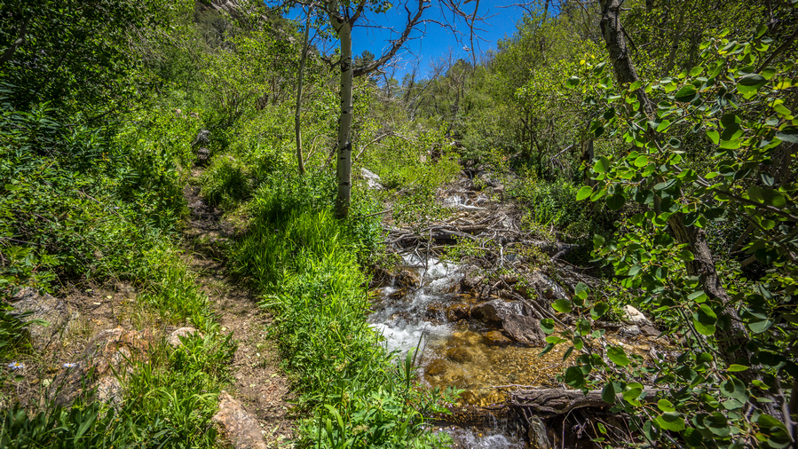
Soldier Creek
I was thinking the hike up Soldier Creek would be better than what it was. There is no water access as the banks were too steep and thick with vegetation. The trail itself often looked like a jungle, very cool looking at times.

The trail emerges from the jungle into a clearing

Soldier Peak viewed from Soldier Creek

Wildflowers along Soldier Creek
After walking through the jungle awhile, the canyon opens up and I was able to access the water in Soldier Creek. I stopped here for a break, looking up at soldier peak. What a nice spot.
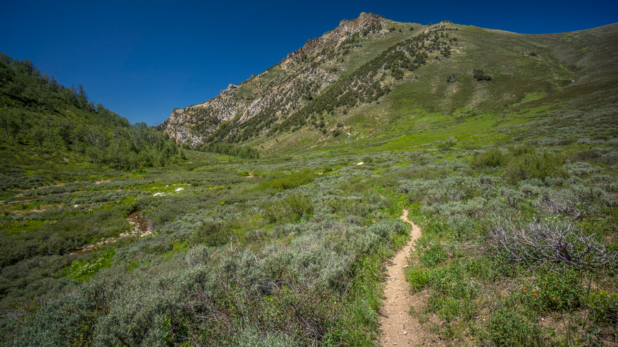
This trail leads to Soldier Lake, not to the crest. Time to leave it and hike off trail
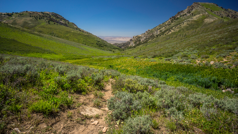
Found trail again, after bushwhacking through all of the dense vegetation in the center of the photo
Next the trail climbs up to the ridge, the crest of the rubies once again. At first there was no Trail. My map shows one, but I couldn’t find it. So I began to bushwhack uphill. This was pretty awful. I say things like this was awful, but its hard to convey just how shitty these bushwhacks can be. Eventually, I came across the trail. It was definitely not visible from the lower trail that goes over to Soldier Lake and Hidden Lakes, but man was I glad to have found it.

View southwest to John Day Peak and, hidden from view, Hidden Lake
I was getting a headache, so I stopped and took one extra strength Excedrin and one ibuprofen. A little combo action. The trail now starts to weave through a couple of trees. From here it’s not that far to the top. Excellent views as I gain elevation.

View from “Soldier Pass”
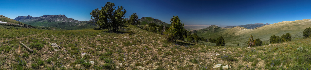
Another view from the pass
The view from the top of the pass was really good. I don’t know what the pass is called, it’s not named on the map, so I called it Soldier Pass.

Ridge leading to Soldier Peak

Extreme northern end of Ruby Valley, and the extreme southern end of the East Humboldt Range
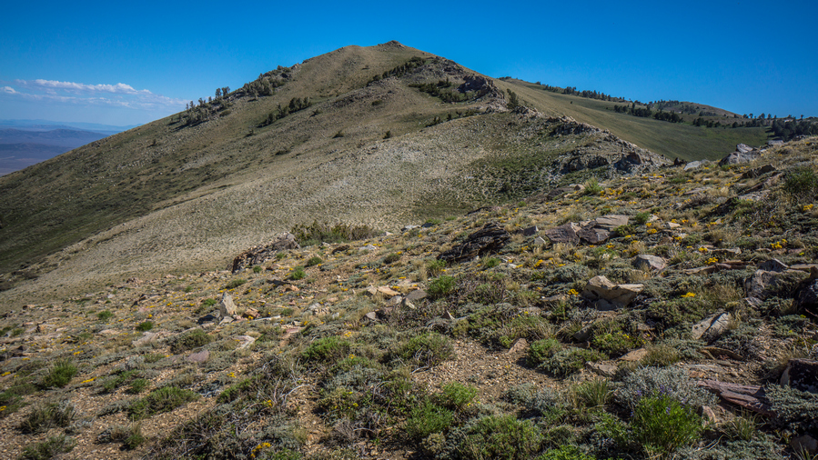
A look back at the ridge leading down from the pass
I stopped many times to take pictures, the landscape constantly changing and evolving as I see it from different angles. Soldier Peak looked more impressive the further I got from the pass. It was really nice to walk the crest, with the trail, good weather, and great views.

View northwest to Lamoille Valley
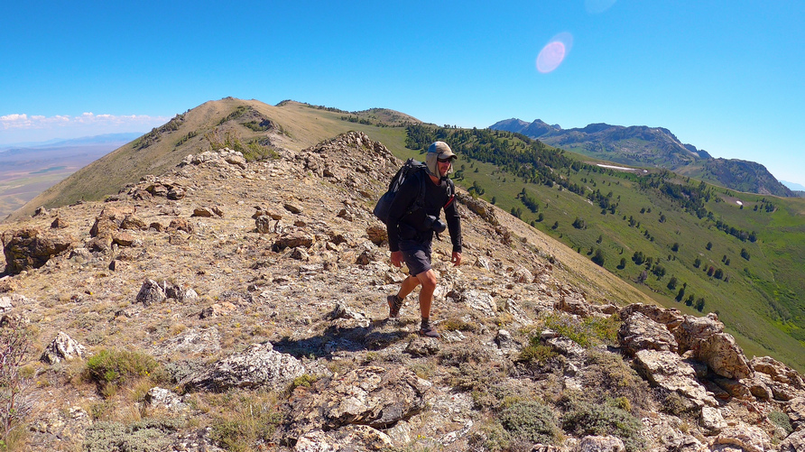
A great walk along this ridgeline
Eventually I reached a saddle where a trail goes downhill. However, my plan was to continue walking the ridge North the ways, and then meet up with another trail. So, I kept going.
When I reached the area where I expected a trail to be, I was very disappointed to see nothing. Lots of thick brush to walk through now. One of them got my leg pretty good and it started bleeding.

Looking north to Secret Peak
I could have continued north from here, to Secret Peak and Secret Pass, which would be the only way to avoid private property coming down from this part of the Rubies, now the extreme northern end. However, that route then means a longer road walk into the East Humboldt Range, my next destination after I cross the valley. A more direct route involves a short section of private property crossing, which I opted for instead.
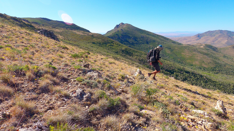
Dropping down off the crest of the Rubies for the final time
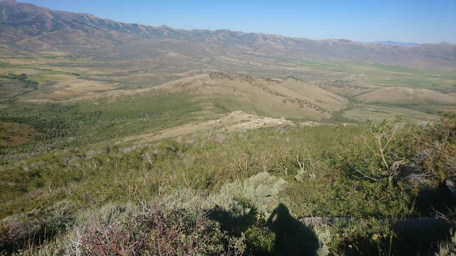
Welcome to Aspen Hell
Eventually I the area where the trail stops skirting the Mountainside and begins to descend down to the valley below. That’s what the trail is supposed to do, but I don’t see a trail now. Then I reached a ridiculous wall of new growth aspens, among the worst I seen yet on Trail. Started through it for a few feet, before backing out and realizing this was not going to work. I backtracked and found a faint trail that was extremely overgrown. It went right into the brush. Amazingly, it seemed to be cleared out a little bit, but it was more like a canopy underneath the brush. It was manageable, but still really thick. Surely this was the trail, just overgrown from many decades of vegetation growth.
More insane bushwhacking. Eventually I reached a saddle where a trail was supposed to follow a ravine, but of course it did not exist. I decided to go the opposite direction, as it was more direct, and still a bushwhack. After a few moments of skirting a hillside, I noticed a road on the other side. A faint 4×4 road. So I dropped down into a valley, and this Hillside to meet the road. I walked right over at the first time, it was so faint. But, I eventually found it and followed it. It was waist high grass.
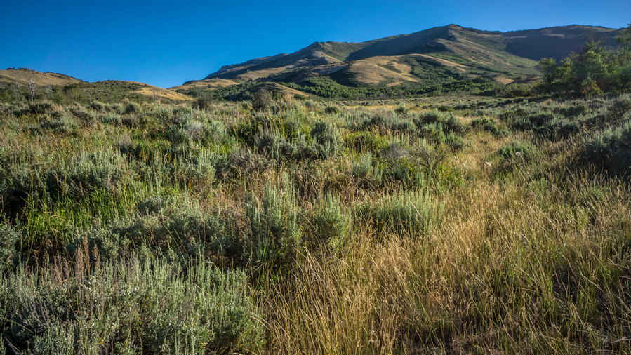
Tall grass to walk through along the base of the northern Rubies
The next couple of miles were more of the same, grass knee to waist high. Crossed a couple of creeks. Saw a couple of deer. You could tell this area gets little to no use. Eventually reached a gate.

Would you kindly mooo-ve out of my way?
Now I am on a private ranch. Cows everywhere. I checked my satellite and saw a route that I could take that would not pass right by the ranch when I reach the main road. So I went for that, walking fast as I could.
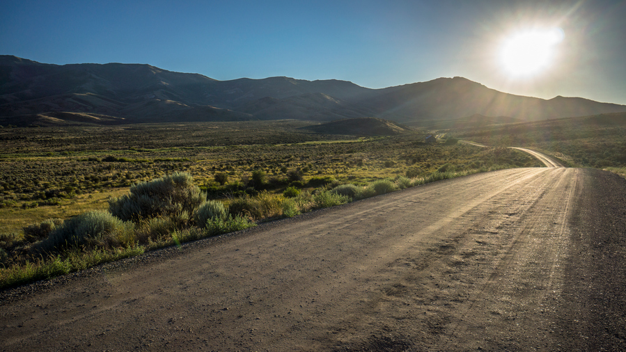
Hiking North Ruby Valley Rd, east of Secret Pass
Reached the main road and hopped the fence. Now I was following a paved Road, before quickly turning off onto another dirt road. Sun was setting and it was actually pleasant to be on a main road. Followed this for an hour before having to jump another fence that said private property, but also on the same sign said National Forest land 1 mile. Huh. So, its legal then??

View south to the extreme northern end of Ruby Valley and the Ruby Mountains
Now I am following Franklin River and pole Canyon, entering the East Humboldt Range. There are cows everywhere, and these ones are very vocal. The kind that make ridiculous noises, as if they were zombies. I found a small hill to Camp upon, in between piles of cow crap and salt licks.
Day 46 – July 16th: Pole Canyon, East Humboldt Range, East Humboldt highline Trail

Campsite in Pole Canyon
Woke up at 6:30. The cows were moaning like zombies. I heard an owl pretty close to camp throughout the night. I could hear a four-wheeler somewhere down low in the valley.
Lots of cows this morning, looking forward to getting up Hill and above them. There was lots of water, but I would not want to filter my water here due to all the cow activity.
After a short while I reached a locked gate with a no trespassing sign. This is where the National Forest land ends. There is public land up the road again, but a section of private land blocking access to the public land. Since I have walked all the way up here, and don’t really have any other options, I climbed gate and moved on.
I walked maybe one mile and heard a four-wheeler approaching. I thought about hiding in the bushes, but just decided to let the situation play out. As the man on the four wheeler approached, I stepped aside on the trail and waved. He stopped and asked what I was doing. Almost immediately I recognized that he was in Nevada Department of Wildlife officer, not the land owner. I said I was walking across Nevada, I’m 46 days into this hike. He said you know you’re on private land right? But also acknowledged this wasn’t his land. I said yes, I’m not going to lie to you, I saw the fence with the sign that said no trespassing and I went over it anyway. I had walked all the way up here and didn’t want to turn around and look for another way, just to avoid a couple miles of private land blocking access to the rest of this public land. I told him I’m trying to get to Wells, via the East Humboldt Highline Trail. We chatted for a solid 20 minutes about my route and things. He was pretty chill, had no interest in Making trouble for me. He also said the land owner probably wouldn’t mind that I was here anyway. I believe they were mostly concerned about illegal hunting, not some hiker just passing through. He was on his way up Mountain to pick up a goat carcass or head or something. After while he moved on. This is one of those situations where honesty prevails.
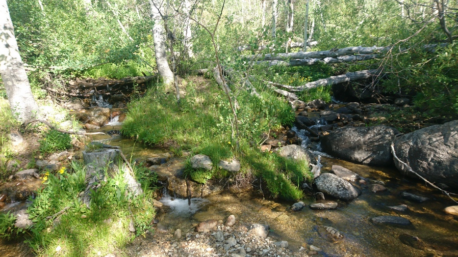
Franklin River
Next the trail got pretty steep. Found a creek near the spring source to filter my water from. I am above most of the cow activity now, at least, a good chunk of it. This water should be cleaner than downstream, where I avoided drawing water from.
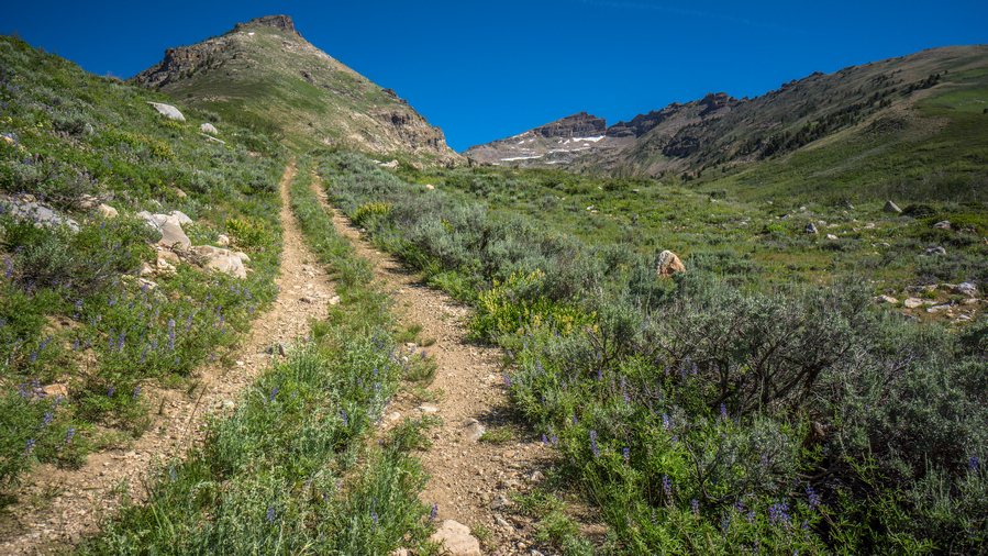
The upper reaches of the 4×4 road in Pole Canyon
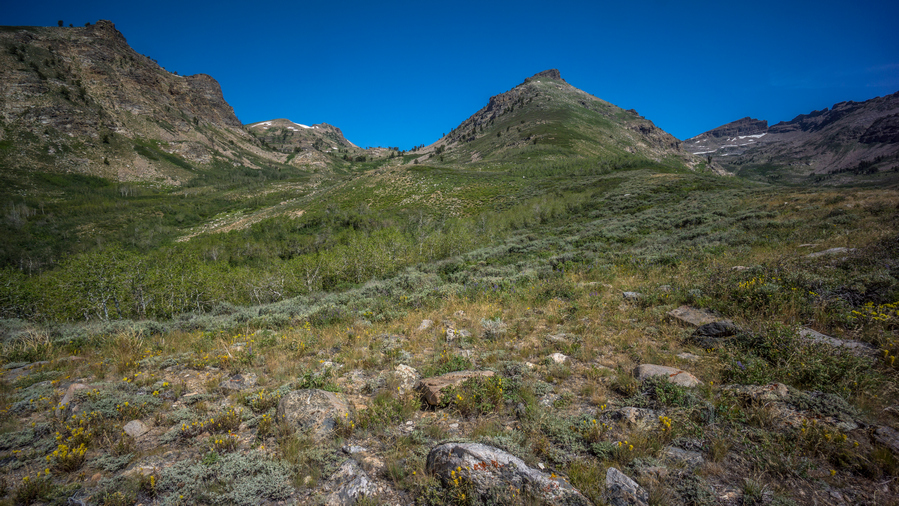
View of route up to pass above First Boulder Creek. USFS maps show the East Humboldt Highline Trail starting around here. Hmm.
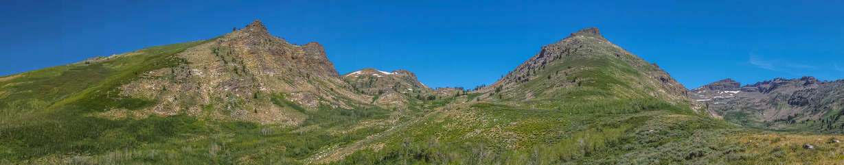
Upper Pole Canyon
Kept hiking uphill until I reached a fork in the valley. Pole Canyon and Franklin River to the right and the route up to 1st Boulder Creek on the left. The USFS maps show the East Humboldt Highline Trail starting around here, but I don’t see it. It looked like it would be all off-trail hiking going up first Boulder, and quite daunting. But at the same time, I could tell it was going to be a very beautiful hike. Very impressive rock walls with Rocky crags.
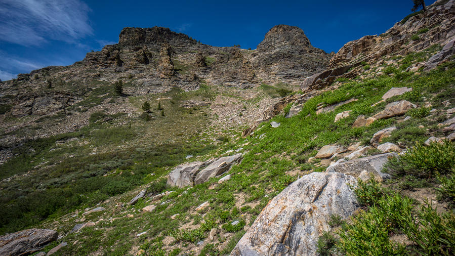
Views from the route up an unnamed canyon to pass above First Boulder Creek

East Humboldt Range is impressive so far
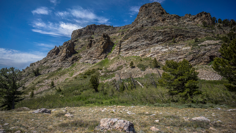
Really enjoyable hike as I enter the East Humboldt Range high country
After a short while I picked up on a faint trail. There were even cairns occasionally. Although it was tough going, I really enjoyed hiking up this Canyon. Very beautiful, among some of the best scenery of this whole hike.

Looking south at the southern East Humboldt Range

Nearing the pass to first boulder creek
I wondered how often this area is hiked, with the lack of proper public access. From a handful of cairns, it’s clear it gets “some” traffic, but how many… 5 hikers a year? It would be impossible to guess.
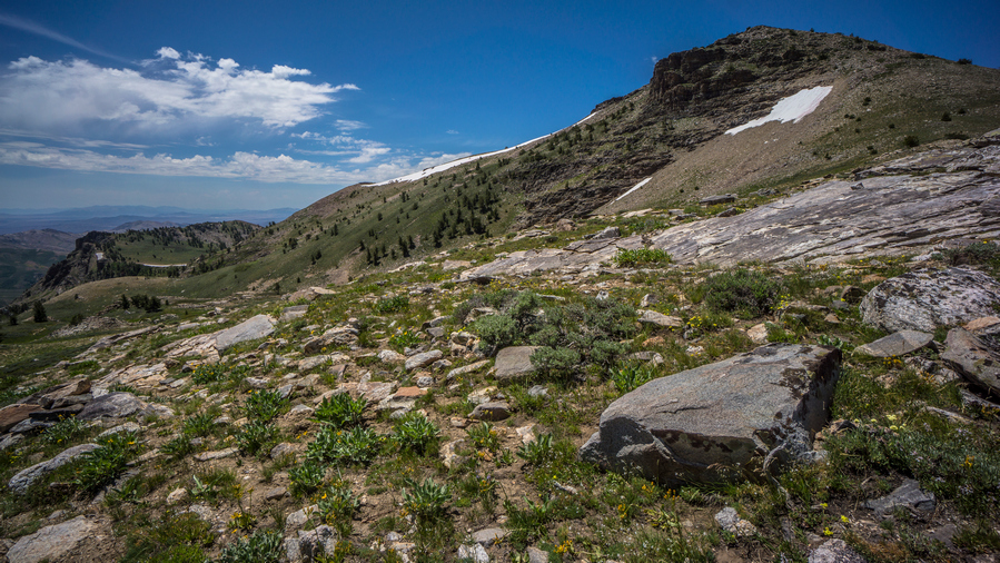
View from the pass, down the canyon I hiked up

View from the pass

View of First Boulder Creek from the Pass
The views from the pass over First Boulder Creek were good, but not excellent. I think enjoyed the hike up more than the view from the top.
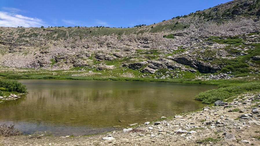
First Boulder Lake. She ain’t much to look at.

View of peak 10,292′ from First Boulder Creek
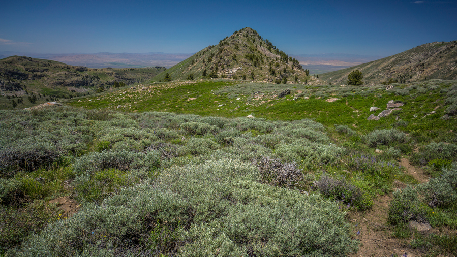
Hiking the East Humboldt Highline Trail to Second Boulder Creek Pass
Next I dropped down from the pass and began the short descent to First Boulder Lake. The “lake” is more like a pond, shallow and muddy. Lots of bugs and lots of flies. The map shows a trail marked East Humboldt Highline Trail that practically traverses this whole range, and at the moment there was indeed a fairly good trail on the ground. However, with little public access to the East Humboldt Range, few people hike here. That means this place gets no trail maintenance, either. Supposedly the East Humboldt Highline Trail gets really thick and overgrown, and the trail eventually disappears. The NDOW officer I spoke with earlier today confirmed this. I told him my plans to hike the East Humboldt Highline Trail, and he said, good luck.

View of First Boulder Creek from pass to Second Boulder Creek
Dropping down to Second Boulder Creek
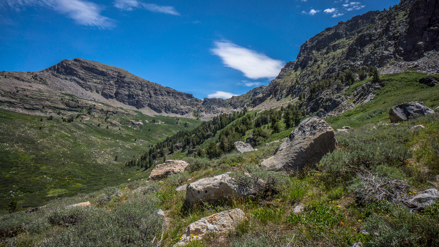
First views into Second Boulder Creek
It was a short pass going over to 2nd Boulder Creek. From the top of this pass, it was quite a drop down to the bottom. I could tell the rest of the day was going to be difficult, looking at this hike down and how the map looked for the rest of the boulder creeks. There are four parallel drainages here in the East Humboldt Range, named first, second, third and fourth Boulder Creek. As I dropped down in elevation, the Cirque became more impressive. These upper basins were just massive, sheer rock faces. Quite Majestic actually. Intermittent Trail now, though.

Crossing Second Boulder Creek along my East Humboldt Highline Trail hike
I reached the bottom and stopped at the second boulder creek. Right where the trail crosses, there was a bag with a bar of soap and a small bottle of liquid soap. Apparently, somebody was here at one point and bathed a little bit. I was really surprised to see this, but it gave me hope that there would be good Trail the rest of the day. Ha, I should have known better.
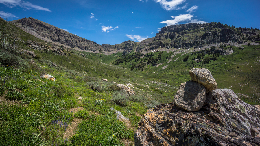
The impressive Second Boulder Creek

View down Second Boulder Creek Canyon
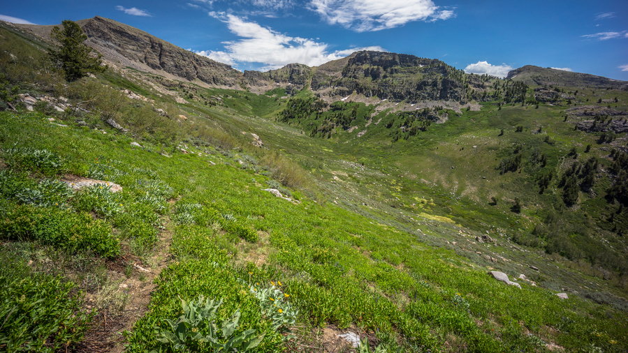
View up Second Boulder Creek on the hike to the pass above Third Boulder Creek
Going up the pass from second to third Boulder Creek was a pain. The trail pretty much disappeared and I was left to follow a couple of cairns. The Rock piles led me the wrong way, through Thick Aspen stands and vegetation. Eventually I Bushwhacked my way back to the trail. I use the word “trail” lightly. The diamond range had better game trails than this “hiking trail”. The East Humboldt Highline Trail is intermittent, at best. And when it’s not there, the going is slow; thick bushwhacking, steep inclines and an all-around pain in the ass.
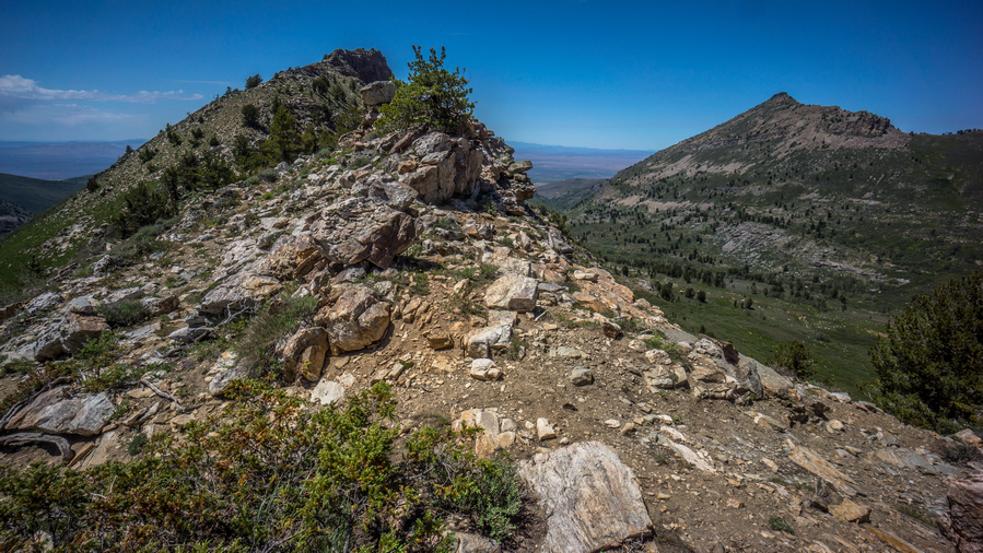
Pass between Second and Third Boulder Creeks. This was my favorite pass in the East Humboldt Range

Second and Third Boulder Creeks
Eventually I made my way to the top of the pass. The view from the pass between Second and Third Boulder Creeks was my favorite along the East Humboldt Highline Trail. The hike had been easy at times today, when there was good section of trail, but lately it has been more of a challenge.

Looking back up at the pass above Third Boulder Creek

View of Third Boulder Creek
I dropped down to 3rd Boulder Creek, which had a couple of small lakes. From the pass, the Basin doesn’t look too impressive. Just like the previous basins. However, upon dropping down an elevation, the Cirque shows itself, and once again blew me away. So impressive! The East Humboldt Range was definitely on par with the Ruby Mountains.
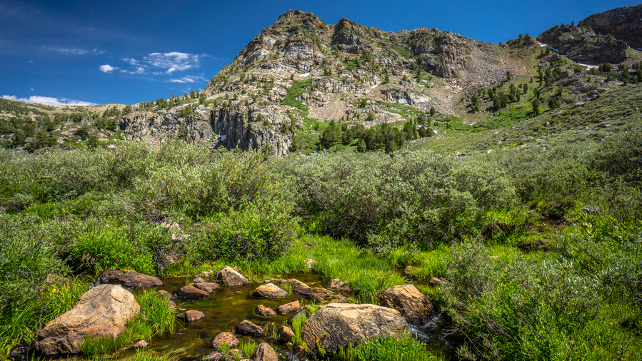
View from Third Boulder Creek
I stopped at third Boulder Creek for a break, filtered water, ate food, washed my socks and soaked my feet. There was a small Beaver pond just Upstream. The creek really wasn’t that cold, probably due to the lake and Beaver Pond Upstream. After my break, I followed a couple of cairns across the valley until I came across a wooden sign. Each Basin seemed to have one. East Humboldt Highline Trail one way, whatever number Boulder Creek the other way, pointing downhill. Funny thing is, there were no trails at all here at this sign!
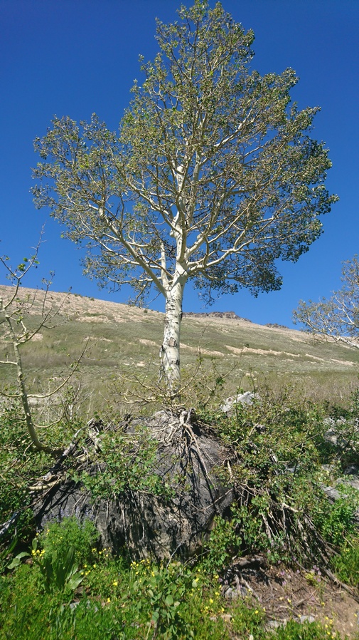
Aspen tree growing on top of a boulder!
Heading up the pass between third and fourth boulder creek, I followed cairns a ways uphill until they once again let me astray. The cairns Definitely indicated the trail went one way, but it led me through thick brush, Only to have to turn around and eventually hike back through that brush again. It was also wet and soggy along the hillside. I slipped and fell a few times. It was a real pain in the ass. My feet were getting wet sloshing around in the soggy ground, which I couldn’t really see with the thick brush obscuring it.

View down on Third Boulder Creek from the hike up the pass above Fourth Boulder Creek
Eventually I found some rock piles again. I knew I was on the right path, although it disappeared again very quickly. I gave up on following the trail and just walked straight up the hill to the pass. This was a pain, but at least I could choose my own path and not be led astray by poorly placed piles of rocks. Whatever was left of the East Humboldt highline Trail is so overgrown that its not always worth trying to follow it.
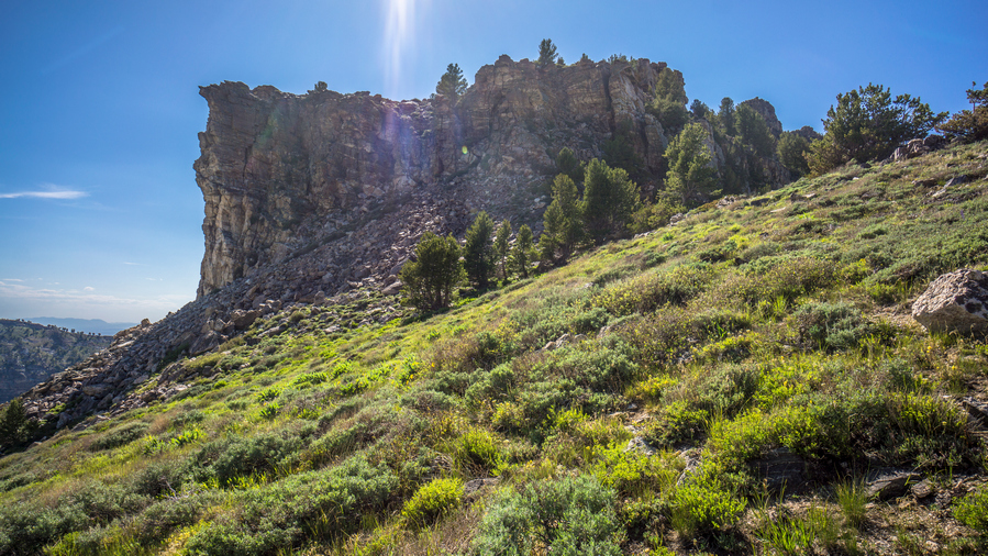
Near the top of the pass separating Third and Fourth Boulder Creek
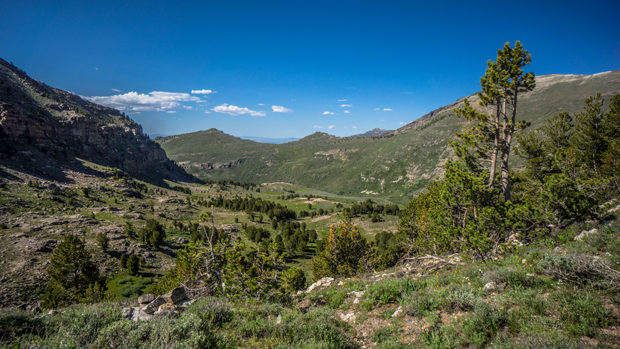
View into Fourth Boulder Creek

View over Third Boulder Creek from pass to Fourth Boulder Creek
Reached the pass above fourth Boulder creek. I’m noticing that the trails going down these passes, on the north side, has been better. The north sides feature more rock and less thick, green vegetation which can easily over take the trail. Once again this Basin was the same as the others, very impressive, and much more so as one drops in elevation.

Looking back up at the pass between Third and Fourth Boulder Creek
Excellent hiking coming down from the pass into Fourth Boulder Creek. A trail exists here, but will soon disappear again
Impressive view in Fourth Boulder Creek
When I reached the general area where the junction would be for the Fourth Boulder Creek Trail going downhill and the East Humboldt Highline Trail, I had to make a decision. The East Humboldt Highline Trail follows the Mountainside about halfway up, and takes a very long route to get up to the pass. So Far, none of these trails have been very good. This route would be very committing, and take a long time to get to the pass. There were some pretty steep sections along the way. I have zero faith that this trail will exist. In the distance, I could see Thunder clouds building. It just didn’t make sense to commit to a really long, nonexistent Trail along a steep Hillside. If I’m going be bushwhacking, I might as well take a shorter bushwhack route.
High point on the left is Tent Mountain. I’ll hike straight up the thick green stuff below the saddle. It’s a 1,000ft climb
Instead, I just decided to follow the fourth Boulder Creek Trail downhill. This would leave me to a spot just below the pass near Tent Mountain, where I could contemplate going straight up the Mountainside from there. Of course it looked very thick with vegetation and very steep, but my other option would be to just follow fourth Boulder Creek Trail downhill all the way to a road and walk around the East Humboldts.

Bushwhack in Fourth boulder Creek
Following the fourth Boulder Creek Trail was not easy either. It was also pretty much non-existent. A couple of cairns here and there, off-Trail hiking through Sagebrush. Worked my way down some Rocky Ledges, then a thick Stand of aspens. Then had to cross fourth Boulder Creek, and some wetlands.

View from the bottom of the climb. 1,000ft straight up, through this. Yay.
Now I am at the base of my climb up to the saddle/pass east of Tent Mountain, should I choose to do it. It’s a 1,000ft climb through a solid wall of really thick vegetation, on some steep slopes. From below, it barely looked possible. I’ve never done anything like this. I kept walking closer to get a better look, slowly walking uphill. Next thing you know, I was 200ft up. I guess I’m doing this.
The climb was exhausting. One must step on the bush while grabbing another branch Above you, to help pull yourself up. I felt like I was swimming uphill. Completely tangled in branches, I fell a few times. The first 400 feet were the hardest. The vegetation was thickest here. An absolute nightmare to say the least.
About halfway up, the vegetation thinned out a bit. Steep grassy slopes, much easier to work with. Eventually though, I passed through some old growth Aspen. Much easier than that new growth shit. I was getting closer to the point on my map where it showed a trail. Of course, I never saw it. I just kept hiking towards the pass, making my own path as I saw fit.

View east to Hole in the Mountain Peak, high point of the East Humboldt Range

Pass between Fourth Boulder Creek and Ackler Creek

Overlooking Fourth Boulder Creek
When I reached the top, I was pretty ecstatic. It’s hard to describe the feeling. Actually, I kind of felt like I did when I got done skydiving. Like a big rush of adrenaline. My face was tingling and I was having a hard time holding back tears of joy. I had hiked up what I thought was an impossible slope, in only 50 minutes. To think I had considered walking down hill, bailing. In your face, fourth boulder creek!! The view here was outstanding.
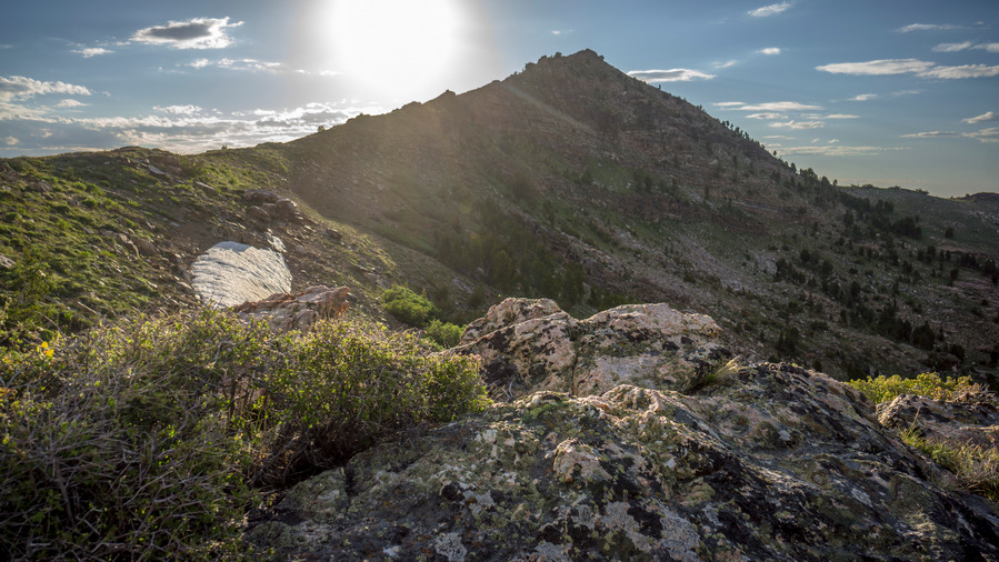
However, I still have to worry about a trail on the other side. Took a break shortly after coming down from the pass. I really needed it, that was a very intense workout.
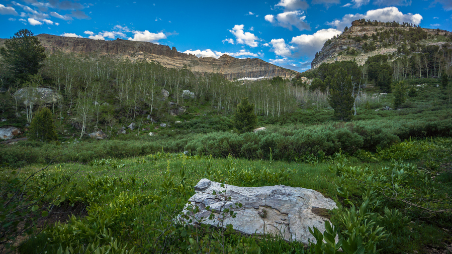
Pretty awesome scenery, when looking up at the crest of the East Humboldt Range
Good Trail coming down hill. I was feeling good about this. Passed a few campsites, some really nice ones. I’m thinking things will be better now, hopeful the East Humboldt Highline Trail will be solid from here. When I get down hill father, I passed a couple of springs, and a few small creeks. I stopped at one to filter water and clean up my legs a little bit. Downhill from here, it was really muddy and swampy. Dead looking Aspen trees line the swamp. This is the worst possible area to be when looking for camp. It was 8pm now, so I tried to rush out of here.
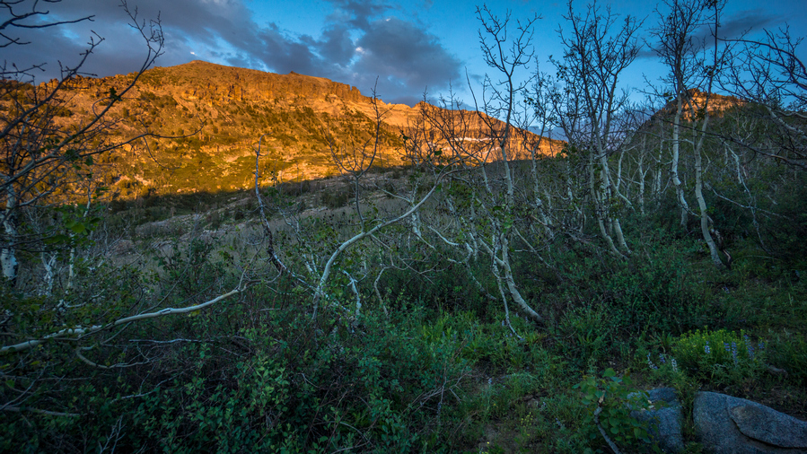
Losing daylight, and nowhere to camp
Made it past the swamp area to dry ground. Went downhill a short ways and realized that I needed to go back up Hill because the East Humboldt Highline Trail branches off near the swamp. Got back up to the swamp area and started bushwhacking through the horrible Aspen tree Forest. I was right on the trail according to the map, and the trail was extremely faint. Looking ahead, all I could see was more Aspen trees, and I only had 20 minutes of daylight left. This is not good.
I decided it was a horrible idea to continue on through the aspens with night approaching, so I began to look for a place to Cowboy camp in the short segment of open ground in between the stands of Aspen trees. Nothing good at all, but I made a spot work. No room to set up a tent, so Ill be cowboy camping tonight.
Looking at my map, CalTopo US Forest Service layer shows the East Humboldt Highline Trail in a different location than the USGS maps. I’m thinking that if I had continued on the trail that I was on, there would be a better East Humboldt Highline Trail to follow further Downstream from where I am now, which would have avoided the aspens. So, I will have to backtrack tomorrow morning to the trail that I was originally following downhill before I turned around. If there is a decent Junction there for the East Humboldt Highline Trail, I might go ahead and follow it. However, I am very tempted to just follow the trail downhill to a road and walk the rest of the way around the east Humboldts. I’m just fed up with trails that don’t exist, with horrible Bushwhacking in between. I would like to get to Wells tomorrow night, and that’s kind of a gamble if I stay on the Highline Trail. A rough estimate of 16 miles to Angel Lake, on the Highline Trail. So it would probably be closer to 25 + if I was to hike all the way to Wells on the Highline Trail. I’m thinking that if I stay on the Highline Trail, I can probably get a ride from Angel Lake down to Wells if I get to the lake early enough. It’s a Friday night so there should be some traffic. I’ll just have to see how things play out tomorrow morning.
Day 47 – July 17th: East Humboldt Range, East Humboldt Highline Trail, Starr Valley

Cowboy camp spot. Lucky to have found this much clear/flat space.
Woke up around 6:30 the sound of a Zombie Cow. The groaning sounded just like a zombie. Cows don’t always make a moo sound. It was a cold night. I had my base layer top and bottom on, and my wind jacket. I had my watch inside my backpack, which said 42 when I pulled it out. So more than likely, mid-thirties.
I walked through the Aspens back to the main trail. Just off the trail were a couple of cows, and they started running through the forest knocking down trees when they saw me. Those goons.

Good trail here, but doesn’t go where I need to go

Walked down the trail a ways and kept looking for a Junction with the east Humboldt highline trail. When I checked my map, the trail I was on was taking me somewhere that wasn’t even marked on My map as a trail. In other words, I was way off any trail now according to the map. What the hell. Trails that are on the map don’t exist on the ground. Trails on the ground don’t match up with any trails that are on the map. I’m so tired of the trails in the east Humboldt range.

View of the East Humboldt Mountains from Ackler Creek
So now my decision was easy… Walk down hill, I’m done with the Humboldts. Of course this always feels like defeat to me, not completing what I set out to do. I made it half way through the east Humboldts. Hiking the rest would mean I’m a full day behind, and I only have food for the rest of the day. And that would be some horrible bushwhacking. It’s a shame that such a beautiful place has such horrible trail systems. But what can i expect? Most of the land around the mountains is private so why would the national forest maintain trails that nobody can access? Another public land issue.
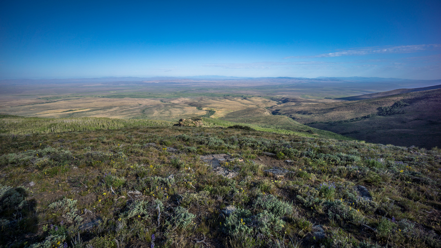
View west into Starr Valley
So now I’m following a trail that goes who knows where. I had a feeling it follows the ridge down hill instead of taking a route through the thick forest, mostly stupid aspens. Really starting to hate these trees, even though most people love them. That’s because they only think of old growth aspens, not thick new growth stuff. Anyways, I was right, the trail goes high up to a Ridgeline which is open and free of trees. For now.
From the ridge I could see down into Starr Valley to the west. There was a lot of agriculture and private ranches, farms. Lots of green. All the land below the ridge was private on my map. How to get to the main road now without blatantly walking through someone’s property, by their home? I plotted a route and began the descent. Off-trail hiking, easy at first, then looked like thick aspens below.
Fortunately, I came up on a road pretty quick. I followed this downhill, through the thick Aspen stands. without this road, wow it would have been a nightmare bushwhack! Followed a series of Roads through various clearings and fences, Gates.
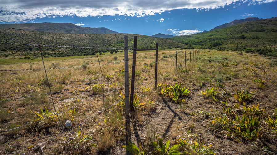
Eventually made it to a fence where I saw a sign that said National Forest boundary. I didn’t see any no trespassing signs or private property signs, but I did see a private property sign laying on the ground along the corner of the fence line. I knew it was private property because my map indicated it was, but if it’s not clearly marked, I will plead ignorance. I have nowhere to go otherwise, there is no National Forest land that I can walk all the way to the main road. It’s all private land blocking the public land.
Went through the gate and continued on the dirt road. Before long, I reached another gated and fenced area. No signs on this one. This was lost creek/alles creek. Stopped here to filter water, maybe my last chance before waking the main road 20+ miles into Wells. Lots of cow activity upstream, better filter this water.
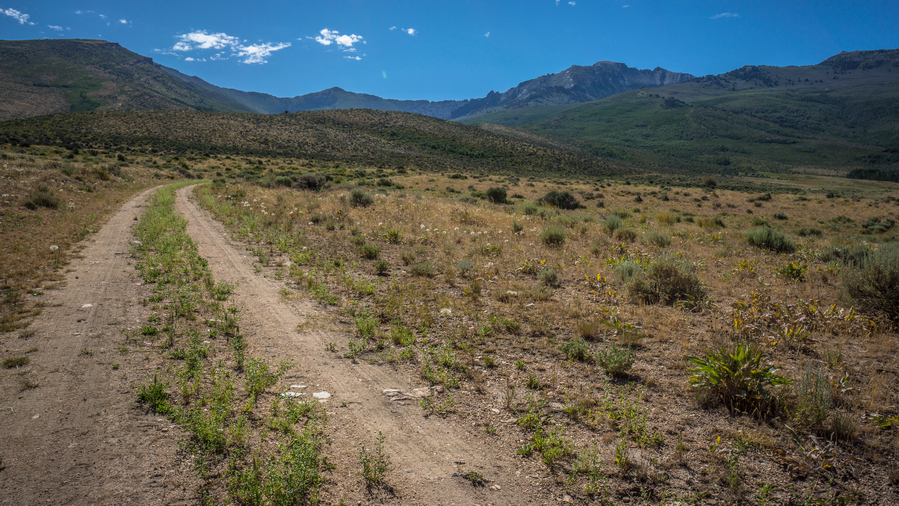
View of East Humboldt Range from Starr Valley
Continue down the road through the fenced area. Not much to see here, just a big open field. Down the road, the land really clears out and it’s a pretty barren area. I debated which road to take down to the main Highway. The one along lost Creek has no houses along it except for right on the other side of the main road, once I reach it. That’s probably my best bet, as I didn’t want to walk right along a house on private property. However, while I was walking this road, it veered off to a different location than my map indicated. Instead of backtracking, I continue to follow this road, as it seemed to be well defined and basically the main road for the area. I looked at my map and this dumps me out further north, which is a good thing. However, it looks like it goes right through a bunch of properties. Still, it’s a main road, so I will take my chances.

Crossing Ackler Creek
The road took me to a winding Hillside overlooking Some Farms. There were tons of cows in the valley. I reached a gate, and once on the other side I saw that it was for a private Ranch. Still, there were no signs that said no trespassing. Farther down hill, I passed through a couple more Farms, with open Gates. I didn’t see any people out working, and no one bothered me. All good.
Finally I reached the main road, Nevada 230. It was a paved Road through a very farmy area. Green Pastures with bales of hay rolled up in the fields, with the East Humboldt range as a backdrop. Very pretty actually.
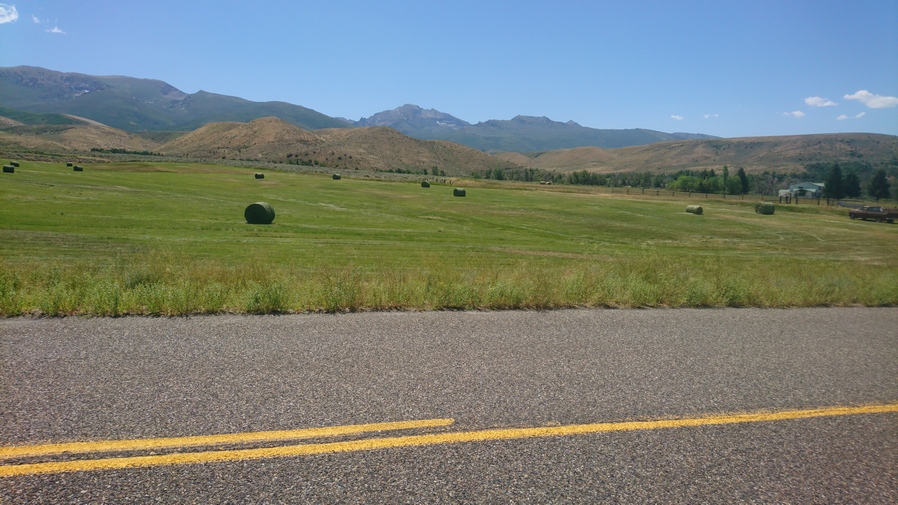
Road walk along NV-230
I walked the country road for several miles before getting a hitch to avoid the hike along I80. My rides name was Ray, who had just bought a place here and retired from a career in well drilling. Ray dropped me off at the Sharon Motel, where my bounce box I was waiting for me. I had intended to stay here, but my estimated arrival dates were the 19th and 20th. Today was the 17th. I had called a few days earlier to see if they had any availability for the 17th 18th and 19th instead, but they were sold out. So I made reservations at the Rest Inn instead. I always feel bad when these kind of things happen, a hotel accepts my bounce box but I don’t end up staying there. I offered to pay a fee for accepting the box but they said that wasn’t necessary. Hey, I tried.
It was less than a mile walk to the Rest Inn from the Sharon Motel. Walking through this area of Wells was a bit weird. There really wasn’t much here, kind of an in between segment of Town. When I got to the Rest Inn, the woman at the front desk gave me a suite, and at the reduced CDL trucker rate. That was awfully nice of her! There really wasn’t much special about the suite, I guess except for the fact that there was a small table and couch, and a phone right next to the toilet! I was hoping for a Jacuzzi hot tub but no such luck. Ill have to settle for a corded phone next to the shitter.
The hotel is located right across the street from a couple of popular truck stops, so there really wasn’t any great restaurants or anything nearby. Just some overpriced places, the iron skillet and the Bella restaurant which closes in the afternoon. So, I ate at Burger King for lunch. Iron skillet take out for dinner, got two chicken strip meals. Backed up my SD cards.
Day 48 – July 18th: Zero Day in Wells, NV
Terminator 1 & 2 were on TV this morning, nice. Watched that while I got started on Town chores, laundry, sorting my media on my SD cards, beard trim, etc.
Got a gas station pizza to go for lunch. Filling. Spent the majority of the afternoon and evening working on changes to the rest of my route. I’m going to finish at Great Basin National Park, and so I had to modify my route a bit to make that my end point. Also, instead of going from West Wendover to Shelbourne pass in the middle of the Schell Creek range and then hitching down to McGill to resupply, I’m just going to go from West Wendover all the way to Cave Lake State Park and hitch to Ely from there, doing the Schell Creek range in one segment. From there I will hike to the snake range, Great Basin National Park and end at Baker. So I figure I have another 360 miles or so to go.
Day 49 – July 19th: Zero Day in Wells, NV
Another day doing town chores. The grocery store was a bit of a walk to the other side of town. The selection is decent, not as good as a Safeway or anything, but enough to work just fine. Wells isn’t an exciting town. The truck stop side of town is a little more depressing than the rest of it, though, in all fairness. There are some nicer homes in the center of town, a nice green park with modern facilities, etc. But there just doesn’t seem to be any real draw to this town, other than being located along interstate 80.
Related Images:
Basin and Range Trail Thru Hike 2020 – Section 6: Eureka to Lamoille

Basin and Range Trail Thru Hike Section 6 Map
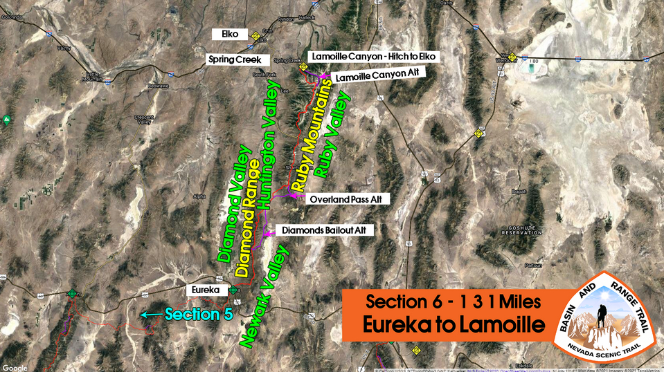
Video: Basin and Range Trail Thru Hike Section 6
In addition to this trail journal, I also filmed my Basin and Range Trail thru hike. I’ve produced a detailed documentary series (11+ hours runtime) documenting this thru hike adventure, the product of over 1,000 hours of video editing. I highly recommending watching the Basin and Range Trail vlog series for an in-depth look at thru-hiking the Great Basin and central Nevada.
Basin and Range Trail Thru Hike Section 6 Journal
Day 37 – July 7th: Diamond Mountians
Started hiking at 9am. When I checked out of the hotel, the woman who works the front desk wished me good luck on my hike, and mentioned that she wanted to hike the Pacific Rim Trail. I always kind of crack up when people Call it The Rim Trail instead of the crest trail. Still, it’s an admirable goal and I told her I’d be rooting for her.

Eureka, NV
It was a short walk out of Eureka as it was only a few blocks before I turned off the main road and began a climb up and around a small hill. So, it felt like it only took about 10 minutes to get out of town. Now it was a dirt road that makes its way towards Diamond Peak and the Diamond Range.
I had been excited about this section for a while. The Diamond Range and Ruby Mountains both have gemstone names, they’ve gotta be pretty good, right?
Simpson Creek had water, but it looked very nasty. There were a bunch of cows here, and oddly enough, they kind of follow you around, of course with a fence blocking them in. Normally, they run as soon as they see you. These cows wanted attention.

4×4 road leading into the Diamond Mountains
The road begins to climb after leaving the ranch that Simpson Creek passes through. Very slowly though, which is a great way to ease into the first day out of town.
The diamond mountains don’t look like much from below. Plain, Brown, and maybe a little green. Not too Rocky or Jagged. The lower reaches of the road had some trees, but they quickly fizzle out. I normally hike in roughly two hour blocks, in between breaks. I was ready for a break, but there was no shade now. So I just had on the road and took my break anyway after about two and a half hours.
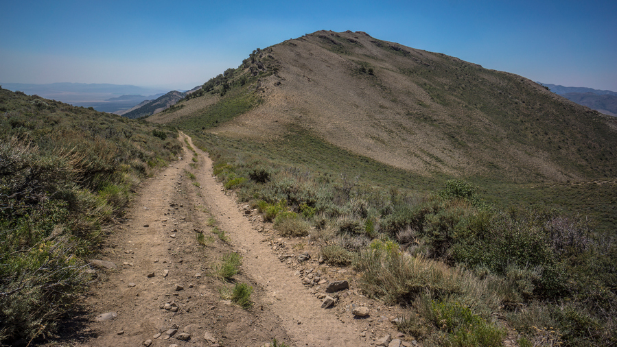
Enjoying the last bit of easy walking along this road
Now the road begins to climb a little steeper. There’s a water source marked on my map just above, but I have to Contour around a whole side to shortcut around a road. This was off Trail, through Sagebrush.
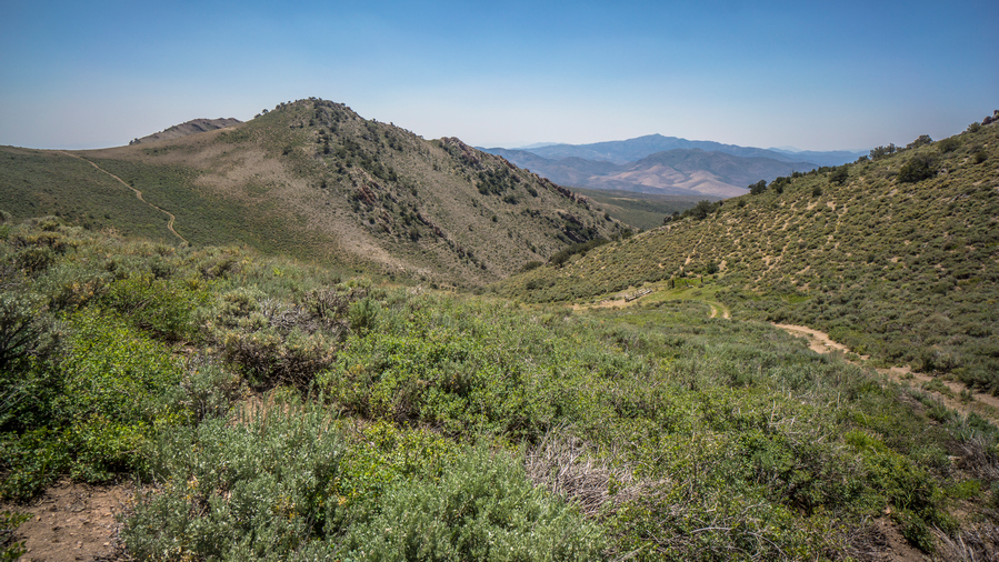
A look back at Diamond Spring
When I reached the saddle I could see cows at Diamond Spring. That’s good, almost guarantees water. When I got there, I was pleasantly surprised to see a pipe with water flowing out. No trough, no muddy puddles, no cow shit to deal with. Just Clear water running out of a pipe, easy to collect from. This is nice little break spot.
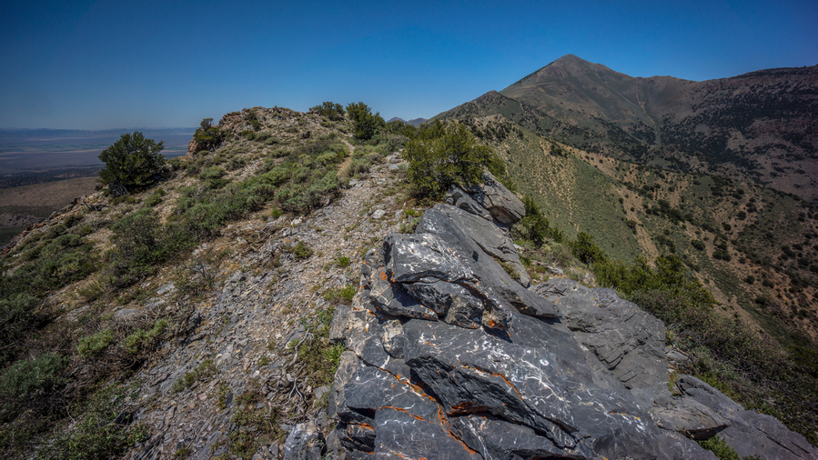
Crest of the Diamond Range, south of Diamond Peak
After leaving this spring, the road gets extremely steep. Fortunately, it doesn’t last all that long. It brings you to a Saddle, with an excellent view. Now I’m on the crest of the Diamond range. Woohoo!
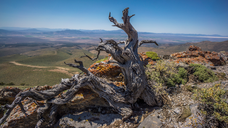
View of Diamond Valley from southern Diamond Range

View south along the Diamond Mountains ridgeline
I was surprised to see a pretty good Trail here, since there is none marked on the map. There was even a cairn marking it. Now the trail follows the top of the ridgeline. Fairly easy walking with very good views. It was hard to make progress because it was so pleasant, the scenery was distracting me.

View northwest to Diamond Valley and Diamond Peak

First view of Newark Valley, east of the Diamond Range
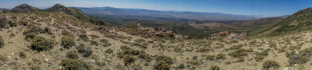
Ridgeline view south of Diamond Peak
Then the trail fades out as it goes over some rougher terrain. Horse trails lead the way, but even they fade out, and you’re left to put together your own route in between small segments of easy walking. In other words, this was pretty good hiking for the Basin and Range Trail.
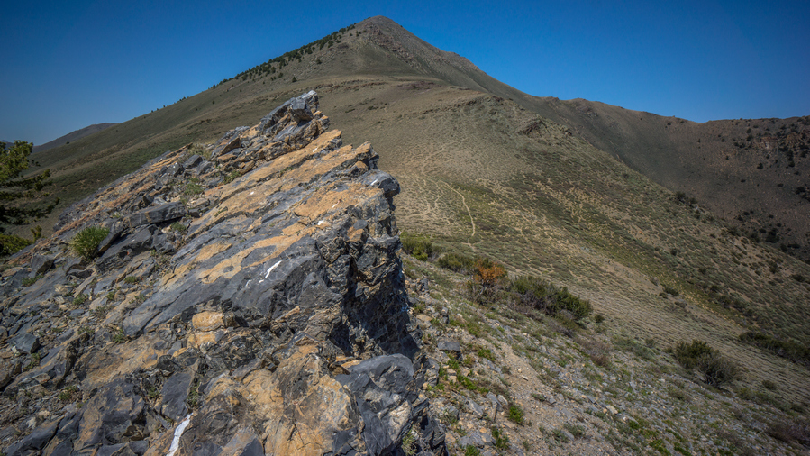
Diamond Peak
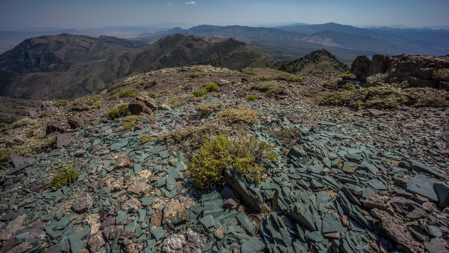
Colorful shale on the crest of the Diamond Range

View south of Diamond Peak
Closer to Diamond Peak, the scenery was excellent. I was more impressed with the diamond Range so far than I had anticipated.

View south
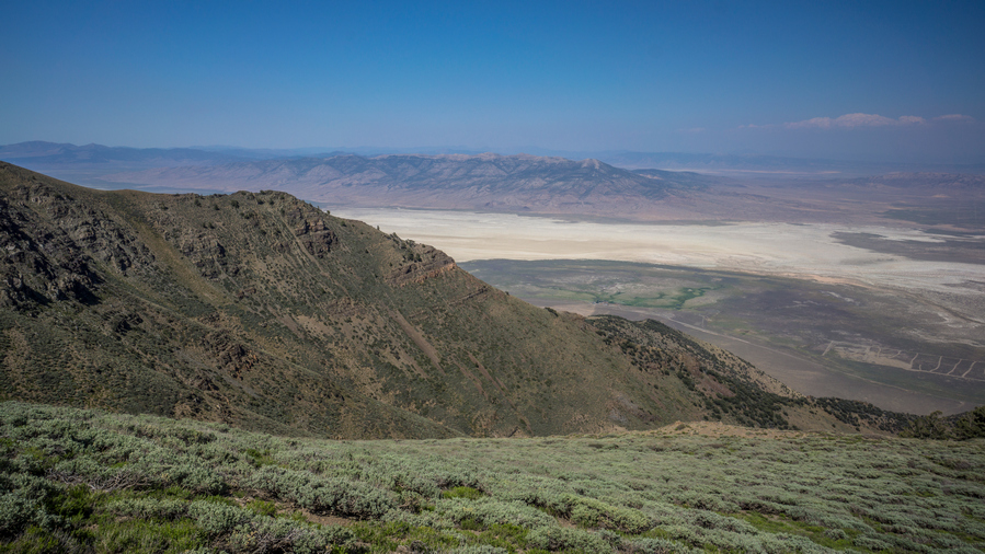
View east, to the dried lake bed of Newark Valley
Once at the base of Diamond Peak, there were game trails that appear to skirt the side of the peak. This looks a lot more appealing then going up and over at the moment, with 8 days of food and 5L of water on my back.

Skirting the hillsides around Diamond Peak
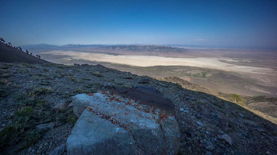
Newark Valley dried lake bed
I skirted around Diamond Peak, and continued to follow the game trails. I was expecting them to leave me up to the top of the ridge at some point, after the Ridgeline loses elevation. However, that never happened. Horse trails became faint and continue to traverse increasingly steep terrain. Eventually, I realized my best route forward was to just head straight up to the ridgeline below Diamond Peak. A 30 minute climb up a steep slope and I was there.
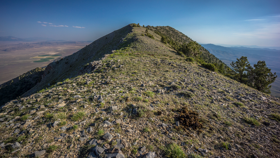
Crest of the Diamond Range, north of Diamond Peak
Now on the crest of the diamond range again. It was around 6pm now, a very pleasant time to be up here and walk the ridge. It was very Smokey today, forest fires burning west in California. The walking on the ridge alternates between easy challenging. The horse trails generally do a good job of avoiding the steepest terrain, but they also fade out often and leave you not sure which way to go.
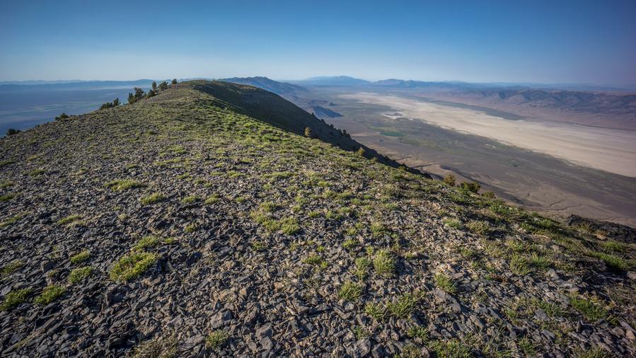
Hiking the crest of the Diamond Range
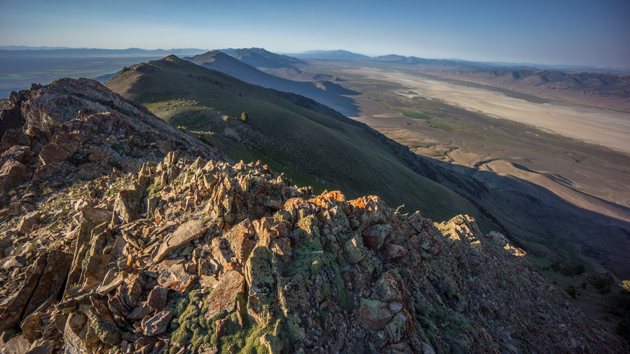
View north along the crest of the Diamond Range
Sometimes, the Ridgelines turned into a knife edge or very undesirable climbing. I had to backtrack a bit at times, as well as climb down some steep and loose chutes. I saw one pronghorn as I made my way around one of the game trails. Also, I had 4G service all day.

Dried lake bed view

Diamond Range Hiking
The views hiking the crest of the Diamond Range were excellent all evening. This is the kind of thing I dreamed of when I was planning this route. Up high on the spine of a mountain range, straddling two massive, desolate valleys on both sides, hiking to sunset. And here I am, living that dream.

Sunset in the Diamond Range
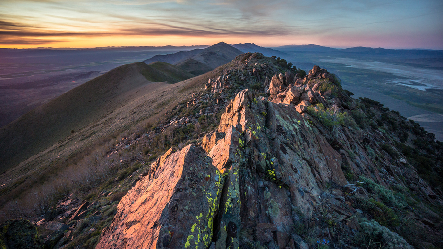
Sunset over the crest of the Diamond Mountains

Sunset over Diamond Valley
As the sun started going down, I found myself on somewhat of a knife Edge Ridge. Very Rocky and steep. Once I had a bunch of thick trees, and that’s the side I ended up hiking. This was just as the sun was going down below the horizon. Then I made it to a saddle, which did have a flat spot that I could have camped on. But of course, I kept going. Followed a game trail along the hill side until it was almost dark. I was on the crest again, going downhill now.
Finally, I found a spot. Sub par, but it will get me through the night. It was just on the side of the crest that is protected from the wind, about 3 ft down below the crest and protected by a small bush. The ground was actually flat too. It was windy though, so I needed this protection, even if it was very minor.
I set up camp as quickly as possible, and got in my sleeping bag. I cowboy camped tonight, no room for a tent and too windy for it anyways. I was literally camping on the crest, with a 360 degree view. Amazing.
Day 38 – July 8th: Diamond Mountains, Newark Valley
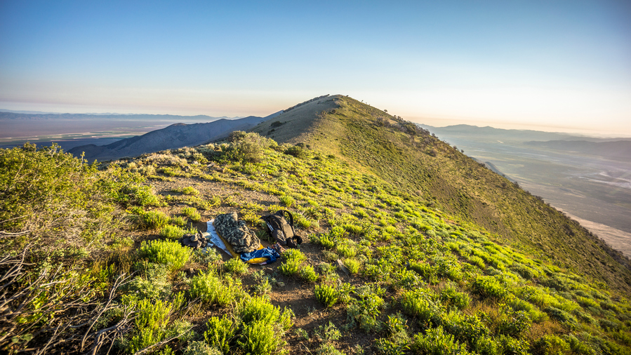
Cowboy camping on the crest of the Diamond Range
The wind died down about an hour after I went to bed. Lots of Lights shining in both Diamond Valley and Newark Valley. I remember seeing the earliest rays of light started to rise over the mountains, with the rest of the sky still black. Too early for me. Then woke exactly at 6 with the sun on me. Hiking by 6:45.
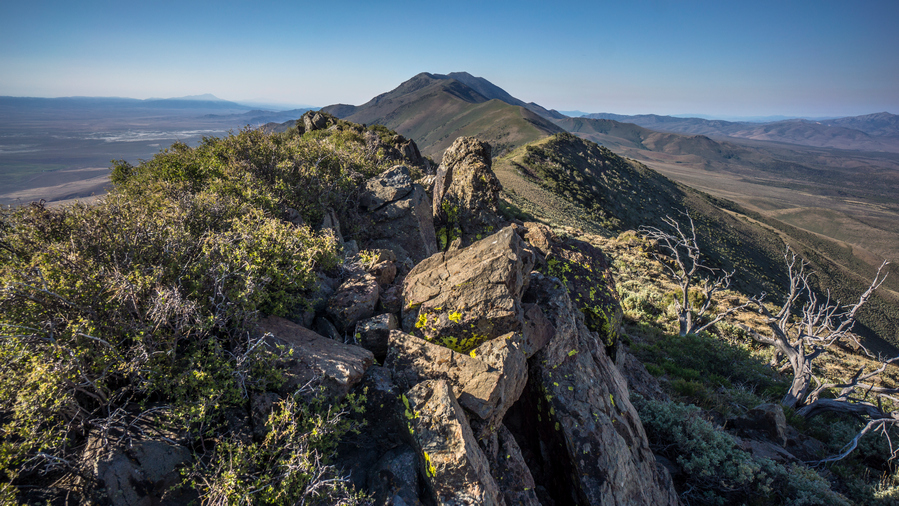
Hiking the Diamond Range
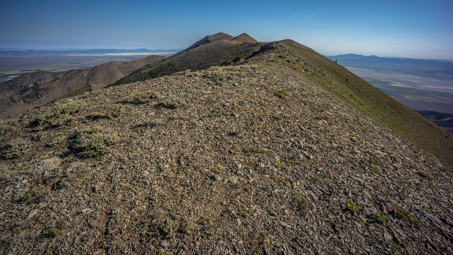
The crest looks like easy hiking, but the route always seems to have more obstacles up close
Followed The Ridge, and horse trails. Walked for 10 or 15 minutes before realizing I was at the spring on the map, the first one of only two along the entire Diamond Mountains route. I would need to drop wayyy down off the ridge to reach it though, and since I had a little over two liters, that wasn’t necessary. Instead, I’ll push on to the spring that is about 8 air miles away. There was also some flat spots on the saddle where I could have camped, if only I pushed 10 minutes further last night.

Horse skeleton
Next I followed a horse trail well below the crest. Eventually though, I had to reach the top of the crest, so it was a climb straight up the hill side. Walked the rest of the ridge for a while, before needing to choose the east or west side of the crest to drop down, and try to follow game trails. The east side of the crest looks less steep and Jagged, so that’s what I chose.

Easy hiking, for now

Difficult hiking
I didn’t see any game trails on the east side at first, but then there was an obvious path. These game trails, they can be really solid and then Fade Into nothing in a matter of a few feet. Sometimes it worked out, other times was kind of horrible… Boulder fields, Sagebrush etc. The typical stuff I guess.
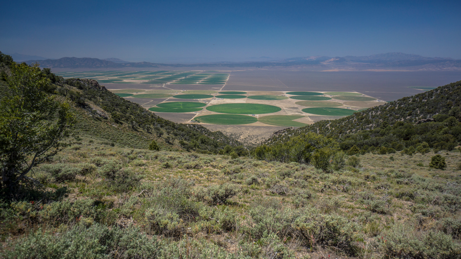
Agriculture in Diamond Valley
Saw an elk sitting under a tree a few hundred feet below me. Of course, he quickly ran away as soon as he saw and heard me. Diamond Valley on the West Side of the crest had a lot of Agriculture, large green circles pretty much spanned the valley at this point. On the east side is Newark Valley, still following the dry Lake bed, but agriculture in between the mountains and the lake bed now.
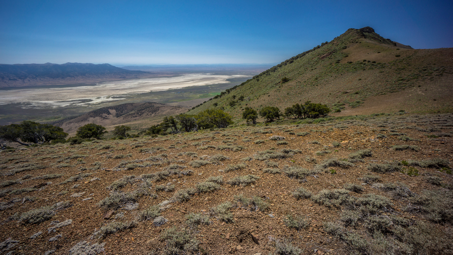
View over Newark Valley, looking southeast
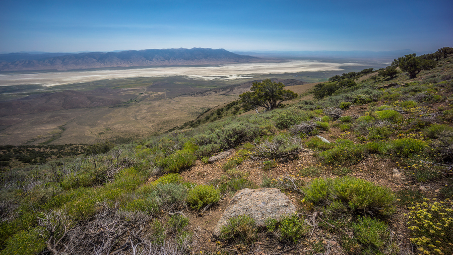
I really enjoyed the views over these dried lake beds
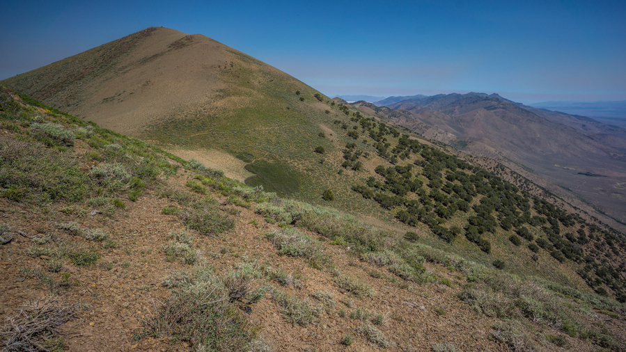
Notice the game trail skirting the mountainside? That’s my route
The game trails were intermittent. Even when they did exist, it was still a constant matter of fighting sagebrush. It wasn’t a fullon bushwhack, but there was enough vegetation to scrape, cut and stab my legs. Needless to say, the route along the crest of the Diamond Range is slow going, despite looking relatively easy from afar.
Eventually I reached the last Ridge before I had to drop down and get water from a spring. This was the last spring I had marked on my map until the end of the entire diamond range. Unfortunately it’s many hundreds of feet below the Ridgeline. From here I had a choice to make, follow the game trails to the east or west side of the ridge. I really wanted to be on the east side, that’s what the spring is. However, the game trails leading east looked pretty weak. They looked pretty strong on the west side, so that’s the route I took.
I was thinking I would be able to just follow a game Trail back to where I needed to go, on the east side of the ridge, but that didn’t work out. I realized the game trails were taking me a bit out of the way after I turned the corner around one side of the mountain. So, I had to go straight up the mountain side through very thick brush and trees. This part was awful. It was around this time when the Flies started getting really bad. They weren’t a problem or earlier today, or any other day, but all the sudden there were 40 or 50 flying around me at all times. Super annoying! To make matters worse, the brush was so thick going up that I had to put my pant legs on. Now I was protected a bit, but at a great cost… Sweating like crazy.

Time to descend into this canyon, east of peak 8802′, to look for water
At the top of the ridge, I couldn’t really see this spring at all. The flies followed me over the ridge and we’re still all over me. Started making my way down the somewhat steep Hillside. It was mostly loose dirt and rock, smaller rock, the kind you could just dig your feet into, and kind of slide down the hill in a controlled manner
I could see a lot of thick green vegetation in the ravine, and this is where I was generally headed. I was super disappointed to see no water In the creek bed though when I reached it. To follow it downhill looks terrible, it looks really thick.
Eventually I reached a point where I couldn’t go any further. All directions, except up, we’re completely covered in thick green vegetation. It looks really, really thick! I put on my pant legs, and chose a spot that looked like it would be the shortest section of vegetation to traverse. I stumbled through it, getting snagged by all the branches, having to push many out of the way, before stumbling on a tiny trickle of water. However, vegetation was so thick here, there was nowhere to even bend down to touch the water, let alone collect it. I was getting cut up by Thorn bushes, covered with flies, hand in Tangled by the vegetation. What a nightmare.
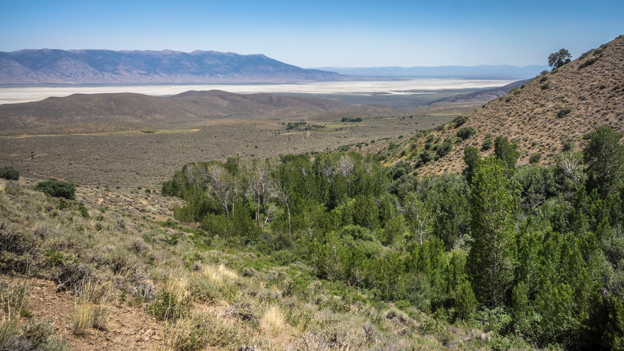
This canyon looked like an easy walk, but was a real pain
After the bushwhack, there was still a lot of side-hilling to do, and I had a lot of debris in my shoes at this point. My feet were pretty sore and tender now from running on all of this debris while walking these steeply angled slopes. At the moment, I remember thinking that this Canyon was one of the worst experiences of the whole hike.
I walked along the Hillside, above the thick vegetation that choked the Ravine. As I dropped lower in elevation, I dropped down to the Ravine to check if there was water. It was dry. This was a bit devastating. I kept walking down hill, that’s all I could do. Closer to the bottom, I dropped down to the Ravine again to check. It’s really thick and hard to reach, but here I did find a little water. And, I actually had enough space to sit down next to the creek and filter water. Up high, I couldn’t even bend down to collect the water if I tried there was too much vegetation. It would have been more pleasant without the Flies, but still, it was shaded and there was water. I had to dig out a pool to collect from. There was a bunch of squiggly little swimmers in the water. I spent a good while here, filtering water and eating lunch. I chugged 2L of water and took one with me. I would have taken more but the map showed a lot of water coming up, now that Im down low in the valley and off the ridge.

looking back up at the canyon I just came down. Doesn’t look like much, but man, what a pain that was.
I wasn’t far from the bottom of the canyon now. No way in hell I am going back up that Canyon. So I guess I am done walking the crest of the diamond mountains. I would have to carry my maximum water capacity, which was now 5L, plus one dirty water bottle. Instead, I’ll just have to walk the road through Newark valley around the northern section of the diamonds.
I was the google satellite images in my pre-hike planning to try and determine whether or not water would be at a marked spring, or anywhere else. However, in this section of the Diamond Mountains, the satellite imagery shows snow on the ground. This makes the satellite imagery useless for my needs, and adds to the difficulty of planning a route through the Diamond Range. However, after returning home from this hike, I found the ESRI satellite layer, which shows the Diamond range without snow. Using the ESRI layer, I was able to locate another spring that wouldn’t require dropping down over 1,000ft to reach it. This means for anyone else hiking the Basin and Range Trail, you shouldn’t have to drop down off the crest of the Diamonds as far as I did, and you should be able to stay high up on the crest for the remainder of the hike to Corta Spring, where the BRT would drop down off the ridge.

View of Newark Valley dried lake bed
After filtering water, the rest of the hike down the canyon continued to be a pain in the ass. Eventually though, I reached a small little road that leads out of the canyon and into Newark Valley. For this I was very thankful.
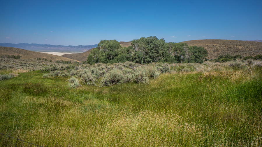
Ferry Dell, Newark Valley
Now I’m on a road that parallels the main road through Newark valley. The map shows several water sources here, such as fairy Dell. In reality, these were fenced off. I could have access them if I wanted, but didn’t really need to at this point.
It was much warmer down here in Newark valley. But I didn’t care, the ease of walking more than made up for it. Many of the Canyons leading up into the diamond mountains looked similar to the one I came down, a ton of green, looks like a pain to hike.

HWY 892, Strawberry Road, running through Newark Valley along the Diamond Range

Beef, it’s what’s for dinner
Now on the main road through the valley, I was surprised to see it paved. I’d be on this road the rest of the day. It really wasn’t that interesting. The dried Lake bed ends and turns into farms and agriculture on the northern end of Newark valley.
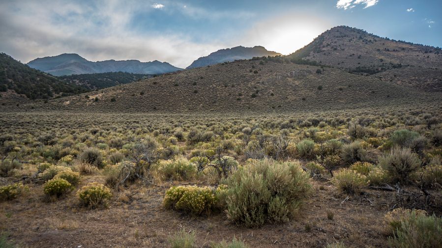
Diamond Mountains from Newark Valley

Cold Creek Reservoir
There wasn’t much traffic on the road. Not a single vehicle stopped for me, unlike a dirt road, where everyone stops. So now I am heading to a place called Cold Creek Reservoir, the next water source on my map. I walked 3 hours straight from my last water source to reach it. It’s very well hidden from the road When approaching, I didn’t think it was going to exist. But sure enough, a little dirt road leaves the main road and leads down to hidden reservoir. Boy I was thankful for that. Water level was low. There were a couple of campers parked around it and a family fishing. I stopped at the creek that feeds the reservoir and sat there for about an hour, I filtered several liters of water, chugging a few and collecting 4 to take with me. Ate dinner, washed my socks etc.

Sunset behind the Diamond Range
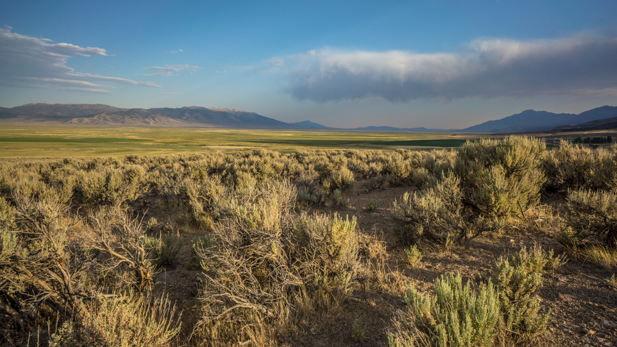
Northern Newark Valley. The dried lake bed was situated in the south, and here, it’s much more green
I left the reservoir around 6:30pm. More Road walking this evening, headed towards the Pony Express route that runs into the southern rubies across Huntington Valley. I was really hoping to make it to the Jacob’s Well Pony Express station, which would have surely provided a flat spot to camp if nothing else. However, it was 9 plus miles away. I wasn’t going to make it before dark. It would have been cool to say I slept in an old Pony Express station.
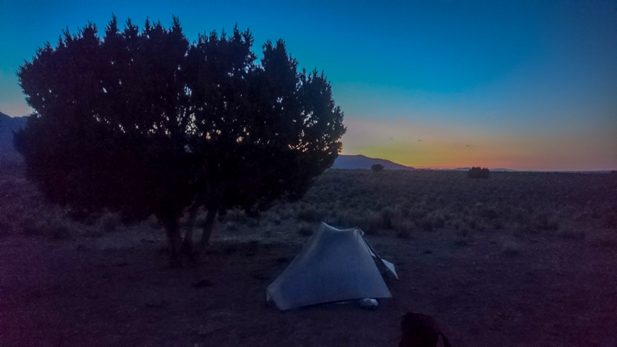
Campsite in Huntington Valley
The paved road turns into a dirt road. There is a turn-off for Bald Mountain with a sign that said Kinross. Apparently, that’s a mine. I kept walking and eventually found a spot under a tree, surrounded by cow crap around 8:30, just as it was getting dark. Perfect timing.
Day 39 – July 9th: Huntington Valley, Pony Express Trail, Overton Pass, Southern Ruby Mountains
Slept pretty good. Finish writing in my journal this morning since I fell asleep during it last night. This is pretty common for me. Started hiking around 7:30.

Hiking the historic Pony Express Route
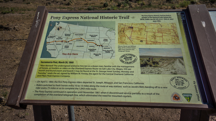
Pony Express route information
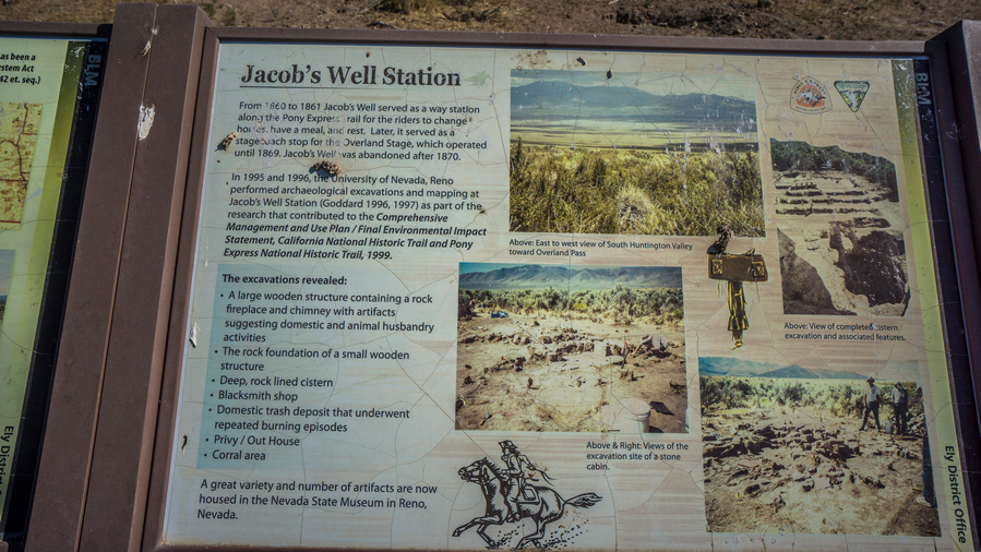
Everything you ever wanted to know about the Jacob’s Well Pony Express Station
Continued walking the road north. After while, I hit the Pony Express route. This is marked by a couple of brown signs. I turned right, heading roughly east and after a few miles I hit the Jacob’s Well Pony Express station. There really wasn’t anything here, just a clearing, which was fenced off. There was a marker made out of railroad ties, and these were all over the Pony Express route. And a couple of signs that described what went on in this area.
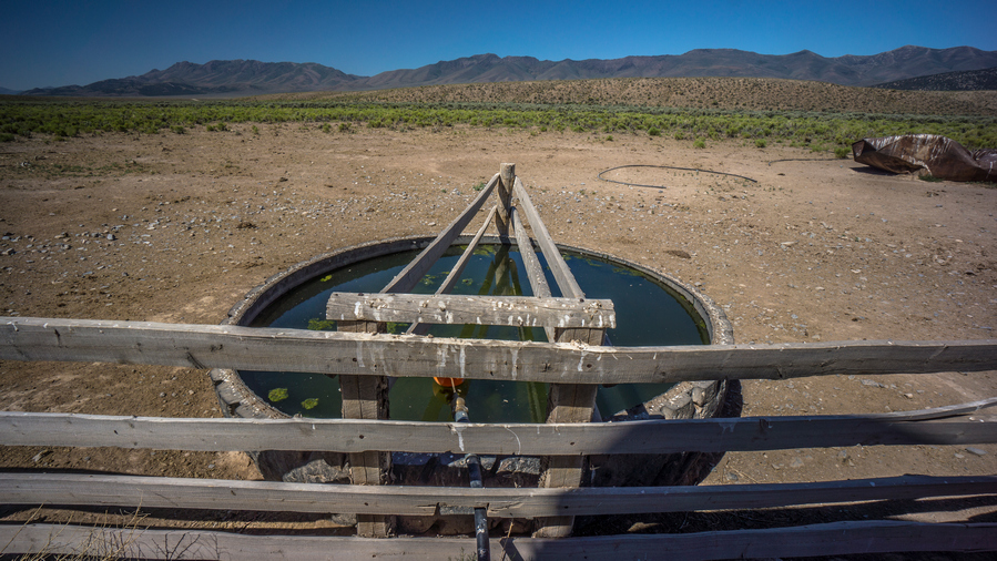
Jacobs Well water source. Water here in 2020, water was OFF in 2021
A few miles up the road I hit Jacob’s Well, the water source. This was a large tank filled with water that fed tires and Troughs. There were cows here but they were fenced off. I could access the well without being in the same area as the cows. There was a spigot on the well, which was very handy. I was able to wash my socks, with some pressure. I chugged 2 liters of water and took 5 with me.

Northern Diamond Range
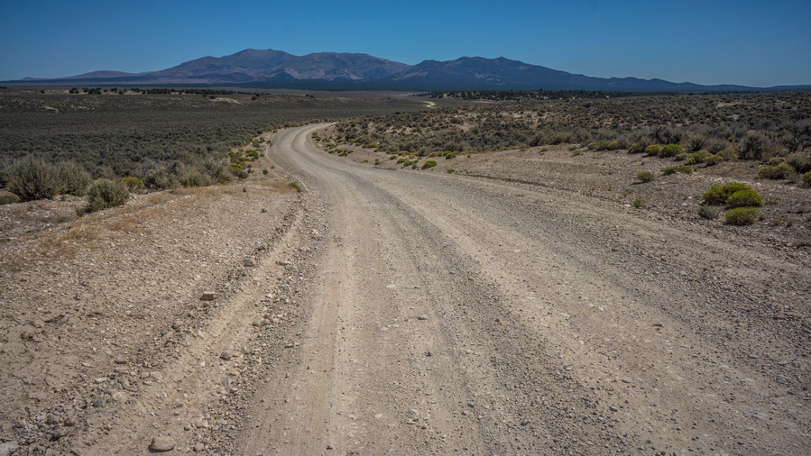
Hiking the Pony Express route in Huntington Valley
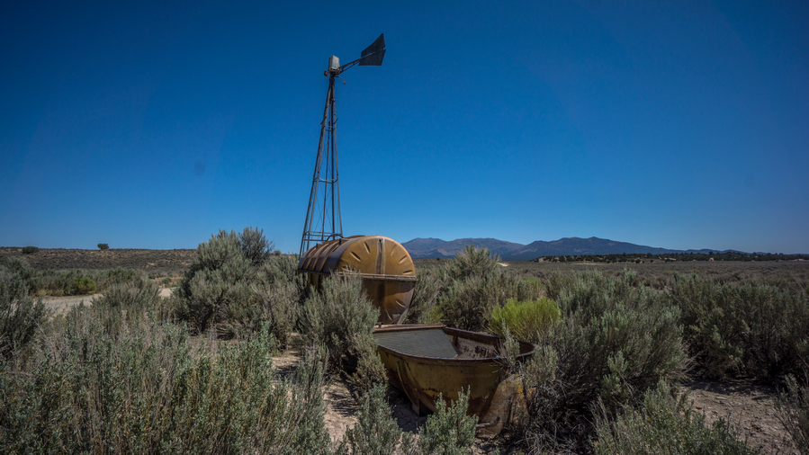
She dry
Now it was a long road walk from here, still along the Pony Express route. I didn’t see single car drive by. I crossed the main road running through Huntington valley here, and continued hiking the Pony Express route. A truck past, the woman stopped asked if I was okay. She said she was hiking the John Muir Trail later this month. That’s awesome!
I stopped along the road for a break under a tree. It was getting really hot today, forecast to be in the low 90s. I continued walking the road, and saw maybe five other vehicles drive by, all coming up over Overland pass from The Ruby Valley side. On the top of Overland pass, looking to the north there was a large burn area. Haven’t seen many of these in Nevada, the only one I can remember is in the grant range.
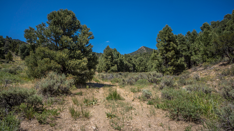
Fading 4×4 road leading into the Ruby Mountains

Route into the southern Ruby Range, looking back at the way I came from Overland Pass
Finally I hit the road that takes me up into the Ruby’s. It look the same as every other mountain range for the most part; at it lower reaches, plain dirt road with some small pine trees. I was really struggling now with the heat. Just having a hard time walking up the road and finding the motivation to keep walking.
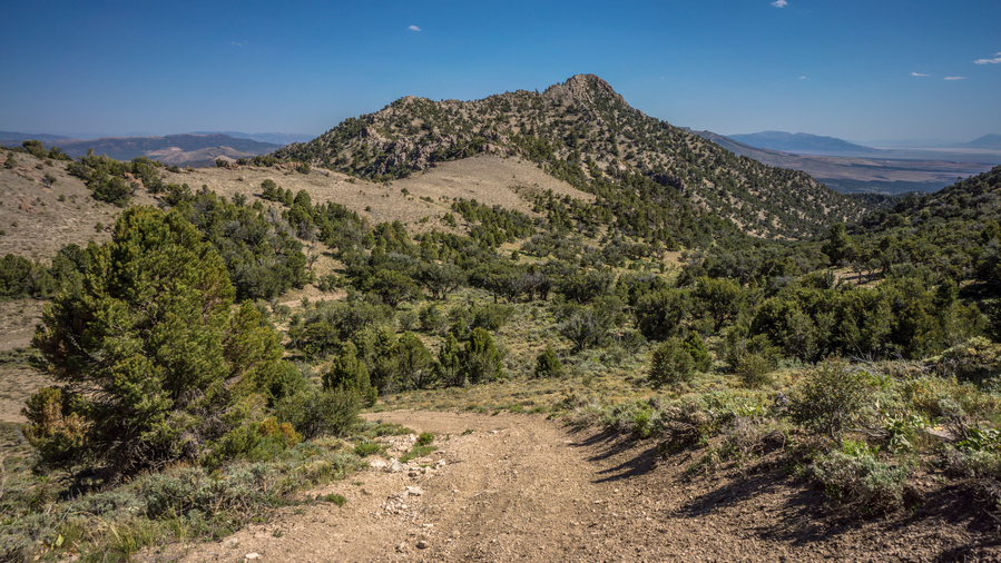
I hiked up the canyon on the right
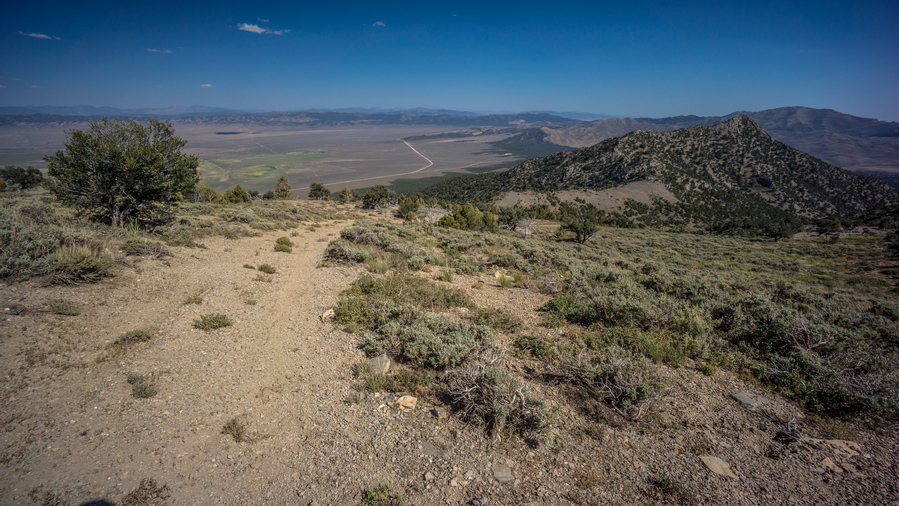
First view of Ruby Valley
It took roughly two hours to get to the top. My mouth was dry, I was thirsty and hot. I had already drank two liters of the five I took from Jacob’s Well. Then I drank another liter at my break, which I took after reaching the hill above the climb I just did. This break was nice, under a tree and a good view.
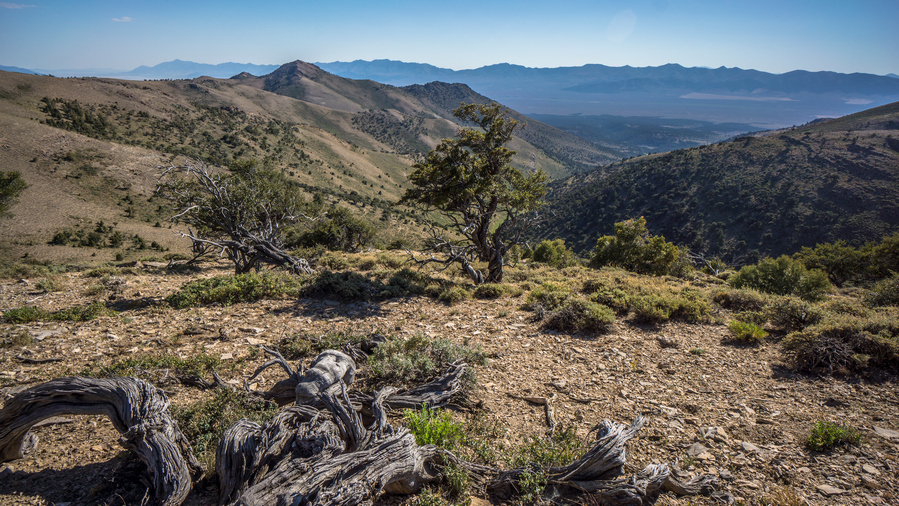
View west
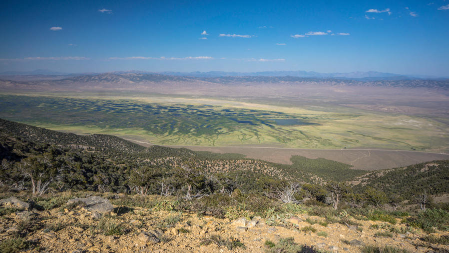
First view of the Ruby Marshes
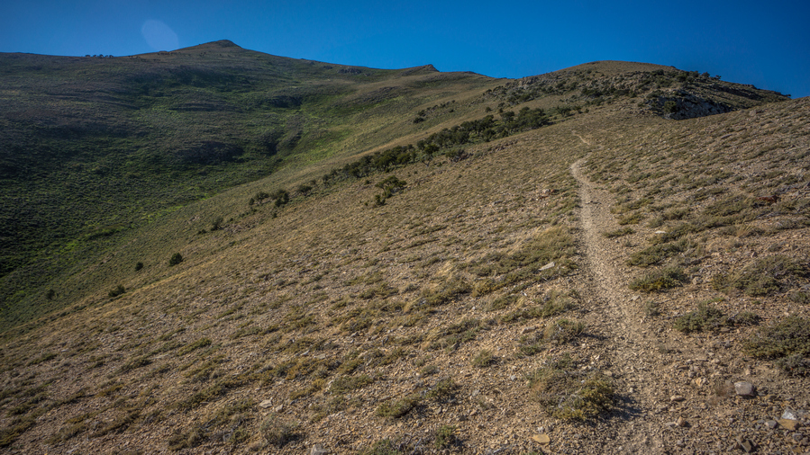
Route uphill. Sometimes there is a path, sometimes there isn’t
My route now continues uphill, along the crest or just below it. From the top, I could see a long way; the Diamond range where I just came from, and down into the Ruby marshes below in Ruby Valley. There was a lot of water down there, and had its own unique look a braided network of ponds and channels, spreading out like a spider web. Maybe, a spider that was drunk or something. Really nice views now, nice to have some reward for all the hard work I put in today.

Looking south, where I’ve come from

View north along the crest of the Southern Rubies
Climbed up to the top of the ridge, and then found a trail that dips down on the other side. It’s skirts the hillside, with a good view to the east of the Ruby Marshes. Now, I’m in the Basin that holds burro Lake. I wish it was a lake, because i was pretty thirsty now. But of course, it was dry as a bone.
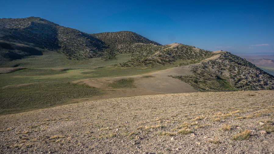
Burro lake (dry), view north to the route along the ridge

Looking down on the Burro Lake area
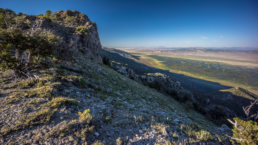
Ruby Marshes viewed from crest south of Sherman Mountain
I followed the crest up The Ridge, knowing I would have to ultimately find my way up a pass. It was easy going at first, a nice game trail. Then it was a difficult off Trail climb. Difficult because it was steep and I was tired. Had one tick on me, that’s three now for this whole hike. Saw two horses in the woods on my way up the pass.
The climb up this unnamed pass near really hit me. At this moment, I was feeling pretty tired of doing this hike to be honest. The off-trail stuff is just so hard. I’m always thirsty, hungry, tired, dirty, sore, feet hurt etc. I was stumbling up the hill, like I was on autopilot. This really is nothing at all like hiking the Continental Divide Trail. The challenges are far greater. Seldom can one just walk without much thought. Everything here is a battle.
I sat down for a minute at the top of the pass, looking to Sherman Mountain to the north. With the wind blowing, it was quite cold actually. Headed down hill through a forest, following game trails where I could. I got down to a clearing, and decided to start looking for camp. I checked one green area for water, no luck. I walked over to a patch of trees, and saw another 10 horses. They ran is I approached. I thought I might camp where they were, though.

Sunset view
However, before I set up camp, I decided to have a look around the Mountainside to see if I could spot tomorrow’s water source. I had given up on reaching it tonight, its too far. It would either be a large climb, say 800 or thousand feet, or skirt around the mountain side. I was leaning towards the latter. So, I started walking around the mountain side on some game trails. Before I knew it, I had gone too far and had committed to the route. The water was too far away to see, but I think it’s going to work based on the terrain and potential for game trails.
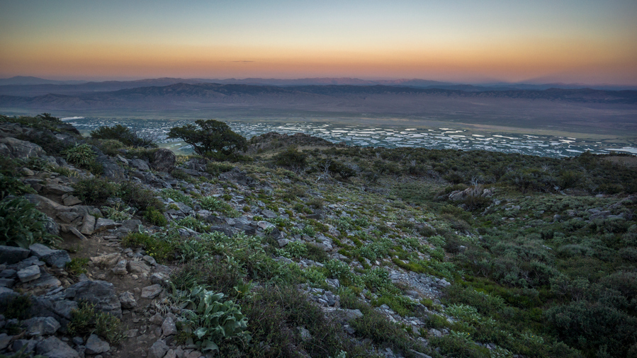
An awe-inspiring view over the Ruby Marshes at sunset
The view over Ruby Marshes was incredible. This was a unique view, no doubt about it. The way the fading rays of sunlight reflect upon the braided channels and pools of water below in the Ruby Marshes was something Ill never forget. I forgot I was in Nevada for a moment, this place looked nothing like the rest of the state I have hiked thus far. For all the challenges, the heat, thirst, bushwhacking etc, this is my reward. The cruel thing is about these hikes is that the payoff is so short lived. For all that I endured today, my reward is so brief, in comparison to the effort involved to reach this place.
Now after 8pm, it was time to find camp. It was a moderately steep Hillside, and nowhere to camp. There were certain spots that where basically small Ledges, although filled with rocks. I found a spot where I cleared a bunch of rocks, and decided this would be camp for the night. I had planned on cowboy camping this evening, mostly due to the lack of space for a tent.
I used my foot to clear out the small rocks, and had to dig out the big rocks. Eventually I cleared a spot the size my tents footprint. I put the Tyvek down, I blew up my air mattress, and then realized they were too many ants around. I haven’t had much problem with ants at night so I figured cowboy camping would work. However, there was just too many ants. They were crawling all over my stuff, and all over my sleeping pad.
The problem now is, it was Dark now and there were no other options for other campsites. The spot was very small. I didn’t think I could get tent in here, if I did, it would be on a huge slant… but that’s just what I did, not having much other choice. What a pain in the ass this was. It felt like amateur hour. It took a long time to set up the tent, my poles were off at odd angles, there were rocks underneath the tent that needed to be moved, and when I did, it stirred up the ants nest. I cut my hand somehow trying to remove some plant from underneath the tent. Basically everything went wrong. But in the end, the air mattress is flat and I’m tired enough that it doesn’t matter.
Just under 1 liter of water left. If Tomorrow is water source doesn’t work out, I will have to dip down out of the mountains again, as there are no other water sources for a long, long ways up on the crest of the Ruby Mountains.
Day 40 – July 10th: Southern Ruby Mountains, Ruby Marshes & Ruby Valley, Pearl Peak
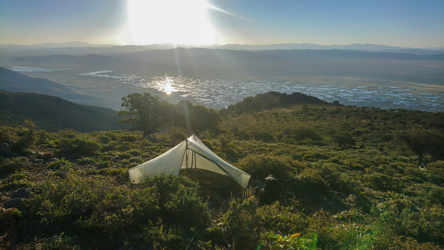
What a view to wake up to!
Slept good because I was so tired, but sure was a shitshow of a campsite. Wind died down a little bit but was still kind of gusty throughout the night. Could not get the tent pitched taught, so I had to listen to the tent flapping around in the wind all night.

Such a unique view. The Great Basin doesn’t usually have this much water
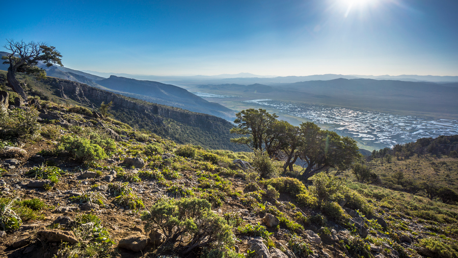
Ruby Marshes overlook at sunsrise
I continued working my way around the hillside, contouring around along the same elevation. Intermittent trails, faint at best. Saw a tank just before I reached the drainage where I had marked water, but this was dry.
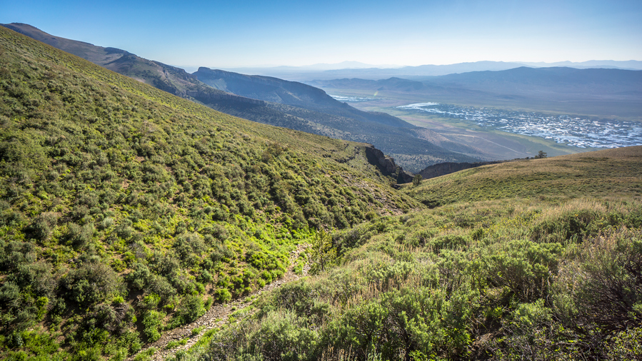
Ravine east of peak 9835′ that should (hopefully) have water
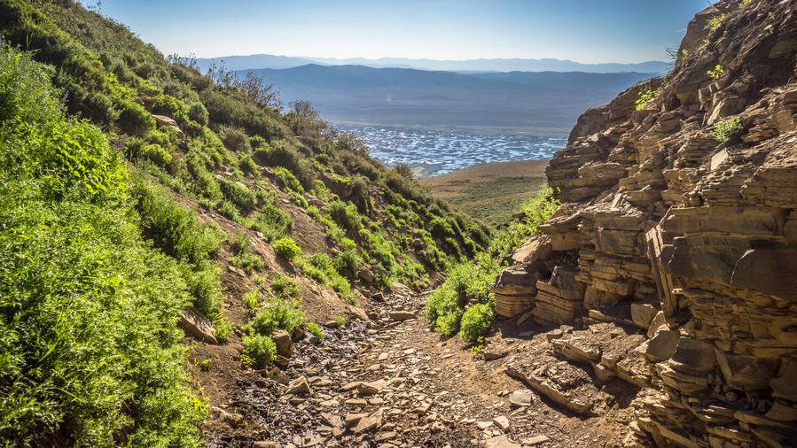
Looking down the drainage

More water as I climb higher, a good sign…
When I reached the drainage where I marked water on the map, this too was dry. Actually, it was damp. So now I could follow it up Hill or downhill. It makes more sense to follow it uphill and try and find the source. However, the canyon was steep and narrow. Still, I didn’t have a whole lot of options, I was a long way from water no matter what I did. So I went up hill. There was a ton of bugs here though, flies and mosquitoes.
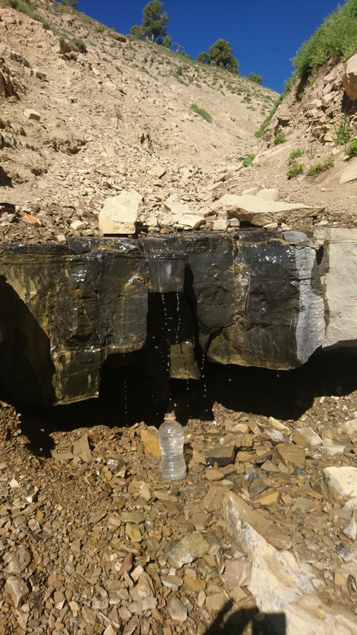
Just a trickle of water, but that’s all I need
Found a couples trickles of water coming off a rock, but the ground itself was still just damp, no running water. I kept going uphill, and finally found a 2-3ft pour off, with a few trickles of water running down that. First thing I did was dunk my head under the water. It was nice and cold, it felt amazing! Really amazing. I wont lie, I got a little emotional finding this water source. You know you are living when finding water brings a tear to your eye. I couldn’t help but scream at the top of my lungs Woohooo!!
After soaking my head and washing off a little, I chugged the half a liter of water I had left, and started to filter more. All in all, I drank 2.5L here, and took 5 with me.
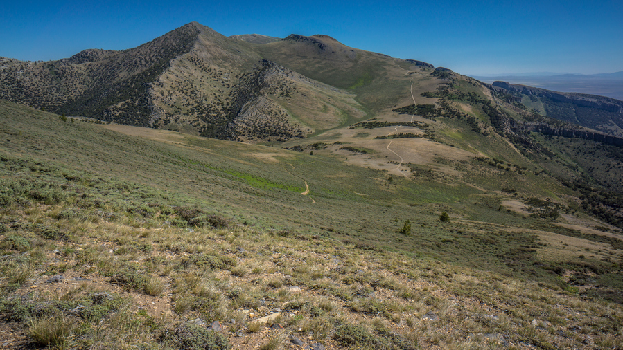
A 4×4 road can be seen running north along the crest now
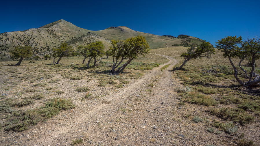
Which way do you suppose the wind was blowing?
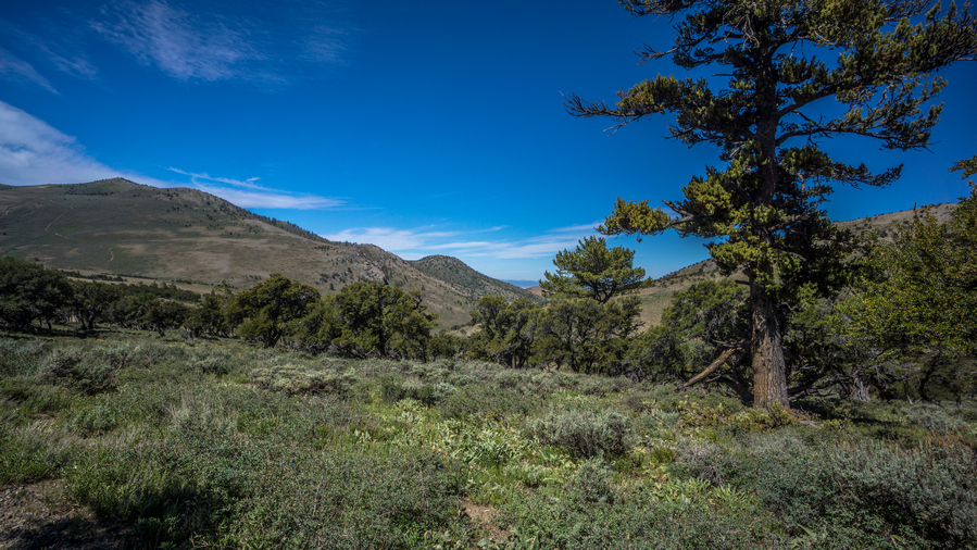
Very green. And look at the size of that pine tree!
Next it was a steep climb out of the ravine, although a short one. More side-hilling for a while, then reached a 4×4 road. This was a relief. Now, I could just relax and walk for a couple of miles, before going off-trail again later today. Now at a saddle, the road climbs up. The trees where practically growing sideways here, very exposed to the wind.

View from rock formation

View north along ridgeline
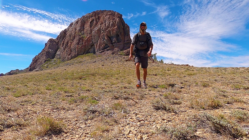
Hiking in the southern Rubies
I stopped to check out a big rock formation that looked like it might be worth exploring. There really wasn’t anything interesting here, other than some cool views!

Descending the pass
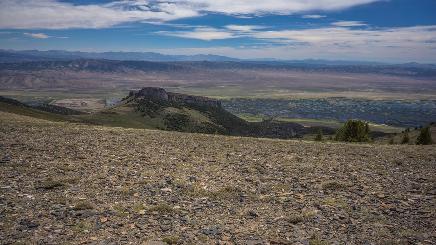
View east into Ruby Valley

View back south along the ridgeline
Went over another pass. Road passes through some trees on the side of a hill. Pleasant hiking for a bit. Pretty nice views all around.
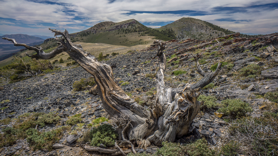

Some excellent hiking here!
Then, another 900 ft climb. In the middle of the climb, I saw 8 horses.

View east to Ruby Valley, Maverick Springs Range, Medicine Range and Cherry Creek Range
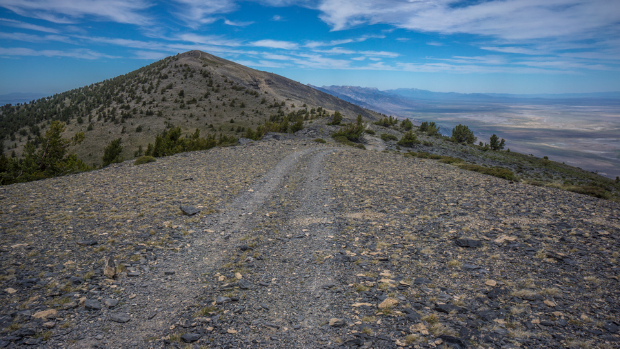
Hiking south of Cass Couse Peak
This climb wasn’t too bad, didn’t seem like 900 ft. This is where I thought the road would end, at the top of this hill. Very very steep 4×4 Road leading to the top. At the top, the road continue to along the Ridgeline towards the next high point.

Copper-lead specimens, with secondary minerals of malachite and azurite
Along the Ridgeline, near Cass House Peak, I found some very interesting rocks and minerals. There was a small hole that someone had dug here, and the ground was littered with rocks bearing colors of green, blue and silver. I am pretty sure this was a copper/lead deposit. The green indicates Malachite, the blue was probably azurite, and these colors are a strong indicator of copper. The silver metallic mineral was likely Lead (galena), which is often found with copper. A very cool find!
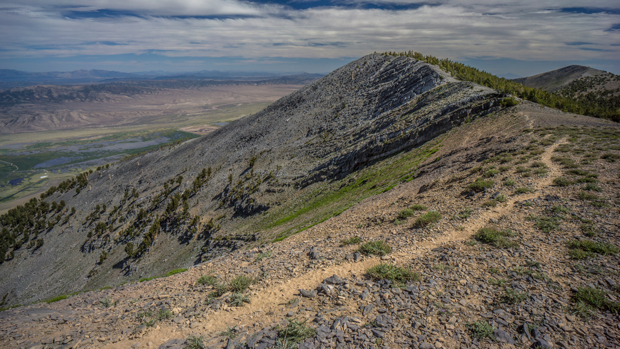
Excellent hike south of Pearl Peak

View south along the crest of the southern Ruby Mountains
Followed the road to the top of the next high point. This is where the road ends. Then it was a ridge walk down crossed a few other high points. Finally, Pearl Peak was in view. The climb up didn’t look too bad. It was going down I was worried about, from looking at the topo maps.
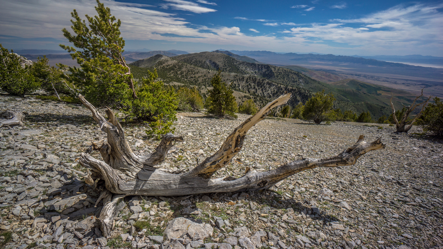
Beauty of the Great Basin
The hike to the summit of Pearl Peak was pretty easy, all things considered. There was an intermittent game trail at times, and the grade was not too steep. Good views along the way.
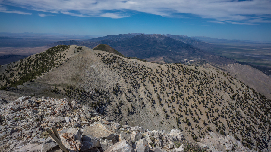
View from the summit of Pearl Peak, looking north
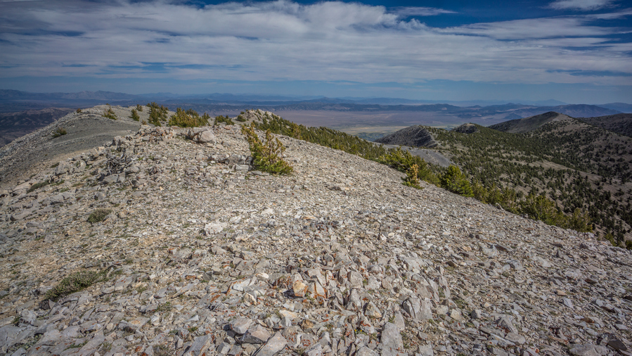
View southeast from the summit of Pearl Peak
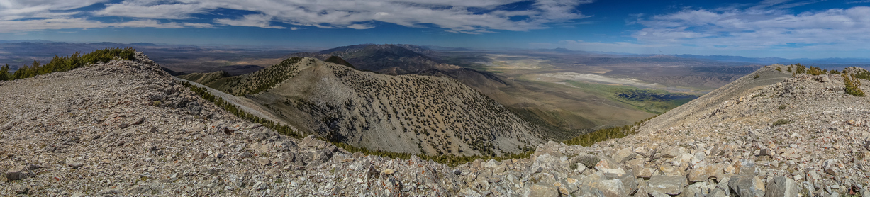
View north from Pearl Peak summit

View southeast from Pearl Peak summit
The summit of Pearl Peak offered an excellent view. Especially to the north over the rest of the Ruby Mountains. The Rubies are a long range, and the section that most people hike (Ruby Crest Trail) is a 40 mile section, north of here. Where I am though, in the southern Rubies, few people hike this.
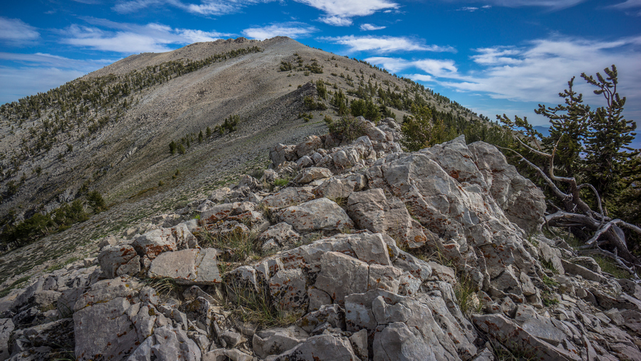
View south to Pearl Peak

View north from peak 10,664′
Now it’s a slow and tedious descent down from Pearl Peak on loose rock and talus. I’ll dip down to a saddle below peak 10,664′, then hike up to the top of it.

View west across Huntington Valley
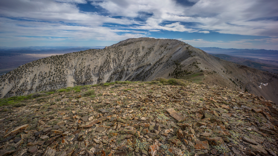
Peak 10,664′

View south from peak 10,528′
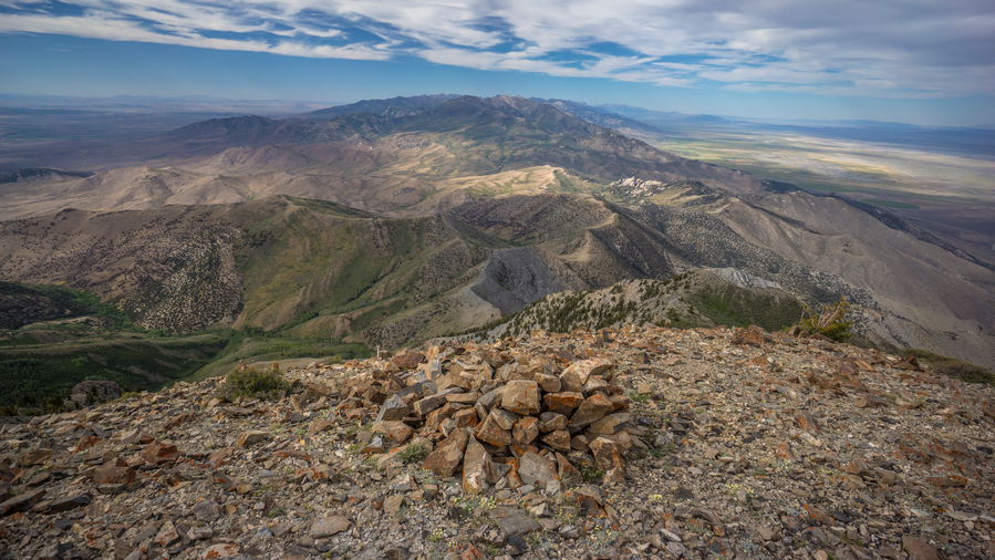
View north from peak 10,528′
Coming down form 10,664′, I drop down to another saddle before going right back up to peak 10,528′. From the top of this one, I couldn’t see over the edge to get eyes on the route down until I got started descending it. It was steep! But, quite manageable.

Looking south to peak 10,528′
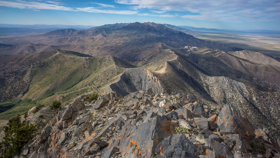
I need to get down this, and follow the ridgeline
When I reached the ridge I was worried about, it had me very nervous. Extremely steep descent. On my map, the caltopo slope angle shading was solid red for 1000 ft. Darker colors indicate a steeper slope. Took a break here, ate food drink water, and went for it.
This is the type of terrain where you just dig your heels and feet into the dirt and rock and just let it slide, basically a controlled slide. Hopefully its a controlled slide anyways, much better than an uncontrolled slide. I fell numerous times on the way down. Still, it was somehow more manageable than I was expecting. My feet hurt, there were pebbles in my shoes and they were rubbing on my feet, making them sore.

Play of shadows as I look back upon the route I traversed down from Pearl Peak

View north along the ridgeline
Finally worked my way down the steep slope and over to the ridge itself. Now you could hear a bunch of sheep down in the valley, and I could see the sheep herders white tent on a ridge. Following the ridge was still hard; it was slippery with loose rock, caught myself many times from falling. Sometimes I didn’t catch myself though!
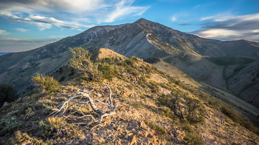
Not the easiest hike along this ridgeline, but it’s a beautiful one
Now I had to go up a series of ridges and Hills, all off Trail. I was absolutely wiped out, basically stumbling around. Beautiful views, just so much hard work. Some of these ridges were a bit of a knife edge at times.
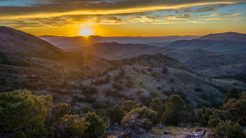
Beautiful sunset this evening
Eventually, I reached the last Ridgeline of the Basin that held a couple Springs. I begin The Descent, off Trail, instead of just following Ridgeline a ways more to a Road. Big mistake. I found myself at a wall of trees, totally impenetrable, with only a tiny bit of daylight left. No way!!
I went back up the hill side, very steep. Worked my way around the trees, and was literally running downhill through Sagebrush, with no care given to my legs. My legs got pretty cut up, they were bleeding and completely black and brown from being dirty. But, I reached the bottom, and then eventually, the road.
I continued to jog along the road, as there is almost no daylight left now. I reached the general area where the spring was on the map, but it was too dark to find the water. I had no choice but to continue along the road, following it up Hill until I found a subpar place to camp alongside it. There was just a little bit of sand over a huge rocks slab, so I couldn’t get my tent up, the stakes wouldn’t go into the ground more than a half inch. Couldn’t even find a single rock to try and pound stakes in! So I ended up cowboy camping, even though the mosquitoes were out. I don’t care, I was too wrecked to give a shit otherwise. 9pm now, another 14+ hour day of hiking.
Day 41 – July 11th: Harrison Pass, Ruby Crest Trail, Ruby Mountains, Overland Lake

I thought they looked pretty clean last night, but I guess not
Woke at 6:45. Feeling wrecked! Thirsty. Tired. Sore. Legs still really dirty, despite cleaning them last night with wet ones. I guess I missed a few spots, like the entire leg. Ha.
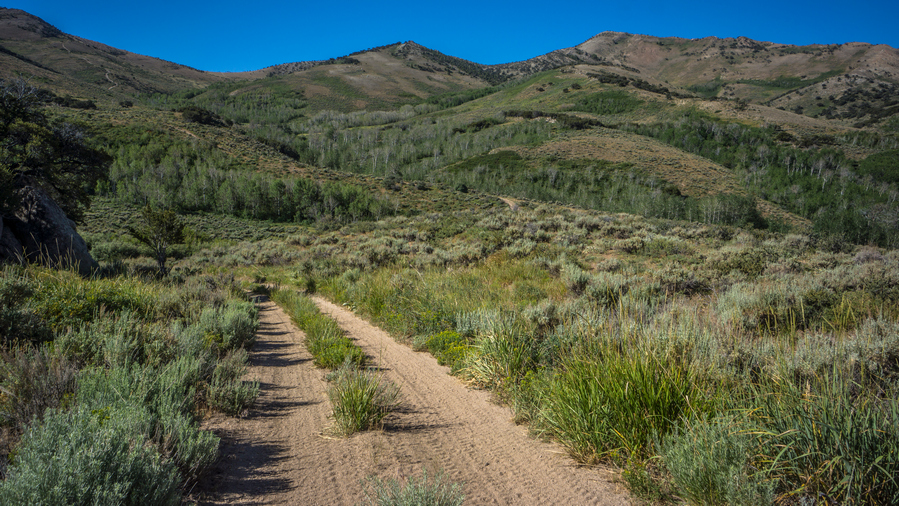
Upper Corral Creek basin, looking back at the ridge I came down last night
Walked down hill to the spring I passed last night in the dark. Found it, in thick brush. A small flowing creek. Found a spot to sit down, thick canopy but open enough to sit on grass. Actually pretty nice.
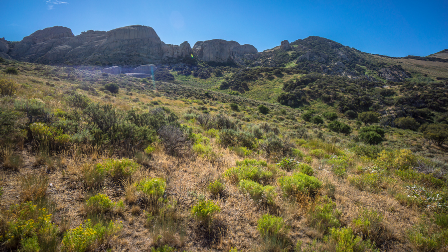
Impressive hoodoos and rock walls in upper Corral Creek basin
The Basin I camped in last night was really nice, lots of Rock hoodoos everywhere. There probably would have been some great camping spots I had time to explore in the daylight. I followed the road North towards Harrison pass.
At Harrison pass, there were three vehicles parked. An actual hiking Trailhead, with a couple of cars. I haven’t really seen many actual hiking trailheads in Nevada along my route, and they usually don’t have cars at them. Welcome to hiking central Nevada.
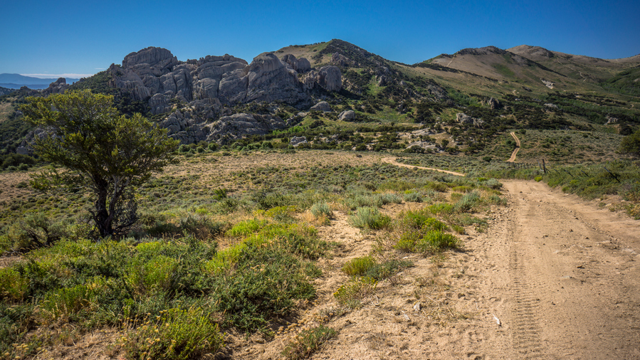
North of Harrison Pass
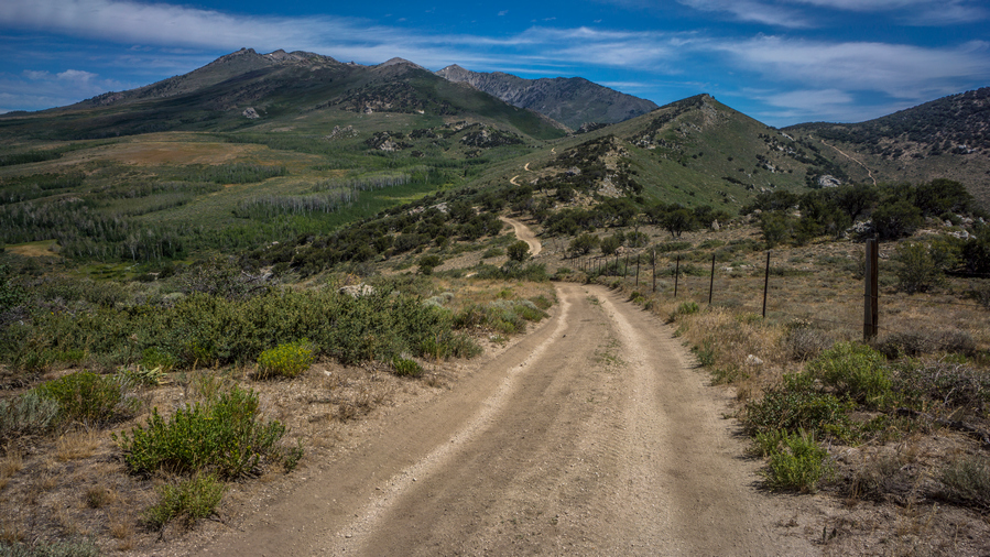
View north into the Ruby Mountains
Continued North on the road above Harrison pass. A sign said Ruby Crest Trailhead 2.8 miles, wilderness boundary 6 miles. The road is rough ahead, so most people park at Harrison Pass, which ought to be considered the official Ruby Crest Trailhead. The road here was also lined with Rock hoodoos and interesting formations, and some pretty excellent campsites for the car camper. I passed one spot that must have had 10 tents. I also passed a couple of Runners coming down Road, they said you picked a good Day to come out, referring to the heat. Today was supposed to be 98 in Spring Creek. Of course, I can’t pick and choose my hiking dates around the weather.
Along the road, I saw a couple Beaver ponds along the creek, I think it was Gardner Creek. Farther up, I reached the Ruby Crest Trail head. There were three trucks parked here. I was surprised to see anything parked here because the road was pretty washed out and deeply rutted in spots.

Before the Ruby Crest Trail gets “good”
The next many miles were not that interesting. It looks like the area had previously burned and low brush was growing back. Just a sea of bushes that were only knee high. Pretty horrible actually, but good thing for the trail. The views were not that great here either. Also, the trail here has a lot of small ups and downs, and even though I was putting in a lot of work, was not really getting anywhere elevation wise.
Saw my second hikers in Nevada. A younger couple that had just left Overland Lake, going back to Harrison pass. They had giant backpacks, with REI tags on them. Looks like they rented their gear.
There were many small trickles of water over the trail. The small streams, probably could have collected from them if I tried, but instead, just used the water to wet my head, hat, and Sun flap. This felt amazing in the heat. It was really hot.
I reached McCutcheon Creek Which is really nice, good flowing Creek and the backdrop of pointy mountains was finally starting to show itself. Hiking North, the scenery didn’t look that great still, but now, looking back to the South, the Ruby mountains began to look bit more impressive.
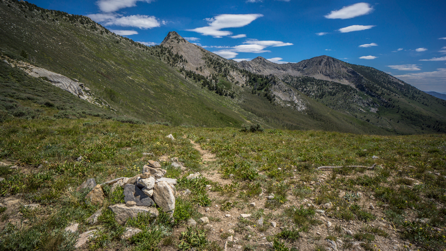
Scenery is starting to improve
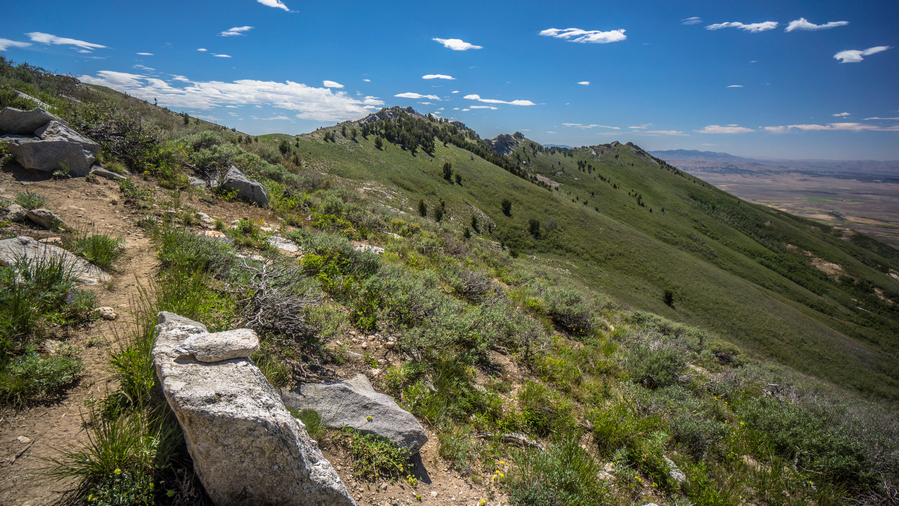
Cresting a ridge above South Fork Smith Creek
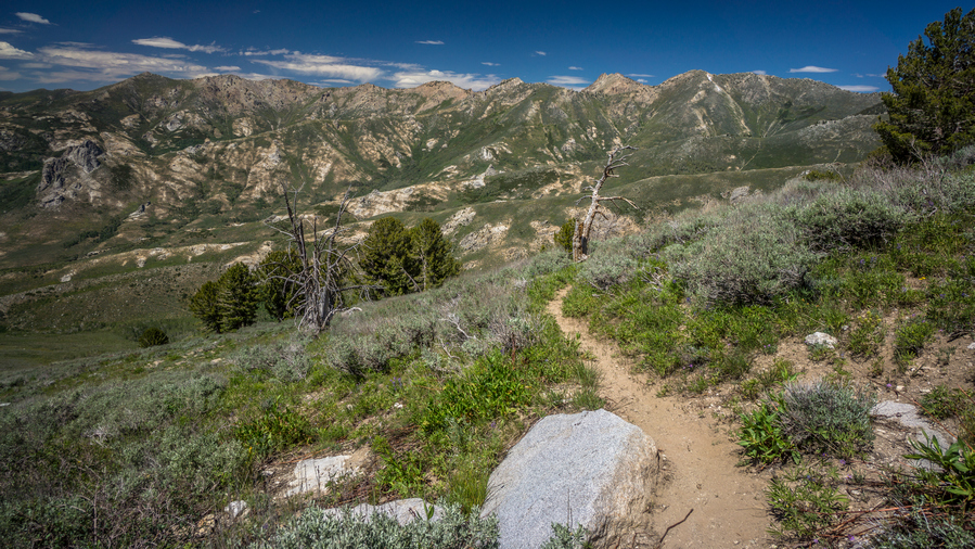
Descending to South Fork Smith Creek
Went over a pass with a nice View, before dropping down to South Fork Smith Creek. Saw two more people with the dog taking a break under a tree. It was a nice hike down to the creek. Good views, Big Valley. Still not amazing, but getting better.
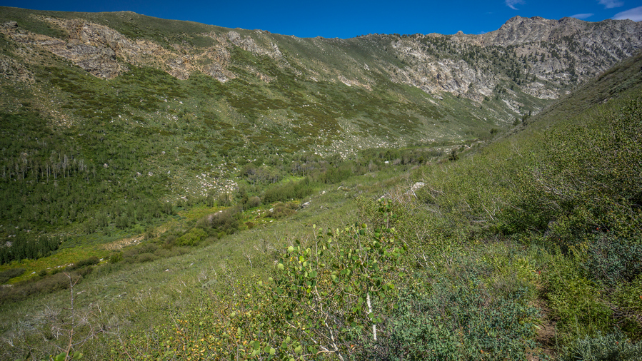
Dropping down to South Fork Smith Creek
Down at the creek, I was hoping to have water large enough to have a swim. It was only a few inches deep though, with slightly deeper pools here and there. There was a large campsite along the river, really the first pre-existing backcountry campsite I’ve seen in the rubies.
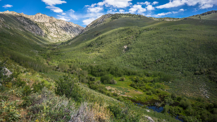
Beaver Ponds along South Fork Smith Creek
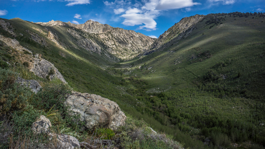
View up South Fork Smith Creek
Next the trail climbs up over a ridge. Good views at the top, then it drops down to Middle Fork Smith Creek. Roughly the same size as South Fork. I stopped here to filter water.
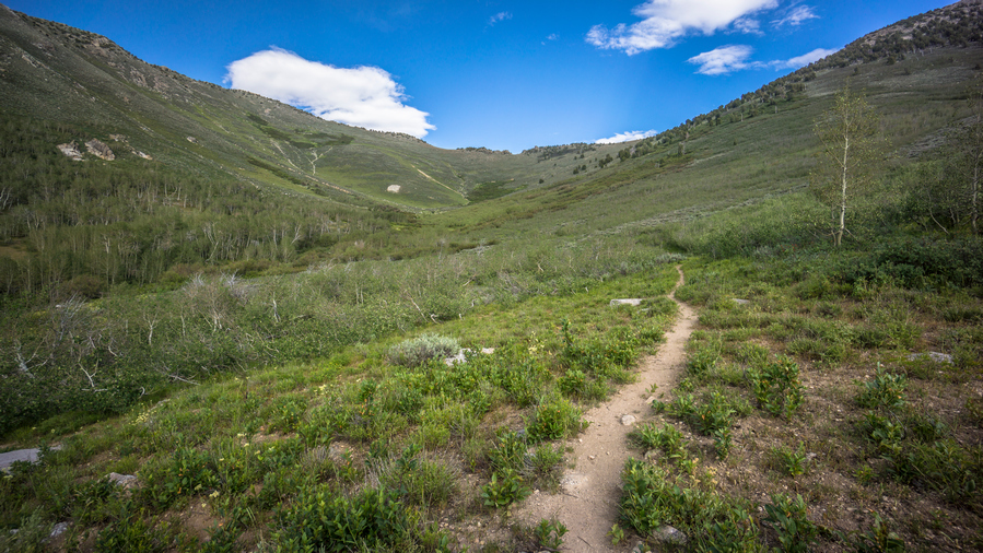
Route up to Overland Lake from North Fork Smith Creek canyon
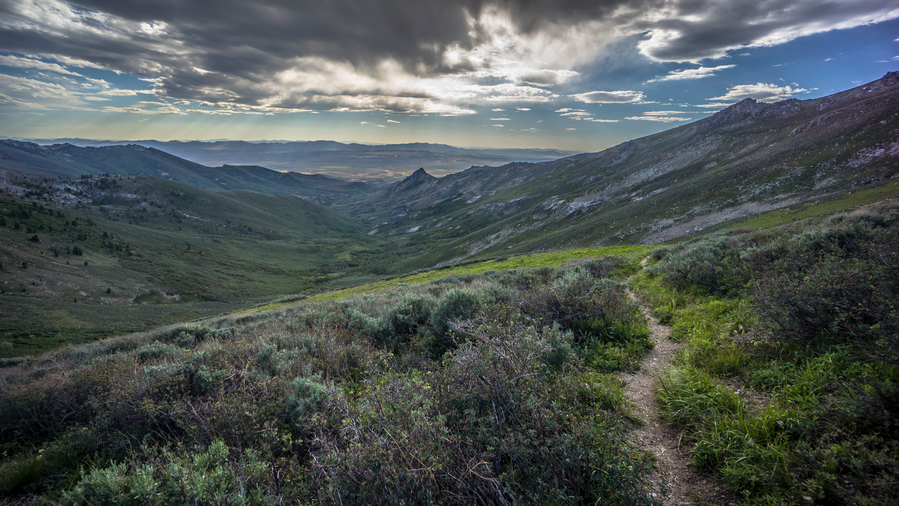
View down North Fork Smith Creek canyon
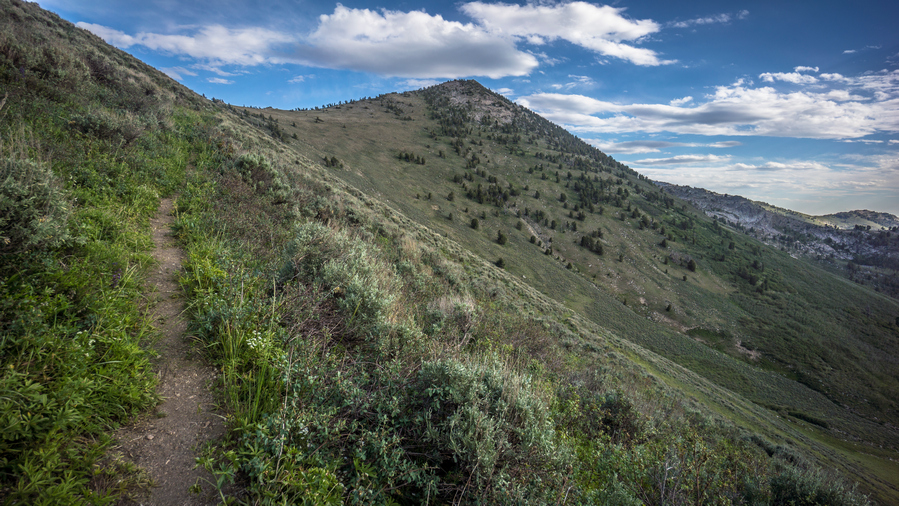
Near the top of the pass above North Fork Smith Creek canyon
The trail climbs up over another Ridge, and then begins its Ascent to the pass above Overland Lake. Trail all the way up to the switchbacks at the end of the basin was actually pretty easy. All of the climbing came in the form of switchbacks, about 1,000 feet straight up. I saw two horses in the upper portion of the basin. This felt like a really long climb, there were many times I thought the leg of the Switchback I was on was the last one, like a false Summit.
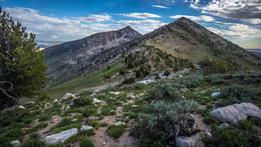
View south from the pass above Overland Lake
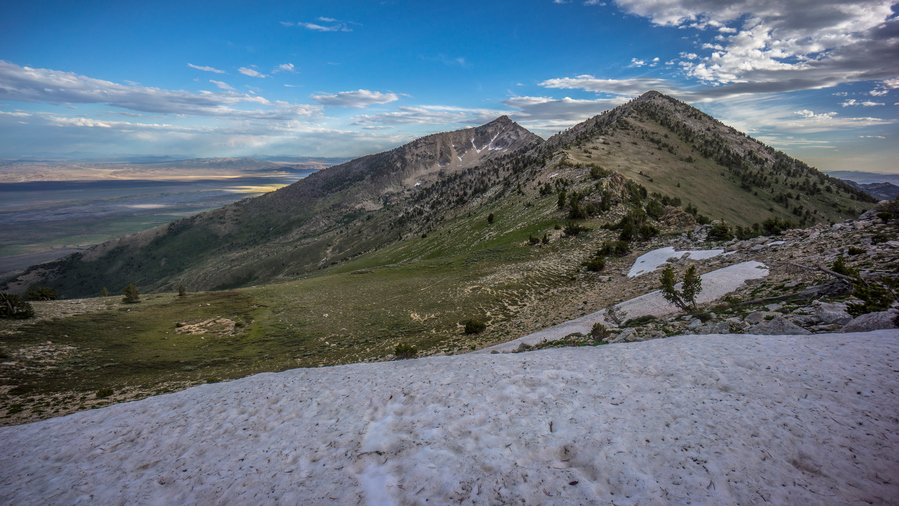
Snow near the pass above Overland Lake
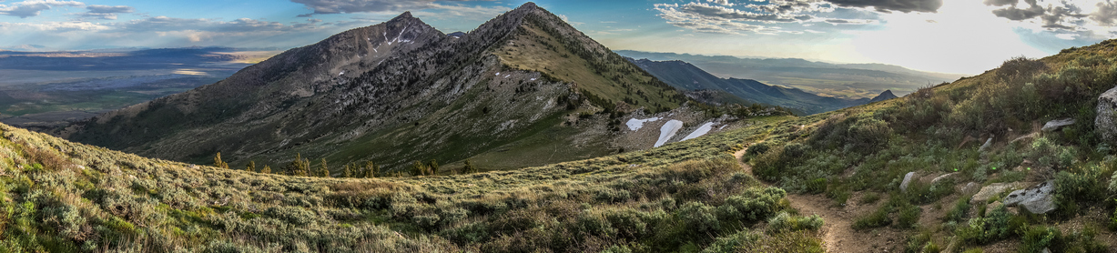
View south from the pass above Overland Lake
The View from the top of the pass was excellent. Looking back to the South, there were two pointy Peaks staggered in such a way that it looked like sawtooths if there were more of them. There was a snow cornice too. I turned my on phone to check for service, had 4g. I sent Cody a message, letting him know that I expect to reach roads end trailhead in upper Lamoille canyon by tomorrow night and was looking for a ride into Elko. After sending the message, I lost my signal, and it never came back! Funny how the wind blows cell phone signal I guess.
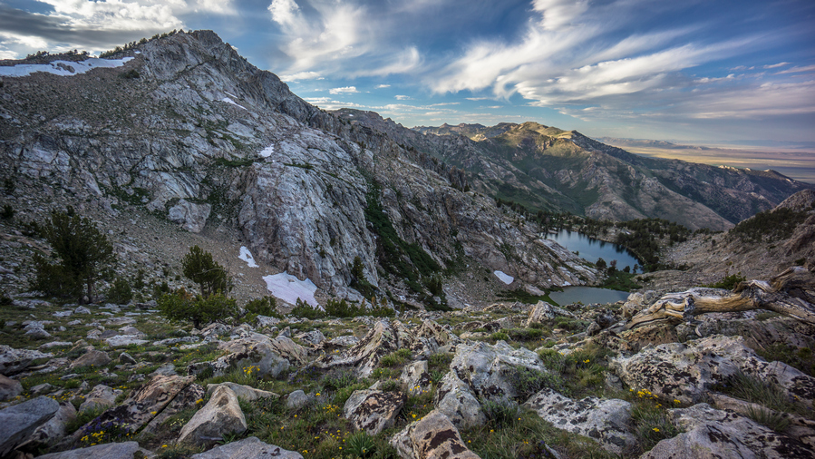
Overland Lake view from Pass
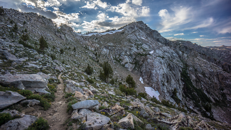
Ruby Crest Trail descends to Overland Lake
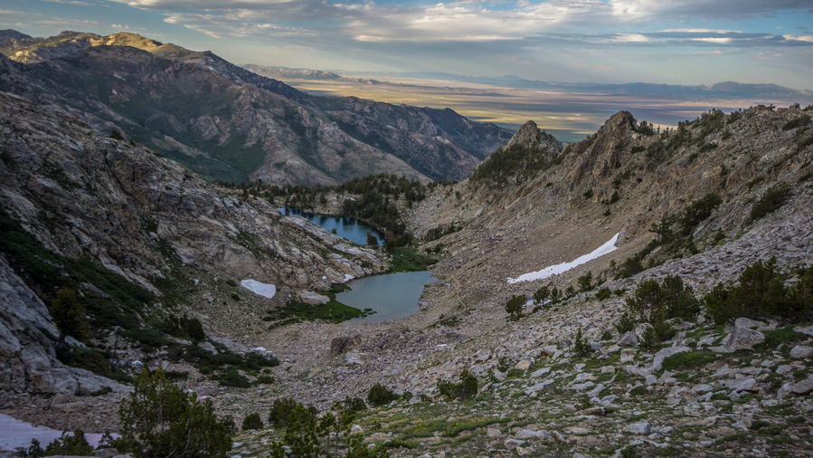
Overland Lake and Ruby Valley view
The view of Overland Lake… Wow! Way more impressive than I was expecting. Two small lakes, the trail sitting very high over the Basin. This was a very impressive little Cirque. I can’t say wow enough. Even from the top, I got Wind River range vibes. This whole cirque was lined with Jagged Rocky spires and impressive sheer rock slabs. the sun had just gone down over the Ridge, so my pictures of this area are not what I was hoping for. Still, my eyes could see the beauty. Wow.
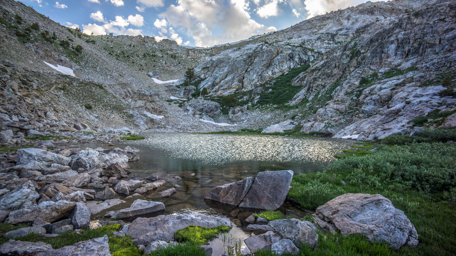
Upper Overland Lake
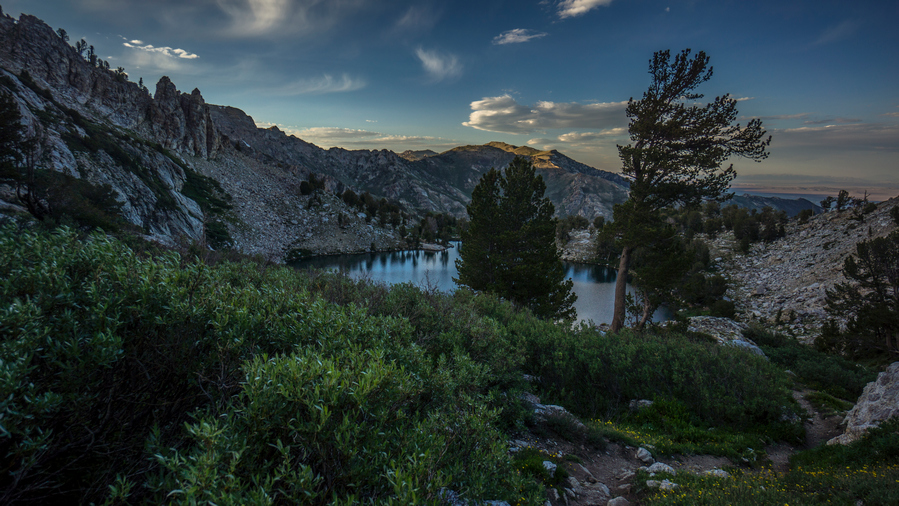
Looking down to lower Overland Lake from the upper Lake
Followed the Steep switchbacks down to the upper Overland Lake. Stopping every so often to take in the scenery, see the place from a different angle. Upper Overland Lake was incredible, but the Lower Lake is usually the main event. I could see a tent down there, so there was at least one person camping, which I expected.
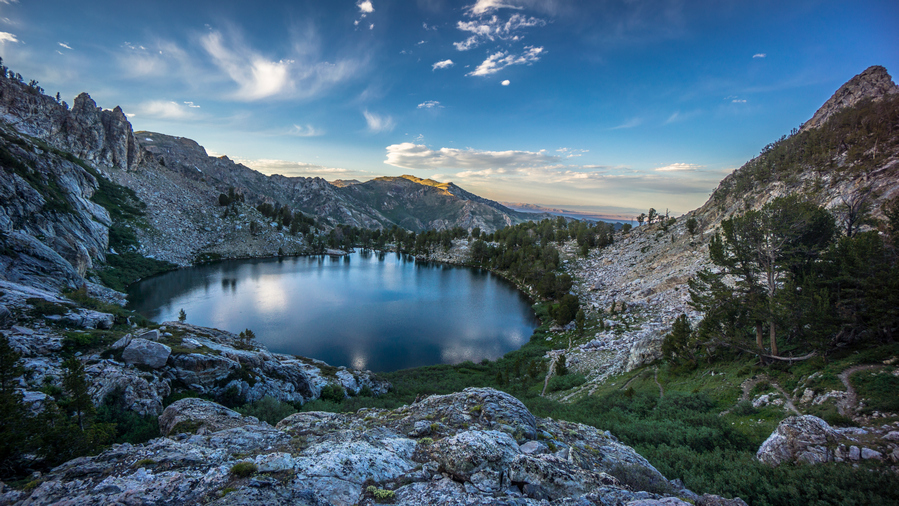
Overland Lake
Along the lower Overland Lake, I saw it about 10 tents along the shore now. There was an abandoned cabin here too. There’s a group of people, the closest person was a guy with a big long beard. I said hello, and kept going. I climbed up the hill above their campsite area and found my own. Pretty good spot with an excellent view of Overland Lake, slightly elevated above it.
Next I headed down to the lake to get water, wash up and eat dinner. The group was mostly ultra marathon runners, and they just happened to be doing this hike together. They weren’t really avid hikers, although one person in the group had hiked the PCT in 2019. Marlene, (trail name fa-fa). She was a SOBO hiker, and made it 30 miles from Mexico of Mexico and suffered a fractured hip. I cant imagine walking all that way, being that close and having that happen right at the end. Just heartbreaking.
Day 42 – July 12th: Overton Lake, Liberty Lake, Ruby Mountains, Ruby Crest Trail, Lamoille Canyon
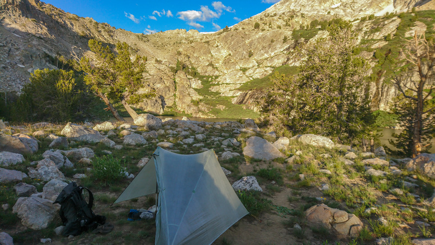
Campsite at Overland Lake
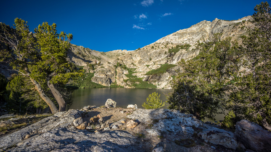
Overland Lake campsite view
Beautiful morning. When I woke up, I noticed a campsite perched almost at the end of a small hill overlooking the lake, about a hundred feet from where I camped. This would have been a better view for sure, although more exposed to the wind. And really, what’s the difference when I didn’t have any time at camp in the sunlight anyway.
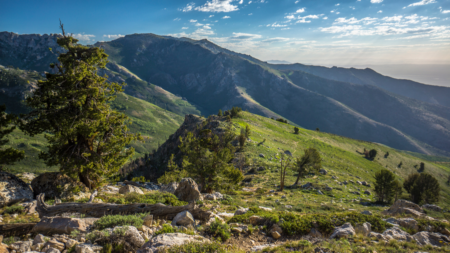
View of Overland Creek Canyon
The views were excellent leaving Overland lake. There was a bit of a haze in the air in the distance, as I look down into Ruby valley out of the Ruby mountains and into the desert. It was really amazing how one could Traverse so many different environments in one day, by climbing up on Valley. Here, you can go from desert to alpine/sub-alpine environment in a matter of hours.
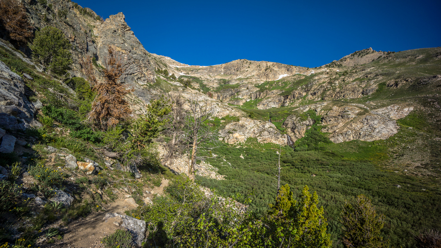
Can you spot the waterfall?
Good trail to follow. The trail drops down a little bit into a valley and then Contours around the Mountainside for quite a ways. As I made some distance from Overland Lake, the scenery became too impressive to ignore. Incredible towering Rock faces, at least 1,000 feet vertical. In the distance, I could see 2 waterfalls at least 40 to 60 feet high. Lush green environment. Absolutely nothing like the rest of Nevada!
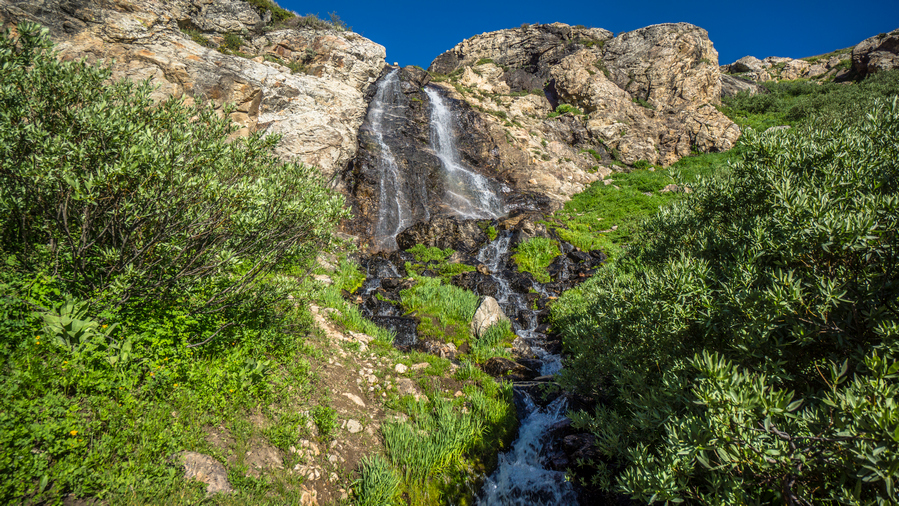
Waterfall!
I was pleased that the trail was routed right underneath one of the waterfalls. The only other waterfall I had come across in Nevada was about 3 ft high. Now I was at the base of a 40ft waterfall. Amazing!
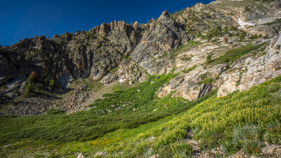
I really enjoyed hiking the Overland Creek area
I was feeling really good as I walked away from the waterfall. I could tell today was going to be one of the best days on trail. I was taking a lot of photos and video, could barely make any forward progress it seemed.
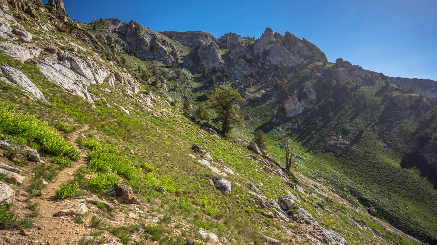
Some cool rock formations along the Ruby Crest Trail
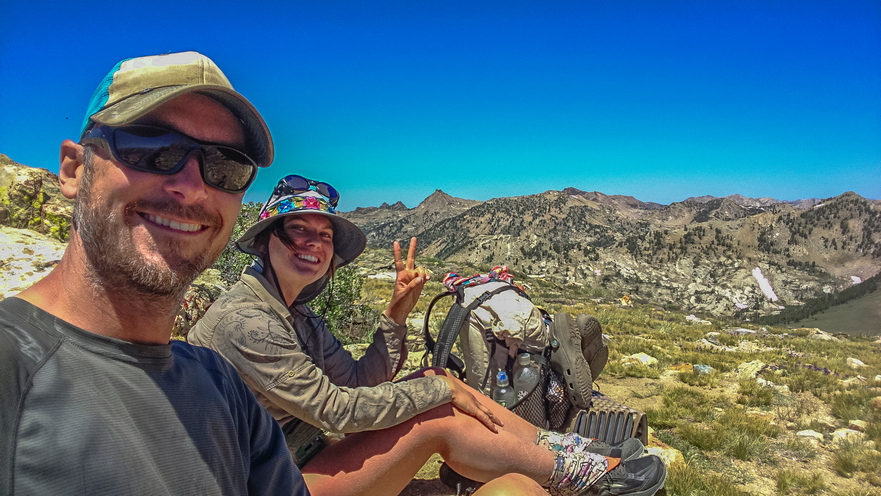
So good to hike with someone!
I went around a corner on the trail and ran into Marlene, who I was speaking with last night. we ended up hiking the rest of the day together. Marlene is an artist and farmer. One unique thing about her, she is a master pumpkin carver and will carve pumpkins for businesses around Halloween time. Pretty unique Niche there!
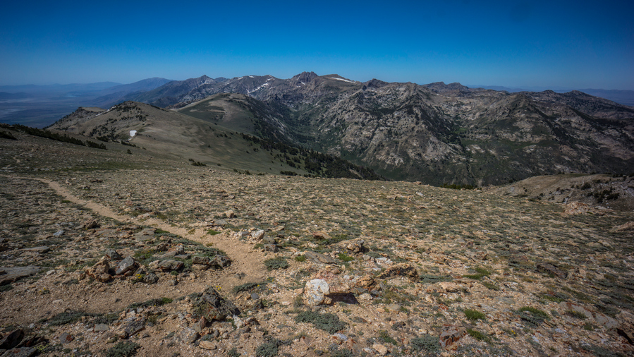
View south
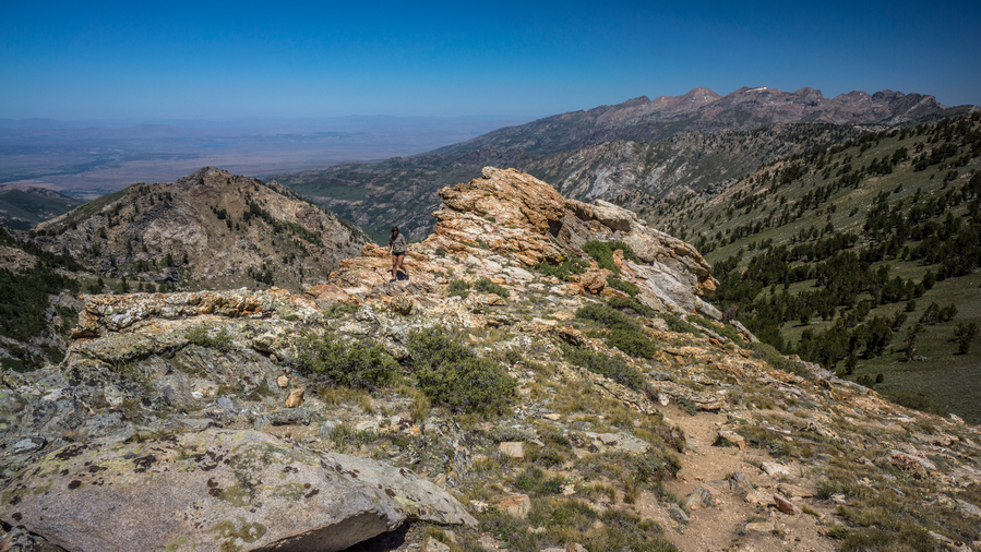
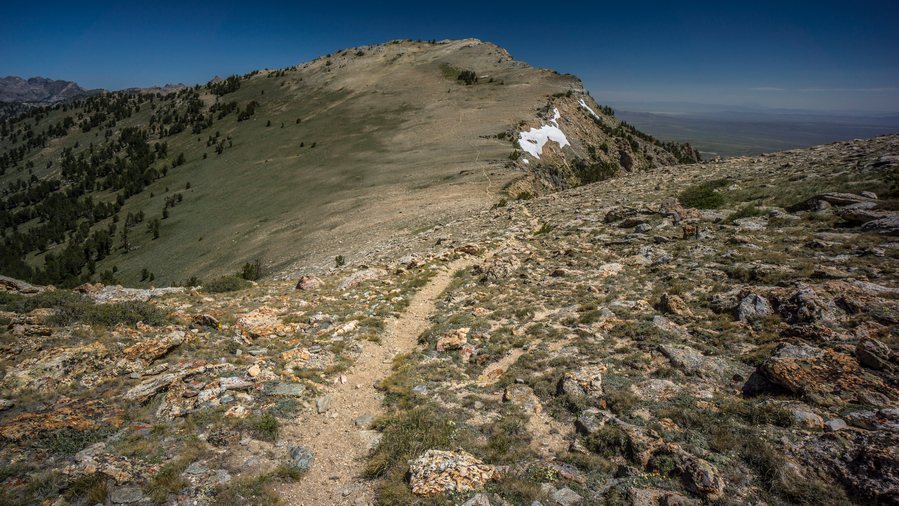
Good trail along the ridgeline
It seems like much of the day we were hiking on a Ridgeline that kind of connects two larger segments of mountainous masses, the North and South. The map of made it look like we just stay high on this Ridgeline, which we do, but there was a lot more ups and downs than I thought. Great views, although they kind of looked the same over each Ridgeline.
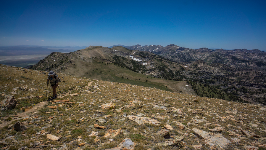
Marlene hiking over Wines Peak Pass
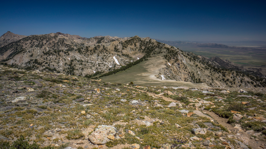
Descending Wines Peak to Furlong Creek and North Furlong Lake
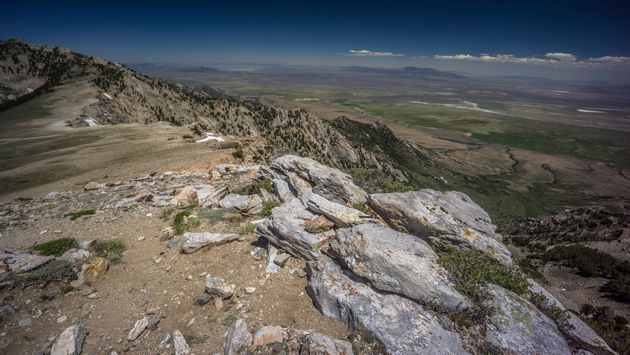
Last views of Ruby Valley
The hike in-between Overland Lake and Lamoille is definitely the best part of the Ruby Crest Trail. Everything south of Overland Lake is just not at the same level. Here, there are constant sweeping views and excellent hiking. The trail is good, the route is easy. Very enjoyable indeed.
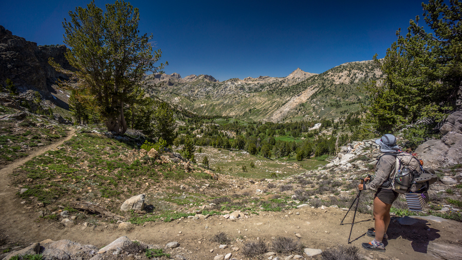
Marlene along the Ruby Crest Trail above Farve Lake
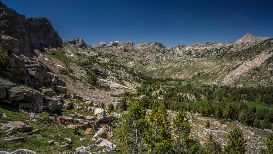
Kleckner Canyon view
By late afternoon we made it up over the last pass the drops us down into the Basin with Favre Lake. We kept saying, where’s the lake? We had to drop down all the to the lake itself before it was visible. I will continue on to Lamoille Canyon this evening, but Marlene needed to find a place for her entire group to camp. They were still behind, we didn’t see them all day. Apparently ultra-marathon running doesn’t translate well to hiking. That, and their packs are really heavy.
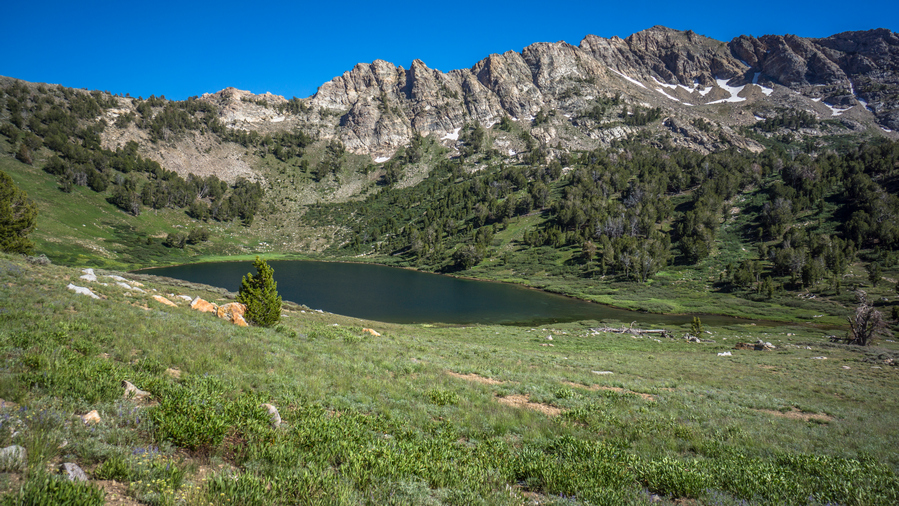
Farve Lake
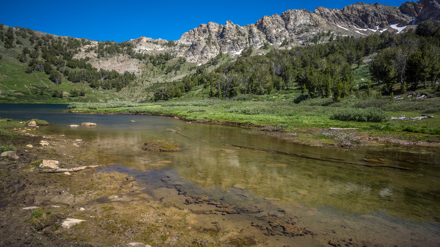
Shoreline of Farve Lake
Farve Lake itself was nice, but not nearly as nice as Overland Lake. The Shoreline was muddy, and the water had some green algae in it. The lake itself looks a bit barren.
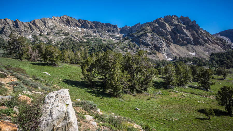
Ridgeline south of Farve Lake
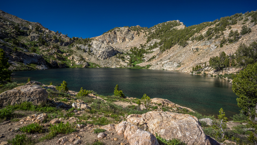
Liberty lake shoreline view north to Liberty Pass
After parting ways with Marlene, I continued my hike up towards Liberty Pass, which connects Farve Lake to Lamoille Canyon. In upper Lamoille Canyon is Roads End Trailhead, where I will meet up with Cody Terras. Cody was one of the guys I met on 4th of July, he had given me his number and said he would pick me up since he only lives a short ways away. I had no service, so I use my satellite Messenger to send him a text here to let him know my ETA.
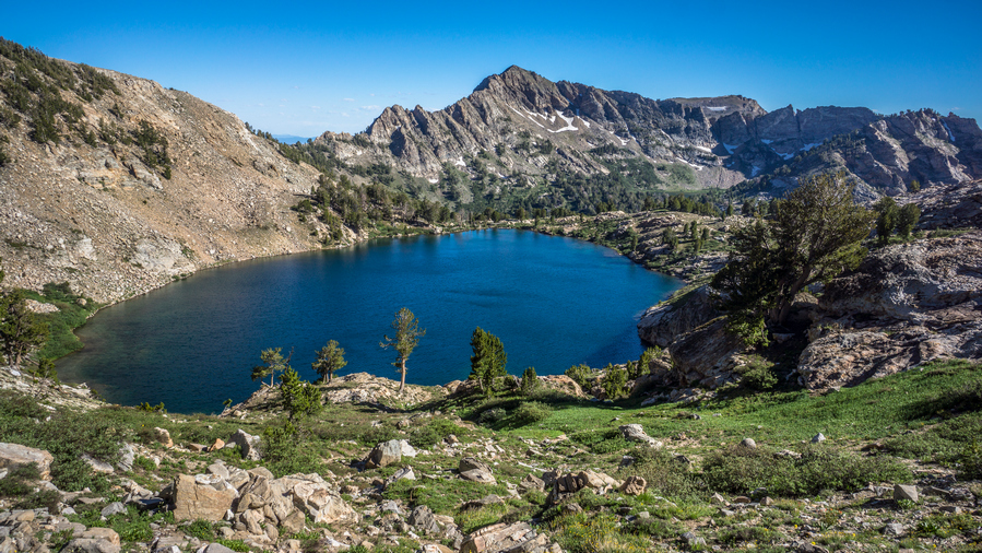
Liberty Lake
The hike up Liberty Pass was nice. From Favre Lake, it was almost like a two-tier pass. One Mini pass up to Liberty Lake, and then another mini pass up to Liberty Pass. There were many people hanging out around Liberty Lake. Liberty Lake was a large and impressive Alpine Lake. Not unlike what you would see in the Sierras, for example.
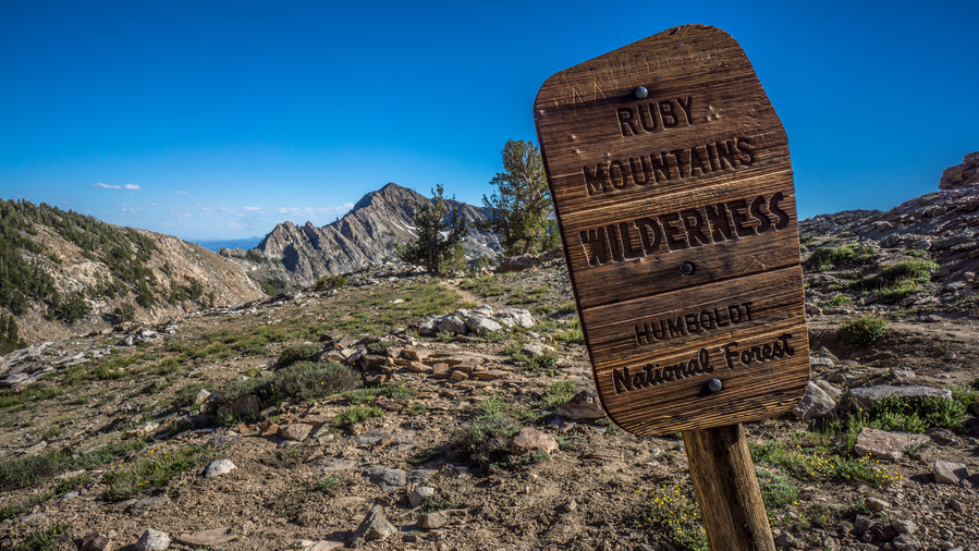
The Ruby Mountains Wilderness boundary is roughly at the top of Liberty Pass
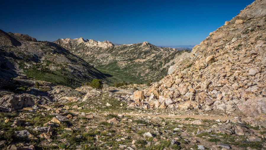
First view into Lamoille Canyon
Coming down Liberty Pass down into Lamoille Canyon, I was surprised to see how rugged it was and how much snow remained up here. There were many switchbacks and they were very close together, snaking the way down Hill, looking like they make almost no progress. I could tell this pass was going to take longer than I thought.
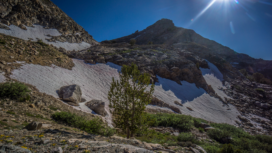
Lots of snow in upper Lamoille Canyon
I had to walk over several patches of snow. Trail itself was very Rocky. It was indeed time-consuming. At the same time, it was really impressive to look back up at Liberty Pass. Steep rock walls and snow.
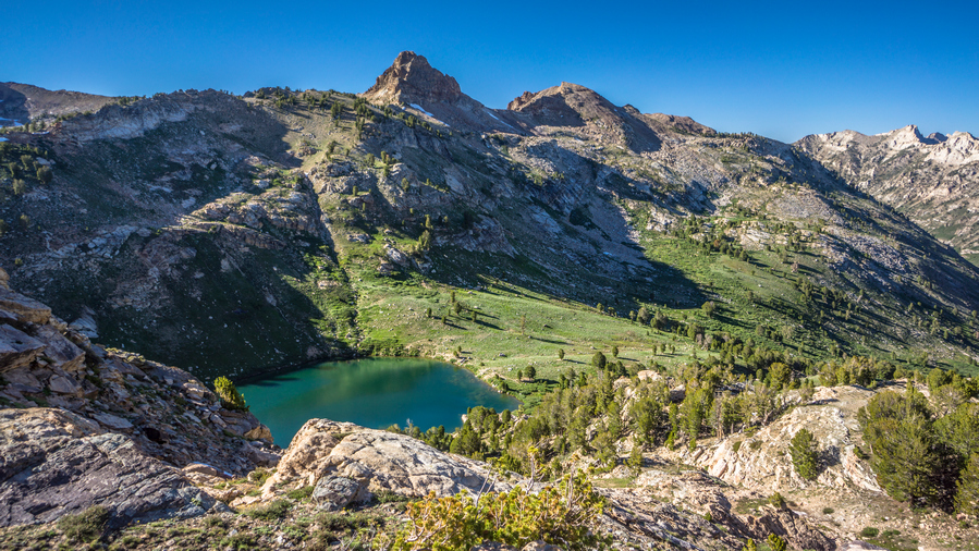
Lamoille Lake
I could see Lamoille Lake from above. A deep green turquoise color. I didn’t really have any time to go down to the lake, and the trail stays a little ways away from it anyhow. I tried to run downhill when I could, trying to reach the trailhead by 6pm, the time I had told Cody to be there.
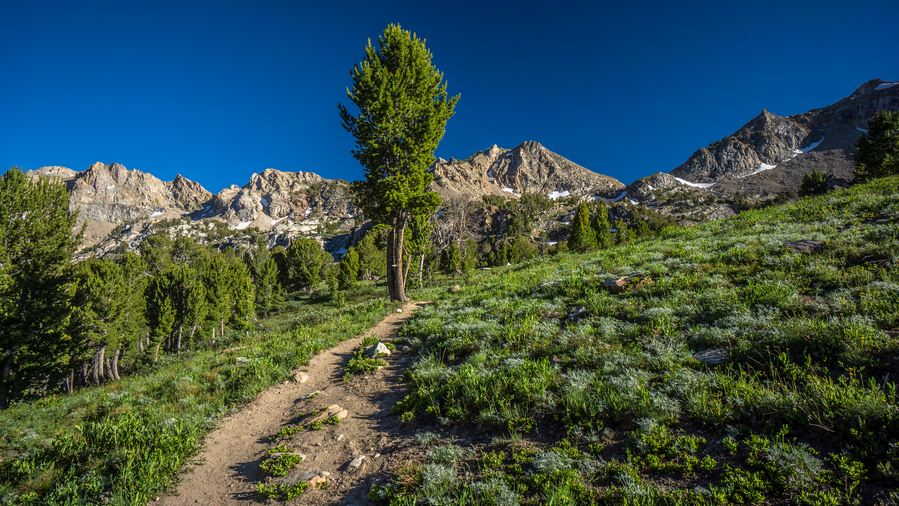
Hiking Lamoille Canyon
I had a bit longer route planned for this section. I had a high route mapped that would connect upper Lamoille Canyon to Echo lake and drop down into Seitz Canyon, ending this section at the Powerhouse Trailhead in lower Lamoille Canyon. However, that would add another day of hiking and logistically, it just worked out to have Cody pick me up here today. Make no mistake, the high route from Lamoille to Seitz would be stunning, based on the maps. I will have to save this route for another time. You just cant do it all on on a thru-hike.
I reached the trailhead around 6:15pm, pretty happy only being 15 minutes late. Cody was sitting there on a rock at the edge of the parking lot, he had been watching me come down hill. He had a cooler waiting for me with a water or beer, drink of my choice. I went for the cold water. Jumped in his car and we took off.
we made our way to Elko, while I decided which hotel to stay at and where to eat. Cody suggested Round Table Pizza, which sounds good to me. I was in my hiking clothes still an extremely dirty. There was a huge hole in the back of my shirt. But Cody insisted with the miners in town, I would fit right in. Works for me.
we made pretty good progress on an extra large meat lovers pizza, and I took the rest with me. From there we went back downtown Elko, and I got a room at the Econo Lodge
Day 43 – July 13: Zero Day in Elko, NV
Doing some laundry
Town chore day. Usually I’m tired and out of it, but I felt really good today. Besides grocery shopping, I had all of my chores done by late morning. Washed my clothes, washed my tent and the zippers to try and restore the functionality. One of the zippers no longer closes properly. Too much sand and Grime in the zippers. I gave Cody a call and asked him if he could take me to the grocery store and the post office This afternoon. He said he would swing by mid-day.
Luckily the grocery store and post office in Spring Creek shared the same parking lot. I picked up my package that Dad had sent containing a new shirt, gaiters and new pair of boxers. Then I did my grocery shopping. I picked up a case of beer for Cody’s folks to return the favor for the generosity on the 4th of July. Then we went back to his place for a bit.
Jamming on my zero day with Cody, and his son
Travis, Cody’s dad, was out fishing for the day, and his mom was out somewhere too. We hung out in the garage and jammed a little bit on the acoustic electric guitar. Their house was situated on the end of the street, last house before you reach The Ruby mountains. What a backyard that was!
I took Cody out to eat at a local restaurant to return the favor for driving me around town. I spent the rest of the day relaxing in the motel and getting ready for the next section. Cody will join me for a day or two in the beginning, which will be great to have the company!
Related Images:
Basin and Range Trail Thru Hike 2020 – Section 5: Austin to Eureka
Basin and Range Trail Thru Hike Section 5 Map

Video: Basin and Range Trail Thru Hike Section 5
In addition to this trail journal, I also filmed my Basin and Range Trail thru hike. I’ve produced a detailed documentary series (11+ hours runtime) documenting this thru hike adventure, the product of over 1,000 hours of video editing. I highly recommending watching the Basin and Range Trail vlog series for an in-depth look at thru-hiking the Great Basin and central Nevada.
Basin and Range Trail Thru Hike Section 5 Journal
Day 32 – July 2nd: Loneliest Highway in America, Big Smoky Valley, Spencer Hot Spring, Linka Mine
Sarah made me some Farm Fresh eggs with sea salt and a piece of toast for breakfast. These eggs were definitely much better than store-bought eggs. I also had a sausage biscuit and muffin. I gave Sarah my bounce box to send out at the post office since I wouldn’t get there before the post office opens at 10am.
It was 9am when I left the motel and began my walk to Eureka. I walked out of town until I reached a wash, which parallels Highway 50. This avoids a big climb, but doesn’t avoid all the climbing. Always hard to leave town, both mentally and physically. This was no exception. It was rough going at first, with a heavy pack and in the heat.
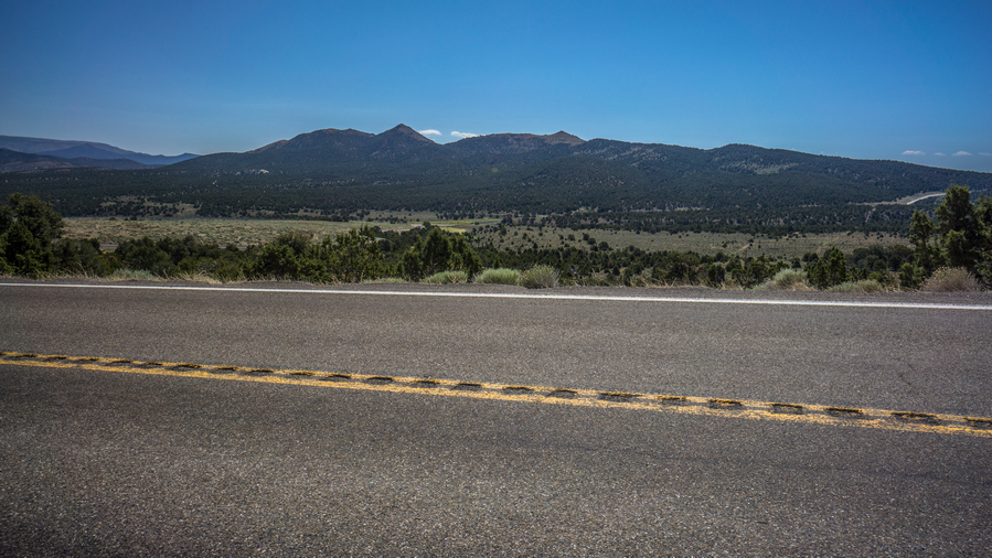
Pretty green over there, the northern end of the Toiyabe Range
After reaching Austin Summit it was a road walk along Highway 50, the Loneliest Highway in America. However, it didn’t feel that lonely. The shoulders weren’t always very large. I was surprised at how wooded and green it was here along the highway.
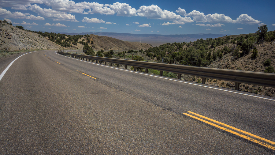
Walking the Loneliest highway in America
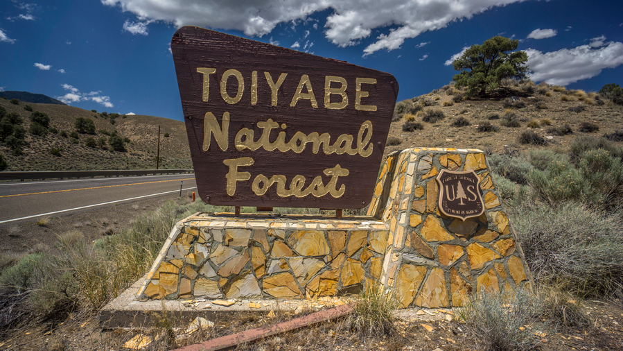
Leaving “the land of many uses”
I stopped to take a break at a campground/rest area, and realized I had 4g service for the first time in Nevada. Ironic, along the loneliest Highway in America.
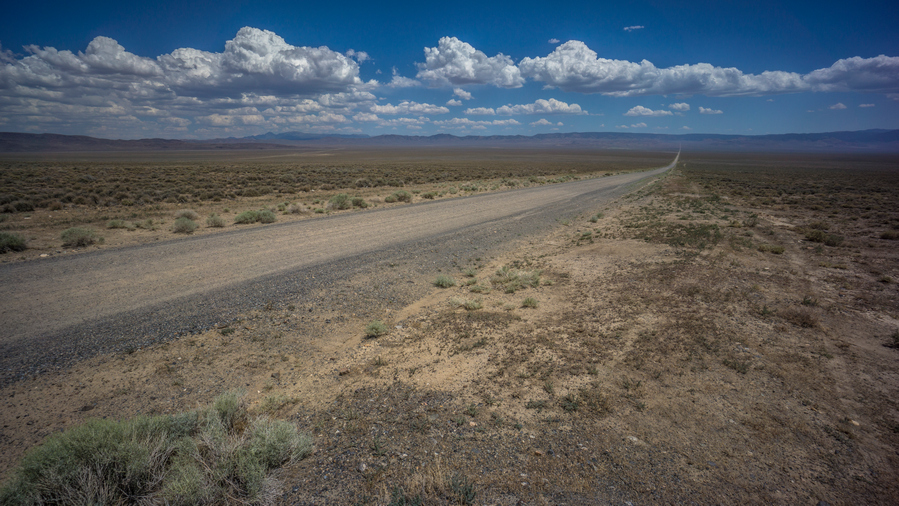
Road to Spencer Hot Springs
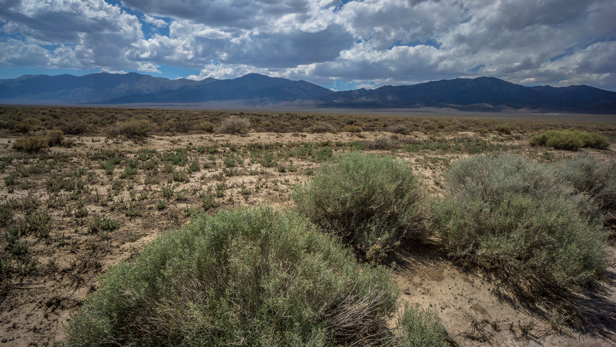
View of the Toiyabe Range from Big Smoky Valley
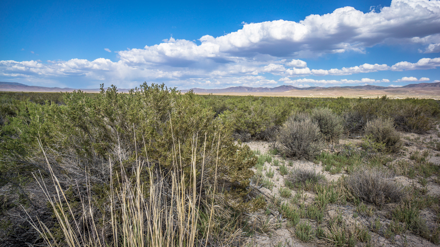
Big Smoky Valley
Reached the junction for Highway 376, the road South to Carvers. This road was a little lonelier. Short walk along this road before I reached the junction to Spencer Hot Springs. Even this road had a fair amount of traffic.
Stop sign with stickers near Spencer Hot Springs
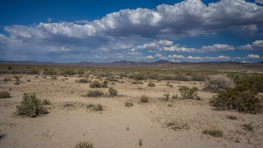
Desert views in Big Smoky Valley
Near Spencer Hot Springs, the stop sign, and other signs, are decorated with stickers from various travelers who have visited the area. You generally know you are somewhere kinda cool when people bother to put stickers on things. Except when it’s in a pristine area, then it’s not cool. Spencer Hot Springs is NOT pristine, it’s heavily trafficked.
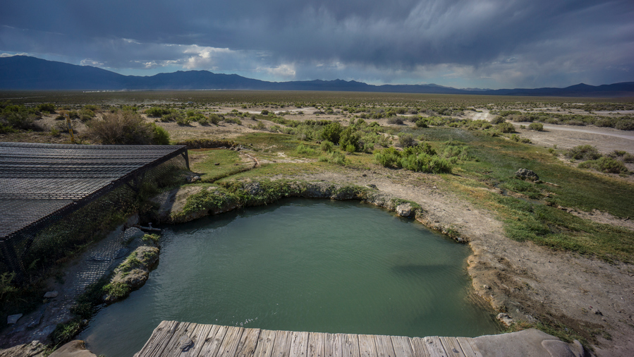
The main soaking pool at Spencer Hot Springs
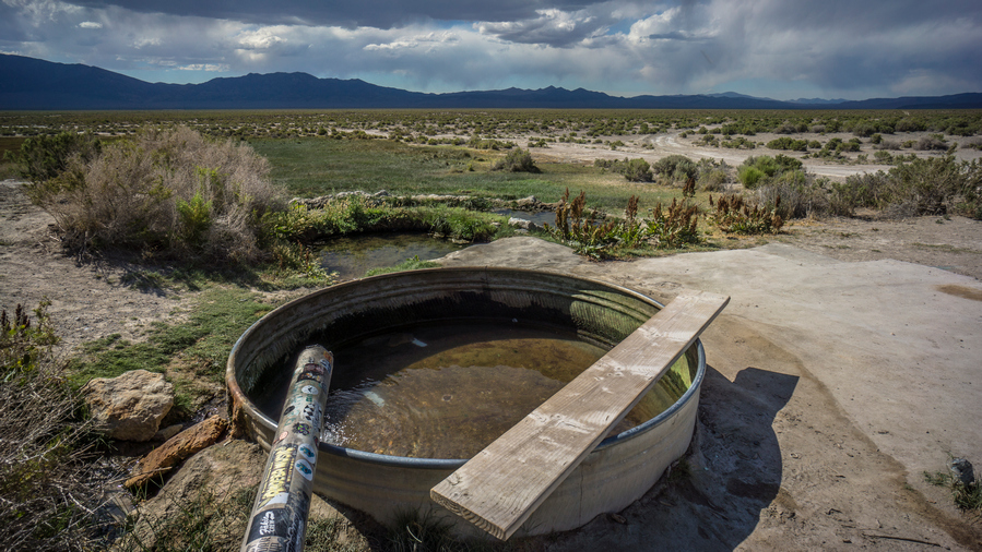
Spencer Hot Springs. There are multiple springs here, not just this one.
Reached Spencer Hot Springs around 5pm. Dark clouds in the sky now over the Toiyabes. Ate some food and chatted with a woman from Estonia on a motorcycle tour across the US.
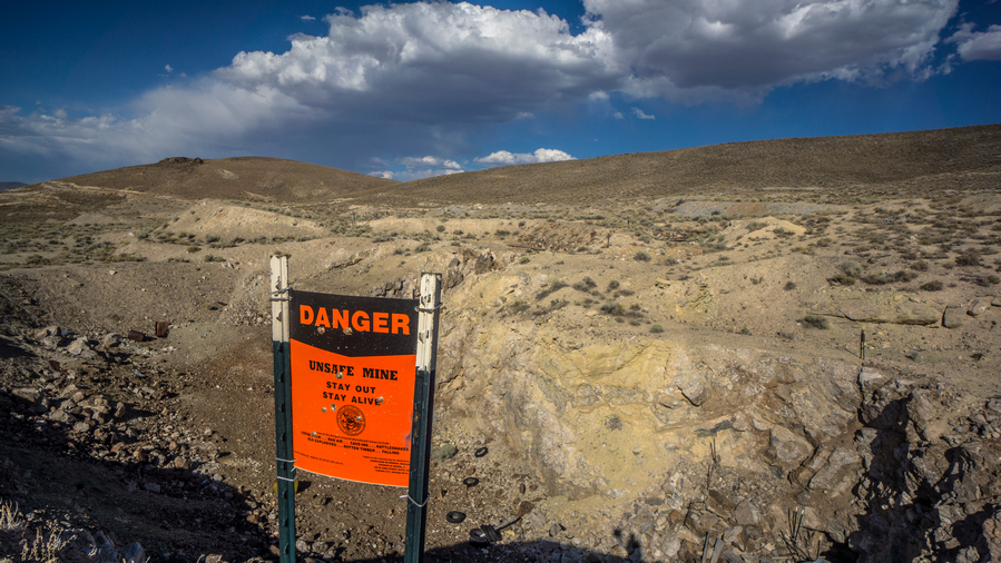
Linka Mine
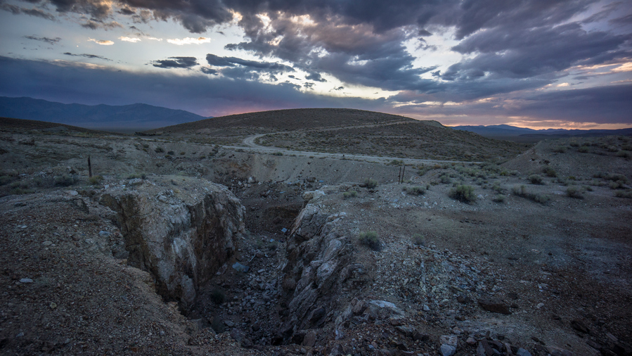
Some of the best rocks and minerals were found here in this section of the Linka Mine. However, it was filled in on my 2021 visit, and there is no more access to this area
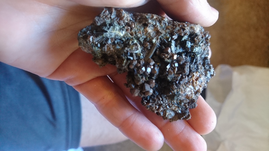
Garnet & epidote specimen from the Linka Mine
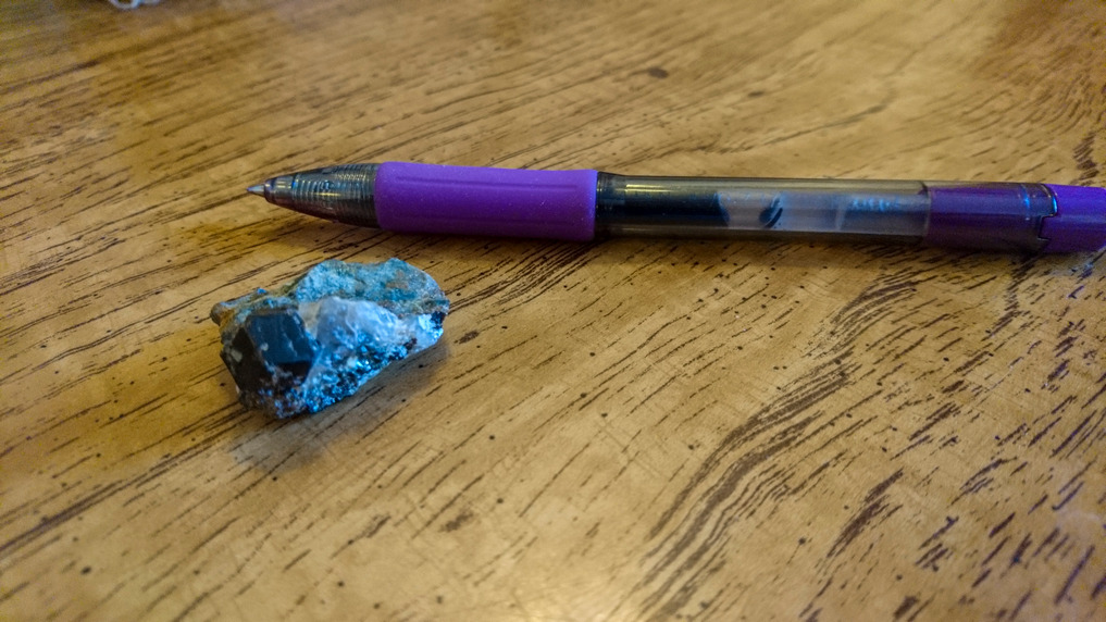
Garnet found in the Linka Mine
Then walked over to the Linka mine. Stayed here for about 2.5 hours cracking rocks open. Found a whole bunch of interesting rocks and minerals. Perhaps the most interesting I’ve ever found. I found many garnets, a few larger ones and many small clusters of garnets on quartz veins. I also had a nice specimen of epidote. Pyrite can be found here, as well as either galena or molybdenum. Dark clouds loomed over the mine, but they eventually turned to a nice red sunset beyond the Toiyabe Range.
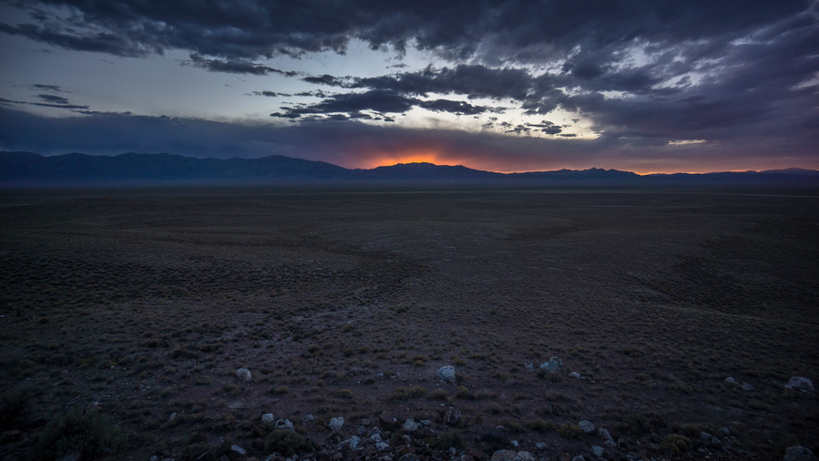
Sunset over the Toiyabe Range
Set up camp in the dark 1/14 mile from Spencer Hot Spring. There were Burros everywhere making noise. Sarah and Cassidy meet me at the hot spring after 10pm, had a soak and brought me a gallon of water. Full moon, too. Went to bed after 11:30pm, much later than my normal hiking routine.
Day 33 – July 3rd: Big Smoky Valley, Linka Mine, Toquima Range, Monitor Valley, Monitor Range
Burros made a lot of noise throughout the night, stomping near my tent and making ridiculous noises. Didn’t get a lot of sleep.
Walked to Spencer hot spring after packing up. Talked to the people here, Rick and Maria. They were from California. Chatted for a while. He asked if I needed water, and I almost never turn that down. Took a few liters, and discarded the empty gallon jug that Sarah brought night before.
Walked past the Linka Mine again this morning. There was a truck parked here, I said hello. It was a young college kid, mining engineer intern, about to head down into the open pit to do some rockhounding himself. We talked for a bit then I showed him what I found last night. His eyes got big, and he said you found that down there? He was pretty excited now.
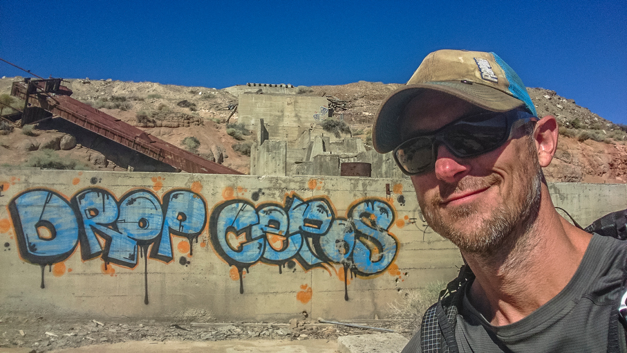
Hiking through the Linka Mine
Down the Road, past the part of the Linka Mine I was ‘hounding yesterday, there are some more elaborate ruins of the mine left. Some large concrete pads/structures and such.
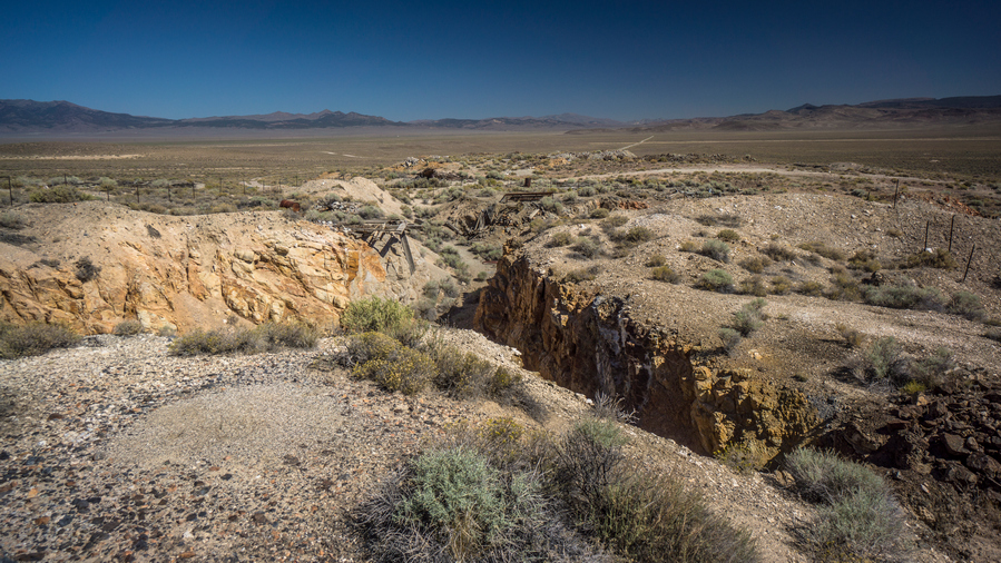
Conquest mine
Walked past the conquest mine next. This was deeper and steeper, and completely fenced off. Went down for a look, didn’t see anything too interesting though.
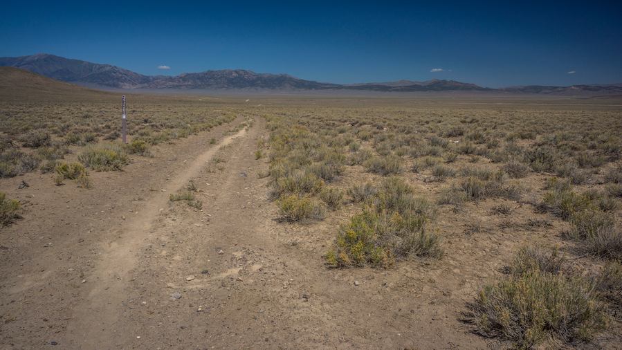
Hiking Big Smoky Valley to the northern Toquima Range
After leaving the mines, the landscape becomes very barren and I felt alone again. The road was loose sand, hard to walk. This was tiring and demoralizing. Saw burros and wild horses.
Stopped for a break at the base of the Toquima range, which is a much smaller obstacle compared to the Mt Jefferson area in the south. That is, until one is at the base of it. Still, it’s small for a mountain range, as this is the extreme northern end.
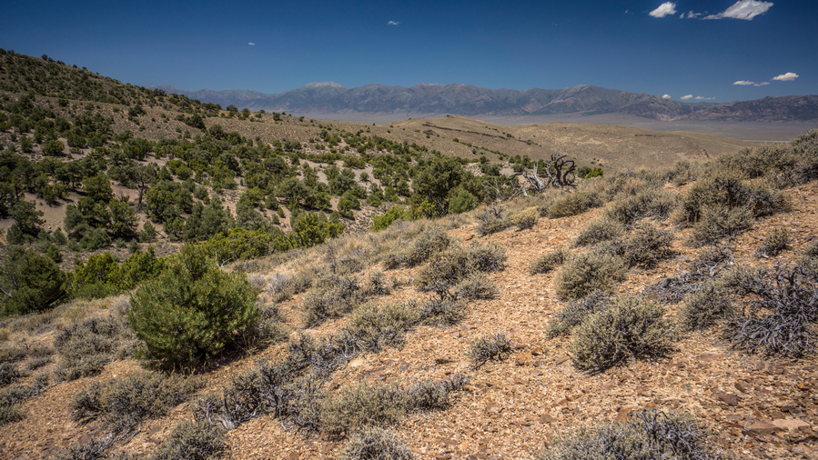
Hiking up the northern end of the Toquima Range. View west across Big Smoky Valley to the Toiyabe Range
The road dead ends into a wash. From here, it’s up to me to find my way up and over. Now I realized how hot it was. Even though it wasn’t very tall, it was still a several hundred foot climb, and had me breathing hard. Weaving in between the pinyon pine and mahogany trees.
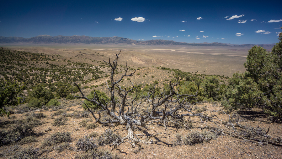
View west from the crest of the northern Toquima Range
At the top, nice views of big Smoky Valley, but not much view of monitor valley… Lots of trees, rolling hills. Now the descent. Pretty plain looking, just weaving in between trees through red-orange Sandy soil.
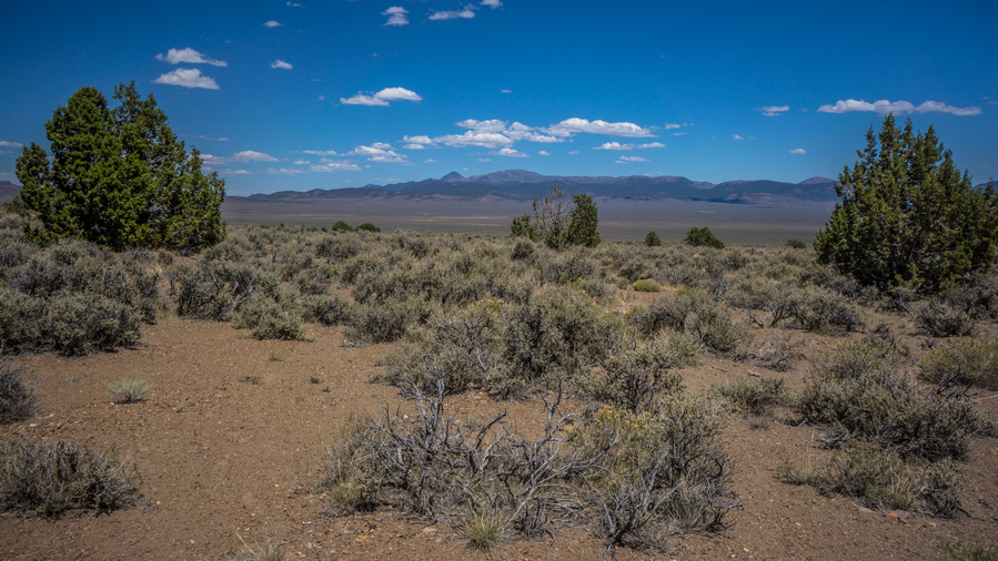
Last trees before hiking Monitor Valley
Before I hiked past the last trees and was at the mercy of the relentless sun, I stopped for a break. This is my routine now, and one that I think almost desert hiker mimics… Take a break under the last shade tree.
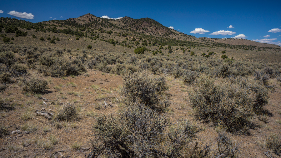
Toquima Range, view from Monitor Valley. What was a prominent landform in the south, is now a meager set of hills in the north
After passing the last trees, I entered a sea of sage brush. I dread this, but no other way forward. I need to walk through miles of sage brush before I reach a road. At first, it’s a pain. Then it snowballs into more of a nightmare. In the beginning of this hike, this was more manageable mentally. Everything is, spirits are high and even the worst of things seem easier to deal with. After a month though, that feeling fades. Waking miles of sage brush in a hot valley with no shade can test the mental toughness of just about anyone.
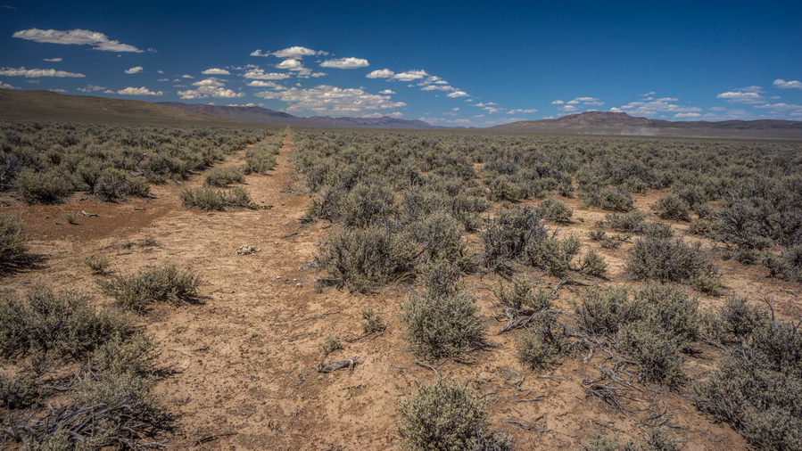
Old 4×4 road in Monitor Valley
Monitor valley looks very barren here. Empty, remote. No signs of roads anywhere. Then, all of the sudden, I stumbled on an old dirt road, only visible from 50ft away. What a relief!
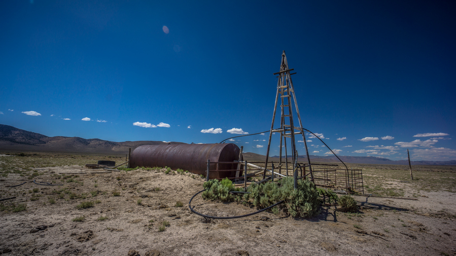
Dry well in Monitor Valley
Followed this north to another road that intersects it heading east. This is what I want, now heading across the valley towards the monitor range. A well/tank can be seen in the distance, about the only thing that stands out from the sage. The road passes by, but there doesn’t appear to be any water.
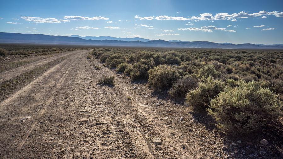
Hiking across Monitor Valley
I followed the dusty road for a couple hours until I reached the main road that runs north and south through the valley. I crossed the road and headed towards Wallace canyon.
My right leg had been giving me trouble today, a dull pain in the thigh. It was sore and tender to the touch. Becoming more of a concern as the day goes on. I debated what to do… Follow the road north to hwy 50? Try to cross the monitors, with 5,000ft of elevation gain? Hike a low route through the monitor range? I took a couple ibuprofen and kept going.
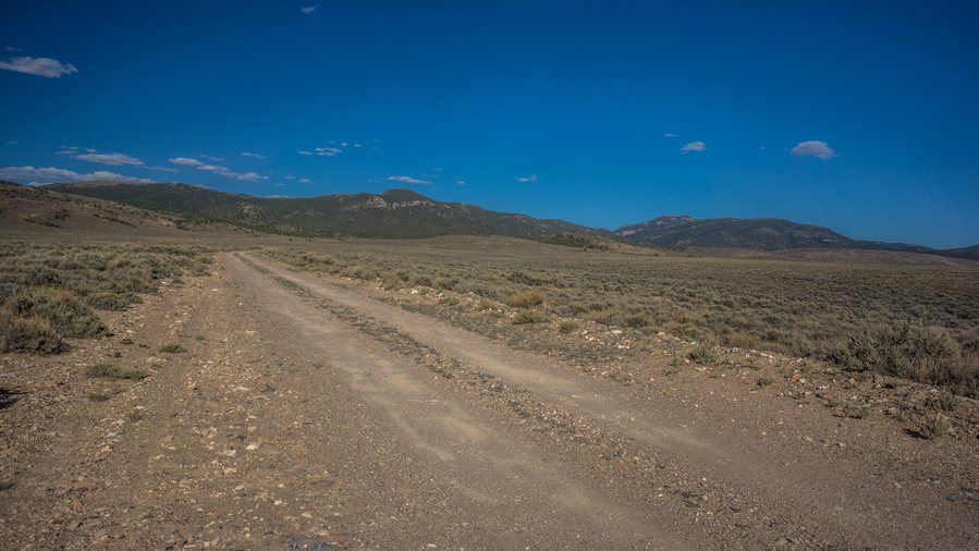
Approaching the Monitor Range
Just then, a truck passed by. Two hunters out scouting, Keith and Johnny. They were super impressed with what I was doing and offered to help in any way they could. They filled all my water bottles and gave me their last piece of KFC fried chicken. Who only knows where the nearest KFC is, but I can tell you its a couple of hours away. This was a real mood booster. I left Keith and Johnny feeling really good, both physically and mentally. My leg was feeling better and my mood massively improved.
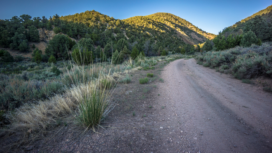
Wallace Canyon
Walked into Wallace canyon, saw the first trees of the Monitor Range. Stopped for a dinner break, at a little campsite that had a few scattered deer legs on the ground. I guess people/animals don’t eat those.
There was a small spring in Wallace canyon with huge willows and vegetation lining the road. The rest of tonight’s walk was rather uneventful. The canyon looked pretty thick, and I was glad to have a road. Saw a couple of deer. Some groves of aspen with a subpar campsite below the pass. Thought about camping here but pushed on.
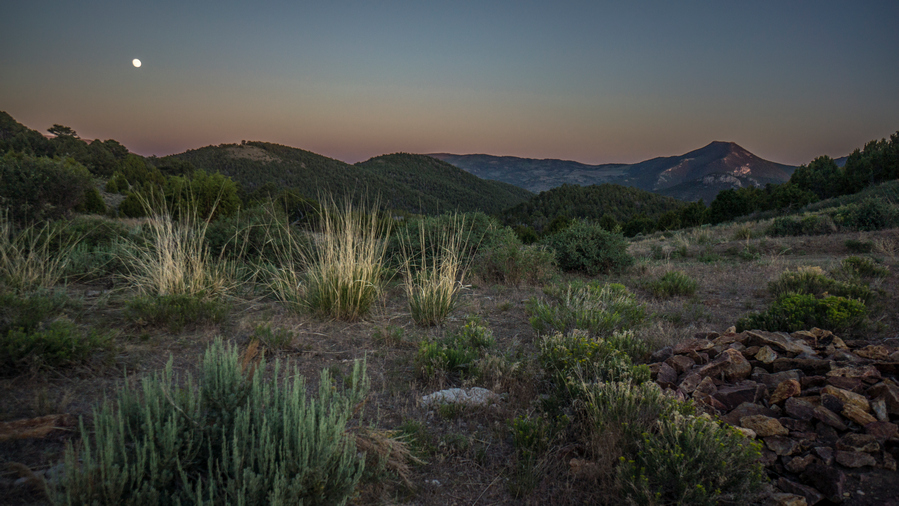
Campsite in the northern Monitor Range
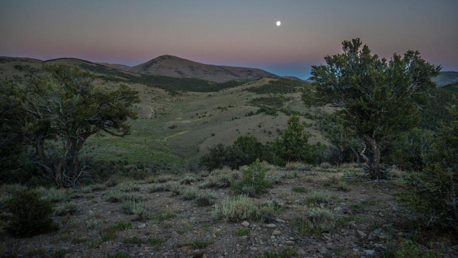
Not a bad view from camp tonight
At the top of the pass, where the high and low routes split, there were a few camp options. Of course, I Climbed a hill above the pass for the best view, and found a decent campsite here. More than decent, damn good spot considering what else was around. Sun going down, a really nice sunset. And, 4g just on this hill!
Day 34 – July 4th: Monitor Range, Summit Mountain, Trail Magic
Woke at 6, great sleep last night. Amazing sleep actually. Feeling much better this morning. No leg pain. Lots of bees buzzing around here. Lots of prickly pear cacti on this little hill.
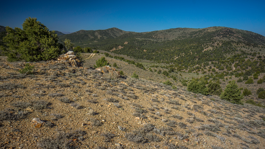
Wallace Canyon
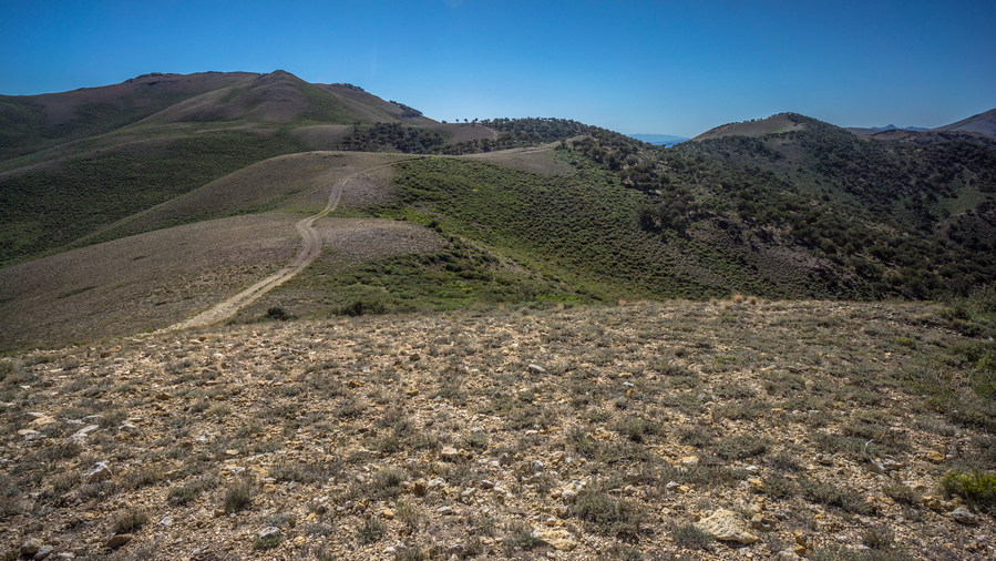
The route up to Big Flat from Wallace Canyon
Decided to take the “high route”. It will offer better views, despite the hugely additional elevation gain. I almost instantly regretted it. Dripping wet with sweat at 8am. Steep 4×4 roads that were poorly laid out for the hiker… Up and down constantly instead of contouring around hill sides. This was demoralizing. It’s demoralizing because the views aren’t really that great, even from the “high route”. In the northern portion of the Monitor Range, it’s mostly a series of hills, not serious mountains like in the south. But that’s the issue with Section 5 in general. It’s just not going to be spectacular no matter which route one takes from Austin to Eureka. I think every thru-hike has some type of filler section, and on the Basin and Range Trail, this is it.
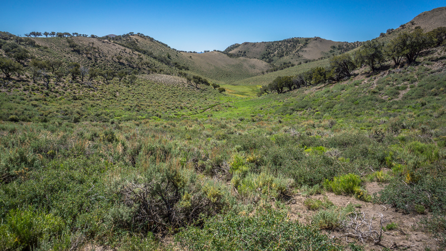
Nearing the top of Wallace Canyon
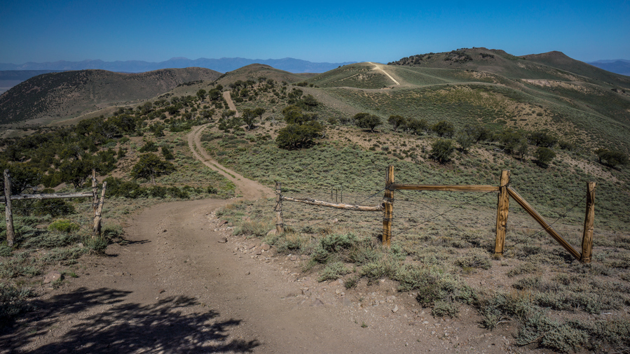
4×4 roads running along the crest of the Monitor Range
It was a rather tough morning. I struggled through it. There was little water compared to what I thought would be here. Very small trickles of water, only occasionally. To collect from these, one would need to follow the water and definitely dig out a hole to collect from. I had a couple of liters, so I kept going.
Monitor Range vistas
The best views of the day were pretty weak compared to what I’m used to. For a brief moment, I enjoyed a scenic little hill with a distant view of the Monitor Range.
Summit Mountain, aka Broken Back #2
Saw about 20 horses in the valley below as I worked my way along an upper Ridgeline. Now, summit mountain (marked on some maps as broken back #2) was clearly in sight. The plan is to go up and over. Looks steep on the map, but doable.
I took a game trail around the final hill that lies between me and the saddle below summit mountain. This worked well at first, then turned into a sage brush bushwhack.
I took a break at the saddle below summit mountain. From here it looked very steep and intimidating, although it doesn’t look bad at all on the topo maps. Not Rocky/Bouldery, but a mix of low grass and small rocks.
Just then, I heard the sound of a distant engine. It grew louder and louder, until I realized someone was coming up the canyon below. This was Allison creek, a route I was considering to avoid summit mountain. Two rzrs came up the hill into view, and I wished them a happy 4th of July. They were just as surprised to see me as I was to see them. In fact, they were probably more surprised that I was there, especially without a vehicle.
Naturally we stopped and talked for a while. Quite a long while actually. I would say a solid 45 minutes. This was the Terras family, currently living in Elko. Travis, Gaye, Cody, Tim and Jim. They offered me water, Gatorade, and beer.
This was basically their stomping ground. Monitor Valley in general. Hunting, camping, relatives in the area, you name it. Central Nevada is what they know. They were very interested in my hike, with my route going through territory that was so near and dear to them. We discussed the typical topics that I get asked; water, food, navigation, animal sightings. They all had binoculars around their necks, trying to spot wildlife. Had they been just 15 minutes later, they would have seen me scrambling up Summit Mountain, probably pretty confused that a person was out here trying to climb it.
They offered to give me a ride anywhere needed to go. One of the options I was looking at was Peddler Creek, where I could then bushwhack up to a saddle between Antelope Peak and Summit Mountain. This would take me over to Falkner Creek where I was headed. Of course, me being hard headed and stubborn, I didn’t want to take a ride. At the same time, I didn’t really want to hike over that mountain, and the other options to go around it where just as long and likely more arduous.
They were headed over the pass and in the direction of peddler Creek anyway. My map shows the trail ends at the Saddle, although it clearly went down the other side. Their goal was to see how far that road went, assuming it connected to Peddler Creek. I fought with myself for a while, debating what I want to do. They had been tempting me with beer and steak, offering to let me camp with them this evening. I figured I would at least take the ride down to Peddler Creek, that is if the road even exists. So I jumped in the rzr with them and went barely more than a hundred yards down hill before the road ends in a Grove of Aspens.
It was now after 1pm, and I had spent over an hour with the Terras family. The goal is to get into Eureka by 8pm tomorrow night. If I go back up to the top of the saddle and try to head over Summit Mountain, I know it will be a long hike. I likely would fall behind schedule.
I considered this section a filler from the beginning, far from a highlight of the Basin and Range Trail. Simply a connector between Austin and Eureka. Having already explored the Linka mine and taking a soak in Spencer Hot Springs, I had already done the things I was interested in doing throughout this section. It was a tough choice, but ultimately I accepted their offer to drink beer and eat steak with them. They have even offered to drive me into Eureka as this was on their way back to Elko, if needed.
You might ask yourself why this was such a hard decision to make. I asked myself that very same question. What do I have to prove? What do I have to prove to myself, to anyone else? I was adamant about walking continuous footsteps from Mexico to Canada on my Continental Divide Trail thru hike, but that made sense to me. You can’t say you walked from Mexico to Canada if you skipped a bunch of it. But here, on the Basin and Range Trail, I am not even hiking a complete loop, just a random route from one arbitrary place to another. Continuous footsteps is not my goal here on the BRT. Adventure and a great experience is what I’m after.
So, reluctantly, I accepted their offer and basically stopped hiking halfway through this section. It was a relief at the same time. Now, I could enjoy the 4th of July like a normal human being, spending it with other people.
As soon as I said I would join them and camp with them, they said great, now you can drink beer with us! Gladly, I said. I need to catch up!
We spent the next couple of hours cruising around on the side by sides. Finding little hills with a view, finding hidden campsites, exploring the countryside while having somewhat deep conversations at the same time. It was incredibly satisfying to be able to take a break like this in the middle of a hike. A physical and mental break. And on the 4th of July, it really meant a lot to be able to kick back and just enjoy the moment, with some super friendly folks.
We found one campsite nestled in the Aspens on a little Hill that had a granite countertop installed in between a couple of Aspen trees. That’s right, a granite countertop! This perked our interest and was an obvious place to stop for lunch. The granite countertop was a great place to lay out all the food, crackers, cheese, summer sausage etc. It felt like a real luxury for the outdoors.
I had never ridden in a side-by-side before. I was really impressed at how well they handled the terrain. Just this morning, I was wondering how it’s possible to drive a vehicle up some of these roads. Now I know. They have really low gearing for the downhill sections, and the suspension is incredible. Many times it felt like the vehicle would just tip over, but it kept going, handling it like a beast.
We got back to camp Terras late afternoon. Camp was a long a small Creek, surrounded by Aspens. Not the most level ground, but I found a nice spot pretty close to the creek. They had all the luxuries of car camping… Fold out chairs, table, cooking stove Etc. It was nice to sit in a comfy chair. One of the things I miss most when hiking.
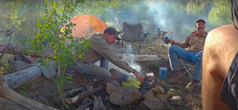
Hanging with my new friends
They got started on dinner shortly after 5 PM. They utilized the fire ring to cook corn over a metal grate. Mostly, it was being smoked at first. Then burned a bit. Methods used to cook this corn became the topic of laughter. In the end, it came out just fine. Meanwhile, Travis cooked the steaks. I felt a bit useless, just standing back while everybody else did something. Course I asked to help, and was told to just sit back and relax. This is always a bit hard for me to do.
After dinner we lounged around and exchange stories. Me being the guest, I think it was my obligation to contribute in that way, with stories. Having hiked and traveled quite a bit, I enjoyed sharing my experiences, and maybe more importantly, my insight on these experiences. The older I get the more I realize how these travels and experiences have shaped me as a person. In a positive way. I look at my life in Detroit before my CDT hike, and not being much of a people person. In fact, hiking in general was a way to get away from people. And now, I see long distance hiking as a way to connect with people, from all walks of life. I’ve always been the type of person that has a hard time accepting anything from anyone. Even when expected, such as on my birthday, I feel very appreciative of a gift or anything that has been given to me. So when people take me in like this, I barely have the words to describe my gratitude.
Day 35 – July 5th: Trail Magic, Antelope Valley
I woke up at 7:30. Tim was already cooking bacon, the sound and smell was great to wake up to. I asked Travis how he was feeling this morning, and he said, I must have been pretty drunk, everyone has asked that!
They were a little low on food for breakfast, so I ate some of my own food but I still Had a small portion of bacon and eggs. Delicious! After that we packed up camp pretty promptly. They seem to be pretty efficient at that, breaking everything down pretty quick. We loaded up the side by sides and headed downhill.
On the way down, Tim stopped here and there for burls. These are the knots on a tree that form when a branch breaks off, and the tree heals itself. A big ugly looking brain, or mushroom look. He cuts these off and uses them in his woodworking projects. Maybe a vase, lamp post or whatever. He turns them on his lathe. also makes something called dragon eggs, where he mixes resin into the wood fill the gaps. The grain of the wood Mixed with the resin was really cool looking, from the pictures he showed me. These are the kind of projects that it seems very few people do, almost like blacksmithing, like a forgotten art. Pretty neat actually.
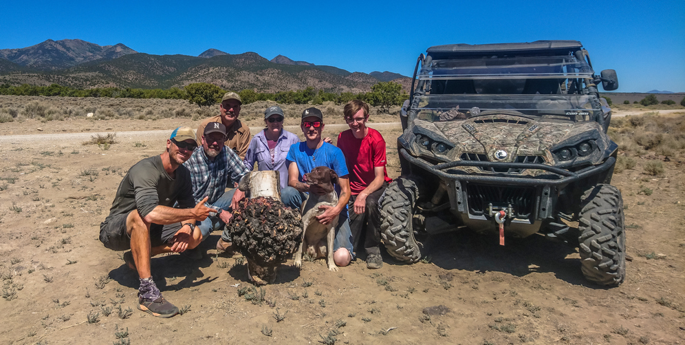
Group photo with the Terras Family and I
A few miles down hill, the valley opens up and we reached the spot where they parked their trucks and trailers that haul the side by sides. It was pretty hot now down in Antelope Valley. While loading up the side by sides, I got everyone together for a group picture. We got the largest burl and posed on front of it of the side by sides. This was great, I love these group pictures. They are pretty tough to come by, but perhaps some of the most meaningful pictures at the end of the day.
Soon we were all loaded up, and I jumped in the truck with Travis and Gaye. They were passing through Eureka anyway, so it wasn’t a bother for them to take me here. My goal was to reach Eureka by 8pm tonight. Had I walked from the spot they Park their trucks and trailers, I would not have reached Eureka this evening. Skipping so much of the planned route, about 40 miles, was a bit hard for me to swallow mentally, but I had already accepted the situation. Now down in Antelope Valley, I certainly wasn’t disappointed to have skipped this section, in the sense that I felt I was missing something, because it was a rather bland looking valley. The temperatures in June were rather mild, but now, in the low-90s, Crossing these valleys is a lot less appealing.
When we reached the Sundown Motel in Eureka, Travis and Gaye got out of the truck and we said our goodbyes. We had exchanged phone numbers and tentatively planned on meeting up again when I finish the Rubies. Since I’m coming out in Lamoille, it’s just a short ways from Spring Creek and Elko. They were more than happy to offer any help they can when I reach their Hometown.
Checked in to the sundown motel. My box was waiting for me in the lobby, a new pair of shoes. Checked into the room, showered, then walked across the street to the Owl Club. Funny, it has the same name as the place in Austin, even though they say they are not related. Seems like a strange coincidence to me. Ordered their biggest burger, double bacon cheeseburger and fries. It was probably one pound, and of course, put it down with ease.
Ate dinner again at the owl club. Made eye contact with a guy at the bar who is about my age. We kind of did “the nod”. I asked him how the 4th of July was, knowing they have a big Fourth of July party in town. He said he just got in today, and missed it. He asked me about mine, I told him about my story with the folks in the monitor range, part of my 1100 mile hike. He did not seem impressed, and that was the end of the conversation. He literally shrugged his shoulders and turned his back on me after hearing about my hike across Nevada. But that’s Eureka for you. This felt like one of the least welcoming towns along my hike.
Day 36 – July 6th: Zero Day in Eureka, NV
Breakfast from the gas station, a couple sausage biscuits and muffin. Spent all day doing chores; Paid Bills, called dad to have him send a box to the Spring Creek (Elko) Post Office with new gaiters, boxers and a new Patagonia capilene daily wear shirt.
Walked up to the Pony Express Deli at the end of town for lunch. Went off to the Post Office and mailed back rocks I found over this past section, and my old shoes. I still wear these when mowing the lawn or whatever, even if they are no longer trail worthy. Then walked up to the grocery store. This was a mile or more out of town. For such a big store, the selection was pretty terrible. I cobbled together what I needed for the upcoming 8 Day hike across the Diamond Range and Ruby Mountains.
I’ve been talking with Cody Terras today about meeting up in Lamoille. He wants to join for a section in the rubies, which would be awesome! So maybe the section north of Lamoille Canyon. Plans to be determined later.
Related Images:
Basin and Range Trail Thru Hike 2020 – Section 4: Carvers to Austin
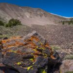
Basin and Range Trail Thru Hike Section 4 Map

Video: Basin and Range Trail Thru Hike Section 4
In addition to this trail journal, I also filmed my Basin and Range Trail thru hike. I’ve produced a detailed documentary series (11+ hours runtime) documenting this thru hike adventure, the product of over 1,000 hours of video editing. I highly recommending watching the Basin and Range Trail vlog series for an in-depth look at thru-hiking the Great Basin and central Nevada.
Basin and Range Trail Thru Hike Section 4 Journal
Day 25 – June 25th: Big Smoky Valley, South Twin River, Toiyabe Range, Toiyabe Crest Trail
Woke at 8. Called the Sundown motel in Eureka to ask if I can send a box. They said sure, so I called my dad to relay the message… Send new shoes to Eureka.
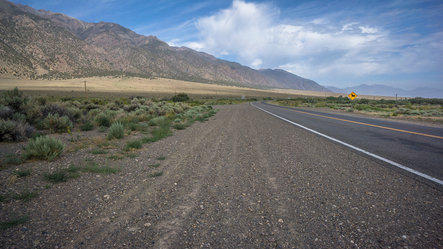
Packed my gear and hit the road around 9:45am. Feeling good physically, better than yesterday. My back is feeling fine now, thankfully. Weather shows afternoon thunderstorms, 70% chance of like 0.02 inches.
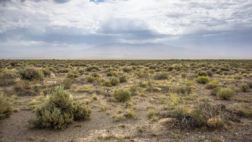
Toquima Range obscured by haze, view across Big Smoky Valley
The walk out of town along highway 376 was nice, for a road walk. It was really hazy looking today, and the Toquima Range eventually disappeared from sight. Still, the massive Toiyabe Range looms high above me as I walk the base of it north, looking for my way in.
One guy stopped in the road to ask if I was ok. He seemed extremely confused to see a hiker. I told him I was walking 1000 miles across Nevada, I’m good and don’t need any help. I got a blank look. Super confused. I reassured him I’m good, and he drove off, confused. Classic reaction.
Shortly after, I turned down the road that leads to Twin River, start of the Toiyabe Crest Trail. Around this time, the Dark Skies turn to rain. Not very heavy at first. Then some tiny hail. Then thunder. Then lighting. Then windy. Fortunately, I found shelter in the bathroom at the parking area around noon. There was one truck here, but he must be out hiking in this. Yuk!
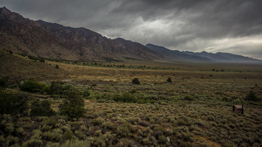
Storm clouds over the Toiyabe Range
It seems like were getting more than the .02 inches of rain the weather was forecasting. Constant lightning and thunder, sounds really nasty. I waited out the worst of it here. When the thunder and lightning subsided, I made my move.
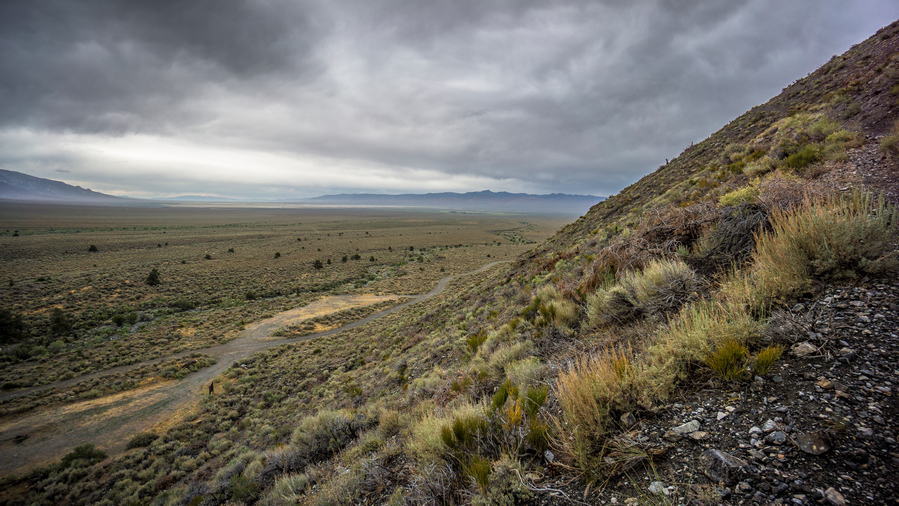
Massive view across Big Smoky Valley
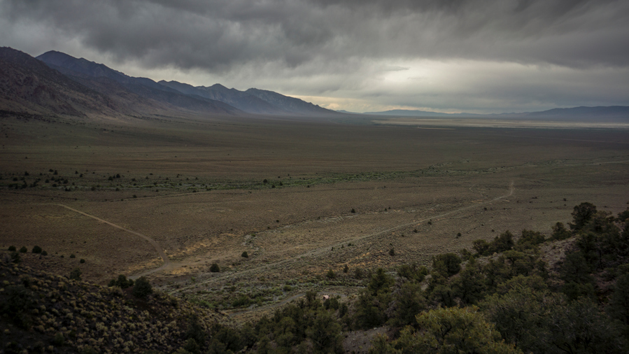
View over Big Smoky Valley and the Toiyabe Range
The trail climb steeply from the parking lot. However, almost immediately I was rewarded with expansive views of Big Smoky Valley, and great look north at the Toiyabe Range.
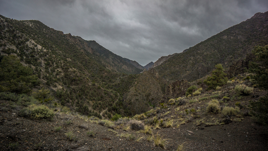
View into South Twin River canyon
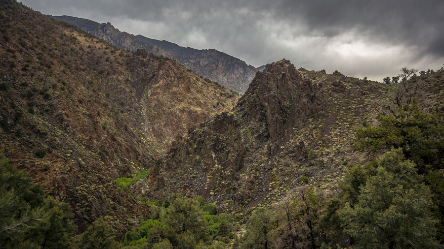
South Twin River entrance along the Toiyabe Crest Trail
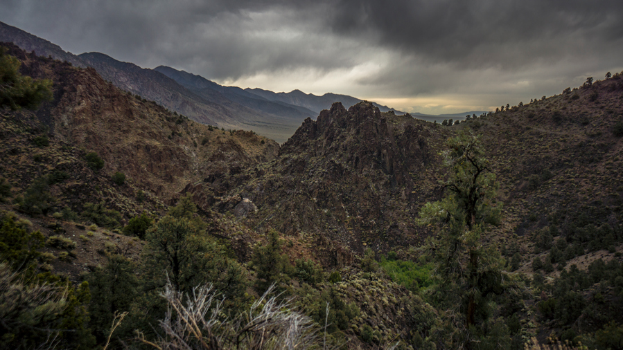
Toiyabe Crest Trail enters South Twin River
Soon the trail leads me to the canyon entrance to South Twin River. Once over the first little hill, I had my first view into South Twin River Valley. Wow! Really, wow! Steep and Jagged rock formations everywhere. Walk 50 ft, stop and look around with awe. Walk another 50ft, and repeat. All while watching your footing on the Steep Hill sides. I could tell I was going to like this place.
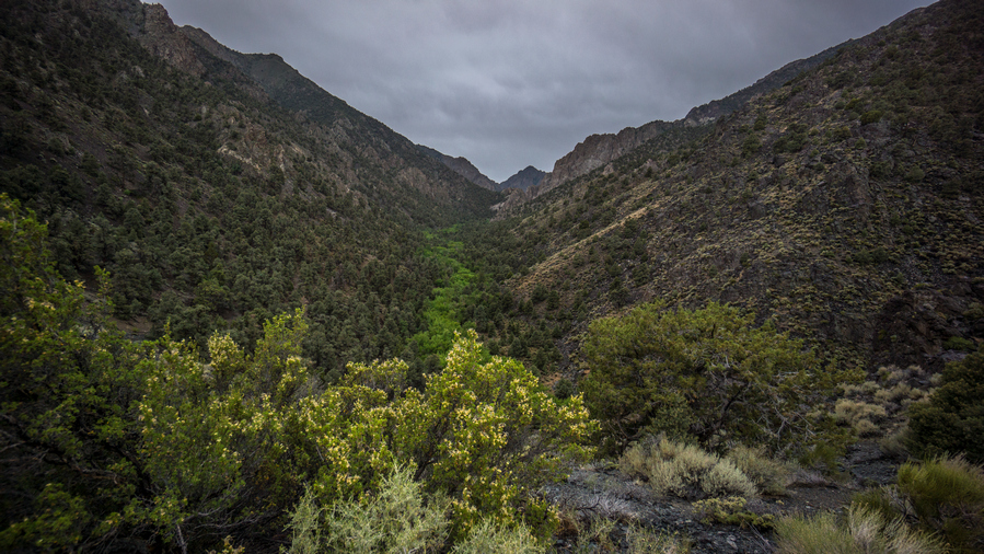
Lush green vegetation lines South Twin River
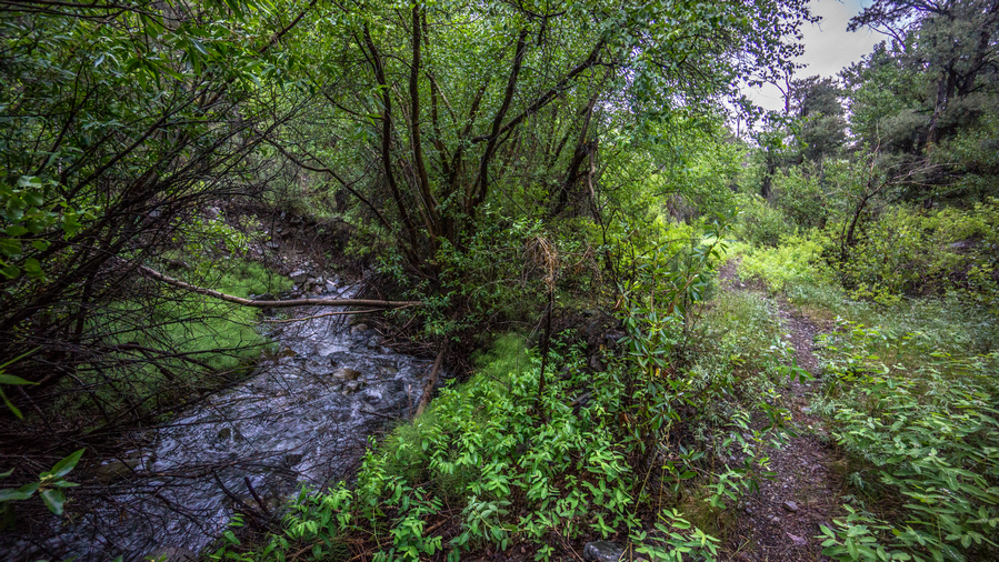
South Twin River
The trail sits up high above the river for a bit to avoid a narrow section of the canyon. Before long, it drops down to South Twin river. Similar to Pine Creek in the Toquima range, it was thick, lush and thorny, with steep Canyon walls surrounding you. However, decent trail. Very nice indeed.
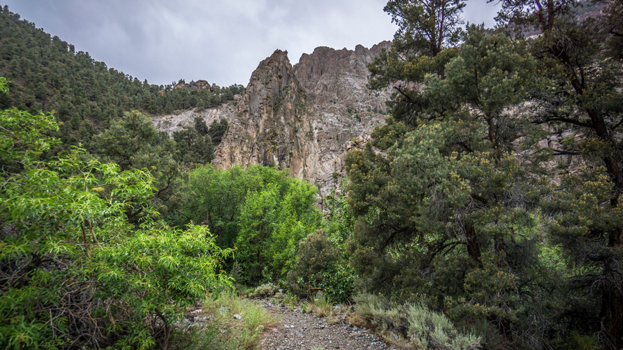
Hiking South Twin River
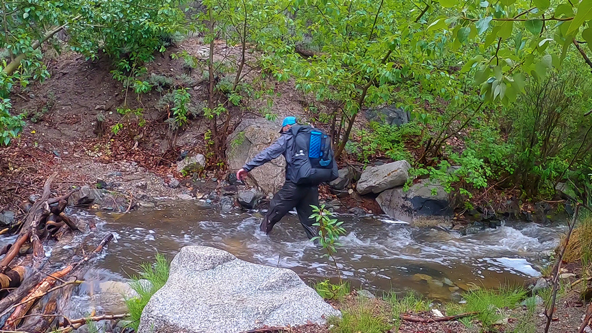
One of many stream crossings along South Twin River
The first River Crossing I was able to jump across the river. Certainly the river is up a little bit from the recent rain today, I’m sure there would have been rocks to hop across otherwise. At the second River Crossing, I was not so lucky. I accepted the fact that my feet were going to get wet today and just walked through the river. This would be the 1st of at least 30 River Crossings.
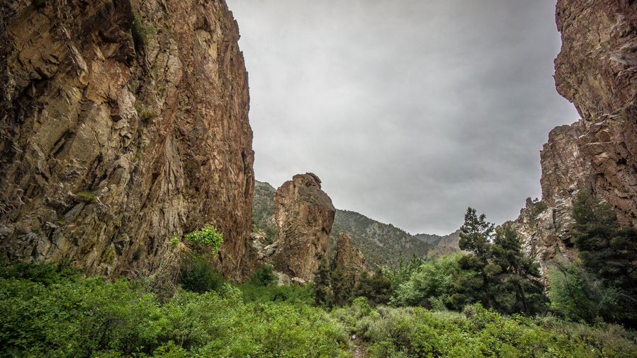
Amazing canyon section along South Twin River
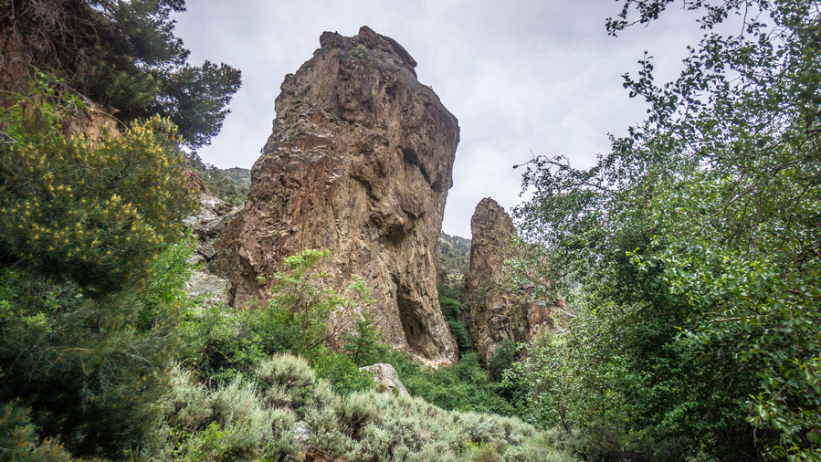
Vertical rock formation with a cave in it!
After one of the first couple River Crossings, I was blown away by what I saw. At first, on my left was a giant Rockwall that was several hundred feet high, straight up. And not on a slant or anything, literally vertical. Just a little farther up the trail was an 80ft vertical pillar just protruding from the ground on it’s own. My reaction was probably pretty comical, think I said something like, “are you kidding me?? Come on!” I was on awe. Just when I thought it couldn’t get any better, I walked further up the trail and on one side of the Rock pillar was a cave! A cave in a vertical rock pillar! I thought I was in a fairytale book, things like this don’t exist in real life. Unfortunately the cave was difficult to reach, especially with the wet rock from the rain and my increasingly worn shoes.
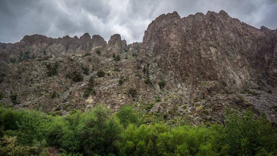
Towering canyon walls in South Twin River
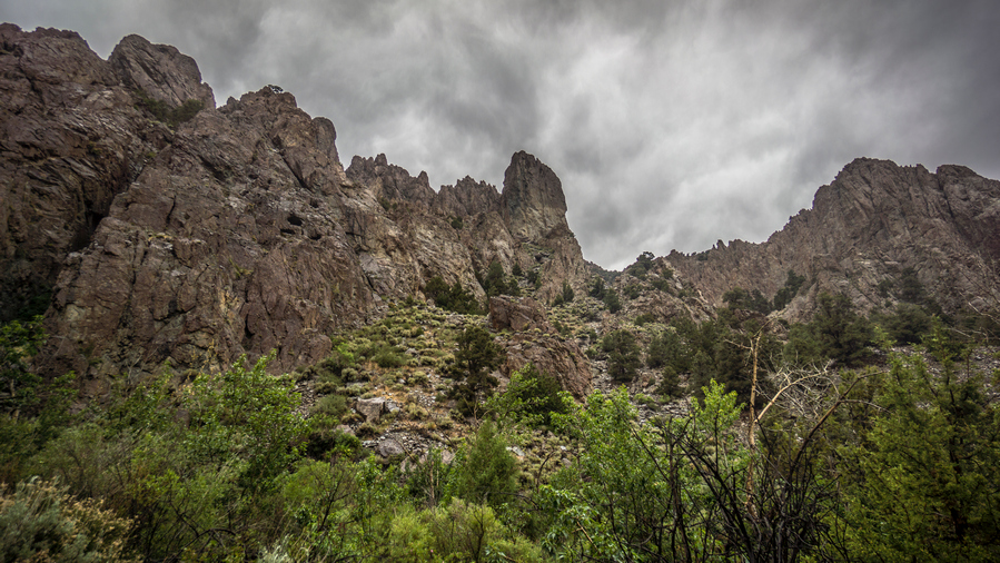
South Twin River hike proves to be very scenic

Hiking the Toiyabe Crest Trail through lower South Twin River Canyon
More Majestic scenery throughout the next couple miles. What an impressive Canyon. However, vegetation was thick and thorny. It was also wet, so it was a pain to move through.

One of many river crossings along South Twin River
Through the hike up South Twin River, there were river crossings at frequent intervals. Perhaps there would be less water flowing if it hadn’t rained recently, but chances are, you’ll be getting your feet wet hiking here.
At one point there was a steep Hillside with loose rock, at the junction of South Twin River and South Fork South Twin River. Looking up, there was a narrow Passage with a large tree. For some reason I had a hunch that there was something up there, maybe a hidden cave, I don’t know. But I felt compelled to check it out.
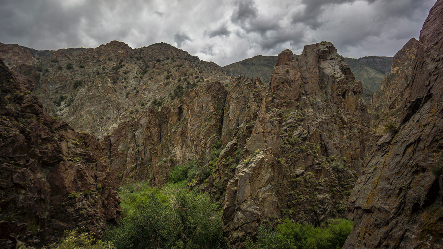
Junction of South Twin River and South Fork South Twin River
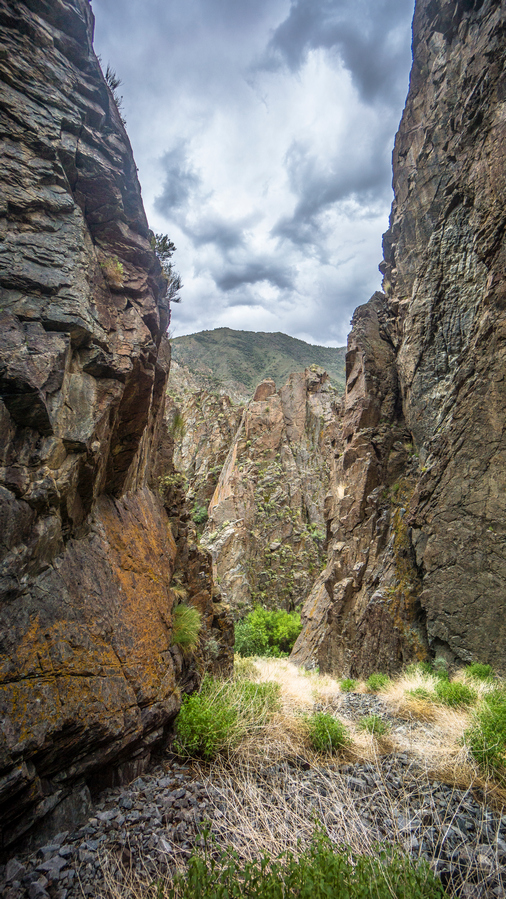
These canyon views really impressed me
Rock was wet and treacherous. I made my way up to the large tree, expecting to see a cave entrance or something. But there was nothing here. I could have kept chasing my hunch up increasingly steep and more treacherous boulder chutes, but I gave up and went back down. The way down provided an amazing view of vertical rock formations throughout the canyon. This was almost worth it on its own, a really unique view amongst all that I have seen on the Basin and Range Trail.
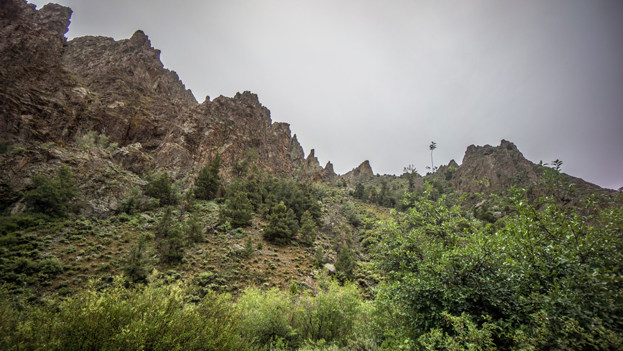
Jagged ridgeline along the cliffs that tower above South Twin River
Past a couple of campsites at a trail Junction. They were a long the river though, I almost never camp in these. Too much condensation overnight. Not that tonight will be dry anywhere. Besides, it was still too early, so I kept moving.
The next section of trail was really thick with vegetation. And lots of River Crossings. Jungle-like. Thorny. Everything was wet. I was wet. I was ready to get to camp. I had seen a couple of small caves, including the one in the pillar, and was really hoping to find a suitable cave to sleep in. To be out of the elements, and dry my things off.
To my surprise, I reached a bit of an open clearing with a Rockwall. Along this Rockwall was a small cave, with the grassy Hillside below. From the trail, it looked absolutely perfect. The kind of cave I had been waiting for! I’ve never been able to find a suitable cave to sleep in, at the right time. I climbed up to the cave, and my initial thought was that it was too small. I thought maybe I could set up my tent in front of the cave on the grassy Hillside. Which I certainly could have done. Ultimately, I decided to cowboy camp inside the cave.
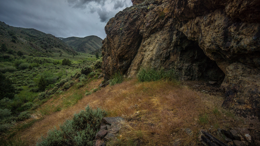
Cave in South Twin River. Good place to camp on a wet and soggy night
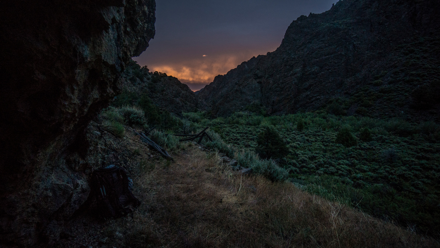
Sunset in South Twin River canyon from my cave campsite
The cave was small enough that there were no animals living in it, and no obvious signs of holes or burrowing. The ground was flat, and pretty clear overall. I had space to set up my gear and hopefully let things dry out a little bit overnight. The rain looked like it was over, but who knows.
Day 26 – June 26th: South Twin River, Toiyabe Range, Toiyabe Crest Trail
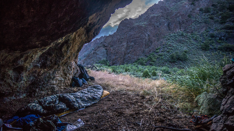
Cowboy camping in a cave in South Twin River Canyon
Didn’t get much sleep last night. My air mattress now has a slow leak, and needs to be refilled every 2 hours or so. It was pretty cool sleeping in a cave though!
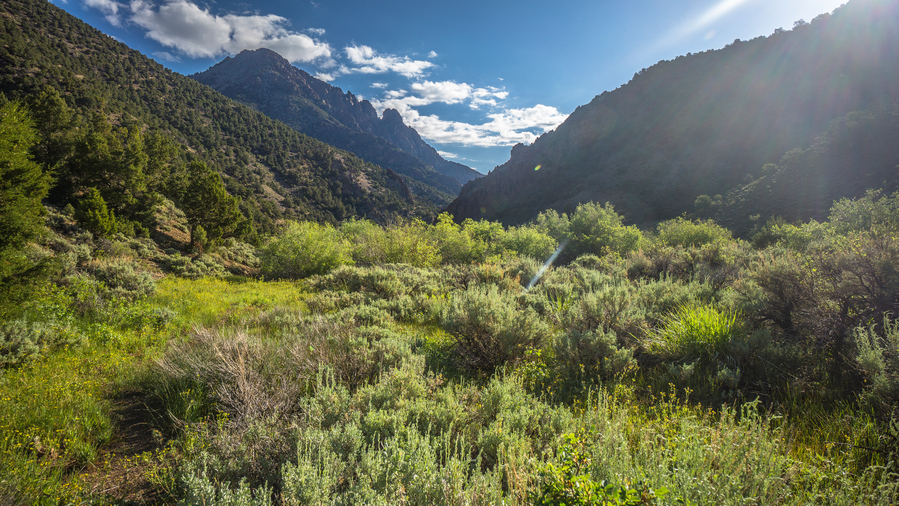
View back down South Twin River, where I came from
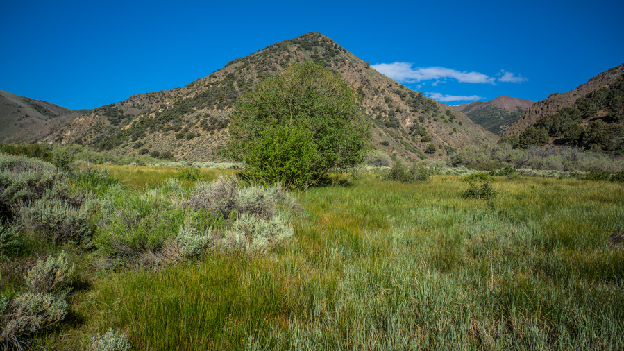
Trail junction: left for the Toiyabe Crest Trail, right for the North Twin River Trail
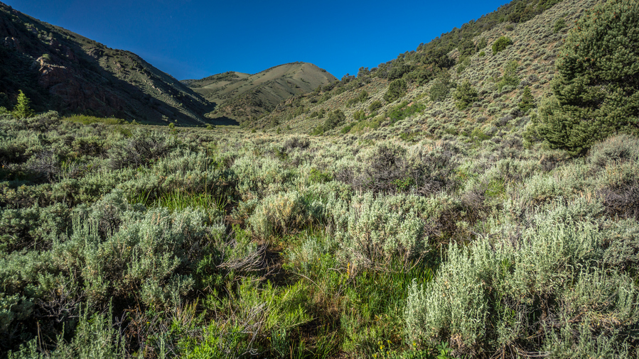
Looking up South Twin River towards the crest of the Toiyabes
Everything was soaking wet from the rain yesterday. And of course, the vegetation continued to be thick. Also, there were a bunch more stream Crossings. At least the stream was smaller now, and mostly I just jumped over it.
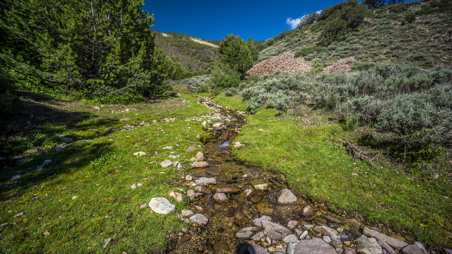
South Twin River still flowing in it’s upper reaches
The scenery in Upper South Twin River Canyon was much less impressive than the lower portion. It was pretty much just bushwhacking through wet and sharp vegetation. Very frustrating at times. The section of the trail is in dire need of maintenance.
I waited until the last minute to get water out of the Stream before the final climb out of South Twin. There was a lot of cow shit here, and it was fresh too. I know this because I slipped in it. It was that soft. But I didn’t see any cows or hear them. Filtered some water and took 2.5L with me.
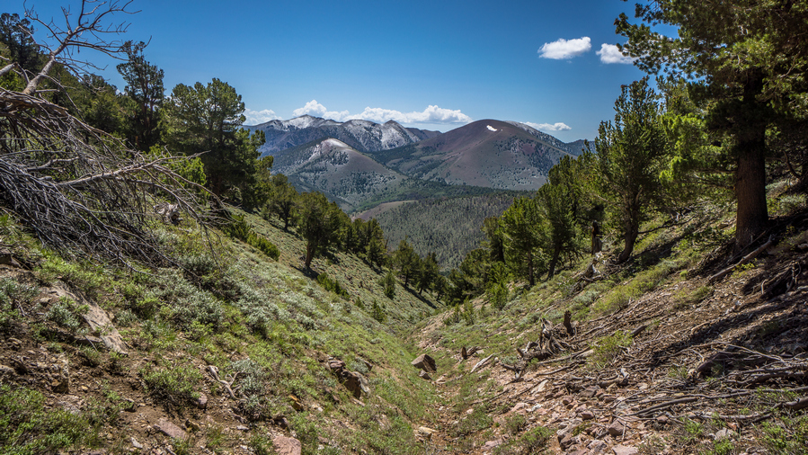
Dusting of snow on the Toiyabe Range from yesterday’s storm
The final climb up to the saddle below Arc Dome was a pain. The trail literally followed the bottom of a drainage. It should have followed the hillside and kept you out of the thick brush and rocks. This seemed to take forever. To the south was a couple of mountain peaks covered in fresh snow. I guess that was from yesterday, while I got the rain high elevations got the snow.
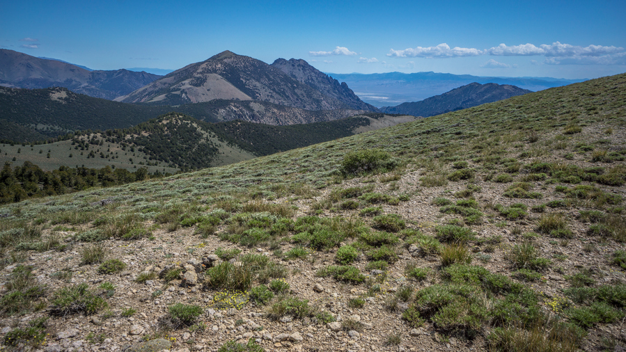
First distant view in the Toiyabe Range
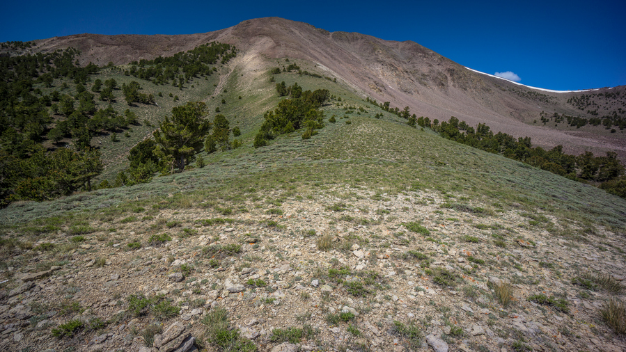
Saddle below Arc Dome
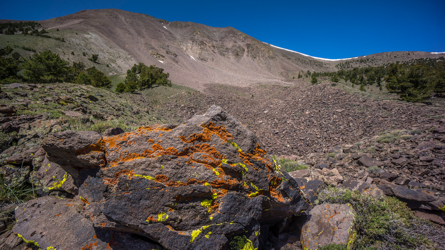
Hiking below Arc Dome
Finally up on the saddle, I could enjoy my first long-distance view. Very nice! Arc Dome still loomed above, and I contemplated climbing it. The original plan was to bag it, as an out and back. However, I am behind schedule with the thunderstorm yesterday that I waited out. So after following the trail up to the saddle below Ark Dome, I decided to pass. It was the smart call to stay on schedule for getting into Austin.
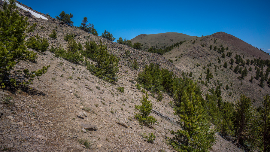
Hiking along the ridgeline below Arc Dome
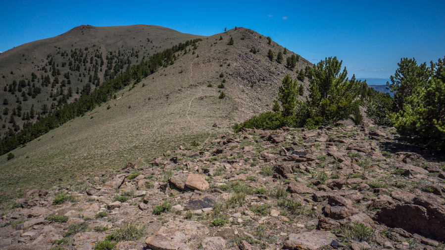
View north along the crest of the Toiyabe Range
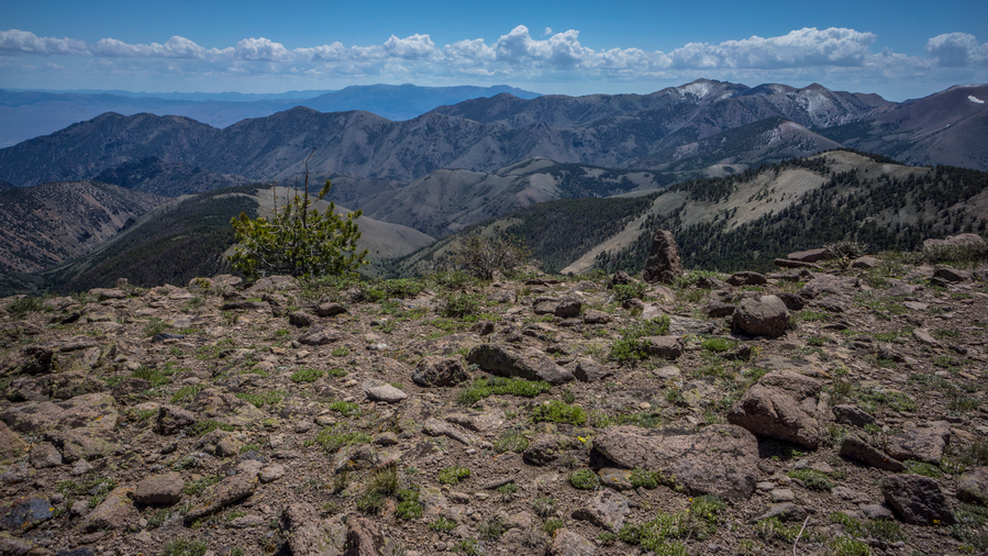
Break spot, with a rgeat view of the Toiyabe Range
I took a break at the edge of some cliffs with rock seats and a nice view. Here, I could take off my shoes and dry my shoes, feet and socks in the Wind and sun. And that’s just what I did. Man what a difference that makes, having dry feet again.
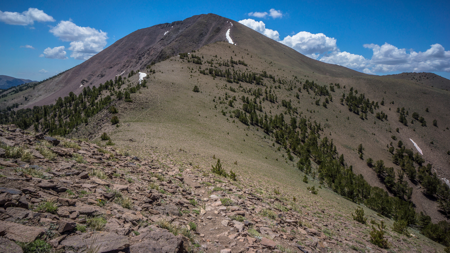
Looking back at Arc Dome
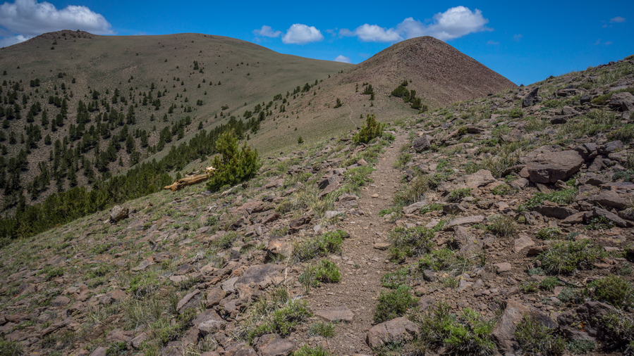
Hiking north along the TCT
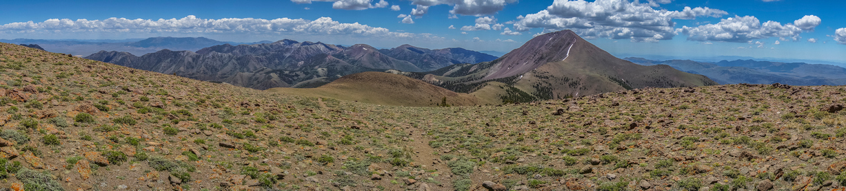
Panorama view of the Toiyabe Range from the TCT
After my break, I was hiking good trail now on the Toiyabe Crest Trail, or TCT. Excellent views, nice solid trail, mostly. It was mostly a climb up a couple of consecutive Hills, and then it really flattened out. A lot like the table mountains in a way. Better views though.
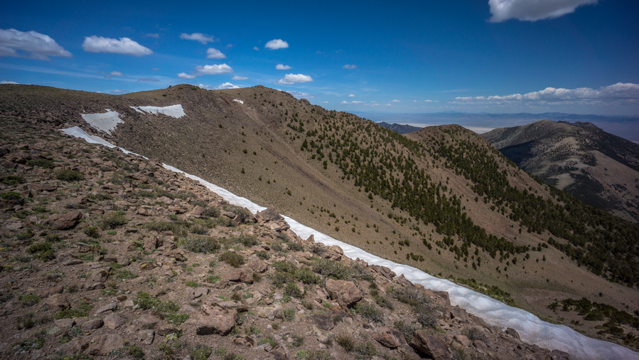
Snow capped ridgeline of the Toiyabe Range
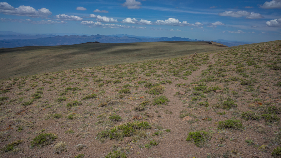
Big views along the TCT
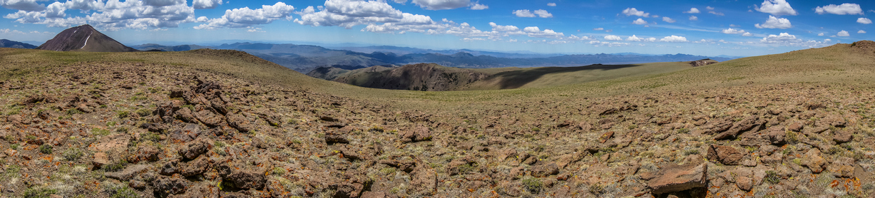
Big open views along flat sections of the Toiyabe Crest Trail
I really enjoyed most of today’s hike. Great views of the Shoshone range to the west and big Smokey Valley to the east.
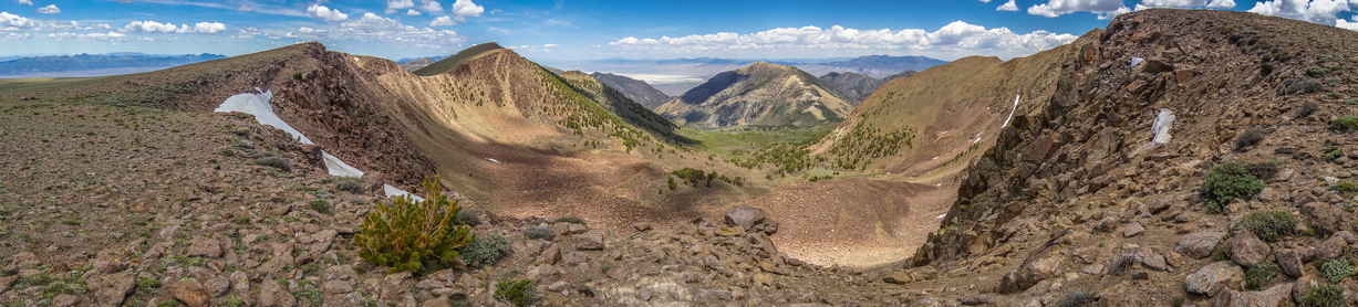
Beautiful high mountain scenery along the Toiyabe Crest Trail
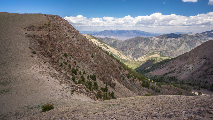
View from the TCT
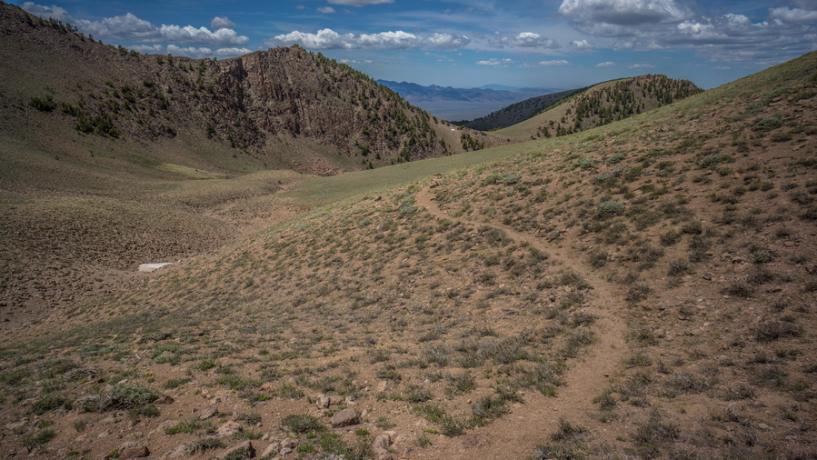
The Toiyabe Crest Trail offers excellent hiking
The trail here was good. Easy to follow, seemed to be well maintained. Not a lot of brush, easy walking, other than the big climbs. Even then, there wasn’t anything too big, couple hundred feet maybe. This added to the enjoyment level.
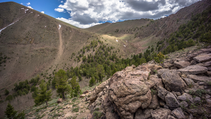
Looking back on a section of the TCT
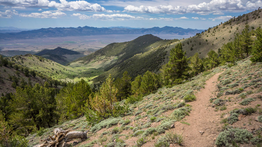
View west to the Shoshone Range from the Toiyabe Crest Trail
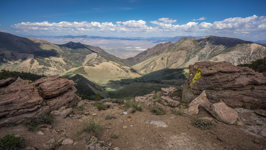
View east across Big Smoky Valley from the crest of the Toiyabes
I only brought 2.5L of water from South Twin River Canyon up to the crest. This decision was pretty short sided, in that I just didn’t want to haul a bunch of water up and already steep and brutal climb to the crest. Of course, I should have brought more. I had to ration my water all day.
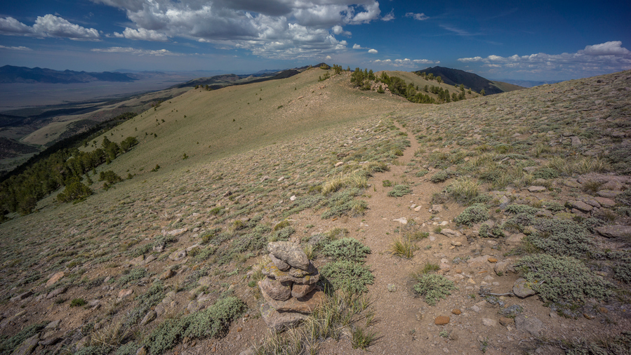
Expansive views while hiking the Toiyabe Crest Trail
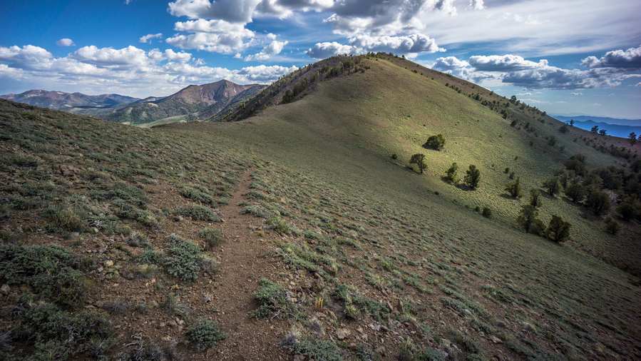
View south from the TCT
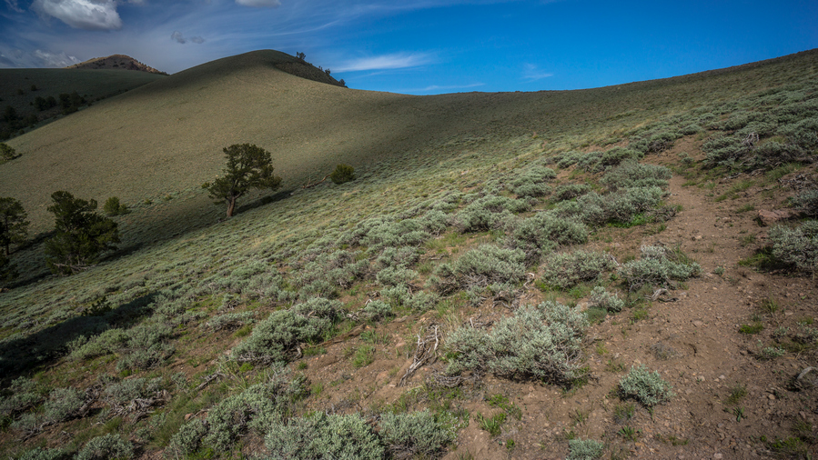
Rolling ridgelines along the crest of the Toiyabe Range
One thing I did to mitigate my water problem was collect snow from the cornices at the top of passes and ridges. I filled both of my Gatorade bottles, because they have the wide mouth opening, with snow. Later, I came across another snow bank. Then, I took the water that has melted from one bottle and poured it into the other. I added more snow to the other bottle. In the end, I got about 1.5L of water from these two 1L Gatorade bottles. Not Bad!
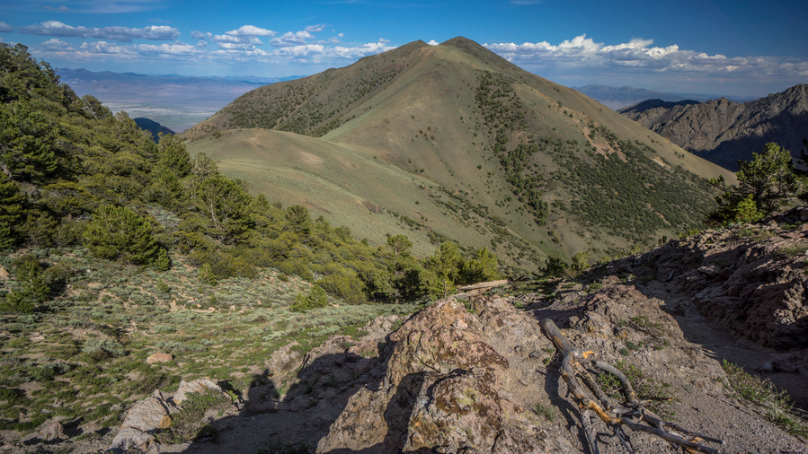
View over the Toiyabes
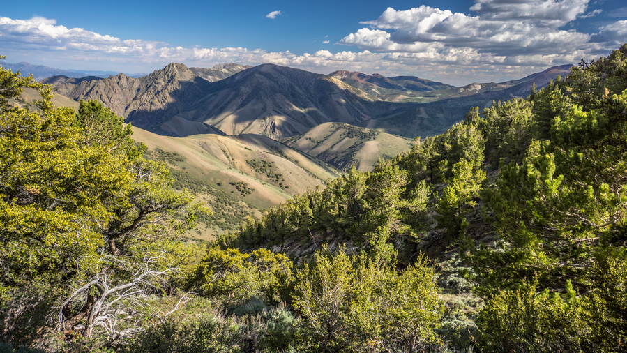
View south
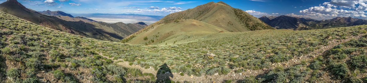
Toiyabe Crest Trail panorama
I was feeling pretty tired from todays hike and took a break around 5:30. Ate food, drank a little bit of water and moved on. I was feeling much better, just in time for a great evening walk.
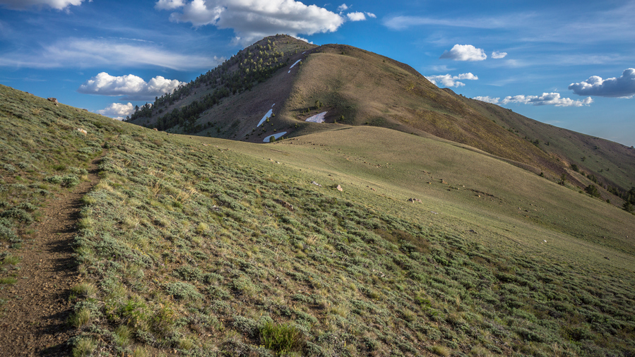
The crest of the Toiyabes is a great hike
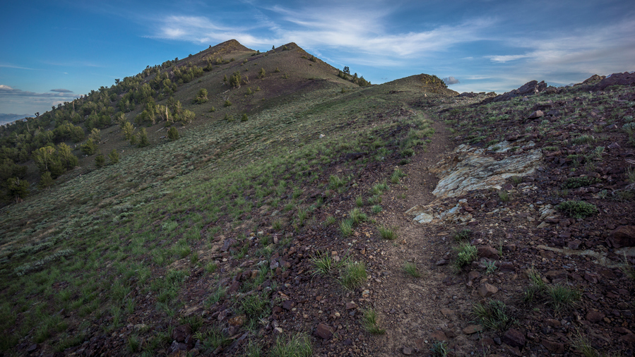
The TCT often follows the ridgeline proper
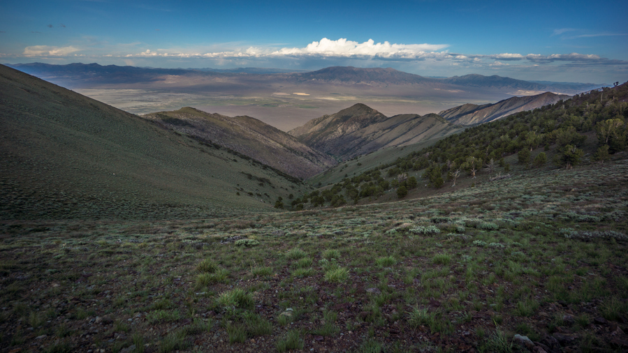
View east into Big Smoky Valley
The walk along the Ridgeline tonight was awesome. This must have been up there with some of my favorite Ridge walks of all time. Beautiful scenery, trail stays really high and beautiful sunset. At one of the passes, a road runs up and over. Here, a Subaru Outback was parked. I expected to see someone in the vehicle, but I did not. I assumed they were out hiking, and wondered if I would run into them. I didn’t.
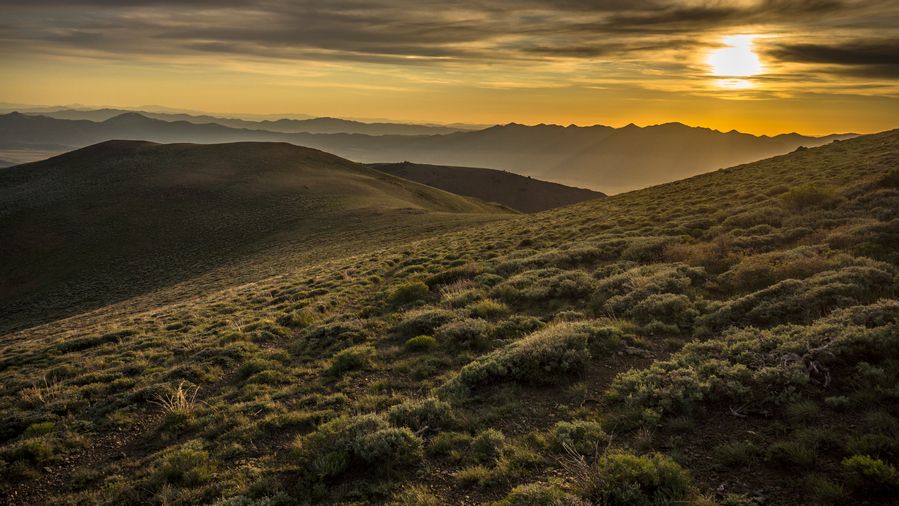
Sunset in the Toiyabe Range
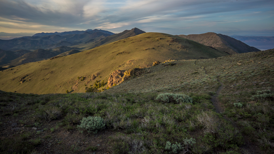
View north along the TCT
Tonight was the night of the never-ending sunset. It seems like the sun was low in the sky forever. It set in slow motion, and literally felt like the longest sunset of all time. I’m not complaining, this was quite amazing actually. To be able to stretch out such an amazing sunset provided seemingly endless photo ops.
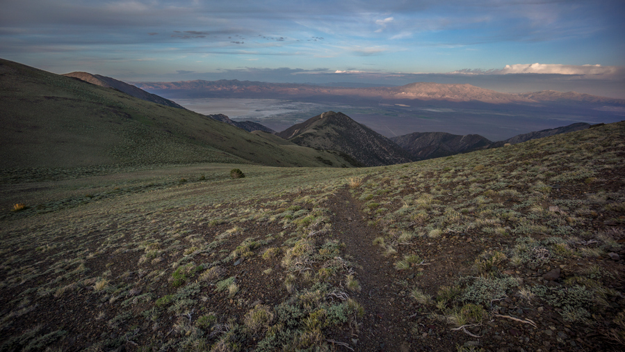
View east into Big Smoky Valley from the Toiyabe Crest Trail
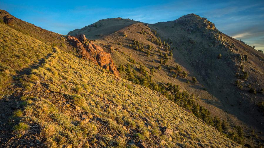
The Toiyabe Crest is an incredible place to walk at sunset
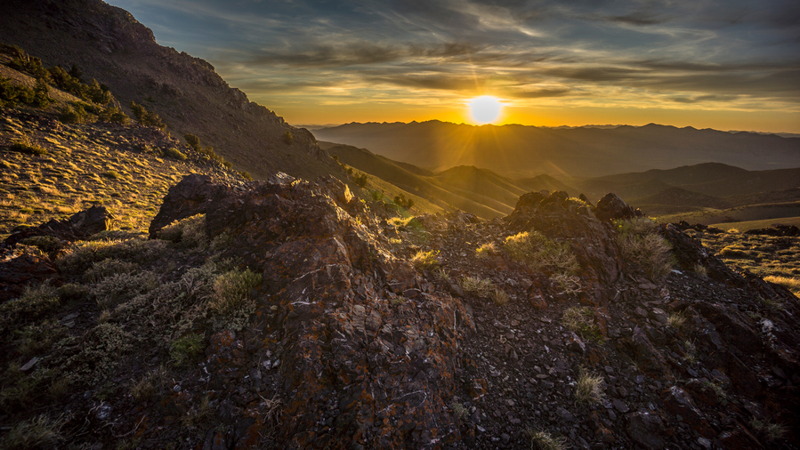
The never ending sunset!
I had been looking for a campsite before the sunset began, but no such luck. Pre-existing campsites are few and far between up here. Pretty much just have to look for a clearing, that doesn’t have too much cow shit. To my surprise, I made it to the next spring on my map. I wasn’t thinking I was going to make it this far tonight, but it was such a great walk that it kept me going a little bit later than usual.
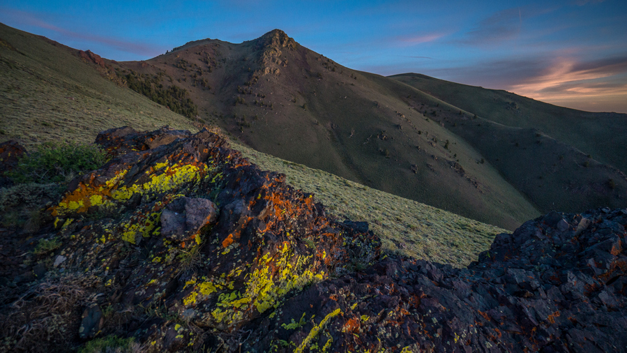
Views along the TCT
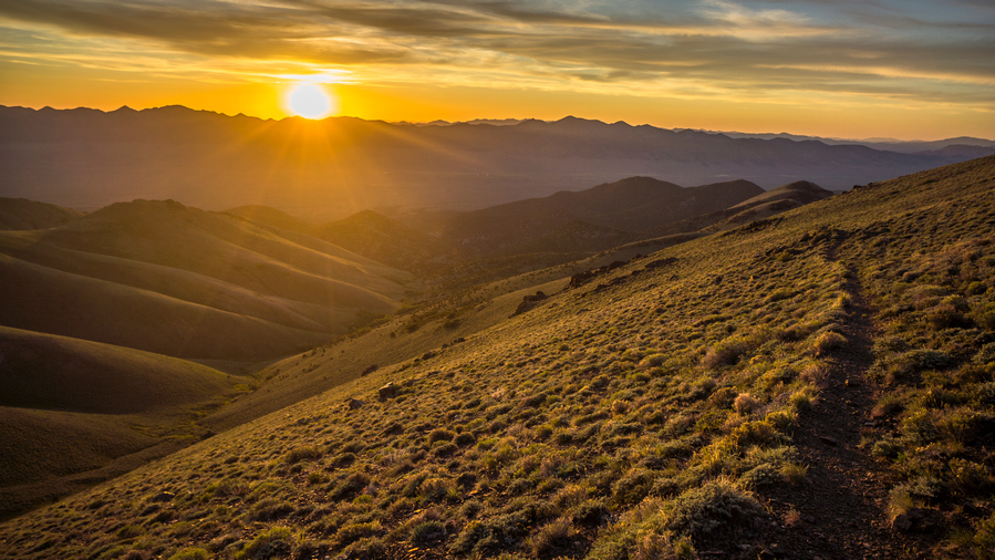
Sun setting over the Shoshone Range
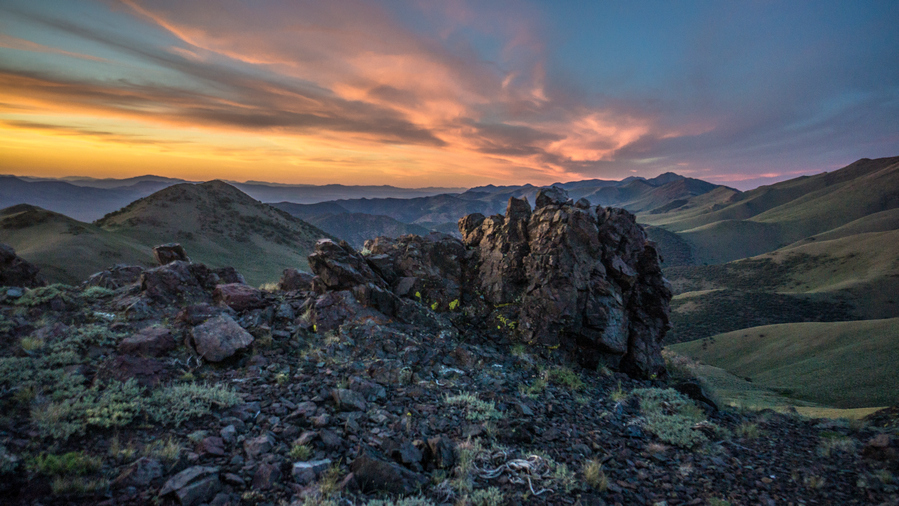
Colorful sky as the sun dips below the horizon
I didn’t actually make it to the spring, I camped on the saddle above it. There was a couple of green patches blow the saddle, but I couldn’t quite tell for sure if there was water. Either way, I’ll check it out in the morning. Not enough light left to do it now.
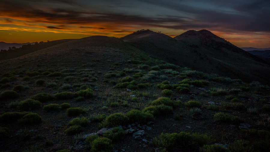
Cowboy camped on this saddle
I cowboy camped on the saddle, having to move cow shit to make room for my air mattress and ground sheet. I probably would have set up my tent, but it’s easier to Cowboy camp when there is limited space such as this. Plus, if you think there could be any wind, it’s lower profile and is easier to ride out the wind gusts. But of course, the winds died down at night like they usually do in Nevada.
Day 27 – June 27th: Toiyabe Range, Toiyabe Crest Trail
Great spot to camp, sun was on me almost first thing in the morning. I heard one animal in the middle of the night, but this is to be expected since I’m on the top of a pass like this. I packed up my gear and headed down to the spring.
Filtered a couple of liters of water at the spring and actually enjoyed the moment. Normally, filtering water is one of my least favorite hiking chores. But on this morning, the Sun was shining and I was out of the wind, warm in the sun and appreciated a moment where I could just sit down in a comfortable environment and relax. While I squeezed a platypus bag, of course.
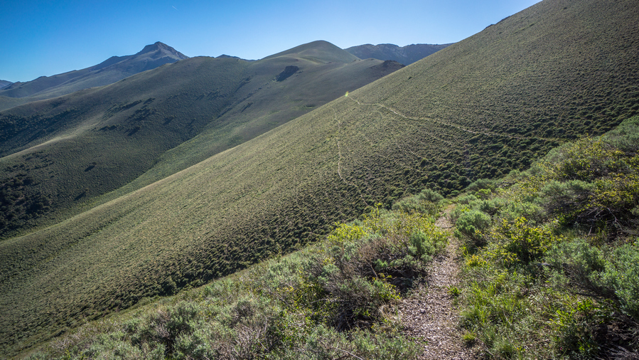
The Toiyabe Crest Trail runs across the mountainside
I couldn’t see an obvious Trail leading away from the spring and back up to the Toiyabe Crest Trail, so I Bushwhacked a bit. Yay, my favorite. Eventually I hit a trail that contoured around the Hillside back over to the main Toiyabe Crest Trail. Whew.
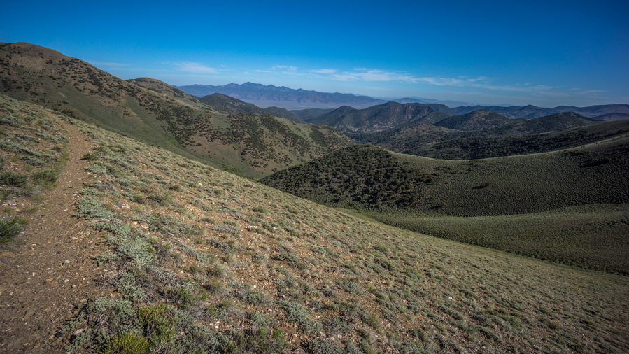
TCT view west
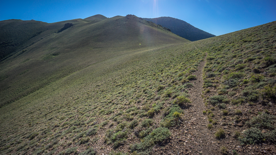
Good trail to follow
The next couple miles were nice. Good quality Trail. Contoured the hillside for a while, going by a couple of creeks in the drainages. Looks like today will have more water than yesterday.
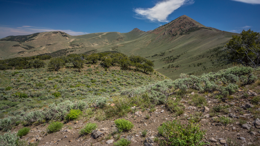
French Peak on the right. The Middle Toiyabe High Route Alternate takes the ridge on the right, avoiding dropping down into the valleys and would provide excellent views
After contouring around the hillside, I began to notice how much I’ve dropped in elevation. This is never a good thing for the hiker unless it’s your final descent out of the mountains. It just means more climbing ahead.
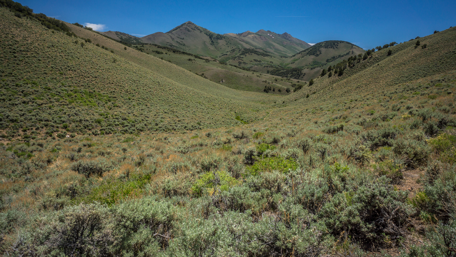
The Toiyabe Crest Trail is no longer following the crest here. Bummer. Should have taken the Middle Toiyabe High Route alternate
There were several water sources I passed. At the bottom of the descent was a small Creek. I thought this was the bottom, until I climbed up over another hill and drop down just a little bit farther than the other Creek. Tierney creek, the bottom of the decent, under 8500′.
The trail consisted of 4×4 roads at this point. These were quite steep, and the worst kind. Small, loose pebbles sitting on hard packed dirt. At this slope angle, its a slip and fall accident waiting to happen. I found myself walking among the Sagebrush alongside the road at times instead, less of a slipping hazard. It was also rather hot down low in the valley.
Now the climb up begins. I stopped at a small Creek to eat lunch. I was feeling my blisters now, aggravated by all of the sand in my shoes. Put my sandals on and soak my feet in the creek, and filtered some water to go.
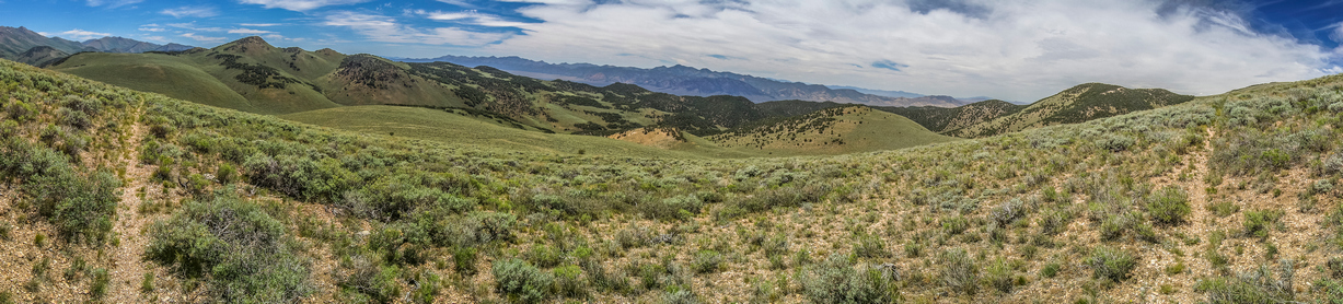
Panorama view west to Shoshone Range
Shortly after my lunch break I saw a pronghorn. Not long after, I saw two more pronghorn and a baby. I wondered, are these called fawns too? Or Pronghornlets, perhaps? Ha.
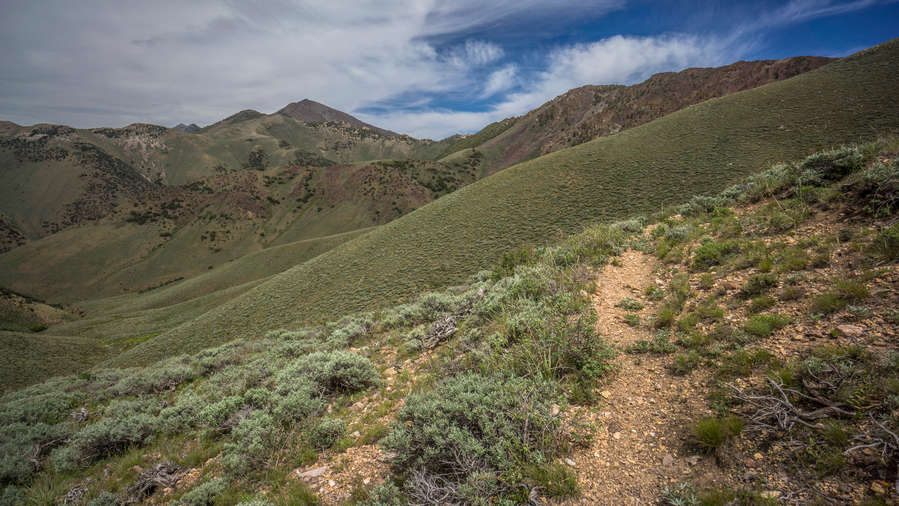
Good views as the route traverses around Toiyabe Range Peak
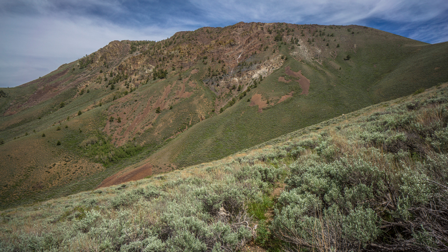
Nice hiking here
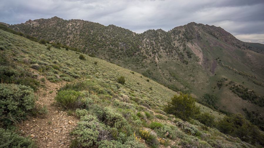
Ridgeline of the Toiyabes
Some of the best scenery of the day came in the afternoon as the Toiyabe Crest Trail skirts around Toiyabe Range Peak.
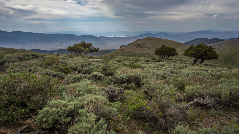
Overlooking the Reese River Valley and the Shoshone Range
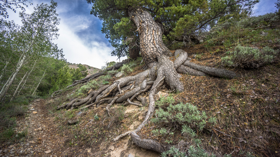
The roots of this huge tree are growing practically vertical along the trail
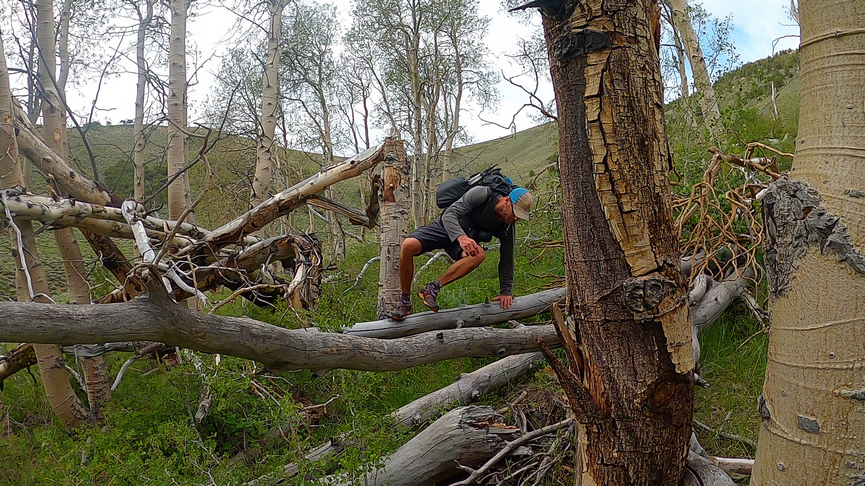
The Toiyabe Crest Trail is less maintained in the middle section
The day was dragging on now, thanks to the increased heat and decrease in scenic views. Cow shit on all the small passes. Lots of it. Pretty uneventful day overall. There were some great views, but they weren’t as constant as they were yesterday, in the Southern Toiyabes. The trail was not as good here either as it was up on the crest yesterday.
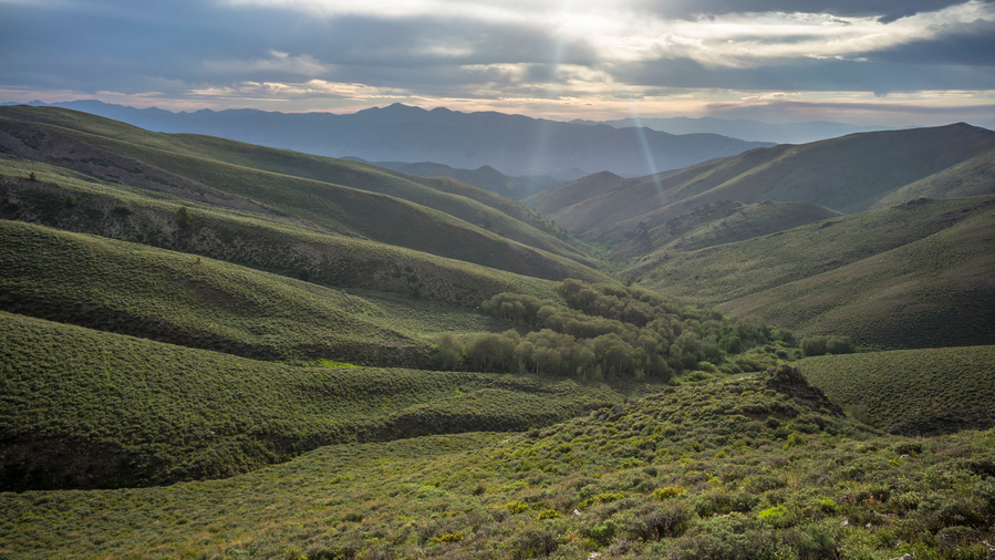
Sun setting soon over the Shoshone Range
Ran into my first person in almost 400 miles of hiking. A guy named Alex, and his dog. Alex was from Grand Rapids Michigan, now living in Vegas. But he just took an internship in Round Mountain for the summer. So now he gets to explore the mountains here. Alex hiked the PCT in 2018 and had the trail name Nuts. Probably because he went through the Sierras in April and May!
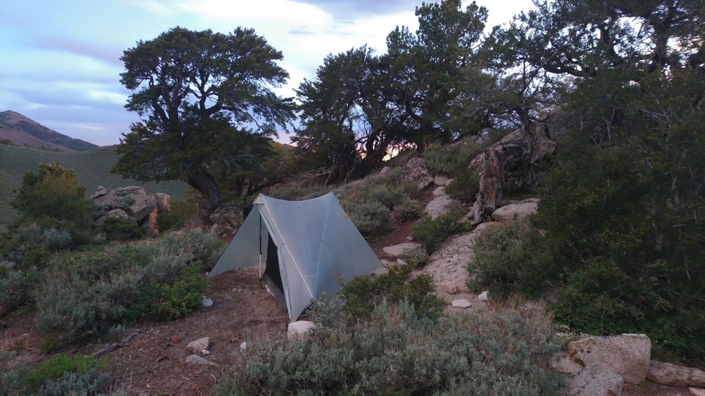
Tarptent Notch Li in the Toiyabe Range
Found a great spot to camp along a Ridgeline Above a pass. Hidden behind some rocks, well protected from the wind. Good thing because it was windy, even after dark. A spring was only a few hundred yards down hill. Found an arrowhead on the pass. A metal sign for the Toiyabe crest trail was here too, the first one Id seen up here.
Day 28 – June 28th: Toiyabe Range, Toiyabe Crest Trail, Kingston Creek, Big Creek
The wind didn’t die down until midnight, so I didn’t get any sleep until after that. Excellent campsite, was pretty well shielded from the wind for most of the night. But the sound of the howling wind still kept me up.
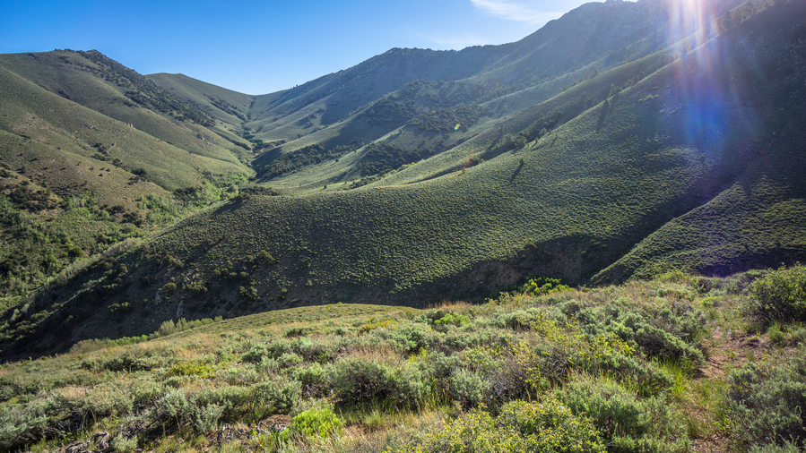
Hiking up Washington Creek, back to the crest of the Toiyabe Range
Dropped down off the pass and into a Cirque that was full of water. Filtered 4L last night so I didn’t need any. Stopped to wash my socks in one of the streams, and a mouse hopped away. Today was a really long day. It’s funny now that I write in my journal, I can barely even remember this morning. It seems like 3 weeks ago. The days are just so long out here.
Feet feeling better today than they were yesterday. Holes in my Darn Tough socks are getting big. Good thing I have a couple new pairs in my bounce box waiting for me in Austin.
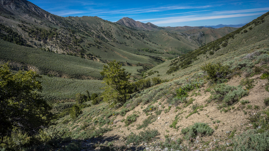
View back down Washington Creek as I near the crest
The climb out of the valley with all the water took a little bit longer than expected but still, I feel like I made good progress. As soon as I reached the top of the pass, I was hit with 40 MPH winds. It was cold too! First thing I did was put on my wind jacket, kept me a little warmer plus I wore the hood to make sure my hat didn’t fly off. It was crazy windy.
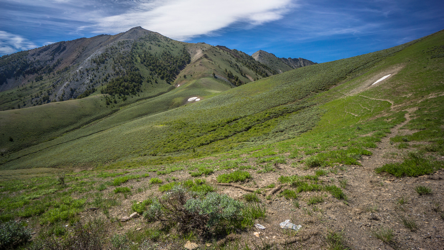
Outstanding views again as the Toiyabe Crest Trail finally returns to the crest
Excellent views now that I was back up on the crest of the Toiyabe Range. The kind where it was hard to make progress because I was constantly stopping to re-analyze the landscape, seeing new angles and shots.
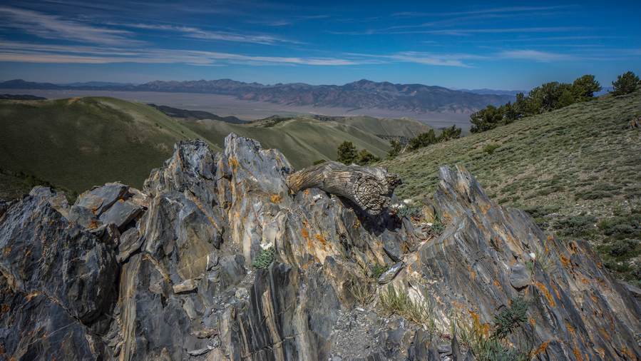
Scenic view into Reese River Valley from northern section of the Toiyabe Crest Trail
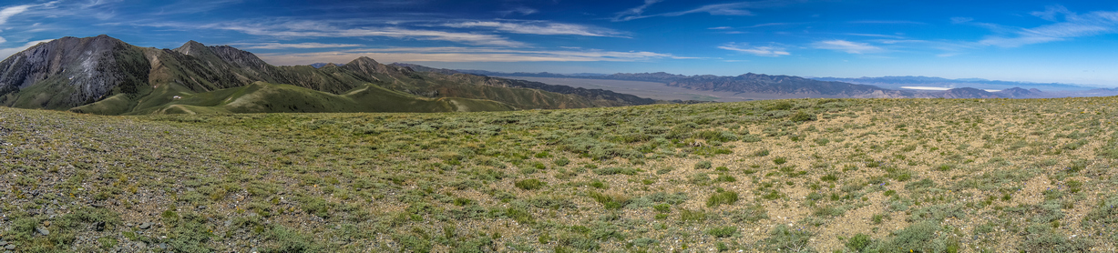
Toiyabe Range, Reese River Valley and the Shoshone Range viewed from the Toiyabe Crest Trail
The wind was blowing in from the West, so as long as I was on the east side of the Divide, it wasn’t too bad. But without something blocking the wind, it was pretty wild. The hood on my wind jacket was constantly being battered, and was really loud on the ears. And sometimes, some of the straps from my backpack would get blown around violently & slap me in the face. I was literally being bitch slapped by my own backpack.
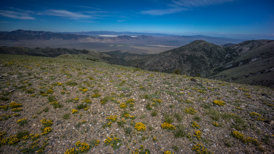
View west to Reese River Valley, Shoshone Range and Smith Creek Valley
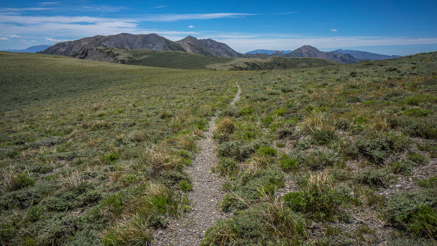
Excellent hiking along the northern section of the TCT
Once I got a good View to the West, I could see a dried lake bed on the other side of what I believe was still the Shoshone range. The winds where kicking up dust and sand into the atmosphere, with a brown layer of debris hoovering low in the air.
Stopped to eat behind an outcrop of rocks. They really weren’t that big, but they did the job, providing enough protection from the brutal winds to be able to eat without my things being blown away. I was running out of space on both my camera and my phone, so I deleted pictures and data from both so I could continue taking pictures on both devices. Man, I really need to send my bounce box to every second or third town instead of 4 towns, so I can dump media more often.
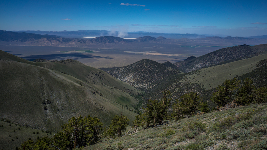
The wind is kicking up dust from the dried lake bed in Smith Creek Valley
After my break, it was back into the wind. Now, I had a decent climb up a hill that was totally exposed to the winds from the West. Here, the winds were gusting 50 to 60 miles per hour. Almost blowing me off my feet at times. I would lean into the winds to try and counteract the force, but when the winds died down suddenly, I found myself almost falling over. The winds would come out of nowhere and catch me by surprise.

Bunker Hill Peak
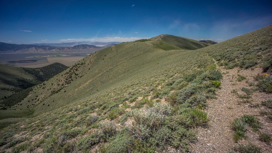
Look at all that dust getting kicked up into the atmosphere. It’s coming this way…
Some spots along the Ridgeline had interesting rocks. Lots of quartz veins visible. The walk along the Ridgeline today was not all that long, but the views were excellent. The winds were extremely taxing on the mind and body. It really wears you down walking through high winds.
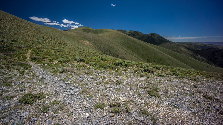
Looking south along the TCT before dropping down to Groves Lake
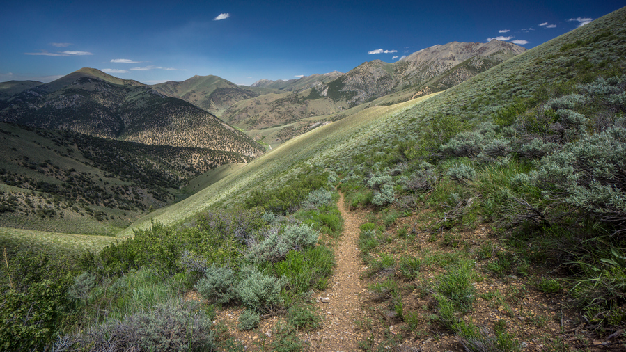
Descending to Groves Lake
I was relieved to reach the saddle where the trail finally drops down to Groves Lake. This is the official end of the Toiyabe Crest Trail, the northern terminus. I made very quick time of the descent, jogging whenever possible. This has always worked well for me to minimize knee pain. One reason knee pain occurs on downhill sections is that we are trying to walk at a pace that is slower than momentum, and in order to maintain our pace we strain our knees in the process. By jogging a bit, or going with the flow, you can minimize knee pain. That’s my theory, anyway.
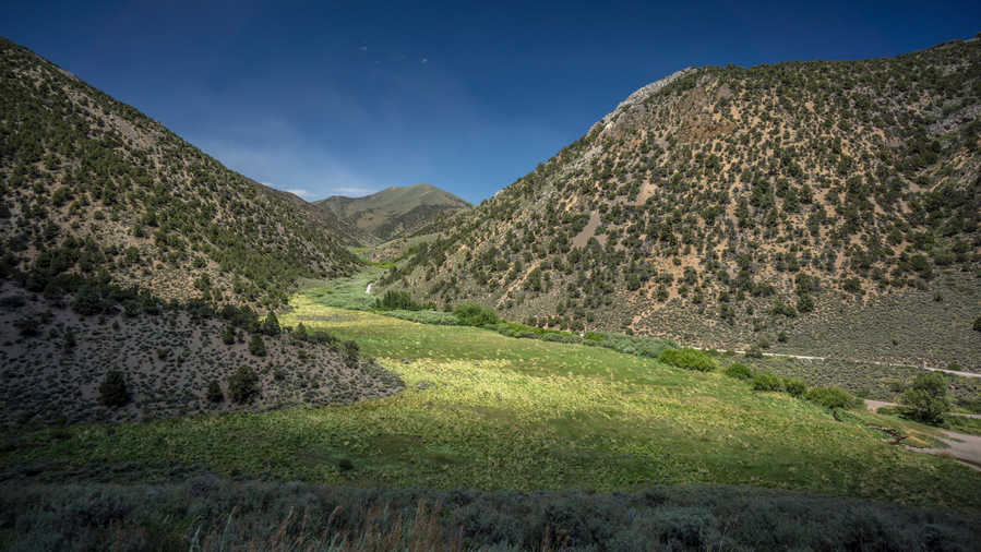
Straight Canyon
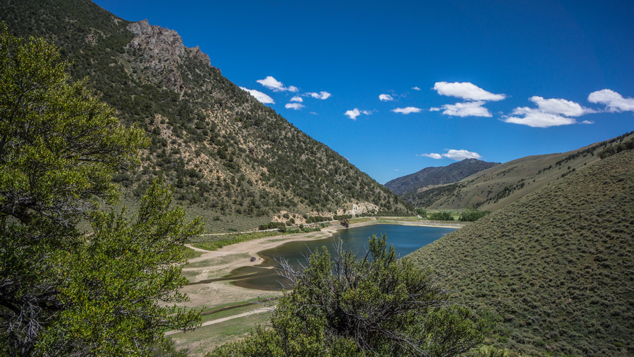
Groves Lake
Groves Lake was definitely low on water. It’s a man-made lake, with a dam on one end. There was a truck with a couple of guys fishing there. Really nice views into Straight Canyon from the lower reaches of the trail.
When I reached the lake, I didn’t bother going for the shoreline, there was no shelter from the sun or wind. Instead, I found a small patch of trees in the parking lot to take a break under. Ate lunch here and aired out my feet. It was decision time. The original plan was to follow a high route extension that began just a little further north from here. However, with the high winds, that plan is not a good one. Not only do I not want to walk in 50 mile an hour winds, I certainly don’t want to have to camp in them. So that’s out. Good thing I had made a low route alternate before coming out here. I’ll take that.

Kingston Guard Station
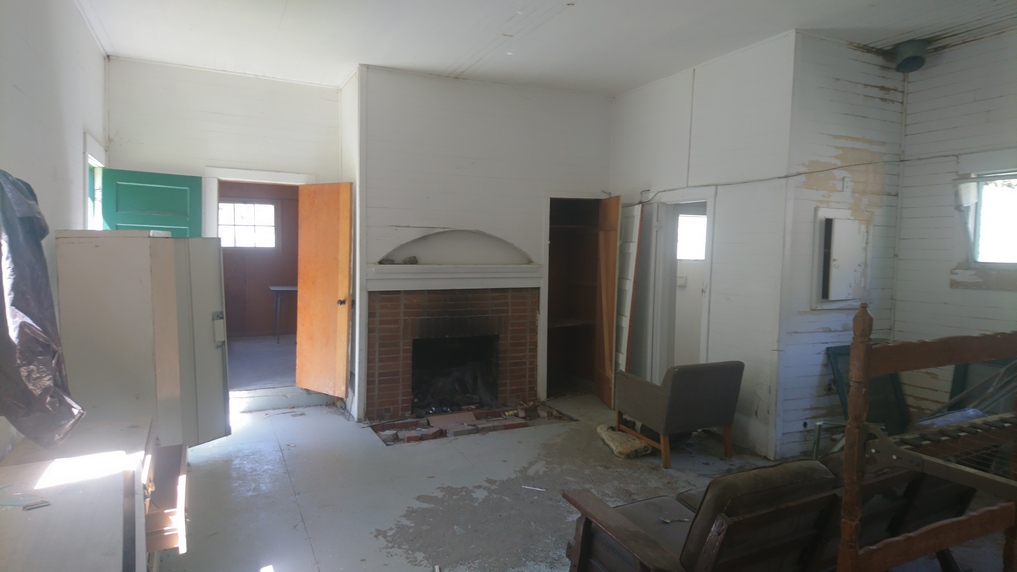
Inside the abandoned Kingston Guard Station
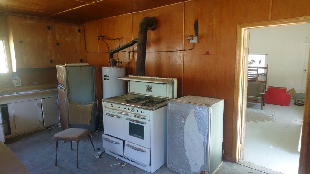
Next I continued down Kingston canyon Rd. This was a very well maintained dirt Road, with a little bit of traffic here and there. A little ways up the road I encountered the Kingston Guard Station. This was an abandoned ranger station, housing for the Rangers and some other buildings. From the road I could tell it was abandoned, windows were broken out and one of the doors was wide open. I went in to have a look and was very disappointed and what I saw. The entire place had been looted, ransacked and destroyed. The brick work on the fireplace had been dismantled, beer cans in the fireplace. Anything of value have either been stolen or removed when funding had been cut for this facility. I walked into another building next door, and there was some sort of bird Nested inside one of the walls behind a cupboard. Another building was like a storage shed. There was a can of green paint that had been opened and someone had smeared it all over. Garbage lay on the floor. There where a bunch of shelves, and someone had opened all the boxes and dumped out the contents. There were literally thousands of plastic knives and forks laying around.
It was a real shame to see the ranger station in this condition. It was a beautiful spot, good view. I just imagined the people that worked there for years, the memories they had there. I am trying to imagine what it was like when the place was open. Was there really that much recreational traffic here to warrant the ranger station?
After leaving the guard station, the next Valley up there was pit toilets and a parking lot. Here, I noticed a sign that said TCT. I’ve never seen a map or read anything that indicates the Toiyabe Crest Trail continuing north from Groves Lake, but the sign is here. I doubt much of a trail exists anymore, but its certainly interesting to see the sign. Also in this parking lot, I noticed a bird that kept swooping down near the same tree. After the bird dive bombed the tree a few times, I noticed a fox or coyote emerge with something in its mouth. It quickly moved on to another set of bushes for cover, and the bird persistently continued to try and protect its nest, its young.

A nice meadow along Kingston Creek
Walking the road was fairly Pleasant, good scenery. There were large Green Meadows with tall grass. And when the wind blew, the grass moved like waves in the sea. That was actually pretty cool looking. However, no signs of cows anywhere in this valley. This blows my mind. I guess they are all up in the High Country. The low lands are not good enough for these cows.
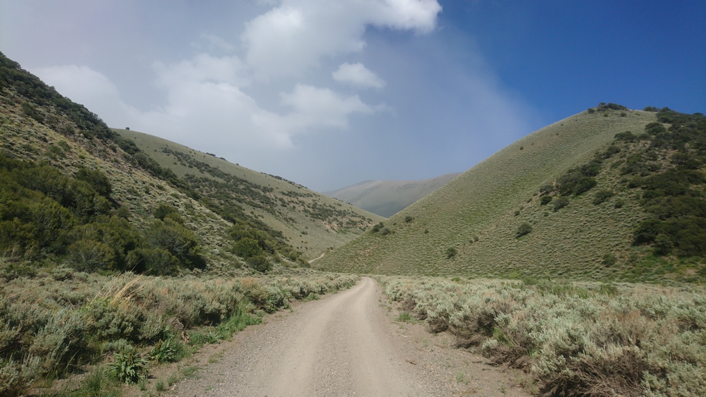
Dust storm approaching. This dust has come from the dried lake bed in Smith Creek Valley, two valleys west
Before the climb up the next pass, I filtered 2 liters of water. Now, I could see dust being blown in from the dried lake to the West. All around me it was moving in, seemingly in every direction.
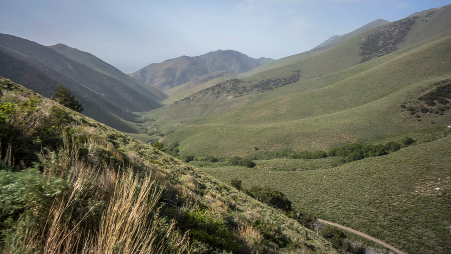
Big Creek
Now I descended into Big Creek Canyon. The road was still pretty good. I saw a couple of car campers along the way, but just the vehicles parked. No humans in sight. After dropping down from the pass, it seems like the temperature had dropped 20 degrees in 10 minutes. I stopped to put on my wind jacket. With all this wind, a cold front is surely on the way.
At the bottom of Big Creek Canyon, I was supposed to take a right and head up North Big Creek. However, I noticed on my map that there was a historical town marked, called Watertown. It looked to be about a half mile away if I just continue down Big Creek Canyon. Thinking it was a ghost town, I decided to check it out. I was disappointed when I arrived to see absolutely nothing there. It was only 10 minutes out of my way each way, so it didn’t set me back too much.
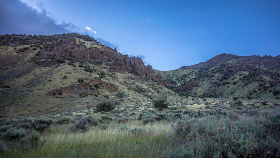
Junction of Big Creek and North Fork Big Creek
Now I noticed a large dark cloud that had been parked right over the mountains for about an hour now. But it wasn’t any normal dark cloud, it had an odd look to it. Didn’t look like a rain cloud. The weather was just weird today.
I headed up North Big Creek now. It had been 2 hours since I stopped for 10 minutes to filter water, and 4 hours since I had eaten last. I was overdue for a break. There just weren’t any good places to stop. Finally, I just stopped at a small rock to sit on. I ate dinner here, and realized how cold I was. I put my pant legs on, and added a couple layers up top. I now had my hiking shirt, wind jacket, fleece, and rain jacket on. I also switched from my baseball hat to my warm fleece hat. It felt like it was in the low 40s.
North Big Creek Canyon became more impressive as I made progress uphill. A 4×4 Road off shoots the main road into another Canyon. Here, at this intersection, was a Green Meadow. It was lined with trees. I thought this might be a decent place to camp, so I went to have a closer look. But of course, most of it was wet, lumpy, extremely tall, and provided no cover from the wind. I never camp in places like this, ever. But it was worth checking none-the-less.
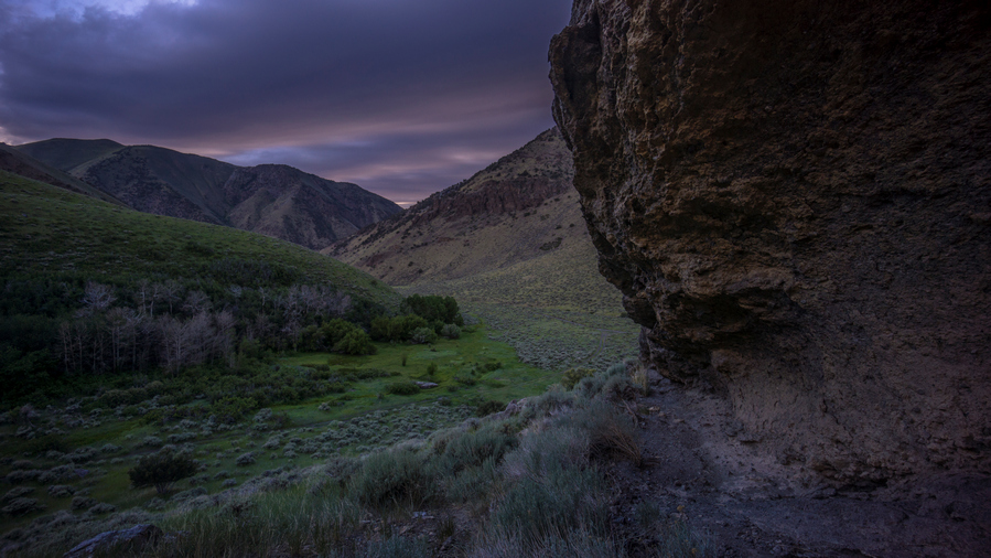
North Fork Big Creek
On the other side of the meadow I noticed a large rock overhang just up the hillside. It looked too interesting to pass up. It was getting late in the day and I was tired, but it was so close that I had to have a closer look. When I got up there, there really wasn’t much to it. Yes it was a rock overhang, but it was on a good slant, and not to deep. Ok, saw it.
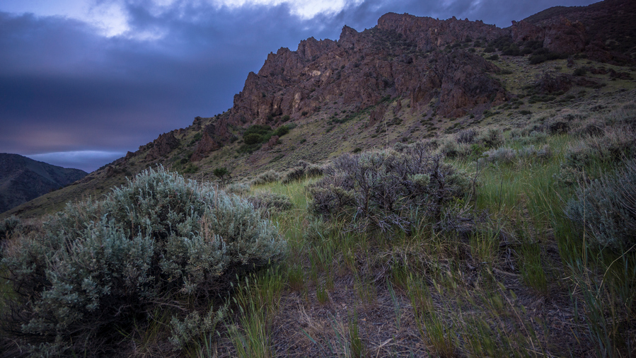
Excellent views in North Fork Big Creek
Still looking for a campsite, I continued up the canyon. It was about 7:30. The creek eventually dried up as I gained elevation. I passed through a couple of patches of trees that gave me a glimmer of hope, but I did not see anything close to a suitable campsite. Of course, if I weren’t so picky about my campsites, I would have just stopped in some random field with tall grass and pitched my tent. But of course, this would provide no cover from the wind, which is a big concern tonight.
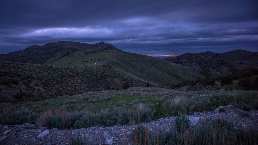
Pass between North Fork Big Creek and Birch Creek. Notice the sheep herder’s tent on the saddle
Eventually I had walked all the way to the top of the valley, and was just below the pass. I had come too far to head back down, so I went up. It was about 8:15 at this point. At the top of the pass, there was a Teepee tent, two horses and several dogs. There was a barbed wire gate here. I stopped at the gate while the dogs went crazy barking at me. I hollered hello a couple of times, but never got a response. I guess nobody was home. I hopped over the barbed wire gate and risked the dogs coming at me. They were actually pretty good about keeping their distance, but they kept barking at me for a half mile. My last GoPro battery had just died heading up the pass due to the cold temperatures, otherwise I would have gotten these events on film. Also, in the distance was a beautiful sunset over the mountains. However, this new view was filled with dark clouds. Looks like rain.
From the top of the pass, I jogged downhill for at least a mile. It was literally a race against time. I had to get downhill before dark to find a campsite, unless I wanted to do it by headlamp. No thank you.
Eventually I reached a spot where the road does a 180 degree turn, with a small patch of land at the curve. This was just above the valley floor. I could hear a ton of sheep bahhing in the near distance, presumably on the valley floor. With the last remaining bits of Twilight, I set up my tent.
Almost immediately after setting up my tent and getting inside, it started sprinkling. Great timing.
Day 29 – June 29th: Toiyabe Range, Birch Creek, Reese River Valley, Stokes Castle
It was actually a very still night. Almost no wind. However, it sprinkled for a little bit right after bed. That didn’t last long. Cold night, too.
My tent was just out of the path of the sun this morning, I was waiting for it to hit my tent but the sound of barking dogs and sheep eventually drove me out of my bed anyway. It was probably closer to 7 when the sun finally hit my tent. The dogs sounded like they were getting closer, and not wanting an encounter with angry sheepdogs, I hurried up and packed things as quick as possible.
At the bottom of the Valley, just below where I camped, there was a creek. However, I wasn’t too eager to filter from it since it was just Downstream from where all the sheep are. And the smell was horrible! So I skipped this water source.
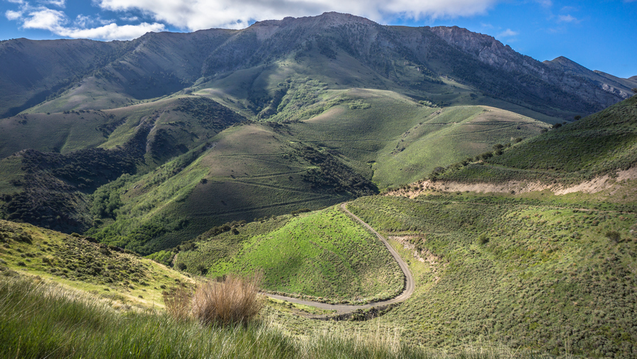
You can see all the switchbacks in the road, These are not marked on the map!
Next, I followed the road for a short ways before my map indicated I needed to climb up hill on a road. This road didn’t seem to exist. So I headed up to Hillside anyway. All of those Terraces I saw cut into the hillsides were actually roads. I hit the first level of the Terrace, and still needed to climb up one more. From the top, looking down, I could see they had a zig zag fashion. I could have just followed a road the whole way up. But, my maps did not show this, it only showed one road straight up the hillside which clearly didn’t exist.
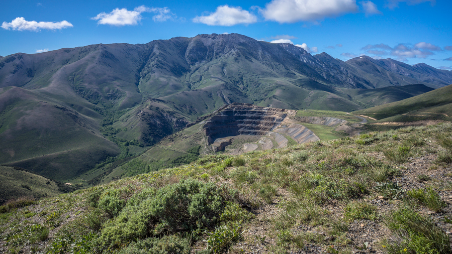
Open pit mine in Birch Creek Canyon
Now following the upper Terrace Road, a large mine came into site. I was on the side that had all of the tailings, which covered an entire Hillside. In fact, I could see a man standing on top of the rest of what was likely the mine. I was going to be walking right through this mine territory, which is private land. However, it’s on a public road, so I shouldn’t have any issues. This was the case. Still, I wondered if he heard me talking to my GoPro. Ha.
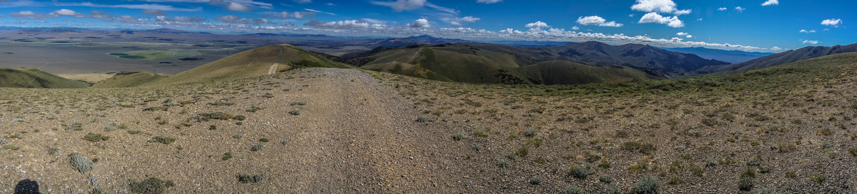
Hiking the crest of the northern Toiyabe Range. There is a network of old 4×4 roads here.
While passing through the mining land, there were a couple of sheep on the hillside above me. This was the closest I’ve gotten to any of them. Then the road goes up a couple of Hills. Of course, many of these were steep. This is where it got really cold and windy. It felt like it was in the 20s or maybe low 30s. I couldn’t feel my fingers or my nose. I stopped to layer up again.
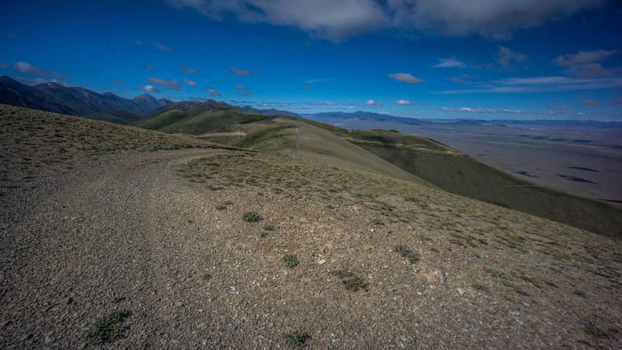
View south along the Toiyabe Range
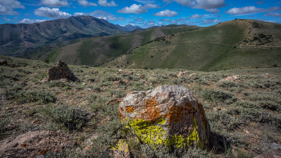
The northern Toiyabe Range is still impressive!
Most of the four by four roads went straight up over the hills and they were quite steep. The kind that you could easily slip and fall on, so on The Descent I would just walk through the Sagebrush alongside the road instead. That is, if I didn’t follow a game Trail around the side of the Hill.
Mormon Crickets. Saddle up!
All over along the ground this morning were giant crickets, called Mormon Crickets. They are a few inches long and as thick as your big toe. Thousands of them. It must have been their mating season. It was hard to avoid them, a few of them got stepped on, walking under my shoes as I walked.
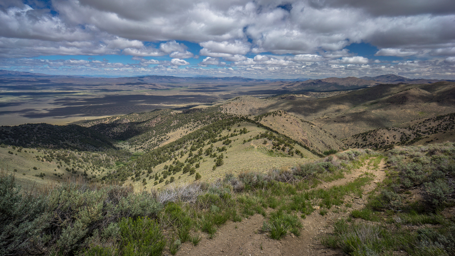
Descending into Veatch Canyon. Reese River Valley in the distance
Eventually I reached my Junction, an even smaller dirt road that veered off the crest of the hillside and took me down to Veatch Canyon. Stopped at the top of The Descent for a quick food break, and a bit of a breather. Took my first gopro time lapse of the entire hike so far here, since there were actually clouds in the sky. Without clouds, there is no motion to capture in a time lapse.
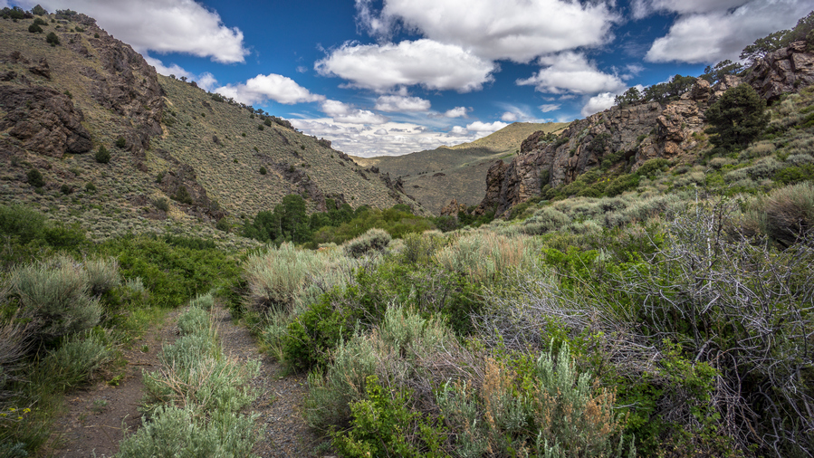
Hiking Veatch Canyon
There were some aggressive birds at the top of Veatch canyon. They kept dive bombing me and squawking at me for a half mile or so. The canyon was quite wooded, and the upper reaches featured some jagged outcroppings. Water was barely a trickle at the top, so I had to keep following it Downstream. There was muddy road Crossings though, one challenging one in particular to get around. There was a down tree, and I had to break a bunch of branches and crawl under it on some gravel that kept me from sinking into the mud.
Eventually I reached a spot where I could filter water. Still, it was very shallow. I have only drank about a half liter this morning, and had maybe a quarter liter left. I was hoping to make it into town, just hurry and get there. To be honest I was still feeling a bit out of it, a bit miserable from the cold although it was warming up a bit now. I just wasn’t feeling the same high I normally get when I walk into town.
As soon as I dropped my pack to filter that water, the urge hit me to take my morning shit that I skipped. I was hoping to make it into town. After taking a shit, Filter in a liter of water and eating a snack, I was feeling infinitely better.
Reese River Valley
The canyon opened up just a short ways after my break. Now, I had a great view of the Reese River Valley. And I began to feel that great feeling that I often get walking into town after completing a section. Still, I had a ways to go. Another hour plus of walking. I reflected on the true meaning of freedom. We talk a lot about freedom in America, but relatively few truly experience the freedom that one feels on a long adventure… no job, obligations or connections to the outside world. Simply wake up and experience whatever the day has in store for you. That is true freedom.
Hiking Reese River Valley
I really enjoyed the walk on the dirt road along the base of the mountains that butt up against the Reese River Valley. There were many mining claims here, past and present.

Stokes Castle

Inside Stokes Castle
After a couple miles of ups and downs, and more mining relics, I reached Stokes Castle. This is one of the most photographed landmarks in Nevada. It’s a three story medieval style castle, built in 1897 by a railroad Tycoon for his sons. It was fenced off, but there was a couple of holes in the fence. Of course, I went inside. Who can resist an abandoned castle?
It was a short walk down to Highway 50 from here. Loneliest Highway in America, my ass! I think that title goes to Highway 6, between Ely and Tonopah. Highway 50 was under construction, and the road that I walked out of the Hills took me right into town. Basically dumped me off into a gas station parking lot, with two cops parked talking to each other. The highway was down to one lane, with a construction worker car that would drive through the one lane with the traffic following. Nothing about this strikes me as lonely.
Cozy Mountain Motel was only a block away. Super convenient! As I was reading the sign on the front door, that had my name on it, the door opened. It was Cassidy, whom Sarah, the owner told me about. She is going to be hiking the Washington section of the PCT this August. Inside the extremely small Lobby, we chatted for quite a while. There were many rocks and minerals up on the windowsill, and quaintly decorated. I like this place already.
I’m my room, my two packages were waiting for me, with a personal note from Sarah. She had gone down to Vegas for a few days with her boyfriend, and would not be here. That was a great touch, and made me feel very special. The room was small but very nice. You could tell the walls used to be wood paneling, And they painted them white. The beds had upgraded Linens, same with the towels, and nice vanity in the bathroom. Nice little upgrades that make a big difference, certainly stands out from all the motels I’ve been in Nevada so far.
First things first, took a shower. The color of the tub hid most of color of the dirt I washed off, but of course I knew it was there. I opened my bounce box, started backing up my SD cards, and got wifi going on my phone. Called Dad, got caught up on things.
Cassidy’s shift at the motel ends at 4, and then she bartends at the owl Club down the street. It’s pizza night, so I’ll be there! I walked in just before 5pm, I was the only one there for a while. The first person to walk in the door with an older guy, with a Sonic the Hedgehog shirt on. He was the owner of the place, popping in to check on things. An Irishman, with a thick accent. Pretty comical guy, even if you couldn’t always understand him. The dynamic between Cassidy and him was funny.
The pizza was delicious. And they had Louisiana hot sauce too, which is my favorite on pizza. Almost nobody carries Louisiana hot sauce, so I liked this place based on that alone.
Other people began to trickle into the bar. First was the two surveyors that were also staying at the Cozy Mountain Motel. I saw them pull in as I was on the phone with Dad. They probably overheard me giving The Rundown on the last Section, but they asked what I was doing in town anyway. So I got to tell my story once again. One of the guys was from the Ruby mountains area, and had spent a lot of time in the mountains growing up. Nothing extended, But he was still pretty interested in what I was doing. We talked about rocks, Gold, mining.
Next, a couple of Road workers showed up. They have the reflective vests still on. They were doing shots of Fireball. I commented about how Fireball seems to be the most common liquor bottle found along side of the road, which got a few laughs.
At one point, the sheriff walked in. If there was ever a stereotypical small town sheriff, he looked exactly like what you would imagine. Big guy, probably 6’3″, late forties, khaki colored uniform, aviator sunglasses and a light colored cowboy hat. I’m not sure why exactly he walked in, Probably just out of boredom. He gave Cassidy a little bit of shit about burning some of the pizzas, crack some jokes and then walked out after about 10 minutes. As he was walking out the door, which stays wide open for all to see, a semi truck flew down the street at a speed far exceeding the 25 MPH limit. the sheriff’s reaction was priceless… he stood in this middle of the street with both hands on his hips and said something to the effect of, “boy, I know you didn’t just speed through my town”! After a moment, he ran into his police truck and began to chase after him. Not in my town, boy Classic!
I walked back to the motel just before 9 and continued backing up my SD cards throughout the night, anticipating a long process That I didn’t want to consume the entire next day. I’ll tell you what though, that bed felt amazing!
Day 30 – June 30th: Zero Day in Austin, NV
Chickens roaming the parking lot of the motel
On the chair outside my motel room, Cassidy had left me two breakfast burritos, AND a bottle of Louisiana hot sauce. So thoughtful! As I ate them on the motel porch outside my room, There were several chickens in the parking lot, and they were begging for my food. Sarah The owner keeps the chickens here, and has about 30 more across the street. They hang out in the parking lot pecking away At whatever they can find. They use them for eggs, and the plan is eventually to harvest the meat. Although Cassidy says Sarah probably won’t be able to go through with it, as all the chickens have names now. I had a few crumbs left on my plate, which I donated to the chickens. They eat bacon and even egg, apparently!
Most of the day was spent doing chores, mostly dealing with the Micro SD card backups. I started going through the video footage, because I couldn’t resist. Good stuff. But also, I wanted to make sure that all of the footage was indeed backed up on my WD Passport hard drive. Since I had no idea which cards were which, it was hard to verify that no data had been skipped. So I began to organize it all… created folders for each section, then moved all of the Footage Into the appropriate folder, verifying that no date had been skipped. When did the same with all of my Still photos. Then backed up my Garmin GPS. Then my cell phone. Then moved all of my Photos and everything else that was on my Phone’s SD card Over to a larger SD card. The 32 gig card with almost full, So 64 gigs should do it Until the end of the hike.
I guess it should come as no surprise, but on my zero days I find myself very tired. Not physically tired, but sleepy tired. I could barely keep my eyes open as I worked through my photos and videos. I spent pretty much all day on this.
Washed my clothes, and found the leak in my thermarest air mattress. I filled up the bathtub and dunked the air mattress. There was a pinhole leak on the bottom of the mattress, probably why it was so slow to leak… weight presses down on the hole, causing it to leak very slowly. I used my patch kit from my bounce box, so I still have the one I carry with me while hiking.
I had planned to go up to the Owl Club for dinner but just felt like staying in. Terminator was on TV, so that played in the background well I did other chores an updated my journal. I ended up going up to the gas station to pick up a chicken sandwich and a bag of chips. I had my neck gaiter on for a covid mask, and As I was walking out, the sheriff walked in. He made a joke with the guy behind the counter, asking if he was okay, if the place is being robbed. Kind of a ballsy move, but I used my hand to make a pretend gun and pointed it at the sheriff, which got a laugh from him. Man I love Austin.
I had planned on leaving tomorrow, to head to Eureka. However, it’s only 91 miles, I only need four days for that. I had originally told the Sundown Motel and Eureka that I would be there on July 6th. If I leave on July 1st I’ll get there the 4th, and I know there won’t be any hotel rooms because Eureka just a big July 4th event. So I called the Sundown motel and ask them if they have availability for the 5th, which they do. So now I plan on staying in Austin until the second, and arriving the fifth in Eureka. That makes sense.
Day 31 – July 1st: Zero Day in Austin, NV
When I woke up, I went outside and on the chair outside my room on the patio was another breakfast burrito plus the box I was expecting, containing my two new Anker battery packs. The one 20,000 mAh battery I am currently using is not enough to keep my electronics charged through a full section.
Today was mostly more town chores. It’s amazing how long this stuff takes. Charge the new battery packs (like 12 hours), clear micro SD cards, save Caltopo layers to cache, post office etc.
Sarah, the motel owner, returned from Vegas today, so I finally got to meet her. She had hiked the Washington section of the PCT and the El Camino Trail.
Went up to the owl Club for dinner with Sarah and Brandon, her boyfriend. Cassidy was cooking chicken wings this evening. Sarah suggested we go to Spencer Springs tonight, but I mentioned that I was hiking there tomorrow and camping there. So she said she would come by tomorrow night, and we can have a soak. Perfect!!
Related Images:
Basin and Range Trail Thru Hike 2020 – Section 3: Tonopah to Carvers
Basin and Range Trail Thru Hike Section 3 Map

Video: Basin and Range Trail Thru Hike Section 3
In addition to this trail journal, I also filmed my Basin and Range Trail thru hike. I’ve produced a detailed documentary series (11+ hours runtime) documenting this thru hike adventure, the product over over 1,000 hours of video editing. I highly recommending watching the Basin and Range Trail vlog series for an in-depth look at thru-hiking the Great Basin and central Nevada.
Basin and Range Trail Thru-Hike Section 3 Journal
Day 17 – June 17th: Big Sand Springs Valley
Slept into almost 9am this morning. It’s been great getting rest, but I’m getting antsy. First thing I did was check the tracking number for the shipment of SD cards I’m expecting today. When I went to bed, it was in Memphis Tennessee. Now, it’s in Las Vegas. That was as of 7 am. Prospects look good, I think I will get out of town today.
Very cold morning, wind was whipping 35 + miles an hour last night. Walked up to the Mizpah to get a couple of haunted muffins for breakfast. Last night, Jennifer at the front desk was telling me about some of the ghost encounters she had there, as the hotel is supposed to be very haunted. Apparently she saw two of the muffins move, literally switch place. Haunted muffins!
Went into the Western store to talk to Paul, the owner. I wanted to let him know that I’m expecting my package today and Didn’t want to come in last minute and say, hey I need a ride. He told me last minute was actually best, so I told him I’d come back in when I received the package.
My package arrived around 1pm. Next I ran up to the Western store. I’ll let Paul know that I’m ready for a ride anytime. He got on the horn and called up a woman named Patty, who was there within minutes. While waiting for her to arrive, I ran back to the hostel to finish packing up my stuff. I called Mickey at the jumping jack motel in Carvers to let her know my new ETA. Then I called Dad to update him on my ETA, and let him know I was expecting a package shipped to the house. As soon as that arrives, a new GoPro audio adapter Mount(which broke on the last section), throw it into my bounce box and send it to Austin.
Ran back up to the Western store, and on my way Tony saw me walking by and came out of the building he was working on to say goodbye. I thanked him for everything, the conversations and the Jewelers Loupe. Great guy. Goodbye friend.
I met Patty And we chatted about rocks and such for a few minutes before we jumped in the car and took off. After a quick stop at Burger King for lunch, we hit the road.
Patty was 50 something, and a bit of a Chatterbox. No problem, I like the conversation. We chatted about rocks, hunting, wild animals and such. The 80 Mile Drive went by pretty quick. I guess that’s because she was going 75 miles per hour, and Matt was going about 45 or 50 the whole way when I got my ride in from lunar crater. Of course, he had a homemade wooden camper thing bolted to the top of his Suburban, and he was likely worried it would get ripped off the roof. From the looks of it, I can understand why he drove so slowly.
Once we got to the spot on the road where my next section begins, she pulled over and turned the car off. We got outside and she began to show me some of the rocks she had collected, sitting in her back seat. And then, we started looking at the rocks alongside the road. Here, we both found a couple of pieces of petrified wood, and I found a piece of Wonder Stone. Pretty cool!
I asked Patty how much I owe her for the ride. She said nothing, but I insisted to at least pay for her gas. We said our goodbyes and just like that I was on my own again. It’s amazing the feeling you get when your ride drives away and it’s time to walk again. Like flipping a light switch, life changes from easy mode too hard mode.

Abandoned Highway in Big Sand Springs Valley

Sagebrush growing through blacktop highway
My task now is to hike off-trail across Big Sand Springs Valley over to the Hot Creek Range. I only took a few steps from Highway 6 before I saw a road running parallel to the highway. It was a black top Road, with Sagebrush growing in between it’s cracks. It’s funny, I thought of Highway 50, loneliest Highway in America. Surely this one is a bit lonelier.

Hiking Big Sand Springs Valley, in between Lunar Crater and the Hot Creek Range
The terrain here was, you guessed it, Sagebrush covered basin. Just feet from the road, the interesting rocks fade away. Everything looks the same. The ground is mostly soft sand, with occasionally slightly harder packed ground. Morey Peak can be seen in the distance, the obvious high point. That’s where I’m going.

Hiking across Big Sand Springs Valley

Looking back at the hills I just hiked in Big Sand Springs Valley
The first hour and a half was rather boring. This should be expected as one leaves the highway. Then I approached a small set of Hills. I could walk around them or over them. I chose to walk over them, not over the highest point but one of the lower saddles. This was good enough to get a bit of an elevated view without needlessly expending too much effort. Of course there were cows in the area, and a few bulls.

Look at me, I’m a deer now
Coming down out of the Hills, I was looking ahead at the terrain. It looks very flat for a while, with no hills or rocks or anywhere to hide from the wind. While it wasn’t too windy, I really didn’t want to have the wind battering my tent all night. I could have stayed here in the Hills, but they didn’t provide much protection either. So I headed out into the open desert to get a few more miles in before sunset.
Eventually I found a small clearing in the Sagebrush, slightly higher than the surrounding Terrain. I decided that I would cowboy camp tonight. Less issues with wind, quicker to set up and I can see the Stars. I haven’t seen much in the way of bugs, and still no snakes or scorpions. I could tell it was going to be a cool night, which means they will not be out tonight. So a good night to lay on the ground!

Sunset over Morey Peak, Hot Creek Range, Nevada
I sent up camp in the shadows of Morey peak, with an awesome orange glow on the horizon.
Day 18 – June 18th: Big Sand Springs Valley, Morey Canyon, Hot Creek Range

Cowboy camping in Big Sand Springs Valley, view of Morey Peak and the Hot Creek Range
It was a calm night, and cold. Bright stars. It was 38 degrees when I woke up.

Hot Creek Range

Deep wash in Big Sand Springs Valley
Continued hiking cross country towards Morey Peak. Deep sand, pain in the ass but could be worse. I’m hiking closer to the base of the Hot Creek Range now, paralleling it, looking for my way up.

Hiking along the base of the Hot Creek Range
Found water along the road in 6 large plastic tubs. No spring or piped water, must have been dropped off by water truck. So this location is not reliable. Crossed the road and continued hiking cross-country.
I was shooting for a pipeline on the map, but it ended up being a dirt road. I followed this all the way to project faultless. Faultless was the site of an underground nuclear test in the 60s. A shaft was drilled 3300ft down and a nuclear device with a yield of 1 megaton was detonated here. Apparently the site is safe to visit.

Warning signs near Project Faultless

Project Faultless nuclear test site
When I approached project faultless I only saw three white markers, like an obelisk, with signs on them that said not to dig or excavator because the soil was petroleum soaked or something. I scanned the Horizon and about 100 yards away I saw the tube I was looking for.

A nuclear device with a yield of 1 megaton was detonated 3200ft underground here at Project Faultless
Project faultless doesn’t really have much do offer. However, it is a unique piece of American history, in that it is one of only two sites in the United States where a nuclear bomb was detonated underground. The other being project Shoal. Project adiago was about 2 miles away, they would have dropped another bomb there but there was too much seismic damage here from Faultless. I skipped that Adiago since it was out of the way.
The shaft that the nuke was dropped down into was originally flush with the surface, but after the explosion the ground in the area sank 9 feet. I thought this would be a good lunch spot, leaning against the exposed shaft in the shade.

The Hot Creek Range rises sharply above Big Sand Springs Valley

First trees in days as I enter the Hot Creek Range

Flowing creek in the Hot Creek Range, a surprise
After leaving the test site, I followed a road. This turned up a canyon, and quickly the road dissipated. Back to Bushwhacking. There was a small Creek that flowed alongside the road. This makes for thick vegetation. The road was intermittently decent. Eventually I crossed the stream and followed another road out of the wash. I believe there was a road running all the way up this Hillside above the wash this whole time. This would have been a better option. It was wide open and offered good views, and was not a bushwhack.
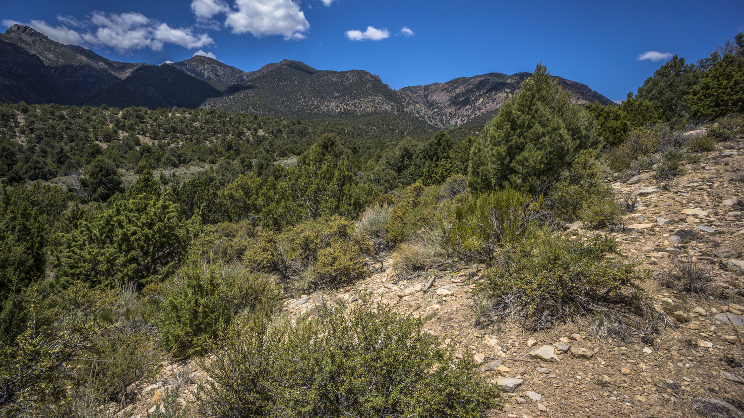
Entering Morey Canyon, Hot Creek Range

Green grass meadow in Morey Canyon

Stone foundation is all that remains of this old mining camp in Morey Canyon

Looking back down Morey Canyon to Big Sand Springs Valley
Next I entered Morey Canyon. There was a small Green Meadow here with a couple pools of water, but of course, lots of cow shit. Such a bad smell for a beautiful area. Uphill from here there was remnants of an old mining camp. Mostly just a stone Foundation.

Abandoned structures in Morey Canyon
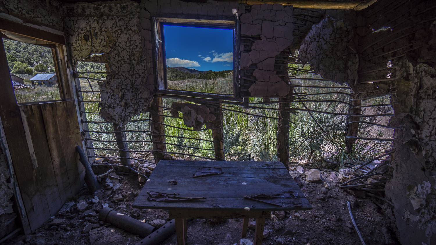
Inside abandoned cabin in Morey Canyon, Hot Creek Range
Farther up the canyon I could see a few abandoned buildings, but they looked a bit newer and better condition. Sure enough, these were a bit more modern, one even had wallpaper and drywall inside. But, the roof was caved in and walls were buckling. That was the first house.

3 more abandoned buildings

Morey Canyon cabins

Old cabin in Morey Canyon
Across the road were three more abandoned structures. The first one had a door that was closed, and an exhaust pipe from a wood-burning stove protruding out of the wall. I opened this one and saw a chair facing me in the middle of the room, with two beds alongside the wall. A creepy vibe, but I quickly realized that this was a little cabin that was open to anyone who could reach it. Not unlike some of the cabins I saw on the CDT. Still, I wouldn’t stay in this one, it was pretty dirty. There was a dead mouse inside the wood-burning stove. Writing on the wall, and I recognized a couple names… Otteson. They own the turquoise mines in Tonopah. I utilized the chair and the shade to take a little break. This was nice, a bit of Comfort if you could call it that.

Hiking Morey Canyon

That’s a lot of trees

Hiking the Hot Creek Range
Next the road climbs out of Morey Canyon. The road here was surprisingly good. I saw another cabin or two on the way up. Good views as I gained elevation. Eventually the canyon reaches a high point, and then the road follows North Canyon. I found a spring here alongside the road that was not on the map. It was guarded by Thorn bushes, but I found way around. I stopped here and filtered some water. I discovered I have a leak in my platypus bag, where it folds on the bottom. I attempted to fix it by patching it with a piece of dyneema, which only slowed the leak. Still, this patch was good enough to last the rest of the hike.

Hiking higher up into the Hot Creek Range
Next the road becomes steep. And top of that, the crazy ants were back and wouldn’t leave me alone. So I kept moving, and tried not to stand in one place for more than a few seconds.

Old 4×4 road continues up North Canyon

North Canyon views

Looking down on the route I came up through North Canyon
When I reached the point where the road ends on the map, I was surprised to see it continue all the way up to a saddle. Great views on the way up of North Canyon and beyond.

Outstanding views in the Hot Creek Range

Morey Peak now visible in the distance (center)

Crest of the Hot Creek Range

Big views from the Hot Creek Range
Even better views from the top of the pass. Here, the road splits. I took the one that heads over towards 6 Mile Canyon. These roads were not on the map! I was really happy to have a road to follow, and even happier with the extremely beautiful views. Rolling Green Hills, rock spires and outcrops.

Sixmile Summit & Devil’s Cave Ridge

Cool knife edge rock formation begging to be climbed upon

Horse trail on Sixmile Summit
Eventually my road splits off, towards Morey Peak to the left and 6 Mile Canyon to the right. Even though I’m going left, I couldn’t resist going right, just to have a look. The road quickly turns into a trail, but again, not on the map. Most likely, horse trail. The Trail passes by a Rocky outcrop, a Jagged knife Edge covered with orange lichen. So of course I checked that out, climbing out on it and such. Then I went up over the little pass over Devils Cave ridge. Excellent views of 6 Mile Canyon. I would be happy to hike here, if I hadn’t already decided to bag Morey.

More cool rock formations along the crest

View of Devil’s Cave Ridge (right) as I hike the crest of the Hot Creek Range

Trail to Morey Peak on the crest of the Hot Creek Range
I made my way back down to the Road that heads towards Morey Peak. This too quickly turned into a hiking trail. I’m not sure how long this Trail will exist, but in the meantime I’m happy to have one. I took a break overlooking a canyon, ate dinner, and was happy to see the trail continue along the hillside to the next saddle.

The incredible Hot Creek Range

Hot Creek Range looking south towards Morey Peak
Made it to the next saddle and was then blown away by more excellent views of Nevada wilderness. The Fandango Wilderness and the monitor range in the distance, the Sun creating a hazy effect. Absolutely gorgeous. And the Trail persists!

Basin and Range topography
I’m looking for a campsite now, but being picky. I want a great view, I just don’t see a good clearing for my tent or to Cowboy camp. So I kept going.

Sun setting in the Hot Creek Range
The great views continued and I was moving rather slow. That’s okay, this has probably been my favorite part of this entire route so far. Even better than the views from the grant range. Ok, hard to compare, and why bother? Some great miles to be hiked here.

Looking east into Big Sand Springs Valley, Lunar Crater and the Pancake Range, and beyond
I went up many small Hills and each time I was disappointed to not find a campsite. So I continued on. The sun was setting soon, so I kept walking. I crested another saddle, this one had a flat spot that I could have camped on. But it was a bit plain looking. I so once again I kept going. On the other side of this saddle the Sun was no longer shining here. It was approaching 8pm when I finally I found a spot that I liked. A Little clearing in the Shadows of Morey Peak, highlighted by the last fading rays of sunlight. There was also an overlook of Big Sand Springs Valley, where I came from earlier this morning. A couple trees around, and did not feel too exposed. Good campsite.

The ‘ol Tarptent Notch Li, in the shadows of Morey Peak
I’ve had a lot of these moments on this route, where I thought I was going to get stuck with a crappy campsite but ended up with a really nice one. Unlike the CDT, where just about every night seemed like a subpar campsite.
Morey looks intimidating from here, and I’m unsure about my route down in to 6 Mile Canyon. It’s probably going to be another cold night, so I have my tent set up and a little extra clothes on.
Day 19 – June 19th: Hot Creek Range, Morey Peak, Sixmile Canyon, Fandango Wilderness

Morning in the Hot Creek Range
Slept pretty good last night. Got up at 6:15, when the sun hit my tent. Great views of Morey peak. Not as cold as I was expecting./

View north from the crest of the Hot Creek Range
Left camp and continued to follow the Trail towards Morey Peak. The trail is much more faint now, and fading quickly. There were really no big climbs, only small ones to little saddles and ridges. Each one provided an excellent view. Beautiful blue skies, no wind. Perfect day to Summit a peak.

Hiking the route up to Morey Peak

Bristlecone pine tree in Morey Peak Wilderness
The rest of the route was fairly easy. No real exposure, not too technical. A couple of spots with some loose rock and a few short sections of scrambling. A couple of bristlecone pine trees could be found on the saddle just below the summit. These impress me, their massive size and incredible age.

Final scramble to the summit of Morey Peak
After a couple of false Summits, the final Summit block of Morey Peak was in view. Like many of the cliff faces around here, it was covered in lichen. Orange and Neon green. This contrast always makes for a great photo.

Summit view (looking south) from Morey Peak, 10,246ft. Highest point of the Hot Creek Range, Nevada

Summit view (looking north) from Morey Peak, 10,246ft. Highest point of the Hot Creek Range, Nevada
A short scramble with minimal exposure brought me to the summit of Morey Peak, the high point of the Hot Creek Range at 10,246ft. Woohoo! Absolutely incredible view. I reckon a 125 to 150 mile View, based on the fact that I could see what I think was wheeler peak in Great Basin National Park. I had measured that at 100 air miles away from the ridge I walked along the grant range, and now I am a few ranges even further away. There were three usgs Summit markers but no Summit register. No summit register on the high point of an entire mountain range? Ok, Nevada. I guess with 310+ mountain ranges, not every range high point gets a register.

Hot Creek Range viewed from Morey Peak summit

Morey Peak summit view north
I spent about 30 minutes on the summit. With the effort it takes to get here, a break is well deserved. Again, absolutely incredible views. Surrounded by mountains as far as the eye could see. I could clearly make out the route I walked all the way from the Quinn Canyon range. I love the way the light Reflects off the dried Lake bed of lunar Lake. Morey Peak was one of my favorite summits along the Basin and Range Trail.

Looking back at Morey Peak
Now it was time to get down off Morey Peak and continue on my route. I think most people who climb this peak come in from Morey Canyon and then North Canyon like I did, then backtrack the way they came. In retrospect, that’s what I should have done too. Instead, I chose to go down a random Canyon. So I descended the summit, which was rather steep and loose, and headed for said Canyon, having picked the one that looked the least steep from my map.

This canyon is my route down. Wish me luck…

Looking back up the canyon, what I’ve hiked down so far
When I reached the top of the saddle where I would drop down into the canyon, I could tell it wasn’t going to be easy. It looked steep, but better than Willow Canyon, more wide open and less vegetation. Still, it was slow going. I was mostly following a dried Creek bed.

Looking up towards Morey Peak. It’s getting steep now
It was slow and tedious but I was making decent progress. That is, until I reached a point where I had to jump from one small Creek bed over a little hump into another small Creek bed. This is where it got really steep and even slower. There was more vegetation and awkwardly stacked boulders creating small but cumbersome obstacles.
Then I looked at my map and realize this was the point I needed to begin to Contour around the mountain side. Unfortunately, it was extremely thick vegetation. There were no game trails. Sometimes it would take a few minutes to go 10ft. When you look at it, it does not look humanly possible to Traverse it. Sometimes I was crawling on my hands and knees, but most times I simply had to break branches to clear a path in the direction I need to go. Another nightmare bushwhack, exactly what I was fearing.

The beautiful Hot Creek Range and Morey Peak Wilderness
Fortunately I only needed to go about a quarter mile. Still, this was extremely exhausting. I walked away with a couple of cuts on my legs and hands, the ones on my hands from breaking branches. A good set of gloves would have been really nice. Finally the trees thinned out and I made my way to the saddle I was aiming for. Climbed to the top of a High point and took a while deserved break. Ate lunch and fueled up for the next section. Great views looking back up at the Morey ridgeline. Truly outstanding views, actually!

Looking down at the rest of the descent into Sixmile Canyon. I’ll take the ridge right/center
My original plan was to walk down the valley, but after this latest bush whack, I wanted nothing to do with it. Instead, I followed a Ridgeline above the Canyon. This had a decent game trail running across the top. At one point progress slowed because of a steep descent. I had to Contour around the hillside to meet up with another Ridgeline.

Looking back up at the Morey Peak ridgeline
I followed the Ridgeline all the way down in to 6 Mile Canyon. Before reaching the bottom, I could see a four-wheel drive Road running up the canyon that I Originally wanted to walk. You never really know if a 4×4 road on the map here in Nevada will actually exist on the ground. The road was only visible on the lower reaches of the canyon, plus it was a bit steep to get down to. Thus, I stayed on the Ridgeline the whole way.

Hot Creek Range from Sixmile Canyon
Down in 6 Mile Canyon, I found water almost immediately. There is a creek running downhill, and the road running through the canyon crosses it several times. However, there really weren’t any good collection points. It was shallow and it’s banks were covered with thick and thorny vegetation. I kept walking uphill towards 6 Mile Summit, hoping for a better spot to collect water from.

Vibrant wildflowers of Sixmile Canyon
There was a section with some beautiful blue wildflowers just completely covering the ground. Before the summit, I found the source of the spring. Probably best to collect from here since there was a lot of cow activity Downstream. Just like everywhere. Even here it was a bit difficult to collect water, but I made it work. It felt great to wash off a bit in the Stream after that horrendous Bushwhack!

Sixmile Canyon, view south
Walked up over Six Mile Summit and dropped into a new Valley. Not incredibly impressive, certainly a better view from above… This is the spot that impressed me last night, right before I began the walk along the Ridgeline to Morey. I had spent almost an entire day hiking a big semi-loop, just to bag Morey Peak, and have only made about a mile of forward progress along my route. Still, it was worth it. There were many green Meadows along the way as I made my way downhill. Also, many horses. Saw 7 or 8, including a pony, in the upper reaches. There were seeps and springs forming a couple of small creeks. Farther down, I saw another five or six horses. I even saw large clumps of horse hair on the ground.
Then I left the main road and headed up hill into an unnamed Canyon. This too was pretty green. The middle section of the climb was extremely Lush. A spring formed a small Creek, with lots of trees. Beautiful stands of Aspen. Again, the ants were quite a problem. I could not stand still without getting bombarded. So I made my way up hill quickly. When I emerged from the thick Lush area, above the spring, I saw another five or six horses. I scared them up over the pass that I was headed for.

Entering the Fandango Wilderness

Descending unnamed pass north of Mahogany Peak
The pass itself didn’t have much of a view. The view looking down into the canyon I was headed into was nice, but not blow you away nice. I followed a game trail downhill, probably built by horses. This Upper Canyon was Pleasant, a different vibe then some of the other mountains I had been too. Not too Jagged, kind of a Rolling Green look.

Small spring. Notice the horse in the distance
I followed a drainage down to the upper reaches of this Canyon. Here, a horse was getting a drink from a spring. A creek flowed through the canyon. Lots of water here, and all around this afternoon actually. The upper reaches of this Canyon was really nice, very green.

Big Cow Canyon, Fandango Wilderness
Now there was a 4×4 Road to follow. I enjoyed the walk downhill, as The sun was getting lower in the sky and the temperatures were pretty mild. A relaxing walk.

Distant view of Little Fish lake Valley and the Monitor Range from the Fandango Wilderness
Followed another dirt road out of Big cow Canyon, over to Little cow Canyon. I found a flowing Creek here. It was 7pm, so I stopped to fill up water and eat dinner. Filtered 6L. Chugged one with dinner and took 5 with me. I’ll chug another with breakfast, and that gives me 4 liters to make it out of little cow Canyon and across little Fish Creek Valley tomorrow.

Sunset in the Fandango Wilderness
I only walked another half mile before setting up camp. I found an interesting colored Sandy hill to setup on. It was now about 8:15, sun was going down. Feet were a bit tired today. Also, feeling like I’m a little short on food for this section.
Day 20 – June 20th: Little Cow Canyon, Little Fish Lake Valley, Clover Creek

Campsite in the Fandango Wilderness
Woke up around 6:30. Followed the road downhill until it disappeared. Then it was off Trail, following a creek bed. This Dry Creek bed hit a junction with another drainage, which did have water. Then I followed that Creek downhill.

Entering narrow box canyon in Little Cow Canyon, Fandango Wilderness

Small cave in Little Cow Canyon
I’m in Little cow Canyon now. Map shows a box Canyon for a short ways. I could see the entrance, some rocks and Cliffs, a small cave. It was really nice. There were a couple of pour offs, but in the 10 to 20 ft range and climbable. Not crazy thick with vegetation. Pretty enjoyable walk, actually.

Hiking Little Cow Canyon
After passing the narrow part, Little Cow Canyon opens up again. There were decent game trails to follow most of the way. None of this was very difficult. What a relief!

Looking north in Little Fish Lake Valley. Hot Creek Range on the right
The lower reaches of Little Cow Canyon where less impressive. When I finally exited the canyon and entered Little Fish Lake valley, it became obvious it was just one Branch of a large Network of alluvial fans. The road I had followed out of the canyon disappeared, and I was left on my own to hike cross country. I know there is a private ranch in the valley that I must walk around. Unfortunately, it runs North and South through the valley for quite a ways.

View across Little Fish Lake Valley to the Monitor Range
I walked across the ups and downs of the alluvial fans, staying near the trees as much as possible. Found a great place to take a break overlooking the whole valley. Couldn’t really see anything going on down there. Once again, I felt like the only one live, last one on Earth.

View east to the Hot Creek Range and Fandango Wilderness
Eventually I approach the ranch. I was on a pretty solid road, and I was hoping it would pass right through the ranch. Like an access point to public land. Fortunately, I hit a fence line. The road appeared to be only usable by the ranch, even though it was on public land. So now I had to decision to make… Hike north or south. Either way I have to walk around the ranch. It would have been a shorter hike to hike North, but it would have been out of the way. So I opted to hike South, the direction I need to go, and hope for a road that passes through the ranch, like one for public access to the hot Creek range and Fandangos.

Little Fish Lake Valley
The hike along the ranch sucked. Fence line as far as the eye could see. And to make matters worse, it was the finest possible type of sand. Not even sand, each foot step created the finest dust cloud imaginable. I later learned a better term for this type of soil poof dirt. Before long my shoes were full this fine powder. Every time I thought the fence line was going to end, it’s simply turned in a different direction. I followed the fence line for about an hour and a half.
I went up over a hill and saw that the fence line continued to the horizon, as far as I could see. Unfortunately, the road that I want to take into the monitor range was directly west of me right now. There’s no way I’m going to hike miles out of my way just to go around this stupid Ranch. The ranch itself, and all of the cow activity, was further north. With nothing in sight, and only about half mile to cross the open ranch land, I decided to hop the fence and go for it.
The first little ways, I was walking behind a bit of a hill, pretty much hidden and out of sight. The final 2/3 or so we’re a little bit more out in the open. However, there was a road that runs right towards the main road running perpendicular to it through the valley. The Sagebrush was tall, maybe about chest height. I walked very quickly and kind of hunched over a bit, hoping to stay hidden from site as much as possible. Realistically, I was pretty far south of anyone that could see me.

Hiking Little Fish Lake Valley
When I reached the main road running through the valley, there was no fence line like there was separating the public land side on the hot Creek range. I crossed the road and continued West along another road that leads into the monitor range along Clover Creek. Pass through a gate, should be on public land now.
Follow the road up ways, towards a spring I had marked on the map. There was a mother cow and calf on the road. The mother ran away, and the calf stayed. I continued my course, walking the road. All of the sudden, the calf started to charge me from about 100 yards away. It ran at me and only stopped 10ft away, as I was yelling at it and waving my arms. It was kind of weird, I’ve never had a cow charge me like that, especially not a calf. What’s gotten into that one?
Walked up to the spring, which was dry. Actually, there was more than just a spring here, there was an old cabin. It was more like a trailer. However, it had signs of recent use… The window was open, only guarded by a screen. The deck had been replaced at some point, and had newer screws in it. I could see through the window, and there were shelves that were stocked with a few items, a modern lighter sitting on the table, etc. I yelled, anyone home? No response. It looks like the type of cabin that’s open for anyone to use since it’s on public land. I tried to open the door, but it was blocked from the inside, I think something was sitting on the ground right behind the door. The door was basically falling apart as I tried to open it, so I’ll let it be. There was an old wooden outhouse stocked with toilet paper. Clearly people have been using this, like this year. There were also some recent tire tracks leading up to the place. Either way, not much for me here, especially if I cant get inside.
After leaving the cabin, I begin to feel a bit off. I was feeling really hot and really thirsty. I only had 1L water left, and not sure of my next water source. I was beginning to get a bit of a headache as well.
The lower reaches of Clover Creek canyon were a bit boring, not unlike many of the other ranges. The lower elevations of these mountain ranges are usually not super interesting. I passed one spring on my map that I had marked dry, and I found it dry. However, there was insanely thick Willow and Thorn bushes along the creek.
The next spring was a couple of miles away. Before I can reach it, I found a flowing Creek along the side of the road. I kept following it up stream until I found a good spot to take a break and filter from. I was really happy to have found water here, I wasn’t feeling my best. I took my shirt off and begin to splash water in my face arms and cool off. This alone felt amazing. Then I filtered a couple liters, chugged two. I left this spot with only one liter, once again rolling the dice that there would be more water Upstream. I never considered myself a gambling man until these last couple weeks.

First view of the Monitor Range high country from Clover Creek
Sure enough, there was plenty of water Upstream. There was a couple of times where it looked like the road was going to fade away, but it was only a short section with tall vegetation, and then the road continued on in good shape. Eventually the canyon opened up a bit and the High Country of the Monitor Range was now visible. The views were getting better and I was starting to get excited about what lies ahead.

Old farming equipment in Clover Creek Canyon

A very lush and green section of Clover Creek
The road eventually stops at a point where it crosses Clover creek. There were several nice campsite here, but not nice enough. Ha! I could tell I can afford to be picky here. There were some Jagged rock formations up ahead, this is what I was shooting for. A foot path continues on from here, through some very thick stands of Aspen, Willow, and Thorn bushes. Very thick! Good thing for this trail.
Made it into an open Meadow along Clover Creek that was quite Majestic. The centerpiece of the meadow featured a Jagged Sawtooth-looking rock formation. Behind that, Rolling Green Hills, with the sun behind them. Behind me, the way I came, was another large rock formation. Everything about this little Valley was breathtaking. Except, when you took a breath, it smelled like cow shit. Cow patties as far as the eye could see. I am beginning to notice a pattern of cows in the higher elevations of these Nevada Mountain ranges.

My Tarptent Notch Li in the Monitor Range
I had to clear several piles of cow shit to make room for my tent. The entire Valley was basically trampled, no green grass, just brown dirt. Only near the spring was there a small patch of grass. I set up near here. Excellent views.

Campsite in Clover Canyon
It was a real luxury to have a water source so close to camp. I was able to soak my feet and clean them properly, clean my socks and Gaiters. Filtered a couple liters and rehydrated. Big climb tomorrow up to the crest of the Monitor Range. The views are going to be awesome!
Day 21 – June 21st: Clover Creek, Monitor Range, Table Mountains Wilderness
A large animal was heard walking near my tent last night. My guess is, horse. I yelled a few times, then got my headlamp on and got out of the tent. Didn’t see anything.

Hiking upper Clover Creek Canyon
The first bit of hiking this morning was okay. Pretty much the same as always, Sagebrush, cow shit, some trees to dodge. Nothing too crazy, nothing too steep. That is, until it got steep. Its 2000 ft climb up to the top of the crest now.

My route up to the crest of the Monitor Range

View east down into Clover Creek, where I had come from. Hot Creek Range is in the distance
My GPS map had a trail marked, Clover Trail number 24052. How funny, you can count the number of trails in Nevada on one hand. They certainly don’t have 24 thousand. Either way, the trail did not exist. I followed its general route until I decided to leave it for a route my eyes saw as the way.
I encountered my first rattlesnake of this hike this morning. It was about 10 ft away under a Sagebrush. I was just shy of 10,000ft in elevation here, not exactly where I was expecting to see this snake, either. Got to keep an eye out now I guess!

Final route to the top of the Monitor Range. I’ll climb right of the cliffs, but a thicket of Aspens stand in the way
Just below the top, there were a few stands of Aspen to work through. Somewhat thick, and on a Steep slope. There were a few false Summits along the way to tease me, of course.

Crest of the Monitor Range, view east into Clover Creek, Little Fish Lake Valley and the Hot Creek Range
Finally, I climbed over the highest ledge and found myself on a massive flat plateau at 10k feet. I’m now on the crest of the Monitor Range, and have entered the Table Mountain Wilderness. Great View, and it felt great to be done with the big climb. Much more climbing to be done today though as I hike the crest of the Monitor Range north.

View north along the crest of the Monitor Range

View south along the crest of the Monitor Range
The first bit of walking was a long a Cliff with excellent views. Then the route veers away from the edge. Here it was a bit of a depression in the plateau, and it was filled with Sagebrush. Hard to believe this is 10,000ft. There were some rather large stands of Aspen on the plateau as well.

Old 4×4 road, view south into the Table Mountain Wilderness

Hiking the Table Mountain Wilderness
Found a very old and faded 4×4 Road, which today serves as the trail here. It was heading up Hill, the kind of ascent where you can’t see anything except the hill and the sky. Kind of reminded me of Colorado, the section in the San Juans with the Colorado Trail High Point.

First view west to the Toquima Range
Soon I would have my first views of the Toquima range to the west. A little snow on top, but not much.

Hiking the Monitor Range north through the Table Mountain Wilderness

View east across Little Fish Lake Valley and the Hot Creek Range

Table Mountain Wilderness view southeast
Then, awesome views! Here, there was an excellent vantage point over the route I had just came up, as well as back towards the Fandango Wilderness and the hot Creek range on the east side of Little Fish Lake Valley.
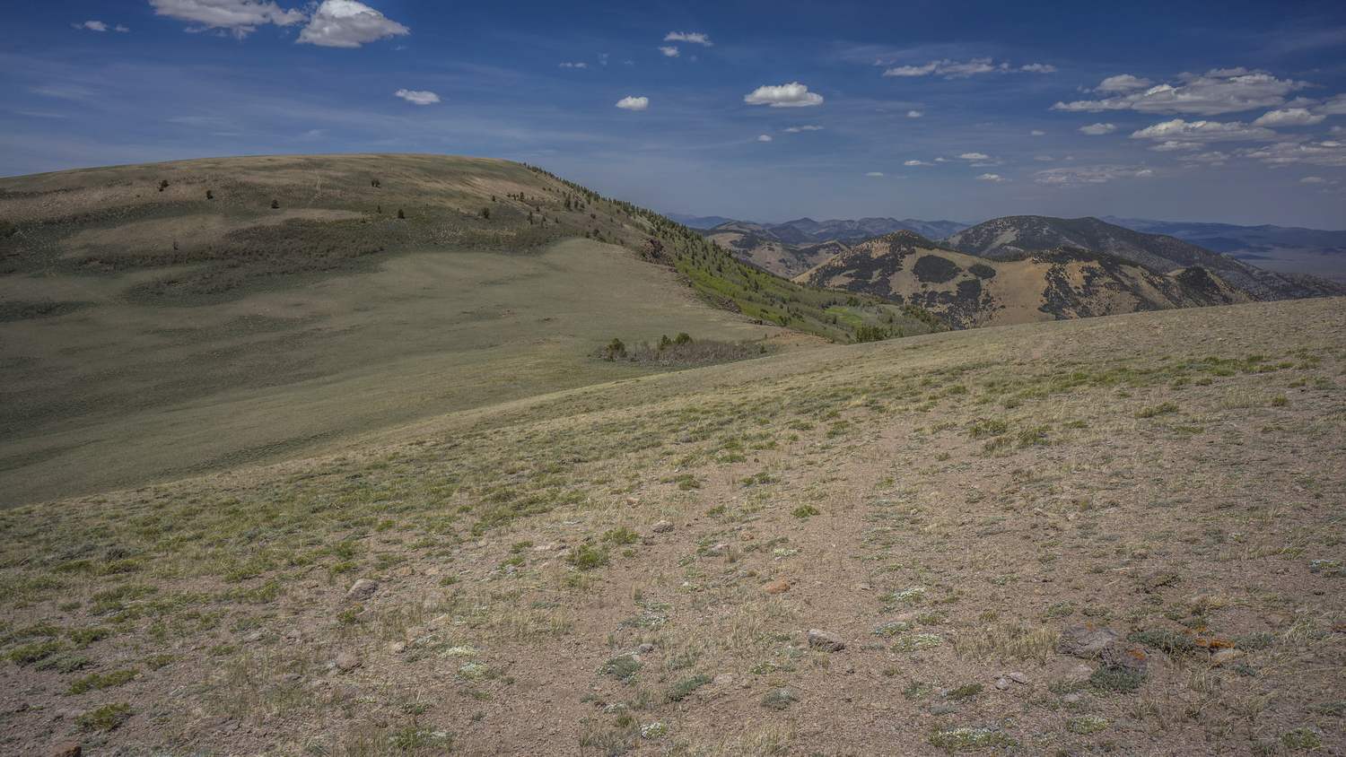
Ups and downs hiking the crest of the Monitor Range
Next was the first real high point at 10500 ft. I stopped here to check for cell phone service, but again, no. It was really windy now. Stopped here and ate lunch.

Hiking the crest of the Monitor Range

Views from the Monitor Range
The rest of the afternoon was an enjoyable walk along the ridge with similar views. The east side of the Monitor Range crest had the steepest drop offs, while the west side was rolling hills. Small patches of snow could be seen just below the crest in a few spots, but not many.

View from Danville Peak (10,888ft), highest point in the Monitor Range
Next I summiting Danville Mountain, the high point of the Monitor Range at 10,888ft. This wasn’t much of a summit, just barely higher than everything else. Still, a cool view over a steep, twisting ridgeline.

Time to drop down off the crest of the Monitor Range into North Fork mosquito Creek
Now its time to drop down into North Fork Mosquito Creek. I could see there was a lot of thick vegetation ahead and likely, bushwhacking. I opted to follow a Ridgeline down, hoping the south side of the Ridgeline has less vegetation then the north. I was correct, but there were still bushes to be whacked.

Hiking good “trail” through the aspens
My route took me straight into the thick aspens. Instead of continuing along my route, I noticed a game trail that seem to be skirting around the edge of the trees. Good call, game. This took me around the aspens and led me to a foot Trail. I followed this trail through the Aspen trees, bewildered that a trail on the map actually exist on the ground. A rare moment on the Basin and Range Trail.

Looking back at the route I cam down, through the aspen trees. I would not have thought that was a good route had I been hiking up.
Followed the trail to a spring. However, I missed my turn, I was supposed to cross the creek a little earlier. So I back tracked, assuming the creek would still be flowing when I crossed it. It took me awhile to find my way down to the creek and find this Trail, but when I did, the creek was dry. I could backtrack to where the spring was, but decided to roll the dice and walk another 2 miles to another spot where there could be water. Gamblin’ man, at it again.
The trail became faint pretty quickly after leaving the creek. Then it disappeared. I got off track a couple of times, but eventually made it to the next spring. This whole Creek bed was dry. However, I was on a good horse Trail now. I was also a bit off my route. I followed the horse trail a ways, and then decided to go further off my route to another spring a mile away. Along the way, I stopped to check my map. All of the sudden I heard something in the bushes behind me, maybe 15 ft away. It was two fawns, and their mother… They were bedding down and apparently I scared them. In the process they scared me pretty good!
Not long after, I was on my way to the spring when I saw a small buck in the wash. Cool. Not long after this, I found myself at the spring. There was water, but it was covered in clovers and green plants. So I followed it Downstream. Here, I saw a couple of big bull Elk drinking from the creek, just beyond a downed tree. There were four of them, and one had some pretty massive antlers. I watched them for a minute, before they got wind of me and ran away. Water is all mine now!

Sunset in the Monitor Range
Filtered four liters and ate dinner. Feeling much better now, I decided to keep walking. It was 7:30 now. I could have camped in this little Valley, there was a Green Meadow. But I was wanting to get back on my route. I hadn’t seen any campsites all day, and definitely not within the past 30 minutes before reaching the spring. Still, I rolled the dice and moved on.

The flattest, clearest place I can find. Still, not large enough for a tent, will have to make it work
I was feeling pretty good for the first hour. Sun low in the sky, some food and my belly and water and my stomach. It wasn’t long before the pack Trail on the map I was following disappeared. Now, I was on a sloping Hill, working my way around to another hill with a steep slope. My maps indicate a pack Trail here, so that’s what I’m heading for. Unfortunately, I didn’t see it when I got there. Sun is going down, and I have nowhere to camp. It was so thick here, nothing remotely clear or level. I ended up hiking back up to the crest of the Monitor Range again. Even here, I barely had a place to put my tent. I was forced to uproot a couple of sagebrushes in order to make room for my tent, and just barely. The sun had long set, but the alpenglow lingered over the hot Creek range in the distance.
Day 22 – June 22nd: North Fork Mosquito Creek, Monitor Valley, Pine Creek, Tqouima Range

Horse trail going over the crest of the Monitor Range, looking east. I placed my tent on top of this “trail” last night
Didn’t sleep as well as I had hoped last night. I woke up with a headache, neck tension. Feeling pretty rough honestly. Pretty whooped from yesterday. Not much wind last night which was good. Its always a gamble when camping up high on a ridge or saddle. Also, the sun was on me right away since I was pretty exposed up here.
Checked my maps in the tent this morning, trying to figure out the day. First plan is to look for the trail that I could not find last night. After leaving Camp, I followed a game Trail from the saddle down a hill. The game Trail faded quick. I put around the hillside looking for the trail on the map, but gave up. It was really Rocky and sometimes thick with trees.
I started hiking back towards the way I came last night. This meant contouring around a steep Hillside. There wasn’t any trail for this section either. My thinking was, head back until I found one of the trails I was walking last night. From there, I remember seeing a horse trail go over a hill and heading downhill towards the valley. This was an option. Also, mosquito Creek. It looked big enough to where there might be some sort of Trail, although none are marked on the map here.
I started walking towards the hillside that I would Contour around, and realized I needed to gain some elevation. I began to look around and noticed that the vegetation wasn’t insanely thick, it looks like there were narrow paths in between it. I started thinking about game trails, and how animals always seem to have the best route up and down things. So, I decided to just head down hill even though there was no Trail anywhere near here on the map. Technically, the trail I wanted to find last night and this morning was parallel in my path downhill, but on the other side of a ravine.
I worked my way down hill for a while, just weaving in and out of vegetation. Eventually I noticed my path was taking me towards a spring. When I reached the spring, I was surprised to see an actual Trail leading towards it, and away from it on the other side. I stopped to filter water here. I had to dig out a hole to dip my bottle into. Actually, the whole Creek was covered with a clover-like Vine or something. I cleared out the vegetation, then moved a few rocks, then dug out a small hole. Eventually I had a nice little pool to dip my water bottle into. I was pretty thirsty, feeling like I have been always running just a little on the dehydrated side.

Hiking lower North Fork mosquito Creek, view over Monitor Range to the Toquima Range
I was extremely relieved to be on an actual trail now. It had been maintained too, a wide path cut alongside it, branches cleared and everything. Nothing to do now but haul ass downhill. I had been worried about making it to Carvers at the end of tomorrow, and now this Trail gives me a sporting shot at it.

Water in Monitor Valley
Soon I was approaching the valley floor. The Toquima range loomed in the distance across Monitor Valley, with a few patches of snow along the crest. But my immediate surroundings were, you guessed it, Sagebrush. And some of it pretty tall too. I was surprised to see a flowing Creek flowing across the valley. It pooled up at a road Crossing. Almost wanted to jump in and wash off, but it wasn’t quite deep enough. Besides, I can do that when I finish crossing this Valley, at the Pine Creek Campground.

Hiking across Monitor Valley

The Toquima Range from Monitor Valley
Walking across monitor Valley wasn’t too bad. I had a nice road to follow most of the way. I passed one Ranch that looks abandoned, if it weren’t for all the cows. There was another one in the distance. I took a break under some sort of old wooden bridge. It was nice to get out of the sun, this was literally the only shade across the entire Valley. Today felt a little bit hotter than the last several days, but nothing unbearable by any means.
The campground was pretty nice. I was very impressed with the size of Pine Creek, definitely the biggest Creek on the route so far. Campsites along the river, picnic tables, Grill, toilets. The creek had a bunch of rocks built up in a way where there was a pool that one could swim in, or at least soak in. Very tempting!
Took a break here at the campground. Enjoyed a picnic table in the shade, filtered couple liters, and washed up in the creek. The creek was very cold but felt amazing. I took off my shirt and washed it, and boy did it need it. I was tired of smelling myself. Rinsed my face and hair, armpits. Cleaned my socks. Soak my feet and clean them, which really needed it. They were extremely dirty from yesterday and I had no way to clean them last night other than using my precious water.

Entering the Toquima Range Canyon via Pine Creek

Entering the Alta Toquima Wilderness
I left the campground feeling great. There was an actual Trail leaving here, and I could tell I was going to like it. Well maintained, and really nice views of steep Canyon walls. The trail followed the creek, so the vegetation was always green and jungle-like.

Pine Creek, Alta Toquima Wilderness
Soon enough I was crossing the creek. The first of at least 20 stream Crossings today. Along the creek, the vegetation was really thick, but again the trail was well maintained. All of the crossings had either rocks to hop across or some downed logs to step on.

Hiking Pine Creek

Jaggedrock formations along the canyon walls above Pine Creek

Views along the trail in Pine Creek Canyon
Really enjoyed the first few miles. In fact this was some of my favorite moments of the route so far. At one point the trail emerges into a bit of a clearing, which provided excellent views of the extremely Jagged Cliffs. It was at this point I realized I was supposed to make a turn for the North Fork Pine Creek Trail. However, I didn’t see any other trails to take. I end up back tracking a ways to see if I missed the trail back there. Couldn’t find it, so I headed back to the opening with the Jagged Cliffs. I started looking around and walking in the direction I thought it would be. I did see what I think was the trail, but it was extremely overgrown. I’d rather stick with the good Trail that I was following. This was a shorter route, as it eliminates a lot of the High Ridgeline walking. I wanted to walk the longer Ridgeline route, but I would probably not make it to Carvers tomorrow night if I do so. Ill still bag Mount Jefferson south Summit, highest in the range, so I’m good with the shorter route up Pine Creek..

Following the hiking trail uphill into the Toquima Range

Pine creek continues to flow as I hike uphill
So now I’m following the South Fork Trail. The trail emerges from the creek for a while, providing open views. Not quite as spectacular as the area with Confluence of North and South Fork trails. I thought the trail would stay out in the open for a while, but it dips back down towards the creek again, many more times. However, much of this section was on steeper slopes with lots of Aspen trees. Very pretty looking.

Making progress up Pine Creek now

Small cascades along Pine Creek
I stopped for a break at a small Cascade along the creek. Filtered 2L water. Chugged one, even though I had drank plenty of water today i still felt thirsty. Climbing up mountains is hard work! I’ve climbed 2000ft since I left the campground, and still have another 2000 to go to get to the Crest, the Ridgeline below the summit of Mount Jefferson. This was my goal now, to get up there so I could say I have walked a r2r. Normally this reference is a rim to rim hike in the Grand Canyon, but to me it has a new meaning… Range to Range. I woke on the crest of the monitor range, and I had a solid shot of going to bed on the crest of the Toquima range.
After refueling with food and water, I was ready to tackle the second half of the climb. From here it was steeper, about 1000ft of vertical elevation gain per mile. It’s always a bit harder after a break, but soon enough you get back into the rhythm.

Approaching the upper basin of Pine Creek
After a few sections of Aspen trees and Bouldery trail, I emerged into a grassy clearing alongside the creek. What do you know, cow shit.
Eventually I reached the upper basin, the Cirque below the Ridgeline. This head strong Colorado vibes. Rolling Green grass with a couple of boulders here and there. A spring feeding the creek.. even this had cow shit.

Campsite in the upper basin of Pine Creek, just below the crest of the Toquima Range
Filtered 2L. The sun was going down quickly. I was planning on trying to make it to the top of the Ridgeline tonight, for my r2r. However, the logical side of me said to camp here. Realistically, it’s going to be Boulder-y and windy up top. So I decided to camp here in the Cirque, at 11000 ft. This is only 400 ft below Ridgeline. I had plenty of time to do it, but didn’t want to deal with the potential lack of campsites. Still, this could be considered an r2r. I felt good about it at least.
Campsite was a bit slanted but was in a great position to accept the morning sunrise tomorrow. The sunset was really nice, lots of strong pink colors.
Day 23 – June 23rd: Toquima Range, Mt Jefferson South Summit, Jefferson Canyon, Big Smoky Valley
Slept okay last night. Slanted campsite didn’t help. Woke up at 6:15 with the sun on my tent, just as I planned. This really was a pretty good campsite other than the slant. I used the remaining juice in my backup battery to charge my phone and a GoPro battery overnight. When I woke this morning, I had 80% on my phone, and 95% on the GoPro battery. That is better than I was expecting!
Because I had 80% on my phone, I could now play some music today. I took the opportunity to jam a few tunes while I got ready this morning. I left camp pumped and ready to go. I need the motivation, because the town of Carvers is a good 25 miles away, and I’d really like to reach it tonight.

Final climb to the top of the Toquimas
It was a pretty short climb up to the Ridgeline after leaving camp. However, there was a lot more climbing to go. The terrain was flat and small rolling sections, a lot like Shale mountain in the Wind River range. Barren, Rocky, and not really what you expect to see on the crest of any mountain range. Just brought back strong memories of Day 10 in the Winds on my 2018 CDT thru hike. How could I ever forget that day!

Hiking the crest of the Toquima Range

View from the crest of the Toquima Range over Big Smoky Valley. Toiyabe Range in the distance

Toquima Range ridgeline, view north. It would be an easy walk coming in from the north along the Toquima High Route Alternate route
There wasn’t much of a trail anymore, you pretty much just pick your line to the top. Great views at the top of the Ridgeline, but I still had a ways to go to the summit of Mt Jefferson. It was pretty Rocky, lots of Talus and small boulders. No real risk of of major rock slides, but certainly a high potential for a leg slipping in between two boulders and snapping in half. For some reason this has always been a fear for me in Boulder fields. Certainly a worst-case scenario type thing, but you can see how it could happen.

The route to Mt Jefferson South Summit

Looking down Pine Creek, the route I hiked up yesterday
There were several false Summits along the way, but good views none-the-less. There’s always another summit to, uh, summit. The side of the mountain facing Carvers was a sheer cliff in most places, with lots of colorful lichen. So it was pretty scenic in that sense, a great backdrop. I was beginning to realize just how many Bugs there were up here. There were an insane amount of flies and gnats.

Mt Jefferson South Summit (11,941ft), highest point in the Toquima Range. View north

Mt Jefferson South Summit view south
Eventually the summit was in sight. There were a couple of large sticks and poles protruding into the air to mark it. Here it is, Mt Jefferson South Summit, 11,941ft, highest point of the Toquima Range. Woohoo! So now I’ve bagged 3 high points of 3 different mountain ranges in 5 days. This was a cool feat that really made this section of the Basin and Range Trail a great one.
However, the summit of Mt Jefferson looked pretty flat. I could see what I thought were a couple of shelters. Instead, they were small structures that housed Communications equipment. The first one looked like an ice Shanty that had been patched together with solder. This one was unlocked, so of course I opened it. When I did, about a hundred flies flew out, and it was empty inside. I kind of laughed about that one.
Close by there was another structure, this one much newer and locked. Clearly, this one replaced the older ghetto looking one with a bunch of flies in it. There were a couple of solar panels, and the large poles I saw from afar had something to do with the communications equipment. So really, nothing too interesting for the hiker.
The summit views weren’t the greatest. The views were better from the Ridgeline on the way up. At least there, one overlooks sheer cliffs over Big Smoky Valley rather than a broad, flat top. Well there were good views Of course, being the highest point around, this was far from my favorite Peak. I took some pictures and Begin The Descent. The bugs were too bothersome to want to stay here very long.

View south over the Toquima Range as I descend from Mt Jefferson south summit

Ridgeline descent down from the summit

Descending Mt Jefferson South Summit
The Descent down the Ridgeline looked interesting at first. And exposed, almost knife edge like. While the Ridgeline looked appealing, and I did walk it for a bit, I noticed a bit of a path running below the top. This made more sense, and of course was safer. But this turned into a Traverse over Boulder fields, and was a bit tedious in its own way.
Eventually the route goes around the boulders and gives a good view of the Ridgeline all the way down to Jefferson summit… The name given to the pass below at around 8700ft. This is the lowest spot on the Ridgeline for me, where I would then drop down into Jefferson canyon which takes me to Carvers. A little higher up the Ridgeline than Jefferson summit, I could see a white truck parked. I assumed he was camping, but you never really know what people are doing. It’s a bit of a curiosity thing.

Looking back up at the route down the south slopes of Mt Jefferson

View south on the hike down from Mt Jefferson

View east from the ridgeline
I really enjoyed the walk down this Ridgeline. Absolutely amazing views. Beautiful green hills, ridges and peaks surrounded me, and with the luxury of heading downhill, these were Some of my favorite moments of the entire section. I’ve been saying that frequently now some of my favorite moments. That’s how you know this was a good section!
This being the final day of this section, knowing I would most likely get to town tonight, I slipped into my favorite mindset of hiking. It’s hard to describe. Reflecting on the section, insightful thoughts, inspired and perhaps the most uplifting mood one can experience ever in life. Basically, a high that rivals any drug on earth. Extremely difficult to describe, indeed.

The trail down from Mt Jefferson
While walking the Ridgeline down, I was pondering difference between a hobby and a passion. I concluded that emotion was the key difference. I like to fish, but it doesn’t give me a high like one gets after completing an ambitious hiking route. Fishing is relaxing, but it lacks the extreme satisfaction of completing a long, arduous journey. In fact, I’m not sure what else compares to a challenging wilderness journey. It’s almost in a league of its own. I laugh when people say, isn’t hiking just walking? I suppose in it’s simplest form, yes. Walking through unknown terrain, where you do not know if you will be able to make it down the mountain without getting cliffed out, if you can make it through that box Canyon without reaching an unclimbable pour off, without getting Rimrocked, when or where your next water will be, surprise animal encounters, near death experiences on steep slopes, bushwhacking through thickets that no other human has bothered to, discovering hidden caves and mines, and all the other trials and Triumphs of the unknown. Sure, it’s just waking.
When I reached the high point above the white truck that was parked along the Ridgeline, I could see a man doing something with his door open. I could see his truck for miles, I assumed he could see me as I approached. Especially now, I figured he would have seen me. I was only 30 or 40ft from his truck when I said hello, and I scared him. This is somewhat typical, I can see the vehicle from afar but most people don’t notice a hiker approaching, we blend in to the terrain a lot better than a vehicle reflecting in the sun.
His name is Alex, he hunts for antler sheds. He had a big horn sheep head and I think a whole body lying in the back of his truck. He had pulled it off of the west side of Mt Jefferson. I was surprised to learn the value of some of these antlers. Apparently, $15 a pound for basic deer antlers. And once they get larger, they branch off in unique ways and become much more valuable. Of course, Bighorn sheep horns are a different thing. He was very interested in my journey, quite impressed with the places I had traversed. We chatted for a while about The Adventure, the mountain ranges I passed through, animals, rocks and Indian artifacts discovered. He offered to give me a ride into Belmont, but of course I declined. I didn’t think there was anything in Belmont other than a hotel where you can only stay if you do work to fix it up. At least, that was from my research for my 2021 hike. Besides, Belmont is in the opposite direction of Carvers.

Hiking to Jefferson Summit. The pass, not an actual summit
It was almost noon when I parted ways with Alex. I had a long way to go to get into town from here, and was beginning to worry how late I would get there. Still, I was feeling great. Downright amazing, actually. The Ridgeline continued to impress with its beauty. The look back at Mt Jefferson was more impressive as I made distance from it, while the mountains to the south beyond Jefferson summit started to show their true character as I drew closer. For the first time on this hike, there were big puffy white clouds in the sky, providing a beautiful contrast for photos while also creating an amazing play of light on the mountains. I’ll admit, I was mesmerized. To further enhance my high, I put on some music. A Couple of the right songs took me to a place I cannot describe. I could feel the most intense energy coursing through my veins, in awe of where I was, what I have done and what I am doing.
And just then, I slipped on some loose Gravel on the dirt road and fell, my right hand taking the brunt of the fall. My hand was bleeding a little, so I wrapped it with my snot rag. This did absolutely nothing to kill my mood. In fact, a little bit of adrenaline only enhanced it. I walked on feeling like I was on top of the world. I felt unstoppable, invincible even! What a feeling it is to stop and realize that you are in the middle of the greatest adventure of your life. If that doesn’t give you goosebumps, you need to check your pulse.

Hiking Jefferson Canyon out of the Toquima Range
At Jefferson summit, I took the road down into Jefferson canyon. I was amazed that anyone could, or would bother to, drive this road up here. The road was extremely rough, the middle portion of it had been washed out and was 3 feet deep. Great views though, some outcrops of Jagged rocks protruding from the otherwise green and grassy Hill sides. I say grassy, although in reality, most of the green that makes up the mountains is actually Sagebrush. Ha.
Before long I crossed the first flowing water in Jefferson Creek. It was just a trickle here, but would continue to get bigger as I went downhill. The upper reaches of Jefferson Canyon were pleasant. As I dropped in elevation, I could feel the temperature rising. This of course, comes along with the time of day, with the late afternoon being the hottest. The middle portion of the canyon was perhaps the least interesting. Exposed, warm, Rocky Road. The valley floor still looked a long ways away.
Many portions of the road along the creek were very thick with vegetation. In fact, the road would not be seen from satellite or above. The Willow grew in a rhododendron tunnel-like fashion, pretty neat actually.

The first stone building in the upper Jefferson townsite

It’s much cooler inside this crumbling old building from the late 1800s
Eventually I reached an abandoned Stone House, part of the old Jefferson town site. Jefferson had a population of several hundred people back in the late 1800s, when this area was booming with mining activity. The Jefferson town site consists of an upper and lower part of town. This stone house was the first building in the upper part of town, and marked the beginning of a large area of mining ruins. I took a break here, utilizing the shade of the building. It was largely intact, at least compared to the other buildings downhill. One couldn’t help but appreciate the stone architecture, and the fact that this building is still standing after about 140 years. Right across the road from this Stone House was Jefferson creek. I filtered 2 liters, while putting my existing 2 one litter water bottles in the creek to cool them off. Nothing worse than drinking warm water, especially in the Heat of the day.

Tailings from old mining townsite of Jefferson, Nevada

Lower section of the Jefferson townsite, or “ghost town”
It was about 3pm now when I left the stone house. Downhill from here, it was like walking through time. All around where old minds, tailings from the mines, structures that supported the mining operations, and many many Stone homes just like the one I took a break in, except in much worse condition. I passed at least 30 Stone structures, and that’s just the ones that I saw or noticed. There were likely many more here, either hidden from view or completely destroyed. Many of these homes had Stone fireplaces built-in, and still intact.
While walking the Road, I heard some commotion in the thick vegetation along for Creek. Something big was back there, and moving. I laughed when a couple of cows Darted out from the bushes and into the road, running downhill and away from me. It’s a Stampede of beef! The best kind of stampede. Man I want a big, juicy burger right now.
For the next several miles, I continued to drive the cows downhill. It’s always a bit funny to me how they were completely fine in the thick brush, but yet when they run away, it seems the only option their tiny cow brains can conceive is to stay on the road.

Ruins from the lower section of Jefferson. The stone work of these buildings were much nice than the ones in the upper townsite
The mining ruins continued, although much more spread out now. There were a couple of mines along the road but their entrances were blocked off. Some Hill sides showed the effects of upheaval, geology in action. There were portions of rock that were completely twisted, most notably, one that was Twisted in a half-circle shape. Just imagine the forces that created rock like that.

Lower Jefferson Canyon views as I hike out of the Toquima Range
The canyon was opening up now, and soon I got my first sight of the round Mountain gold mine. This is one of the largest open pit gold mines in the world (supposedly). It was very warm now. When I crossed Jefferson creek for the last time, I made sure to dunk my hat and sun flap in the water, as well as splash water on my head and neck to cool off.

Round Mountain Gold Mine
As the road exits Jefferson canyon, it parallels the round Mountain gold mine. Then, the road I was walking hit a barbed wire fence. On the other side of the fence was a road that exits the mine and runs across the valley, parallel to the Toquima range. This road wasn’t on my map. I had not anticipated this in my planning. Clearly, this road had recently been constructed. This isn’t the kind of place I want to jump the fence and just start walking through.

Crossing under the road to the Round Mountain Gold Mine in a culvert
I contemplated what to do for a bit and ultimately started walking the fence line away from the mine. After a couple hundred yards, I found a culvert that runs under the road. The fence line runs right to each side of the Culvert, but not across it. I dropped my pack and walked through the culvert under the road, which was a hundred feet long or so. On the other side, it was the same thing, the fence line runs to the opening of the Culvert but not across it. Therefore, I am good to go in terms of walking through the culvert and continuing on the other side. So that’s what I did, went for the light at the end of the tunnel. The places I find myself!

Old truck in the middle of Big Smoky Valley
Now on the other side of the road to the gold mine, it was a hike across open desert in Big Smoky Valley. At least until I figured out there was a road. However, it was a 4×4 Road, with deep sand. It really wasn’t any better than just walking through the desert, except it there was no Sagebrush on the road. Plus, the road seem to disappear intermittently. Welcome to Nevada.

View across Big Smoky Valley back towards the Toquima Range and Mt Jefferson
Dark clouds began to build all around me, especially behind me over Mount Jefferson, and towards the Toiyabe range. It was nice that it was cooler now, but the threat of rain lingered. Alongside the road, while it still existed, was a very old truck that was just sitting there in the desert. It have been mostly stripped and was just a frame at this point. Still, a pretty neat little prop for a photo.

The Toiyabe Range stands tall on the horizon as I approach the small community of Carvers
Eventually I hit a better Road, and stopped to empty the sand out of my shoes. Time for the last few miles into town along a network of random dirt roads.
I reached Highway 376, a paved Road. From here it was a road walk all the way to the motel. I was expecting it to be about 1 to 2 miles, but it was more like 4. I passed the Shoshone Market, really the only convenience store in town. I was going to stop here for some food to eat tonight, but figured the motel was just a little further and would stop there first. The spot I had marked on the map for the motel was wrong. The spot I had marked was for an RV/mobile home park, and the motel was even farther down the road.
I was really tired and ready for the motel. My feet were pretty sore now, specifically my right foot which is been giving me slight problems over the last few days. I have a blister on the ball of my foot that is about the size of a quarter that had popped. Dirt was getting trapped inside the flap of skin, and soreness was pretty much constant in that spot.
The jumping jack motel ended up being on the extreme north end of town. I guess that’ll save a bit of walking when I start the next section. Once I reached the Motel, I realized just how tired I was. Feet were sore and just feeling overall worn out. Checked in with Mickey, who runs the place. My resupply box was sitting right there in the office. She had said that the hotel owner was very weary of it, thinking it was somehow a scam or someone sending drugs with the mail. She reassured him I was legit, as I had called several times to keep them posted on the ETA of the package and and my arrival.
Mickey and I chatted for a while about the surrounding area, the mountains, and of course, my hike. I mentioned that I was hungry I’m looking for a place to get food tonight. There’s a bar and grill next door, but it’s closed on Monday and Tuesday, today being one of those days. Mickey offered to give me a ride up to the Shoshone Market, about 2 miles back. I was planning on just walking over to the market after checking in, but this will save me some time and save the wear and tear on my weary body. They have a deli inside, and they also serve burgers! So of course, I asked what their biggest burger was which was a double, and I asked for a triple. I got it to go, along with a couple other items to get me through breakfast in the morning.
After eating and showering, I was pretty much physically incapacitated. My feet sore, even my quads were sore, which is extremely rare for me. Only once on the CDT can I remember having sore quads. Also, I was laying in bed for 20 minutes writing in my journal and when I tried to get up, I couldn’t. Like I threw out my back. It was so painful, I didn’t think I was going to be able to get out of bed at all. After a couple of minutes, I forced myself to get up, needing to get the charging cable for my phone. I forced myself to walk across the room, trembling the whole way. It was a bit frightening to be honest, to go from seemingly completely fine to on the verge of being crippled in 20 minutes. I’ve often felt pretty good walking into town, but as soon as I reach the safety of a hotel, will get extremely tired. But nothing like this. It always amazes me how the body seems to know that it’s over, it’s safe now, you can relax. The amazing thing is, if I had a few more days of hiking ahead of me, this never would have happened. The body just knows. Truly amazing, really.
I took two Ibuprofen and Made my way back to the bed. I passed out a little after 9 pm. So thankful for the ride up to the market, I don’t know if I would have been physically able to walk up there and back. It was either that or go to bed hungry!
Day 24 – June 24th: Zero Day in Carvers, NV
I got about 11 hours of sleep last night. For the first couple hours, it was a mix of hot and cold sweats. I was able to turn over in the bed at least without any pain.
Spent the day charging my devices, updating my journal, making phone calls and making purchases online. That is when I had Wi-Fi. Wi-Fi I only worked between 11 and 1 p.m. Then worked fine after about 4pm.
Still feeling tired and worn out. I hope I am in good enough shape to continue on the next section tomorrow.
Ate at the Carvers Cafe next door. I believe Mickey’s brother owned it. Demolished the 1 lb double bacon cheeseburger and fries. Got a grilled cheese and chicken strips to go, this will be breakfast in the morning since there is nowhere else to go.
The winds where howling tonight, easily 45 MPH or more, and some really nasty looking clouds lingering over the Toiyabes. Will I be ready tomorrow?
Related Images:
Basin and Range Trail Thru Hike 2020 – Section 2: Preston to Tonopah
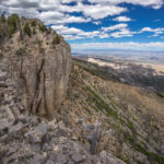
Basin and Range Trail Thru Hike Section 2 Map

Video: Basin and Range Trail Thru Hike Section 2
In addition to this trail journal, I also filmed my Basin and Range Trail thru hike. I’ve produced a detailed documentary series (11+ hours runtime) documenting this thru hike adventure, the product of over 1,000 hours of video editing. I highly recommending watching the Basin and Range Trail vlog series for an in-depth look at thru-hiking the Great Basin and central Nevada.
Basin and Range Trail Thru Hike Section 2 Journal
Day 8 – June 8th: White River Valley, Hot Creek Spring
I am fortunate that I didn’t have to hitch back down to the Sunnyside area along HWY 318 where I left off, since Henry from the motel had offered to give me a ride down there this morning. Henry knocked on the door around 8 and we were off.
The bad weather that was lingering over the weekend had mostly moved out, but had left behind some cold temperatures. The overnight low in Ely was 24, and the high temperature today is only predicted to be 56. The Utah news station said this was the lowest daytime high temperature for this date, ever. Today maybe the only day I wear my long pants. I’m a shorts guy myself.

Crossing White River Valley, view west to the Grant Range
It’s an 11 Mile Road walk to Hot Spring Creek from here. Not very exciting. Many cars drove past, and a couple of them stopped to ask if I was okay. I told them about my hike and watched their eyes get big. The reactions people give when I tell them I’m walking 1000 miles through the state is priceless.
I past David Deacon Campground, which had a couple campers there. Shortly thereafter I found Hot Creek Spring. I had to step over barbed wire fences and walked along the fence line all the way to the parking area.

Hot Creek Spring, White River Valley
Wow! Really, wow!! This water was crystal clear and had a deep blue tint to it. The banks were developed, lined with large Boulders. I stripped down to my underwear and jumped in. Literally jumped in, Cannonball Style. The water temperature was so much warmer than the air and it felt great, despite water temps only in the low 80s. It’s a warm spring, not a hot spring. Good enough for me!

This warm spring is roughly 85 degrees. Great place for a swim!
I swam for a while, and two dirt bikers showed up. We said our hellos, they gave the water a brief look and moved on. Then I tested the waterproof feature of the GoPro 8. To be honest I was quite worried, but it held up under water without a leak.
As soon as I was done swimming, I changed out of my wet boxers, thankful no one else was around. The low temperatures and blowing wind made it really cold. As I was leaving, a Nevada Department of Wildlife employee showed up. He asked where I was camping tonight, and I proceeded to tell him about my hike. He thought I was nuts! Just like everyone else, but in a good way, I think. He was about my age, Brady was his name. He asked if I was filming the hike and I told him my plans to do so. I also asked him if he would like to say a few words for my movie project, but he declined. He mentioned a mountain lion and Cubs in the grant range, where I am heading next.
Feeling refreshed, I hit the road again. Walked past a large ranch, Moon Ranch I believe. From here, the traffic stopped. Not a single car. It would be a long time before I see anyone else again. It was a long straight away, with some large power lines crossing the road at one point. I stopped in the shade of a large water tank, with a dry trough. Still feeling pretty good, I ate a quick snack. Not too dehydrated or anything, despite only drinking one liter so far today other than the water I chugged before I left the hotel.

View of the Grant Range and Troy Peak from White River Valley
I reached Forest home spring around 5 pm. There was a small homestead here that seemed to control the water source, making it off limits for me. It’s too bad because this is a critical water source for me, perhaps the last before I enter the Grant Range and walk its crest. I wish I had done my research a little better on this one, because I still believe there to be water a ways west of here, it looks promising on the satellite. It is the spring that feeds this homestead, so it must have water. Unfortunately, in a spur-of-the-moment decision, I chose to abandon my plan to go up to Timber Mountain and begin my ridge walk north of Troy Peak. I was really looking forward to this, but at the time, based on the research I did, I made the best decisions I could.
The plan now is to follow a different dirt road up a different Valley towards teaspoon spring and Wiregrass spring, both of which appeared on a big brown sign leaving the main road. However, I did not see any signs of water on satellite. Still, I have no choice. I dipped down into the Valley below the road to check for water in the wash, hoping for a damp spot along a shaded bend in the wash as it had recently rained. No luck, everything bone dry.

View from foothills of the Grant Range, looking east across White River Valley towards the Egan Range
Walked the road a little while longer and found a camp spot a few feet off the road. Decent view actually, overlooking the little Valley below the road. I’m feeling thirsty now, with only one liter left to get me through dinner and breakfast, as well as reach the next water source. Pretty tired now that I have stopped. GPS is still not accurate, saying I hiked over 30 miles today when I did about 23-25 if I had to guess.
Wind dies down at sunset every night, thankfully. Snacked lightly for dinner and drank half a liter. Getting nervous about tomorrow. If I can be honest, this entire section has me nervous. This whole route has me nervous! Maybe everyone is right, maybe I am nuts. But no doubt is it exciting.
Day 9 – June 9th: Garden Valley, Scofield Canyon, Grant Range

Campsite in the foothills of the Grant Range
Slept pretty good last night. Sipped on a few ounces of water and left camp with half a liter. Spent a good half-hour looking at my map, planning out the day.

Hiking the lower elevations of the Grant Range
New plan. Skip teaspoon spring and Wiregrass spring, skip Troy Peak. Bummer, I know. Seems like I have to skip a lot of things. But logistically, I would have to fill up water at one of the Springs, backtrack to get back to Timber Mountain, and have a minimum of two full days without another water source. Plus the elevation gained and off Trail hiking.

New plan is to hit a guzzler on the way to Scofield Canyon, then hike up Scofield Canyon. Camp near the top, next day walk the Ridgeline and exit to the guzzler on the Railroad Valley side.
It was a nice hike this morning. The 4×4 Road wandered through some short pine trees. I love the smell of the pine trees and Sage brush. I found horse spring and filtered a liter and a half. It took 30 to 40 minutes to collect that water from the dripping pipe. I would have dipped into the trough, but there was a dead bird with maggots on it in the water. I also saw a puddle in the fenced-in area, but would rather collect from the pipe. I would have collected more water but it was so slow. I only drink about 1.75L yesterday after leaving the motel, so I really needed to spend some time at a water source cameling up.

Hiking along the base of the Grant Range over to Scofield Canyon
I started following a dirt road in the direction of Scofield Canyon. However, there was a split in the road that I didn’t see and I started viewing off on a different Road. I cross country hiked through some low scrub to find the dirt road. However, this road had not been used in a long time. It was intermittent at best. So basically, I continued to hike off Trail. I thought about the threat of rattlesnakes in the tall grass and piles of wood, but have yet to see one.

Hiking a dirt road through Garden Valley

Hiking along the base of the Grant Range through Garden valley
Finally, I reached a more legitimate road. While hiking towards the guzzler I saw something not far off the road. I decided to check it out. I’m glad I did because it was a trough overflowing with water. This water source was not marked on the map at all. Great flow coming out of the pipe feeding the trough. I stayed here for a while, filtering water and eating lunch. I filtered 9 liters total, two liters to chug, and 7 to take with me. My capacity is 6 L but I also filled my dirty water bottle, which I can filter later on. I enjoyed massive views of Garden Valley to the east. This too looked desolate, yet alluring.

Overflowing water trough in Garden Valley
While sitting down and filtering water, I saw a herd of wild horses approaching from the distance. They got within 30 yards, and stopped. I was down wind, they could likely smell me, in addition to seeing my movements as I filtered water. There were about 8 horses, including a young one. Eventually I stopped trying to hide or limit my movements and the horses backed off. You could tell they wanted this water, they just hung out in the distance staring at me.
The terrain now was pretty wide open. Fields of golden grass right up to the Piedmont. Troy Peak along with the rest of the high grant range became more impressive the closer I got to them. I followed a faint 4×4 Road at times, other times I just hiked cross country. At one point, the old 4×4 Road reached a deep ditch. It was too deep and narrow to drive across, yet the road continued on the other side. What do people do, jump it?

Old 4×4 road leading into Scofield Canyon. This soon becomes washed out, and hasn’t been used in years
Eventually I reached the road leading into Scofield Canyon. I was relieved to have a good road to follow for a while. With seven liters of water and 6 days of food left, my pack was the heaviest of the trip so far.

View east over Garden Valley and the Egan Range
For much of the hike through Scofield Canyon, the road was intermittent. Eventually, this road ended. Here, I was standing 100 ft above the wash below, and Cliffed out. I walked along the cliffs for a while and found a weakness. I made my way down to the wash and continued on.

Looking up into Scofield Canyon and the Grant Range

Hiking through lower Scofield Canyon
From here on out, the road was Hit or Miss. And when it was not there, it was gnarly! Seriously rough, and made me question whether or not it was actually “the way”. The middle part of the canyon was probably the worst. At one point I followed a wash that was 7 ft deep and 3 feet wide at the top, but shaped like a V.
Eventually, I reached a point where I saw the road again. I was actually surprised, but extremely relieved. And when I say I saw the road, I mean I saw the remnants of it. It was overgrown, clearly had not been used in a long time. At some point, the road had gotten washed out in decades past, and after this no vehicles have ever been able to get through it.

Hiking the wash through Scofield Canyon
Farther up the canyon, I walked through miles of old forest fire burn area. The burn area continued all the way to the upper reaches of Scofield canyon. The route continued to challenge me. I was seriously sweating with my heavy pack, but at the same time, feeling pretty good all things considered.

Small cave in Scofield Canyon
I reached my first good size cave just a little ways above the wash. This looks like a great place for a break. Here, I could see lots of evidence of birds or bats nesting inside, with some sort of brown droppings piling up on the Ledges. It would ooze down the walls, forming a cone where it lands. On the ground there were many animal bones, and a few mountain lion turds. I also found a piece of obsidian, it looked like it had been worked into a cutting tool. This was the first piece of obsidian I had seen on this hike. There aren’t any occurrences of obsidian in the Grant Range, but several a few mountain ranges away.

Hiking up Scofield Canyon. The canyon walls are taller now and more impressive
I continued up the canyon and came across some piles of old rusty metal, remnants of either an old mining operation or maybe just a homestead. Metal mattress frame with Springs, old barrels, etc.

Cave entrance

Large cave in Scofield Canyon, Grant Range, Nevada
Farther up the canyon, at the point on the map where the four-wheel drive Road splits left and right, just on the right side of the fork, I saw huge cave. I was already working my way down the left side when I looked back and saw it. Not all that far from my destination this evening, I decided to walk over there and check out the cave. This one was like the other, with lots of bird or bat droppings on the walls and Ledges, but the biggest I’d seen yet. I climbed up to the highest and deepest point in the cave and was rewarded with a beautiful view looking out at sheer cliffs on the other side of the canyon. At the bottom of the cave there were more bones and mountain lion turds, even a deer or elk leg with hoof. Clearly the mountain lions use these caves, although none of these signs looked recent. Recall though, how the NDOW officer I spoke with yesterday near Hot Creek Spring mentioned the mountain lion activity in the Grant Range. He wasn’t “lion”. Ha!

Making progress into Scofield Canyon
Following the left fork of the 4×4 road now, I saw a badger bumbling around the edge of the wash. I tried to get a little closer, although not too close, but I spooked him. Seconds later, I saw an elk. A female or younger male. The canyon walls were extremely impressive now, pretty much sheer rock faces just towering above the canyon floor.

Upper Scofield Canyon

Upper Scofield Canyon, below the crest of the Grant Range
Near the very upper reaches of Scofield Canyon I saw several more elk. 5 at one time, four of them were big males with huge antlers. It was now time to look for a campsite, but nothing was looking flat or very appealing in the bottom reaches of the Canyon. I worked my way up and Hillside, expecting a flat spot on the top. However, it was never flat, it just kept continuing up at an unacceptable angle. I had hoped to camp up here because of the amazing 360 view. Instead, I dropped down off of this Ridge into a wash and up the ridge that I will ultimately take tomorrow. Here I had the same issue, no flat ground. It was very Rocky and not steep, but not an angle at which you would pitch your tent.

Upper Scofield Canyon view
Eventually I settled on a spot high up the ridge under a tree. This was the flattest spot I had seen, although still not flat. I spent some time digging out rocks from the ground and using my foot to try and carve out a flat spot in the dirt. Eventually I created a campsite that was acceptable for my standards. Yes, I have standards, especially when quality sleep is at stake. And the view from this spot was actually pretty damn great! Tower and Cliffs above me, hemmed in by a little cirque. This will do!
When I took my shoes off this evening, I was surprised to see a hole in my sock, above the pinky toe. I have never had a hole in Darn Tough socks in this location. The Nevada terrain is rough on the shoes, that’s for sure.
Even with the hard work of Bushwhacking for what seemed like more than half of the day, I felt pretty good. I set up camp and ate dinner, which was no problem tonight. Good to have an appetite again. I enjoyed an excellent view of the mountains while I ate.

Campsite in Upper Scofield Canyon
Man, what a day. I can’t remember the last time I experienced so much adventure. This is what I came out here for. I’m finally feeling good and strong, and was really happy to have experienced all that I did today.
Day 10 – June 10th
The Sun was shining on me around 5:30 am. Minutes before 6, a loud explosion could be heard. I have no idea where it came from, but the echo through the canyon was incredible. There are no mining operations nearby that I know of, unless it was a private prospector or something. I was pretty stumped on what could have caused it.

Morning in upper Scofield Canyon
The view I woke up to was spectacular. I felt really good this morning. Really good, at peace with the world. All of the sudden I had a really peculiar feeling overcome me; the thought I might die today. I don’t know why, it doesn’t really make any sense. Sure I had an ambitious Ridge walk planned, but none of it looked particularly gnarly. Still somehow I was at peace with world. Odd start to the morning for sure.

Hiking out of Scofield Canyon

Burn area in Scofield Canyon
Leaving Camp, I immediately begin ascending up to 3000 ft. There was no Trail, and it was steep. I had 4L of water on me I, and still weighed down with 5 plus days of food. Burnt trees are everywhere still, some of them rather large. The slope was such that I could only walk about 30 seconds before getting super winded and tired.

Crest of the Grant Range, looking east over Garden Valley
I battled my way up Hill for about 2 hours before I reached the crest of the grant range. Right before I reached the crest, I saw two bull Elk. I Contoured around the summit of the 11000 plus foot Peak I was aiming for. I stopped to take a break as soon as I reach the crest. It was cold when the wind blows.

Hiking the crest of the Grant Range, south of Troy Peak

View of the Quinn Canyon Range from the crest of the Grant Range

View east from the crest of the Grant Range
Now I’m following the Ridgeline, Crest of the grant range. It’s fairly wooded at times, a variety of pine trees. It’s also pretty Rocky. The terrain was not too difficult, but there were a lot of ups and downs. All around me where burnt trees, in Rimrock Canyon and beyond. Even still, it was pretty nice. I wondered what it all would have looked like as a sea of green.

Grant Range ridgewalk

Pretty easy hike here

Hiking the crest of the Grant Range
The first mile or two of the ridgewalk along the crest of the Grant Range was the easiest. Besides some occasional trees and rocks for obstacles, it was not too steep and really just a nice walk.
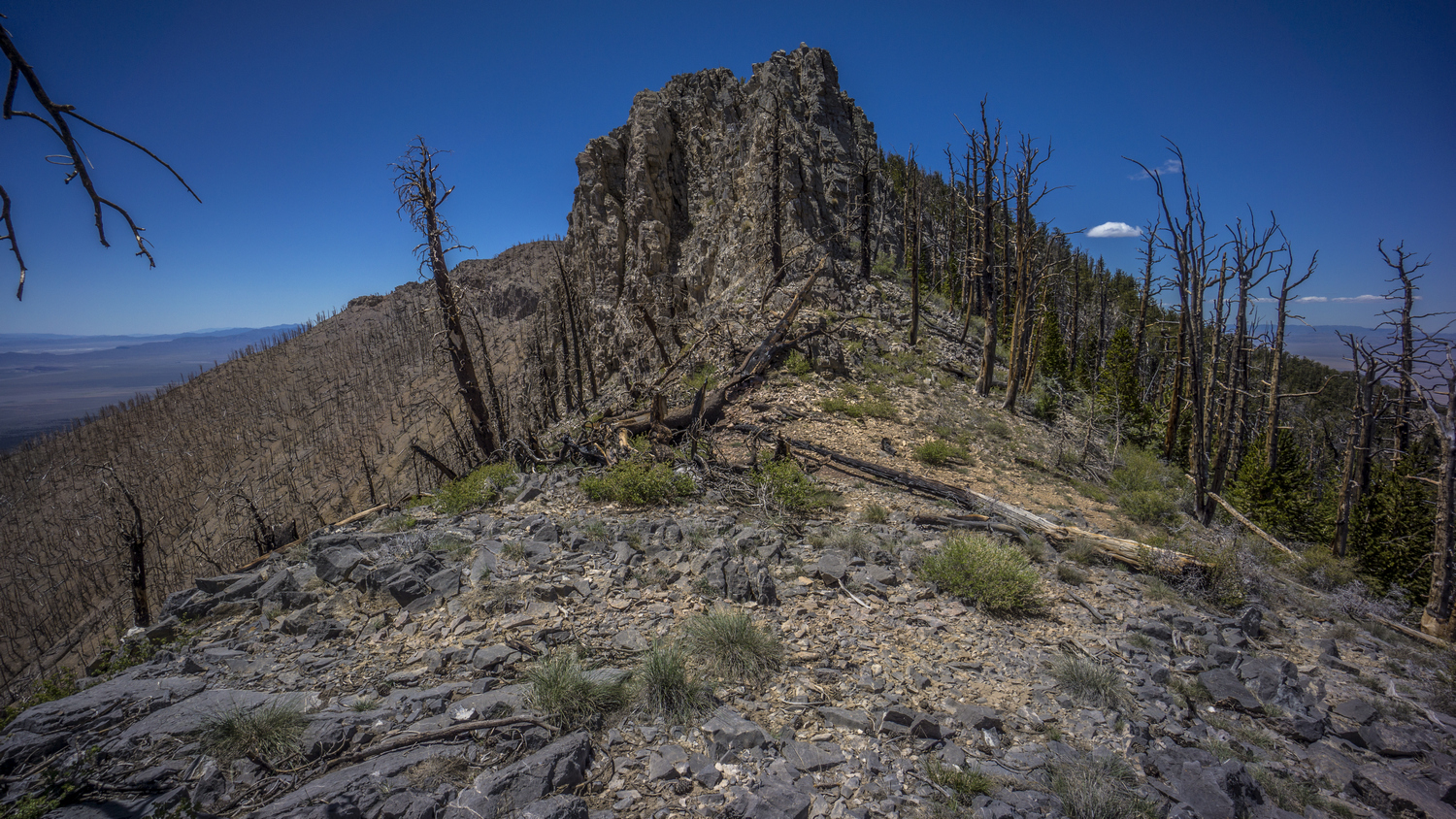
Terrain becoming more challenging along the crest

By midday, the hike was getting pretty hard. Peak 10396 proved to be much more difficult than it looks like on the map. This was typical of everything along this Ridgeline. Very steep terrain with loose rock made for a challenging Traverse up and around this peak. Scrambling was involved at times, and the rock was horrible. Even larger boulders that looked solid would just crumble away in your hands. It was very sketchy at times, one must be careful of each foot hold. Loose, Sliding rock. But eventually I made it. Looking down, I don’t know how. I’m glad I was going up, because if I was going down I would have looked for another way!

Hiking the jagged ridgeline of the Grant Range
Other sections of the crest proved difficult. There was one section where there were a couple of spires protruding into the sky, but with a window in between them. Nearby was a singular vertical shaft of Rock, Rising maybe 30 ft above everything else. Sticking up on its own. Impressive, for sure, but certainly imposing up close. Once I got right up on it, a route became obvious. Most of the routes through this type of Terrain involved scrambling and climbing over downed trees.

View of Railroad Valley to the west from the crest of the Grant Range

Grant Range ridgeline, and the Quinn Canyon Range in the distance, to the right/top of the photo
Next was Bordoli Peak. When I approach this, it looked impossible. Sheer Cliffs, maybe 40 ft above the ground I was standing on. Certainly it would have been possible to climb up, with the right skills, but with a pack it wouldn’t be my first choice. Eventually I discovered a game trail that skirts the side of the peak. Within 15 minutes I was around it, looking back at a wall of rock. Game trails are great.

Awesome cliffs along the crest of the Grant Range

View east over Basin and Range National Monument and the Golden Gate Range from the crest of the Grant Range

A “window” view from the Grant Range own into Basin and Range National Monument
Next was peak 10292. Again, I took a game trail that followed a lower route Around the peak. However, when I reached the South side, I was blown away. Best views of the day for sure. And the whole trip so far. At first, two large vertical Cliffs on each side with a window in between offered an impressive View. As I continued along the crest, I walked the edge of sheer Cliffs. Favorite moment of the hike so far. The views of Garden Valley, Golden Gate range, White Pine Valley and the Egans Beyond were absolutely stunning. Again it made me wonder why nobody comes out here. Is the terrain too difficult? Lack of water? Lack of access? Is it just Troy Peak that gets all the attention? Do people even know it exists?

One of my favorite views from the crest of the Grant Range. Hiking south, towards the Quinn Canyon Range

Panorama view from the crest of the Grant Range, looking northeast

Grant Range views
I took my time walking this section of the Ridgeline. In fact, I couldn’t leave, every few steps offered a new and interesting perspective. Then I noticed the bristlecone pine trees. These are the oldest living trees on Earth! They can reach ages of 4000 years or more. In fact, the oldest living tree ever discovered on Earth was 4900 years old, in Great Basin National Park.
I worked my way around one last Peak, 10147. Again I followed a game Trail. At times these were steep, and it was a real pain to always be sliding in One Direction with my right foot. This was definitely aggravating my blisters now. Eventually the game Trail led me to a bit of a saddle, where I had planned an emergency campsite based on satellite views. This would have certainly worked out; it was flat, mostly clear, and actually a pretty decent spot. In fact, there were a couple places along the crest where one could have camped. It was now about 3:30 and I decided to make the push down hill so I could hit the next water source tonight, hopefully.

Quinn Canyon Range, viewed from the Grant Range
Eventually I came to the point along the ridge where I had planned to drop down. The first bit was actually fairly easy and straightforward. The terrain wasn’t too steep nor was it too thick with vegetation. As I progressed down, there were patches of mahogany trees, occasionally thicker.

The route down from the Grant Range, Railroad Valley in the distance
The farther down I went, the harder it was. Towards the middle, there were more Ledges, although small. These were somewhat easy to work around, but did require a little bit of route finding.
Below Benchmark 8625 is where things got interesting. And when I say interesting, I mean quite frightening. The Topo maps don’t show anything of real significance here. The Contour lines and slope angle shading on CalTopo did not reflect the dangers that existed in real life. I was getting Cliffed out rather often. Some of these drop offs appeared to be more than 40 ft to me, and should have been reflected on the topo maps. Others were certainly below the 40 ft threshold, easily hiding within the Contour lines.
After getting cliffed out, I was working my way around the hillside looking for a way down. The slope was improving and I could see a potential way down. Then I stepped on a boulder, maybe 3 ft by 3 ft, and the boulder gave way. One leg ended up being in front of the boulder and the other behind it. The boulder was essentially pushing me down hill now as it slid straight towards a cliff, only about 10 ft away. I was able to get my leading leg out of the boulders way and it came to a stop right at the edge of the cliff. Had the boulder been any larger and heavier, I don’t know that I would have been able to get my leg out of the way. Both legs suffered some damage, pretty much just a scrape on the back of the right leg, and a nice big cut on my left shin.
Shaken up, I took a break right then and there. I used an alcohol pad to try and clean the cut on my left shin, which now had blood dripping into my socks. It wasn’t a terrible wound or anything, but certainly a reminder of how close I came to being shoved off that cliff. The cliff itself was maybe 20 ft, not an instant death drop by any means but even a drop of 20 ft has the potential to seriously injure or kill if I had fallen on my head or neck, or if the boulder followed me off the cliff landed on me, or if a rock slide ensued, etc. Sure I am carrying a satellite communication device, but in a fall like that, it could easily get smashed and be rendered useless.
I sat down for about 10 or 15 minutes to collect my composure before continuing on. From here on out, I was operating on pure adrenaline for the rest of the day. The rest of the day was extremely difficult and painful at times, nevertheless I felt very lucky to be continuing on with only a flesh wound. I found a route down a Series of Ledges and eventually reached a more favorable slope angle.

Slow going in this thick, narrow canyon
Eventually I reached a point where I left the Ridgeline and dropped down into a Canyon. It was a small narrow Canyon choked with vegetation. The farther I went down stream, the more difficult it became. There weren’t a whole lot of options to get down off the rest of the grant range, this was the shortest of the two. The other one certainly would have had its own set of challenges as well.
At the bottom of this Canyon, the vegetation was unavoidably thick. A variety of vegetation exists here, from pine trees and grasses to Thorn bushes and Cactus. There was no choice but to push through the vegetation, no matter what kind. I got pretty scratched up, and frequently I had Thorn bushes scraping away at my existing wounds. As a progressed, I cared less and less about the vegetation. I forced my way through it without even trying to avoid pain. Many of these trees had dead limbs, and I would just walk through them like they weren’t there. My main concern was my eyes, but with sunglasses on I had the proper protection. Otherwise I didn’t care anymore.
The walls of the canyon began to narrow as I progressed further down. My maps indicate potential for a box Canyon, with sheer cliffs on both sides. I was unsure if it was even possible to make it through this Canyon, as the possibility of an unclimbable pour off was on my mind. Topo maps can easily hide such things, a lesson I have learned many times in the past and as recently as an hour ago. Still, I’m here and must get out of this Canyon.
At one point the walls narrowed to about 5 ft wide. Of course thick vegetation was growing here, so I waded between trees on one side and a sheer rock face on the other. Then I reached the pour off. I was relieved to see that it was only about 8 ft. At the top was a plant that had grown in between the cracks of the rock, and was obscuring my ability to negotiate this climb. I grabbed it and ripped it out, chucked it out of my way. This opened up more possibilities for foot holds and allowed the down climb to become more obvious. In the end, I wedged myself in between the rock and shimmied my way down, with my pack on. It was at this point I remembered that I probably should have brought a small length of 550 cord or something for just this kind of thing.
I made it down into another narrow passage way filled with vegetation. Beyond this, I could see what looked like another potential pour off. I was relieved to see that was not the case when I got closer. Still, the thick vegetation remained, and I continued to fight my way down the Canyon.
The canyon walls were impressive, despite the nightmare of my reality. At one point I saw a cave opening about 60 ft above the canyon floor. I wondered how far back it went, but it would have been really steep to climb up to it.

Exiting the canyon, looking back up into the Grant Range

Quinn Canyon Range in the distance
Shortly after the pour off, the canyon began to open up a little bit. It was slow, but eventually it widened. Now I am walking on talus, with only the occasional tree. I turned around and looked back at the opening of the canyon. I breathed a sigh of relief Knowing I had made it to “safety” tonight. I let out a loud victory scream before dropping to my knees and letting this joyous victory moment soak in.

Railroad Valley at sunset
I was now only one mile from my intended water source, but this too was all off Trail. I followed a contour line around the hillside which led into blind Canyon. No such name was marked on the map, but I learned this later on when I reached my water source. The contouring part was actually pretty easy. Soft ground, trees were not too close together. It was amazing to walk such easy ground.

Blind Canyon, Grant Range, Nevada
When I reached blind Canyon, I was blown away by its beauty. I could tell from the topo map that it was going to be impressive, but nothing could have prepared me for what I saw. Absolutely massive and sheer cliffs surrounding this Canyon. I’ve been a lot of places and I can’t think of another Canyon that compares.
The walk through Blind canyon was not easy either. Lots of foot sized rocks in a wash, with a series of ups and downs over ridges, Hills and gullies, with a bunch of Sagebrush and Thorn bushes mixed in. It was almost 8 pm now, so I was trying to move as fast as I can in order to beat the approaching darkness. I reached the end of the canyon and discovered a series of narrow chutes and pour offs. I have no doubt somebody could climb it, but it wasn’t going to be me. I had expected my water source, a guzzler, to be here. However, no water and no guzzler.

Big Game Guzzler in Blind Canyon
I turned back around and began searching parallel to the route I walked in, and moments later discovered the guzzler. It was a flying saucer looking object just through the trees. I walked around the saucer and saw an opening. There was plenty of water, so I dropped my pack and promptly began filtering water. I dipped my dirty bottle in, trying to push all of the dead bugs aside, and pulled it out to discover only a slight green tint. Good enough for me, my Sawyer filter will take care of the rest. I immediately chugged the first liter I filtered. I needed this. I only had a few ounces of water left now and was quite thirsty after the such a strenuous day in the mountains.
Then I filtered 5L to take with me. The sun set while I was filtering, so I moved fast. I took out my headlamp in case I needed it. I walked back out of the Canyon as fast as I could, jogging at times with limited light. When I got a ways out of the canyon, I was still not seeing any good spots to set up camp. Just a rocky wash with a lot of vegetation. So, I left the wash and went back up the hill side that I had Contoured around. Sure enough, up the first little Hill was a nice flat spot with pretty soft ground. This will do!
I’ve realized my campsite selection was not as flat as I was hoping for, pretty much like every night. Fortunately, with the ground a soft as it was, I had no problem using my foot to remove some Earth from the high side and ended up making a pretty nice flat spot for the floor of my tent. I set up by headlamp, with the last remaining raise of light fading away as I finished.
I cleaned up my wounds a bit and applied some iodine. I hadn’t eaten since lunch, maybe 12:30. Okay I had one granola bar at 3 pm. Still, not enough to keep me going. I had mentioned adrenaline, which has now faded away and replaced with proper hunger. I snacked on some random items, anything salty tasted great.
Today was one of the most difficult days of hiking I’ve ever experienced. I’m not sure I even covered 10 miles. I feel lucky to be alive and well, to have made it to a proper camp and to have the opportunity to do it all over again tomorrow. My body feels surprisingly well for the extremes I asked of it today. I definitely lost some muscle today, I did not eat enough for sure and I could smell that horrible smell that comes when muscle is converted into energy as the body’s last resort.
Day 11 – June 11th: Quinn Canyon Range, Cherry Creek
Didn’t sleep that great last night. It was a warm night, too warm for my 40F quilt but too cold to go without it. I was extremely sore and tired this morning, but I didn’t feel that way at all last night. It must have been the adrenaline. Woke up at 7 am., about an hour after I have been getting up the rest of this trip. This was mostly due to the Sun needing to rise over the Cliffs that made up blind Canyon. This works out for me though, I could really use the extra sleep this morning.

Campsite near Blind Canyon, Grant Range, Nevada
Just an all-around excellent view from Camp this morning with blind Canyon behind. The views from the west side of the Grant Range are very impressive; here, the slopes are steeper and provide a much more dramatic backdrop compared to the east side.

Walking fenceline on the west side of the Grant Range

Railroad Valley, with the Pancake Range in the distance
After leaving Camp, I had to cover some cross-country ground again, backtracking the way I came last night. Eventually I hit a fence line with a bit of a clearing alongside it, so I followed that for a while. This took me to a wash with an old 4×4 Road, so I followed that downhill ways until I hit the main road that cuts through the Grant and Quinn Canyon Wilderness, separating the two.
The road walk up to The Summit was not that interesting. In fact it was extremely boring. However, it was a great mental break from all of the ridiculous stuff I was doing the day before. Plus, I could finally cover some miles. One can not fully appreciate the convenience of a trail or road until you have gone some time without one.

Entering the Quinn Canyon Range
On the other side of the summit, the walk became more interesting. Better views of the mountains and more interesting rocks. Lots of different colored rocks from green red orange and yellow, but nothing special. The type that has some sort of Micah or muscavite that glistens in the sun, tricking you to bend down and pick it up, when in fact it’s worthless.
When I reached the road for the Cherry Creek Campground, a stream was flowing alongside it. This is a great sign. I thought for sure there would be people camping in the campground, and I had hopes of someone running a generator so that I could charge my backup battery pack. However, the campground was empty.
While I didn’t Explore More, it seems like the campground consists of just one campsite, a picnic table fire ring and Creek side access, all with a less than ideal slanted ground. The campground was riddled with bullet shells, and someone even pounded them into the picnic table. How clever.
I took my time here at the campground, utilizing the picnic table which is actually quite the luxury for a hiker. I also utilize the stream to rinse out my dirty clothes, and let them dry out in the sun while I filtered a couple liters of cold water. No sense on stocking up, I know the creek will be flowing a ways up the canyon. I saw several trout in the creek here and Upstream from the campground.

Lush vegetation of Cherry Creek
This marks a bit of a milestone in this hike, the first foot Trail along the Route. It starts right here at the campground. Maybe 50 ft after leaving the campground, I could tell this was going to be a lot of work. Several large down trees over the trail, and it was overgrown. However, it was extremely impressive! The creek was flowing and lined with very Lush green vegetation, almost jungle-like. All of this was hemmed in by vertical Cliffs, the likes of which I haven’t seen yet in Nevada. Red Rock, rounded, similar to what I would expect in Utah. Overall, I compare this Creek to something in New Mexico, perhaps a less maintained quasi-Gila River experience, on a much smaller scale.

Cool canyon along Cherry Creek
The first section right out of the campground was through a bit of a box Canyon. This is why It was so Lush and jungle-y. My progress was slow here, frequently turning around and looking up with great Grandeur. The trail winds back-and-forth, following both sides of the creek. I crossed the creek about 15 times. Sometimes there were logs and sometimes there were rocks, but I managed to keep my feet dry.

A nice green meadow, with a lot of cow activity

Cherry Creek flowing
Before long, Cherry Creek Canyon opened up. Even though the canyon was wider and one was not forced to stay by the creek, the going was still tough. The Trail was intermittent, and passed through a lot of thick brush. Sagebrush mostly, as well as thorn bushes and the occasional odd ball plant. And now, signs of cows. Cow patties and prints, turning a nice creek into a muddy wasteland. It stinks like cows. Damn cows ruin everything they touch. Still, it was a pretty Canyon.

Rock formations along Creek Creek
Eventually the creek went dry, so I backtracked a bit to the point where the water began to flow from a spring. I drew 6 liters from here, not really knowing where my next water source was going to be. After following Cherry Creek to its upper reaches, I will have two options: go over a pass to Cooper Canyon or Willow Canyon. I still have not decided which I want to do.

Hiking through Cherry Creek Canyon
After filtering my water, the hiking got even tougher. Even thicker brush. I suppose I could have put on my pant legs, but every time I do so I end up getting a heat rash or something on my legs. Plus it’s just downright hot to wear them. So, I made my way through the brush in shorts, subjecting my already wounded Shins to an onslaught of brush. Nothing like thorn bushes scratching yesterday’s wounds.

Upper Cherry Creek
I barreled through the brush for hours, thinking about how this is prime rattlesnake country. I have yet to see one. I did see a couple of cows eventually, including a bull only about 30 ft away. He did not see me, and that’s probably for the best. It’s much more rare to see bulls free roaming.
Now in the upper reaches of Cherry Creek Canyon, it was decision time. I had already been leaning towards the route that would take me over to Willow Creek Canyon, so I started heading up that way. I was looking for a campsite now, but there was nothing good. There was one or two spots that could have worked, but they were not good campsites. I kept heading up hill.
I found another spot that could have worked, but again it was pretty sub par, more of an absolute last resort. The drainage I was following up to the pass or saddle to Willow Creek was now getting narrow and was subjected to all of the same thick brush and blow downs as the rest of the canyon. Only here, it was harder to navigate around and avoid. I did not have any good options now. I could go back down and take a crappy campsite, or I could continue to head up the drainage and see if the trees clear out.
Next I thought, maybe I can camp on the saddle. I was only about 200 ft below the saddle now, but some of the hardest terrain lies ahead. It was a gamble to try and make it up there. The saddle is only so big, what if there is nowhere to camp? What if it’s too rocky, too many trees, or all cliffs?

I need to climb these cliffs to reach the saddle, and gain the ridgeline
Just below the saddle there were 30 ft rock walls blocking the way. From Below they looked impenetrable. I was getting nervous. I made my way to the base of the cliffs and a route became obvious. It was not going to be easy, but it was better than a vertical rock climb.
I began to work my way up a small chute. At first it was manageable. Then, it got really steep. I was on all fours now, using feet and hands to climb. It was a combination of loose soil and loose rocks. I took my time to find solid hand holds and continued the climb. This was the type of climb that you go up and not down. I can’t imagine down climbing this one. 6L of water on my back didn’t help either.

Sunset over the Quinn Canyon Range, from my campsite on the saddle
Eventually I made it past the Steep section and I could see the remaining route to the saddle. Once at the top, I was relieved to see a few relatively flat spots with decent ground, small rocks that could be moved aside. I was also rewarded with an excellent view of mountains on the Willow Creek side. Impressive, reminded me of the Egans.
I don’t know what the criteria is for saying no man has ever been here before. Do they mean this Valley? This saddle? This quarter mile radius, this 10ft radius? I don’t know the answer, but I felt like there was a good chance nobody climbed up the canyon and the chute that I did to reach this saddle. Of course, some miner in the 1800s probably made his way up here, and undoubtedly, indigenous peoples of the past have done so as well. But that’s the beauty of places like this. You can still feel like you are the first to step foot somewhere, even if that’s not actually the case. Either way, I ended this day again with an incredible feeling of adventure. It’s hard to describe really, the feeling you get from reaching hard to get places.

Campsite in the Quinn Canyon Range
I can’t think of a better feeling than a long, hard day of hiking coming to a close. Where you finally are able to lay down on your air mattress knowing you won’t have to sit back up again until the morning. What an incredible relief. The winds are not incredibly strong up here on this saddle, but gusting strong enough to raise anxiety. The winds generally die down at night here in Nevada, so I’m banking on that. Also, pulled my first tick off my leg while getting into my tent this evening.
Day 12 – June 12th: Quinn Canyon Range, Willow Creek, Railroad Valley
Didn’t sleep well last night. The winds did not die down at all. They weren’t terrible, not in danger of blowing my tent over or anything, but enough to keep me awake most of the night. Then, around 5am, I heard another loud explosion, like the one I heard in Scofield Canyon the other day. Then I realized… It’s a military plane doing a fly over, it’s a sonic boom! How’s that for a wake-up call?
Got up at 6 am, ready to be done with the sound of the wind blowing on my tent. One side was higher than the other side due to setting up the tent on a little ledge of sorts. This prevented the tent from being taught on one side, and caused a lot of flapping in the Wind. So annoying.

Descending the canyon in upper Willow Creek
I had high hopes that it would be easier going down the Ravine this morning then the other side when I came up last night. Not really easier at all though, probably about the same. Trees were thick, many dead branches to snap off so I couldn’t make my way through. Had to duck under many trees, forced my way through others. Sometimes worked my way along a steep talus slope to avoid the vegetation. Basically just weaved my way in and out of all of the obstacles, and sometimes right through them. I fell down twice I think, once near the top almost first thing this morning.
I saw water a couple of times in the Ravine, but it was always short-lived. Water would trickle out for a hundred feet so and then disappear. It would be somewhat difficult to collect from these pools, but possible. Because the water flows over Rock, you can’t really dig a deeper pool to collect from.
Coming down took something like 2 hours. Now I am on the main Valley floor, and my maps indicate a foot trail that leads to a road. I found the foot Trail higher up the canyon then I expected, so I had high hopes for this. Found a balloon that said “welcome back”. I found many balloons like this over the years in Pretty remote areas. This always pisses me off. Welcome back, let’s commemorate the moment by depositing a piece of trash in your name in an otherwise pristine Wilderness. Screw you. Letting balloons go into the sky should be considered littering just like throwing a piece of trash out of your car window. It’s no different.

Thick vegetation in Willow Creek to bushwhack through
Eventually I realized the foot path was intermittent. Extremely intermittent. The trail would be good for a while and then just disappear. Then you’d find it again and it would be pretty decent. This wasn’t really an issue since there was no water this high up in the canyon. Therefore the vegetation was similar to everything else I’d already gone through.
The real issues began when the creek started flowing. Along any body of water grows different vegetation; much thicker and much thornier. Hear a variety of Sagebrush, Willow, and a plethora of thorn bushes could be found. Thick patches of thorn bushes, the kind that you generally look at and say, well that’s impossible, I’ll go a different way. At first this was possible, I would just go around them. But eventually, I had to go through them.
The worst part of Willow Creek Canyon was where the map showed the road. And this pissed me off because it was supposed to be the easiest section, due to the road. At Best, an intermittent foot Trail was all to be found. It was so hard to follow, but it seemed to cross the creek from time to time. This intermittent Trail offered no easy route through the insane vegetation along the Creek. Instead, it presented a nightmarish challenge.
It’s hard to describe how awful this Bushwhack was. I hesitate to even mention the intermittent trail because it could give the idea that sometimes the going was easy. It never was. It was truly horrible. Oftentimes the creek was situated 8 ft down in a wash with it’s banks cut vertically from flash floods. Guarding this were thorn bushes. Then there was the Willow and Sage. Both grew vigorously here. Imagine vegetation so dense that your feet never touch the ground. Sometimes I couldn’t see the ground at all. I was literally wading in vegetation.
For much of the day I had my shorts on so my legs continued to get cut up. New cuts and more damage to existing wounds. I thought my legs would turn into leather by the end of this hike. Then I remembered my pant legs, and decided to put them on despite the fact that I typically get heat rash when wearing them. This helps significantly. Still, the nightmare Bushwhack continued.
I needed to cross the creek at one point, with no other way forward due to steep Canyon walls. I had to literally sit and crawl on the ground to get under the Willow branches. I pushed my way through, hoping this was the only time this would be needed. Wishful thinking, of course.

Entrance to gold mine hidden in Willow Creek

Exploring an old mine tunnel in the Willow Creek
I was traversing a steep Rocky slope when I stumbled upon a mine entrance. The opening was hidden by thick brush, it would have been nearly impossible to see except up close. So of course I went in to check it out. I went in about 20 ft and dropped my pack, and put on my headlamp. Walked back a ways around the first corner and came to one side tunnel that was a dead-end after a few feet, and continued on. I would say the mine went back 500ft total. The walls where lined with many quartz veins, so I assumed they were looking for gold or silver. I wonder what they pulled out of here, how much. I scoured the walls for any signs of gold, but to no avail.
While coming out of the mine I noticed that I was missing my external microphone for my Gopro. Pretty sure I lost it while forcing my way under those willow trees crossing the creek. No way I was going back for that. I was really bummed. I also lost a water bottle at some point battling the brush. So now 6 L capacity down to 5, unless I use my dirty water bags.

A nightmare thicket to hike through
Leaving the mine, there were a couple times where I had to scramble over some rocks, using all fours to climb short sections. Ultimately I couldn’t progress forward, and had to backtrack. Had to drop down into the wash and cross. Here, I faced probably the thickest thorn patch of this whole bushwhack. This led me to a vertical rock face. I really had nowhere else to go. After doing my best to push aside the thorn branches, I climbed a 15 foot Rockwall and got past the obstacle.
This continued for a couple hours. I handled the bushwhacking sections of the rest of this trip pretty well, but towards the end I was losing my mind on this one. The worst part was that I was expecting a trail and then a road. It should have been easy.

Old truck along the 4×4 road in lower Willow Creek Canyon
Then, after a creek crossing, there was a decent gravel road. It hadn’t been used in many years, but it was an obvious old path. According to the map, this road should have been miles up the canyon! Nevertheless I was extremely happy to be done with the bushwhack.

Can you see the waterfall below?
Once on the road, the canyon opened up a bit and vegetation became more sparse. I still had not filtered water, waiting until the lower reaches of the canyon so I could fill up just before hitting the valley floor. As the road left the creek for the last time, I decided to follow the creek downhill off Trail a short ways. I was using a game Trail that gave me an elevated view of the creek. From here I spotted a small waterfall. A Waterfall!!

Waterfall along Willow Creek in the Quinn Canyon Range, Nevada
This was the spot I was looking for. I carved out a spot to sit under a large Sagebrush and took a break. Chugged some water, filtered some more. Washed my socks and clothes, and of course took a shower in the waterfall. This literally brought tears to my eyes. Being able to take a brisk shower immediately after fighting through all that dense brush was just incredible. A reward I deserved, no doubt. This afternoon’s Bushwhack was perhaps the worst of my life. In fact, I know it was. I’ve seen brush that thick before and did not think it was possible to progress through it. But when you have to, anything is possible.
I spent a solid hour and a half here at the waterfall. From here I could look out into Railroad Valley. It was getting very windy, kicking up a lot of dust and sand from the dried Lake bed. Still, I was relieved that it was in the 70s and cloudy, with a strong breeze. This will Bode well for crossing this massive Valley.

Quinn Canyon Range, Nevada viewed from Willow Creek in Railroad Valley

Railroad Valley and the Quinn Canyon Range
Leaving Willow Creek, I follow the hill sides South for a while instead of following the dirt road out to the main road. This was more direct. A large agricultural operation could be seen out in the valley, surely possible only because of Willow Creek. Otherwise, this huge Valley was pretty empty looking. On the other side the pancake range makes up the horizon.

View into Railroad Valley towards the Pancake Range
Finally I took my last steps off the Foothills and on to the valley floor. Easy walking, vegetation spaced out well enough. There really was no sense in following dirt roads since they were only marginally easier walking then just going cross-country. So that’s what I did, I picked a point on the horizon around where my next water source will be and headed for that. I crossed a couple of roads but continued on my trajectory.
The wind was whipping, and getting stronger. Visibility to the north was low. I was glad the wind was blowing in the direction it was, if it were the opposite and blowing to the South all of that dust would be coming towards me.

Hiking across a dried lake bed in Railroad Valley, with the Quinn Canyon Range in the distance
I walked across a decent sized dried Lake bed. I don’t know why, but I’ve always wanted to do this. A bigger one would be even more impressive. I was feeling good and feeling strong, now reflecting on the trip as a whole a bit. That’s what I enjoy about the Basins; A break from the hard stuff up in the mountains, and a chance to let your experiences sink in.

Pancake Range from Railroad Valley
The wind now was easily 30 MPH or more. I kept thinking about how awful tonight will be if I have to sleep out in the wind. My next water source is a place on the map called Stonewall Corral. I wasn’t really expecting water here, so I was wishing I had filtered more than 6L to take with me from Willow Creek. I noticed that the water source I am heading to is pretty close to a small series of Rocky Hills jetting out from the desert floor. The water source was about a mile from these, so once I got close to the hills I changed my trajectory to the water tank which was now visible.

View east from Railroad Valley to the Quinn Canyon Range (right) and the Grant Range (left)
Approaching the water tank, I noticed a lot of signs of cow, as well as some sort of trailer next to the water tank. I had very high hopes now. I was relieved to see a trough full of water when I arrived. The large water tank also seem to have water in it. The trailer was actually an old pickup bed converted to a trailer, and it had a generator strapped in. This ran a small pump. Put this together and you have a reliable water source. Well, if the local rancher has his cows nearby.

Water trough in Railroad Valley
Chugged 1.5L, then filtered water to top off my supply. So that’s 5L, plus I brought 1L in a dedicated dirty Gatorade bottle. Then I field up my platypus bag, normally reserved for dirty water. So I have five filtered, clean liters and 3 dirty liters to be filtered later for a total of 8L. This should be totally fine to get me through another day and a half.

Sunset in Railroad Valley

Small outcrop of rocks in the middle of Railroad Valley provide the only cover for miles
It was about a mile to the Rocky out cropping of Hills after leaving the water tank. I was hoping to use part of these Hills as a wind block. When I reach the Hills, I found a couple of spots that probably would have worked. But my curiosity got the best of me and I kept going. Then I spotted a small cave. When I approached I realized it was too small. Bummer, I was kind of hoping to sleep in a cave at some point. I also spotted a circular Stonewall down on the valley floor right next to the Hills. After dropping down here, I realized the wind was blowing right into the only opening in the circle, so that’s out. I thought about camping on the other side of the wall, but it was still too windy.

Campsite in Railroad Valley
Eventually I found a place to camp, just as the sun had crested behind the pancake range. There was a large Boulder that provided a decent wind break. I set up behind this Boulder, knowing that the wind will probably change directions at some point in the evening. Better than anything else I’ve seen though.
Now lying in tent, the wind had shifted briefly. Sand was being blown all over inside the tent, and even into my mouth. Yuck! Then the wind died down, or at least shifted directions.
Day 13 – June 13th: Railroad Valley, Pancake Range, Lunar Crater Volcanic Field

Morning in Railroad Valley
The wind shifted a couple of times during the night and was momentarily a nuisance. However, when I woke up it was dead silent. You could hear a cricket chirping from a mile away. To be in such a massive Valley with absolutely no sound at all was relaxing. Light cloud cover to begin the day.

Small cave in Railroad Valley, in The Wall Wilderness Study Area
Without the pressure of finding a spot out of the wind before the sunset, I had a chance to soak in my surroundings. I realized the outcrop of Hills I was camping alongside was an old Indian camp or hunting ground. Many signs of arrowheads here, mostly just fragments from the arrowhead making process, but I found one fully intact Arrowhead made of chert. Several small caves littered the hills, not really big enough to be utilized by humans other than to squat in for shelter or to get out of the Sun. These Hills were just barely within The Wall Wilderness Study Area.

Hiking Railroad Valley, looking back at the Quinn Canyon Range and the Grant Range
With the winds gone, I Had A Renewed sense of excitement as I left camp this morning. I spent some time exploring the Hills, but I quickly left them behind a long a dirt road seemingly leading to nowhere. I had crossed the majority of railroad Valley yesterday, with only a couple more miles to go before I entered the Hills making up the western side of the valley. I saw several horned lizards scurrying about. As true of the last few miles last night, much of this morning’s hike, and even much of the day’s hike really, was through very loose and deep sand. This was a real pain to walk through.

Hiking Railroad Valley through The Wall Wilderness Study Area towards Big Fault Mesa
This area had a completely different feel from anything else I had walked through so far. It’s not just a wide-open valley, but a series of Hills, mesas, and interesting rock formations spread out across an extremely desolate and mysterious land. I stress mysterious, along with raw and primitive. One can’t help but think of the past when walking through a place like this. Who else has come before me? Why were they here, what were they doing? Surely this land holds many Secrets, known to only a privileged few.
Even here, seemingly the farthest place from civilization one could imagine, signs of cows were everywhere. I couldn’t help but think that the only people that ever visit this land are the nearby Ranchers. I can’t see this land drawing any visitors for recreation, Beyond the locals. Even then, travel here would be on horseback, Maybe. It’s a Wilderness study area, so there’s no access to dirt bikes or ATV’s. In Wilderness areas, it’s somewhat common (unfortunately) to see tracks in the sand. But not here, just some piles of cow shit. I must say that this, even though it may seem small, really dampers the Wilderness experience.

Large volcanic boulders litter the hills as I approach the Pancake Range
My route now was mostly a cross-country Meander in between various land forms. However, now that I’m here it doesn’t make sense to follow a line I drew on the map at home. It makes sense to follow what your eyes see, what intrigues you at the moment. That is the spirit of Adventure in my eyes. So I left my planned route behind, and began to walk towards a series of hills that looked interesting. A bunch of random large boulders dotted landscape, and fragmented rock formations jetted up into the sky.

View from random volcanic hills I climbed on the way to the Pancake Range. Big Fault Ridge (right), Quinn Canyon Range in the distance (left)
I made it to the top of the small set of Hills and was rewarded with a great view. Pretty much any elevated position over a massive landscape such as this will please the eyes and soul. Yes, this is where I will take my late morning lunch break. Here one can reflect upon many aspects of life. How small and insignificant we are as individuals. Here, a person feels like an ant. And not even an ant that’s part of a colony, but a rogue ant. perhaps the only ant left after his entire colony had been had been destroyed. Last of his kind, beginning a lifelong search for any remaining survivors. It’s just you now, Roaming the world all alone, searching for a purpose. A promise of a new and better life.
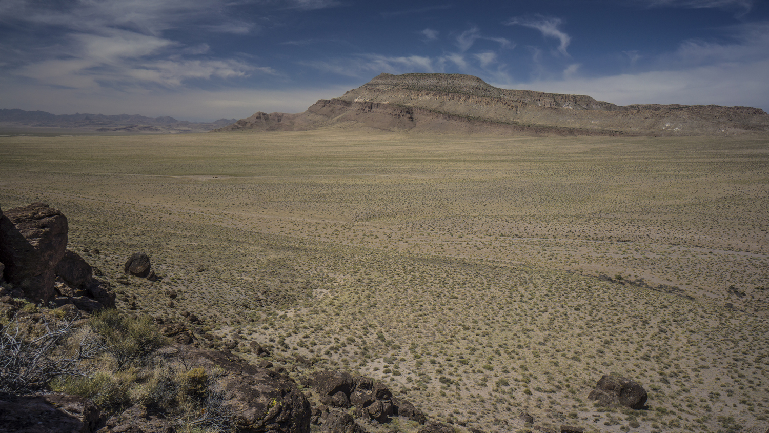
Big Fault Ridge, Pancake Range, Nevada

Sandy wash with volcanic rock
One could stay on top the hill like this all day and lend time to all sorts of random thoughts. But then, of course, one would miss out on all of the discoveries that lie ahead. I emptied the sand out of my shoes and dropped back down to the desert floor. Here, I followed a Sandy wash towards a gap between two land formations. There were random outcrops of black rocks in an otherwise Brown and Sandy landscape. There were even a few lone trees, which seemed very much out of place.

Lone Tree in the desert as I enter the Pancake Range
I followed the wash for a while and began to walk cross-country through the desert again. I eventually reached a well graded dirt road. This was a relief to be able to get out of the deep sand. As a hiker, we are generally not too fond of walking roads. However, I must say that in certain Landscapes, like the one I’m walking through right now, walking cross-country offers little to no benefit over a road. The same views can be had at a fraction of the effort expended. With that said, I highly recommend hiking cross-country through the desert at least once to know and understand what it means to do so. This is best done where the ground is firm and the vegetation is well spaced apart. Soft Sand and/or thick sagebrush are not pleasant and will not enhance your hiking experience. In this case, take the road!

Hiking Chuck Wagon Flat in the Pancake Range

Cool rock formations hiking in between The Wall and Palisades Mesa Wilderness Study Areas

Chuck Wagon Flat, The Wall & Palisades Mesa Wilderness Study Areas
I was impressed with the views of the surrounding land formations. They didn’t look like much from afar, but the closer I got the more I enjoyed them. Again, I wondered if anyone ever comes out here to hike, climb, or camp. The only signs of usage here where again, cows and Ranchers.

Hiking across Chuck Wagon Flat in Nevada’s Pancake Range. The route straddles two Wilderness Study Areas; The Wall and Palisades Mesa

Palisades Mesa Wilderness Study Area, Nevada
The road I’m walking now straddles two Wilderness study areas. The Wall wsa on the East, and Palisades Mesa to the West. These are obscure lands by any measurement. Several land formations caught my eye, and begged to the explored. However, I wanted to spend more time at lunar crater, so I made it my goal to reach it as soon as possible. Several miles off in the distance, I noticed A glimmering white object on a Ridgeline. I had no idea what it was, but I was heading that way.

Pancake Range and Lunar Lake

Lunar Lake in the distance, a dried lake bed in the Pancake Range
Walking with quick and easy along the road, but eventually I came to a point where I would leave the road and hike cross-country to a high point overlooking lunar crater. After hiking across fields of volcanic rock for a while, a bit of inspiration struck me. When I left for this hike, most people I spoke to projected their fears on to me. They told me that it would be too hot, there wouldn’t be enough water, the snakes and scorpions would get me. But you know what? None of those people have hiked Nevada! When people tell you that you can’t do something, most of the time it’s because they can’t do it themselves, or aren’t willing to. It’s important to keep an open mind, but at the same time, don’t let the opinions of an unqualified third-party influence your dreams and goals in life. They don’t know what you’re capable of, and what you’re willing to do. Only YOU know that.

Hiking the Pancake Range near Lunar Crater
I followed the route I created at home on the map towards a rather insignificant looking hill. Lunar crater is just on the other side, but you would never know. As I approached the hill, I could see that the glimmering white object I saw from a distance was a truck. There was a strange blue object on top, my assumption was that it was some type of camper. At one point I could see two people standing on the Ridgeline. I assumed they could see me, maybe the screen of my GPS or my watch reflecting in the Sun. I continued to weave my way in between sagebrush towards the top of the hill. Eventually I hit a small two track Road that I followed to a saddle, and then up a ways on the hill itself. From there, it was a short scramble up some black rock formations with orange lichen growing on them. I always enjoyed that contrast of orange on black, looks like lava.

View over the Pancake Range and the Lunar Crater Volcanic Field

Lunar Crater, Nevada
I expected a view of lunar crater once I crested the highest point here, but there was a very short ridgewalk that remained. Following the Ridgeline, the crater came into view as I neared the edge of the Hill. Wow! It was every bit as impressive as I expected. A giant hole in the Earth, 400 acres in size, 3600ft across and 430ft deep. Lunar crater sits in the middle of the 100 square mile Lunar Crater Volcanic Field, perhaps the highlight of the pancake range. The crater (this type is called a “Maar”) was created by a volcanic eruption around 38,000 years ago. This isn’t all that long in geologic terms.

Lunar Crater National Natural Landmark
I stood up on the top of this hill for quite awhile. This is a place I’ve long wanted to see. An obscure Landmark for sure. I considered my possibilities to further enjoy this area… Camp up on the top of this hill for an amazing sunrise and sunset view? Maybe capture some night photography and the Milky Way overlooking this crater? Drop down into the crater for the unique experience of camping inside? All good options. Ultimately, I chose to drop down the hill and make my way down to the rim. A road runs almost all the way along the circumference of the crater. Just below the hill was the white vehicle with the camper top. The Allure of a cold drink, perhaps a Gatorade, was too much. So I approached the vehicle, which looked empty at the moment. I figured they had gone for a walk, maybe down low into the crater.

Lunar Crater Natural Natural Landmark, Nevada
I approached the vehicle cautiously, never wanting to startle someone out here. Now within a few yards, I said “hello, anyone home”? Then little access door on a homemade blue camper top popped open and a man stuck his head out. He was very surprised to see someone. He asked where I came from, and I pointed out into the desert. “what do you mean, you walked? From where?” I proceeded to tell him my story, and this began a very fluid series of events that lasted for nearly the next day.
Matt and his son Casey, who had just graduated from high school, were on a road trip across America. They had driven here all the way from Florida. They had their dog Shay with them, who right off the bat seem to like me. That’s always a great sign I think, when a dog is so trusting of a stranger.
We chatted for a few minutes, and then I was offered a water and a seat inside the vehicle. A comfy seat is one of my most sought after luxuries after an extended wilderness trip. Once I sat in that seat, I felt a great deal of relaxation. I was even more relaxed when I was offered to share the joint they passed around. It’s not hard to understand why Marijuana and the outdoors go so well together.
Over the years, I’ve realized that I have a tendency to underestimate my knowledge and abilities. I am the type of person that thanks the bar is extremely high in order to be considered an expert, and never I think I am good enough when comparing myself to others in the same field or category. I think the turning point in my life was when I was hired by a large corporation to do search engine optimization. While there is no degree for this skill, I did not think that my basic knowledge of the field, acquired during the course of some hobby projects, was sufficient. I couldn’t believe I got the job. Certainly there are many more qualified people out there, but the bar was set low enough I was hired. This really changed my perception of things and my outlook on life. I’m not saying I wasn’t qualified or I was bad at my job. Quite the opposite.
I only mentioned the previous paragraph because of the conversations I had with my new friends Matt and Casey. They knew nothing of the area, and very little about outdoors in general. While we were sitting at lunar crater, I pointed out several other craters in the distance. They had been up here for a while, and had not even noticed them. I began to tell them about how these land formations came to be, a product of volcanic eruptions. They were under the impression it was a meteor impact site, which is an extremely Fair assumption. This too was my assumption when I first learned of lunar crater. But I had been doing my research. I have been researching Nevada for over a year in the process of creating this route, and another separate route. I felt like their tour guide, giving them information about a land I had never been to. To them I may have been an expert. But on a personal level, I barely felt qualified to convey this information. I don’t want to take away from all this to sound like you only need to know more than the person you’re talking to be considered an expert. Instead, we should not underestimate ourselves and to be confident in our perceived strengths. I have spent hundreds of hours researching Nevada and everything that goes along with hiking it in the course of planning the Basin and Range Trail route. There will always be someone that is better than you in your field, but that doesn’t mean you aren’t qualified yourself.

Easy Chair Crater, Nevada
Upon discovering easy chair crater in the distance, Matt suggested we drive over to that crater to have a look. Sounds good to me. A short drive later we were there, overlooking another impressive landform and hiking around its rim.
Upon returning to the vehicle, we discussed the low pressure in one of the tires. Matt said the tire was not that low yesterday. If it’s losing air pressure that fast, I suggested that he drive into town this evening before he’s not able to drive out tomorrow. After all, there is no cell phone service out here. I do have my Garmin satellite messaging device, but better not to push it. The nearest town is Tonopah, where I’m going. It’s also on the way to where they are headed, Mammoth California. It seems it was meant to be. My only qualm with the situation is that I still needed to walk the 6 miles from lunar crater to Highway 6. On the CDT it was very important for me to walk every mile, out of principle. People skip hundreds of miles of Trail and claim they walked the whole thing. I did my continuous footsteps on the CDT, for myself. But now here on the Basin and Range Trail, My goals for this route are different. Since there are no meaningful start and end points (say, Mexico or Canada), I don’t see the point in being a stickler about continuous footsteps here. I’m out here for the adventure and the experiences.
This was going to be one of the hardest hitches on the entire route. 80 miles to Tonopah, or about 90 to Ely. People often use the term middle of nowhere, but this literally is the exact middle of nowhere… Right in the middle of a 167 Mile Stretch with no gas between Ely and Tonopah. There is very little traffic, and hitching here would certainly take some time. I felt thankful to be able to get a ride with no effort or wasted time.
When we arrived in Tonopah, first things first, we put air in the tire. Next up, and perhaps most importantly, we put food in our stomachs. We ate at Hometown Pizza, my treat. We split an extra large 6 meat Pizza, which we finished off no problem. Of course, I could have eaten much more. Sitting at the table next to us was to older gentleman with hiking gear on, DSLR cameras with huge lenses and computers. Clearly downloading photos. Stopped a minute to talk to them and see what they were up to. I should have known, night photography. That’s what this area is known for.
Next I went into the mizpah hotel to check in at the old Brewery hostel, which is under their ownership. Matt and Casey just need a place to park their Suburban to sleep. So they drove me to the hostel and they slept outside in the parking lot. It worked out for them, I let them come inside to use the bathroom when needed.
Day 14 – June 14th: Zero Day in Tonopah, NV
It was a really cold morning. Around 8 am. we left the hostel and headed down to Burger King for breakfast. From memory I thought it was a McDonald’s, but hey, it’ll do. They were serving a couple of lunch menu items even during breakfast, so I got the large bacon King combo. It was actually pretty huge, and really hit the spot. I was starved! By mid day, Matt and Casey left town and continued on their road trip.
I began town chores today. I needed to replace the microphone for my camera that I lost in the bushwhack in Willow Creek, and I needed a few more micro sd cards to continue filming the next section. I ordered these today and will need to stay in town until they arrive, unfortunately. This will be a long and expensive stay, but these are the kind of situations that come with filming and documenting these hikes.
Day 15 – June 15th: Zero Day in Tonopah, NV
Without much else to do today, I walked out of town and through some of the old mining areas on BLM land. Here, I did some rockhounding. Supposedly Tonopah is a great area. However, it has been heavily mined over the years, and any place worth digging is already claimed. Still, I found a few somewhat interesting rocks, but nothing like the turquoise nugget I was hoping for.
Back at the hostel, there was a guy named Tony staying there as well, a contractor working on a job. He saw my rocks and we began talking. Turns out, he had worked in some mines and was very knowledgeable about rocks and minerals. He ended up giving me his jeweler’s loupe as a gift. So kind!
Day 16 – June 16th: Zero Day in Tonopah, NV
Did my grocery shopping today. Raley’s Grocery has a good selection and is considered a “full” resupply. Grocery is located about a mile from the Hostel/Mizpah.
Someone in town told me that the Western Store in town sells cell phones, and that they might have micro sd cards for sale. I figured I’d stop in and see if I could pick one up, even though I had already ordered a few. Inside, I could see they only had the most basic selection. The owner, Paul, asked me what I needed them for and I told him about my hike. He offered to give me the 16GB card right out of his own cell phone! Unfortunately, I need much more storage than that. But what a nice gesture. He also mentioned someone that might be able to give me a ride back out to Lunar Crater tomorrow, which really caught my attention. I told him I’d come back tomorrow if/when my cards arrive in the mail.
Related Images:
Basin and Range Trail Thru Hike 2020 – Section 1: Ely to Preston
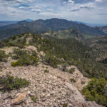
Basin and Range Trail Thru Hike Section 1 Map

Quick Facts About My Basin And Range Trail Thru-Hike
Miles: ~950
Dates: June 1st, 2020 – August 6th, 2020
Days: 67
Zero Days: 17
Highest Point: Wheeler Peak 13,064’
Lowest Point: Railroad Valley 4,851’
Starting Terminus: Ely, NV
Ending Terminus: Baker, NV
Resupply Stops: 9
Video: Basin and Range Trail Thru Hike Section 1
In addition to this trail journal, I also filmed my Basin and Range Trail thru hike. I’ve produced a detailed documentary series (11+ hours runtime) documenting this thru hike adventure, the product over over 1,000 hours of video editing. I highly recommending watching the Basin and Range Trail vlog series for an in-depth look at thru-hiking the Great Basin and central Nevada.
Basin And Range Trail Thru-Hike Journal
This is my journal documenting my 2020 Basin and Range Trail thru hike. This is not meant to be a guide to hiking this route, rather, it tells the story of how the events unfolded along the journey. For a guide to thru-hiking the Basin and Range Trail, visit https://basinandrangetrail.com/. Additionally, join the Basin and Range Trail facebook group to connect with past, present and future Basin and Range Trail thru hikers.
Day 0 – May 31st: Getting to the Starting Terminus
I flew into Salt Lake City, and had a friend drive me to Ely, Nevada. This is where I will start my Basin and Range Trail thru-hike across the great basin region of central of Nevada, along a new long distance hiking route I have mapped out over the winter. After being dropped off at my motel, I did some grocery shopping and spent the evening getting my gear together and going over my maps.
Day 1 – June 1st: Ward Mountain, Egan Range
I left my motel in Ely, Nevada a little after what I thought was 7:30am. That’s what my phone was telling me, as it automatically updates to the time zone. However, when I reached the post office that was supposed to be open at 7:30, it was still closed. Confused, I asked the lady inside when it will open. She said at 7:30. I looked at my phone, and it was after 7:30. That’s when I realized my phone had not properly updated to the Pacific time zone. A little embarrassed, but I waited outside for a while until it actually opened so I could send out a box with extra gear back home.
After the post office debacle, I hit the road. It was a couple mile road walk out of town from here along Highway 6. I got a lot of funny looks from the traffic driving by with my backpack on. Apparently, Nevada doesn’t see many long distance hikers.

Next Gas 167 Miles!
Shortly after leaving Ely, there was a sign along the road that said “next gas 167 miles”. Wow! This is a record for me. That next gas is in Tonopah, where it also says “next gas 167 miles” when heading east to Ely. The majority of the state is extremely vast and empty, beyond comprehension for anyone who has not visited. I laugh when I think of my home state of Michigan, and hear people describe anywhere in the state as remote. You can hardly get to a spot that is farther than 1 mile from any road in Michigan’s lower peninsula.
Other than the occasional narrow shoulder, the road walk was actually not that bad. The road passes through a short segment of mountains, and then emerges into a more open landscape. I continued to walk until I saw signs for Ward Mountain. This is my entry into the Egan mountains.

Hiking into the Egan Mountains
I utilized one of the picnic tables in the campground and took a quick break to eat a snack. There was a water spigot here for water. I think there was one vehicle here. Leaving the campground, I followed an old Aqueduct line towards the upper Terrace. This route was not efficient at all in terms of elevation gain, as it just went up and down over every hill in a straight line. However, it was a straight line to where I needed to go. I was surprised to see a flowing Creek, until I saw a break and the aqueduct line on the hillside above. Mystery solved.
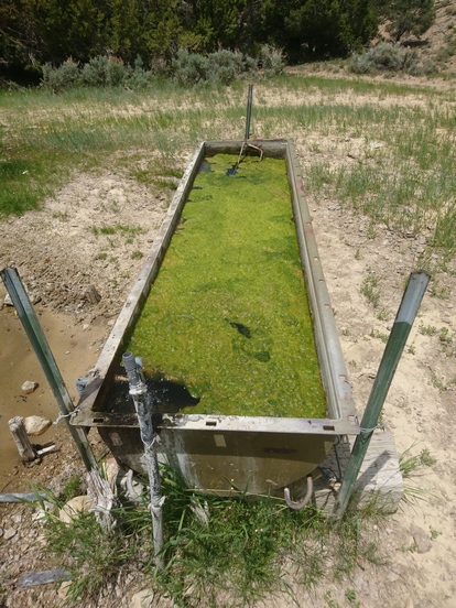
First backcountry water source along the BRT
There was another trough overflowing with water, and a couple of other small water sources along the way. So right away, I am thinking, great, water is not going to be as big of an issue here as I thought.

The Egan Mountains
Eventually I left the aqueduct behind for a 4×4 Road. This climbed steeply up to the upper Terrace. Pretty good views of the white river valley below. I was surprised to see how wooded it was. Looking out into the vast valley looked more like a sea of green than a desert. Eventually the road popped up above the trees, but not the tree line itself. It just cleared out. In fact, I saw a few patches of snow here, and nowhere else.

Looking west towards White River Valley and the White Pine Range
Above 8000ft I saw my first wildflowers. I was getting pretty tired now, having a hard time with the climb uphill. I had spent two nights in Ely at over 6300ft, and I was really hoping this would be enough for someone coming from sea level. Today I will reach elevations nearing 10,000ft, and over that tomorrow. On top of that, I had been working almost non-stop for months before I left for this hike, and had practically no time to dedicate to training for this hike. I was definitely starting this hike at a disadvantage in that regard, but I am just glad to finally be out here.

A lot of the 4×4 roads climbed steeply, which quickly took its toll on me. They didn’t look that steep on the map, but they sure felt like it. Once up on the Upper Terrace, I began to see aspen trees. There were some rather striking uplifted limestone mountains that form the upper and lower terraces of the Egan Range, and wow were they beautiful. I had seen a couple of photos online of the lower terrace, but couldn’t find any of the upper terrace. Much of the Basin and Range Trail is like that, no photos were available of the areas I plan to hike through. The topography on the map sure looks promising in many areas, but until you get there and lay eyes on it, you never know what you’re going to get. So here, I am pleasantly surprised. I will get used to this feeling along the BRT over the next 2 months.

Striking limestone formations on the lower terrace of the Egan Mountains

Plenty of Aspen trees as the elevation climbs to 9000ft
Somewhere on the upper terrace, I got my first huge sweeping view of White River Valley to the west, and the White Pine Range on the other side. Here was my first real view of Basin and Range topography: a series of parallel running, tall and narrow faulted mountains separated by vast arid basins, or valleys. It’s a stunning landscape really, providing massive wide-open views with tons of prominence above the valley below. Yes, this is going to be a beautiful hike!

Limestone ridges of the Egan Range, looking west into White River Valley

Day 1 of the Basin and Range Trail, already stunning!
My GPS said I hiked 30 miles today, but that’s absurd. It’s more like 15 (18 actually, upon returning home and looking at the GPS track). There were no deep canyons or anything, it’s all been very wide open. So clearly, my new top-of-the-line Garmin 66i can’t be trusted for accurate mileage estimates in the field. What a shame.

Beautiful aspen trees on the upper terrace of the Egan Mountains

Backcountry camping in the Egan Range – Night 1 on the Basin and Range Trail
I’ve reached an elevation of 9300ft today, and I am feeling it. I dropped down to the protection of some pine trees, to get out of the 35+ mph winds, and found camp for the night. There is nothing that compares to the feeling of sheer exhaustion felt on the first day of a hike like this… not only did I not get in very much pre-hike conditioning, but going up in elevation rapidly is also exhausting. This combination tends to kill my appetite, making it a triple whammy. After getting up tent up, I was so tired and lethargic, pretty much skipped dinner and just went to bed at 7:45. Make no mistake, the first few days are a difficult adjustment period. But once your body gets used to it, the impossible becomes possible.
Day 2 – June 2nd: Crest of the Egan Range, Willow Peak, Water Canyon

Egan Range, Upper Terrace

I got plenty of sleep, if you can call it that, last night. My body is feeling tired and sore today, as expected. The views were great leaving camp as I continued along the main 4×4 road running south. I could have taken an alternate route up to Ward Mountain yesterday, the high point of the Egan range, but with the way I am feeling, there is just no way. However, that would have been an excellent route, and had I started this hike with better conditioning and more acclimated to the elevation (perhaps coming off another thru hike somewhere else), that would have been my route. The upper terrace is still pretty nice too.
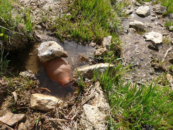
Filtering water from a small seep
I passed several springs this morning right alongside the road. Eventually the road dipped down into a valley, so I continued off-trail to avoid dropping in elevation. I filtered water from a very small spring that I had to dig out to collect from, as this was the last water before heading up to the ridgeline, over 10k feet.
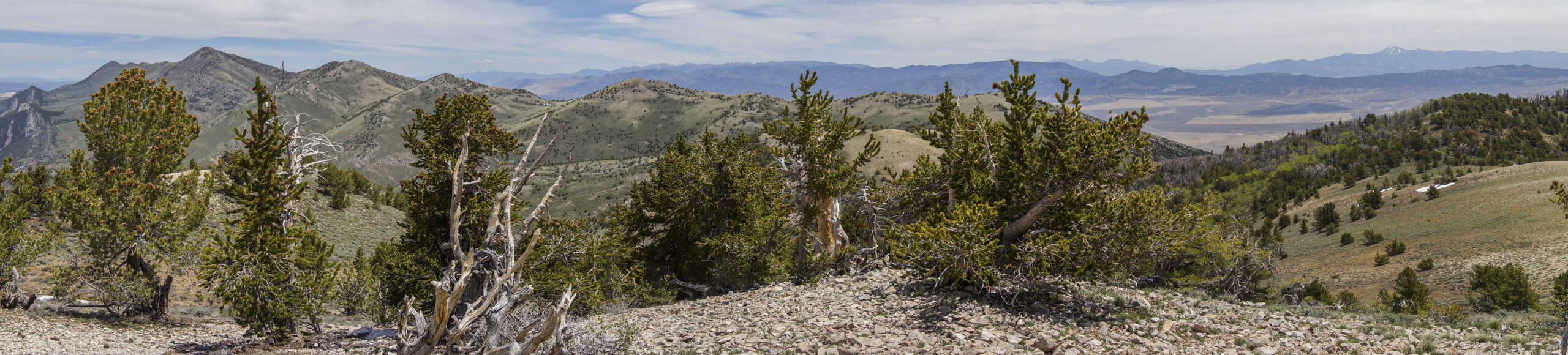

Willow Peak summit looking north to Ward Mountain and the crest of the Egans

Looking east to Wheeler Peak, Great Basin National Park, from the summit of Willow Peak in the Egan Range
Once at the top of the crest, the 4×4 road faded and I began my cross-country trek across the ridge south. First, I bagged Willow Peak, 10,302ft. I could see Wheeler Peak in Great Basin National Park to the east, which is essentially the end point of the Basin and Range Trail. It’s a strange feeling to have your end point in sight, but know that it is still 2 months away.
Here on Willow Peak, I found some Rugose Coral fossils, evidence that the ground beneath my feet was once underwater, part of an ancient sea bed. I love geology, it’s fascinating!
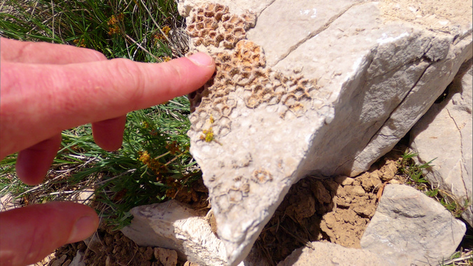
Rugose Coral at 10k feet

Overlooking Steptoe Valley to the east of the Egan Range
At first, the route begins with some thick and often frustrating bushwhacking (although I would later come to see this kind of bushwhacking as “easy” by the end of the BRT). I encountered some pronghorn from a distance, which scampered off before I could get too close. First real wild life encountered along the trail.

Looking south/southwest from the crest of the Egans

Hiking the crest of the Egan Range south. Let the bushwhack begin!
I contoured around some hills and worked my way up to the crest, forcing my way through thick stands of curl leaf mountain mahogany. Eventually I would learn to hate this stuff, as it, along with new growth aspens, make up the worst bushwhacks along the BRT. For now, everything was new and exciting to me, and the overwhelming feeling of excitement, adventure and discovery over rides all the negatives.

Steptoe Valley from the Egan Range

Hiking south on the crest of the Egans

Hiking the crest of the Egan Mountains
This next section was the highlight of Section 1 for me. Had I taken the Warn Mountain Alternate, I think that could have been the highlight, or perhaps, even a section farther south that I ultimately ended up walking around. Regardless, the walk here to Water Canyon was awesome. The route follows the rocky crest south, with excellent sweeping views, little vegetation, and was a fairly easy walk. It also runs slightly downhill from here, and for a moment, I forgot how tired and exhausted I was.
I mentioned that I filmed the hike, and unfortunately, the footage from this afternoon to tomorrow morning was lost. I was really bummed about this. I was using a mixture of 32GB and 128GB cards, and fortunately this was only a 32GB card. What I think happened, was I accidentally cleared it at the motel when I was dumping my media after section 4, thinking I had already backed it up. Or maybe, I just lost the card. I don’t know, but it’s gone.

Approaching Water Canyon

Entering Water Canyon

Once I approached Water Canyon, my next water source (duh!), I had to bushwhack my way down into it. Steep and loose terrain with thick brush guarded the path, but once down in canyon, it began to clear out a bit as I headed downstream, Soon, it became green and lush, and all of the sudden, there was a small but strongly flowing creek flowing. The spring is so strong that a creek just begins at this spot. I stopped here at this amazing spot and took my first meaningful break of the trip. I filtered water, chugged a few liters to hydrate (much needed), and washed off the blood and sweat from the last two days. Amazing break, indeed.

Water Canyon

Creek flowing through Water Canyon

Limestone cliffs of the Egan Range

South Egan Range Wilderness to the south
I followed the creek a short ways before continuing off-trail around a hillside, which showed a 4×4 road ahead. Sure enough, I found the faded old path and followed it to something larger. This area was surprisingly beautiful. Very lush, with craggy rock formations protruding from green mountainsides. 4×4 roads provide the easiest path forward here. The crest of the Egan Range is difficult to walk overall, except in a few areas. This is one of those areas where it’s just best to take a lower route. But hey, this is pretty nice too.

Old 4×4 road in the Egan Range

What a beautiful mountain range!

Camp night 2
Made it to camp around 5:30 today. I was just absolutely whooped, now feeling worn down from the lack of calories I’ve put into my body. People say you just need to force yourself to eat when feeling appetite suppression from the altitude, but for me, I physically gag on foods I normally like. I hate this feeling. I was really lucky I didn’t feel like this starting the CDT, but the CDT also starts out around 4300ft which certainly made it easier for me. Anyhow, I know this will all pass. It’s an adjustment period, and you have to stick with it until your body gets used to the abrupt change in eating habits, sleep schedule, elevation and of course, the extreme physical exertion.
Day 3 – June 3rd: Cave Valley
Slept a solid 10 hours. I was ridiculously sore and tired last night. Did not eat dinner. Got in the tent and laid down for a minute. It hurt to move, and I just let out a pathetic whimpering sound every time I tried. I quickly passed out face first, and slept a solid 5 hours without moving.

Millard Spring
Filtered water from Millard spring this morning. I had to dig out a shallow pool to collect from at the source. Good water. The ants are getting very annoying. For the last 2 days, everywhere I stand I get swarmed with ants after 20 seconds. The ground looks clear and then they come out of the ground or something and just start growing up my leg. This was extremely bothersome while trying to filter water or breakdown camp. There is literally nowhere you can stand where ants won’t suddenly appear and start crawling up your leg.


Jagged limestone cliffs. The route I had planned runs on top of that ridge
I decided to take a low route and avoid the higher route which would have hit Egan Benchmark. With my lack of appetite and lack of proper training before the hike, it just seems foolish trying to continue along the Route I planned, I simply don’t have the energy. So instead I dropped down into Steptoe Valley to the east. Nice views coming out of the mountains, but surely, not as nice as they would have been from Egan Benchmark. I also bypassed a bunch of bushwhacking up there though, and it looked thick. Not too upset about missing that part. I passed a couple of water sources on my way out of the mountains, but was already full.

Walking out of the Egans towards Steptoe Valley

Leaving the Egans, Mt Grafton in the distance
I continued along a 4×4 Road that parallel the main road running through Steptoe Valley…. Here I found an unopened Gatorade bottle, a great find! Unfortunately, it had been baking in the sun and would need to cool off before I want to drink it. The label looked really faded, so I don’t think it was recently dropped. My guess is, it had been there over the winter. Still, little things like this are a big deal to a long distance hiker. Imagine walking through the middle of nowhere, and finding a free non-water drink. Yeah, this might make your day.
Pretty uneventful hike today. Lots of Sagebrush now in the low valleys. There is no sign of anything here. There is supposed to be a road running through this valley, but I don’t see it. And I certainly don’t see any vehicles driving through the valley. It’s pretty empty out here.
Took a break under a juniper tree, which thankfully was ant-free. Here I took a short siesta, more for the rest than getting out of the heat. It’s not all that hot, very manageable right now.

Mt Grafton Wilderness
Shortly after mu break, I joined up with the main road running through Steptoe Valley. It’s a dirt road but well graded. I walked by the Mount Grafton Wilderness area, farther to the east. This was one range I had considered walking during my planning for the BRT, but ultimately, chose the Egans. From here, boy, Mt Grafton doesn’t look like much. But that’s how a lot of Nevada is. It doesn’t look like much from the road, you have to get into it to see how beautiful and diverse is can be.
My legs are getting a lot of sun now at this point. Lots of cuts and scrapes from the off-trail hiking over the previous two days. I have hotspots and blisters forming on the balls of both feet now as well. I certainly didn’t need this on top of the way I am already feeling.

Windmill with good water
Saw a little horned toad along the road. Then saw a coyote or fox run across the road leaving the robbers Roost windmill. There were a couple of other places along the main road that had water as well, but I stopped here. The pipe feeding the trough, like all of the other ones I’ve seen so far, was positioned too far away from the edge of the trough to be able to collect from it. Fortunately, the water in the trough was very clear, despite looking extremely green… The green was on the bottom. Unfortunately, there was no shade and a lot of bugs, lots of cow shit. Filtered 2 liters and was on my way.

Campsite night 3
Walked another hour and started walking up a 4×4 road that intercepted the main road, just before a several mile stretch of private property. Found camp a couple hundred yards of the road before reaching the private land.
Still very little appetite, and just snacked on a couple things for dinner. Went to bed at 845, another exhausting day.
Day 4 – June 4th: Cave Valley, Shingle Pass
I thought my campsite selection was pretty flat, but my air mattress was sliding towards the end of the tent in the middle of the night. I switched directions and that seemed to improve the sliding. However, I was confused when the sun was on my face in the morning, since it was also on my face when I went to bed. It took me a moment to remember I switched directions.
I had camped very close to some private Ranch Land, and some cows could be heard nearby. Even through the middle of the night, they continued to make ridiculous sounds. One of them was flipping out, out of nowhere. Almost as if the cow had a nightmare. Visions of the slaughterhouse, maybe. And that was before the coyotes moved in.

Welcome to “Valley”. Cave Valley.
It was a warm morning. I was moving by 7 a.m., hoping to cover some miles before it started to get too hot. I walked through the private Ranch Land on a public Road. There was a BLM sign for Cave Valley, but a shotgun had taken out the word cave. The sign just read Valley. Those lovable locals.

Parker Station
I had wanted to leave the main road at a place called Parker station, but that ended up being private land too. I had another spot in mind to leave the road, but it would have required a crossing of Haggerty wash. Here, there was shallow flowing Creek over some very thick mud, as evident by the cow tracks in it. I’m glad this wasn’t the only way, because it would have been probably ankle to Mid Shin Deep with mud. The kind you worried about losing your shoe in. Additionally, I had some blisters forming on my feet, with no way to wash off the mud it surely would have worsened my blisters. Plus, half the mud was probably sow shit anyways. So, I turned around and went back to the main road. That is, after taking a break under a juniper tree. Never pass up shade in the desert.
Back on the main road now, the only vehicle I saw the whole time drove by, a ranch hand’s truck. He asked if I was broken down. I said no, just hiking. He said, we don’t see many hikers here. I proceeded to tell him about my hike. I asked him if he had an extra liter of water, but he said no. He gave the location of Haggerty wash further up the road, which was where I was going anyway. So that’s where I headed.

Cave Valley views
The ranch I past was the only Homestead I saw this whole section, in Steptoe Valley and Cave Valley. The Schell Creek range proved the backdrop for the ranch to the east, which was now looking more impressive. Even though my route to traverses the shell Creek range North of Ely, it’s very long and continues all the way down to the southern end of this section, and beyond. It’s the second longest mountain range in Nevada, with the Toiyabes being the longest. And I’ll walk that one in section 4.
Then I came to an intersection with a sign indicating Highway 318 was 16 miles away, over shingle pass. I wasn’t expecting a main road going over shingle pass (I hadn’t even researched the route I am on now before my hike), but it was a well graded dirt road. Not a single car drove by while I walked through it all day.
When I reached Haggerty wash, I was pleased to see that it was a flowing Creek with less cow activity than the last spot. It was also well shaded. I wasn’t in dire need of water or overly hot or anything, but it was a really nice break. I thought about how hiking makes you appreciate little things in life like this.

Road walk to Shingle Pass
The rest of the day was fairly uneventful. Walked the road up shingle pass. Along the way, I hunted for rocks along the road. Didn’t find anything to interesting, but had to look since the road was cut into the hillside 6ft deep.
My feet were hurting now. I took a break at the top of Shingle Pass. Took off my shoes and my Luko tape had slipped off a bit. Had a blister the size of a quarter under the ball of my right foot. Nothing to do but keep moving.

Near Shingle Spring

Shingle Spring. Yum.
Next, I encountered Shingle Spring, which was really nasty looking. A really large round trough with a tree growing right along the outside edge, over hanging half of the trough. The water was thick with green algae. Huge warms of bugs were attracted to this water. Not too appetizing, but I was really hot, and so is my water. I was eager for a cold drink, so I filtered a quick liter.

Shingle Peak and the Far South Egan Wilderness
The views of the far south Egan Wilderness and shingle Peak to the South were very impressive the farther I progressed downhill. Vertical spires and Rocky outcroppings were everywhere along the upper reaches of the canyons, below the Ridgeline. It looked extremely rugged, and made me think, who was the last person to climb that? Does anyone climb it?

Far South Egan Wilderness, making up the southern portion of the Egan Range

Far South Egan Wilderness
I’m only a few miles from Highway 318 now, where I will hitch into Preston, a small community population 16) just north of Lund. Feeling tired, sore, thirsty, sunburnt and even a little hungry now, I began to feel a second wind. This is the “high” I sometimes get when the end is in sight. Even though the last few days have been extremely rough, I haven’t felt alive like this since I walked the Continental Divide Trail in 2018. It’s a feeling I NEVER feel in my “normal” life, only out here. It’s funny how that works. But this is the feeling I chase when I do these long distance hikes. And it feels good to be “home” again, where life is exciting and fulfilling, even if your accomplishments are meaningless on the grand scale of things.

Trying to hitch into Lund, or more specifically, the smaller community of Preston
Much of the traffic I saw on the highway was Truckers, so I knew this was going to be a difficult hitch. Sure enough, it was. Truckers never stop for hikers, Ever. Have the time they don’t even move over either, they just drive by as close as they can, almost as if you don’t exist, or if they just don’t like you for being on the side of the road. The regular passenger car traffic wasn’t any better. I had a piece of cardboard that I wrote Lund on, and had my thumb out. I tried waving my arms in an overhead cross motion, signaling for help. I also tried waving a $20 bill along with my thumb. No luck. After an hour and a half, I was about to give up.
Next I had the idea to write on the bottom of my Tyvek tent footprint with marker… “Hiker needs ride to town please help”. When the next car drove by, I tried to display the sign but it was too windy, it kept folding over and became illegible. Before the car had fully driven by, I tucked the sign under my arm and just threw out my thumb as a last resort. The vehicle drove by and I kind of threw up my arms in frustration, as if saying, what the hell man? Next thing you know, the car turned around and picked me up. It only took an hour and a half.
My ride was a single woman in her late 40s. She was on her way to Idaho, from Arizona. We got to talking and it turns out that we went to the same high school in Michigan! Just 12 years apart. What are the odds, in the middle of nowhere Nevada!

This is Preston… basically, just a truck stop that has a motel, convenience store and gas station. A bare-bones resupply stop
She dropped me off at the Lanes Ranch motel in Preston. I checked in and asked if my food box was there. It had not arrived. No problem, I’ll check back tomorrow. First thing I did was run over to the convenience store to see what kind of food they had. I was extremely disappointed when I learned that the cafe had just closed, and is closed all weekend. I was even more disappointed with the food selection in the convenience store, just a handful of microwavable sandwiches. I took a Big AZ chicken sandwich, which tasted pretty horrible.
Whew, section 1 of the Basin and Range Trail done, time to rest up a bit!
Day 5 – June 5th (zero day)
I ultimately ended up taking 3 full zero days, and they kind of blurred together. I checked the tracking number for my food box I sent to the hotel, and it updated this morning, saying my box had just been returned to Michigan, processing through the Detroit Center. Uh oh, I’m in trouble. The convenience store doesn’t have enough food for a 7-day hike (or really, a one day hike), so one way or another I’m going to need to figure out how to get to Ely to hit up Ridley’s grocery store.
Next I got started on chores, like laundry and recharging batteries. I stopped back in the motel office and talked to the lady up front, let her know that my food box was not going to arrive. There was another guy standing in the lobby talking to her, and overheard when I asked if she knew if anyone was going to Ely in the next couple Days. She did not, but the guy in the lobby was also works for the hotel, who will be relieving her later. He offered to let me take his car tomorrow and make a run to Ely. I was taken by surprise, as always when someone offers something so kind and generous. His name is Henry, and I will be seeing him all weekend.
At this point I know I’m going to stay at least all day today, Friday, and all day tomorrow, Saturday. Sunday is up in the air, we’ll see how my blisters heal up and how the weather plays out.
Not much else worth mentioning today. It was nice to relax in the motel room, really the first time I’ve been able to just sit there and relax in weeks, as I was working like a dog right up until the moment I left to come out here.
Day 6 – June 6th: Zero Day in Preston, NV
I stopped in the office this morning and talk to Henry, and grabbed his car to make a run to Ely. It was late morning now. It was cold and wet today, and perfect timing for a zero day. The skies were dark, and it began to rain, with snow likely at high elevations.
Got what I needed from Ridley’s. Then headed over to the post office to mail back some rocks and extra gear. Next, I placed an order at Hometown Pizza for an extra large 6 meat. This pizza will sustain me for the rest of the weekend. However, I wanted something right now as well. While I waited for them to cook the pizza, I headed over to Carl’s Junior and got a chicken strip combo meal. Holy shit, those chicken strips were insanely delicious! Maybe it was my Hunger, which was pretty much out of control now. I did not get to really pig out on anything yesterday, just a hoagie sandwich from the convenience store and some snacks. This really hit the spot.
Picked up the pizza, topped off the gas in the car, and headed back to the hotel. Dropped the car off, talked to Henry for a while. Pretty cool dude, we got along pretty well, talking about the outdoors and just life in general. He’s in his late seventies, but still moves around decently and gets out to explore. He offered to let me take his side by side open to the mountains tomorrow if I wanted to get out of the motel. Damn, so generous!
Spent the rest of the day in the motel room going over Maps for the next section, and debating overall Logistics moving forward. I decided to stay all day Sunday (tomorrow) too, since there were single digit wind chill temperatures up at Troy Peak for the next couple days, along with some potential snow from the storm.
Day 7 – June 7th: Zero Day in Preston, NV
Went into the front office and chatted with Henry for a while. Instead of taking the side-by-side, I took his advice to walk across the street and hunt for arrowheads. He gave me permission to look on the motel owners land, which he says has produced over 5000 arrowheads over the years. Sure, why not!
It felt a bit awkward to be on private property, but nevertheless I wandered the fields for a while. I found many chips and fragments from the Arrowhead making process, and a couple of full arrowheads. I did find one cutting tool, perhaps, so I took that with me too. It was much cooler today and looking like rain, so I only stayed out about an hour.
Back at the motel room, I re packaged my food, and continued to pine over map decisions. Went to bed around 10, a bit nervous about the next section. But you know, if you aren’t nervous about what’s coming up, maybe what you have planned is too easy? That’s how I think, anyways. I tried to clear my head so I could get some sleep.
Related Images:
1000 Mile Nevada Thru Hike Documentary: Pioneering Nevada’s Basin and Range Trail
In 2020, I walked a new 1000 mile thru hiking route across Nevada’s backcountry. The unique Basin and Range topography here is stunning and remote, difficult and rewarding. I’ve filmed this trek and have produced a 60 minute film that documents this epic journey across one of the last true wilderness areas in the west. And now, you can watch “Pioneering Nevada’s Basin and Range Trail” to experience this journey for yourself!
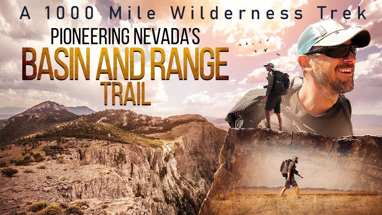
Related Images:
Pioneering Nevada’s Basin and Range Trail: Official Movie Trailer
I haven’t been very active here lately, but a LOT has been going on behind the scenes. Since I returned from my Basin and Range Trail thru hike last summer, I have been hard at work documenting the journey. Since November, I have been working non-stop on this project; building a dedicated website for the BRT, writing a guidebook, creating maps for navigation. The website is now live, and you can visit it here: https://basinandrangetrail.com/
Additionally, I have been working on a feature film called “Pioneering Nevada’s Basin and Range Trail”, and today I am pleased to share the trailer for the movie with you:
")
The movie is to be released on streaming and video on demand services late spring/early summer 2021. More info to come soon! Also in production is a much more detailed 10 part series on the Basin and Range Trail. The movie barely scratches the surface of the adventures to be had on the BRT, and the series will really give you a chance to immerse yourself in the full experience.
How you can help: Marketing is the biggest factor that can make or break the success of a film. If you enjoy the trailer, please take a moment to share it on facebook, reddit or the social media platform of your choice.
Thank you all for your patience and support!
UPDATE: You can now watch the 60 minute Basin and Range Trail Documentary Film for free on youtube, but if you’d prefer, you can also watch it on the following streaming services:
Related Images:
Basin And Range Trail Thru Hike Guide
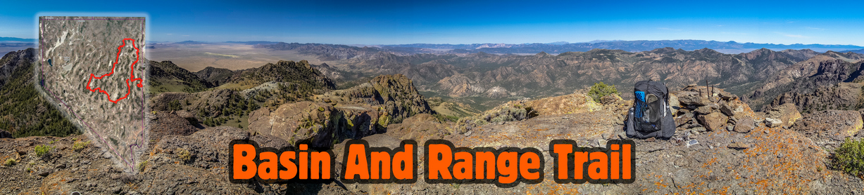
Basin and Range Trail Introduction

Map of the Basin and Range Trail
The Basin and Range Trail (BRT) is a 1,090-mile hiking route through Nevada’s Basin and Range country, more commonly referred to simply as the Great Basin. Nevada is home to more than 310 mountain ranges, second only to Alaska. Most of these mountain ranges are tall, narrow and run parallel to each other in a north-south configuration. In between these mountain ranges lies vast arid valleys, or basins. The Basin and Range Trail was created to explore this unsung landscape, a region with few established hiking trails and very little information on what is even out there. In short, the allure of the unknown inspired this route.
The BRT offers a different kind of thru hiking adventure, more raw and rugged than those within the National Scenic Trail system. The BRT is not a blazed trail, a beaten path or even a 100% fully ground-truthed route. Routes of this nature are constantly evolving, seeking the best scenery and most interesting hiking, the optimal route. As more hikers take on the Basin and Range Trail, various alternate routes are explored and feedback is gathered, the future will see many updates to the current route. Thru-hiking the Basin and Range Trail means off-trail hiking and bushwhacking, and hikers setting foot here should understand that this is part of the adventure.
The Basin and Range Trail is split up into 10 sections, and could end up being anywhere from 900-1100+ miles, depending on the route you take. There are many options for alternates and cutoffs. It begins in Ely and forms a large “loop” through the state, nearly ending in Ely but actually ending in Baker. The BRT is best suited for a clockwise hike. Late spring/early summer is the optimal window. Expect 45-55 days of hiking. There is a lot of rugged cross-country terrain with a lot of bushwhacking, so the pace is slower than a normal thru hike.
Read the Las Vegas Review Journals’ story on the Basin and Range Trail
BRT 1.0 vs BRT 2.0
The version of the Basin and Range Trail I hiked could be considered 1.0. Since my first attempt of this route, it has undergone major revisions to take advantage of the first-hand knowledge I gained by getting my feet on the ground and actually hiking the route. Large portions of my original route have become the standard route, some portions of the original route are now alternate routes, and some portions of the original route have been scrapped and re-routed all together. Keep in mind that the Basin and Range Trail experience presented in my journal only partially represents the standard Basin and Range Trail route presented in the Official Guidebook and Map Set, which could be referred to as BRT 2.0.
Basin and Range Trail Thru Hike Journal And Photos
Goshute Range Traverse
1 – Ely to Preston: 94 Miles (87 Miles)
2 – Preston to Tonopah: 120 Miles (110 Miles)
3 – Tonopah to Carvers: 116 Miles (124 Miles)
4 – Carvers to Austin: 95 Miles (94 Miles)
5 – Austin to Eureka: 106 Miles (59 Miles)
6 – Eureka to Lamoille: 131 Miles (123 Miles)
7 – Lamoille to Wells: 80 Miles (70 Miles)
8 – Wells to Wendover: 113 Miles (83 Miles)
9 – Wendover to Ely: 125 Miles (105 Miles)
10 – Ely to Baker: 111 Miles (96 Miles)
BRT 2.0 Total: 1091 miles My Total: 951 Miles
*Note: I want to present both my actual mileage hiked, but also, the mileage of the standard route for future BRT thru hikers. Read the above mileages as follows: “1 – Ely to Preston: 94 Miles (87 miles)”… the 94 miles represents standard BRT route presented in the guidebook (BRT 2.0), while the 87 miles represents the actual miles I hiked on my version of this section (BRT 1.0). Basically, this is a quick way of understanding how many miles I hiked that section, compared to what the total is for that section moving forward in BRT 2.0.
Basin and Range Trail Thru Hike Videos
I filmed carried 6lbs of electronics and camera gear to film my Basin and Range Trail thru hike. After the hike, I then spent well over 1,000 hours editing and producing a 10 part series documenting my Great Basin thru hike experience, as well as a feature film that condenses the Basin and Range Trail thru hike adventure down to 60 minutes. Watching these videos is the best way to get a feel for a Great Basin thru hike, to see the beauty of Nevada but also the difficulty of the route.
10 Part Basin and Range Trail Thru Hike Vlog Series
Basin and Range Trail Thru Hike Documentary Film
Basin and Range Trail Thru Hike Documentary Film on Streaming Services
You can watch the 60 minute Basin and Range Trail Documentary Film for free on youtube, but if you’d prefer, you can also watch it on the following streaming services:
- Amazon Prime
- Xumo
- Tubi
- Filmocracy
- Telus
- Overdrive
Basin and Range Trail Guide
Toiyabe Range, Reese River Valley and the Shoshone Range viewed from the Toiyabe Crest Trail
Now that you’ve read the BRT Journals and watched the Basin and Range Trail movie/vlog series, you may be interested in the more technical aspects of the hike. Perhaps to plan a thru hike, or section hike, of the Basin and Range trail yourself. The information below is meant to be a condensed guide to give the potential BRT hiker a quick look at the basic logistical aspects of planning your own hike.
The Official Guidebook and Map Set is the most complete, detailed Basin and Range Trail planning resource available for those who are serious about thru hiking their own version of the Basin and Range Trail. The route is well documented in the available 120 page guidebook, GPX file of the route, PDF map sets, water chart and more. The Basin and Range Trail planning resources are detailed and thorough, everything you need to hit the ground. The complete BRT planning guide and GPX kit is available for free to those who join the Basin and Range Trail Facebook group , which is the best way to get in touch with other past, present and future BRT thru hikers, trail angels etc.
Start and End Points
The Basin and Range Trail starts in Ely and ends in Baker. The route nearly forms a loop, but doesn’t actually end in Ely, although a hiker could if he/she so chooses. Getting to and from the start and end points of the BRT is a challenge. Ely doesn’t offer the hiker much in terms of transportation options. There are no airports, trains, bus routes, uber, taxi services or shuttles that operate out of Ely (population 4,000). Therefore, ending the hike in Baker (population 58) puts the hiker in a roughly similar situation, the need to find a ride to a larger town for transportation back home. If you don’t have a friend willing to drive you to and from the terminus points, your best bet is rideshare listings on facebook or craigslist. And of course, thumbing it as a last resort. Remember, the trial provides. If you can get to it.
Direction of Travel
The route is best hiked in a clockwise direction. The route ends at Wheeler Peak (13,065′) in Great Basin National Park, so you aren’t going to want t be at that elevation too early in the season. The Snake Range, encompassing Mt Moriah and Great Basin National Park, is best hiked last along the BRT. In general, the southern leg of the BRT is lower in elevation, as well as latitude, and so it can be hiked earlier in the season. For these reasons, it’s best to hike clockwise. A counter-clockwise hike of the BRT would likely require different start and end points.
Seasonality
The BRT could be hiked in the spring, summer and fall. However, most hikers will prefer this hike in May to July timeframe. The southern portion of the route is the warmest/lowest elevation, and that is why it is hiked first. In many years (snow has been low in recent years) the Toiyabes hold significant snow into June. The Rubies, Schell Creek Range and the Snake Range can all hold snow into July. In the southern portion, the Egans and Grant ranges both spend time over 10k feet, and reach 11k feet, so these can hold snow later into the season as well. Those who don’t mind the snow, or don’t mind bailing and walking around if high snow is encountered, can start earlier in the season, say, April. Those looking for a snow-free hike should wait until around 1st or second week of May at least, potentially later depending on the year. Start too late and the heat is an issue from mid July on, and water sources start to dry up. The ideal start date is based off the snowpack for the current year. Your goal is to have snow melt to draw water from while hiking the crest of the Toiyabes and Diamonds, in sections 4 and 6.
Time on Trail
The miles here are MUCH slower than a typical thru hike, because of the frequent bushwhacking and cross-country hiking across rough terrain. The hike will take much longer if you stick with the bushwhacking, not bailing out and taking alternates. The route variables could mean a total mileage of 900-1100+, which also has a big effect on your time to complete the route. Not counting zero days, figure 45-55 days for a “typical” thru hike of about 1000 miles.
Type of Hiking
Approximate breakdown of surface types along the Basin and Range Trail and their estimated percentages:
Single Track Trail – 10%
Cross-Country Hiking – 35%
4×4 Roads – 35%
Dirt Roads – 15%
Paved Roads – 5%
The majority of the hiking along the Basin and Range Trail is either cross-country or on a 4×4 road, many of
which are very old and faded. There are practically no hiking trails along the route, except in the Toiyabes,
Rubies, Mt. Moriah and Great Basin National Park. If you see a hiking trail marked anywhere else on the map,
chances are, it doesn’t actually exist on the ground. Sometimes, the same is true for 4×4 roads. If you do
encounter a trail, it likely needs some maintenance as most are overgrown. Many of the trails encountered are actually horse trails,
which quickly fade in and out.
Maps
Download the Basin and Range Trail GPX file & PDF Map Set. The GPX file and PDF maps are FREE for those who join the Basin and Range Trail facebook group, or available for purchase using the first link. You can can use the GPX file with the mapping platform of your choice (I recommend caltopo). The GPX file includes all of the water sources as waypoints as well.
Water
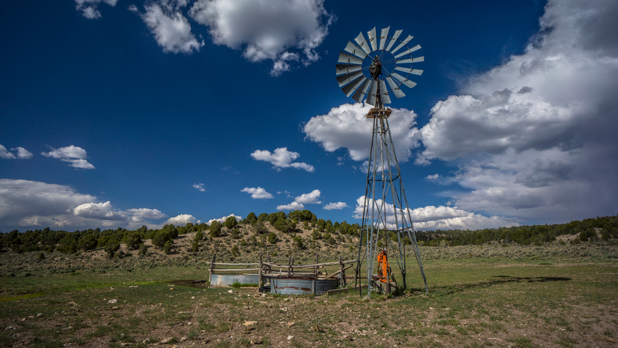
Windmill with good water in the Egan Range/Cave Valley
Water is perhaps the biggest concern a potential Basin and Range Trail thru hiker has when considering this trail. To those unfamiliar with Nevada, the prospect of finding reliable water in Nevada sounds daunting, and downright dangerous. However, this is not the case. Nevada is the driest state in the country, and even during an exceptional drought, in the middle of summer in 2020, I generally had no problem finding water.
The water availability along the BRT could be considered comparable to that of New Mexico on the Continental Divide Trail. There are plenty of days where you will have multiple water sources, and there are many days where you will only have one. It’s a dry and arid climate, but there is almost always water, when you know where to find it. They key is pre-hike planning.
Water sources plotted along the route, color coded for ease of visibility and understanding: Blue = Reliable, Green = Probably/Maybe, Black = Dry
The longest distance in between water sources for me was roughly 25 miles. The standard BRT route as presented in this guidebook has a water carry of up to 38 miles, but potentially as low as 25 depending on the route taken. In total, the BRT has 4 water carries over 20 miles. In general, water is pretty easy to come by, for such an arid climate. In short, water is not as big of a deal as you might think in Nevada.
Most of Nevada’s precipitation falls in the form of snow, and after snowmelt is when water is most abundant. Snow remains longer into the spring and summer season in some ranges than others. The taller the mountains, generally, the wetter they are. In most ranges, the large canyons have water. Many of these water sources in the mountains are flowing creeks.
Water Chart
Besides the GPX file of the route, here’s perhaps the single most important piece of planning info available for a thru hike of the Basin and Range Trail: the Water Chart. All of these water sources are plotted along the GPX file as well, so you can view these water sources along an interactive map.
*This chart is set to View Only, so if you have any updates to this chart, contact me directly and I will add your notes/updates here to the Basin and Range Trail Master Water Chart.
Bushwhacking
To be blunt, there is a shitload of bushwhacking along the Basin and Range Trail. This route was never meant to be conservative, ensuring easy passage or safety. It was meant to be the next-level adventure I was looking for after completing the CDT. For me personally, that meant mapping my own route, going off-trail, and dealing with whatever it was I got myself into. I knew I would be bushwhacking, and I accepted this going into it. I wanted to reach places that looked intriguing to me via satellite, or perhaps, simply connect segments of the route that would not otherwise be possible if one were not willing to put forth the extra effort in bushwhacking. If you don’t want to do any bushwhacking, I don’t blame you. But unless you are willing to do what others won’t, your adventures will be confined to the path more frequently traveled.
The worst bushwhacking along the BRT was in the East Humboldt Range, and the Goshute Range. The East Humboldt Range is notorious for being overgrown, and as wet as it is, can be thicker than anything else you’ve encountered along the BRT. The supple new growth aspens bend easily, but grow so thick that you’ll feel like you’re swimming in them above the ground. The Goshute Range, on the other hand, is much drier. Here, Mahogany Trees are the main obstacle. They grow thick too, but are stiff and brittle. In other words, it hurts more.
One option to consider is having a pair of gloves to protect your hands. They will become torn up without them as you constantly grab and snap branches on some of these bushwhacks. I didn’t have them at the time, but I am now wearing these Fish Monkey Fingerless Gloves. The inside of the palm is a soft flexible leather, and the outside is like a thin neoprene material. The gloves feel light and flexible, yet provide good protection for the hands while bushwhacking.
Weather & Climate
Those unfamiliar with Nevada often think of the state as a giant extension of Las Vegas, one big hot desert. Many are surprised to realize that the rest of the state varies as much as it does. Las Vegas sits in a valley at around 1800’ elevation, while the lowest point along the BRT is 4800’. Only once does it dip below 5000’. Most basins are around 5500’, with some as high as 6500’. Those are the LOW points along the route. Sure, it can be hot on the BRT, but nowhere near as hot as Las Vegas, due to higher elevations. Central and northern Nevada is a different environment. The rest of the state does not see the 115 degree temps that Las Vegas does.
See the Koppen climate classification map of Nevada below, with the BRT route overlaid:

You can see in southern Nevada, the red, which indicates “hot desert”. This is the desert most people think of when they think of deserts. In the southern portion of the route, along sections 2 and 3, you will encounter “cold desert” environments, but the rest of the low valleys along the route are mostly “cold semi-arid”. The mountain ranges are mostly “warm-summer Mediterranean continental” and to a lesser extent, “warm-summer Mediterranean”.
Expect bluebird skies nearly every day in June with mild temps. The low valleys aren’t too hot this time of year, and can actually be quite cold still on occasion throughout June. There is still the possibility of snow storms in June, expect a dusting or two at high elevations. The temps heat up around the beginning or July, and getting uncomfortable by mid July. Afternoon thunderstorms were sparse during my 2020 thru hike, only occurring within a one week window in late July. July and August will routinely see temps of the 90s and during a heat wave, the low 100s in the valleys along the BRT. It’s almost always windy in Nevada, and the winds are often high. The good news is that the winds generally die down at night. There are very few overcast days, so be prepared to be exposed to direct sunlight for the majority of your hike.
Mountain Ranges of the Basin and Range Trail
Mountain Ranges of the Basin and Range Trail
Valleys (Basins) of the Basin and Range Trail
Valleys/Basins of the Basin and Range Trail
Town Stops & Resupply

The Basin and Range Trail was created with as many walk-in town stops for resupply as possible, as opposed to hitching. Even so, half of the town stops require hitching. The towns are small and extremely isolated along most of the route. Besides the I-80 corridor along the northern end of the route, the biggest towns are Ely with 4,000 and Tonopah with 2,000. The other towns have little to offer. Preston, Carvers and Austin do not have grocery stores, so you’ll need to send a food box to these towns.
With the need to charge electronics and dump media from my cameras, I generally stay in a hotel in town. If I am sending myself a package, I’ll send it to the motel I plan on staying at. This is preferred over sending to a post office, because then you are not tied to their hours when you get into town. For example, get into town Saturday afternoon, and you’ll need to wait until Monday to get your box from the post office. Mailing to a motel eliminates that problem.
For a detailed Town Guide, check out the Basin and Range Trail Guidebook
Caching
It is not necessary to cache food or water anywhere along the Basin and Range Trail, unless you wish to do so. I did not employ this strategy as I rely on towns to recharge my electronics, dump media from my cameras and backup data.
If I were to cache, I would do so in place of the towns that require a hitch. So, I would cache at the end of section 1 (Sunnyside), section 2 (Lunar Crater), section 6 (Lamoille Canyon), section 8 (US 93 Alt) and section 9 (Cave Lake State Park). Of course, anywhere your route crosses a road will work, and selecting exact cache locations is up to you.


