Mojave Sonoran Trail Updates 2026
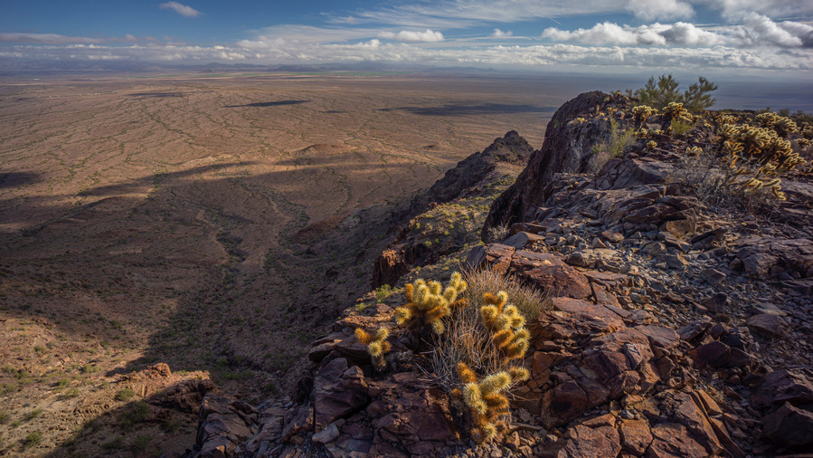
View over Renegras Plains, New Water Mountains, Section 9
It’s been nearly 5 years since I created, and first hiked, the Mojave Sonoran Trail. Since then, the route has seen a steady increase in interest, with several successful completions now by other thru hikers. With increased activity and use comes an increase in new information that future hikers should be aware of. The biggest changes are the addition of a water chart, some refinement of the route and the mapset, and the addition of Brenda, AZ as a resupply option.
NEW!! Water Chart for the Mojave Sonoran Trail
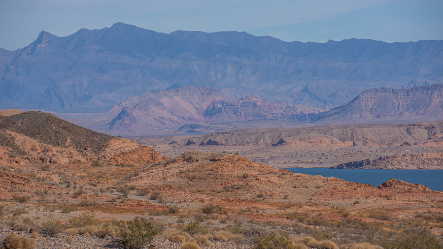
Lake Mead, Section 2
Now that a few hikers have had the chance to hike the MST, over the course of several years with varying water conditions, a water chart is available. The updated water chart now includes field observations of the water sources along the route from thru hikers in 2021, 2024 and 2026. Big thanks to Buck30 for creating the chart, and for his detailed field observations of the water sources he encountered on his Jan/Feb 2026 hike!
Download your own copy of the Mojave Sonoran Trail Water Chart
Route Refinement & Reroutes
Updated Mojave Sonoran Trail route on caltopo. Once you’ve opened this link in caltopo, click “Export” from the top left column under Map Objects to download your own copy of the route that you can edit or upload to your GPS. Choose GPX if you’ll send the file directly to your GPS or cell phone, choose GeoJSON if you’ll upload it into your own caltopo account and do some editing. GeoJSON retains all the custom colored icons, etc while GPX will strip them and revert them all to default colors.
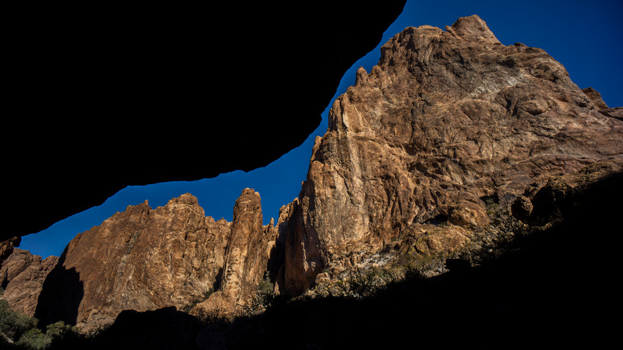
Mt Nutt Wilderness, Section 6. Narrow canyons such as these caused inaccuracies and exaggerations of my original recorded GPX track
The tracks I recorded on my original 2021 hike included a lot of extra exploration, backtracking, peak bagging etc. Not to mention the “bouncing effect” of a GPS in a deep or narrow canyon, where the position jumps around creating a scattered mess of impossibly unrealistic tracks. Big thanks to Buck30 for spearheading the effort to clean up these tracks into the more polished version I’ve linked to above.
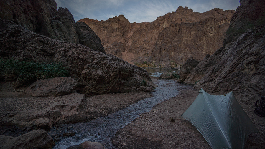
Camp near Gold Strike Hot Spring, an out-and-back alt in Section 4
I’ve also changed the route to make all “out and back” hikes their own alternate route, instead of just including them as the main route. This shaves miles off the main route in many places, making each section “shorter”. You should really consider hiking most of these out and back alts, which are usually fairly short, as they often contain highlights of the section.
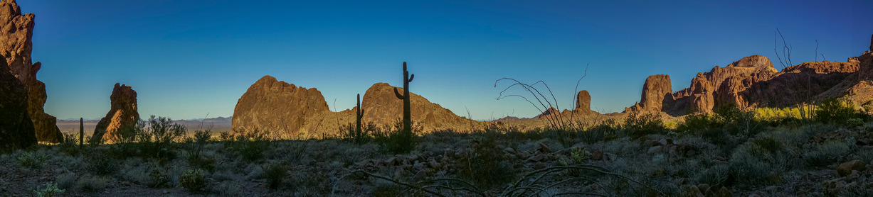
Kofa Wilderness, Section 9
Also note the addition of a new folder “B30 Alternates” in the official MST caltopo map. Some of Buck30’s alternate routes became part of the official route, as mentioned below in the changelog, and others that did not become part of the official route are presented to you here in this folder.
Route Change Log (Sobo Direction)
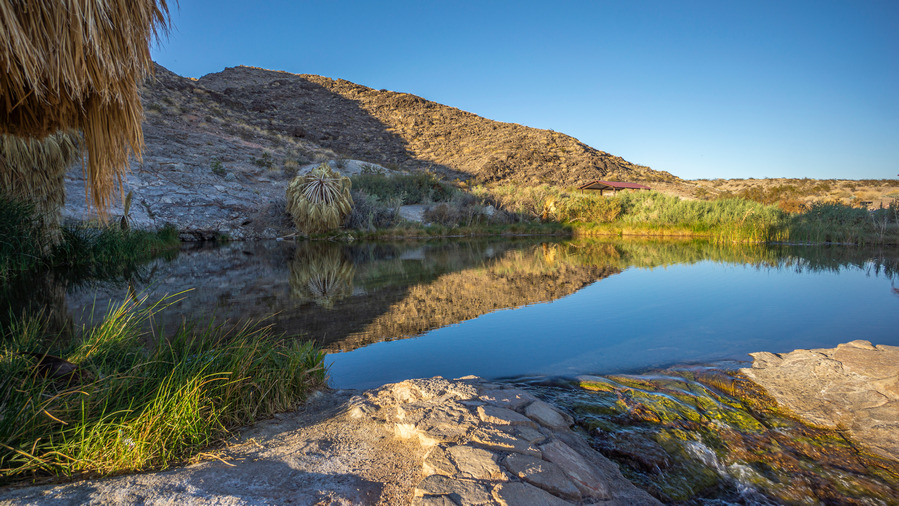
Rogers Spring, Section 1
Section 1 – After Rogers Spring, moved route off paved Northshore Rd making a more direct route to Echo Bay. Buck30 hiked this route in Jan 2026 and says “I took this alternate to Echo Bay, its a bit of wash and then remote powerline/jeep roads. It gets you off the pavement 3 miles early and is a fine route.” My original route explored a very steep canyon farther west of Roger’s Spring, as I was looking for a route through the Muddy Mountains if I had come up and over the ridge at Fire Alcove. The canyon proved to be too difficult and this route became the obvious choice moving forward.
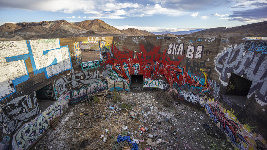
Three Kids Mine, Section 3, March 2022 before housing development leveled all this
Section 3 – Route modified to bypass new development at the site of the old Three Kids Mine, which WAS an interesting, eclectic stop along the route. This new route cuts off about a mile, is more direct and easier. RIP Three Kids.
Section 5 – Minor change to the way the route leaves town. More direct, cuts off about a half mile. Hardly worth mentioning.
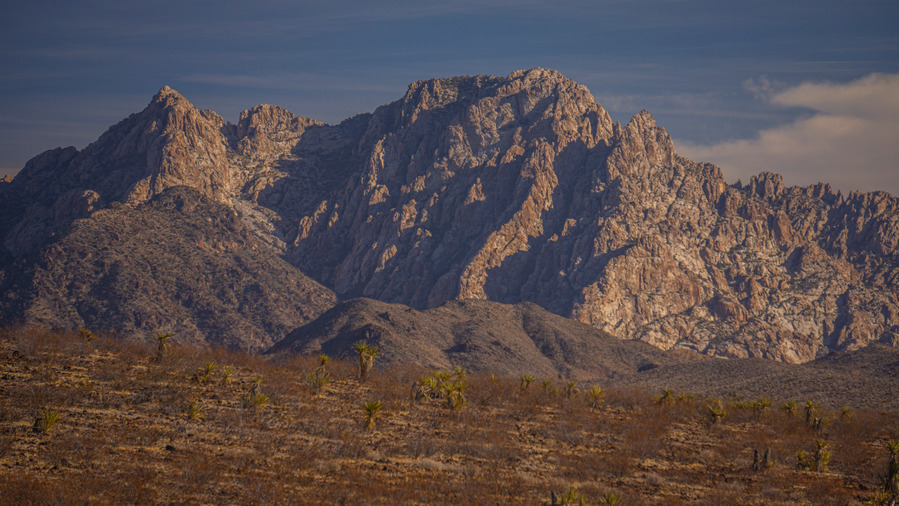
Spirit Mountain, Section 5
Section 5 – A minor change to the end of this section provides some big benefits. The old route crossed over David Dam and required either a hitch into Bullhead, or a couple miles of hiking, to the north end of town. Then one would need to hitch back and continue on a pretty uneventful hike through a wash for a couple miles at the beginning of Section 6. The new route, as hiked by Buck30 in Feb 2026, heads south along the Colorado River at the Sportsman Paradise Campground and takes the hiker right into Laughlin, NV. Here there are dirt cheap casino hotels and fast food restaurants. The downside is the grocery stores are all in Bullhead City, several miles south of Laughlin on the opposite side of the Colorado River. Nonetheless, Laughlin as a resupply point seems like an enticing option compared to the sprawled out town of Bullhead City.
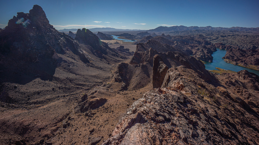
Havasu Wilderness, Section 6
Section 6 – Buck30’s Feb 2026 route out of Laughlin/Bullhead City will become the official route here. Basically, it follows a route south of AZ68 now, instead of north of the highway. It’s nearly 2 miles shorter, avoids private property, and is much more straightforward and direct now, following only the coincidentally named Buck Wash Rd (named after Buck30 I presume!) to Thumb Butte, where it rejoins the old route.
The Brenda, AZ Resupply Option
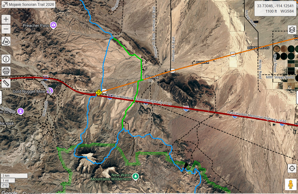
Blue is the official MST Route, green route is Buck30’s Brenda resupply route
At the end of section 8, I hitched into Quartzsite to resupply for the final section. Alternatively, Buck30 resupplied in Brenda, a small RV community 3.75 miles East of the spot along hwy 60 where I hitched. Brenda has a small convenience store(Buckaroo’s) and a restaurant. They did have an Amazon locker until recently, however it’s currently marked as temporarily closed. Water should be available, as there are several hundred RVs here. You could probably arrange to have a package held by calling the store, but this is completely unconfirmed. There may or may not be a place to spend the night, you could always ask the folks at Buckaroo’s if there is a trailer to rent.
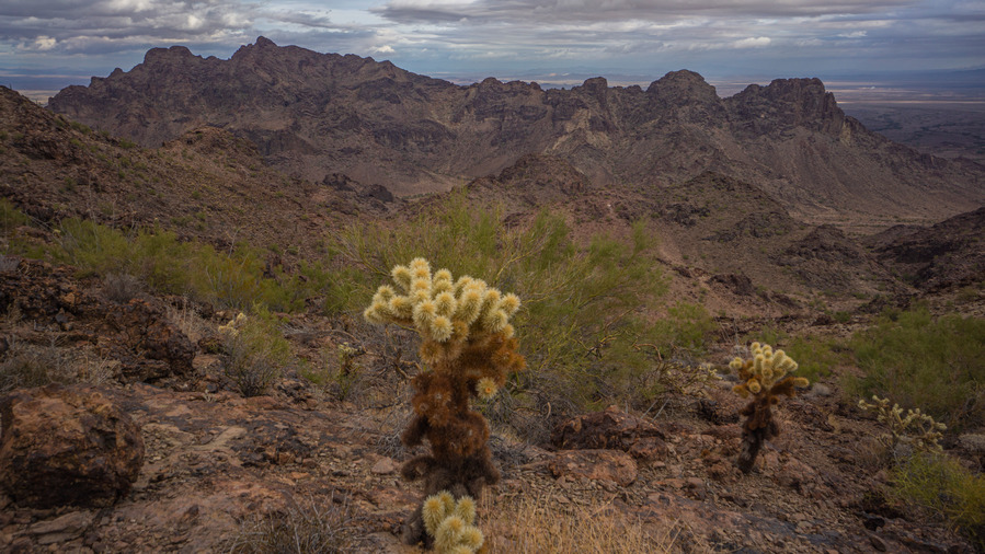
Plamosa Mountains, Section 8. About 7 miles north of hwy 60/Brenda
If you choose to resupply in Brenda, you can just hike in without the need for hitching. This route can be found in the B30 Alternates folder of the MST caltopo map. Also note that Buck30’s route south out of Brenda cuts off the rather brutal hike up and down Black Mesa. This is probably the way to go for most hikers.
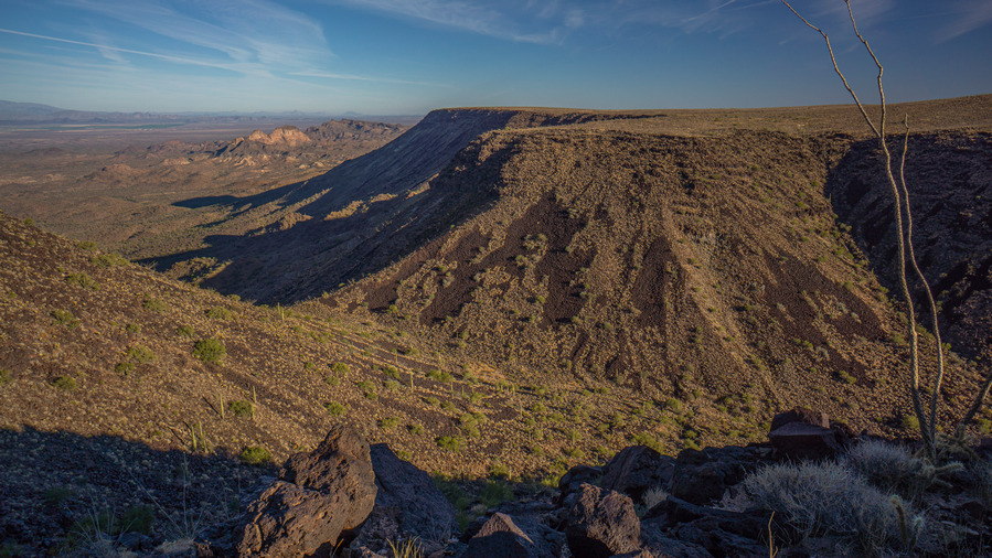
Black Mesa, southern Plomosa Mountains, Section 9
Choose to resupply in Brenda over Quartzsite if you are ok with a very limited selection of food from Buckaroo’s Market, want to avoid hitching, and looking for an easier overall route. Choose Quartzite if you need a hotel, more food selection or other town conveniences, and don’t mind a tough hitch.
Related Images:
North Country Trail Section Hike – Hwy 131 to Mesick, MI – Dec 2015

View All Photos | HD Video on Youtube
- Location – Pere Marquette State Forest, MI
- Trail – North Country Trail Section – Hwy 131 in Fife Lake to Mesick
- Fees and Permits: none
- Length Of Time Hiked – 2 days, 1 night
- Miles Hiked – 25+
- Trail Type – Point-to-point
- Starting Point – Roadside park along Hwy 131 in Fife Lake (closed in winter for parking!)
- Ending Point – 12/15 Rd Trailhead in Mesick
- Route Difficulty – 3
- Fires Allowed – Yes
- Solitude – 7 (For Michigan)
Maps
Below is my caltopo map I created before the hike.
Notes
I’ve hiked the High Country Pathway, Manistee River Loop, Nordhouse Dunes and the Jordan River Valley, which I consider to be the top hiking destinations in the lower peninsula. However, I have not hiked any segments of the North Country Trail yet, other than the west bank of the Manistee River where the NCT, along with the Manistee River trail, helps form the extremely popular Manistee River Loop. I found a segment of the NCT that sparked my interest, running from Hwy 131 south of Fife Lake to Mesick, and and chose that for a weekend getaway. There really isn’t much info in NCT section hiking in the lower peninsula. I only managed to dig up a couple trip reports with very limited pictures.
This hike ended up being 25-27 miles. I forgot my GPS so I don’t know the exact mileage. The North Country Trail is extremely well marked throughout and follows the Manistee River the whole way through this section, making it hard to get lost.
The challenge with this hike is logistics. It’s a point-to-point and requires a shuttle from one end to the other. Fortunately I was able to secure a ride from my car to my starting point at Hwy 131 to make this hike happen.
Saturday December 19th, 2015
I woke up around 5am today and made the 1 hour drive over to the town of Mesick with my shuttle ride following behind. After dropping my car off near the 12/15 Rd Trailhead on the north side of the Manistee River just east of M-37, we headed towards my starting point, where the Manistee River meets Hwy 131. First, we passed through the small town of Manton to stop for breakfast. Gotta get that last hot meal in before setting out into the cold!
After breakfast we continued north on Hwy 131 until we crossed the Manistee River. On the east side of the road just north of the river is a roadside park where you can pick up the NCT. However, the roadside park is closed for the winter. My ride dropped me off in front of the gate and I was on my own from here.
I walked through the parking lot towards the river and quickly picked up the trail. Heading south/west, the trail immediately runs underneath Hwy 131. It was in the teens today and windy, with some flurries in the air. After a short while of walking I was warmed up and ready to cover some miles.

Manistee River at Hwy 131 in Fife Lake where I started

The purpose of this hike was not only to get away and see this previously unexplored section of the Manistee River, but also to get a bunch of miles on my legs before my upcoming hike in Big Bend National Park in January 2016. I sprained my ankle in October and have been trying to slowly rehab it. After a few weeks of shorter walks, now is the time to do a more serious test and make sure I can handle a week in the desert.

The river has many, many bends like this along the trail

Not far after leaving Hwy 131 behind, I came across a campground, aptly named Old Us-131 State Forest Campground. Here, there was one car parked and some foot prints in the snow.

After passing the campground, I came across a railroad bridge crossing the river. Just past this bridge, there was a nice campsite with a nice overlook above the river. A little further down the trail was the first sign along the trail.


Sign near railroad bridge
Flurries continued to fall much of the morning and early afternoon. Not enough to really accumulate, but enough to set that winter mood. The trail has been very well marked and groomed making navigation easy, even with some snow to contend with.


The trail passes right alongside the edge of some private property for a while before dumping you out at a road. From here, it’s time to walk to road for a while.

After leaving the road and back on a trail, it passes behind a house higher up the hill. after getting out of sight of this home, I don’t believe there’s any more buildings homes to pass along the rest of the hike. Good views of the river from here. The next section is a little hilly with some ups and downs.

Sign marking the end of the road walk and the beginning of the NCT trail again
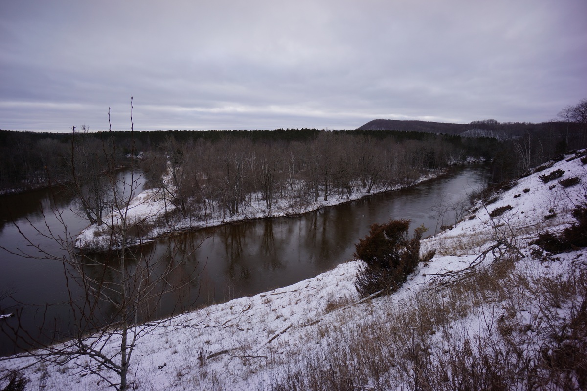
Near Baxter, back along the river again

Next I arrived at the Highbanks Rollway overlook. Here, there’s a wooden platform extending over the edges of the bluffs for a great view of the Manistee River and the the surrounding area. There was a sign up here that said it’s 200ft above the river, a massive view for the lower peninsula of Michigan. You could actually see a ways in the distance from here.

View from Highbanks Rollway
After leaving the Highbanks Rollway, the trail continued to follow the edges of the bluffs and good views ensued. I was ready to find a campsite, but was looking to be a little farther away from this area. I went around another bend in the river and felt like that was far enough, and started actively searching for a place to hang my hammock.

Sign near Highbanks Rollway

West of Highbanks Rollway
When I found a place to camp, first thing I did was get a fire going. It was cold just sitting around and and I wanted the warm of the fire to warm my hands as I set up camp.

After getting the fire going, I got the hammock up and decided to leave the tarp off and chance it. There was no mention of snow tonight so I figured it was a chance worth taking. Not messing with that tarp saved a lot of time.

For dinner, I had sausage (cooked it at home and ground it up pretty good) and shredded cheddar cheese in some flatbread. It was wrapped in some aluminium foil, so all I had to do is throw it n the fire for a bit to warm it up. When it was soft to the touch, it’s done. And DAMN, was this thing good. I’m going to make more of these in the future when the temperature allows.
Before jumping in bed I put my boots in a garbage bag so that I could sleep with them under my top quilt. Frozen boots are NOT fun, lesson learned from my previous winter hike in January 2015.
Sunday December 20th, 2015
It was a cold night, in the teens. However, I was fairly warm all night with what I had. And the best part is, my boots were really warm when I put them on this morning.
After getting out of the hammock I headed down to the river overlook a few hundred yards away to watch a beautiful sunrise. Lots of reds and oranges, very colorful compared to the bright white that dominates most of the landscape.
Sunrise over the Manistee River
After watching the sunrise, eating breakfast and packing up I got a move on. It was overcast now and waiting for the warm up. In fact, it was supposed to warm up to around 40 today. I wanted to cover some ground before things softened up and became slippery and muddy. For now everything was good underfoot.

The trial continues to look and feel like it did yesterday. Some high banks with good views above the river and some lowlands here, passing through old logging fields that have been replanted or maybe alongside the river itself.


Occasionally near the river, there would be an access road leading to it. In some spots it looks like people just car camp there. I only saw one spot with some trash and it was minimal. I wondered if the fishing was any good from any of these spots by the river. Between Hodenpyl Dam and Red Bridge, roughly 15 miles southwest of here where I’ve hiked several time before, I never had any luck from the shore.

It was definitely warming up now. The clouds appeared to be thinning and although still overcast, more sun was bleeding through. Yesterday when I was hiking, it was much colder, and so having my base layer pants on underneath my hiking pants kept me at a pretty good temperature. Today though, I was sweating. A lot. I should have just stopped and removed them, but I kept pushing on. My decision ultimately ended up resulting in a good bit of chaffing, which always sucks.


I knew I had to be getting close to my car at this point. The ground was getting getting soft now and the snow was melting. Eventually, I walked through a small dirt parking lot area alongside a road, with a sign at the trailhead. Cool, there’s my car. It was early afternoon now, and I was ready to get these boots off! 25+ miles in less than 36 hours, not bad. Hopefully I’m ready for Big Bend National Park next month.
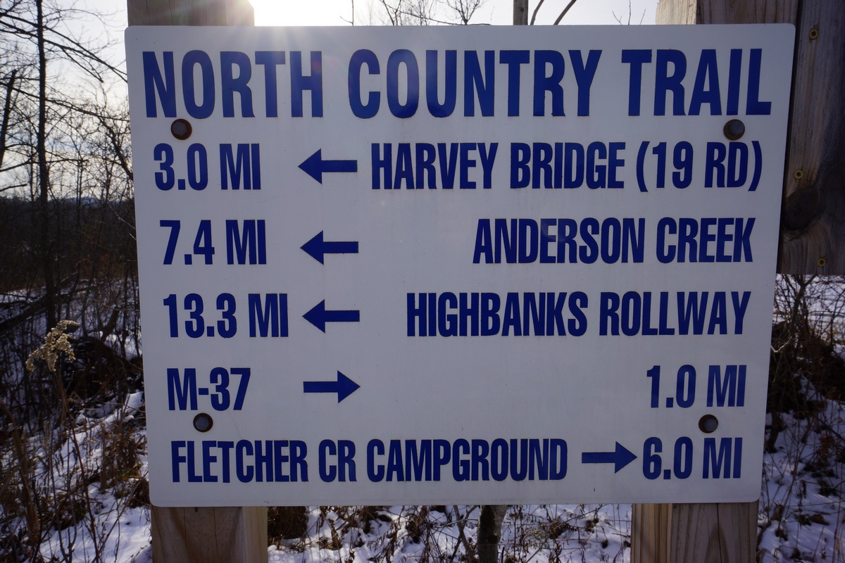
Sign at the 12/15 Rd trailhead
Related Images:
Superstition Wilderness, AZ – January 2014 (Backpacking Trip Report)
Superstition Wilderness 7 Day Hike Overview
All Photos From This Hike | HD Video
- Location – Superstition Wilderness, AZ
- Park Administarion – Tonto National Forest
- Fees & Permits – None
- Trail Name – Custom route, various trails
- Trail Type – Semi-loop
- Length Of Time Hiked – 7 days, 6 nights
- Miles Hiked – 92
- Trail Difficulty – 8
- Solitude – 7.5
- Fires Allowed – Yes
For my annual winter hike, I thought I’d give the Superstition Wilderness in Arizona another try. My previous attempt here in March of 2013 was a failure due to sickness, and further hindered by weather and gear problems. This will be a solo hike as was my previous visit here.