Alpine Lakes Wilderness, WA – West Fork Foss Lakes Trail Hike June 2016
Hiking The West Fork Foss Lakes Trail In Washington’s Alpine Lake Wilderness
View All Photos | West Fork Foss Lakes Youtube Video
- Location – Alpine Lakes Wilderness, WA
- Park Administration – Mt. Baker-Snoqualmie National Forest
- Trail Name – West Fork Foss Lakes Trail # 1064
- Fees & Permits – Northwest Forest pass required, or can pay $5/day for a day pass. You can get either pass at the US Ranger Station located here: 74920 Stevens Pass Hwy Skykomish, WA 98288. It’s on the north side of HWY 2 right about a half mile west of Foss River Rd, which takes you to the trailhead.
- Travel Logistics – Flew into Seattle, rented a Chevy Cruze
- Length Of Time Hiked – 4 Days, 3 Nights
- Miles Hiked – 20
- Trail Type – Out and back
- Trailhead – West For Foss River Trailhead
- Trail Difficulty – 6.5/10 (not including off-trail segments)
- Fires Allowed – No, not above 4000ft or at any of he lakes I passed
- Solitude – 6.5
- Scenic Beauty – 8
West Fork Foss Lakes Trail Maps
[sgpx gpx=”/wp-content/uploads/gpx/WestForkFossLakesTrailAllDaysOneTrack.gpx”]Pre-Hike
My work sent me out to Seattle for a conference, and I had the option to stay the weekend. This was my first trip to Washington state, and naturally I’m going to use that time to squeeze in a hike. A former co-worker had recently moved back to Seattle, and we planned to do this hike together. However, as with several of my past attempts to hike with a buddy, conflicting schedules and priorities meant I’d once again be hiking solo. While I totally understand and respect his decision to stay behind due to more important issues at hand, the fact remains; another hike with nobody to share the memories with.
Similar to my last hike in Arizona’s Sierra Ancha Wilderness, I’ve done much less research and planning on the are then I normally would. The big difference here is that I felt much more out of my element before the hike. While I have a fair amount of alpine hiking experience in Colorado, Utah and Wyoming, I’ve never been anywhere that had glaciers at 6000 feet. There are no snotel stations nearby at the 5000 foot mark, around the highest elevation this hike will see without any additional off-trail climbs I may decide to take on. Plus, all of my alpine hikes have been in late July or August, not late June. I set off on this adventure without any concrete knowledge of how much snow to expect at what elevation, although I felt pretty confident based on the little research I did that I’d be alright up to around 5000 feet. Still, the unknown awaits me.
Preliminary research showed that there was an avalanche that had blocked the road to the West Fork Foss River trailhead in February, which persisted into early June. A recent trip report on wta.org showed that the road had been cleared, but unfortunately the person who left the report had not actually hiked the trail to report on the snow pack conditions. Only 2 days before my hike, I learned that the avalanche debris had been cleared. Also, I discovered that the road would easily allow passage of a small car, even a Prius, despite the information on the forest service’s website about this road being for high clearance vehicles only.
Day 1 – Friday June 24th, 2106
Miles Hiked – 4.67
Elevation Gain – 2694′
Route – West Fork Foss River Trailhead to Copper Lake
I left the Seattle area in the early afternoon today and headed to the mountains. Once on Hwy 2 and east of Monroe, the drive was pretty scenic. I stopped into the US Ranger station on Hwy 2 in Skykomish to pick up a couple of day passes for parking at the trailhead. $5 bucks a day for anyone who doesn’t have a Northwest Forest Pass, which was $30.
The road to the West Fork Foss Lakes trailhead was cleared and smooth as any dirt road is going to get. It looked like they just left a bunch of the avalanche debris and turned it into a little hill to drive over. There were only a couple of small potholes, not large enough to cause any damage if one were to drive right over them at any speed. At the trailhead, there were about 12 cars. I was expecting there to be fewer cars here, considering the fact that it was raining and the trailhead had only been open a few weeks at most.
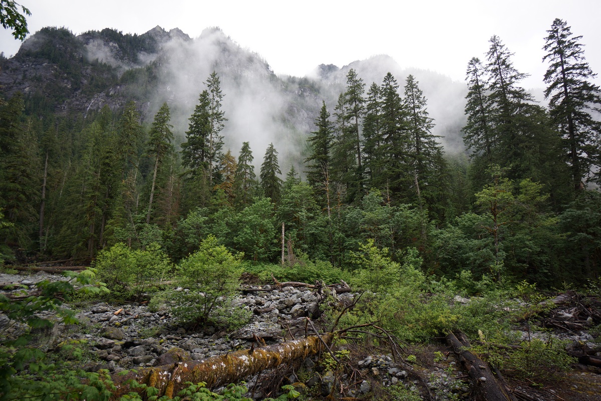
I hit the trail at 5pm. The plan for today is to hike to Trout Lake, the first lake and last landmark before the trail begins it’s ascent towards Copper Lake. The trail starts out in a lush looking pine forest with lots of moss growing on the trees. It looked similar to what I envisioned the Olympic Peninsula to look like, but I’m sure it’s quite different.
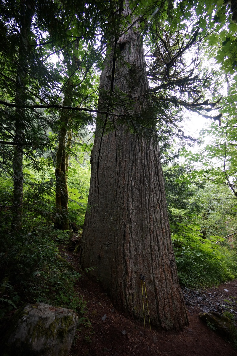
After a short while I reached the bridge crossing the West Fork Foss River. The water was flowing with some force and was quite loud. Some ways past the bridge I passed a huge pine tree, much larger than the others. This old-growth giant was obviously spared the ax when this area was logged in the past. Really impressive to see a tree of this size.
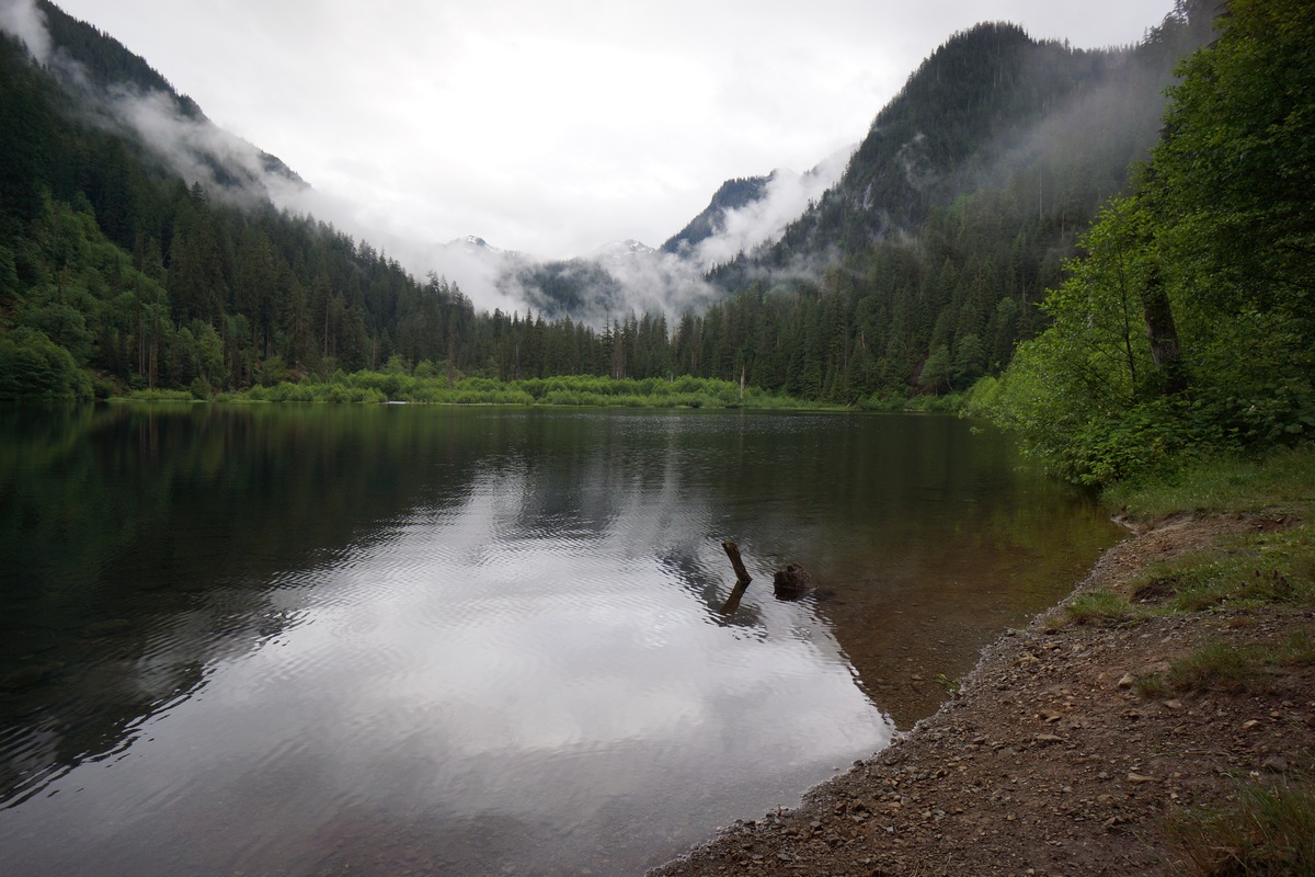
Next up along the trail was Trout Lake. I went down to the shore line to snap a picture, but with all the clouds, it wasn’t that great. When I turned around I saw a tent in the woods just off the trail. I continued along the trail and saw many more tents, I estimate at least 10-12. So much for camping here tonight. Doesn’t looks like there was an open spot, even if I wanted to camp here. These people seemed not to care that they were camping just 50 feet from each other. It’s one thing if you’re part of a large group, but otherwise, why would you come all the way out here to camp within sight of another person? That’s not my idea of camping.
It was around 6pm now as I pushed on past Trout Lake and headed up towards Copper Lake. While I didn’t really want to make the hike up to Copper Lake tonight, I figure I’d have more time in the high country tomorrow and should be able to snag a good campsite tonight. Not long after leaving Trout Lake behind and starting the climb up the switchbacks, the brush along the trail started to choke the path. It was now impossible to avoid the wet brush lining the path, and before long what little of me was dry became soaking wet. Water was sloshing out of my shoes now. This was pretty crappy and not what I was wanting to get into just 1.5 hours from the car.
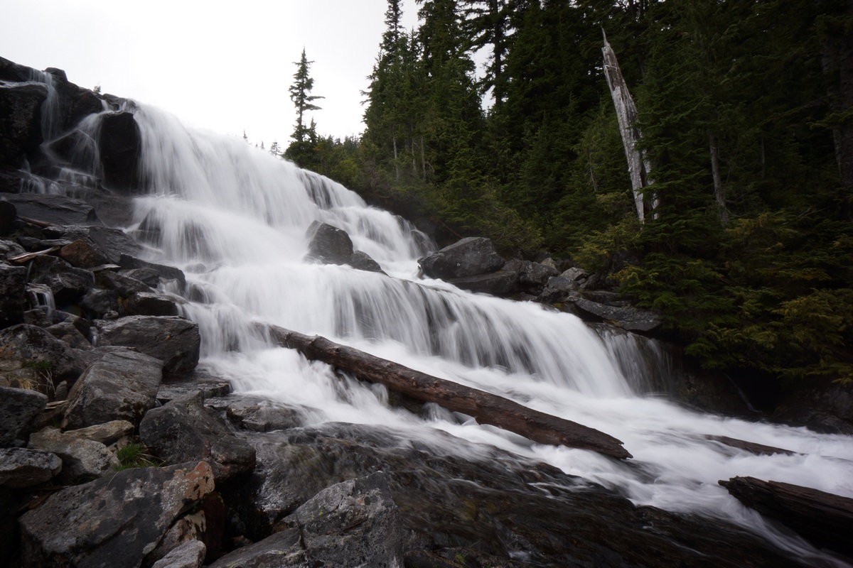
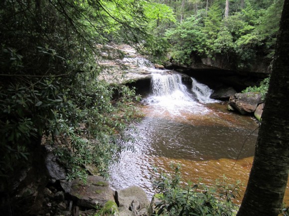
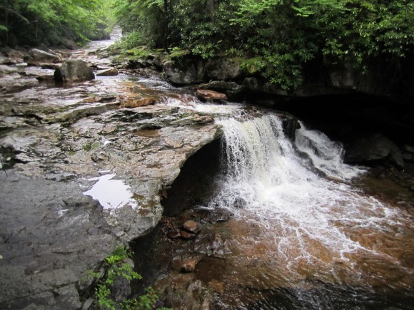
There weren’t many views from the trail as it winded up to Malachite and Copper Lake. However, the sound of a waterfall was present much of the way and there were a couple of good views of it towards the top. This waterfall was coming from the Copper Lake outlet. There was a decent campsite that probably would have worked for my hammock too around 3500ft, but why stop here? Just a few hundred feet from the top now, I pushed on.
When I reached Copper Lake, I saw a sign for Toilet and a path leading off into the woods. Didn’t realize they had toilets up here. I’ve only seen them in a handful of places, typically where human impact is large. That must be the case here as well.
I passed two young girls cooking hot dogs in their tent vestibule as I searched the are for a campsite. It was now around 7:45 and I wanted to find a spot to hang before it gets too dark. It took a while to find the right pair of trees. I’m learning that finding good hammock sites can be tougher then tent spots. Let’s face it, all pre-existing campsites are generally flat and will accommodate a tent, but not all pre-existing sites have trees, let alone trees spaced the right distance apart and of the right size. Some of these trees were so large, I couldn’t even fit the hammock webbing around it!
Finally got my hammock and tarp set up just before dark. It’s been a while since I’ve set up the tarp over the hammock and that took me a good while. Just in time though as it did start raining a little bit right after I went to bed. It was a good hang and super comfy, so I had no trouble falling asleep tonight.
Day 2 – Saturday June 25th, 2016
Miles Hiked – 4.81
Elevation Gain – 1788′
Route – Copper Lake to Big Heart Lake
It rained a bit throughout the night but not very hard. Either way, nothing of mine dried out. The trees were drip-drying this morning and I didn’t feel motivated to leave the tent until 9am. Nothing like putting on soaking wet shoes and socks when it’s 45 degrees out! It took a while to break down everything this morning with all my gear being wet, and I didn’t get on the trail this morning til around 10:15.
Unfortunately the weather was still looking crappy this morning. The forecast all week had been calling for rain Friday with it clearing overnight, leaving the rest of the weekend to be rather nice and sunny. So far, just clouds, and looks like it might rain at some point.
I worked my way around Copper Lake, which looked like it would have been much more picturesque under blue skies. I didn’t see many good, obvious campsites the rest of the way around the lake. I was looking because I may decide to camp here again on the way back. After all, I didn’t really get to experience this lake at all since I’ve been here.
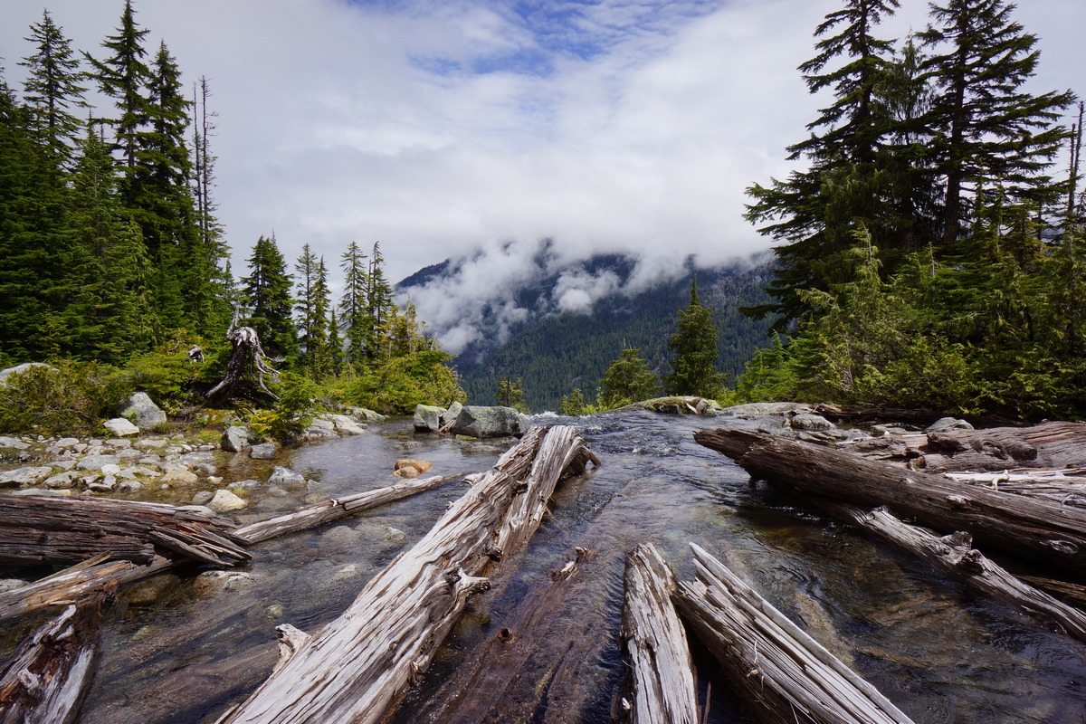
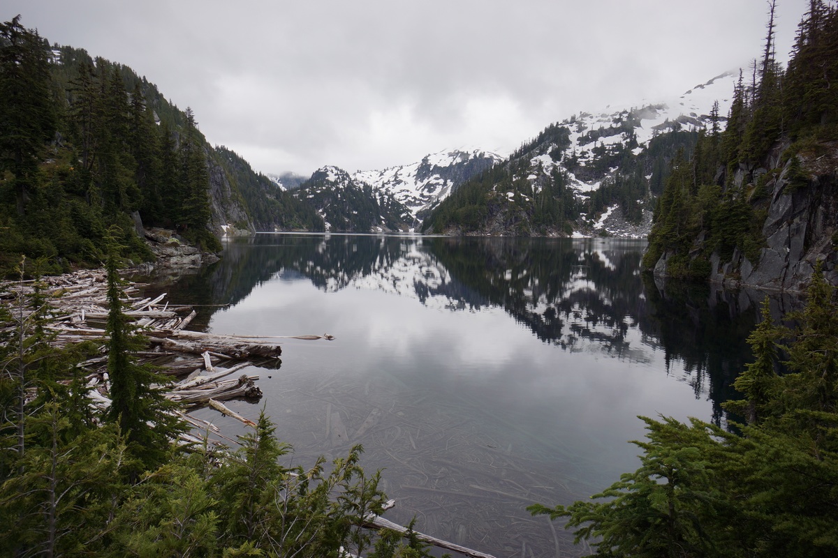
The trail winds away from the lake towards the north end, and off into the woods. It was a short hike over to Little Heart Lake from here. The stream outlet was jammed with logs like the others, and provided one of the better views of the lake in the immediate area of the trail.
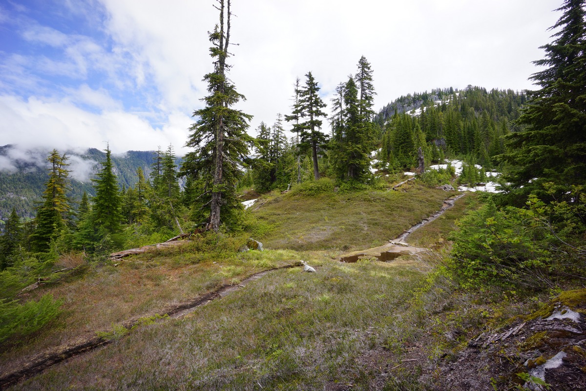
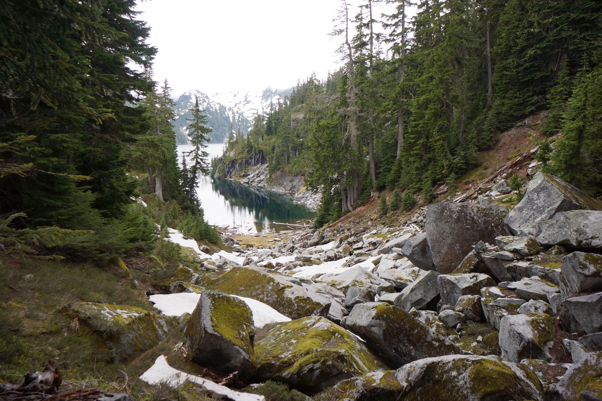
Moving on past Little Heart Lake, I started to encounter more downed trees. One was particularly large and kinda difficult to get past. After that, the trail continued to climb up over a small ridge. The thick cloud cover prevented any real views from breaks in the trees up here. In this area, I saw the first snow along the trail around the 4400ft mark. The trail along this ridgeline tops out around 4925ft before descending down towards Big Heart Lake. After a few switchbacks, the trail levels out and enters a little meadow littered with fallen rocks from the cliffs above. I ended up camping along a hill above this meadow later tonight, but at this moment I hiked right past it.
After roughly 2 miles from Little Heart Lake, I reached Big Heart Lake. There was a nice campsite sitting just above the lake’s outlet on the north side. At the moment though, it was occupied. I kept moving and made my way down to Big Heart Lake’s outlet. There was a huge logjam here that required crossing in order to continue along the lake. These were huge logs and pretty sturdy, which made for a simple crossing.
Now on the other side, I had a better look at the waterfall that is the result of Big Heart Lake basically pouring off a cliff. After a quick look and a few pictures, I moved on. I figured I’ll be back through here later, and might as well wait until the skies clear up for better pictures.
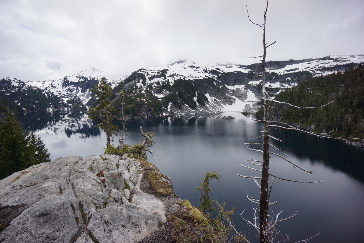
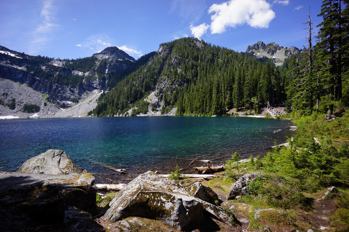
I continued up the trail along Big Heart Lake and found a couple of spots with sweeping views of the lake. Best views yet during this hike. Tons of mosquitoes up here though, but they’ve been pretty much everywhere.
Further up the trail I started hitting more snow. It wasn’t super deep, but my feet were occasionally punching through hollow spots in the snow. It was tough to keep sight of the trail at this point as well. I intended to try for Chetwoot Lake, but I decided to turn around and head back to Big Heart Lake and just try to dry out and enjoy the day, maybe do some fishing.
I headed back to the outlet area, and noticed that the prime campsite that was occupied earlier was now open. I dropped my pack here and laid claim to it, only to find out shortly after that my hammock would not fit between any of the trees here. Bummer. I spent the next hour at least trying to find another spot to camp. It’s insane to me to come all the way out to a place like this and take a campsite with no view of anything, but that’s what I ended up doing. The trees here make it very hard to hang a hammock since they’re so large. The spot I found was on a little hill at 4675ft overlooking that little meadow I mentioned earlier, on the extreme north end of Big Heart Lake.
My campsite was on a slope, which kind of sucks for a campsite, but it works when you have a hammock. After getting camp squared away, I headed down to the lake to do some fishing. From my campsite, there was a boulder field leading downhill towards a protected cove on the very northern tip of the lake. I worked my way around the west side of the cove and found a couple of nice boulders to sit on and fish from.
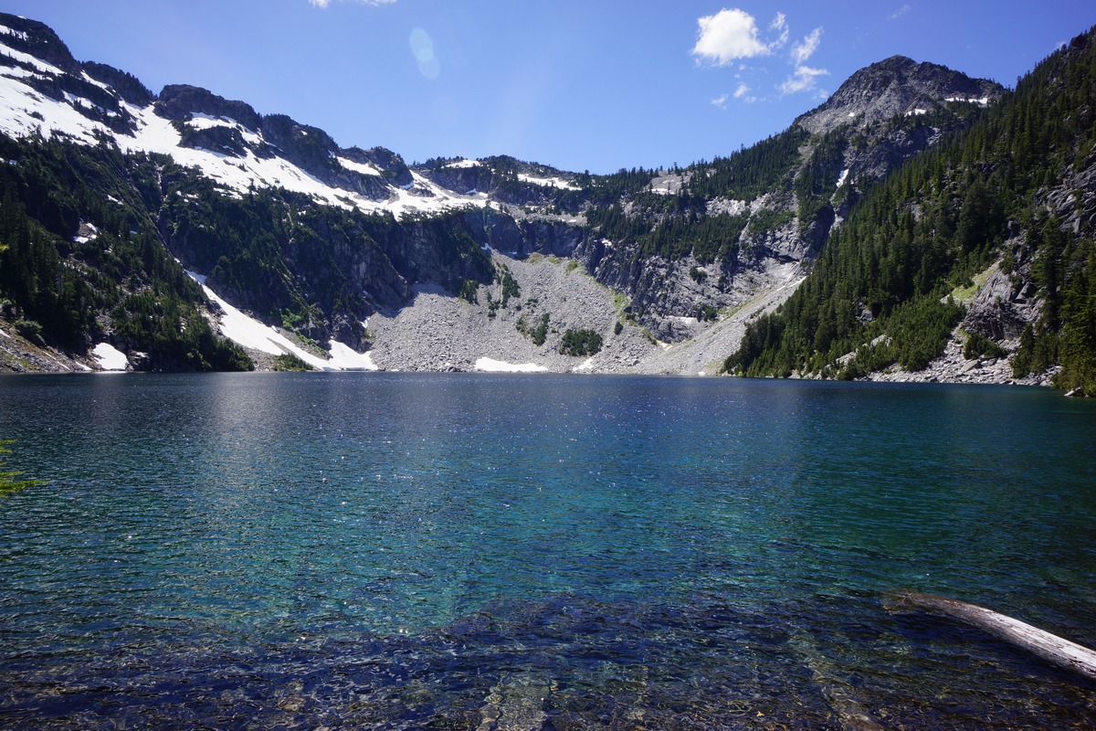
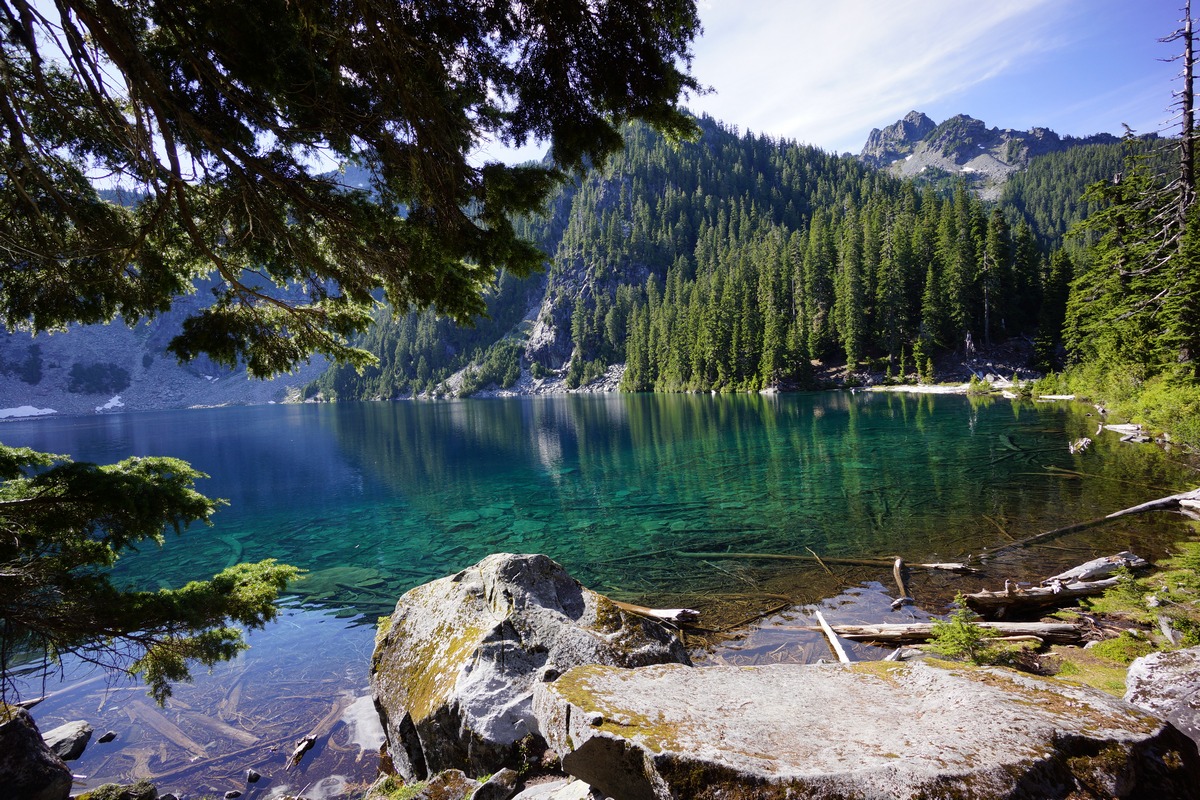
I didn’t see any fish in this corner of the lake. I’m sure there would be more by the logjam at the outlet, but it also looked pretty snaggy. The color of the water was that deep, vibrant blue which happened to be clear as glass at the moment. Visibility in the water was high, and there was a nice reflection of the mountains on other portions of the water.
After heading back up to camp, I grabbed my camera gear and headed back down towards the waterfall. There now was a couple camped at the prime spot. The downside of this campsite is that the trail runs right through it. Not my problem now I guess.
Now down at Big Heart Lake, I crossed the outlet and worked my way down the waterfall some more. It was pretty steep here, but I ended up descending more ground than I thought I could. This provided some cool views of the waterfall, although the grey sky was still washing out my photos.
I climbed back up to the lake outlet and continued up hill to some good vantage points I encountered earlier. However, all of these spots were now occupied with other campers, so I just headed back to camp for the night. I was getting tired of having soaking wet feet anyways.
For dinner I had a 100% whole wheat tortilla with cheddar cheese and pepperoni. I scarfed that, and was glad to have an appetite this time unlike some of my other hikes.
The sky started clearing up a little just as the sun set, through the trees and out of my direct sight. The sky was red and pink, it looked like an awesome sunset for someone else. For me, with no campfires allowed up here to keep the mosquitoes away or dry my wet shoes and clothes, I just headed to bed.
Day 3 – Saturday June 26th, 2016
Miles Hiked – 6.59
Elevation Gain – 2158′
Route – Big Heart Lake to Malachite Lake
I woke up at 2am to pee, and the stars were out and shining bright. When I got out of my hammock at 7, the sky was completely blue without a cloud in the sky. Finally! I was excited to have a day with some good weather to finally take full advantage of this beautiful area.
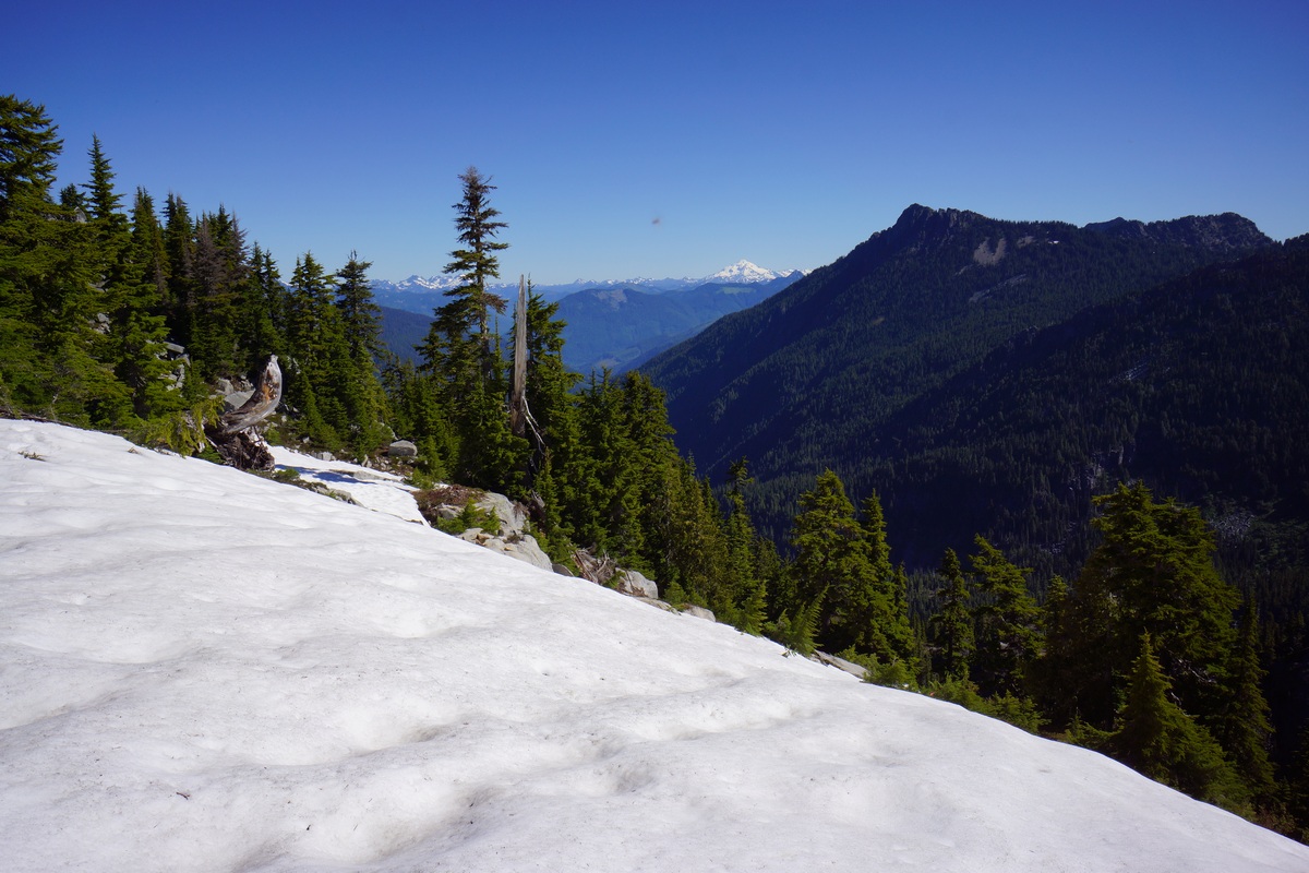
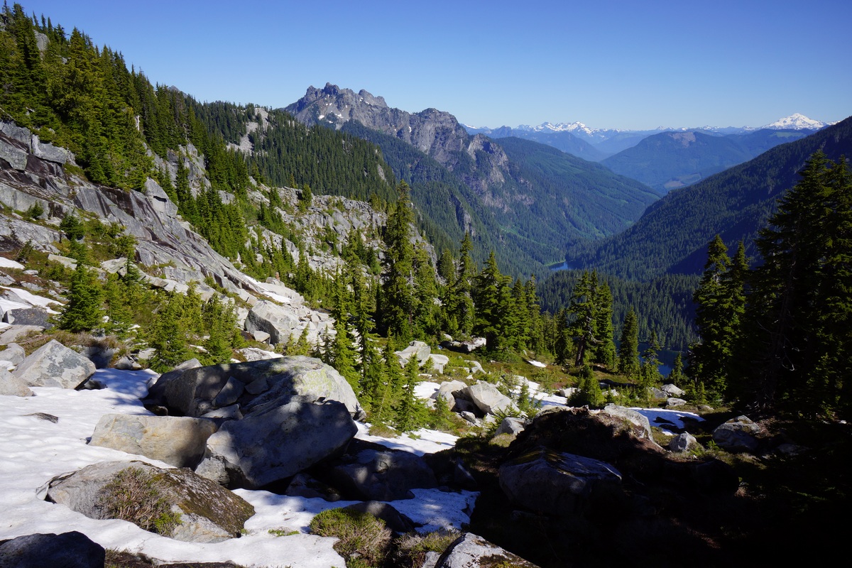
After packing up camp, I decided to head back up the ridgeline above Big Heart Lake towards Chetwoot Lake. I didn’t really intend to hike all the way to Chetwoot at this point, but I did want to get high enough to get a proper view. Up on this ridgeline, overlooking Angeline and Big Heart Lakes, should provide some of the best views of the hike.
On my way up the ridgeline towards Chetwoot, I passed a group of guys I talked to yesterday. They said they went up the ridge and descended halfway down to Angeline Lake. Well, I’m gonna check it out. Point 5359 seemed like a good destination, where I should find ample views.
I continued up the trail until it hit some snow patches and petered out. There were sets of footprints to follow though, so that helped. There was a faint footpath to follow much of the way from here on out, but it’d be real easy to lose it in some spots. It’s obviously not a maintained trail anymore.
The path I followed had me working my way over a smaller ridge at around 5000′. On the other side, the path became very faint and I wasn’t sure if I was following an old game trail at one point, but as I made my way down a steep section the path reappeared. The path descends downhill a bit in the direction of Delta Lake, going as low as 4840′ or so before swinging back uphill. There were some cairns here and there to follow, but not everywhere they were needed. The path lead me to a cliff overlooking Angeline Lake, my first glimpse. Nice!
The final push up to point 5359 had more snow. Even up here, the mosquitoes were relentless. I battled them up to the top, where I stopped at a small saddle before the actual summit. Great view, but still some trees in the way.
The climb up to the top of point 5359 was short and easy from here. This is a better vantage point, with less trees obstructing my view. I would have taken more pictures and stayed up here a while, but damn, those mosquitoes! I had to take multiple pictures of the same scene since they kept getting in front of my shot and showing up as a blurry spec. Alright, time to head down.
I was satisfied with making it this far. I could keep going towards Chetwoot, but it’s just going to be further out of the way of my destination tonight, which is Malachite Lake. Hopefully, there’ll be nobody up there.
Going down the patches of snow was harder than going up. Not bad, but slippery at times in my trail runners. I was able to dig in a heel as needed, the snow was pretty soft. Going back down through this area was a lot quicker than getting up here, it seemed. I was getting really warm now, and the mosquitoes were getting old. I was hiking with my headnet on now, which I don’t normally do unless absolutely necessary. And it was one of those times.
Nobody camping at Big Heart Lake now. I took a break at the prime campsite and ate a bit, but not much. I snapped a couple of nice pictures here at the lake now that the sun is up and the skies are blue. My goal now is to push on to Malachite Lake without any breaks (not dropping my pack).
The trail heads up some switchbacks now in between Big and Little Heart lakes. At the top of the ridge, there’s an overlook area just off the trail that I walked past yesterday, since there was no view of anything. Today though, I went to check it out. Here, there was a good view of Delta and Angeline Lakes, as well as the waterfall below Big Heart Lake’s outlet. The only problem is that I could not fit them all in the picture without falling off the cliff, as I was already leaning towards it to get the ones I did manage.
I kept on towards Little Heart Lake. The fallen trees I encountered yesterday seemed a bit easier to manager today, moving downhill. I moved on past Little Heart Lake and towards Copper Lake, where I saw a guy fishing with his dog. He said he hadn’t had any luck, and that the fish weren’t rising at all. I thought about camping along Copper Lake too if the right campsite presented itself, but it didn’t. I did see a few more groups of people along the lake and figured it would be best to just keep moving and shoot for Malachite Lake. After all, it’s only about a half mile away now from the outlet of Copper Lake.
After crossing Copper Lake’s outlet, I started looking for a way to get up to Malachite Lake. I wasn’t sure what kind of trail there would be leading to the lake, but I was pretty certain there would be some type of blazed path somewhere. So far, the terrain looked pretty steep and didn’t see any signs of anything. Just when I was about to think that there was no trail, I saw a sign on a tree pointing towards the path to Malachite Lake. I didn’t see this on my way up.
The trail up to the lake was actually the steepest trail of the whole trip. Even though it was short, I was whopped by the time I got to the top. With that said, I was also very hot, hungry and thirsty which certainly were factors at play. The trail lead to the lake’s outlet, where I scouted the area for potential campsites. I followed the shoreline south and eventually found a pretty sweet spot to hang my hammock. And the best news is, I had this lake all to myself! Not another person in sight.
Since it wasn’t going to rain (at least I hope not) tonight, I just set up the hammock without the tarp. It was tough finding a spot to hang, and the spot I chose just barely worked. I had less than 6 inches of play left on my hammock straps. The view from the hammock was really good though, just what I was hoping for.
After getting it all set up I went down to the lake to filter some water. I chugged a liter and filtered another. It was still fairly early in the afternoon, and so I decided to take a quick nap to recharge.
After waking up, I went and found the toilet that was near the lake’s outlet. There was a toilet at every lake up here, even Malachite. So, these toilets… it’s a wood box with no toilet seat. No way I’m sitting on that nasty wood. Hovering over this thing is not easy easy due to it’s shape. Fun stuff.
Now, on to the REAL fun stuff… fishing! Along the shoreline below my camp, the water was pretty shallow and had some downed logs, but fishable. I did see a couple of 6 or 7 inchers in there, but there wasn’t much action. This fish were hitting bugs on top of the water, but I didn’t have a fly rod with me. The few fish I did see were cruising the shallows. I didn’t have any luck farther out near the drop off.
I had only one bite this whole trip, and it was here at Malachite Lake on a Rebel Crickhopper, a grasshopper lure. I have used the brown color and the brown and fire tiger colors, and prefer the brown. Sounds goofy, but I’ve had lots of success with this lure in the past with bass, sunfish and trout and it’s one of only 5 or so lures I bring with me hiking. I ended up snagging my crickhopper on a log later and lost it. Gotta get another one!
After fishing I filtered more water and headed back to camp to seek shade. I had a pretty good view of the lake from camp, in the shade which was nice. I relaxed the rest of the day, alternating between the shoreline and my camp. I’m really grateful for the clear weather today as it really made this trip worth while.
I was running pretty low on food now, but fortunately had one more tortilla with cheese and pepperoni waiting for me in my bag. I went to bed just after the sunset, since I plan to get up early and get back to my car in the morning.
Day 4 – Saturday June 27th, 2016
Miles Hiked – 4.13
Elevation Gain – 320′
Route – Malachite Lake to West Fork Foss River Trailhead
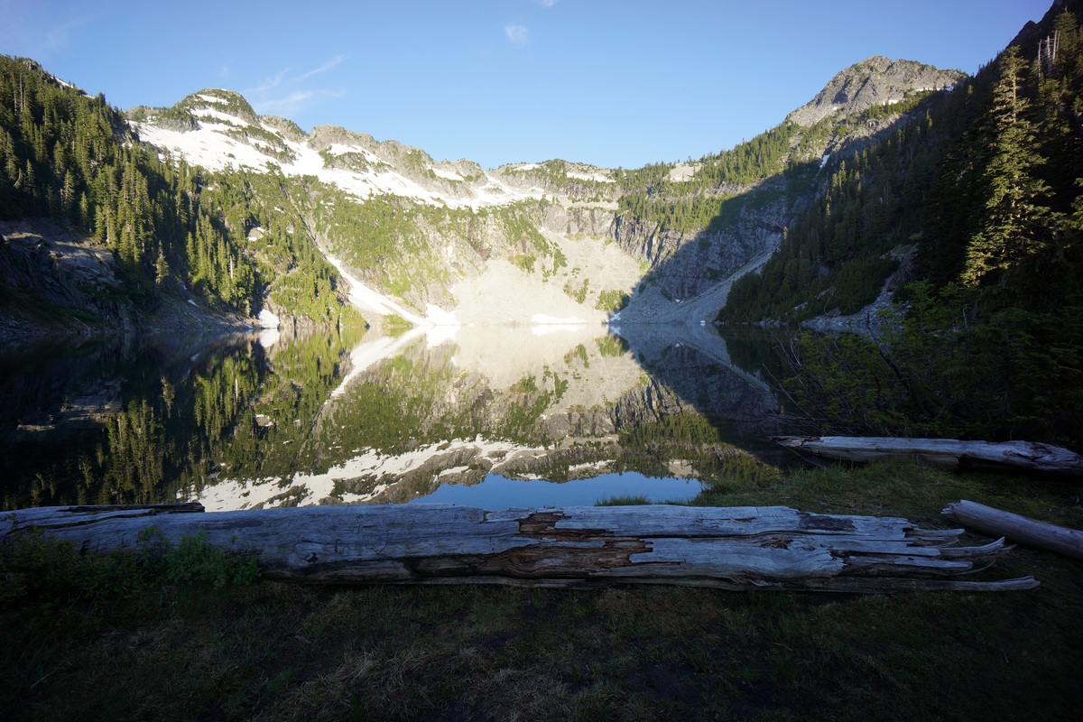
I woke up at 5:30 this morning to a great view of Malachite Lake from my hammock. The night was clear and calm, and I slept well. This was a really nice way to end my hike here in the Alpine Lakes Wilderness! Without the tarp to put away, no need to filter water and no wet gear to contend with, leaving camp was quick this morning.
The reflection on the lake was incredible, I just had to stop at the outlet to admire it a little longer. Sadly, I’ll be on a plane in a few hours heading back home.
I made quick time down the Malachite Lake trail down to the West Fork Foss Lakes trail and didn’t stop there. I stopped a couple of times near the top where views of the waterfall presented itself, but the lighting wasn’t great yet at this hour of the day. I just kept moving down as soon as possible, ready to get back to the car at this point.
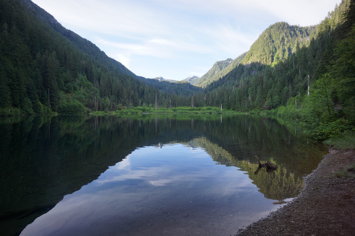
Much of the brush along the trail was wet still from the morning dew, and I was pretty drenched by the time I made it down to Trout Lake. There was nobody camping here this time. I continued on towards the trailhead, with clean clothes, food and water my motivation.
After leaving Trout Lake, I made great time getting back to the trailhead, arriving just after 8am. For reference, it took me about 1 hour 50 minutes to get down to West Fork Foss River trailhead from Malachite Lake. There were about 5 cars in the parking lot now.
Final Thoughts
The drive in to this area along Hwy 2 was beautiful. Looks like an awesome area to spend more time and explore, but it does seem to be very popular. I wasn’t expecting as many people, even though it wasn’t too insane.
I wish I brought mosquitoes repellent. Definitely bring a mosquito head net!
Think twice about bringing your hammock out here. It was a pain in the ass finding a place to hang from here due to the large tree sizes. Consider bringing longer straps if you insist on sleeping in a hammock. I don’t blame you, that’s my preference too.
The fishing was slow here. Maybe it’s the time of year? First time to Washington state, I have no idea. Either way, these lakes are hard to fish because lots of the shoreline is inaccessible. Cliffs and steep slopes butt up against deep water in many parts of these lakes. Oh and the cost of that damn fishing license was $28 bucks for 2 days for an out-of-stater like me. That’s why a lot of people choose not to buy them and take their chances. I try to do the right thing but damn, that’s the cost of an annual fishing license in Michigan, for 2 days of lousy fishing!
I’d like to come back here again, but probably in July or August. Maybe the mosquitoes aren’t so bad then. Plus, it would make traversing some of this terrain easier with less snow and mud.
Dolly Sods Wilderness, WV Backpacking – June 2012
Dolly Sods Wilderness Backpacking Overview
Complete Dolly Sods Photo Gallery | Dolly Sods Wilderness Video
- Location – Dolly Sods Wilderness, West Virginia
- Park – Monongahela National Forest
- Trail Hiked – Custom Route
- Miles Driven To Destination – 920 miles roundtrip
- Length Of Time Hiked – 4 days, 3 nights
- Trail Type – Loop
- Miles Hiked – 21.9
- Trail Difficulty – 4.5/10
- Fires Allowed – Yes
Get a printed topographical map of the above GPX route here: Dolly Sods Wilderness Topo Map
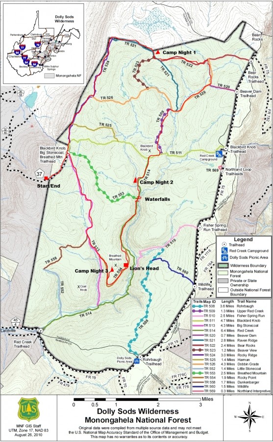
Download this map without my writing on it here: http://www.fs.usda.gov/Internet/FSE_DOCUMENTS/stelprdb5152038.pdf
Only three weeks after returning from the Gila Wilderness, NM I decided that I wanted to take my father somewhere for his birthday instead of getting him another crappy gift that we’ll both have forgotten about by the next year. He’d never been on a hike over 4 miles and that was without a pack, so for a guy turning 61 this was going to be an adventure. I picked the Dolly Sods Wilderness because it looked like it had a lot to offer in a small area, and was not going to be too physically demanding for dad. Also, it was “only” an 8.5 hour drive from home.
Getting There
We got up at 5am and cooked breakfast, and headed out the door by 6am. We were able to beat the morning rush hour traffic and get past the worst of it without delays. Ohio’s toll road got us for $10.50, and the PA toll road totaled nearly $10 as well. Nothing like paying to drive on roads that are always under construction! Glad we don’t have toll roads in my home state. Ohio is a pretty boring drive, but once we got into Pennsylvania the landscape was much more to look at. Maryland and West Virginia were both beautiful drives, the kind you don’t mind driving through at all.
We got to our planned trailhead at around 3:30pm. We parked at the Blackbird Knob/Big Stonecoal/Breathed Mountain trailhead off Public Road 80 (aka Freeland Rd or hwy 37). We expected to have been able to drive all the way up to the trailhead itself, but deep puddles and rough road ahead were signs that my small car wasn’t to go any farther. We ended up having to hike an extra mile to the trailhead itself from where we parked our car. Even if you have a truck, you could have only gone a few hundred yards farther before large rocks block the path from here from any vehicle traffic. So, add an extra mile if you plan to start here.
Day 1 – June 4th, 2012
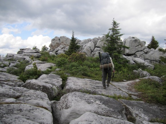
From the moment we got out of the car, we noticed how the climate was different here. It was fairly cool out, maybe in the upper 50’s and windy. Once you finally reach the actual trailhead itself, you’ll see signs for several trails that branch off from this area. We hiked north on the Rocky Ridge Trail, number 524. This was a really nice hike, and great way to start our trip. There are excellent views to the West, but since this trail is right on the Wilderness boundary at this point, you can still see many signs of civilization down below… houses, roads, farms, etc. We pretty much followed the perimeter of the park’s Northwestern corner on our first day, constantly hugging the boundary line. This area was covered with large boulders and rocky outcrops that I would have loved to climb, but we didn’t have a lot of time to spare. Today, we were trying to make it to the junction of the Raven Ridge Trail and Beaver View Trail, trail numbers 521 and 524.
We made it to our planned destination around 6:30, which ended up being a little over 6 miles. Not bad for 3 hours, with a 61 year old first timer! Camp was a small clearing under some pine trees along the Raven Ridge Trail. I helped my dad set up his tent (my spare one-man, an Alps Mountaineering Zephyr 1) since it was his first time using it. The weather was looking cloudy, so we put our packs in the vestibules and headed down the trail to find a place to cook our dinner. Usually on my first or even second night in the backcountry, I’ll eat a nice meal like burgers or italian sausages. If you freeze them and keep them in a cooler until you reach the trail, these types of foods can be kept 1-2 days depending on the temperature and how well you keep them insulated in your backpack. I know many people don’t do this, but I like to eat GOOD! Unfortunately, I forgot the cheese for our burgers. But that’s the only thing I forgot for this entire trip, and seeing how as I planned it in such little time, I’m ok with that.
It was nearly 9pm by the time we finished cooking and cleaning, and by this time my old man was worn out. He was off to bed, and I did the same about 30 minutes later. This night was eerily quiet… I don’t ever remember having such a quiet night in the woods. When I was trying to get to sleep, I couldn’t hear one cricket, bird, anything. It was so quiet, all I could hear is a slight ringing/buzzing in my ears.
Day 2 – June 5th, 2012
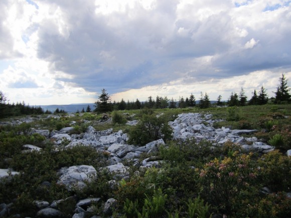
My alarm went off at 7am and it was time to get out of bed. My dad is an early bird, and was already up on his own without an type of alarm. It was pretty overcast, and looked like rain in the distance. It looked like this the whole afternoon/evening the day before though and we didn’t see rain then, so we hoped today would be the same. We hit the trail around 8:30am and headed East on the Bear Rocks Trail, number 522. This area had nice views of rolling hills and meadows, with low rain clouds at the tree tops in the distance. The openness of this terrain was a welcome sight to my last hike in New Mexico.

Raven Ridge Trail just south of the Bear Rocks Trail
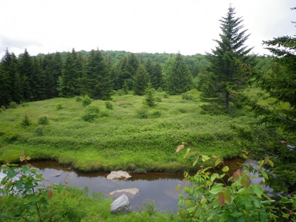
Upper Red Creek along the Dobbins Grade Trail
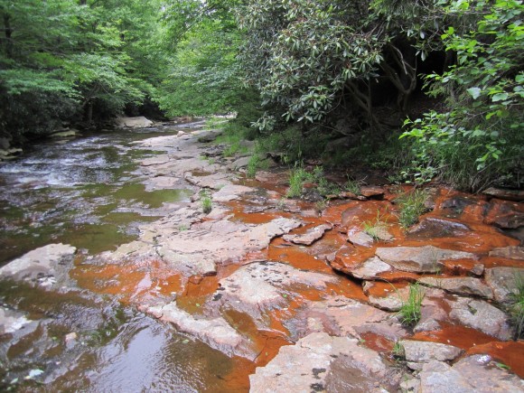
Shortly after turning hitting the Dobbins Grade Trail, number 526, we crossed our first stream, the upper portion of the Red Creek. After hiking a bit farther, we passed the river again, which was deeper and wider at this point. We decided to drop our packs and try fishing some of the small pools. I usually bring a collapsible rod strapped to the outside of my pack and store my reel inside. My dad brought his fly rod, in a case strapped to the side of his backpack. A few minutes after throwing our lines in the water, an older man walked by on the trail above us, and asked if we caught anything. This was the first person we’d seen, but not the last. After a half hour, we weren’t getting any action and we called it quits.
Eventually this area became very wet and boggy as we made our way down the Dobbins Grade Trail. This was probably my least favorite section of our hike. Everywhere you stepped was wet and muddy, sometimes mid shin depth and probably much deeper in areas we avoided. If I were to hike this area again, I’d follow a ridge on higher ground rather than trekking through this swampy area. I can’t complain though, because my boots did keep my feet dry. My dad’s brand new thinsulate water proof boots did not keep his feet dry, but once again my Zamberlains served me well. Before I left for this hike I applied some Sno-Seal on them to treat the leather and water proof them. At first, the water was beading off pretty well, but eventually the wax wore off and although the water didn’t bead up, they still didn’t leak.
Once we hit the Upper Red Creek Trail, number 509, we followed it South and left the sinking mud pits of the Dobbins behind. This trail was much drier and pleasant. After 1.25 miles, the 509 ends at the Blackbird Knob trail, number 511. We followed this west for 1/3 mile and continued south on the Red Creek Trail, # 514. Our plan for today was to stop at a campsite along this trail, explore the river and it’s waterfalls and maybe get some fishing in. We found a great campsite along the river by 12:30pm, probably the earliest I’ve ever stopped hiking. We’d covered 6 miles already so this was good enough for me. I had to keep in mind that my dad is not used to this kind of activity, and I tried to keep the hike as easy as possible for him. His only complaint so far was that my crappy High Sierra backpacking was hurting his hip. If anything, I was expecting a back problem… if you could see how this backpack sits on your back, you’d understand. The straps at the top have a buckle that prevents the weight from being pulled right up to your back, leaving a gap between your back and the backpack. I put the pack on and could feel the weight of it just wanting to pull you backwards.
It still looked like it was going to rain, so we promptly set up camp. We then headed up the river a few hundred feet to check out a small waterfall. After snapping some pictures here, we headed downstream through the river, hoping rocks and following the banks past our campsite. There were several other groups of people camping just a few hundred yards downstream from us near another small waterfall, at the forks of the Red Creek and another stream. We hiked upstream of one of the forks for a ways, but didn’t see any waterfalls here.
We headed back to the forks and downstream along the other direction. It was starting to sprinkle now, but we kept going as there we encountered numerous waterfalls that became more impressive as you progressed downriver. With the added beauty came increasingly difficult terrain. We came up to a waterfall that was 15 feet or so in height that had a good sized cave behind the falls just as it began to rain harder. The cave provided excellent shelter from the rain, but after 2 hours it was still coming down. I suggested that we make a fire to warm up a bit and to give us something to do. Even though there were plenty of sticks in this cave, they were pretty damp and we had no dry tinder. We spent a good 20 minutes trying to get this fire lit but it did not want to catch. I flipped over a large rock and there was a small, wet piece of birch bark underneath. This was all we needed to get it going, and soon we had a roaring fire. But wouldn’t you know it… the rain stopped 10 minutes later!
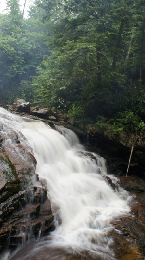
Waterfall on Red Creek
Taking advantage of the break in the weather, we headed back to camp. We had planned on cooking hot dogs over the fire tonight, but the weather didn’t look like it was going to cooperate for long. All the firewood we gathered earlier was already soaked. Fortunately, there were a lot of birch trees in the area and with a few handfuls of bark, we just might be able to have a fire after all. We gathered more “dry” firewood and tinder from areas underneath pine trees and rock overhangs, and started a fire with the birch bark once again. Once lit, even the wet stuff was burning. However, the fire was requiring a lot of attention and we didn’t have many large pieces of wood, so we ate our night 3 dinner tonight, 2 tortillas each with cheese and pepperoni. Hopefully tomorrow night will be dry so we can cook the dogs over a fire.
I went to bed around 10pm tonight, and it wasn’t raining at the moment. Minutes after I laid down, I heard a small animal moving around very close to my tent. VERY close. I shouted at it but whatever it was would not go away. I got up and out of the tent to make my presence known, but didn’t see anything. I laid down again and didn’t hear anything else, and eventually fell asleep.
Day 3 – June 6th, 2012
I woke up around 4am to the sound of rain. It wasn’t heavy, but it the fact that it was raining at all was disheartening. Today we were supposed to hike to Breathed Mountain and visit the Lion’s Head. I went back to sleep and woke up at 7 when my alarm went off. It was still raining, and my dad was up walking around with his rain gear on. I opted to stay in my tent, and figured we’d wait a few hours to see if the weather clears up before breaking camp. We only had to hike about 4 miles today, so there was no hurry.
Eventually, the rain let up after 11am and I crawled out of my tent. When I reached into my backpack to grab breakfast, which was in my vestibule, I saw evidence of the animal that had been rooting around near my tent. I had a ziplock bag with hot dog buns and bagels that was chewed open and had mouse crap all around it. I usually don’t hang my food, because I use these OP Saks, which are advertised to block the scent of anything inside. I’ve tested these bags by putting food inside it and putting it under my dog’s nose, and the dog had no interest in it. However, my bread was in a separate ziplock bag that was not stored inside the OP Sak, and it fell victim to the mouse. Fortunately only 1 bagel and a few hot dog buns were affected, and it wasn’t a total loss. Lesson learned.
The weather appeared to be clearing up at this point so we decided to pack up and head out. And by clearing up, I mean becoming only 95% cloudy. Seeing a little patch of blue in the sky was a glimmer of hope as broke camp around 12:30 and headed South on the Red Creek Trail. I was disappointed that this trail had no view of the river below, as this is where I saw some nice waterfalls the day earlier. Not having the chance to push farther downstream yesterday and now not having a view from the trail was killing me! You could rear the roar of the water for a ways, before the trail curved away from the river. The trail was muddy, but still not as bad as the Dobbins Grade Trail.
Between the Breathed Mountain Trail, 553, and the Rocky Point Trail, 554 was a relatively easy hike. There really wasn’t much to see here though, so we made good time through this section and took the Rocky Point Trail. I had read there was a campsite near Lion’s Head, a rock formation on Breathed Mountain, so my plan was to camp up there for our last night. I had considered camping here the first night and doing the loop in the opposite direction, but am now glad that I chose to do it this way. The weather was looking better and just maybe we’d get a chance to take some pictures of the sunset and sunrise here without cloud cover. We found the side trail near the Southern end of the Rocky Point Trail, on the West side. After a short scramble up some rocks, we found a small campsite right on the edge of a wooded area. It was barely large enough for our two one-man tents, but we made it work. My tent was sopping wet when I set it up and after it had rained several more times that afternoon, I noticed it was now completely dry thanks to the pine tree above. Usually when it rains at camp, I’ll just hang out in my tent. My area was dry enough to just stand out in the rain, which was really nice.
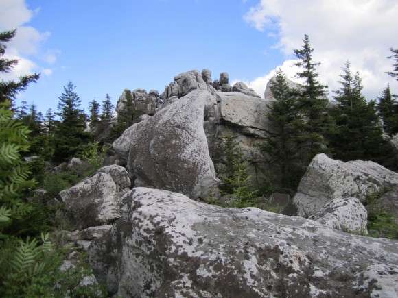
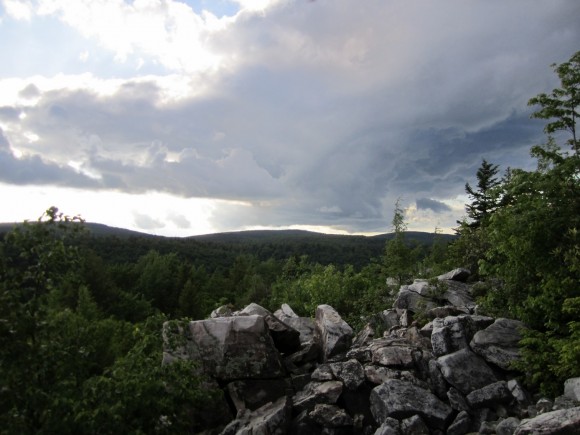
We spent the afternoon exploring the open rocky area surrounding the Lion’s Head and snapping pictures. That is, of course, in between the frequent rain showers. Navigating these rocks required jumping over deep cracks ind gullies form time to time, but nothing too extreme. The rocks were not slippery, even when wet. In fact, they had a sandpaper-like grip which was nice for once. There were tons of pinkish flowers up here which I was not expecting to see on an exposed rock face, but added to the beauty of this already amazing vista. I had an elevated view of my surroundings in a 270 degree field of view, and could hear the distant roar of Red Creek below. No wonder this is known as the best view in the Dolly Sods Wilderness!
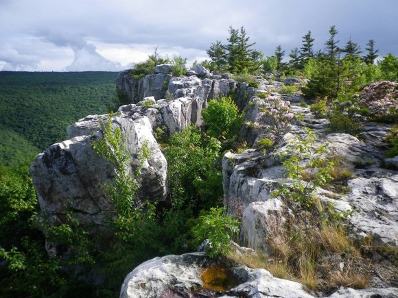
Breathed Mountain View

Breathed Mountain View

The infamous Lion’s head
There were two other guys up here who we ended up talking to for a while. They were locals, both in their early 20’s. One of them had never been to the Dolly Sods Wilderness or backpacking at all for that matter, but I if I remember right they both frequent Seneca Rocks nearby for rock climbing. They were taking pictures on the Lion’s Head and wanted to “trade” pictures with us. My dad and I stepped out onto the Lion’s Head as they took a few pictures of us together, and then we returned the favor. They were busy climbing so I set their camera on one of their backpacks and I noticed one of them had the same backpack as the one my dad was using, the High Sierra 75. Do yourself a favor and spend a little more money on a better pack if you plan to use it more than once…this thing sucks. Check my gear section for the complete review.
Again, finding dry firewood would be a challenge. We gathered even less than the night before but enough to cook with. My dad gathered some birch bark earlier and had it stuffed in his pocket. This got the fire going rather quickly and it was time to grill some hot dogs! Since that damn mouse ate some of the buns, I had to “double up” the meat in each bun. This was another meal where I wish I remembered to bring the cheese… I always put shredded cheddar on mine, it’s great! But to anyone in the backcountry, a couple of plain hot dogs is as good as it gets. They must have smelled great, because I saw another mouse on the rocks below while we were eating. I grabbed a 20lb rock and hurled it at the mouse, and I still don’t know how he didn’t get crushed… it looked like it landed right on top of him! It scurried away and we did not see any more animals in the area or hear any throughout the night.
Day 4 – May 7th, 2012
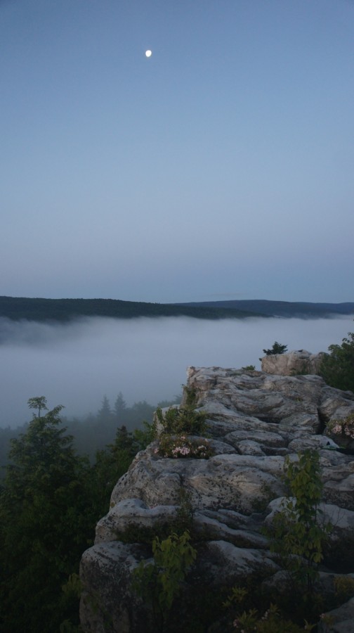
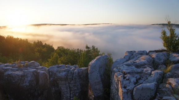
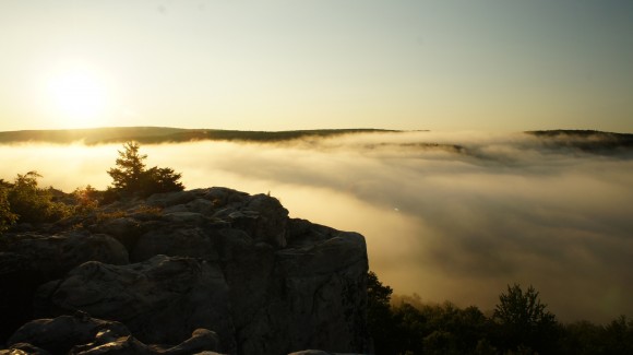
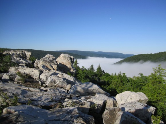
I woke up at 5am today to watch and photograph the sunrise, and I’m glad I did because the weather had cleared overnight and the sky was as clear as you could get. Immediately after leaving the cover of the trees near camp and making my way onto the exposed rocks, I could see the intensely thick cloud cover in the valleys. I’ve never seen anything like this before… it was awe-inspiring. While waiting for the sun to come up, I set up my tripod and fooled around with my new camera, a Sony Nex-5. I have to admit though, I’m a complete novice when it comes to photography. I really need to educate myself more but haven’t had the time before this trip. Regardless, I was going to fool around with it and see what I could do. This really just consisted of adjusting the aperture and shutter speed manually. I had a polarized filter which I used for most of the trip as well.
The sun rose around 6am, and the rapid changes in lighting offered many photo opportunities. The fog had an orange glow to it as the sun climbed higher in the sky. The moon was still very brightly visible as well… a stark contrast to the vividly blue sky. Shortly after sun rise, my dad got up and joined me. He took a few pictures with his camera, but I easily snapped over a hundred this morning.

We headed back to camp around 7:30am to pack up and head back to the car. Today’s hike would be around 5 miles. We were almost out of water and began to ration it to last us to the car. I had eaten a Met-rx bar earlier, around 7am, but this is not enough for me. I was pretty hungry by the time we hit the trail at 8:30, but I didn’t want to eat without having enough water to drink, so I skipped a full breakfast this morning.
Back on the Rocky Point Trail, it became less rocky as we headed North. After reaching Big Stonecoal Trail, number 513, it’s a straight shot back to the trailhead we started at. From this point, it’s about 3 miles to the trailhead, and another mile to the car from there. Now on the 513, the two hikers we saw up by the Lion’s Head the night before passes us. For the rest of the morning, we’d play leap frog on the trail, passing each other several times. Not long after, we passed a cascading waterfall about 20 feet in height. I climbed down to get some pictures, and then it’s back to the trail.
The next section of the trial consisted of multiple meadows separated by patchy wooded areas. It was pretty wet through here, but there was almost always a rock or log to hop your way past anything that looked deep. There were a few campsites through here that would have been nice, but we didn’t bother to investigate. We were both ready to get back to the car, and didn’t stop for much. After passing through a pine forest, the trail became rocky again and was wreaking havoc on Dad’s endurance. He doesn’t complain though, and before you know it we were back at the trailhead. Only 1 mile left to go! This section seemed twice as long coming back. When we got within sight of the car, there were three people on horseback coming our way. One of the horses got spooked by the sound of our trekking poles hitting the rocky ground and looked like he was going to bite us!
Final Thoughts
The Dolly Sods Wilderness has it’s own little climate pattern. It’s a wet region, bring good water proof boots and your rain gear. Also, a tarp would have been nice so that we had something to sit under when it rains. I’ve carried one before but have opted not to recently due to weight and bulkiness… I’d have carried it this time but the weather forecast looked good before we left so I chose not to. Be prepared to start a fire in wet conditions, or have no fire at all. If you choose to hike that route we took, leave your fishing pole at home. We didn’t see any fish anywhere, and had no luck fishing.
This hike wasn’t particularly difficult, and is suitable for most people. There were some ups and downs, but never anything real steep and nor was it for longer than a tenth of a mile or so.
I’m really glad I did this hike. Dad had a good time, and I know this trip will be something he’ll never forget. Watching the sunrise on Breathed Mountain was incredible, and worth the drive alone. I highly recommend camping up by the Lion’s Head and spending some time up here.
Complete Dolly Sods Photo Gallery
As always, questions and comments are welcome!
If you found my trip report useful, please don’t hesitate to leave a comment! Alternatively, if you feel you have any information you’d like to share with others regarding this hike, please feel free to leave that below in a comment as well.
[tcb_comment_count]Mogollon Mountains Backpacking – Gila Wilderness, NM – May 2012
Gila Wilderness, NM – Mogollon Mountains Backpacking Overview
Complete Gila Wilderness Photo Gallery | Gila Wilderness HD Video
- Location – Mogollon Mountains in the Gila Wilderness, New Mexico
- Park – Gila National Forest
- Trail Hiked – Custom Route
- Miles Driven To Destination – 3700 miles roundtrip
- Length Of Time Hiked – 6 days, 5 nights
- Trail Type – Loop
- Miles Hiked – 45
- Trail Difficulty – 8/10
- Fires Allowed – Yes
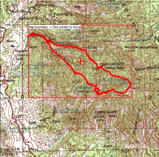
When I went to order topographical maps to use in the Gila Wilderness, I realized that I’d actually need to buy 6 maps to cover all the quads that my route was passing through. Instead, I ordered a custom printed map that covers only the area I will be hiking in, allowing you to pick sections of quads and print them. This is what I ordered for this trip:
If you plan on hiking the same route as me, you can order the map I bought here: Mogollon Mountains Topo Map
Here’s another map of my route, showing you where I camped and where the forest fire was (read about that later):

Soon after getting back from my hike in Big Bend National Park, TX I started planning a spring trip. I had my hopes set on somewhere mountainous, like Colorado or Northern New Mexico, specifically The Pecos Wilderness. However, the weather in May just doesn’t allow for snow-free access in those regions this time of year, so I either had to move farther south, or lower in elevation. The Truchas peaks, at 13,000 feet, would have been awesome… but I after checking snotel and word of mouth from those who’ve hiked it this time of year, I realized that early June is the earliest access to that region. However, I was told about the Gila Wilderness in Southwestern New Mexico. After a little research, I concluded that the Gila (pronounced hee-la) would be a perfect place for me to go at this time of the year.
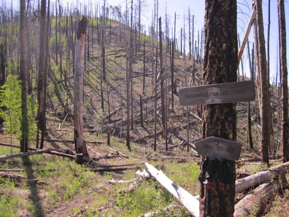
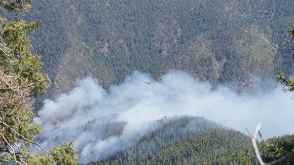
The Gila Wilderness is part of the Gila National Forest, which is only separated from the Aldo Leopold Wilderness by one small 4×4 road. Combined, the two areas cover around 750,000 acres. I chose the Mogollon Mountains region of the Gila Wilderness, which is on the extreme West side of the park, close to Arizona. The temperature was forecast to be anywhere from 50-80 degrees during the day, depending on elevation, and around 35-65 at night. Temperature wise, I figured this would be perfect. May is also the driest time of year here, so I also figured that rain wouldn’t be a problem. The rivers should also be lower, making stream crossings easier. And, campfires are allowed as long is there is not an alert in place… check the Forest Service website here http://www.fs.usda.gov/alerts/gila/alerts-notices. There was no alert or fire ban in place when I went, however, lightning caused 2 fires in the Mogollon Mountains while I was in the park. This fire has now grown to be the largest wildfire in New Mexico’s history! We had some excellent views of the fire from the top of Grouse Mountain, of which I have some nice pictures and video, but I’ll get into that later.
Getting There
With an 1,850 mile drive ahead of me, I left home in southeastern Michigan at 7:30am on Friday, May 11th and headed for Springfield, IL to pick up my hiking partner. I made it all the way to Springfield around 2:30pm on one tank of gas, 462 miles. We promptly ran out of gas looking for a gas station, but luckily I plan ahead for most things, and it was as simple as getting the gas can out of the trunk which I filled ahead of time, just in case. This got us to the next gas station, and we drove until 11:30pm. We stopped at a crappy Budget Inn type of motel in Pratt, Kansas and got the best room $55 could buy.
The next morning we got on the road at 7:30am, and began the long boring drive through Kansas. At this point, we figured we’d arrive at the trailhead at around 6pm today. We were making such good time that we had a decision to make: stop in the last town that has a hotel (which looked like Socorro on the map, which was a 3 hour drive from our destination) and head to the trailhead in the morning, or camp at/near the trailhead somewhere and leave early morning to hit the trail. We choose to drive all the way to the trailhead, and ended up making it there around 7pm. We camped in a small campground on highway 180, literally right across the street from the entrance to the Whitewater Picnic Area. There is NO CAMPING at the Whitewater Picnic Area, it’s day use only. This is where you park your car, which will run you a whopping $3/day. Not bad since there are no other fees or permits required to hike or camp in the Gila Wilderness. Just park your car and go.
Notes
There are 2 main trailheads in the Gila Wilderness and several smaller ones. For the Mogollon Mountains region, the Whitewater Picnic Area is the most popular. The other is the Gila Wilderness visitor center on the East side of the park, which is at the end of State Hwy 527 (also called Hwy 15), which is near the Cliff Dwellings. There are several other trailheads along Bursum Rd on the North side of the park, and many more. These are usually marked on a topographical map, which you should have if you are hiking here anyways.
Day 1 – May 13th, 2012
We hit the trail around 8:30am on Sunday May 13th.The first mile of our hike was on the Catwalk trail, a developed area with paved trails and a metal catwalk that allows you to walk over the rugged terrain without getting your feet wet. This area was pretty cool and easy to see why it was a popular day hike. At the terminus of the Catwalk trail, we thought we’d be at the junction of the Whitewater Trail #207 and the South Fork Trail #212. Instead, the end of the Catwalk Trail becomes the beginning of the Whitewater Trail, and we had about another mile to go before we reach the above junction.
Our plan was pretty loosely formed at this point… I had picked a point on my topographic map that we determined to be about 10.5 miles away where the Golden Link Trail crosses Big Dry Creek. We would hike the Catwalk trail to the Whitewater trail, to the South Fork Trail, which later becomes the Golden link trail after you pass Camp Creek Saddle. Our plan was to hike to this point today, set up a basecamp, and spend the next 1-2 days exploring Big Dry Creek, Spider Creek, and Spruce Creek as there are numerous waterfalls in this area. I found an awesome site that tells you about all of the waterfalls in New Mexico, including many in the Gila Wilderness. It has pictures, descriptions and even GPS coordinates of the falls. It’s http://www.dougscottart.com/hobbies/waterfalls.htm and the falls in the Gila Wilderness are numbered K4 – L3, just to save you some time plotting them on the map. After this, we had no plan… to be determined as we go!
After leaving the Catwalk trail behind, we saw a handful of other hikers, maybe 4 between 2 groups before hitting the South Fork Trail. At this point, my hiking partner, Dan, began to slow down quite a bit. It got got to the point where we’d hike for 3 or 4 minutes and then take a 2 minute break. I was getting agitated with the stop and go pace we had adopted, and I told Dan we need to pick up the pace. His response was “What’s the rush? We have until 9pm.” This was Dan’s 2nd hike ever, and he thinks it’s not going to be a big deal hiking until complete darkness and then trying to find a campsite. He was totally fine with this. Well, not me. “I’d rather cover my mileage in as few hours as possible, and have the rest of the day to explore and relax as I see fit,” I said. Dan snapped, “Well, I don’t want to be rushed. Go ahead and get to the campsite then, I’ll get there.” Even though I know I shouldn’t have, I left Dan behind and continued on the trail at my own pace. We both had a map and knew where to meet, and as long as he followed the trail, we’d meet up. That was my thinking at that point.
Hiking solo, I pushed on for another hour and a half before stopping for lunch. A pastrami and cheese sandwich was on the menu, which I ate as I air dried my feet near the creek. They were already soaking wet with sweat, but were dry after 25 minutes. I figured after 25 minutes, maybe Dan would have caught up to me, but he didn’t. I hit the trail again, and was really enjoying the hike along he South Fork Whitewater Creek. The canyons were very steep on both sides, and the trail criss-crossed the river many times. It was easy to hop rocks across the river in nearly every crossing because the water level was lower, so that made it easier. It was about 30 minutes after eating lunch that I began to feel like crap. I think t was a combination of dehydration and maybe that sandwich. I know I didn’t drink enough during the car ride, didn’t want to stop every hour to take a piss. So, I found a comfortable spot on the rocks beside the South Fork Whitewater Creek and laid down for 45 minutes. I hit the trail again once I felt a little better, but still no sign of Dan. At this point I thought he may have turned around and went back to the car, and planned on camping across the street at the campground we stayed at the night before. Or, he’s just incredibly slow!
I now realized that I was not going to make it to our planned destination today. My new plan was to continue hiking the South Fork Trail until I passed the junction of the Little Whitewater Trail/East Fork Trail, and start looking for a campsite. After passing the above junction, I found a campsite a few hundred yards down the trail. It was within view of the trail, so if Dan was hiking by here, he’d definitely see me. By nightfall, I still hasn’t seen him. Now, I though for sure he’d turned around. My dilemma was to continue without him or to turn around and make sure he was ok. Knowing he had everything he needed to get by on his own, I decided that I’ve driven too far to call off the hike. I really enjoyed my only prior solo hike, a 25 mile loop through the Porcupine Mountains in the Upper Peninsula of Michigan in October of 2011 and did not mind at all doing another 5 days here by myself if need be. With that in mind, I started a fire and cooked some italian sausages that I kept frozen (well, partially frozen) in my cooler on the car ride here. I always opt for something good my first night such as a burger or brats, since they keep just fine for 1-2 days if kept frozen until you hit the trail… and DAMN, were they delicious!
Day 2 – May 14th, 2012
After filtering some water and refilling my water supply, a 2L Osprey hydration bladder and a 1L water bottle, I hit the trail at 8am. I was making good time and made it to Camp Creek Saddle about 1.5 hours later. I stopped and dropped my pack to climb a small hill to get a view of my surroundings and snap some pictures, then proceeded down the Golden Link Trail towards yesterday’s original destination at the junction of the Golden Link Trail and Big Dry Creek. Little did I know that this was going to be an all day adventure… what was supposed to only be a hike of 3 miles max ended up taking me the entire day! The Golden Link Trail was very difficult to follow in the section Southeast of Camp Creek Saddle, and I was constantly losing the trail and trying to find it again. If the trail was on one of the hillsides next to Camp Creek, I didn’t see it. They were pretty steep anyways, so I opted to hop down into Camp Creek and hike through the river bed. This was very slow going due to huge boulders, flash flood debris, and tons of downed trees. I knew the trail followed the creek, so I wasn’t too worried about finding it again, which I eventually did.
Where the Golden Link Trail crosses Spider Creek, I dropped my pack to air out my feet and have a snack. Knowing that there are a few waterfalls farther up Spider Creek, I hiked upstream for about 15 minutes. I had planned on exploring Big Dry Creek and Spruce Creek the next day, without my pack, so I decided to turn around and cover more ground today. Now, this is where things began to get really interesting for me. After crossing Spider Creek, I could not find the Golden Link Trail for the life of me. There were cairns stacked on the other side of Spider Creek, so I hopped up there to look for the trail but simply could not find it. I followed several little foot paths on this steep hillside, only to find dead ends and dense shrubbery. I spent about an hour looking for this trail with no luck.I decided to follow Spider Creek downstream to the point where it meets Big Dry Creek, and this point was only a half mile or so from where I was planning on meeting up with Dan.
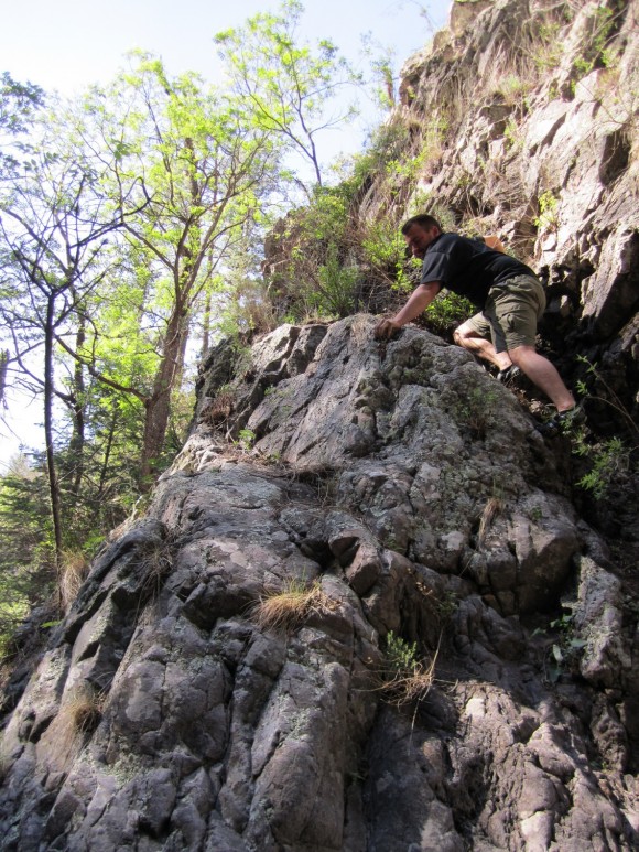
I really enjoyed following Spider Creek as it felt very remote. There was no trail here, just following the river. Actually, hiking through it in spots. The canyon walls around me got steeper as I progressed downstream until eventually I was stopped in my tracks by a waterfall that appeared to be 40-60 feet. This was Lower Spider Falls. From my topographical map, I could see this as a potential problem before I began hiking this way, but couldn’t be sure if it was passable of not. Well, it was definitely not passable as sheer cliffs came together in one small point for the water to flow over the edge. I had no choice but to backtrack the way I came. I hiked about halfway back to the Golden Link Trail before finding an area that seemed to have the “least steep” slope, and decided to just hike to the top of the hill that towers over Spider Creek, as I knew the Golden Link Trail was on top of that hill somewhere. If I hike straight up this thing, I have to hit the trail. This was a bitch… having a 50lb pack and hiking through dense vegetation was not helping. I don’t remember how long this took, maybe 45 minutes or an hour, but it was a 700 ft elevation gain. I tried to follow little game trails where I could, but no matter which way I went I was getting scratched up by all the thorn bushes. Finally, near the top of the ridge I hit the Golden Link Trail and was back on track.
By this time, it was mid to late afternoon. The trail was now descending into Big Dry Canyon via steep switchbacks. This section of the trail was very beautiful, with excellent views of sheer canyon walls all around. I eventually made my way down to Big Dry Creek, which is where Dan and I planned on meeting up the night before. I was planning on camping here tonight regardless, but to my surprise, Dan was already there and had set up his camp just a few minutes earlier. Honestly, we were both surprised to see each other, as he thought I was way ahead of him, and I thought he’d gone back to the car. Although Dan had reached our destination before I had, he did not lose the trail as I did and was hiking the whole day to get to this point.
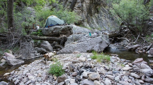
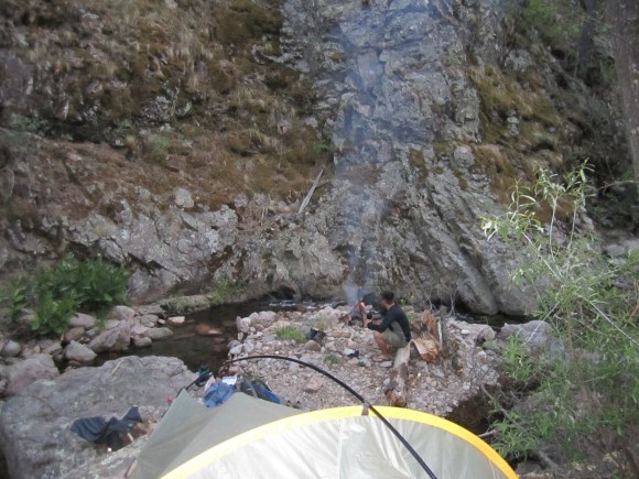
From the topographical map, this area looked like it would be a good place to camp as the banks of the river looked wide. In reality though, like everywhere else in the Mogollon Mountains, there were no flat areas to camp, at least not like I had expected. Dan found a small area on the hillside that was just large enough to fit his tent, while I set mine up on a large, semi-flat rock that sat about 8 feet above Big Dry Creek. However, it was not as flat as it looked and no matter which way I positioned the tent, it was pretty slanted. I found some flat rocks to put underneath my tent to level it out, and it was almost comfortable. Good enough, now it’s time to start thinking about a fire. There was a bit of an “island” in the center of the creek with just rocks and gravel, and this is where we made our fire.
We began to plan out our next move on the map as we ate and enjoyed the fire. Tomorrow, we’d stick to our original plan, which was to have our 3rd day as an “exploration day”. The plan was to follow Big Dry Creek and find some waterfalls, and explore off trail.
Day 3 – May 15th, 2012
We woke up around 7am, ate breakfast, and headed up the Big Dry Creek by 8am. I chose to wear my hiking boots while exploring upstream over my water shoes. Most of the time we were hoping rocks and hiking right through the creek itself because the banks were either too steep or covered with thick vegetation. As rocky as this creek was, my feet were sore as hell from trekking a 1/4 mile in them the night before, so I opted for comfort. I’m glad I did, because I don’t think my feet could have taken that kind of beating for an entire day. Sure, my boots got soaked as they were occasionally dunked in the water halfway up my shins, but at the end of the day it was a good decision. Dan chose to wear his Vibram FiveFinger shoes, which were a lot more sturdy than my water shoes. Although his feet were sore at the end of the day, I know they provided a lot more protection than my cheapo Walmart water shoes would have. Maybe I’ll pick up a pair before my next trip.
Hiking up Big Dry Creek was awesome. We encountered several smaller sized waterfalls, with the largest being around 15 feet or so. The farther we went upstream, the more rugged the terrain became. Every so often, we’d run into something we weren’t sure we’d be able to get around, such as some extremely large boulders or steep canyon walls. At one point we had to squeeze through a narrow opening at the end of a small cave to continue up river. We took our time and enjoyed this relaxing day, because tomorrow we’ll have to hike up to Black Mountain, a 4,000 ft elevation gain from our current campsite.
We turned around sometime in the early afternoon and headed back. We stopped at one of the waterfalls we passed earlier in the day and were tempted to swim in the pool at it’s base. We were both filthy from 3 days of backcountry travel, and although the water was freezing, the warm weather and beauty of the waterfall proved to be irresistible. Dan jumped first after taking a few minutes to build up the courage. As soon as he resurfaced, he quickly swam ashore. I laughed at his reaction to the icy water, but it was my turn next. My feet hit bottom, and I guessed it was around 8 feet deep. I lasted no longer than Dan, and instantly got out. That water was numbingly cold, but it felt great to be somewhat “clean” again.
We got back to camp in the late afternoon, and after a quick break, we headed downstream on the Big Dry Creek. I wanted to get to the bottom of Lower Spider Falls, the waterfall that stopped me in my tracks the day earlier. I had scouted this area earlier, and only made it a few hundred feet from our camp before the canyon walls narrowed and the water dumped into a pool that appeared to be 6 feet deep or so, even at the edges. We found an area on the hillside that looked manageable to climb up and go over the canyon wall, but it was steep. We made it over and only a few hundred feet downstream, we were again stopped by a similar situation. Another deep pool with no way around it. I found another way around, but this hill was steeper and much taller than the last. It was maybe 200ft up, and it was getting a bit hairy. I used a stick as an improvised “ice axe” to keep from sliding down which really helped. After making it to the top of this ridge, we could see Lower Spider Falls. However, the ridge we were on appeared to get very steep and we didn’t see an easy way down to the river again. It was around 6:30 at this point and we decided to turn around.
For dinner I thought I’d try one of those freeze-dried meals. It was the Natural High brand, honey lime chicken. After pouring boiling into the bag, it says to wait 10-12 minutes or so. Mine was in there for a half hour or so, next to the fire keeping it warm, and it never absorbed all the water. Yuk. Dan, however, was really impressed with his Mountain House meals, especially the lasagna. We sat by the fire and ate some sour patch kids and watched the stars for a while before turning in around 10:30.
Day 4 – May 16th, 2012
Today is the day Dan has been dreading. A 4,000ft elevation gain up to Black Mountain on the Golden Link Trail, and then we’ll push on to Spruce Creek Saddle via the Holt Apache Trail. After hiking for about a half hour, we passed an older man with his dogs camping alongside the trail. This was the only person we saw out here our entire trip, beside people near the trailhead and along the Whitewater Trail. A little farther down the trail we passed the Golden Link Cabin. It’s always amazing to me seeing something like this in such a remote place. The next section of the trail offered some great views, but the switchback were relentless! We also found a old mine which was not blocked off, so we decided to explore inside. We dropped our packs and with our headlamps on, entered the mine and were only able to make it a few hundred feet in before it dead ended. There was nothing of interest to see in here so we hit the trail again.
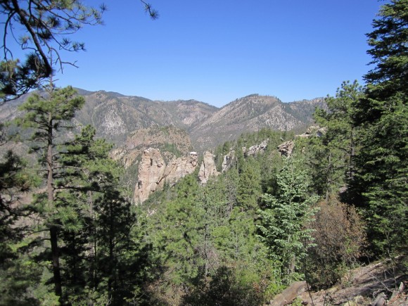
By late morning, we made it to the point where the Golden Link Trail crosses Big Dry Creek. We had hoped to filter water here, but at this altitude, the creek was nothing more than a trickle. We were almost out of water and there wasn’t going to be any water for quite a while, so it as imperative to fill up here. We followed it “downstream” a ways and found a small pool that was suitable for drawing water from. After loading up on H2O and eating lunch, we headed for the top of Black Mountain. On our way up, we noticed a fire not far in the distance, over the next ridge. We did not see any flames, but plenty of white smoke billowing up from the forest and staying somewhat low in the valley. Because of it’s small size, I thought it may have been a controlled burn. We moved on eventually made it to the summit, but we were sorely disappointed to find that there was no view as it was blocked by thick tree cover. Nothing to do now but push on to Spruce Creek Saddle. Now on the Holt Apache Trail, the terrain was not as steep which was a nice break. We hiked another hour or so before reaching our destination. Camp Creek Saddle is a large open meadow, a welcome sight in the Gila. Everywhere we’ve been so far was steep, rocky, and covered with thick fauna. Although we were not near a water source, there was a large fire pit area and plenty of firewood at hand.
Although we were a good ways away from the fire we saw earlier, it was still on my mind. I turned on my cell phone and was surprised to have signal, albeit only one bar. FYI, I have Sprint. I was able to search google for “gila fire” and the first result was from the forest service’s website, and in the description it mentioned a prescribed burn scheduled for May 9th that was postponed. I tried to click on it to read more but apparently I did not have “enough signal”, as the page would not load. So, I optimistically assumed that this fire was a controlled burn. This was comforting and helped us sleep a little better.
Day 5 – May 17th, 2012
Today we will hike the Holt Apache Trail to Spider Saddle, then take the Deloche Trail through Winn Canyon and finally to the Whitewater Creek Trail. This day was going to be almost all downhill, which was a relief after a hard day yesterday. We would also cover more ground than any other day, 13.8 miles.
I woke up at 6am as I have been doing most days on this trip. Like every morning, I walk over to Dan’s tent and wake him up since he doesn’t have a watch with an alarm. And, like every morning, he says “Ok, I’m up”, but continues to sleep until I wake him again in a half hour. Eventually, we get moving and hike the Holt Apache towards Grouse Mountain. The topo shows a clearing near the summit, and we were hellbent on getting some mountaintop views one way or another. We dropped our packs on the trail, put on our Camelbaks, and hiked the 1 mile trail to the summit. The trail was difficult to follow after a certain point, and we ended up just bushwacking our way to the top. Even up here, there were remnants of an old cabin or mining operation. Pieces of metal bed frames and other objects littered the summit .
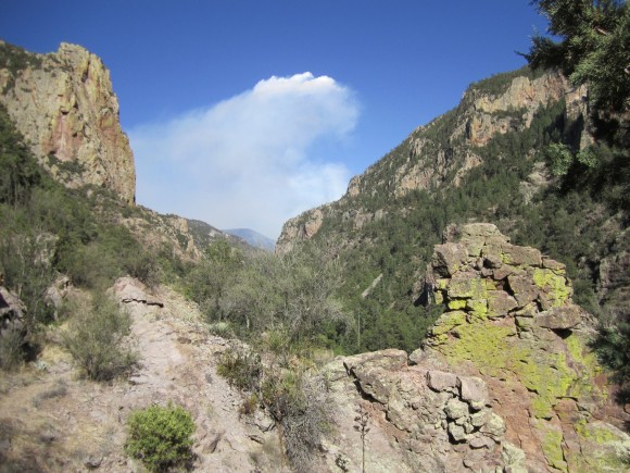
When we got to the top, we found ourselves on the edge of a cliff with a spectacular view of the Mogollon Mountains. We saw another forest fire burning in the valley below, which appeared to be in Lipsey canyon near Redstone Park along the Whitewater Trail. We spent a good hour up here scrambling down to various ledges to get pictures of ourselves and the fire below, eating lunch and relaxing. We even saw a helicopter flying through the smoke surveying the fire. Little did we know that this fire would grow into the largest fire in New Mexico state history! It’s still burning as of June 10th 2012 and is now 278,000 acres, or 434 square miles.
With a lot of ground to cover, we descended Grouse Mountain and jumped back on the Holt Apache. Shortly thereafter, we made a wrong turn and headed down a side trail to Nabours Spring instead of staying on the main trail. We were going down steep switchbacks for a while and eventually the trail just ended. We found ourselves on the side of a steep slop with a long way to go to the top. We stopped and I consulted my GPS and topo, and discovered our mistake. If we continue to head down, this will put us in a canyon with no trails and difficult terrain. Our only choice was to head back up the way we came. This probably set us back an hour, but it happens.
Back on track, we found the Deloche Trail and hiked towards Whitewater Creek. Somewhere along this trail, we both ran out of water. We didn’t have much farther until we reached the creek so we kept a good pace all the way there. Once we hit Whitewater, we began to see a steady flow of other hikers in the area. We passed a group of guys who had just left Redstone Park the day earlier, and asked us if we saw any rattlesnakes. We hadn’t but he said he’d seen three. With all the climbing we did, we were surprised to hear that, and lucky we hadn’t. We stopped along the creek to filter water and cool off. Down in the bottom of the canyons was much hotter than it was a day earlier at 10,000+ feet.
We were worn out now, but needed to cover a few more miles today so that our hike back to the car tomorrow morning is a short one. We hiked another 4.3 miles until we reached a campsite at the junction of the Whitewater Trail and South Fork Trail. After making camp, we filtered more water and tried to rehydrate. I had been pissing dark yellow for a while now and chugged a few liters over the course of the night. We had a fire going, but it was pretty warm out and we were too tired to keep it going. Our last night in the Gila Wilderness was pretty low key. We both passed out around 9:30 or so, maybe earlier.
Day 6 – May 18th, 2012
I don’t think it matters where you are, but for me, I am ready to go home on my last day anywhere. Today was no different, and our car was only a 2.8 mile hike away. I ate the last of my food for breakfast, something I’ve never done before. Usually, I pack a little too much food. In all fairness though, I did plan this trip for 5 days, but since we made such good time driving we were able to get a sixth day in. Now foodless, we hit the trail and embarked on what seemed like a much longer trek than when we hiked this stretch on our first day.
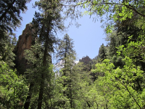
I hadn’t noticed hiking through here a few days earlier, but the the two sides of the canyon seemed to have very different types of ecosystems. One side was dry and looked like a desert, complete with cacti, while the other was forested and more lush looking. Looking back the way we came, we could see the smoke from the fire we saw earlier over the mountains.
Now on the Catwalk Trail, we passed an older couple on a day hike. They asked if that was my “small black car” in the parking lot, and I said yes. Apparently we were now the only ones here. When we finally reached the car, there was a forest ranger there who told us they had just sent in rangers on horseback to look for any hikers still out there, as they have closed all the trails in this area due to the fire. He told us that lightning caused the fires and that it was around 400 acres as of this morning.
After changing out of our dirty clothes and packing our gear into the car, we left the Whitewater Picnic area around 10:30am. On our way back home, we thought it might be cool to check out the Mogollon Ghost Town nearby. Supposedly the town was abandoned in the 1940’s when WWII broke out. After the price of silver plummeted, the town went under and it was abandoned. Heading north on hwy 180, make a right on Bursum Rd and go down about 10 miles. The drive in was more impressive than the ghost town though. The road was steep and had no guard rails, and had great views of the land below. There were farms that butt upp to this road that had no fences, and there were cows wandering in the road at times. Once we got into the “ghost town”, we saw at least 3 houses the were inhabited. One guy had his sprinkler on and had a green lawn. There was a small museum and some other types of shops here, among a few old buildings like a saloon. From what I had read though, it was supposed to be abandoned, but clearly it was not. We turned around and headed back to hwy 180 and began the long drive back home.
Final Thoughts
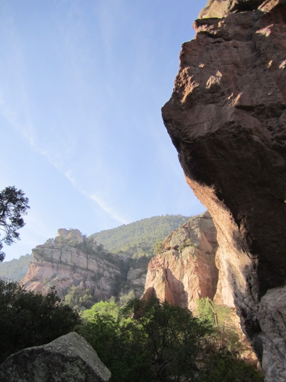
The Gila Wilderness is an ass-kicker! The terrain is rocky and rough everywhere you go. The trails can be difficult to follow, and it would be easy to get lost here without a GPS or a topographic map (and knowing how to use it). It’s a very rugged place with a real feeling of solitude everywhere except for the Catwalk and Whitewater Trails, as this is where all but one of the people we encountered were. There are opportunities abound for those wishing to explore off trail, but in doing so you will find that the terrain can be a real challenge. Although we were able to hop rocks across every stream we encountered, other times of the year you would certainly need water shoes for stream crossings.
All in all, it was an excellent trip and I would love to visit another area of the park someday. Hopefully the forest fire doesn’t destroy the entire park, as it would be a shame to see this beautiful place scarred on such a massive level. I’m glad I got to see it before (and during) the fire, and I hope they are able to contain it soon so that others can enjoy it in the future.
Complete Gila Wilderness Photo Gallery
As always, questions and comments are welcome!
If you found my trip report useful, please don’t hesitate to leave a comment! Alternatively, if you feel you have any information you’d like to share with others regarding this hike, please feel free to leave that below in a comment as well.
[tcb_comment_count]


