
CDT Section Hike 2021 – Never Summer Wilderness & Parkview Mountain
CDT Section Hike August 2021 – Rocky Mountain National Park, Never Summer Wilderness & Parkview Mountain, Colorado

-
- Hike Location – Rocky Mountain National Park, Never Summer Wilderness & Parkview Mountain, Colorado
- Land Administration – National Park, National Forest
- Hike Type – Point to Point
- Fees & Permits – No fees or permits needed (unless camping overnight in RMNP)
- Start Trailhead – Shadowcliff Hostel, Grand Lake
- End Trailhead – Forest Rd 104
- Length Of Time Hiked – 3.5 Days
- Miles Hiked – 60
- Route Difficulty – 4.5
- Scenic Beauty – 7.5
- Solitude – 8
Pre-Hike Planning Notes
I’ll be joining my friends Alex Maier and Amy Robin on their 2021 CDT thru hike as they walk from Grand Lake to Steamboat Springs. I’ve hiked this before myself on my 2018 CDT thru hike, and know it probably isn’t the highlight of the CDT. But, I wanted to join Alex and Amy for a section of hiking this summer and logistically, this is where it worked out for us both. I’ll have a friend pick me up along FR 104, south of Little Haystack Mountain. He’ll take me back to Grand Lake to get my van, where I parked it at the Shadowcliff Hostel, and I’ll follow him back to his place in Colorado Springs afterwards.
You’ll need a permit if you plan on camping overnight in Rocky Mountain National Park. But the RMNP section is only a few hours walk out of Grand Lake, and much of it has been burned recently in a fire, so you wouldn’t want to camp here anyways. Recent fires have also burned sections of the CDT south of Parkview Mountain. Much of this section has good trail and is a relatively easy hike.
Map of my CDT Section Hike:
Caltopo map of my CDT section hike from Grand Lake to, well, not quite Steamboat Springs

Elevation chart
Download GPX file of this hike
Video: CDT Section Hike: Grand Lake to Steamboat Springs, Colorado
Day 1 – August 2nd, 2021
Miles Hiked – 12.92
Elevation Gain – 2973′
Route Hiked – Grand Lake to Upper Bowen Gulch

My newly-built Astro Adventure Van in northern Utah, a few weeks earlier

It’s pretty comfy inside!
Let me start by backing up a bit. Two nights ago, my friends Alex Maier and Amy Robin hiked into Grand Lake. They have been hiking since April on the Continental Divide Trail, having started at the border of Mexico and New Mexico. This puts them roughly 1300 miles into their hike, with another 1700 remaining to the border of Canada. I completed the CDT in 2018, and now it’s my privilege to join Alex and Amy for a section of their hike this year. I had been touring the west for the past 6 weeks in my newly built camper van, and it’s here in northern Colorado that our paths cross this summer.

Alex Maier and Amy Robin
Alex is a documentary film marker, best known for his “Figure It Out On The Hayduke” movie. I really enjoyed Alex’s take on the benefits of being in the wilderness, and his ability to put profound concepts into clear, distinct words. So I was very interested in his latest project, “Mind Body Soul“. This project follow Alex and Amy’s 3,000 mile hike on the Continental Divide Trail, with a goal of exploring the effects hiking has on the mind, body and soul. Alex also has a youtube channel called Wilderness Mindset, where he shares high quality videos of his outdoor adventures and thru hikes.

Rocky Mountain National Park
We started the hike out of Grand Lake at Shadowcliff Hostel. Alex and Amy are also hiking with their two service dogs, Echo and Minnow. From here it’s a short walked through some burned forest. This had all burned since my visit here in 2018 on my CDT thru hike. The route I took before had us continuing north for a few more miles, but the trail was closed and we had to detour west. This led us back to HWY 34, the main road north/south running road in the area. And now it’s a few miles of road walking through Rocky Mountain National Park.

The mighty Colorado River
North of Onahu Trailhead, we leave the paved road for a dirt one. Life is suddenly more quiet and calm away from the traffic. We cross the Colorado River here, not all that far from its headwaters just 10 miles away, as the crow flies. We stop here for a lunch break along the banks of the river. This is nice. This brings back memories.

Never Summer Wilderness
We leave the Colorado River behind and hike towards Bowen Gulch. We hike uphill though the the forest for a while and enter the Never Summer Wilderness. The trail is good and the grade is excellent for those long, continuous pushes uphill. This makes a 2,000ft climb like this one much easier.

Upper Bowen Gulch
The trees break as we reach the upper Bowen Basin area. We see a few moose in the area, and I remember seeing them here in 2018 too. This is their turf.

Campsite in upper Bowen Gulch, Never Summer Wilderness
We found a pretty nice campsite with good tree cover not far off trail. The clouds moved in and out rapidly as the evening progressed.
Day 2 – August 3rd, 2021
Miles Hiked – 13.75
Elevation Gain – 2411′
Route Hiked – Upper Bowen Gulch to Willow Creek Pass
Last night we had a lot of animal activity. By the sound, they were large animals, and they were close by. We assumed moosr, since we saw several in the area lst night, and there were little trails leading through our general campsite area. One animal was probably only 4ft from my tent at one point.

Hike up to Bowen Pass

Looking back down Bowen Gulch
After leaving camp, we still had a few hundred feet left to climb to reach the top of Bowen Pass. We saw a few more moose down lower in the valley. They really like this area.

West side of Bowen PassThe top of Bowen Pass was a bit of a let down, with all the fog around. This pass separates the Arapaho National Forest and Route National Forest though, so that’s something.

Coming down the west side of Bowen Pass. Entering the Routt National Forest
On the way down form Bowen Pass, we stop at a small creek for water. I remember stopping here for water too on my 2018 hike. I don’t remember the miles ahead being very memorable, though.

These clouds never left all day
My memory served me right; the rest of the day was not that interesting. It had been raining on and off today, quite a bit in the afternoon. We were pretty wet and when we stopped, it was cold. We kept our breaks short and kept moving.
Later this afternoon, we hiked through several large burn areas. I didn’t take any photos here, apparently. It was pretty bleak looking, but very easy to walk. The terrain was pretty open and free of vegetation, and some erosion was starting to occur as a result.
We found camp above Willow Creek Pass. Nothing special, but campsites on the CDT seldom seemed special to me. This fits my recollection of CDT camping perfectly; a subpar campsite that looks a lot better at the end of a long day.
Day 3 – August 4th, 2021
Miles Hiked – 14.26
Elevation Gain – 4523′
Route Hiked – Willow Creek Pass to Poison Ridge
We got clobbered with rain last night. It was coming down heavily. Probably heavier than any single rain event on my entire CDT thru hike in 2018. But it barely rained at all on my 2018 hike. Now, I’m getting the full Colorado experience here.

Beginning the hike up Parkview Mountain
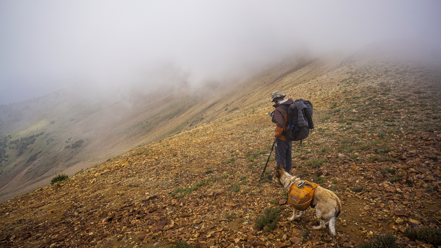
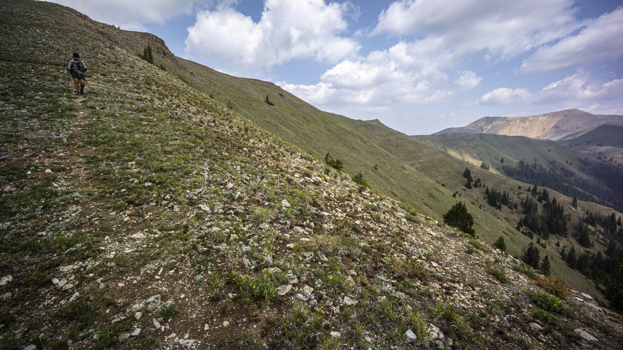
We pack up camp wet this morning and hit the soggy trail. We emerge from the forest and find ourselves at the bouldery base of Parkview Mountain. We skirt this base and begin our ascent of Parkview as we punch through the clouds.

Clouds rolling in fast. Like, really, REALLY FAST!


CDT, this way…
The weather is weird today; low clouds that rapidly come and go, alternating periods of high winds and total silence. Once we gain the crest of our first ridgeline, we get above the clouds for the first time. Well, we’re hiking in them now, too. It’s sunny and clear blue skies one minute, and within seconds, a big cloud blows in and visibility goes down to mere feet. It’s wild, and pretty damn cool.

Our four legged friend making it look easy
The hike up the ridgeline is great. I enjoyed it in 2018, when the views were wide open and vast. But I enjoyed this more. Alex and Amy hadn’t had any days like this either on their CDT hike this year up to this point.

Cloud blowing over the ridge… wait 10 seconds…

10 seconds later, and the ridge looks like this!

Optimism has my tent on the outside of my pack today, hoping it will dry out after last night’s rain
Conditions continue to change second by second and keep us on our toes. But, there seems to be no threat of rain. We take our time heading up the mountain now, as the 3 of us are all photographers. We are sidetracked with the constantly changing lighting, mood and landscapes!

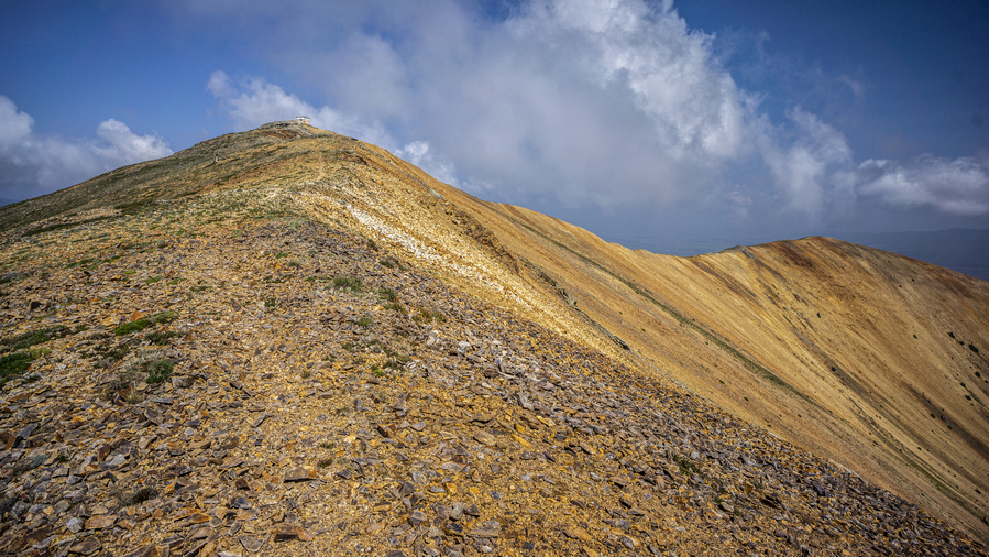
Alex emerges from the cloud on the final approach to Parkview Mountain

Final push to the summit of Parkview Mountain

Shelter on the summit of Parkview Mountain (12,300ft)
We reach the summit of Parkview Mountain mid-day. For northbound CDT thru hikers, Parkview Mountain is the last 12k peak they will encounter. Unless you do the Wind River Range High Route alternate, and you’d be a FOOL not to! Just saying. We take lunch inside the shelter and enjoy the wind break. I’m sure the rodents would be an issue if one tried sleeping in here. The dogs were going nuts trying to get at them while they scurried around underneath the shelter.

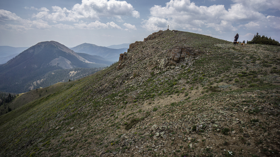
Descending Parkview Mountain
Looking back up Parkview Mountain

We begin the descent down Parkview Mountain by doing exactly what I did in 2018; taking a wrong turn here and walking down the obvious looking ridgeline. While there is good trail leading this way, and good views too, the correct route was to take the ridge to the west. This was a dumb mistake, and even dumber because I made it twice.

Looking back at Parkview Mountain

Descending this ridge

Alex with a backdrop of Parkview Mountain
Back on trail now, CDT signs and posts lead the way. The hiking here is excellent, just as I remembered it from 2018. It’s not the most scenic place you’ve ever been, but it has a simple beauty to it. It’s mot going to wow you, but it’s extremely pleasant. You just feel good being here.

Awesome perspective of the landscape
Follow the CDT posts…

Oh yeah! I dig it. I can walk ridges like this all day 🙂
We get some distance from Parkview Mountain and watch it become smaller on the horizon. It’s also an excellent backdrop now to the scenic ridge we’re hiking.

Haystack Mountain ahead. These mountains have a different feel to them. Wyoming is getting closer…
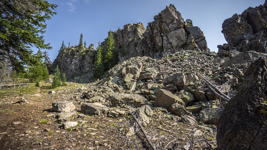
Next, we hike around Haystack Mountain. The trail drops down off the ridgeline about 450ft and contours around the east side of Haystack at the 10,200 mark. This section had a few downed trees and minor obstacles, but nothing too bad.

Woof, maybe

Nice campsite on Poison Ridge
We cross Troublesome Pass and keep hiking towards Poison Ridge. The sun is getting lower in the sky and it’s time for camp. We find a pretty nice spot with an elevated view over Sheep Creek. With the full sun of the afternoon, we have been able to fully dry out our gear. What a great end to a day that started out wet and dreary.
Day 4 – August 5th, 2021
Miles Hiked – 15.47
Elevation Gain – 3075′
Route Hiked – Poison Ridge to FR 104


This morning’s hike was nice. Clear skies and sun, good trail and good views. Again, this area is not spectacular. But it’s enjoyable. I felt good being here. However, today is the day I’ll meet up with my friend who will pick me up somewhere along FR 104. And so, after a few hours, I say goodbye to Alex and Amy and hike ahead. I’m slightly behind schedule now, and increase my pace to make up for the time. I don’t want to keep my friend waiting any longer than he has to, he drove quite a long ways to meet me out here.


The ridgeline hike continues to be enjoyable. Eventually though, it’s time to drop down to Middle Fork Arapaho Creek near Hyannis Peak. It’s here that I run into another moose along the trail. Fortunately he went on his way, and I could keep running down the trail. And that’s what I was doing now, jogging where possible.
I climb out of Middle Fork Arapaho Creek to the ridge on the south side of the canyon. This is FR 104, the 4×4 road I have been shooting for. The spot my friend and I chose was a little farther downhill, so head that way. The road looks pretty good here, but I have a feeling it’s rough lower down the mountain. I get a brief moment of cell service and call him. He’s about 6.5 miles downhill from here, but the road is really rough. I get going to try and knock out these final miles as fast as possible.
I hike another hour or so, and was surprised to see my friend’s Subaru coming uphill. He was able to keep driving since our last call, but as rough as the road was here, I was not expecting him at all. So that saved me about 3 miles of the 6.5. But I would not recommend driving on this road without a high clearance vehicle!
That’s it for this hike. What’s next? I have a killer Wind River Range hike planned for next week!


