Creating new thru-hiking routes & guides, hiking videos, outdoor documentaries, backpacking trip reports, trail journals, photos and more!

Latest

Pagosa Springs to Lake City – CDT Thru Hike 2018

Continental Divide Trail – Pagosa Springs to Lake City Hike Overview

Between Pagosa Springs and Lake City, the CDT passes through the San Juan mountains and the Weminuche Wilderness, Colorado’s largest. It’s a tough section with rugged mountains, alpine lakes, lots of high trail and beautiful scenery. It’s much longer than the last section, but fortunately the trail was a bit drier and less snow which allowed for slightly easier travel. But still, very challenging!

Saturday June 9th – CDT Day 50

I had a couple of bananas and some banana bread at the motel continental breakfast. Then sprinkler and I went out for a real breakfast. We ate at the junction restaurant at the end of town. Pancakes and sausage, last hot meal for up to 7 days.

Sprinkler was taking another zero today so he went back to the hotel. Being at the end of town and across the street from the gas station, it seemed like a good place to start looking for a hitch up to the pass. I had a cardboard sign that said “wolf creek pass”. I got a ride after about 15 minutes from a fisherman heading up that way

After being dropped off, I joined Quiet (another hiker) in a conversation with a couple of motorcyclists at the pass. After about 20 minutes, I started hiking. It was roughly 10am.

The trail climbs for a while after leaving Wolf Creek pass. That is to be expected, it’s a pass after all. But damn, was it tiring with a pack of food and water.

I bumped into to hikers named Casper and button. As we were talking, a guy came down the trail southbound and mentioned that he just saw a bear about a mile down the trail.

The more I hiked today, the more the views improved. Only a couple of snow patches to cross as the trail reached the end of a Valley with a nice Lake. Trail climbs steeply above it to the top of a ridge. This was one of two big climbs today.

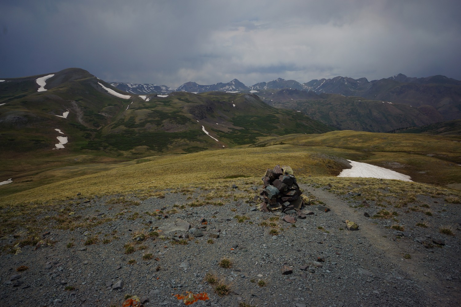
Now on the ridge, I felt like I was back on Trail between Chama and Pagosa Springs. Big views and felt like the top of the world. Forest fire smoke from the 416 fire in Durango could be seen on the horizon to the west.

I did my best to keep hiking although I was pretty distracted by the scenery. More ups and downs along Ridge lines, small passes and generally staying high.

I saw two more hikers, turtle and mangus. Stopped here for second lunch around 5pm. All have another 7.5 miles to go and another big climb ahead.

The trail goes downhill for a bit and then start the climb. Steady at first, sleeper later. Excellent views the rest of the evening. The trail is heading west, right into the sunset. The way the Ridgeline was illuminated by the Sun was magical.

As the trail started climbing up the switch backs, I was getting really tired. Only a few more miles. At the top, more incredible views. This is what I envisioned before hiking the CDT. Really awesome and words can’t describe it.

The trail dropped down a little bit before ascending the final High Point of the day. Cold and windy now with the sun setting behind the first fire smoke.

With the climbing done for today, all this left is to descent into a valley towards a stream, the first water source in a while. This will make a good place to camp.

I found a place to camp near the stream after 8:30pm. Long day, but I got my miles in. I’m hoping to trail remains snow free and relatively dry as it was today for the rest of the hike to Lake City. If not, it’s going to be rough and slow going like the last stretch.

Miles – 22.7
Total Miles – 855.5
Rain – no
Sleep – Backcountry tent
Animals – marmot

Sunday June 10th – CDT Day 51

Woke up at 7am. Filtered water from the stream and took off.

Much of the morning and early afternoon was fairly boring trail. Lots of small ups and downs along hillside with little view of anything. There were some nice moments but just not as constant as other sections of trail. 

Sometime mid afternoon, the trail climbed up a Ridgeline and the views improved. About time. I ran into Mangus a couple times, and played leapfrog the rest of the day.

Smoke from the 416 fire in Durango was pretty thick now. I couldn’t even see it this morning, and now it has engulfed the sky and filled the valleys.

I must have forgotten to turn my GPS back on after first lunch, because the next time I went to turn it off it was already off. I have guthooks app miles I can use, I’ll just add another mile or two to that total since the app usually underestimates the total miles.

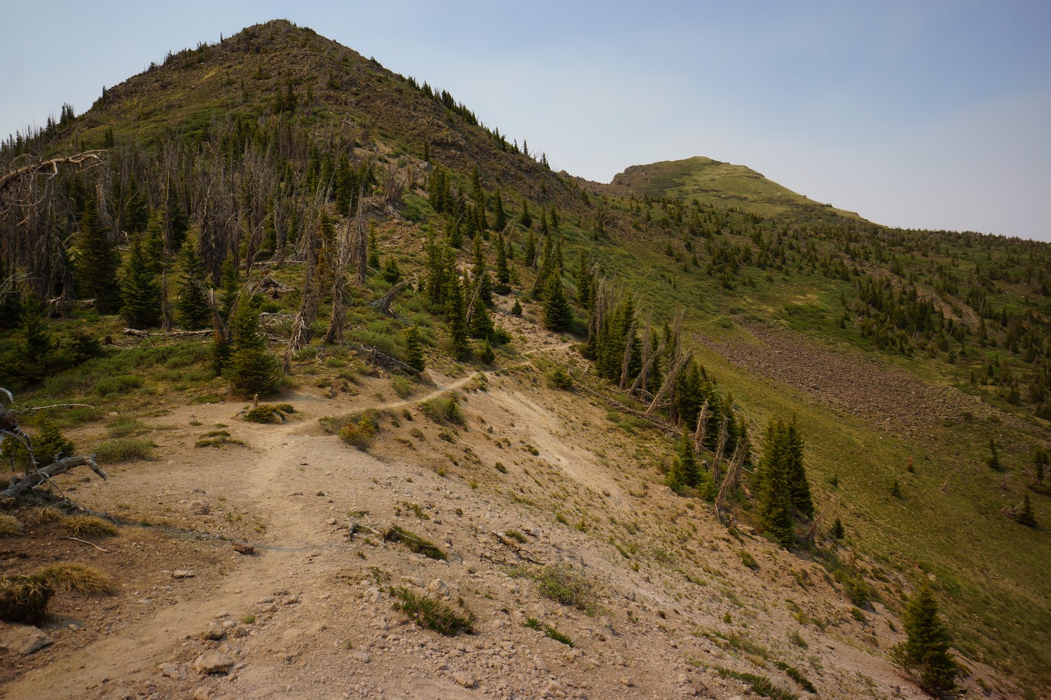
Next the trail traverses a hillside through a large basin.

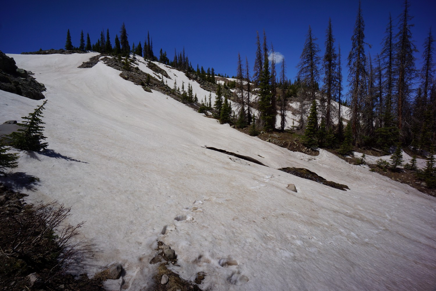
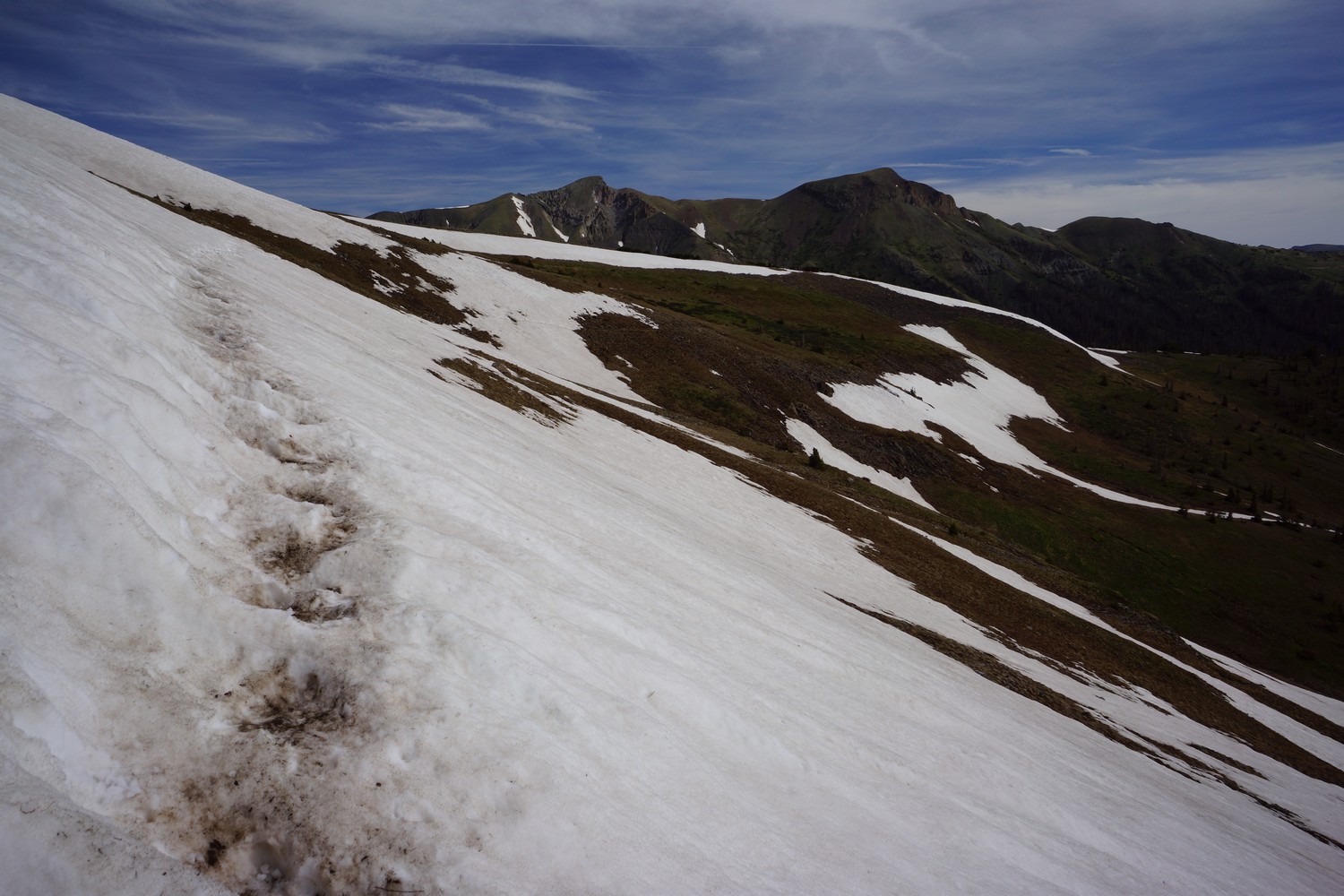
Later in the afternoon I reached knife edge, a pointy ridge. The Ridge itself was not a challenge, but the steep slopes following it were more difficult. Had there been more snow, I would have used my micro spikes. There were a couple of snow patches on steep slopes that I was able to cross with no snow gear, not even trekking poles.

After the knife edge, I had another climb up over a Ridge. I stepped on some mud that looked fairly dry and sturdy, but it ended up being ankle deep. I got a bunch of mud inside my shoe, too. I was able to keep my feet dry the rest of the day up until this point.

I had another hour or so until I got to a pass below the final climb for today. I had planned on hiking to Squaw Creek, but it was another 3 miles and it was already 7. I certainly could have done it, I did something similar last night, but I was really hungry and exhausted. I decided to camp just below the pass near a small pond.

The miles here in Colorado are so much harder than New Mexico. I could hike all day and New Mexico and never feel this tired, even on a 30 mile day. Here, I have to really bust my ass to get 20 miles. Today I hiked 18.7 miles according to guthook, which would probably be 19.5 – 20 on my GPS.

Miles – 18.7
Total Miles – 871.2
Rain – no
Sleep – cowboy camp
Animals – marmots

Monday June 11th – CDT Day 52

Woke up at 6am to a 28°morning. My 20° quilt kept me toasty.

After leaving camp I finished the climb I intend on doing last night. I made a good call not pushing on because there were few campsites in the area I was hoping to camp when I passed by this morning.

Today had a lot of big climbs. It started with a 1100 ft descent to Squaw Creek. Then it was a 1700 ft climb.

Good views along much of the climb. I stopped for first lunch here along a creek. Actually, I had four lunches today. I’ve been hiking in 3 hours blocks, but today I decided to try 2 hour blocks, eating and drinking water each break.

Lots of willow bushes along the trail today. Just had me cursing quite a bit as they cut up my legs. I also went through a gauntlet of mosquitoes along a small Lake, possibly the thickest swarm I’ve ever encountered.

I took another break at the top of the pass. Oh man these climbs are getting to me. I leaned up against my backpack and admired the beautiful view, and wished I could stay here longer.

The trail climbs a little bit higher after leaving the pass. After reaching at High Point trail curves around a hillside and a view of a whole new landscape opens up. Lightly snow capped peaks lined the horizon. It’s a shame the forest fire smoke obscured the view, because it was stunning.

Now the trail drops down to 10400 ft over the next few miles. This is the lowest the trail will get on this entire stretch from Pagosa Springs to Lake city.

At first the trail stays high on a bit of a plateau with good distant views. Then it drops down to a meadow, where I stopped for another food break.

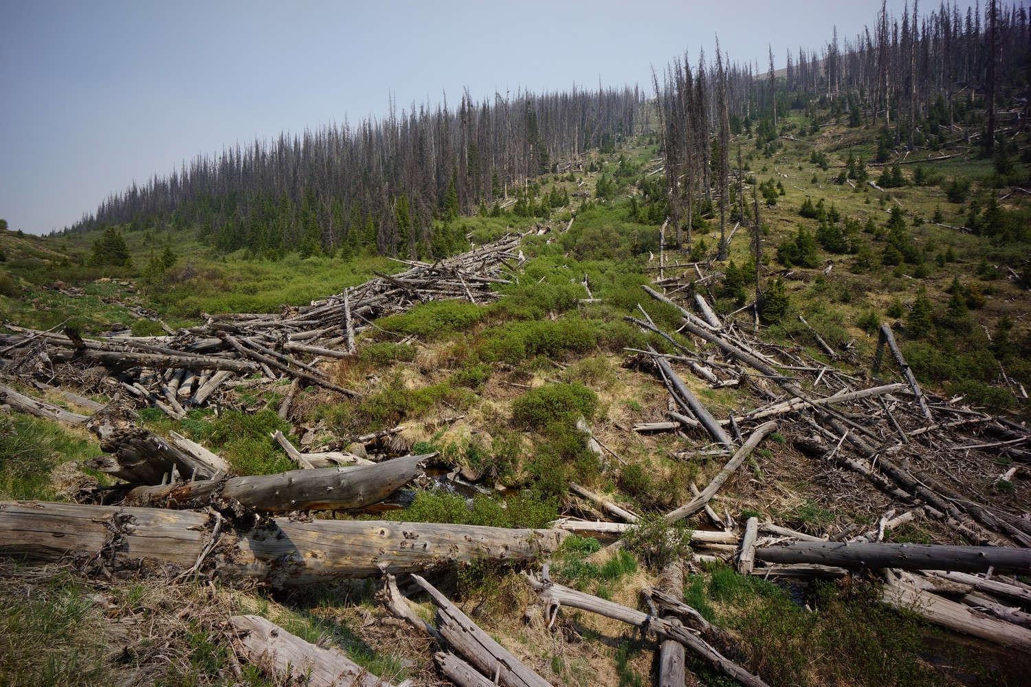
After leaving the meadow, there’s a short climb up a hill and then the trail followers a river Gorge downhill. There was a huge log jam along the river, looks like the product of an avalanche.

The River then dumps into a huge Meadow. The forest fire smoke created a thick haze that filled the valley and obscured sight of the mountains beyond. However, a distinct notch in the Ridgeline could be seen even from the other side of the meadow. It first I thought this was the pass I would be hiking to, but I would later find out the trail doesn’t actually go through this notch, but close to it.

I took another break at the end of the meadow before the trail starts to climb. Mangus was here too. We were both dreading the 2200 ft ascent that awaits us. Filtered water for tonight as well.

The hike up to the next pass wasn’t as bad as I was anticipating, but still very tiring. I think the extra breaks I took today helped.

I thought about camping before the pass, but I was feeling good enough to go over it and shoot for a saddle about a mile after. I’m glad I did because I was able to cover a couple more miles and after cresting the pass it was so beautiful. It was around 7pm now, which has been probably my favorite time of the day to hike. Even though I’d prefer to be in camp already!

Coming down from the pass, it was another mile or so to the saddle. I found a pretty decent campsite here, and decided to cowboy camp again.

Hiking through the mountains is such hard work. It still surprises me that I’m able to get up in the morning and do it all over again every day.

A few other things… I’ve yet to set any sign of bear in Colorado, but saw bear crap almost daily in New Mexico. I’ve only taken one ibuprofen so far and it was in town, not even in trail. That must be some thru hiker record. Many hikers call it vitamin I. OK quit rambling and get some sleep!

Miles – 24.6
Total Miles – 898.8
Rain – no
Sleep – cowboy camp
Animals – marmots

Tuesday June 12th – CDT Day 53

I was hiking by 6:55 this morning. I hiked about a quarter mile so I could get into the sunlight to eat my breakfast. Really hoping to put in some miles today.

Great views all day long, best of the hike so far. It started almost immediately after leaving camp. The trail goes through a large basin. Heading around a blind corner near the top I stumbled upon a bull elk. Antlers are starting to grow more this time of year.

At the top of the Pass, I could see Ute lake below. Lots of beautiful Mountains forming the backdrop. Good start to the day.

After passing Ute lake I filtered water from a small stream, ate and rinsed yesterday’s socks.

Next was the first of 4 big climbs today. Felt good on this one. Beautiful view from the top, didn’t think it could get much better but it does.


The view from the second pass was incredible. It was reminiscent of the wind River range. Closer to Nebo Creek, there was some interesting looking upheaval in one of the mountains. Going down Nebo Creek there was a lot of wading through willow bushes and wet ground.

The third pass was named Hunchback pass. I’ve hiked in this area of the San Juans in 2013, and came down Hunchback pass from the opposite direction. When we came down the pass last time, visibility was almost zero due to extreme fog and drizzling rain. I was looking forward to seeing what I missed last time but honestly, it wasn’t super spectacular. At least going up. Going down the pass towards bear town trailhead was beautiful though!

Before the 4th and final big climb of the day, I filtered 3L water from a stream. Then I began the arduous trek uphill. The first bit was steep. I can handle a steady up Hill Climb all day but past a certain angle it just kills me. And it was definitely past that angle.

I reached the top of the pass but not the climb. Now the tail is on a high, rolling, open mountaintop. Would be hard to describe without the pictures. It’s pretty barren, and really wet. I had been able to avoid wet feet all day but not anymore. There were just too many large wet fields to cross, and eventually I ended up just trudging through the water. Ugh, I hate wet feet.

The forest fire smoke was really thick and once again obscured what would have been some Pretty cool views. Still had a couple more miles to go but was getting worn out. I stopped for dinner a little before 7.

The rest of the evening was very scenic. I found a place to camp in a narrow Valley that had an awesome view of the sunset. Going to cowboy camp again. Saw a couple of elk this evening from camp.

I hiked for 13 hours today to cover 20.1 miles according to the guthook app. Did I mention how hard Colorado is? Holy crap. In New Mexico I could hike all day long and almost never get winded. I feel like half my day in Colorado I just want to keel over and die due to all the climbing. I was never very good at cardio and certainly don’t enjoy it. I’m wondering how long it will take for this to get easier.

Miles – 22.7
Total Miles – 921.5
Rain – no
Sleep – cowboy camp
Animals – marmots, elk

Wednesday June 13th – CDT Day 54

It was 22° when I woke up this morning. Since my shoes got wet only two hours before sunset, I had to put them in a plastic bag and warm them in my sleeping bag. It gets annoying having them in my sleeping bag the entire night, so I typically bring them in the bag an hour or two before I get up. They don’t get dry but at least they are warm when I put them on. Waiting for the Sun to hit my location before I get out of my sleeping bag.

Lots more climbing ahead today. The trail will reach its highest point at over 13000 ft, and several Peaks just below.

The day started with a small climb. More great mountain views.

The trail passes through stony pass. There’s a little traveled dirt road here to hitch to Silverton, or just walk the 10 miles to town. Some hikers resupplied here, but it’s another 35 miles to spring creek pass where I plan on hitching into Lake City. Moving on.

The trail follows a dirt road for about a quarter mile before splitting of as trail again. First road walk in Colorado, albeit a short one. This begins a climb out of a new valley. This valley had an empty feel to it. Hard to describe. The climb wasn’t too hard and soon enough I was at the top of the pass.

New pass, new views. Impressive scenery. Clouds building. Stopped at a small pond to filter water and eat.

More ups and downs, more clouds. One mountain had some interesting rocks that slowed me down, just as the skies were darkening to their breaking point. I heard an incredible roaring sound, then got hit with a 60 mph wind gust out of nowhere. Snow flakes followed, flying horizontally. I put on my rain jacket and put away the camera gear for a while.

I hiked for a while under the threat of rain but in the end I never got wet. The forest fire smoke was thick now and made it tough to tell if there were rain clouds overhead or not.

Passed a couple of lakes before another climb. It was steeper at first then leveled out to an easy pace the rest of the way up. I was listening to music and felt great at this moment, definitely thinking about town tomorrow now.

After cresting the pass it was a long decent into this valley. Massive views, this valley just felt enormous. The smoke was probably thicker here than anywhere else yet.

Filtered water again here at a steam, last water for a long time. Then the trail climbs up to an area with some dirt roads and a trailhead. I stopped here for food before pushing on.

It was 6pm now, and I began a 1000ft climb up a very steep dirt road. At the top of this climb is the highest point in the Colorado trail, which is also the CDT right now, at 13,271ft. Up here will be 20 miles for the day, but there will be few places to camp. And windy! Fortunately, I just discovered a yurt along the trail, but it’s another 8 miles from here. It’s going to take a herculean effort to reach that yurt before nightfall.

The steep road whooped my ass the whole way up. At the top was a super barren landscape, yet the highest on trail so far.

Now it was time to haul ass. I fast-walked everywhere that wasn’t steep uphill, and jogged on the downhill sections. I began to get tunnel vision, intensely concentrated on reaching that yurt before dark. This was the fastest pace I’ve maintained so far on the CDT.

Even with the smoke, there were some beautiful views along occasional Ridgelines. Coming down from one, I saw an elk.

I made it to the yurt aid 8:30pm, with little light to spare. I was completely exhausted, just spent from the day’s effort. I climbed a ladder to reach the platform the yurt sits on and saw turtle, yoda, and peppers. Inside was Baylor and crash, who were hiking the Colorado trail, already sleeping.

Ate dinner and slept on the floor inside the yurt. Didn’t want to use my inflatable air mattress on the metal wire bunk beds. Whew, long day! Not something I want to replicate any time soon.

Miles – 28.1
Total Miles – 949.6
Rain – sprinkles
Sleep – yurt
Animals – marmots, elk

Thursday June 14th – CDT Day 55

I was the last to leave the yurt this morning at 8:30am. With only 8.5 miles to spring creek pass, there was no hurry for me.

Today’s hike was not that scenic. Large open areas, huge hills that had several false horizons as they were climbed and few mountain views.

Later, the trail drops down into forest land and eventually hits a door road. This road is followed all the way down to the pass, a paved highway. It took about 3 hours of hiking to get here.

As soon as I reached the road, two hikers were coming down to the pass, southbound. Before I had a chance to put my thumb out for a hitch, they offered a ride into Lake City. Absolutely!

It turns out that Mary and Clee, my ride into town, were related to Liminal, another hiker I’d met in Silver City. Small world! They have been following along the trail and assisting with rides and resupply. In fact, they knew many of the same hikers I met along the trail.

Mary and Clee were kind enough to take me out to lunch in town after I checked in at the ravens rest hostel. I had an awesome burger at the cannibal grill, probably the best yet on trail.

It turns out both Mary and Clee work for the fish and wildlife service, which spawned some interesting conversations. Clee had been stocking a lake with fish by plane some time ago, and when they looked back to see where the fish landed, he saw a man bailing water and fish out of his rowboat! Such a great story!

After a greatly appreciated ride from the pass and hot meal, I picked up my bounce box from the post office and settled in at the hostel. There were about 10 hikers here today.

Did laundry, started backing up photos, GoPro video and GPS tracks. Then sprinkler, earl gray and I went to Poker Alice for dinner. I got a 16″ meat lovers pizza, and had plenty to take with me for later.

Not much else was accomplished this evening. Some R and R was just what I needed after a tough hike in the san Juans.

Miles – 8.9
Total Miles – 958.5
Rain – sprinkles
Sleep – hostel
Animals – deer

Friday June 15th – CDT Day 56 (zero day)

It felt great to sleep in a bed, even if it was a bunk bed. We went out to the bakery for breakfast… Good stuff. On the way back, We hit the county store to resupply for the next section to Salida.

Spent the rest of the day backing up photos and video, processing them and began updating my blog.

Everyone left the hostel and it was just Sprinkler and I. Weird for it to be so empty after being nearly full the day before, but I suppose this is what happens when the San Juans are closed due to fire.

Remnants of hurricane Bud are coming tomrrow, brining heavy rain all day, so I think I will take another zero. Also, I had plans to meet up with a friend in Salida, and having my zero day fall on a Friday would work better for my buddy than Thursday, so the extra zero here in Lake City isn’t really a problem.

Miles – 0
Total Miles – 958.5
Rain – sprinkles
Sleep – hostel
Animals – rabbits

Saturday June 16th – CDT Day 57 (zero day)

Ate breakfast at the Chillin place next door. Grey skies, looks like rain already. Trying to finish my blog updates and everything I need with my bounce box so I can send it back today before 1pm. Buuuttt… that didn’t happen!

Ate lunch at the Cannibal Grill with Easy and Sprinkler. They left and as I continued to plug away on my laptop. Then, Forrest and Sequoia walked in! I thought they were far ahead of me, but they had taken some time off in Silverton. 

I should get back on trail tomorrow. Just gotta figure out how to get my bounce box sent out on Monday now in my absence. Ah, trail logistics.

Miles – 0
Total Miles – 958.5
Rain – no
Sleep – hostel
Animals – rabbits

Related Images:

Chama to Pagosa Springs – CDT Thru Hike 2018

Continental Divide Trail – Chama to Pagosa Springs Hike Overview

This section has been the most difficult of the hike thusfar. More snow, highest elevation, most climbing, wettest, muddiest and all-around toughest hiking yet. But also, the most beautiful and impressive mountain scenery so far. Welcome to Colorado, snow and high mountains. Climb high, stay high! And that’s exactly what the trail does here. It follows the highest possible route without dropping down into valleys. That’s the spirit of the CDT, and this section is trial by fire. 

Monday June 4th – CDT Day 45

At breakfast at the Chama grill, then got a ride to the post office from Ralph, a local Trail angel. Set my bounce box to Lake City, sent home some gear, and returned the backpack I bought.

We squeezed 7 people I believe into Ralph’s pickup truck for the ride up to cumbress pass. We arrived at the pass around 9am and I started hiking shortly after. Not bad, more of an early start then I was expecting.

The trail start climbing immediately north of the pass. It was a good hike with increasingly good scenery. Before long the sound of the highway faded and only the sounds of nature remained.

The trail reaches a ridge that overlooks a valley below. Snow capped peaks can be seen in the distance. Woohoo, finally in the high mountains!

The trail continues to climb along the side of a mountain. Eventually it reaches a pass, the first real Mountain pass of the trip. Seems like a good place to stop for first lunch. I hate the remainder of a triple cheeseburger I had for lunch yesterday. I actually ordered two triple cheeseburger combo meals, trying my best to fatten up while in town.

After lunch, the trail continues to climb a long a Ridgeline. At this point it’s really starting to look like the CDT I was expecting. It felt really good to finally be here.

The trail continues to climb to today’s High Point at around 12200 ft. This is the highest point on trail to date. Once again, awesome views. My pace slowed for a while here as I took pictures and video.

Next the trail trends downhill slightly. It’s amazing that at this elevation there are such large open Meadows.


Next the trail passes dipping lakes. The first Lake was pretty scenic, with rocky cliff alongside the water. I stopped to filter water and eat second lunch.

The trail passes the other dipping Lakes and then begins an 800 ft climb. Around this point the trail became much more difficult. Patches of snow, lot of melt water making it nearly impossible to avoid getting my feet wet. This continued for the rest of the evening.

Now I’m traversing a shelf above a cirque. More snow here and very wet. I saw a Ptarmigan, marmots and pikas while hiking here. First of all three so far on the CDT.

I reached Trail Lake around 7:30, my goal for the day. I camped on a hill before the lake, no view of it. This was 22 miles by my GPS in roughly 20 miles on the guthook app.

I’m pretty tired today, going to blame this on the additional elevation. It’s 12000 ft here at Camp. Last week I did two 30 mi days back to back at 10,000 ft, but in my experience I don’t feel the effects of elevation until around 12000 feet. The next two hundred plus miles are going to be above 11 thousand feet, so I’ve got my work cut out for me.

Alright, bedtime. Time to try out my new 20 degree quilt.

Miles – 22
Total Miles – 777 
Rain – no
Sleep – backcountry, tent
Animals – marmots, pika, Ptarmigan

Tuesday June 5th – CDT Day 46

Woke up with the sun on my tent a little after 6. Calm night, I was expecting it to be more windy up high up here and exposed. Got up in the middle of the night to pee and damn, the stars and milky way were bright!

After leaving camp, the trail climbs above trail lake. Someone else had camped here the night before, which I could see from my campsite.

Above trail lake is a pass at 12,320ft. Great view. It’s Rocky and wet.

I descend a little and cross a large snow field, then skirt the side of a hillside for a while.

The trail then passes through a large meadow. It’s really wet here too, lots of streams and ponds from the snow melt. 

Is been slow going today. Partly because of how beautiful it is, and also the terrain. Early season obstacles like snow, fields of water and mud make progress a real chore. There are few sections where I can cover ground quickly.

I had first lunch at blue lake. What an original name. Time to filter water too. Ugh I should be farther along today.

After lunch, I postholed through some patches of snow along blue lake. Fun stuff. Then the trail climbs above the lake and a small pond.

More scenic ponds, hillsides and valleys. Everywhere I went it was beautiful. There wasn’t a boring section of trail all day.

Next I had a big climb. I traversed a mountainside with a great view of the valley below, containing the Navajo River.

The climb continues up a ridge, with snow now becoming more plentiful. Patches of snow and large areas of water force reroutes, as has been the case all day. The switchbacks can get annoying, and since they’re often lost in the snow I’ve just been going straight uphill.

The trail reaches 12100ft and there’s an awesome view of a new set of mountains. Lots of snow up here.

Now the trail drops downhill along a huge slab of snow. Fortunately I can walk around it. I go straight downhill again, avoiding the intermittent switchbacks where I can. It’s wet and muddy if it’s not snow. Really stunning backdrop though! The pictures don’t do it justice. This is the valley containing the middle fork conejos river.

This area was beautiful, but also very tough going. Numerous snow fields to cross. I was postholing in the snow, and getting soaked walking through anywhere that wasn’t snow. It was also really Rocky again, making all non snow travel slow. I got my ass kicked hiking through here.

Before I could leave the worst of the snow behind, I had to cross a river, or cross the snow bridge over it. There were footprint over it all I followed suit. Success. Just as well, falling in would bad news.

I worked my way around a trail along the hillside of the valley, crossing many more streams and postholing through snow patches. Lots of mud too, deeper than you’d think.

I took second lunch at upper reaches of the valley. Man, I am really whooped now. Still almost 8 more guthook miles till I hit my 20. That’s not happening. I let my feet air out for the first time today. Good thing, they were wet, wrinkled and tender.

After lunch, another climb of about 900ft in 1.2 miles. Great views of the snowy mountainside I just traversed on the other side of the valley.

A new landscape reveals itself as I reached the pass. I worked my way across a shelf before going over another small pass.

Incredible scenery as I descend the pass. It’s really steep going down. After a while, the terrain really starts to fight back. Lots of steep snow to traverse, postholing in many places now since it’s early evening. There was also lots of mud, causing me to slip again. I was getting really tired and frustrated.

I made camp around 7pm. I found a spot high in the valley of the north fork conejos River. Another person is camped nearby, can’t see who.

Man I am tired. Today was beautiful but very hard. The terrain was an absolute nightmare. Type 2 fun all the way.

Miles – 19.6
Total Miles – 796.6
Rain – no
Sleep – backcountry, tent
Animals – marmots, Ptarmigan

Wednesday June 6th – CDT Day 47

Once again, the Sun shining in my tent woke me up. A beautiful morning in the cirque. Today will be an adventure.

Sprinkler had camped nearby last night, as well as DG (delayed gratification) which I would later find out. All left camp before me.

After leaving camp, I crossed a small stream running under snow, one of many today. These are crossed by walking over a snow bridge. You never know if it will hold. The snow pack and the severity of the potential fall into the stream below varied greatly.

I hiked around a a hillside, wading through thick bushes. Otherwise, the trail was pretty manageable for the first couple miles.

It’s a steady climb to the top of a pass, one of many today. The trail stays high and encounters a lot of snow. For now, no postholing.

Next the trail skirts a steep hillside above Adams Fork Conejos River Valley. Had to cross several really steep slopes of snow. Did someone say death drop? Awesome views though.

This was a long valley, the only one of the day really. Near where the trail drops down and crosses the Adams Fork canejos river, there’s a huge amount of snow remaining alongside a section of River. Maybe 30 or 40 ft high. I crossed up stream.

I caught up with Sprinkler above the river  crossing. Nice hike up the rest of the Valley. I stopped for first lunch near the top.

Finished the climb up out of the valley. The trail had a pretty different feel the rest of the day now, it just stays high.

After the trail turns to the north Face of Summit peak, there was a massive snow field to cross. Fairly steep and a long way down. Amongst the most snow I’ve seen on Trail yet. At the end of the snow field is a partially frozen Blue Lake.

From here to Trail climbs up another Ridgeline leading to the Crux of today’s hike, the segment between Chama and Pagosa Springs, and the entire see CDT thus far. There’s and extremely deep slope of snow. The kind where you can’t see over the edge. Beyonce and frito head just turned away and decided to head back and look for a way down the valley. Sprinkler and DG were both here trying to figure out what to do. DG climbed the hill above looking for a way around, but no go. It’s either cross this super sketchy slope or turn around and spend basically the rest of the day working around it somehow by dropping down into the valley.

Sprinkler had full fledged crampons, and tackled it first. He disappeared over a line of sight edge as I was putting on my micro spikes. DG was just behind him. Everyone was tense. Sprinkler made it across, and DG went ahead of me. He had an ice axe, but no spikes or crampons. There’s a break in the snow halfway through, DG made it. Now my turn.This was the first time I used my Micro spikes, and although the snow was slushy, I appreciated the extra grip over my trail runners alone.

Once we all made it across, it was a good feeling. That was the steepest slope of snow I’ve ever crossed. We carried on, all at a somewhat similar pace now.

The trail then does some ups and downs through high alpine fields, Ridgelines and passes. Sprinkler, DG and I stopped to eat second lunch around 4pm. We all agreed on trying to reach Elwood pass at the very least tonight, and hopefully a few more miles. It was another 4.4 miles, according to guthook.

We made good progress through this next section. Some decent sections of trail that allowed for fast passage, finally. Occasional patches of snow, some big some small. Lots more mud and flooded fields. But still somehow faster than earlier today.

Once down at Elwood pass, we realized there wasn’t much here. I filtered water and ate dinner. Sprinkler one on first so he could get to camp and cook dinner there. DG took the road that paralled the ridge I’m going to take. With all the clouds today, he didn’t want to be up on that Ridgeline in case it got Windy. Very valid point, but I’m going to roll the dice.

I enjoyed the walk up on the Ridgeline. I saw three Elk in a field tonight, and another later on. I made it 2.8 miles past Elwood pass before finding a campsite around 8pm.

Beautiful sunset, but just be on the trees. No Clear view, bummer.

Today was a good day. 14.8 miles to wolf Creek past tomorrow, my ticket into Pagosa Springs. Really looking forward to that!

Miles – 20.5
Total Miles – 817.1
Rain – no
Sleep – backcountry, tent
Animals – elk

Thursday June 7th – CDT Day 48

Up at 6:15am, hiking by 7. Cool and a little windy, Grey skies still.

This morning was a nice hike. The CDT stays high upon a Ridgeline. Mountains to the west had some snow.

Lack of water would be an issue today. There was no water since a couple miles past Elwood pass. I had 1.5L for the day, and already dehydrated a little this morning.

Saw a couple of deer in an opening along the Ridgeline. Haven’t seen many deer so far on the CDT, mostly elk.

The trail was completely different today. None of the big snow fields, snow capped peaks or wet trail of yesterday. Ok, a few wet spots, but my feet were dry all day. Even though the elevation was similar to the snow covered mountains of the last two days, the trail resembled a lower elevation ecosystem. This allowed for faster miles today.

The trail was skirting a steep mountainside when I found and interesting rock. A milky turquoise looking blob encased by a sedimentary conglomerate. I used another rock to break off the sedimentary part. I broke open the turquoise blob and exposed a crystal center. A geode! Cool find.

The trail follows many ridgelines today and generally is heading down to a low point just below 11k feet at silver pass. I ate first lunch here. Only lunch, actually. Going to do the last 8 miles to wolf creek pass in one go. Here I’ll hitch onto Pagosa springs to resupply.

After lunch, the trail climbs most of the rest of the day. Lots of downed trees in the forest sections. Lots. And the detours around them can be a pain… Over, under, around and any which way.

The trail passes above a water reservoir, then climbs a ridge that follows the border of the wolf creek ski area. Really windy, but also really great views all the way up and around Alberta peak.

I made it to wolf creek pass at 2pm. There was a state trooper at the pass checking semi trucks for something. I Googled the legalities of hitchhiking in Colorado and determined I was good in this instance. 150ft away from the trooper, I stuck my thumb out. A woman named Nancy stopped had just dropped off a hiker coming from Pagosa, and picked me up on her way back. Perfect, only took a few minutes.

In town, I got a motel room at the pinewood inn. I showered up then DG stopped by. We ate lunch at Kip’s cantina. Triple bacon cheese burger and chips… No problem. Sprinkler showed up and joined us. Turns out he’s staying two rooms down at the pinewood.

I had a double bed room at the motel, and DG split the room with me for the night. Later, sprinkler joined us for dinner and beers at the riff raff brewery. Good times.

Will do town stuff tomorrow… Laundry, food resupply, post office and packages, etc.

Miles – 15.7
Total Miles – 832.8 
Rain – no
Sleep – motel
Animals – elk, deer, marmot

Friday June 8th – CDT Day 49 (zero day)

The Continental breakfast selection at the motel was sparse, so I headed out on search of a real breakfast establishment. The Rose had a line out the door, so I went to the peak Cafe instead.

Got a lot done today, at least it felt that way. Had to make a couple calls to get a few things sorted back in the real world, hit up some local shops for a few things to send back to friends and family at home, went to the grocery store for food resupply to Lake City, and hit the post office. Had to mail back some Darn Tough socks for warranty, but they held up pretty well… the whole state of New Mexico basically.

Later I ate dinner with sprinkler and Alan at the Malt Shop. The 1lb “challenger” burger was no challenge at all.

Went back to the motel and finished packing my food. Hoping to do the next section in 6 days, but bringing food for 7

Miles – 0
Total Miles – 832.8
Rain – no
Sleep – motel
Animals – deer

Related Images:

Ghost Ranch to Chama – CDT Thru Hike 2018

Continental Divide Trail – Ghost Ranch to Chama Hike Overview

This section of trail takes you to the border of Colorado. After leaving Ghost Ranch, the terrain quickly transitions into mesa, hills, meadows, and ridges running high above valleys below. Water is suddenly abundant. Relatively, of course. The trails stays high, near 10k feet for much of this section, with a high of 11k. Lots of Elk. With every mile passed, it’s looking less like New Mexico and more like Colorado. 

Sunday May 27th – CDT Day 37

Woke up around 6:30am to that same jackass playing the drum from the night before. Only this time, it was a single hit on the drum once every few seconds. At least this got me up for breakfast.

At the dining hall, it was bagels, hard boiled eggs, mixed fruit, packaged muffins and grits or something. A lot like a continental breakfast at a motel.

Hung out on the porch of the welcome center the rest of the morning and into the afternoon. I charged my phone, used wifi to do some internet things and ate food. Hikers came and went. I’ll be leaving later too, hoping the heat will die down a little.

I normally fluctuate between 32 and 34 size waist at home. The convertible pants I’m hiking in are size 32 waist, and they’ve been falling off for weeks now. This also means the hipbelt on my size large osprey exos 58 backpack cannot be tightened any more. The hipbelt is built in to the pack, not removable. I’ll need to buy the same pack in medium. I spent a while shopping online to find the best price for this discontinued item. Discontinued meaning, this is the 2017 model, replaced with the 2018 model. The new model has the hip belt pockets romoved. No deal (in Arnold Schwarzenegger voice).

I left ghost ranch around 4pm. New shoes now after exactly 650 miles. The Brooks Cascadia 12s are really working well for me, few blisters and no real foot issues.

The trail leaves the ranch via the box canyon trail, and there are spectacular views all around. A good way to end the desert landscape, as I believe it now transitions into more high mountains from here on out.

The Box Canyon Trail follows a small stream as it travels through the canyon. It’s a nice little desert oasis.

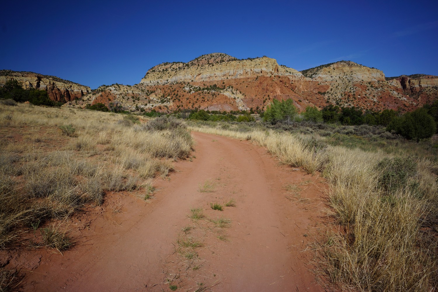
There’s an off shoot Canyon where the trail climbs out, very sleepy I might add. After this, the trail just keeps climbing and climbing. No more canyon, and back to the high desert. It’s hot and there’s some steeper climbs. At least they’re short-ish.

After the majority of the climbing is done, the trail joins a road and that is to be followed. This leads to dead end tank, which looked like a pretty good water source, despite being a cow pond, and yeso tank a little farther. Yeso was as nasty as it comes! I have a little over 2L left, I can make that last till late morning tomorrow when I get to the next good water source, maybe 7 miles more.

I found camp around 7:45pm. It’s along a dirt road, and had been used by car campers. It was the skeletons tied to the trees that caught my eye… Old animal bones tied up with barbed wire, boots, beer cans. Weird but funny. Some ambitious hiker should take this to the next level… skeleton wind chimes.

A beautiful sunset played out just beyond the trees. Looking forward to many more of these in Colorado!

Miles – 9.4
Total Miles – 659.8
Rain – no
Sleep – backcountry, tent
Animals – none

Monday May 28th – CDT Day 38

Started hiking around 8am, which has been my usual lately. Then hike til 8pm-ish. Hiking around 12 hours a day now.

The morning starts with a climb. First up a dirt road, then the trail splits off and climbs higher along the Ridgeline. Lots of elevation gain throughout the day. I had LTE for the first couple hours, then no more.
About 8 miles past last night’s camp and right before the junction with the main CDT, I reached Harris bear spring. I took my water from the pipe feeding the lower Trough. I ate first lunch while filtering water.

Now done with the ghost ranch alternate route, the landscape looks like the San Pedro parks wilderness area, but with more distant views. Large rolling Hills and open Meadows, patches of pine and Aspen trees. And of course, cows grazing here and there.

I found a couple more pieces of obsidian this morning. Then I found in Arrowhead made out of obsidian. Pretty cool, never found an artifact like that before.

The trail is still climbing. Lots of downed trees in the 2 mile stretch before upper canjilon lake. Saw an elk in this area.

The trail continues to climb up along canjilon creek. Some small patch of snow still exist along the creek and in tickets of trees. I stopped to filter water again early evening. Carrying 3L.

Above canjilon creek is a large open park. I saw about 5 more elk and a coyote as I passed through. I was considering camping here based on the map, but now here in person, I don’t see anywhere and want to camp.

I pushed on over the high point for today, 10,433ft. I was looking for campsites at this point but being picky. I do this to myself looking for the perfect campsite. However, I must say it’s a great technique for getting in extra miles in the evening. I didn’t stop until about 8:30 pm. Wanted to get in a lot of miles over the next couple days so I don’t get into town so late on Thursday, making it a lighter day.

Full moon and coyotes howling. Off to bed.

Miles – 29.7
Total Miles – 689.5
Rain – no
Sleep – backcountry, tent
Animals – elk, coyote

Tuesday May 29th – CDT Day 39

I slept pretty decent last night, rested up for another big day.

This mornings hike was much like yesterday. Ups and downs, forest, occasional view of a field.

Mid morning, I passed sequoia. Unfortunately camel had to bail yesterday due to sickness. He was able to hitch to Chama from the upper canjilon lake area. If it hadn’t been memorial day, there probably wouldn’t have been anyone up there.

This mornings water source was the Rio Vallecitos. Nice flowing creek with knee deep water, some pools with trout. Ate first lunch here as well.

More forest, small fields. I kept busy by looking at the ground for rocks. Every day I have a couple to add to the collection. I have at least a pound of rocks on me now, haha. I’ll send them and the others in my bounce box home when I get to Chama.

Late afternoon I passed hopewell lake and hwy 64. Man made Lake, but still very scenic.

After hwy 64, the trail passes through a couple of meadows, and starts climbing up hill. It’s on a dirt road for quite a while.

This evening I passed Cracker. I hadn’t seen him since Doc Campbell’s! Glad to see he’s still on trail and doing well. We chatted for a while and sequoia showed up as well. We all wanted to get in another mile or two tonight, and I was the first to leave as I intended on 4 more.

Nice hike this evening. Some more rolling Hills and larger fields. I saw two elk along the tree line just before dark.

Around 8:15 pm I found camp in the tree line at the top of a saddle. A 30 mile day, whew. Feet are tired at the end of the day but in the morning I’m good to go.

Wow, so I was laying in my tent writing in my journal when I got buzzed by two planes! Didn’t get a chance to poke my head out and get a glimpse, but they were super low and very loud. Pretty cool!

Miles – 30.6
Total Miles – 720.1
Rain – no
Sleep – backcountry, tent
Animals – elk

Wednesday May 30th – CDT Day 40

Woke up to scattered clouds, which has not been typical of New Mexico. Lots of mosquitoes too, just like last night.

Not long after leaving camp, I saw 2 elk. I’ve lost track how many I’ve seen total now.

A few more miles of forest and meadows, and the trail reaches a ravine with a small stream. I followed it to the valley floor and pulled 3L, ate some food. Nice little place to stop.

Next, the trail climbs very steeply up to a ridge above the Rio San Antonio. As the trail begins heading northwest, the Valley really opens up. Great view, definitely starting to resemble Colorado now.

Back into the forest, I was getting attacked by mosquitoes. I have no bug spray, didn’t think I’d need it this soon. Black flies are out too. Instead free been using Adobe of my Dr Bronners magic soap. It’s peppermint scented, which I believe keeps bugs away. It definitely seems to work.

Next I passed through the lagunitas lakes area. It’s a bunch of smaller lakes and ponds on this shelf, with a few campgrounds alongside. There were actually several people out here. A guy driving his truck up to one of the campgrounds slowed down as he passed and waved his fist, in a “I know you’re hiking the CDT, kick some ass” fashion. I did the same, and laughed a little.

The trail then climbs a ridge and skirts the side of the steep slopes. Big views. I can get used to this.

Then the trail drops back down into the forest for a good while. The way the light shines through the trees is calming. I still haven’t mastered forest photos though.

After the forest the trail winds up high above a valley again. The east fork Rio Brazos flows here. Snow can be senn on the mountains to the north, although much less than in years past. It’s a low snow year in Colorado.

Storm clouds are Brewing all around, but I’ve avoided rain all day so far. Typical weather for Colorado in the summer, and I’m only about 12 miles from the border now.

The trail then drops down to a saddle where a forest road weeds. It’s a scenic overlook, and a trailhead for the Cruces Basin wilderness. I sat on a log here and ate second lunch. Nobody drove by. I don’t think there are any trails in this wilderness, so I’m pretty sure nobody visit it. Like most of New Mexico. The only non-CDT hikers I saw in the entire state we’re in the Gila, between little bear Canyon and Jordan Hot Springs. It just feels like us CDT hikers have the entire state to ourselves.

After traversing a rocky Ridgeline for a while, it’s downhill towards a stream. My next water source, and hopeful campsite location.

The skies were looking pretty dark all around now. I made it to the stream around 6pm and found a nice campsite alongside it. I set up my tent first in case it rained, but it never did. This was the earliest I’ve gotten to camp in a long time, I can’t remember anything earlier actually.

I soaked my feet in the steam, which was ice cold. Filtered water, cleaned up, ate and relaxed next to the sound of flowing water. As I sat up from dinner, I scared off an elk that was hanging out about 100ft behind my tent.

This is my last night in New Mexico. Hard to believe! I’ll save the reflections for tomorrow. I’m off to bed.

Miles – 23.2
Total Miles – 743.3
Rain – no
Sleep – backcountry, tent
Animals – elk

Thursday May 31st – CDT Day 41

Last night was cold. One pair of socks were frozen, the other I brought in the tent, but were still wet this morning. Not used to this after so long in the desert. I just packed up all my things as quick as possible so I could get moving and generate some heat.

Saw 2 more elk this morning as I broke down camp. Walked Through the large clearing just below camp and from there the trail starts climbing again. Not all that much to see this morning really. Dirt roads, forests with a lot of downed trees to step over. This morning was really all about reaching the Border of Colorado as soon as possible, so I had more time in Chama.

I made it to the underwhelming state line around 11am. It’s just a barbed wire fence along a hillside, with a sign saying entering Rio Grande National Forest. Still, a big milestone. I’ve hiked 750 miles through New Mexico to get here!

After crossing the barbed wire fence and walking a few yards to the Treeline, I was presented with a big sweeping view of Colorado. Below I could see Highway 17 and cumbres pass, now only 3 miles away. There’s a train that runs up and down cumbres pass that had just left as well, with a big black plume of smoke giving away its location.

When I reached cumbres pass, I began the arduous task of hitchhiking. There wasn’t a whole lot of traffic, but in reality I was lucky with maybe the 7th or so car stopping for me. All in all it took maybe 20 minutes.

Hitchhiking is a new experience for me, and I’ve always heard you meet a lot of interesting characters in the process. This was definitely the case! Really interesting guy, works 54 days a year preparing taxes on the east coast and then drives around the country having fun for the rest of the year.

After being dropped off at the Y Motel, I walked to the post office to retrieve my bounce box. It didn’t reach the motel, the post office just held it in general delivery. Huh. At least I got it.

It was an hour walk to the post office and back, and since I don’t only eaten breakfast and a light snack I was pretty damn hungry at this point. I stopped in to the High Country Restaurant for lunch. Good food and great service!

Back at the hotel, I had a wicked food coma and a bit of a headache. I rested for a while before starting to backup all my pictures and GoPro video onto my laptop. Then I went to hang out with some other hikers in another room, and headed up to the Chama Grill for dinner.

Miles – 12
Total Miles – 755.5
Rain – no
Sleep – hotel
Animals – elk

Friday June 1st – CDT Day 42 (zero day)

Walked up to the RV park across the street and did laundry this morning. Ate breakfast at the Chama Grill. 

Spent much of the afternoon working on my blog and some online logistics. My backpack never arrived, and the tracking number showed it still had not left Georgia. I called the company I purchased it from and they said they shipped it on the 29th. It’s in the post office’s hands now.

I bought my food for the stretch to Pagosa Springs from the store across the street, and picked up a DiGiorno pizza for dinner. My room at the motel has an oven, so why not? Later I hung out with Bugs, Shawn, Katie & Becca. We played this game when the dice are pigs and the way the pigs lay after rolled determines how many points you get. And drank whiskey. 

Miles – 0
Total Miles – 755.5
Rain – no
Sleep – hotel
Animals – none

Saturday June 2nd – CDT Day 43 (zero day)

This morning I woke up and worked on my blog for a while. 

Ralph, a local trail angel, was giving hikers rides to Cumbress Pass, and gave a few of us rides to the post office on his way. I decided to check and see if my package was at the post office, even though the tracking number said it hasn’t arrived yet from Albuquerque, its last stop at 3am. Sure enough, they had it! 

It was now around 11am. There’s no way I could get back on trail today as planned, since I still had so much to do. Most importantly, mail back my old backpack, 40 degree sleeping bag, etc. Post office closes at noon today, so I’ll have to wait until 8am Monday. It sucks that I am being pushed back 2 extra days, but on the other hand, there is supposed to be a big storm tomorrow, so I’ll avoid being caught out in that. Also, 2 more days for snow to melt in the mountains, making for easier passage. 

Ralph picked us up on his way back down from Cumbress Pass, and took us back to the motel. I reluctantly paid for two more nights.

I walked up to the barber shop to get a haircut, but it was closed. Oh well, maybe in Pagosa Springs. 

Early evening, I was hanging out on the motel patio with Sprinkler. A couple of non-CDT hikers were hanging out in a room nearby, on a fishing trip. They offered us some beer which we gladly accepted. 

With our livers primed, Sprinkler and I headed up to the saloon across the street for beers and dinner. Good food, good times.

Miles – 0
Total Miles – 755.5
Rain – no
Sleep – hotel
Animals – none

Sunday June 3rd – CDT Day 44

Woke up today to dark clouds and rain, just as forecasted. I ate breakfast at Finas Diner with Music then came back to my motel room to get ready for tomorrow.

I started fooling around with my new backpack, moving over straps and little customizations added in the past. I noticed the hip belt wasn’t really any smaller than my old backpack, and checked the tag… LARGE! Wtf, I ordered a medium to replace my old large! Ugh, they sent me the wrong size.

I contacted the company I bought it from, Going Gear in Smyrna, GA. Even though they were closed today, I was lucky and got ahold of someone there who was able to send me an RMA label. I had the motel print it out for me and I’ll return it tomorrow morning on my way out of town. But, I wasted two full days sitting around waiting on this package. Had to pay for two more days of hotel, food, etc. More importantly, it set me back two full days. The bright side is, I avoided a major storm and had two more days for snow to melt out in the high mountains. 

I spent the rest of the day getting my food together and other little chores. Ready to get out of town and hit the trail again. 

Miles – 0
Total Miles – 755.5
Rain – yes
Sleep – hotel
Animals – none

Related Images:

×