Oregon Desert Trail Thru Hike Guide & Tips

Overview
The Oregon Desert Trail (ODT) is a 750-mile route across eastern Oregon, connecting Bend (roughly) and Lake Owyhee. It’s a rugged and remote route, with about 1/3 of its miles as cross-country hiking. As of 2022, roughly 60 people have completed a thru-hike of the entire Oregon Desert Trail.


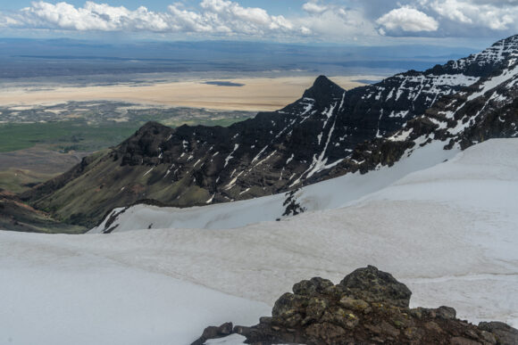

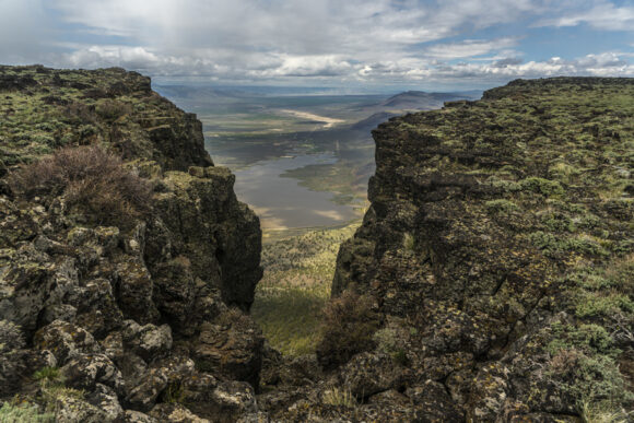
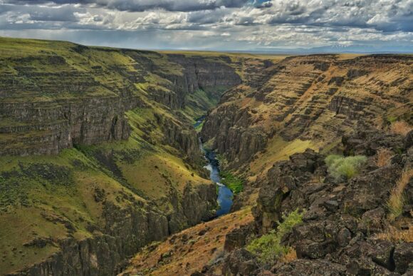

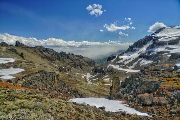
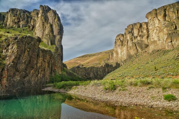
About My 2022 Oregon Desert Trail Thru Hike


I hiked the Oregon Desert Trail eastbound in the spring of 2022. I completed the 739-mile hike in 43 days, which include 7 zero days. My ODT hike began on May 12th at the Tumulus Trailhead and finished on June 23rd at Lake Owyhee.
Trail Journals & Photos
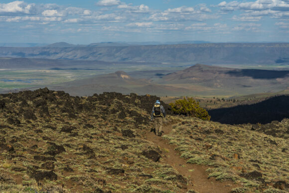
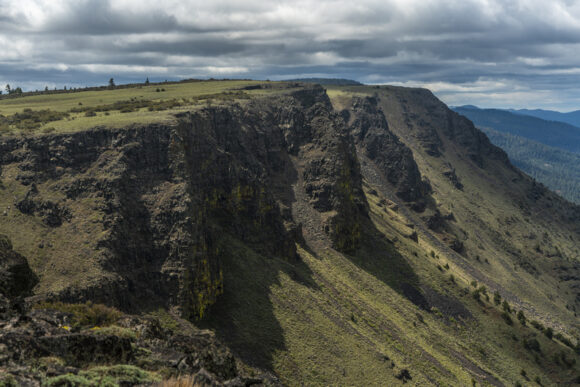
Before we get into the ODT Guide, you may want to take a moment to browse my detailed trail journals (with photos) of each section of the Oregon Desert Trail. Click below to learn more about each section of the ODT:




Official ODT Thru Hike Planning Resources
The Oregon Natural Desert Association, or ONDA, oversees the Oregon Desert Trail, and provides truly excellent set of planning resources to get you started on your hike, so start by having a look at their website. Here’s a list of links to the most important ODT planning resources on ONDA’s site:
- About the ODT
- Form to download official ODT maps & waypoints, and the ODT Guidebook
- ODT Town Guide
- ODT Water Chart & Data
- ODT Resupply Strategy
- All ODT Trail Resources
My ODT Resupply & Itinerary
ONDA breaks the Oregon Desert Trail down into 25 sections. Personally, when I plan my thru hikes, I break them down into sections that correspond to my resupply itinerary. On the ODT, I resupplied 9 times, making for a total of 10 sections. So, I looked at the ODT as 10 sections, not 25 sections as ONDA presents the route. I broke the route up like this:
| Section | To/From | Section Miles | Total Miles | Resupply Method | Notes |
| 1 | Bend to Christmas Valley | 100 | 100 | Sagewood Grocery | Moderate selection here, supplement with food from Chevron Market |
| 2 | Christmas Valley to Paisley | 54 | 154 | Paisley Mechantile | Small but good selection |
| 3 | Paisley to Lakeview | 51 | 205 | Safeway | Last big grocery store along ODT. Mail food boxes ahead from here! |
| 4 | Lakeview to Plush | 56 | 261 | Box to Hart Mountain Store | Store has limited food selection. Send a box! |
| 5 | Plush to Frenchglen | 107 | 368 | Box to Steens Mountain Resort | Send a food box! Resupply not possible here. |
| 6 | Frenchglen to Fields | 63 | 431 | Limited Grocery(snacks), Hot Meals | It’s only 1.5 days to Denio from here. I carried extra staple foods from FG, bought basic snack items here (nuts, jerky etc) and ate dinner/breakfast here |
| 7 | Fields to Denio | 28 | 459 | Box to Post Office | Resupply not possible here. Send a box. |
| 8 | Denio to McDermitt | 72 | 531 | Quinn River Grocery | Small market with a great selection. Full resupply. |
| 9 | McDermitt to Rome | 117 | 648 | Box to Rome Station | Resupply not possible here. Send a box to Rome Station |
| 10 | Rome to Lake Owyhee/End | 91 | 739 | You DONE! | Ontario, OR has all the food you need after you finish |
Technically, I didn’t resupply at Fields, but I spent the night and ate dinner/breakfast there. So you could say 8 resupply points, but I still stopped at 9 trail towns, making for 10 sections.
Difficulty
This route is best suited for hikers with at least one other thru hike under their belt. From a pure physical sense, the ODT is not overly difficult, as the elevation gain is not extreme. The challenge lies more with the terrain and weather conditions. 35% of the ODT is off-trail, so there’s a lot of deep sand, bushwhacking, pushing through sagebrush etc. This can be a land of extremes; it’s either really cold, or really hot. There’s very little shade or cover from the sun along much of the route. When I hiked in 2022, it was a very cold and wet spring. Hikers just a week before us faced even colder, harsher conditions. Still, 20-30 mile days are entirely possible along much of this route, but the miles aren’t always easy.
Seasonality

The ODT is best hiked in the spring or fall. Most hikers choose to hike in the spring, when water is more abundant from snow melt. The general consensus for the optimal start date is roughly mid May, for east bounders. However, it’s worth noting hikers who start too early typically have issues with snow in multiple places along the trail. Most notably, the Steens Mountains. This is one of the highlights of the ODT, so you may want to consider a later start date to avoid snow here. Early season hikers generally either bypass the Steens completely, or face high water crossings and lots of lingering snow. The Pueblo Mountains are another area hikers sometimes see snow, especially if too early. The mountains between Paisley, Lakeview and Plush can also hold a fair amount of snow, and present issues for the early season hiker.
The seasonality of the ODT is nice in that it can be hiked from mid May to mid June, when few other trails are hikeable yet. This makes the ODT a great warm up hike, before another summer thru.
Pace & Time on Trail

I completed the ODT in 43 days, with 7 zero days. Most hikers are completing this trail a few days faster than I hiked it. The days are reasonably long here in the spring, and 20+ mile days are still achievable almost everywhere along the route, despite all of the off-trail hiking. Strong hikers can complete the ODT in about a month.
Permits
Permits can be a real pain to manage in advance on a long trail, but the ODT hiker doesn’t have to worry much about this. In fact, the only place that you do need to consider a permit for backcountry camping is in Hart Mountain National Antelope Refuge, in between Plush and Frenchglen. This permit is free. If you stay in a designated campground along the way (also free), a permit is not needed. This means you can time your hike through the refuge so that you don’t need a permit. It’s pretty sparsely visited though, and chances are, a stealth camp would go undetected if it comes to that.
Link to Hart Mountain Permit: https://www.fws.gov/media/backcountry-camping-permit-hart-mountain-narpdf
Water Availability
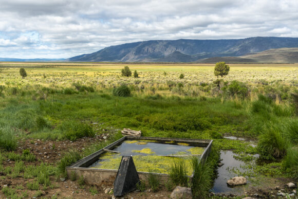
For the east bounder, the first 160 miles or so are very dry. There are caching locations along the way here to minimize the water carries, as well as a couple of water caching locations maintained and stocked by ONDA volunteers. This makes a huge difference in the viability of this part of the route. Hikers in the spring will have an easier time finding water than fall hikers, due to spring snow melt runoff and recharging the ground water in the springs.
The longest water carry you should encounter on the ODT, if utilizing the caches in the first 160 miles, is 40 miles. This is in between the Hart Mountain Visitor Center and Miller Place, in between Plush and Frenchglen.
Lastly, it gets pretty dry towards the eastern end of the route in the Owyhees. Nothing requiring a cache, just careful awareness of your next water source.
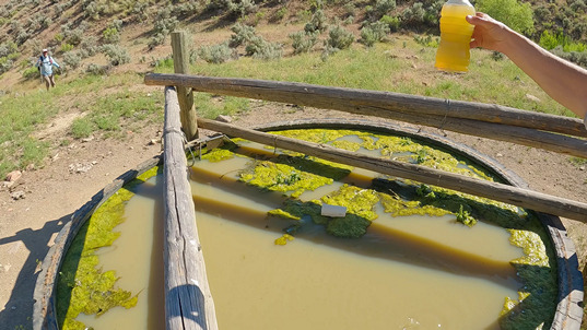
You may also want to bring a pre-filter for your water. I didn’t need it much, but there was one particularly muddy water source in the Owyhees that I wish I had one for… a water trough in Craig Gulch, about 20 miles from the eastern terminus at Lake Owyhee. I had lost mine a few weeks earlier. It took 2 hours to filter 5L water, backflushing every 1/4 liter!
Trail Towns & Resupply
I enjoyed the town stops along the ODT overall. There is a decent amount of awareness to the ODT in town, so many people know what you’re doing. All the towns were small on the ODT, many were too small for a resupply without sending a box. The mileage in between town stops was generally pretty manageable.

For eastbounders, after you pass Lakeview (3rd town stop), McDermitt is the only town you’ll encounter with a grocery store, and sending food boxes is necessary. Lakeview has about 3,000 people, and is the largest town along the ODT besides Bend, near the western terminus. Lakeview has a Safeway, and I used this town to shop for much of the rest of the trail. I assembled food boxes in my hotel room and sent them ahead from here. See my resupply chart above for where I sent food boxes.
Favorite Trail Town
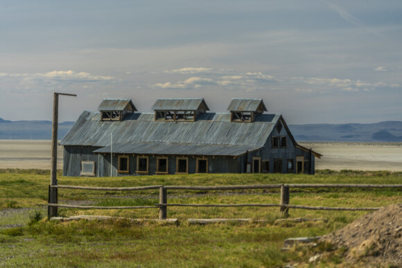
Paisley. After 130 miles of sagebrush desert, you reach Paisley, with the Chewaucan River flowing through it. Nestled at the base of mountains with pine forest, you can tell that the environment is changing here and it’s time to head into something greener. The Paisley Mercantile is small but stocked with a good selection of foods for the hiker. The Saloon has good food and a great old-west feel to it, perfect trail town atmosphere. We stayed at the Summer Lake Hot Springs a few miles out of town, because the hotel in town was booked. Cool little cabins at the edge of Summer Lake (huge dried lake bed), and soaked in the hot/warm springs. What more can you ask for in a trail town??
Least Favorite Trail Town
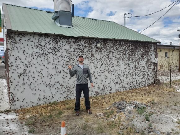

McDermitt. The only hotel open in town was the Rodeway Inn, and it was an awful experience. The owner there knows he’s the only one open and was engaging in some extremely unethical business practices (outright lying about room availability regarding reservations through priceline, price gouging, refusal to participate in Choice Hotels rewards program, etc). The only restaurant in town is inside the casino, and had pretty crappy food. The Mormon cricket swarm was in full swing here, and there were millions of these giant insects swarming everything all over town. Everywhere you step, it’s on these huge crickets. The smell of the dead ones was horrendous.
My Favorite Sections of the ODT
- Abert Rim
- Steens Mountains
- Pueblo Mountains
- Owyhee Canyon, Five Bar & Three Forks
- Leslie Gulch

My Least Favorite Sections of the ODT

- Large chunks of the first 130 miles
- Between Hart Mountain Visitor Center & Frenchglen
- Marsh by Borax Lake
What I love About the ODT

The ODT is vast, remote and wild! There are some truly spectacular landscapes along this route that are unforgettable. The planning resources that ONDA provides are excellent. I enjoyed most of the town stops. The mileage in-between most of the resupply stops is pretty manageable. I also love the fact that there are (almost) no permits needed to hike the ODT.
What I Didn’t Like About the ODT

The first 130 miles (eastbound) were a slow start to the hike. There is a lot of deep sand to walk through. Sometimes it felt like there were a lot of miles in between the scenic stuff (1st 130 miles, after Hart Mountain Visitor Center, and even large parts of the Owhyees). The route seems to want to hit every nasty cow pond in the area, and will take the hiker miles out of the way sometimes for a water source that nobody is going to drink.
What I Would Do Differently
- I would do the Xmas Valley Alternate instead of the official route into Christmas Valley
- I started May 12th. I would have started two weeks later if I had known just how cold and wet the spring would be
- I would have brought a 20 or 30 degree bag instead of a 40 degree bag (my normal go-to for desert hikes)
- I would not mail a box to McDermitt, resupply there was good at Quinn River Market
Route Suggestions For the ODT Hiker
The Oregon Desert Trail is meant to be a choose your own route type of adventure. In the spirit of that, I thought I’d share my opinions on route suggestions for future ODT hikers. These are mostly minor changes that I would suggest in the interest of optimizing the route, not necessarily scenic alternates. **As mentioned earlier in this guide, I broke the ODT into 10 sections that corresponded with my resupply itinerary, not the 25 sections presented by ONDA. This more closely represents the way most hikers are resupplying along the ODT**
Section 1: Tumulus TH to Xmas Valley

I suggest taking the Christmas Valley alternate into town instead of the official route. While the Lost Forest and Sand Dunes areas were interesting, there was a LOT of sandy, cross-country miles required to make that happen. There were many miles of rather boring “Sage Kansas” along the official route. Plus, you then need to hitch into Christmas Valley, which was a difficult hitch for me. There is little traffic along the highway.
Section 5: Plush to Frenchglen

After leaving Plush, you’ll notice the ODT route goes all the way around Hart Lake. This may have been a lake at one point, but it’s not right now. And I know what you’re thinking…. I’ll just cut across this dry lake bed, right? Well, you can do it, just make sure not to veer too far south. On my hike across the lake bed, I did start to encounter mud and pools of water as I approached the center of the lake bed. I was aiming for the peninsula that jets out into the lake bed. Don’t do that. Instead, aim for the east shore of Hart Lake, about 1.25 miles north of the peninsula. This way, you avoid the mud and water, and shave off some miles, along a cool trek across this lake bed.
Watch video footage of this alternate route crossing Hart Lake.
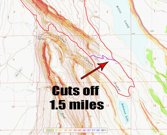
After climbing out of Warner Valley and heading up Fischer Canyon, you can take a very easy cutoff on the long switchback up this canyon that shaves off 1.5 miles. It begins with a very easy xc section, then joins a 4×4 road for the second half of the .75 mile alternate. It cuts off Robinson “Lake”, but since you got water at the homestead a few miles back at the good clear trough, you don’t need any, right?
Watch video footage of this Fischer Canyon cutoff/alternate route
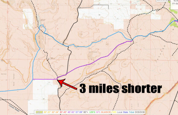
About 16 miles before reaching Frenchglen, after passing through Sand Hollow, the ODT route has you hiking over to Walls Lake, where there are two large reservoirs that likely have water. If you don’t need water, OR if you want to take a shorter route that also has water (access), considering taking this alternate route that shaves off 3 miles. For water, drop down into the scenic-looking Waterhole Canyon. I could see water in the canyon, but didn’t go down to it. In retrospect, I wish I had hiked Waterhole Canyon, but I didn’t realize how scenic it was until I was hiking the top of the canyon, above it.
Watch video footage of this cutoff/alternate route above Waterhole Canyon
Section 6: Frenchglen to Fields

After hiking the across Alvord Lake (dry lake bed), the official ODT route goes through the Borax Hot Springs area. But as you near the area, the ground becomes very marshy. This is no normal marshy area wither, the mud is salty and stings the skin. I could not see a way to avoid getting very wet and muddy, following the official ODT route. This area is NOT worth it!! Do yourself a favor and try to find a dry route around this nightmare. It’s no place for a human to be.
Watch video footage of the marsh crossing by Borax Lake
Section 7: Fields to Denio

After climbing out of Van Horn Creek up to a ridgeline, the official ODT route drops down 1400ft into Denio Basin. That would be 1700ft, if you are going all the way down to Denio Creek for water. But you just filled up in Van Horn Creek a few miles back, right? Even if you DO need water, town is just a few hours away now. You’ll notice the route then promptly climbs up about 500ft again to Propener Meadows, or 800ft from Denio Creek. So then the question becomes, why not just stay up on this ridgeline? It takes you directly to Propener Meadows, without the needless descent into Denio Basin. It stays high up on the ridge, which is easy to hike, and offers scenic views. It’s also 1.2 miles shorter, with at least 500ft less elevation gain. Taking this high route about Denio Basin was a no-brainer for me.
Watch video footage of this ridgeline alternate route above Denio Basin
Section 9: McDermitt to Rome

The official ODT route suggests to hike through Louse Canyon, along\through the West Fork Little Owyhee River, from Anderson Crossing to the Five Bar area, near the ford of the main fork Owyhee River. This route is about 38 miles of extremely challenging terrain… thick brush, wading through the river, etc. I intended to take this route, but after hiking in a few hundred yards, I turned around. The brush was impenetrable, forcing me into the creek immediately. Water levels were waist high in places, at the beginning/upper portions of the canyon. It didn’t make sense to commit to 38 miles of this, where it should only become bigger/deeper water downstream. Sure, there’s a couple of exit options, but they wouldn’t be easy. I hadn’t really heard of anyone who’s taken this route, it seems everyone takes the bypass route around West Little Owyhee and Louse Canyon. Now I can see why. I think you’d have the best shot of hiking the West Little Owyhee River through louse Canyon during the summer months when the water levels are at their lowest, since you’ll be spending a lot of time in the water. No way you’d wanna be here as an early season hiker, with higher water levels and colder temps. Either way, most hikers will probably choose the road walk bypass route that parallels Louse Canyon, to the west. This is about 30 miles from Anderson Crossing to the ford of the Owyhee River near Five Bar. The bypass is easy hiking on old 4×4 roads, through some real Sage Kansas country. Figure one day to hike from Anderson Crossing to Five Bar, or at least two if taking the West Little Owyhee route.
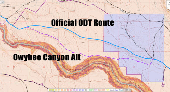
About 15 miles before you reach Rome, or about 5 miles west of Soldier Creek, the ODT route leaves a 4×4 road at benchmark 4458 and begins an xc segment at the base of some nondescript hills. Instead of doing this, climb up a mere 100ft to the top of said nondescript hills for a view of Owyhee Canyon. This give you about a mile of hiking along the rim, with big views, and a few more miles of hiking along the rim with a better vantage point than the official route. It’s .4 miles longer, practically no more effort, and offers a much better hiking experience.
Watch video footage of this alternate route along the rim of Owyhee Canyon
Section 10: Rome to Lake Owyhee

In the past, some ODT hikers have complained about aggressive dogs roaming around near the bridge over the Owyhee River at the confluence with Jordan Creek. There’s some private property here, that the road goes through, and the owners have dogs. ONDA has created an alternate route that avoids these dogs, but it involves some road walking along a busy paved highway, the need to ford Jordan Creek, and some steep climbs in and out of Jordan Canyon. I’ve heard from other ODT hikers that this “bad dog bypass route” was a pain in the ass, so we decided to roll the dice with the dogs and take the old official ODT route. We did see a few dogs, but none of them were aggressive. In fact, I don’t remember them barking at all. I would recommend taking this route over the bypass route, as long as there are no recent reports of “bad dog” encounters from other hikers.
Watch video footage hiking through the “bad dog” property

After Rookie Canyon Spring, the ODT route begins several miles of xc hiking. It’s not incredibly difficult at first, but it’s full of cheat grass and is a rather bland hike. Instead, have an equally bland hike for a few miles by hiking a 4×4 road that parallels the xc segment. Then when it begins to get scenic, as the route approaches Birch Creek again, the alt stays high above the creek for the final descent to Lake Owyhee. Other ODT hikers reported a heavy bushwhack in Birch Creek, through lots of poison ivy. Is this how you want to spend the last few miles on the ODT? This alternate is along a 4×4 road that provides a great view over Lake Owyhee as you walk the final few miles of your thru hike. Perfect for reflecting on your journey. This alternate adds about 3 miles, but you’ll make this time up with the much easier hiking along the 4×4 road, and no poison ivy!
Watch video footage of this Birch Creek bypass/alternate route
Overall Impressions of the Oregon Desert Trail

The Oregon Desert Trail offers the opportunity to hike some incredibly beautiful landscapes, in an extremely remote and wild region of the country. Solitude is not a problem here! While this route boasts some incredible scenery, it’s far from constant. There can be many miles of “Sage Kansas” in between. Still, the ODT is an excellent route choice for the semi-experienced thru hiker, who’s looking for an immersive experience in high desert country.
Oregon Desert Trail Videos
For the ultimate Oregon Desert Trail thru hike planning resource, watch my 35-episode vlog series documenting my 2022 spring eastbound hike of the ODT. This video series is focused on showing the landscapes of the Oregon Desert Trail, as well as the challenges and daily struggles of hiking this route. This 6.5 hour series is condensed from over 24 hours of footage, and is the result of 2 months of full-time editing work. If you want to immerse yourself in the Oregon Desert Trail experience, this is the way to do it!


This is seriously one of the most thorough trail breakdowns I have ever read. This is great!
March 29, 2024 at 9:18 am
Thanks Brian, glad you found it helpful!
March 31, 2024 at 7:14 pm
My husband and I are planning to hike the ODT in 2025 and have been using your videos and this page for our planning process, along with the ONDA resources. I’d love to see a gear list for your ODT hike if you’ve got one. Any gear (besides your quilt) that toy would change?
August 18, 2024 at 5:13 am