Superstition Wilderness, AZ – March 2013 (Post Hike Trip Report)
Superstition Wilderness Hike Overview
Complete Superstition Wilderness Photo Gallery | Superstition Wilderness HD Video
- Location – Superstition Wilderness, Arizona
- Park – Tonto National Forest
- Trail Hiked – Custom Route
- Miles Driven To Destination – 4200 miles Round trip
- Length Of Time Hiked –4 days, 3 nights
- Trail Type – Loop
- Miles Hiked – 20+
- Trail Difficulty – 7/10
- Fires Allowed – Yes
[sgpx gpx=”/wp-content/uploads/gpx/Superstition Wilderness AZ March 2013 Route Hiked.gpx”]
Only 3 days before I left to drive 2,000+ miles across country, I thought I had everything covered. After all, I’d spent several weeks planning and preparing for this trip, an 88 mile 6 day, 5 night solo hike through the Superstition Wilderness of Arizona. Sometimes though, things don’t exactly as planned. Any number of factors can quickly turn a much anticipated hike into “can’t wait for it to be over” experience. For some, this may be something like being sick on your hike. Or, maybe a freak storm that pinned you down for an entire day. Freezing cold water infiltrating the tent at night, popped air mattress, etc. Well, for me it was all of those things, and more! What a disaster.
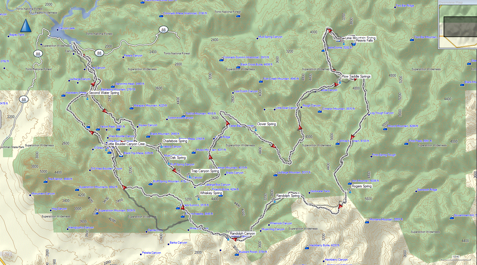
Alright, let me start from the beginning. After selecting the Superstition Wilderness as my backpacking destination, I invited my buddy Jesse to go with me. He could not make it due to his schedule, so I decided to go solo. No big deal, I don’t mind. In fact, this actually allows me the opportunity to try and cover more miles… my hiking partners are not usually up to pushing it too hard. So, what I had planned for this hike was 88 miles in 6 days, roughly twice as many miles as I’ve ever done in the same time period. Below is an overview of the route I intended to hike. Start/end point is at the Canyon Lake trailhead.
I made several gear changes before this trip to save some weight. I shaved over 8lbs off my pack weight! More on that in another post.
It had been 5 months since my last hike in Linville Gorge, NC so I was anxious to get out on the trail. I was really looking forward to this hike, but unfortunately I started feeling sick 2 days before I left. I had just finished doing some stair climbs with a weighted pack, and all of the sudden I got the chills and felt weak. Uh oh. The next day was more of the same, and a slight runny nose and cough developed. When it came time to leave, which was a 30 hour drive for me(each way), I decided to chance it, gambling that I’d feel better by the time I started my hike. I was going to break the drive up into 3 days, so that would buy me some time. However, I got sicker as I drove. By this time, I started developing an upper respiratory infection. Armed with some OTC expectorant and cough syrup, I was determined to fight it off and continue with the trip.
I made my hotel reservations in advance this time instead of randomly procuring a room along the way. I noticed that when I do that, I generally get stuck with a smelly, dirty motel for an inflated price, upwards of $80/night. Planning ahead, I can spend less money on a much, much better hotel room. The downside, as I learned this time, was that the money paid upfront for the rooms makes it harder to abandon a trip if needed. Still, I am going to continue getting my hotel rooms upfront.
Like all drives through middle America, it was boring as hell. I was coughing up a rainbow of colors the whole drive. I could hear fluid gurgling in my lungs when I took a breath. The expectorant wasn’t doing as much as I hoped. Not much I can do about it now, I’m already committed to this.
Along interstate 40, the landscape starts to change in the panhandle of Texas. This is where the drive becomes more fun. This was my first time in Arizona, and the immediately upon crossing the New Mexico/Arizona border the landscape changes again. Large red rock formations are all around now. The drive on hwy 260 into Payson was really nice. There was still quite a bit of snow high up in the mountains, which I was not expecting. Come to think of it, I saw snow in every sate I drove through on the way here… pretty amazing for March! The area near Payson was cool… very rugged mountains with lots of huge pines trees… again, not what I was expecting in Arizona.
When I got to my hotel in Payson, I had a decision to make: start my hike tomorrow as planned, or stay here in Payson for another day. Option 2 will shorten my hike by one day, but hopefully buy more time to get better. I decided to make the call in the morning… maybe one more night of sleep will help? Nope, my lungs are still gurgling. I also skipped the next day, but I came up with a modified, shorter route to attempt the day after. My hike was now 4 days instead of 6. With that plan in motion, I decided to drive there and camp at the Canyon Lake Marina campground tonight.
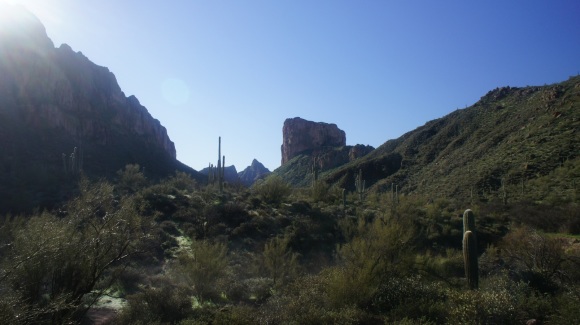
The drive from Payson to the Superstition Wilderness, along hwy 87 and 88, was incredible. It’s hard to describe this landscape, it was just so cool to see for the first time. I had never seen a Saguaro cactus before, and they were everywhere.
After arriving at the Canyon Lake campground, I set off to explore the area a little. Heading east on hwy 88, I soon arrived at Tortilla Flat. This was almost like a little town… there was a restaurant, a few shops, and ton and tons of people walking around in the street. I was not expecting a huge crowd of people to be here. Continuing east, a small stream crossings the road that you have to drive through. This is probably common in this area of the country, but that’s unheard of where I live. There was no danger to it, just a trickle running across the road. I’m sure it would be a different story after a rainstorm though. I drove a few miles and stopped for pictures along the way. Eventually, the road turned into a dirt road, and that’s where I turned around.
I had a low key evening. I wet to bed early and tried to rest up for the hike ahead, hoping I might feel better in the morning.
Day 1 – Thursday March 7th, 2013
Miles Hiked – 10.2
Route – Canyon Lake TH to Black Top Mesa. Boulder Canyon Trail to Second Water Trail to Black Mesa Trail to Dutchman’s Trail to Bull Pass Trail to Spanish Hieroglyphics Trail
When I woke up this morning, I wasn’t feeling any better. I felt 85% of normal physically, but I was still coughing a lot. I could still feel fluid in my lungs, gurgling as I take a deep breath. After driving all this way though, sitting around doing pretty much nothing was getting old. I figured I have 4 days left, so I might as well go out there and just take my time. However, I have been coughing quite a bit without doing any physical activity, so who knows what will happen when I get winded. Only one way to find out!
I brought my bathroom scale as I normally do to weigh my backpack after it’s all loaded up with food and water, but the parking lot was all dirt/gravel and was too uneven. I was pretty bummed about that because I spent a lot of time and money trying to shave weight off my pack before this trip and I was really eager to see the total number. With 4 liters of water, my best guess is 35 pounds. Not bad for me, I usually carry 45+ pounds.
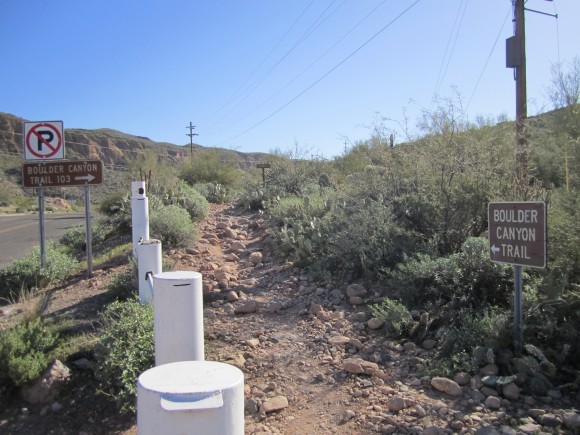
I hit the trail around 9:30am. Exiting the Canyon Lake Marina, the Boulder Canyon Trail begins on the other side of Hwy 88, about 50 feet to your right. A big brown sign marks the trail. Shortly after leaving Hwy 88 behind, there is a smaller side trail to your left that splits off and goes up a hill, which is steeper than the main route. I didn’t even see it until I took this route on my way back. You’d be better off leaving this trail for your return to the car due to the elevation gain.
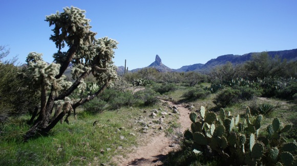
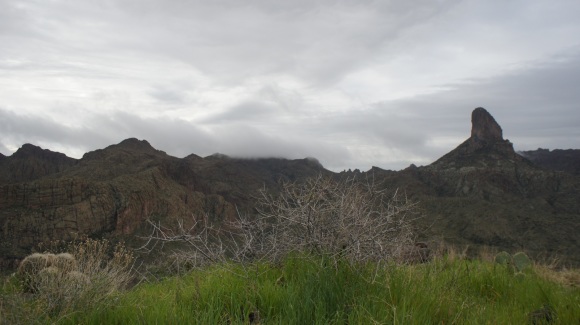
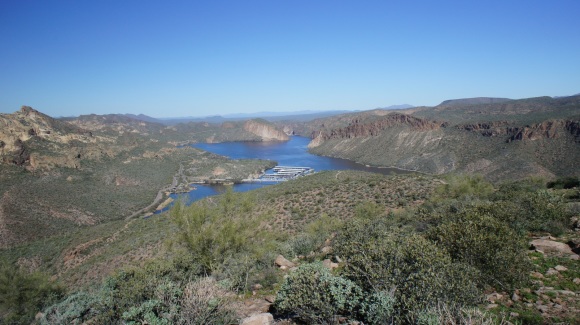
Almost from the beginning of the Boulder Canyon Trail, you can see Battleship Mountain and Weaver’s Needle in the distance. The trail gains in elevation fairly steadily from here. After going over just a few hills, the view of Canyon Lake disappears. No more man made objects in sight anymore, just other people. I saw maybe 35-40 hikers out on the trail today, mostly old people day hiking to the Battleship Mountain area. I am pretty sure I was the only person out there without an AARP card! I think it’s cool that they are out there still doing this kind of stuff though. But I didn’t see many other backpackers. I always like that because I know that when I get away from the trailhead area, I’ll pretty much be alone.
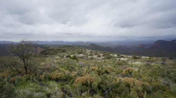
One thing I learned rather quickly is that the Superstition Wilderness has many more poking, stabbing plants than anywhere else I’ve ever been. After being poked by the first cactus, I became more aware of my surroundings. Still, avoiding them completely is impossible out here. One cluster of thorns got me above the knee. They don’t always stay together when you pull them out and often end up staying below the skin. After a while, I just rubbed the needles until they broke off instead of attempting to extract them.
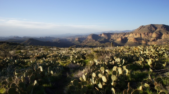
One unique thing about this area though is the Saguaro cactus. I had never seen these until the drive south from my Hotel in Payson yesterday, so they were a new and interesting thing to me. When I got home from the trip I found the above map that shows where the Saguaro cactus grows. Now out on the trail, I had a chance to see them up close. These things are massive! I estimate the highest ones to be about 25ft. Really cool to see these things up close. Everything out here seems so foreign to me compared to Michigan, but that’s why I like coming to places like this.
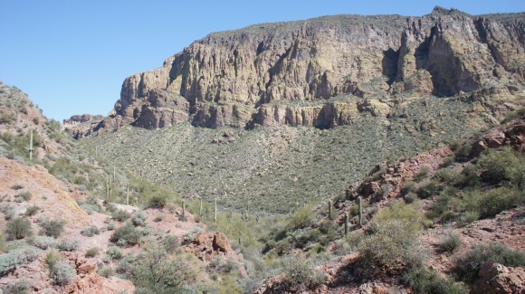
The trail wasn’t too difficult so far, but everywhere around me sure looked gnarly. Jagged rock cliffs, canyons, and thorny plants everywhere. After about 3 miles, I came to a great overlook point, making for good pictures of Weaver’s Needle and Battleship Mountain. In fact, when researching a place to hike on this trip, I saw a picture taken from this spot that pretty much convinced me to come to the Superstition Wilderness. This is probably where most of the old people I saw on the trail stopped. The trail which drops a few hundred feet in elevation from here before intersecting the Second Water Trail about another mile from here.
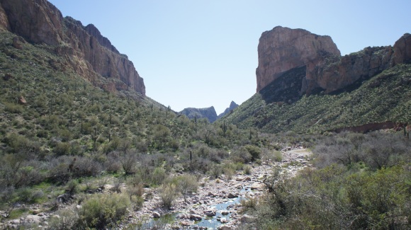
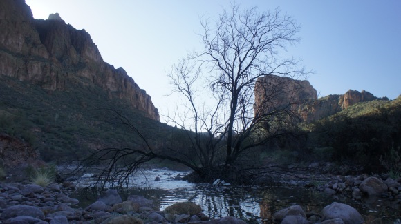
Once I dropped down to the canyon floor, I could see running water in LaBarge Creek. I had been told that water wasn’t going to be a problem on this trip due to recent rains, and I was glad to see that be true. From higher up, the water looked much greener. There wasn’t much of a flow, but at least there was water. I was able to easily hop rocks across this and every other body of water I encountered today. I didn’t need to filter water yet, but was confident that there would be water at my intended spot at Little Boulder Canyon Creek.
Shortly after crossing LaBarge Creek, alongside the Boulder Canyon Trail I saw what appeared to be part of some type of old Indian dwelling. There was a flat area that had been shored up with large stones on the sides, and a large area chiseled out of rock to shield a fire from the elements. There was a narrow passageway between the rocks that led elsewhere, but I was moving pretty slowly as it was, so I didn’t stop to explore this too much. Pretty cool though. Knowing I wasn’t going to make it to Roger’s Canyon to see the cliff dwellings there, I should have stopped to check this out. But, I didn’t.
The trail became pretty steep after leaving the ruins behind, but fortunately it was short lived. Once at the “top”, I was awarded with one of the easiest sections of trail I can ever remember hiking. This section was the Garden Valley area, where the Second Water Trail meets the Black Mesa Trail. It was extremely flat and the trail was wide enough for a semi truck. In fact, it even looked as if there were ruts created from vehicles driving down it, although I can’t imagine how they would have gotten up here, as well as being illegal in a wilderness area. But it sure did look like an old dirt road at times.
I hauled ass all the way to Little Boulder Canyon Creek, making great time along the Black Mesa Trail. The creek ended up being a pool of green water with all sorts of algae and insects in it. There was a slight flow to it but it looked really disgusting. This was where I planned to filter water, so time to get to it. This would be my first field test with my new Steri-Pen Opti Adventurer UV water purifier.
Unlike my MSR Miniworks water filter, the Steri-Pen Opti does nothing for the taste of the water, but it does purify the water and renders it safe to drink. It was slow going at first due to my bandana not allowing much water into the mouth of the bottle. I was using it to filer out any larger things like clumps of algae or an entire bug. I figured water would flow a little more freely into the bottle through the bandana, but the fabric was woven too closely together. I also carry one of those red cloth mechanic’s rags, so I tried that. Same problem. What I found out is that you need to squeeze the bottle while holding the rag over the mouth, forcing water in a little at a time. It takes about 20-30 seconds to fill the bottle in this way, whereas it would have taken 30 minutes letting the water seep in on it’s own. And the taste? Actually, I didn’t notice anything funky about it. I was pleasantly surprised, but still not a believer of the Opti just yet.
After filling my 2L bladder, another 2L platypus collapsible jug, and and 1 liter bottle, I was on my way. The land flattened out and had several intersecting trails and washes running through it. I could see how this area could be confusing to some. I saw two people on horseback in the distance on another trail. These would be the last people I see for two and a half days.
Once on the Bull Pass Trail, the trail starts climbing. Shortly after, another trail splits off and heads up Black Top Mesa, that’s what I was looking for. It was starting to get late in the day, probably after 5pm at this point. This was the final push to reach camp for today, but I was running out of gas. I coughed my way up almost a mile of steep trail before it finally began to level out. It was great to be done with the hard work for the day, now to find that campsite!
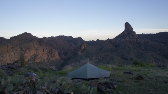
I followed a faint trail to the Southeast end of the mesa and stumbled upon the campsite around 5:45. Damn, it was definitely worth the hike up here! The view of Weaver’s Needle and the rest of the Sonoran Desert was awe-inspiring. I could not have imagined a better place to camp for the night. There was plenty of space for my one man tent on level ground about 30ft from the cliff’s edge of the mesa. There was a nice fire pit up here and even some wood. After getting my tent up I got a fire built and ready to light when it became dark.
The sun was going down quickly, so I didn’t manage to get very many photos tonight. No big deal, I thought. I’ll get some good sunrise pics in the morning. I could see some clouds accumulating in the distance, but they didn’t look too menacing. I knew there was an 80% chance of rain tomorrow, but that’s all I knew. Then I got the fire going and began to think about dinner. I wasn’t too hungry which is really strange for me. I know I need to eat, so I cooked a few hot dogs over the fire anyway. I was only able to eat a few bites. Not good. My appetite had been greatly diminished over the last few days traveling to get here, but nothing like this. Things I normally love to eat just didn’t taste good, nor did I feel hungry at all. As much as it hurt me to do it, I threw my dinner in the fire and went to bed shortly thereafter.
I was eager to get to sleep and rest up for tomorrow. I tried to set the alarm on my watch but the battery died. This seemed like the tuning point of the trip, looking back on it. From here on out, it seemed like nothing went right. After not being able to sleep for about 45 minutes, the wind started to kick up. It was pretty exposed up here on this mesa, so the wind rocked my tent. My Tarptent Moment has an optional pole that helps with wind stabilization that I left behind to save weight. This was the first time I’d ever gone without it, and also the first time where I actually needed it.
Not long after the wind started howling, the rains followed. After several hours of rain, the ground beneath the tent became saturated. I had to pound the tent stakes into the ground using a rock, but now the soil was so wet that they could no longer hold the tent up in these high winds. Whooosh!! There goes the tent. One end of the tent was still staked down, and I was holding on to the other end as it flapped in the wind. I had to get out of the tent to put it back up, and didn’t have time to put on my rain gear, which was really just the jacket, no pants. Didn’t think I’d need ’em this time. So, I went out in the rain in just my boxers. No sense of getting all my clothes wet and having no way to dry them. I don’t know how cold it was, but my guess is low 40s, with winds gusting to maybe 40 mph. I had to hunt for some large rocks to put over the stakes in order to prevent them from pulling out of the ground. After 5 or 10 minutes I had the tent back up and reinforced, ready for another bout with the storm.
Back in the tent, my sleeping bag was partially wet along with half of my stuff. Fortunately for me it was almost all in dry sacks. I was cold and wet in my bag, and just when it matters most, my new Klymit Inertia X-Frame sleeping pad got a rip in it on it’s very first use. I don’t know how it happened, I assume it was from tossing and turning in the night somehow. The ground below was not sharp. So that sucks, because now I have no insulation from the ground, which was very cold. I eventually warmed up enough to maintain an occasional shiver throughout the night.
Day 2 – Friday March 8th, 2013
Miles Hiked – 0
Well, I’d like to say I woke up this morning, but I didn’t really have sleep to wake up from. I got an hour or so throughout the night, but tossed and turned as daylight finally broke. It was still stormy, with dark cloudy skies all around. It was still raining here and there and the winds were still very strong. At some point early this morning I remember seeing a few snowflakes. At times, Weaver’s Needle was completely engulfed by dark clouds. Very cool thing to see. Then it rained some more. Winds were still strong, and they ended up blowing the same side of the tent over again. I went outside again in my boxers,and spent about 10 minutes in the freezing cold rain further reinforcing my tent stakes. Awesome.
I was still sick, and still coughing. My chest was beginning to hurt a lot when I coughed, and sometimes when I took a deep breath. With the weather being so terrible, not having the proper rain gear, and the fact that I just didn’t have to get somewhere in order to stay on schedule meant that I was just going to call this a zero day.
I spent most of the day in the tent. Today sucked. It was better than last night, anything was better than that. Once I realized my tent was not going to blow over any more, and had it pulled taut enough to stop flapping around, I was able to get a little sleep. I just couldn’t get comfortable laying directly on the ground. One of my extremities was constantly falling asleep, forcing me to toss and turn every few minutes. But it was rest nonetheless.
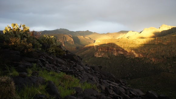
It didn’t stop raining until about 6pm today. I got out of the tent around this time and saw the sun peak out of the clouds for about 15 minutes. I grabbed my camera and took a few pictures. It was nice to be able to leave the tent and walk around for a while. But eventually the sun went away and it was just dark and cloudy once again. Back to the tent.
I barely ate anything today, maybe 1000 calories. That’s crazy low for me, as I usually eat 3200+ calories a day at home. I simply had no appetite. Also, everything I ate tasted bland. The food I did eat, I couldn’t even enjoy. I was also pretty dehydrated, my pee was a very dark yellow, almost brown. I was trying to conserve my water as there were no sources up here. I would have tried to collect rain water had I known I was going to be staying an extra day, but had no idea the storm would last so long.
As the sun went down, the weather still looked like it had potential to be nasty. Winds and rains were much less in frequency and intensity, but still the threat lingered. I hunkered down for another night, hoping the storm was over.
Day 3 – Saturday March 9th, 2013
Miles Hiked – 5.5
Route – Black Top Mesa to Boulder Canyon Campsite. Spanish Hieroglyphics Trail to Bull Pass Trail to Dutchmans Trail to Boulder Canyon Trail
The weather was still completely overcast and raining on and off. The winds were much less at this point. Still feeling like crap, I went back in the tent to try and sleep some more. After the weather remained fairly calm all morning, I decided to start heading back towards the trailhead. It was about noon now. The plan is to spend one more night on the trail, wherever I make it today. Then hike the rest out to the trailheead tomorrow, should be about 5 miles. I looked at the map and realized I had two routes I could take to get back. The first route was the Black Mesa Trail, which I took to get here. I’ve already been through there so I wanted to take a trail that I haven’t hiked yet. This trail was not originally part of my plan, but I decided to take the Boulder Canyon Trail because it was shorter.
It was nice to be heading down off the mesa. I needed water pretty badly, my pee was very dark. I was worried about the water level in the creeks though. With all the rain I was expecting the worst. Now down in the canyon floor, I could see that the little streams I crossed a few days earlier were now raging torrents, just as I feared. I topped off my water supply and rehydrated at the first creek crossing as I scoped out the water levels. This first crossing I was able to do by hopping rocks, as with the next several crossings.
As I made my way downstream along the creek in Boulder Canyon, the hopping rocks at the crossings was no longer possible. From here on out, the water was a bit deeper and I had to use my water shoes. The deepest water I crossed today was knee deep, and fast flowing in spots. After another several water crossings, I just kept the water shoes on while I hiked instead of switching from boots to water shoes every time. The crossings were just too frequent. There were about 30-40 creek crossings throughout the day. Had I known there were going to be this many water crossings, I would have just taken the Black Mesa Trail back.
I made it most of the way through Boulder Canyon before calling it quits. The light was starting to fade in the canyon, and I found a decent campsite. There were few campsites anywhere along the trail today, so I figured I’d better not push my luck and go farther. I set up camp quickly and purified more water from the creek. There wasn’t much to see here in this canyon, and I didn’t feel like making a fire tonight. I tried to eat a little and went to bed
I was not physically tired, surprisingly, but just mentally exhausted. Mostly, I was frustrated and disappointed at how my trip turned out. I put a lot of time into planning this trip, and I was really looking forward it. I rarely get sick, so this was really hard for me to accept.
Day 4 – Sunday March 10th, 2013
Miles Hiked – 5
Route – Boulder Canyon Trail to Canyon Lake TH.
Last night was nice. It was very calm and the sky was clear. Finally, I saw a few stars. It was cold though. My tent was drenched with condensation, and it was raining down on me occasionally throughout the night. I have the optional condensation liner for my Tarptent Moment, but opted to leave that at home this time to save some weight. I did not expect to have to deal with condensation in the desert, as it’s (normally) so dry. The sun doesn’t reach down into the canyon until later, so it was still quite cold as I packed up camp. After eating a quick nibble of breakfast, I was on my way.
The skies were blue and sunny, and it looked like it was going to be a beautiful day. About 2 minutes down the trail, I encountered the first water crossing of the day. I put on my water shoes and kept them on for the rest of the water crossings. Only about a 12 mile north of my camp, I passed a few other hikers still in camp. These were the only other people I saw camping out here, and the first people I’d seen since day 1. We exchanged nods as I hiked past, on a mission to get to my car.
There were about 8 creek crossings this morning before I was sure I had crossed the last one, at La Barge Creek. Finally, I was hiking up out of Boulder Canyon. Only a few miles left. I was expecting to see a bunch of day hikers now, but I didn’t see a soul until 3/4 mile from the trailhead. Looking at the peaks to the north, which I believe were Four Peaks, they were all snow capped. I am pretty certain that they did not have snow before the storm a few days ago. The elevation in the Four Peaks is a few thousand feet higher than where I was.
I made it back to my car around 11 or 12. After washing up in the bathroom at the marina, I changed into some fresh clothes and hit the road, beginning the long 30 hour drive back home. The drive on hwy 88 and 87 was awesome, certainly my favorite part of my entire drive across country. Highway 260 north of Payson is a cool drive as well.
Throughout my drive home, I pulled cactus thorns out of my arm and side of my knee. In fact, I still had thorns in me a few weeks after the hike!
Final Thoughts
Well, I’m sure you can see where this is going. I was really looking forward to doing a monster hike in the ‘supes, but sickness and weather conspired against me. I should have stayed at home on the count of the sickness, but after all that time planning, what would you do? I really can’t believe how good I felt physically, despite barely eating or drinking anything. I was certainly not feeling 100%, but I normally don’t function well when I’m very hungry. My bag of food was about 3/4 full after I finished the hike. Normally, I eat every damn thing in the bag!
The vegetation here is very thorny. Almost every single plant here wants to stab you, so hiking off trail would be a nightmare. I’m glad I brought my water shoes, as I almost left them behind. I wasn’t counting on a huge rainstorm hitting the desert.
Being sick took all the fun out of this trip, but the weather was the icing on the cake. Gear failures also added to the misery. Nothing went right for me on this hike. Despite all the mishaps, I’d love to come back to the Superstition Wilderness someday. In fact, I can’t think of anything better than getting a second chance to complete this hike, exactly as I planned it: 88 miles in 6 days though the Superstition Wilderness, solo. I will do this again someday, but for now, this trip will serve as a reminder that things don’t always go as planned in the wilderness.
For more pictures of this hike, check out the complete Superstition Wilderness Photo Gallery.


