Creating new thru-hiking routes & guides, hiking videos, outdoor documentaries, backpacking trip reports, trail journals, photos and more!

Latest

Doc Campbell’s Post to Pie Town – CDT Thru Hike 2018

Continental Divide Trail – Doc Campbell’s Post to Pie Town Hike Overview
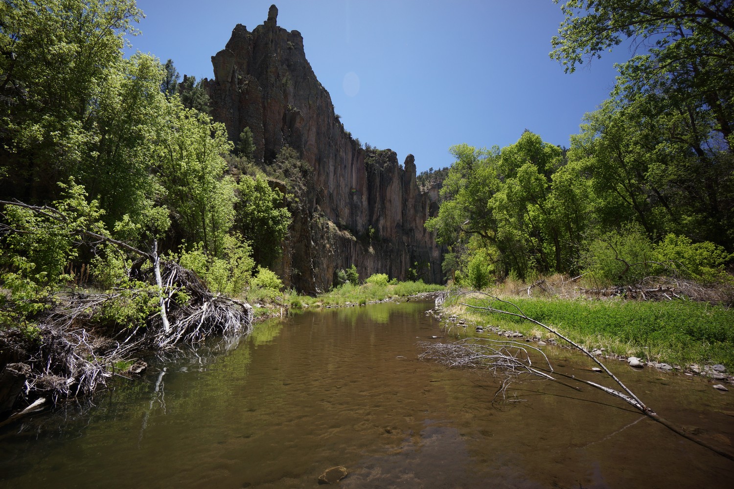
This section presents CDT hikers with a major route choice: hike the official CDT route through the Black Mountains, or hike the Gila River alternate. While I haven’t hiked the Blacks before, and I’m sure it’s nice and all, you’d have to be crazy to skip this alternate. The Middle Fork Gila River is incredible, and offers an experience like no other on the CDT. The Middle Fork Gila River is one of my favorite non-mountainous hikes of all time. There are over 200 river crossings, steep canyons and remote country that practically nobody other than CDT hikers visit. There’s also a great chance of seeing wildlife through this section. 

Friday May 4th – CDT Day 14

Another cold night. Instead of jumping in the hot springs this morning, I packed up and started hiking to warm up. 


It was a road walk of about 4 miles to the Gila Cliff Dwellings visitor center. I bought a few stickers to add to my collection of hiking crap and headed out for the cliff Dwellings. Outside the visitor center, I ran into a guy named Henry who had just type the PCT last year. A New Mexico resident of 25 + years, he had plenty of good info about the area. 

I bumped into Camel and Sequoia at the start of the cliff dwellings Trail. They just finished and were headed out. I spent about an hour here. It’s a cool thing to see but I’ve been to Mesa Verde previously and the dwellings are basically the same. 

Next I walked over to the TJ Corral trailhead to hike little bear canyon. This leads down to the middle fork of the Gila, where the popular CDT alternate runs. It’s about 2 miles uphill then 2 down to the river. The last half mile of little bear canyon is awesome. A spring runs downhill and forms a very small creek in the canyon. It’s narrow and has steep sided walls, and has a lush tropical feel to it. The pictures don’t really show how cool it was.
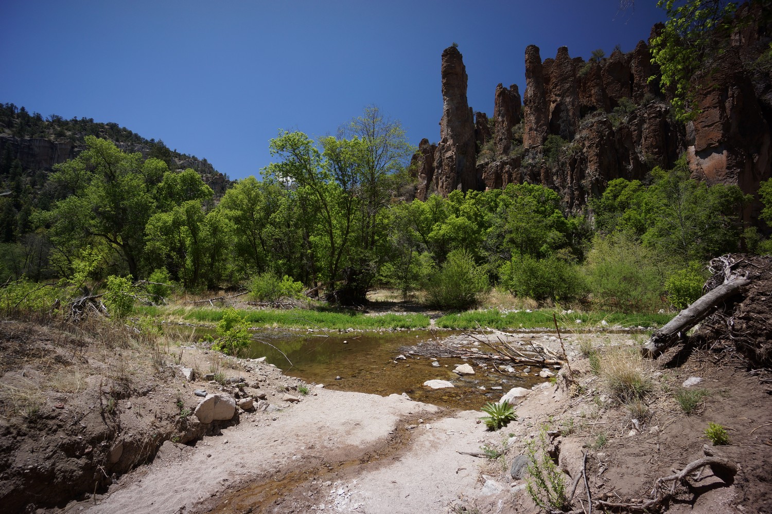
Little bear canyon then dumps into the middle fork of the Gila. Now this is truly a sight to be seen. Very tall and steep cliffs frame the middle fork and create scene you couldn’t dream up. It’s hard to find the words for how beautiful this place is. Pictures and video don’t do it justice. You just have to see it for yourself. 

Now I’m walking northbound along the middle fork, crossing the river every couple hundred yards. It’s slow going with the sand and rocks, but mainly due to the sheer beauty. Everything in sight is picture worthy. There are a lot of tadpoles in the water and I saw my first school of Trout as well. 

I made it to Jordan hot springs around 2:30pm. Once again, I bumped into camel and sequoia here. They just stopped for a dip before pushing on. I, however, intend to camp here. Short day, but I want to take my time through what will probably be the highlight of New Mexico. 

Above Jordan hot springs is a camping area, but the grounds isn’t very flat. Still, I found an acceptable spot. I spent the afternoon in and out of the water, taking in the scenery. The water is warm but not hot. Maybe 90°, nowhere near the temp of the Gila hot springs campground. I ended up losing a contact lens in the spring, the first time ever in 150+ nights in the backcountry. Good thing I carry extras. 

Around 6pm, a group of people showed up whom I had passed on the trail around 12:30pm. They set up camp in an even less flat area that I passed on. Others arrived at the campsite across the river. A few people joined me in the hot spring and I enjoyed a good conversation about travels and adventures.

Bed time at 9pm. Short day today, long day tomorrow to make up for it. 

Miles – 13.5
Total Miles –  225.7
Rain – no
Sleep – Backcountry tent
Animals – trout

Saturday May 5th – CDT Day 15

Got my feet wet just a few hundred feet away from camp with my first river crossing around 7:30am. It takes the sun a while to reach the bottom of the canyon, and so it feels cold. All the Jordan hot Springs campers were camped nearby, and didn’t see anyone else all day. 

I really enjoyed this morning’s hike. More steep canyon walls, pinnacles and spires towering over the river. Deeper pools along the river bends hide trout, some appeared to be 15″ or more. Lots of tadpoles, lizards, and birds everywhere. 

I find myself hiking in 3 hour blocks before stopping for a break. At 10:30am, I dropped my pack. 8 miles on the GPS, 5 according to the Guthooks app. Hmm, it’s going to take forever to get out of this canyon. 

After turning a corner on the river, I saw a black bear cub on the other side. It was about 150ft away, and thankfully no momma bear in sight. It ran uphill and that was that. Finally, some Wildlife!

I stopped again around noon thirty to air out the feet and clean the sand out of my shoes. My feet are doing pretty good and I intend to keep it that way. A lot of interesting rocks on the bank which kept me occupied for a while.

As the afternoon wore on, I began to get really tired of all of the deep sand and loose rocks on the trail. Not to mention the constant River crossings. I don’t mind the wet feet but the slippery rocks are a pain in the ass. When my feet slip on a rock coated in algae or whatever, often times my foot gets jammed into another rock or my shins get bashed up. It’s getting old.

Later in the afternoon I saw a deer getting a drink from the river. I took another break around 4:30pm to refuel, as I planned on hiking late this evening. The canyon walls were becoming less steep and tall, and more pine trees. Ah I love that smell. 

There were nunerous small caves along the river this evening. Some dry, some wet. I airways wanted to sleep in a cave, but I wasn’t ready to camp yet. Maybe sometime on the CDT. 

As I entered Flying V canyon I scared off a herd of elk. Wow, what a day for wildlife! Making up for lost time I guess. I contemplated camping here but the ground was not great. Sandy, Lumpy no pre made sites. I continued on, disappointed as it was already 7:30pm. 

No campsites further upstream until I reached swinging cross canyon. There was a tent here, first people I saw all day. It was 8pm now, and I had been hiking since 7:30am. I did my camp chores fast and ate a bunch of food. What a day. 

Today’s mileage is 26 according to my GPS and only 19.5 by Guthooks. I’m not sure if Guthooks uses Ley maps or bear creek, but I’m really disappointed in the variance. It seems almost nobody on the CDT is using a GPS to create a track of their hike. Almost everyone uses Guthooks which doesn’t create a track, just let’s toy follow along. I’m not sure anyone realizes how terribly inaccurate the mileage is or if they even care. 

An owl is hooting nearby as I write this. I’m tired but not as bad as past days. Looking forward to hiking out of this canyon tomorrow, even if it is beautiful.

Miles – 26
Total Miles –  251.7
Rain – no
Sleep – Backcountry tent
Animals – trout, black bear, deer, Elk

Sunday May 6th – CDT Day 16

Last night was really cold, I was not expecting sub freezing temperatures. When I woke up in the morning, my shoes were frozen solid. They were soaking wet when I went to bed from yesterday’s River crossings. I put them in a garbage bag and brought them in my quilt to warm them up. My Sawyer water filter could have been ruined by the freezing temperatures, but I got lucky. It was likely not below freezing long enough to do it any harm. Needless to say, I got a late start this morning. I didn’t start hiking until 8:30am. 

Today’s hike along the Gila River middle fork was nowhere near as impressive as yesterday, but still a pretty nice hike. The canyon walls were rolling hillsides more often than sheer cliffs and spires. There were about 30 more River crossings, which seemed like much less than yesterday mile for mile. Along the river banks were more thorn bushes now. These were unavoidable and wreaked havoc on my shins. 

Along one of the last bends in the river before reaching Snow Lake, I saw a small cave in the canyon wall. I explored this for a moment and pressed on. 

Just ahead is the last river crossing, finally! I stopped counting around 20, but between the Gila River and the middle Fork Gila River, it must have been close to 200 River Crossings. Not having bridges over the river and the general inaccessibility of it keeps the crowds away, so it’s worth it. The middle Fork was one of my favorite hikes, and probably my favorite non-mountain hike of all time! 

When I reached snow Lake I was a little surprised that it was a man-made lake. And I had a hard time envisioning snow here. As I walked around the lake, I caught up to some hikers finishing a weekend trip. We started talking and when I mentioned I was hiking the CDT, they offered me some water and beer back at their Basecamp in the dripping vat campground above snow lake. Sounds good to me! 

I hung out with Sam, Kim and a group of about 6 at the campground for about an hour. I used this time to air out my feet and dry my shoes for the first time in a few days. I really didn’t want to get back on trail now, but I still had a lot of daylight left to cover miles. 

It’s a road walk leaving the campground for a while before a trail veers off the road. The trail follows a little Canyon uphill, which became more scenic as it climbed. Nice hike. A few water sources along the way, but I was shooting for the pond at the top of the climb. 

When I reached the pond, I stopped in the shade underneath the solar panels. It’s a cow pond and the water was murky, but it’s a big pain so the shit water is diluted. I drank the rest of my water and filtered 5 liters. It’s about 20 miles to the next water source.

After leaving the cow pond it’s a short climb up a hill. At the top, I was blown away by the view. Huge expensive view of rolling hills and golden grass with some mountains in the distance. A sea of gold illuminated by the sun. In fact, that’s what I called this area, “The Sea of Gold”. I imagined Hank Hill saying, “boy I tell you what, this here is God’s country”. The vast view had me stopping and looking around in awe every so often. Except for a dirt road, nothing man made as far as the eye could see. I didn’t mind the dirt road, it’s just like a wide trail that never gets used. My pictures didn’t really capture this beauty of this area.

Eventually the sea of gold turned into a forest. Here, I linked up with bursum Rd and followed this for a few miles. I found a spot along the road to camp for the night. Nothing special, but it was 7:45pm now and sundown is fast approaching. 

Another great day on the CDT. I’m only 16 days in and I’m already starting to wonder how I can ever go back to a normal life again. 

Miles – 22
Total Miles –  273.7
Rain – no
Sleep – Backcountry tent
Animals – trout

Monday May 7th – CDT Day 17
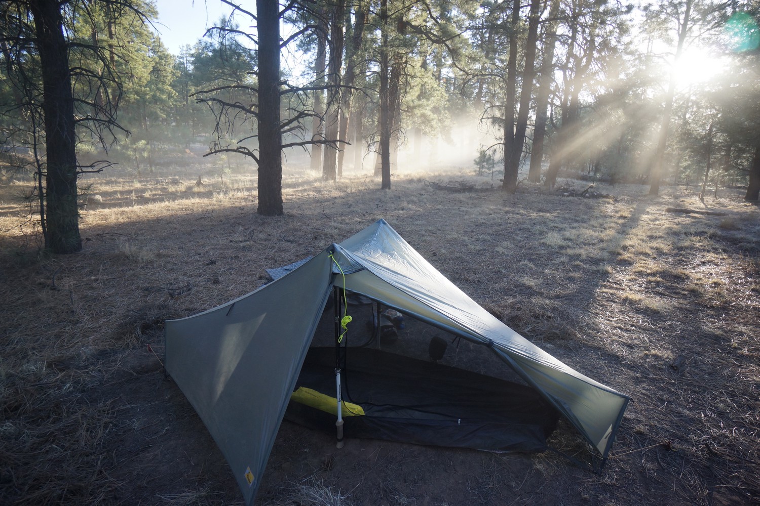
Another calm night. Most nights so far, any wind present during the day dies down when the sun sets. It’s only day 4 since leaving Doc Campbell’s post, but it feels like a week. I still have almost 90 miles to Pie Town, so I’m hoping to cover some big miles today. 


I started hiking around 7:30am, continuing north on bursum rd. It’s a gravel road and not all that scenic at first, passing through a pine forest. Eventually the forest gives way to a large open grassland. 

Now mid morning, I passed a watering hole called Collins tank. I skipped it since I was pretty well stocked with water, but as I passed it I saw camel and sequoia leaving the tank. It turns out they were camped about 2 miles up bursum Rd last night.

We hiked together for the rest of the morning along forest road 94 until we reached Dutchman spring just after noon. At this point I had hiked 16 miles straight without stopping for a break. This left me pretty tired, thirsty and hungry. 

We spent about 2 hours here resting, eating, cleaning up and stocking up on water. It’s another 22+miles to the next water source, so I carried 5 liters. The extra water weight was very noticeable when we set off again. 

Is a short climb up forest Rd 94 to the top of a hill where the Gila River alternate ends and we meet up with the official CDT route again. There was rumors of cell service up here, if you have Verizon. I had nothing with AT&T, and it’s been about a week now without cell service. 

Finally, the CDT splits off from the road to an actual trail. It follows a ridge for a while and passes through a burn area. Better views now, with rolling hills and mountains in all directions. Lots of ups and downs though. 

After about 2 hours of hiking it was break time. This is the most elevation gain we’d had in a while, with Burro Mountain being the only other competition. I kept the break short and moved on after 15 minutes. 

The next section is more ups and downs through pine forest and Rocky outcrops. I was feeling pretty whooped now. I was fully hydrated and acclimated to the 8500ft Elevation, having slept at a similar Elevation last night, but was feeling a little lightheaded and slightly delerious. I think the effects of diet deficient in calories was starting to catch up to me. I didn’t have much fat to lose before the trip and have already lost some weight. Keeping my body fat percentage high enough is going to be a challenge. 

I hiked another hour or more before stopping again. I have to eat, but need to ration my food for the coming days. Camel and sequoia caught up and took a break here as well. A friendly rancher drove by and had knowledge of several other hikers ahead of us. He made sure we had enough water and drove off. 

We hiked another 30 minutes before reading a saddle with a flat spot to camp around 6:45p. An elk scurried away as we approached. We were all pretty tired and ready for food and rest. 

Miles – 24.5
Total Miles –  298.2
Rain – no
Sleep – Backcountry tent
Animals – elk

Tuesday May 8th – CDT Day 18

Hit the trail around 7:30am yet again. We took the Govina canyon alternate based on the chance it had water. Todd Cienaga tank had some nasty brown cow water. This water was murkier than my ex’s soul. Lots of mud and flies, just the smell made me gag. I’ll pass. 

Govina canyon was a nice hike, but no more water. After climbing out of the canyon, the trail then climbs another 500ft up Wagontongue Mountain. The trail doesn’t reach the summit, and instead skirts the side of the mountain. There’s no clear view with all the pine trees unfortunately. 

A small burned section on the descent provided about the only good overlook of the surrounding landscape. It’s massive and wild looking, nothing man made in sight. I set my stuff down on a log and a minute later my backpack, hat and camera were each covered in about 50 ants. Shortly after, I saw a horny toad bumbling along the trail. 

I hiked another 10 minutes before finding a spot to take a break. Camel and sequoia kept going, not wanting to stop until they reached the next reliable water source. This is about 6 or 7 miles more, so about 2 hours. I pushed hard yesterday before lunch, but find I do better when I stop once every 3 hours or so for food and water. It was a good choice. 
After lunch I ran into Gillian, a woman from LA horsepacking the CDT. Pretty sure I already ran into her before, maybe the crazy cook to Lordsburg section. Later, I bumped into Duece, a guy from Wisconsin. Around this time we saw some some interesting notes left along the trail made of sticks… “yum yum snack tree ahead”, “mmm snack tree” and more. Not sure what that was all about. 

Made it to today’s water source, Aragon Well, around 2pm. It’s a large metal tank with goldfish and a large coy fish swimming in it. The water is surprisingly clear once scooped, and filters well. Good water. Camel and sequoia were here already, and duece showed up shortly after. We hung out under a shade tree nearby for about 2 hours. I drank 2.5L of water, washed up a little and carried 5L to get me to the next water source about 23 miles away. 

We set out into the heat of the day with a goal of about 8 miles. It’s pretty much all a dirt road walk for the rest of the day. These roads don’t see much traffic, and some aren’t even real roads anymore. Just a wide trail.

Made camp around 7pm at a flat spot just west of Cabellenza canyon. Another basic, nondescript campsite. Many like this so far on the CDT, the product of just camping wherever you happen to be at the end of the day when you’re tired. 

Running low on food. I’ll be fine but need to carry more next time. Me hungry!! Looking forward to Pie Town, about 32 miles left. 

Miles – 24.2
Total Miles – 322.4
Rain – no
Sleep – Backcountry tent
Animals – Horny toad 

Wednesday May 9th – CDT Day 19

Started hiking at 7:30am. I’m glad we stopped before reaching Cabellenza canyon last night, it was full of cows this morning. Beyond the canyon is a campground. It has a bathroom, picnic tables and water troughs for horses. No water though. 

Across the street from the campground is the turn off for Mangas mountain. There were a few gallons of water cached under a tree here, left by a local Korean war veteran from what I understand. This was greatly appreciated! I chugged another 1.5L and refilled my bottle, carrying 2L out of here. 

The road up to Mangas mountain was an easy walk. At the top, I saw camel’s pack alongside the road. Just as I dropped mine, he came down from the summit which has a fire lookout tower. He moved on while I headed up to check out the tower. 

At the summit, I saw the tower and a small cabin for the lookout person to live in. The tower is manned, and the lookout yelled down and asked if I would like to come up. Yes, please! I climbed up and entered the tower, greeted by Patrick. He’s retired and it’s a summer job for him. I spent about an hour up here chatting with Patrick and listening to lots of interesting things about the area. 

When it was time to leave, Patrick gave me a gallon of water. I chugged another 1.5L and filled up my hydration bladder with another 3L. Now carrying 5L, I didn’t need to filter anything at the next water source. 

This afternoons hike is all downhill along a series of dirt roads. Easy hiking, but not super scenic. I eventually caught up with sequoia just before the water tank we planned on stopping at, about 15 miles from this mornings camp. Camel was waiting here under the shade. 

I ate some food and moved on after a short break. It was really hot this afternoon and I just wanted to get to camp early for once. It’s more Road walking through ranch land. There was one guy on a dirt bike and one truck pulling a cattle trailer, otherwise no traffic at all. 

Around 5:30pm, I was walking by a driveway to a ranch as a truck pulled out. The woman driving asked if I was OK and needed water. I didn’t need water, but was looking for a place to camp at this point. It’s all private land the rest of the way into Pie Town, but fortunately the rancher gave me permission to camp on their land. This was great news, as I already hiked over 24 miles toady and didn’t want to do another 10 into town. 

Camp tonight is on the edge of a field with an imposing mountain in the near distance. I belive the ranchers actually own the mountain. I can’t imagine owning such a large tract of land, or such a prominent feature of the landscape. 

Ate everything I had left except for tomorrows breakfast. I’m so ready for town tomorrow. I just want food, food and more food! So damn hungry all the time. If you ever want to lose weight, hike 8-12 hours a day for weeks on end. Also, really tired of being dirty. Crawling into bed and feeling sticky every night sucks. In such a dry environment, it’s hard to stay clean. Any water found is for drinking. In a few weeks, this will be a problem of the past

I’ve hiked around 180 miles now without getting any cell phone signal. I was expecting to have service in all the towns along the trail, but that might not be realistic. No service at Doc Campbell’s and I’ve heard no AT&T in Pie Town town either. We’ll see tomorrow. 

Miles – 24.3
Total Miles –  346.7
Rain – no
Sleep – Backcountry tent
Animals – jackrabbit 

Thursday May 10th – CDT Day 20

The sun hit my tent at 6:15am this morning, getting earlier every day as the summer solstice approaches. This got me moving and on the trail by 7am.

This mornings hike was nothing special, just 10 miles of dirt roads through ranch land. I passed an animal shelter along the way that had a cooler full of water by the road for hikers.

Around 10am I entered Pie Town. The dirt road I was on good right through a residential area. There were several debris themed homes and yards, so the toaster house stuck out a little less than I was expecting. Nevertheless, it was easy to find. 

There were about 10 people inside the toaster house when I arrived. There’s much to say about this place… It’s eclectic, cluttered, full of energy and good vibes. This is a hiker hostel that operates on a donation basis, and for many, a favorite stop along the CDT. 

First thing I did was take a shower and wash off a week of dessert grime. The washing machine is also in the bathroom, so I did laundry at the same time. Then I snagged a bed upstairs in the loft before they were all taken. There’s no clothes dryer, so I hung my clothes on the balcony outside the loft to dry. I was so hungry that I just put the semi wet clothes on anyways and headed up to the pie town Cafe for lunch. Only ate about 700 calories so far today, not nearly enough for a 10 mile hike. 

The pie town Cafe is known for its burgers. The menu is basically just burgers and tacos anyways. I asked how big the burgers were… 1/2 pound. Cool, give me two! I ate both burgers and fries in less than 5 minutes, no problem. I could have ate a third. 

It’s been nearly 200 miles since I’ve had cell service, but at least the Pie town Cafe has wifi. I downloaded a wifi calling app so that I could call my dad and discuss the next resupply. It’s amazing how remote this area of New Mexico is! 

There were people hanging out drinking beer at the RV park next to the toaster house when I returned, so I joined. Shortly after, we realized all the places to get food in town close at 4pm. Time to eat again, only 2 hours later. 

This time we ate at The Gatherin’ Place. Really friendly people here! I ate a French dip sandwich and pie with ice cream. Afterwards I immediately regretted eating so much. I felt like I was going to puke as I walked back to the toaster house, but I have the stomach of steel and so tragedy averted. 

I immediately laid down once I returned. I fell asleep for an hour and a half, product of a wicked food coma. I felt better afterwards and joined the others outside on the patio. 

The evening was spent telling stories, drinking beer and relaxing on the patio. It looks like a log cabin, and has those party lights strung up. The seats outside are mostly car and van seats and lazy boy recliners. Everything about this place is odd and entertaining. 

Time for bed, and an actual bed at that. I’ve been sleeping like crap on my foam mattress, so this is gone be great! 

Miles – 10.1
Total Miles –  356.8
Rain – no
Sleep – hostel
Animals – jackrabbit

Friday May 11th – CDT Day 21 (Zero Day)

Sleeping in an actual bed was everything I hoped it could be. I woke up refreshed and feeling great. Still not feeling any recurring pains from the demands of the thru hike, which is more than many others can say. Today is a zero day, no hiking. Just eating! 

Several of us hikers headed up to the pie town cafe for breakfast. They don’t really have a menu, they just tell you what breakfast they have that day. Today it was eggs and bacon or biscuits and gravy. I got the eggs and bacon, with extra bacon and a side of biscuits. While I wasn’t super full, it definitely hit the spot. 

After breakfast I used the wifi to order some food from Walmart.com and had it sent to the Sands Motel in Grants, my next resupply stop. When walking back to the toaster house, I noticed a billboard for a septic tank cleaning company called “the stool bus”. Clever, now I won’t be able to forget that! 

Back at the toaster house, Tony and Joan showed up to collect the money from the donation box and pick up the trash. Tony and Joan are friends with Nita, the owner of the house. They help her with the necessary elements of running the house. The use the donation money to pay the electric bill, restock food in the pantry, fridge and freezer, buy laundry detergent and toilet paper, and of course, keep the fridge stocked with beer. It’s cool to see how this place keeps going, with so many people coming and going. 

There’s no grocery store or convenience store directly in pie town, but there is a place called top of the world located 3 miles west on highway 60. Joan and Tony where kinda enough to give Strider and I a ride there so we could pick up a few things. However, they were not returning back to the toaster house, so we had to walk back. We walked less than a mile before getting a hitch back.

After returning, it was time to eat more food. We headed up to the pie town cafe again. This time I ordered a double bacon cheeseburger, which is one pound of beef. The pie town cafe is under new ownership, and only been operating for 6 weeks. Therefore this is the first CDT season for the new owners, and so they are not used to people ordering huge amount of food yet. Brad, the owner and server, said this was the largest burger they’ve made yet. They took my picture with a picture of wimpy behind me, and said they might use it for one of their advertisements. Good times! 

Camel, Sequoia and I were sitting outside on the patio of the pie town cafe when another hiker named Left showed up. She was looking for her friends who were somewhere along the CDT. After chatting a while here, we invited her back to the toaster house to drink some beer with us.

There were a lot more people at the toaster house tonight. It was a good time hanging out with all the other hikers, seeing new faces as well as old. I went to bed shortly after 10pm, got to get my 8 before setting out on the trail tomorrow morning.

Miles – 0
Total Miles –  356.8 
Rain – no
Sleep – hostel
Animals – none

Related Images:

Silver City to Doc Campbell’s Post – CDT Thru Hike 2018

Continental Divide Trail – Silver City to Doc Campbell’s Post Hike Overview

No more open desert, and more water in this section. At least towards the end of this leg. The beautiful Gila River awaits, and cell phone service is a thing of the past for us AT&T customers… it will be another 300 miles before reliable service! 

Monday April 30th – CDT Day 10

I had some errands to run this morning, including a trip to the post office to mail my bounce box to the town of Grants. I should be there roughly 2 weeks from now. I got a much later start than I intended.

Since I hitched in to Silver City on Saturday so that I could have most of the day at the Trail Days festival, I now had to get back to the point on hwy 90 where I got my hitch. Other hikers hitched into town and never went back to complete the 12.6 Mile Road walk section on highway 90, or highway 180 if they took that route, but I don’t intend to cheat! Fortunately, the very hiker friendly camp host at the Silver City RV park offered to give me a ride.

I got dropped off on hwy 90 about a mile north of Tyrone Rd just before noon. It should be roughly 11 miles to Silver City from here. Yay, road walk time.

The road walk is just as boring as it sounds. However, there was some entertainment along the way. I passed a long driveway beating to a home along Highway 90 that was lined with toilets. One can’t help but laugh at this. His neighbors must love him!

When I got into Silver City, I walked past a store that sold mattresses and guitars. Yep, you heard right. I love weird business models like this. Not sure how successful it is but it sure is good for a laugh. 

As I was walking down hwy 90, someone shouted “Famous! Famous!!”. It was hodgepodge and Swiss monkey on the other side of the street. Hodgepodge is the one who gave me my trail name back in Lordsburg. They just got into town themselves, and were running around doing errands. We chatted for a few minutes, and then we went our separate ways.

It was around 3pm by the time I made it to Dairy Queen, my lunch destination. So I made pretty good time getting into town. Just over 10 miles. 

After lunch, more Road walking. I followed little walnut rd north out of town for several miles. I passed a guy on the sidewalk who had a ranch up the road. He recognized I’m hiking the CDT and we talked for a few minutes about the trail. As I walked up the road, many cars seem to recognize me as a CDT hiker and waved. 

Several more miles of road walking before I entered the Gila national forest. Still many more miles before the best of the Gila, but no more paved Road walking and a notable milestone nonetheless. 

After walking on the trails for a while, two Mountain bikers came flying around the corner and scared the shit out of me. I quickly jumped off trail to avoid being hit.

Now back on the official CDT route, the Trail reaches little Walnut road trailhead. From here, you can choose to take the official CDT route through the Black mountains or veer west on the dirt road and take the Gila river alternate route. Almost everyone takes the river route. That’s what I’m doing as well.  It really should just be the official route. 

A car approached on the dirt road and stopped alongside me. The passengers were wondering why I had so much camera gear hanging off my pack and just generally interested in what I was doing out here. I told them I’m hiking the CDT and explained that it’s a route from Mexico to Canada. This spawned numerous questions which I was happy to answer. I enjoy telling people about the trail and hearing their reactions. It’s especially entertaining when they’ve never heard of the trail. Most people think I’m crazy! But, in a good way.

The route then follows a smaller dirt road up hill. It was around 7pm now, so I was looking for a place to set up camp. After another half hour I found a good spot and called it a day.

As the sunset, several coyotes could be heard in the distance, growing ever closer. I laid my head down to sleep just before 10pm, ready for another 140 days of hiking on the CDT! It’s hard work but the adventure ails most pains. Life is good. 

Miles – 22.7
Total Miles – 169.6  
Rain – no
Sleep – Backcountry tent 
Animals – none seen

Tuesday May 1st – CDT Day 11

The Coyotes were howling all night, and even as the Sun rose. Now on day 11, this is officially my longest backpacking trip for both time and distance. 

Not far up the trail, I passed a few people cowboy camping. More dirt road to follow, but the views are getting better. 

When I reached bear Creek, I found a plenty of water about 100 ft upstream. A Brit named Henry was camping nearby, and we both pulled some water from the stream. He had been camping with Cracker last night, who had already hit the trail. I hung out at the stream for a while cameling up. 

Even though it was a dirt road, I enjoyed the next section. Sometimes the dirt road is old and now it is a trail only. That’s what I assumed this was. Old mining equipment littered the side of the road. There were a few small stream crossings well. It was surprising to see a truck coming down the road after one of the crossings. It was a US forest service truck. The two guys in the truck asked where I was headed. “Canada”, I said. This spawned the usual questions. I am starting to enjoy seeing people’s reactions. 

Eventually I left the road and headed up Hill along a canyon. Now the trail is along a ridge top with great views. Lots of rolling Hills and mountains, Green trees and eventually red Rocks and hoodoos. Very cool. 

I stopped for lunch at the “Regis-tree”… A tree converted into a CDT register. Clever. I later found out a guy who goes by the name “the hermit” lives about 30 yards away from the tree, but I never saw him or anything resembling a place to live in the area. I’m sure he was watching me, lucking in the bushes or something.

Nice hiking for a little while after lunch. Red rocks and then a forested canyon. Now on the sycamore canyon trail, it gains some elevation, quite steeply at times. Probably the hardest climb yet.

The climbing went on for a while. Thick vegetation along the trail too, including manzanitas. I have some scars on my legs from previous encounters with manzanitas, which brought back those not so fond memories. 

When I made it to tadpole ridge, I was surprised that it was actually a canyon. It was all downhill and easy walking. Where it ends at sheep corral canyon, there was a water tank with a few hikers resting beside it. They started April 27th, and were doing 35 mile days. Beasts! Have fun with that. 

I took a lengthy break at the water tank, which had good water from a spigot. Afterwards I continued down sheep corral canyon. Easy waking downhill. After a few miles, I saw a sign for the Gila River, 4.25 miles. That should make a good camp for tonight. 

The next section of trail follows a dirt road on a ridge top. When it starts heading downhill towards the river, I was presented with the best views yet. Huge canyons and red rocks. 

The trail down to the river took forever. My knees hurt from going downhill and the rocks on the trail made slipping a common occurrence. Because of a the switchbacks, it was about 6 miles, not the 4.25 as the sign said. Liar! 

The trail goes down to Sapillo creek first before hitting the Gila. After crossing the creek it was only a 1/4 mile to the confluence with the Gila. Here I ran into Cruise again, who I had seen earlier at the last water tank. He was looking for a campsite too. There was a good site along Sapillo, but not many right at the confluence. I was also expecting there to be more hikers here, but it was just Cruise. He took the food campsite along Sapillo, which had room for multiple tents. I opted for a small spot under a tree right at the confluence. 

This spot is impressive. Huge canyon walls surrounding me on all sides, and the most water I’ve seen on the CDT so far. This is where all of the river crossings start. Basically, my feet will be wet all day tomorrow as I will have about 50 crossings or more. Definitely a good place to stop for the night. 

Today seemed long and tough. Tomorrow is going to be interesting. The only other time I’ve done anywhere near as many River crossings was also in the Gila back in 2012, on the west side in the Mogollan mountains. However, those were tiny streams in comparison. 

Miles – 21.7
Total Miles – 191.3 
Rain – no
Sleep – Backcountry tent 
Animals – none seen


Wednesday May 2nd – CDT Day 12

It was nice sleeping next to the sound of the river last night. I saw Cruise make his first river crossing as I woke up and looked out my tent around  6:30am. 

The skies looked dark and stormy, and it was noticeably cooler than previous days. I don’t have a rain jacket, rain cover for my backpack or a compactor bag for the inside of my backpack yet, as these items are in the resupply box I have waiting for me at Doc Campbell’s. I only have one garbage bag to protect my belongings from the rain. I put my sleeping bag, toilet paper and extra electronics stuff inside as I packed up. 

My campsite was only about 15ft from the Gila River,  and I needed to cross it immediately after setting off this morning. If crossing a river only once or twice throughout the day, it might make sense to take off your shoes. However, today’s hike will cross the river about 50 times, so the shoes stay on. 

Aftet the first crossing, I hardly cared about wet feet. The amazing scenery certainly helped. The river flows through a fairly steep sided canyon with red rocks. Really cool! I bet few people hike this outside of CDT hikers. 

Progress was slow at first, with numerous crossings and lots of loose sand. The wind was gusting over 40mph and the occasional rain drops could be felt. After about 2 miles, I passed the only other hikers I’d see along the river all day. 

When I stopped for lunch, I realized how cold it was as soon as I stopped moving. Lots of sand and pebbles were accumulating in my shoes from the river Crossings, so I had to empty my shoes to prevent blisters. I only stopped long enough to clean out my shoes, filter water and eat. 

Many more river crossings. Deepest was mid thigh, and the water levels are really low right now. None of the crossings were dangerous though. Some really beautiful bends and pools. I can’t stress how cool this was! 

By early afternoon the weather stated to clear. This made the hike that much more enjoyable. The middle section had less river crossings and more actual trail waking. This helped me get the miles I needed faster. 

By mid afternoon the train clouds were back. It rained for about 20 minutes but not terribly hard. Good, otherwise much of my gear and myself would be soaked. 

I saw a sign for a trail leading up to hwy 15 (1 mile) that wasn’t on my map. Otherwise it’d be Another 3+ miles to the Gila River bridge on hwy 15. This was a good climb, but a straight shot to the road. Awesome view of the Gila River in the canyon below. 

Now on hwy 15, there were some good photos ops alongside the road. Another 3 miles or so to Doc Campbell’s. I arrived around 5pm, and set up on a bench outside next to cracker, sequoia and camel. Familiar faces! 

Doc Campbell’s is awesome. They go out of their way to accommodate CDT hikers by staying open much later than their posted hours, stocking foods hikers want, accepting mail stop packages etc. Pretty much any CDT hiker passing through stops here and there’s almost always a few hanging out on the patio outside. It’s a great place to hang out and socialize. 

There are 2 main options for camping nearby; The RV park on the opposite side of hwy 15 and the Gila hot springs campground off Access Rd. I chose the latter. The campground is right on the river, and the hot springs are here too. No showers, but everything else you could want out of a campground. 

First thing I did after setting up my tent was jump in the hot springs for a soak. It felt amazing after the cold and windy day in the Gila River. Beautiful scenery and so relaxing. 

I ate dinner with the other CDT hikers next to a campfire, my first along the trail. Afterwards most of us had another soak to warm up before bed. I laid in my tent looking up at the stars, reflecting on the day. I feel so lucky to be out here. So many adventures still to be had. 

Miles – 20.9
Total Miles – 212.2  
Rain – yes
Sleep – tent, developed campground 
Animals – none seen

Thursday May 3rd – CDT Day 13 (Zero Day)

Today is another zero day. I have one planned for every resupply point in New Mexico, except Lordsburg. It was the first day I woke up to sun hitting my tent. On a hiking day, is already be packed up and gone by then. Last night was the coldest yet, below freezing. I got up in the middle of the night to take my water filter in my tent with me so it didn’t freeze. 

I jumped into a hot spring immediately after getting up. There is no better way to beat the cold! Most other hikers had the same idea. Most hikers also left this morning, few were taking a zero. 

After warning up it was time to head back to Doc Campbell’s to pick up my resupply box, get breakfast and bullshit with everyone else. Walking out of the campground, the road passes through a ranch. There was a rope across the road, clearly blocking it temporarily for some reason. I waited a minute but nothing was happening, so I ducked under it to keep going. As soon as I did that, a stampede of horses came flying down a side road. I quickly jumped back on the other side until the rancher was done moving them from the stable to the corral. 

Up at Doc’s, several hikers were hanging out on the patio. I spent several hours up here charging batteries, eating, going through my resupply box, eating, bullshiting and more eating. It’s more scenic than I was expecting, and just a cool place to hang out if you have good company.

One interesting thing about Doc Campbell’s is the fact that their toilets are plumbed with hot water. You’d think the seat is heated but the hot water warms the bowl. This is only the second toilet I’ve encountered in my life with hot water, worth noting for the comedic value. Lots of jokes about this. 

More hot springs soaking and good conversations back at the Gila hot springs campground. This place is awesome. At $8 for an overnight stay, this is going to be hard to beat in terms of bang for your buck. I highly recommend visiting whether you’re a hiker or not. If your schedule allows, you’d be crazy not to take a zero here! 

I bought some brats from Doc Campbell’s earlier which we cooked over a fire for dinner. Last hot meal for a while, with a 145 mile hike to Pie Town next. I asked if they had any skewers for sale for cooking the brats, and they suggested I buy a fly swatter and remove the swatter part. Genius! McGuyver would have been proud.

Miles – 0
Total Miles –  212.2
Rain – no
Sleep – tent, developed campground 
Animals – none seen


Related Images:

Lordsburg to Silver City – CDT Thru Hike 2018

Continental Divide Trail – Lordsburg to Silver City Hike Overview

The first part of this section, out of Lordsburg, was flat and hot. But, This is a good section because the landscape transitions from desert to rolling hills and lots of trees. It’s hard not to like that after 100+ miles of desert. 

Thursday April 26th – CDT Day 6

I got a bit later start today, leaving the Econo Lodge around 8:15am. It seems like most of the hikers at the Econo Lodge who got in from crazy cook yesterday as I did where going to take a zero day. I considered the same, but really wanted to push to make it to Silver City for the Trail Days festival this weekend. 

It was about an hours walk to get our of town and back on to the actual trail. I walked passed a really old man working outside on his yard blasting some metal music. He waved, I waved back. Then I proceeded to play the air guitar in approval of his choice of music, to which he pumped his fist in the air. “You good? Need any water?” he asked. “I’m all topped off, thanks for asking. Rock on man!” I replied. This made me smile. 

After turning off on to highway 90, the trail splits off from the road and into some ranch land. It’s super easy to miss though, only marked by 2 blue poles along the fence line. On the other side, no trail or markers can be seen. Makes you really wonder if you’re in the right place or trespassing. 

Back into the open desert

This next section is flat, wide open and not the most interesting. It’s going to be over 12 miles with little or no shade. Easy walking, but another hot day. Real feel in the low 90s. I saw a couple of jackrabbits and a horned lizard, that’s about it. 

Lordsburg in the distance

After walking about 3 hours non-stop from Lordsburg I came across my first shade, a small tree in a wash. I stopped here for lunch. Man is it hard to get up and get back into that heat afterwards!

Before stopping I had only seen maybe 3 CDT markers, but they were more frequent now. I walked about another hour and a half before entering some new Ranch land that was at the base of some Hills in a canyon. Engineer Canyon I believe. It was nice to get out of the open desert.

Dead coyote. Those vicious cows must have got him

The smart desert hiker spend his afternoons under any available shade

Working my way up the canyon, I came across the couple of dry water tanks, some cows and a dead coyote. As a followed the wash through the canyon, I came across it really nice shade tree that I couldn’t pass up. It was 2pm now and I had covered around 15 miles, so it was time to get out of the heat for a little bit. 

Not far up the trail I encountered a full trough of water. It was green but would have been decent water to filter. Going by the water report, I opted to hike to the co-op windmill at Mile 102. 

By the time I reached the co-op windmill, I was pretty dehydrated. I thought I had drink almost 4 liters, but upon inspecting my water bladder I had probably drank closer to 2.5 today. I was not very hydrated when setting out this morning to begin with. Yeah, not smart… 20 miles hiked in low 90° Temps through the desert. There was a spigot under the windmill, first thing I did was fill a liter and poured it over my head and upper body. I quickly filtered another liter to drink, which almost brought tears to my eyes. It’s been quite a while since I was in such desperate need of water and the feeling is tough to describe if you’ve never been there. 

Now that’s some high quality H2o

I proceeded to fill my 4L platypus dirty water bag, but I only got another 2L before the spigot went dry. Really now? There was a cow trough that looked had nasty green algae water. Initially I thought it was a no go, but there was a lid covering one corner of the trough. Underneath was much cleaner water, despite tons of bug debris… It looks like a bunch of wings. After swishing these aside, I was able to scoop fairly clean looking water which I then dumped into my platypus bag to use with my gravity system. Boom, good water! I ate dinner here, drank 2.5L and filtered 5L to carry. Tomorrow will be dry too. 

Over the hill lies a whole new environment. No more flat open desert! For now anyways

I hit the trail again around 7pm. I wanted to knock out a few more miles before dark, as well as not wanting to sleep next to the windmill with all the cows. The trail climbs uphill from here. Once at the top, there was an expansive view of more wilderness. The trail follows the top of a Ridgeline for a while before dipping down into a new environment. Easily the best views yet. This energized me as I hiked on another 45 minutes. I found a place to camp about 20 minutes before sunset. I never saw that person after leaving the paved highway in Lordsburg. What a day!

Miles – 21.66
Total Miles – 113.3
Rain – no
Sleep – Backcountry tent
Animals – rabbits, horned lizard

Friday April 27th – CDT Day 7

Quiet night, but slept poorly. Cooler and cloudy this morning. 

Todays walk started off easy. Forested hillsides with little Elevation change. Lots of places to camp just off trail on soft sand. 

After an hours hike I reached hwy 90. I had a few bars of cell signal but no data. I called my dad to hash out the logistics for my resupply box in Pie Town before moving on. 

Gopher Snake

The next section was enjoyable… New terrain, nice views and easy. So easy that I wasn’t paying attention to my footing and almost stepped on a snake. It looked poisonous at first but upon closer inspection, it lacked the diamond head and rattle. Gopher snake. Still, don’t want to step on it and get bit. 

I liked the views over the next couple hours. Rolling hills, trees and occasional grassland. Not stunning but a really nice walk in a unique looking environment. 

I came across a cooler full of pop and beer for CDT hikers near the jacks peak /burro peak trailhead. Yay! I helped myself to a pop and moved on. 

Now the trail begins to climb. A lot. And climbs some more. Now there are pine trees, first I’ve seen on the CDT. 

Soon enough I was near the top of Jack’s peak. There’s some campsites up here and foundations of old buildings. At the summit is several cell towers. Apparently none for AT&T though, as I had no data. 

Taking a break below Burro Peak first 8,000ft mountain on the trail

Next the trail dips briefly before heading back up to burro peak. Not a great summit view with the vegetation, but still a decent. It’s just over 8000ft, the highest yet on the CDT. 

Really nice walk through pine forest coming down from burro. I stopped for a break at the first nice view, and man was it a good one. And wouldn’t you know it, I had cell service and LTE now! Perfect. 

After my break, I had a decision to make. Take the cut off trail through deadmans canyon or head towards Burro Mountain Homestead. I need water, and mud spring is near the junction of the two trails, so that’s where I headed. 

I spent about Half hour looking for mud spring before realizing it’s along the trail and not down the mountain off trail like my GPS coordinates indicated. The spring looked like a campground fire ring filled with water. You’d want to filter this, but I opted to wait… Thinking I’ll stay the night at the homestead. Just yesterday, Wayne at the burro mountain homestead posted on the CDT Facebook page that a certain area is open to CDT hikers for free tent camping, along with water and free shower. Can’t beat that! 

I passed a hiker named cracker on the way. He gave me his map of the homestead and told me the office is closed. It’s basically an rv park /campground /trailer park, but had pretty good amenities. I set up my tent in the “orchard” along orchard drive. The shower felt amazing after such a long day! 

Miles – 25.4
Total Miles – 138.7
Rain – no
Sleep – rv Park /campground in tent
Animals – rabbits, deer, gopher snake

Saturday April 28th – CDT Day 8

I was pretty sore this morning and got a bit slower start. I can’t wait to swap my foam sleeping pad for the inflatable, just as soon as the threat of thorny plants and cacti subsidies. Then I’ll sleep better. 

My walk this morning was boring and uneventful along Tyrone Rd. The plan is to get to Silver City as early as possible, so I’ll hike to hwy 90 and attempt to hitch into town. 

When I reached 90, I started walking north as I put my thumb out. Several cars passed before a pick up stopped. The woman had a CDT hat on, and was headed to Silver City for Trail Days herself. She dropped me off at the silver city rv park, where I planned to stay. I got out of the truck and she drove away before I could grab my pack from the bed of the truck, so I chased after her. Luckily she stopped! 

Checked in at the Rv park, showered and picked up my first bounce box. A bounce box is a package filled with things that I send myself every other town or so as I progress up the trail. I have extra batteries, first aid supplies, vitamins, ziplock bags for food, etc in the box. Most importantly, I have the 2 in 1 laptop/tablet I am using right now to update this blog as well as a hard drive to dump my photos and GoPro video to and interact with my GPS unit. I mailed the box direct to the RV park, but will have to wait until Monday morning to ship it to the next destination, the town of Grants… about 300 miles up trail. 

Next I headed out for food. I went to a place called Fry House for chicken wings. Been craving them for several days now. Behind the bar, a cooler full of Four Loko caught my eye. I thought they outlawed it, hadn’t seen it in a few years. I asked the bartender if it’s a popular drink around here. Apparently, they are used to make a drink called a Mexican Trashcan where you pour shots of liquor into the Four Loko. Those days are gone for me, I’ll pass! 

Then I headed up to western New Mexico university for the trail days festival. I wandered around campus for a while until I found a bunch of booths set up on an athletic field. Yay, freebies! I got half way through the booths before they started to pack up for the day. 

Back at the RV park, hikers were gathered around drinking beer and swapping stories. Most of us headed back up to the university for the trail days keynote speaker event at 7pm. Cam “Swami” has hiked over 60,000 miles in 56 counties, and is known for his “12 long walks” in a year and a half. He hiked over 10,000 miles in one calendar year.. what a beast!

Miles – 8.2
Total Miles – 146.9
Rain – no
Sleep – rv Park /campground in tent
Animals – deer

Sunday April 29th – CDT Day 9 (Zero Day)

Today was my first “zero” day, which means zero miles hiked. And it felt great! No alarm to wake up to, just a full day of rest. Most other hikers I started with on April 21st took a zero day in Lordsburg, but I pushed to make it to Silver City for trail days. 

cdt 2018 silver city

It was a nice leisurely morning bullshitting with the remaining CDT hikers before they took off. It really emptied out by noon. I used the hard drive in my bounce box to dump my pictures and video and spent much of the afternoon on my laptop updating this blog. The mini usb cable I brought to connect my GPS to my laptop wouldn’t allow the computer to see the GPS. Could be a charging only cable, no data transfer. I walked to a few stores before realizing nobody carries these in stock anywhere. I called my dad and had him throw in a known working cable into my next resupply box.

Later in the afternoon, the RV park’s camp host Kat offered to take a few of us hikers up to Walmart. The folks at the RV par are super hiker friendly! Bought my food for the next section and picked up a super lightweight pair of sandals to wear in camp. I also picked up another set of headphones since the earbud fell out during the last section. I gots to have my metal music!

I spent the rest of the evening going through my bounce box and resupplying items in my pack. Back on trail tomorrow!


Related Images:

×