
Mojave-Sonoran Trail Thru Hike 2021 – Section 8: Bouse to Quartzsite
Mojave-Sonoran Trail Thru Hike 2021 – Section 8: Bouse to Quartzsite

Plamosa Mountains
Mojave-Sonoran Trail Section 8 Map

Mojave Sonoran Trail Thru-Hike Section 8 – Bouse to Quartzsite, 40 Miles
The above map only represents represents section 8 of 9 on the MST. For a more detailed map and general route info, see the Mojave-Sonoran Trail Guide page.
Mojave-Sonoran Trail Section 8 Journal
Day 36 – December 8th
Miles: 19.8
No Animals Seen
*Technically, I started section 8 last night, on Day 35. I walked out of Bouse at sunset and hiked about 2.5 miles out of town. It’s nice when the dates fit nicely into the sections of the route that I’m hiking, but in this case, one day spans two sections. I’ve just left all that as part of section 7 to make things easier.

Last night’s camp
A very brief moment of sprinkles last night, extremely light and barely worth mentioning. Still cloudy when I woke up this morning.

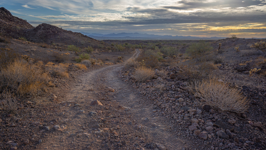
I continued walking the dirt road into the mountains. This mountain range exists within BLM land, not wilderness as much of the previous route has. That means there are more 4×4 roads, rv campers and a lot of active mining claims. There will be little off trail hiking in this section, only to connect one 4×4 road to another on occasion.

This section is not going to be one of the highlights. I figure about 45 miles, and much of it will be along a low route on 4×4 roads. There really isn’t much of a continuous ridge line to speak of, and therefore a higher route is not feasible. One could certainly bag the occasional peak or hill, but it hardly seems worth the effort unless one is feeling energetic.
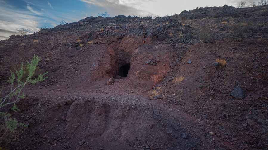
Burro Barite Mine


I walked past a mine, a horizontal tunnel into the earth. I had camped by this mine in my camper van about two months ago while scouting this area. I found small samples of barite and fluorite here previously, but nothing too exciting. Across the road was perhaps the best marked mining claim I’ve ever seen. I happened to meet the claim owners when camping here in my camper van. Their claim encompassed most of a small mountain, and they were after gold. They had many large yellow metal signs up making it clear this was an active mining claim. Most of the other mining claims I see are simply marked with wooden posts. If they are newer, pretty obvious it’s active. However, many claim owners like to reuse very old wooden posts which doesn’t make it clear at all that it’s active. In fact, it does the opposite, one would assume it’s inactive due to the age of the posts and the lack of signage. I figured these folks aren’t very concerned with prospectors encroaching on their claim if they don’t take the effort to properly mark it.


A small prospect
I left the road and followed a wash into the mountains. There were tons of interesting rocks here. Some I recognized, many I didn’t. Progress was slow, but as the rocks became less interesting, my pace increased.


This off trail section lasted a few miles, and had me going up and over a few small passes and many washes/ridges. None of it was particularly interesting or scenic.


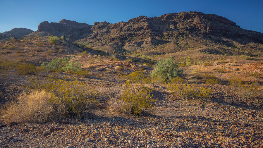
I joined a 4×4 road and continued south. The route mostly stays on the east side of the Plamosa mountains Divide, and the town of Bouse is occasionally visible in the distance. I had 4g signal for the first few hours of today’s walk, but not after mid-morning. It must be blowing in from Parker, to the west.

Exploring an old mine tunnel

For much of the rest of the morning, I followed a network of dirt roads and past countless small mining prospects. There was one tunnel into the hillside that I entered. You could walk in about 30 feet, but At some point, The mine owner or the BLM had sealed off the rest of the mine with a stone /cement wall. However, previous visitors to the mine had broken down this wall to regain entry to the rest of the mine. Looking in through the hole, it slants downward and goes an unknown distance. I was going to put on my headlamp and explore further, but there were a ton of bats flying around inside, and the smell was kind of strong. I decided to skip this one.


Four Peak. There’s a guzzler here…
Next I followed some dirt roads towards a guzzler. I found this area to be a little more scenic than this morning. Some really nice red colored rock and soil, and the Four Peak area was kinda cool looking.

Guzzler at Four Peaks
I reached a guzzler early afternoon, the first water source along this section. A group of three off roaders were just leaving as I approached. The Guzzler looked like the last one I encountered, near the beginning of the aqueduct in the previous section. The water in the drinker (trough) was full, but pretty gross. It was a deep green color with a film on the top, and a bunch of feathers floating around in it. I had 3.5L, so I passed on this one. I’ve filtered water like this before, just need to back flush the Sawyer filter every other liter.
While I was taking down notes on this guzzler, another group of three off-roaders showed up. I talked to these guys for a while, and asked them if they had any extra water. I scored a half liter water bottle and a 12oz Gatorade. Thank you, fellas.


The peak above the guzzler was probably the most scenic one yet. It looked like an old volcano. After leaving this behind, I followed 4×4 roads for pretty much the rest of the day. There are many more roads in existence then the map indicates. When looking at the map, If you are trying to work around a landforms, there is probably a road there whether it’s on the map or not.


Haystack and Ibex peaks

Haystack and Ibex peaks dominate the horizon now, and are growing closer. I’ll be hiking around these peaks tomorrow. For now, I follow dirt roads and washes towards these peaks while passing more prospects and old mines.


Ibex Peak
It was late afternoon when I crossed the paved road (Plamosa Rd) that cuts across the Plamosa Mountains. I continued up a wash on the south side.


I found my campsite about 20 minutes before dark, with a good view of Haystack and Ibex peaks. The southern part of the Plamosa Range is definitely more scenic than the north.
Day 37 – December 9th
Miles: 17.1
Animals Seen: Jack rabbit, mule deer

Sunrise at camp in the Plamosa Mountains
I woke up to a nice view of haystack and Ibex peaks, with the sun creeping over the ridge line just as I broke camp. I continued walking dirt roads through fields of teddy bear Cholla, up and over a series of small washes. Today, I hope to reach the highway and make my way into Quartzsite to resupply. It’s day 7 since I’ve left Lake Havasu City now.


I walked dirt roads around the southern end of Ibex Peak, and followed a wash over the divide to the west side of the Plamosa Mountains for the first time.


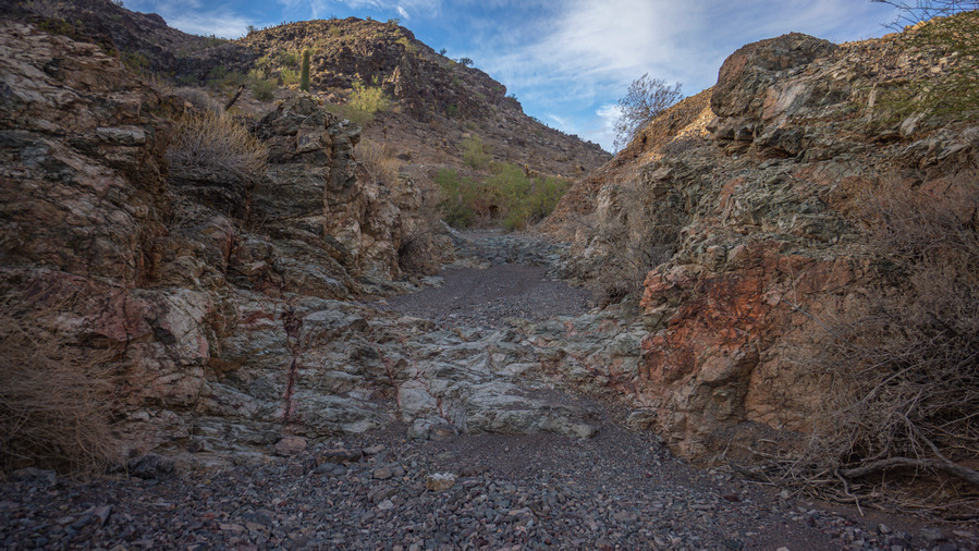
By late morning, the clouds started building. The wind picked up, and it was colder now. At the same time, I began to notice the impressiveness of this Canyon. Not on a spectacular level, but for this section at least, it was beginning to get interesting.

Near the guzzler

The guzzler

This one has a float system operating the water level. But the water comes out brown…
I reached a guzzler, my second water source along this section. This one featured two troughs (drinkers), and both had water. As expected though, the water was pretty green and unappealing. One of the troughs was fed by a float system that dispensed water from a large tank, pretty similar to the design of the guzzler I visited just before reaching the Hayden Rhodes aqueduct on the last section. Good, I thought. However, once I push down in the float and began to dispense water into my platypus bag, I could see the water had a pretty brown and cloudy appearance. Would this water be filterable? Absolutely. But I have 2L of water and a 12 oz Gatorade on me, enough to reach the highway this afternoon. And so, I passed on another water source.

Headed up this canyon
The dirt road ends here at the guzzler, and now I begin hiking off Trail. The canyon ahead of me looked fairly thick with vegetation, along with some rugged-looking Terrain. However, as it made my way up the canyon, the route became less daunting and much more manageable.

Looking back down the canyon I’ve climbed up
I found some interesting rocks on the way up to the Ridgeline. A really nice piece of agate with some druzy quartz. It was about the size of my hand, but since I am getting into town today, I figured I’d carry this one with me. Totally ultralight, I know.


View east from the saddle

View from the saddle up the next section of the route
The climb up to the Ridgeline could be broken down into two sections. The first was a fairly easy going Canyon up to a saddle. My map shows a guzzler just below the saddle on the other side. I didn’t see anything here oh, and even if I did, it would be pretty hard to down climb the steep Canyon to get to it. There was a pretty nice view here though, really the first elevated and somewhat sweeping view of the whole section.


The second segment of the climb up to the Ridgeline leaves the saddle and continues up a more challenging looking Canyon. Again, what looks daunting from below is typically more manageable than you think, if you just start walking up it. There were a couple of small pour offs to climb, and a few spots with thick brush as the canyon funnels you into the wash, but really, just par for the course.


Plamosa Mountains ridgeline. Ibex and Haystack peaks


The vast Renagras Plain
I climbed the final Hillside, littered with volcanic rock and teddy bear Cholla, up to the crest the Ridgeline. Wow! My first distant view since The Mesa, overlooking the Bill Williams River Valley. And with the dark clouds that fill the skies, a completely different feel to this view than almost anything else along three route thus far. The views were quite massive; the desolate looking mountains in California to the West, large desert valleys on both sides of the Plamosa mountains, the Rugged Ridge line of the new water mountains to the South, and the alluring Kofa wilderness just beyond that.


This was the slowest part of my day. Not only due to the terrain, but because of the scenic beauty. Renegras Plain lies to the south, the massive valley that I’m overlooking.


From here, it’s less than 2 miles of walking along the crest of this Ridgeline before I drop down to the valley below. This is not an easy ridge to walk, though. Mostly, the best path forward is following game Trails just below the crest of the bridge on either side. The true crest is often a knife-edge or jagged rock formations. There’s some Cholla appear as well, just to add to the challenge.


View east to Haystack Mountain
Walking South along the Ridgeline, some views improve of the mountains to the east, part of the haystack mountain formation. Maybe it was the lighting, but the views over the surrounding landscape look greener than much of what I’ve been walking through over the last few weeks. The hiking is slow up here, but easily the most scenic of the section. I’m glad I chose to walk this Ridgeline.

Awesome views of the Plamosa Mountains

The route down somewhere ahead, presumably


The route down off the Plamosa Mountains ridgeline
The route down off of the Ridgeline is a little cryptic. There’s a series of different ridges leading down off the crest, and one needs to be careful, ensuring you’re on the right one before covering too much ground. Eventually I reached the valley floor, thankful to be on flat-ground now and no longer sliding down loose rock and scree. Here, I met a dirt road and began walking South towards the highway.
Shortly after descending the Ridgeline, I took a break at the Black Beauty mine and ate lunch. There were supposed to be some more rare and interesting minerals here, but my untrained eye doesn’t know what they look like and what to look for, and I kept nothing.
Leaving the mine now, I followed a series of dirt roads South. One guy on a 4×4 passed me, likely coming from a pop-up city of RV campers that are living out in the desert a few miles away. I could see this from the Ridgeline that I had walked earlier. At this time of the year, the Quartzsite and surrounding areas see a massive influx of people that flock to this area for the warm winter weather. Instead of spreading out, they Camp a few feet away from each other and form small cities and communities. I’ve heard the Quartzsite area draws a quarter of a million people each year. It’s an interesting culture, for sure. I’m new to the van life thing, but when I think of camping, I typically think of camping in places where I can’t see another person. The concept of being so close together is a bit foreign to me.

I left the dirt roads when they no longer took me in the direction I need to go. I chose a distant landmark and set out on a cross-country track crossed about 5 miles of open desert. I’m shooting for the junction of Highway 60 and Interstate 10. Obviously, I won’t be able to hitchhike on the interstate, so I’m shooting for Highway 60 right before it dumps into the Interstate.

The first half of this desert track was quite easy. Very open, very few obstacles. A decent amount of interesting rocks too… Mostly red jasper and agates, with some chalcedony sprinkled in.

Renegras Plain
The second half of the walk, the final 2 miles or so before the highway, presented more obstacles. There were more washes to climb in and out of, it was thicker with brush, and towards the end it was littered with a sea of large black rocks to step over.
When I reached highway 60, I had a rickety looking barbed wire gate to open and close. Traffic buzzed by occasionally as I dropped my backpack. An RV was parked on the side of the road 100 ft away, surely looking on at the drifter who just emerged from the desert.
I put my thumb out to every passing vehicle, which worked out to be one every couple of minutes. I regret not bringing a piece of cardboard with me to write “Quartzsite” on, since anyone getting on the highway here might assume I’m looking for a longer ride than just 15 minutes down the road. It was 4 p.m. when I arrived, which gives me almost 2 hours to try and get a ride before Darkness. After that, I’d be stuck here, camping alongside the highway somewhere for the night. This is the worst feeling, being so close to town and having to spend another night out, and a crappy one with road noise at that.
After an hour, I was getting nervous. I had phone service, but there was no Uber service here as expected. I looked up taxi services in Quartzsite, but came up dry. While I was up on the Ridgeline earlier today and had good cell phone signal, I used Priceline to book my hotel for tonight in Quartzsite. If I don’t make it, it’s nonrefundable. As a last-ditch effort, I gave the hotel a call and asked if they knew anyone in town that gives rides for money. In a stroke of luck, the guy at the front desk immediately had a person that runs a shuttle service to recommend. He gave me a woman’s number, who was able to come pick me up in just 20 minutes. It’s amazing how the trail provides, even if it means being a little resourceful on your end.
The sprinkles started falling on the way into Quartzsite, so the timing worked out perfectly. The Super 8 Motel oh, the only motel in town, is on the far side of town away from pretty much everything a hiker wants. There’s also no pizza or food delivery in town. I didn’t have much Choice except to walk a mile in the dark, in the rain, up to Carl’s Jr. It’s a dangerous walk to, along roads that have no shoulder, thick bushes along the roadside that force you to walk on the blacktop, no street lights. I also had to walk over a highway overpass that had no sidewalk, no lights, and no guardrail. Stupid semi truck drivers barely acknowledge a human being waking here and don’t have the courtesy to move over, buzzing by without a care. A monster thickburger combo made things better though, as I stuffed myself full of fatty goodness. What a day.
Day 38 – December 10th
Zero day
Today was spent doing Town chores. I did some laundry last night, and the rest today. I walked up to the Carl’s Junior again for lunch, and utilized the community Transportation program for the rest of today’s errands across town. It’s called The Camel Express, and they operate as a curb-to-curb transportation service. It’s $2.50 one way to wherever you want to go in town. I had them pick me up at the Carl’s Junior and drop me off at the post office. Here, I mailed back nearly eight pounds of rocks from the last section!
After the post office, I walked a few blocks away to the Roadrunner Market, probably the biggest grocery store in town. This isn’t saying much though; the selection is pretty poor. Generally, enough for a full resupply, but they lack a lot of basic items. I stopped in the coyote Fresh Foods Market another two blocks away to check their selection, which was even more scarce.
Next I hit up the pizza place in town call Silly Al’s. I ordered two medium pizzas, these would last me for the next two days in the hotel so I don’t have to leave again just to get a meal.
I spent the rest of the day going through photos from the fast to sections and updating my journal. Typical zero day stuff.
Day 39 – December 11th
Zero day
Today was spent getting food together and making plans to wrap up this hike. I called my friend in Phoenix, who would be picking me up at the end of my hike along Highway 95 outside of the Kofa Wilderness. I can’t believe the end is so near now, but I’m looking forward to it.


Leave a Reply