
Pigeon River Country State Forest, MI – January 2015 (Trip Report)
Overview
- Location – Pigeon River Country State Forest, MI
- Park Type – State Forest
- Miles Driven To Destination – 500 miles Round trip
- Length Of Time Hiked – 4 days, 3 nights
- Miles Hiked – 11
- Trail Type – Basecamp, off trail
- Trail Difficulty – 5/10
- Fires Allowed – Yes
- Solitude – 7.5
Notes
If you plan on camping in the backcountry (on State Forest land, but outside of a state forest campground), the Michigan DNR (Department of Natural Resources) requires you to fill out a camp registration card. You need to fill it out in PENCIL and leave this card where you camped, tied to a tree or secured in some other way. This system is pretty dumb if you ask me. You need to carry a card for each camp you stay at, and a pencil… who brings a pencil backpacking? And why on Earth do they want you to leave it in the woods where it will likely be destroyed by the weather long before any DNR officer ever finds it? Regardless, you can print out your camp registration card (they are free) by opening the link below:
http://www.michigan.gov/dnr/0,1607,7-153-30301_30505_30731-31303–,00.html
Getting There
Many of the “roads” on the map in the Pigeon River Country State Forest aren’t really roads that you can drive on. These roads may have been old logging roads, but now are only passable by 4×4 vehicles with a high clearance. Many of these roads have downed trees blocking the path, or even new trees growing in the road. Some of the roads on the map simply weren’t there as well. Google earth showed roads on the map that were not there when reached that area.
From I-75, Sturgeon Valley Rd. coming from Vanderbilt is the main access road for the southern portion of the state forest, and Webb Rd through Wolverine is the main access road for the northern section.
Day 1 – January 2nd, 2015
Miles Hiked – 1.5
Route – Parking spot at Chaffe Rd & Osmun Rd to camp near Little McMasters Creek
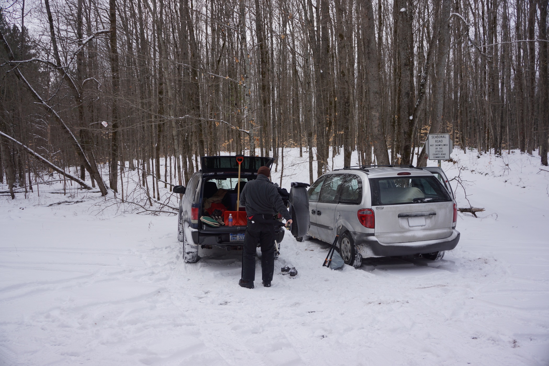
Parking at Osmun Rd & Chaffe Rd
We arrived at our parking spot at the intersection of Osmun Rd and Chaffe Rd later than anticipated due to my car GPS taking us down some ridiculous route down non-existent roads. There was no parking area, but the intersection was very large and provided enough room to park two vehicles without being in the way of anyone driving down the road. Since we saw no tire tracks in the snow on any roads for the last 30+ minutes, we figured this spot would be acceptable. Actually, we tried driving east on Chaffe a ways first to see if we could park farther down, but quickly found that this would not be possible with one of the vehicles in our convoy due to huge ruts, downed trees and steep hills.
We loaded up our gear and started walking around 2:30, much later than I hoped. Fortunately, this trip is not about hiking a ton of miles and moving from camp to camp, but instead we planned on setting up a basecamp and just exploring the area. Before leaving home, I used Garmin Basecamp and Google Earth to pick an area that would be suitable for camp. From our parking spot, camp was mostly a straight shot down Chaffe Rd, and then off trail a short ways.
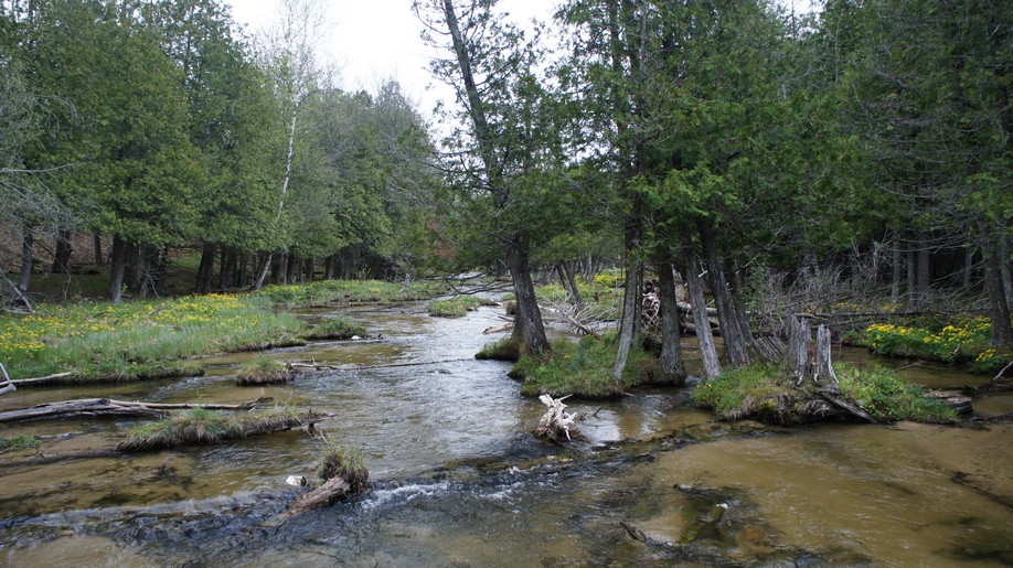
We saw elk tracks almost immediately after leaving the car behind. In addition, we also saw coyote and rabbit prints in the snow along Chaffe Rd. This section was hilly, and would be very hard to drive up in all but the beefiest 4x4s. Right now there was about 2 inches of snow on the ground, but we were expecting a few more inches this weekend. The walk was pretty quick and eventually the road ended. From here, we cut a path through the forest towards the area I had picked for camp. After a short distance, we reached a large clearing. The area had clearly been logged, but also seemed to have a lot of downed trees. Little McMasters Creek flowed through here, originating from this marshy area according to the map. We saw cattails and other signs that told us the ground we were walking on wasn’t completely solid. We headed towards the treeline once we had the chance.
As soon as we exited the logging area, we found ourselves in a thin stretch of cedar swamp lining the edges of the marsh. In the summer this probably wouldn’t have been a great place to camp, but right now it looked pretty decent as soggy areas were mostly frozen and there were obviously no bugs that typically plague these areas. There was a flat spot with good cover from the trees for Bryan’s tent, good space between the trees to hang my hammock (first time using one!), and an uprooted tree that would provide a good wind block for our fire. Most importantly, the close proximity to water. The creek was about 100 yards from camp which was very convenient. Yup, this is it, home for the next 3 nights.

Marshy area with Little McMasters Creek flowing through it
Now about 3:30, it was time to start setting up camp. Daylight is scare this time of year, and we had about 2 hours of light left to work with. Marc didn’t have to worry about setting up a tent, since he planned to hike back to the parking spot each night and sleep in the back of his minivan. Instead, he went to town on gathering firewood. He brought a hand saw and loppers which proved invaluable throughout the trip.
I mentioned that I would be sleeping in a hammock. I have been dying to try one for the last 2 years and finally have the chance to after receiving one for Christmas. The Grand Trunk brand hammock has no mesh bug liner or anything fancy about it, but for this trip it should suffice. I had ordered the Grand Trunk Funky Forest tarp to use with this hammock a few days earlier, but apparently UPS doesn’t deliver on New Year’s Eve or New Year’s Day, only air mail. Needless to say, I didn’t receive it in time. I had to use some lightweight blue tarps I bought at REI. The largest tarp I had was a little too short for the hammock but I had multiple tarps with me. For the first night, I just used one tarp overhead and one below me to set my gear on.
Bryan and I decided to go out for a short walk after setting up camp. We headed through the cedar swamp towards the east end of the marsh. Not far from camp, we picked up some coyote tracks that led right where we were already going, so we followed them. At the end of the marshy area the tracks ran along the top of a small burm or levee, separating this area from another large open marshy area to the east, which had a very thin line of trees blocking the view. The creek flowed from one open area to the other through a gap in the burm.
Once the sun went down it was time to get a fire going. I tried lighting the fire with some cattails and a spark from my firesteel, but that was a no go. Most of the wood was a little wet and snow covered, so the fire took some effort to get going. Finally, I was successful using a lighter and the stalks of the cattails, constantly feeding the fire with stalks since they go out fairly quickly. Now it was time to cook some italian sausages for dinner. How could they possibly be any better? Try eating them on cheesebread with shredded cheddar cheese sprinkled on top. No noodles in a bag for me!
After eating dinner and hanging out for a while, Marc headed back to his van. He was hesitant about sleeping in a tent this weekend since the temps were forecast to be in the low single digits on night 3. To each his own I guess.
The moon was nearly full and illuminated the marsh by our camp. The crisp air, dead silence and stillness of the night was very peaceful. I actually had the feeling of being in a remote location despite this being the lower peninsula of Michigan. There was a good chance we were the only ones sleeping out here tonight, as this place isn’t all that crowded with hikers and backpackers in the summer either. In May of 2013, I hiked the High Country Pathway, an 80 mile loop trail that runs through this area, and I didn’t see a single hiker. I highly doubt there will be anyone out here now.
When I went to brush my teeth tonight, my toothpaste was almost frozen. I had been trying to keep my water and any food that I planned on eating soon warm by putting it in my pockets, but I guess I’ll have to do the same for toothpaste and contact lens solution.
Tonight was going to be interesting. First night in a hammock, and I have never slept in temps this low (around 13 tonight). I gave my 0 degree bag to Bryan, and I took the 20 degree bag. I planned on sleeping in my clothes for extra warmth. I don’t have an underquilt to use under the hammock, so I used two inflatable sleeping pads (Thermarest ProLite and Klymit Inertia X-Frame) instead to block heat loss from below. We’ll see how the night turns out.
Day 2 – January 3rd, 2015
Miles Hiked – 4.1
Route – Logging roads, off trail
My first night in the hammock wasn’t the greatest. I had to get up once to put some more slack in the straps for the hammock so it wasn’t so tipsy. The extra slack helped a lot. My feet were cold but I was only wearing 1 pair of sock liners and one pair of smartwool socks. Tonight I will add another pair of smartwool socks, that ought to help. Also, as I had anticipated, not being able to turn over and lay on my stomach or sides was annoying.

Freshly fallen sow
There was a dusting of snow overnight, which was on my gear below me. Not too much so no big deal, but I’ll have to address that later. Right now I had to concentrate on warming up my feet, they were very cold! I ran up the hill behind camp and did a bunch of jumping jacks at the top and ran back down. That wasn’t enough so I used my hands to massage the feeling back to my toes. Definitely going to need to have wood ready for a fire tomorrow morning.

Built this to keep the firewood from getting buried in snow
After Bryan got up and we both ate, we started gathering more firewood. Then we realized that the snow coming later today and tomorrow is just going to bury our wood, so we decided to make a bit of a shelter for the firewood to keep it dry. There was a ton of great wood around as there were many downed trees near camp, so finding all the materials needed was easy.

Not the prettiest solution but for such short notice, it will suffice

After building a storage area for our firewood, I decided to beef up my tarp system to keep me and my gear protected from the snow. I repositioned the tarp over the hammock to be closer to one tree than the other, then added a second tarp on the exposed end. Also, I placed another small tarp over my gear below. This was a pretty ghetto solution but functional, and the best I could come up with on short notice. After all, I started planned this trip only 5 days earlier.
Marc finally made his way back to camp by late morning. My MSR Miniworks water filter wasn’t pumping water, so when Marc returned with his Katadyn filter we were finally able to fill our water bottles. I’m not sure what the problem was with mine, other than the fact that it was cold out, and I have never used it in temps this low yet. I have been using my SteriPen Opti for the last 2 years due to it’s smaller size and weight.


We were anticipating several inches of snow over the next few days and thought it would be nice to have a bit of shelter overhead while we sat in front of the fire, so we made a quick lean-to. There weren’t many downed pine or cedar trees around though so we were short on roofing materials. Still, it will act as a wind block and provide at least some protection from the snow.
Once we were done with improvements to basecamp, we headed out for a day hike. We didn’t have any set location to head to, we were just out wandering around for the most part, following anything we thought may be interesting. We headed south from camp, which took us up hill and into a large clearing with a single huge pine in the open. There were a few sets of coyote prints here, which we followed through the field. At the other end of the field was a huge pine tree, alone out in the open. We then entered the woods again, following a faint pathway between the trees.
Eventually we ran into an old logging road, which we followed until it dead ended into another logging road. This road actually showed up on my GPS and was Little McMasters Creek Trail. The road had tons of animal prints on it, including coyote, deer, and elk. We took a right and followed the road a ways until we came across a field to the west. On the other side of the field, the land looked more hilly, and we decide to head that way.
There was no trail or road to follow now, so we cut a path trough into the woods through unbroken snow. There was maybe 3 inches on the ground, so it wasn’t too difficult to walk through. It was slippery in spots, especially going up and down hills. It was nice walking through here but with three guys, I am pretty sure we scared off any animals that were around. Several times we came upon some extremely fresh tracks, deer mostly.
The temperature was warming up today and was forecast to be around 32 for the high, which would be the high for the entire trip as well. We were pretty warm from climbing up the hills with all our layers on, so we took a break to cool off before breaking too much of a sweat.
After our break, we started heading in the direction of camp. The GPS showed a nice loop forming as we cut a direct path back. There were occasionally some logging roads the we crossed but eventually stopped following them as they would often curve and lead us away from camp. The woods weren’t extremely thick but there were a lot of smaller trees that were perfect for eye poking. It was nice to finally make it out of the woods and back into the large field with the lone pine tree near camp. From here we followed our tracks back. Today’s hike was 2.5 hours and about 4.5 miles.
For dinner tonight I had some bacon, sausage and flatbread with olive oil drizzled on it, among other snacks. I cooked the bacon and sausage in aluminum foil over the fire. After losing 15+ pounds in 8 days on my hike in the Wind River Range this summer, I was determined not to lose any weight this trip. It took me 3 months to gain that weight back in the gym. This time, I brought 9 pounds of food for 2 full days and 2 half days, and was not having any problem chowing down like a madman. One of my favorite things about hiking is eating a bunch of good food (fatty animal meats for instance) I normally wouldn’t get to eat at home because I try to eat healthy. Out here, I need all the calories I can get!
We were getting some flurries this evening but nothing serious. I weren’t sure exactly when the bulk of the snow was coming but knew it was sometime tonight or tomorrow. Our firewood storage structure was full of wood and ready to fuel the fire tonight and tomorrow morning. After waking up with freezing feet this morning, I wanted to make sure I could get a fire going in the morning asap.
While sitting by the fire we heard several coyotes howling in the distance. Between breaks in the clouds we could see that moon was now almost full too. Now, it was time for Marc to hike back to the van for the evening. I’m sure glad I didn’t have to do that every night, especially after dinner. Speaking of after dinner, it was time for more food… chocolate to warm me up before bed!
Day 3 – January 4th, 2015
Miles Hiked – 3.7
Route – Logging roads, off trail
I slept much better last night. I was more used to the hammock and was more comfortable in it. I added an extra pair of smartwool socks to keep my feet warm, and put my feet and legs into the arms of my rain jacket. Sounds silly but this has worked for me in the past on cold nights. Actually though, last night wasn’t that cold, it was the warmest while we were out here, with lows in the mid 20s or so. This morning was much more bearable.
About 2 inches of snow fell over night. Good thing I added the extra tarps to my setup, that helped keep the snow out. I was getting some condensation buildup on the inside of the tarp though. This freezes and falls on my sleeping bag throughout the night, especially when I would shake the tarp to knock off snow that has accumulated on the outside. Even so, I was dry all night so I can’t complain.
Our 3 sided firewood storage area allowed some snow in but not nearly as much as without it. I got a fire going and started cooking some bacon bacon for breakfast. Afterwards, Bryan and I filtered some water from the creek.
Marc showed up a little earlier this morning, and we then proceeded to gather firewood for tonight and tomorrow morning, which we anticipate to be the coldest of the trip.

Little McMasters Creek flowing through a large open area. Much of this was soggy and partially frozen.
We headed out for another day hike around noon. This time we thought we would follow the marsh east. We hiked through the woods along the marsh for a while before trying to venture out into the open area, which looked more like a normal field now than a marsh. However, it wasn’t long before my foot went through a soft spot on the ground and some water got into my boot. We headed back into the woods where the ground should be more solid. This was true for a short while, but eventually we reached an area where there was pools of water pretty much everywhere as we were basically still in a cedar swamp. We decided that it wasn’t worth walking through this area and headed back towards the way we came.


Overlooking a logging area just west of Canada Creek Ranch
On our way back towards camp we hit Little McMasters Creek Trail again, north of where we hiked it yesterday. We walked south on this road for a short while before heading east through a field. We saw some human footprints in this field that were probably a day or two old, as the prints were visible but had new snowfall on them. I figured they led into the Canada Creek Ranch which was not far from here. We decided to follow them and see where they went. The footprints led us down a series of logging roads, fields, and pathways in the woods before we reached an area that had been logged. Since the Canada Creek Ranch is private property, we figured this would be a good place to turn around since we were pretty close to it now.
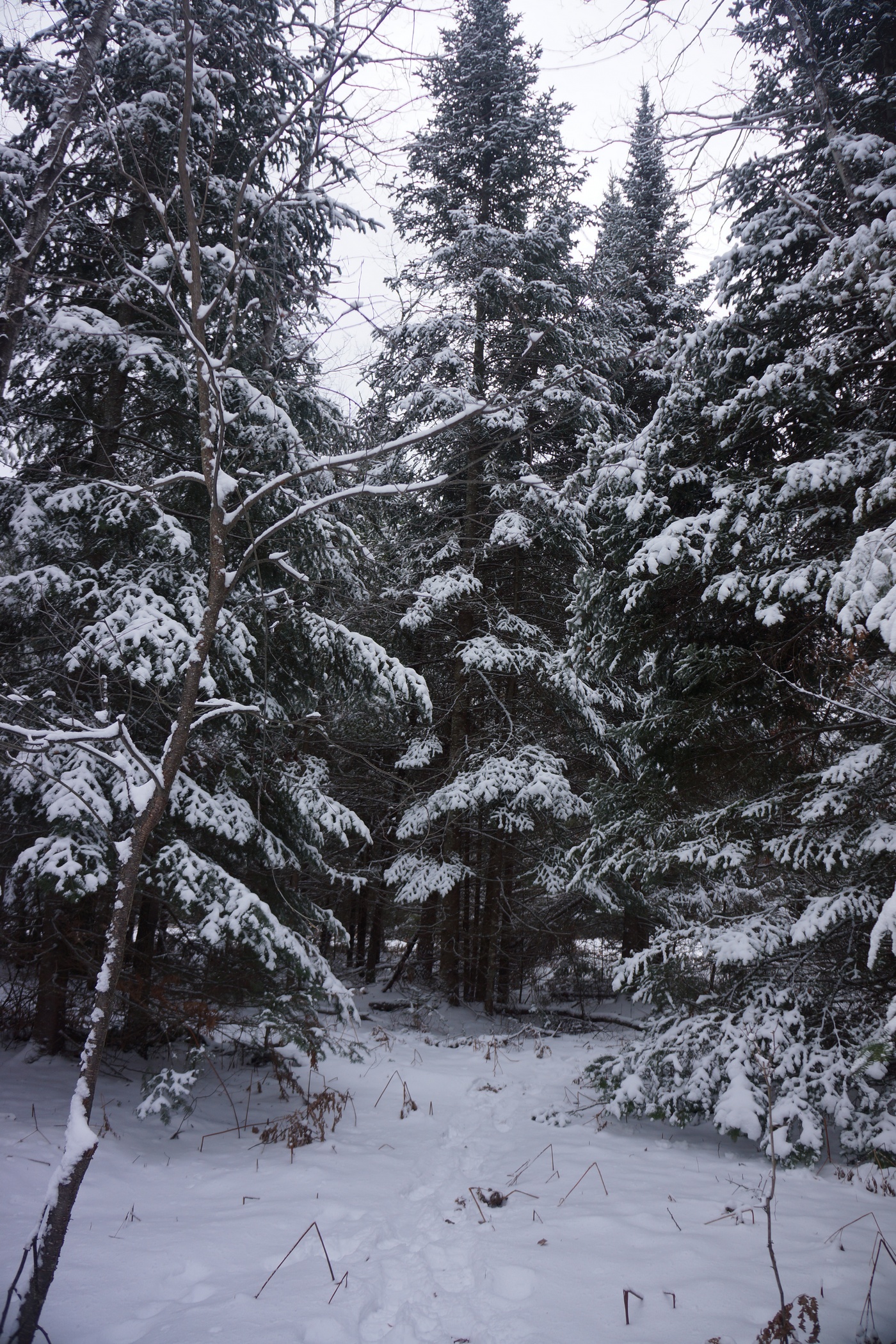
Walking among these snow covered pines was beautiful

The hike up to this point was very pretty with lots of huge, snow-covered pines. This was what I was envisioning for a winter hike. The snow was coming down a little bit here and there all day long, never very heavy at any time though.
We returned back to camp in mid afternoon. The temperature was really starting to drop. A few minutes of sitting and I was cold. It was hard to stay warm now since we weren’t moving. After eating some food and relaxing for a while, we headed out for another short hike. This time, we wanted to head north, which meant crossing the marsh. We didn’t want to cut through it near camp, so we headed west a ways before turning north, hoping to go around any wet areas. However, this area was looking pretty thick and we decided that it wasn’t worth the effort. Instead we just headed back to camp again, this time for the night.
We got the fire going early tonight since it was so cold now. There was intermittent wind in addition to on and off flurries. We hovered by the fire for warmth all night while we cooked dinner and waited for bedtime. This was definitely one of those times when you didn’t want to leave the fire. It’s easy to forget how cold it is just a few feet away. My watch can read the temperature, but apparently not when it’s this cold. Everything else on the watch was functioning properly, but when I left the watch out in the cold for a few minutes the temperature wouldn’t register. After warming it up with my hands for a few seconds it read 14 degrees, so I know it was colder than that. It was only going to get colder as the night goes on.
Day 4- January 5th, 2015
Miles Hiked – 1.6
Route – Camp near Little McMasters Creek to parking spot at Osmun Rd. & Chaffe Rd.
I did everything I did the night before to stay warm, but my feet were cold again tonight. My body was mostly warm despite a few shivers throughout the night. All in all, the night was pretty tolerable though considering it was likely several degrees below 0 with the wind chill. We got a few more inches of snow overnight bringing the total up to 6-8 inches.
The worst thing about today was that my boots were frozen. I had shoved my gloves into the boots and put them under a tarp, but they were quite solid when I attempted to put my feet in them. I had to piss so bad after being in the hammock for 10 hours, so I just forced my feet in there so I could get out of bed. I immediately lit a fire and began thawing out my boots, and my feet. It’s amazing how quickly those boots sucked out any remaining heat that was left in my feet. I spent a good 15 minutes regaining feeling in my toes before moving on to other chores.
Bryan had to be back downstate by 6pm for work tonight, so we tried to pack up camp as quickly as possible this morning. He wasn’t feeling good from something he ate yesterday so he didn’t cook any breakfast. I was going to cook some sausage links but decided to save time and just eat a Metrx bar.
Packing up camp was a pain because every time the wind blew, huge clumps of snow would fall on me and my gear. Once I packed the tarps I had no protection from the falling snow, which got inside my backpack and over other things. The good news is that it was so cold that the snow wasn’t wet at all, and it was easy to shake out. The fire was essential for warming my hands every so often.
We left camp around 10:30 this morning. Marc was sleeping in his van, so there was no need for him to come to camp this morning. Instead, we would hike back to him and our vehicles. This was a lot easier a few days ago when there was less snow. Now, there was a good 8 inches in spots, and the hike back was rather hilly. Bryan was worn out from not eating any food over the past day due to his stomach, so he was having trouble with the walk back. Good thing it’s only 1.5 miles. Felt like 5 miles though.
Once we reached our vehicles, Marc was there to greet us. He had to jump start his van this morning with Bryan’s truck. It sure was nice having two vehicle here this time. Bryan’s truck read 3 degrees outside, and this was at 11:30. I wonder how cold it was at 6am?
We took a different route back to Sturgeon Valley Rd, the main road leading back to Vanderbilt and I-75. I was concerned about Marc’s minivan making through the unplowed roads but we made it out without issues. Woohoo, first winter camping trip under my belt!
Final Thoughts
This trip was more of a learning experience for me than anything else. I wanted to see what it was like and what it takes to camp in cold weather. Specifically, what gear I found useful and which I could do without. The first thing I would leave behind next time is the shovel. I was envisioning more snow and the need to dig out an area for the tent, near the campfire, etc. Unless there was at least a foot of snow on the ground or the snow was hard and icy, I don’t see a need for it in this area. Maybe in the mountains but not Michigan’s Lower Peninsula. I definitely need to get a longer rain jacket too as mine is shorter than my insulation jacket below it. It’s a tight fit with all those layers on.
Sleeping in the hammock was comfortable overall, much more than sleeping on the ground. When sleeping on the ground I felt like I was waking up every 20-30 minutes when my arm or leg would go numb from laying on it. Coming up with a rainfly setup for the hammock is my next challenge.
The Pigeon River Country State Forest is, in my opinion, the most wild area in Michigan’s Lower Peninsula. We didn’t see anyone else out here, not even tire tracks in the snow on any state forest road. Lots of animal tracks as expected but with three guys traveling together I didn’t expect to see much. It was kind of discouraging seeing all the “roads” that criss cross through this area on the map, but in reality, many of these roads aren’t used at all, since they are impassible by car or simply non existent. I have been through this area twice before in the summer, and never saw any hikers either time. This time was no different, didn’t see a soul. Not surprising given the weather.
As always, questions and comments are welcome!
If you found my trip report useful, please don’t hesitate to leave a comment! Alternatively, if you feel you have any information you’d like to share with others regarding this hike, please feel free to leave that below in a comment as well.
Nordhouse Dunes Wilderness, MI – July 2014 (Backpacking Trip Report)

Hiking & Camping In Nordhouse Dunes Wilderness, MI
View all of my Nordhouse Dunes Wilderness pictures | Nordhouse Dunes Wilderness HD video on Youtube
- Location – Nordhouse Dunes Wilderness, Michigan
- Trail – Varied, and mostly off trail
- Trailhead – Nurnberg Trailhead
- Park Type – National Forest, Wilderness Area
- Fees & Permits – There is no fee to camp, but at the Nurnberg trailhead there is a $5/night fee per car, or $15 for a week
- Length Of Time Hiked – 4 days, 3 nights
- Trail Type – Off trail
- Miles Hiked – ~30
- Trail Difficulty – 4/10
- Solitude – 1 on beach and popular trails, 5 in the interior of the park
- Fires Allowed – Yes
Nordhouse Dunes Wilderness Notes
Nordhouse Dunes is the only federally designated Wilderness Area in Michigan’s lower peninsula. This isn’t really too surprising as Michigan’s lower peninsula is about as far from wilderness as you can get. I don’t believe I have ever been more than 1.5 miles from a road anywhere in the lower peninsula. Another interesting fact is that Ludington State Park, which borders Nordhouse Dunes Wilderness to the south, has the largest area of fresh water interdunal ponds in the world.
Nordhouse Dunes Wilderness Maps
http://www.fs.usda.gov/Internet/FSE_DOCUMENTS/stelprdb5151641.pdf


Day 1 – Friday July 11th, 2014
Miles Hiked – 2.1
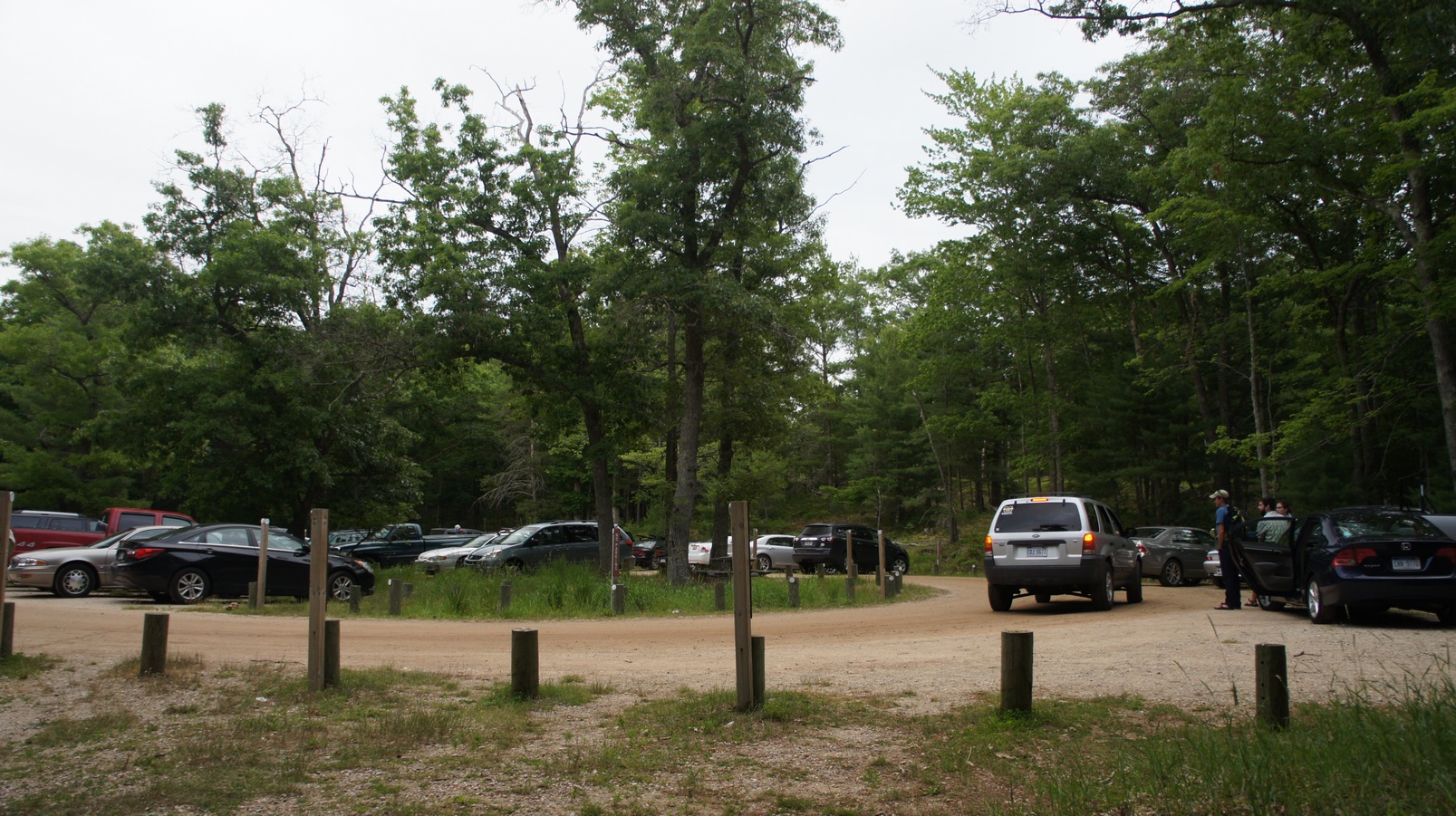
We arrived at the Nurnberg trailhead around 6:30pm, and it was packed. The car after us took the last spot, and people now had to park down the road, past a sign saying “no parking beyond this point”. This is where Ryan had to park when he arrived about an hour later.
There where a lot of people coming and going, and it really looked the like the party crowd. One guy was carrying a cooler full of beer. I wasn’t really sure what to expect, but this was not what I was wanting to see. Regardless, we left the trailhead around 8:30pm or so.
Packed parking lot at Nurnberg Trailhead in Nordhouse Dunes Wilderness, MI
The Nurnburg trailhead parking lot actually has a trail passing through both sides of it. On the north side, near the outhouse, the trail heads towards Nordhouse Lake. On the south side, the trail heads straight for Lake Michigan, which is the route we chose. We hiked past one or two small ponds and a marshy area before reaching our first dune outcrop about 20-30 minutes later. Once over one or two small dunes we had our first view of the lake.


The sun was going down quick, and we started scouting for campsites at this point. We started heading north along the dunes paralleling the shoreline. We saw a lot of people scattered around here and there, and as expected, it took a while to find a decent site. We settled on a spot tucked in a bit of a bowl just a few yards into the first patch of trees butting up to the dunes. Bryan and I were in tents, while Ryan brought his hammock. I’ve never slept in one, let alone laid in one (the kind for overnight camping anyway). asked if I could test out the hammock, and it was pretty comfortable. Maybe someday I’ll buy one for myself.


We didn’t have much time for anything tonight after setting up camp as the sun had pretty much set. We hung out down by the water for a while before calling it a night.
Day 2 – Saturday July 12th, 2014
Miles Hiked – 10.1

After waking up I headed down to the beach for a while. Ryan joined me a while later, and finally Bryan emerged from his tent and made his way to the water. We didn’t have a set plan for today, just to explore.


I’m flying!

After getting back to camp and eating breakfast, we set off on a hike to Nordhouse Lake. It wasn’t long before we came across some dunes that looked inviting. One in particular caught my eye, with its large bowl shaped pit. We had some fun jumping into the pit from the top and taking some pictures before moving on.

Nordhouse Lake

The trail to Nordhouse Lake from where we were camped required heading back to the trailhead, since the trail we were looking for passes through the other side of the parking lot. It was just as packed, if not moreso today. We passed through the lot and continued on the trail to the lake. There were less people around now, but we weren’t alone by any means. Once we arrived at the lake, it started sprinkling. Fortunately it was light and short lived. We were rather unimpressed with the lake itself and since there didn’t appear to be anywhere that would be easy to fish (and worthwhile to do so) from on the shore, we moved on. At this point, we decided to head back to camp and explore the dunes some more.
Once we arrived back at camp, we were shocked to find another group of people setting up camp extremely close to us. Probably about 40ft separating out campsites. It was a group of about 12 or so people, some boyscouts and their scout leader(s). I consider this to be rude and bad hiking etiquette. There are plenty of campsites scattered throughout the park, and therefore unnecessary to be that close to us. Especially with such a large group of young kids. We immediately began to pack up our stuff to move somewhere else. Ugh, the nerve of some people.

Hiking south along Lake Michigan
We headed south down the beach, scoping the area for someplace more secluded to camp. Walking along the shore was easy and nice. After covering a little ground, we had to start heading inland to look for campsites. Every time we thought we found somewhere good, there were already people there. So all we could do was keep heading south.


This is the ridgeline we used to travel from our campsite up and over to the “interior” of the park.
After a while we left the beach altogether for a more accurate lay of the land. From the high ground we could see a few spots worth checking out, however, they were farther to the north. No big deal, we just back tracked a little. It turns out that we passed right by a great campsite earlier because we couldn’t see it from the beach.

Campsite for nights 2 and 3
After setting up camp, we took a quick swim in Lake Michigan. It was pretty cool at first, but not bad after a few minutes. However, a few minutes was good enough for me, I’m nice and cool now. The weather was starting to look pretty crappy now as the skies grew increasingly foggy. Back at camp, Ryan was taking a nap in his hammock. Bryan and I decided to head out further into the interior of the dune field and away from the lake. We figured there would be nobody out there, especially with the weather looking the way it was.

Leaving camp for the “interior”

The other side…

We headed up a ridgeline in the dune up to a high point, which we could not see past all day. Now, we could see on the other side of this ridge, sort of. The fog was getting thick and hindered our views greatly. Still, being in a place like this with heavy fog cover was pretty cool.

“Hey, is that an interdunal pond? Let’s check that out!”

We saw some water in the distance, so we headed for that. We still had not yet seen any of those interdunal ponds. From a distance, I was thinking this could be a potential campsite. Once we were up close, I could see that it was a dirty, muddy looking pond of stagnant water. Nothing like what I was expecting.

Next, we headed farther inland and up an even higher ridgeline. The top of the ridge was a knife point edge in spots and again, not what I was expecting for sand dunes. This was much more interesting to me than the beach.

We wandered around through the dunes for about an hour and a half before heading back to camp. Hopefully the weather will cooperate tomorrow.
Day 3 – Sunday July 13th, 2014
Miles Hiked – 12.5


I awoke before the others again today, and headed off into the interior of the dune field shortly after sunrise. I saw some deer as I made it to the top of the ridge. Actually, we had seen a lot of deer this whole trip. It was kind of nice to be up here alone this morning.
Once I was back at camp, everyone was up and ready to go for the day. We decided to use this camp as a basecamp and just day hike from here. Bryan and I both suggested further exploration of the dune’s interior. Ryan agreed, having not yet seen it.

We took a different route into the dune field this time as Ryan mostly led the way. It was really sunny now and shaping up to be a hot day. Still, I can’t complain about clear blue skies! The views were excellent now with proper visibility. It looked like we were hiking on an abandoned golf course with enormous over-sized sand traps. I’m sure a more skilled photographer would have a field day out here, but we still had fun taking pictures along the way nonetheless.

Shadow play

Much of the morning was spent off trail, on grassy dunes and sometimes just sand, although there were sections of trail here and there. There were a lot of ups and downs but nothing very strenuous. We saw shotgun shells here and there, reminding us that this area is open to hunting when in season.


Hognosed snake
By late morning, we were approaching a large open sand area north of Hamlin Lake. The southern boundary line of the Nordhouse Dunes Wilderness lies in this area. Continuing on our southerly path, we entered Ludington State Park land. Along the edges of this long sandy area, Bryan spotted a Hognosed snake. It looks a lot like a rattlesnake, and has a king cobra-like hood, but it’s non venomous. Bryan got some “up close” footage with his GoPro and then we left it alone.

North of Hamlin Lake


We took our time wandering towards Hamlin Lake. It was actually farther than it looked.


Once we got to the shore of the lake, we could see all sorts of people and activity on the lake. Several boats were out and many were docking on the northern shore of the lake and hanging out on the state park land, swimming and drinking beer. The scenery along the lake was very nice. Lots of soft sand dunes to hike up and down around the lake though.

Interdunal pond along the lighthouse trail

I like the tiny little arrow mounted on that stub of a post. Nice.
Our plan now was to take the lighthouse trail back to the beach, and hike that north back to camp. We had to leave the shore of Hamlin lake and heard west inland in order to hook up with the lighthouse trail. We saw lots of people along the way and there were plenty of easy trails to follow. The lighthouse trail was pretty boring though, not much worth noting at all.

Looking north from Big Sable Point Lighthouse

Looking south from Big Sable Point Lighthouse


“Check out them interdunals! “
At the end of the lighthouse trail lies Big Sable Point Lighthouse. I’ll bet you never saw that coming. This was more of a tourist attraction than anything, with a gift shop and a fee to go up to the top. We went up to the top, which offered a great view of the surrounding area. Finally, we could see some of those interdunal ponds! However, it was not quite as extensive as I thought it would be. There were some small ponds in the dune areas, but certainly not what I was expecting for “world’s largest”.
We hung out outside the lighthouse for a while after we got back down, sitting in the shade beside the building. It was a pretty warm day, and quite sunny, so it was nice to take off the boots and relax for a few minutes. One of the ladies inside gave us some leftover pizza they had, so we had a tasty lunch as well. Then, she tossed down a few apples from the window above as we headed off. Thanks for the hospitality, lighthouse ladies!

Piping Plover nesting area


The hike back to camp was a couple mile stretch of shoreline. The hiking here was very easy and straight forward. At some point we came across some fenced off areas on the beach, closed for Piping Plover nesting. The Piping Plover is an an endangered and protected bird. The feet on these little guys move fast, and they almost looked cartoonish. Or maybe cartoony? You get the point.
Once back at camp, we were eager to jump in the lake and cool off. After that, we hung out at camp for a while and relaxed before having dinner.


Once the sun had dropped a little, we hiked back to the same area Bryan and I had explored last night. We figured this would be a more interesting place to watch the sunset, with all the shadows on the dunes and whatnot. Ryan didn’t venture too far out, while Bryan and I were both in search of interesting photo opportunities that took us a bit farther out.


I found a spot to set up on a dune perched above the interdunal pond we found the night before, with Lake Michigan beyond that in the background. I hung out here as the sunset and took some pictures. What a great way to end a great day.
Day 4- Monday July 14th, 2014
Miles Hiked – 2.1
It was another nice morning when we woke up today. After a leisurely start to the morning we packed up camp and hit the trail, headed back to the trailhead. It was only a few miles at most back to the car, and there isn’t much to say about today really. I didn’t bother to take any pictures. We had already walked the trail we hiked back, so that wasn’t new. I will say that there were almost no people out here now, being Monday. It cleared out yesterday afternoon, actually. We made great time back to the parking lot which had cleared out considerably since we arrived.
Want to see ALL of my pictures from Nordhouse Dunes? Check them out here: Nordhouse Dunes Wilderness Pictures
Final Thoughts About Nordhouse Dunes Wilderness
Nordhouse Dunes is one of the better hikes in Michigan’s lower peninsula in my opinion. I’m very glad I did this hike and would love to go back, but only during the week. There are just too many people here on the weekend. The fact that this wilderness butts up to Ludington State Park is nice because it extends the area in which you can hike. Even if you want to camp out in the wilderness, hiking through Ludington State Park during the day and returning to the wilderness at night is very feasible.
DO NOT plan on hiking with flip flops here! I made this mistake of wearing them on day two much of the day as we hiked along the beach and later, through the grassy dune interior. By the end of the day, the top of my feet were swollen and tender. By day 3 (now wearing boots again), you could actually feel the tendonitis in the tendons on the top of my feet. My feet hurt for 7-10 days afterwards, preventing me from running or doing stair climbs. I recommend either a sandal with a strap of the back of the heel if you must wear a sandal, but really I liked wearing my full grain leather boots (Zamberlan Vioz GT). They provide the necessary foot support for sand and also kept all of the sand out of my feet, when used with long pants. That was part of the reason why I chose to hike in sandals on day 2, so that I could wear shorts. Without long pants, sand can easily get into the boot.
I didn’t explore the northern or western parts of the park at all, we ended up staying on the east on south side. So, next time I could check that out if returning. Those sections seem to be heavily wooded though, and even swampy in the western section.
As always, questions and comments are welcome!
If you found my trip report useful, please don’t hesitate to leave a comment! Alternatively, if you feel you have any information you’d like to share with others regarding this hike, please feel free to leave that below in a comment as well.
[tcb_comment_count]Jordan River Pathway, MI – May 2014 | Backpacking Trip Report
Jordan River Pathway Backpacking Overview
View all of my Jordan River Pathway pictures
- Location – Jordan River Valley, Michigan (Mackinaw State Forest)
- Trail – Jordan River Pathway
- Trailhead – From M-32 & US 131 in Elmira, go south on 131 for 1.5 miles, turn right (west) on Deadman’s Hill Rd. Road dead ends at trailhead
- Park Type – State Forest
- Fees & Permits – None to hike or park, but $13 per campsite per night at Pinney Bridge campground
- Length Of Time Hiked – 2 days, 1 night
- Trail Type – Loop
- Miles Hiked – 21
- Trail Difficulty – 3/10
- Solitude – 2
- Fires Allowed – Yes (in designated campsites only)


Map of my route along the Jordan River Pathway

Map for both the Warner Creek Pathway and Jordan River Pathway
Notes
Pinney Bridge campground is the only place for hikers to camp along the Jordan River Pathway trail. There is potable water at the campground, as well as toilets.
Day 1 – Monday June 20th, 2011
Miles Hiked – 9.2
Route – Trailhead to Pinney Bridge campground

The weather was supposed to be nice today, but it was very foggy and raining lightly on and off when we arrived at the trailhead. I had already pushed this hike back a few days due to crappy weather, and could not push it back any farther. There was only one other vehicle parked here when we arrived.

We chose to hike the north side of the trail first, supposedly 8 miles. At times, the Jordan River Pathway merges with the North Country Trail. The hike starts off by dropping about 350ft into the valley. The landscape consisted of soggy meadows and various patches of forest.

It wasn’t long before we reached a detour sign due to a bridge being out on the trail. The map we have showed only one river crossing on this side of the trail, and it was a ways away. Regardless, we followed the detour uphill. The detour followed the Deadman’s Hill Loop, the section that connects both sides of the Jordan River Pathway. After about a mile, we reached the end of the detour. Now, we were on the opposite side of the loop, which we were going to hike tomorrow. The detour had us hike south a very short distance, maybe a few hundred feet, before heading downhill again. Soon enough, we were back on the northern side of the loop. Looking at the map, there was a pond or small lake along side the trail where the bridge was most likely located.

The trail meanders through the woods for a while before crossing the Jordan River along a dirt road. We stopped here for a while so Bryan could fish this area while I ate some snacks. Cedar swamp lined the banks of the river, which was fairly shallow here. It looked like it had a lot of downed tress and branches to snag on. After 20-30 minutes, we moved on.

The next section of trail was probably the coolest part of the hike today. It passed along the river for a while allowing us to get down to the banks. The trail was mostly above the river a ways in other parts, so this was nice. There is a fish hatchery located along the river on the opposite side that was now visible. Well, visible when the trail was elevated above the river… once down at the water level, the hatchery could not be seen. We had originally wanted to check this out but there didn’t appear to be any easy way to get across the river here.

We followed the trail south along the river for a while, taking pictures and enjoying the views. There were a ton of yellow flowers along the river’s banks which added some nice color to the freshly sprouted greenery blanketing the landscape. There were many downed trees here protruding into the river, some of which had a large amount of soil on top of them allowing a good amount of grass to grow. You could easily walk out onto them and stand in the middle of the river on the 1 foot wide “planks”.

The trail eventually leaves the river and heads uphill. There was nothing steep here, but some gradual inclines. Now in the forest and away from the water, the yellow flowers disappeared and were replaced with tons of white ones. If you couldn’t tell, I don’t know my flowers very well!

Approaching the southern end of the trail now, we were presented with a view on an open hilltop. Nothing spectacular, but still more than we see in southeastern Michigan. Around this time we passed a group of 4 people doing trail maintenance. Much thanks to the folks who maintain this and all the other trails out there. We found the Jordan River Pathway to be well maintained and easy to traverse just about everywhere.

From here, the trail drops a a little bit before passing through Pinney Bridge campground. The campground is located in a large open field, and is “hike-in” only. There are 15 sites here, each has a picnic table and a fire ring. There is also a hand pump well and pit toilets here. The cost if $13 per night, per campsite and is set up as a self-pay system. You must put cash or check in an envelope, fill out the form and deposit the money in a pole next to the registration area. Before depositing your envelope in the pole, tear off the receipt and post it on the numbered pole next to your chosen campsite.
The campground itself is not much to look at, being just an open field and all. However, it’s located just a short walk away from Pinney Bridge, which crossed the Jordan River on the very southern end of the loop. After setting up camp, we headed down to the river to do some fishing.

I was a little surprised at how nice the river looked once we got down to the bridge. The water was flowing pretty fast, but at least there are some deeper holes here to fish than we had seen upstream. Bryan and I went our separate ways as we both explored different sides of the river, hiking through the cedar swamps along the banks. I quickly found that the river is very braided here making walking along the banks more challenging. To get anywhere, one must hop from island to island over countless small channels of water flowing through the swamp.

Not long after getting down to the river, the sun finally came out. Coincidentally, the mosquitoes and black flies also came out around this time. They really came out in force, too. Although it was warming up now, I was forced to wear a long sleeved jacket with my hoodie on to keep my skin covered. I also had a mosquito head net which helped a lot. It’s difficult to see through and just annoying to have in your face all the time, but better than being eaten alive by bugs I suppose.


After having no luck on the downstream side of the bridge, I headed upstream. More of the same braided streams passing through cedar swamp on the other side. I could see many animal tracks in the mud through here. As with most spots along the river, there was a lot of downed trees and tons of things to snag on. I kept moving upstream for a while, having more fun exploring the banks of the river than actually fishing. Bryan was fishing on the other side of the river, and had just told me that he spotted a steelhead earlier. The snags in the water and ruggedness of the banks made it difficult to reach many of the best looking holes though, and he was not able to cast towards it. I made it quite a ways upstream before the various offshoots of water led me too far away from the Jordan River, and I decided to turn back.

After a few hours on the river, we wanted a break from the bugs and headed back to camp to see if they were any better there. They weren’t. We gathered firewood and got a fire ready to go for later this evening.
After an hour or so back at camp, we decided to head back down to the river to try our hand at fishing one more time. I had no luck and eventually gave up. It was really peaceful just sitting on the bridge next to the water, and this was good enough for me. Bryan headed back into the swamp in search of the steelhead he saw earlier. While sitting on the bridge, people occasionally passed by. Mostly, they were mushroom hunters, picking Morels. There are a lot of people out in the woods this time of the year picking Morels in Michigan. Bryan did end up catching one small rainbow trout, so at least one of us caught something.
Back at camp, we got a fire going pretty quickly to battle the bugs. I cooked italian sausages over the fire while Bryan ate a power bar and some beef sticks. The clouds returned as the sunlight faded away. We went to bed around 11pm.
Day 2 – Tuesday June 21st, 2011
Miles Hiked – 10.8
Route – Pinney Bridge campground to trailhead
I slept decently last night, and it wasn’t too cold. However, the clouds remained, and I was beginning to doubt today’s forecast of “sunny”.

We hit the trail around 9am this morning. Today’s hike should be around 10 miles back to the trailhead. The southern side of the loop is further from the Jordan River, but is supposed to have a few high points with views. We passed a marker along the trail indicating that we are crossing the 45th parallel, the half way mark between the equator and North Pole.


Next we crossed Cascade Creek. Lots of downed trees here along the water. The trail follows along the creek for a short distance.


He’s standing on solid ground
The trail then climbs up to Landslide Overlook. There were two other people up here leaving as we arrived. They had no backpacks or any other hiking gear, so I assumed there was a road nearby that they accessed this area from. At this high point, you can see for quite a ways. Views like this are few and far between in Michigan, especially in the Lower Peninsula. So, I figured this would be a good time to take a break and eat some food and take some pictures.

After leaving Landslide Overlook, the trail heads down to Section 13 Creek. Yup, Section 13 Creek. Awesome name, very creative. The trail follows the creek for about a half mile, which was nice.

The rest of the hike today was rather boring, from Section 13 Creek north to the trailhead. There were no more creeks to cross and no more vistas until we reach the parking lot. We were just hiking through nondescript forest for the last 5 miles or so. The forest was starting to come alive again with lush greenery though, and in a few more weeks, the trail may be overgrown in spots.


Bryan’s knees were starting to hurt by the time we reached Deadman’s Hill, which was just around the corner from where our car was parked. This was the other well-known vista this trail has to offer. The view was definitely better than Landslide Overlook. Here, you had a much more open view, and the scenery was better. To the north, the Jordan looks like a trickle of a creek winding through a marshy lowland area. To the south, the river cannot really be seen due to the thick patch of cedar trees along its banks. From up here, the dark green color of the cedar trees really stands out among the deciduous trees farther from the river.
The parking lot was packed when we returned around 2pm. We hiked around 11 miles today, and about 21 total for the trip.
Final Thoughts
I was glad to have finally done this hike as it is known for being one of the best in the Lower Peninsula, albeit a rather unknown one. There were some really pretty areas here, again, for Michigan’s Lower Peninsula. This is not a challenging hike, despite a few ups and downs here and there.
I was hoping the fishing would have been better, but isn’t that always the case? There were just too many logs in the water to snag on, and most of the fish we saw were tiny. However, for me, Pinney Bridge was the highlight of the trip. It was a beautiful spot to fish or just hang out by the river. It was a popular spot though, as I saw several people passing through here. There is a parking area near the bridge along Pinney Bridge Rd.
Pinney Bridge campground was convenient. It was convenient having the hand pump well there and the toilets, but the campground makes you feel like you are car camping at a state park, not along a hiking trail.
I would definitely hike here again, but the Manistee River is still my favorite Lower Peninsula hike.
As always, questions and comments are welcome!
If you found my trip report useful, please don’t hesitate to leave a comment! Alternatively, if you feel you have any information you’d like to share with others regarding this hike, please feel free to leave that below in a comment as well.
[tcb_comment_count]
High Country Pathway (HCP) – Pigeon River Country SF, MI (Backpacking Trip Report) – May 2013
High Country Pathway Hike Overview
Complete High Country Pathway Photo Gallery | High Country Pathway HD Video
- Trail Name – High Country Pathway (HCP)
- Location – Pigeon River Country State Forest & Atlanta State Forest, Michigan
- Park Type – State Forest
- Miles Driven To Destination – 820 miles Round trip
- Length Of Time Hiked – 4 days, 3 nights
- Trail Type – Loop
- Miles Hiked – 80
- Trail Difficulty – 3
- Fires Allowed – Yes

Planned Hike – High Country Pathway (HCP) in Michigan
As much as I’d like to get away from Michigan for a real hike, it’s not in the cards right now. However, I will have a week off and plan on hiking somewhere semi local. There is an 80 mile loop in the Pigeon River Country State Forest that is supposed to be the closest thing to wilderness in Michigan’s Lower Peninsula. It’s called the High Country Pathway. I’ve hiked a 5-6 mile section here before, but it ended up being more of a fishing trip after we found a nice spot along the Pigeon River where we pulled out several Rainbow and Brook Trout. The trail is not spectacular by any means, but it’s really close to home at only 3.5 hours. The Pigeon River Country State Forest may be best known for being home to the largest herd of free-roaming elk east of the Mississippi River. Hopefully I’m lucky enough to spot one myself.
It took a long time to find a gpx file online of the HCP. After loading the GPX into Basecamp, I saw that the total elevation gain was only 6200ft for the entire trail. Honestly, I thought it would be less. Still, that’s nothing. I’m going to try and do this 80 mile loop in 4 days. I normally take a ton of pictures on my hikes, but that’s when there is beautiful scenery everywhere. I don’t think I will have much to photograph on this trip, so it will be interesting to see how many miles I can cover in a day.
I could only find about 3 trip reports from those who have hiked the entire HCP. Not many people hike it. I hear it’s supposed to be pretty wild, for the Lower Peninsula anyways. So, I’m gonna check it out, and I’ll get a trip report up soon enough.


