
Coxcomb Mountains 3 Day Hike – Joshua Tree NP, CA – Dec 2016
Joshua Tree National Park – Coxcomb Mountains 3 Day Hike

View All Coxcomb Mountains Photos | Watch the Coxcomb Mountains Hike Video On Youtube
- Park Administration – Joshua Tree National Park
- Fees & Permits – Free permit, self register at one of 12 backcountry registration boards (none near the Coxcomb Mountains) or at one of the Joshua Tree national park visitor centers
- Travel Logistics – Flew into Ontario, CA airport, drove (with a local friend) to Joshua Tree NP
- Trailhead – There is no dedicated trailhead to access the Coxcombs. However, you can park along Hwy 62 (TwentyNine Palms Rd) at 34.095135, -115.420799. This is 11.9 miles west of the Hwy 62/Hwy 177 junction. This starting point is recognized by the park though as the main point of access to the Coxcombs. BEWARE of deep sand here at the parking area! We found another place to park (north side of hwy 62) a half mile or so east of the designated spot if you don’t have a 4×4.
- Length Of Time Hiked – 3 days, 2 nights
- Miles Hiked – 25
- Route Difficulty – 7.5
- Fires Allowed – No
- Scenic Beauty – 7
- Solitude – 9.5
Coxcomb Mountains Pre-Hike Planning Notes
The Coxcomb Mountains are situated in the northeast corner of Joshua Tree National Park. This region is seldom visited, and considered the most rugged area of Joshua Tree with many jagged peaks. The highest peak in the Coxcombs is Aqua Peak. Although most maps label the high point as Aqua Peak, Aqua actually refers to 3 separate peaks… Spectre, Tensor and Dyadic. Tensor Peak is the lowest, and Aqua is the tallest at 4,416′.
There are no dedicated campsites in the Coxcomb Mountains.
There are no reliable water sources in the Coxcombs. We hauled our own water in for this 3 day hike.
The Inner Basin and Aqua Peaks are day-use only, but I could not find any official information on this within the Joshua Tree National park website. There’s no signs telling you where you can/can’t camp, and there’s nobody around to enforce it, but still you should try and honor these regulations as the are set in place to protect the local population of Big Horn Sheep. When I arrived at the park to get my permit, I asked the ranger to show me on the map the boundaries of the day use area. His map was a Trails Illustration/Nat Geo map of Joshua Tree National Park, and it the boundary was clearly marked on it. Later at home, I created this image to show the boundary of the day use area in the Inner Basin of the Coxcomb Mountains:
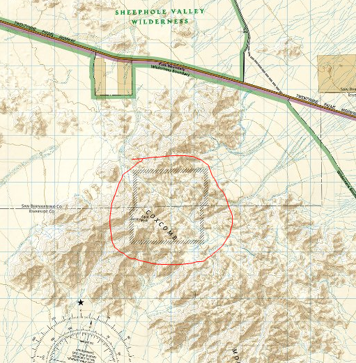
The day use boundary for the Inner Basin area of the Coxcomb Mountains can be seen on this map
Coxcomb Mountains Hike Maps
Download GPX file of this hike
[sgpx gpx=”/wp-content/uploads/gpx/CoxcombMtnsPostHike.gpx”]
This is the caltopo map of the route I hiked. I’ve highlighted the Inner Basin day use are for your convenience.
Day 1 – Friday December 2nd, 2016
Miles Hiked – 7
Elevation Gain – 1704′

Dan’s Mustang stuck in the sand
When it came time to park at the trailhead, we tried to drive on some sand that was way too soft for my friend’s Mustang, and the car got stuck. Very stuck. We had to call a tow truck to pull it out, which was a 4 hour ordeal. The only reason we we able to call that tow truck is due to a passing motorist, who stopped and drove Dan to an intersection several miles away that had cell service.
We didn’t start hiking today until around 2pm. I was hoping to make it past the Inner Basin today, but was also considering camping before the Inner Basin if it didn’t look like we could make it before sundown.
We parked about .85 miles east of the “designated” spot. From here, it would be slightly out of the way to walk back towards the standard route. which runs west of the outcrop of small mountains (marked 806T on my caltopo map). Instead, we started hiking south and aimed east of the 806T benchmark. This wash appeared to be easy and take us to the same place, so we felt confident about of choice and headed out into the desert.
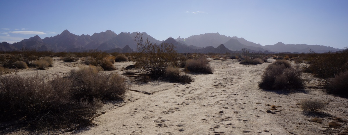
Coxcomb Mountains from the wash near Hwy 62
The desert floor consisted of soft sand in the washes, and slightly firmer sand elsewhere. Not the hard-packed desert soil I’ve hiked in much of the time in the past, in the Sonoran and Chihuahuan deserts. Vegetation consisted of low brush, much of it very thorny. No Joshua Trees here on this side of the park. We saw an occasional Prickly Pear and even a Sotol plant. Along the washes were some larger trees, at least compared to the rest of the scrub.

Not 10 minutes into the hike, and we saw a tarantula walking around, making it’s way back into it’s hole. This was the first time either Dan or myself had seen one in the wild. It was only about 55 degrees today, and being December I thought most of the snakes and spiders would be laying low somewhere. Cool to see!

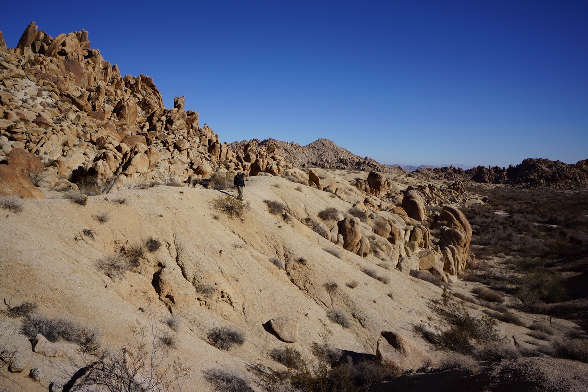
I’m not sure it would have been any easier had we taken the standard route, but walking along the wash east of the outcrop was really easy. We made great time through here. Looking back towards the car, we couldn’t see hwy 62 running through the desert. Pretty quickly you feel isolated here. The mountains around us were really rugged looking, especially compared to the rounded boulders of the iconic Joshua Tree landscape.
When we reached the point along our route where it intersects with the standard route, right before it heads uphill to Inner Basin Pass, we had a decision to make: camp here, or push on and hope we make it out of the Inner Basin before dark. We’d made great time so far, so we decided to chance it and keep moving. The terrain here remains easy, hiking up a sandy wash as the canyon narrows. I saw a jackrabbit darting through the wash, just about the only wildlife wee’d see this whole trip.

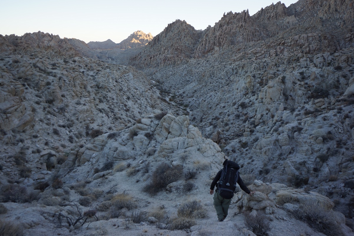
Hiking down the pass into the Inner Basin
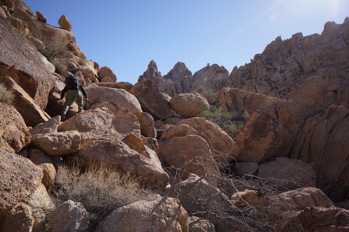
Eventually, our route in the sandy wash becomes a boulder climb. Not terribly difficult or long, but a bit of a scramble in spots. Once at the top, it’s actually a bit of a flat plateau. Our first views of the Inner Basin were impressive, but the view is best right before the trail drops down in elevation.

After dropping down into Inner Basin, it was back to an easy walk in a sandy wash. There’s a lot of thorny bushes around to snag clothing, but nothing too thick. The sun was really disappearing now, and the entire basin was shaded at this point.
When we reached the end of the Inner Basin, there were cairns leading southwest. I was expecting the route to continue southeast and up hill. I could have taken the route I had marked on the map, but I just followed the cairns. The route winded through some narrow canyons and involved a little more boulders. Eventually, we popped out into the large flat area nestled in the heart of the mountains seen from my map. I originally thought this was the Inner Basin, based on the look of it on the map and the piss-poor descriptions available on the web. To be clear, I am talking about the open area on the map at these coordinates: 34.0195, -115.3733. Since this area is not part of the day use area, we started to look for a campsite. It was really windy, so we walked to several outcrops of rocks to see if they provided ample wind break. Wind always seemed to be hitting us no matter where we stood, so we just picked a spot. I had to use my headlamp to finish setting up my tent. The sandy soil was so soft, I had to weigh down my stakes with rocks to keep the tent from blowing over.
After setting up camp, Dan and I ate dinner. It was 5:30 now and the stars were shining bright already. In fact, we could clearly see the milky way despite competing with the moon’s light. It was also getting pretty cold. Tonight was supposed to get down to near freezing. After shivering in the wind for a while, Dan and I decided to turn in around 6:30. Nights in the desert are long in the winter!
Day 2 – Saturday December 3rd, 2016
Miles Hiked – 10
Elevation Gain – 1671′
I woke up at 5:50 this morning, hoping to get in position for the sunrise. I walked over to Dan’s tent and woke him, but he didn’t get out of his tent by the time I was ready. In fact. he was snoring again. So, I let him sleep while I climbed up rocks behind our camp.
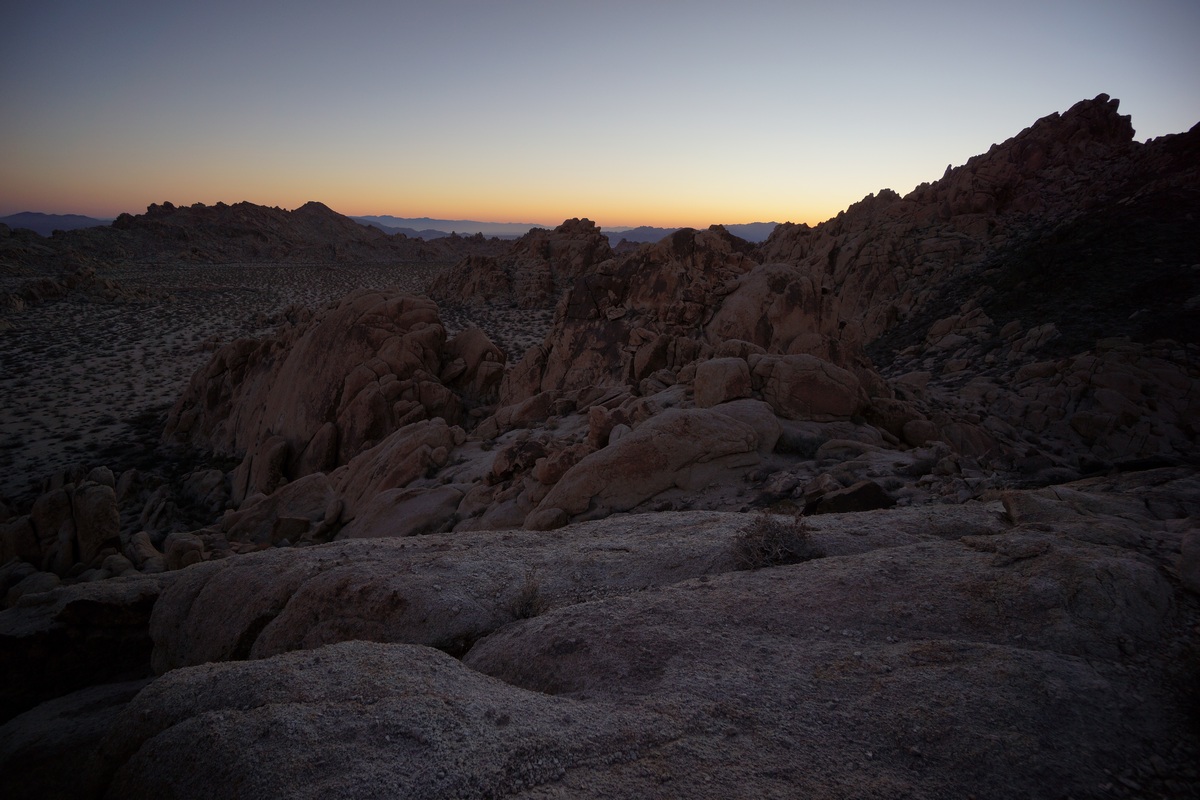
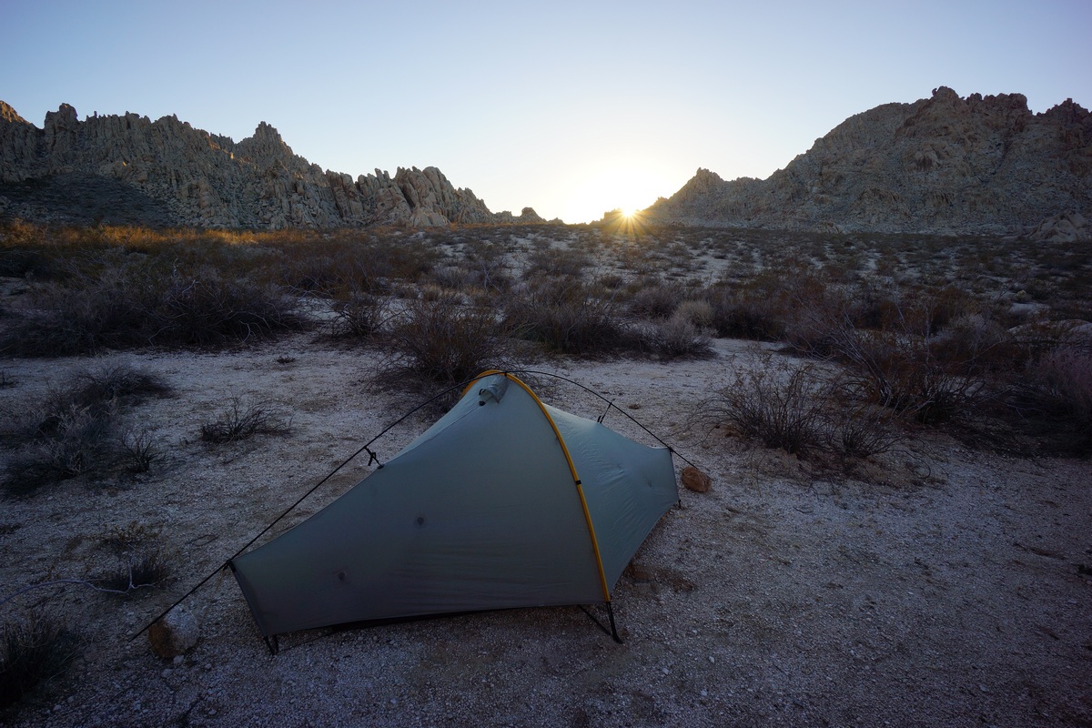
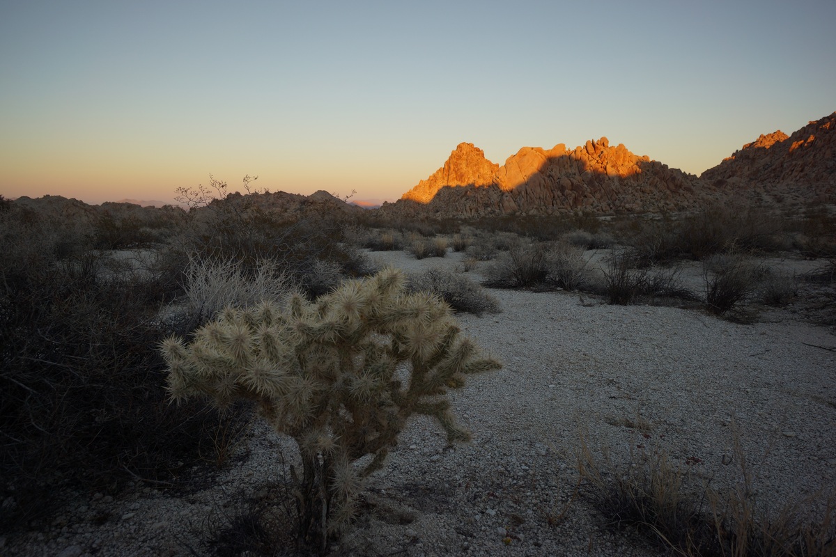
Sunrise in the Coxcomb Mountains
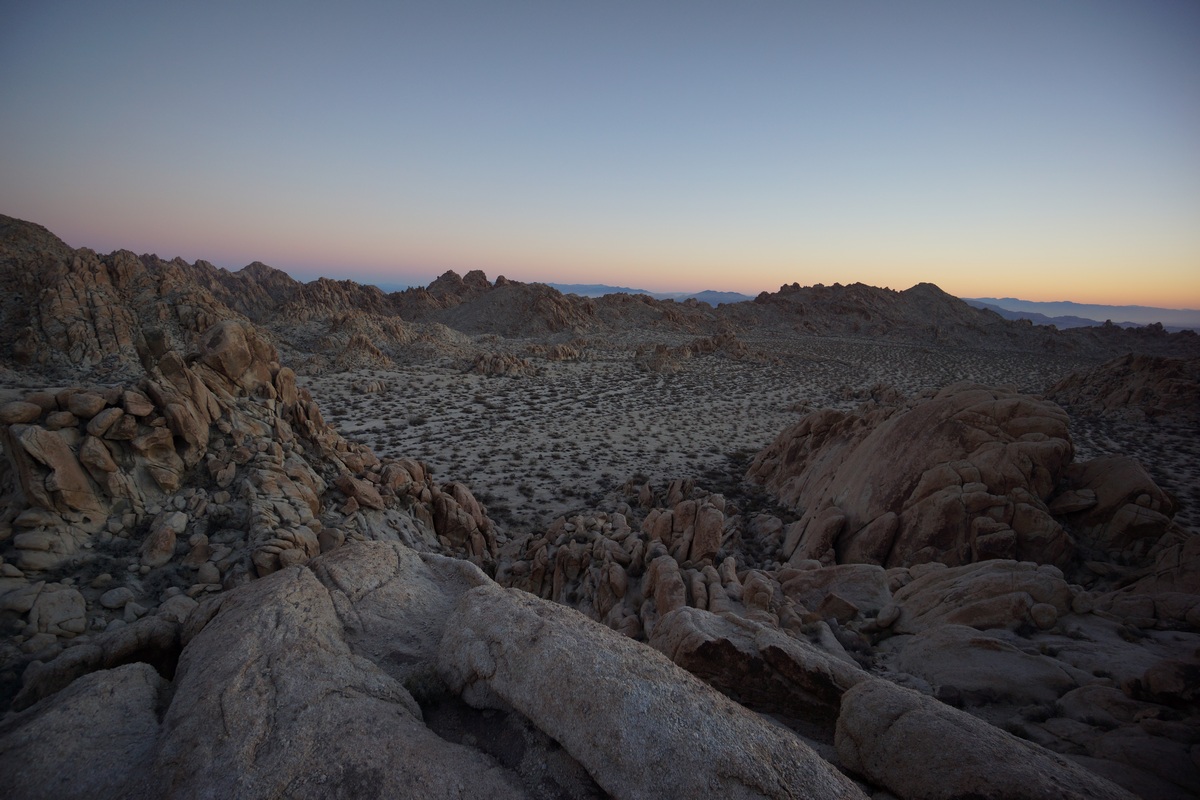

My camp is along the base of the rocks I’m on
From my spot on top of the rocks, I had a pretty good view of the large flat basin in which we’re camped. I could tell the sun wasn’t going to be directly in view, but I had had a good spot to capture the glow of light in the distance.


I spent a good while up here taking pictures of the sunrise and enjoying the excellent scenery. This was one of the better views of the whole trip.
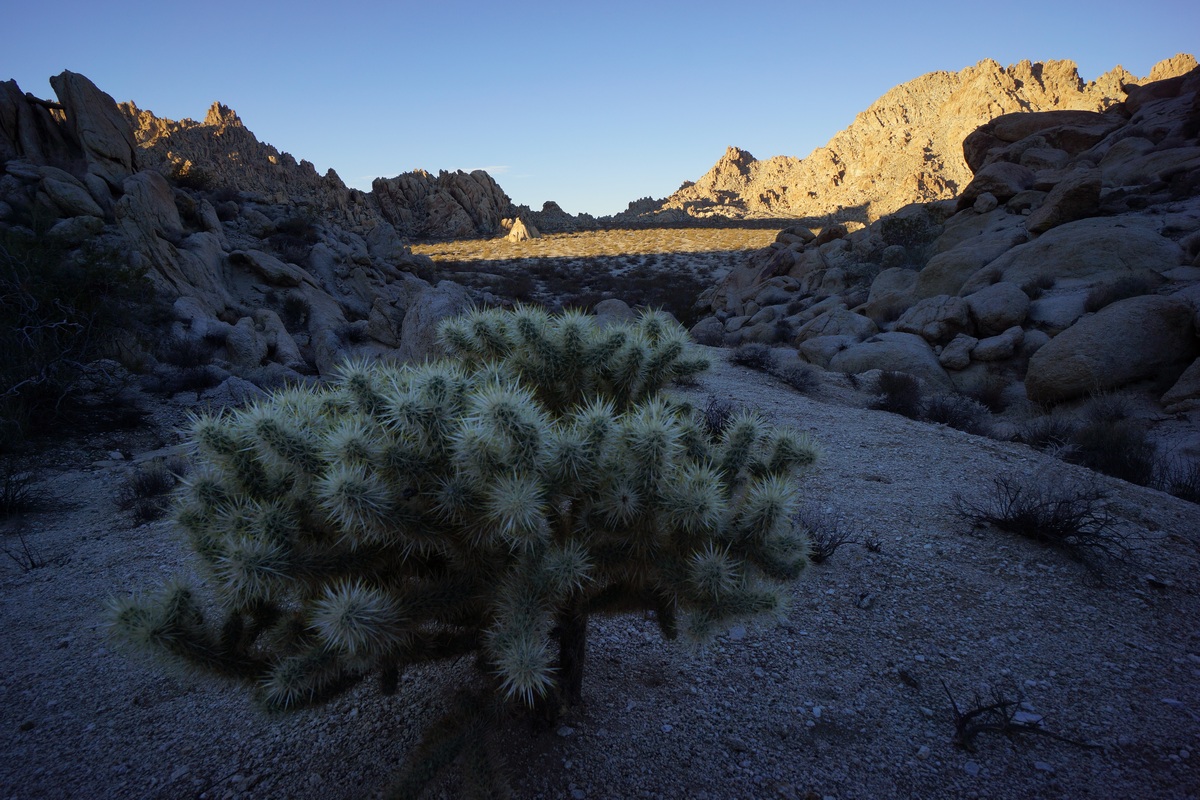
Some variety of Cholla Cactus

When I returned to camp, Dan was still snoring. Again, I let him be and continued with my search for some good early morning photo ops. Next, I headed southwest from camp to the edge of this flat open area. Here, the map shows a large drop off down to Pinto Basin below.

View of Pinto Basin and the Pinto Mountains beyond

Once at my destination, I realized most of it lies within the shade currently. maybe this would be better to return to this evening. I took a few pictures here before moving around some, trying to get to a higher vantage point. I bounced around from spot to spot along the tops of the nearby hills, but eventually I gave up on the area and decided to head back to camp.
Dan still wasn’t up when I returned after 8am now, so I tried waking him again. This time, it worked. After Dan ate breakfast and got ready, we headed out to do some exploring. Today, our plan is to go wherever we feel like going!

A small cave in the Coxcomb Mountains

First, Dan wanted to check out a small cave we saw last night as we exited the Inner Basin area and entered the flat open area we camped in. The cave was a rounded cavity in a rock face, sitting about 8-10ft above the ground. With some effort, it’s possible to climb into it from below.
Dropping down into the wash below
After this, we headed south across the open flat area. We hiked up over some boulders and dropped down into a wash below. We followed this was downhill for a ways. I had this marked on my map as a potential spot of interest, as the canyon looks like it narrows further down and is flanked by some cliffs ranging from 400′-1200′ plus. Might be worth checking out.

The hike down this wash was pretty easy at first. There were some occasional boulders that needed to be climbed in order to continue along our path. We had no intentions of following this canyon out into the desert, just to follow it for a ways. We didn’t see much of interest here, so we decided to turn back at our first real obstacle. There was a short drop off along the wash that might have been hard to get back up if we had continued down past it, so we figured this was a good turn around point.

We hiked back uphill and eventually made it back to the spot where we had originally entered the wash. From here, I suggested hiking higher up the same wash. On the satellite maps I saw at home, I saw a sizable patch of green here, which might indicate a spring or seep. Since thee was nothing marked on the map and no info on natural water sources in the Coxcombs online, we decided it might be an interesting destination.
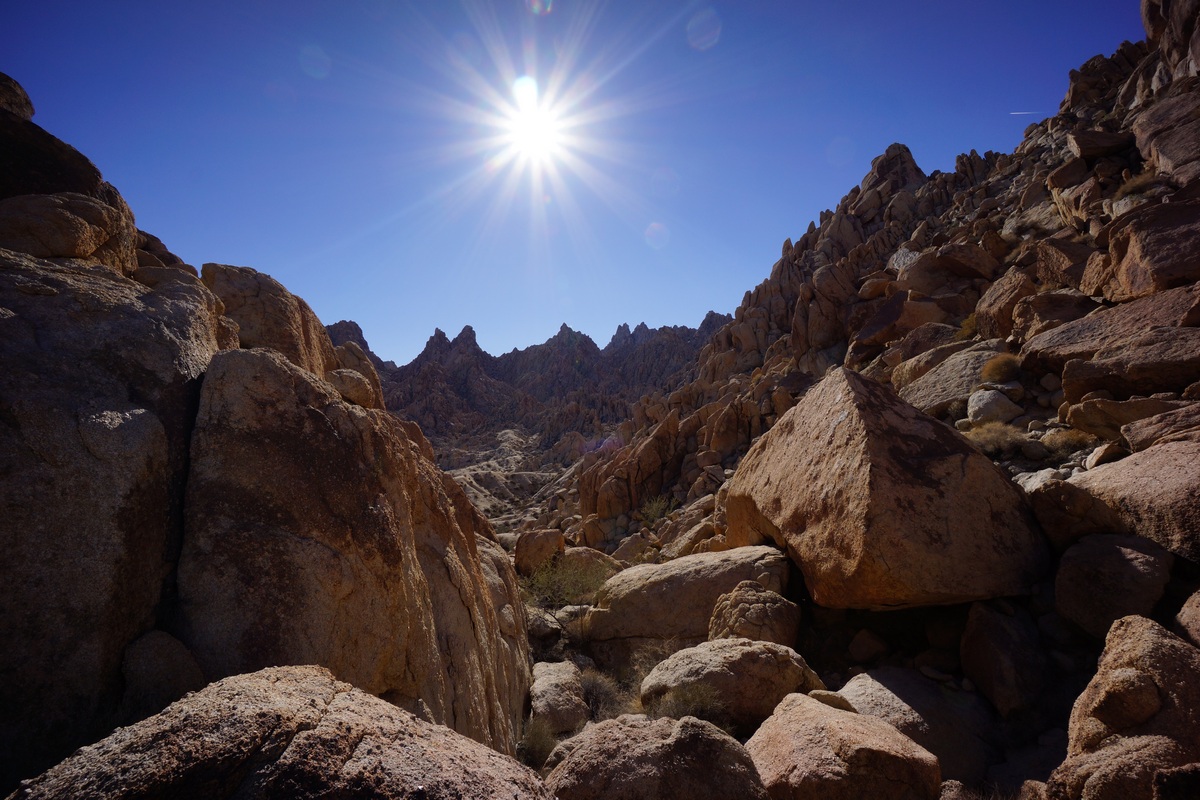
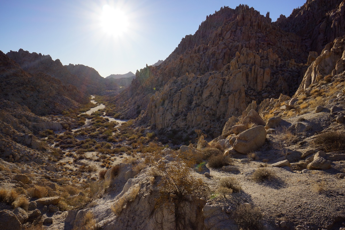
Climbing up the rock chute

View north from the rock chute

Dan enjoying himself
At first, our hike was again easy, winding through a sandy wash. Soon enough though, it turned into a boulder climb. This was a fairly long and sometimes challenging scramble, too. There were large boulders here, stacked on top of each other creating huge spaces in between them in which to fall. Sometimes, traversing the boulders meant walking along steep faces of the boulder with little or nothing to grip. A slip could result in a slide down the boulder and then a fall of up to 25ft onto various size and shapes of boulders below. Not exactly a high exposure type danger, but a real risk of injury if one step is out of place.
Lots of green around. I didn’t see water, but this is the closest to it I’ve seen out here
After a tough scramble to the top, there wasn’t much to see. The vegetation was thicker up here, and this meant mostly more thorn bushes. We had already been cut up pretty good during the rest of today’s hike, but the worst of it seemed to be up here. We pushed through the thorn bushes and headed for the spot of green I saw on the satellite map. Once at the spot, we did see a high concentration of some coniferous trees, the exact species, I’m not sure. They were so thick that I couldn’t penetrate them to check for existence of water, either.
We took a break here in the sun and relaxed for a while. We debated taking another route down, but that would require traversing some steep territory. Who knows what that will look like when we get there. It was early afternoon now and we end to start thinking about heading back to camp. We ultimately decided to take the same route back as we know it’s traversable already.

Descending the chute

Red rocks. Yup

Big Horn Sheep skull

The jagged peaks that surrounded us looked more impressive going down than it did when we went up. It was hard work, but offered up some of the best views of the day. We also saw a big horn sheep skull that we didn’t see on our way up. It had both horns intact.
My campsite
Coming down was a little easier. Before long we were in the sandy wash again and headed back to the place where we entered this wash. We could go over the little ridge we did this morning, or take another route, running northeast from benchmark 927T. We opted for the second choice. This took us back to camp, where we relaxed and rehydrated.

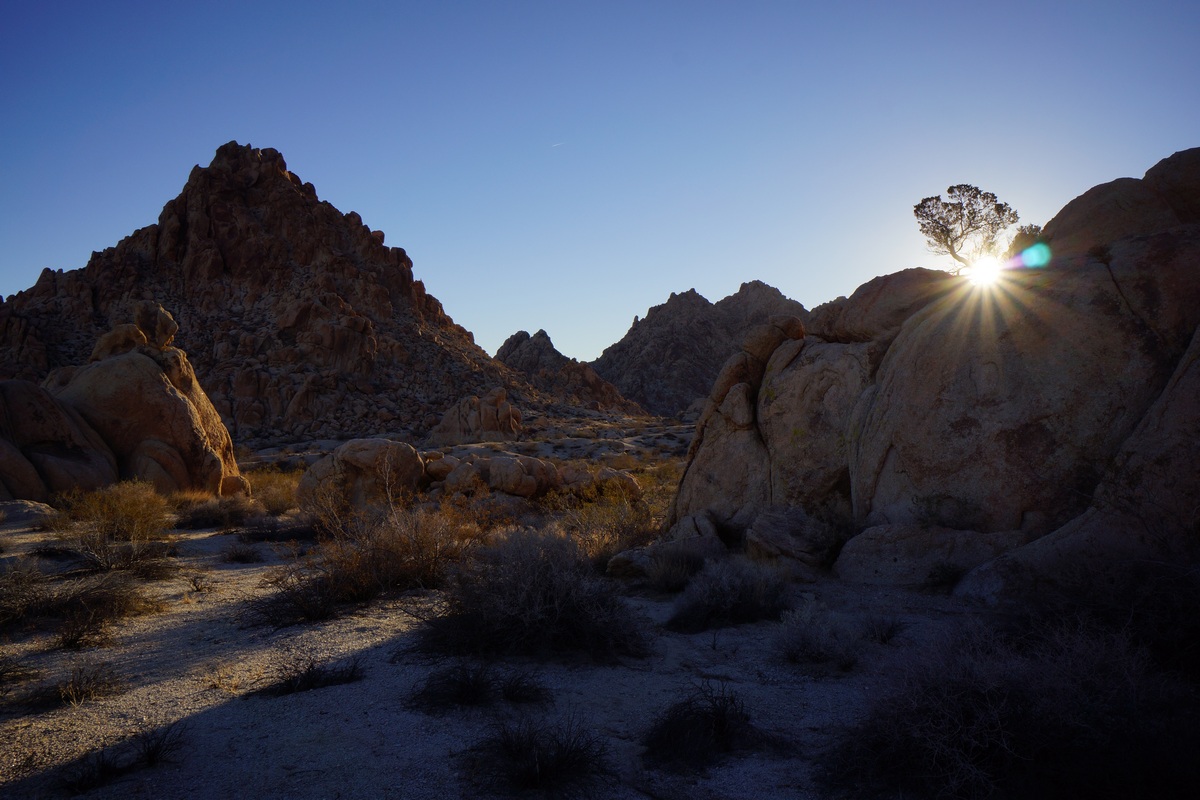
Sunset over the Pinto Basin

It wasn’t long before the sun was on it’s way down again, and fast. We decided to head back to the spot I visited this morning, on the southeast corner of the large open area. It was aonly a 10 minute walk to get there, but when we did the sun was just going down over the Pinto Mountains. It wasn’t the best vantage point base don the angle of the sun, but I snapped a few photos I was happy with. We ate dinner here as we watched the glow of the sun disappear.
Back at camp, we pretty much mirrored last night: sit on the rocks, watch the stars and chat. By 7pm we were both in bed again, seeking the relative comfort of the tent and the warm it provides.
Day 3 – Sunday December 4th, 2016
Miles Hiked – 7
Elevation Gain – 375′
I woke at 6am this morning, and Dan even woke on the first try. My original plan for today was to bag Tensor and Spectre peaks today on the way back to the car. However, Dan was not really wanting to do that after the climbing we did yesterday. He’d rather get back to the car early and spend the rest of the day driving through Joshua Tree or other areas nearby. While I was really looking forward to the great views from Aqua Peak (the name for Spectre, Tensor and Didiac Peaks), you really can’t go wrong with his plan either. So, I went along with the idea and started packing up my gear.


Hiking through the Inner Basin
We started hiking at 7am. It was a little warmer last night, and so this morning was easier to get moving. He hiked back towards the elevated cave, then down into the narrow wash leading into the Inner Basin.
We were able to follow our tracks back through most of the wash, not that that was necessary. The route is very straight forward, just follow the wash through the canyon. There is one large side canyon running northeast, but it’s obviously not the main path. This is the alternate route that’s marked on my caltopo map. I know nothing about this alternate route though, and skipped it because it looked like it would involve more climbing and steeper terrain that we won’t have to deal with if we continue the way we came.
Looking south into the Inner Basin

Inner Basin Pass, looking south
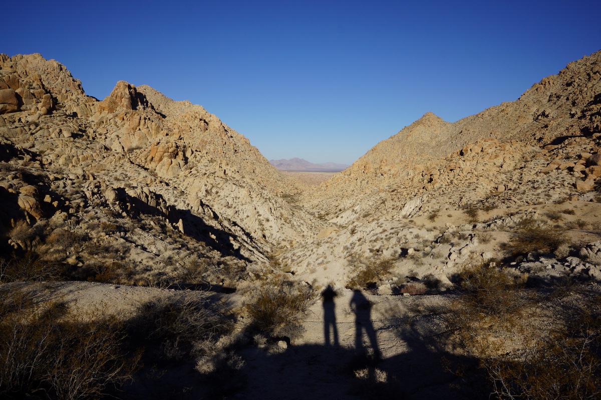
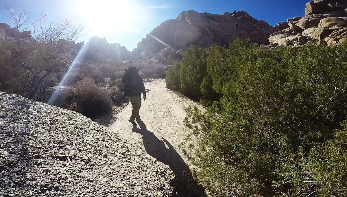
Heading out of the Coxcomb Mountains
We made it to the top of Inner Basin pass in good time, and had some nice views of the basin. We continued on down hill through a couple of patches of boulders, but the rest is pretty much sandy wash from here on out.
Back down in the main wash, we followed it out of the canyon and took the same path we took in two days earlier. We followed our own footsteps on and off as we hiked through the small canyon. I saw another jackrabbit through here, and wondered if it was the same one I saw Friday. It was practically the same area.
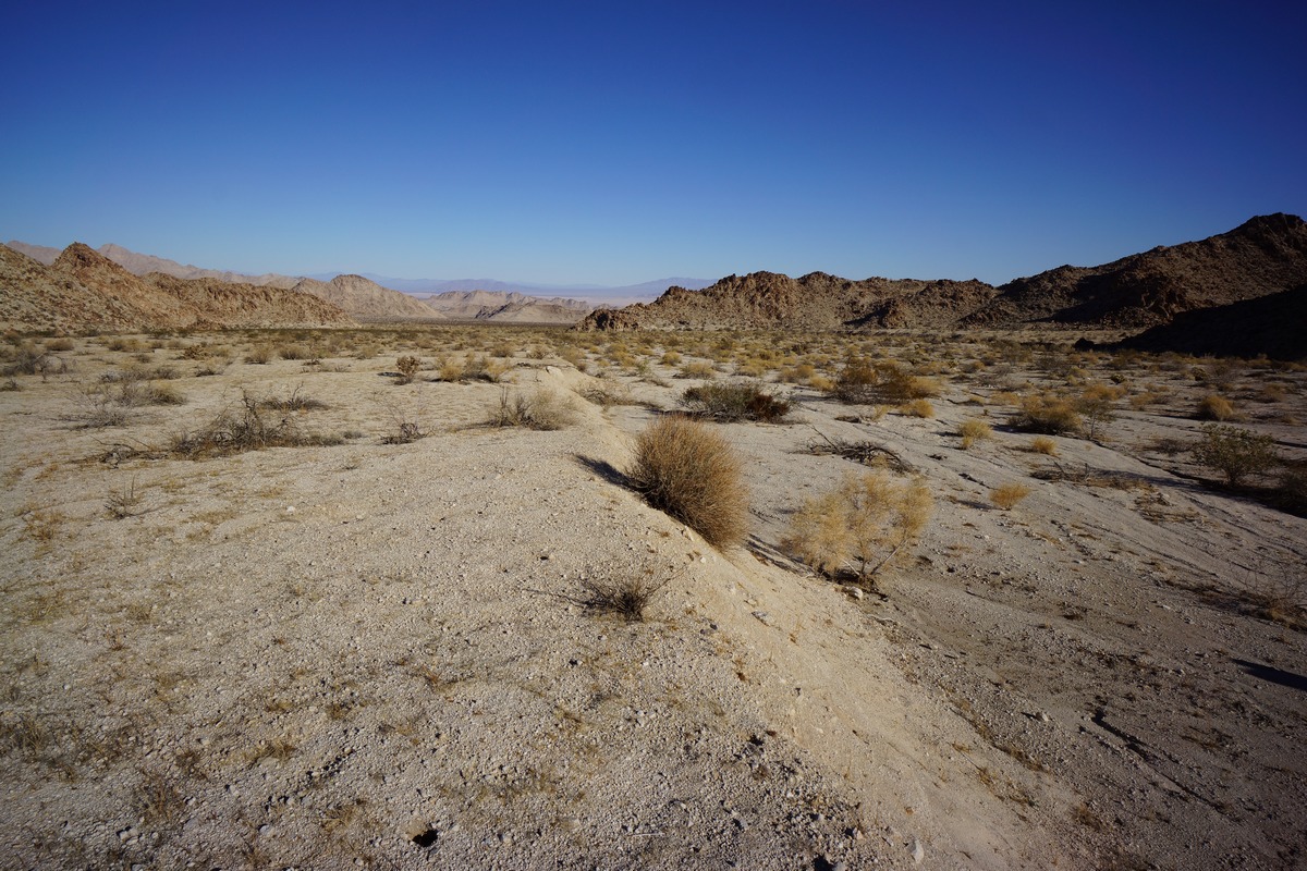
The landscape looked unfamiliar as we returned, as we now had a huge open desert in front of us. On Friday, all that was at our back and we only saw it as we turned back. It was nice to have this contrast as we left the mountains and now entered the desert.

The final stretch of desert had us talking about our dreams of a hot lunch. It took a while to actually spot hwy 62. The car was parked behind some boulders along side the road where others had clearly camped, and we headed for a graffitied rock that marked the spot. We were relieved to see that the car had not been broken into. The time was just before 10am, so almost a 3 hour hike from our camp.
From here, we headed back into 29 Palms and ate ate the Andreas restaurant. Good burgers, they really hit the spot! After this, we headed into Joshua Tree National Park on Utah Drive road to explore the park by car.
Final Thoughts About Hiking In The Coxcomb Mountains
The Coxcomb Mountains are a great place for a weekend hike, provided you’re OK with hauling in all the water you’ll need. Without a reliable water source though, longer trips aren’t really possible here. It doesn’t look like this place gets much use. The access probably keeps many people away, as well as the day use restriction in what might otherwise be the best camping spot.
As always, questions and comments are welcome!
If you found my trip report useful, please don’t hesitate to leave a comment! Alternatively, if you feel you have any information you’d like to share with others regarding this hike, please feel free to leave that below in a comment as well.


