
East Glacier to Canada – CDT Thru Hike 2018
Continental Divide Trail – East Glacier to Canada Hike Overview

With a fair amount of snow already on the ground and much more foretasted, Katie Hopeful and I set off into Glacier National Park. I was reluctant due to the weather, but Katie and Hopeful seemed optimistic. Stopped in the Two Medicine ranger station only minutes before they closed for the season. On the morning of our second day, Katie and I decided to turn back due to the weather conditions, with the idea of road walking to Canada from here. Hopeful continued to hike, alone. Katie and I regrouped in East Glacier and I ultimately set off alone the next day. A 37 mile road walk and another 11 miles in a blizzard, and I reached Port of Piegan at the Canadian border. At last, my journey on the CDT is complete!
Saturday September 29th – CDT Day 162
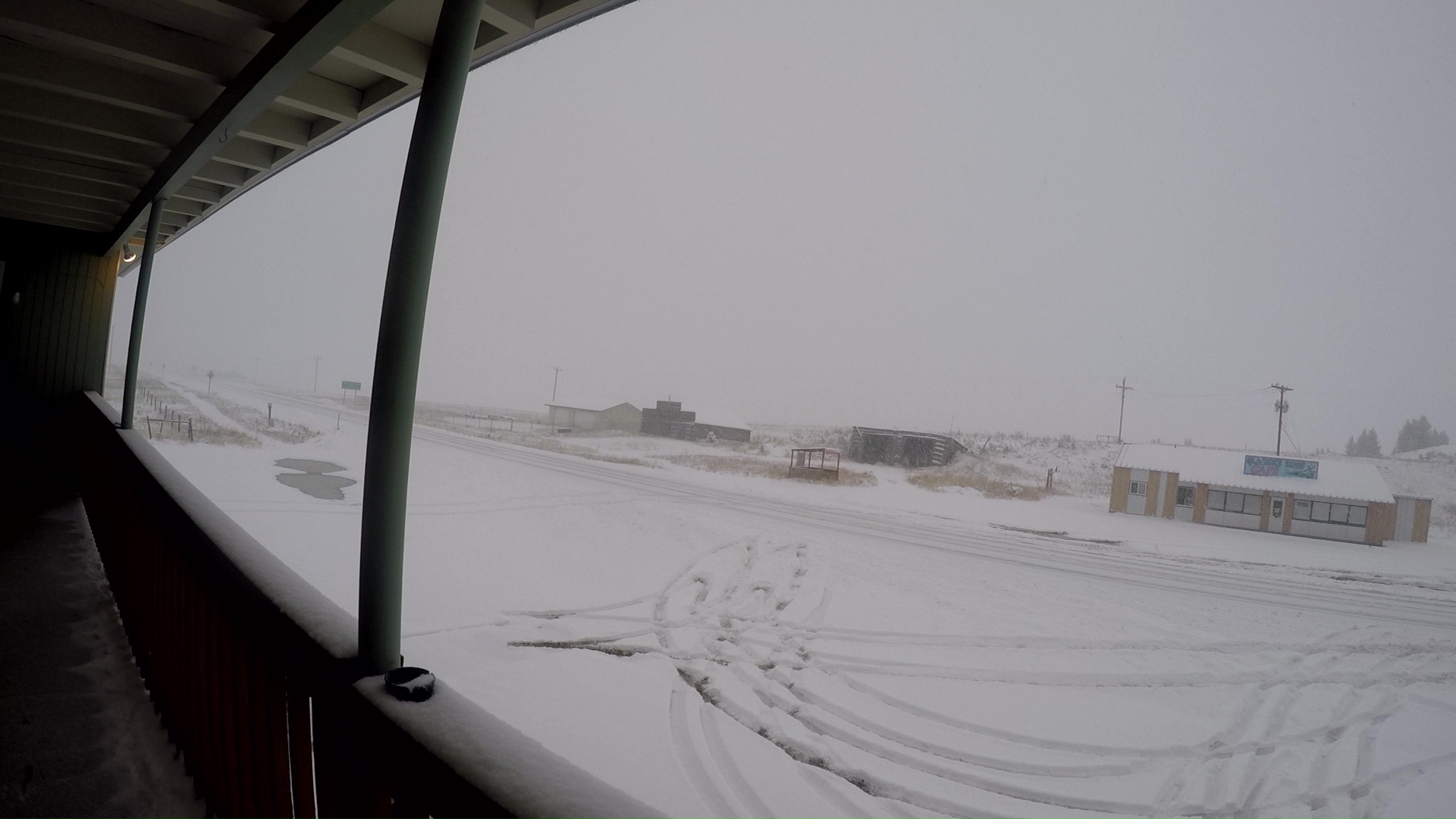
Woke at 7:45 to gloomy skies. This would be the best it looks all day.
Packed up and got breakfast at the diner. We had many discussions about the route, end points and ride back to east glacier logistics, etc.. Mostly based on the oncoming weather. Maybe 8 inches of snow today at high elevation forecasted, and wind chill in the teens. The next several days won’t be great either, with another storm coming Tuesday.
Walked out of town at noon. Road walked to two medicine, about 12 miles. The rain switched over to snow as the time passed. I had plastic grocery bags over my feet to keep them dry/warm. It seemed to be working so far.
We stopped to eat lunch inside the Ranger station once we arrived. Nice to get out of the snow for a bit. This was the last day this Ranger station was open for the season, and this Ranger was leaving in less than an hour. After this, no more permits from this location. This would make big problems for any CDT hiker behind me. I only know of Mr. Clean behind currently.


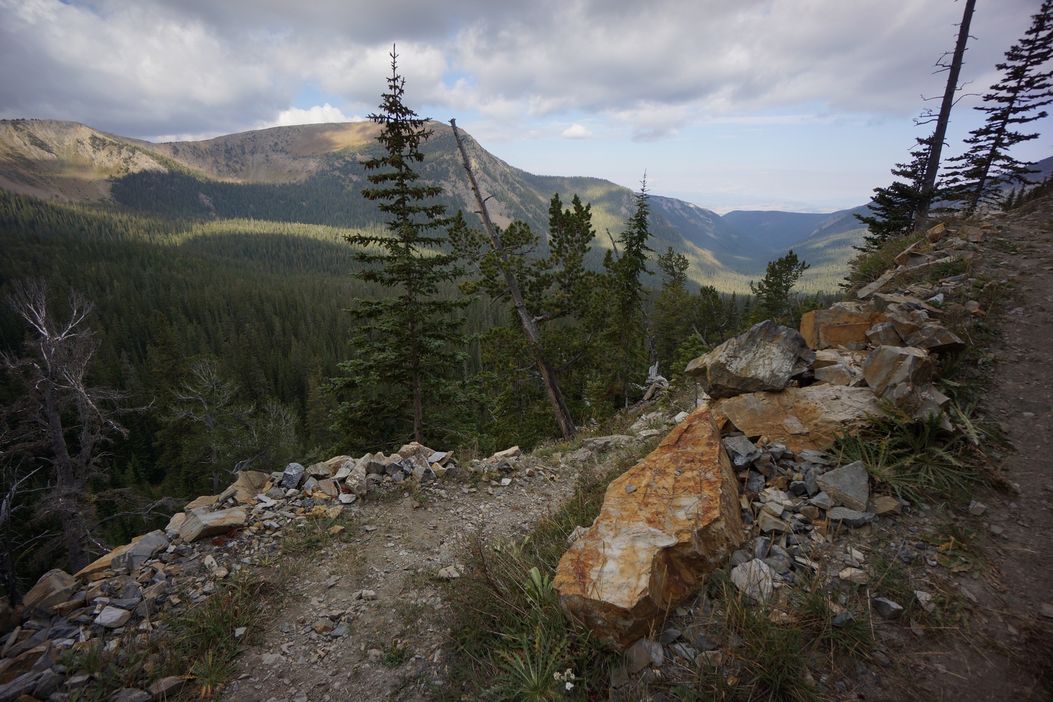
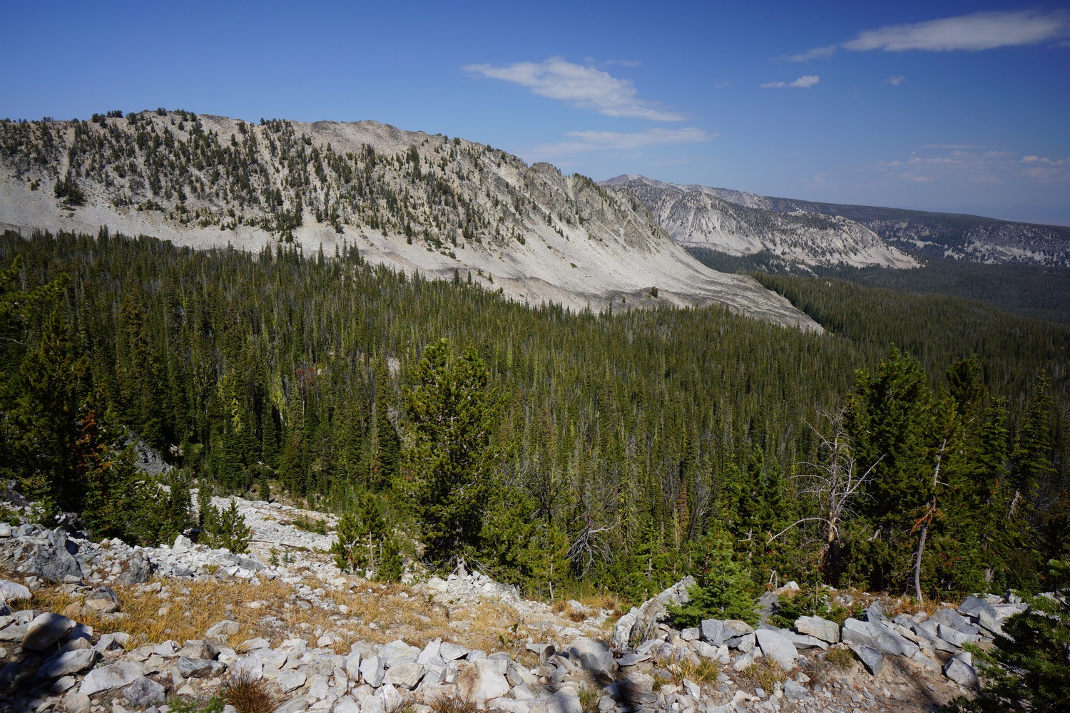
After the Ranger station, we start hiking actual trail. The scenery here was incredible, even as it was barely visible through the falling snow. One could only imagine the grandeur of this place in optimal weather!


It somehow seemed fitting, to spend my final days on the CDT in a snowstorm. Kinda like, you’ve been out here a long time and you’re really pushing your luck. If you aren’t ready for the end, here’s a strong sign that it’s over. Beautiful though, no doubt.


We walked another 6+ miles to our campsite at Oldman lake. By the time our tents were up, we were all cold and ready for shelter. It’s going to be a long couple of days like this. Katie and hopeful were too cold to cook outside and opted to eat some no-cook food items for dinner instead. We were all too cold to get water from the lake, or hang food. With Opsaks for food storage, this wasn’t a great concern though.

I was glad to have the grocery bags on my feet, but they certainly weren’t dry. Tomorrow I’ll use turkey bags, since the grocery bags ended up getting holes in them. I didn’t expect them to last.
Miles – 18
Total Miles – 2839
Rain – yes, and snow
Sleep – Backcountry, tent
Animals – none
Sunday September 30th – CDT Day 163
Woke up around 7. I was cold the second half of the night. This was the coldest I felt at night on the CDT. The snow continued to fall lightly as we all dreaded the moment we have to get out of our bags.
Last night, I put my wet shoes in a heavy duty grocery bag and kept them in my tent. This morning, I put them in my bag to warm up. Katie and hopeful, well, their shoes were frozen. However, My socks were frozen. Good thing I had multiple pairs.
I emerged from my tent to a world freshly covered in snow. Three or four inches had fallen. Visibility was low this morning and there was no view of the surrounding mountains to be had. To prepare for the cold and wet weather today, I wore a couple of turkey bags over the warmest pair of socks I had. However, my feet got cold very quickly. My hands were also cold to the point I couldn’t use them to do anything useful. I did jumping jacks, ran up and down the trail and ran in place to try and get the circulation going, but to no avail. It took much longer to pack up this morning than usual.
I tried to scrape off the frost from the outside of my tent, but there was a lot left, including on the inside of the tent. It was also wet underneath my sleeping pad. My Tyvek ground she was frozen to the ground and when I hold it up, and inch of ice came with it. There’s no way this stuff is going dry out.
Reality was setting in for me that hiking the Highline trail to Waterton was a foolish endeavor. I should have listened to my gut instinct on this one and not followed the group mentality. I announced my decision to turn around and go back to East glacier, with the intention of road walking the rest of the way to Canada. It would only be 45 miles. Considering there’s no view of anything, current weather conditions and future forecast, it’s the right call. Katie agreed and joined me. Hopeful still wanted to press on to Waterton on his own. There really wasn’t anything I could say to change his mind.
Katie and I started walking back to two medicine while hopeful headed up pitamakan pass. We hiked less than a mile before Katie started having regrets about turning back. She really wanted to hike to Waterton. Well, so did I, but it’s not a matter of what you want at this point it’s a matter of should you do it. It’s like she just forgot all of the reasons she wanted to turn back. Either way, she continued on to East glacier with me.

It seemed like visibility was even lower than yesterday. Still, a nice hike back. It was pretty with all the freshly fallen snow.
We ended up on a spur trail that dumped us out near the entrance of Glacier National Park. This was actually closer to where we wanted to go anyways, so this worked in our favor. We didn’t have to walk far before we were able to hitch a ride.
Now back in East glacier, we headed to the two medicine grill for lunch. Duffle was sitting outside on a bench. He left yesterday morning at 9am, and bailed going over pitamakan pass. He lost the trail in a complete white out and almost fell off a cliff. Couldn’t tell if it was a 10 foot cliff or a thousand. After that he said no way.
While eating lunch I got a text from Dixie saying that she bailed as well. She made it over triple divide pass which had snow up to mid thigh. Hearing Dixie and Duffle’s stories make me very happy with my choice to bail.
I got a room at the Whistling Swan again. Showered up and started drying out my gear. Spent the evening prepping for tomorrow. Instead of packing 5 days of food I now only needed a little over one. I took my extra food and condensed it into one Opsak. I’ll drop off the extra food with Mark at the general store tomorrow morning to hold for me until I finish.
Miles – 8
Total Miles – 2847
Rain – snow
Sleep – hotel
Animals – none
Monday October 1st – CDT Day 164
Katie decided to hitch up to many glacier and continue hiking to Waterton with Magoo. I really couldn’t wrap my head around this decision, considering the fact that tomorrow there will be 18 inches of snow on the way for high elevations. Regardless, she made up her mind.
Since I finish tomorrow and she’ll likely finish Thursday, we might not see each other again. It also dawned on me that I might not see hopeful again either. Saying bye to Katie was hard. All of the sudden there’s been a lot of goodbyes and it’s been tough.
It was a little after 9 when I made my way up to the general store. Mark was happy to hold my food. I then jumped on highway 49 and immediately got a hitch from old scout and his wife. I saw him yesterday at two medicine grill, he finished a few days ago.

I got dropped off along highway 49 right where the road splits off to two Medicine. Highway 49 was closed, assuming for the winter. I started walking it around 9:30.


Great views of two Medicine Lake and the snow capped peaks behind it. All the sudden I was overcome with thoughts and emotions regarding the end of the trail tomorrow. Crazy to think that this is my last full day of hiking. I’ve been waiting for this moment a long time, and I am ready for it. Still, reflecting on all of the things I’ve seen, places I’ve been and people I’ve met along the way made me wish it wasn’t ending.


Even though the road was closed there were many people driving on it. Regardless of the traffic, it was a very scenic Road walk.

When I got close to highway 89, I stopped along the side of the road for a quick food break. 10 minutes max. Then I made my way down to the highway.


The first few miles of highway 89 were under construction, just a dirt road. I had 5 cars stop today to ask me where I was waking and if I need a ride. Of course, I said no.

Most of the day was spent hiking hwy 89. I took another short break after 3pm. People were looking at me weird as I sat on the ground and ate food along the highway.


The views outside of Lake Mary were awesome. Snow capped peaks, dark clouds and stray beams of sunlight gave this place a magical touch.

As I walked by a scenic overlook, a woman flagged me down. She said she saw me walking and asked me a few questions about my hike. I told her about the CDT and she gave me a couple of beers.

Black bear
Everything in St Mary had closed for the season, and it was basically a ghost town. I walked right through it and moved on. Just north of St Mary, I saw a black bear walking a small road alone the lakeshore. This was basically just down a small embankment from where I was walking. The bear didn’t know I was there for a minute or two. The bear noticed me and we locked eyes for a few seconds. Not feeling threatened from my position, I kept walking and the bear then ran away.

After I saw the bear, the clouds fell out of the sky and fog over took the landscape. Darkness came shortly after. It was a bit eerie yet pretty cool walking in the dark in the fog. Except when a car went by.
When I got into the town of Babb, I stopped in a restaurant that was open. However, it was a fine dining restaurant with entrées all above 30 bucks each. No thanks. I found my hotel a couple hundred yards north. I had called this morning to reserve a room and I was told to walk in the unlock door and the key would be in the room. It was nice to be able to just walk straight into the hotel and not have to do anything. At 37 miles, today was my second highest mileage day on the CDT.
Miles – 37
Total Miles – 2884
Rain – no
Sleep – hotel
Animals – black bear
Tuesday October 2nd – CDT Day 165
The weather was looking nasty this morning, with several inches of snow on the ground and lots more still falling. I was pretty tired from yesterday’s big mile day, but motivated by being only hours away from completing my CDT thru hike. Time to get moving and finish this thing.


Dressed with all my layers and turkey bags over my feet, I set out into the snow storm for the final 10 miles to Canada. Visibility was low and the snow flakes were huge. Not much traffic on the road, good for road walking but bad for the hitch back from the border.


While walking the road, a park Ranger drove by and said he might be able to give me a ride south from the border if he gets done pulling some motorists out of the snow. I also a had border patrol agent offer up a ride south to Babb. Hopefully one will pan out when I get there.
For months I’ve been waiting for this moment. The last stretch to the finish line. I had wondered what it would feel like to walk the final mile of a thru hike, and that moment is finally here. With the weather being so bad and road waking to Port of Piegan instead of hiking through Glacier to Waterton, it was not the joyous walk I envisioned. Nevertheless, my journey was just mere steps away from ending and that was difficult to come to terms with.


As I battled my emotions, the border crossing finally came into sight. The falling snow obscured it from view until I was right up on it. This is it! I walked through knee deep snow drifts on the side of the road to get to a sign that said “now leaving USA” for a picture. I held back tears with some nervous laughter, in shock of what I had just accomplished.
I continued walking into Canada, stopping at the Canadian customs office. It’s set up for vehicles, not pedestrians, so I stood behind the line of cars in the road and waited a few minutes in the falling snow. When it was my turn, the customs agent asked what I will be doing in Canada. I pointed at the Welcome to Alberta sign a few hundred feet away and said “I’m going to walk up to your sign right there, take a picture and drink this beer if that’s alright with you”. She gave me a weird look and I explained that I’m ending my CDT hike here. She asked another agent about the beer and they said since I’m not driving It’d probably be OK, and they’re just going to look the other way.


Standing in front of the Welcome to Alberta sign, there was nothing left to do except drink that beer. It wasn’t the best tasting beer I’ve ever had, but it was certainly the most meaningful and by far the most well-deserved. I sat in the snow and stared at the sign, and the snowy nothingness behind it. I thought about all I had done and seen over the last 165 days to get to this point. I almost couldn’t believe I was here.
Finished hiking and celebrating, I walked back into the US. I mentioned the border patrol agent who offered a ride to the agent at the window, and he said to come inside while he asks around. The woman who offered the ride had already left, but another agent said he could take me in a half hour. That’ll do, I’m in no hurry now with my hike over. I also asked if there was an obelisk here, the type of monument that’s at Waterton and Chief Joseph. The agents told me they were not aware of one. However, I later found out from Dixie that there was indeed an obelisk right here, positioned somewhere in between the the US and Canadian buildings. I was glad she got to get that iconic thru hike photo in front of it, but really bummed I was not able to.
The ride to Babb with the border patrol agent worked out. Now, I had my thumb out on the road here trying to hitch back to east glacier. It took about 15 minutes before a guy in an FJ Cruiser stopped. He was a photographer named Lee, here on a 100 day trip from his home state of Hawaii. He was planning on camping at st Mary lake, but with all the snow on the ground he decided against it.
Lee was going to drop me off in st Mary, but since he was no longer staying there he asked “where do you need to go”? I said east glacier, so that’s where we headed. Nice!
In east glacier, I picked up my bounce box from the general store. Lee was thinking of heading to Whitefish, which is right next to Kalispell. He then offered to drive me to Kalispell from east glacier, which I gladly accepted. This saves me a train ride to Whitefish and an Uber from Whitefish to Kalispell.
In Kalispell, I got a hotel room at the country inn next to the airport. Lee and I had been in the car together for a couple hours and were getting along great, so I offered to let Lee use the other bed in my room. He accepted. It’s the least I can do for a guy who dropped who drove me a couple hours across the state. We ordered pizza, my first post hike meal. Of course, I ate the entire large pizza.
I went to bed thinking about my journey, and the end of an Era, really. This had been my dream for the last 6 years and now it’s finally done. It’s a great feeling, but overshadowing that is a greater feeling of “what’s next”? Only time will tell!
Miles – 11
Total Miles – 2895
Rain – snow
Sleep – hotel
Animals – none
Lincoln to East Glacier – CDT Thru Hike 2018
Continental Divide Trail – Lincoln to East Glacier Hike Overview

I entered the Scapegoat Wilderness just north of Rogers Pass, where I did the most climbing I’d done in a single day on the entire CDT. However, these were the best views I’d seen in a long time. Lots of ridges with distant views. Then the trail drops down into a valley, where it’d mostly stay for the remainder of the hike to East Glacier. I picked up a package of food I had my dad send to Benchmark Ranch along the way before starting the Bob Marshall Wilderness section. Forest fires and high elevation snow forced a lower route through the Bob, so we missed the Chinese Wall and more. Winter is coming soon.
Friday September 21st – CDT Day 154
Woke at 7:30. Took my last hot shower for the next 8 days. Then we all went out for breakfast at Lambkins.

Gary, the local trail angel, picked us up here and took us to Rogers Pass. Near the pass was a sign for the record cold spot in the Continental US at negative 70 degrees. Wow!


The trail starts climbing right away and does so all day, really. Passed a locked yurt about 3 miles in. It’s used by some guys doing research on eagles and stuff. It used to be open to hikers from what I heard.


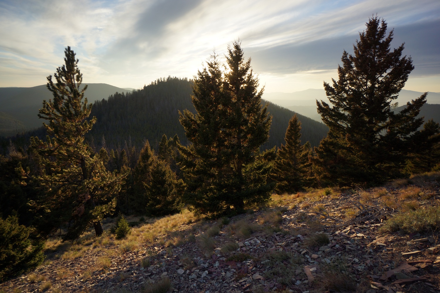
Wow, lots of climbing today. However, this time there is a reward of nice views from exposed ridgelines.


So many ups and downs. It was a tough day. Almost no water sources as well.

Hiked to 8:15 and found camp on a flat but exposed section of a ridge. We cowboy camped, figuring no rain tonight. With a 10:15am start, we were hoping to get more than 22 miles today. There was just so much climbing. Today was actually the day with the most elevation gain on the entire CDT for me at 7576′.
Miles – 22
Total Miles – 2675
Rain – no
Sleep – Backcountry, cowboy camp
Animals – none
Saturday September 22nd – CDT Day 155
I slept great until about 1:30 this morning. Then the wind picked up. This was a nuisance until I got up at 6:30.


We continued up the Ridgeline we camped upon last night. Great views for the next several miles. The winds remained strong and tossed us around as we walked.


After a couple miles of hiking the trail drops down into a valley along a Creek. This was a Welcome relief from the maddening winds. The boring forest I cursed for the last several hundred miles was now my sanctuary.


The trail trends uphill for several miles at a decent grade. Yesterday was the first day of fall, and today that is apparent with the colors changing on select trees.


We then hiked up over a pass above welcome Creek. For a couple miles before and several miles after the pass, we hiked through old forest fire burn areas and blow downs.

We found camp at the junction where the CDT splits off from Straight Creek around 7:15pm. The sky was dark and had already let loose a few sprinkles, so it seemed like the right call to make. I nestled my tent among some trees to provide protection from the wind and potential rain. Good day of progress!
Miles – 28
Total Miles – 2703
Rain – sprinkles
Sleep – Backcountry, tent
Animals – none
Sunday September 23rd – CDT Day 156
Nice night… Calm, no rain and not too cold. Woke at 6, hiking at 7.


Patches of dark clouds rolled by as we left camp, but cleared up as the morning went on. The burn area continues down this valley for another mile or two. Finally, we are in living forest again!

We made good time to Benchmark. At the road junction, I headed to the benchmark wilderness ranch and hopeful hiked to a trail junction we agreed upon. He isn’t picking up a box here, so no need for him to walk extra miles.


The benchmark ranch was empty when I arrived. It wasn’t clear where the CDT resupply boxes are stored, so I started poking around. Found it… Front porch of one of the “main” cabins. There was even a trash can for all my garbage. In years past I’ve heard there was no trash can, and so you had to pack out all garbage.


I left benchmark and hiked to a trail junction hopeful and I agreed to meet at. The fall colors were beautiful here. Mainly, the aspens and their golden color. They’ve really come out in the last few days.


Hopeful and I hiked north on the South fork Sun River trail after reconnecting. This was definitely a main thoroughfare, with tons of horse traffic. Nice views of the river.

Reached West Fork South Fork Sun River and crossed our at a large bridge. Yep, super long name and it sounds ridiculous. From here, we’d continue west to say on the CDT. But since we need to reroute around the Juliet fire and Moose creek fire anyways, we decided to continue north on the south fork sun river trail. This will reroute around the fire while shaving off a few miles.


The south fork sun river trail was really beautiful. Lots of big views of the river, fall colors and mountains.


Easy walking along a flat river valley that was dry, not swampy. Really, a rare combo!
Right before we found camp, we bumped into a herd of about 15 elk in a field. There was a big bull a hundred yards away, and others putting on a vocal show further along the tree line.
We made camp in the tree line not far from the elk. They were perfectly happy being super vocal all night with us here. They were doing their thing, we were doing ours. Man and beast, living in harmony.
Miles – 29
Total Miles – 2732
Rain – no
Sleep – Backcountry, tent
Animals – deer, bald eagle, elk (around 15)
Monday September 24th – CDT Day 157
Slept great. The elk were bugling all night, heard them every time I woke up. Sounds like a cross between a horse and a dinosaur that’s being murdered.

Started hiking just after 7. The clouds look menacing today, very dark and low.

Saw lots of fresh grizzly scat this morning, even some prints.


Low clouds rolled into the valley and gave us some sprinkles. Higher elevations were getting snow. With the fall colors and snow capped peaks, it looked like an iconic western art scene.


Reached gates cabin early afternoon. This looked to be a Ranger outpost. There were a few horses in the corral, but the place was locked up. Probably out for patrol. Either way, the porch was a great spot to eat lunch and get out of the rain.

Gates cabin was near the junction with the CDT, where would rejoin after the fire reroute. However, it looked as if we could take another shortcut by continuing north along the north fork sun river trail. This would keep us at low elevation and out of the bad weather up high. It would cut off a few miles as well. Only problem is, we don’t have a map showing the trails north of a certain point. Despite this, we were confident there would be a trail here that would eventually take us back to the CDT.

Our alternate route was definitely not as straight as we hoped. There were many zig zags and a few trail junctions that we basically guessed at. There were also a couple river Fords. Man, that water is cold!
Early evening we heard several wolves howling not too far away. That was cool to hear. We then stumbled upon a horse camp with a ton of wooden “improvements”, mostly to corral and otherwise support the housing of horses. There was also a lot of wood cut and ready to go for a fire. This is the obviously place to camp, since we were thinking a bushwhack might be necessary to rejoin the CDT at this point. That’s best left for the morning.

We had a nice fire, I think my 5th on trail. Got in my tent second before the sprinkles came back. Perfect timing.
Miles – 23
Total Miles – 2755
Rain – yes
Sleep – Backcountry, tent
Animals – deer, elk (around 15)
Tuesday September 25th – CDT Day 158
It rained fairly heavily last night. Woke at 7am and it still looked crappy out when I poked my head out of the tent. Since we’ll be bushwhacking through wet vegetation in the cold, we decided to wait a while to see if the sun comes out. Would be much nicer if it were warmer and drier.


Hopeful had a fire going when I woke up at 8:45. Three was patches of blue but clouds still dominated the sky. We didn’t start hiking until 10:15ish.

We back tracked a couple hundred feet until we reached a trail going down to a campsite along the river which we passed on last night due to it being a magnet for condensation. The trail led to a campsite, indeed, but it also crossed the river, which we could not see from the trail above. On the other side was a trail junction with signs. This led us to the North Fork Sun River trail, number 110. We were on this Trail initially after leaving gates cabin yesterday, but it seemed to branch off into trail 109. It would have been nice to have maps showing where these trails went, but we didn’t have that luxury. We went fairly far out of the way following trail 109 compared to where 110 would have run. Either way, back on trail and no horrendous bushwhack! Best case scenario.

Hiked several miles through burned areas and downed trees before rejoining the CDT. I was having a rough morning, just really wanting this hike to be over. Still another week or so and about 175 miles.


Took lunch by a stream. Laid my tent in the sun to dry, filtered water and washed my socks. It’s so great to not be moving. The entire day is spent hiking, from sun up to sun down, and this just wears on you mentally after a while.

Most of the rest of the day was spent hiking through burned areas, with occasional patches of forest that was spared. Had to ford strawberry creek, which was cold but shallow. Weather was gradually clearing but still lots of puffy white clouds.
Stopped to eat a quick dinner around 6. Then we pushed on for another 4.5 miles to a guthook waypoint with comments about a good campsite. Arrived at 7:40, just as it was getting dark. 22 miles today, not bad for a late start. It was a clear night now and the stars are out.
Miles – 22
Total Miles – 2777
Rain – yes
Sleep – Backcountry, tent
Animals – deer
Wednesday September 26th – CDT Day 159
Got up at 6:45, and it was cold. There was condensation on the inside of my tent, which turned to frost as soon as I opened it. There was a full moon still illuminating the sky, making it much brighter than daylight alone would have.
Hiked through burned out forest for a while. Some of the wooden trail signs had burned, but were still readable. Sort of.

The trail then made its way around a few small lakes. We stopped at one of them for first lunch. Found a spot in the sunlight on a open grassy slope high above the water. Here we could dry our tents out while eating. When I opened mine to lay it out, there was so much frost that it collected into about half a snowball which I then threw at hopeful. While sitting here, a guy named Goldilocks stopped to chat with us. I believe hopeful and I have both met him at separate times further down the trail. At Old Faithful he flipped up to Glacier and hiked the GDT(Great Divide Trail), and just now heading south back to Old Faithful.
After lunch, the trail continued through some healthy forest. Finally something that’s not burned. In fact, lots of the vegetation along the trail was overgrown. Easy walking though.
It was actually pretty warm today, and the skies were mostly blue. A nice change from the last couple days. I hope the weather can hold out another week like this.

Stopped at a stream for a second lunch. We were almost at a junction where the CDT climbs 1500′ and jogs sharply west. There’s an alternate route that continues straight and cuts off about 4 miles, as well as the climbing. That’s what I wanted to do. Hopeful wanted to climb it. Additionally, Hopeful was shooting to get into East glacier Friday morning whereas I prefer to get in tomorrow, Thursday night. We decided to split up at this junction and do our own separate thing, meeting up Friday morning in East Glacier.


After second lunch the trail became much wider, akin into the south Fork sun Trail just north of benchmark a few days ago. You could drive a car down it. I passed a ranger outpost cabin which looked like no one was home. Other than that, just a walk in the woods.

I stopped at a really nice campsite around 6:45. I’d planned on hiking a few more miles, but the trail will drop down into a river valley and I thought staying higher and drier would be the way to go.
Miles – 26
Total Miles – 2803
Rain – no
Sleep – Backcountry, tent
Animals – none
Thursday September 27th – CDT Day 160
Woke at 6:30. Slightly warmer this morning, but cloudy. Looks like rain.

The trail crossed the south fork two medicine river several times. No bridges, no obvious crossing points… Had to really hunt for a spot to hop rocks and logs. Even then, it wasn’t easy. In the end, my feet got wet when they slipped off rocks. Then I just walked through the water for subsequent Crossings.


It was raining lightly as I made my way down the river. As the trail nears hwy 2, it becomes more of an old road than trail. There were gates and barbed wires fences to climb over. All the vegetation was wet and significantly colder than the river fords earlier.


Road walk along hwy 2
Made it to hwy 2 and began the road walk into east glacier. This took a couple hours. It was raining consistently now, and it was cold… Low 40s, 30s with the wind chill. Cold hands and feet. Narrow shoulders along sections of road with a guard rail too. Not a fun road walk but the fastest way into town. Important in this weather. I had lte along the road and talked to Katie for a bit. I thought she was further along the trail but apparently was in east glacier still.
Went to brownies hostel upon entering east glacier around 1pm. I picked up my bounce box and finish box here, then I paid for a bed in the bunkhouse. After I paid she said come back at 3pm. If I can’t check in now, shouldn’t you tell someone that before taking their money? I asked for a refund and went outside to figure out my next move.
I called Katie and she was with a guy named bugagoo, a friend of mold and mildew. They had a minivan that bugagoo rented, so they picked me up. We got a 2 bedroom motel room for the 3 of us at the whistling swan for a few bucks more than a room in the bunkhouse.

Last bubble of CDT hikers in East Glacier. Most had already finished!
Got my hot shower which felt amazing! They all do but this one was a bit more necessary, providing essential warmth. Just like when I reached Lincoln. Ate dinner later at Serrano’s with a whole slew of other CDT hikers who came out of the woodworks. Sprinkler was here too, having just finished his hike a few days ago. I hadn’t seen him since Grand Lake. Very cool for the last Town.
Around dinner time, hopeful rolled into town. He got settled in at the swan and met up with him upon our return from dinner.
Miles – 18
Total Miles – 2821
Rain – yes
Sleep – hotel
Animals – none
Friday September 28th – CDT Day 161 (zero day)
Bugaboo caught a train out of East glacier this morning, back home to Minnesota. Hopeful, Katie and I then grabbed Breakfast at the two medicine Cafe.

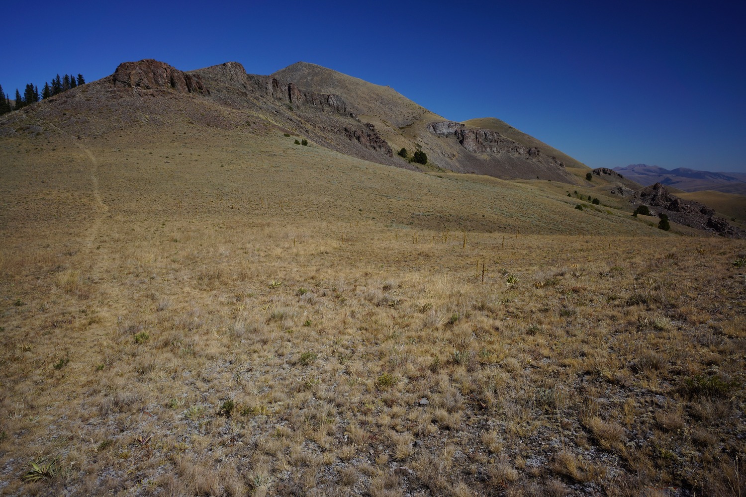
View from Two Medicine Ranger Station
Got a ride over to the two medicine Ranger station from a local named Lou. Awesome guy doing some very inspiring work with conservation and public lands. We had to go to the Ranger station to get permits and this basically needs to be done in person.
Did town chores remainder of the day. We got food from the general store for dinner since the motel had a kitchenette. Wild Mike’s pizza… Looks legit. Hung out here prepping for our last leg on the CDT, which is shaking up to be an adventure with the weather forecast. It’s already snowed and calling for several more inches at high elevation in the coming days. At those elevations, temps will be in the teens and 20s. But don’t worry, I’m full prepared with turkey bags to wrap around my socks to keep my feet warmer in my trail runners. Ha.
Anaconda to Lincoln – CDT Thru Hike 2018
Continental Divide Trail – Anaconda to Lincoln Hike Overview

North of Anaconda, the CDT changes from paved roads to dirt roads and finally trail. This section was not one of the most scenic on the CDT, with mundane low hills and forest dominating the views. I found the best views to be between Dana Spring and Granite Butte. Lots of hunters out in the woods at this time of year. North of Dana Spring, I ran into Hopeful. This was a great surprise and we hiked hundreds more miles together, almost to Canada. Our last day before reaching Rogers Pass, we hiked through a cloud in near zero visibility.
Friday September 14th – CDT Day 147

Hiker food
Slept in to 8:30. Ate the continental breakfast which was actually pretty good, although very carb heavy. I asked the front desk if I could check out like an hour after 11 and they were cool with it. I ran up to the post office to mail my Salomon Odyssey Pro shoes back home and stopped at Albertson’s to do grocery shopping for the next 6 days.
I ate at McDonald’s for lunch before leaving town. It was about 1pm when I actually started hiking. My goal for today is 22 miles.
The entire day was a road walk. The first couple hours were on larger highways with a very narrow shoulder. There was a good amount of traffic and as always, there are people that don’t get over at all. Jerks!


I followed road that passes under interstate 90 and heads towards the foothills. Some pretty country right here. Talked with a farmer on his dirt bike for a bit. He said nobody has passed through here in a while, implying I’m running behind. Yup, a little.


Took a quick dinner break after reaching dry cottonwood road. Then pushed on another 10 miles. This had me hiking to 9pm, well into the darkness. I found a flat and level spot alongside a road that split off dry Cottonwood Road. Good enough for me… 24 miles hiked since 1pm, yeah I’m ready to stop!
About 20 minutes after I laid my head down in my tent, a group of rednecks on ATVs showed up and parked a few yards away. I don’t know how they missed my tent as their headlights shined right through it, but they made no mention of it nor did they seem to care. They proceeded to drink beer and spew some drunken gibberish. This went on for about 15 minutes before they moved down the road. Just glad it didn’t turn into a night of shooting street signs.
Miles – 24
Total Miles – 2556
Rain – no
Sleep – backcountry, tent
Animals – deer
Saturday September 15th – CDT Day 148
A hunter driving a truck down the road last night as it just got dark had told me I was a mile and a half from the top and there was a campsite up there. Look for a cattle guard and then backtrack a little bit and it’s on your left. I hiked about 2 more miles last night and never saw the cattle guard or the campsite. I walked another 2 miles or so to the actual top this morning and still never saw a cattle guard. I swear, you can never trust people and their mileage estimates on things out here… Especially people driving vehicles.

At the top I joined the official CDT again. The trail goes up and down many hills and ridges and is mostly forest. The trail is mostly in good condition and the walking is fairly easy as far as the CDT goes. Ran into one bow hunter on trail.

By noon I had hiked 11 miles. I was running low on water so I stopped at a spring to filter some. It seems I’m missing a gasket from one of the hoses that connect to my water filter. It does not have an air tight seal and water leaks out now. I can still use it without that hose to get me into Lincoln. They’re not going to have an outfitter in that town, best I can hope for is a hardware store. It took a long time to filter water with this setup so I ate some food in the meantime.
After lunch I kept up a good pace. 9 miles in the next 3 hours.
Took a break at Cottonwood Lake which was more like a marsh. Ate another lunch here. Weather forecast was calling for rain around 7. Eating now will set me up to hike until it rains.

I did stop to filter water one more time since the next stretch looked pretty dry. Then it was the final push to camp, another 3 miles or so to the spot I was scoping on the map. The skies were cloudy but not super dark. Looks like rain will hold off for a little bit.
By the last mile, I could just feel the rain coming. My experience in Idaho and Montana with rain is that the clouds build later and the evening and it will rain around sunset. And that’s what it did today. In anticipation of this, I was jogging down the down sections. Not only is it faster but it seems to alleviate some of the impact on the knees when done correctly.
I reached the a junction, where the ground started leveling out a bit. I found a flat spot right next to the trail as it started sprinkling lightly. I setup my tent and as soon as it was up, the rain came down harder. I threw my backpack in the vestibule and did all my chores from the inside. This is one of maybe 5 times I had to do this on the CDT.
Today was a good day in the sense that I met my mileage goal, the weather was warmer and the rain held out until I got my tent up, and the trail was not too hard today despite a fair amount of climbing. I’m hoping for more Trail like this in the coming days, but with better views.
Miles – 28
Total Miles – 2584
Rain – yes
Sleep – backcountry, tent
Animals – elk
Sunday September 16th – CDT Day 149
Last night was a solid rainstorm. It rained consistently for a couple hours. As result, everything was pretty wet this morning, including my tent. I was cold too, so I was slow to get going. 8am start time today.
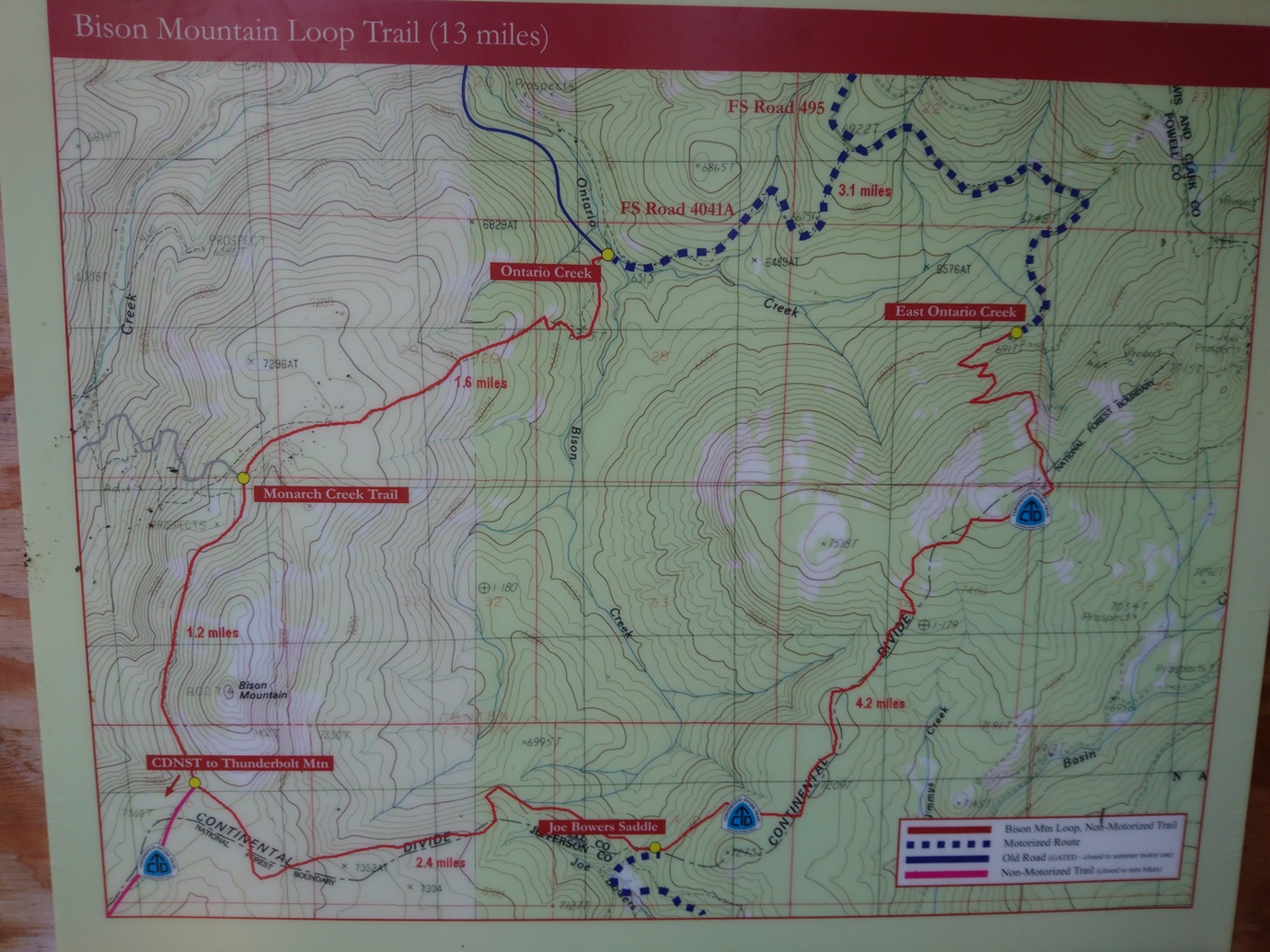
After a couple miles I reached an area called the Bison Mountain loop. In guthook, there’s a marker for trail junction here. Several people commented that the mileage listed in guthook is wrong in this area. Instead of being something like 3.9 miles it was probably around 10. That means I’m now several miles behind schedule, since I hadn’t accounted for these additional miles when planning for this section.


Today was another mix of forested trail and dirt roads. Some occasional distant views but mostly just forest. I saw two hunters and a woman walking her dog today. The woman asked if I was going to McDonald pass this evening, I said yes, approximately. She then offered to let me stay at her place, as she had hosted several CDT hikers in the past as well. I politely declined and stated my intentions were to stay on trail and try to cover miles. As much as I would love to, I know that I will just end up staying up late and or getting to the trailhead late tomorrow, and that’s not going to help my cause of getting to Lincoln any faster.

Filtered water from a small stream before heading back up to the divide where it looks dry. I was hoping to get to McDonald pass but I end up stopping a mile before the highway. Otherwise, I had a mile road walk along the highway and then probably at least a mile to get away from the highway before I could find camp on the other side. It was already 8pm and pretty much dark, not to mention I had a decent place to Camp right here.
Cowboy camped tonight under a pretty bright moon, a blinking red radio tower thing, and the sound of highway traffic.
Miles – 28
Total Miles – 2612
Rain – no
Sleep – backcountry, cowboy camp
Animals – none
Monday September 17th – CDT Day 150

Good night of sleep. The ball of my right foot hurt when I went to sleep last night, and still did this morning. Bummer. I took an ibuprofen, and I believe it’s the first one on trail (not counting ONE in town). Many hikers eat them like candy, referring to them as “Vitamin I”.

Walked the mile to McDonald pass and continued on the other side. Cell towers and such at the top of the hill on my first climb.

Walked a few miles until I reached a junction with a road. If I make a left here, I can follow the road and cut off a few miles from the official CDT route. It’s not like I’m missing anything. OK, sold!

Much of the road walk passes through private property, with permission to use the road only. Lots of cows everywhere. Filtered water from a stream that I later found out was filled with cow shit all the way to its source, which I walked to eventually. But I’ve filtered from similar in New Mexico and was fine, so I wasn’t too worried.

The road eventually led up to Meyers hill where I rejoined the CDT again. The ley alternate I was hiking was 8 miles, a savings of 6 from the 14 miles of official trail.

I took a break near Dana spring which was dry. Fortunately I had 2.5L still.

After my break, I started the climb up black mountain. I was walking with my head down when I heard a voice… “hey! hey!!” The, coming out of the trees was Hopeful! This was such a pleasant surprise as we could both use the company. We sat down and caught up on things for about 15 minutes before hitting the trail together.

The climb up black mountain seemed to go by much faster than it would have alone. Then another climb up to Nevada mountain. On the descent, we found camp just as it got dark.
It was great having someone to hike with again! Cowboy camping under the stars again tonight.
Miles – 29
Total Miles – 2641
Rain – no
Sleep – backcountry, cowboy camp
Animals – elk
Tuesday September 18th – CDT Day 151
It was another cold morning. Frost on everything including my sleeping bag.


This mornings hike was nice, with some distant views and ridge walking. There hasn’t been much of either lately.

We took a dirt road that skirts the mountainside below Granite Butte, saving a bunch of elevation gain. We did miss out on the view from the lookout tower, but this road was the way to the only water around for miles, so that made it an easy choice.

The road led us to Stemple pass. Here we dumped our trash in a trash can inside the outhouse and topped off water from a water cache.
Walked at a good pace the rest of the day. Covered 14 more miles and put us within 11 miles of Roger’s pass for tomorrow. However, the weather is calling for rain in the morning, so hopefully it holds off long enough to get packed up and moving. Or just doesn’t rain at all.
Miles – 26
Total Miles – 2641
Rain – no
Sleep – backcountry, tent
Animals – none
Wednesday September 19th – CDT Day 152


Woke up in a cloud this morning. Cold, misty, low visibility. Immediately climbed 600ft. Feet soaking wet. Stopping meant being cold, so we just kept moving.


There were a couple of climbs today, but none that were too big. However, there were no views of anything as the cloud cover remained pretty consistent with visibility of around 100′ or less.

After about 4 hours and 12 miles, we reached Roger’s pass. There was a tarp and a tent set up in the field just before hwy 200. I just walked right by and towards the road, ready to hitch. Hopeful was more observant, and noticed a whiteboard near a couple lawn chairs with both our names on it, literally. It was a trail angel named River Wulf, camped Under the tarp. He was hanging out here supporting CDT hikers… Whiskey, beer, solar charging etc. We chatted for a few minutes before heading up to the road to hitch.

Rogers Pass
Hitching sucked today. It was freezing cold and we were wet, shivering uncontrollably. The traffic was there but nobody would stop. I had my thumb out and one driver gave me a thumbs up. Very frustrating! Finally a guy named Tom picked us up on his way home from a traveling sales trip.
Ate lunch at Lambkins, then got a room at Three Bears Motel. A hot shower felt amazing! I was not fully warm until now.
In the hiker box at the motel, I snagged a sawyer filter for its gasket. This fixed my missing gasket issue on my filter. This was one of maybe two items where I pulled something useful out of a hiker box while on trail. It surprised me how many hikers relied on or used the hiker boxes extensively, as I thought most of the stuff in there was usually junk or food I didn’t want.
Ate dinner at The Wheel Inn, and had a couple beers. Long day!
Miles – 12
Total Miles – 2653
Rain – yes
Sleep – hotel
Animals – none
Thursday September 20th – CDT Day 153 (zero day)
Ate breakfast at Lambkins. Did chores all day… Ranger station, hardware store, atm, groceries, post office etc. Ate lunch at the Bootlegger Inn. Another great burger.
Met River Wulf for dinner at the Scapegoat Eatery. He was going to hitch back to the pass tonight but decided to stay in town. Only problem is, all his gear is back up at the pass. He was going to just sit under a tree at Hooper Park all night with all his layers on, and that sounded damn cold. I offered to let him stay with us at the motel, and just sleep on the ground. Obviously he accepted!
Darby to Anaconda – CDT Thru Hike 2018
Continental Divide Trail – Darby to Anaconda Hike Overview

The first 30+ miles north of Chief Joseph Pass were pretty awful. Partially my fault due to a crazy thick bushwhack, but mostly due to never-ending forests of dead trees and burned trees while doing lots of elevation gain and no view of anything. Soon after, the Anaconda Pintler wilderness starts and offers some redeeming views, mostly in the northern section. Bear activity was high, with lots of fresh scat. Temperatures are getting noticeably cooler now and days are getting shorter.
Monday September 10th – CDT Day 143
Slept in till about 8 this morning. Headed over to Park Place Cafe for breakfast, being the only place open. Another place that serves big portions. I could only eat half of a three stack pancake order!
Next I took care of my grocery shopping. The people’s market was amazing compared to Lima and Leadore, where I resupplied from gas stations. Then I worked on getting a list of items together for my dad to send me at East Glacier. This way, when I’m done with the hike I can pick up a box full of non-hiking items like blue jeans and a dedicated GPS unit to use in the rental car that I will use to drive back home in.
Back at Travellers Rest, I was packing up my stuff when Jim, Mary’s husband and the other owner of Travellers Rest, approached me and asked if I needed a ride back up to Chief Joseph pass. They were going to do a little biking up there in an hour or so. Perfect!
With an hour to kill, I headed up to the post office to send some things back home and send my bounce box ahead to Lincoln. I stopped in a fly shop along the way back and picked up a t-shirt for 8 bucks. Of course, right after I sent my bounce box back. Every time!

Trying out these new Salomon Odyssey Pro shoes
I reached Chief Joseph pass around 1pm. Today I’m trying out a pair of Salomon Odyssey Pro shoes. The Salomon rep I met in Yellowstone had sent these to me to test out. Initial impression are great, the shoe feels comfortable and has felt great walking around town. Let’s see how they hold up to the conditions a thru hiker faces on the CDT.
Not far from the pass, a ley alternate splits off from the official CDT. It looks like it cuts off a few miles, taking a nice flat dirt road instead of ups and downs through likely nondescript forest and ridges. Yeah, I’m into that.
I missed a few turns today and had to backtrack about 2 miles total. Guthook doesn’t show this alternate, but I have it loaded in Gaia on my phone. The free version of Gaia sucks though. Even when I’ve downloaded the detailed maps surrounding my track, they don’t show. Or the maps show up in patches. I was basically following a blue arrow on a grey screen.
When it was time to leave road for trail, ley suggests taking an old cross country ski trail. This might be OK in the winter, and for skiers, but it was soggy and overgrown here and now. Didn’t want to bushwhack uphill through this so I walked down to the next road leading uphill. Then I follow some old railroad grade.

The farther I walked along that railroad grade, the worse it became. Lots of deadfall. Like, no way to step around it because there was so much. Lots of small pine trees taking up the rest of the available ground space. This stopped me in my tracks.
I decided to bushwhack straight up hill towards a road on my map. Crawling over the piles of downed trees and wading through thick pines, I fought my way to the top. This was one of the nastiest bushwhacks I’ve done.
On the road now, I took a side trail leading up to the Divide. Here I reconnected with the CDT again. Shortly after I took a break for dinner.
Knocked out a few more miles after dinner in pursuit of Schultz saddle. I was disappointed to see a truck and camper here using the site. I put on by headlamp and got ready to do some night hiking. Luckily, I didn’t have to go far. Found a a small flat spot a few hundred yards away and cowboy camped here.
Miles – 19
Total Miles – 2449
Rain – no
Sleep – Backcountry, cowboy camp
Animals – none
Tuesday September 11th – CDT Day 144
Last night was cold. 25° when I woke up. Frost on my sleeping bag and clothes. I shivered throughout my morning routine and skipped breakfast in lieu of getting moving to get the blood pumping.


After an hour, I stopped in the first patch of sun I came across to eat breakfast. I could also remove layers now.


I gotta say, today was one of the more boring days I’ve done on the CDT. Every since I left chief Joseph pass, it’s just been downed trees and burn areas. Really bleak looking. This continued all day long. It also included many ups and downs. I did see about 5 elk in the forest this evening, but didn’t have a clear view.


It had gotten progressively cloudier throughout the day, and was now cold and windy as well. Tomorrow morning it might rain according to the last forecast I saw.
I made camp at a trail junction below pintler pass. I was surprised to see a tent and hammock set up here already. I chose a spot nearby but far enough away. I wonder if they’re CDT hikers?
Miles – 28
Total Miles – 2477
Rain – no
Sleep – Backcountry, tent
Animals – elk
Wednesday September 12th – CDT Day 145
I thought there was two people in the campsite next to me, but I think it was only one. I saw one person return by headlamp right before I jumped in bed last night, and heard one person leave this morning before I left my tent. I think it was a hunter.
Today is the day of climbing. Non-stop climbing, all day. If I were to hit my mileage goal, it would encompass at least 8500′ elevation gain. Not looking forward to today at all.


Right after leaving camp I climbed up pintler pass, and descended to Johnson Lake. This is where I would have liked to have made it to last night, ideally. This Lake marks the end of the southern Montana/Idaho map in my Guthook App, and the beginning of the northern Montana map, the final map.


After Johnson Lake the trail drops some more before going up another pass. Rainbow pass, Rainbow Lake. In this area, I crossed paths with 2 older guys out for a 30 mile hike. First actual hikers I’ve seen out here. A little further up, I stopped for a break.

The trail drops down another Valley to go around a steep Ridgeline and then heads uphill again. After cresting the pass, the trail swing by Warren lake. Nice mountain backdrop, it’s been a while since I’ve seen one like this.
I took another break below Warren Lake. I’ve been sweating going uphill, but going downhill or stopped I was freezing. Light snowflakes were falling, very light. As I descended downhill after the break, it turned into more of a rain than snow. It rained for about 2 hours and then within a matter of minutes, the Sun was out and the skies were completely blue.
Went over yet another pass, cutaway pass I believe. Then dropped down into Queener Basin and found camp around 7:30. I would have liked to have pressed on for another 30 or 45 minutes but there was another pass to climb and I didn’t feel like hiking in the dark. My shoes are wet and it’s going to be a cold night. Plus, I needed water which was next to camp. However, only 24 miles on the day. This was one of my lowest full days of hiking in a very long time.
It felt so good to get in my sleeping bag. I was really cold, especially my shriveled feet.
Miles – 24
Total Miles – 2501
Rain – yes, snowflakes
Sleep – Backcountry, tent
Animals – none
Thursday September 13th – CDT Day 146
Last night was cold but I stayed warm in my bag. There were a few sprinkles overnight but overall my tent was dry this morning. I threw on all of my available layers other than sleeping clothes to stay warm. My shoes were still soaked from yesterday, but that’s where having that second pair comes in handy!
As much as I’d planned for an early start this morning, I was just slow to get going into the cold and what I thought was going to be immediately rainy weather. I didn’t start hiking until around 8am.
No more than a quarter mile from Camp I encountered two fresh piles of bear scat. Definitely from this morning. Look like grizzly scat to me. Add that with the one last night, and Queener Basin is one place I’m glad I don’t have to spend another night.

As usual I had a hard time getting going with the climbing this morning. I’m just so burnt out with it. It wears me out and I dread any sign of uphill hiking these days. Just another sign I am so ready to be done with this thru hike. The last part is the hardest for sure.


I went over two passes this morning and both of them had the most beautiful scenery I’ve come across in the anaconda pintler wilderness. It’s a shame the trail spends so much time in the woods and forest and not up on the ridge lines. However, from what I can tell the beautiful part of this wilderness is not very widespread. Maybe a 15 mile segment of the about 100 miles from Chief Joseph pass to Anaconda.


On top of the second pass, the anaconda alternate route splits off from the CDT. The trail goes up hill a little bit, passes through goat flats, then skirts the mountainside over to another pass. From this pass the trail drops down to storm Lake.


On my way down to Storm Lake I was looking at my guthook map. It had the trail dropping down around the lake and then going way back up this Valley. I was looking at Bushwhacking across the valley to cut off a mile or two around the lake when I noticed a trail leading downhill from the lake. This trail became a road and goes all the way to highway 1, where I need to go anyway. This would save me a couple of miles total, and several miles of Trail walking. The new route would put me on a road the whole way into Anaconda, and so I can cover miles easier and faster. Realistically, it was going to be quite a push to get into town tonight anyway since I was looking at around 34 miles. So at least this gives me a shot, and a shot by dark no less.
About a mile before reaching Highway 1, it started raining. There was nowhere to take cover and if there was, it was private property. It rained for at least an hour. After the rain let up, I came across a campground. I headed over to the outhouse, as these usually have a little covered area outside for shelter. This one was no different, so I stopped here for a lunch break.

The rain had cleared by the time I was done eating lunch. The road walk went through some pretty country for being a highway. Started getting warm and I shed off all my layers. Of course after doing so, storms started building again. Super dark and nasty looking clouds behind me, with some crazy wind gusts. But I got lucky and this one passed to the side of the highway.
My Salomon Odyssey Pro shoes were starting to bother the calluses on the outside of my heels, so I switched back to my Cascadia 13s. It felt much better but the damage was already done. Nothing too crazy I can’t deal with, but if I had waited till I got into anaconda things would have been much worse.
I got into anaconda a little after 7. I stopped at the Dairy Queen but they were closed. Bummer! From here I called tradewinds motel to reserve a room and then headed out to find dinner. I stopped at a place called wings and things and got some great Wings. Not many places do a dry rub and I liked this one.
It was almost 9 by the time I got to my motel. I started charging things, washing socks underwear and shirt in the sink and then took a nice hot shower. Time for bed, and this was a very comfy bed!
Miles – 31
Total Miles – 2532
Rain – yes
Sleep – hotel
Animals – deer
Leadore to Darby – CDT Thru Hike 2018
Continental Divide Trail – Leadore to Darby Hike Overview
The hike north out of Leadore continued to offer some good ridgeline views, although not as frequent or quite as impressive as the Lima to Leadore section. However, it was forest fires dominated the theme of this stretch. Small and large plumes of forest fire smoke could be seen in many directions, and I was often quite close. I even walked over some active flames. I later found out the forest service closed the trail I was on again only hours after they gave me the go-ahead. I also encountered a momma bear and her two cubs. There was a lot of climbing in this section, with no day under 4200′.
Tuesday September 4th – CDT Day 137

I was going to eat at the silver dollar restaurant again for breakfast but they were closed at 8:30am. I headed to the stage stop instead and picked up some sausage egg and cheese biscuits, cinnamon roll and a monster… A 2200 calorie breakfast for this hungry hiker!

While browsing the CDT hiker registry/log maintained by the Stage Stop, I came across Cookie and Paul’s entry from 2008. This was cool to me because I must have watched Cookie and Paul’s video of their CDT hike a hundred times over the past 6 years. It’s very detailed in showing what a hiker can expect to see and encounter on the Continental Divide Trail, and might be my biggest inspiration for choosing to hike the CDT. This definitely made me pause for a moment as I realized the significance of this. Also, we were both here September 4th which makes me feel better about my pace. Still, I’m basically the caboose on this CDT train. I’m not aware of any other NOBOs behind me.
After breakfast I went to the ranger station to get some info on the fires. As it turns out, all of the closures for the goldstone fire have been lifted. That means no super long reroute for me! Now I could go back to the stage Stop & buy my groceries knowing how many miles I need to hike over how many days. Then I went to the post office to mail back some things.
I checked out around 11:30am and had Sam drive me back up to Bannock pass. It was closer to 12:30 by the time I started hiking today.


First few miles where nothing special. The trail heads up hill through Forest along the Idaho/Montana border. Occasional cow activity.


Nice views of a rolling Valley below. Then more uphill climbing. Then down, then Uphill, then down again and repeat.

Hiked through this pine forest that was filled with trees where the lower branches had a very bright green moss. It looked like a whole forest of moss, pretty neat.
Later the trail goes up on a ridge with a good open view of the mountains in the distance across the valley below. The valley that leadore and salmon and other cities are in, running parallel to the Divide. Early evening time it was beautiful with the setting Sun.
I saw some smoke from a fire that was not all that far away. At the closest it looked like it was only over one or two more ridges, but my view was obstructed by trees.
I made camp in a gully about 6 miles south of Lemhi pass. It was about 8:45, and pretty close to dark. I Cowboy camped again under some really bright stars.
Miles – 22
Total Miles – 2321
Rain – no
Sleep -Backcountry, cowboy camp
Animals – elk, bald eagle
Wednesday September 5th – CDT Day 138
Last night wasn’t too cold. Started hiking at 7:20.


Not much to see on this mornings hike. Made it to Lemhi pass around 10am. From here, it’s a quarter mile walk to Sacagawea Memorial. There is a spring here that feeds Trail Creek. Trail Creek is essentially the headwaters of the Missouri River. Lewis and Clark passed through here on their expedition. And this is where I will fill my water to last me the rest of the day. So glad I have a 3L water capacity again as well!
Leaving the spring I bumped into a local. I told him about the fire I saw last night and he wasn’t aware of it. He said he was going to call it in.


Leaving Lemhi pass the trail climbs up hill steeply for a while. When it flattened out for a bit, I could cover some ground. It was not scenic either, so I ended up covering 9 miles in 3 hours. A pretty solid pace for me in this terrain.


The trail is on fire…

Later in the afternoon I began to come across burn areas. Some random spotty burns and some widespread areas. Only a week ago this was on fire. Most everything was out, but some areas were smoldering and some were even on fire still. I stepped over a couple of burning logs along the trail, isolated pockets of fire from rogue embers.


There were few good views today. Almost the whole day was spent in the forest with no distant view. The forested open up at one point and there was a large amount of smoke coming off the closest Ridgeline to me, just downhill. Not that far at all. Fortunately the smoke is blowing the other way. Otherwise, I might not have been able to pass through here. It was that thick.


The final climb before Goldstone pass did offer some good mountain views. However, the weather was turning. Dark clouds building to the west and moving my way. Rain could be seen across the valley, in front of a beautiful orange sunset as the backdrop.
Made it down to Goldstone pass. Not even 8pm yet, I set up camp here due to impending rain. Sure enough, sprinkles as I set my tent up. I got it all together just in time, jumped in the tent as heavier rain began to fall. Looks like I’ll get water tomorrow morning instead, not doing that tonight.
Miles – 28
Total Miles – 2349
Rain – yes
Sleep – Backcountry, tent
Animals – deer
Thursday September 6th – CDT Day 139
I walked about a quarter mile down the road to a spring on the map. It was pretty shallow but I made it work. Filled my dirty water bag and headed up hill. Filtered this water while I broke down camp and hit the trail around 8:15.

Trail goes uphill then drops down into a new basin briefly before climbing a pass. Not really super scenic today overall, mostly just walking in the woods with no view of anything. The next several hours will be like the above, as the trail detours around some really steep terrain on the divide.

After first lunch I tried to pick up the pace on the now flat and easy trail. I made a conscious effort to keep up a 4mph pace and really knocked out some miles.
One section of trail south of miners Lake trailhead had some new switch backs that weren’t on the map. The old route pretty much goes straight down. This one zigzags wildly across the mountainside adding one to two more miles that I wasn’t planning on doing today.

Next up is a 2000′ climb. I was hoping to get it all done today but realistically, setting up at one of the top lakes just below the divide is a good way to go as well. I still have to filter water, been running all day on only three liters and almost out.

Just before reaching the highest Lake in the chain, I drew some water from the outlet. Carried this with me as I searched the area for a campsite. Filtered water as I set up camp along a small Lake. I got a few sprinkles after setting up my tent but nothing major.
Miles – 31
Total Miles – 2380
Rain – no
Sleep – Backcountry, tent
Animals – deer, Ptarmigan?
Friday September 7th – CDT Day 140
The reflection this morning on the Lake was incredible. Very reminiscent of Colorado.


Finished the 2000′ climb I was unable to complete last night. I crested the pass and laid eyes on another new valley. This one was filled with lots of green pine trees, which would later obscure my view. Some big boulders and nice scenery in the upper basin.


Went over another pass with a nice view. Wow, this is a pretty big valley.


The trail manages to stay slightly higher than treeline offering better views. The trail then follows a scenic ridgeline with some of the best views of the day.
I took a break to filter water and eat food near a stream around 4:30pm. When I was packing up and getting ready to leave, I heard a weird noise behind me. I turned around and saw two black bear Cubs climbing a tree only 50 feet away. I grabbed my bear spray and started looking for the mother bear. I yelled “yo bear” and the mama bears head popped up from behind a fallen tree. I yelled again causing the mama bear to turn around and run up the hill. The Cubs were still in the tree, mama bear abandoned them. After short while the Cubs climbed down the tree and ran uphill to their mama. That was really cool to see so close.
After the bear encounter it was a 3000′ descent into a valley. I mostly zoned out and zombied along the trail. At one point a squirrel fell out of a tree a couple feet in front of me. He landed in the dirt, but bounced up and ran away quickly. I got a little chuckle out of this, as I nearly had a squirrel fall on my head. Later I saw a couple of big Elk off in the forest.

Male Spruce Grouse putting on a show

When I reached the area I had planned on camping at, I didn’t see any good campsites so I kept moving along the trail. Problem is, next two miles are a 1500′ climb through a narrow Gulch. There’s not going to be anywhere to camp here. It was also dark now, so I was hiking by headlamp. I made great time going uphill but was really pushing myself now.
Made it to the top of the climb around 9pm and found some good camp spots. Cowboy camped under the stars. Really tired, and really looking forward to town tomorrow!
Miles – 29
Total Miles – 2409
Rain – no
Sleep – Backcountry, cowboy camp
Animals – deer, spruce grouse, elk, 3 black bear
Saturday September 8th – CDT Day 141
Intermittent clouds and stars last night had me a little worried about the possibility of rain, but there was none. Warm night, warm morning. Nice for once.
Hiked a few miles to big hole pass. I saw some elk hunters on the way. At the pass, I walked a hundred yards downhill to a piped to spring to get my days water.


More of the same terrain… Hiking up and down Ridgelines with little or no view. When there was a view, the smoke and haze prevented distant views with any clarity. However, the haze created a pleasant scene with layers and layers of mountains on the horizon.
The last several miles of hiking follows a dirt road. There were many people cutting firewood here.
At Chief Joseph pass, I stuck out my thumb and began the process of hitching into town. There wasn’t a whole lot of traffic going the direction I needed, but after about 30 minutes the 5th or so vehicle that passed by stopped. It was a small RV driven buy a nice guy named Pete. He was kinda enough to take me to the Travellers Rest RV park where I had planned on staying.
All of the motel rooms in Darby where booked this weekend, including the cabins at Travellers Rest. This is due to the filming of the Kevin Costner series Yellowstone here in Darby. The only available option for me was a tent site. Not ideal, but at least it’s cheap.
I had five boxes waiting for me in the office at Travellers Rest… Bounce box, box of Resupply items from dad, new Salomon shoes sent from the rep I met in Yellowstone, new Brooks insoles for my Cascadia shoes, and new Patagonia boxers.
Like most days I get into town knowing I will zero the next day, I didn’t do much. I setup my tent and headed up to the little blue joint restaurant for dinner. I got chicken strips, fries and a small pizza. Both were amazing, really really good food that seemed out of place for a town like this.
With a full belly it was time to get some sleep. It certainly wasn’t a comfy bed, but rest is rest. At the Travellers Rest.
Miles – 21
Total Miles – 2430
Rain – no
Sleep – rv park, tent
Animals – none
Sunday September 9th – CDT Day 142 (zero day)
Breakfast this morning was the other half of last night’s dinner. Portions were huge at the little blue joint.
I got started on all my town chores by late morning. I had a little table set up in the shade with an extension cord running out to it to power my laptop and portable hard drive, and began backing up all my photos and video. Opened all my packages, Resupplied my bounce box, Resupplied things in my backpack from my bounce box, etc.
Mary, one of the owners of Travellers Rest, said that the bunkhouse was now open tonight if I wanted to get a bed. Yes, absolutely! I broke down my tent and moved all my gear indoors. Once I got inside, I realized how tired I was. I laid down and took a half a half-assed nap for about an hour.
I headed up to the little blue joint again for dinner. Got a burger and it was delicious! Headed back to Travellers Rest to knockout a few more chores before bed. Mostly, dealing with my bounce box and figuring out where to send it next and plans for the rest of the trail.
Lima to Leadore – CDT Thru Hike 2018
Continental Divide Trail – Lima to Leadore Hike Overview
The hike from Lima to Leadore was probably my favorite section of the CDT in Montana/Idaho. This is how I envisioned more of the state would be. The trail is often up on a ridge with a fence separating Idaho from Montana, and there’s big views all around. The vast seas of golden colored rolling hills convey a subtle yet powerful message of beauty. Other times, seemingly endless mountain ranges dominate distant views across a massive valley. Walking on the divide in the dwindling alpenglow proved to be some of the most memorable moments for me.
Friday August 31st – CDT Day 133
Got a ride back to the trail at 9am. Mike had his friend Bob give me a ride. Bob is from Canada and was passing through the area, and ended up staying several weeks at the motel. Great guy. He mentioned that most hikers get dropped off 3 miles past where I got picked up at to avoid a dirt road walk along the highway. He said I was only the second person he dropped off that requested to be dropped off at the same place they were picked up from. Everyone else had no problem skipping the 3 Mile Road walk. That’s just crazy to me how many people out here are skipping sections of Trail because they find it boring or whatever. I guess I’m one of the few, one of the proud… continuous footsteps the whole way.
Did that 3 road walk in my sleep. Actually, I made use of the LTE signal and ordered some new boxers. Mine are falling apart.

After the 3 mile road walk along I-15, the road turns into the mountains. It’s another 5 or so miles to the trailhead, which was guarded by cows. Damn, it’s new Mexico all over again.


Off the dirt road and now on trail, it climbs and climbs. It follows the divide which is once again the Idaho/Montana border. I already like these views better than the last section.


There was an amazing amount of annoying gnats and mosquitoes up on the ridge in spots. It looks like the land here is used for sheep grazing in spots.


Although the trail stays high most of the day now, it still includes a lot of PUDs, or pointless ups and downs. It’s also really dry and no water. I did see two southbounders named turtle and willow as well as a couple of elk hunters.


Eventually the trail drops down into a valley. I lost the trail here and ended up on a cow path. It led me to a stream where I filtered water. Perfect, because I’d been going all day on 1.5L. I was also really hungry, only stopped once for a snack today. Didn’t want to eat much without the water. Had a quick snack with my water and moved on out was 6:30pm now and only a few miles to a trailhead with good camping, so I pushed on.

I arrived at the trailhead around 8:30pm. There were several car campers here. I set up by the creek under some evergreens, and promptly chowed down dinner. I was pretty tired and went to bed immediately after.
Miles – 27
Total Miles – 2224
Rain – no
Sleep – Backcountry, cowboy camp
Animals – none
Saturday September 1st – CDT Day 134
Woke at 7. Cold morning. Took a while to get going. Left camp at 8:30.

Like always, it’s a big climb first thing in the morning. 1500′ for this one.


Over the pass, life gets a little easier with a down hill trending path for a few miles. Nice views. Passed a couple of elk hunters on horseback. Today is season opener, lots of hunters out.


I lost the trail a couple times today. The trail is so faint, or literally non-existent at times, and it just it happens. Typical for the CDT, really.

Reached a dirt road that I followed for about 5 miles. A guy in a van drove by and stopped to talk to me. Super nice guy, his name was John. He asked if I needed anything, and I replied a Gatorade if you have it. Not only for the the Gatorade but I could use the extra container. I’m only carrying 2 liters of water and it’s been dry enough at times to warrant a third liter. Anyways, John had a cold Powerade in the cooler for me which was greatly appreciated! I used this bottle the rest of the trail.


A few miles up the road, I bumped into another guy sitting in his truck. His son is out Elk hunting and he was just waiting there for him to finish for the day. His name was Fred, an illustrator for several outdoor magazines. His son writes articles for the same magazines, fly fishing and hunting. I really envy people that get to do what they love for work.

Eventually I jumped off road and back onto a trail. I follow this couple more miles before reaching deadman lake. This was a pretty spot! Great campsite here, but I wanted to put in a couple more miles. Story of my life on the CDT.
Leaving deadman Lake, I had a choice. I could take a longer route on trail that zigzags around, or cut off a few miles by taking a dirt road. Being in the situation I am, in a hurry to reach Canada in 30 days. Obviously I took the dirt road.

Bumped into a few more hunters just as the Sun went down. We walked together a little ways on the dirt road as I searched for a campsite. They offered to let me stay with them, another two miles down the road, but it was already dark and to be honest I didn’t want to be up late bullshitting with them. I snagged the first flat spot I saw.
Stars are bright and milky way is super visible. Wow!
Miles – 27
Total Miles – 2251
Rain – no
Sleep – Backcountry, cowboy camp
Animals – none
Sunday September 2nd – CDT Day 135
Woke up to the sound of a truck driving by around 6:45. Last night was pretty cold. It was even colder because I hadn’t fluffed up my quilt. Usually I shake it in such a way that the down settles where it will be on top of me and very little underneath me, where I am already warm from my sleeping pad. I won’t forget tonight!

I followed the dirt road I was on yesterday down into a valley below, and headed across it. There were tons of hunting camps here.


It was a couple miles of dirt road walking before it transitions into trail. The trail had been trending uphill for much of the morning and early afternoon. Lots of elevation gain today, very tiring.


After lunch it became very scenic. Lots of Ridge walking with huge views in all directions. Really nice walking. I saw a pronghorn running through the golden grass on one of these ridges as well. Haven’t seen one since Wyoming. The great Divide Basin desert come to think of it.


Interesting red rock and red lichen on a black rock backdrop caught the eye.


Eventually the trail drops down from the divide and follows a drainage downhill. Descending this Valley was beautiful.


It’s a couple more miles of walking over ridges and long the base of the hills before reaching Morrison Lake. I stopped here to filter water and eat dinner. Really pretty Lake.

I had about 4 and a half miles left to hike at this point in order to leave myself with a 20 mile day tomorrow. This way I can get into town late afternoon or early evening. Most of this will be uphill. The climb was steepest just above Morrison lake. After that, it was more manageable and about 2 miles to the top of the Divide.


Really nice walking this evening up on the divide. The Sun was setting and provided beautiful skies in all directions. There needs to be more of this!

Set up camp on one of the saddles along the ridge. Just downhill and near a couple trees. Minimal cover, but very calm night. Perfect to cowboy camp under the stars again.
Miles – 27
Total Miles – 2278
Rain – no
Sleep – Backcountry, cowboy camp
Animals – pronghorn
Monday September 3rd – CDT Day 136
Another nice night sleeping out under the stars. But chattering of the squirrels and birds woke me up around 6:30 today. No problem, I want to get to Bannock pass as early as possible to increase my chances of getting a hitch. That is, if I don’t get cell phone signal. If I do, I will call Sam at the leadore inn and get a ride that way.


This morning’s hike was a nice one along the divide. Exposed, good views and Pleasant. Ups and downs, but smaller ones.


Break time on the summit of Elk Mountain
The big climb for today that I was dreading was up Elk Mountain. However, it wasn’t too bad. Other hikers have said you could call Sam at the leadore Inn from here with decent signal. I was not that lucky. Nothing. I did stop and eat lunch up here though, great view.


More enjoyable walking coming down from Elk Mountain. The trail follows Ridgelines and skirts the hillside of others. Most of the big climbs are now out of the way.


The rest of the afternoon was spent walking Ridgelines downhill towards Bannock pass. The Idaho/Montana section of trail is almost always on a ridge. Good stuff, But hard work.


Forest fire in the distance. I’ll be hiking right by it soon…
Made it to Bannock pass at 4:15. As I was hiking down to the pass, I saw several cars drive by. This gave me hope. I also noticed a fire burning a couple miles away from the pass that I hadn’t noticed while hiking the trail. Yikes.
There was very little traffic on Bannock pass. It took 2 hours, but I did get a hitch. Super nice woman named Laura, a local out cutting firewood in the forest. She dropped me off at the leadore Inn.

I spoke with Sam, the owner, as I checked in. Nice guy. The motel itself is four rooms in the backyard of Sam’s house. Took a shower and then headed out to the silver dollar restaurant for dinner. Of course I ordered something like ” whatever you’re biggest burger is, double it”. The waitress usually gets a kick out of it, especially when I put it down no problem. And this was no exception.
I was going to check out the stage stops food selection, but apparently they close at 6. It’ll have to wait till morning. Nothing to do but go back to my room. I spent the rest of the evening doing internet things on my phone and relaxing on a nice comfy bed. It feels incredible to be off my feet.
Miles – 21
Total Miles – 2299
Rain – no
Sleep – hotel
Animals – none


